After our disrupted week walking the Wayfarer’s Way we are off in the caravan for a few days to stay at Rails End Nursery CL in Ashton under Hill. This site is not too far from Goodhleigh Hill CL on the other side of Bredon Hill, in the past we have found that staying close to somewhere we have previously visited opens up a whole new range of walks.
It is our first time on this site. Everything was straightforward from booking through to receiving the helpful directions to ensure easy access. It was also good to meet Andrew ,the site owner, on arrival who showed us where everything was and gave some useful tips on local footpaths.
It doesn’t take long to set up and after a cup of tea I am ready to head out for a short walk. I leave the site by the main driveway passing the glasshouses that used to grow tomatoes commercially but these days are let to a couple of people growing garden plants. At Back Lane I turn right and walk into the village.
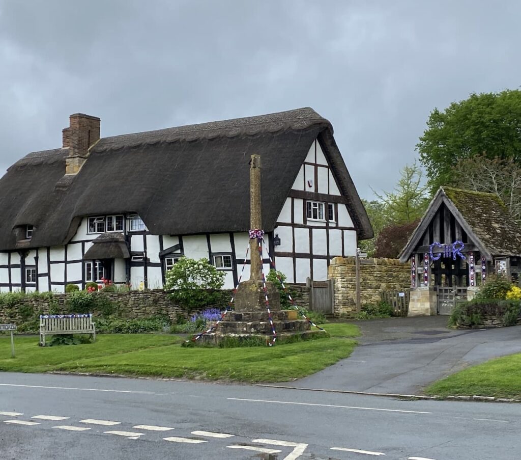
Turning left at the end of the lane I see the village cross. It is thought that prior to the village church being built in 1627 this cross was used as a preaching place by the monks from nearby Beckford Priory.
I now turn right and head through the village passing the Star Inn, village school and playing field. On reaching Cotton’s Lane I turn left and head steadily uphill.
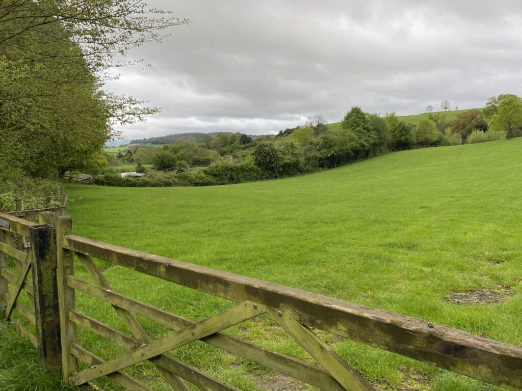
This lane goes uphill out of the village and I ignore a couple of paths to the right and stay on the tarmac driveway with some fine views.
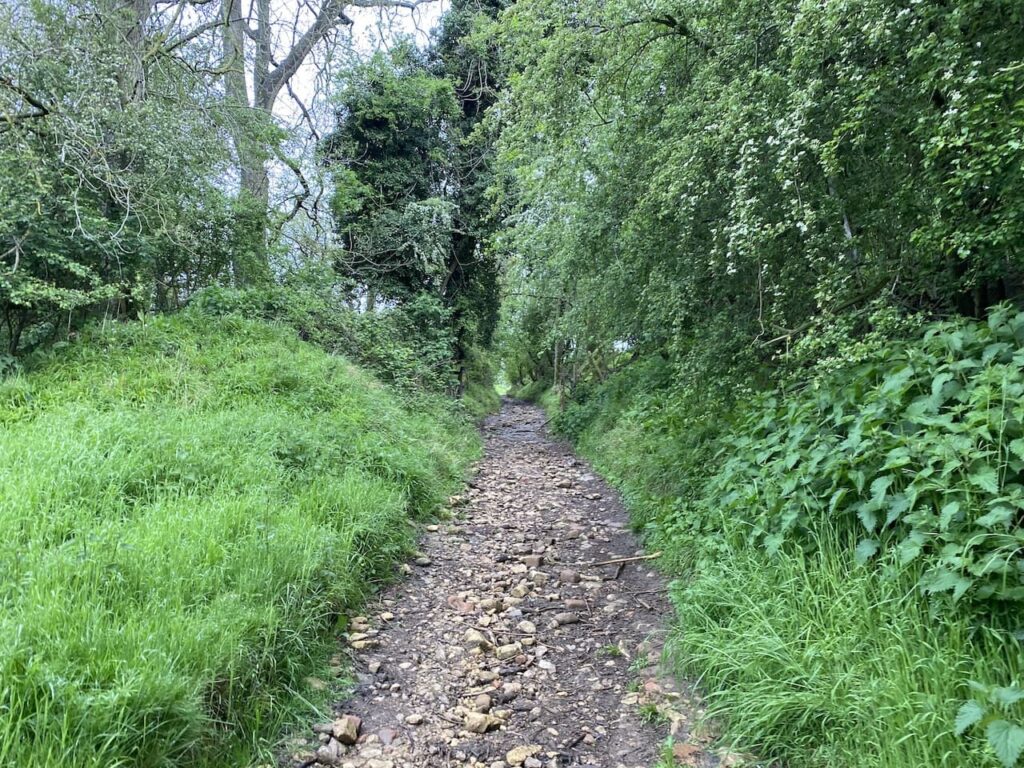
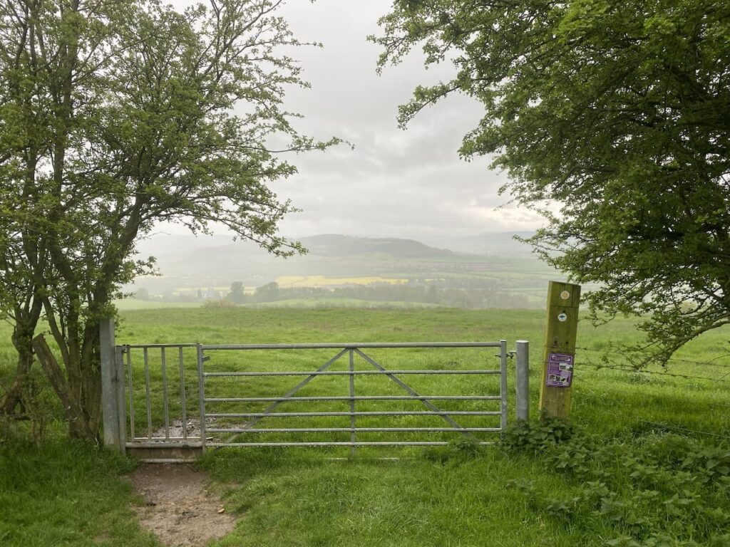
After passing some farm buildings I go through a gate and continue uphill on a track.
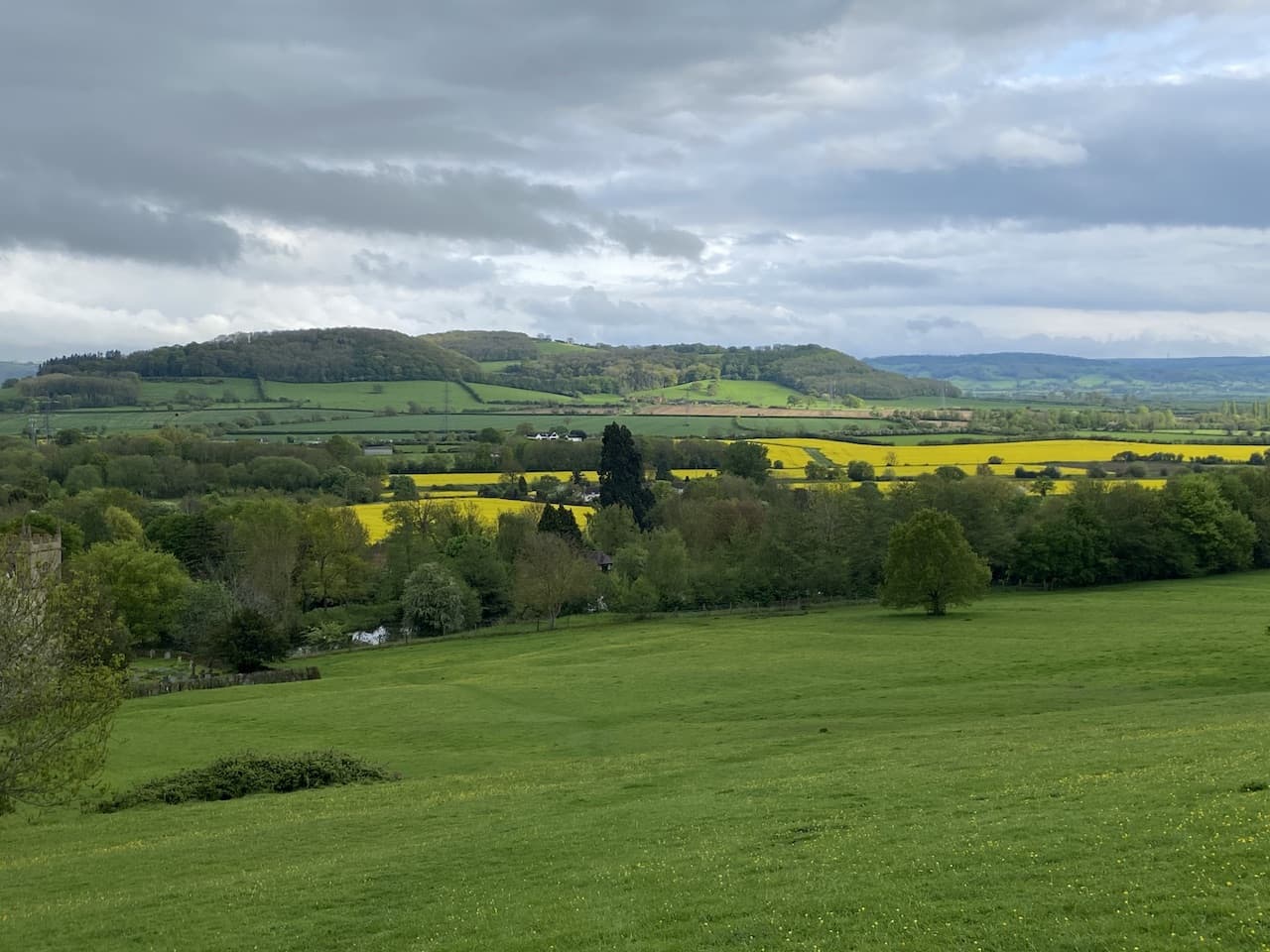
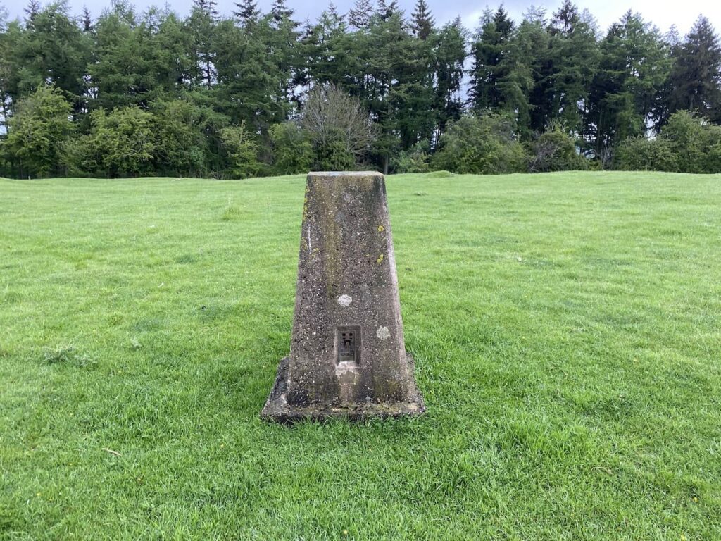
At a junction of paths my route is to the left through a gate, but first I take a diversion following the path to the right to continue uphill and then I briefly leave the path to head across the grassland to bag the Ordnance Survey Holcomb Nap trig pillar. This is the 373rd trig I have bagged.
The trees to the north of the trig block out any view in that direction, but to the south it is open and there are far reaching vistas.
From the trig I retrace my steps to the junction of paths, this time going through the gate to follow the waymarked route through sheep pasture.
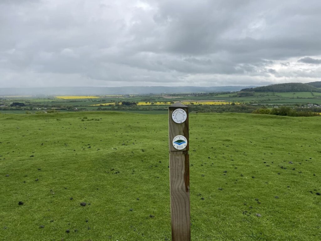
After going through another pasture field I reach a junction with the Wychavon Way trail. Here I turn left to follow the Wychavon Way downhill.
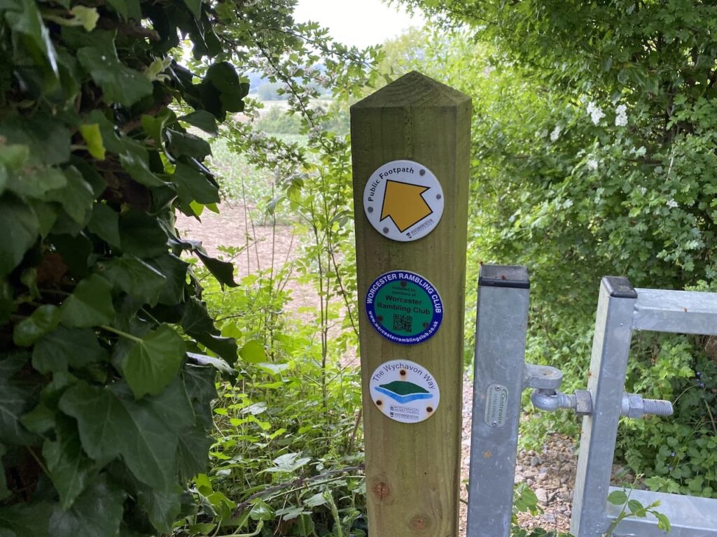
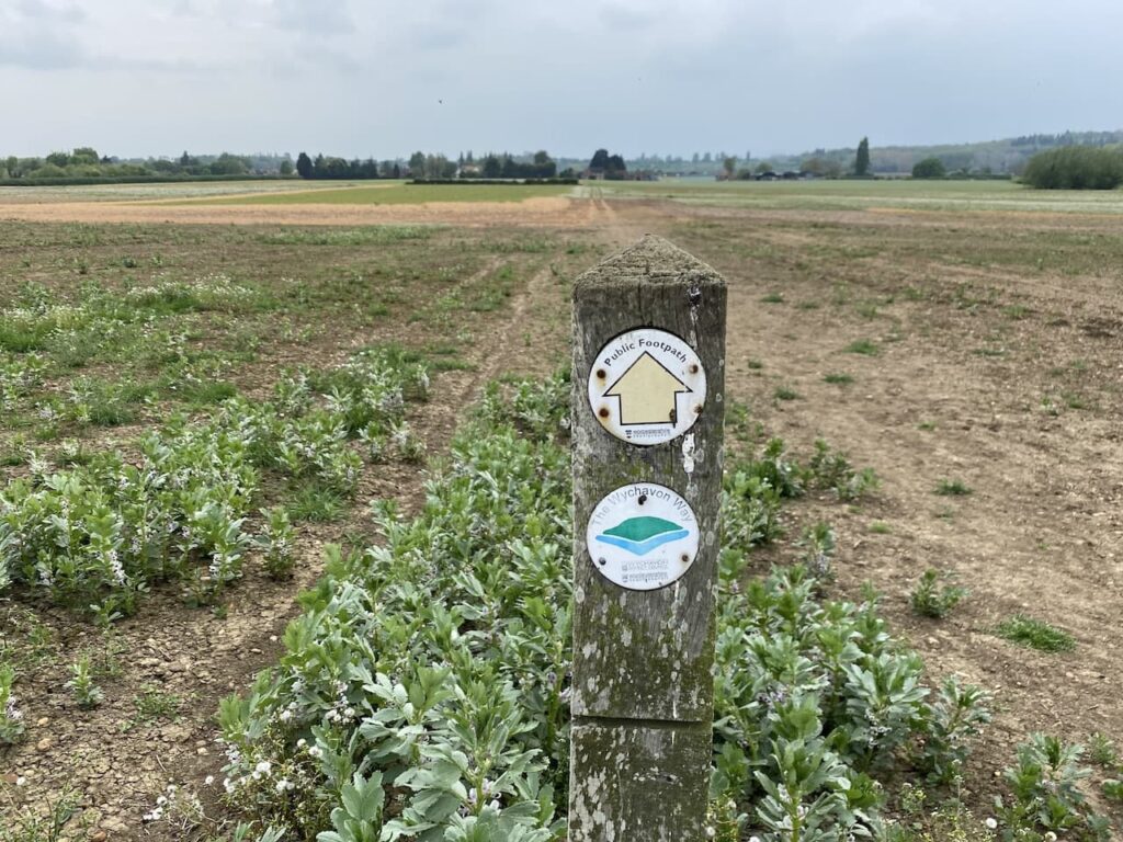
The Wychavon Way is a 40-mile route through the Worcestershire countryside between Droitwich Spa and Broadway. The symbol on the waymarkers signifies Bredon Hill above the River Avon.
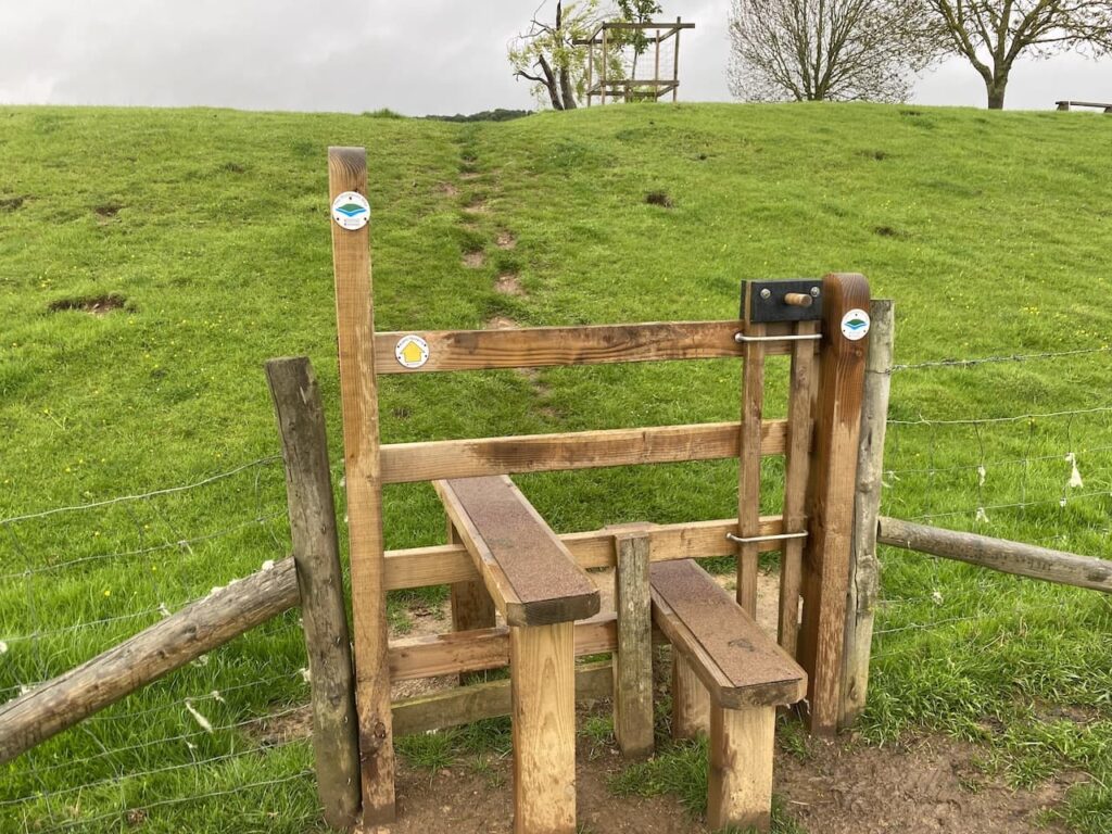
This well-walked footpath is easy to follow over a series of stiles heading downhill towards Ashton under Hill. It is always welcome when stiles have a dog gate. It makes life a lot easier if I don’t have to lift a 26 kilo Crosby over every stile.
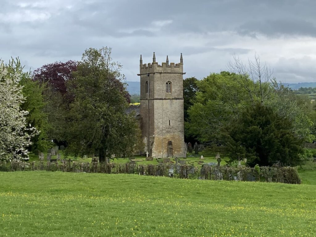
Nearing the village I keep with the Wychavon Way waymarkers bringing me to field above St Barbara’s church. The drizzle that has been with me since Holcomb Nap has finally ceased and visibility has improved.
The path now leads through the churchyard of St Barbara’s church. This church was built in the 12th century and apparently retains many interesting features. Before we leave we are sure to pop in and have a look around. The dedication to St Barbara is unusual, apparently there are very few other churches in the Country with such a dedication. It is said that St Barbara lived before the 7th century and was the daughter of a pagan man who killed her for her Christian beliefs. As he beheaded her a bolt of lightning struck him and he was also killed.
From the church I pass the village cross and then retrace my route back to Rails End CL. This little loop has covered just over three miles and has been a good introduction to the area. Time now to plan a longer walk for tomorrow.
All information on this site is provided free of charge and in good faith and no liability is accepted in respect of damage, loss or injury which might result from it. To the best of my knowledge the routes are entirely on public rights of way or within areas that are open for public access. Walking can be hazardous and is done entirely at your own risk. It is your responsibility to check your route and navigate using a map and compass.
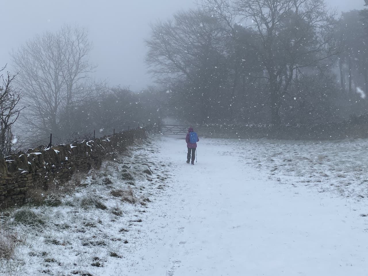
When we arrived at Goodleigh Hill CL yesterday it was a cracking afternoon, but overnight the weather has changed and the predicted cold wintery spell has arrived. I had planned for us to walk on the Malvern Hills today, however the fall of snow in the early hours has put Lynnie off. So instead we are going to walk from the caravan and head onto Bredon Hill.
We walked to the top of Bredon Hill on our first stay at this site, but today’s route to and from the summit will bit different. Leaving the site by the pedestrian access we walk down to the road and then turn left heading uphill into Pensham Hill. As the road levels we take a footpath on the right beside a post box. The path follows a driveway and then goes through a gate to enter a field.
This is the route of the Wychavon Way, a forty mile long distance route between Droitwich Spa and Broadway. We go through the field with the hedge to our right to reach a kissing gate. We now follow a clear path across fields heading towards Home Farm in Pensham.
The path leads to a minor road where we turn left and walk through the village. At a junction of roads we continue straight on.
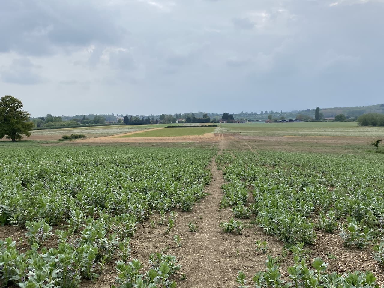
At the end of the lane we turn left, still on the route of the Wychavon Way and follow the farm track which passes glasshouses at Sandilands. After passing a barn which is being converted into a home we reach a junction of paths. Here we turn right still on the route of the Wychavon Way. The map shows the footpath going diagonally across a field but there is a permissive path around the field edge which we choose instead. When possible I prefer to take a route that avoids damaging crops.
The permitted path turns left at the corner of the field and soon rejoins the main footpath continuing along the edge of the field. We reach a point where the footpath goes through bushes, when we walked this path last year the path was overgrown and impassable, so I continue along the edge of the field towards glass houses and then turn right to follow a track downhill to rejoin the main footpath which goes over a footbridge into a field.
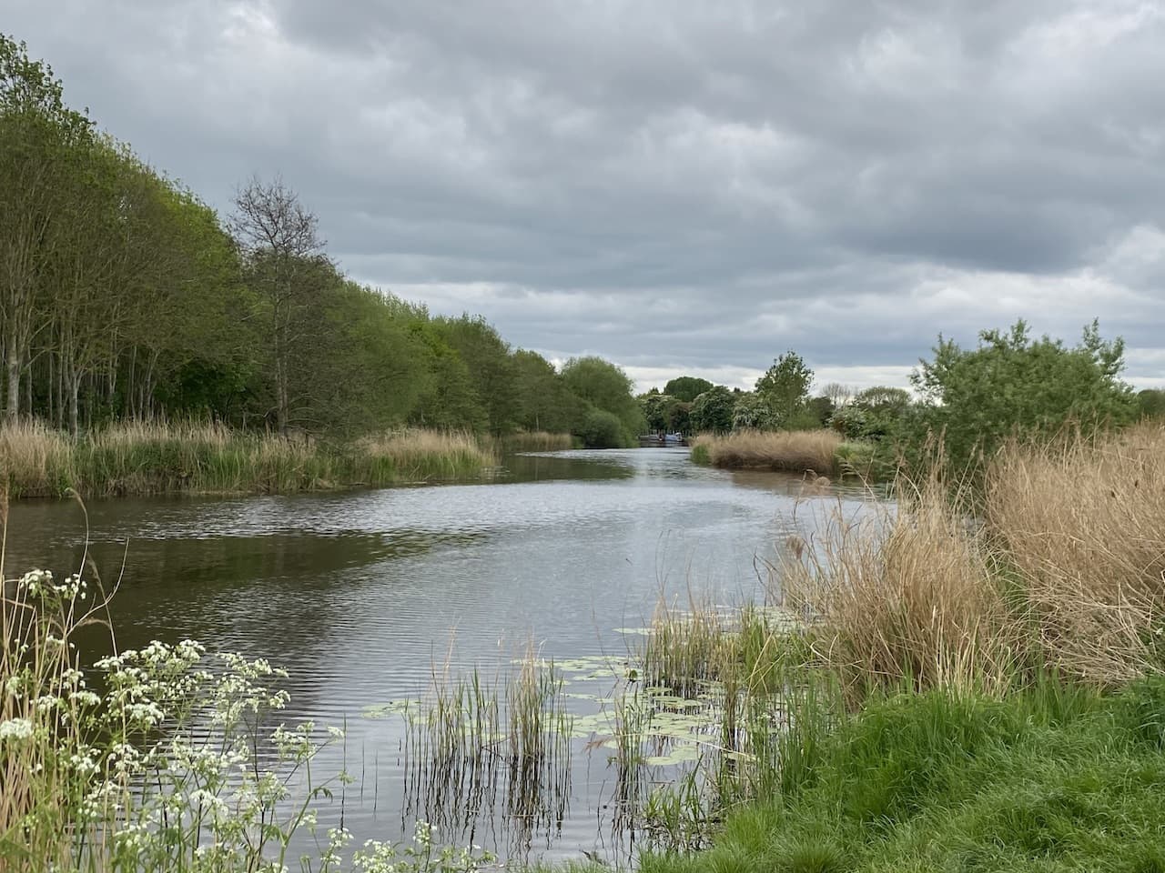
Over the bridge we turn to the right and the path soon turns besides the River Avon and we continue along with the river on our right.
Through a gate we keep going along a broad grassy path besides the river.
After going through another gate the footpath turns away from the river and heads up a lane towards Great Comberton. At a junction with a road we turn right to walk into the village and then fork right by a telephone box to continue through this attractive village.
At a way-marker for a footpath to Nafford we turn right following the path to a wooden gate which we go through and continue downhill.
We are now on the route of the Shakespeare’s Avon Way, this is an eighty-eight mile long distance trail following the River Avon from its source at Nasby in Northamptonshire to Tewkesbury in Gloucestershire.
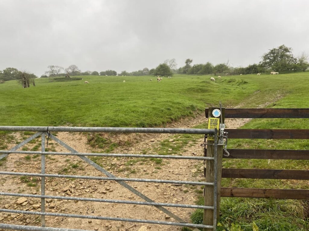
At the foot of the hill we go through another gate and then follow the path as it turns to the right and heads through a field of sheep pasture.
After another gate into a field we get fine views over the River Avon.
Keeping the fence line close to our left we continue through the field and then descend to reach a footbridge over a stream. Over the bridge we cross a field to a gate and another field. The path heads towards Nafford House and then after going through a kissing gate reaches a minor road.
We turn left along the road to reach a junction where we turn left and then within fifty metres take a minor road on the right, Woollas Hill, going towards Woollas Hall. After passing Woollas Hall Farm we reach a gate by a cattle grid, here the footpath continues on the tarmac drive still heading towards Woollas Hall.
At a crossing of paths we leave the tarmac driveway going over a stile and continuing uphill on a grass path. We have now rejoined the Wychavon Way and it has started to snow.
We reach a gate besides a cattle grid and continue along a track until we reach a junction, here the footpath goes to the right into a field and the route is well waymarked as it ascends the hill.
After going through a gate the track heads uphill towards trees.
We go through another gate and quickly reach a junction of paths where we turn left and follow a broad path in the shelter of trees.
Leaving the trees we are exposed to the full force of the wind and snow. It is suddenly a bit bleak and the visibility is significantly reduced. We go through a gate and continue to Parsons’ Tower.
The tower was built in the mid 18th century for John Parsons, he was the local MP and squire at nearby Kemerton Court, apparently he intended to use it as a summer house so he could enjoy the views over the surrounding countryside.
The tower sits on the edge of an Iron Age hillfort known as Kemerton Camp, we are unable to see any of the fort because of the poor visibility.
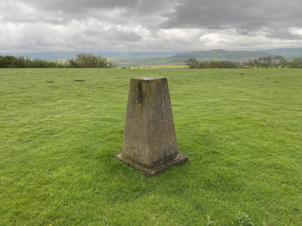
Our route continues in a north easterly direction to reach a toposcope, I recall from our last visit enjoying some good views, however we can’t even see Parsons’ Tower from here.
From the toposcope we continue in a north easterly direction to reach a stone wall and then continue on the Wychavon Way with the wall to our left.
After passing through a gate we continue along to reach a junction of paths where we fork left staying with the Wychavon Way as it descends to a crossing of paths at which point we turn left to follow a path heading north downhill towards the edge of Doctor’s Wood.
The path leads to a pasture field which we cross to reach Comberton Wood.
In the woods the route descends steeply on a path, which has been well used by horses, and then reaches a track where we go right. Soon the track leaves the trees and heads downhill between fields.
We stay with the track at a crossing of paths and then at the next junction of paths turn left on a bridleway with a well-hidden fingerpost pointing towards Great Comberton.
We keep with the bridleway to Great Comberton, it is easy to follow, passing through a couple of fields to join a track into the village.
In the village we turn right at a junction and reach the telephone box and then go right before taking the left into Quay Lane leading us back towards the River Avon at Comberton Quay.
We are now on the route we covered earlier in the walk and turn right to walk along the grassy area besides the river. This time at a junction of paths we turn right to walk beside the site of a former golf course which is being turned into a mobile home park.
We go through a kissing gate and follow the grassy path besides the fence line and then reach a recently ploughed field. The path is waymarked and continues on the muddy margin with the field edge on our left to reach a footbridge over a stream.
After the bridge the map shows the footpath crossing a field, but it is clear from the worn route that locals use the field margin, so we turn right and then at a hedge line turn left and continue uphill to reach a track.
Staying with this track, which is the route of Shakespeare’s Avon Way we head back to Pensham Hill. At a road junction we turn right and continue along to reach the pedestrian entrance to Goodleigh Hill CL.
Our walk has covered just over eleven miles and despite the wintery conditions and poor visibility on Bredon Hill it has been a very enjoyable bit of out.
All information on this site is provided free of charge and in good faith and no liability is accepted in respect of damage, loss or injury which might result from it. To the best of my knowledge the routes are entirely on public rights of way or within areas that are open for public access. Walking can be hazardous and is done entirely at your own risk. It is your responsibility to check your route and navigate using a map and compass.
Today is one of those days when Crosby and I are heading out on our own. Lynnie has decided to spend a few hours wandering around Pershore so I am free to walk as far as I please. I don’t fancy driving anywhere so after a quick scan of the map I decide to head out from the caravan.
Leaving the site by the pedestrian access I walk down to the road and the turn left and head uphill into Pensham Hill. As the road levels out I take a footpath on the right beside a post box. The path follows a driveway and then goes through a gate to enter a field.
This is the route of the Wychavon Way, a forty-mile long distance route between Droitwich Spa and the Cotswold village of Broadway. I go through the field with the hedge to my right to reach a kissing gate and then follow a clear path across fields heading towards Home Farm in Pensham.
On reaching a road in the village I turn left and continue on this towards Pensham Farm. The road then becomes a track and passes glass houses and barns. Shortly after the last barn the footpath turns to the right, here the footpath goes diagonally across a field but there is a permissive path around the field edge which I choose instead. If possible I prefer to take a route that avoids damaging crops.
The permitted path turns left at the corner of the field and soon rejoins the main footpath continuing along the edge of the field. I reach a point where the footpath goes through bushes, when I last walked the path in the opposite direction the path was overgrown and impassable, things have not improved so I continue along the edge of the field towards glass houses and then turn right to follow a track downhill to rejoin the main footpath which goes over a footbridge into a field.
Over the bridge I turn to the right and the path soon turns besides the River Avon and I continue along with the river on my right.
Through a gate I keep going along a broad grassy path besides the river, in front of me is a good view of Bredon Hill, Lynnie and I walked up there on a cold day last November but it is not on my list of planned walks this trip.
After going through another gate the footpath turns away from the river and heads up a lane towards Great Comberton. At a junction with a road I turn right and walk into the village and then fork left by a telephone box, now being used as a book swap, and walk along Church Street. I soon reach a junction with Russell Street and follow this tarmac lane which passes houses and then becomes a track as it heads out of the village.
I stay with this track as it becomes a footpath leading through fields heading east. At a junction of footpaths besides a gate I continue straight on along a hedge-lined path to take a track where I turn right following it for a few hundred yards to reach a footpath on the left. This path goes east across the field with the fence-line on the left hand side.
In the corner of the field I cross a stream on a footbridge and then continue along the waymarked path heading through fields towards Elmley Castle.
At a junction of paths besides a barn I turn right, this leads to a lane where I turn left and walk into the attractive village.
On reaching the village pub, The Queen Elizabeth, I turn left. This 16th century pub apparently derives its name from the visit of Queen Elizabeth I to Elmley Castle in August 1575. One side of the pub sign shows the date 20th August 1575, and the pub’s website says they like to think that the Queen stayed at the inn. Even if it can’t be proven it is a good marketing ploy.
Just after the pub I turn right into a narrow lane which soon reaches the village cricket field.
To avoid the narrow lane I walk besides the cricket pitch and then rejoin the road by the entrance to the field car park. I now have a section on the road, but it broadens out and there is very little traffic. I ignore a footpath on the left and a couple of others on the right and carry on besides the road until I reach a footpath sign which points to a path on the left crossing a stile besides a gate into a paddock area, this is marked on the map as Netherton Fields. The path goes beside the paddock and then along the edge of woodland.
Emerging from the trees I follow the path heading north to reach barns at Elms Farm where there is an abandoned old lorry.
I follow the track around the barns and then pass a gate and continue on the farm driveway to reach a road where I turn right and then very soon take a left along a lane signposted to Netherton.
The lane goes by cottages and continues on past the old barns of Chapel Farm.
At a crossing of footpaths I carry on northwards along a track to a gateway. Through this I keep north and at the next gateway enter a field of cattle, thankfully they show no interest in Crosby and I as we make our way between them and my heart rate returns to normal when we are safely through the gate on the far side of the field.
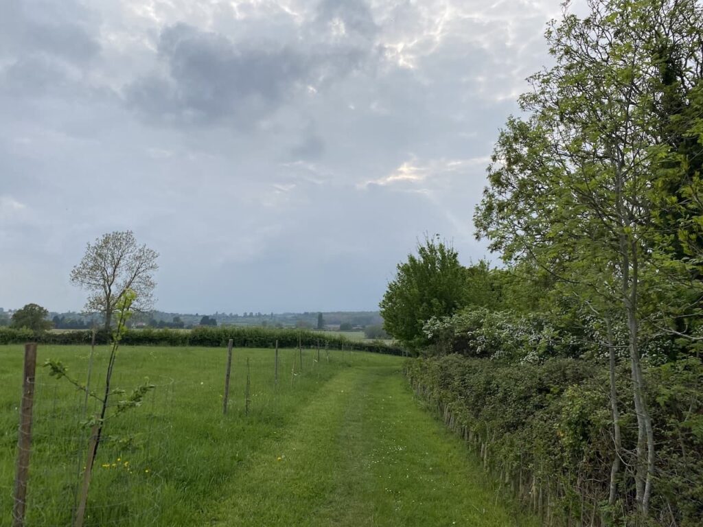
The next gate reaches a junction of paths and I turn left staying on the Wychavon Way and keeping left when the path forks. The route continues along a hedge-lined track.
At a footpath on the right I turn to follow a broad path between fields heading in the direction of Cropvale Farm.
After crossing a bridge the path turns to the left and heads north towards Cropthorne and I soon pass a fine old barn.
Staying with the waymarked route I continue through fields with a stream to my left. This footpath leads to the B4084 which I cross and turn left along the pavement for a hundred yards before turning right at a junction down Brooks Lane. This lane takes me into Cropthorne and I stay with it as it bends to the right and crosses a stream before heading uphill to the village church.
The church of St Michael has an interesting interior with fragments of an ancient wall painting.
There are also some interesting memorials one of which is Francis Dingley (died 1624) and his wife Elizabeth Bigg. The inscription states they were married for 50 years and had eleven sons and seven daughters.
Leaving the churchyard I turn left and continue through the village to a junction where I turn left into Neigh Lane which is signposted to Fladbury. I follow this road out of the village and then downhill to reach a junction where I turn left and cross the River Avon.
On the far side of the bridge I join a permissive path on the right crossing meadows besides the river, heading to Fladbury Mill.
The path leads to a road besides Fladbury Mill, here I turn right and walk into the village passing the Anchor pub and the Fladbury Pie Shop which is opposite the St John the Baptist church, built in 1340.
I continue through the village past the Social Club and then almost immediately after take a footpath on the left leading down Coach Drive, this passes houses and then allotments and follows a concrete driveway heading towards Spring Hill Farm. This is the route of Shakespeare’s Avon Way an eighty-eight mile long distance path following the river Avon from its source at Naseby to its confluence with the River Severn at Tewkesbury.
As the path nears Spring Hill Farm I go to the right and follow the route as it passes farm buildings and then heads west to cross a minor road and then the waymarked route heads towards a static caravan park. The route through the park is clearly waymarked and passes the caravans dotted around disused gravel pits.
Staying with the waymarkers for Shakespeare’s Avon Way I continue on to skirt around a sewage works and then Lower End Farm and then carry on, ignoring other footpaths, to reach Wyre Piddle.
The path joins a road where I turn left and wander through the village passing the Anchor Inn to reach the village medieval cross.
I go left at the cross and follow the lane past the small church of St Ann.
The lane heads out of the village, going downhill passing the entrance to Wyre Boatyard and then reaching Wyre Mill, this old corn mill dates from the early 1800’s and originally had three wheels. It is now the base of Wyre Mill Club a social club for locals and visiting caravanners and boaters.
After passing the mill and the entrance to a caravan and camping site the path continues on to follow a footpath across meadows heading towards Pershore.
I have a number of options on reaching the edge of Pershore and choose to walk around past the entrance of Pershore Football Club and then wander through a car park besides Asda supermarket and join the High Street where I turn left and continue along the road through the town and then across the River Avon before turning right to return to Goodleigh Hill CL.
My walk has covered fifteen miles and there have been plenty of interesting things to see along the way.
All information on this site is provided free of charge and in good faith and no liability is accepted in respect of damage, loss or injury which might result from it. To the best of my knowledge the routes are entirely on public rights of way or within areas that are open for public access. Walking can be hazardous and is done entirely at your own risk. It is your responsibility to check your route and navigate using a map and compass.
After a couple of weeks walking on and around the Brecon Beacons we have moved site and are now located at Goodleigh Hill CL on the outskirts of Pershore. We visited this site for the first time last November, it was a very cold spell and we decided to return in warmer weather.
Our journey from Llangadog was straightforward and we were warmly greeted by Emily, the site owner. It is always useful to arrive at a site and meet someone happy to share their local knowledge with you. Goodleigh Hill is a relatively new CL and it has been developed well. All pitches are fully serviced on a large hardstanding and on arrival there is a comprehensive information folder which you can peruse at your leisure during your stay.
As soon as we are pitched up it is time for a quick walk from the site. We aim to walk into Pershore to pick up some shopping later so decide to do the walk that formed my morning circuit when we last stayed here.
Leaving the site by the pedestrian access we walk down to the road and the turn left heading uphill into Pensham Hill. As the road levels out we take a footpath on the right beside a post box. The path follows a driveway and then goes through a gate to enter a field.
This is the route of the Wychavon Way, a forty mile long distance route between Droitwich Spa and Broadway. We go through the field with the hedge to our right to reach a kissing gate.
We now follow a clear path across fields heading towards Home Farm in Pensham.
On reaching a road in the village we turn left and soon reach a junction of minor roads where we turn left to head back to Pensham Hill. This is a long straight road with very little traffic so easy walking.
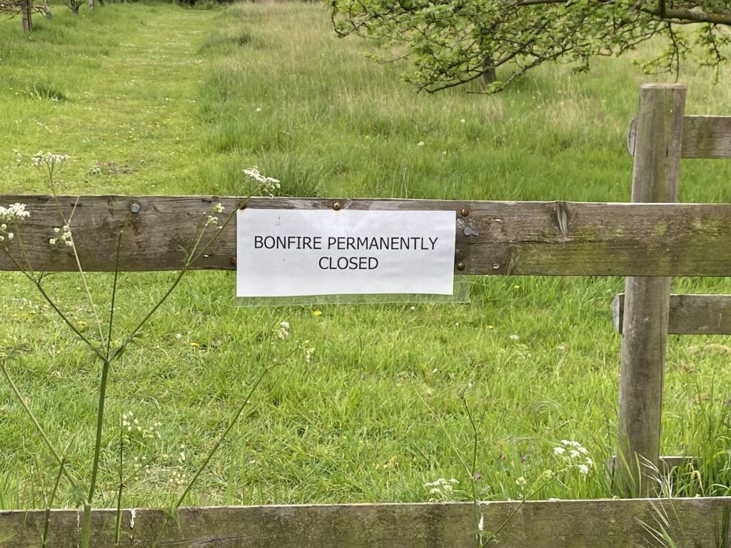
As we leave the village we pass the entrance to the village field, apparently in 2000 local residents raised funds to purchase a couple of acres of land for planting with trees and an Orchard creating a recreation area. Such initiatives are great for supporting wildlife habitat and developing communities.
At the entrance to the field is a notice saying that the Bonfire is permanently closed. I am not a fan of bonfires or those that light them on sunny afternoons when folk are trying to relax in their gardens.
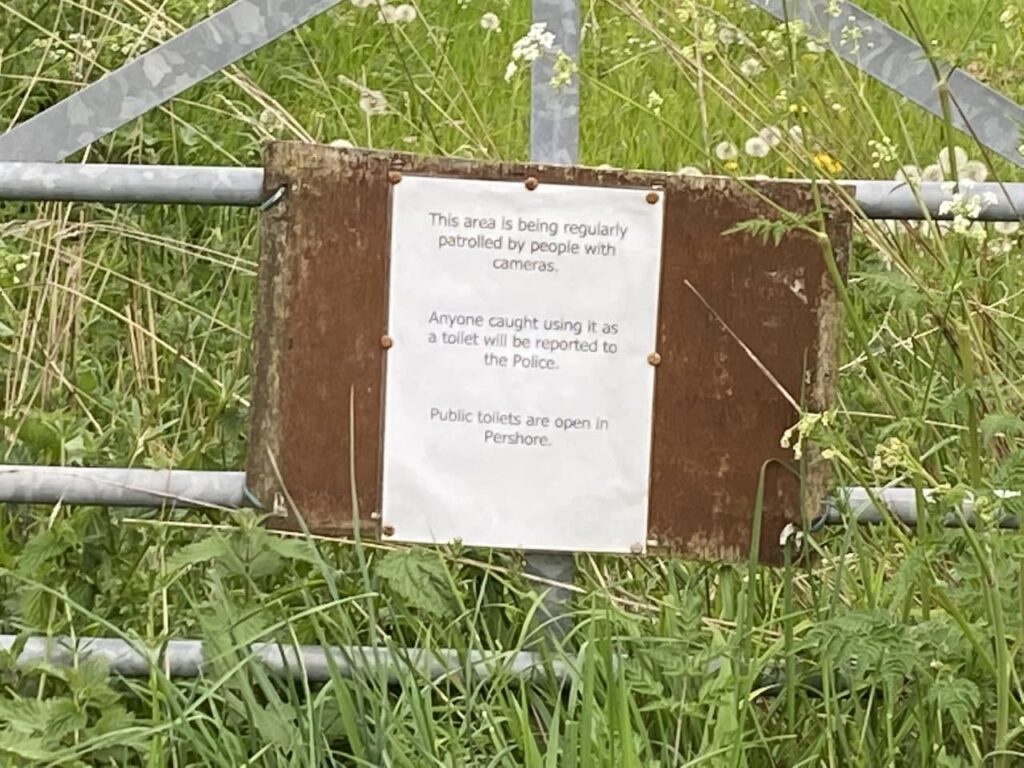
A little further along the lane is another sign. Whilst I concur with the sentiments it leads us to wonder why folk would feel the need to use the field as a toilet, presumably it is a frequent occurrence otherwise why put up such a notice. But equally concerning is that someone is lurking behind a tree with a camera just on the off chance that someone might have a desperate call of nature!
We now stay with the road returning back to Pensham Hill and continue straight on going steadily downhill to reach the entrance to the CL. This little route is just over two miles, enough for Crosby to stretch his legs after being in the car for a few hours. Now it is time to pop into Pershore and get some supplies before planning our walks for the next few days.
All information on this site is provided free of charge and in good faith and no liability is accepted in respect of damage, loss or injury which might result from it. To the best of my knowledge the routes are entirely on public rights of way or within areas that are open for public access. Walking can be hazardous and is done entirely at your own risk. It is your responsibility to check your route and navigate using a map and compass.