Tag: Wiltshire Walks

  • The Cheverells from Market Lavington

    The Cheverells from Market Lavington

    Last year whilst driving from home for a walk in the Pewsey Vale I had to make a diversion due to a road closure.  The revised route took me through Market Lavington and I realised I had never visited the village.  On numerous occasions I have driven along the A360 which goes through nearby West Lavington, but had never turned off.  So today we are going to explore the area and start a walk from Market Lavington.

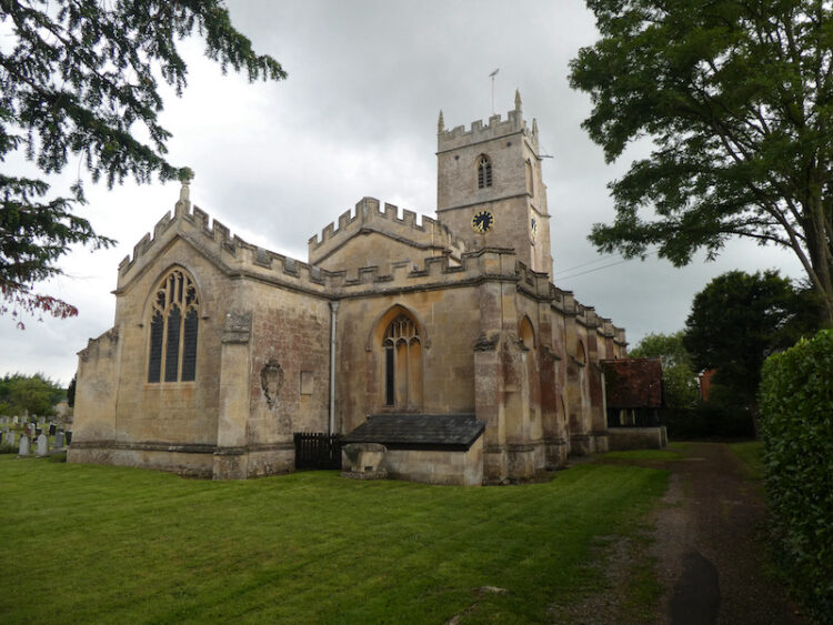
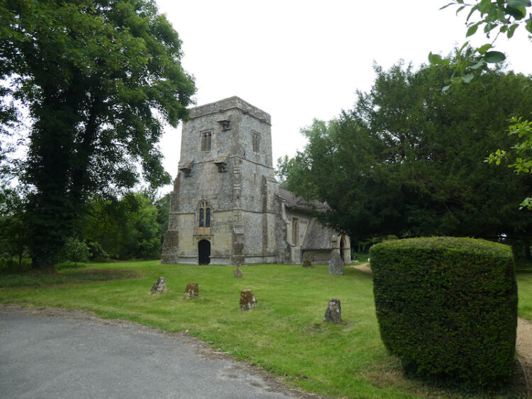
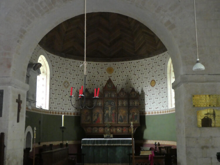
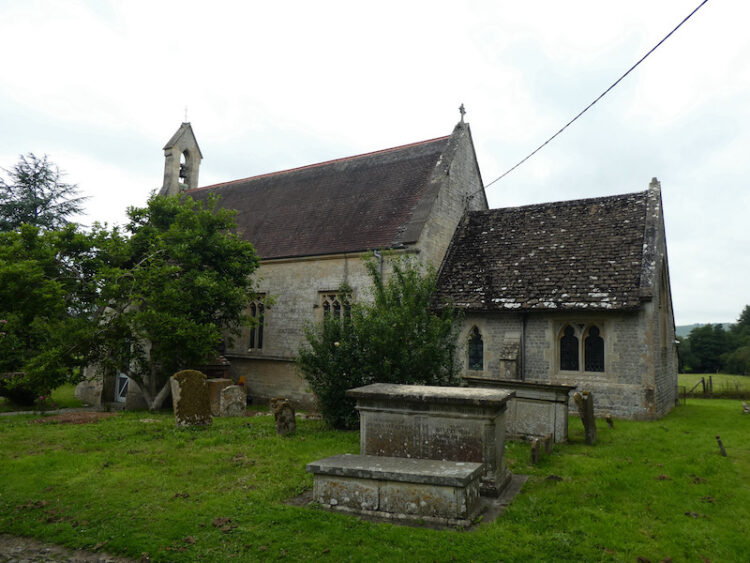
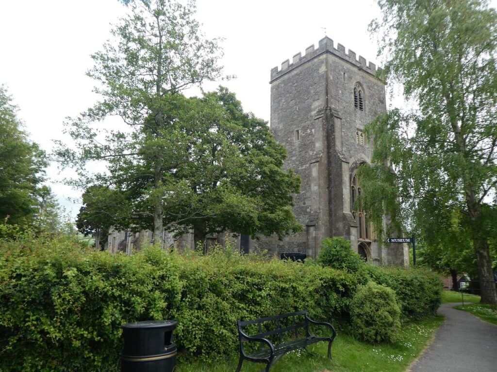
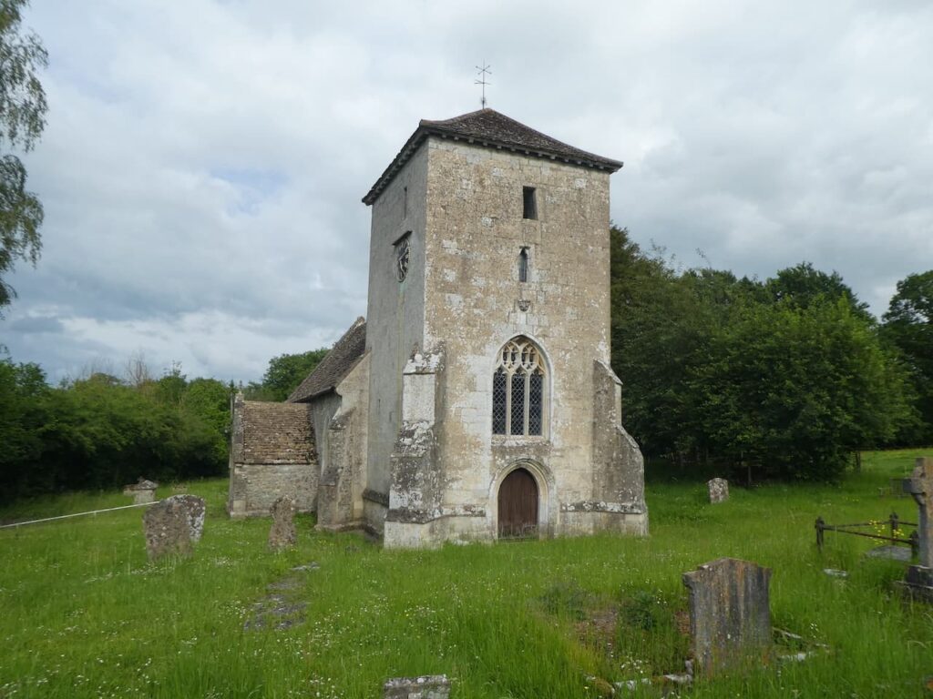
    The starting point for our walk is the car park of Market Lavington Community Hall in St Mary’s Road (SN10 4DG) (Grid Ref: SU013541).  We start by walking up towards St Mary’s Church, parts of which date from the 13th century with further additions in the 14th and 15th centuries.  Major restorations took place in 1864 and 1910.

    We take a path that goes north besides the church wall and then through the corner of the churchyard to reach houses.  We we follow the estate road down to reach Grove Road where we turn right and follow the pavement to a mini roundabout.  Here we take the first left into Canada Rise and head uphill.  Just before reaching houses we take a footpath on the right and follow this until we reach a road where we turn left and walk along the pavement for just over a hundred yards and then take a bridleway on the right.

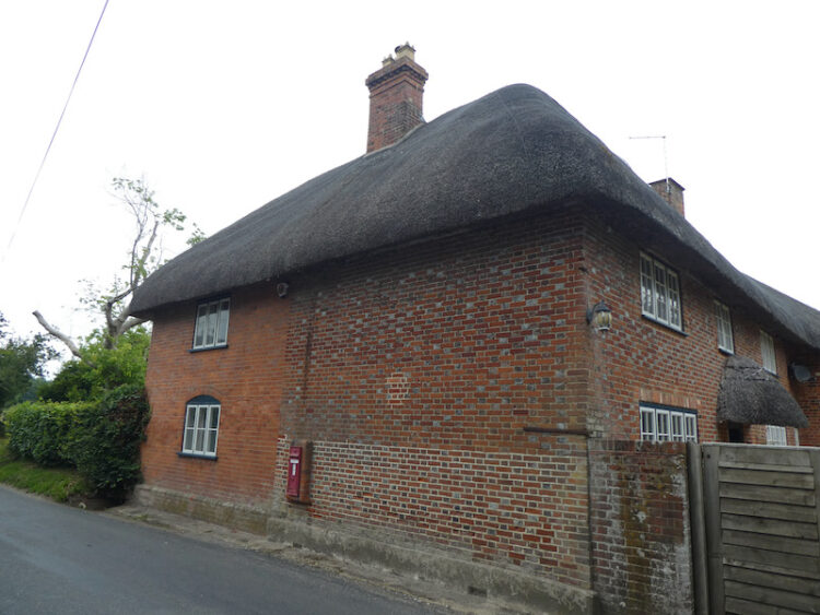
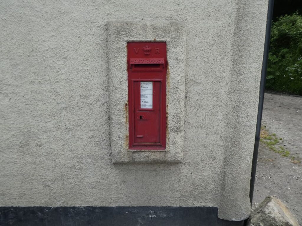
    This track soon forks and we go right and follow a path between fields to reach a junction of paths where we turn left and then at the end of that field fork right and continue on to reach a junction of tracks beside a cottage on Kings Road.  In the wall of the cottage is a Victorian post box.

    We now follow Kings Road, which is a narrow lane, to reach a junction.  Here we go straight on along a lane called Eastern Sands and keep going until we reach Sands Farm.  We fork left and then almost immediately take another fork to the right to follow a lane down through West Wood.

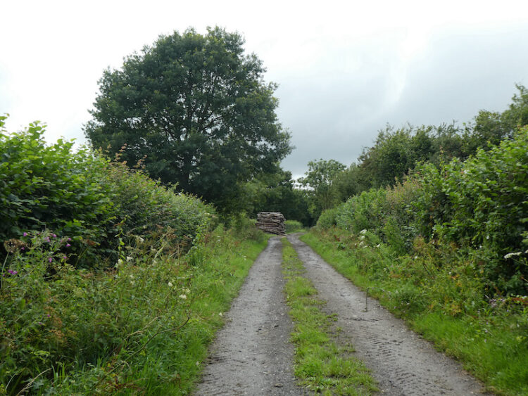
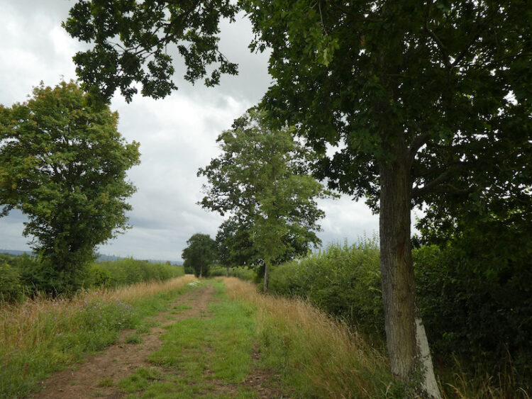
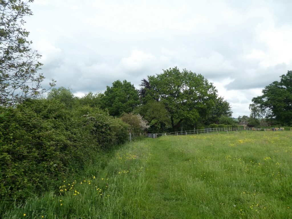
    This lane leads past Forest Farm and then goes under a railway line and continues on a grassy track in open countryside.

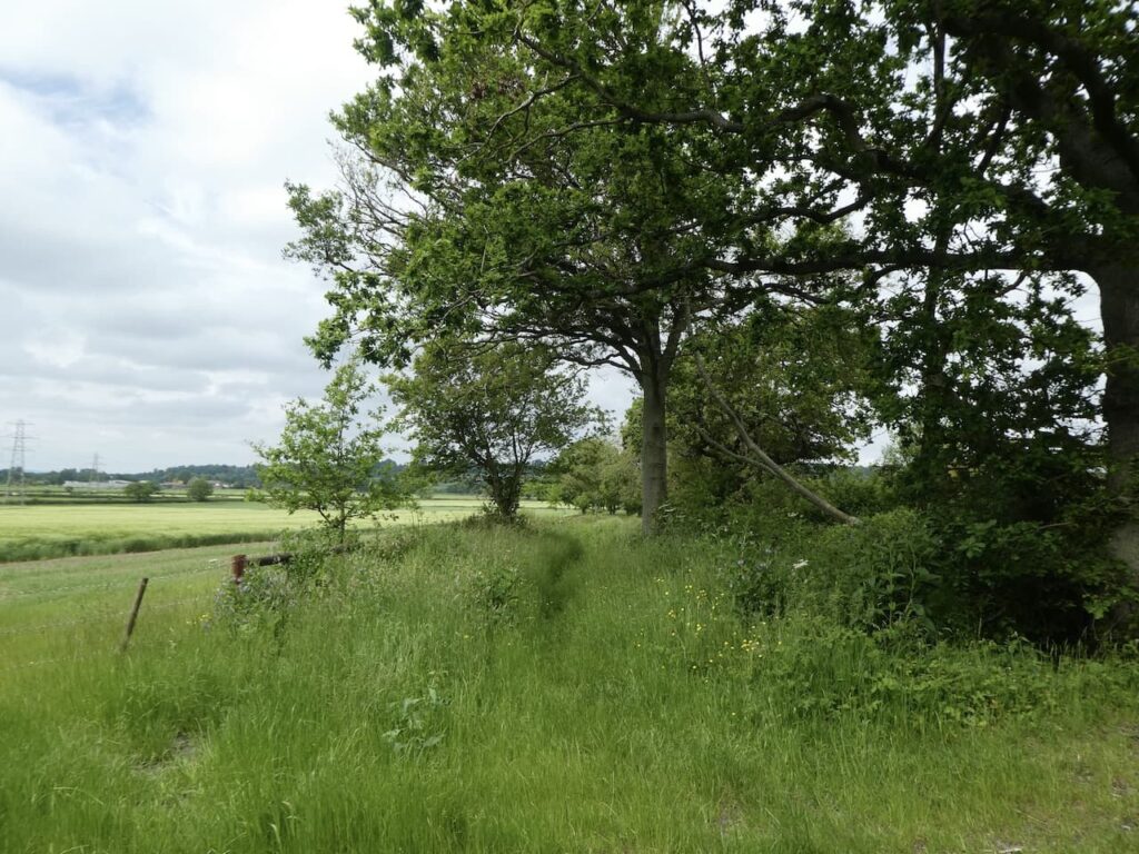
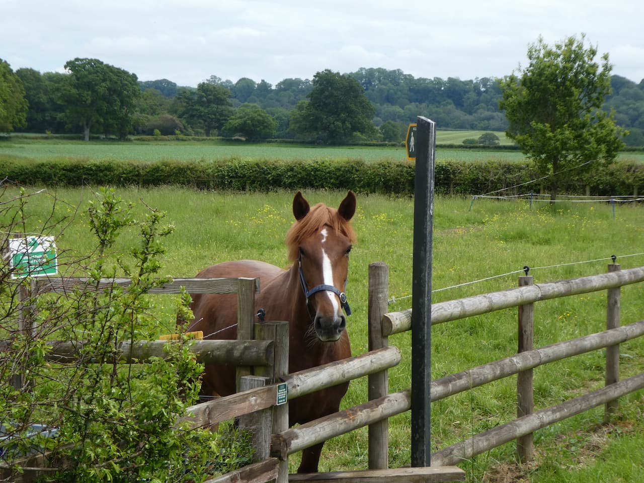
    On reaching a gate we turn left and follow a farm track which soon bends to the right and heads west towards Potterne Wick. The path leads us to a paddock where the horse is very interested in us and follows us towards a stile on the far side.

    We have now joined the driveway to Potterne Park Farm and we continue along this towards Potterne Wick.  At a junction of paths we continue along the lane and then a few hundred yards later take a footpath on the right leading through a field of free range chickens and then over a stile to a lane which we cross to continue along Saddleback Lane.

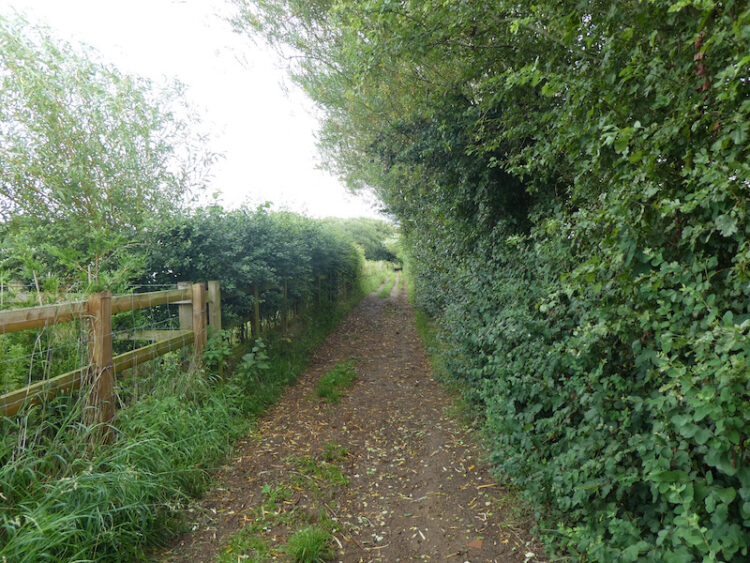
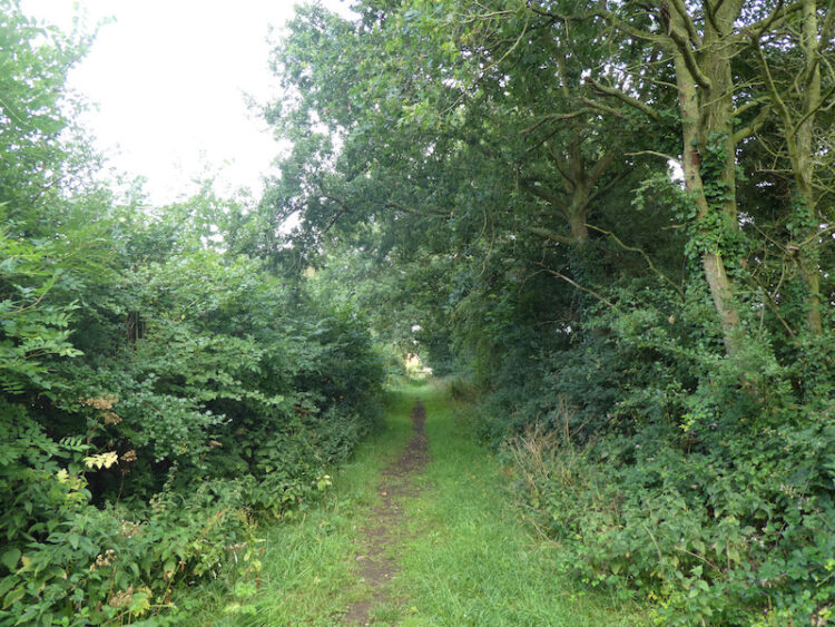
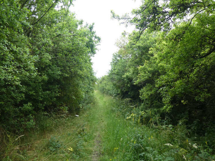
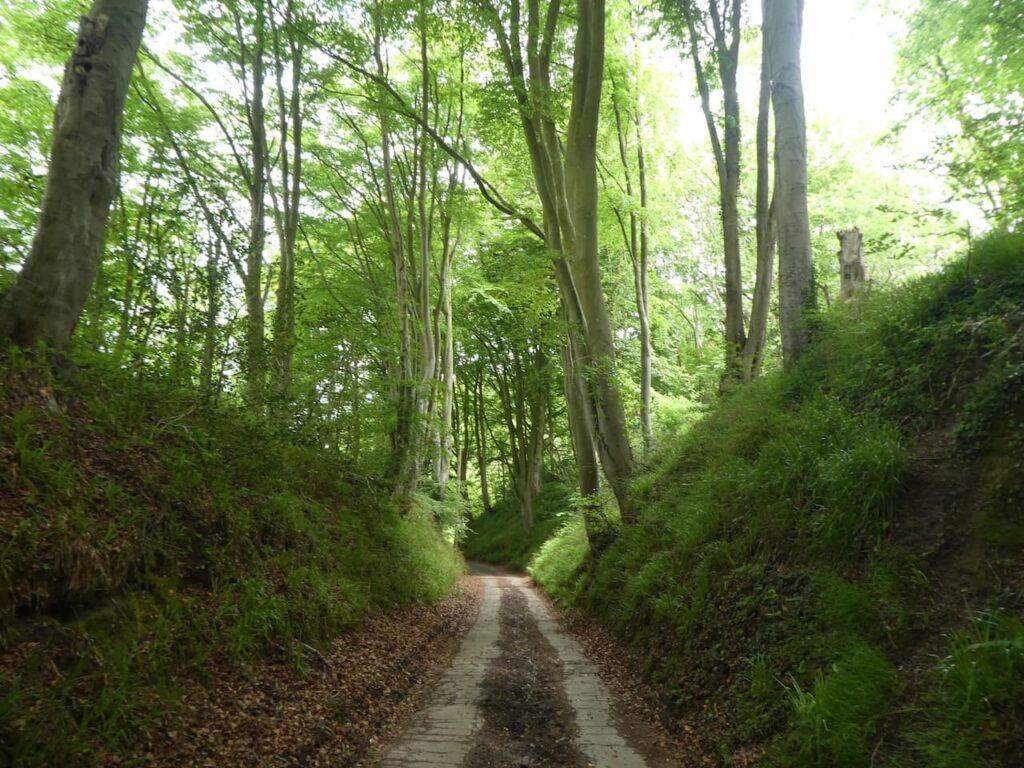
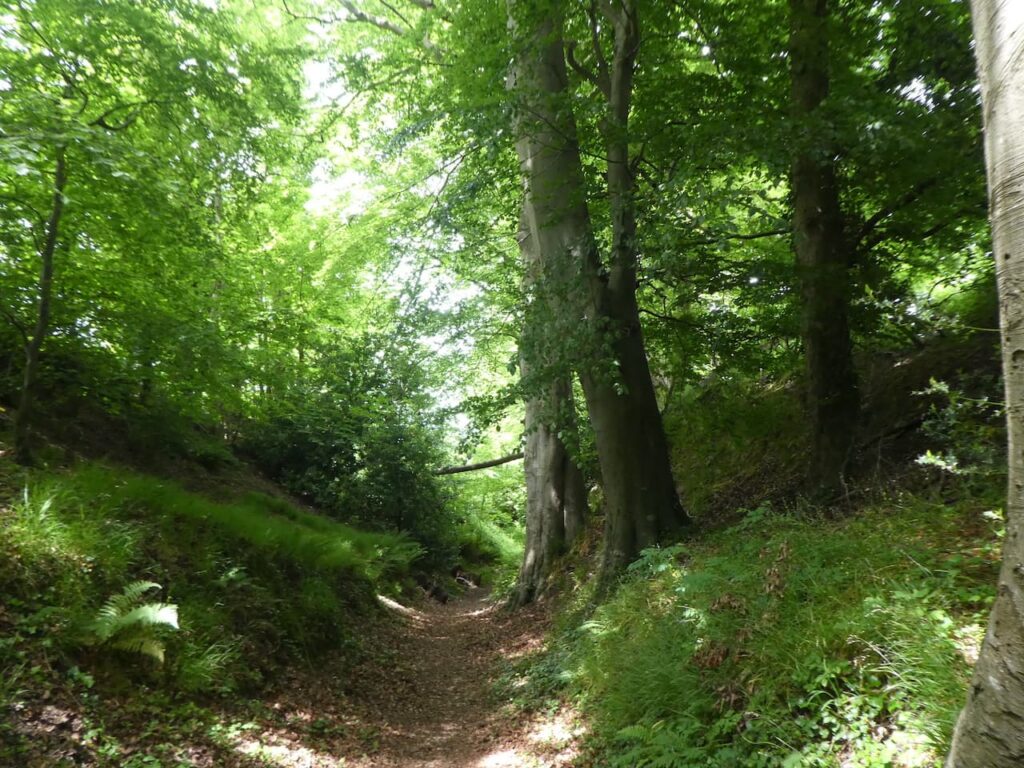
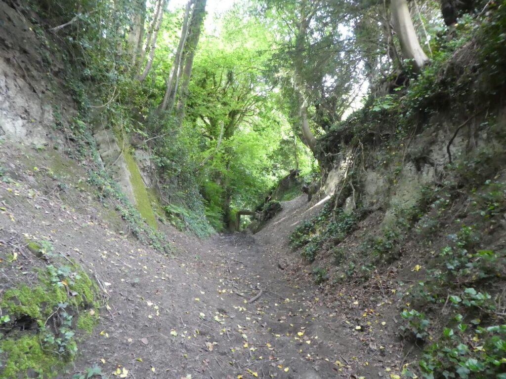
    This lane heads uphill and when the houses end we continue on a footpath following a fine sunken track lane.

    On reaching a cottage we join a tarmac lane and continue downhill to a junction of lanes where we go right uphill on a lane heading north.  After passing the post office we turn left to walk on the pavement besides the A360 to reach the entrance to St Mary’s Church.  

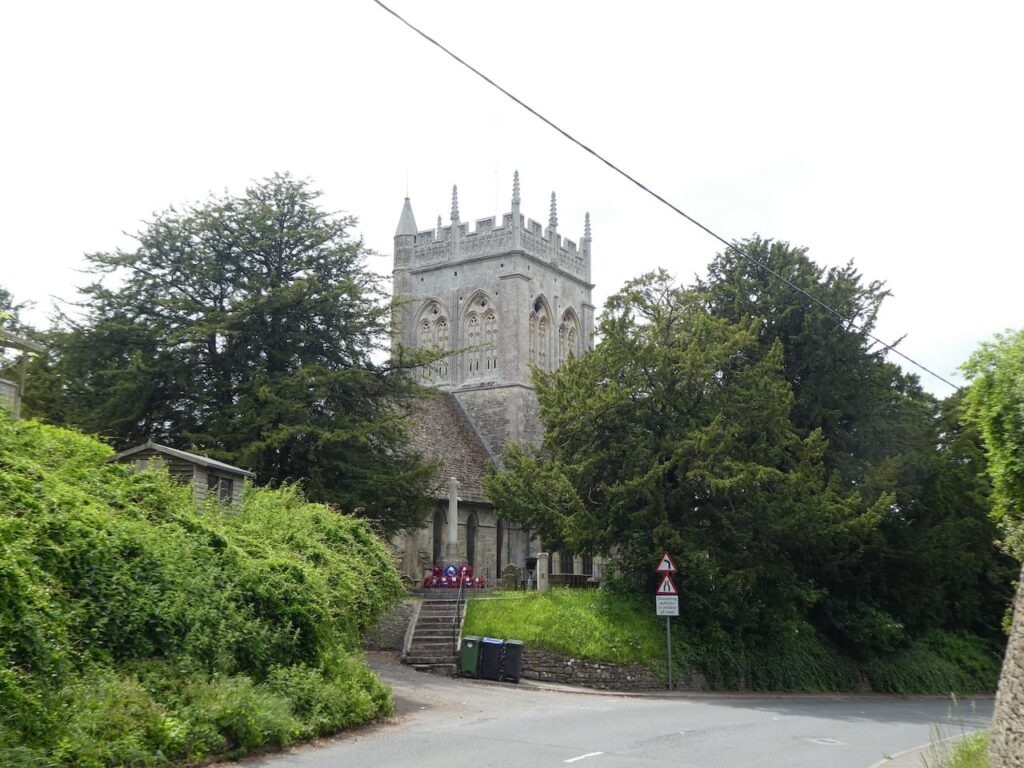
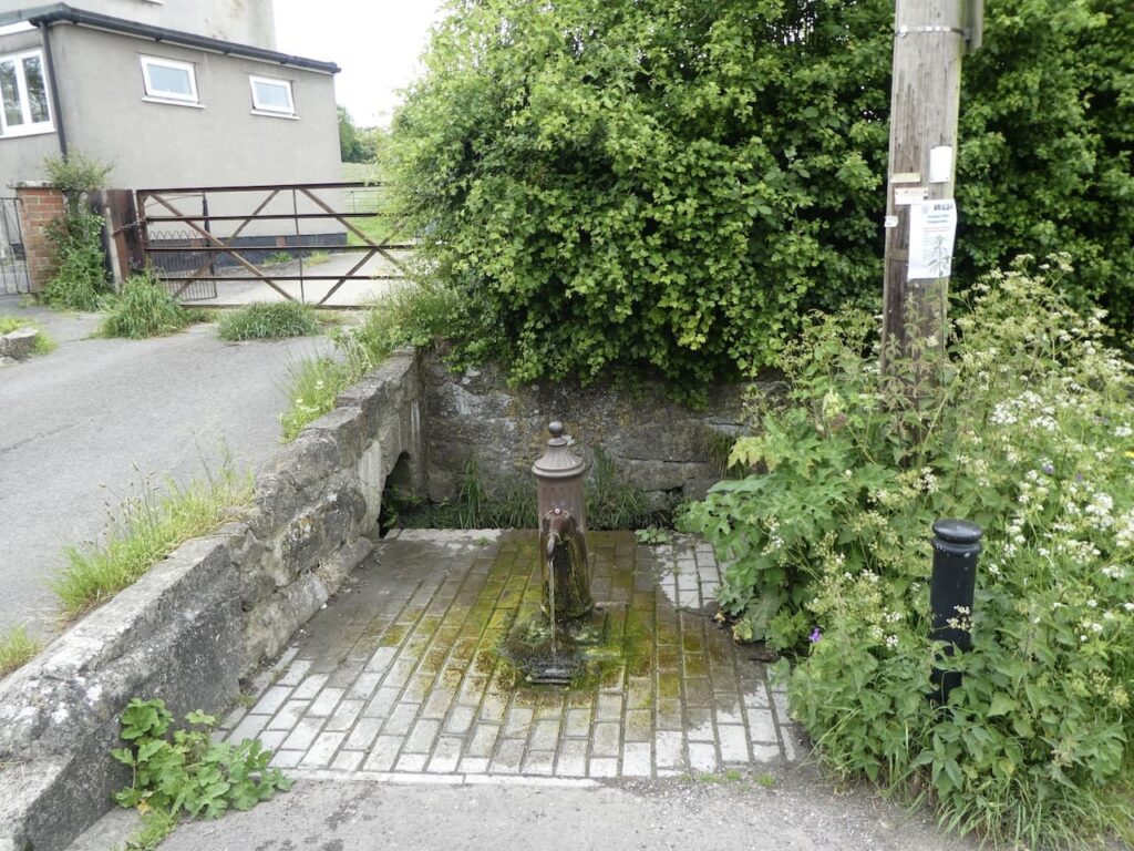
    It is time for lunch so we enter the churchyard in search of a bench and find a spot tucked behind the tower providing a pleasant view.  The A360 passes below the church but we are high above it so not disturbed.  Refreshed we resume our walk and return to the road and follow the pavement to reach a junction we leave the A360 to join Mill Lane heading downhill until we reach a lane where we turn left and then almost immediately take a footpath on the left besides a water pump.

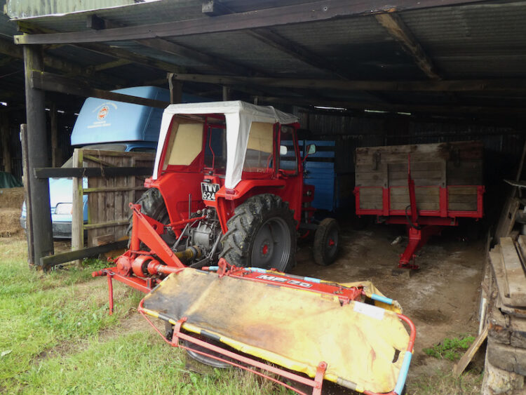
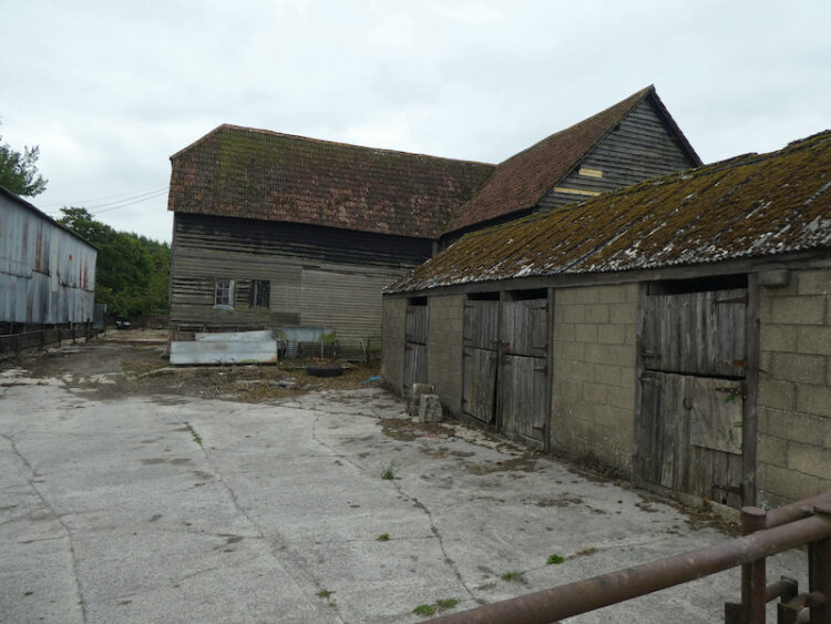
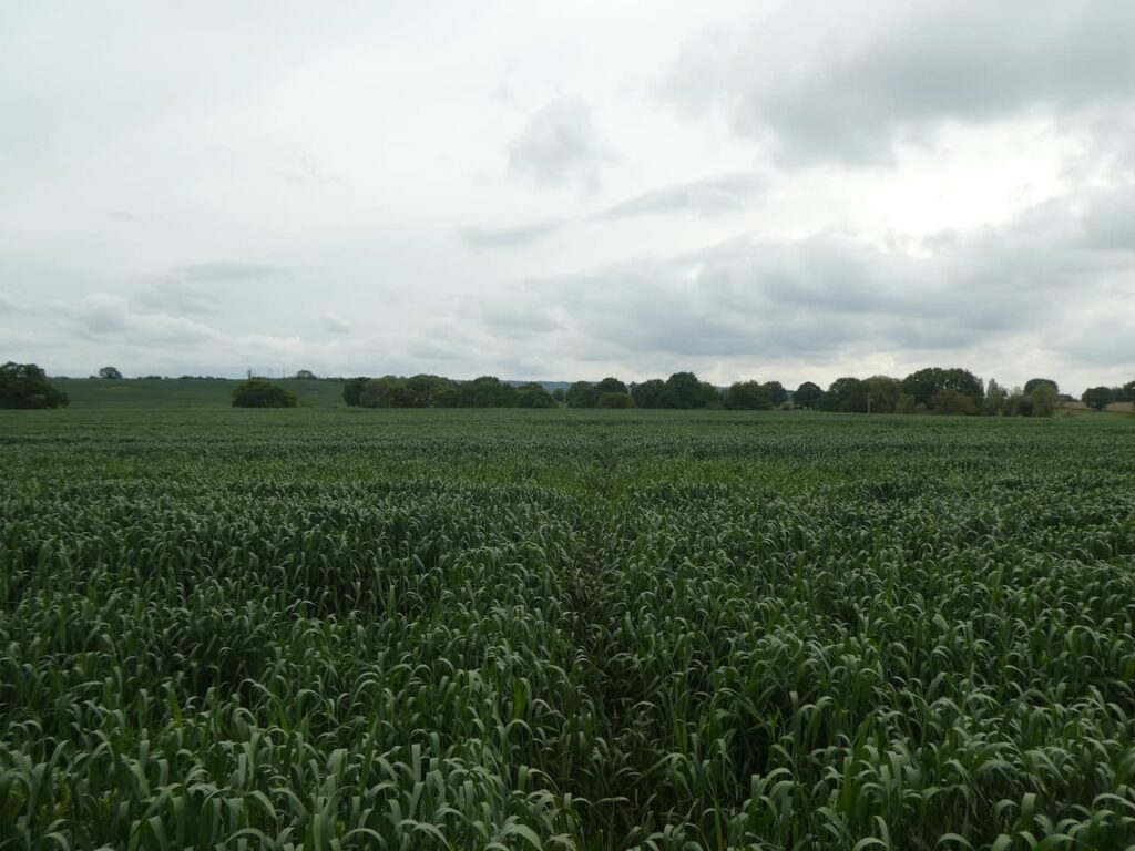
    This path leads through a farmyard and then continues across fields to reach a lane where we turn left and then after about 100 yards take a footpath on the right and stay with this path in a south-westerly direction towards Ware Farm.

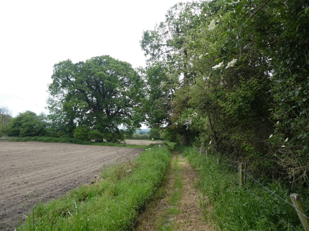
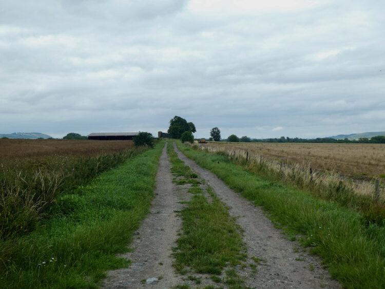
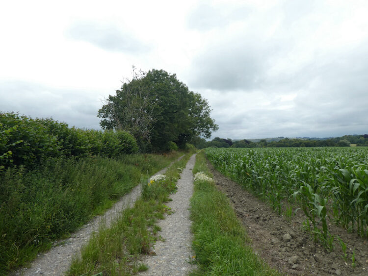
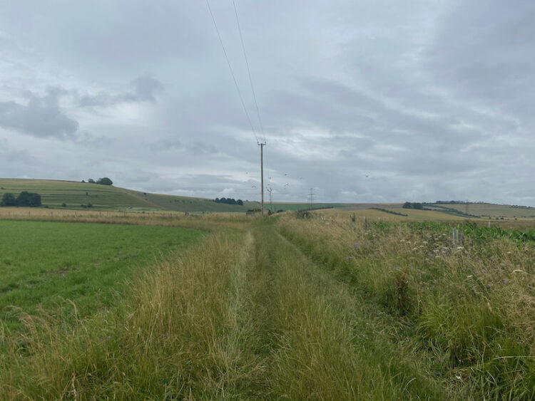
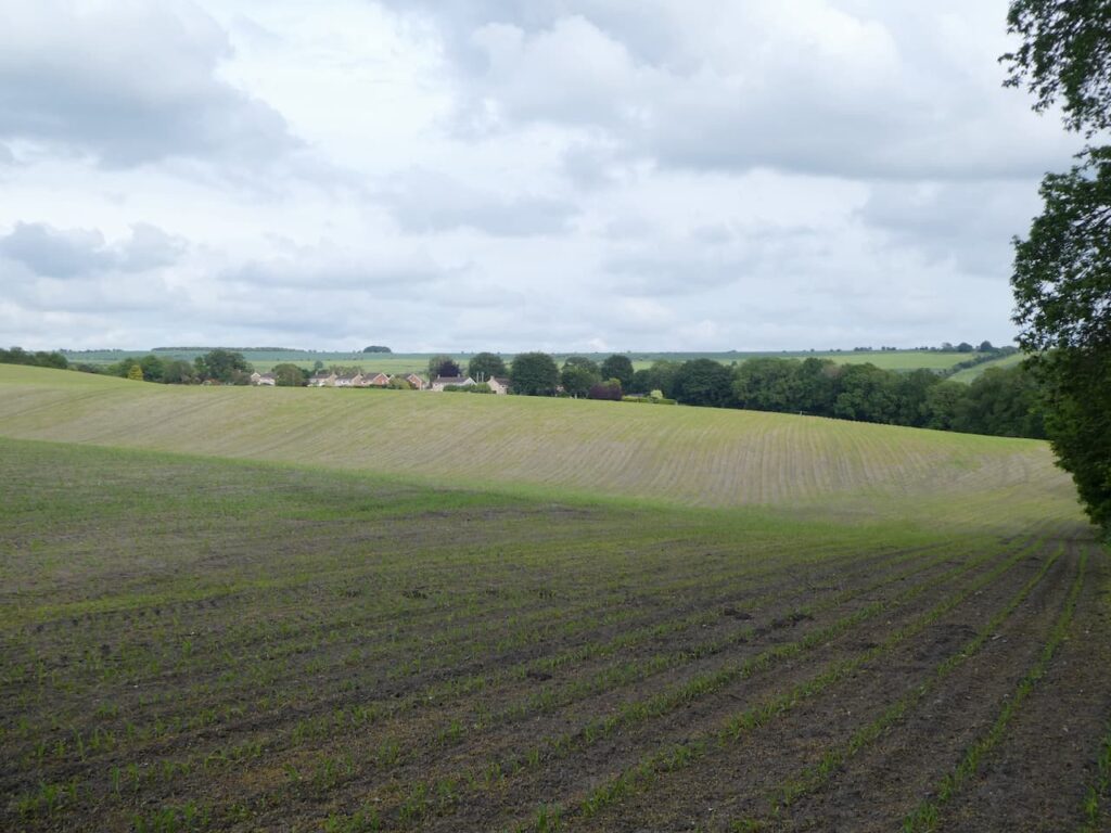
    At a crossing of tracks near a barn at Ware Farm we go left and follow the path through a large arable field.

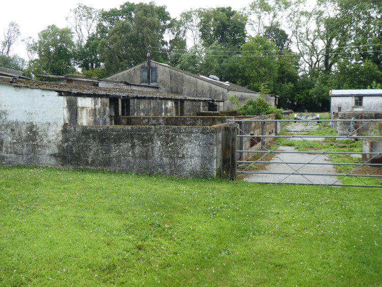
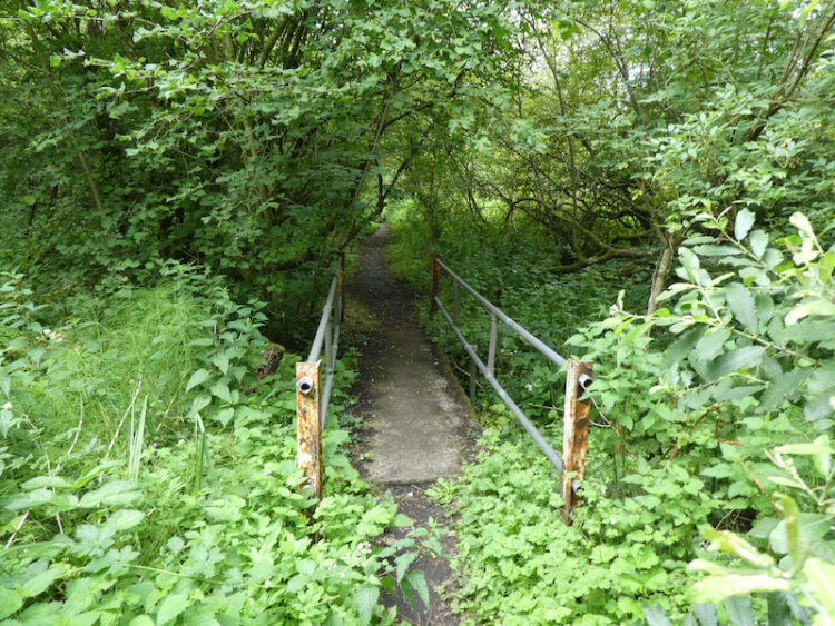
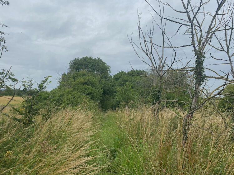
    We go into another field and continue heading east across fields.  At a junction of paths we turn right and continue across fields on a path that goes close to Larborough Farm.  The path descends to a large indoor pig unit.  It is not particularly well marked and in parts is overgrown as we cross a stream and beat a route which continues with the farm barns on our left.  It is irritating when landowners neglect footpaths or allow the way-markers to become obscured.  I often wonder if this is a deliberate act to try and discourage walkers.

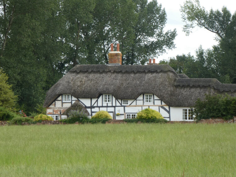
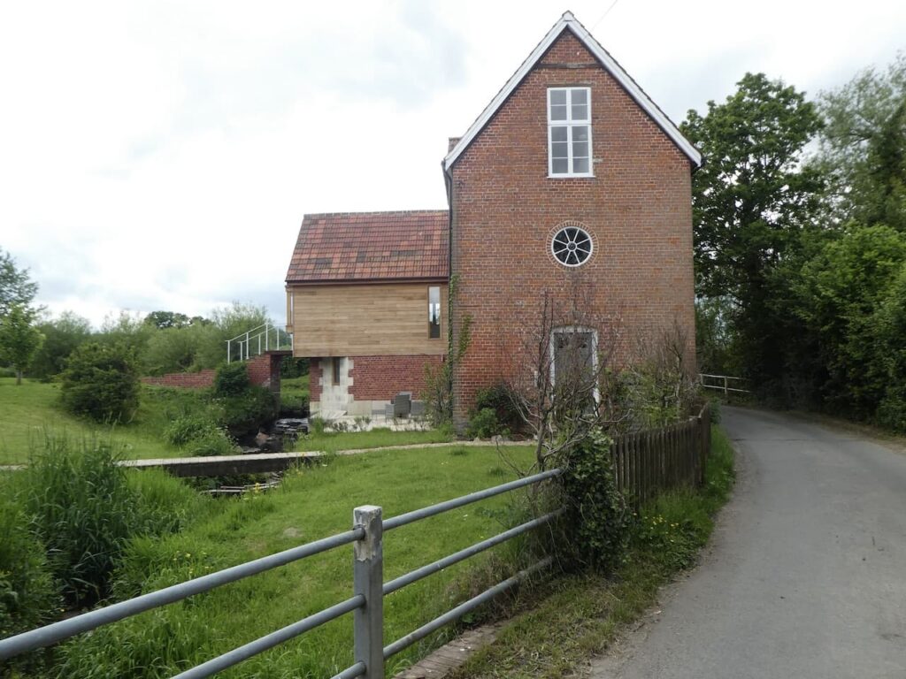
    On reaching a road we turn right and walk with care beside the road to reach South Cross Lane where we turn left and follow this lane past farms and Great Cheverell Mill, this was built in the 19th century and has now been converted to a private house.

    We stay with the lane which has now become Cheverell Green Road and then The Green which leads into Great Cheverell.  The sign announcing the village is a long way from the centre and when we finally reach the High Street we turn right and head uphill. At the Kyte’s Garage we turn left at Hill Corner.

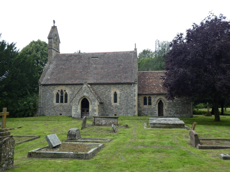
    After passing some houses the lane becomes School Lane and we follow this into Little Cheverell.  On reaching the B3098 we turn left and walk on the pavement until we reach the entrance to St Peters Church.  The tower on this church was built in 1291 whilst the rest of the church was rebuilt in 1850.

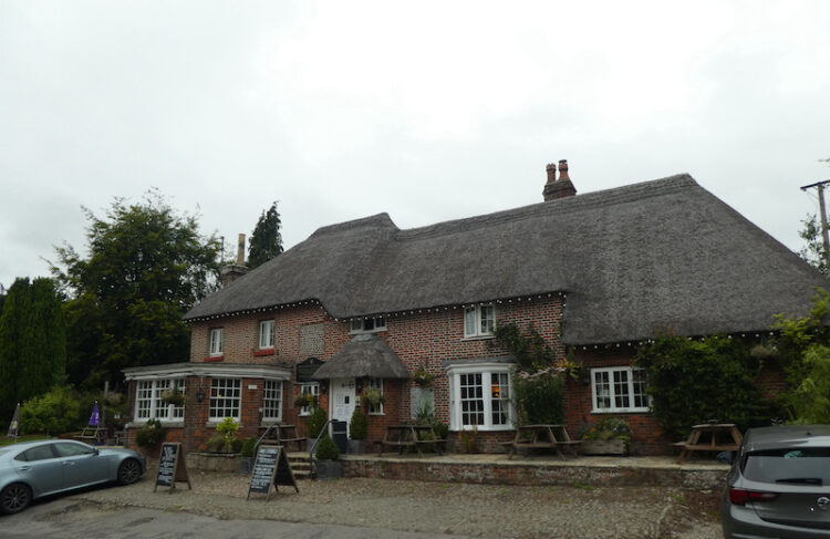
    From the church we continue downhill besides the B3098 and then turn left into Low Road.  Just before we reach The Owl pub we turn right into a lane and follow this as it curves around heading back towards the B3098.  Shortly before reaching the road we take a footpath on the left which heads across fields towards Littleton Panell.

    As we near houses we take a footpath on the right and follow this as it continues around to meet the A360.  Here we turn left and then soon take a right turn into Russell Mill Lane.  We stay with this lane until we reach the entrance driveway to Park Farm here we fork right and follow the path uphill to enter woods.  

    The path continues along the northern edge of the woodland and then at a junction of paths we turn right and follow a footpath towards Beech Wood.

    The path continues through the woodland and leads us to the mini roundabout at the junction of Grove Road and Canada Rise.  Here we turn right and retrace our steps back to our starting point at Market Lavington Community Centre.

    Our walk has covered twelve miles.  It has been interesting to visit the villages of Potterne, Great Cheverell and Little Cheverell, however the enjoyment of the walk has been hampered by the lack of signage and poorly maintained footpaths and stiles on the section between Potterne and Great Cheverell. 

    You can view this 12 mile walk on OS Maps and download the GPX File Here

    To follow my walk, you will need Ordnance Survey Explorer 130 – Salisbury & Stonehenge; and OS Explorer 143 – Warminster & Trowbridge

    7th June 2021

    © Two Dogs and an Awning (2021)

    All information on this site is provided free of charge and in good faith and no liability is accepted in respect of damage, loss or injury which might result from it.  To the best of my knowledge the routes are entirely on public rights of way or within areas that are open for public access.
    Walking can be hazardous and is done entirely at your own risk.  It is your responsibility to check your route and navigate using a map and compass.

  • A Circuit To Etchilhampton Hill

    A Circuit To Etchilhampton Hill

    We are nearly at the end of this short trip away, but there is still time for one more walk and an opportunity to bag a new Ordnance Survey trig pillar along the way.  Visiting trig pillars has long been a feature of our walking, for years they were ancillary.  If we happened to pass one along the way that was fine, but rarely did we make a special effort to reach one.  However, a couple of years ago a Twitter buddy suggested I start logging them.  Since then they have become a regular feature when planning my walks.

    Once again our walk starts from the pay and display car park in Station Road close to the centre of Devizes.  We leave the car park and turn left to walk up to a mini roundabout where we turn left crossing a canal bridge and then cross the road to take the towpath signed for Devizes Wharf.  As we near the Wharf, which is on the opposite side, we fork away from the towpath going up steps to join a lane with a World War II Pill Box.  This is one of a series of such boxes built along the edge of the canal to form the GHQ Blue Line a section of the General Headquarters Line which compartmentalised the country to thwart the expected German Invasion.

    We continue along the lane reaching the cemetery where we make a brief diversion to look around.  This cemetery was opened in 1878 and over the years has been extended a number of times.

    Back on the lane we cross the canal bridge and stop to look at Devizes Wharf.  In normal circumstances I imagine this is a must stop spot with its cafe, museum and theatre but today it is quiet.  Back in the days when the canal was in use as a trading route this would have been a major hub for goods coming in and out of the thriving town.

    We rejoin the towpath and head east through Devizes.  The Kennet and Avon canal goes between Reading and Bristol, 87 miles of waterway, the section from Reading to Newbury follows close to the River Kennet and from Bath to Bristol is close to the River Avon. It was designed and built by John Rennie between 1794 and 1810.

    Like most canals this one suffered competition from the railways and the opening of the Great Western Railway in 1841 removed most of its traffic. By 1852 GWR had taken over control of the canal and increased tolls significantly to persuade the remaining traffic to move to the railway.  Then in 1925 GWR sought to close the canal all together but by then pleasure boats had started to use it.

    After World War II the Transport Act 1947 saw the canal transfer to the British Transport Commission, under their stewardship the canal fell into decline with large sections becoming unnavigable.  In 1962 the charitable company the Kennet & Avon Canal Trust was established and they immediately started work on restoring sections and by 2003 the canal was fully navigable again.

    We continue to walk through this section of the canal to reach Devizes Marina.

    Now the canal heads into open countryside.  Whilst I find it interesting walking towpaths through towns I much prefer it when it is less built up, so this section is a pleasant relief and the towpath is a lot quieter.

    At Horton Bridge, with the Bridge Inn besides it, we leave the canal and join the road sign posted to Coate and Little Horton. 

    This lane heads south, initially following the route of the canal, after passing an overgrown World War II pillbox it leaves the canal. The route now follows the straight country lane to reach Little Horton and continues on to pass the smart looking cricket ground in Coate.  At a cross roads we pass the bus shelter with the telephone kiosk beside it now housing a defibrillator.   

    Now we continue to head south through the village on the Etchilhampton Road and pass the car park of the New Inn pub, our route is still on the Etchilhampton Road but first we pop up the lane to have a look at the pub for future reference.  I always take the view that if a pub looks cared for outside there is every chance it is well worth popping in.  This is adorned with flowers and looks a delight, so when things are a bit safer we will return here to sample the food and ale.

    Back on Etchilhampton Road we continue out of the village still heading south.  The road starts to ascend and we get a good view of Tan Hill and the Alton Barnes White Horse.  It was only a few weeks ago that we walked there whilst staying in Charlton St Peter.

    At the brow of the hill we leave the road and take a bridleway on the right which follows a broad grass track heading steadily uphill.

    As we ascend there are fine views across the Vale of Pewsey.  Until earlier this year I had not walked in this area, it has now become a favourite local spot.

    The path now runs besides a fence continuing up to the top of Etchilhampton Hill.

    At the top of the hill besides the path is an Ordinance Survey trig pillar, this is the 212th I have bagged.

    From the trig we follow the track descending the hill and on reaching a crossing of tracks turn left to reach a minor road.  Our route is straight across but first I make a quick detour by turning right and walking downhill for a few hundred yards to the junction with the A342 to have a look at the monument on the junction which is a lion on a plinth.  I have driven by this many times but never known why it is here.

    The monument commemorates James Long, he lived in Devizes and in 1768 he promoted a new road to connect Nursteed in Devizes to Lydeway in Urchfont.  The route he proposed avoided the steep slopes of Etchilhampton Hill and was therefore a much easier journey for horses, oxen and the drovers.  Local folklore has it that when the clock on St James Church in Devizes strikes midnight the lion leaves the plinth and visits a farm pond in nearby Stert to quench his thirst.

    I walk back up the hill to the crossing of paths and find Lynnie and Crosby sat in the shade of a tree.  It is a very hot afternoon and both decided there was little benefit in adding any distance to their walk!

    We now head across the road and follow the track down to the A342 which we cross and take the lane into Stert.  In the village we head towards the church and then at a fork in the road go left downhill.  After a few hundred yards the road becomes a track and we follow this down to reach a footpath leading over a stream.

    After crossing the foot bridge we turn right and start with the path that leads through Stert Valley with the stream to our right.  On reaching a junction with Sleight Lane we turn left heading towards Sleight Farm.

    The harvest is well under way and the dust from the combines billows across the tracks ahead and the tractors coming down the lane show little sign of slowing as they pass.  There is rain forecast for later, but the few seconds it would take to slow to a reasonable speed to pass pedestrians would not make any difference to how quickly the grain is stored.

    At a junction of tracks we turn right, thankfully walking away from the fields that are being harvested.

    This track leads north towards Devizes and as we near the outskirts of the town we pass a skatepark and football pitches to join Green Lane.  We stay with this road as it heads through a residential area and then becomes pedestrianised.  At a road junction we turn left and follow the pavement to a mini roundabout where we cross to join Wick Lane.  We walk on the pavement besides the lane to reach a junction with the Potterne Road where we turn right and then after a hundred yards take a footpath on the left.

    The footpath leads to Queens Road where we turn left and walk to the junction with Hartmoor Road.  We turn right and head to the junction with Hillworth Road.  Crossing the road we follow the footpath along the edge of the grounds of Devizes Castle.

    This path brings us to St John’s churchyard and from here we wander into the town.  We set off on our walk in mid afternoon to avoid the hottest part of the day, so it is now early evening and it is pleasant to wander around the town.  Few folk are about so it is an ideal time to look at some of the stunning old buildings.

    If we were not in the midst of a pandemic we might have stopped in one of the pubs for a bite to eat and a pint, we have earned it having walked almost twelve miles on a hot day.  But we are being extremely cautious and also should get back to the caravan to pack up for our trip home tomorrow.  With overnight rain forecast we need to get the awning down before it gets wet!

    To follow this walk you will need Ordnance Survey Explorer Map OL157 Marlborough & Savernake Forest and OL130 Salisbury & Stonehenge

    You can view this 11.5 mile walk on OS Maps and download the GPX File Here

    30th July 2020

    © Two Dogs and an Awning (2020)

    All information on this site is provided free of charge and in good faith and no liability is accepted in respect of damage, loss or injury which might result from it.  To the best of my knowledge the routes are entirely on public rights of way or within areas that are open for public access.
    Walking can be hazardous and is done entirely at your own risk.  It is your responsibility to check your route and navigate using a map and compass.

  • Cherhill Monument from Roundway Hill

    Cherhill Monument from Roundway Hill

    Earlier in the year I visited the Cherhill Monument and White Horse with Mandy my walking buddy.  It was part of our quest to visit all the Wiltshire white horses in 2020.  It was a cracking area to visit so today our walk is going to include a trip to the monument.

    The starting point for our walk is a car park on Roundway Hill (Grid Ref: SU014641), this is only a short drive from Horse Lane Farm CL.  We head off along a wide track heading in a northerly direction with the aerials on Morgan’s Hill in the distance in front of us.

    In this area on the 13th July 1643 the Battle of Roundway Down was fought between the Royalists, led by Lord Wilmot, and the Parliamentarians, led by Sir William Waller.  The day ended in a resounding victory for the Royalists. The fleeing Parliamentarians inadvertently rode their horses over the steep edge of the hill fort at Roundway Hill which is now known as Oliver’s Castle.

    After one and a quarter miles we reach a junction of tracks and turn right to head east towards a minor road.  After crossing the road we continue in the same direction with Furze Knoll on top of Morgan’s Hill to our left.

    This is another clear track easy to follow without much reference to the map, allowing us to take in the surrounding scenery across the vale.

    We stay with this track to pass the entrance to Baltic Farm we now have sight of the monument on Cherhill.  I have promised Lynnie that when we reach it we will stop for lunch so our pace quickens.

    At a junction of paths we turn left and head north on a footpath that soon runs besides a plantation.  At a crossing of tracks we go straight over to join the Wessex Ridgeway and White Horse Trail.

    Passing through a gate we enter access land and continue uphill.  To our left is the impressive bowl in Calstone Down and we decide this would make the perfect spot to stop on the downs for lunch.

    Resuming our walk we follow the path up to the Iron Age hill fort of Oldbury Castle.

    We walk through the ramparts towards the Lansdowne Monument. This is a popular spot so we take care to ensure we maintain a good social distance from all the families that are here.  The monument, which is known as the Cherhill Monument or Lansdowne Monument stands at 125 feet high and is a clear landmark.  It was erected in 1845 by the 3rd Marquis of Lansdowne to commemorate his ancestor Sir William Petty (1623-1687) and was designed by Sir Charles Barry, the architect of the Houses of Parliament.  Petty was the son of a cloth maker and studied to become Professor of Anatomy at Oxford.  He served as Physician General in Oliver Cromwell’s Army in Ireland and whilst there reportedly conducted the first land survey of the Country.  After the restoration of the Monarchy he was appointed a Commissioner of the Royal Navy by Charles II.  He was a founding member of the Royal Society and attained great wealth.  

    The lower parts of the monument are clad in timber with a rubble guard, this was first erected in 2013 and the National Trust, who now own the site recently sought a further five-year extension to retain this protective structure.  Apparently, they need this extra time to raise the £2.7m required to restore the monument. It is reported in local newspapers that the National Trust said they might close the entire site if the permission for the protective structure was not granted.  It is a pity that between the National Trust and the current Marquises of Lansdowne they cannot find the funds required to ensure continued safe public access to the site without the need for the unsightly cladding.

    From the monument we wander around the hill fort ramparts to get a view of the White Horse.  I tell Lynnie that there is a much better view from the bottom of the hill, but when she realises that we would need to come back to this point to continue our walk she politely declines.

    From the monument we take a path heading west to reach a gate.  Looking back we get a good view of the monument and white horse.

    After going through the gate we continue west to gradually descend the downs.

    The path reaches a gate and then joins a hedge lined track.

    We stay on this track for just over half a mile then just as we reach houses we turn left to head south along a track towards Calstone Mill.  Near the mill we take the permissive path around the property.  The footpath runs in front of the mill, but I am not one of those walkers who insists on walking the route of a footpath when it goes through someone’s garden.  As long as a well maintained alternative is supplied I am content to preserve people’s privacy.  We catch a glimpse of the 18th century mill which was used for corn and cloth.

    We stay with the path to reach Calstone Wellington and then turn left along a minor road to pass Manor Farm

    As we walk along I say to Lynnie this is very familiar, but I know we have not walked here before.  Then I realise that a couple of years ago we attended the wedding of our niece Kate at the Wellington Barn which is up a lane to our right.  

    We continue through the village passing an area where trees were planted in 2012 to mark Queen Elizabeth II Diamond Jubilee and then take a lane on the right to walk up to have a look at the 15th century St Mary’s Church.

    From the church we go through a gate and take an uphill footpath through a field of pasture.  After going through a gate we meet a couple walking towards us.  They have just come down a track on the left and tell us this is a permitted route to connect to another footpath which heads up Morgan’s Hill.  We take their advice and turn left to walk on the track around the edge of the field.  On meeting a footpath besides a copse we go right and continue uphill.

    We carry on across a track and then head more steeply up towards the wireless station on Morgan’s Hill.  Apparently in 1913 a Marconi Imperial Wireless Chain receiving station was built here, this was converted to military use in 1916.  From 1920 to 1929 it was the base for the first British long-range maritime communications station.  More recently it was used by the Wiltshire Constabulary for radio communications and in recent years has been used for mobile phone telecommunications.

    We carry on to reach the impressive Wansdyke and turn right to walk beside it.  To our left the trig point on Morgan’s Hill is clearly visible.  When I visited this trig to bag it in March it was on its side, so it is good to see it back upright.  I need to get close to “bag” a trig, but Lynnie is content to claim one from a few hundred yards away.  So will be wanting this one added to her list.

    We now walk west following the route of this early medieval dyke that once spanned the Western part of the Country from Savernake Forest towards the Severn Estuary.  The part we are on is a section of the remaining Eastern Dyke which is nine miles long. 

    We stay with the Wansdyke path as it leaves the access land and joins a track where we continue to head west passing through a wooded area to reach a road.  We cross and then turn right to follow a path along the edge of the field.  This is not shown as a footpath on the map, but it does mean we avoid walking along the busy road.  On reaching a track we turn left and walk a few hundred yards to a crossing of tracks.  Here we turn left and head south along the track towards Hampsley Hollow.

    The track soon runs besides the edge of North Wilts Golf course and then reaches stables at Hampsley Hollow. The track becomes a tarmac lane and we stay with this to reach Heddington.  As we enter the village we turn right into Hampsley Road and follow this to a junction with Stockley Road where we turn left and soon pass the attractive thatched Ivy Inn.

    We continue through the village to reach Church Lane and soon reach the entrance to St Andrew’s Church.

    From the church we continue along Church Lane to a junction where we turn right to walk out of the village.  As the road sweeps to the left we take a track on the right passing a farmyard and then providing a good view of the church with interesting windows set in the roof.

    We stay with this track as it initially heads west and then sweeps to the south with views of the top of the Buddhist Temple at the International Meditation Centre which was established on this site at Splatts House in 1978.

    On reaching a track we turn left and make the long steady ascent of Beacon Hill.

    It is now a warm afternoon so we are grateful when we reach the top of the hill and turn right on a track with a fine view of Oliver’s Castle.

    We continue on the track to reach a junction of tracks where we turn left and then almost immediately right to follow the route of the Mid Wilts Way along a wide track.

    Just as we reach the brow of Roundway Hill we take a path on the left which heads west towards a plantation and then walk through the trees to return to our starting point.

    Our walk has covered fourteen miles and there have been stunning views all the way around.  This really is a cracking area to walk.

    To follow my walk you will need Ordnance Survey Explorer Map OL157& 156

    You can view this 14 mile walk on OS Maps and download the GPX File Here

    29th July 2020

    © Two Dogs and an Awning (2020)

    All information on this site is provided free of charge and in good faith and no liability is accepted in respect of damage, loss or injury which might result from it.  To the best of my knowledge the routes are entirely on public rights of way or within areas that are open for public access.
    Walking can be hazardous and is done entirely at your own risk.  It is your responsibility to check your route and navigate using a map and compass.

  • Visiting Caen Hill Locks

    Visiting Caen Hill Locks

    One of our reasons for visiting Horse Lane Farm CL was to explore around Devizes, in particular to make a trip to Caen Hill Locks on the Kennet and Avon Canal.  This well renowned rise of locks is a major tourist attraction, but despite being relatively close to home we have never visited.

    Yesterday we only walked a few miles to give my knee a rest.  I did a short walk earlier and felt hardly any pain so feel confident that I can manage the ten miles I have planned for our main walk today.

    Our starting point is the pay and display car park in Station Road, close to the centre of Devizes.  Leaving the car park we wander up into the town and resist the temptation to explore the town centre for now because there are a number of people about, hopefully it will be quieter when we get back from our walk.  We go south heading towards St John’s churchyard.

    St John’s Church was built in the early 12th century by the Bishop of Salisbury as the church for the nearby castle and garrison.  We do not venture inside but it is said to be very impressive.  

    We head through the churchyard to pass the 17th century Sexton’s Cottage.  Apparently this was originally an almshouse and later became the home of the Sexton who was responsible for the maintenance of the church and its surroundings.

    We leave the churchyard close to the Sexton’s Cottage and go over a bridge crossing the route of the now disused Devizes branch line railway.  The line was closed in 1966 and little evidence of it remains.  We now follow a footpath besides the fence of Devizes Castle.  This path leads to Hillworth Road where we turn right and then almost immediately left into Hartmoor Lane.  We stay with this road as it goes through housing and then becomes a sunken track.

    The track continues to pass Furzehill Farm.  Soon after the farm we reach a bench offering fine views across the valley to Potterne.  The ideal spot to stop for lunch.

    Resuming our walk we continue down the track to reach a minor road, Whistley Road and turn left to pass Whistley Farm and then stay with this lane for half a mile to reach a bridleway on the right.  We follow the bridleway to a junction of tracks near the sewage works where we turn right.  

    At the next junction of tracks we go left and keep with the track to reach a junction of tracks at Five Lanes.  Here we turn right to take the Hay Lane track heading northwest.  This track goes over a stream with an ornate bridge.

    There are a number of footpaths leading off the track which we ignore.  The track takes us to the village of Poulshot. This is an interesting village with a large green with houses dotted around it. 

    To our left is an area known as Green Gardens Woodland.  In 1831 this area was enclosed for the benefit of the poor.  It later became allotments, the demand for which gradually decreased so in 1977 the Parish Council started planting trees on the land. Initially this was a small plantation but in 2003 a three and a half acre woodland was created by the planting of 1,200 trees.

    There is also a handy water tap by the entrance to the gardens so I am able to top up Crosby’s drinking bottle. 

    From the woodland we head back towards the Raven pub and take a turning on the left into Barley Hill Lane just before reaching the pub.  After just over quarter of a mile we turn right onto a footpath along a track and follow this path to reach the A361 where we turn right and walk along the wide verge of this busy road for 100 yards and then take a left into the driveway of Foxhanger camp site.  After passing camping fields we turn left through a gate and follow the wide track down towards the Kennet and Avon Canal.

    We join the canal by the Foxhanger Pump House which was installed in 1996 to pump water back to the top of the canal.  Apparently it pumps 32 million litres of water everyday which equates to a lock full of water every eleven minutes.

    By the pump house is a lock, the start of a series of twenty nine locks which rise the canal 237 feet in two miles.

    We now follow the towpath by a series of seven locks which are fairly evenly spaced and look no different than a normal series of locks on any canal around the country.

    However, after passing the last of this section of locks comes the impressive site of the sixteen locks heading up Caen Hill.  This is a stunning sight.  

    Apparently to provide the bricks required to build these locks a brickyard was created at Foxhangers. The flight was completed in 1810 and was the last part of the 87 mile canal from Reading to Bristol. It is a stunning bit of engineering.  In order to have sufficient water to operate the locks large side pounds were created between fifteen of them.

    It is a steady ascent up the hill on foot, but considerable effort is needed for those on a barge.  It is said to take between five and six hours to complete the full flight, but in the world of narrow boating it is considered one of the must do experiences.

    We stay with the canal path to pass the Black Horse pub.  I assume this pub is usually extremely busy refreshing those that have just made the ascent up the canal.  However, the current pandemic means it is quiet.

    Still on the towpath we head towards Devizes and keep with it when it changes sides and soon passes the town’s cemetery to reach Park Gates at the entrance to Roundway Park.

    We now head up New Park Road towards St Mary’s Church and then pop in to have a wander around this fine old church which was originally built in the 12th century and over the years has undergone a number of alterations and restorations.

    We continue into the centre of Devizes which is full of interesting buildings.  The town was built on the wealth from the wool and textile trade in the 16th century and in the 1800’s had the largest corn market in the west country.

    Thankfully many of the old buildings remain and it would be worth spending a day just wandering around and learning the history of such grand structures.  Years ago I used to visit the town occasionally for work, but in those days I did not appreciate how attractive it was and the only buildings I recall from those days are the Bear Hotel and Black Swan Inn.  

    From the centre of the town we retrace our steps back to the car park.  Our walk has covered ten miles, far enough for a man with a dodgy knee.  The good news is it has not given any pain, so hopefully we can clock up a few more miles tomorrow.

    To follow this walk you will need Ordnance Survey Explorer Map OL157 Marlborough & Savernake Forest

    You can view this 10 mile walk on OS Maps and download the GPX File Here

    28th July 2020

    © Two Dogs and an Awning (2020)

    All information on this site is provided free of charge and in good faith and no liability is accepted in respect of damage, loss or injury which might result from it.  To the best of my knowledge the routes are entirely on public rights of way or within areas that are open for public access.
    Walking can be hazardous and is done entirely at your own risk.  It is your responsibility to check your route and navigate using a map and compass.

  • A Few Miles from Horse Lane Farm CL

    A Few Miles from Horse Lane Farm CL

    In a normal year, and this is anything but a normal year, we would have been away in the caravan for around sixty nights by now.  However this year we have had less than fifteen so we are spending a bit of time today just sorting things out around the van and chilling in the sunshine.

    Another reason for resting up a bit is that on my morning walk with Crosby I started getting pain in my right knee.  This is something I have experienced on and off for the last six years and normally a day’s rest and an application of Ibuprofen gel sorts things out.

    Crosby is content to lay in the sun, but there comes a time when both dog and man need to stretch their legs.  So come late afternoon the boots are on and we all head out.

    We leave the CL and turn right along the farm lane and follow this to a gate which we go through and continue across fields to reach a gate onto a track which we follow to reach a minor road, Durlett Road, where we turn right.

    We follow Durlett Road heading north for just over a mile to reach a footpath on the right which is way marked to St Edith’s Marsh.  This path follows a lane.

    We stay with the lane to pass a disused farmyard.

    The yard looks in a dilapidated state, but the pole barn on our right contains two cracking old tractors.  There is a Ford 4600 dating from the 1970’s which looks like it has just come out of a showroom.

    In equally immaculate condition is a Massey Ferguson with a hay cutter attached.

    Needless to say as we continue our walk I am regaling Lynnie with tales of working on a farm as a nipper in the early 1970’s.  At a junction of tracks we turn right and follow a track into a copse and then emerge into a field of pasture.  At a junction of paths we turn left crossing a field to reach a track leading to the A342.

    We cross the road and turn right along the pavement and follow this for quarter of a mile to reach the entrance to Horse Lane Farm CL.  Our walk has covered almost 2.5 miles and most of the way my knee has been painful.  Hopefully tomorrow it will have eased a bit.

    To follow this walk you will need Ordnance Survey Explorer Map OL157 Marlborough & Savernake Forest.

    You can view this 2.5 mile walk on OS Maps and download the GPX File Here (Subscription to OS Maps Required)

    27th July 2020

    © Two Dogs and an Awning (2020)

  • Rowde from Horse Lane Farm CL

    Rowde from Horse Lane Farm CL

    We have decided to get away for another week in the caravan.  We have not been shopping since the start of the Covid 19 pandemic relying on home delivery instead, we have worked out  we can get a week’s supply of food in the caravan without needing to visit a supermarket.

    As we are only away for a week I am keen not to drive far, so we are exploring more of Wiltshire and have found a pitch at Horse Lane Farm CL, just outside the village of Rowde near Devizes.  It is only a thirty mile journey, so within an hour of setting off we are pitching up.  Once everything is sorted the boots are on and we are off for a wander from the site.

    Leaving the CL we turn right to take a farm lane and follow this to a gate which we go through and continue across a field.  From here we get a good view of Oliver’s Castle Hillfort.  This is an Iron Age Hillfort originally known as Roundway Hillfort.  Apparently during the English Civil War the battle of Roundway resulted in Parliamentarians fleeing the Royalists and inadvertently riding their horses over the steep edge of the hill fort and falling to their deaths.

    We continue across the fields with an attractive thatched cottage to our left, soon reaching a gate onto a track which we follow to a minor road where we turn left.

    We follow the minor road past Durlett Farm and then Lower Durlett Farm and then take a footpath on the left along a wide grassy track.

    We stay with this track as it sweeps to the south to reach a minor road.  Here we turn left and follow this country lane for a mile to reach Rowde.  In the village we take a footpath to St Matthews Church.  This is a large church for the size of the village.  The tower was built in the 15th century but the rest of the church dates from the 1800’s when it was totally rebuilt.

    From the church we wander through the village passing the two pubs.  First the Cross Keys which was built in the 1930’s to replace a pub that had burnt down on the same site, and then the George and Dragon which dates back to the 16th century.  Sadly we will not be visiting either pub on this visit.

    Our route now heads north out of the village on the pavement besides the A342 for just over half a mile.  Our little wander has covered just short of four miles and has given us a feel for the area. Now it is time to settle down to plan walks for the next few days.

    To follow my walk, you will need Ordnance Survey Explorer Map OL157 Marlborough & Savernake Forest

    You can view this 4-mile walk on OS Maps and download the GPX File Here (Subscription to OS Maps Required)

    26th July 2020

    © Two Dogs and an Awning (2020)

  • The Smallest Village in Wiltshire

    The Smallest Village in Wiltshire

    After a couple of weeks away I am back walking on my own again on Cranborne Chase.  Over the last year I have done a number of walks from Broadchalke, but I am still trying to link the local footpath network.  So today whilst some of my walk will be on previously walked tracks, I intend exploring as well.

    The start point for my walk is the car park of All Saints Church in Broad Chalke (Grid reference SU040253).  As I arrive at the car park a large group of Ramblers are gathering and I hear the group leader say they are heading towards the Punchbowl, this is my intended route so I get sorted quickly and head off to avoid getting caught up with them.

    Leaving the car park by the entrance gateway I turn left and walk along The Causeway soon crossing the River Ebble.  At the road junction close to the Queens Head pub I turn right and pass the United Reform Chapel that now also houses the village community shop and café. 

    Just after the chapel I take a footpath on the left, this leads to a lane where I turn right and continue along a footpath when the lane ends. I am now heading northeasterly uphill, with good views of the valley.

    I can hear the voices of the ramblers behind me so don’t hang about for too long admiring the views.  At a junction with a broad track I turn left and continue uphill towards Stoke Down.

    After passing a farm I continue on the track, this is a long steady haul up the hill, at a way-marker I leave the track to fork right and head across arable fields on a clearly defined path. 

    The route now enters woodland and soon reaches a driveway where I turn left following it to reach the Old Shaftesbury Drove.  I turn left and follow the drove for 2.2 miles to reach a track on the right. 

    Here I turn and follow this track as it descends steadily on Compton Down. 

    The track continues to the A30 where I cross and follow a track up to Naishes Farm.

    After passing the farm buildings the track heads between fields and then descends on a sunken track through woodland continuing on to Compton Chamberlayne.  I turn left and wander through the village to visit the cemetery which has a number of Commonwealth War Graves from World War I.  

    During World War I Army Camps were located in the fields below Compton and Fovant Down, here troops prepared to fight in the conflict.  Amongst the men stationed here were troops from Australia and many of these war graves are for Australian service men. Some of whom, just boys, had joined up to fight and then spent months on an arduous sea crossing leaving the Australian summer to arrive in a British winter, sadly their lives were ended by respiratory disease.

    Leaving the cemetery I turn and left continue through this attractive village to reach St Michael’s Church. This church was originally built in the 13th century with additions in later years, in 1877 a major restoration was paid for by the villagers.  

    I briefly pop inside to admire an impressive interior.

    Leaving the Church I turn right and then almost immediately take a footpath on a track on the left going steadily uphill and becoming a fine sunken track.

    As the path levels out it continues besides woodland to reach Home Farm.  I keep heading west along a farm track, passing barns and then continuing between fields.  There are good views of the Fovant Regimental Badges.   

    These were created by soldiers garrisoned in the valley below the Downs during World War I.  The first badge was cut in 1916 and a further nineteen badges were created.  Of the originals nine remain and further badges have been added to the surrounding Downs.  

    The path leads along the edge of woodland with a steep slope to the right. 

    I reach a track, Green Drove, and cross it to join a footpath going along the edge of a field on Fir Hill.  In the field of Barley to my right is an Ordnance Survey trig point, I have previously bagged this one, so I content myself with just seeing the top of it as I pass by.

    I follow the path around the edge of a field and then ignore a kissing gate on the right, instead continuing for a few hundred yards to take a footpath going downhill through woodland.

    On reaching a lane in Fovant I turn right and then very quickly take a left into Mill Lane and follow this through the village to meet the Tisbury Road.  I turn right through the village and at a fork in the road go right into Church Lane and follow this to St George’s Church.

    The churchyard is another poignant reminder of the World War I camps in this area with 63 Commonwealth War Graves.

    From the church I retrace my steps down Church Lane to the junction and turn right along Moor Hill heading out of the village.  I stay with this lane past Long’s Farm and then at a junction turn left into Panter’s Road gradually climbing towards Sutton Mandeville.  At a footpath on the right I leave the road to walk up to All Saints church. 

    The church dates from the 13th century with the tower added in the 15th century and restoration work carried out in 1862.  The churchyard has an unusual sundial.

    From the church I continue into the village and then turn left passing the Old Rectory.  At a fork in the road I go right and join Glass’s Lane heading south towards the A30.  After crossing the main road I join a footpath going south along the side of an arable field.  

    The path joins access land on Sutton Down, I follow way-markers across a stile aiming to keep to a footpath heading up the hill.  This is not a well walked path, but I roughly follow the fence line to reach a stile in the top corner. 

    From here I head west along the top of access land before turning south to walk besides a fence to a gate where I rejoin the Old Shaftesbury Drove and turn left.

    After a quarter of a mile I take a footpath on the right leaving the drove.  I stay with the track through arable fields ignoring a footpath on the right. The track takes me across the top of Fifield Down which has some splendid contours.

    It is then a long steady descent across the downs whilst enjoying some stunning views.

    On reaching a gate I join a minor road and turn left to walk into Fifield Bavant.  This is the smallest village in Wiltshire with just two houses, the Manor House and former rectory, and ten cottages. 

    I stay with the road to a footpath leading through a farmyard to reach the small 13th Century St Martin’s Church.  Recent restoration on this church was completed in 2011, funded in part by a location fee paid for the use of the village for scenes in the filming of Pride and Prejudice.

    After visiting the church I return through the farmyard and then take a footpath through a gate on the left heading downhill to cross a footbridge over a stream, it is dry at the moment.  I continue south in the field to reach a footpath heading east and follow this through the valley.

    I reach a minor road besides watercress beds.  According to the website for Chalke Valley watercress these beds date back to 1880 when John Hutchings chose the site to build them.  Production started in 1889 and has continued, the beds have been run by the same family ever since.

    After passing the watercress beds I stay on the lane to a junction with South Street, I turn left and wander along the road into Broad Chalke passing attractive cottages.

    At the church I take a path to the left returning to my starting point in the car park.  My walk has covered the best part of 17 miles and has been thoroughly enjoyable.

    You can view this 17 mile walk on OS Maps and download the GPX File Here

    To follow my walk you will need Ordnance Survey Explorer Map OL118 – Shaftesbury & Cranborne Chase and OL130 – Salisbury & Stonehenge

    Additional Information

    For more information on this walk including car parking, amenities, refreshments and detailed walking directions visit my associated Walking Moonraker website.

    24th July 2020

    © Two Dogs and an Awning (2020)

    All information on this site is provided free of charge and in good faith and no liability is accepted in respect of damage, loss or injury which might result from it.  To the best of my knowledge the routes are entirely on public rights of way or within areas that are open for public access.
    Walking can be hazardous and is done entirely at your own risk.  It is your responsibility to check your route and navigate using a map and compass.

  • Walkers Hill from Pewsey

    Walkers Hill from Pewsey

    Last year with  three walking buddies I walked the Sarsen Trail, the 26-mile walk between Avebury and Stonehenge.  The route took us over Walkers Hill near the Alton Barnes White Horse and the views were absolutely stunning.  Today Lynnie and I are going there, we could start our walk from the car park on Walkers Hill, but I always think part of the enjoyment of visiting somewhere is the journey involved so we are starting nine miles away in Pewsey.

    We park in the free car park in the centre of Pewsey, off Goddard Road (Grid Ref: SU162601).  Leaving the car park we walk back to the A345 the main road through Pewsey.  We turn left and follow the road to a mini roundabout then continue besides the A345, now North Street.  We stay on the main road until we reach Buckleaze Lane on the right.  This lane goes under a railway bridge and then turns right to run parallel to the line before becoming a footpath besides an old mill.

    After crossing the River Avon we continue on the narrow path besides the railway line, when the path opens out we fork left keeping a fence on our left and soon pass gardens.  Reaching a tarmac lane we continue to a junction and turn left to head north on a bridleway, this is the route of the White Horse Trail. The path heads downhill and crosses the River Avon.

    Soon after we cross the Kennet and Avon Canal at Pains Bridge. 

    The path is now a farm track still heading north.  After passing the entrance to Inlands Farm we continue on the farm track. 

    Reaching a minor road, Sunnyhill Lane, we turn left and then soon turn right to pick up the White Horse Trail again until we reach a track.  Here we leave the White Horse Trail and turn left along the track, we are now on the route of the Mid Wilts Way.  This long distance path is a 68-mile route crossing the County from its boundary with Berkshire to Somerset.  We follow the lane, Pound Lane into the village of Oare.

    Reaching the A345 we turn right and pass The White Hart pub, sadly this pub closed in 2014 and it looks like it is a long way from re-opening.  Such pubs are key to retaining village life and it is surprising that one so close to so many good walks is not worthy of brewery investment to keep it going.  Apparently the local community had plans to try and operate the pub as a community venture, but that doesn’t seem to have progressed.

    Soon after passing the pub we take a lane on the left leading past the school and then turn right to follow a footpath heading steadily uphill on the edge of a field. We are still on the Mid Wilts Way. 

    The path enters access land on Huish Hill and then climbs steeply.  It is a hot day and this ascent is a good challenge but the views make it worthwhile.

    We follow the footpath to reach a driveway to Huish Hill House and then turn left to follow the path through the grounds of the property and into a copse.  The path now continues in a northwesterly direction across fields.

    We have now joined the White Horse Trail and Tan Hill Way; the latter is a 12-mile route from Clench Common to the Wansdyke Path.  I often wonder how walks such as this end up being named on the Ordnance Survey Map. 

    We stay with this route to reach a gate leading into a field of cattle.  I am wary of cattle, especially when Crosby is with me, there is something about him that seems to attract them.  This herd are in a frisky mood so we make a quick decision to re-plot our route.   Back at the gate we turn and follow a footpath along a grassy track heading east.

    In just under a mile we take a footpath on the left to head north towards Bayardo Farm. After passing farm buildings the track takes us to the farmhouse with a Caravan and Motorhome Club CL in the field to our right.

    We turn left and briefly follow a road, but as this sweeps sharply to the right we continue straight on along a track into Broom Copse.

    This is a cracking bit of woodland.  We stay with the track along the southern edge of the woods.

    At a junction of tracks we turn left and continue along the edge of trees now on the route of the Wansdyke and White Horse Trail, this passes Strawberry Ground and Heath Plantation to reach another crossing of paths.  We go left following the White Horse Trail way-markers south.

    The track reaches a junction of seven footpaths, we turn right into a field and head steadily uphill besides Gopher Wood to reach the top of Draycott Hill.

    We now head west along the top of the hill.  The views from here are stunning.

    A few times this year Lynnie has asked why we have not walked more in Wiltshire, she had not appreciated it was so beautiful.  The answer if that we usually head off to walk in the Yorkshire Dales, Scotland, Exmoor or the Brecon Beacons, but the views from here compare with anywhere we have been on our travels.

    The path passes through fields abundant with a wide array of wildflowers.  Despite all the challenges of the year so far being here surrounded by nature is great therapy.

    Our route descends to skirt north of the Neolithic hill fort on Knap Hill.

    We then continues through a car park.  We cross the road and turn to the left to follow a path up Walkers Hill.

    The views from the top are panoramic. 

    It is a clear day and we can see for miles.

    We head south down Walkers Hill getting a good view of the Alton Barnes White Horse.  This horse was first cut in 1812 when Robert Pile of Manor Farm in Alton Barnes paid twenty pounds to John Thorne, known as Jack the Painter, to design and cut the horse.  The figure stands on Milk Hill which is the highest hill in Wiltshire at 295metres and is reported to be the second highest chalk hill in the UK.

    On the 10th May 2011 a chap named Neville Almond recorded the longest hang gliding flight in the UK after taking off from Milk Hill.  He flew an amazing 167 miles to the Norfolk coast in less than five hours.  His record stood for a year until Carl Wallbank flew from Llangollen in Wales to Weymouth a distance of 171 miles.

    After going through a gate we continue downhill crossing the road and joining a permissive path besides paddocks.  As we near a road we turn left and follow the path along the edge of the field and then join the road and soon turn right by a fine old thatched barn in Alton Priors.

    At the back of the barn I spot a collection of old farm machinery and we wander over to have a look.

    Resuming our walk down the lane in front of the barn we see that it is full of old farm machinery.  I particularly like the seed drill.  When I was a nipper working on a farm I used to ride on the back of one of these to make sure the seed was distributed evenly.

    Now we continue down the lane, Village Street, and follow this to a gate with an interesting turnstile besides it.

    We enter the field and walk the short distance to All Saints church.  This church dates from the 12th century but it was declared redundant by the Church of England in 1972 and is now in the care of the Churches Conservation Trust.  

    It is used as a meeting place, but retains the feel of a place of worship.

    In the churchyard there is a Yew Tree which has been dated as 1,700 years old.  Faced with a tree with a hole in it Lynnie belies her years and cannot resist sticking her head through it!

    From the church we follow the footpath to another set of turnstiles on either side of a footbridge.

    From here we follow the paved footpath across a field of pasture and head towards St Mary’s Church in Alton Barnes.  

    The two churches are only a few hundred yards apart.  It would appear that the two congregations of Alton Barnes and Alton Priors were separated in 1660.  I had hoped this church would be open, when I walked by here last summer restoration work was in progress and we managed a brief peek inside and it was full of scaffolding, however a notice on the door says the church has been permanently closed.

    From the church we head along the lane to reach a minor road where we turn left and follow it into Honeystreet where we join the towpath of the Kennet and Avon Canal and head east.

    We walk along the towpath for four and a half miles, it is a cracking section of the canal going through open countryside with the occasional barge moored on the bank.  

    We pass under the ornate Ladies Bridge, built by John Rennie in 1808.  The design was at the insistence of Susannah Wroughton who owned the land the canal passed through and the name refers to her and her daughter, also Susannah.

    Just after the bridge we reach a section where the canal widens, this was also at the behest of Susannah Wroughton and her family, they would only allow the canal to pass through if an ornamental lake was created.

    From here we pass Wilcot bridge and then go under the Stowell Park suspension bridge which spans the canal.  This was built in 1845 as a bridge for a private path across the canal. It was designed and built by the noted bridge builder James Dredge (senior).  Apparently he was a brewer who later became an inventor of suspension bridges unfortunately only a few now remain. 

    We continue on, passing Pewsey Wharf, now the location for the Waterfront a pub and cafe but in the past it would have been key to local trade with goods being loaded and unloaded.  There are a few people about so conscious of the need to social distance we decide to keep going and not explore the site.

    Staying on the towpath we pass more barges, these look like they are permenantly moored.  We soon reach Pains Bridge where we leave the canal and turn right to retrace our earlier route back towards Pewsey.  As we reach houses we have the option of following our earlier route back to the car or continuing along Hollybush Lane.  We opt for the latter and take this lane along the edge of the village.  We stay with this road as it becomes more built up and then at a junction with the B3087 turn right and soon reach a guide post with a lamp at the junction with Ball Road.  The base and cast iron post date from 1880 with the lamp being added later.

    We stay with the B3087 and walk along the pavement to reach the centre of Pewsey where we turn right at the statue of King Alfred and return to our starting point.  Our walk has covered close to 16.5 miles and has had some absolutely stunning views.  

    We are heading home tomorrow.  Our first trip away since the outbreak of the Covid-19 pandemic has been really enjoyable and there have been times when we have forgotten about all the challenges going on in the world.  Hopefully it won’t be too long before we are off in the Coachman again.

    To follow this walk you will need Ordnance Survey Explorer Map OL157 Marlborough & Savernake Forest

    You can view this 16.5 mile walk on OS Maps and download the GPX File Here

    16th July 2020

    © Two Dogs and an Awning (2020)

    ll information on this site is provided free of charge and in good faith and no liability is accepted in respect of damage, loss or injury which might result from it.  To the best of my knowledge the routes are entirely on public rights of way or within areas that are open for public access.
    Walking can be hazardous and is done entirely at your own risk.  It is your responsibility to check your route and navigate using a map and compass.

  • Thatch in the Pewsey Vale

    Thatch in the Pewsey Vale

    Today we are walking from Charlton Manor CL again, exploring a bit more of the Vale of Pewsey.  It is amazing that we are so close to home, yet until this year hadn’t considered walking around here.  From now it will be one of my go to locations for a day out.

    Leaving the site we turn left to walk up a track following the route of the White Horse Trail.

    We stay with this long distance path ignoring two paths on the left and then at a fork we stay with the White Horse Trail heading towards Falkner’s Farm.

    After passing the farmyard we cross a minor road and continue along a tarmac lane passing old barns that look as if they are no longer used.

    We follow the lane to reach St James’ Church, apparently there was a church on this site back in 963 but part of the current building dates from the 13th century.  The tower dates from the 15th century and the church underwent a restoration in the 1950’s.

    From the church we head through trees to pass the lakes of Manningford Trout Fishery.  I am not a fisherman, many years ago I spent a couple of hours with a friend besides the River Wharfe in the Yorkshire Dales.  I found it peaceful sat by the river, but after 30 minutes I was itching to go for a walk.  I have never been tempted to try it again.  According to this fishery’s website it has some of the best trout fishing in the south of England.

    We stay with the White Horse trail to reach a minor lane which we cross and then in a field of pasture we leave the trail as forks left to follow a footpath along the edge of the field to reach St Peter’s Church, Manningford Bruce.

    This church has elements from the 12th century and was restored in 1882.  We decide to pop in side, it is a fine building.  I later discover there is a plaque on the wall to Mary Nicholas who with her sister helped King Charles II escape after the battle of Worcester in 1651.

    From the church we head back to the field and take a footpath that leads by the Manor House and then rejoins the White Horse Trail in the next field.

    After crossing a lane we continue on the White Horse Trail and then at a junction of footpaths go across a field to visit the church at Manningford Abbots.  Apparently there is no recorded dedication for this church which was rebuilt from 1861-64.  On all our travels I cannot recall visiting another church without a dedication.

    From the church we head back across the field to rejoin the White Horse Trail and follow it heading north through woods to pass over a stream and under power lines to reach a converted mill.

    On reaching a minor road we leave the White Horse Trail and turn right to follow the road northwards and cross a railway bridge and then turn left on a footpath along a track.  We stay with this track to reach a minor road where we turn right and then within a hundred yards take a left to follow a track besides arable fields.

    At a junction of tracks we continue north to pass the Dovecote at Wilcot Manor.  This was built in 1737.  Apparently in 1939 the interior was converted to an air raid shelter.

    We walk past the Holy Cross Church in Wilcot, it was gutted by fire on 11 April1876 with only the walls and tower remaining.  Work immediately started on rebuilding what is now a fine looking church.

    We now head through this attractive village to reach the Golden Swan pub.  According to Wiltshire Council’s History site in 1746 there was a pub called the Swan on the south corner of the village green, however, around 1859 this was replaced by the Golden Swan.  It is said that this pub has the steepest thatched roof in Wiltshire.

    At the pub we turn left along the road and head northwest through the village to pass the Green and reach a bridge over the Kennet and Avon Canal.

    We join the canal and although our route is to the west we first go east for a few hundred yards to  look at the Stowell Park suspension bridge spanning the canal.  This was built in 1845 as a bridge to provide a private crossing of the canal.  It was designed and built by the noted bridge builder James Dredge (senior).  Apparently he was a brewer who later became an inventor of suspension bridges of which only a few remain. 

    We turn and walk back along the canal passing under the bridge at Wilcot before continuing on to pass a wider section with the Wilcot Withy Bed on the far side.  A withy bed was an area of willow or ash grown and coppiced for their flexible stems used for thatching.  The widening of the canal here was at the insistence of Susannah Wroughton and her family, they lived in Wilcot Manor and owned the land and would only allow the canal to pass through if an ornamental lake was created.

    We then reach the ornate Ladies Bridge was built by John Rennie in 1808.  The design was also at the behest of Susannah Wroughton and the reference to Ladies refers to her and her daughter, also named Susannah.

    This is a very pleasant section of canal to walk along.  It is surrounded by open country side.

    We leave the canal on reaching Woodborough Fields Bridge, No. 122, and follow the footpath towards Woodborough and enter the village by St Mary Magdalen Church.  This was rebuilt in 1850, but apparently has a number of elements from the past including the Royal arms of Charles II over the chancel arch.

    We continue south through the village to reach a junction where we turn right and after a couple of hundred yards take a footpath on the left.  We now follow this path across a field to reach the mainline railway. 

    We cross this on a pedestrian crossing so take extra special care to “Stop, Look and Listen”, on the far side we cross another field to reach the back of the Seven Stars pub where we cross a stile.  Then on reaching a road we turn right to pass the pub.  According to its website there has been a pub here for the last 265 years.

    We now head west through Bottlesford to reach a footpath on the left which we follow along a track and then go across a field towards a copse.  The path skirts the copse and then goes towards a minor road on the edge of Hilcott.  We turn left and walk along the road towards Wilds Farm.  Before reaching the farm we pass a cottage with a Victorian Letterbox set into the wall.

    At Wilds Farm we turn right to take a footpath along a track and follow this south to reach a junction with the White Horse Trail.  Here we turn right and retrace our route for half a mile back to Charlton Manor CL.

    Our wander around this section of the Pewsey Vale has covered almost 11.5 miles.  I cannot recall seeing so many thatched cottages in one day, which is saying something for a native of Wiltshire.  We may not have enjoyed far ranging views, but we have had a very scenic day.

    To follow this walk you will need Ordnance Survey Explorer Map OL130  Salisbury & Stonehenge and OL157 Marlborough & Savernake Forest .

    You can view this 11.5 mile walk on OS Maps and download the GPX File Here

    15th July 2020

    © Two Dogs and an Awning (2020)

    All information on this site is provided free of charge and in good faith and no liability is accepted in respect of damage, loss or injury which might result from it.  To the best of my knowledge the routes are entirely on public rights of way or within areas that are open for public access.
    Walking can be hazardous and is done entirely at your own risk.  It is your responsibility to check your route and navigate using a map and compass.

  • A Morning Walk from Charlton Manor CL

    A Morning Walk from Charlton Manor CL

    One of the things I like about being away in the caravan is that first thing in the morning I have to head out with Crosby for a walk.  This is usually around 7.00am. before many other folk are about.

    Depending on where we are staying our walk normally covers between one and a half to three miles.  I always try to do a circular walk, I have an aversion to walking out and back on the same route.

    My morning walk from Charlton Manor CL has been a two mile loop.  I leave the CL and turn left to join the track which is also the route of the White Horse Trail and I follow this for half a mile to a junction of tracks where I turn left leaving the White Horse Trail.

    I go along this track, with views of the Alton Barnes White Horse to the right, for three quarters of a mile to reach a junction of paths where I turn left.  The path heads through a field to cross a stream and then head along the edge of another field.  

    At the next crossing of paths I turn left and follow this path eastward.  To my right on the opposite side of the road is a fine example of Strip Lynchets.  This is an ancient field system created on downland to maximise the use of the land for agriculture.

    Now I follow the path along the edge of the field with the Charlton Cat cafe visible in front to the right.

    Leaving the field I turn left down a track to reach the edge of Charlton St Peter, where I turn left and follow the lane back to the caravan site.  This walk is just over two miles, just about right for both Crosby and I before breakfast.  Now it is time to start preparing for our main walk of the day!

    To follow this walk you will need Ordnance Survey Explorer Map OL130 Salisbury and Stonehenge

    You can view this 2.3 mile walk on OS Maps and download the GPX File Here

    15th July 2020

    © Two Dogs and an Awning (2020)

    All information on this site is provided free of charge and in good faith and no liability is accepted in respect of damage, loss or injury which might result from it.  To the best of my knowledge the routes are entirely on public rights of way or within areas that are open for public access.
    Walking can be hazardous and is done entirely at your own risk.  It is your responsibility to check your route and navigate using a map and compass.