Tag: Two Moors Way

  • Landacre Bridge and Brightworthy Barrows

    Landacre Bridge and Brightworthy Barrows

    The weather forecast suggests I will get wet at some point on my walk today.  This is hardly surprising when walking on Exmoor in late October.  I don’t mind walking in rain, there is little point in spending money on fancy wet weather walking gear and then sitting inside if there is the slightest sign of precipitation.  

    Today I am going to walk from Landacre Bridge which is a few miles west of Withypool.  The starting point for my walk is the parking area (Grid Ref: SS815360).  As expected on arrival at the car park rain is sweeping across the moor in front of me, so it is a case of getting the waterproofs on before I start.

    Leaving the car park I follow a clear path heading south to cross a stream and then join a footpath heading east across Withypool Common.

    At the hedge line I turn right and follow a path heading south which steadily ascends along the hedge line.

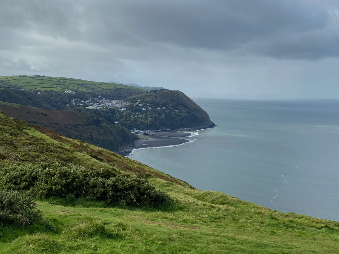
    The rain has eased a bit but the odd squall keeps blowing across the moor.  After 300 yards I take a path on the right that rises steadily onto the moor heading towards Brightworthy Barrows.  The sky briefly clears and I get a cracking view towards Withypool.

    As the path starts to level I fork to the right to visit the Withypool Common Ordnance Survey trig pillar at Brightworthy Barrow, this is the 229th trig I have bagged.  The rain has stopped but the wind is blowing a gale and Crosby is less than impressed at having to pose for a picture by the trig.

    From the trig I pick up a well-used path that heads south across the moor towards a minor road.  The recent rain has made this path sodden, but despite the surface water it is still firm underfoot.

    On reaching the road I turn right and follow it to pass a cattle grid and continue on to a junction at Withypool Cross.  Here I turn right and follow the road steadily downhill in the direction of Landacre.

    After 200 yards I turn left to follow a bridleway along a track signposted to Horsen via Sherdon Farm.

    This is a fine track with great views as it steadily descends towards Sherdon Bridge.

    After crossing the bridge I pass a cottage and stay with the main track to reach the now abandoned Sherdon Farm.  

    It is an isolated spot and it must have been a harsh existence which even the stunning view could not compensate for.  I am sure that at some point the site will be developed, but at the moment it stands as a reminder to the past.

    I stay with the track as it passes through gates and then after 350 yards I reach a footpath on the right.  I leave the track and take the footpath along the edge of a field of pasture.

    After crossing another field the footpath reaches access land on Horsen Hill, I stay with the clear path heading north.  I leave the access land to follow a way-marked path around fields to reach a minor road near Horsen Farm.

    At the road I turn right and then within a short distance, before reaching the farm, I turn right on a track heading towards Cow Castle.

    The track has stunning views and continues steadily downhill to cross a brook at a ford.  Fortunately there is a footbridge besides the ford so I can cross without getting wet feet.

    Staying with the footpath I continue along a track in a lovely valley.

    On reaching the River Barle I take a footbridge over the river and then turn right on the route of the Two Moors Way.

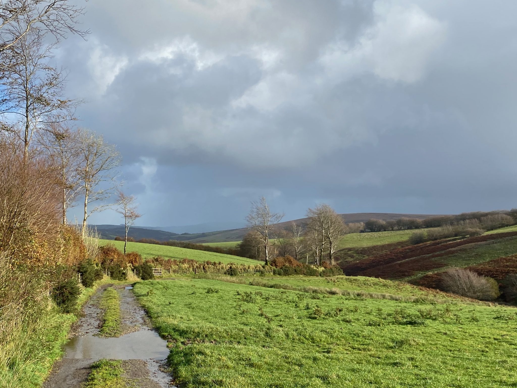
    The route is now very straightforward.  I stay with the Two Moors Way route markers following the path through an area of cleared forest land and then pass through gates to cross moorland.  There are some cracking views as I go along and the storm has blown through so it is now a pleasant autumnal afternoon.

    At a junction of footpaths I stay with the Two Moors Way as it sweeps across access land with views down to the Landacre Bridge crossing the River Barle.

    Eventually the Two Moors Way leads to Landacre Lane, here I turn right and follow the lane to pass a farm and continue steadily downhill to reach Landacre Bridge.  There has been a bridge here across the River Barle since medieval times, apparently it is documented in 1610.  The bridge was restored in 1875 and then further work was carried out following flood damage in 1952.  

    After crossing the bridge it is only a short distance back to the car park, which is now occupied by cattle.  Fortunately not the sort of cattle that seem interested in me or Crosby so we are able to reach the car without incident.

     I have covered just over nine miles and it has been a cracking wander around the moor.  I haven’t seen another walker.  Time now to head back to the caravan and plan tomorrow’s route.

    You can view this 9 mile walk on OS Maps and download the GPX File Here

    To follow our walk you will need Ordnance Survey Outdoor Explorer Map OS9 Exmoor

    27th October 2020

    © Two Dogs and an Awning (2020)

    All information on this site is provided free of charge and in good faith and no liability is accepted in respect of damage, loss or injury which might result from it.  To the best of my knowledge the routes are entirely on public rights of way or within areas that are open for public access.
    Walking can be hazardous and is done entirely at your own risk.  It is your responsibility to check your route and navigate using a map and compass.
  • Hawkridge and Tarr Steps from Marsh Bridge

    Hawkridge and Tarr Steps from Marsh Bridge

    On my trips to Exmoor I have “bagged” a number of the Ordnance Survey Trig Pillars dotted around the National Park.  However, there are still a few on my list to visit, so today I have planned a route to encompass them and take me to places I have not previously visited.

    The starting point for my walk is the small parking area close to Marsh Bridge, which is off the B3223 to the west of Dulverton (Grid Ref: SS907289).  From the parking area I cross the B3223 and take a way-marked path along a restricted byway towards Court Down. 

    It is a long steady ascent up this ancient track.  I always find it interesting to look at a map and try to work out why some of these old tracks were turned into roads while others were left. 

    As the track starts to level out I reach a junction of paths, here I turn right to take a slight diversion from my route to follow the footpath uphill to reach a gate into a field of pasture.  From the gate I continue across the field to visit the trig pillar on Court Down, this is the 222nd I have bagged.

    From the trig I return to the gate, here there are two footpaths and I take the one on the right which heads across the field to rejoin the track I was on earlier.  Turning right along the track I follow it through a gate and then continue along a hedge lined route offering occasional cracking views.

    On reaching a junction of paths I turn left to join a tarmac lane, Leigh Lane, and then follow this lane for just over a mile to reach the farm at Leigh.

    Soon after passing the farm I take a footpath on the left that leads along a track towards access land on an area of moorland marked on the map as The Allotment.

    On reaching the access land I turn left and follow a track to a junction of paths.  Here I turn left again to follow the route way-marked to Mounsey Hill Gate.

    On reaching Mounsey Hill Gate at the B3223 I cross and continue on a path that follows the fence line to reach a cattle grid on a minor road.  I go through the gate besides the cattle grid and then fork left away from the road on a track heading across Varle Hill.

    At a fork in the track I go right and follow a well-worn path across Ashway Side that descends gradually towards a band of trees.

    I follow the path as it descends through trees to cross a stream and reach a minor road where I turn left towards the clapper bridge at Tarr Steps.  Because of the Covid restrictions there is a one way system in place across the bridge to enable folk to maintain a social distance whilst crossing.  Sadly not everyone thinks the rules apply to them, especially if their visit has involved driving a car to the beauty spot and walking halfway across to get a picture and then returning to the car to “experience” the next location on their itinerary. 

    There was a time when I would have engaged with such people to explain the error of their ways, but these days I choose to ignore them knowing they will soon be gone.  I wait until the bridge is clear and then make my way across and continue along the minor road at the far side to reach Penny Bridge.  

    I had intended to turn right here on a footpath but the road is so quiet I decide to continue on as it climbs steadily up Marshclose Hill.

    Eventually the lane leads me into Hawkridge near the church of St Giles. Originally built in the 14th century it underwent major restoration in 1878, but parts of the original church remain.

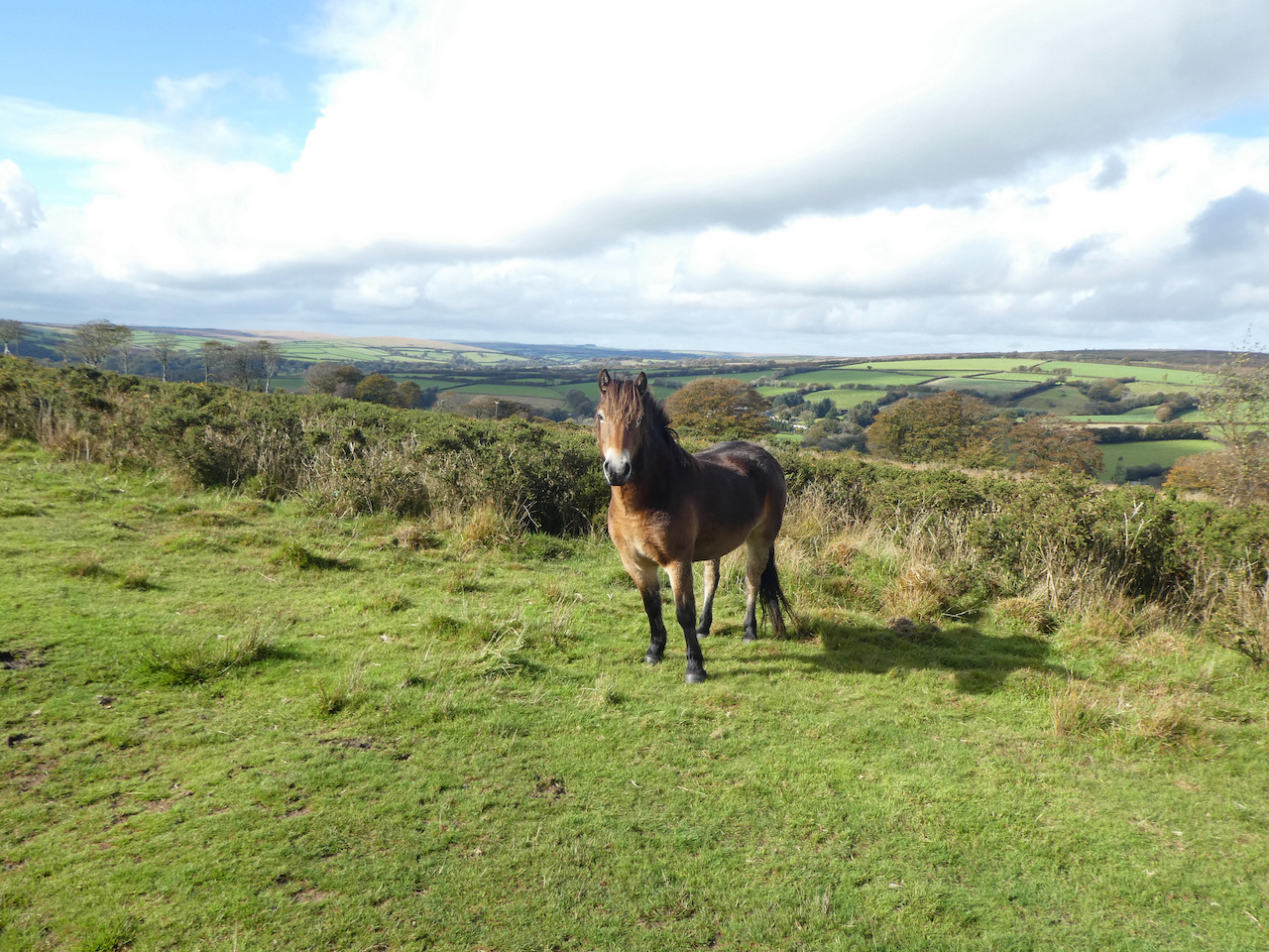
    I have visited a number of churches on our travels, not many have such a stunning view from the churchyard as this one.

    From the churchyard I turn left and walk along Broad Lane at a fork in the road by the telephone kiosk I go left and pass the village hall.  

    I stay with Broad Lane as it heads out of the village to reach West Hollowcombe where I take a footpath on the left which is the route of the Two Moors Way heading towards Slade Bridge.

    This way-marked route heads across pasture fields and gradually descends to a gate where it joins a minor road, Slade Lane.   Here I turn left and follow the road downhill to reach Slade Bridge.

    After crossing the bridge I continue with the road as it heads uphill to reach a cattle grid, here I turn right along a broad track.  I stay with this track towards a minor road, Ridge Road.  Just short of the road I take a brief diversion onto the moor to visit the Ordnance Survey trig pillar on West Ansty Common, this is number 223 for me.

    From the trig pillar I continue to the road and then turn left along it.  I had originally planned to take a path across Venford Moor and then drop down to the River Barle, but I know I need to be on the north bank of the river at some point and the map only shows fords and not footbridges.  There is not a lot of daylight left, so I don’t want to find it impossible to cross the river.  A quick check of the map and I work out an alternative route.  This entails walking along the road for a couple of miles, but it is straight and there is little traffic about.

    One of the benefits of walking on the road is I can pick up my pace so daylight should not be an issue.  After a mile and a half on the road I reach Five Cross Ways and continue straight on for another half a mile to reach a footpath on the left at Chilcott Cross.  This path follows the hedge line in a field as it descends towards a minor road.

    On reaching the road I turn left and continue downhill to a track on the left which continues to head steadily downhill through trees towards the river.

    At the River Barle I turn right and follow the path besides the south bank of the river. 

    The route is now very straightforward.  I stay with the path as it heads east with the river to my left.  There are times that the path departs from the river briefly but it is never too far away and I am soon back beside it.

    I stay with the path besides the River for just over a mile and a half to reach the tearooms besides Marsh Bridge.  Here I turn left and cross the bridge to return to my starting point.  Marsh Bridge is thought to have been built in the 18th century, but over the years it has been altered.  In 1866-67 the iron bridge was constructed and this has had many repairs over the years.

    My walk has covered just over 14 miles through some stunning scenery. Before I head off I take a look at the packhorse bridge close to the parking area.  This would have been the original route for pack horses travelling between Dulverton and Ansty.

    To follow my walk you will need Ordnance Survey Outdoor Explorer OL9 – Exmoor

    You can view this 14 mile walk on OS Maps and download the GPX File Here

    9th October 2020

    © Two Dogs and an Awning (2020)

    All information on this site is provided free of charge and in good faith and no liability is accepted in respect of damage, loss or injury which might result from it.  To the best of my knowledge the routes are entirely on public rights of way or within areas that are open for public access.
    Walking can be hazardous and is done entirely at your own risk.  It is your responsibility to check your route and navigate using a map and compass.
  • Countisbury to Lynmouth

    Countisbury to Lynmouth

    Yesterday when I met Sarah, my Twitter buddy, at Periwinkle Cottage tea rooms in Selworthy we chatted about walks on Exmoor.  A number of the places that Sarah mentioned I had previously visited but there were a few I hadn’t.  One of those locations was Countisbury which Sarah told me had stunning views of the coastline.

    The starting point for my walk is the free car park besides the A39 at Barna Barrow, which is just east of Countisbury (Grid Ref SS752496).  My plan is to walk from the top of the hill into Lynmouth, but first I want to head east to Countisbury Common to bag the OS trig point on the hill.  Leaving the car park I initially head north and then follow a track as it sweeps to the right to head east. 

    After crossing a driveway the path continues east to pass Kipscombe Farm and then goes through fields.  After passing through a gate I make a brief diversion from the path by following the fence line uphill and then enter a field where the OS trig point sits on top of Kipscombe Hill.  This the 220th I have bagged.

    After admiring the views from the trig pillar I retrace my steps downhill and on reaching the gate turn right along the footpath to head through fields.  At a junction of paths. I go left to enter access land above the cliff.

    The path I’m on heads north towards the sea and then at a junction I turn left and follow this path as it enters trees and then fords a stream.

    It was my original intention to walk through Chubhill Wood to pick up the coastal path, but it is clear that this will mean walking through trees and missing out on the views so instead I follow a well-worn path which heads west across the top of the access land to reach a gate.  Going through the gate I rejoin the footpath I was on earlier and head west back towards Kipscombe Farm.

    On reaching the track just beyond the farm I take a path heading north west heading towards a telecoms mast.

    I stay with this track to pass the mast and reach the Ordnance Survey trig point close to it.  This is my 221st and has more cracking views.

    From the trig pillar I continue along a broad path heading towards Countisbury Church and then stop at a bench to enjoy the view and eat my lunch.

    Heading off again I pass Countisbury Church and briefly join the South West coastal path before going left through a gate and heading down to cross the A39. 

    On the far side of the road there is a choice of three paths.  I take the central one heading steadily downhill in a valley through South Hill Common.

    At a junction of paths I turn right and follow the Coleridge Way footpath above the river.  

    There are a network of paths heading west through this valley I stay with the Coleridge Way and then drop down to cross the river and walk a short distance on the south bank before crossing the river again.

    The recent weather means the river is fast flowing.  But this is nothing compared to how the river would have looked back on the on the night of the 15th August 1952.  Then torrential rain fell on the already saturated surrounding moorland.  Over the course of a couple of hours the East Lyn and West Lyn river levels rose and the power of the water was enough to move rocks and debris downstream.  As the force of the rivers met at Watersmeet their combined power was enough to cause devastation to anything in its wake.  

    Sadly this resulted in total disaster in Lynmouth with 34 lives lost and many properties destroyed,  420 people were made homeless.

    My route now runs close to the river as it approaches Lynmouth.

    On reaching the village I cross the bridge and then turn right to walk towards the harbour.

    After months of avoiding crowds and busy spots the village is a bit too crowded for me.  So I wander around to the Lynton and Lynmouth cliff railway.  This was opened in 1890 and was built to transport freight arriving at Lynmouth to Lynton high above it on the cliff.  With the emergence of tourism in the last 1890’s the railway was soon carrying passengers and it has run continuously ever since.  It is water powered by a clever water system using two cars, water is put into the top car and emptied when it reaches the bottom.

    I walk back around past the harbour and at the junction turn right and quickly left into Watersmeet Road and follows this for a hundred yards to reach a footpath on the right way-marked for the Two Moors Way.

    This path heads steeply through houses and then enters woodland and continues to climb as it zig zags its way up.  I stay with the Two Moors Way as it emerges from the trees and continues heading east along the fence line.

    At a junction of footpaths I turn right to leave the Two Moors Way and head south across fields.

    At a junction of paths I go left heading along the edge of a field and then go through a gate to follow a wall-lined grassy path to reach Lower East Lyn Farm.

    The path passes the farm and continues on through Higher East Lyn Farm and then goes through a gate onto a grassy track.

    There are soon good views in all directions as I stay with the path ignoring others leading off to the left.

    The path I am on soon starts to sweep round the top of the hill and turns towards the south to reach Myrtleberry South Iron Age Enclosure.

    Now the path descends gradually through the trees heading towards the A39.

    On reaching the road I walk besides it for a short section heading downhill to Hillsford Bridge where I cross the river and take a footpath on the left heading into the Watersmeet Estate.

    The path follows the course of the river to reach Watersmeet. 

    Crossing the river I pass the cafe.  The water level is not too high, but its force is still noticeable as it squeezes through the rocks.

    There are a few path options here but I stay with the route that heads north besides the river.

    Soon the path goes away from the river to reach the junction of paths I was at earlier in my walk.  This time I go uphill retracing my steps along the steep path heading through the valley on South Hill Common.

    I get caught in a heavy rain shower, it has been threatening for much of the afternoon but had managed to evade me until now.  Nearing the A39 I turn right taking a permitted path that avoids the road to arrive in the village at a pavement.  I continue up the hill to pass the Blue Ball Inn and then turn left on a minor road heading up to the entrance to St John the Evangelist church.

    The path leads through the churchyard and through a gate where I turn right and follow a path heading west back to my starting point in the car park.  My walk has covered just over 11 miles and I have enjoyed stunning views all the way round.

    You can view this 11 mile walk on OS Maps and download the GPX File Here

    To follow my walk you will need Ordnance Survey Explorer Map OL9 Exmoor

    7th October 2020

    © Two Dogs and an Awning (2020)

    All information on this site is provided free of charge and in good faith and no liability is accepted in respect of damage, loss or injury which might result from it.  To the best of my knowledge the routes are entirely on public rights of way or within areas that are open for public access.
    Walking can be hazardous and is done entirely at your own risk.  It is your responsibility to check your route and navigate using a map and compass.

  • On Exmoor Exploring the Chains and Hoaroak Water

    On Exmoor Exploring the Chains and Hoaroak Water

    I am off in the caravan again, Lynnie and Dexter have stayed at home so Crosby and I are travelling solo for a few days walking on Exmoor.  Our base for this trip will be the Caravan and Motorhome Club’s Minehead site.
    (more…)

  • Walking from Plymptons Farm

    Walking from Plymptons Farm

    After yesterday’s trek Lynnie has requested an easier walk today. So in the morning I catch up with some work and then we pop into South Molton to do some shopping and get access to decent wi-fi to send emails. It is great staying in remote locations, but the downside is that I occasionally need access to the internet for work.

    One of the benefits of travelling and working at the same time is the constant change of scenery from my office window. Usually the awning doubles as an office, but this week the ground is too wet and muddy for us to even contemplate trying to erect our new fancy air awning, so I am working from inside the Coachman. The view out of the window across the small lake at Plymptons Farm CL is a great setting to work.
    (more…)