Tag: Severn Way

  • Jenner and Jester

    Jenner and Jester

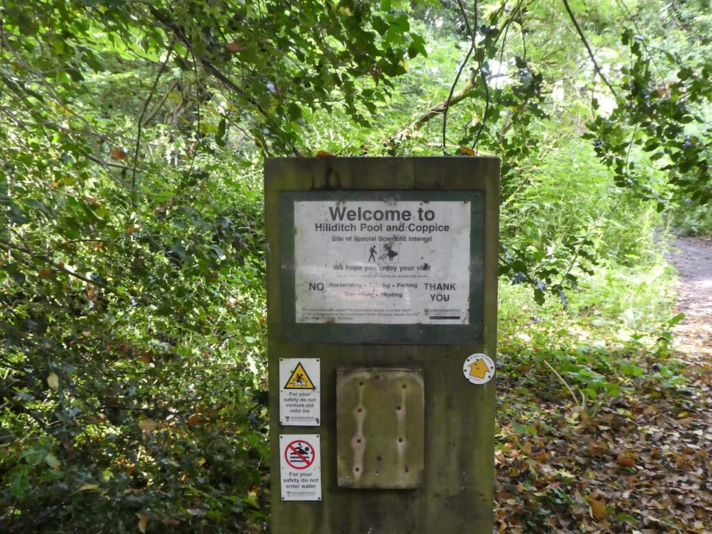
    Our stay at Golden Valley House CL has almost come to an end, we head home tomorrow. So today is our last chance to explore some more of the local area.  We have decided to return to Sharpness and do a circular walk visiting the historic town of Berkeley.

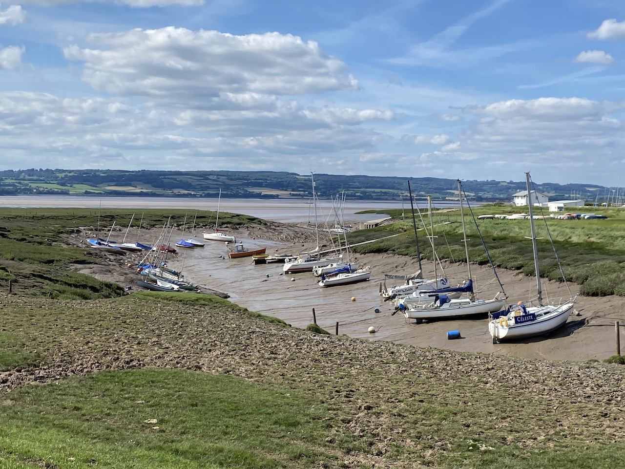
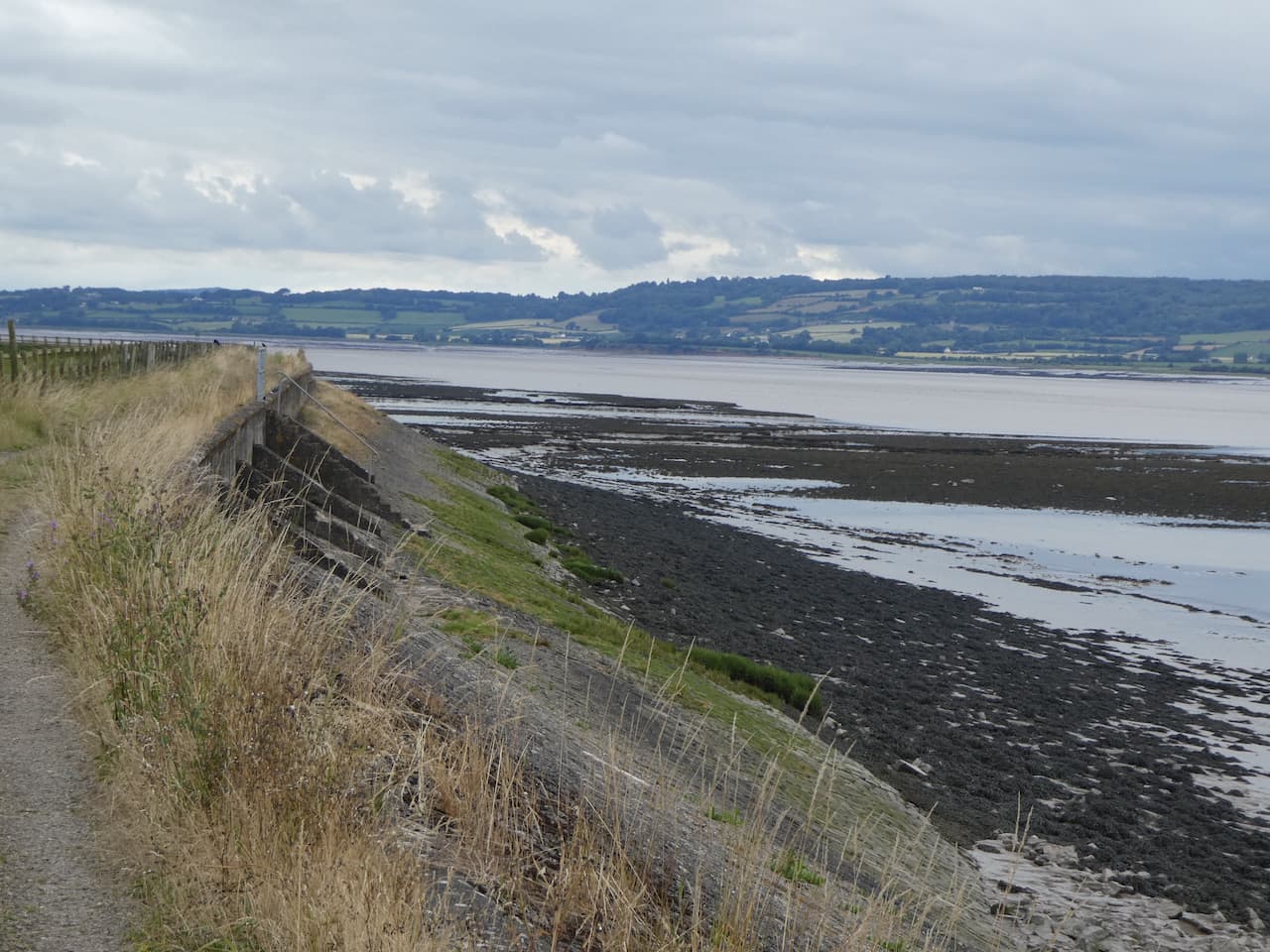
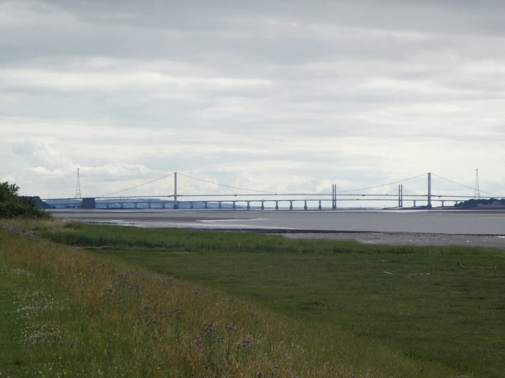
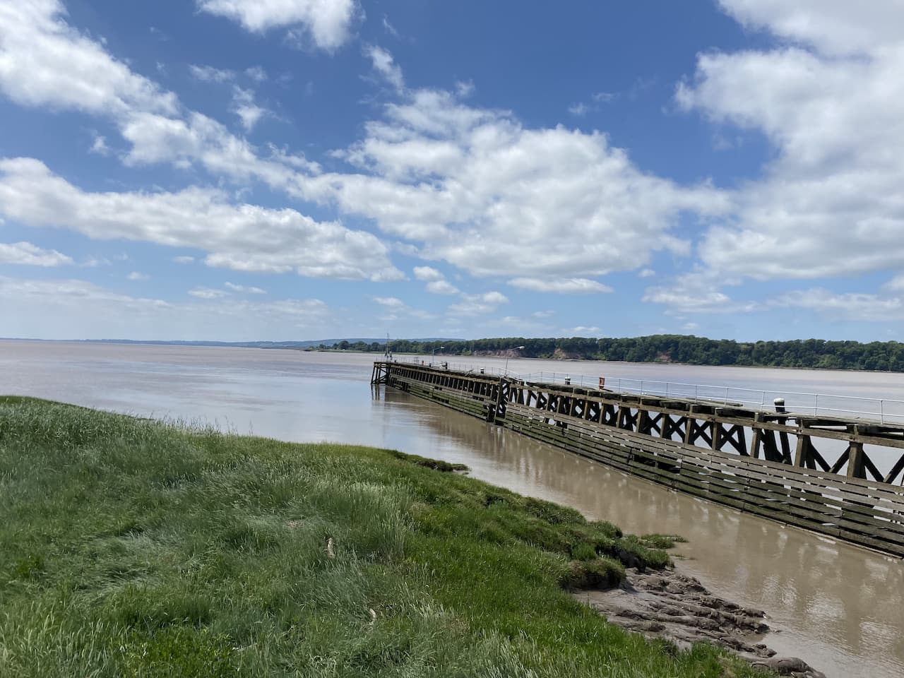
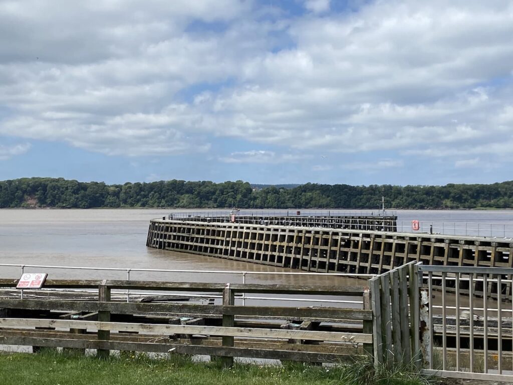
    Our starting point is once again the Canal and River Trust free car park at Sharpness Viewpoint (GL13 9UF), located besides the entrance to Sharpness Docks.  Before starting our walk we stop for lunch on one of the benches at the viewpoint overlooking the River Severn.

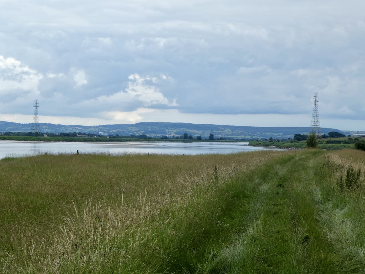
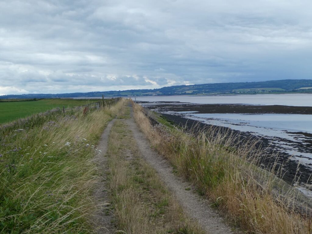
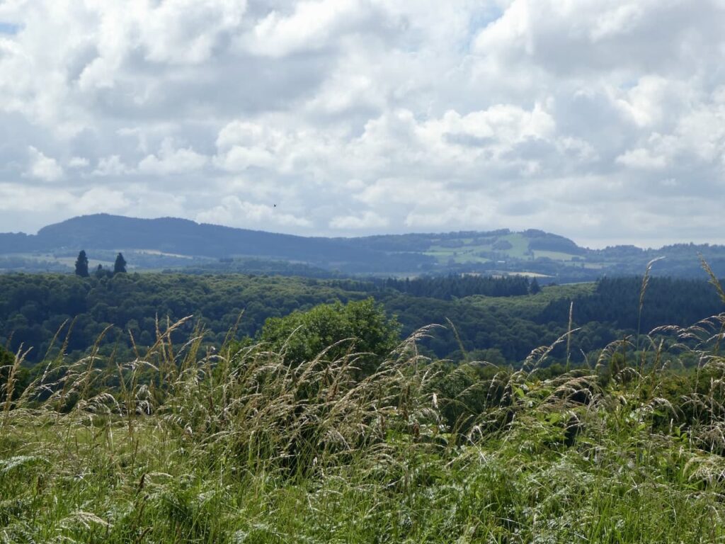
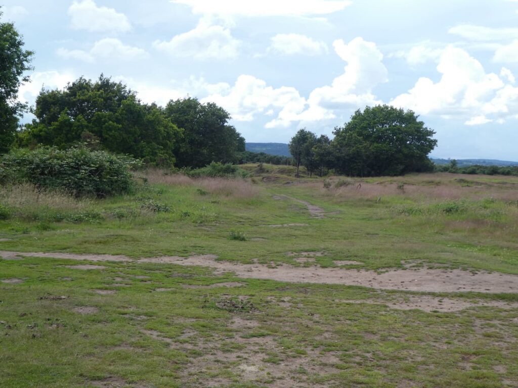
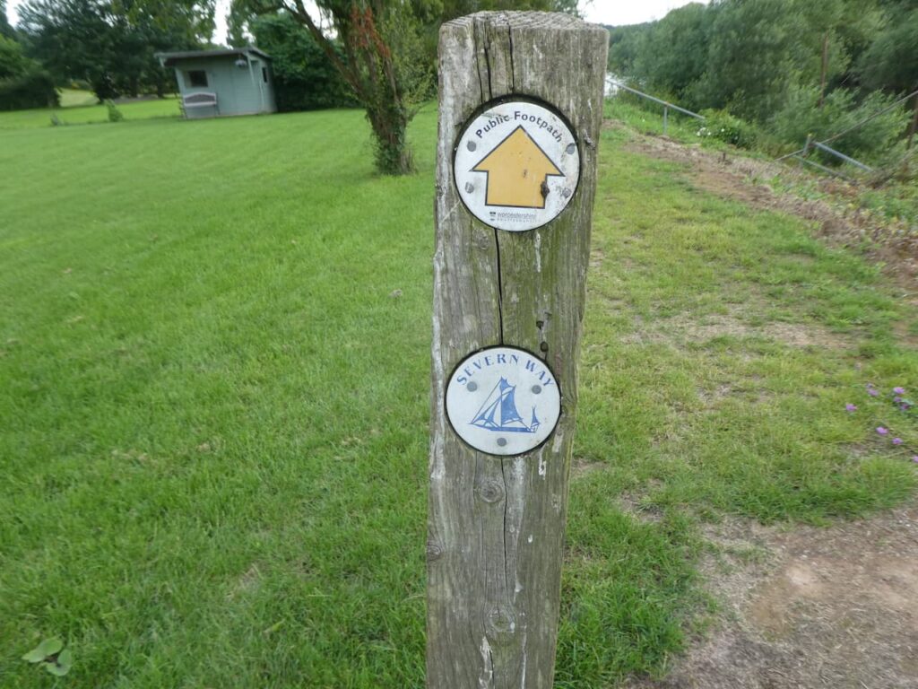
    Our walk starts along the Severn Way heading south with the river on our right hand side.  From the viewpoint we pass a row of cottages and then reach a stile into a field where we walk along the flood defence embankment.

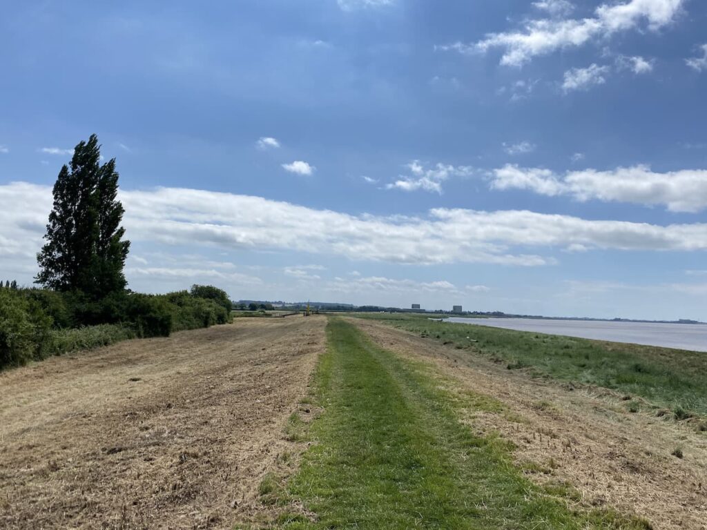
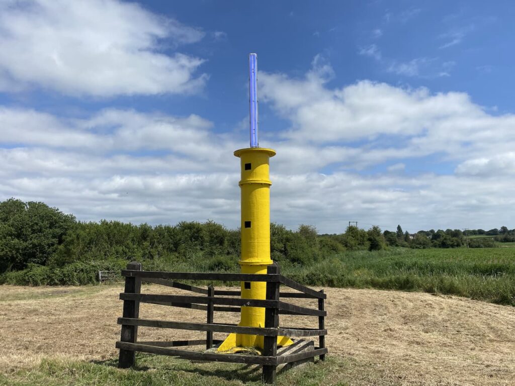
    We continue along the flood defence to reach the navigation beacon on Panthurst Farm.  A navigation post was established here in 1894 to guide vessels through the narrow channel that had been blasted through Bull Rock. In 1912 a lit beacon was installed and was replaced in 1974.  The current beacon was installed in 1987 with the Blue LED light being added in April 2020.

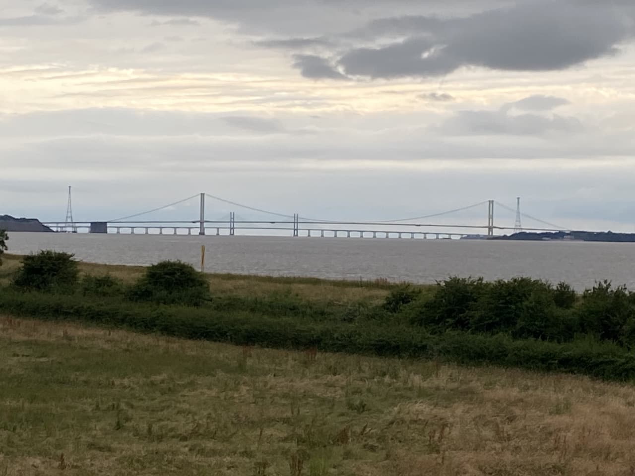
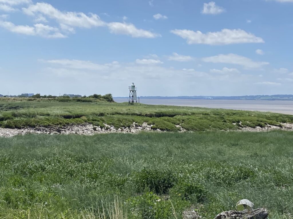
    Staying with the flood embankment we cross a stile and continue beside the river with Berkeley Power station in the distance.  Construction of this power station started in 1956 and it was commissioned in 1962. It created power for 27 years before being decommissioned in 1987.   The process of tidying up the site continues and it will be around 2070 before the radioactivity levels fall low enough for it to be demolished.

    On reaching Berkeley Pill the path turns inland besides the side of the inlet.  Across the other side of the inlet is another navigation light.  This one was installed in 1906 and originally ran on gas.  In 1951 the gas was replaced by batteries and then in 1964 it was supplied by electricity from the conveniently located power station next door.  

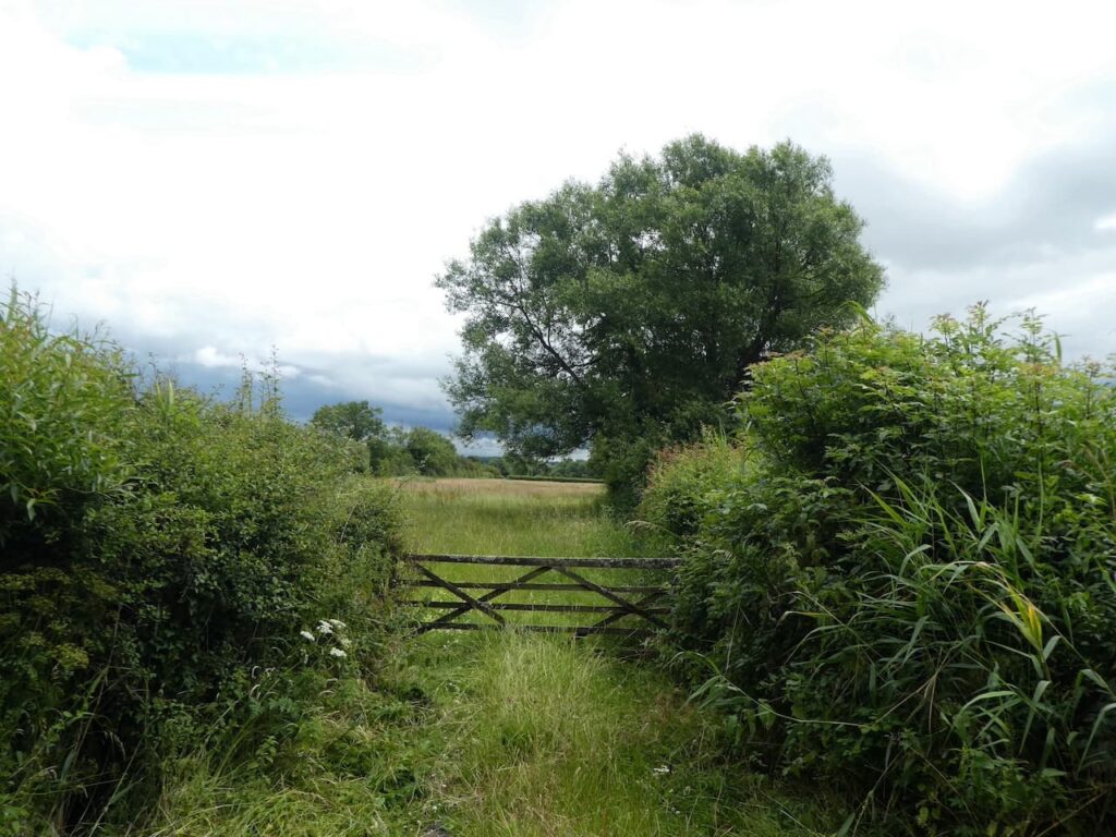
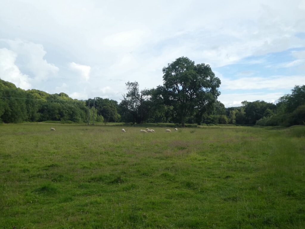
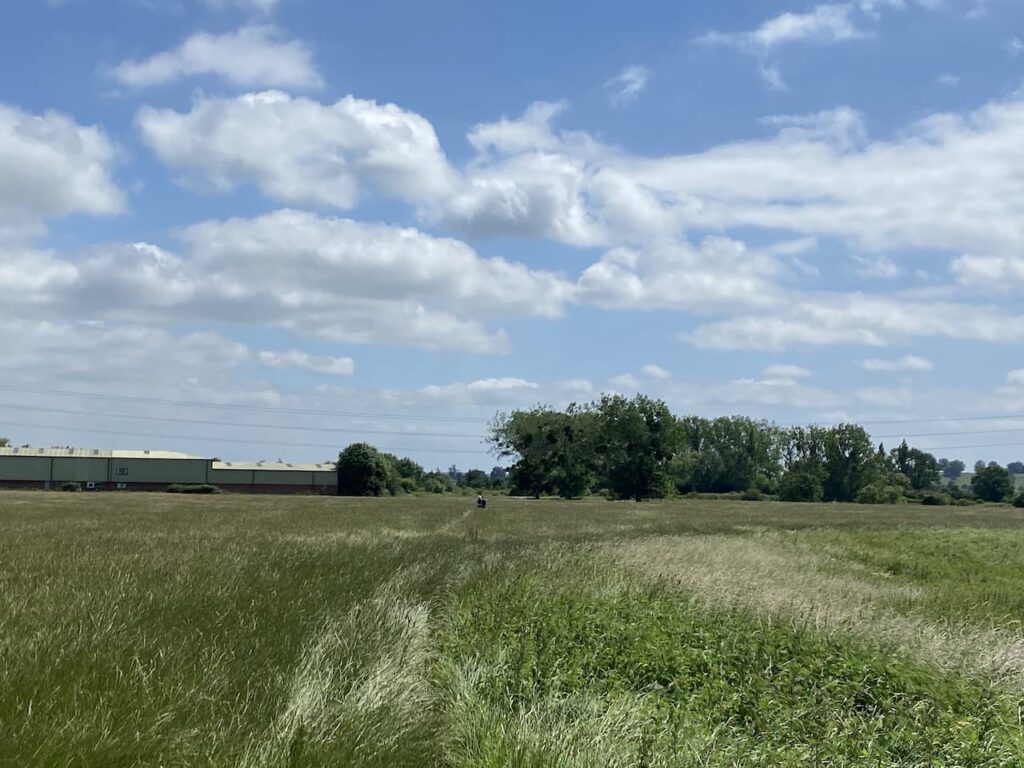
    The path goes through a gate and then enters a meadow which we cross heading towards a small industrial estate.

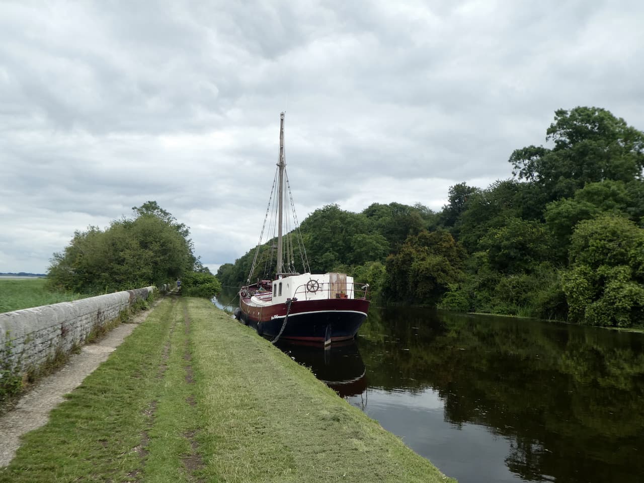
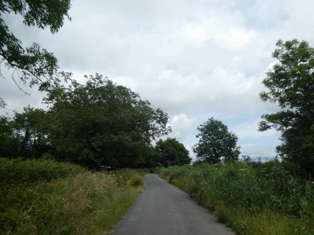
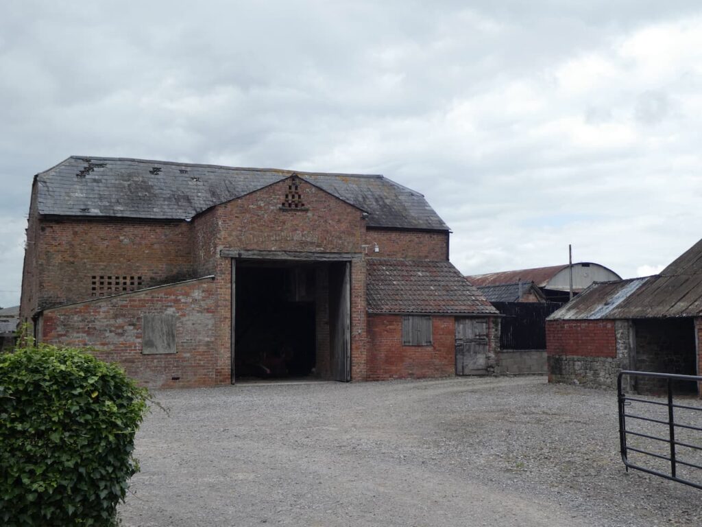
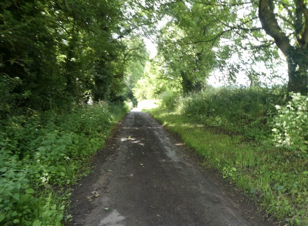
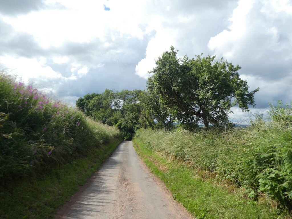
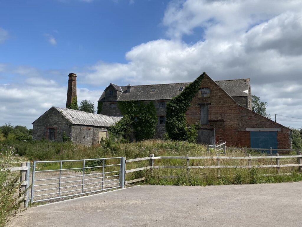
    After going through a kissing gate we turn right and follow the path as it passes through shrubland besides the stream.  At a road we turn right and cross a bridge over the Berkeley Pill.  We stay with this minor road for a few hundred yards to reach a junction where we turn left into Hamfield Lane and follow this past Floodgates Farm and then reach the disused Castle Grain Mill which looks ripe for redevelopment.  

    After passing the mill the lane leads into Ham and reaches the village besides the Salutation Inn, this pub is a frequent winner of Campaign for Real Ale awards and has its own small brewery attached.  It is the sort of pub that I like to visit, but sadly it is currently running restricted opening times due to Covid restrictions.

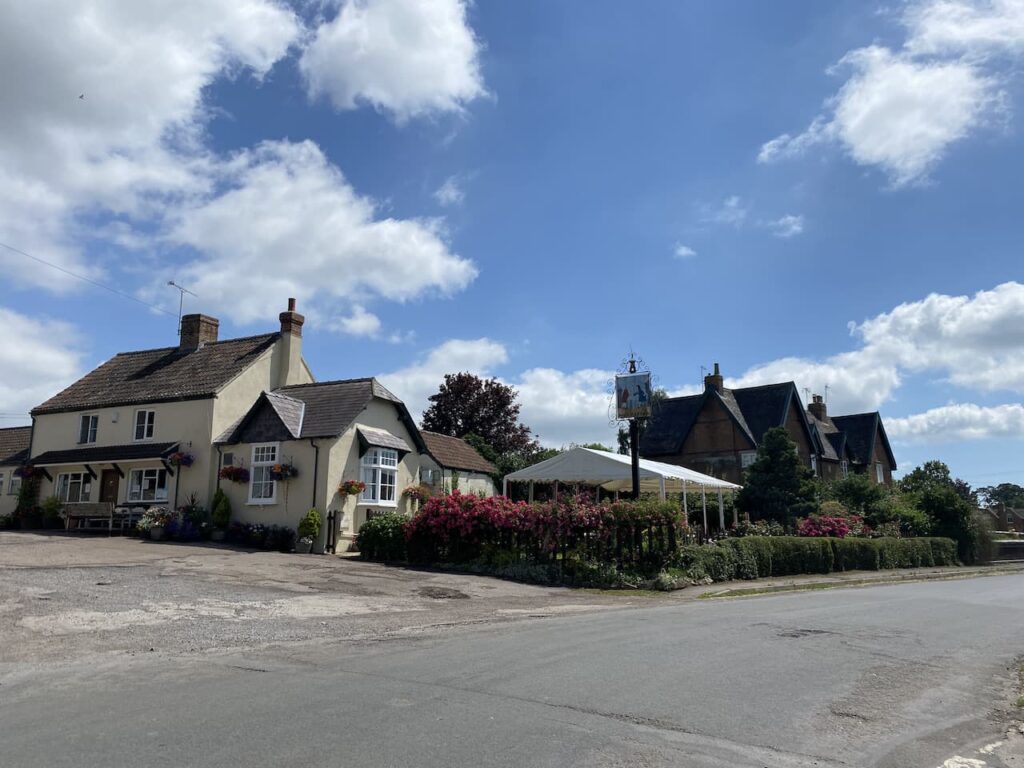
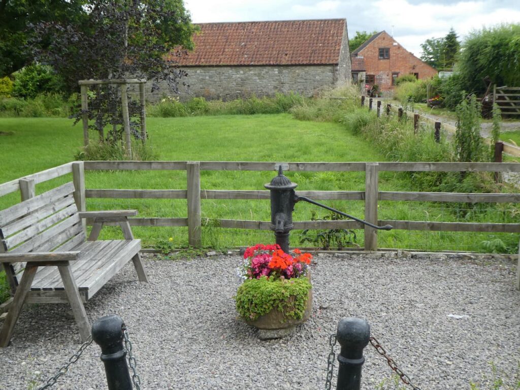
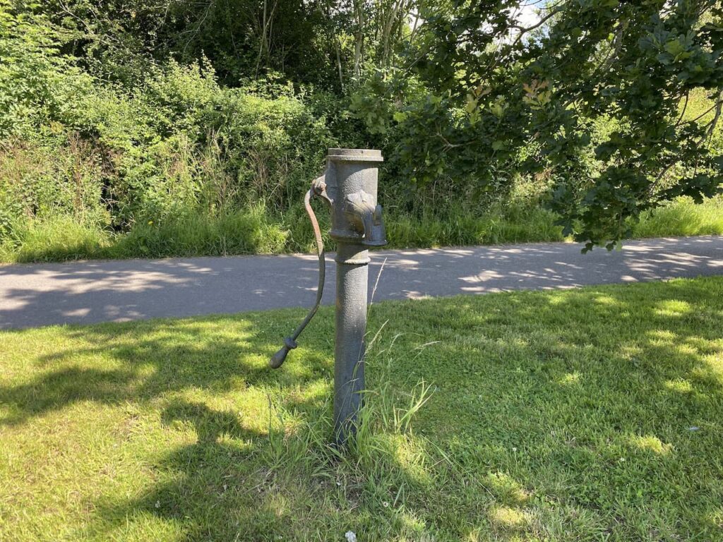
    We turn right to pass the pub and then fork left besides the village green which retains its water pump.  Later I discover there is a website dedicated to village pumps. It contains very little detail about this one apart from it being made by Llewellins & James, of Bristol.

    Leaving the green we continue on a lane to pass Brownsmill Farm and then at a junction of paths turn left to follow a route besides a stream.  In front of us we soon see Berkeley Castle.  This is one of the Marches Castles, built to defend the border with Wales and as such was at the centre of many battles.  It has been in the ownership of the Berkeley family since it was built in the 11th century and the castle’s website talks about the strong association the family had with the monarchy.  It was so close that Edward II was murdered at the castle in 1326 whilst being held by Thomas de Berkeley.

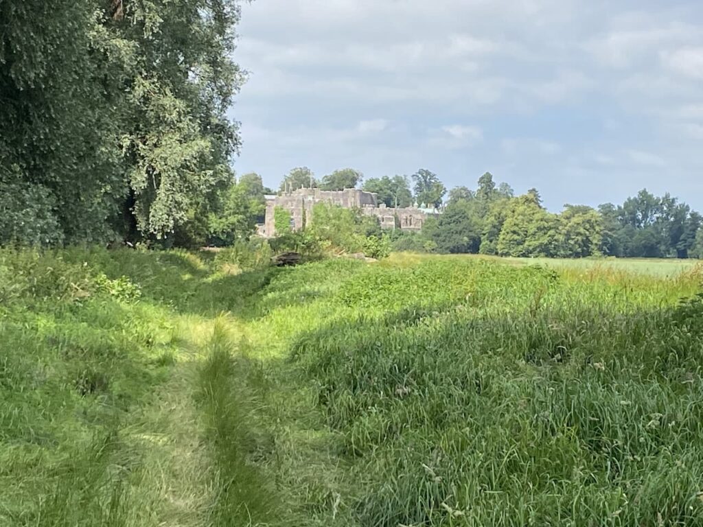
    The first castle was built in 1067 as a motte and bailey then over time was gradually developed starting with the shell keep being built between 1153 and 1156.  In the 14th century most of the rest of the castle was built.

    We stay besides the stream and then reach a tree lined path which heads north towards Berkeley.

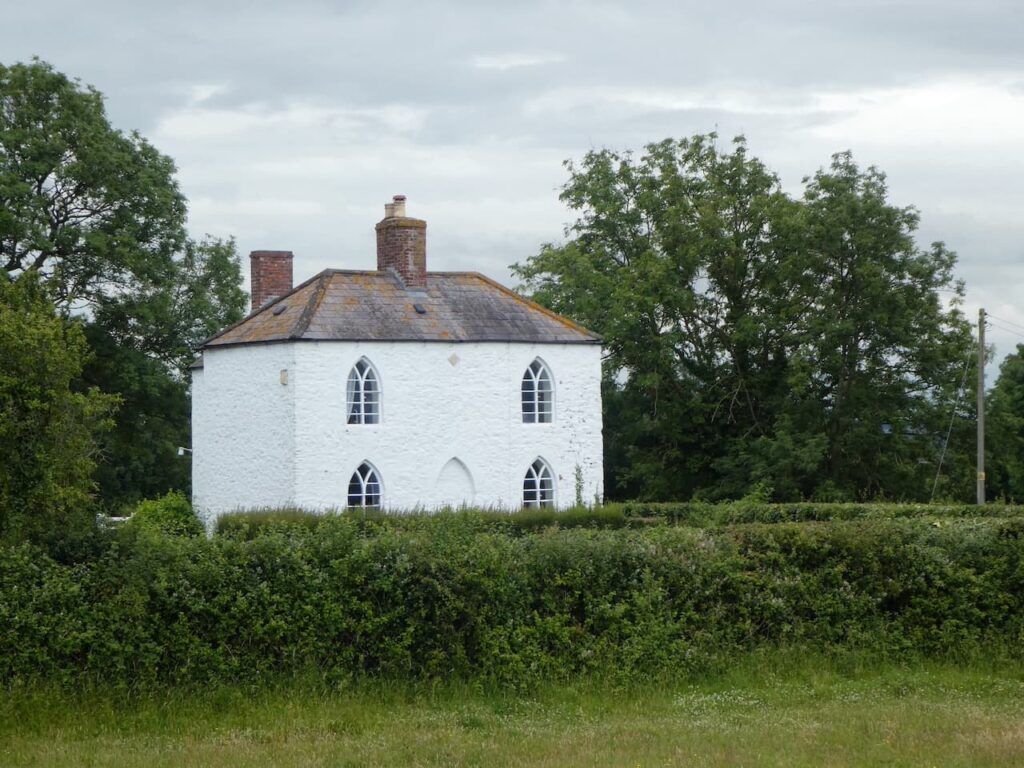
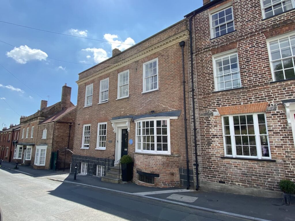
    Th path soon crosses a stile and then joins a pavement besides a road to cross a bridge and head into Berkeley.  Heading into Berkeley we pass the house built by Edward Jenner and his brother Stephen Jenner.  Edward Jenner gained fame as the person that was at the forefront of immunology and famously discovered a vaccination for smallpox.

    We turn right up a lane with a way marker to the Jenner Museum and follow this uphill towards the churchyard to pass the house that Edward Jenner left to James Phipps.  As an eight year old Phipps was the first person that Jenner inoculated against smallpox.  Jenner observed that dairy workers who had caught Cowpox appeared immune from Smallpox.  He therefore inoculated Phipps with Cowpox and then eight weeks later gave him a dose of smallpox without any adverse reaction.  Jenner went on to give Phipps more than twenty doses of smallpox.  No wonder he left him a cottage!

    A bit further on we turn right into the churchyard and take a while reading the information board and plan of the graves.  There are a number of interesting graves here not least the tomb of Dicky Pearce. He is said to have been the last court jester.  Born in 1665 he was originally the Earl of Suffolk’s fool before joining the Berkeley household.  As a jester he would have been an accomplished musician and would also have performed sleight of hand tricks and acrobatics.  Sadly his acrobatic skills let him down while performing in the minstrels gallery at Berkley Castle and he fell to his death.  

    He was held in such high regard by Lord Berkeley that he was buried in an elaborate tomb in the churchyard with the inscription “Here lies the Earl of Suffolks Fool, Men called him Dicky Pearce, his folly served to make folks laugh when wit and mirth were scarce.  Poor Dick Alas! Is dead and gone, what signifies to cry! Dickys enough are still behind to laugh at by and by.”

    There is a chap cutting the grass and he points us towards the Clock Makers Grave.  This is the chest tomb of Thomas Pearce (also spelt as Pierce on the grave) who died in 1665, he was a clockmaker and five times Mayor of Berkeley.  The inscription on the tomb reads “Here lyeth Thomas Peirce, whom no man taught / Yet he in Iron Brasse and Silver wrought / He Jacks and Clocks, and watches (with Art) made / And mended too when others worke did fade / of Berkeley five tymes Mayor this Artist was / And Yet this Mayor this Artist was but Grasse / when his owne watch was Downe on the last Day / He that made watches, had not made A Key / To winde it Up, but Uselesse it must lie / Untill he Rise AGaine no more to die”.

    This is a fascinating graveyard with numerous chest tombs.  We could easily spend more time wandering around but we still have a few miles to cover so take a quick look at the church of St Mary.  Most of this church was built between 1225 and 1250.

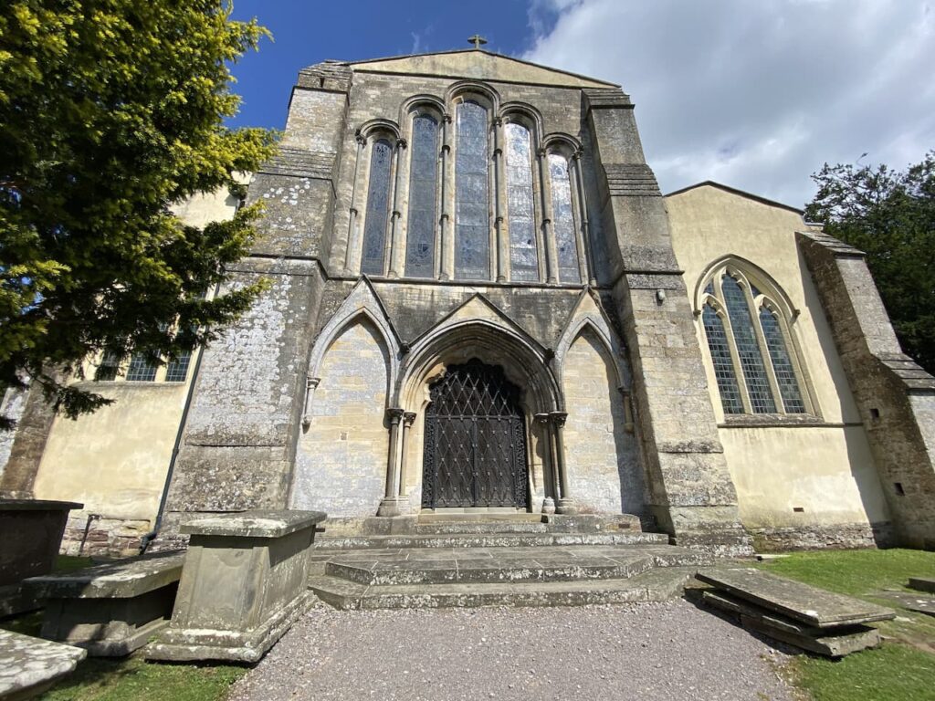
    Unusually the tower for the church stands separately to the main building, this was built in 1753.

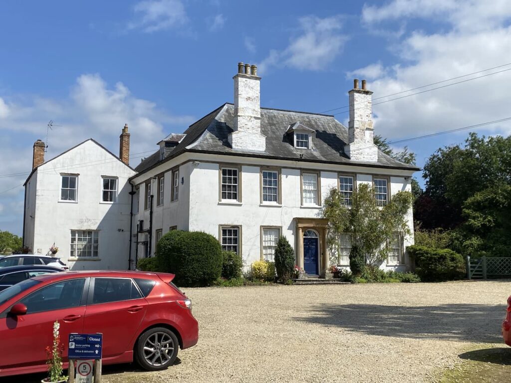
    From the churchyard we continue along the lane towards the town passing The Chantry, this was Edward Jenner’s House from 1785 until his death in 1823.  It was from here that he started his vaccinations for smallpox. Over the years he also had homes in London and Cheltenham, but this remained his main residence and is now the home of the Jenner Museum.

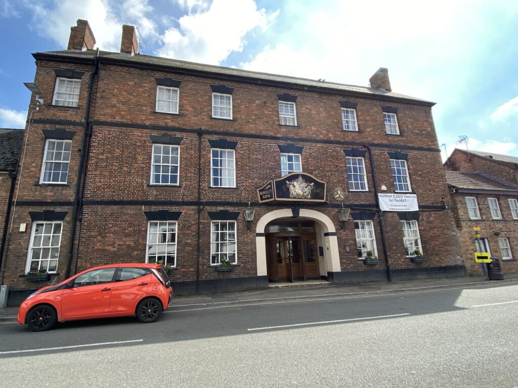
    We stay with Church Lane and on reaching the High Street turn right.  To our right is the impressive looking Berkeley Arms Hotel a former 16th century coaching inn.

    After a wander around we leave the centre of Berkeley on Marybrook Street which soon passes Almshouses and continues past the town cemetery.  Passing the last house on the left, just before reaching a roundabout, we take a footpath on the left which initially follows a track besides houses and then continues into fields.  At a junction of paths we go right and join Saniger Lane.

    We stay with Saniger Lane to the B4066 which we cross to join a track opposite, this heads steadily downhill between the road and railway line.  After passing cottages we reach the B4066 and continue besides this initially on the broad verge and then a pavement to pass industrial units.  The road leads to a mini roundabout at the entrance to the docks.  Here we turn left into Severn Road and follow this the short distance back to our starting point at the Sharpness Viewpoint car park.

    You can view this 7.5 mile walk on OS Maps and download the GPX File Here

    To follow our walk you will need Ordnance Survey Outdoor Explorer OL167 Thornbury, Dursley & Yate

    15th July 2021

    © Two Dogs and an Awning (2021)

    All information on this site is provided free of charge and in good faith and no liability is accepted in respect of damage, loss or injury which might result from it.  To the best of my knowledge the routes are entirely on public rights of way or within areas that are open for public access.
    Walking can be hazardous and is done entirely at your own risk.  It is your responsibility to check your route and navigate using a map and compass.

  • Jamming About from Golden Valley House CL

    Jamming About from Golden Valley House CL

    After my early morning walk Lynnie and I discuss our plans for the day.  Later we are heading to the Anchor Inn in Oldbury on Severn for our evening meal so decide a short walk will be in order.  My definition of a short walk is around six miles, whereas Lynnie would say around three.

    Leaving the site we turn left into the minor road Stoneyard Lane, and then at a junction in a hundred yards turn left into Shepperdine Road, signposted to Shepperdine and the River.  We stay with Shepperdine Road until it turns to the right just after passing Knight’s Farm, the road bends to the right and we carry straight on.  We are now on a lane heading towards Jobsgreen Farm.

    Nearing the farmhouse we take a bridleway on the left and follow this to reach a gate.  

    We don’t go through the gate but turn left onto a bridleway running along the perimeter of Oldbury Nuclear Power Station.

    On reaching a road we turn right and then almost immediately left to take a path that follows the high fence line of the Power Station.

    This path leads to the River Severn besides Oldbury Power Station.  This power station was commissioned in 1967 and the nuclear reactors created enough electricity each day to serve a city twice the size of Bristol.  It has two nuclear reactors, the second was commissioned in 1968.  The power station was decommissioned in 2012 and is now going through the decommissioning process.  The defueling process will continue until 2027 and apparently the demolition of the reactor buildings and clearance of the site is scheduled for 2096 to 2101. 

    We now turn left to join the Severn Way and follow this footpath besides the River Severn. 

    In front of us are the two road bridges crossing the River Severn.  The closest suspension bridge was opened in 1966 by Queen Elizabeth II, this originally carried the M4 linking England to Wales.  The second, newer bridge, The Prince of Wales Bridge, opened in 1996 and now carries the rerouted M4, whilst the old bridge has been designated as the M48.

    It is pleasant walking along the flood defence embankment and across the river we can see the Forest of Dean.

    We stay with the path to Oldbury Pill with the Thornbury Sailing Club tucked into the inlet. 

    The path now goes inland and then besides the driveway to the Sailing Club and at a gate we go right to cross through a gates and over the pill to a second gate and now head down the other side of the pill still on the Severn Way heading towards the river.

    We now follow the grass flood defence embankment heading towards the Severn Bridge. 

    After passing through a gate we continue along the embankment to reach a gate at Littleton Pill.  Here we turn left and walk down off the embankment to another gate which leads to a lane besides Whale Wharf Business Centre.  We follow the road to Littleton-upon-Severn at a junction in the village we follow the lane towards Kingston and Thornbury and keep heading in the same direction at the next junction.  

    We pass Lodge Farm and then Stock Farm before heading up Stock Hill.  Where the road bends to the right we turn left into Stock Lane and follow this broad grassy track heading north.

    When we reach a minor road we cross and stay with Stock Lane which continues to reach a minor road where we turn right to pass the village school and head downhill into Oldbury on Severn.  In the village we pass the Anchor Inn and community shop and then on reaching the War Memorial continue straight on into Camp Road.

    We stay with this lane as it leads through houses and then becomes a grass track.

    There are a number of footpaths off this track which we ignore, then at a fork we go right and continue on to reach a minor road where we turn right and then at the crossroads turn left into The Naite and walk the short distance back to Golden Valley House CL.

    Our walk has covered nine and a half miles, which is further than I originally planned but it has been pleasant afternoon and we still have plenty of time before we head off to walk to the Anchor Inn for our evening meal.

    You can view this 9.5 mile walk on OS Maps and download the GPX File Here

    To follow our walk you will need Ordnance Survey Outdoor Explorer OL167 Thornbury, Dursley & Yate

    14th July 2021

    © Two Dogs and an Awning (2021)

    All information on this site is provided free of charge and in good faith and no liability is accepted in respect of damage, loss or injury which might result from it.  To the best of my knowledge the routes are entirely on public rights of way or within areas that are open for public access.
    Walking can be hazardous and is done entirely at your own risk.  It is your responsibility to check your route and navigate using a map and compass.

  • The Severn Way around Arlingham

    The Severn Way around Arlingham

    A few days ago one of my Twitter buddies Olly recommended that whilst in this area we walk the loop of the Severn Way from Frampton on Severn as it took an interesting circuit around a large bend in the river that goes around Arlingham.  I follow Olly’s walking blog and know if he recommends it it must be a good walk.

    Our starting point is the Canal and River Trust car park besides the Gloucester and Sharpness Canal which is besides the Sandfield Swing Bridge (GL2 7LA).  The pay and display car park also serves the Cotswold Canal Trust Visitor Centre and the Stables Cafe.

    Leaving the car park we start our walk by walking back past the Stable Cafe and Swing Bridge.

    The Gloucester and Sharpness Canal opened in 1827 to enable vessels to avoid dangerous channels in the River Severn where it loops around Arlingham.  It starts at Sharpness Dock and covers 16 miles to Gloucester Dock.  Apparently when it opened it was the widest and deepest canal in the world.  

    We soon reach the Shipton Mill on the far side of the canal.  This mill was originally built by Cadbury’s in 1917.  The location was chosen so cocoa beans imported into Bristol Docks could be transferred to barges and carried up the canal to the mill, there they were mixed with milk from surrounding farms to create chocolate crumb.  This was then transported by canal to Gloucester and then continued on the canal network to the Bournville factory in Birmingham.  Cadbury’s closed their mill here in 1982 and it is now a flour mill.

    We continue towards a road where Fretherne Bridge crosses the canal. Or at his moment does not cross because a barge is about to go through the swing bridge.

    At the road we turn right and then almost immediately as the road bends to the right we continue straight on a lane towards Fretherne and Arlingham.  In about 100 yards, just after passing a bungalow we take a footpath on the left which is way marked for the Severn Way.

    At the end of the lane the footpath goes to the right and follows a fence line besides trees.  It is the time of year when paths are overgrown and we have to contend with nettles and brambles.  I assume we are unlucky because this must be a well walked route as it forms part of the Severn Way.

    After a couple of hundred yards we reach a gate in front of us, here we turn to the left to enter a field, thankfully this is easier going as the path continues towards the River Severn.  On entering another field we turn to the right and follow the path along the fence line.

    At the end of the field we follow the fence as it sweeps to the left and then join a flood defence embankment and continue on with the River Severn to our left.

    Our route is now very straightforward, we are going to stick with the Severn Way as it follows the River Severn on a large loop around Arlingham.  We soon pass Hock Ditch and then across the fields we can see the gothic steeple of St Mary’s Church in Fretherne. Built in 1847 this church is apparently known as Gloucestershire’s mini cathedral.

    We continue to enter a meadow above Hock Cliff with a warning sign to beware of getting too close to the edge because of recent cliff erosion.  The path is fenced but then we notice that in some parts the erosion has come under the fence.  Fortunately there is plenty of room in the field so there is no need to get close to the edge.

    Leaving the meadow we enter woodland above the cliff.  Apparently the shoreline below is popular with fossil hunters looking for treasures amongst the Blue Lias rocks.  The erosion of the cliff face frequently provides new rocks to scour.

    We cross a footbridge and leave the woods to be greeted by an expansive view in front of us.

    The path now descends gradually through fields to once again join a flood defence embankment.  In front of us is the Forest of Dean on the western side of the River Severn.

    Across the river we can see the small shipyard at Bullo Pill.

    The river has started to bend now and we soon see the shipyard at the old docks at Newnham on Severn.  Apparently this dock was once a major trading post, however, that stopped soon after the Gloucester and Sharpness Canal opened in 1827. 

    Staying with the embankment we pass through a gate and reach the Old Passage Inn, I offer Lynnie a cup of tea, but she opts to sit on a bench besides the river looking across to the other side.  There are warning signs that it is dangerous to enter the river.  Frankly it was the last thing on my mind.

    Heading off again we go through a gate and continue along the flood defence embankment through fields of cattle, which show no interest in us or Crosby.  The river is starting to bend again so we get an ever changing view and soon see the impressive Garden Cliff.

    As we pass Milton End Farm we stop to talk to a chap who is a regular visitor to this spot.  He enthusiastically regales how impressive the Severn Bore is when it passes this farm.  He caveats the statement by saying it is a lot more impressive further up where the river narrows. He says it is strange because you can hear the volume of water and debris coming up the river before you see it and then within seconds the river has risen so it is over the banks and in a high bore up towards the top of the flood defences.

    It is something that neither Lynnie or I have seen.  The next one is towards the end of the month around the time of the full moon.  Unfortunately we will not be in these parts then, but we agree we should plan a trip so we can catch a bore.

    Soon the path goes along the edge of a field with electric fencing keeping cattle away from the path.

    We continue along the edge of narrow fields to reach a metal gate leading to a minor road which we follow until it bends sharp to the right.  Here we go along a dead end lane which leads to a footpath heading towards Upper Framilode.  We join a lane to pass St Peter’s church and continue on until we reach a footpath on the right which goes besides the disused Stroudwater Navigation canal.

    We follow the canal past the Ship Inn and continue along a section of the canal that appears to have been cleared of weeds.

    On reaching a road at Saul Bridge we cross and continue besides the old canal and then along the edge of fields to reach the Gloucester and Sharpness Canal at Junction Bridge.  This is the point where the Stroudwater Navigation crossed the main canal.

    We stop to read an information board and then notice that a barge is approaching and the swing bridge has opened.  The barge is entering the marina and has to go up and turn around before making the turn into the marina.

    We now turn to the right and follow the canal towpath the short distance back to our starting point in the car park. 

    You can view this 11 mile walk on OS Maps and download the GPX File Here

    To follow our walk you will need Ordnance Survey Outdoor Explorer OL167 Thornbury, Dursley & Yate

    13th July 2021

    © Two Dogs and an Awning (2021)

    All information on this site is provided free of charge and in good faith and no liability is accepted in respect of damage, loss or injury which might result from it.  To the best of my knowledge the routes are entirely on public rights of way or within areas that are open for public access.
    Walking can be hazardous and is done entirely at your own risk.  It is your responsibility to check your route and navigate using a map and compass.

  • Gloucester and Sharpness Canal

    Gloucester and Sharpness Canal

    On our travels we frequently walk along canal tow paths.  I particularly like them because they are usually fine feats of engineering and part of our great industrial heritage.  Today we are heading to Sharpness and plan to walk a section of the Gloucester and Sharpness Canal.

    The starting point for our walk is the Canal and River Trust car park at Sharpness Viewpoint (GL13 9UF).  This a free car park  located besides the entrance to Sharpness Docks.

    We start by leaving the car park and following the Severn Road to head back to the entrance to the docks.  Here we turn right on the B4066 and follow the pavement to a footpath on the left that goes through a metal kissing gate.  We are on the route of the Severn Way, which leads us through a field to a railway line crossing.  On the other side of the line we continue on a path besides a playing field and then turn left on Oldminster Road and soon pass the Pier View Hotel.

    We stay with the Severn Way and reach the old Severn Bridge and Railway Hotel which is now private accommodation.  The path bends to the left and heads towards the docks with the old railway line soon running alongside.

    To our left is a good view of Sharpness Docks.  The docks were built in 1874 to develop Sharpness as a port.  Prior to that there was a dock further to the north that opened in 1827 to provide access to the Gloucester and Sharpness Canal which took vessels to Gloucester docks.   The new dock continues to be used as a commercial port which is only accessible to vessels at high tide.

    We go over the swing bridge and continue on to reach a road where we turn right following the Severn Way way-markers.  We then turn right along a lane with a large grassy car parking area to our right.  Very soon we reach a monument to the Training Ship Vindicatrix.  From  1939 to 1966 the Vindicatrix was moored in Sharpness Docks and used as a training ship for boys going into the merchant navy as deck hands or stewards. The training lasted between two and three months and they lived under the same conditions as if they were at sea.  During its 27 years in operation 70,000 boys were trained on the vessel.  After it finished being used as a training ship it was taken to a yard in Newport and broken up.

    The track passes the Sharpness Dockers Club and then heads down to a parking area for the canal.  The footpath is on the right of the car park and leads down to a marina area where we cross the canal.

    To our left is the original Sharpness dock which opened in 1827.  Now the gates to the port have been permanently closed so that the dock area maintains a constant water level with the canal.

    We turn and walk along the towpath with the canal to our right to pass a plaque on a building which indicates where Vindicatrix was moored.

    The towpath soon leads away from the marina and heads along the canal.  When it was built in 1827 the Gloucester and Sharpness canal was apparently one the broadest and deepest canals in the world.  This was required in order to carry the vessels into Gloucester Dock.

    The canal runs parallel to the river and was built to cut out the tidal river and a dangerous area where the River Severn does a big loop around Arlington.

    We soon reach the parapets for the Severn Railway Bridge.  This bridge opened in 1879 to carry coal from the coalfields in the Forest of Dean across the river from Lydney to Sharpness.  Unfortunately the amount of coal transported was not as high as anticipated and the single track railway was barely viable.

    There were 21 spans to the bridge causing some challenges to vessels using the river with a number of incidents when the bridge was struck and vessels sank with the loss of life.  There are also reports of RAF Spitfires flying below the arches, eventually the RAF court martialed individuals involved in this practice which proved sufficient deterrent to others.

    Tragedy struck when on 25th October 1960 two barges overshot Sharpness Dock due to thick fog. The barges collided and smashed into a bridge pillar causing a partial collapse of the bridge. One barge, carrying petroleum, caught fire and exploded, the other vessel had a cargo of black oil that ignited.  A significant fire ensued and five people lost their lives.  It was decided that it was uneconomical to repair the bridge so the whole bridge would have to be demolished and by 1968 it was all removed.

    The tower on the towpath side of the canal used to house a steam engine which drove the mechanism for opening the swing section of the bridge over the canal to enable tall vessels to pass.

    We continue along the towpath and reach a milestone indicating that it is 15 miles to G (Gloucester) and 1 from S (Sharpness).

    There is little traffic on this stretch of the canal and few barges are moored beside it.  Approaching Purton there is a sign to the Purton Ship Graveyard.  An information board explains that from 1909 to 1965 unwanted vessels were beached on the foreshore of the River Severn and allowed to fill with silt.  This was done to stop the erosion of the river bank endangering the canal.

    There are said to be 86 vessels beached here, with some on top of others and difficult to distinguish.  To assist there are small plaques providing information on some of them.

    It is low tide and the wrecks of Arkendale H and Wasdale H, the two barges that collided with the Severn Rail Bridge, can be seen still lying in the middle of the river.

    This is a fascinating spot and we wander around for a while, but I think a couple of hours is really needed to take in all the maritime history here.  As we head back to the canal there is a monolith with a list of vessels wrecked here.

    We continue past some canal side cottages and then two swing bridges close to the village of Purton.

    We now have a two and a half mile section on the canal as it heads through open countryside.  It is very tranquil and very few others are out enjoying the scenery.  To our left on the banks of the River Severn I spot a World War II pillbox.

    As we near Patch Bridge there are more boats moored besides the river.

    We leave the towpath at Patch Bridge and cross the swing bridge.

    I offer Lynnie a pot of tea at the cafe besides the canal, but much to my surprise she declines.  We walk by the Tudor Arms pub, which appears very busy and has a caravan park behind it.  Our route now involves a bit of road walking, but these are quiet lanes so we are not going to be bothered by too much traffic.  We head away from the canal on Kingston Road, this passes the carpark for Slimbridge Nature Reserve. 

    At the next junction we turn right into Lightenbrook Lane and follow this for just over half a mile to reach a junction with Moorend Lane where we turn right.  In just under half a mile we reach Folly Bridge where we turn right into Tyndale Road.  After nearly a mile we reach Hurst Farm which has a fine collection of old barns and farm machinery.

    After crossing Gilgal Bridge the lane becomes Slimbridge Lane and we stay with this to pass the entrance to the Ernest Cook Trust – Redwood Outdoor Learning  Centre.  This site is used to provide children and young people with opportunities for outdoor learning.  After a mile on Slimbridge Lane we reach a junction where we turn right on Riddle Street following a signpost to Purton and Hinton.  A couple of hundred yards along the lane, we take a footpath on the left besides the Parish Council notice board. We are now on Lip Lane and this soon becomes a grassy track and then a clear path.

    The track leads to a minor road where we turn left and pass a row of cottages in Brookend and walk steadily uphill to reach the Lammastide Inn.  Sadly this pub has recently permanently closed after the long term landlords decided it was not economically viable to continue.  Let’s hope they find someone willing to take it on and make a go of it.  I cannot recall previously seeing a pub with this name, so later look it up and discover the Lammastide was the festival of wheat harvest, thus explaining the sheaf of wheat on the pub sign.

    We continue along the road the reach a junction where we turn right and follow the road through Newtown passing the village school and then at a junction soon after the Post Office we turn right into Oldminster Road.  After passing the allotments on our left we turn left onto the footpath that leads down past the playing field and crosses the railway line.  After crossing a field we turn right and then retrace our route back to the viewpoint car park.

    You can view this 13 mile walk on OS Maps and download the GPX File Here

    To follow our walk you will need Ordnance Survey Outdoor Explorer OL167 Thornbury, Dursley & Yate

    12th July 2021

    © Two Dogs and an Awning (2021)

    All information on this site is provided free of charge and in good faith and no liability is accepted in respect of damage, loss or injury which might result from it.  To the best of my knowledge the routes are entirely on public rights of way or within areas that are open for public access.
    Walking can be hazardous and is done entirely at your own risk.  It is your responsibility to check your route and navigate using a map and compass.

  • Down Memory Lane at Severn View

    Down Memory Lane at Severn View

    The weather forecast for today suggests there will be rain after lunch so Lynnie is reluctant to head out for a walk, instead opting to stay in the caravan with a good book.  A bit of wet weather will not stop me from heading out.  Apart from thunderstorms I am comfortable walking in most weather conditions, but avoid woodland when there are very strong winds.

    So with lunch packed in my rucksack I head off with Crosby for a walk which will take me to the original Severn Bridge.  I have no intention of walking across the bridge, although that is possible, I don’t think my poor head for heights would stand it.  However, I aim to revisit a spot that Lynnie and I went to about forty years ago,

    Leaving the site I turn right and walk along the lane to the crossroads.  I go straight across on The Naite heading towards Oldbury on Severn.  

    At a junction I turn right into Chapel Street and continue through the village with the Rhine, the term they use for drainage ditches in this area, to my left.

    On reaching a junction by the War Memorial I turn left into Church Lane and pass the Community Shop which is doing a brisk trade in drinks at the outside tables.  This is the route of cycle way 41 on the National Cycle Network.  This 120 mile cycle way connects Bristol with Gloucester, Stratford-on-Avon and Rugby.  There are plenty of cyclists stopping for refreshments today.  Soon after I reach the Anchor Inn and there are folk waiting outside for the doors to open.  

    At a junction in the road I keep left and head up Church Hill to pass Oldbury-on-Severn primary school.  The school dates back to 1854 when it was built from public subscriptions and a government grant.  It is good to see a thriving village school, all too often these days they get subsumed into larger units and lose the benefits of small school teaching.

    Just after the school the road bends to the right but I take a bridleway to the left, Stocks Lane, this initially goes besides the Rectory and then at a fork in the lane I go to the right, still on Stocks Lane, which is now a grassy track.

    The lane crosses a minor road and continues along another grassy track to reach another minor road where I turn right and walk along Stock Hill soon passing Stock Farm.  On reaching a footpath on the left I go through a metal gate and walk south across a pasture field with Sacks Hill to my left.

    To my right is a fine view of the Severn Bridge.

    I reach a gate and go through to enter Wood Well Meadows Local Nature Reserve.  Apparently the two fields that form this nature reserve have never had any pesticides or fertiliser used on them so it is an abundance of wild flowers.  After being in private ownership for many years and cared for as a wildlife meadow, it is now owned by Aust Parish Council.   They plan to improve the fencing and graze cattle on it in the late summer and autumn thereby maintaining the biodiversity.

    The grass in the meadow is long at the moment but there is a clear path which I follow to a kissing gate.  Now I follow a footpath alongside a paddock and then go across stiles through further paddocks and then over a stile by a metal gate onto a lane where I turn right and walk a short distance to a minor road.  Here I carry straight on to soon pass the Water Treatment Works and then continue on to reach the B4461 Redhill Lane where I turn right and then almost immediately left into Elberton Road.  After passing through the village I come to a driveway leading to the church of St John the Evangelist.

    The spire on the church dates to the 14th century but most of the rest of the building was rebuilt in 1858.  I find a bench beneath a tree and decide this is as good a spot as any to stop for lunch.  I am not at all religious but often avail myself of a bench in a churchyard on my walks.  It is usually a tranquil spot to sit and observe the wildlife. 

    Refreshed from lunch, both Crosby and I are topped up with water so we head off again back to the minor road and turn left along the Elberton Road and follow this to reach Olveston. At a junction in the village I turn right and join Aust Road.  This heads downhill and passes a parking area where I spot a battered milestone besides the road.  It is difficult to read but it is 10 miles from it’s unreadable destination.

    I continue on past the entrance to the Harnhill Landfill site.  This site was originally a quarry and then became a landfill site which is now used for biomes generation producing power for the national grid.  I turn left off Aust Road into Ingst Road.  This is a narrow lane passing Priestpool Farm and Box Bush Farm before crossing the M48.

    After crossing the motorway the lane leads into Ingst where soon after passing Old Manor Farm I take a footpath on the right.  The path goes over a stile and enters a field and then quickly through a gate into a field of rough pasture.  I am grateful for the OS Map app on my phone because the path is not immediately clear but soon joins a track.  Nearing the end of a field the track continues on, but I take a poorly marked path on the right into a field and head for a footbridge over a drainage ditch.  I am now in a meadow which I cross to reach another footbridge over a drainage ditch.

    The footpath follows the edge of an arable field and then heads across the corner of the field on a diagonal path to reach a farm track.  I cross the track and head across another arable field.  The rain that was forecast has arrived and it is a constant drizzle and looks well set in.

    I go over a stile and join a lane where I turn left.  The M48 is just the other side of the fence as I walk along the lane and pass a parking area.  The lane then continues on into Aust where I pass houses to reach the Boars Head pub.

    I follow the road through the village and pass an old petrol station.

    I stay with the road past the village church and then reach the Village Hall at a junction of a road.  I always think the size of a village hall reflects on the number of active members within a community.  Village meetings in this hall must be cosy affairs.

    I now cross the A403 with care to take a path through trees which leads me to a road which I cross and then follow the Severn Way signs on an access road to the Severn Services.  I stay with the Severn Way markers to cross the M48.  From here you get a good impression of the scale of the suspension towers on the bridge.

    The Severn Way path now leads away from the new service area, which was opened in 1999 and in 2019 voted the worst motorway service station in the Country.  I soon emerge on the site of the old Severn View Services, it is a nearly forty years since I visited here with Lynnie on our first holiday away together in South Wales.  The services were opened in 1966 by Top Rank.  It was a spot where travellers stopped to take in the view  of the bridge.  With the advent of the second river crossing and the diversion of the M4 the main service area moved and the old building was sold and is currently owned by Brightside Insurance which was founded by Aaron Banks.  I will resist commenting on this individual and the role he has played in recent British politics for fear of making a defamatory statement.

    I follow the footpath to the wall which is on the edge of Aust Cliff.  I am a man with vertigo, so cliffs are not an area I feel comfortable.  However I was determined to revisit this spot, in a photo album I have a picture of Lynnie sat on this wall nearly forty years ago. 

    The Severn Bridge was opened in 1966 and took three years to build.  It replaced what was previously a ferry crossing between Aust Cliff and Beachley Peninsula.  Construction of the bridge cost £8m and was recovered through toll charges.  Originally it carried the M4, but in 1996 the second crossing, The Prince of Wales Bridge, opened and the M4 was diverted.  This old bridge now carries the M48.

    I now follow the way markers leading along the top of Aust Cliff, thankfully the edge is well away and protected by undergrowth.  On reaching a pasture field I start to descend and I am soon down on an embankment besides the River Severn looking back at the bridge.

    There is no protection from the rain besides the river, but it is at my back as I head along the Severn Way.

    The route is very easy to follow.  I stay on the embankment through a couple of herds of cattle, who show no interest in us whatsoever.  In the far distance is Oldbury Nuclear Power Station.  The path cuts inland slightly around the Littleton Pill and then continues on to Oldury Pill where the Thornbury Sailing Club is located.  

    After crossing Oldbury Pill I continue on to reach the lane which serves the sailing club.  Here I turn right and walk back into Oldbury on Severn.  In the village I turn left and pass the community shop.

    and then on reaching the War Memorial continue straight on into Camp Road and stay with this lane as it leads through houses and then becomes a grass track.

    There are a number of footpaths off this track which I ignore, then at a fork I go right and continue on to reach a minor road where I turn right and then at the crossroads turn left into The Naite and walk the short distance back to Golden Valley House CL.

    I have had a cracking walk, a bit more road walking than I would normally choose, but it has been on quiet lanes and I have only seen a handful of cars.  Visiting the Severn View brought back many happy memories. I have covered 15 miles and for the last couple of hours it has been raining.  So I hang up my jacket and dry Crosby before planning tomorrow’s walk.

    You can view this 14.5 mile walk on OS Maps and download the GPX File Here

    To follow our walk you will need Ordnance Survey Outdoor Explorer OL167 Thornbury, Dursley & Yate

    11th July 2021

    © Two Dogs and an Awning (2021)

    All information on this site is provided free of charge and in good faith and no liability is accepted in respect of damage, loss or injury which might result from it.  To the best of my knowledge the routes are entirely on public rights of way or within areas that are open for public access.
    Walking can be hazardous and is done entirely at your own risk.  It is your responsibility to check your route and navigate using a map and compass.

  • Poachers and Bridges

    Poachers and Bridges

    We have decided to walk from the caravan site today.  I am never keen on driving far when we are away.  Years ago I used to find driving pleasurable, but nowadays it is something to be done out of necessity and I try to limit our mileage as much as possible.  Walking from the site also gives us a great opportunity to get to know the area in more detail.

    After chatting to the CL owner Kate this morning I have checked the map and plotted a walk that will take Lynnie and I along a section of the River Severn.  Leaving the site we turn left and follow the minor road Stoneyard Lane, which soon becomes Hill Lane, towards the village of Hill.  Clearly the locals around here were not that imaginative when they named their villages, but then again the land around here is fairly flat.

    This is a very quiet lane and forms part of Route 41 on the National Cycle way.  This is a 120 mile cycle way connecting Bristol with Gloucester, Stratford-on-Avon and Rugby.  

    We follow the road into Hill and decide it is time for lunch, we find a convenient spot on one of the two benches besides the Millennium Pump.  Areas like this are always a blessing to walkers looking for a suitable spot to stop and take on some refreshments.

    Apparently Hill is recorded in the Doomsday Book as Hilla and then between 1250 and 1455 it was recorded as Hulla, but since 1733 it has been known just as Hill.  After our lunch we continue along the road and pass the entrance to St Michael and All Angels Church and Hill Court.  We stay with the road passing Blisbury Farm with its collection of fine old brick barns.

    Up on the escarpment to our right is Catgrove Wood.  These woods were the scene of a murder on the night of 18th January 1816. Sixteen poachers took part in a mass poaching intended as a protest, feelings were running high following the death of a local man, killed by a spring gun two months earlier.  The group encountered gamekeepers and in the resulting melee an assistant gamekeeper, William Ingram, was shot dead.  Eleven men stood trial for his murder, two were executed and the remaining nine were transported as convicts to Australia.

    On reaching a crossroads we turn left onto Severn Lane and follow this to reach Severn House Farm.  Here we go through a gate and turn left to join the Severn Way as it follows a path along the sea wall.

    Following the Severn Way we pass the White House, apparently this house dates from 1845 and has long been associated with navigation on the River Severn. It now has a navigation beacon beside it.

    In front of us we can see the two road crossings over the River Severn.  The suspension bridge closest to us, The Severn Bridge, was opened in 1966 by Queen Elizabeth II, it was granted Grade 1 listed status in 1999 .  It originally carried the M4 to link England and Wales.  With the opening of the second river crossing, The Prince of Wales Bridge, in 1996 the main M4 was rerouted to cross the new bridge, whilst the old bridge was designated as the M48.  Both started life as toll bridges but are now free to cross.

    On reaching a gate to a minor road we leave the Severn Way and walk along Shepperdine Road heading back inland.  This lane passes farms, there are options to cut corners on footpaths, but it is pleasant walking on the quiet lane so we stick with it as we wend our way back.  As we pass a field of cattle the inquisitive calves watch us carefully.

    At the junction with Stoneyard Lane we turn right and walk the short distance back to the entrance to Golden Valley House CL.  Our walk has covered ten and a half miles and it has been a pleasant jamabout.

    You can view this 10.5 mile walk on OS Maps and download the GPX File Here

    To follow our walk you will need Ordnance Survey Outdoor Explorer OL167 Thornbury, Dursley & Yate

    10th July 2021

    © Two Dogs and an Awning (2021)

    All information on this site is provided free of charge and in good faith and no liability is accepted in respect of damage, loss or injury which might result from it.  To the best of my knowledge the routes are entirely on public rights of way or within areas that are open for public access.
    Walking can be hazardous and is done entirely at your own risk.  It is your responsibility to check your route and navigate using a map and compass.

  • A Five Mile Walk from Golden Valley House CL

    A Five Mile Walk from Golden Valley House CL

    A couple of weeks ago Lynnie’s brother John mentioned he had recently stayed in a holiday cottage at Oldbury Naite, close to the River Severn in South Gloucestershire, where a new CL was about to open.  It is a part of the Country we have not previously visited so decided to give it a go.

    Following an email exchange with Vic the CL owner we find ourselves booked in as the first visitors to their brand new site at Golden Valley House CL.   Access to the site is really good and as you would expect from a new CL the facilities are top notch.  After pitching up Crosby and I are out for a walk to stretch our legs and explore the area.

    Leaving the site I turn left into the minor road Stoneyard Lane, and then at a junction in a hundred yards turn left into Shepperdine Road, signposted to Shepperdine and the River.  I stay with Shepperdine Road until it turns to the right just after passing Knight’s Farm.  I am now on a lane heading towards Jobsgreen Farm, nearing the farmhouse I take a bridleway on the left and follow this to reach a gate.  I don’t go through the gate but turn left onto a bridleway running along the perimeter of Oldbury Nuclear Power Station.

    On reaching a road I turn right and then almost immediately left to take a path that follows the high fence line of the Power Station to reach the River Severn.

    Oldbury Power Station was commissioned in 1967 and the nuclear reactors created enough electricity each day to serve a city twice the size of Bristol.  It has two nuclear reactors, the second being commissioned in 1968.  The power station was decommissioned in 2012 and is now going through the decommissioning process.  The defuelling process will continue until 2027 and apparently the demolition of the reactor buildings and clearance of the site is scheduled for 2096 to 2101.  A stark reminder that nuclear fuel leaves a legacy for future generations to clear up.

    I now turn left to join the Severn Way and follow this footpath besides the River Severn.  Last week we were walking on the Severn Way around Worcester, then we would only get an occasional glimpse of the water, here the full expanse can be enjoyed as I look across towards the Forest of Dean.

    In front of me are the two road bridges crossing the River Severn.  The closest suspension bridge was opened in 1966 by Queen Elizabeth II, this originally carried the M4 linking England to Wales.  The second, newer bridge, The Prince of Wales Bridge, opened in 1996 and now carries the rerouted M4, whilst the old bridge has been designated as the M48.

    I stay with the path to Oldbury Pill with the Thornbury Sailing Club tucked into the inlet.  I am not keen on being on water and have never ventured out sailing, the Isle of Wight ferry is my type of sea transport.  However, it is obviously a popular activity and this club was formed back in 1949 and according to its website is thriving.

    The footpath soon joins the tarmac driveway to the sailing club and on reaching a gate the Severn Way goes to the right over Oldbury Pill, but I stay on the tarmac drive and walk into the village of Oldbury on Severn.  The lane comes out almost opposite the Anchor Inn.  

    After a long day a pint would be very welcome, but it is getting late and I know that Lynnie will be preparing food back at the caravan.  So I turn left away from the pub and walk through the village passing the Community Shop and then following the road as it bends to the right into Chapel Lane.  On reaching a junction I turn left into The Naite and follow this minor road to reach a crossroads where I go straight over and then walk the short distance back to Golden Valley House CL.  

    My stroll has covered five miles and it has been an interesting introduction to the area.  Time now to plan some walks for the next few days.

    You can view this 5 mile walk on OS Maps and download the GPX File Here

    To follow our walk you will need Ordnance Survey Outdoor Explorer OL167 Thornbury, Dursley & Yate

    9th July 2021

    © Two Dogs and an Awning (2021)

    All information on this site is provided free of charge and in good faith and no liability is accepted in respect of damage, loss or injury which might result from it.  To the best of my knowledge the routes are entirely on public rights of way or within areas that are open for public access.
    Walking can be hazardous and is done entirely at your own risk.  It is your responsibility to check your route and navigate using a map and compass.

  • A Jamabout to Hartlebury Common

    A Jamabout to Hartlebury Common

    Yesterday evening I spent some time studying the Ordnance Survey maps for the local area around Old Orchard CL.  As far as Lynnie is concerned my studying maps is ominous, she knows I will be planning a route to bag a couple of trig points.  In times past I would roughly work out the distance of a route with a method I learnt at school fifty years ago.  It was not wholly accurate, but gave a rough approximation.  Strangely, and to Lynnie’s dismay, the walk was always further than I calculated.  These days after studying the paper map I plot the route on OS Maps giving a pretty accurate distance, so there should be no unwelcome surprises.

    Heading out today we know our planned route is about 12 miles, I say about because there is always scope for deviation if we see something interesting along the way.   The first section of our walk is on local lanes, we have walked a few of these since our arrival and know they are relatively free of traffic.

    Leaving the site by the main entrance we turn left and follow the road steadily downhill to pass a junction on the right and then fifty yards further on fork right on to a single track lane, Little Battenton.  

    We stay with this lane for just over 500 metres and then turn left into another narrow lane, Tattle Street.  This leads to a road, Blacksmith’s Bank where we turn right.  There are fine views from this road across the River Severn to Abberley Hill where we were walking a few days ago.

    We continue along this road for 250 metres to reach a grass triangle at a junction.  Here we turn left onto the road sign-posted towards Hartlebury and Stourport.  We walked this lane in the opposite direction a few days ago and soon pass Ombersley Golf Club.

    We stay on this lane for 500 metres, ignoring footpaths leading off of on both sides and a junction on the left, to reach a driveway to Bishops Wood Nursery.  We follow this towards the car park for the nursery and then spot the Ordnance Survey Trig Pillar that is located on land to the right.  This is the 261st trig I have bagged.

    After bagging the trig we walk back to the road and then turn left, at which point Lynnie realises we have detoured from the route to bag a trig.  She has become resigned to this and sighs exasperatedly whilst mentally chalking up that it is worth an ice cream.  After 500 metres we turn right into Lincomb Bank and follow this road downhill.

    On reaching houses in Lincomb we turn right to pass Lincomb Farm and continue along Lincomb Lane to reach the A4025 which we cross to continue along a narrow lane.  After 750 metres we turn left into Titton Lane and follow this downhill to Hillditch Pool.  Just after crossing a stream we turn right onto a footpath that leads to Hillditch Coppice.

    Apparently this pool and surrounding bog area is a rare habitat, it is an acid bog and attracts a variety of wildlife.  There are signs advising people not to swim in the pool, strangely it had not crossed my mind that anyone would want to venture into the murky water.

    Our route heads north, the footpath is surrounded by bracken, which is tall at this time of year.

    Soon the path becomes clearer and runs besides paddocks to reach a junction of paths, we turn left and head uphill towards Upper Poollands Farm and the Stourport Riding Centre.  After passing the riding centre barns the footpath continues along a track to reach Hartlebury Common where we stay close to the fence line to reach the Hartlebury Common Ordnance Survey trig pillar, my 262nd.

    We now head across Hartlebury Common in a westerly direction.  There are a network of paths on this common, which according to Worcestershire County Council is the largest and most important area of heathland remaining in Worcestershire.

    We are nattering away and taking in the views so I am not fully concentrating on our route, it does not matter because we soon find a path that will take us across the common to reach the A4025 at a car park opposite Cook’s Garden Centre.  Here we turn right and walk along the pavement for 200 metres and then take a lane on the left which we follow to reach Power Station Road where we turn left and then follow the way-markers to reach the River Severn.

    On the riverbank we turn left  and stay with the easy to follow Severn Way to pass Stourport Marina.

    A few hundred metres further on down the river we reach a barrier across part of the river which diverts boats away from a weir and into Lincomb Lock.

    We quickly reach the lock.  This is one of a series of locks built in the 1830’s to enable the River Severn to be navigable up to Stourport.

    Walking on a route besides a river or canal is very straightforward and this one is no exception.  The path is clearly way-marked as we continue to head south through woodland and then into fields.

    We pass a campsite and continue along the river bank until we reach a footpath on the left which takes us across a field towards Lyth Farm.

    From the field we join a track and pass the farm, staying on the track to reach a minor road at a junction.  We turn right and follow this lane to another junction where we turn left and then at the next junction go right.  In around 100 metres we take a footpath just before a 16th century timber framed property, Tytchney Gables.

    From here we follow the footpath back across the fields to return to our caravan at Old Orchard.  The walk has covered just over 11.5 miles which was just about what I promised Lynnie before we set off!

    You can view this 11.5 mile walk on OS Maps and download the GPX File Here

    To follow our walk you will need Ordnance Survey Outdoor Explorer – 204 – Worcester & Droitwich Spa, and OS Explorer – 218 – Kidderminster & Wyre Forest

    3rd July 2021

    © Two Dogs and an Awning (2021)

    All information on this site is provided free of charge and in good faith and no liability is accepted in respect of damage, loss or injury which might result from it.  To the best of my knowledge the routes are entirely on public rights of way or within areas that are open for public access.
    Walking can be hazardous and is done entirely at your own risk.  It is your responsibility to check your route and navigate using a map and compass.

  • The Severn Way and Ombersley

    The Severn Way and Ombersley

    On today’s walk I am keen to walk a section of the Severn Way besides the River Severn.  We often walk besides canals, but a riverside walk is not such a regular occurrence and I am interested to see what wildlife we might see along the river bank.  Looking at the map I can see the river is only a short walk from our pitch at The Old Orchard CL so we will head off from the site.

    From the caravan we head to the field margin to the north which runs close to the minor road and follow this until the top margin of the third field , here we turn left to reach the edge of the field and then go right on a footpath heading downhill towards a minor road and properties at Tytchney.

    At the road our route is to the right, but first we have a look at Tytchney Gables a 16th century timber framed property which is just to our left.

    Heading north along the lane we soon reach a crossroads where we turn left into Boreley Lane signposted to Lincomb and follow it to a T-junction where we turn right keeping on this country lane until we reach a junction.  Here we turn left into Lyth Lane and follow this steadily downhill towards Lyth Farm.

    After passing the farm we keep on the track as it descends through trees and then reaches the edge of a field of pasture, which we diagonally cross passing a flock of sheep. 

    On the far side of the field we reach the Severn Way and turn left to walk with the river bank on our right.  Our route is now straightforward as we are staying on this path besides the river for a few miles as it wends its way through fields.

    The Severn Way is a 224-mile long distance path which starts at the source of the River Severn on the Plynlimon plateau in Mid Wales and roughly follows the river until Severn Beach and then follows the River Avon into Bristol City Centre.

    I had hoped we would see the river as we walked along but most of the time there are hedges or trees obscuring the view, however, it is pleasant walking on a well-marked route and most of the fields have yet to be cut for hay.

    A fallen tree with a good view of the river provides a grand spot to stop for our lunch and soon a couple of barges pass by.

    Continuing our walk we go through an area of woodland and emerge besides a lake and continue with water on both sides heading towards a static caravan site.

    On the opposite side of the river is the Lenchford Inn which from the sound of it is gearing up for the international football match this evening when England play West Germany.  I have never been a great fan of international football so will not be making an effort to try and watch the match.

    After passing the static caravan park we are back in fields and then pass holiday chalets before reaching Holt Lock.  This lock was built in the 1830’s to enable the river to be navigable for vessels heading further upstream towards Stourport.

    Alongside the lock is the old Lock Keepers cottage also built in the 1830’s, this was still occupied by the lock keeper up until 2010 but has now been sold and converted into holiday accommodation.  It is interesting to note how the windows on the front of the building enabled the lock keeper to have a clear view up and down the river if he was downstairs or upstairs.

    We continue along a tarmac lane beside the river with Holt Fleet Bridge in front of us.  Built in 1828 this bridge was designed by Thomas Telford and has a single 150 foot span across the river.  It was reinforced and the road widened in 1928 and carries the A4133 over the Severn.

    We take a footpath which passes under the bridge with the Holts Fleet pub on the far side of the river. This former hotel was rebuilt in 1937, but apparently the location was a popular stop for Victorian riverside cruises visiting Telford’s Bridge.  

    Our path now takes us onto a caravan park with the pitches dotted around lakes.

    The footpath stays close to the river and goes through the terrace garden of the Wharf Inn.

    After passing more caravans we continue on to reach open fields and follow the path close to the river going through a number of fields until we reach Hawford Wood.

    At the woods the path turns inland and joins a track that heads uphill towards the A449 where we turn left and walk on the pavement besides the road.

    We now stay besides the A449 to pass the entrance to Park Farm and Sinton Lodge at the gates to Ombersley Park. 

    There is pavement all the way along so it is easy going, the only downside being the noise of the traffic.  Soon after passing the lodge we turn left to leave the A449 and head into Ombersley. At this point there is a milestone besides the two roads which has had the metal plate stolen from it. I despair at such vandalism.  The plate showed it is 7 miles to Stourport.

    We follow the road into Ombersley.  I have driven through this attractive village on numerous occasions but this is the first time I have walked here and it is full of fascinating buildings.

    We pass the Crown and Sandys, this unusually named pub’s origins date back to the English Civil War when King Charles I and then King Charles II had close links with the Sandys family who lived at Ombersley Court.  Originally the coaching house was known as the Crown but when the building underwent an extensive Georgian renovation in 1810 its name changed to the Crown and Sandys.

    Next door is the Kings Arms pub, you can quickly tell whose side the locals where on during the Civil War, this is said to be named after Charles II who travelled through Ombersley with his troops on their way to defeat at the Battle of Worcester.

    We briefly stop to look at the exterior of the fine St Andrews Church, built in the 1820’s by the famous Gothic architect Thomas Rickman for the Marchioness of Downshire.   Due to Covid measures the church is locked so we are unable to view the inside.

    Back on the road we head through the village and continue straight on at a roundabout.  Just to the right of the roundabout is the weighbridge hut.  Originally situated on the opposite side of the road the hut housed the equipment for the County Councils weighbridge.  Apparently it was moved to its current location in 1930 at which time the equipment was removed.

    We now stay on the pavement besides the road heading north out of the village until we pass the Ombersley Medical Centre, here we turn left into Woodall Lane towards Uphampton. We stay on this lane until we reach a footpath on the right. This path takes us in a northerly direction across fields heading towards Fruitlands Farm.

    Arriving at a minor road we make a diversion from our route and turn right and walk a few hundred yards down the lane to reach the Fruitier’s Arms.  I walked past here a few days ago, but on that occasion did not stop for a drink. Apparently it has been run by generations of the same family since 1848 and is said to be a traditional boozer, focussing on selling local beer and serving light snacks.  It would be rude not to pop in and sample some beer.

    Refreshed from our excellent pint, or two, we return to the road and head uphill and turn right at the junction besides Pipestyle House.  We now keep heading north along the lane, at a junction we ignore a turning on the right still going northwards and then as the road sweeps to the right by an entrance to a caravan and camping site we go straight on joining a footpath which goes through a gate into a field.

    After a brief section through the long grass the footpath emerges on our caravan site at the Old Orchard and we wander back to the caravan.  Our walk has covered almost twelve miles and whilst we did not get the river views I expected we did visit a number of interesting historical places.

    You can view this 12 mile walk on OS Maps and download the GPX File Here

    To follow my walk, you will need Ordnance Survey Explorer Map – 204 – Worcester & Droitwich Spa

    29th June 2021

    © Two Dogs and an Awning (2021)

    All information on this site is provided free of charge and in good faith and no liability is accepted in respect of damage, loss or injury which might result from it.  To the best of my knowledge the routes are entirely on public rights of way or within areas that are open for public access.
    Walking can be hazardous and is done entirely at your own risk.  It is your responsibility to check your route and navigate using a map and compass.