The hot weather has settled in so we have planned another shortish walk today to ensure Crosby is fine. Yesterday afternoon we tried again to walk to Winskill but after a couple of miles he started limping so we abandoned our walk. However, earlier today on his morning walk he was absolutely fine.
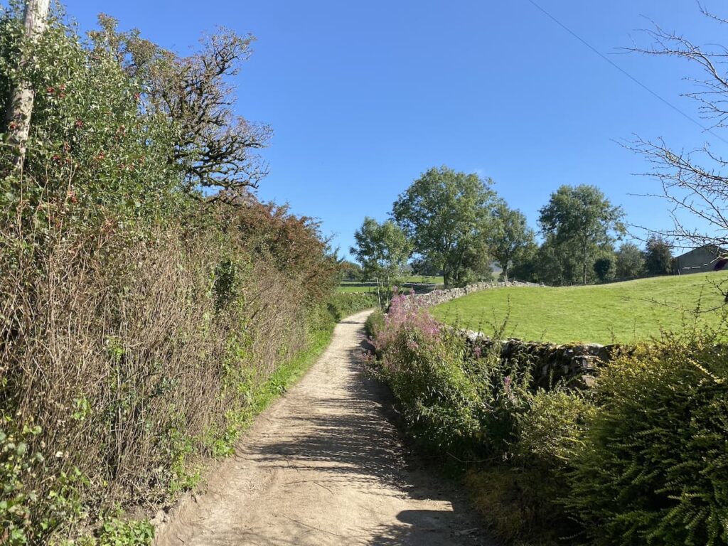
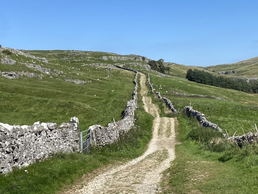
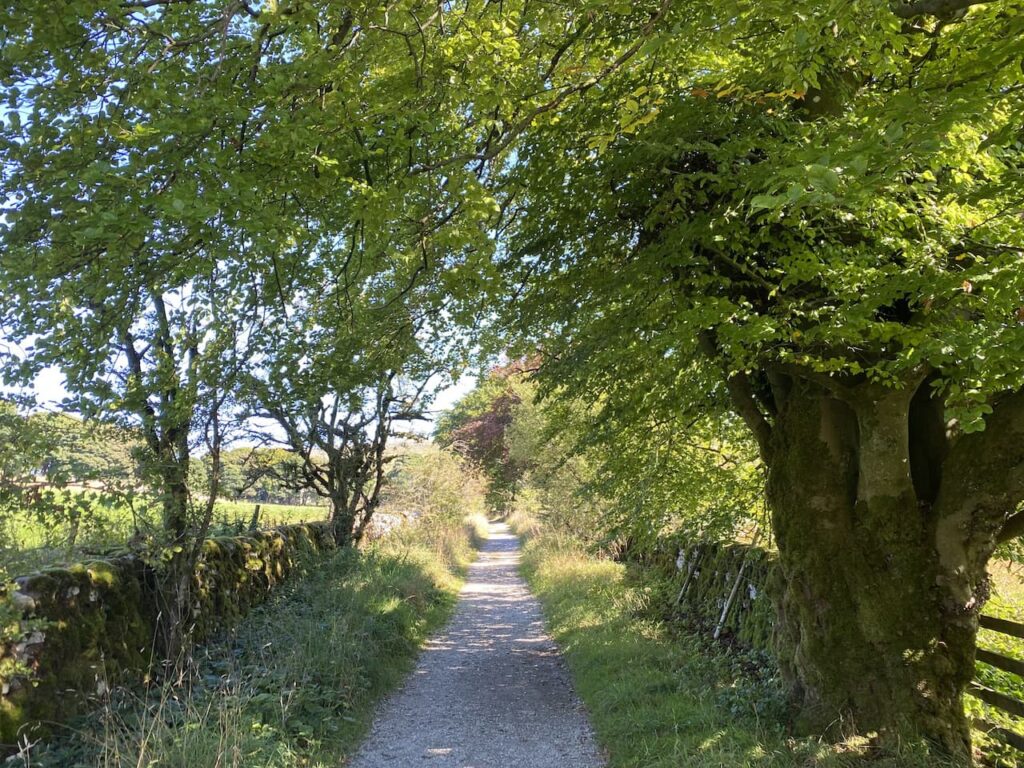
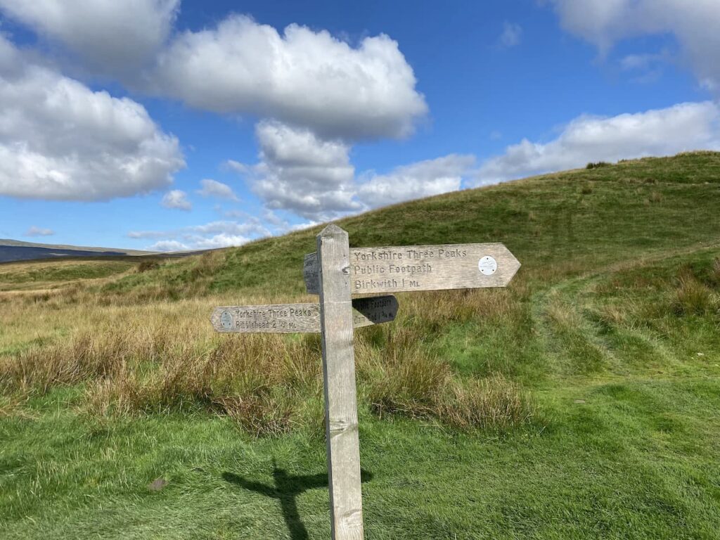
The starting point for today’s walk is Horton in Ribblesdale. Being a Monday it is relatively quiet in the village and we start our walk by heading through the village to pass the now closed Pen-y-Ghent cafe. At a finger post for the Pennine Way we cross the road and follow a lane passing properties.
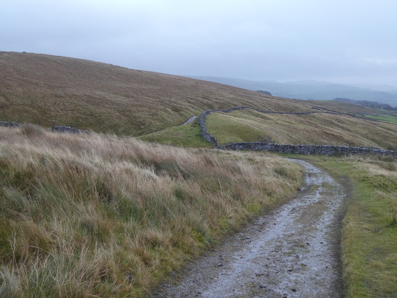
At a junction of tracks we turn to the left and follow the track as it gradually goes uphill.
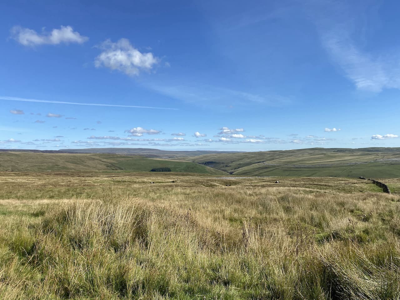
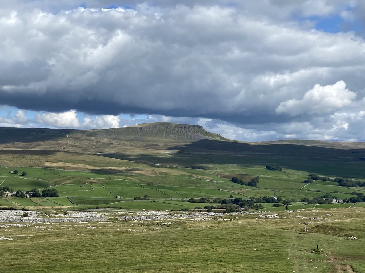
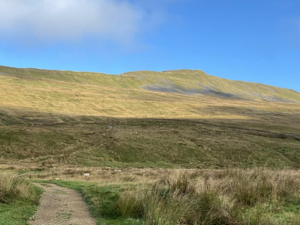
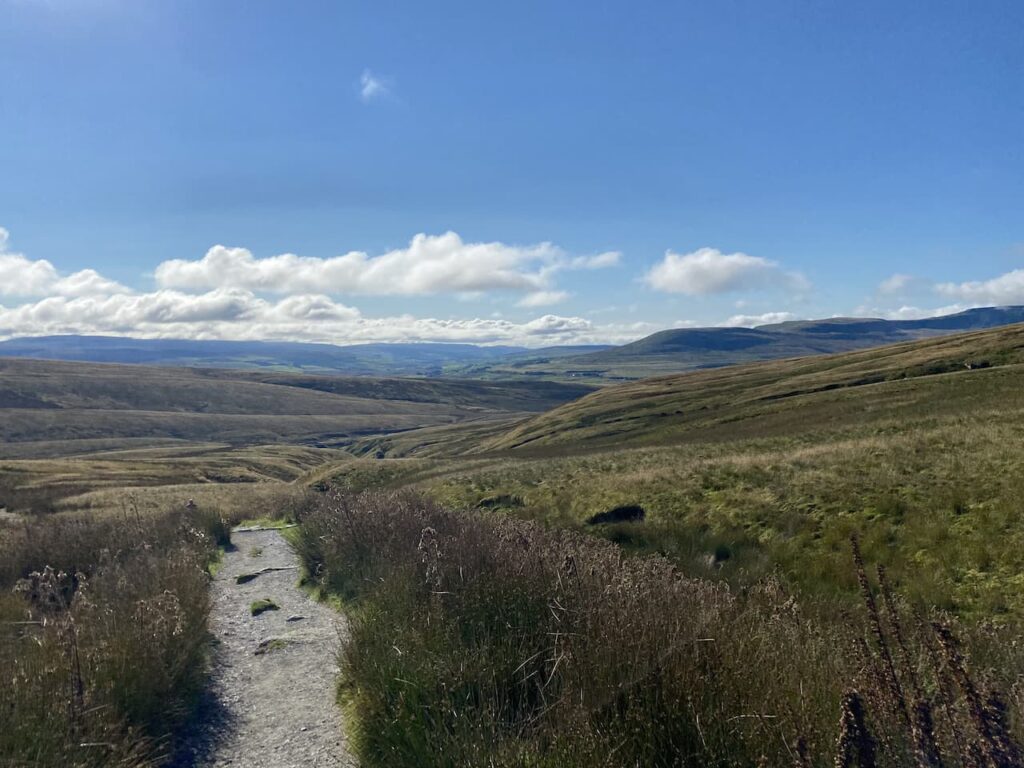
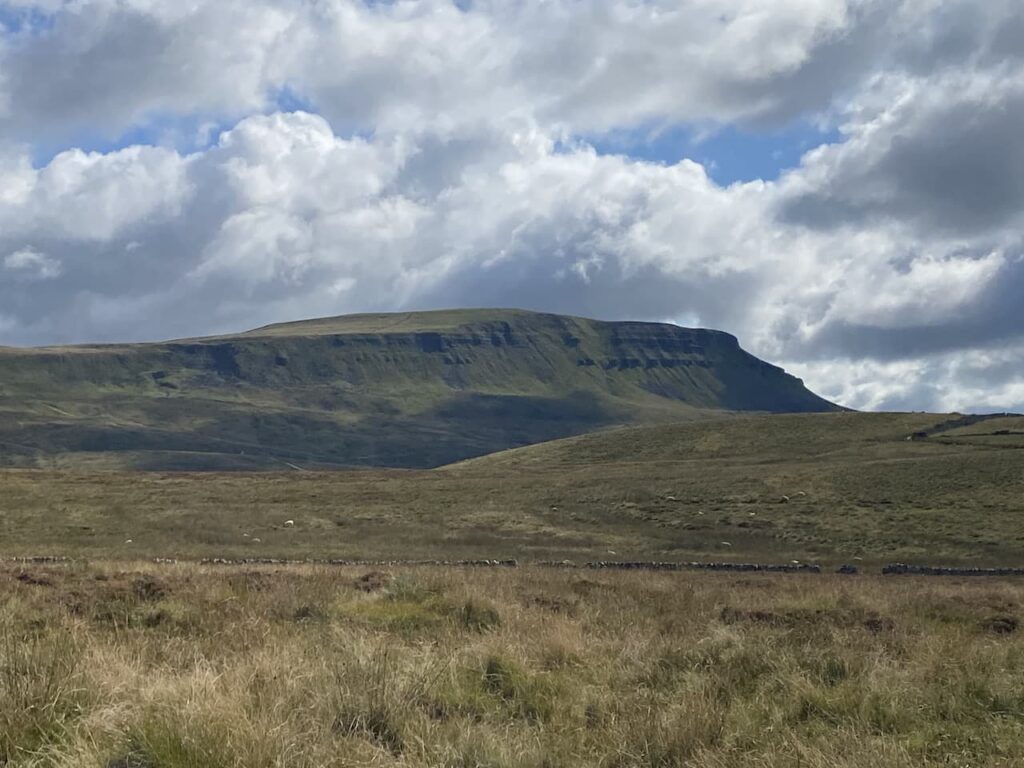
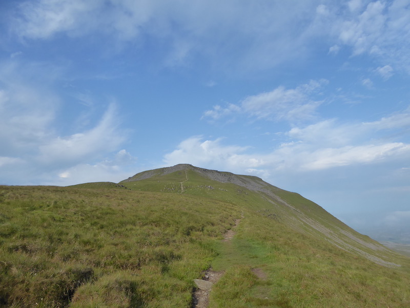
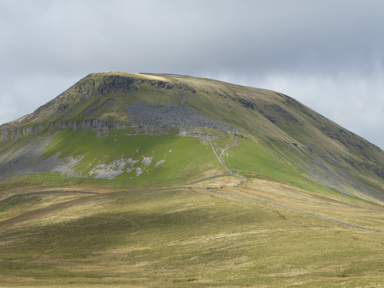
It is a stunning day and this is a cracking path to be walking along. Away to our right Pen-y-Ghent dominates the view.
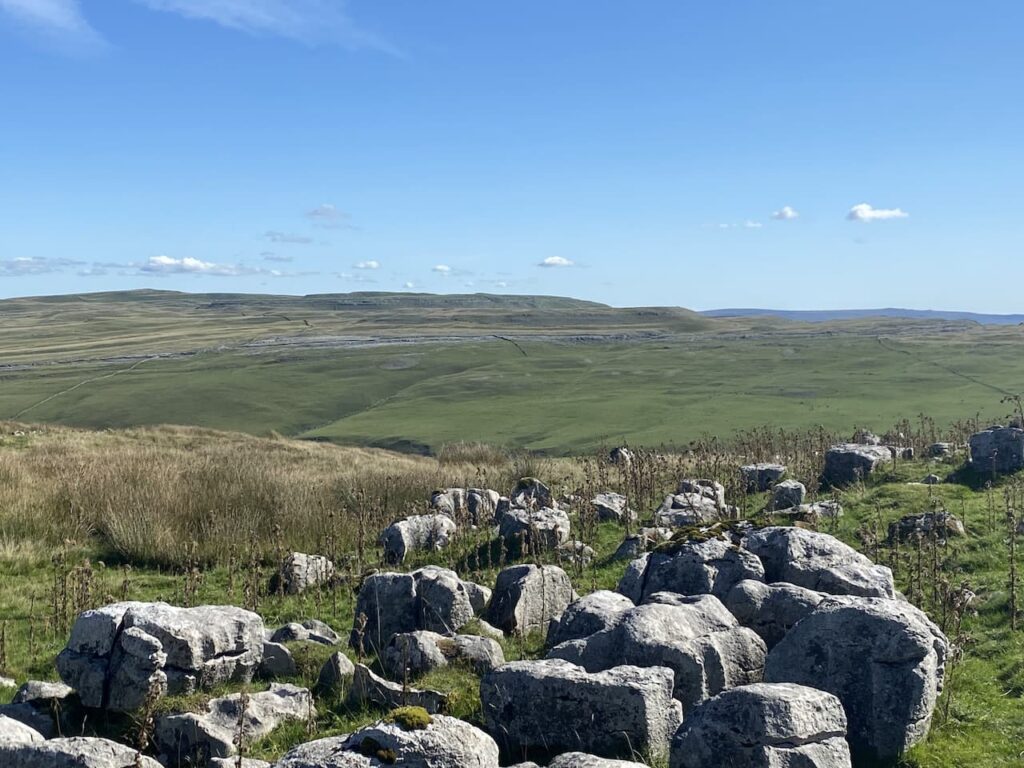
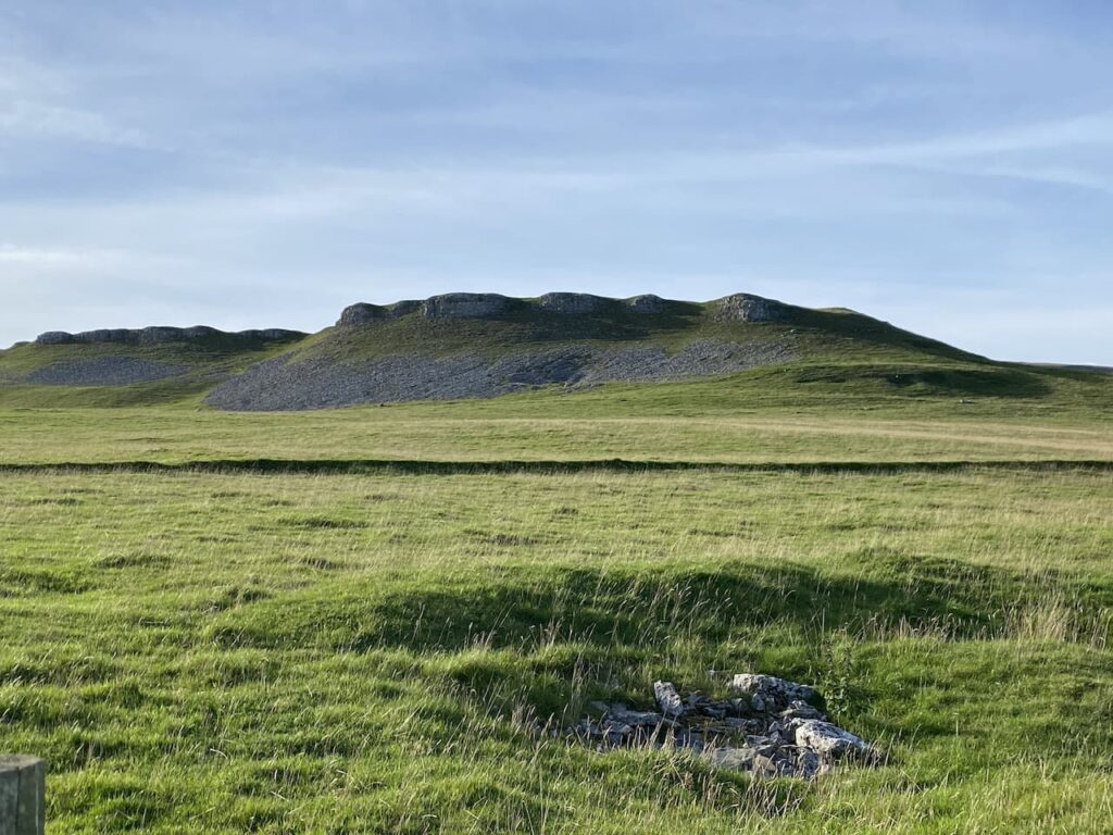
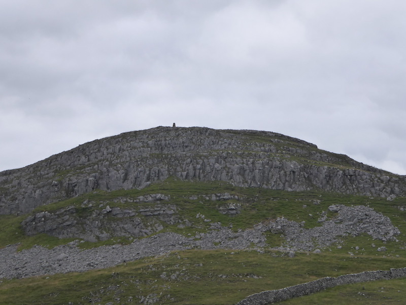
The track leads us towards the limestone outcrop at Stot Rakes.
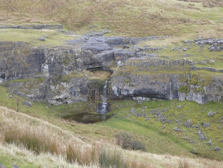
Over the wall is Tarn Bar. In the past we have been here during a wet spell and have seen a waterfall flowing here.
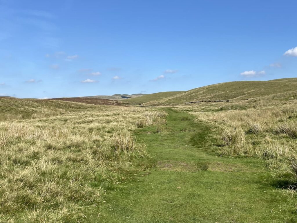
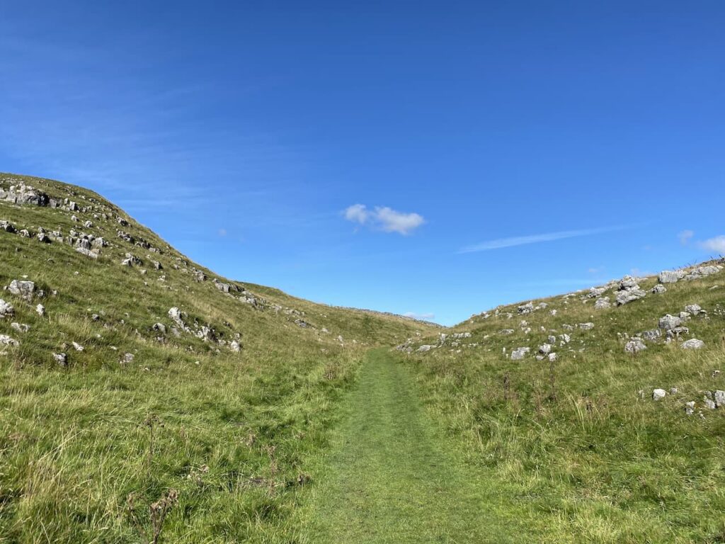
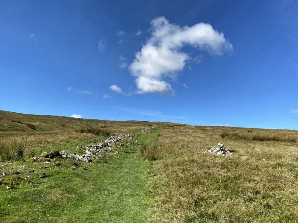
After going through a gate at a junction of tracks we go straight on along a grassy footpath toward Foxup.
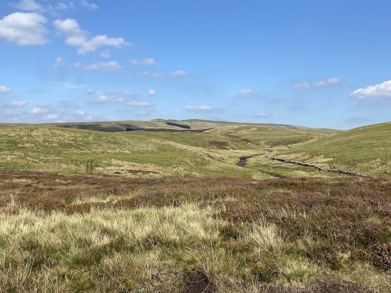
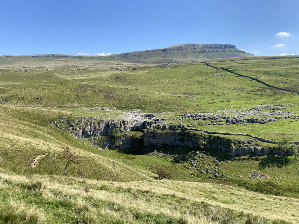
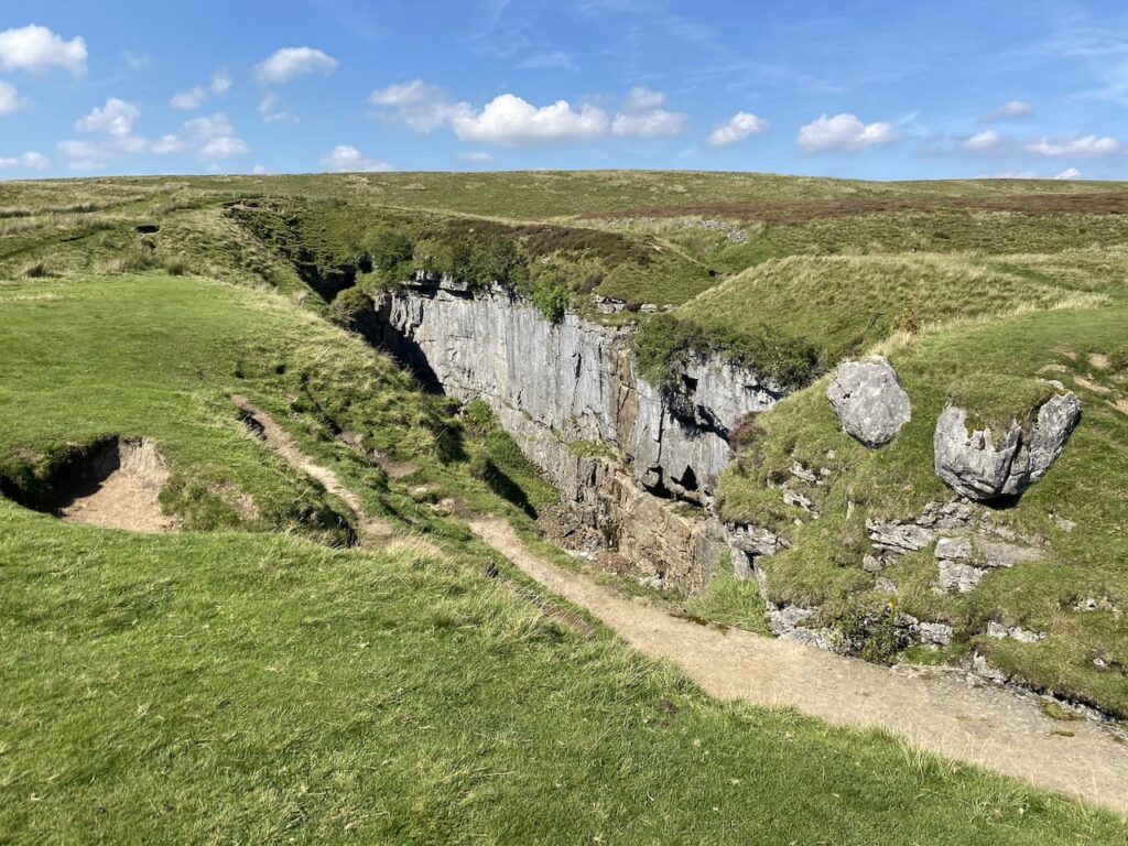
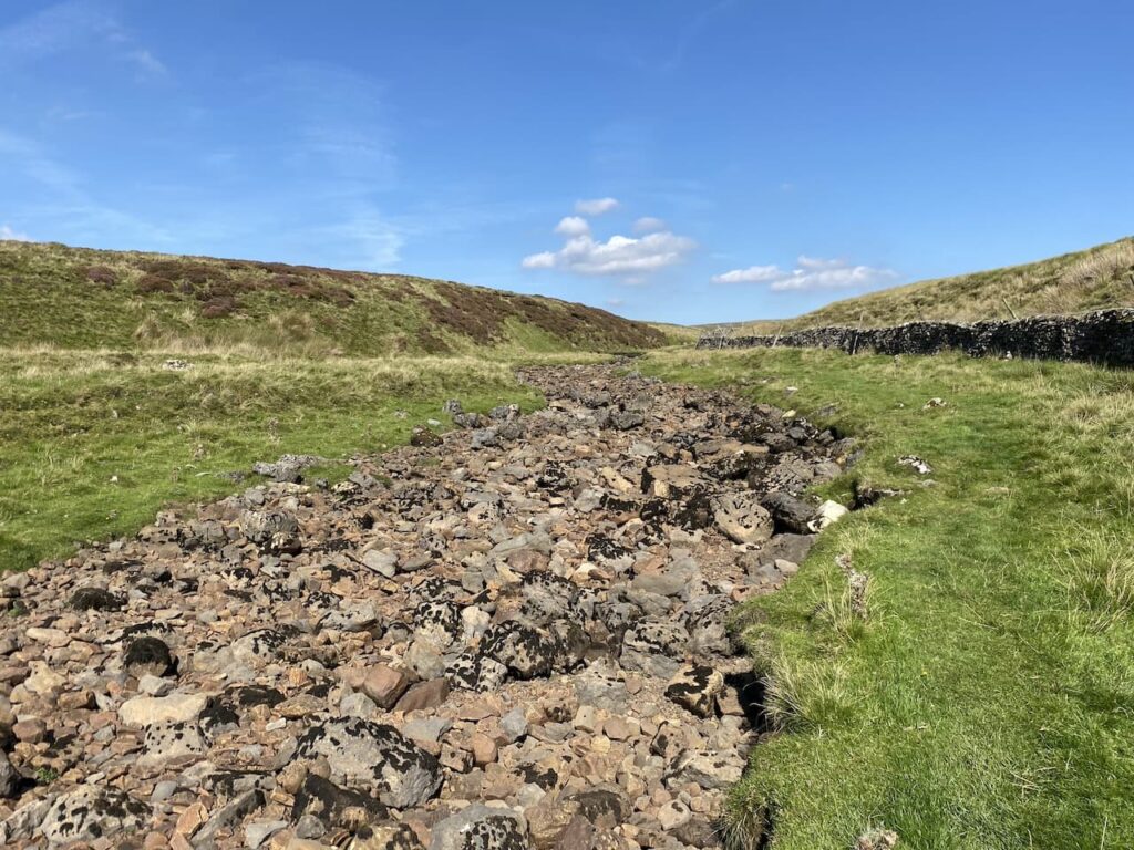
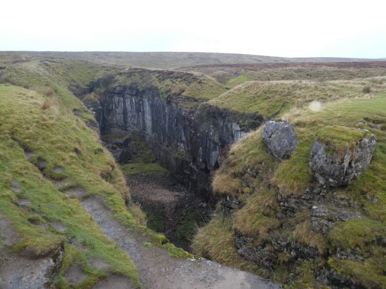
We have visited Hull Pot on numerous occasions but I never ceased to be amazed by how this huge pot hole suddenly appears. One minute it looks like you are walking along a grassy path leading into the distance and then only a few metres away there is a large chasm in front of you.
There is a trickle of water running into the pot hole, not from the dry river bed above but half way down. We decide to follow the route of Hull Pot Beck to find a spot for lunch.
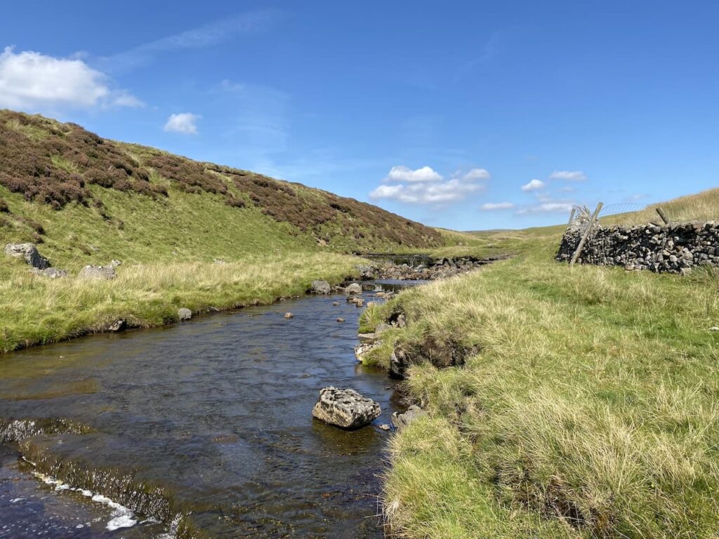
Initially the river bed is dry and after a couple of hundred metres we reach a point where there is water flowing before it disappears underground.
This is a very pleasant spot to sit for lunch. It gives Crosby a chance to stand in the beck and cool off a bit while we admire the view.
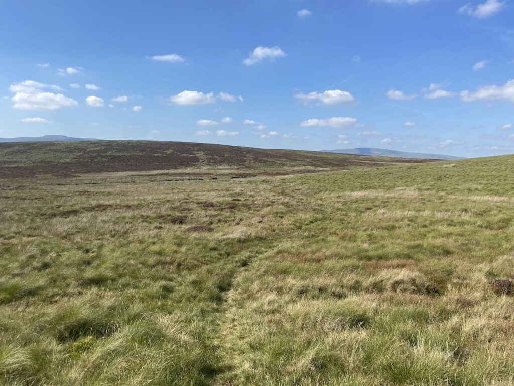
Resuming our walk we continue heading alongside the beck and at a junction of paths turn to the left to head steadily uphill onto Todber Moss.
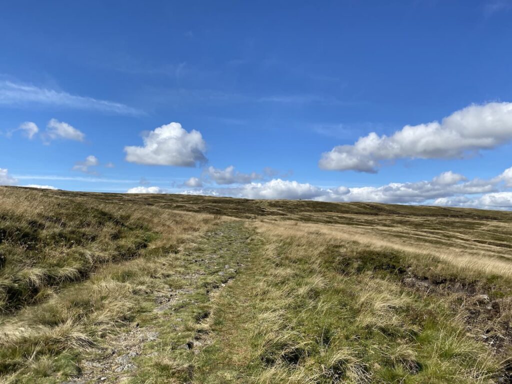
The path now heads across moor land. A number of years ago we headed up onto this moor after a prolonged wet spell and it was extremely boggy. In those days my navigation skills were not as good as they are now and visibility was not great so we made the sensible decision to turn around and head back to the beck.
The ground conditions are good today, and there is a clear path across the moor. However, I still use the map and compass to check we are heading in the right direction.
We go through a gate across a stream before continuing over Red Moss.
The path leads us to a junction of paths with the Pennine Way and Yorkshire Three Peaks route. Here we turn left along the track which forms the Pennine Way and the Three Peaks route.
Usually on this section of path you would expect to meet walkers heading in the opposite direction walking the Three Peaks but today with he have it to ourselves.
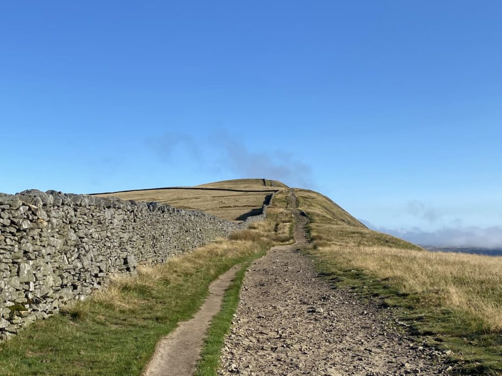
We reach the point where the Three Peaks path goes to the left. Here we go through a gate still on the route of the Pennine Way and follow the track towards another gate at Sell Gill.
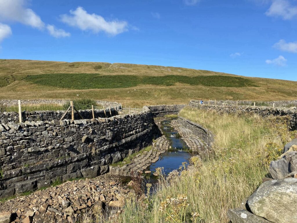
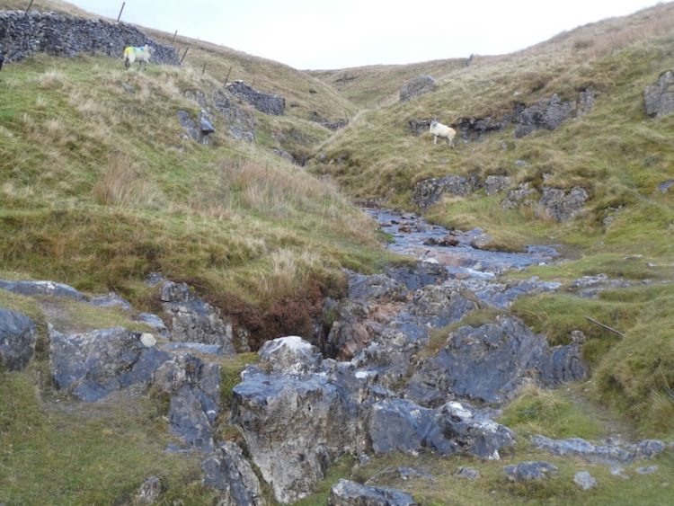
The dry conditions mean there is only a small amount of water in Sell Gill Beck.
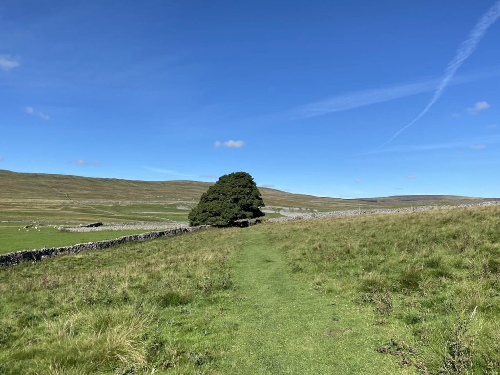
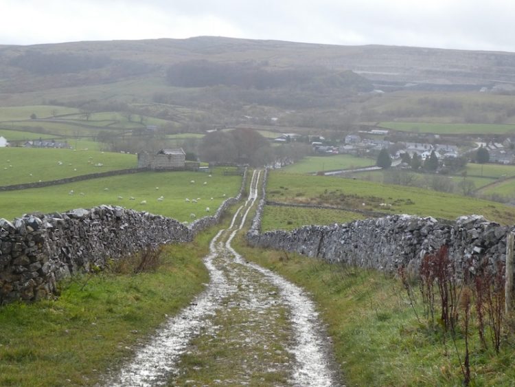
The route is now very straightforward we are staying on this track back to Horton in Ribblesdale. We are in no rush so take time to admire the views.
Soon we see the village in front of us as we descend the final section of the track.
After passing the Crown Inn we cross the River Ribble and return to our starting point.
All information on this site is provided free of charge and in good faith and no liability is accepted in respect of damage, loss or injury which might result from it. To the best of my knowledge the routes are entirely on public rights of way or within areas that are open for public access. Walking can be hazardous and is done entirely at your own risk. It is your responsibility to check your route and navigate using a map and compass.
After yesterday’s walk from the caravan site we are venturing a bit further afield today to walk close to Malham Tarn. Despite coming to the Dales for most of my life it is an area I have rarely walked. A few years ago Lynnie and I did a circuit of the Tarn with the dogs but apart from that we have not explored this area.
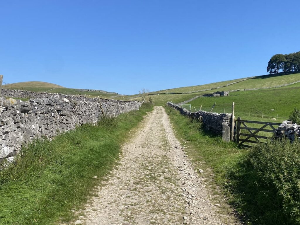
Our starting point for today’s walk is a car park in a disused quarry (Grid Reference SD883672). Leaving the parking area we turn right down the road and then very soon take a turning on the left. The footpath goes through a gate and continues along a wall-lined track.
We stay with this track until the end where we turn right and soon pass some cottages and then reach a footpath on the left which is the route of the Pennine Way. We take this path as it enters fields heading north away from the Tarn. Being part of the National Trail this path is obviously well used and is easy to follow as we continue through pasture land.
It is a corking day, there is a bit of a chill to the wind but the sky is clear with only the odd wispy cloud. Perfect conditions for walking.
I have often considered walking the Pennine Way, if I had a “bucket list” it would definitely be on it. But so far managing to organise the time is difficult, but now in my early sixties I probably need to get it done before the challenge is too much for me. Perhaps when things become a bit more settled with the Covid pandemic I will arrange it.
We stay with the Pennine Way markers heading towards Tennant Gill. This keeps us close to a dry stone wall and then through a field of cattle who are not interested in us or the dog. We assume they must see a lot of walkers and as long as they are left alone are not bothered by dogs.
We cross a tall wall stile and then continue on to reach a minor road where we turn right and continue along for a short distance to reach the entrance driveway to Tennant Gill. We are still on the route of the Pennine Way which goes through a gate besides a cattle grid and continues towards Tennant Gill. The route turns left just before reaching farm buildings and skirts the farm it then heads onto Middle Fell where we keep with the Pennine Way and start to ascend through rough pasture.
It is time for lunch so we sit on an area of limestone outcrop and admire the view. It is a constant discussion on our walks as to when I will find somewhere with a decent view for our lunch stop. I keep trying but one day I am bound to succeed!
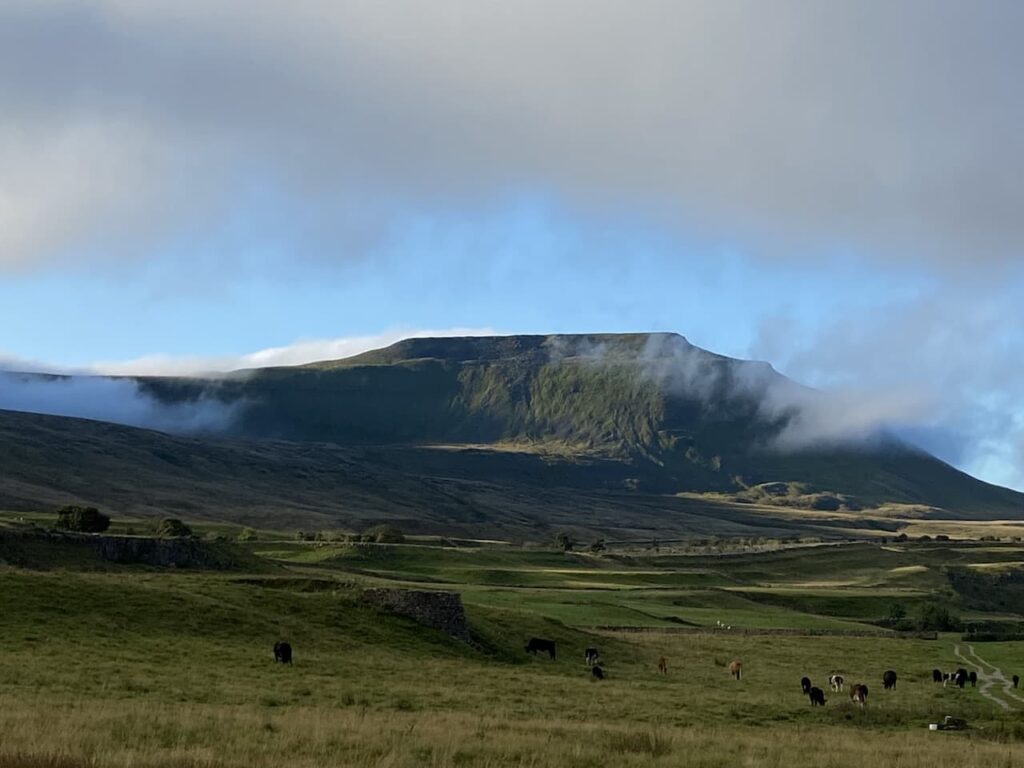
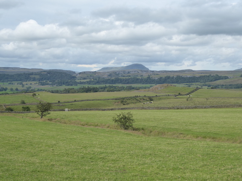
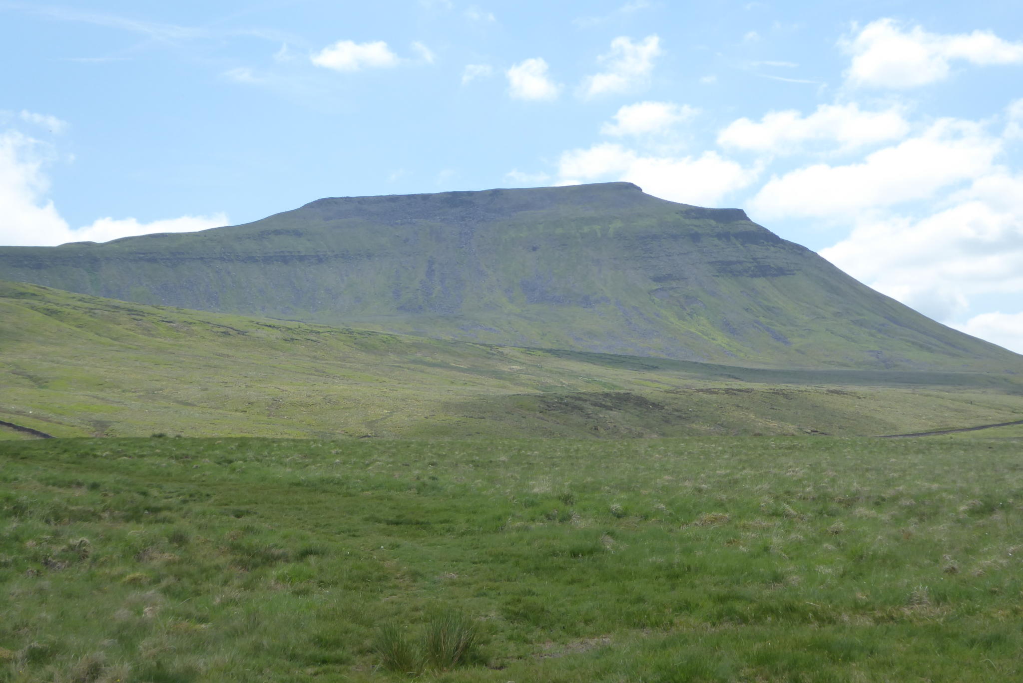
Refreshed we resume our walk along the route of the Pennine Way. It is a steady slog uphill as we head across Fountains Fell. A couple of years ago Lynnie and I were walking down from Pen-y-Ghent when we met two young chaps walking the Pennine Way. One of them had clearly had enough. At the time I wondered why the section between Malham and Horton-in-Ribblesdale would break someone. I can see now that if you were feeling low walking up this fell with Peny-Ghent rising before you and standing between a beer and bed you might be tempted to throw in the towel.
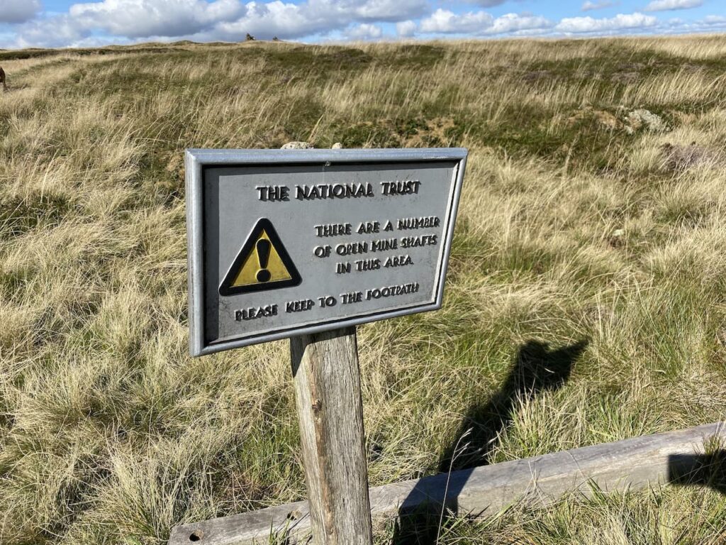
We continue along the Pennine Way and reach a notice warning us of mine shafts. This is a remote spot and mining up here must have been hard work. According to the informative Northern Mine Research Society, the seam of coal here was 30 inches thick and a survey identified more that 192 shafts. The depth of these shafts varied but some seams were as deep as 50 metres. We will be cautious and keep to well walked paths!
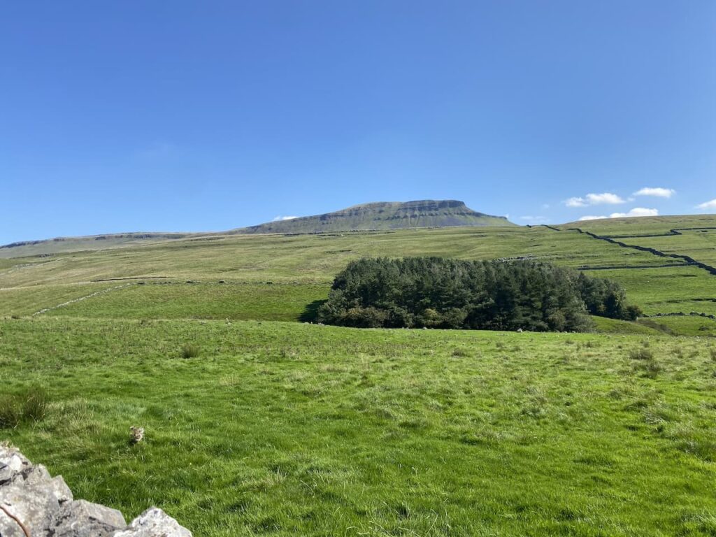
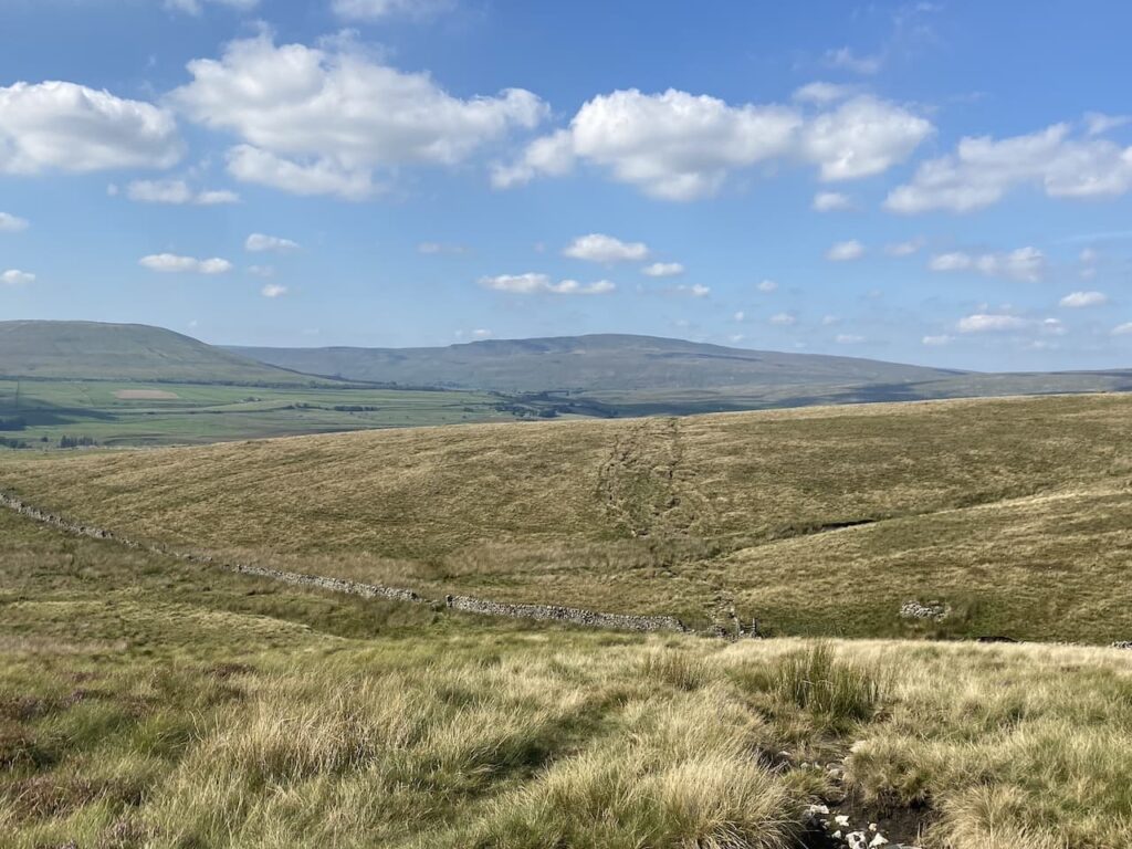
We continue up the footpath towards the top of the ridge and look towards Pen-y-ghent. For those folk walking the Pennine Way this point marks about eighty-five miles from the start at Edale and the ascent of Peny-ghent would look daunting for tired legs.
To get a view of Peny-ghent we have walked past the path we need, so wander back and turn onto the path going in a north easterly direction below the ridge heading towards Darnbrook Fell. To our left is the large cairn on the ridge of Fountains Fell.
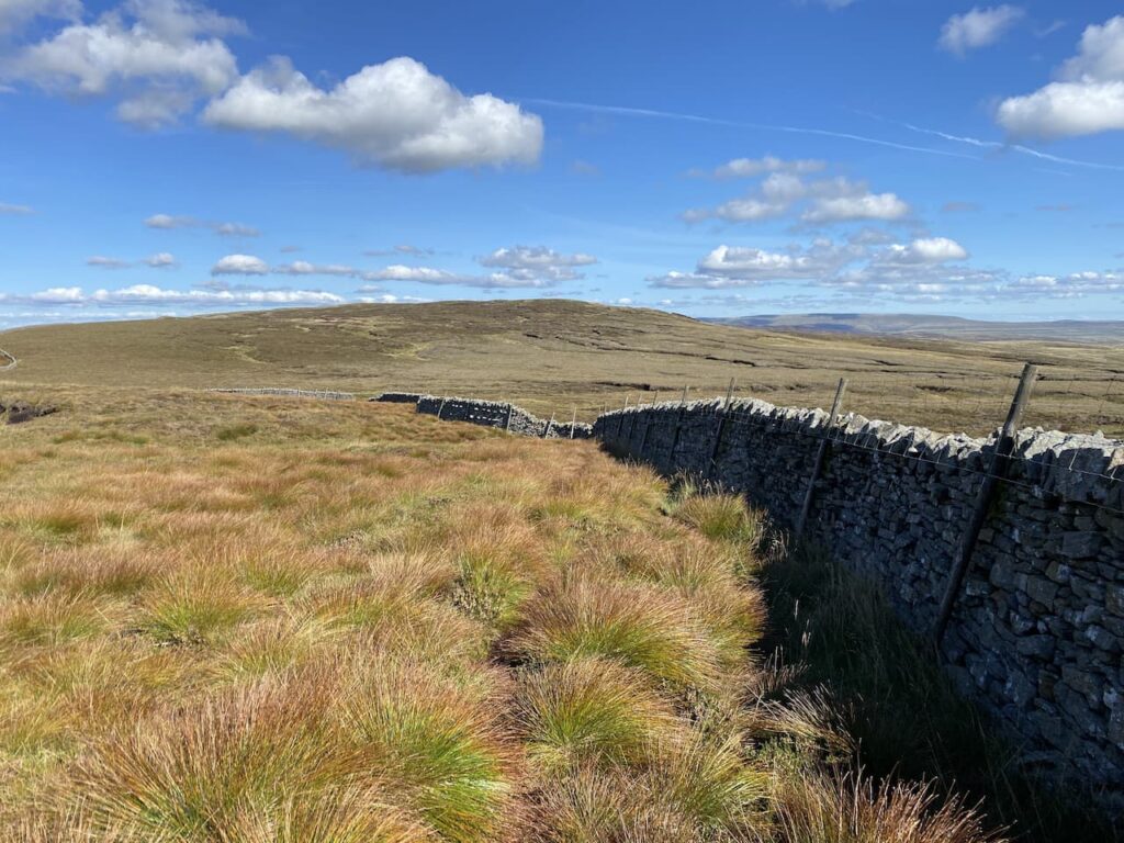
Following the path we reach a wall and turn right and walk besides the wall until a gateway. Here we cross and continue across the fell with a wall on our right.
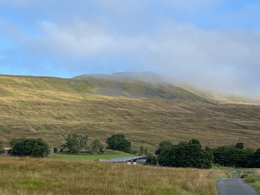
This is a remote fell and fortunately the recent dry spell means that the ground is firm under foot. We pass through slightly boggy sections which I would not feel comfortable about in the depths of winter.
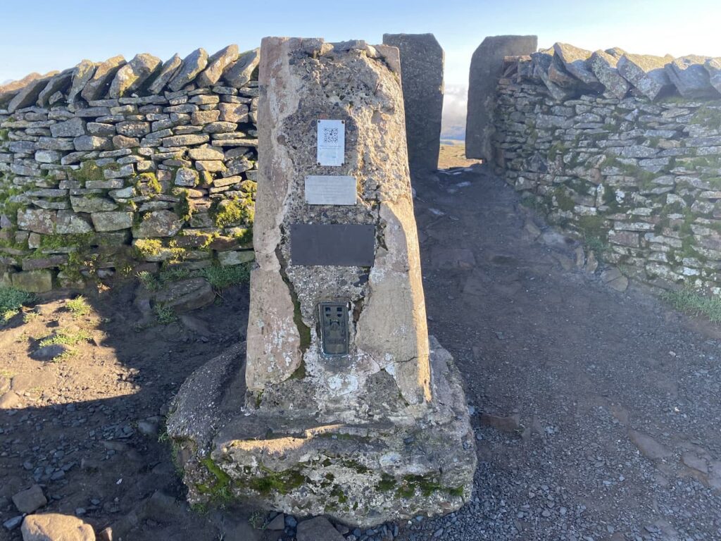
We continue walking besides the wall as it initially goes downhill and then rises onto Darnbrook Fell. At a junction with another wall we turn right and follow this wall and then fence line heading east. We reach a point where it is clear that others frequently cross the fence and go over and continue across the peat exposed summit of Darnbrook Fell to reach the Ordnance Survey trig pillar. This is the 271st trig I have bagged.
It is scary how much the area around the trig pillar has been eroded. I have come across a couple of examples of this whilst trig bagging, but cannot recall another where it is so dramatic.
From the trig we return to the point where we crossed the fence and go over and then continue to follow the fence line that rejoins a wall.
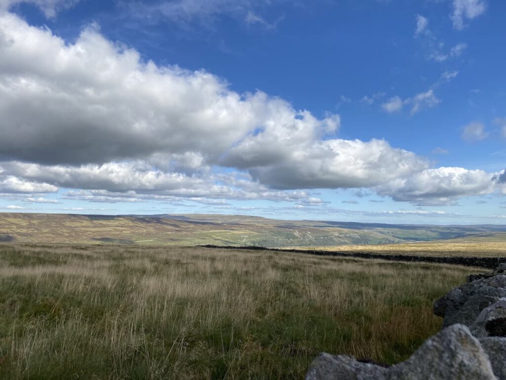
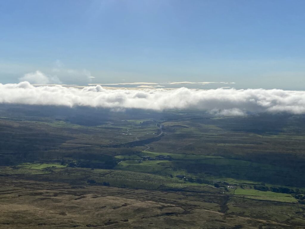
The wall line turns to the right with stunning view. On our left is Littondale, it is years since we last walked in that attractive dale. I must plan another walk there soon.
When the wall turns to the left we head across the fell on a faint path heading towards a dry stone wall and then follow the wall line to reach a gate which we go through and continue descending the fell with the wall to our left. At the wall junction we turn right and head south with cracking views in front of us.
We are now walking besides a brook as it heads downhill to Darnbrook Beck. The fell we are on is open access land and it is not clear how we exit it. There is a farm gate on our left, but no footpath. My prior research had shown that many people walk off the fell at this point, I am always reluctant to walk on land without a footpath but there appears to be no other option so we enter the field and cross above a farm.
As we go we are greeted with a cheery wave from someone at the farm so it is obvious they have no issue with walkers going through their field. We leave the field via a gate and then turn right to follow the road as it passes the farm at Darnbrook House. My original intention was to take a footpath on the left to head up unto the fell. However this would extend our walk significantly and Lynnie is in a bit of pain caused by walking across the uneven ground on the fell. Instead we follow the road back towards Tennant Gill. After walking on the exposed fell it is pleasant walking along this lane.
We cross Thoragill Beck and then soon go through a gate besides a cattle grid. This is a single track lane with passing places, the remote location means there is very little traffic. After going besides another cattle grid we continue on to pass a cracking barn.
After passing the entrance to Tennant Gill we have the option of retracing our route across fields, but this would mean crossing a wall stile and Lynnie thinks walking on the lane is better for her leg so we carry on. After going through a gate besides a cattle grid the lane goes through a field and then on our right is the disused quarry workings on Chapel Fell.
From here it is just a short walk to reach our starting point. We have covered eleven miles on a cracking day and have had some outstanding views.
All information on this site is provided free of charge and in good faith and no liability is accepted in respect of damage, loss or injury which might result from it. To the best of my knowledge the routes are entirely on public rights of way or within areas that are open for public access. Walking can be hazardous and is done entirely at your own risk. It is your responsibility to check your route and navigate using a map and compass.
I have walked the Yorkshire Three Peaks on four occasions. Each time I have taken the traditional anti-clockwise route . The first three trips started at Horton-in-Ribblesdale going up Pen-y-ghent first followed by Whernside and finally Ingleborough. It was walking this route in 2018, a couple of weeks before my sixtieth birthday, that I clocked my personal best time of seven hours and forty four minutes. I will never try and better that time so have since taken a more leisurely approach to the walk.
The last time I took on the Three Peaks I started in a lay-by just up from the Old Hill Inn. That day I stuck with the anti-clockwise route, tackling Ingleborough first and then Pen-y-ghent before finishing with Whernside. I found it enjoyable because I was behind those who started at Horton and had the walk almost to myself. I plan to walk that route again next week with my walking buddy. It will be her first time around the Peaks.
In 2016, my first time doing the walk, I met a chap part way round and we walked together for the best part of an hour. He had done the walk a number of times and mentioned how enjoyable it was to do in a clockwise direction. The conversation has stuck with me so today I am going to see what it is like.
I park at the small parking area just north of the Old Hill Inn on the Ingleton to Ribblehead road. Ingleborough looks almost clear as I set off and it appears I am in for a cracking day.
Leaving the car I have a short section on the road heading south and soon pass the Old Hill Inn. I don’t plan to describe the route in detail because it is well way-marked. I leave the road and follow the tarmac Philpin Lane soon passing the farm with its barns and campsite. This section of the walk is one of the easiest and I strike out at a reasonable pace to warm my legs up in anticipation of the steep ascent of Whernside that is coming soon.
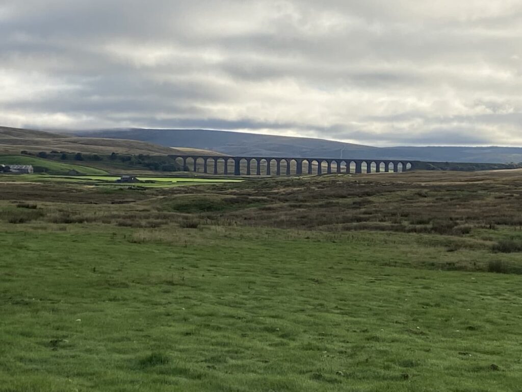
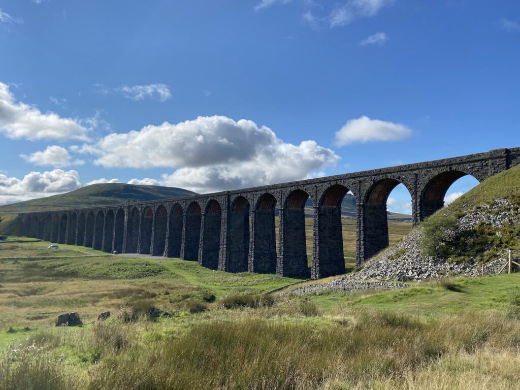
Heading towards Bruntscar there is a cracking view of the Ribblehead Viaduct. I am not sure I have ever looked at it from here. Usually when I am walking along this lane I am focused on the ascent of Ingleborough or looking at my watch to check the time I will record for the Three Peaks.
After passing Bruntscar the first ascent of the day starts. I have walked this route up Whernside many times, but always as a circular walk from Ribblehead when only going up this one peak.
Initially this is a gradual ascent interspersed with flagstone steps. It then becomes ferocious, but has been made easier in recent years by the addition of new rocks replacing the old steps which were narrow and sloping the wrong way. It is warm as I go up and I am soon shedding a layer. As I reach the top of the scar I meet a couple walking the anti-clockwise route from Ribblehead.
I still have some ascending to do to reach the summit of Whernside, the conditions are perfect for walking and the visibility is far better than I have ever encountered before on this peak. Down to my right the Settle to Carlisle Railway looks stunning.
Soon I am on top of Whernside and stop at the trig pillar. This is looking a bit worse for wear with the spider at the top exposed. I hope this is because of the adverse weather it faces for most of the year rather than folk wanting to take a souvenir home with them.
Leaving the trig I start to pass walkers who are heading in the opposite direction and soon realise that I am destined to spend most of the day saying hello to folk. I always find it amazing how people might walk by you in the street without any acknowledgement, but once out on a walk everyone wants to say “Hi”. I find it refreshing and only wish they were friendlier in normal day to day life.
The views are truly stunning. I have often seen Morecambe Bay and the Lake District from Ingleborough, but never from Whernside before. I am pleased I am not out to set a good time, but can just enjoy the day’s walking. Heading down there is a great view of the tarn on Greensett Moss.
Walking in this direction it is a long steady descent down Whernside. I have been walking this peak for over thirty years and in that time the path has been improved significantly. There was a time when even during a dry spell of weather a boggy section would be encountered. Now it is almost guaranteed to be firm underfoot all year round.
Going down Slack Hill there is a steady stream of people passing me. Not all looking in great shape, I can only assume they had a very early start from Horton-in-Ribblesdale and are now feeling the pressure. One of my favourite architectural features on this walk is the aqueduct carrying the water flowing from Force Gill across the Settle to Carlisle Railway.
The path starts to level and I am soon passing Bleamoor signal box then soon after the Ribblehead Viaduct comes into view.
As usual close to the viaduct there are a lot of people about. I just hope a few of them take time to think about the lives of the workers that built this impressive structure. It would have been extremely bleak during the winters and in the shanty towns where the 2,300 workers and their families lived, they were rife with disease. In the construction of the viaduct over 100 men lost their lives, but a similar number of women and children died of smallpox and other diseases.
The next section is beside the road before turning off and passing Ingman Lodge and continuing on to cross the River Ribble which is very low after the recent dry spell.
This is such a well-marked route that in good weather conditions like today you do not need to be constantly looking at a map. After passing Nether Lodge I head on towards Birkwith.
After the earlier sections where I was frequently passing people walking in the opposite direction I have a few quiet miles. The Three Peaks Path joins the Pennine Way for a while and I get a good view of Pen-y-ghent. I always thing this mountain looks more challenging than it actually is.
The Three Peaks path leaves the Pennine Way and heads over Sell Gill Hill and Whitber Hill before starting the long steady ascent of Pen-y-ghent. I have walked up this path many times and it is a long steady slog. I soon catch up with a group of junior school children who are out on an adventure walking to the summit and back from Horton-in-Ribblesdale. It is great to see these young people being introduced to the pleasures of being out walking. Although some of the stragglers don’t look as if it is something they are enjoying.
I am soon at the trig point on the summit and pause to take the obligatory picture of the trig before starting my descent.
I have been down the steep side of Pen-y-ghent on a few occasions. Today there is a steady stream of people coming up and one or two are in danger of becoming rock fast. I am not keen on heights but the section here does not worry me but I can understand why if someone is approaching it for the first time they might get concerned. The initial steep descent is not a place to hurry, the rocks are worn smooth and it is not a good place to take a tumble so with so many people coming up I proceed with caution.
At the foot of the steep descent I turn to the right to follow the flagstone path downhill. Over recent years this path has improved significantly and it makes the going much easier.
Going around Brackenbottom Scar I see posts have been erected to try and keep folk on the main route, gradually over time the volume of foot traffic here has spread the path. Hopefully people will respect the notices and prevent further erosion.
After the long drag up Pen-y-ghent it is pleasant heading downhill into the village where I cross the River Ribble again.
After crossing the Settle to Carlisle railway line at Horton Station I start my final ascent of the day. There are a steady stream of people heading downhill, many of whom I recognise from passing earlier. As I head towards Sulber Nick it is clear that significant work has been done to this section of the route since I was last here. What was once a boggy difficult area has now been laid as a clear path.
Heading up Ingleborough I come to the conclusion that walking the peaks in this direction is harder than doing it anti-clockwise. I had thought the long steady ascents of Pen-y-ghent and Ingleborough would make things easier, but the opposite is true. Added to which I am expending further energy acknowledging everyone passing in the opposite direction.
Near the summit of Ingleborough I pass a group of guys I met earlier as I was descending Whernside. One chap is particularly pleased to see me because he has had a bet with his fellow walkers that I was doing the Three Peaks the “wrong way”. He is confident that he is going to be drinking free beer when they reach the pub!
Even though I was on Ingleborough yesterday I still walk over to the trig point. Failure to do so would mean that I would not be able to count today’s walk as a successful circuit of the peaks.
I make my way off the summit and due to the volume of walkers coming up Ingleborough decide it is safer not to try to pass them on the steep path. Instead I follow the path along the top of the escarpment towards Simon Fell.
At a junction of paths I turn left and make the steep descent towards Humphrey Bottom. I have come up this path many times and over recent years it has obviously been used a lot more. What was once a faint route is now well-worn and in parts eroded away.
At the foot of the hill I turn right and follow the path past the Great Douk pothole. From there it is only a short walk back to my starting point. The 25 mile route has taken me 9 hours and 9 minutes, which is almost an hour and a half slower than my quickest time on this challenge. However, today was never about trying to record a spectacular time, it was more about being out for the pure pleasure of being able to undertake this walk again.
All information on this site is provided free of charge and in good faith and no liability is accepted in respect of damage, loss or injury which might result from it. To the best of my knowledge the routes are entirely on public rights of way or within areas that are open for public access. Walking can be hazardous and is done entirely at your own risk. It is your responsibility to check your route and navigate using a map and compass.
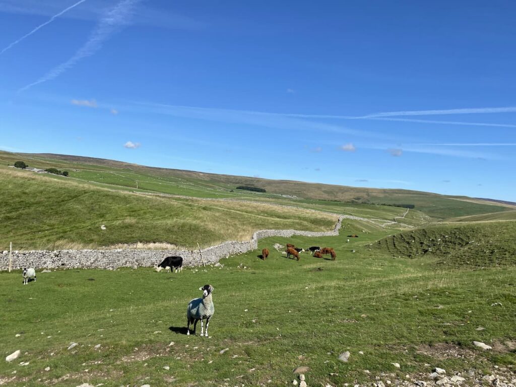
Now that Dexter is getting older we have to manage the distances he walks, if it is not too hot he can still clock up a few miles, but his days of long distance walks are sadly over. I thoroughly enjoyed my morning walk with Crosby and Lynnie is keen to get out for a few miles this afternoon so we head off to Horton in Ribblesdale.
Our walk starts from the Yorkshire Dales National Park car park in Horton in Ribblesdale (Grid Reference: SD807725). Leaving the car park we turn right along the road soon passing the Pen-y-ghent Café, which appears to have closed down. We cross the road to take the track that leads past Horton Scar.
The skyline to our right is dominated by the Pen-y-ghent.
At the crossroads of footpaths we walk straight on towards Hull Pot. I have previously written about Hull Pot, it is a huge pothole that suddenly appears on the track.
We turn around and retrace our steps to the crossroads of paths and turn right to climb over Whitber Hill. It can be bleak up here, today there is a bit of mizzle but we have been here when the visibility has been very poor. We are grateful for the well-defined path (that forms part of the Three Peaks Walk).
Crossing the Sell Gill Beck, we continue until we reach a junction of paths and turn left onto the Pennine Way signposted to Horton in Ribblesdale. Soon we meet Sell Gill Beck again. In the past we have seen people potholing here, not something I would ever fancy doing.
The route is now very straightforward we follow the track as it steadily descends towards Horton in Ribblesdale.
Back at the car park our walk has covered just over four and a half miles, which is just about right for Dexter at the moment. It is now time to head back to the caravan and start planning tomorrow’s walk.
[To follow our walk you will need Ordnance Survey Outdoor Leisure Map OL2 – Yorkshire Dales – Western Area]
Today I am heading out from Brigholme Farm CL to bag another trig point and visit Giggleswick Common, an area I have not previously visited. I had thought I had bagged all the trig points within walking distance of this CL, but scanning the map last night I realised I did not have the complete set. (more…)
After my early morning walk with the dogs I am soon out again for an early start to tackle the Yorkshire Three Peaks. This is a walk that I have done on three previous occasions each time starting from Horton-in-Ribblesdale, but today I am going to start from a small layby (Grid Ref SD745777) on the B6255 a few hundred yards past the Hill Inn. (more…)
It was soon after we got our first caravan in 2012 that we made our first visit to Brigholme Farm CL, since then we have stayed for over a fortnight at least once a year. I have, therefore, walked many of the routes and paths around here but surprisingly there are still a couple of trig points within walking distance that I have yet to “bag”. Today I plan to rectify that by knocking one off the list. (more…)
After five nights at Hall Croft CL we have moved on to Brigholme Farm in Giggleswick, just the other side of the River Ribble from Settle. This is a CL we have stayed on many times and the trip up from Ilkley does not take us long, so I am soon lacing up my boots to head out for a walk with Crosby. (more…)
In just over four weeks time I reach sixty, I have no desire for any celebrations but there is one thing I want to do to mark the passing of another decade of my life and that is to undertake the Yorkshire Three Peaks Challenge for a third time. (more…)
Lynnie has had two days off from walking and whilst there is no guarantee of a dry day today the forecast looks reasonable, so she decides to come on a jamabout. By way of encouragement I have promised a new walk today starting from Stainforth so that we can visit Stainforth Force. (more…)