Tag: Grim’s Ditch

  • Visiting Pentridge and Martin

    Visiting Pentridge and Martin

    Today Lynnie and are walking with our friends Wendy and Gary who we have known since they moved into the village just over a year ago.  In normal circumstances I am sure we would have done a fair bit of socialising with them, but this year has been anything but normal.  So apart from the occasional drink in the garden during the summer and a weekly videocall call we have not seen a lot of them.  So it will be good to get out for a few hours and have a chat and try to put the world to rights.

    Even though we live in the same village we travel separately to the car park on Martin Down Nature Reserve besides the A354.  The weather forecast suggested there would be early morning rain, but a good chance the rest of the day would be dry and chilly.  So arriving at the car park we layer up and boots on we head off.

    We start from the southern end of the car park, passing a metal barrier beside some information boards. Initially the path heads through shrub, but then opens out onto the vast expanse of the nature reserve, there are over 850 acres of protected land here providing a haven for flora and fauna.  

    We follow the track towards the dominant rifle range butt in front of us.  This area of the downs was used as a military rifle range up until the 1950’s and evidence of this is strewn across it. Before reaching the butt we take a path on the right to head across towards the Bokerley Dyke.  This ditch is thought to have been built during the iron age and fortified in the 5th century.  It runs for around 3.5 miles and is an impressive structure.

    At the dyke we pass through to reach the fence-line of a field. Entering the field we take a footpath on the right and continue along the edge of the field with the fence to our right.  The path follows around the edge of the field and we are soon heading south with a hedge line on our right. 

    At a junction of paths we continue straight on to reach a gate besides a crossing of paths.  Here we continue along a hedge lined path still heading south towards Pentridge.

    As the path reaches farm buildings it becomes a tarmac lane, Earthpits Lane, and we stay with this to walk into the village.  At a sign for the church we turn right and wander up to visit the fine church of St Rumbold which apparently was rebuilt in 1855 in a 14th century style.

    From the church we head back to Earthpits Lane and turn right for thirty yards to take a footpath on the left leading up a driveway before heading left across grass to a narrow path besides a fence.  It is a gradual ascent to a stile leading into a pasture field.  The path continues by the fence line and then as the fence turns to the right we continue straight on towards a stile.  From here there are cracking views.

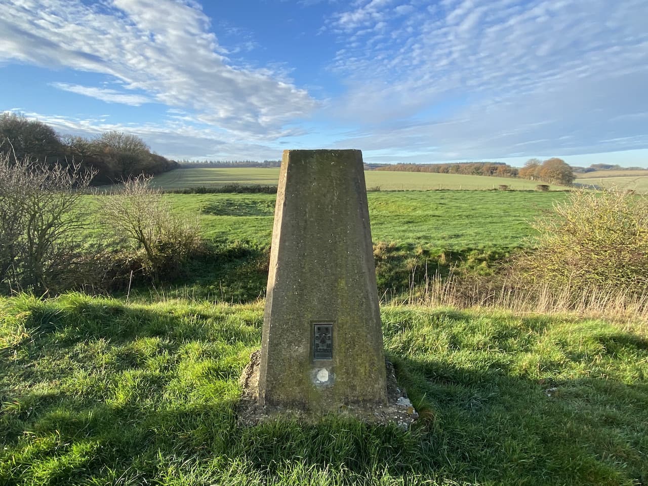
    After crossing the stile we continue up Penbury Knoll and visit the Ordnance Survey trig pillar.  I have visited this trig on a number of occasions but it is always worth a re-visit.

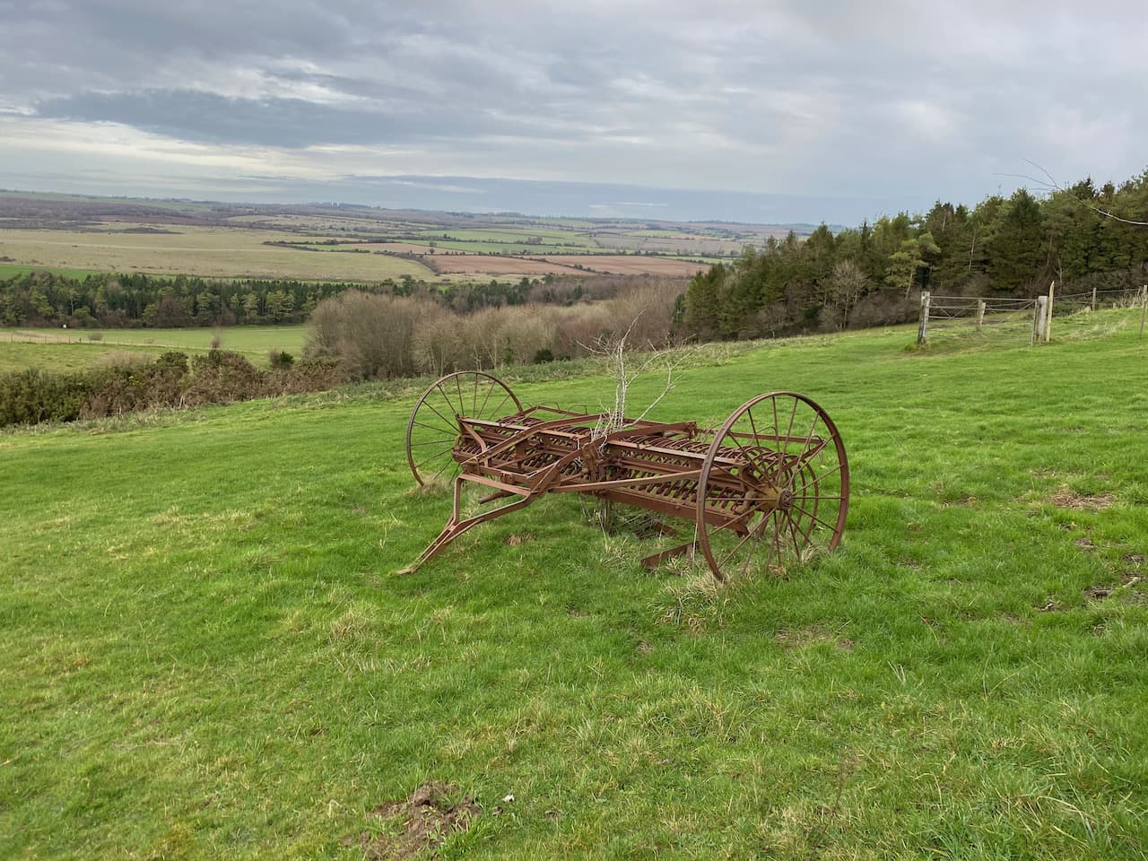
    From the trig we head north east on a track across the access land.  This track follows a fence to our right and we stay with it as the fence turns to the north.  At an abandoned old hay rake we turn to the right and go through a gate.

    We now follow a path along the edge of an arable field and then pass Blagdon Plantation.  On reaching a track we turn right and then take the second footpath on the left to head along the side of attractive woodland.

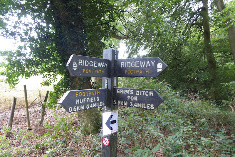
    The footpath reaches Martin Down and crosses the Bokerley Ditch.

    Now we follow a path that runs besides a Grim’s Ditch.  This is a common name for earthworks of this type which are found across chalk downland in southern England.  Their purpose is unclear, too small to act as military defences it is thought that they marked territorial boundaries in the Iron Age.

    We follow the ditch to reach a footpath where we turn left and head north along a track, this starts to descend with views towards the village of Martin in front of us. 

    We stay with the track as it leads to the edge of Martin Down and then continue along a hedge lined track leading towards Martin.  In the village we turn left and walk along the road, Martin Drove End, until we reach a sign towards the church.  Here we turn and wander up to see if we can locate the Ordnance Survey benchmark on All Saints Church.

    Apparently parts of this church date back to 12th century, with the tower being built in the 13th century and then late in the 18th century a spire was added.

    From the church we head back to Martin Drove End and turn right soon reaching a village green with an old pump above a covered well.  

    Also on the Green there is a millennium cross showing it is 37.5 miles to Glastonbury.  Apparently the significance of this is that back in 945 Edmund, King of Mercia bestowed the Damerham and Martin Estate to his wife Ethelfled on the condition that she should leave it to the “ancient church of the blessed Mary in the monastery of Glastonberi”, the Abbot of Glastonbury held a manor which included the village for many centuries. Close to the millennium stone is the base of the old market cross the history of which appears hard to determine.  But it is thought to date from the 5th century.

    From the green we head west along Sillens Lane to leave the village.  This road leads to a car park on the edge of Martin Down.  Here we keep heading west across the downs until we reach a junction of paths besides a Grim’s Ditch.  Here we follow a clear track heading northwest towards the rifle butts. 

    After passing the rifle butt we continue along the track to reach our starting point in the car park.  Our walk has covered almost eight miles.  The weather has been fine and not as cold as forecast and it has been great to get out and catch up after the recent Covid-19 lockdown.

    You can view this 8 mile walk on OS Maps and download the GPX File Here

    To follow this walk you will need Ordnance Survey Explorer Map OL130

    4th December 2020

    © Two Dogs and an Awning (2020)

    All information on this site is provided free of charge and in good faith and no liability is accepted in respect of damage, loss or injury which might result from it.  To the best of my knowledge the routes are entirely on public rights of way or within areas that are open for public access.
    Walking can be hazardous and is done entirely at your own risk.  It is your responsibility to check your route and navigate using a map and compass.

  • Trigs and Handsel Sisters in Grovely Wood

    Trigs and Handsel Sisters in Grovely Wood

    I am continuing my quest to walk areas close to home I have not previously explored.  So today I am off to Grovely Wood on the west side of Wilton for a walk with my friend Mandy.  There are a number of options for parking around the woods, we choose the small car park on Grovely Road to the south west of Great Wishford.

    We start our walk by heading up the forestry track into the woods on the route of the Monarch’s Way.

    It is a steady ascent through the trees and we stay with this track until meeting a crossing of tracks close to Grovely Lodge here we turn right along a wide track and soon pass a gate and continue along the track.

    After passing Four Sisters Copse we leave the main track and follow a path through the trees heading northwest towards the Little Langford Down Nature Reserve.  Like much of Grovely Wood this is open access land so there are no way markers and we take care to ensure we skirt the top of a valley before turning north through Langford Woods.

    This is a stunning section of woodland maintained as a nature reserve by the Wiltshire Wildlife Trust.

    We stay with a broad ride through the trees to reach the northern end of Langford Woods where there is a barbed wire fence.  This marks the edge of the access land.  Here we make a brief excursion into the field to bag the Ordnance Survey trig pillar on the ramparts of the Grovely Castle Iron Age hill fort.  

    This is the 233rd trig I have bagged and the views from here are stunning.

    We spend a few minutes just taking in the far ranging views and once again I am blown away by the beauty of the Wiltshire downland.

    Back in the woods we retrace our steps through the nature reserve, this time when we reach the top of the valley we fork right on a ride passing and area marked on the map as Powten Stone.  I had hoped this would mean there was a stone here we could seek out, but whilst planning the route I discovered that despite much searching the location of the stone is unknown.

    On reaching a junction with a footpath following the line of a Grim’s Ditch we turn right following the path as it goes along the edge of the woodland besides the ditch.  A Grim’s Ditch is not an uncommon site when walking on chalk downland.  Apparently their exact purpose is unclear, they are not large enough for military purposes it is therefore thought they were used to mark territorial boundaries and date from around 300 BC.  The ditch is to our right and we soon pass a small pond.

    Our route is now very straightforward, we stay on the path along the edge of the woodland with the occasional clearing to our right giving stunning views.

    We pass a barn and stay with the track until we reach a minor road at Dinton Beeches, here we turn right along the road for a couple of hundred yards to make a brief diversion from our route to visit the Ordnance Survey trig pillar at West Hill, my 234th.

    This is another trig with great views across the Wylye Valley. Now we head back along the road to Dinton Beeches and take a track into the trees which heads south.  At a junction of paths we turn left and head along the southern edge of the copse to reach a minor road.

    We cross and pass a parking area and head along the drove on the route of the Monarch’s Way.

    The Monarch’s Way is a long distance walking route retracing the journey made by Charles II after the battle of Worcester.  The 615-mile route starts from Worcester and after a convoluted route reaches the Dorset coast and then heads east to finally end at Shoreham-on-Sea.  Over recent years I have walked a number of sections of the route, but this is the first time I have walked this stretch.

    This track is also an Ox Drove, a common term in this area for a track which was used to drive cattle to market.  This particular route linked Chicklade and Wilton. 

    The route is easy to follow we stay with the Monarch’s Way along the Ox Drove passing through farmland to reach a junction of paths with Fir Drove, here we stay with the Monarch’s Way to head uphill heading east.

    At a junction of tracks before reaching West Thornhills copse we leave the Monarch’s Way, which forks to the left, and take the right fork staying on the Ox Drove passing the copse and carrying on to reach East Thornhills.  Here we take a diversion from the track to hop into the field to bag the clearly visible trig point on Crouch’s Down, my 235th.

    When bagging trig points on arable land I always seek to visit them at a time when there are no crops in the field.  This is perfect, the field is still stubble from last year’s harvest.  This is another trig with cracking views.

    Back on the Ox Drove we continue east, ignoring footpaths off the main track to reach a junction at the end of a minor road.  There is a small parking area here and at the crossway of paths there is a milestone with the inscription “VI Miles from Sarum 1750”.

    We continue on the Ox Drove heading east and the track now heads uphill with more stunning views.

    Then we come across another milestone to the right of the track.  This is a large stone but the inscription has eroded.  We can just make out a “V”, but the rest is too faint to read.  Apparently it said “V Miles to Sarum 1750”.

    We come to a crossing of paths, but continue straight on towards Ugford Red Buildings.

    At a junction of paths by the farm buildings we turn left and keep left as the path forks, this takes us along a line of attractive beech trees.  

    As we near a hedge line of a field we take a diversion to follow the hedge line south to the Ordnance Survey trig pillar on Grovely Hill.  I have previously bagged this trig, but it is worth a revisit.

    Leaving our fourth trig of the day we walk back to the footpath and then continue north west through the trees.  At a junction of paths we turn right and then after a couple of hundred yards take a left along the wide track called First Broad Drive.  After 650 yards, just before the Grim’s Ditch joins the drove, we turn left into the trees in search of the Handsel Sisters.  These are ancient beech trees within this section of pine woodland.

    The Handsel sisters were born in Denmark and moved to the Wilton area.  Soon after they arrived an outbreak of small pox claimed 136 lives.  Locals were convinced the sisters were responsible for the deaths and they were accused of witchcraft and an alliance with the devil.  Without an official hearing they were taken to Grovely Woods and bludgeoned to death.  They were then buried some distance apart to stop them conspiring against their murderers.

    There are conflicting tales about the origins of the beech trees, one is that they were planted to mark the graves as a warning to others who might consider practicing witchcraft.  The other is that the trees grew on top of the unmarked graves as a reminder to locals of their murders.

    Of the four original trees three remain.  The largest of the trees is strewn with offerings to the sisters.  There are reported sightings of the ghosts of the sisters in this area of the woods and pages on the internet dedicated to the spooky goings on here.  I am not sure what to believe, but the trees have grown in a very strange way and there is certainly a feel about this area that made me slightly uneasy.  I would definitely not wander up here after dark!

    Back on the First Broad Drove we head west to soon pass a permitted bridleway on the right.  

    A few hundred yards further on at the next ride we turn right and follow this to a five ways junction of tracks here we go left following a ride going northwest and keep heading in this direction at two further ride junctions.  The path we are on starts to descend steadily towards the forestry track we had started our walk on.

    On reaching the track we turn right and walk a couple of hundred yards back to our starting point.  Our walk has covered just over fifteen miles.  It has been a cracking day with sunshine all round and some stunning views.  I am sure I will be returning here again very soon to walk with Lynnie.

    You can view this 15 mile walk on OS Maps and download the GPX File Here

    To follow our walk you will need Ordnance Survey Outdoor Explorer Map OS 130 Salisbury & Stonehenge 

    26th November 2020

    © Two Dogs and an Awning (2020)

    All information on this site is provided free of charge and in good faith and no liability is accepted in respect of damage, loss or injury which might result from it.  To the best of my knowledge the routes are entirely on public rights of way or within areas that are open for public access.
    Walking can be hazardous and is done entirely at your own risk.  It is your responsibility to check your route and navigate using a map and compass.

  • A Ten Mile Jamabout from Ewelme to Grim’s Ditch

    A Ten Mile Jamabout from Ewelme to Grim’s Ditch

    During our stay at Cholsey Grange last August we did a delightful walk that took us through the attractive village of Ewelme which is just a few miles drive from the caravan site.
    (more…)