It is the time of year when I always like to get away for a few days walking on Exmoor. There is something exhilarating about being out in the sort of weather that keeps most people tucked up inside. So when the opportunity arises to hitch up the caravan and head to Minehead for a week I jump at it.
Lynnie is not so keen on winter walking and has opted to stay at home. Unfortunately Crosby is getting old and the walking I have planned is beyond his old joints so he is staying at home too.
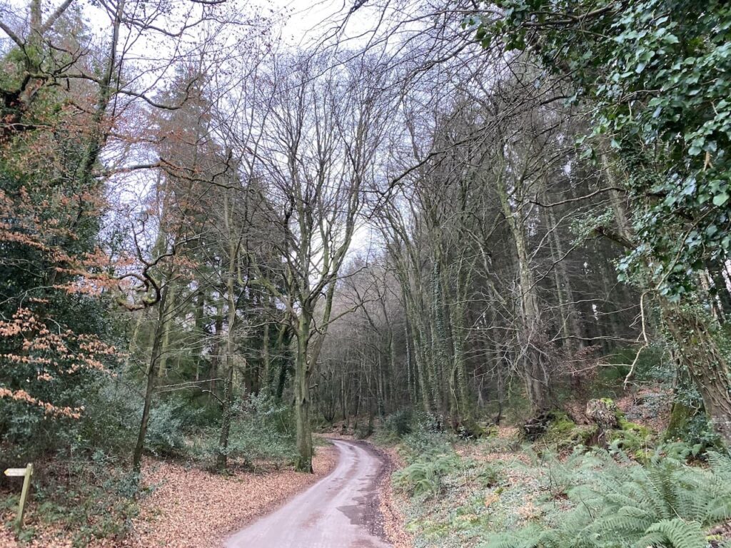
I am a frequent visitor to Minehead CAMC site so it doesn’t take long to set up and then I am lacing my boots up and heading out for a walk before it gets too dark. Leaving the site I turn left and walk uphill along the pavement beside the A39, Hopcott Road. On reaching The Hopcott I turn left to follow the narrow tarmac lane as it heads steadily uphill passing Higher Hopcott and then reaching woodland.
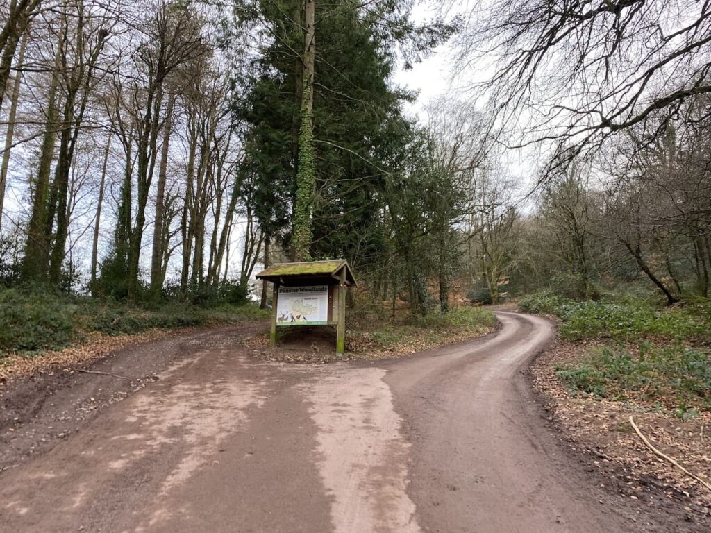
I ignore footpaths leading off from the road until I reach an information board for Dunster Woods.
I take the track to the left of the information board and continue uphill to what is usually a parking area but it is currently closed because of forestry work going on in the woods.
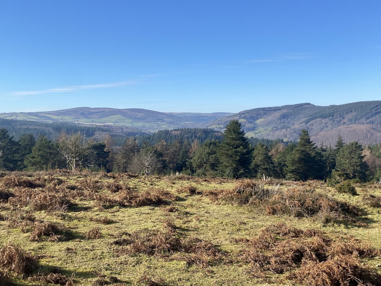
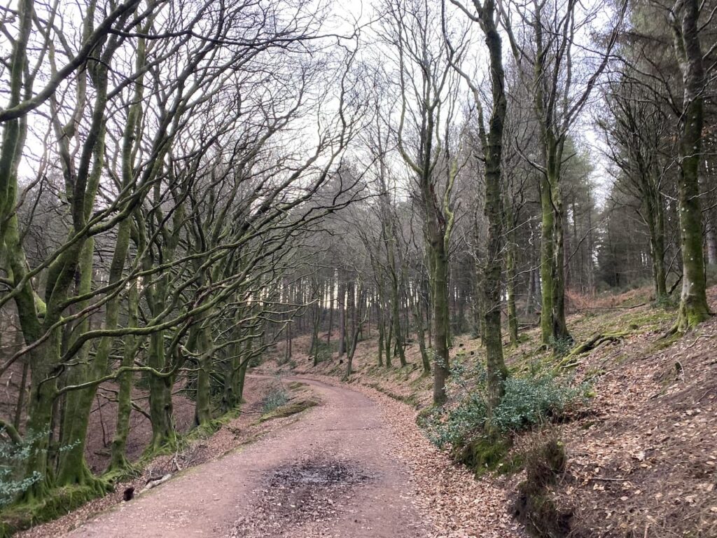
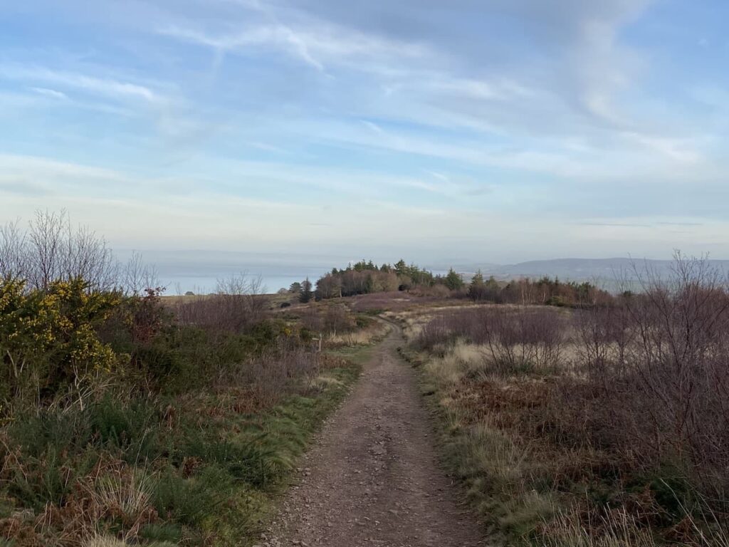
I keep with this track as it turns left and starts to descend into Long Combe. When I last walked here the track was surrounded by trees but now there are far reaching views.
Ignoring a footpath to the right I continue heading downhill on this steep track and I’m soon in an area where the trees have not been cleared.
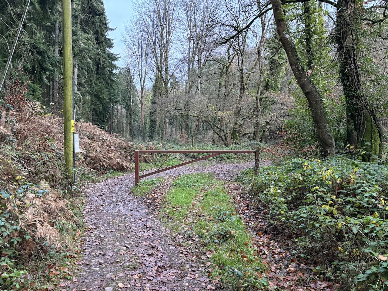
At a five way junction of tracks and paths I take the first footpath on the right and head downhill to the bottom of the combe and then turn left and pass a metal gate.
I now cross the stream running through the combe and follow a track heading towards Alcombe.
From here the route is very straightforward. The track soon becomes Manor Road and enters the outskirts of Alcombe. On reaching the Britannia Inn I turn left into Church Street.
Church Street leads to the A39 where I turn left and walk the short distance back to the caravan site. This little circuit has covered just over three and a half miles and has been a good stretch of the legs after my earlier journey. It is now time to plan my walking for the next couple of days.
All information on this site is provided free of charge and in good faith and no liability is accepted in respect of damage, loss or injury which might result from it. To the best of my knowledge the routes are entirely on public rights of way or within areas that are open for public access. Walking can be hazardous and is done entirely at your own risk. It is your responsibility to check your route and navigate using a map and compass.
After a cracking day’s walking yesterday I sat down with the map to plan my route for today. On recent visits to this site I have squeezed in a walk to include a stop at Dunster for a Cornish Pasty. I don’t usually buy pasties or pies whilst out walking, but the Lunchbox cafe close to the Dunster Exmoor National Park Centre serves great pasties.
There are numerous ways to walk to Dunster from the site and I have done many but I tried to find a new route. Eventually I spotted a couple of paths I couldn’t recall walking and I now have the route roughly sorted. I say roughly sorted because I rarely keep to a set route. If I see something interesting, or if the mood takes me, I deviate from a plotted circuit.
Today’s route is not the most direct to Dunster, but adding a couple of miles is no problem especially if it means exploring a new path in Dunster Woods. So on leaving the site I turn left and walk uphill along the pavement besides the A39, Hopcott Road. At the Hopcott I turn left to follow the narrow tarmac lane as it heads steadily uphill passing Higher Hopcott and reaching woodland.
I ignore footpaths leading off from the road until I reach an information board for Dunster Woods. Now I take the path to the left of the information board and keep straight on to pass another parking area. The path sweeps to the left and starts to descend into Long Combe.
I have walked around the top of Long Combe but never followed the path leading steadily down into the combe. It is a cracking spot to walk. Early in the descent I ignore two paths to the left. It is another cracking day and the sun is shining through the trees as I head towards a junction of paths.
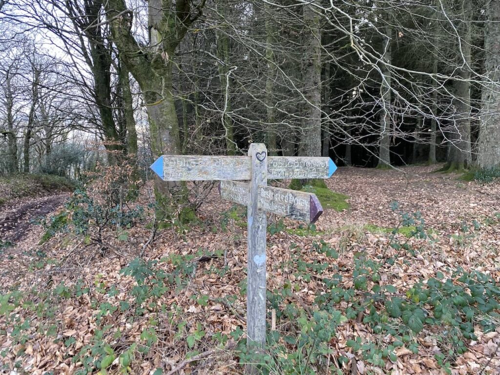
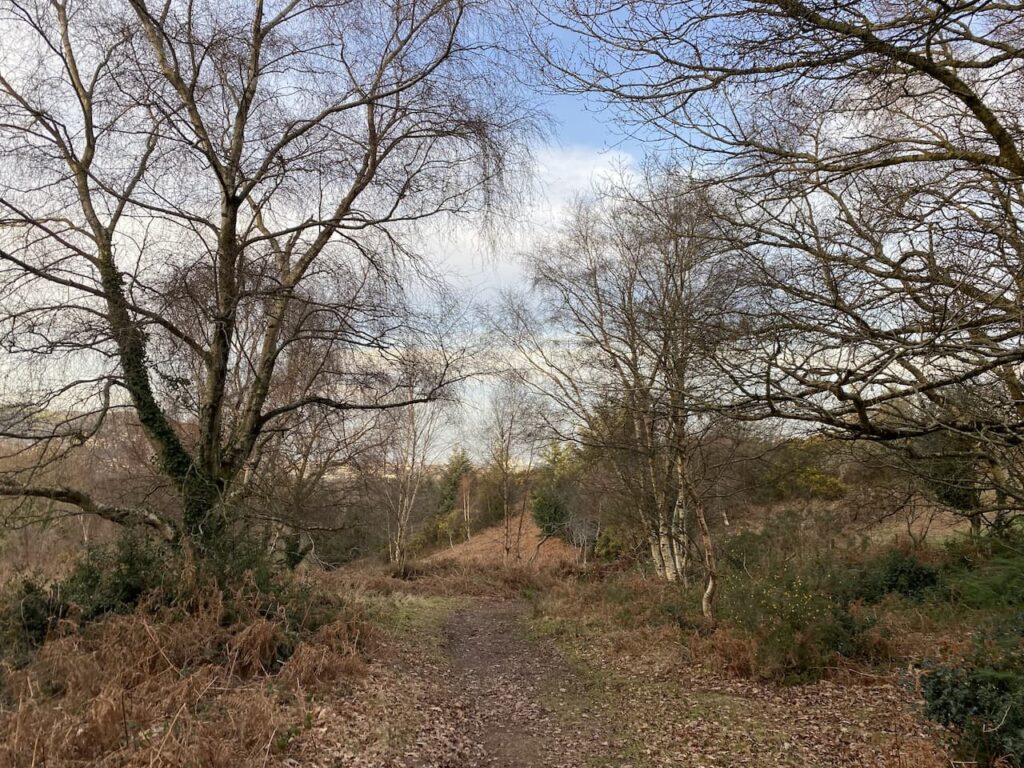
At the junction I turn right to descend steeply towards the stream running through the combe. The path joins another running through the bottom of the combe and I turn left and then after a couple of hundred yards take a footpath on the right going uphill and passing the entrance to the Youth Hostel. Very quickly I reach a way-marker showing the route of a bridleway to Alcombe Common. I take this path into woodland.
The path leads through the trees and shrub to pass the grounds of the Youth Hostel and then reaches a junction of paths where I follow the way-marked route towards Dunster.
This clear path was apparently the medieval route between Dunster and Alcombe, it goes in a south easterly direction and crosses a couple of other paths to reach a third crossing of paths. Here I go left on a path through a gate heading towards Dunster. I like walking tracks that have been used for centuries, it is amazing to imagine the people that have trodden this path in earlier times and the lives they led.
The path follows the fence line of a field. As I look back towards Minehead I can see mist rolling in from the sea.
After going through another gate the path descends through woodland to join a track which soon passes St Leonard’s Well. This medieval Holy Well is now housed in a 16th century well house. It is thought to have supplied water to a Benedictine priory that was located a bit further down this lane and was dissolved in 1539.
I now follow this lane downhill towards Dunster with views of the Quantock Hills in the distance.
On reaching a junction with a minor road I turn left and then within a few yards turn right at the Butter Cross. This trading post dates from the late 14th century and once stood in the High Street in Dunster. It was the centre for a market that traded local produce. It was originally taller and although the exact date of moving to this site is not known it is thought to have been in the late 1700’s or early 1800’s.
I follow the path, passing a community orchard. These local community initiatives are great ideas, not only growing produce, but also providing a community hub, thereby, tackling the issues related to social isolation.
At a minor road I continue straight on and follow this lane into Dunster arriving in the centre of the village close to the Yarn Market. My route is to the right, but I turn left and walk the short distance to pick up a pasty at the Lunchbox Cafe by the Exmoor Visitors Centre. In recent years this has been a regular stop on our walks through Dunster and Crosby makes it abundantly clear that he fully intends sharing my pasty!
We now head through the village to pass the octagonal Yarn Market Cross. This was originally built around 1609 by the Lutterall family, who were major landowners in the area, including Dunster Castle. As the name suggests the Yarn Market was predominantly used for trading cloth and wool. At the time Dunster was a major centre in the wool trade.
Keeping by the road I continue through the village to pass St George’s Church and reach The Foresters Arms where I turn left into Park Street and follow this lane to reach the Gallox Bridge. This grade 1 listed medieval packhorse bridge crosses the River Avill, at one time this was the main route into Dunster from the south. Its name derived from its proximity to the village gallows, which stood on nearby Gallox Hill.
After crossing the bridge I follow a path which heads steadily uphill in a south westerly direction. At a fork in the path I keep left, the path keeps going uphill now in a more southerly direction to reach a gate which I go through and follow a track up to Gallox Hill.
After going over the hill the path descends to a junction of tracks, here I go straight on to ascend the hill to the Iron Age Hillfort of Bat’s Castle. The ramparts of this hill fort are well preserved.
I am now on the route of the Macmillan Way West and I follow this over the hill towards Withycombe Hill Gate.
On reaching the tall deer proof gate I turn left to join a track, Park Lane, lined with beech trees.
As I descend towards Carhampton along Park Lane I am walking into the mist and the temperature drops significantly.
I stay with the lane as it bends to the right to head into the village of Carhampton where I turn left down the High Street to reach the A39. Here I turn right and cross the road at the traffic lights and then opposite the Butchers Arms I take a track on the left which passes the church.
Continuing down the lane I turn right at a footpath sign to walk along a field edge path.
I stay on the footpath across a stream. On the far side of the stream I cross fields towards the West Somerset Railway line.
I ago over a stile and then cross the railway line heeding the sign to “Stop, Look and Listen”.
On the far side of railway I join the coast path and turn left. This path soon becomes tarmac as it heads towards Dunster Beach.
After going through a large car parking area at Dunster Beach I keep on the coast path passing chalets.
This route is part of the West Somerset Coast Path, a twenty-five mile route from Steart to Minehead.
After passing the chalets the path continues with Minehead Golf Course to the left and the beach to the right. Once again the tide is out and there is a huge expanse of sand.
The path is easy to follow going beside the golf course to reach the car park next to the club house.
I now join the promenade and walk into Minehead. The earlier mist has cleared and there are stunning cloud formations.
From here I wander through the residential streets of Minehead to return to the caravan site.
All information on this site is provided free of charge and in good faith and no liability is accepted in respect of damage, loss or injury which might result from it. To the best of my knowledge the routes are entirely on public rights of way or within areas that are open for public access. Walking can be hazardous and is done entirely at your own risk. It is your responsibility to check your route and navigate using a map and compass.
The start of my 2023 walking year has been slightly hampered due to illness. Last October I went down with Covid and it laid me low for a couple of days. Then a few weeks later I caught a heavy cold which took a while to shake off. Given I avoided any colds or flu like bugs for a couple of years I had thought a couple of infections would build up my immunity.
However, in early January I picked up a flu like virus that knocked me out for the best part of three weeks. It was not Covid, but affected me far worse than when I did have it. Any plans of getting away for a few days walking were put on hold. Fortunately I am back to full health and consequently have booked a short trip to Minehead CAMC to do some walking on Exmoor.
Minehead is one of my favourite winter locations for a trip on my own, Lynnie is not so keen on winter caravanning and is happy for Crosby and I to disappear for a few days together.
It doesn’t take long to set up on site and then I am lacing the boots up and heading out. My stock walk when arriving on this site is a loop around the town to the harbour. But today the light is good enough for me to do a loop up around Hopcott and Alcombe Commons.
Leaving the site I turn left and walk uphill along the pavement beside the A39, Hopcott Road. On reaching The Hopcott I turn left to follow the narrow tarmac lane as it heads steadily uphill passing Higher Hopcott and then reaching woodland.
I ignore footpaths leading off from the road until I reach an information board for Dunster Woods.
I take the uphill path to the right of the information board on the route of the Macmillan Way West. I ignore a path on the right soon after leaving the car park and then where the Macmillan Way meets a crossing of tracks I continue straight on, staying on the route of the long distance path. The path now goes around the head of Long Combe, this is a cracking spot with stunning Beech trees lining the path.
Leaving the trees the path continues through a section of open land with dead bracken and gorse. On reaching a junction of tracks I turn left heading towards Dunster.
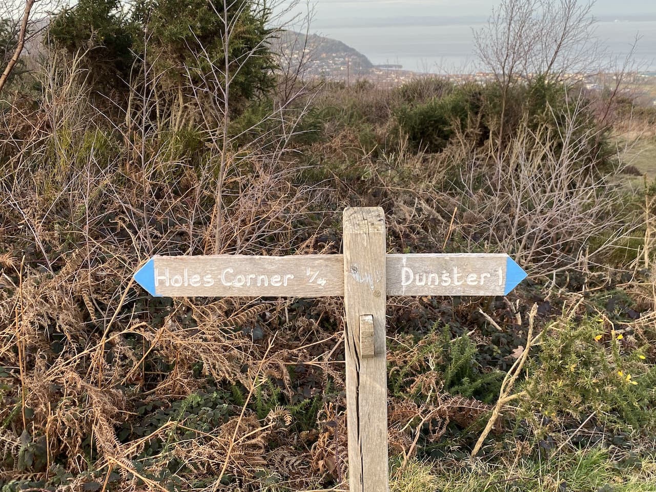
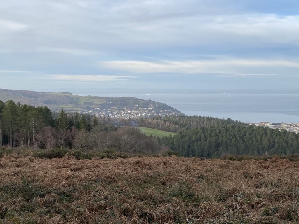
I now stay with this track heading east to reach Holes Corner. Out to my left are views of Minehead and over the Bristol Channel to the South Wales coast.
At Holes Corner there is a convergence of tracks and paths. I take the broad track heading east towards trees in the distance. This route is signposted towards Dunster.
I ignore a couple of footpaths leading off to the left and stay with the track I am on until I reach trees, here I turn left to reach a crossing of paths where I turn left again to take a path heading towards Alcombe.
The path steadily descends through an area of gorse and at every junction I follow the way-markers to Alcombe.
At a junction of paths close to the Youth Hostel I turn right on the path which is signed to Alcombe. This descends steadily to reach a tarmac lane where I turn right and follow it into Alcombe.
At the junction by the Britannia Inn I turn left into Church Street and then on reaching the main A39 turn left and walk on the pavement back to the caravan site.
This little circuit has covered just over four and a half miles and has been a good stretch of the legs after my earlier journey. It is now time to plan my walking for the next couple of days.
All information on this site is provided free of charge and in good faith and no liability is accepted in respect of damage, loss or injury which might result from it. To the best of my knowledge the routes are entirely on public rights of way or within areas that are open for public access. Walking can be hazardous and is done entirely at your own risk. It is your responsibility to check your route and navigate using a map and compass.
No sooner than we arrived home from our Settle trip I am off again. This time I am heading back to Minehead for a few days walking on Exmoor with Crosby. Lynnie has declined joining me, I am not sure if it is the prospect of walking on the moor in December or the fact I have started a cold and she thinks it a good idea to keep well away from me.
I have become a frequent winter visitor to the Caravan and Motorhome Club site in Minehead. It is perfectly placed for easy access to walking routes and being just on the edge of the town makes it easy to get supplies. The layout of the site means it never feels busy and with easy access it ticks all the boxes for a solo trip. By the time I set up yesterday it was well into the afternoon but there was sufficient light for Crosby and I to stretch our legs by wandering down to the harbour.
Today’s walk is from the site and will be a variation of a walk I have done a few times. On leaving the site I turn left and walk uphill along the pavement besides the A39, Hopcott Road. On reaching the Hopcott I turn left to follow the narrow tarmac lane as it heads steadily uphill passing Higher Hopcott and reaching woodland.
I ignore footpaths leading off from the road until I reach an information board for Dunster Woods.
Now I take the path to the right of the information board on the route of the Macmillan Way West heading uphill. I ignore a path on the right soon after leaving the car park and then where the Macmillan Way meets a crossing of tracks I continue straight on, staying on the route of the long distance path. The path now goes around the head of Long Combe, this is a cracking spot with stunning Beech trees lining the path.
Leaving the trees the path continues through a section of open land with dead bracken and gorse.
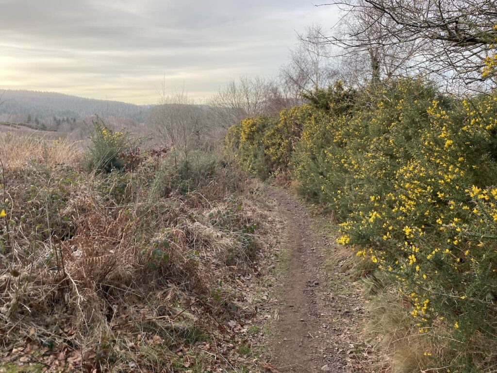
On reaching a junction of tracks I turn right still on the route of the Macmillan Way West heading towards Tivington across the top of Hopcott Common. At a fork in the track I go left to keep with the Macmillan Way West. There are good views from here back along the coastline towards Blue Anchor.
I continue to head west to reach another crossing of paths. Here the Macmillan Way turns left towards Wootton Courtney, however, I keep going straight ahead soon reaching an Ordnance Survey trig point tucked to the left of the track on a high bank. This trig on Periton Hill is one I have bagged a number of times.
At the next crossing of footpaths I continue straight on.
At the next junction of paths I follow the way-marker towards Headon Cross and soon pass a National Trust plaque and enter Holnicote Estate. Within a short distance the track forks and I go right continuing towards Headon Cross with the path leading through the attractive woodland of Tivington Common.
The sun is out and there is a clear sky. Ideal conditions for a walk in December. The path I am on initially descends gradually, but as I near Headon Cross there is a short steep descent to reach a minor road. Turning right on the road I reach Headon Cross and go straight over to take another minor road opposite. This climbs steadily, as the road sweeps to the right I continue straight on along a track towards East Lynch.
Approaching East Lynch farm I take a footpath on the right that runs behind a fine old barn. I stay on the wide grassy track as it passes farm cottages, ignoring a footpath on the left and continuing uphill.
I reach a minor road at Deans Cross and turn left following the road downhill into Selworthy where I stop on one of the many benches in the churchyard and admire the view whilst I have my lunch.
Resuming my walk I continue through the village and pass the Tithe Barn which has a plaque commemorating the wanderings of Walter Wilkinson with his peep show. Many years ago Lynnie gave me a copy of Walter’s “Peep Show” book. It is a great insight into a way of life long passed.
I continue through the village and then fork right on a footpath that leads through Selworthy Farm with its range of old barns and then continue along a track. When I was here in February the hedge besides this path had recently been laid and looked a bit of an eyesore. Now ten months later nature has taken its course and the casual observer would not even know of the work to the hedgerow.
As I go downhill I pause to take in the view. There was a time when I constantly glanced at my watch to ensure I was maintaining a decent pace. These days I like to pause and look occasionally. I still walk pretty fast but I have learnt to stop from time to time and take it all in.
The track leads to the outskirts of Higher Allerford where I go straight on along a narrow lane leading to Allerford via a packhorse bridge besides a ford. The bridge is thought to be medieval, though work to enlarge the bridge was undertaken in 1886.
After crossing the bridge I turn right to walk through this attractive village passing the old Post Office with its King George VI postbox.
Soon I reach a footpath along a track which passes Stoates Farm and goes through a gate to reach a footbridge over the river. On the far side of the bridge I turn left and take a footpath towards West Lynch this initially follows the river.
The path soon starts to ascend into the woods.
At a crossing of paths I take the route signposted towards Hurlstone Point, the path continues to steadily ascend through trees. The path leads to a wooden gate and a crossing of paths at Lynch Combe. There is an information board explaining the work that has been done by National Trust volunteers to restore the stone walls in the Selworthy and Cockerhill section of the Holnicote Estate. The walls are at least 200 years old and there are some fine examples in this Combe.
On previous visits I have turned right here and walked up the hill, but today I go straight over to follow the path towards Hurlstone Point. This path leads through stunning section of trees.
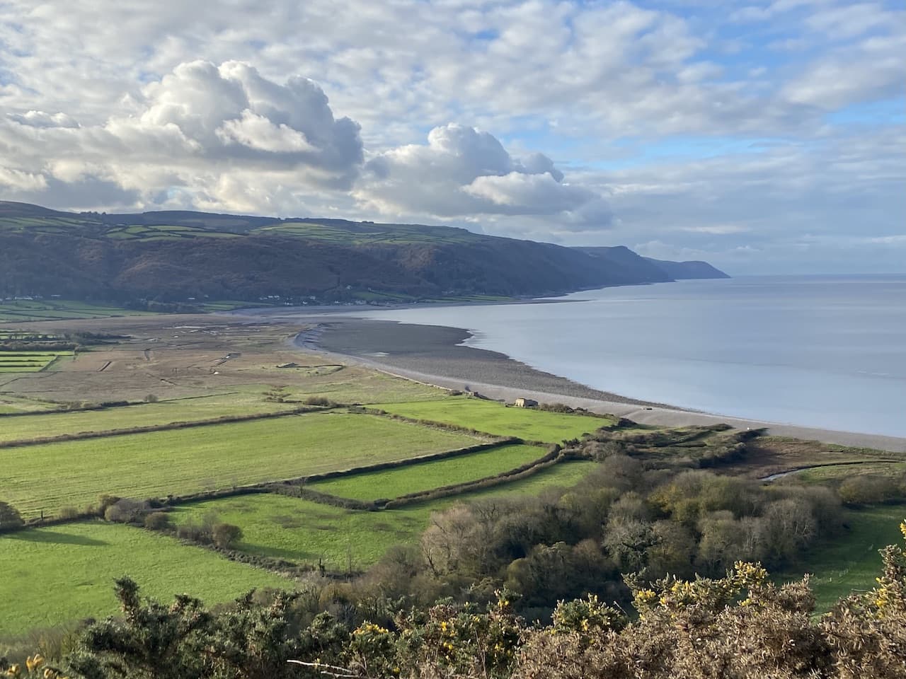
The path follows the contour line around Bossington Hill and opens out to provide cracking views over Bossington and Porlock Beaches.
The path now opens out as it heads toward Hurlstone Point.
At a fingerpost I turn right on a path to Minehead.
This path goes uphill, when I say uphill I mean seriously uphill. Bossington Hill is a stiff ascent.
The first time I walked up here I thought I would do it in one go and today I try to repeat the challenge. But my cold is taking a toll on my lungs and I decide it is sensible to take a breather and admire the view back towards the coast.
I am now on the route of the South West Coastal Path and I follow this uphill. There are a number of options but I choose a broad path heading towards Selwothy Beacon. Close to the path are cattle and I meet a lady walking her dog who is anxious going through the cows. I offer to walk with her and we spend the next fifteen minutes chatting. I really enjoy such encounters I always learn something about others’ lives; this person, like me, feels the need to get out every day for a walk to get away from the pressures of modern life.
We walk together to Selworthy Beacon where we wish each other well and part company.
From the Beacon I follow a track heading east across North Hill. There are a number of paths up here but I know as long as I head east and keep the minor road somewhere to my right I will be fine.
The track leads towards a parking area and soon after passing through it I take a path on the left. This heads north and rejoins the South West Coast path where I turn right and soon go through a gate into an area of pasture.
The path continues close to the road to reach another gate, now I keep going east to reach another parking area and then keep going to pass some Exmoor ponies.
On reaching another car park close to woodland I have a choice of routes to take to get to Minehead. I go to the left and then take a path that goes east through the trees and passes concrete bases that housed Nissen huts during World War II. Apparently the American Forces had a NAAFI in one of the huts on this hill.
I continue on this path until I reach a fork in the path, here I go to the left and descend towards a gate and then continue on the path going steadily downhill.
There are multiple paths in the trees that descend towards the seafront. I stay with one that goes straight on to reach a tarmac lane where I turn left, soon joining the Zig Zag path going steadily downward.
At the bottom of the path I turn left and pass cottages to reach the seafront by the sculpture marking the start, or end, of the south west coast path.
It is a cracking evening and I stop on the seawall to watch the moonrise.
From here it is a wander through the streets of Minehead to get back to the caravan site for a well-deserved cup of tea and a sit down to plan were I will walk tomorrow.
All information on this site is provided free of charge and in good faith and no liability is accepted in respect of damage, loss or injury which might result from it. To the best of my knowledge the routes are entirely on public rights of way or within areas that are open for public access. Walking can be hazardous and is done entirely at your own risk. It is your responsibility to check your route and navigate using a map and compass.