Lynnie has suggested that today I should take it easier having completed the clockwise route of the Three Peaks yesterday. I am broadly in agreement, but have in mind that I am nearing reaching 2,021 “boots on” miles in 2021 and want to make sure I achieve the target somewhere memorable.
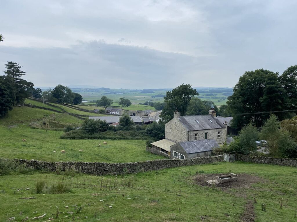
One of Lynnie’s favourite spots in this area is Winskill Stones, it is a place we visit on every journey. The last time we went there we did a short circuit from Langclffe because Dexter was getting too old to walk far. Today we are going to walk from the caravan. Leaving Brigholme Farm CL we turn right and head into Settle and leave the centre of town via Constitution Hill and then continue along the tarmac narrow lane towards Langcliffe.
At the end of the lane we turn right and follow the pavement besides the B6479 for a short distance to reach Main Street where we turn right and wander into Langcliffe.
We have visited Langcliffe many times but I do not recall wandering around the green so we head across to the former Wesleyan Chapel. This was built in 1903 as an extension to the next door Sunday school which was built in 1852. The chapel and school building were converted into a private house in 2001.
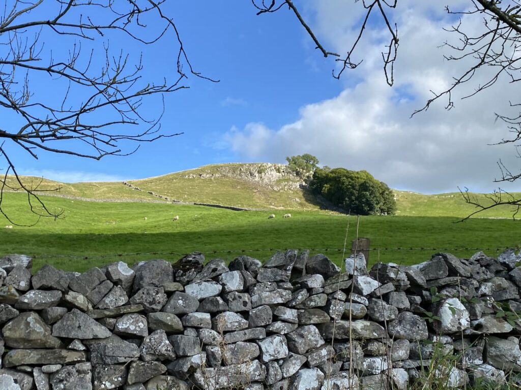
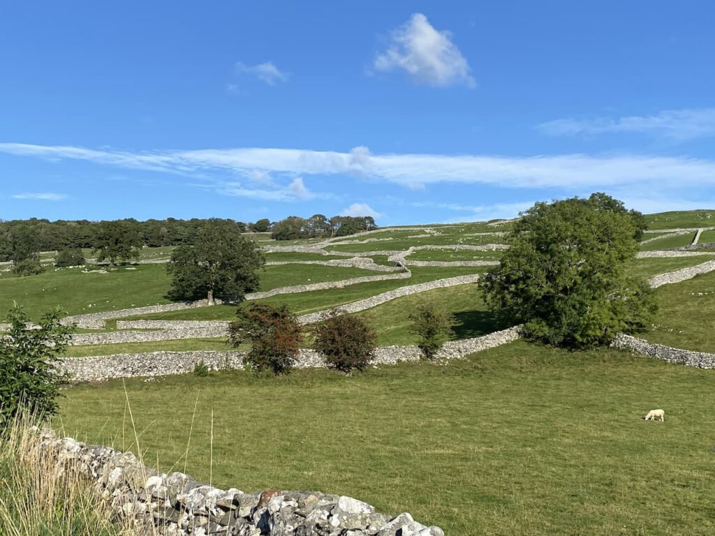
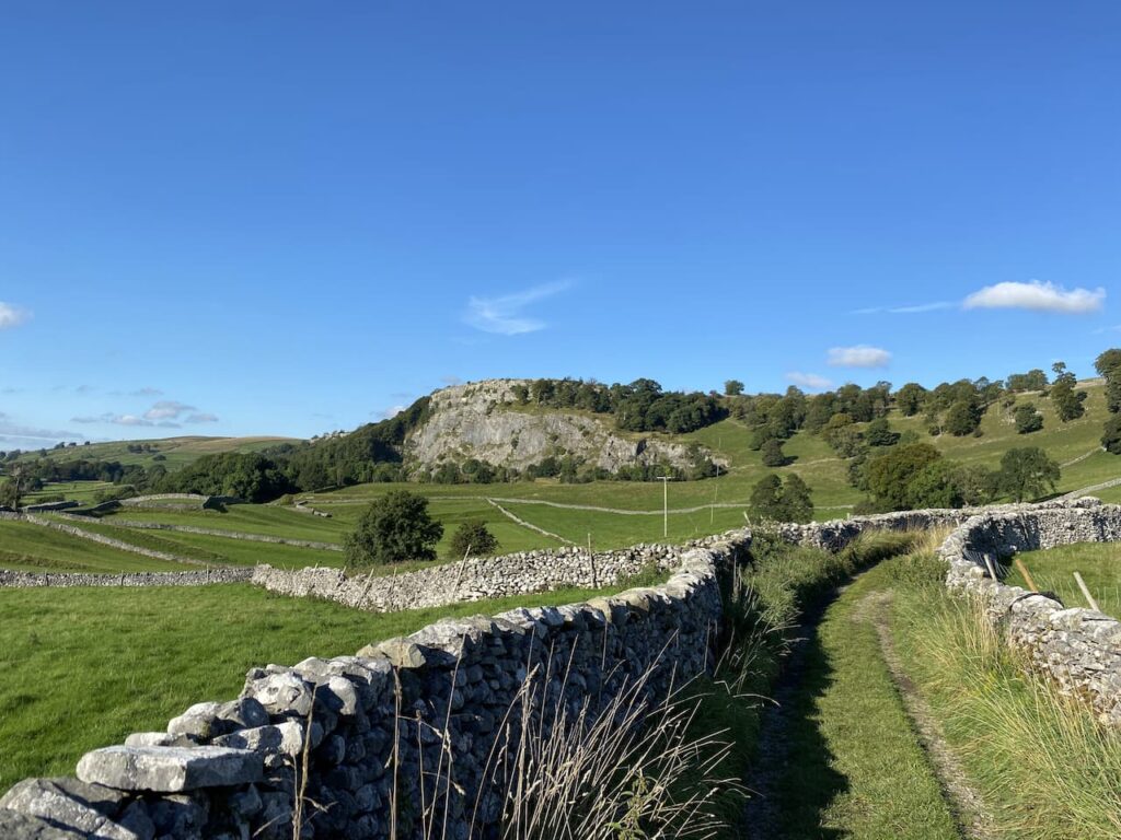
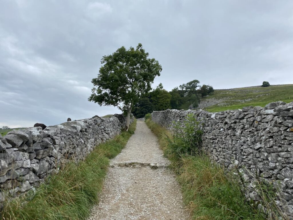
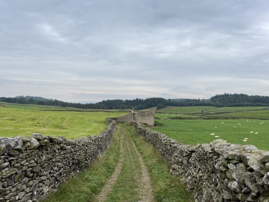
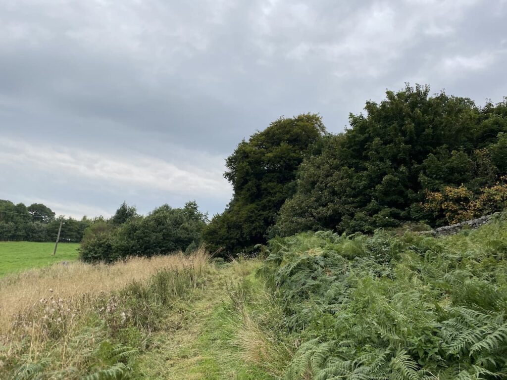
We continue around the green to pass the entrance to the church and then cross the road and go through a car park besides the former school and join Pike Lane and then continue along a walled track lane. The fields on either side of the track are a stunning patchwork of dry stone walls.
The path continues heading north towards the former Langcliffe Quarry. Reaching a gate we meet another walker, she is unsure of the route she needs to reach Stainforth. I explain the two options and she chooses to walk with us for a while until she reaches the path down to Stainforth.
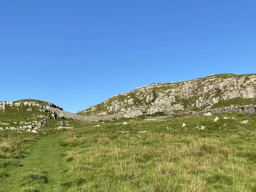
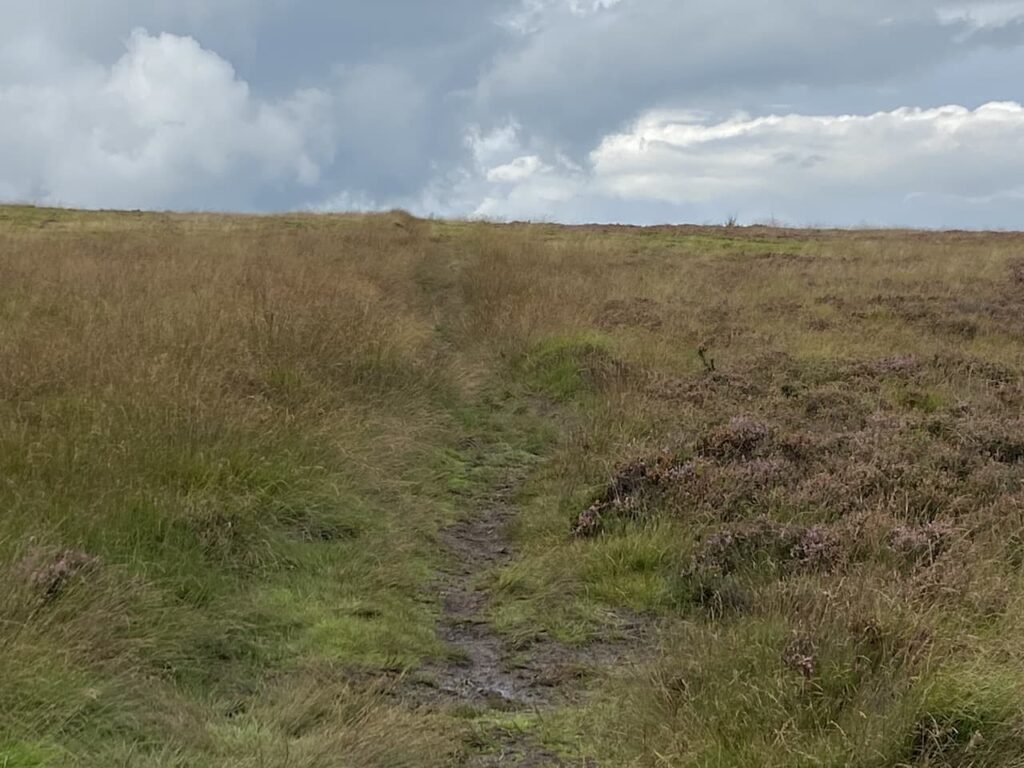
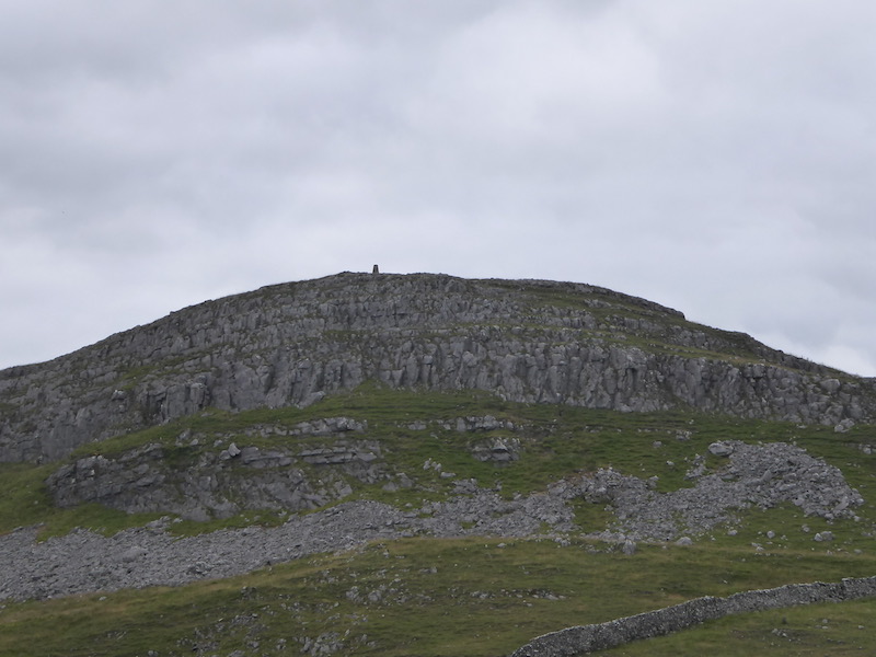
Through the gate we enter a field of pasture and follow the path as it runs close to the wall and then starts to climb besides the quarry. It is a short steep ascent to reach pasture land. In the Spring this is an abundance of wild flowers. After going through a wall gate we turn right on the track and head up to Upper Winskill passing through a gate besides a cattle grid. Now we continue on the path with a wall on our left. There are cracking views of Peny-Ghent from here.
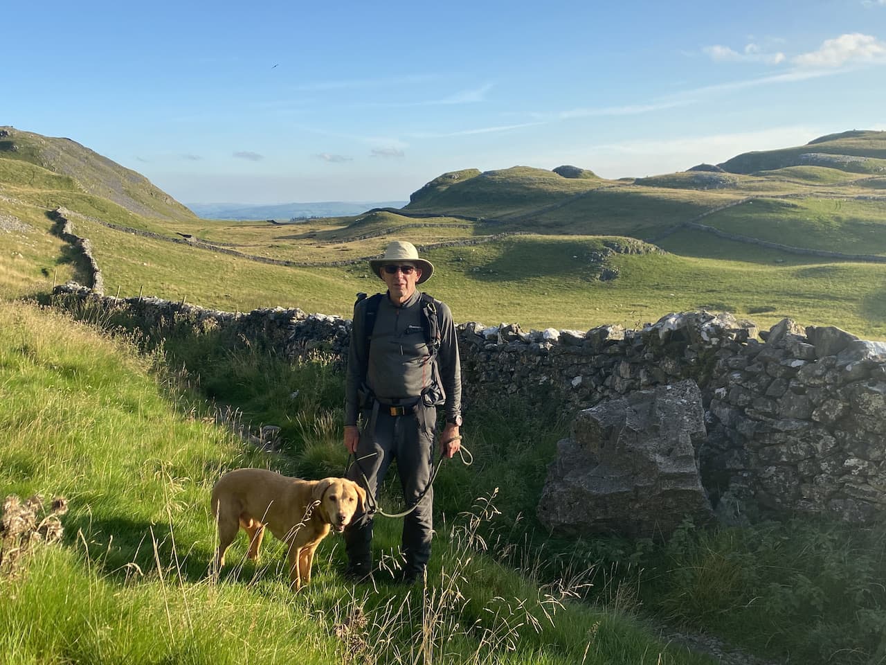
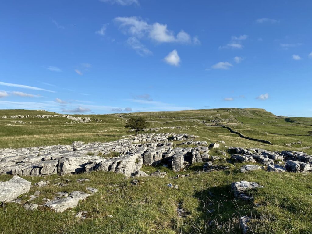
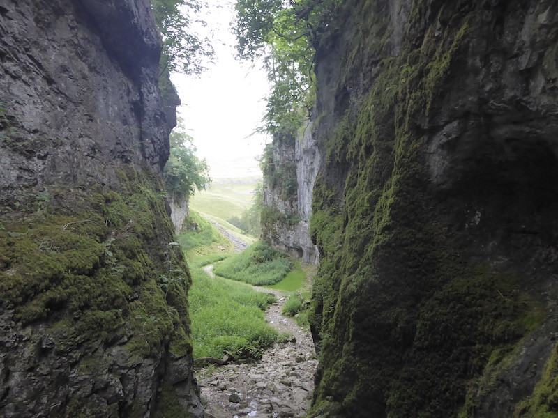
At this point we bid farewell to our fellow walker. We turn right heading across the access land towards Winskill Stones. The limestone pavement around here is stunning, but sadly there is not as much as there once was. For some reason, probably greed, it was thought a good idea to dig up the limestone for people’s rockeries. The gardener Geoff Hamilton campaigned against this and after his death in 1996 the charity Plantlife was able to buy and safeguard the area for future generations.
After looking at a section of limestone pavement we join a farm driveway and follow this to reach a minor road.
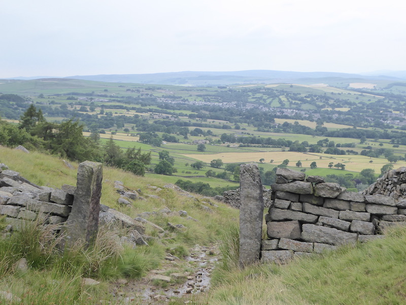
We turn right soon passing a cattle grid and within a hundred yards take a grassy track on the left leading across access land to a gate in the wall. We continue heading south across the access land on a grassy track to reach a stony track.
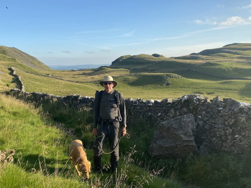
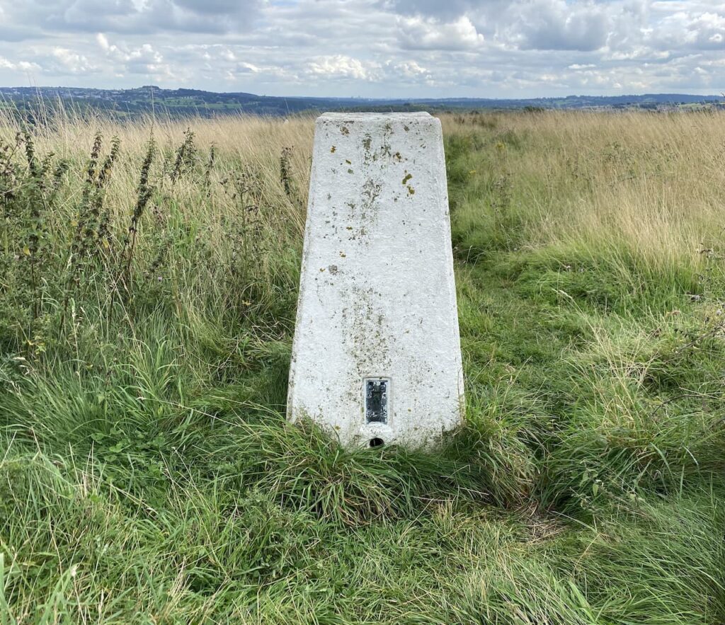
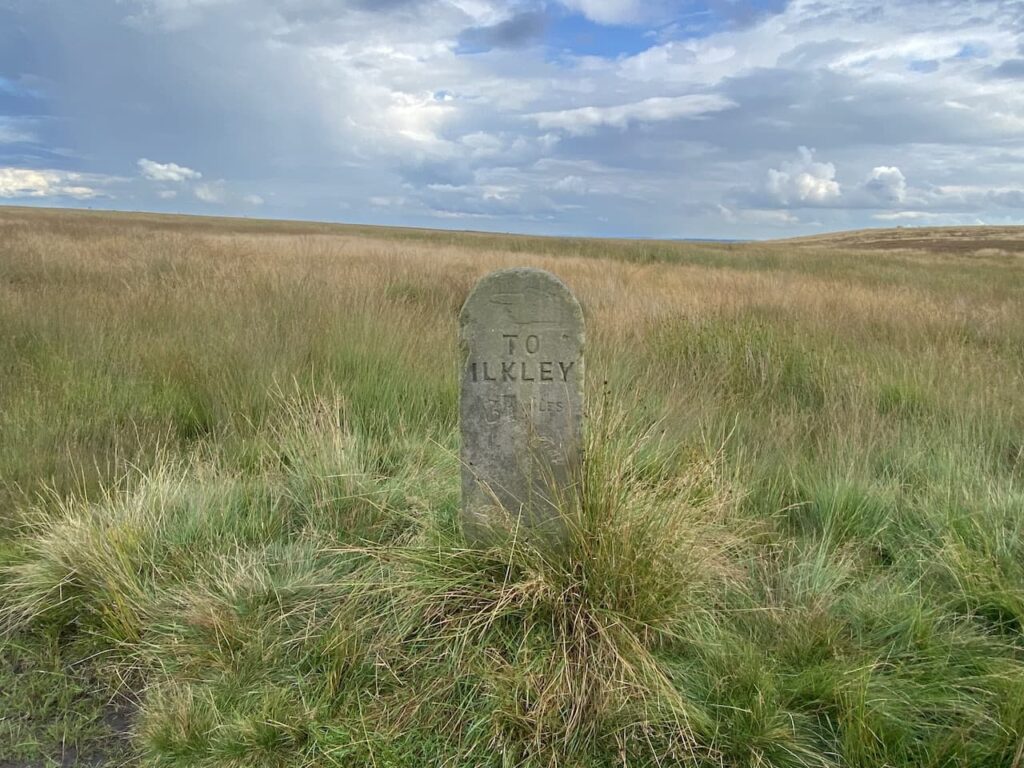
Here we turn left and go up to a gate then almost immediately turn right through a kissing gate and follow the path besides a drystone wall. To our left is Brent Scar and as we reach the path leading up to Victoria Cave I reach the point where I have walked 2,021 “boots on” miles in 2021.
This is the earliest I have reached my walking target, last year I achieved the target on 16th October and the two previous year it was in November. Lynnie suggests I ease up on the walking now with no need to keep notching up miles. It is an interesting idea but I want to walk further this year than last when I clocked up 2,542 miles.
We continue besides the drystone wall to another kissing gate. The path now goes across a field below Attermire Scar to a gate in the wall.
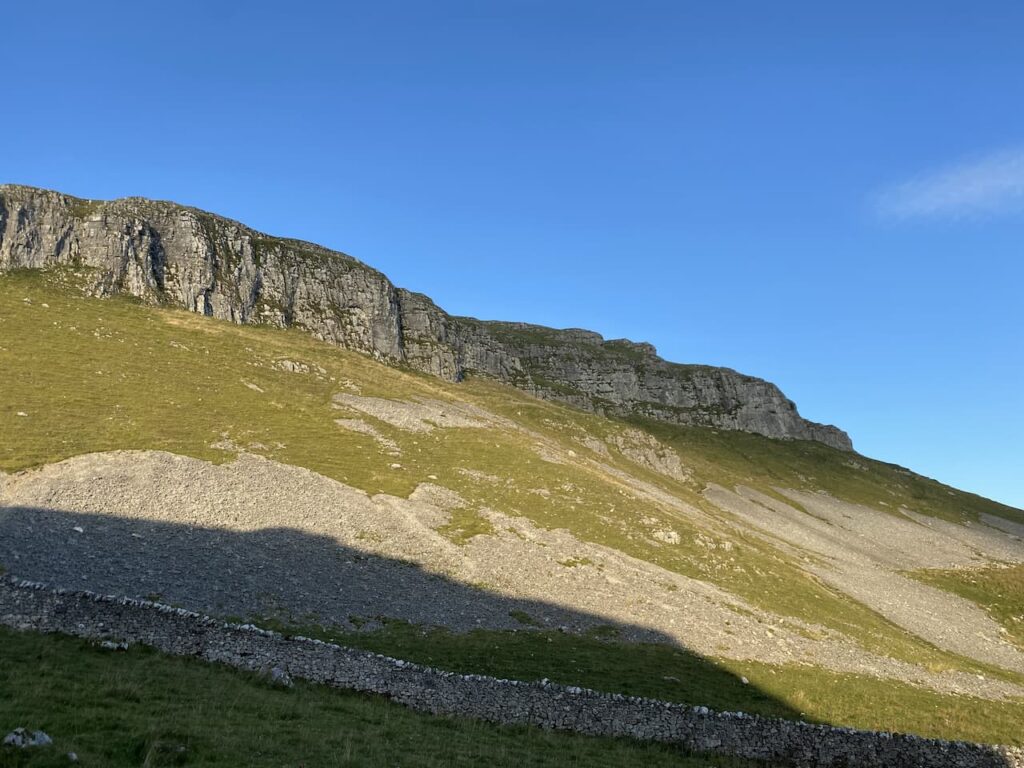
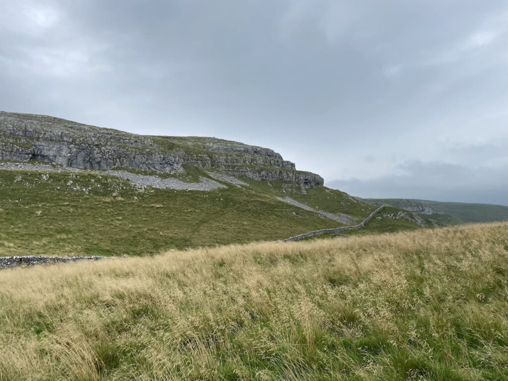
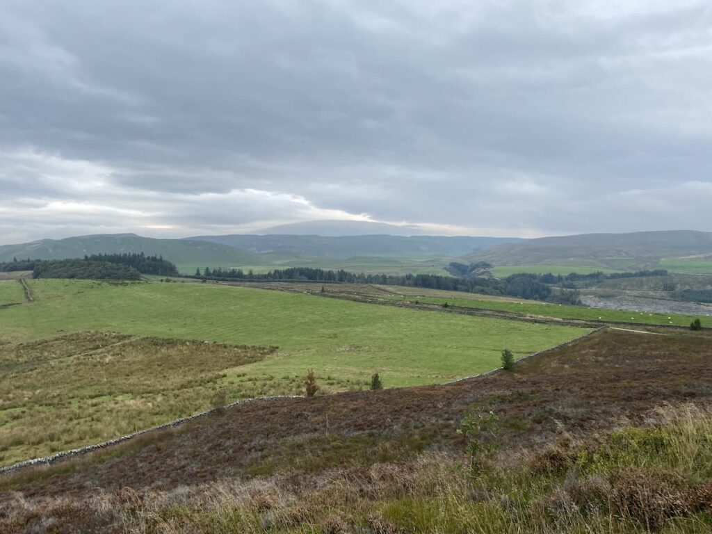
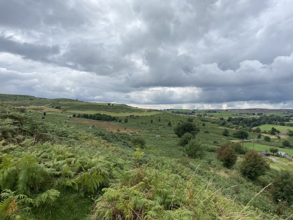
Through the gate we continue downhill through limestone outcrops and then turn right to follow the route of the Dales High Way heading west. There are cattle spread about in these fields and we are very conscious of avoiding getting between any cow and her calf. We are now below the impressive scar of Warrendale Knotts.
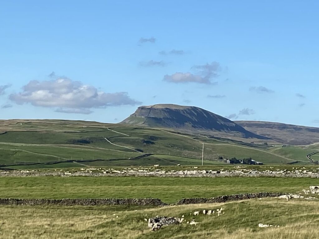
After going through a gate we start to descend steeply. The views are stunning. It is so clear we can see for miles with Ingleborough standing out in the distance.
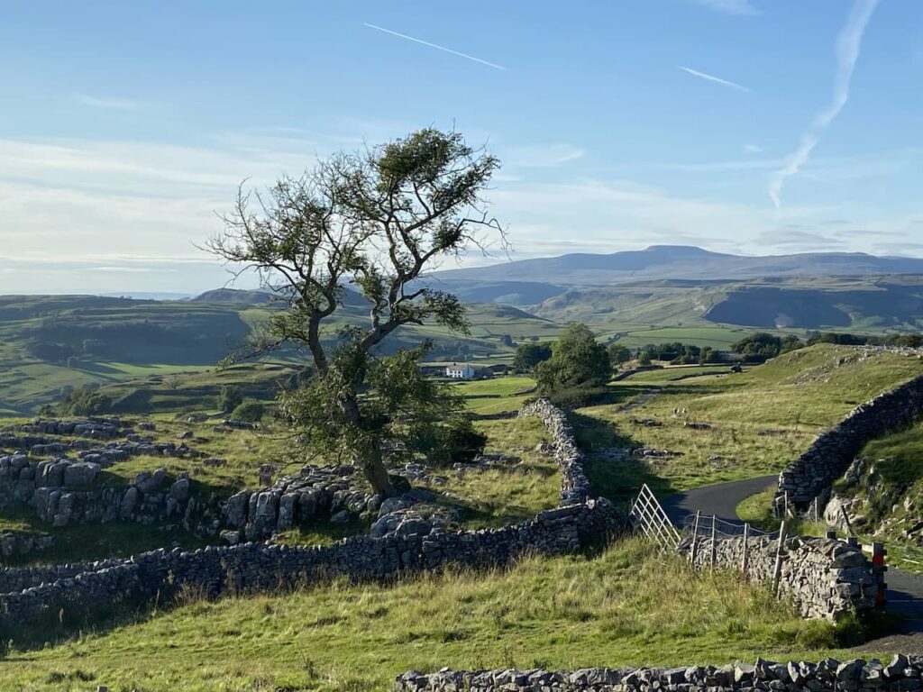
We keep heading downhill on the steep grassy path and then veer to the left to pick up a walled track heading back towards Settle.
We arrive back in Settle at the Market Square and then head back to Brigholme Farm CL. It has been a cracking walk on a stunning day. Since losing Dexter we have revisited many places we had taken him but being at Winskill Stones without him was particularly sad.
As it is a milestone day reaching 2,021 miles we decide to pop along the road to the Craven Arms and enjoy a couple of pints of excellent ale from the Bowland Brewery.
All information on this site is provided free of charge and in good faith and no liability is accepted in respect of damage, loss or injury which might result from it. To the best of my knowledge the routes are entirely on public rights of way or within areas that are open for public access. Walking can be hazardous and is done entirely at your own risk. It is your responsibility to check your route and navigate using a map and compass.
On our last trip to Giggleswick I did a walk that took me to nearby Long Preston and on the way I bagged a trig point at Hunter Bark. Before setting off on this trip Lynnie requested, even though we have not been here for almost two years, we did some new walks whilst staying at Brigholme Farm. So I have planned a route taking in a couple of familiar spots but also walking paths we have not previously covered.
We leave Brigholme Farm by turning right and heading into Settle. On reaching the market square we leave the town via Constitution Hill and follow the road until it reaches the wide footpath that continues steeply upwards between two dry stone walls.
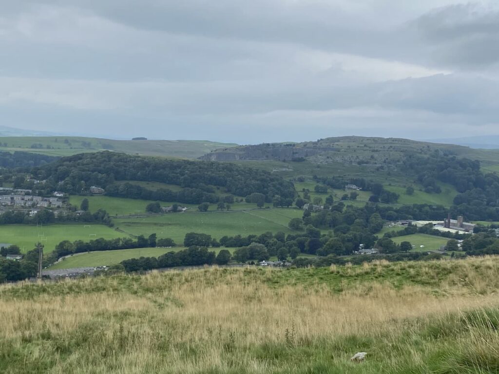
Through the gate at the top of the track we soon veer right to continue even more steeply uphill. As we climb we stop to admire the views back behind us. To the left is Settle and Giggleswick and to the right in the foreground is Langcliffe High Mill.
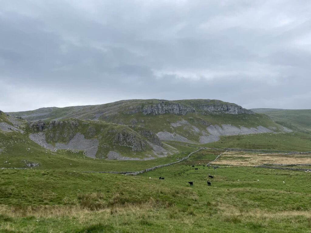
We are now on the route of the Dales High Way and follow the well-worn grass path to reach a gate. We go through and continue along the path with the impressive looking Warrendale Knotts on our left.
The scenery here is stunning and it gets even better as we go over the brow of a hill and head towards Attermire Scar.
On reaching a junction of footpaths we go right and head uphill to skirt the side of Sugar Loaf Hill and then as we head towards a gate stop to look at an Old Lime Kiln. These kilns are part of agricultural history, the lime was burnt and then spread on the fields as a fertiliser. If you look carefully you can frequently spot these features on farmland around the Dales.
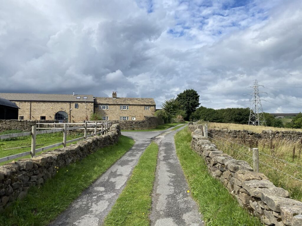
We reach a ladder stile and cross to join Stockdale Lane and continue along this track to reach High Hill Lane where we turn right and then very soon left into Lambert Lane. This is a cracking walled track which soon passes Preston’s Barn.
We are now on the route of the Pennine Bridleway and we stay with this by turning left at a junction of Lambert Lane and Mitchell Lane. This broad track leads us past Black’s Plantation, we stay left at a fork in the track to stay on the Pennine Bridleway heading south. As the track reaches the access land of Hunter Bark we detour right to follow a path which leads uphill around the disused quarries. There are cracking views from the top of the hill.
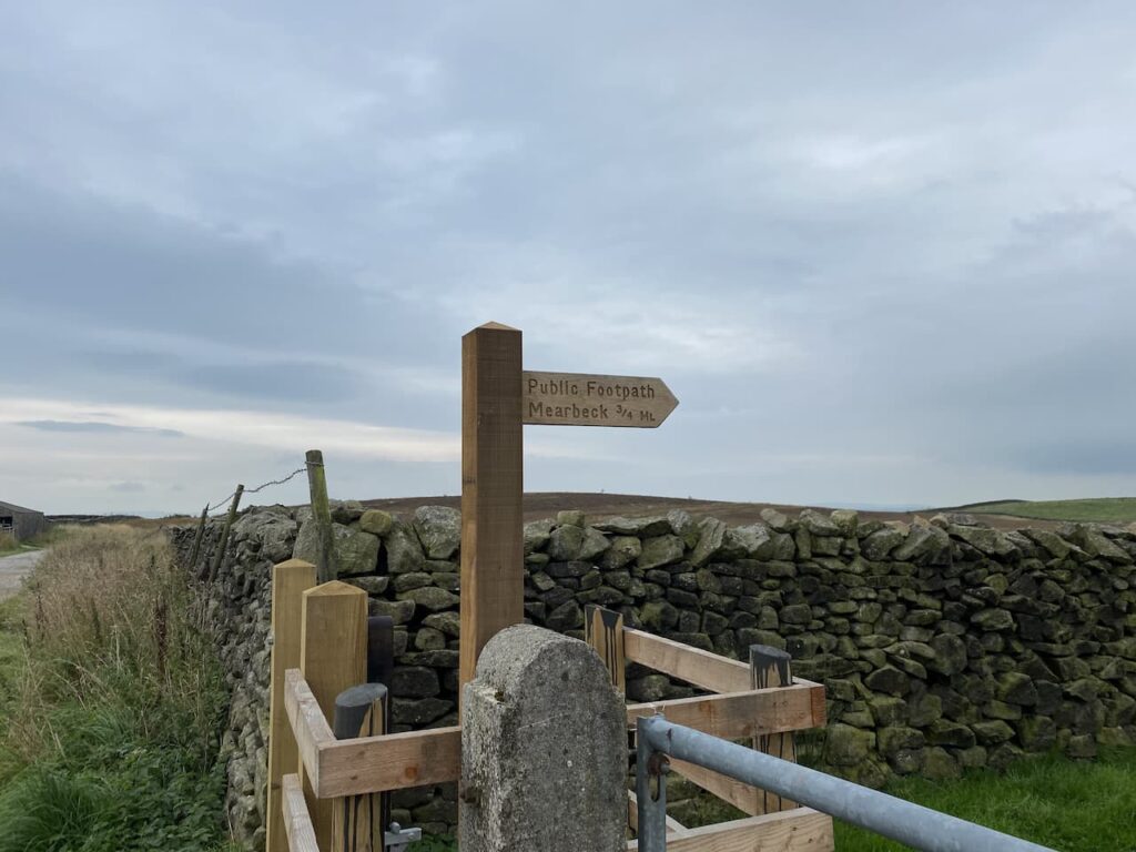
We follow the path as it descends to rejoin the track and continue past a fenced section of access land to reach a newly installed kissing gate with a footpath signposted to Mearbeck.
The footpath leads along the edge of the field; however we take a detour over the open access land to head up a grassy track to reach the summit of the hill in order to bag the Hunter Bark trig pillar. I have been here before but it is a new one for Lynnie.
From the trig we head to the south west corner of the access land and rejoin the footpath. After going through a gate this route continues across fields of pasture towards High Mearbeck Farm.
At the farm the farmer points us in the direction of the path we need to head back towards Settle. This way-marked path goes to the right passing a cottage and heading north to Mearbeck Wood. In the woods at a fork in the footpath we go right keeping close to a boundary wall and the top of the wood.
As the path emerges from the trees it descends steeply to a field of pasture and then goes through a wall gate to reach Cleatop Wood. This area is owned by the Woodland Trust.
The clear path leads us to a field of pasture, here we follow the path along the edge keeping a wall on our right had side. We then cross two further fields to reach the farm track to Lodge Farm. We cross this track and join Brockhole Lane and follow this back towards Settle.
Nearing Settle we pass allotments and then reach a road, we turn left then at the junction with Ingfield Lane we go left and then continue on to a crossroads where go straight over and then follow the road back towards Brigholme Farm CL. Our walk has covered eight and a half miles and ticked the box for being a new walk for us in this area. Tomorrow I have plans to walk a more familiar route and head up Ingleborough, but I will have to break the news to Lynnie gently.
All information on this site is provided free of charge and in good faith and no liability is accepted in respect of damage, loss or injury which might result from it. To the best of my knowledge the routes are entirely on public rights of way or within areas that are open for public access. Walking can be hazardous and is done entirely at your own risk. It is your responsibility to check your route and navigate using a map and compass.
Whilst scanning the map yesterday evening I spotted the Ordnance Survey Trig Pillar on Skipton Moor, it is one I have not bagged and it can be reached from our pitch at Hall Croft CL. I invite Lynnie to join me, but seemingly the prospect of a 16 mile walk does not hold much attraction, especially when the alternative is to wander into Ilkley for a mooch about.
I leave Hall Croft CL by crossing the entrance driveway to join the footpath running between a fence and hedge.
At a junction of paths close to the River Wharfe I turn left and follow the Dales Way beside the river through a meadow. On the opposite side of the river is Ilkley Golf Course and being a Saturday morning there are plenty of people out for a round.
On reaching Ilkley Road I turn right along the pavement, still on the Dales Way and follow the footpath sign to Addingham. The path follows along the pavement to a junction with Old Lane, I continue on the Ilkley Road to the outskirts of Addingham. I cross Church Street and continue into the village along Main Street. Soon I pass the village cricket pitch, where players and officials are arriving for the start of the afternoon’s fixture.
Cricket is big in this part of the world and Addingham CC has a long history dating back to 1870. The Club’s website lists the overseas players that have represented them. This is a strange concept to me, when I played village cricket almost the whole team were either born or currently lived in two local villages. It never crossed our minds to look much further afield and when we had a couple of players join from Salisbury, seven miles away, it was considered adventurous!
Addingham is an attractive place, I first came here in the late 1970’s and have happy memories of staying with friends in the village. My route goes up through the village along Main Street and on reaching the Craven Heifer pub I fork left onto Silsden Road soon passing the old village poorhouse. It was built in 1686 and inhabited until around 1910. It was later used as a venue for the village band to practice and after falling derelict it was fully refurbished in 2009.
I follow the Silsden Road through allotments on either side of the road. Then just after passing a bus stop I take a footpath on the right along the Dales High Way into a recreational playing field. The path heads to the north west corner of the playing field into Turner Lane where I turn right, staying with this road to reach Moor Lane where I turn left. This lane heads uphill towards the A65. To my right there are good views of Beamsley Moor.
I cross the A65 with care and then continue on the Dales High Way now on Crossbank Lane.
The lane continues as a tarmac road heading steadily uphill towards the moor, I soon pass a farm with an interesting water tower and buildings.
It is a long steady ascent along this road, as it is a dead end I encounter no traffic and the surrounding views are cracking. I pass through a gate still on the Dales High Way that is now a track heading towards the moor.
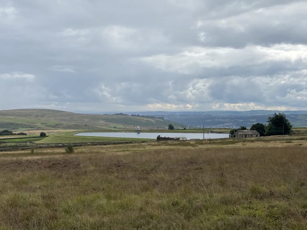
After going through another gate I enter a field of sheep and from here I get a good view of the Chelker Reservoir. It was built in 1866 to provide water to homes in Bradford. I have driven by it on the A65 but the view is better from up here.
After going through another gate the route of the Dales High Way follows a track besides a dry stone wall on the edge of Draughton Moor. Stone walls are not a feature of my walking at home in Wiltshire and I am always impressed with the craftsmanship that goes into constructing these walls that stand for so many year. The physical challenge of erecting some of the gate posts must have been immense.
Further along I see an old boundary stone inscribed ‘JC’, this provides a convenient spot to perch and take in the view. Later research proved it impossible to identify the source of the JC and I found I was not alone. In 1959 writing in the Ilkley Gazette, Alan Shackleton, who appeared to be a local historian, outlined the research he had undertaken trying to find the source of the inscription. He concludes it related to the old stage coach road running between Skipton and Otley.
Resuming my walk I continue to a metal gate to reach a road. On the right is an old milestone. The inscription is very weathered and difficult to make out. But it is said to be hundreds of years old and was there to direct the stage coaches at a junction of tracks.
I now continue on a well-made track towards Skipton Moor. Prior to being an old stage coach route this lane was once the Roman Road that connected Ilkley with Skipton. I always find it amazing to walk along routes that have been used for so many years.
After passing through a couple of gates the track continues with the edge of the moor to my left. The views from here looking over Skipton and Embsay towards Malham and the Dales are stunning.
I stay with the track to pass a plantation on the edge of the moor and then after a couple of hundred yards I reach a small gate on the left which leads onto the moor. This is access land and a clear path heads diagonally back towards the plantation.
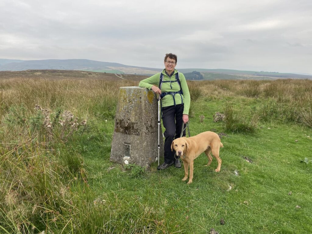
It is a stiff ascent across the steep escarpment and reaching the edge of the trees I realise that there is still more up to do to get to the top of the moor. This area of Skipton Moor is known as Vicar’s Allotment
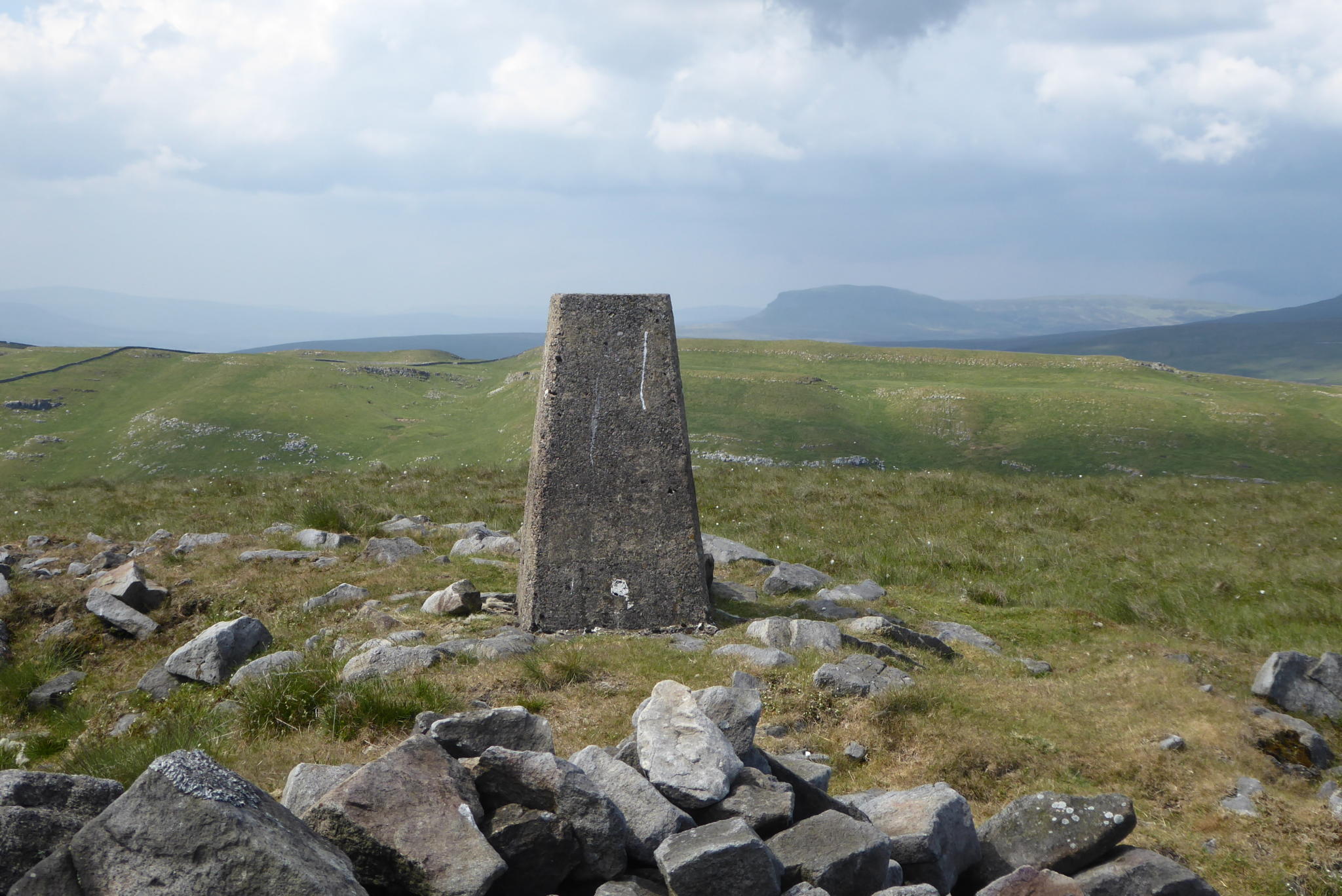
After one final short sharp ascent I am on the ridge at the top of the moor. The path brings me straight to the Vicar’s Allotment Ordnance Survey trig pillar. This is the 269th trig I have bagged and I have chosen a cracking day to visit it. The views are stunning in every direction.
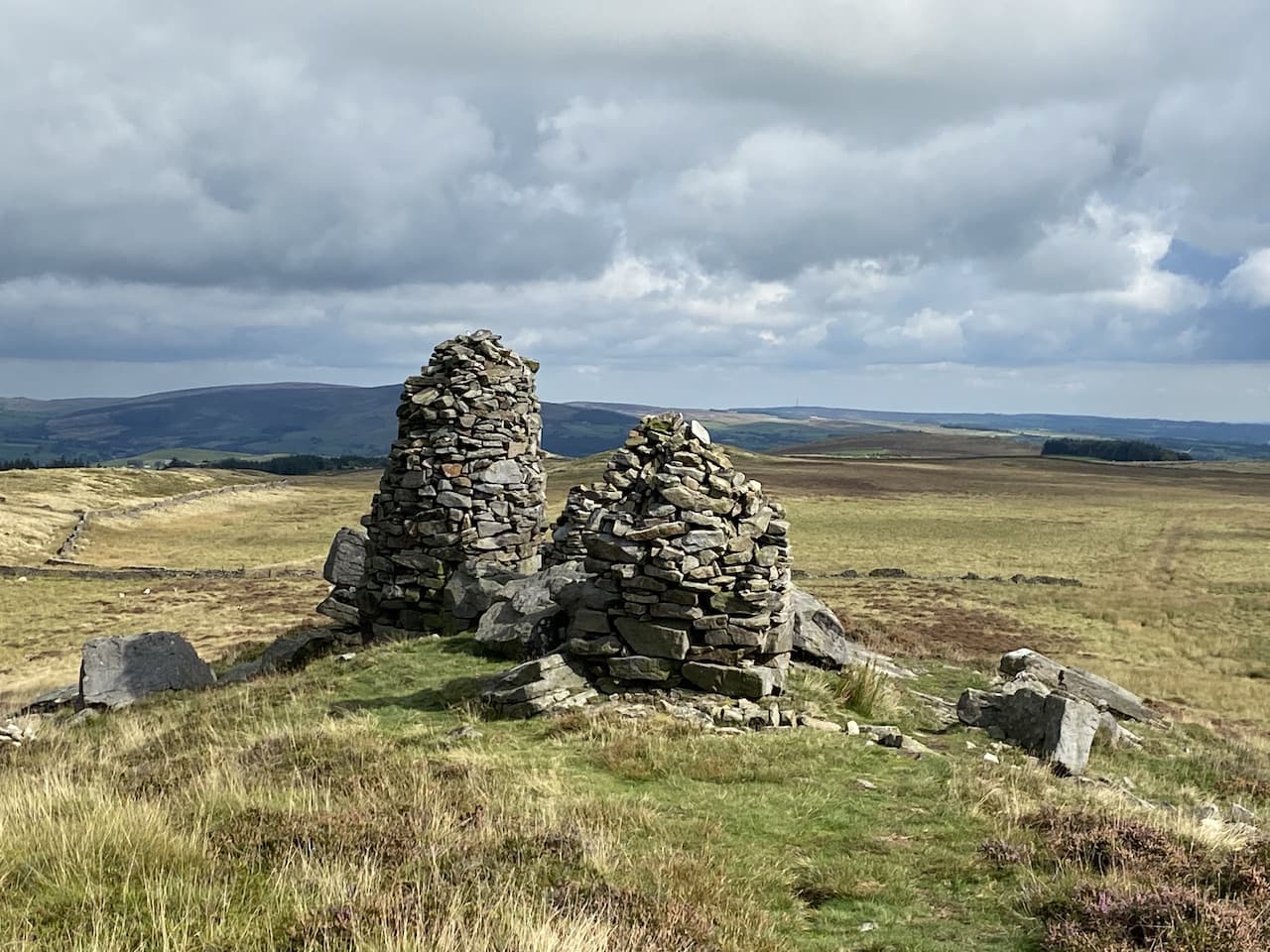
I wander along the ridge in both directions to look at the cairns and rock outcrops. This is the first time I have been on this moor and had not expected such views.
Back at the trig pillar I head south across the moor on a path leading to a rocky outcrop, Standard Crag and then turn left to follow a path besides a drystone wall.
I stay with this clear path as it goes through a couple of boggy areas and continues through a gate and then reaches a wall stile. Over the years Crosby has mastered these stiles and despite not climbing one for a while he is over without any assistance.
I am now on High Bradley Moor and follow a path that heads south easterly towards Low Edge Farm.
There are a network of paths converging near Low Edge Farm. I take one down to cross a stream and then is clearly signed around the back of the farmhouse before going along the farm driveway. I follow this until I reach a footpath on the right which goes across a field to a gate. Through the gate I go across another field to reach Jenkin Farm.
Now I turn left and follow the farm driveway heading towards a minor road with the interestingly named Schoolmaster Place Farm in the distance.
On reaching the road I cross and follow the footpath to pass the farm and cross fields to reach another minor road where I turn left towards Cringles.
This is a quiet country lane and I am passed by a car and tractor before reaching the A6034. Here I turn left and follow the pavement besides the road. On my left is a tower standing beside a covered reservoir. Initially I think this must be related to mining because there is a nearby shaft marked on the map. However, later I discover an archive article in the Keighley News about the tower, it was built in 1853 to survey the proposed conduit and aqueduct for supplying water to Bradford. Apparently the norm was to build such platforms out of wood and remove them when they had served their purpose, but this stone one survives .
After a few hundred yards along the road I turn right onto a track, Lippersley Lane. This lane heads uphill and then levels. In front of me I can see Addingham High Moor.
When the lane reaches a junction of roads I go straight across and follow Lightbank Lane as it rises gradually to reach a footpath on the left leading towards the moor. This is a steep ascent towards a rocky outcrop. I pause to take in the view behind me.
I now follow a path with a stone wall on my right to pass a plantation. I cross a wall stile on the right and continue uphill heading south east to Windgate Nick. As I reach the top of the ridge I stop to look at the memorial to the two man crew of de Haviland Mosquito Mk 11 Aircraft DD750. This plane from RAF Church Fenton (now known as Leeds East Airport) crashed into the side of the hill close to this spot at 21.00 hours on 23rd March 1943. The pilot, Sergeant John Hudson Staples, and navigator, Sergeant Ralph Ernest Andrews were both killed in the crash. The plane had been returning from RAF Cotishall in Norfolk when it crashed.
The clear path now heads east along the top of the escarpment. It is a cracking place to be walking on a sunny afternoon. The cairns I pass are a reminder that in the depth of winter this is a bleak spot and navigation is far more difficult.
The path continues and passes through stone walls to reach the Noon Stone. Apparently mention of this stone dates back to 1579, it was then recorded as the None Stone, it is assumed that it derives its name as the stone over which the noon sun appears. But I suppose that depends on where you are stood at the time.
This part of Addingham High Moor is scattered with stones with ancient cup and ring markings, the most famous being the Swastika Stone, which my route passes. An ancient carving on it is thought to date from the Bronze or Neolithic age, although the one visible today is a Victorian replica placed close to the original which was severely eroded.
From the stone I continue along the path and then take a footpath on the left leading down into Heber’s Ghyll. This is an amazing path that winds its way steeply downhill frequently crossing Black Beck on footbridges.
On reaching a minor road, Heber’s Ghyll Drive, I turn right and then almost immediately take a footpath that heads up steps to continue behind gardens to reach another minor road, Hollin Hall Drive. Now it is time for me to wind my way back downhill towards the A65 so I take a left into Hollingwood Drive and then on reaching Victoria Avenue I head downhill towards the A65.
At the A65 I turn left and follow the road the short distance back to Hall Croft CL. I have had a cracking walk covering just over sixteen and a half miles. Tomorrow is a moving day and we are heading a few miles further north into the Dales to spend a couple of weeks at Brigholme Farm CL in Giggleswick a regular favourite of ours.
All information on this site is provided free of charge and in good faith and no liability is accepted in respect of damage, loss or injury which might result from it. To the best of my knowledge the routes are entirely on public rights of way or within areas that are open for public access. Walking can be hazardous and is done entirely at your own risk. It is your responsibility to check your route and navigate using a map and compass.
My interest in walking was really ignited in my teens when we used to visit family friends who lived in Eldwick. On occasions I would take myself off for a walk just exploring the local countryside. I did not venture too far, most of the walks were around Shipley Glen and there was the occasional excursion onto the edge of Baildon Moor. I have a faint recollection of walking to a trig point from Eldwick, but up until now have not really thought about where it was.
Whilst studying the map last night I realised the nearest trig to Eldwick is on top of Baildon Hill, so that was probably the one I visited the best part of fifty years ago. Of course in those days I was not bothered about logging trigs or “bagging” them. As we are staying so close to Baildon Moor it makes sense to venture there today.
Our starting point is the car park off Hawksworth Road just to the north of Baildon. Google maps shows this car park as Baildon Trig Point car park, which sounds very promising to me. Starting our walk we follow a path from the car park which heads north and very quickly we reach the trig pillar, this is the 267th I have bagged. Lynnie would like all trigs to be this easy to access.
From the trig we follow a bracken lined path that descends across the hill towards Hawksworth Road. There are fine views with part of Baildon Golf Course on Baildon Hill in front of us.
On reaching Hawksworth Road we cross and follow a footpath sign on the opposite side. This heads in a north westerly direction besides the aptly called Bracken Hill. We ignore other paths to the right and left until we reach the northern edge of the access land, here we take a footpath straight ahead through a narrow gap besides a wall.
The path passes through what appears to be the grounds of an activity centre, although at the moment there is no obvious sign of activity, it joins Sconce Lane where we turn left and follow the lane past Ash House Farm.
The lane continues past smart holiday chalets and then the entrance to Faweather Grange. At a junction of tracks we turn left along Birch Close Lane and head towards Birch Close Farm. Just before we reach the farm we turn right up a tarmac lane to join the route of the Dales High Way, this is a ninety-mile long distance walk from Saltaire to Appleby in Cumbria. I am always on the lookout for new trails to walk and will have to look at this one in more detail.
The path gradually ascends to pass close by Weecher reservoir, this stands behind a high embankment so is not visible, in any case I am more interested in looking for any Ordnance Survey benchmarks on the gate posts we pass. Last year I got into “bagging” benchmarks and used to spend time researching their locations before going out for a walk. Lynnie is pleased that I have now moved onto wild benchmark bagging, this involves no prior research but just the odd glance at a likely location. Wild bagging is far more rewarding and I am soon smiling from ear to ear when I spot the tell-tale chisel marking high on a former gate post.
On reaching a junction with the Otley Road we turn right and walk besides this busy road. Fortunately the verge has been laid with gravel to create a pavement. After a couple of hundred yards we take a way-marked footpath on the left going onto the moor still following the route of the Dales High Way.
As we ascend we look back and get a view over Weecher reservoir. This reservoir was built around the 1880’s by the Baildon Water Board, it was reported that in 1910 it recorded having just over 30,000,000 gallons of water in it.
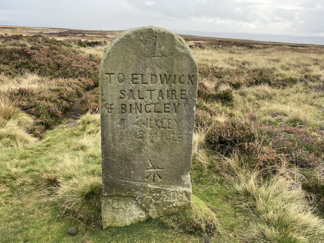
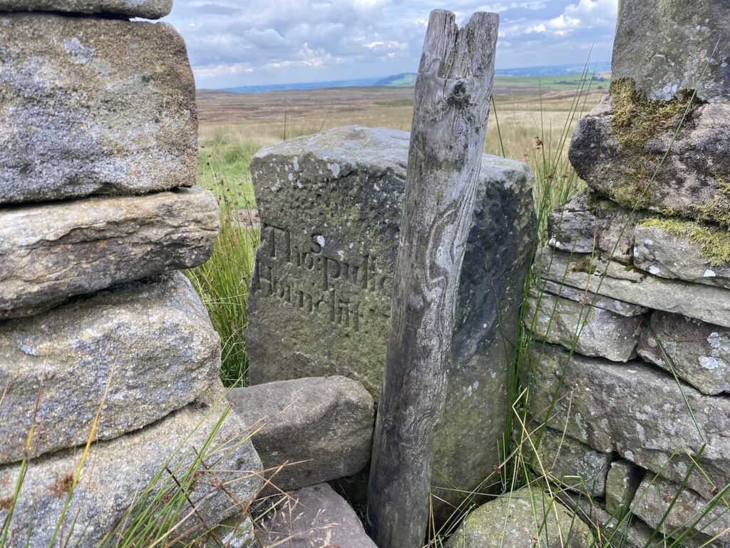
The Dales High Way leads up across a section of moor shown on the map as Low Two Stoops. We pass through a gate and continue on the well-worn path to a junction of paths besides a wall close to the Horncliffe Well. There is a boundary stone in the wall at this point marked “Thos Pulleyn, Horncliffe”.
Now we leave the Dales High Way through a gap in the wall to take a footpath that follows the boundary fence. On the other side of the fence is a stone marking the Horncliffe Well. Apparently this well is shown on land records dating back to 1273 and it had the tradition of never drying up. It stands at the meeting point of three moors, Burley, Hawksworth and Bingley. There are records of a house being on the moor in the early 1800’s but little evidence remains now. The once free flowing water from the well was diverted into pipes by Yorkshire Water in the 1990’s so there is now little evidence of water but the stone marks the historic spot.
We follow the well-defined path with the fence line to our right, this route heads steadily uphill occasionally crossing streams running off the moor. After a dry spell the ground conditions are firm under foot, but I imagine that in the depth of winter it would be very boggy up here. There are further boundary stones on the fence line.
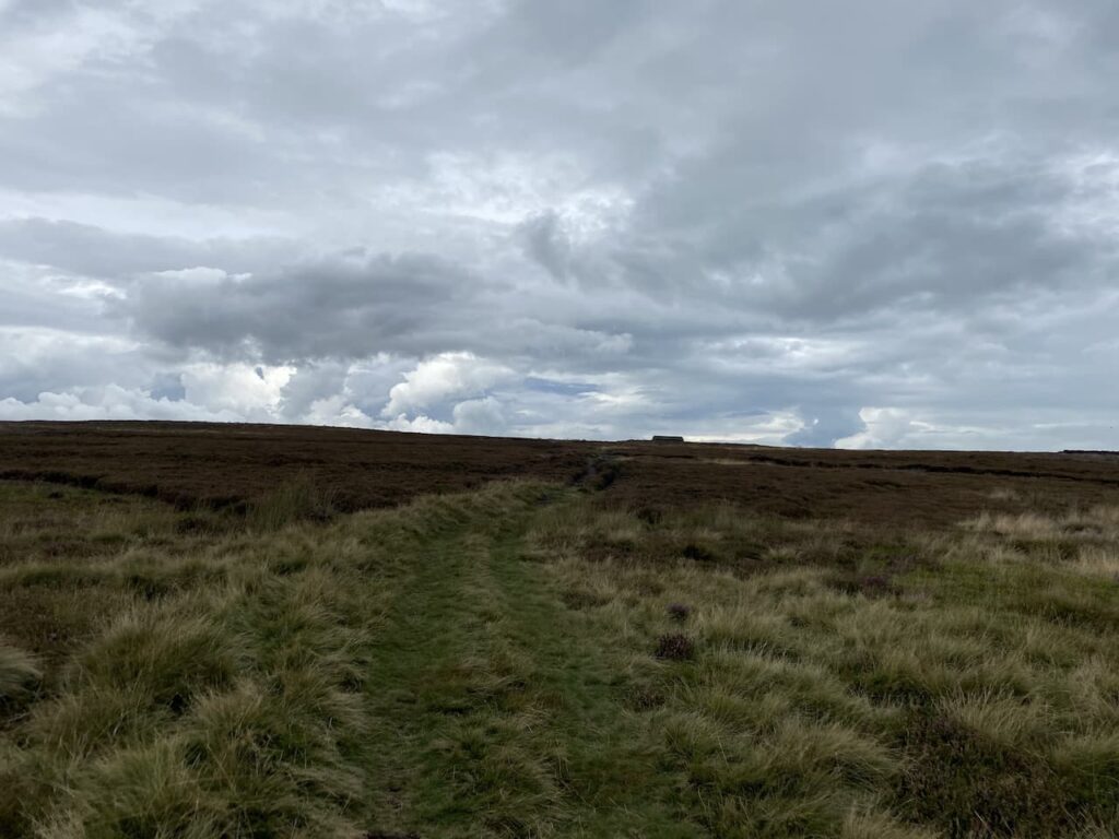
This path is the route of the Bradford Millennium Way which is a 45-mile circuit around Bradford created in 2000 to celebrate the millennium. I can’t recall walking any sections of it before, it appears to visit some interesting locations including the Bronte Falls, White Wells and Shipley Glen. The section we are on heads towards a hut on the horizon.
After passing the hut and an outcrop of rocks we continue on to a junction of paths where we turn left to follow a track with views of High Lanshaw Dam. This is the highest of three small reservoirs, apparently they were originally built for Urban District Council, later operated by the Rombalds Water Board and eventually Yorkshire Water.
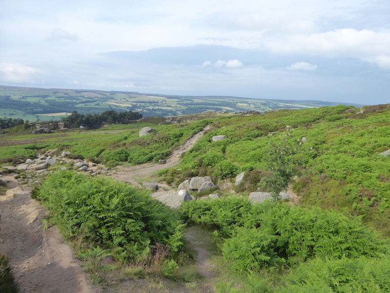
As we start on the track the beaters for a driven grouse shoot start heading across the moor. I am not a supporter of grouse shooting and watching it take place at close quarters reinforces my view.
At a junction of paths close to the Twelve Apostles we turn left rejoining the Dales High Way this time heading south. The grouse shoot is going on to our right, they are in the final throws of driving the birds to the guns. Frankly how anyone could describe this as sport is beyond me. If individuals feel the need demonstrate their ability with a firearm surely they could shoot at clays.
On our right is an old milestone. At this point the Dales High Way veers off to the left but we continue on a path marked on the map as the Dales Way Link.
After going through a gate we follow a clear track heading south across Bingley Moor. We go over Hog Hill and through Hog Hill Flat where we pass another milestone. This route was part of the pack horse trail between Ilkley and Bingley and would have been a main communication link for hundreds of years
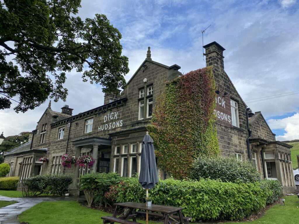
We continue over moorland and then follow the path as it goes between walls descending gradually to the Otley Road and the Dick Hudson pub.
We cross the busy Otley Road and wander around to the front of the pub. It is years since we have been here. It was a pub we used to visit as a family when I was child and over forty years ago, when I took Lynnie on her first trip to Yorkshire, we popped in for a pint. It is tempting to have a sharp’ner for old times’ sake, however it is still too early in the day for a drink.
Apparently there has been a pub in this area since the 17th century. The original watering hole known as the Plough Boy was located a bit further along the Otley Road. But when a new road was constructed the license moved to Highgate farmhouse which is the site of the current pub. The pub became known as the Fleece Inn and it 1809 was purchased by Thomas Hudson. After his death in 1850 his son Richard aka ‘Dick’ took over as landlord and the pub which was popular with workers from the textile mills in Airedale gained the name Dick Hudson’s. Dick remained landlord until his death in 1878 but hopefully his name will remain synonymous with this spot for many generations to come.
We have a choice of routes here, both involving walking beside a road, we opt for the Otley Road heading south because it looks a bit quieter, but it is still too busy for comfort. However, there is no other option to link the sections of the Dales Way Link. Therefore, we are relieved to reach the footpath on our left leading up the driveway of Toils Farm. After passing behind the farmhouse we continue on the way-marked path across fields to reach a tarmac lane. After going over a wall stile we turn right on the lane following the Dales Way Link towards Shipley.
On reaching the end of the tarmac driveway we go through a gate and follow the path across fields towards Golcar Farm. After passing the farm the route joins a track leading to the Bingley Road which we cross to take the footpath marked Dales Way Link and Millennium Way. This path leads around barns and continues besides Glovershaw Beck.
The path takes us onto bracken covered moorland where we continue to head south on the Dales Way Link to reach a car park besides Glen Road. We cross the road and follow a pathway uphill towards the caravan site at Dobrudden Farm. It Is clear that this area of access land is well walked and we are chatting away so at a junction of paths I assume the worn route in front of us is the way to go. It does take us up to the caravan site but it is a steep ascent that becomes less clear as we rise.
Reaching the boundary wall of the caravan site we turn right on a clearer path. We stop here to catch our breath and look back over Eldwick.
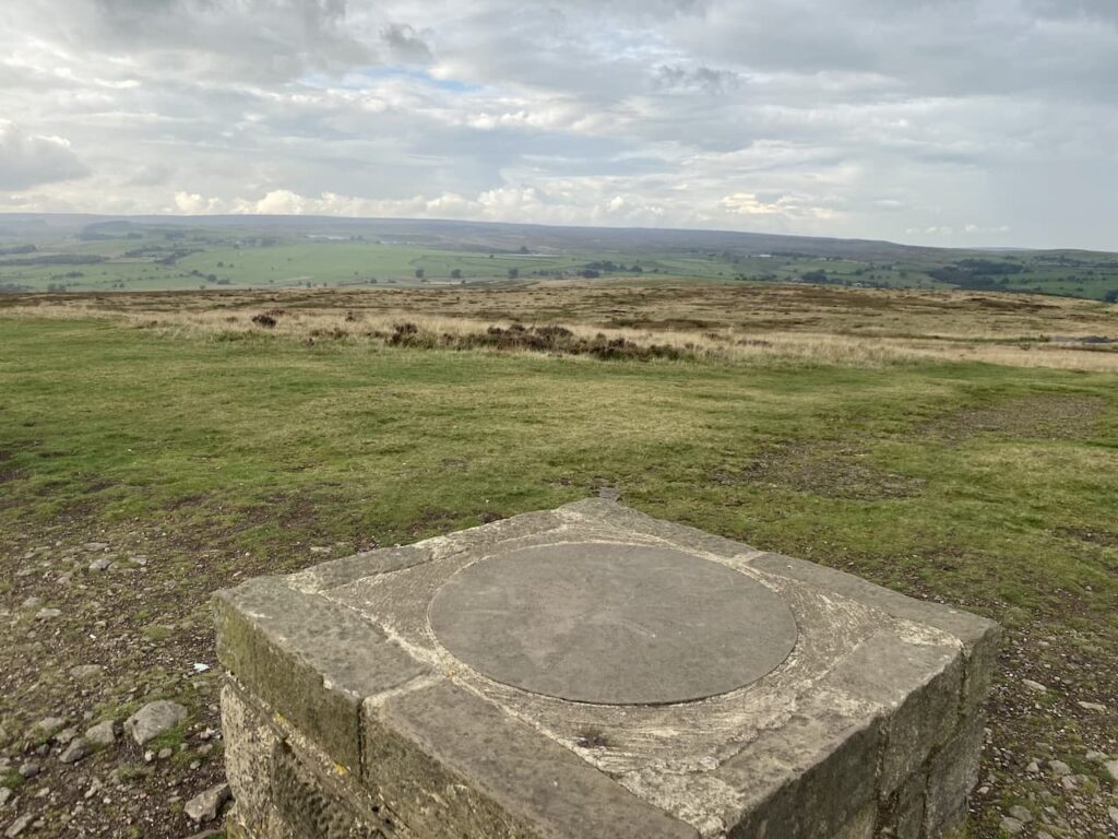
There are a wide range of paths crossing Baildon Hill, we are aiming for the trig point on the summit so we continue a gradual ascent towards the top. There is a long history of quarrying and coal mining on areas of the hill. These where not the massive mechanised quarries, but small ones used to extract stone for building. We arrive at the summit by a large fenced depression. Later I check the Coal Authorities website and discover that this has only emerged in the last couple of years and has been fenced off because it is the site of old mine workings. The Coal Authorities article records it as some subsidence and movement, I would call it a big hole!
After looking at the subsidence, without getting too close to the edge, we wander over to bag the trig point, this is my 268th. It has been painted white, but there are splashes of red paint around which is a pity. It stands at 925 feet above sea level, this would be a pretty exposed spot on a winter’s day. I try to recall if I have been here before, but nothing about this spot sparks a memory.
Close to the trig is a toposcope. We stop to look at points on the horizon, picking out places we have visited, or plan to in the future.
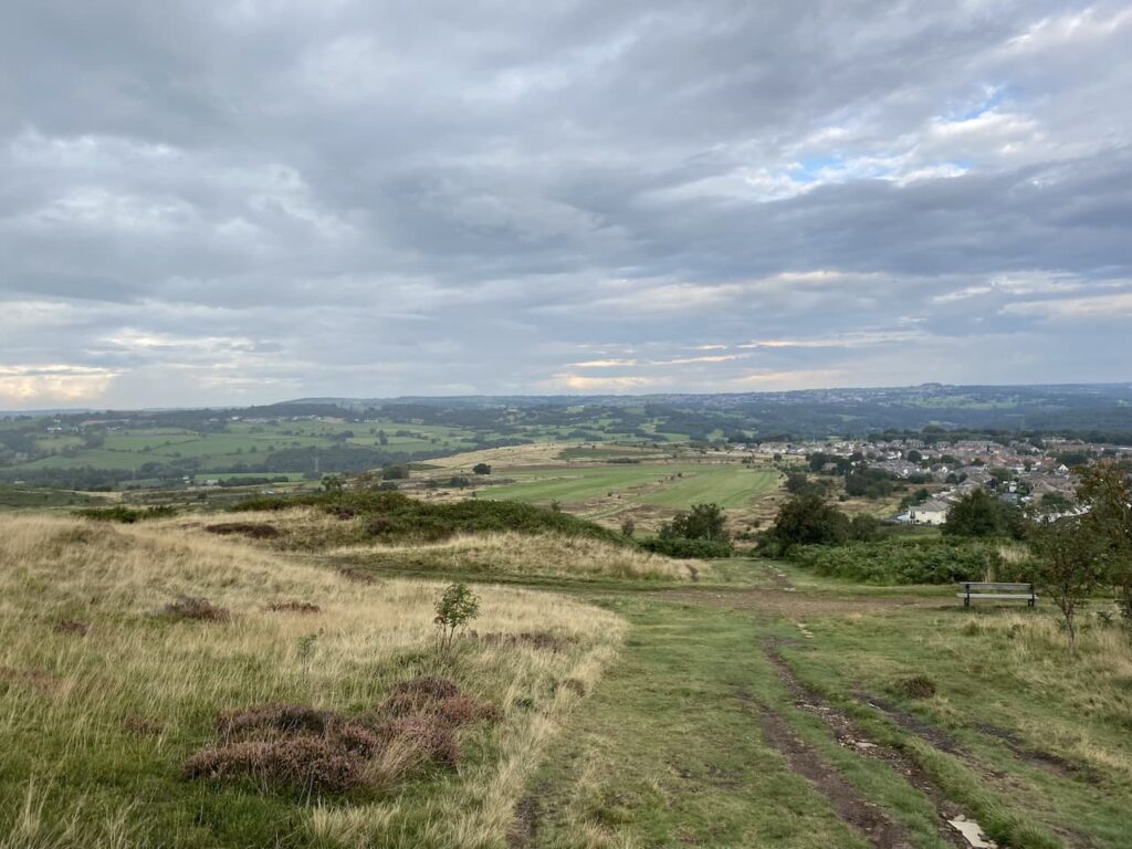
Our route continues along the top of the hill heading east. This path soon descends steeply towards Baildon Golf Course and then goes alongside a couple of holes and the club house. This course was established in 1893 initially as the Bradford Golf Club, but when they moved in 1899 it became known as the Baildon Golf Club. Over the years the original seven hole course was developed into a full eighteen and the clubhouse was moved and then further developed. During the First World War what is the 17th fairway was used as a practice firing range. Then during World War II the course was considered an area of risk as a landing site for enemy gliders so tree trunks were sunk into the ground as a deterrent.
Our route takes us to the Hawksworth Road where we turn left to follow a path besides the road heading back up to the car park on Baildon Common where we started our walk. We have covered just over ten miles, littered with local history. It has been a very enjoyable stroll apart from witnessing the grouse shoot and a short section besides a busy road.
All information on this site is provided free of charge and in good faith and no liability is accepted in respect of damage, loss or injury which might result from it. To the best of my knowledge the routes are entirely on public rights of way or within areas that are open for public access. Walking can be hazardous and is done entirely at your own risk. It is your responsibility to check your route and navigate using a map and compass.
We are at the end of our tour, after thirty-one nights we are heading back home tomorrow. But before we do there is time to fit in one final walk in the Yorkshire Dales. If I was ever on the walking equivalent of “Desert Island Discs”, which I suppose would be “Desert Island Walks,” I would struggle to choose my favourite eight walks, but I know which one would top the list; a walk up Ingleborough. (more…)
It was soon after we got our first caravan in 2012 that we made our first visit to Brigholme Farm CL, since then we have stayed for over a fortnight at least once a year. I have, therefore, walked many of the routes and paths around here but surprisingly there are still a couple of trig points within walking distance that I have yet to “bag”. Today I plan to rectify that by knocking one off the list. (more…)
I am sure that I am not alone within the walking community in finding pleasure in just sitting and studying an OS Map, my collection of Outdoor Explorer Maps now stands at 186 and I can pick one from the bookshelf and immediately recall the walk I did in that area. (more…)
A trip to Ilkley would not be complete without a walk on Ilkley Moor, as we all know the moor became famous as the inspiration for the folk song “On Ilkla Moor Baht ‘at” and it is almost impossible to think of the moor without the lyrics of the song coming into your head. (more…)
Today I am again walking from Hall Croft CL with Crosby whilst Lynnie and Dexter have a relaxing day around the caravan. Leaving the site I turn left and follow the pavement besides the A65 towards Ilkley. (more…)
So far on this trip we have been really fortunate with the weather and today it is forecast to be very hot and sunny. I have in mind a walk to bag another trig point but due to the heat Lynnie opts to stay at the caravan with the dogs whilst I go wandering. First I need to take the dogs out for their morning walk, they might be let off heavy walking duties but they still need to clock up a few miles. (more…)