Tag: Cranborne Chase

  • A Roman Road and Droves from Martin Down

    A Roman Road and Droves from Martin Down

    I continue to look for new locations to walk whilst staying close to home.  Until now I have coped better than I anticipated with not getting away in the caravan, but I still need some variation in my walking.  For the past year I have been exploring the Cranborne Chase and today’s walk will start on Martin Down and visit villages to the east of the A354.

    I have travelled along the A354 numerous times but never stopped at Martin Down, there is a large parking area on the edge of the nature reserve and I observe the signs asking people to leave plenty of space between vehicles as part of the social distancing.   

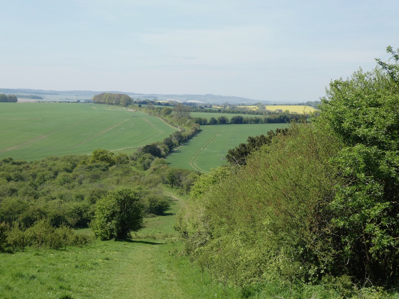
    I start my walk from the southern end of the car park and head out passing a metal barrier besides some information boards. Initially the path heads through shrub, but then opens out on to the vast expanse of the nature reserve, there are over 850 acres of protected land here which provide a haven for flora and fauna.  

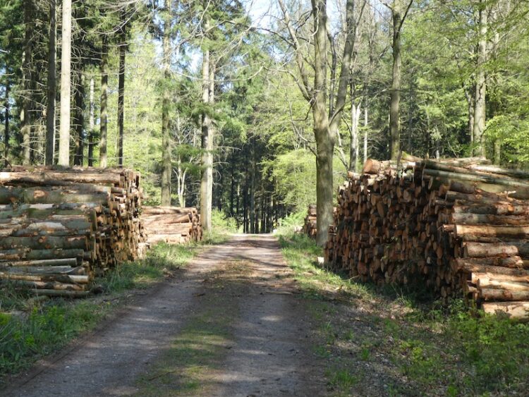
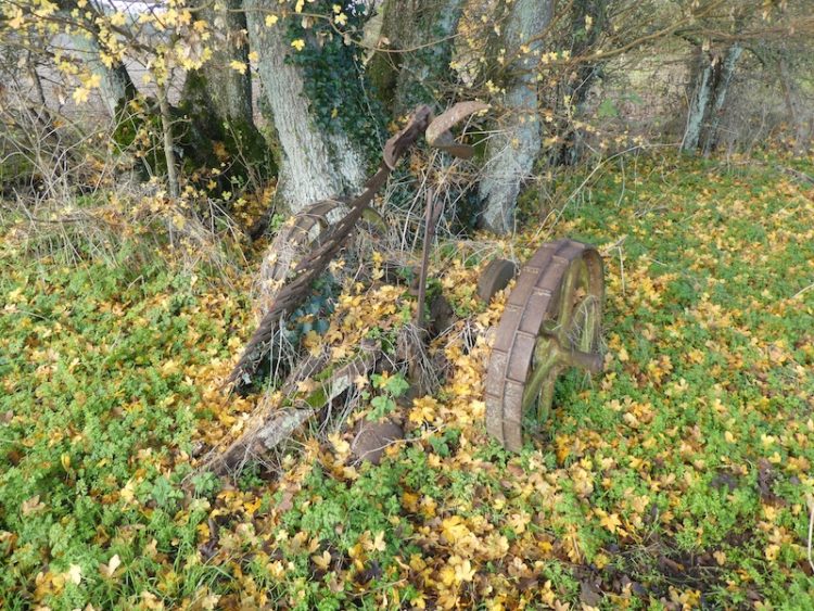
    I follow the track towards the dominant rifle range butt in front of me.  This area was used as a military rifle range up until the 1950’s and strewn across this area of the downs remains evidence.

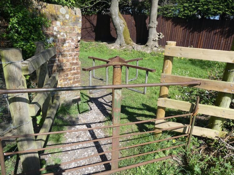
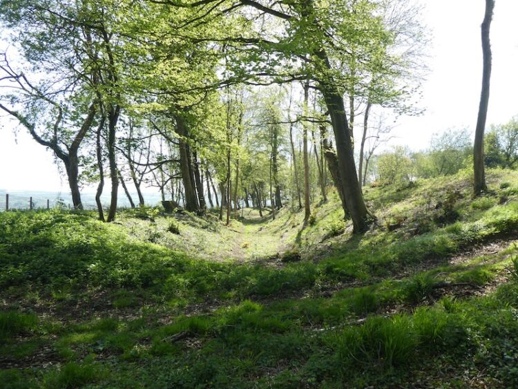
    Before reaching the butt I take a path on the right to head across the Bokerley Dyke.  This ditch is thought to have been built during the iron age and fortified in the 5th century.  It runs for around 3.5 miles and is an impressive structure.

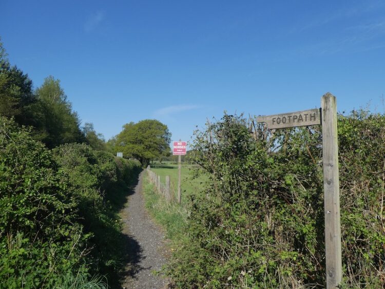
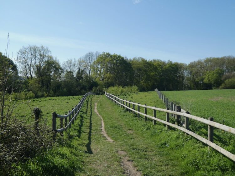
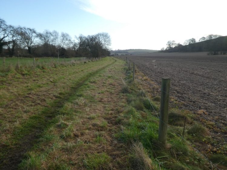
    At the dyke I pass through to reach the fence-line of a field. I enter the field and take a footpath on the right and continue along the edge of the field with the fence to my right.  The path follows around the edge of the field and I am soon heading south with a hedge line to my right. 

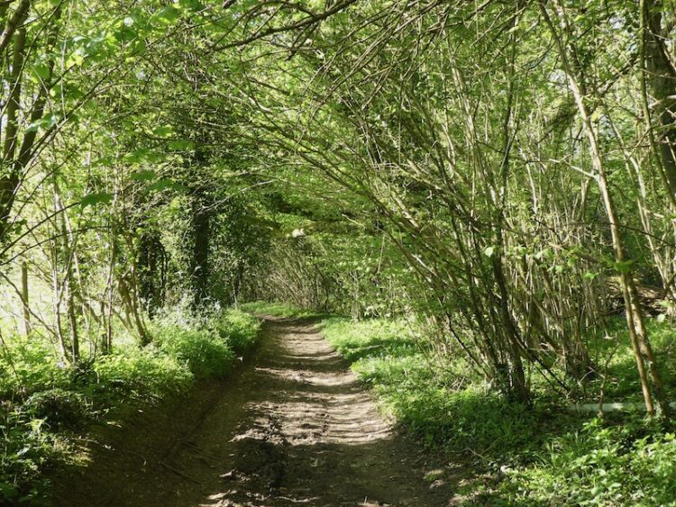
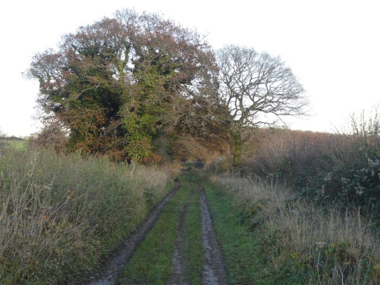
    At a junction of paths I continue straight on to reach a gate besides a crossing of paths.  Here I continue along a tree lined path still heading south towards Pentridge.

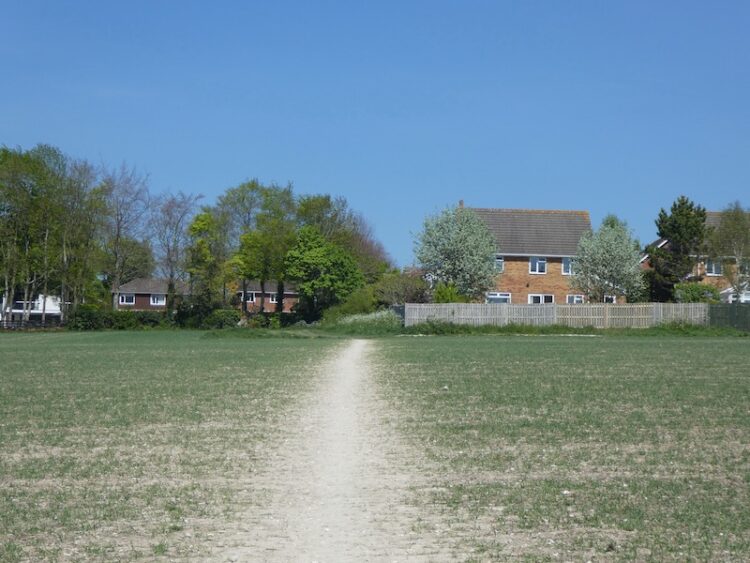
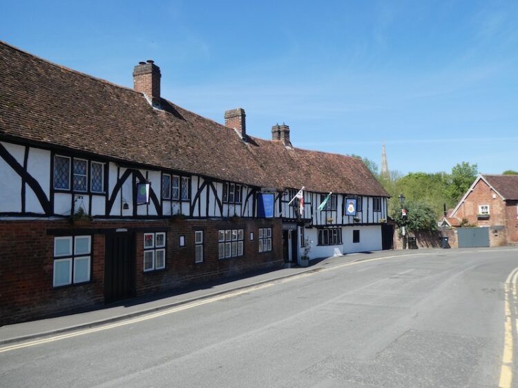
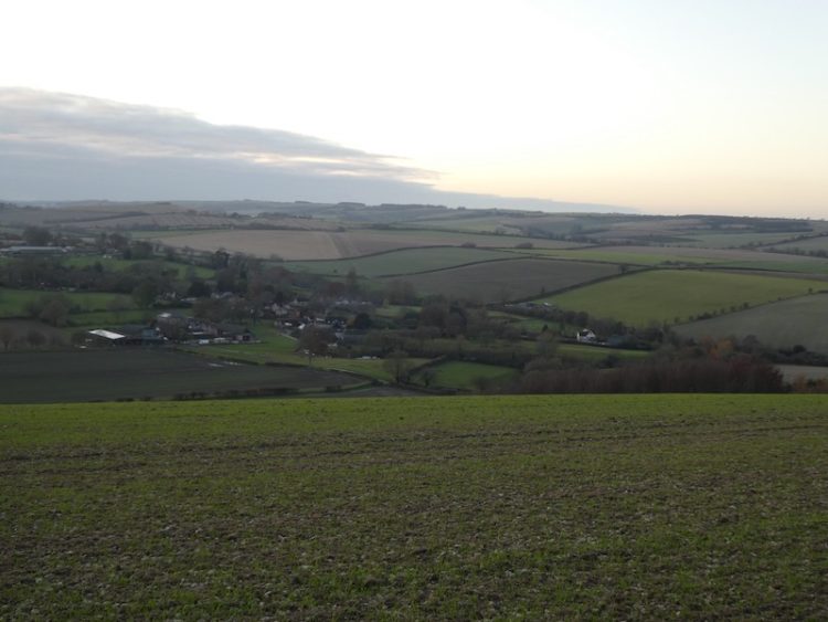
    As the path reaches farm buildings it becomes a tarmac lane and I stay with this to walk into the village. I cannot ever recall visiting this village.  It is a quiet spot well away from the main road and has some attractive old properties.

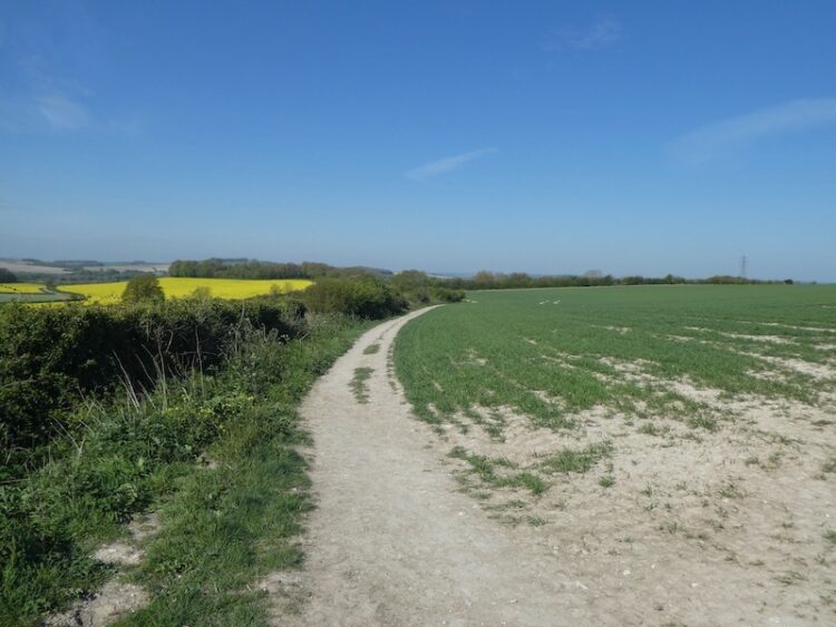
    My route continues south through the village and passes Manor Farm to join a farm track.  At a junction of paths I turn right and follow a track that soon heads uphill along the edge of a field.  The path crosses the next field and shows clearly through the crops. At a fork in the path I keep left to head towards the edge of Salisbury Planation.

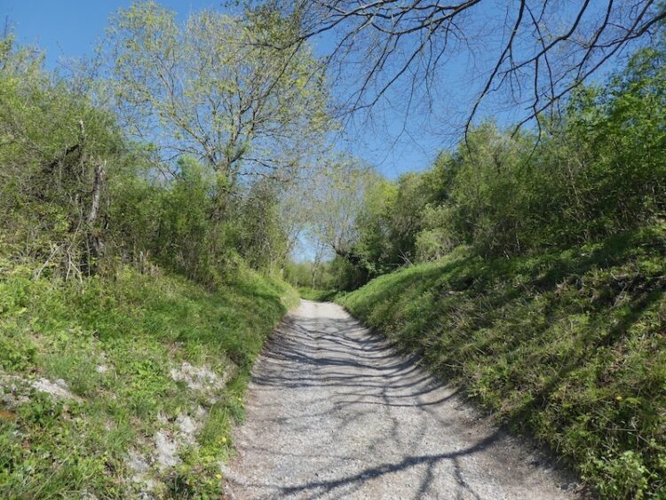
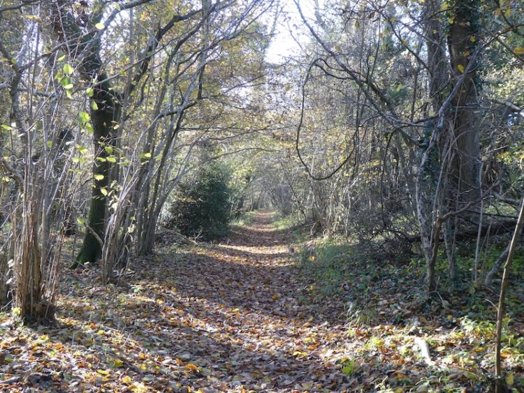
    I ignore paths to the left and right as I follow the path along the edge of the woods to reach the course of the old Roman Road, the Ackling Dyke. Here I turn left and follow the route of the Roman Road.

    After crossing a stile there is an impressive array of tumuli in the next field.  I have passed these when driving along the A354, but at 60mph it is difficult to fully appreciate them.

    Now I stay with the Roman Road as it gradually ascends to reach the B3081.  After crossing the road I go through a gate and follow a path running besides the overgrown Roman Road.

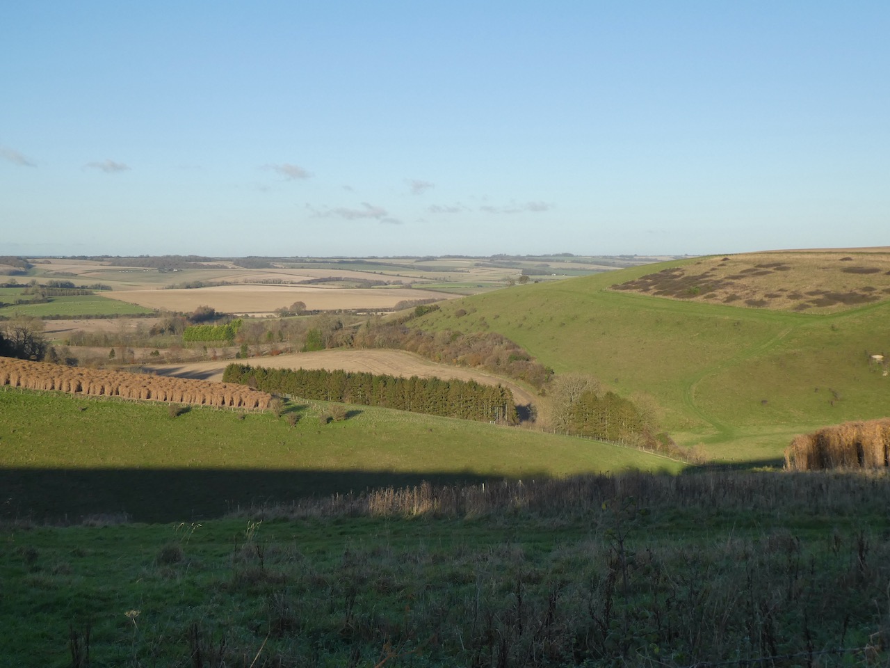
    The route now descends steadily with fine views in front of me.  After crossing a farm track the route enters trees that form the edge of the Drive Planation and continues on to reach a minor road.

    After crossing the road the route continues uphill through the edge of woodland.  The Ackling Dyke covers 22 miles and connected the Roman settlements at Old Sarum on the edge of Salisbury and the Hillfort at Badbury Ring.  

    At a crossing of paths at Harley Gap I turn right.  On this junction of paths is a memorial stone to a John Ironmonger (1919-1986) apparently he was the Manager for Lord Shaftesbury’s St Giles Estate.

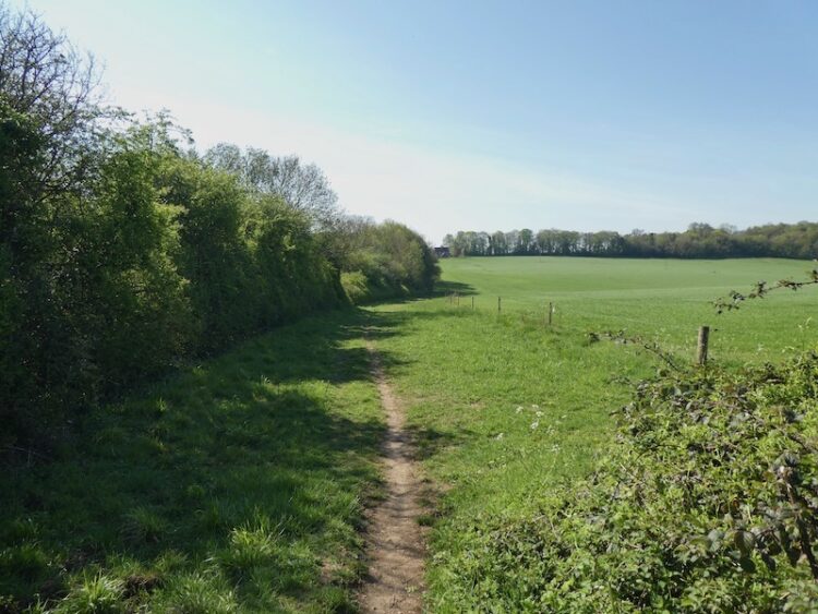
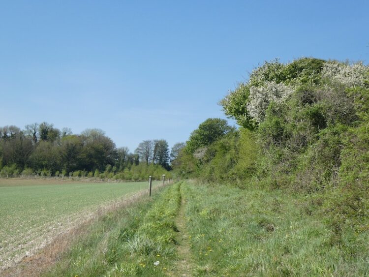
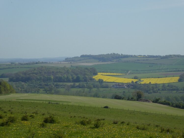
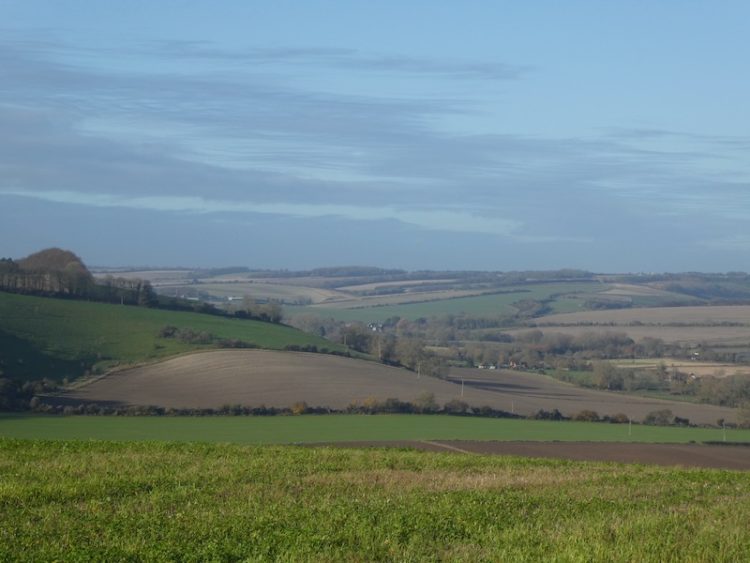
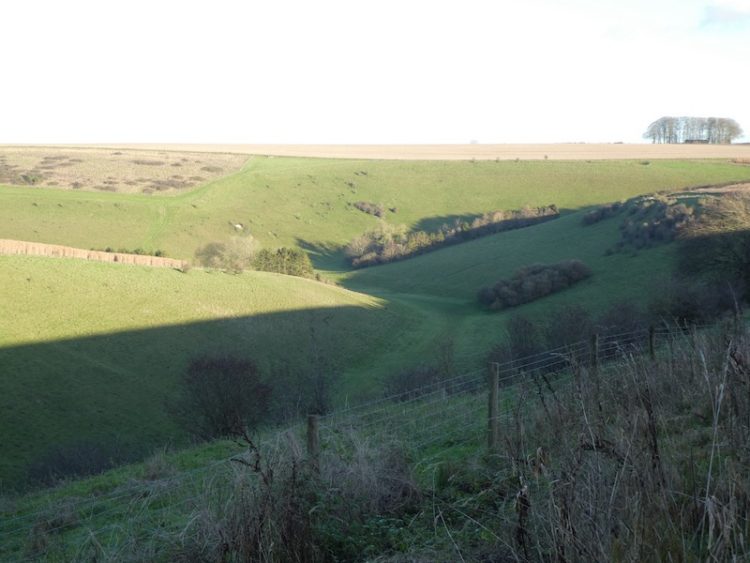
    I am now walking along the edge of a field with far ranging views.  This is stunning countryside.

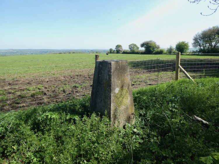
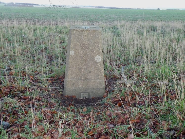
    At a junction of paths I turn left to follow a drove along the top of Gussage Hill.  Nearing the hedge line on the left I pop over the fence to bag the OS Trig that stands between fields.  This is the 205th OS trig pillar I have bagged.

    Back on the track I continue in a southwesterly direction, the track soon starts to descend and then turns left near a barn and after a couple of hundred yards turns right and continues steadily downhill too reach Lower Farm on the edge of Gussage St Michael.  Here the track becomes a tarmac road and leads into the village passing AG Edwards & Sons Hardware store and continuing to a junction opposite St Michael’s Church, said to have a tower dating back to the12th century.

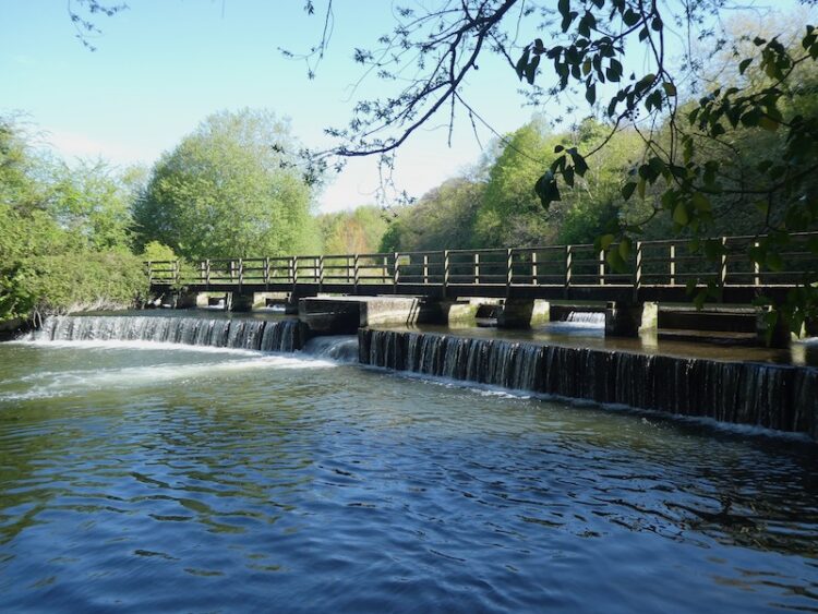
    I turn left and walk out of the village on the country lane heading towards Gussage All Saints.  This is a very quiet lane and only one vehicle passes me.  As I reach Gussage All Saints I turn left and cross a stream to reach the War Memorial.

    I continue a bit further along the lane to visit the All Saints Church most of which was built in the 14th century.

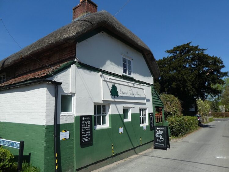
    After visiting the church I return to the war memorial and head east through the village passing the village hall and then reach the Drovers Inn.  This pub was shut in November 2014 and there were proposals to develop it into a large house.  However the local community opposed this plan and set about establishing a Community Benefit Society to take control of the pub.  In March 2016 they managed to purchase the property and now it is run as a community pub.  I am a firm believer in community assets being owned and run but the local community, it does take a lot of effort to get established and there needs to be financial support from the community, but if successful it creates a hub for village activities.  I would sooner drink in a pub run by the community than one owned by a chain. This is one reason why you will never see me in a J D Wetherspoon pub.

    I continue on the lane, having made a note to make sure I return to the Drovers when the current pandemic is over.  The lane reaches a crossroads at Amen Corner, here I continue straight over towards Bowerswaine.

    Just before reaching a bridge over a stream I take a footpath on the left, Brockington Lane, which leads northeasterly towards Brockington Farm.

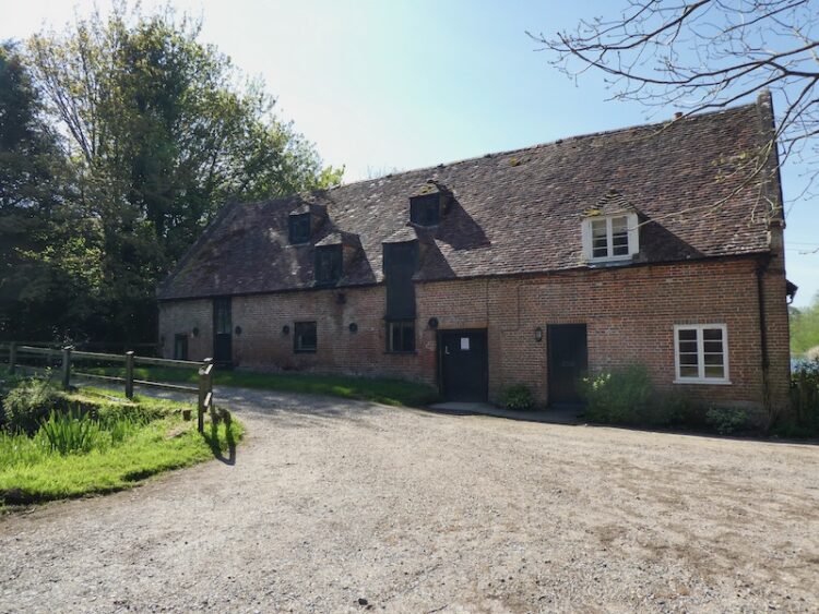
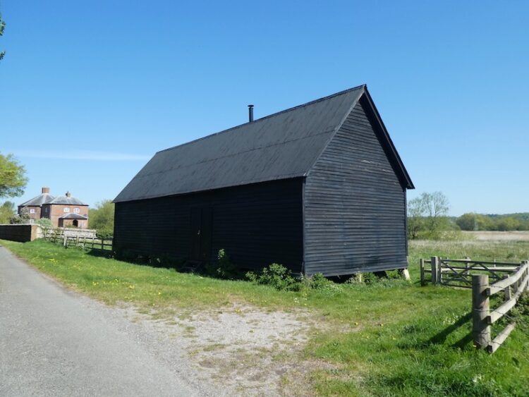
    At a minor road in front of Brockington Farm farmyard I turn left.  The farm buildings appear to be disused.  I find it sad that stunning old barns, such as these are no longer used as originally intended, they would once have been the busy hub of a thriving farm. 

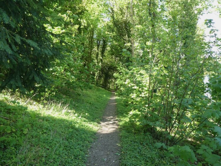
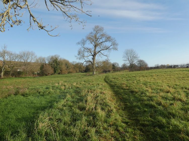
    As the road bends to the left I take a path which follows a track towards Farringdon Copse.  After passing through a small copse the path continues across a field and then reaches a stile besides a minor road.  

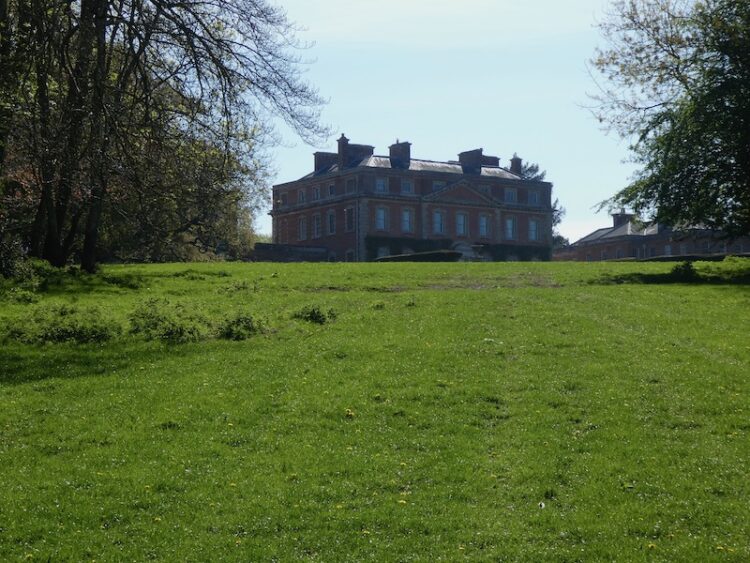
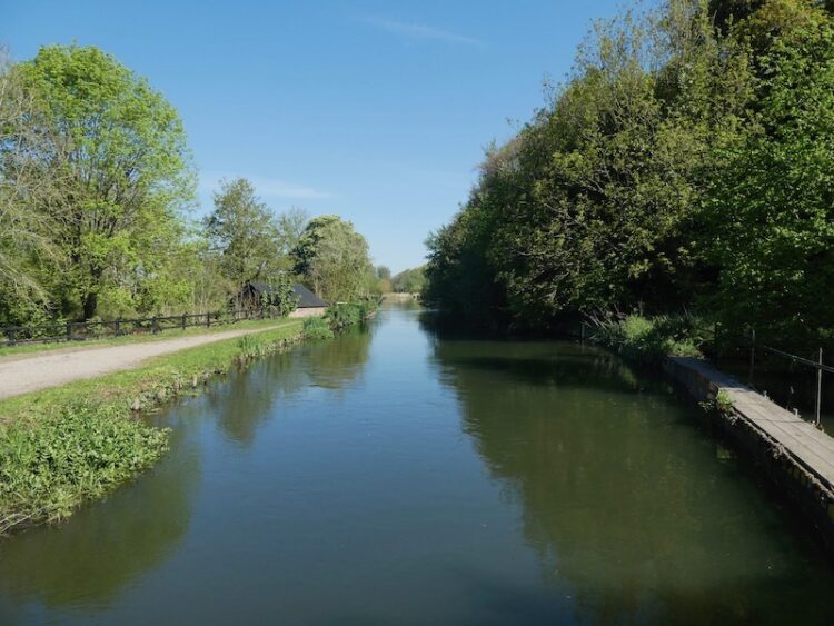
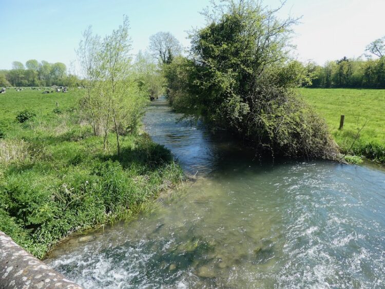
    I turn right and follow this road into Wimborne St Giles.  Entering the village I cross the River Allen and continue into the centre.  This is a cracking spot with St Giles church prominent besides a stunning row of almshouses.

    The Almshouses date back to around 1624 and were endowed by Sir Anthony Ashley (1551-1628).  Ashley was Clerk to the Privy Council and apparently found favour with Queen Elizabeth I, it is reported that he was distinguished in the Battle of Cadiz in 1596 and was knighted soon after.

    St Giles Church was constructed in 1732 on the site of an earlier medieval church.  It was designed by the Bastard Brothers, who were architects from Blandford.  When I first left school and worked in an office there was an old boy called George working there, now long dead. George had in-laws in Blandford and he would say on a daily basis that Blandford was built by Bastards and so were the folk that lived there. However, I have always found people from that attractive Dorset town very personable.

    The church suffered a major fire in the early 1900’s and was rebuilt to the design of Sir John Cowper. It is a fine building, but currently closed to the public.

    I sit on the bench by the church to eat  my lunch and then head back through the village passing the school and turning right to take a lane that runs through the village passing attractive cottages.

    At a road junction I turn right and walk past the Manor House and head north along a minor road. I have now joined the Hardy Way.  This 220 mile route links parts of Wessex connected with Thomas Hardy.  I have walked a number of sections but not previously trod this part. My friend, Stuart, is a devotee of Hardy’s work and has encouraged me to embrace his writing. A few years ago I tried with Tess of the d’Urbervilles but after reading the Maiden chapters could take no more.  Perhaps I should try again!

    At a track on the right I leave the minor road for a footpath along Ringwood Lane, still on the Hardy Way I keep with the trail way markers as it turns left to head north and then right to go besides a field heading towards the B3081.  

    I have driven along the B3081 many times and know the section I am heading towards, so I am pleased when the path runs on the field side of the hedge rather than the road side. Nearing Creech Hill House the path goes through a gap in the hedge and after crossing the road with care I continue heading east along a minor road towards Cranborne.

    As the road bends to the right I stay with the Hardy Way and take a path on the left. This heads across fields to reach a common where I cross a stream and continue towards the village.

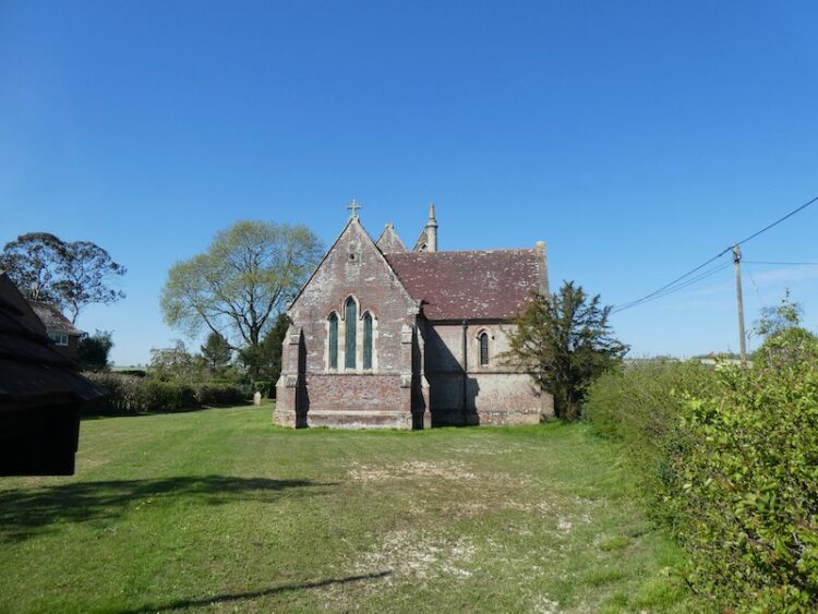
    I have never visited this village, in the days of King Henry VIII when the Cranborne Chase was a Royal hunting ground this was a major centre. Henry built a hunting lodge in the village.  The church of St Mary and St Bartholomew was built in the 12th century and over following centuries additions were made, the tower was added in the 15th century and the chancel rebuilt in the 19th century.

    After visiting the church I leave the village along Salisbury Street, at a fork in the road I take a tarmac lane signed posted “Bridleway to Pentridge”.  This lane heads steadily uphill, passing houses to reach a gate across the track.  I pass besides the gate and continue along the bridleway.

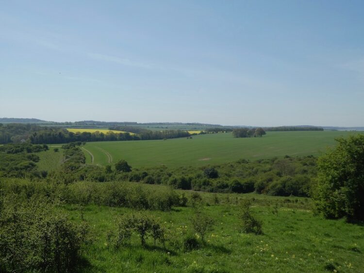
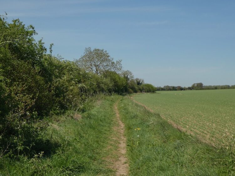
    I stay with the main bridleway ignoring paths to the left and right as I head towards Pentridge Hill.  The views either side of the track are stunning.

    At a gate besides a junction of paths I go through and keep to the path continuing up to the summit of Pentridge Hill with a fence to the right.  I go through another gate and continue to the trees on Penbury Knoll which top Pentridge Hill.  I stay on the path close to the fence and then take a short detour to visit the Ordnance Survey trig pillar in the trees, my 206th trig.

    This is my first time on this hill, it is a cracking place with ancient field systems and outstanding views.

    At a fork in the track I leave the Hardy Way and follow a grassy path that heads steadily downhill towards Whitey Top Farm. After crossing a stile I join a footpath heading north besides the edge of an arable field.  I have joined the Jubilee Trail, an 90 mile path crossing Dorset from Forde Abbey near the Somerset border to the Bokerley Dyke.  I go through a gate and then continue along the edge of a copse to reach Martin Down at Bokerley Ditch.

    On the downs I turn left and walk besides the stunning Bokerley Ditch.

    The path is easy to follow and I stay by the ditch until I reach the rifle range butt where I retrace my steps to the car park.  My walk has covered just over twenty miles and has been stunning throughout.  It will not be too long before I am walking around in this area again.

    To follow my walk, you will need Ordnance Survey Explorer Map 118 – Shaftesbury and Cranbourne Chase

    You can view this 20 mile walk on OS Maps and download the GPX File Here

    Additional Information

    For more information on this walk including car parking, amenities, refreshments and detailed walking directions visit my associated Walking Moonraker website.

    29th May 2020

    © Two Dogs and an Awning (2020)

    All information on this site is provided free of charge and in good faith and no liability is accepted in respect of damage, loss or injury which might result from it.  To the best of my knowledge the routes are entirely on public rights of way or within areas that are open for public access.
    Walking can be hazardous and is done entirely at your own risk.  It is your responsibility to check your route and navigate using a map and compass.

  • Twenty Mile Circuit to Clearbury Ring

    Twenty Mile Circuit to Clearbury Ring

    For many years I have intended walking from Pitton to Clearbury Ring. As a circular walk it is over twenty miles, a distance I walk regularly.  In normal circumstances, when travelling with the caravan, time at home is filled with catching up on jobs around the house and garden.  So I don’t often take a day out for walking long distances.  However, with the current restrictions on travel getting out for a whole day sounds perfect.

    I have two reasons for wanting to visit Clearbury, there is a trig point I have not previously bagged and it was a spot we would often look towards when I was a teenager helping Jack Judd with his harvest.  It was always a diversionary tactic to take a breather, when it got hot working in the field stooking or collecting sheaves.  We would ask Jack to identify points on the skyline of which Clearbury was always a favourite.

    I start my walk from outside the Silver Plough pub in Pitton.  Leaving the car park I cross the road and take the track to the left of the village hall passing the village playing field.  Just after the tennis court the footpath leaves the track and follows a parallel route on the left.  This leads into a copse where just after passing Coldharbour Cottage I fork left and head steadily uphill through the copse to reach a fence lined path along the ridge with memorial benches.

    At a junction of paths I continue straight on along a track, Cock Road, so called because in medieval times local peasants used to net Woodcock along it. 

    I stay with this track until I reach a tarmac drive where I continue straight on to a junction with Lucewood Lane.  Here I turn right and walk along the road.  At a T-junction I turn left on to Clarendon Road and after a couple of hundred yards fork right into Green Drove.

    At the bottom of the drove I carry straight on to cross the River Dun and then go under the railway bridge.  Here I leave the road and take a footpath directly opposite.

    On reaching a road I turn right and walk through the village of West Grimstead.  The early morning chill has gone from the air and I stop at a bench on the green to take a layer off.  Resuming my walk I follow a path that runs inside a hedge parallel to Grimstead Road.

    Nearing Alderbury the path joins a pavement and crosses the A36.  I then continue down the road to a junction where I turn right onto the Southampton Road.  Prior to the by-pass this was the main Salisbury to Southampton route.  Within a hundred yards I turn left opposite the village shop to walk along an unmade road, Castle Lane.  When the lane forks I go left and then join a footpath on the right and stay with this to pass Matron’s College Farm.

    This footpath crosses the disused Salisbury and Dorset Junction Railway and continues on a clear track across arable fields.

    At a junction of footpaths I turn right and then after crossing the disused railway line again turn left and walk along a permissive route parallel to the railway line.  The Salisbury and Dorset Junction Railway was an 18 mile line spurring from the Salisbury Southampton line at a junction in Alderbury through Downton and Fordingbridge to West Moors where it connected with the main Southampton to Dorchester line.  The line was completed in 1866 and operated until May 1964.  This section of the line ran through a deep cutting.

    To my right I get a good view of Clearbury Ring in the distance it will be a couple of hours before I am up there. I keep the disused railway to my left until I reach Four Gates, after passing through a gate I turn right and walk along a minor road to reach a junction with Witherington Road where I turn right and follow this minor road downhill towards Standlynch Farm.  Just before the entrance to the farm I take a footpath on the left which heads into woodland.

    These woods are part of the Trafalgar Park estate and after passing through a gate I catch a glimpse of the main house.  As you might imagine with a name like Trafalgar this estate has connections with Admiral Horatio Nelson.  Following Horatio’s death at the Battle of Trafalgar in 1805 his brother Rev William Nelson was created 1st Earl Nelson and apparently lobbied Parliament for an estate in recognition of his brother’s service to the nation.  Standlynch Park was the location chosen by the Treasury and it was renamed Trafalger Park.  Descendants of Horatio Nelson lived here until 1948 when it was sold by the 5th Earl Nelson.

    After crossing a field I go through another gate to follow a track through woods.  I stay with this path until I reach a concrete path.  Here I turn right and head downhill to reach the disused Standlynch Mill.  

    This is a cracking spot besides the River Avon.

    The footpath goes over weirs on the river.  I have not visited this spot before it is absolutely stunning.  I will have to come here again with Lynnie.

    After a series of small footbridges I reach a field and fork right to head towards Charlton-All-Saints.  The exit from the field is by way of an unusual turnstile gate.  I cannot recall passing through a gate like this before. 

    I now turn left along a path to reach a road running through the village where I turn right and walk along Lower Road.  At All Saints Church I turn left into Church Lane.

    After a few hundred yards on Church Lane I take a footpath on the right across a field.  This is the Avon Valley Path and I stay with it to cross further fields to reach a minor road where I turn right and follow the lane passing old barns and Matrimony Farm House. 

    At a footpath on the left I leave the road and cross a field to reach the A338 which I cross with care to join a footpath heading uphill besides a field.  I stay with this path as the Avon Valley Path goes through a gate on the right.  

    This is a steady ascent and after going through a gate carries on along the edge of a field of pasture to reach Clearbury Hill fort.  This is an impressive fort much of which is amongst trees.

    I make a brief diversion here to visit the trig point which is to the right, on the edge of the ring.

    Back in the pasture field I take a few moments to admire the view.  I can see for miles, but cannot immediately pick out the spot back in Pitton from where I used to look at this ring.

    The path follows around the ring on Clearbury Down.  After passing through a gate this becomes access land, I stick to the path continuing around the ring and then heading south looking towards the Cranborne Chase.

    The path descends steadily and then joins a track that heads uphill to a junction of tracks.  I turn right along a wide drove to reach the entrance to Yew Farm.  Here I continue straight on along a minor road towards Odstock Copse. There are fine views to my left.

    After going through Odstock Copse the road starts to descend to reach Odstock by the Yew Tree pub.

    At a crossroads I continue straight on along Odstock Road soon crossing the River Avon.

    As the road bends to the right I take a footpath on the left which initially goes through bushes and then reaches arable fields.

    This is a well-worn path that I follow heading west.  I ignore a path on the left and continue to a crossing of paths.  Here I turn right and go steadily uphill.  This path crosses a drove and continues up towards houses. 

    It then descends down steps to reach the A354 which I cross and take a footpath opposite.  Initially fenced this path soon reaches Bouverie Avenue South which I continue on as the road sweeps into Bouverie Avenue I take a footpath directly in front of me between properties.  This leads to steps which I take to head to the right and downhill to reach the Old Blandford Road.  From here I continue downhill to a junction with the A3094.

    I turn right and then cross the road at traffic lights and then turn left into Harnham Road.  This is the first time I have been in a built up area since the start of the lockdown, it is immediately noticeable how everyone is walking well away from each other.  With so little traffic about some are walking in the road.  I pass the Rose and Crown Hotel and continue towards Salisbury.

    To ensure I give people a wide berth I avoid the Cathedral Close, instead I follow the wall of the Close until I reach Exeter Street.  I am surprised how few people are in what is normally a busy street.  So rather than navigate a route through back streets I pass the White Hart Hotel and continue into Catherine Street.  At the junction with Milford Street I turn right and head out of the City Centre.

    After passing under the ring road I continue up Milford Hill.  I have recently been researching my family history and was surprised to discover that my grandfather owned a house on this road.  His daughter and her husband lived in it and when my father left school he lived with them.  It was whilst he was living there that he met my mother.  They both came from Southampton but met in Salisbury in the mid 1940’s and their courting continued after my mother’s family returned to Southampton.

    At the top of Milford Hill I fork right into Shady Bower following it as it descends to Milford Mill Road where I turn right and continue along to cross the River Bourne.

    After the river I turn left into Queen Manor Road and stay with it until I reach the gates to Clarendon Estate at Rangers Lodge.  I am now on the Clarendon Way and follow the Estate Road before forking right onto the footpath to cross a field heading towards Kings Manor Hill.

    The path continues up a track and as it bends to the right I continue straight on to visit the remains of Clarendon Palace.  This Royal Hunting Lodge was a major residence of Kings from the reign of Henry II to Henry VII.  When I was a youngster this site was overgrown and the ruins were lost in the undergrowth, now they have been cleared and it is an interesting and historic spot to visit.

    I leave the site of the palace by a gate in the north east corner and rejoin the Clarendon Way and turn left along a track.  Within a hundred yards I fork left leaving the track to follow the Clarendon Way sign into the woods.

    I now stay with the Clarendon Way as it follows a clear path through the trees to reach farm buildings and then continues around the back of Four Cottages and then back into Pitton.  At the cross roads I turn right and walk up White Hill to reach my starting point at the Silver Plough.

    You can view this 20-mile walk on OS Maps and download the GPX File Here

    To follow my walk you will need Ordnance Survey Explorer Map OL131 Romsey, Andover & Test Valley; and OL130 Salisbury & Stonehenge

    Additional Information

    For more information on this walk including car parking, amenities, refreshments and detailed walking directions visit my associated Walking Moonraker website.

    21st April 2020

    © Two Dogs and an Awning (2020)

    All information on this site is provided free of charge and in good faith and no liability is accepted in respect of damage, loss or injury which might result from it.  To the best of my knowledge the routes are entirely on public rights of way or within areas that are open for public access.
    Walking can be hazardous and is done entirely at your own risk.  It is your responsibility to check your route and navigate using a map and compass.

  • Droves and Trig Pillars on Cranborne Chase

    Droves and Trig Pillars on Cranborne Chase

    Today I am heading back onto Cranborne Chase with two of my walking buddies, Mandy and Ged.  Over the last year we have walked regularly together and explored parts of the local area I have not previously walked.  We start our walk from the car park of All Saints Church in Broad Chalk, which is busy as there is an event on, but we get confirmation it is okay to leave the car.

    From the car park we turn right onto the minor road and after fifty yards take a footpath on the left that leads across fields with the River Ebble to our left.  

    On joining a minor road we turn left and then almost immediately take a footpath on the right continuing across fields to reach Knighton Mill.  After passing the mill we join a minor road and head east. As the road sweeps to the left we continue straight on to join a track and then very quickly the path goes along the edge of arable fields. 

    As we continue I spot an old piece of farm machinery discarded in the corner of a field.  It appears to be a cutter of some sort made by a company called Bamlett.  Later I discover it is a grass cutter made by AC Bamlett in Thirsk.  It is difficult to determine if it was horse or tractor drawn but it must be around 100 years old.  It is a pity to see it rusting away rather than restored and displayed in an agricultural museum.

    On reaching the edge of the hamlet of Croucheston we go through a gate and pass farm buildings to join a minor road.  We proceed through the village in an easterly direction until we reach a T-Junction with Croucheston Drove, here we turn right and walk south. At a junction of tracks besides a barn we turn left and start a long gradual ascent. In the distance to our left we can see the 17th century dovecote at Faulston House in Bishopstone .

    At a junction of tracks we keep straight on, pausing to take in the stunning view. Over the last year I have walked on Cranborne Chase more often than anytime in the past.  I am not sure why I haven’t spent a lot more time here, especially as it is so close to home and very quiet.

    Continuing to head south towards the Ox Drove we keep an eye out for the OS Trig Pillar at Pale Ash, initially we walk by it, but then after a bit of searching find it lurking in the hedgerow.  This is the 188th trig pillar I have bagged.

    After bagging the trig pillar we reach the Ox Drove and turn right along this ancient byway.   Approaching Knighton High Wood the track is impassable because of deep puddles, so we take a path on the right to join Croucheston Drove and then after a couple of hundred yards take a footpath on the left leading across a field to rejoin the Ox Drove beyond the western side of Knighton High Wood,  At a junction of paths we turn left and follow a track towards Knighton Wood Farm.  Just as we reach the woods we take a path on the right running just inside the woodland.

    The path leaves the woodland and follows a tree-lined track to reach a minor road. We cross and go through a parking area at Vitrell Gate to enter the Woodland Trust access land of Vernditch Chase. 

    We follow a track southwesterly through the woodland to reach a footpath.  Here we turn right and continue through trees to pass the hard to define Kitt’s Grave. Local folklore is unclear of the origin of the person buried here, however it is widely thought to be either a young girl or a romany woman who had taken her own life. Therefore she could not be buried on consecrated ground and with no parish willing to claim her she was buried at the meeting point of three local parish boundaries.  However, it could also be a long barrow, so it is a case of picking whichever tale you prefer.

    The path now follows a hedge-lined route to reach a minor road at Cutler’s Corner.  We turn left and follow the road to a crossing of tracks.  The road turns to the left, but we continue straight on in a westerly direction.  As we approach barns we spot what looks like a grass runway and then our suspicions are confirmed by the light aircraft being stored in the barn.

    We cross another road and follow the path through fields around Middle Chase farm and then enter the edge of Stonedown Wood.  We follow a path northwesterly along the edge of the woodland to go through Dank Wood Corner and then out onto a track leading to a minor road, the Ox Drove.

    Turning right on the road we take a footpath on the left after a couple of hundred yards, however after crossing a couple of stiles with gaps for Ged’s large dog Moss to pass through we suddenly reach fenced stiles.  Moss is a very big Weimaraner and too heavy to lift over stiles, so we retrace our steps to Ox Drove and turn left and follow it heading east.  At a road junction we continue heading east on the Ox Drove and follow it for just over two miles to reach a minor road at Hut Farmhouse.

    Here we turn left and walk besides the road until we reach Knowle Hill trig pillar which is located to the right hand side of the road on the edge of a field.  

    After bagging my 189th trig pillar we turn around and walk back along the road for 150 yards to reach a bridleway on the right.  With the light fading we head down Knowle Hill to reach a crossing of tracks.  Here we turn right and follow a track to pass Field Barn.  Soon after at a fork in the track we go right and follow this track as it descends to reach South Street in Broad Chalke.  

    We turn right and walk through the village to reach a footpath on the left, this runs besides All Saints church and heads steadily downhill to reach our starting point.  Our walk has covered 15.5 miles and despite some muddy tracks, to be expected in late November, we have had a thoroughly enjoyable day out with some stunning views. 

    To follow my walk you will need Ordnance Survey Explorer Map OL 130 Salisbury & Stonehenge and OL 118 Shaftesbury & Cranbourne Chase

    You can view this walk on OS Maps and download the GPX File Here

    Additional Information

    For more information on this walk including car parking, amenities, refreshments and detailed walking directions visit my associated Walking Moonraker website.

    29th November 2019

    © Two Dogs and an Awning (2019)

    All information on this site is provided free of charge and in good faith and no liability is accepted in respect of damage, loss or injury which might result from it.  To the best of my knowledge the routes are entirely on public rights of way or within areas that are open for public access.
    Walking can be hazardous and is done entirely at your own risk.  It is your responsibility to check your route and navigate using a map and compass.

  • Visiting the Fovant Badges

    Visiting the Fovant Badges

    Today Lynnie and I are out for a days walking on Cranborne Chase to check out a route I plan to use as a guided walk in a few days time.  The starting point for our walk is the church car park in the village of Broad Chalke (Grid reference SU040253).

    Leaving the car park by the entrance gateway we turn left and walk along The Causeway soon crossing the River Ebble.

    At the road junction close to the Queens Head pub we turn left and follow the High Road through the village as it sweeps to the right into North Street. as this road sweeps to the left we continue straight on along Chalk Pyt Road and stay on this lane as it leads through Chalk Pyt Farm.  At a junction of paths in the farmyard we head north on a track that leads steadily uphill and soon gives some cracking views.

    Where the track joins the Old Shaftesbury Drove on Compton Down we turn left heading west along the route of the ancient drove between the market towns of Salisbury and Shaftesbury.

    After a mile on the drove we take a footpath on the right following a footpath across a field of pasture to reach the Iron Age Chiselbury hillfort.  This was a sizable fort covering approximately ten acres.

    The way marked footpath reaches the edge of Fovant Down and then descends diagonally across the chalk escarpment going through the site of the famous Fovant Badges.  Being so close to the badges it is difficult to distinguish much but I know we will get a good view when we reach the other side of the valley.

    The path, steep in parts, leads to a gate and we follow a track to reach East Farm, here we continue on to cross the A30.  Behind us the badges can be clearly seen.

    After crossing the road we continue straight on heading steadily uphill on Green Drove and then turn to look back at the regimental badges.  They were created by soldiers garrisoned in the valley below the Downs during World War I.  The first badge was cut in 1916 and a further nineteen badges were created.  Of the originals nine remain and further badges have been added to the surrounding downs.  

    They make an impressive and poignant site.  It is impossible to look at the badges without reflecting on the fate awaiting the men that originally created them.  Exchanging the tranquility of the Wiltshire countryside for the trenches in France must have been a traumatic experience.

    As we reach the edge of woodland we leave the track to join a footpath on the left.  In the stubble of the field stands a trig point, so I make a slight diversion to “Bag it”; this is my 182nd trig pillar.

    The footpath runs around the edge of the field besides woodland.  As the trees end we take another footpath on the right through a kissing gate into a field of pasture to reach another kissing gate.  We make steady progress downhill on the footpath to reach the village of Fovant.

    At a road on the outskirts of the village we turn left on the Dinton Road, at a fork we go right to join a minor lane, Mary Barters Lane.  This leads to Mill Lane where we turn right passing the old watermill, now converted to a home, and then turn right along Tisbury Road.   At a crossroads we go straight on, now on Moor Hill, to continue through the village and then as the road sweeps to the right we take a track on the left.  

    We stay on this track for just over half a mile to the outskirts of the village of Sutton Mandeville.  Here we turn right towards the village along a lane, Sutton Hill.  At a sign to the church we turn right to make a detour to visit the 13th century church of All Saints.

    The tower was added to the church in the 15th century and restoration work carried out in 1862.  In the churchyard is an unusual sundial.

    Leaving the church we head back to Sutton Hill and turn right to continue along the lane for just over 150 yards before taking a footpath on the left leading through a field of sheep and then continuing steeply uphill through woodland.

    At a junction of paths we turn right and follow the path along the edge of an arable field to rejoin Sutton Hill close to Larkhams Farm.  We turn left along the lane and then take a right into Lagpond Lane.  At the point where this lane turns sharp to the right we take a drove on the left, Hut Lane Path, towards the A30.  Hut Lane gets its name because it was the route to Cribbage Hut public house, this is now closed and known as Lancers House.

    After crossing the A30 we continue straight on along another track, Buxbury Hollow, which heads towards woodland where it starts a steady ascent up Buxbury Hill.  After going through a gate onto access land we continue up the track.  At a fork in the path we go right and reach the trig point at Sutton Down.  I have previously bagged this one, but it is another for Lynnie to add to her list.

    We continue along the track to reach the Old Shaftesbury Drove, we cross and keep heading south towards North Hill Farm with the attractive Prescombe Down on our left.

    After passing North Hill Farm we continue downhill to reach the edge of Ebbesbourne Wake where we join a minor road which leads us down to cross the River Ebble.  Then we take a left to follow a lane, Duck Street running besides the river, signposted to the village centre.

    At a fork in the road we go right and join Hay Lane, following this until we reach a minor road on the right, The Hollow, which we take and follow until we reach a cottage on the left.  Here we take a bridleway on the left going steadily uphill towards Hill Farm.

    Close to the farm buildings, which all appear to have been converted into homes, we turn right along a track and after about a hundred yards take a footpath on the left leading between properties and then across fields into a copse.

    Emerging from the trees we continue downhill crossing fields in a south eastern direction.

    On reaching a track we turn left and then just before a road take a path on the right.  This takes us to a minor road on the edge of the village of Bowerchalke.  We turn left to take a footpath along the edge of fields and running parallel to the road.  Interestingly the gate to this footpath has the Postcode engraved into it.

    We stay with this path as it runs through the village and passes the church and cricket field.  In my younger days I played cricket for many years and my club visited many villages in South Wiltshire, but I never played here.  It is a cracking setting.

    We join a road in the village, Church Road and follow this for a short distance until we reach a footpath on the right, which leads through the farmyard at Knowle Farm.  From here the route follows a tarmac farm road uphill to a junction of tracks.  We go straight over to follow a track to Field Barn.

    Soon after passing the barn and storage area we take a right fork in the track and stay with this route to go through a gate and head down to the edge of the village of Broad Chalke.

    In the village we turn right along South Street and follow this past some grand looking houses and the village hall.  On reaching All Saints church we stop to have a look inside this splendid building, parts of which date from the 13th and 14th century, the porch is reportedly from the 15th century.  Restoration work was undertaken in the 1840’s, but it must take a lot of effort to maintain such a large church in a small community.

    After visiting the church we follow the path through the churchyard to reach our starting point in the car park.  We have covered just over 15 miles and it has been a cracking walk on the Cranborne Chase.

    You can view this 15 mile walk on OS Maps and download the GPX File Here

    To follow our walk you will need Ordnance Survey Explorer Map 118 – Shaftesbury & Cranborne Chase

    Additional Information

    For more information on this walk including car parking, amenities, refreshments and detailed walking directions visit my associated Walking Moonraker website.

    21st October 2019

    © Two Dogs and an Awning (2019)

    All information on this site is provided free of charge and in good faith and no liability is accepted in respect of damage, loss or injury which might result from it.  To the best of my knowledge the routes are entirely on public rights of way or within areas that are open for public access.
    Walking can be hazardous and is done entirely at your own risk.  It is your responsibility to check your route and navigate using a map and compass.

  • Exploring the Cranborne Chase from Tollard Royal

    Exploring the Cranborne Chase from Tollard Royal

    A few days ago I was chatting to Mandy, one of my walking buddies and I mentioned a walk I had done on Cranborne Chase earlier in the year.  This led to us realising that neither of us had really explored the Chase, despite both of us having lived in this area for most of our lives.  So today we hop in the car and head off to the village of Tollard Royal to start our walk.

    (more…)