Tag: Coleridge Way

  • Robber’s Bridge and Culbone Hill

    Robber’s Bridge and Culbone Hill

    Yesterday I woke to the sound of heavy rain on the roof of the caravan and the forecast showed it was set in for most of the day so I hunkered down in the van until midafternoon and then went for a wander around Minehead.  The day ended with a fish and chip supper.  I rarely eat fish and chips because it usually leads to a bad bout of indigestion.  But unfortunately, I could not resist the temptation and today I feel decidedly under the weather.  Hopefully some fresh air will improve things.

    For a number of years I have had a trig point on Culbone Hill in my sights, but it involves hopping over a gate into a field which usually houses sheep so it has been off limits when Crosby has been with me, however, today I am walking solo so plan to see if I can bag it as part of my walk.

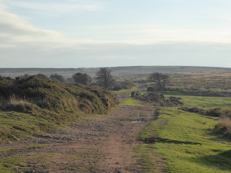
    I start from the car park on Porlock Common (OS Grid Ref: SS845461).  This is an exposed spot and there is a chill to the strong wind blowing across the moor as I lace up my boots and then head off west beside the A39 towards Pittcombe Head.

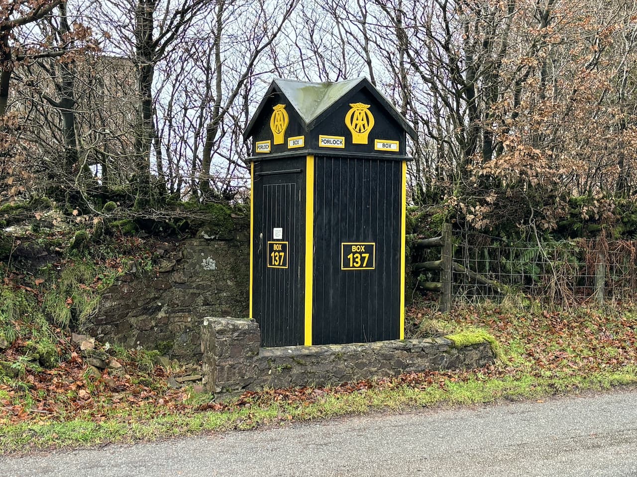
    Close to a junction for the Porlock Hill Toll Road on the opposite side of the road sits an AA sentry box.  These boxes were first installed by the Automobile Association (AA) in 1912 and were installed to be used by patrolmen as places for shelter.  Later they were fitted with telephones and AA members were issued with a key so they could open the box and make a call in the event of a breakdown.  When I started driving in the 1970’s I was an AA member and was issued with a key.  

    There were over 1,000 of these boxes installed around the country, but by 1968 the AA had started phasing them out.  The once familiar roadside landmarks are now extremely rare with only nineteen remaining in their original locations.

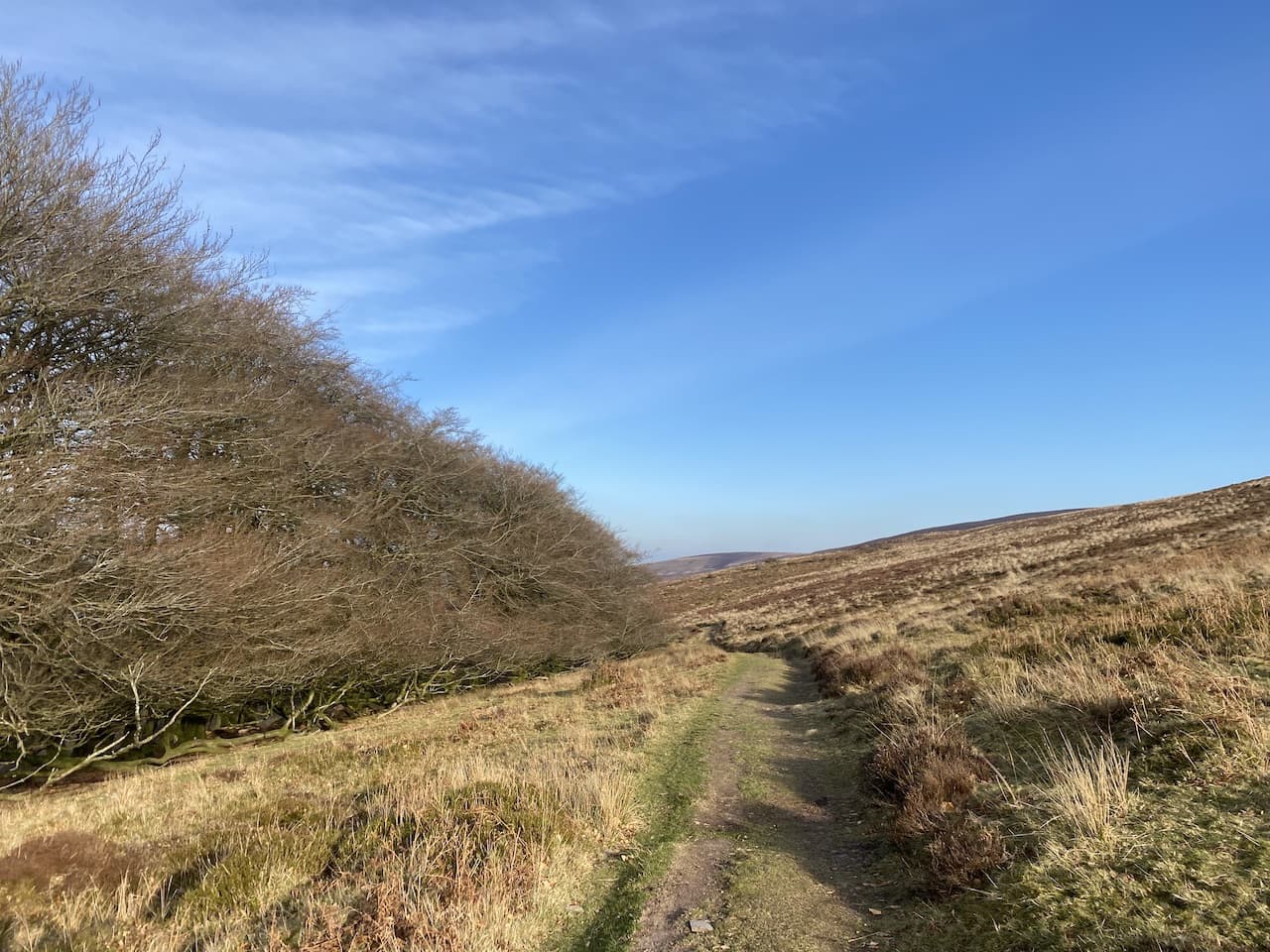
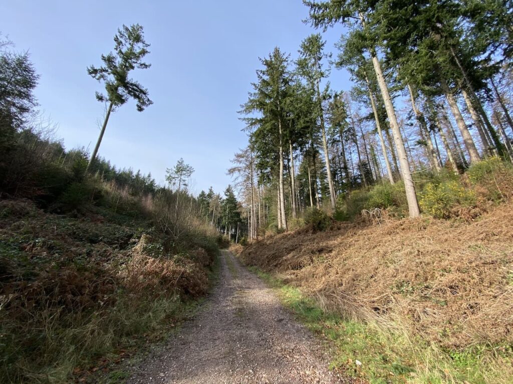
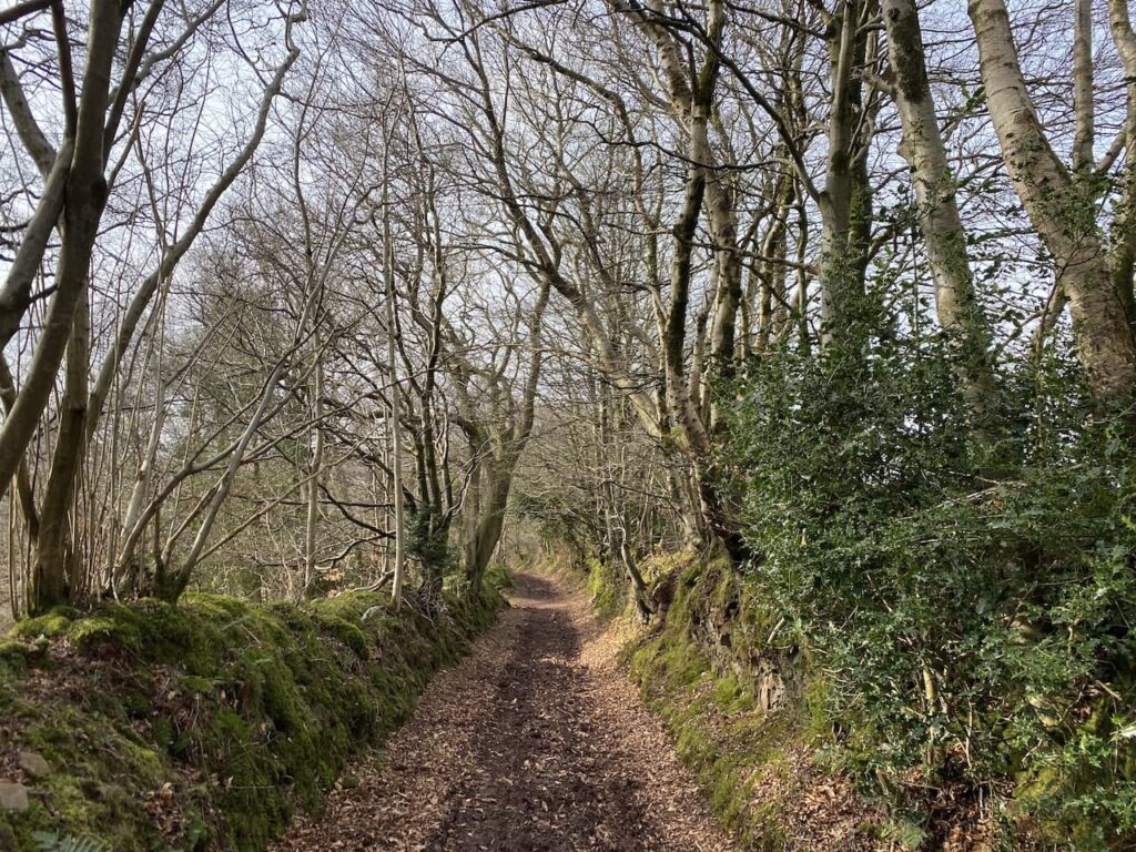
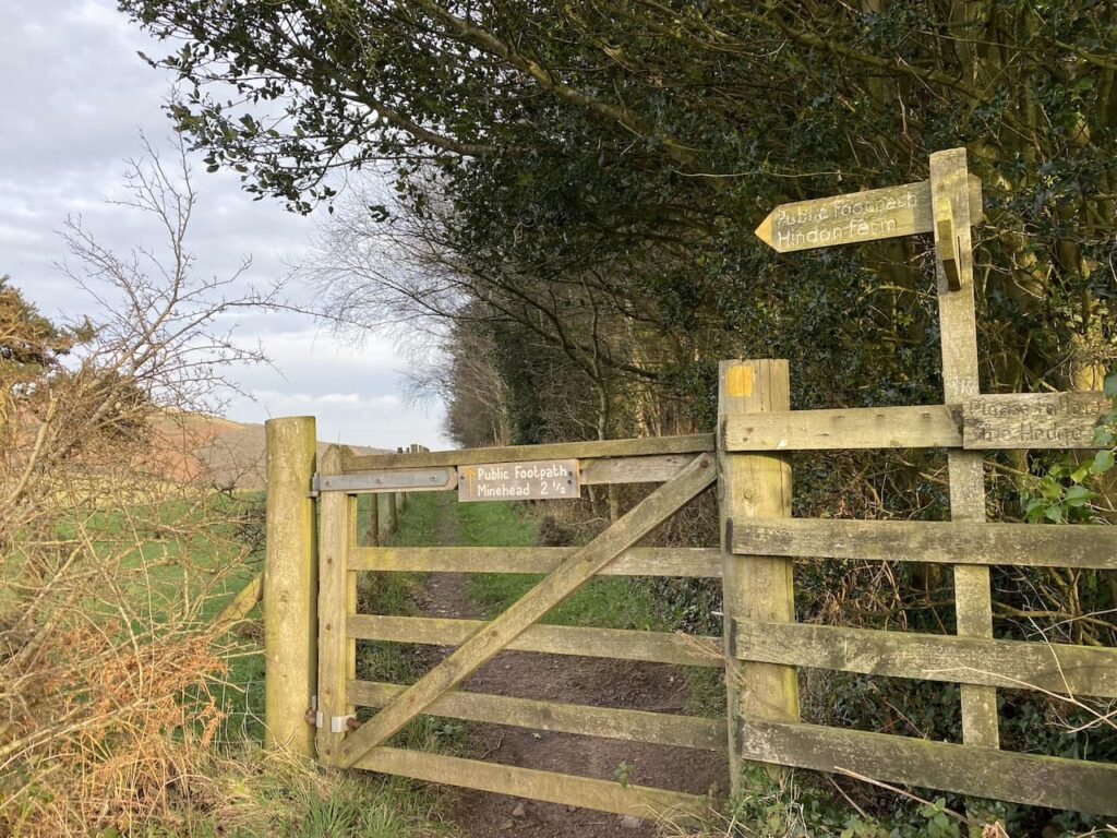
    Opposite the sentry box is a junction of bridleways, one heads north, but the one I take is a permitted bridleway heading towards Culbone Hill which runs parallel with the A39.

    Despite being close to the road this bridleway is protected from the traffic by a hedge so it is a pleasant route.

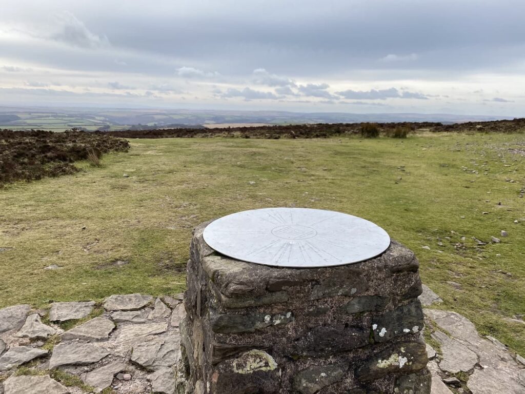
    On reaching a gate in the bridleway I go through and then make a detour from my route by hopping over the gate on my right and heading up onto Culbone Hill to bag the trig pillar.  This is the 420th trig I have bagged.

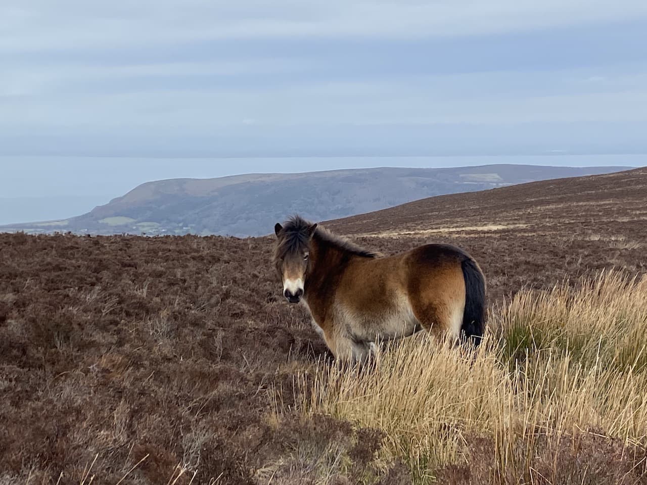
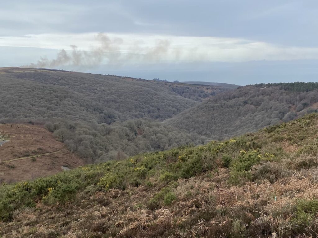
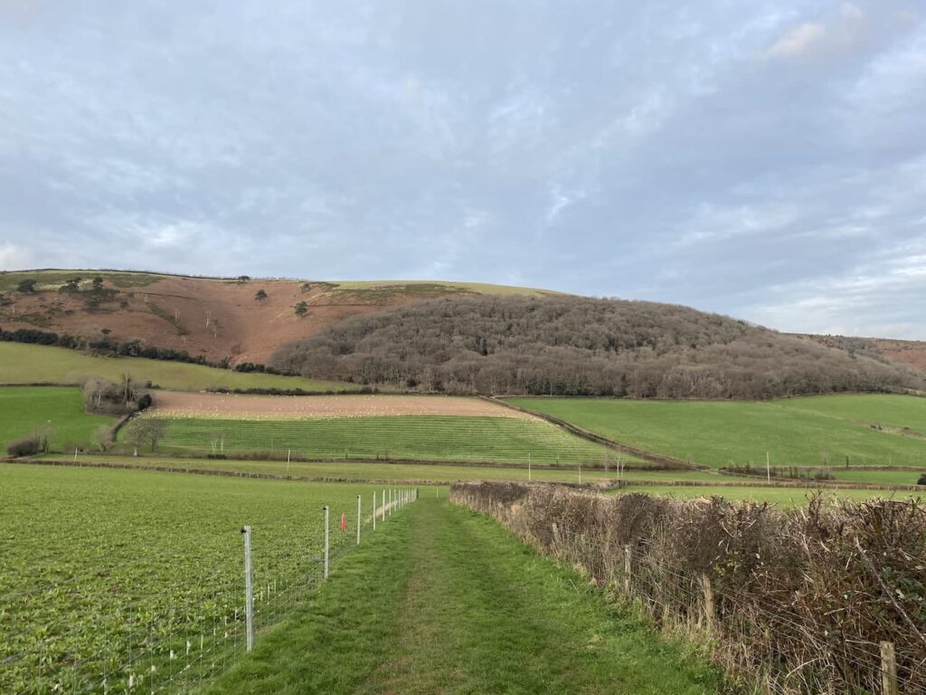
    From the trig I return to the bridleway and then cross the A39.  I am now at Oare Post and here I take the minor road that heads steadily downhill towards Oareford.  Out to my left there are far reaching views across Exmoor.

    This is a very quiet lane and it is cracking to walk down.  Soon I reach an area where there is a magnificent old beech tree hedge.  

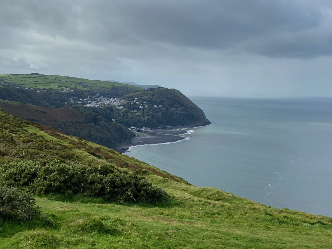
    Then as I keep going down a stunning view opens up in front of me.

    Gradually the road levels out and reaches a parking and picnic area near Robber’s Bridge.  In the height of the summer this would be a popular spot but today there is no one else here.  I pause to look at the old stone bridge dating to before1842, because it was shown on tithe maps of that time.  It gets its name because this area was once known as bandit country and travel along this route would have been fraught with danger.

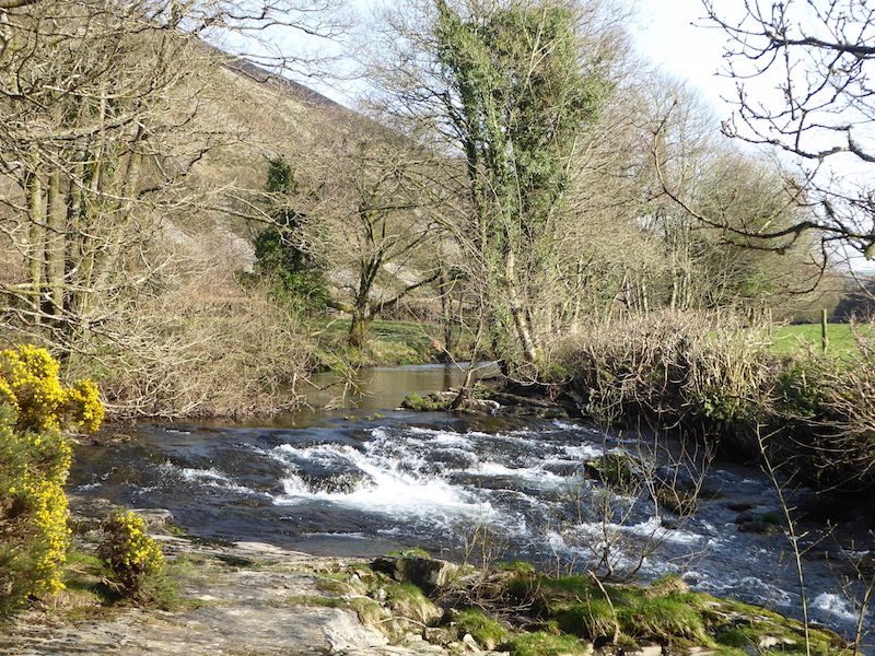
    Just before reaching Oareford I turn right to follow a bridleway heading towards North Common which goes over the river on a wooden bridge.

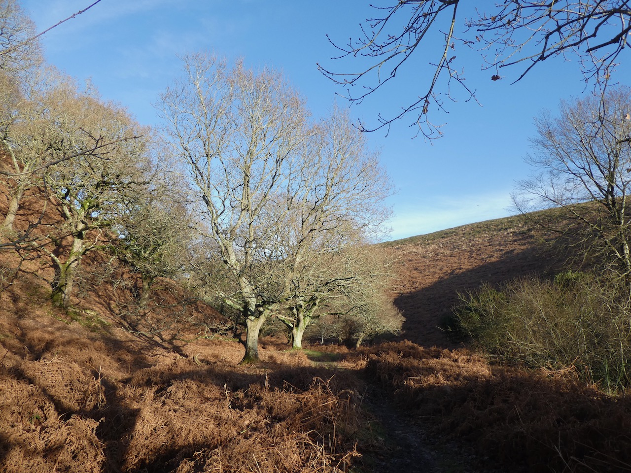
    This path heads steeply uphill and I am feeling decidedly under the weather and beginning to fear that I might have more than a bout of bad indigestion. So I am grateful for the excuse to stop and take in the views.

    It is a stiff ascent to reach the more level ground of North Common and once out in the open a strong wind is blowing.  I head north towards a copse on the horizon, I am certainly getting some fresh air but I’m not sure it is doing me any good.  

    On reaching the trees I turn to the right to join the Coleridge Way.  I know that tucked on the western side of the trees is a bench with a cracking view, I sat here in July whilst on a ten day long distance walk.  It is the ideal spot to sit and get my flask of tea out of the rucksack.

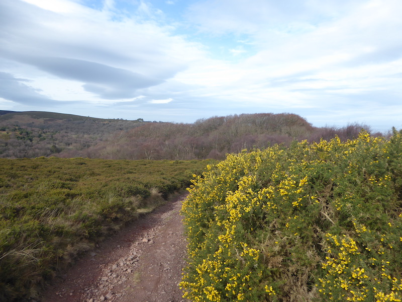
    Resuming my walk I follow the Coleridge Way as it goes between the trees and a fence line.

    Leaving the trees behind me I continue along the path still along the fence line before turning left towards the A39.

    At the main road it had been my intention to cross and follow the Coleridge Way before heading back to my starting point via Pitt Combe, however, I am not feeling up to a couple of hours more walking.  So unusually for me I look at options for shortening my route and decide to walk east along the wide grass verge beside the A39 which is the quickest route back to the car.

    The side verge makes it safe enough to walk besides the road and there is not much traffic at this time of year.  I stay with the road to reach the Culbone Stables Inn.  This was once the point where stage coaches stopped on the route between Lynton, Porlock and Minehead.  In 1962 it became a private members club then appears to have been run as pub for a while.  It is now used as a shooting lodge for people visiting the Lillycombe Estate.

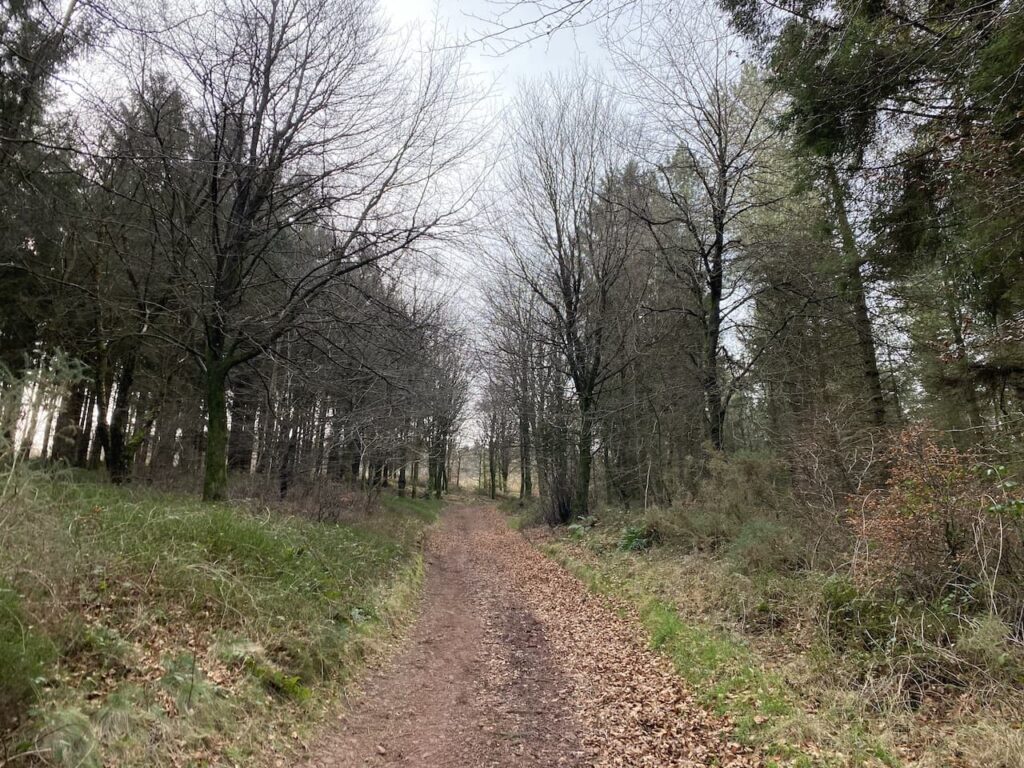
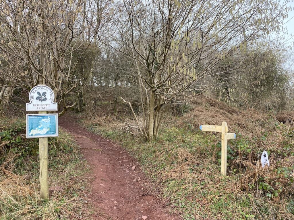
    After passing the Stables Inn I cross the road to take a permitted bridleway on the right which runs parallel to the A39.

    I follow this permitted bridleway with the hedge protecting me from the A39.  To my left is woodland.  

    The bridleway leads me to the point where earlier I hopped over the gate to bag Culbone trig pillar.  I now retrace my steps to return to the car.

    My walk has covered just over 5 miles which is much shorter than originally planned. I am looking forward to getting back to the caravan and resting up for the remainder of the day.

    You can view this 5.25 mile walk on OS Maps and download the GPX File Here

    To follow my walk, you will need Ordnance Survey Explorer Map OL9 – Exmoor

    8th December 2023

    © Two Dogs and an Awning (2023)

    All information on this site is provided free of charge and in good faith and no liability is accepted in respect of damage, loss or injury which might result from it.  To the best of my knowledge the routes are entirely on public rights of way or within areas that are open for public access.
    Walking can be hazardous and is done entirely at your own risk.  It is your responsibility to check your route and navigate using a map and compass.

  • Barrows and Combes On Dunkery Hill

    Barrows and Combes On Dunkery Hill

    After a couple of days walking from the caravan site I have decided it is time to get in the car to venture to a slightly different area.  Today I plan to walk up to Dunkery Beacon, a hill I have walked many times.  However, today I am going to ascend it on a path I have never walked.

    The starting place for my walk is the National Trust car park in Horner (Grid Ref SS898455).  I leave the car park by the path besides the pay and display machine and then join a minor road where I turn left soon passing Horner Mill, built around 1839.  After passing the mill I take a footpath on the right which goes through tall deer gates.

    This path follows a wide track uphill through Horner Plantation.  I am on the route of the Coleridge Way, this long distance trail covers the fifty miles from Nether Stowey, on the east side of the Quantocks, to Lynmouth linking locations associated with the poet Samuel Taylor Coleridge.  

    At a junction of paths I turn right in the direction of Webber’s Post following the Coleridge Way markers, annotated with a writing quill. 

    Ignoring paths to the right and left I gradually ascend Horner Hill keeping with the route of the Coleridge Way.  It is a cracking day and I soon get good views of Ley Hill on the opposite side of the combe.

    This area is part of the Holnicote Estate, the Acland family seat for the best part of 300 years before Sir Richard Dyke Acland, 15th Baronet, donated both this and the Killerton Estate to the National Trust.  The land covered 16,000 acres and was the largest donation received by the National Trust.

    On top of Horner Hill there is a weather hut, thought to have been originally built by the Acland’s to celebrate Queen Victoria’s Diamond Jubilee, it became known as the Jubilee Hut.  During World War II it was used as a look out post, but then fell into disrepair and collapsed in the winter of 1946.  The National Trust have rebuilt it following the original design, facing four directions it always provides shelter from wind and rain.

    I now continue along the Coleridge Way to reach Webber’s Post car park.  Here the route goes in a south easterly direction to cross a minor road and then after going through a thicket reaches another minor road which I cross and go into another parking area. This is a bit of a sun trap and the Exmoor ponies appear to have chosen the spot for some winter warmth.

    From the car park I follow the Coleridge Way as it goes uphill still heading south east.

    At a junction of paths I turn left on the Coleridge Way heading towards Wooton Courtney.  I have passed a couple of warning signs indicating there is gorse clearing work going on in the area.  In front of me I can see smoke rising from the controlled fires.

    The path goes close to the area being burnt, but the chaps supervising the fires make sure I can pass safely.  One of them has a chat with me about the methods by which gorse is controlled in this area of the moor.  It needs to be kept back otherwise it would smother everything and apparently an added bonus of fires is it regenerates the growth of heather.

    The challenge for these chaps is knowing which way the wind will take the fire, apparently it has changed direction three times in the last forty minutes.  Currently it is blowing from the east so as I continue along the path I know the smoke is blowing in the opposite direction.

    Nearing woodland I take a path on the right and follow the contour line heading south.  I soon reach the route of the Macmillan Way West.  A right turn here would take me up towards Dunkery Beacon, but instead I turn left and descend a few yards to reach a path on the right.  I have now rejoined the Coleridge Way and head steadily uphill.

    There are a couple of paths leading off the route but I stay with the Coleridge Way and skirt round a field and then start going downhill.

    I know if Lynnie was walking with me she would now be questioning the route and demanding why if we are walking up Dunkery Hill we are going downhill.  Of course the answer to the question is to see where the path leads.  

    This path leads into Hanny Combe and it is a stunning spot.

    I cross a stream and then it is a short steep ascent to reach a junction of paths.  I go to the right to follow the Coleridge Way towards Spangate.

    It is now a steady ascent towards Spangate with some stunning views behind me.

    At a junction of paths at Spangate I leave the Coleridge Way and turn right to head uphill on a broad track which has intermittent boulders along it.

    This is the first time I have approached Dunkery Beacon on this path.  It is a long steady ascent to reach a minor road.  After crossing I join a narrow path which heads west through the heather.  In the distance on the horizon I can see Dunkery Beacon.

    At a junction with a broader path I turn left and follow this route to reach the hill summit.  This is the highest point on Exmoor and also the highest spot in Somerset.  It stands at 1,705 feet and there is no protection from the elements so the wind is always blowing up here.  Today there is a slight breeze but I have been up here when it is difficult to stay on your feet.

    As I stand admiring the view I am approached by a lady who is interested in to know where I have walked from.  She is bewildered by the distance I have walked so far and how much further I am going to travel.  She has walked up from the road and says that was plenty enough for her.  We then spend ten minutes talking about the spots we can see.  She lives relatively nearby in Tiverton, but has never been up here before.

    I have a choice of routes here, but decide to extend my walk by following a clear track heading west towards Little Rowbarrow.

    The track passes by the ancient burial mound of Little Rowbarrow,  On top of the barrow is a cairn which in poor weather would be a welcome site on this section of moor.

    Soon I reach a junction of tracks where I turn right and pass Great Rowbarrow, this burial mound in more prominent and distinctive by the number of stones covering it.

    The track now goes north west and soon starts to descend with Wilmersham Common in the distance.

    At the road I turn right and follow this single track lane through Stoke Pero Common.

    On reaching a small parking area I turn right on a track which follows the fence and tree line downhill into Bagley Combe.

    The track leads down to a ford in Bagley Combe and then rises again and heads east towards Sweetworthy Combe.

    At a fork in the track I go left  and continue straight on at a junction of paths following a route which is shown on the map as Dicky’s Path.  This soon heads through the attractive Aller Combe.

    Now there is an open stretch of moorland before reaching trees to go through Hollow Combe after which the path heads north towards Easter Hill.

    I ignore routes leading off this path and keep going north until I reach the car park at Webber’s Post.   I now retrace my steps along the Coleridge Way until I reach the Memorial Hut where I take a path on the left descending steeply through Horner Side.

    The route zig-zags its way down the hill, I ignore paths from it to reach a footbridge over Horner Water.

    After crossing the footbridge I turn right and follow a wide track with the attractive Horner Water flowing to my right.

    I stay with this path heading towards Horner. After crossing a stone bridge I turn left along the road and walk through the hamlet to reach the entrance to the car park.

    My walk has covered almost 13 miles.  The sun shone for most of the day and it has felt more like a spring day than early February.  I have been very lucky with the weather this week.  Let’s hope it lasts into tomorrow because that will be my last chance to be out on the moor for a while.

    You can view this 12.6 mile walk on OS Maps and download the GPX File Here

    To follow my walk, you will need Ordnance Survey Explorer Map OL9 – Exmoor

    8th February 2023

    © Two Dogs and an Awning (2023)

    All information on this site is provided free of charge and in good faith and no liability is accepted in respect of damage, loss or injury which might result from it.  To the best of my knowledge the routes are entirely on public rights of way or within areas that are open for public access.
    Walking can be hazardous and is done entirely at your own risk.  It is your responsibility to check your route and navigate using a map and compass.

  • Jamming About to Dunkery Beacon

    Jamming About to Dunkery Beacon

    Whilst staying in Minehead in October last year Crosby and I walked from the site to Dunkery Beacon.  I was hoping for a clear day to appreciate the views from the Beacon but as I was walking the weather closed in and I struggled to see as far as the North Somerset coast.  I am heading towards Dunkery today but don’t plan to go to the summit.

    The start of my walk follows the route I took yesterday, leaving the site I turn left and walk uphill along the pavement besides the A39, Hopcott Road.  I keep with the road until I reach Periton Cross.  Here I turn left and take a bridleway on a track into Periton Combe.

    Soon I reach a metal barrier preventing vehicle access to the Combe, it has an information board about Dunster Woods attached to it.

    The path follows the track and then starts heading uphill.  There are forestry tracks in the woods but I keep with the way-markers for the bridleway as I ascend through the trees.

    It is a long steady haul up Periton Hill to reach Wootton Common, I was a bit chilly at the start of my walk but I soon warm up and start shedding layers.  

    At a fork in the track, as is reaches the edge of open land on Wootton Common, I fork to the left, still going uphill to reach a junction with a track running along the top of the hill where I turn right.

    At a fingerpost for Wootton Courtenay I turn left onto a track initially passing through Pine woods which are dark and featureless but at a junction of paths I turn right into a cracking area of Beech woodland.

    The path I am now on is marked on the map as Roadway Lane, this soon becomes a stunning sunken track descending steeply into Wootton Courtenay.  Such tracks will have been used for centuries and it would have been a challenging journey dragging a cart up this hill to reach Minehead.

    The track enters the village and passes the community hall and then reaches a road.  Here I turn right and then very soon take a lane on the left which is signposted to Brockwell and Ford.  This lane leads to a cattle grid with a gate beside it and then continues on to reach Brockwell.  At a T-junction I leave the road and take a bridleway with a fingerpost to Dunkery Beacon.

    The bridleway ascends gradually and then goes through an attractive area of woodland.

    At a junction of tracks I continue straight on, still going uphill and then emerge from the trees.  It had been my initial intention to turn right here and head towards Horner Wood, but it is such a pleasant day that I decide to head further up Dunkery Hill.  So I continue straight on making a gradual ascent through the heather.

    As I head up I decide that despite my initial plans I will walk to the summit of Dunkery Beacon.  This is often a feature of my solo walking, I have a rough idea of a route but at a junction of paths will go wherever the mood takes me.  So on reaching a minor road I cross and then pass a metal barrier to continue on towards the beacon.

    The ascent is now easier and there is a chance to take in the stunning views.  Reaching four Exmoor ponies I realise I have now seen more ponies than people on my walk.

    Heading towards the summit I see there are folk up there, but by the time I stop to look at the toposcope near the beacon they have moved on.  I do like a toposcope, not as much as a trig point, but they are always an interesting feature on a walk.

    In recent times the beacon has been repointed and it looks a bit stark until it weathers in.  This is the highest point on Exmoor and Somerset and as you might expect it is a bit breezy up here, but the last couple of times I have been here I have struggled to stay upright against the wind.

    Dunkery Hill forms part of the Holnicote Estate which was donated to the National Trust by Colonel W.W Wiggins in 1932.  The views from the summit are outstanding and today I can see all the way across to South Wales.  

    Close to the cairn a chap has what looks like a radio transmitter and aerial.  We have a brief chat and he explains he has been there a couple of hours and has been speaking to people in Europe and now is in a conversation with someone on the Brecon Beacons.  It must be a chilly hobby to participate in.

    I leave the summit following a path downhill heading north towards the coast.

    I ignore paths to the right and continue downhill towards a path marked on the map as Dicky’s Path.

    On reaching the junction with Dicky’s Path I turn right to head towards Aller Coombe. I later try, without success, to find the origins of the naming of this path.

    I follow the path into the combe and cross a ford around the head of the combe and then continue on to reach Hollow Combe.

    From this Combe I stay with Dicky’s Path to reach the large parking area at Webber’s Post.  This is another spot with stunning views.

    From the car park I join the Coleridge Way and follow the way-markers for this long distance path as it leads through Horner Wood.

    The Coleridge Way is a route based on the path said to have been walked by Samuel Coleridge  from Nether Stowey on the west side of the Quantock Hills to Lynmouth.  This section goes through attractive woodland reaching a minor road on the outskirts of Horner after going through a deer proof gate.

    At the road I turn left and walk through the hamlet, continuing along the road to reach a footpath on the left.  Here I take a short diversion to view the pack horse bridge over Horner Water.

    Returning to the road I turn left and head north towards West Luccombe.  Before reaching the village I take a footpath on the right heading east across a field of pasture.

    The way-marked route leads through kissing gates into another field and then follows the fence line to further fields to reach a minor road.

    I turn left along the road and follow it to Piles Mill.  This is a 16th century corn mill with an overshoot watermill.  In the 1930’s and 40’s it was used as a cider mill and is now a National Trust visitor centre.

    After passing the mill I cross the A39 and walk into Higher Allerford and then take a track on the right which leads steadily uphill towards Selworthy.  There are great views from the track looking over the route I was on earlier today.

    I pass fine old barns on the outskirts of Selworthy and then reach a road where I turn left and head uphill to pass the village church.

    After passing the church I continue along the single track lane to reach a crossing of tracks at Dean’s Cross, here I continue straight on along the narrow lane to reach a junction of footpaths on the edge of Little Headon Plantation.  I go through a gate straight in front of me to walk along the northern edge of the plantation.

    Heading along this footpath I get a cracking view of North Hill away to my left.

    The footpath leads into a pasture field where I continue with the hedge line to my left until I reach a way-marker which indicates the path goes through a gate and then downhill on a fenced path towards a minor road.

    At the road I turn right and follow the lane heading back towards Minehead, soon I pass Bratton Court and then continue straight on to stay with the road to reach housing at Woodcombe.  At a road I turn left and then very quickly take a path besides a stream through a park.

    At a road I turn right and then almost immediately left to continue following the stream through another park.  The route is marked as the Parks Walk and leads me to the outskirts of Minehead where I turn left and walk into the town centre and then wend my way back through the streets to reach the caravan park.

    My walk has covered 17 miles which is further than I had intended when I set off, but it has been a cracking day to be out and I have walked through some stunning scenery.

    You can view this 17 mile walk on OS Maps and download the GPX File Here

    To follow my walk, you will need Ordnance Survey Explorer Map OL9 – Exmoor

    11th February 2022

    © Two Dogs and an Awning (2022)

    All information on this site is provided free of charge and in good faith and no liability is accepted in respect of damage, loss or injury which might result from it.  To the best of my knowledge the routes are entirely on public rights of way or within areas that are open for public access.
    Walking can be hazardous and is done entirely at your own risk.  It is your responsibility to check your route and navigate using a map and compass.

  • The Smallest Church in England

    The Smallest Church in England

    Almost exactly a year ago I took a trip to Minehead CAMC without Lynnie.  She decided to stay at home whilst Crosby and I walked on Exmoor.   During the week I did a number of cracking walks I had not previously done.  This year I have persuaded Lynnie to join us, I am not sure whether it was the thought of some new walks or the promise of visits to a few tea rooms that temped her.  I am pretty sure it was the latter.

    The final walk on my last trip was a stunning, circular walk from Bossington visiting Porlock Weir, Culbone Church, Worthy Wood and Porlock.  At around 12 miles it is an acceptable distance for Lynnie and is a new walk she is keen to do.  Our starting point is the National Trust car park in Bossington (TA24 8HF) (Grid Ref: SS898479).  

    From the car park we join the road and turn right and at a junction continue on a right fork to head along a dead end lane passing Bossington Farm and heading towards the beach.

    On the beach we turn left towards a World War II pillbox.

    Just a bit further along is an impressive disused lime kiln.  This is the last remaining one of four kilns on this beach and is thought to have been built in the early 1800’s.

    Close to the lime kiln is another pillbox, this one is a bit further inland and looks better protected from the ravages of the sea.

    From the pillbox we take a path that goes beside a wall over marshy pasture and then at a junction of paths we turn left and follow a raised walkway across the salt marsh heading inland.  There are cracking views of Bossington Hill from here.

    At a junction of paths we turn right and follow the route of the South West Coast Path towards Porlock Weir.  After crossing a footbridge over a stream we reach a memorial to the crew of an American Liberator bomber that set off on 29th October 1942 from Holmsely airfield in the New Forest as part of an anti-submarine patrol in the Bay of Biscay.  On its return flight it encountered bad weather and  clipped Bossington Hill.  The plane crashed on the marshland and eleven of the twelve man crew lost their lives.

    We continue on the path through the petrified remains of ancient woodland on the marshes which formed part of a submerged forest.

    We stay with the coastal path way markers and soon follow a shingle bank heading towards Porlock Weir.

    As the path reaches a road we turn right and wander into Porlock Weir passing the Ship Inn, or Bottom Ship, as it is known.  This is because there is also a Ship Inn in nearby Porlock.

    A bit further on we reach the harbour.  There was once a thriving industry here catching Oysters and the harbour was also visited by herring fleets.  These days the fishing industry is small, the harbour is mainly occupied by pleasure vessels, though oyster farming was revived in 2013 and they can be purchased at the harbour.

    It is a pleasant, sunny, autumnal day and we decide to stop at a picnic bench beside the harbour and get a pot of tea from a cafe situated in the converted barns.  Lynnie seizes the opportunity to look at the crafts in the gallery. 

    Refreshed we resume our walk and take a footpath on the left just after the barns.  This goes up some steps to reach the edge of a field of pasture.  Now we follow the way-markers to reach a minor road where we turn right and continue down to the gates of the private toll road at Worthy.  This toll road on the Porlock Manor Estate was built in the 1840’s to provide work for local people following the Napoleonic Wars.  Originally the tolls were collected at the Ship Inn in Porlock Weir, but these days they are collected at the gates.

    Our route continues on the coastal path through the arch to the right of the main gate and then goes steadily uphill passing through tunnels.  Apparently early in the 19th century the Earl of Lovelace built a home here for his bride, Lord Byron’s daughter Ada. This was a rambling folly called Ashley Coombe which was demolished in the 1950’s.  It is said that these tunnels were built so that Ada did not have to see tradesman delivering goods to her home.

    The path steadily ascends through the trees, over time landslips have meant the path has been diverted, there is the occasional section where recent erosion makes the going a bit tricky and the walking poles are deployed for extra stability.  After getting the occasional view across  the sea to the south coast of Wales we start to descend into the hamlet of Culbone and  make our way to the churchyard.

    St Beuno’s church still holds regular services and is said to be the smallest church in England seating just 30 people.  It is a cracking little church dating back to pre-Norman times, the porch was added in the 13th century.

    After stopping for lunch on a bench in the churchyard we leave via a gate leading to a footpath beside a stream and turn right following the way-markers to Silcombe Farm.  This path goes by a cottage and then continues up through Withy Combe on a clear way-marked path.

    At a junction of paths we turn left and continue heading uphill on a hedge lined track to reach a gate.

    After going through the gate we continue along a track besides a field to reach another gate where we join a minor road near Silcombe Farm. Now we turn left and follow this lane, Yearnor Mill Lane, passing a series of entrances to farms, Parsonage Farm, Ash Farm and Yarner Farm.  Along the way there are stunning views of the coastline.

    We are now on the Coleridge Way, I have walked a number of sections of this 51 mile route which goes from Samuel Taylor Coleridge’s home in Nether Stowey to Lynmouth. It is said that he walked the route frequently to visit friends.  Coleridge was mates with William and Dorothy Wordsworth, at the time Coleridge was in Nether Stowey the Wordsworth’s were also in the Quantock Hills at Alfreston, he was also a contemporary of Lord Byron.

    We ignore a road to the right to Lynmouth and stay with Yearnor Mill Lane to a junction with Pitt Lane, here turning left we go steadily downhill to reach the entrance to the Worthy Hill Toll Road.   The toll road is not accessible to walkers so we take a footpath on the right signed to Porlock.  This goes through a gate and joins an attractive track through trees in Worthy Wood.

    We are still on the Coleridge Way, but where it veers to the left we stay on the main track at the southern edge of the woods.  Then at a fork in the path we go left and continue downhill to a junction of tracks and turn left.  At the next junction of tracks we turn right and rejoin the Coleridge Way and follow the track to the Community Hall at Porlockford.  Now we turn right up a track besides the hall and then cross a stream at a footbridge on the left.

    We are still on the Coleridge Way and follow this towards Porlock.  It is a wooded path but we get occasional glimpses of the coastline and Porlock Bay.

    The path leads into Porlock where we turn left and wander through the village to pass the Ship Inn, or the Top Ship as it is known.  This pub dates back to the 15th century and as you would expect of such an old inn there are many tales of smuggling and other goings on.  The pub’s website has tales of its interesting history.

    We continue through the village to pass the church of St Dubricius with its unusual spire that appears to have had the top cut off.

    From the church we continue along the High Street and then take a left turn into Sparkhayes Lane and follow this out of the village towards the coast. At a junction of paths we turn right to join the South West Coast Path with a cracking view of Bossington Hill in front of us.

    We now follow the way-markers back into Bossington to reach our starting point in the National Trust car park.  Our walk has covered 12 miles and has gained full approval from Lynnie.

    You can view this 12 mile walk on OS Maps and download the GPX file here

    To follow our walk you will need Ordnance Survey Outdoor Explorer Map OS9 Exmoor

    25th  October 2021

    © Two Dogs and an Awning (2021)

    All information on this site is provided free of charge and in good faith and no liability is accepted in respect of damage, loss or injury which might result from it.  To the best of my knowledge the routes are entirely on public rights of way or within areas that are open for public access.
    Walking can be hazardous and is done entirely at your own risk.  It is your responsibility to check your route and navigate using a map and compass.

  • Porlock Weir and Culbone

    Porlock Weir and Culbone

    Before I left home I mentioned to a friend that I was heading to Minehead to do some walking on Exmoor and she asked if I had ever walked to Culbone church from Porlock Weir.  Despite my many visits to this area I confessed to never having visited Culbone so today I plan to rectify that.

    The starting point for my walk is the National Trust car park in Bossington (TA24 8HF) (Grid Ref: SS898479).  From the car park I rejoin the road and turn right and then at a junction continue on a right fork to head along a dead end lane that passes Bossington Farm.

    I stay with the tarmac lane until it becomes a track and then continue towards the coast, ignoring two footpaths leading off to the left.

    On reaching the pebble beach I take a moment to look to the right at Bossington Hill.  A few days ago I had a cracking walk up there and it has been added to my list of places to walk again on a return visit.

    My route now follows the path along the coastline heading towards Porlock Weir and I soon reach a World War II pillbox.

    Soon after the pillbox I arrive at a cracking old disused lime kiln.  This is the last remaining one of four kilns on this beach and is thought to have been built in the early 1800’s.

    The path now goes through a gate to enter an area of marshy pasture and then at a junction of paths I turn left and follow a raised walkway heading inland.

    As I head across the walkway there are stunning views in both directions.

    At a junction of paths I turn right and follow the route of the South West Coast Path heading to Porlock Weir.  I soon reach a memorial to the crew of an American Liberator bomber that set off on 29th October 1942 from Holmsely airfield in the New Forest as part of an anti-submarine patrol in the Bay of Biscay.  On its return flight it encountered bad weather and  clipped Bossington Hill.  The plane crashed on the marshland and eleven of the twelve man crew lost their lives.

    I continue on the path through an area of ancient woodland on the marshes which form part of a submerged forest.

    I stay with the coastal path way markers and soon follow a shingle bank as I near Porlock Weir.

    As the path reaches a road I turn right and wander into Porlock Weir passing the Ship Inn to reach the harbour.  

    It is the first time I have been here and I am sure by normal standards it is quiet, but after months of avoiding people there are more folk around than I am comfortable with so I decide not to hang around and continue on the route of the coast path.  This passes a converted barn housing shops and food outlets and then at a junction of paths goes right up some steps before heading along the edge of a field.

    The path reaches a minor road where I turn right and continue down to the gates of the private toll road at Worthy.  This toll road on the Porlock Manor Estate was built in the 1840’s to provide work for local people following the Napoleonic Wars.  Originally the tolls were collected at the Ship Inn in Porlock Weir, but these days they are collected at the gates.

    My route continues on the coastal path through the arch to the right of the main gate and then goes steadily uphill passing through tunnels.

    The South West Coast Path now goes up through Yearnor Wood. There are warning signs to follow a diversion as the cliff has eroded and the original path is no longer considered safe.  This is an attractive path through woodland.

    As I near Culbone the path descends to reach a cottage by the church.  I go through a gate into the churchyard to visit the church of St Beuno.  This is said to be the smallest church in England and seats just 30 people.  

    It is a cracking little church dating back to pre-Norman times, the porch was added in the 13th century.  It is surprising that on this pleasant afternoon at the end of October I am the only person here.

    I leave the churchyard by a gate that leads to a footpath besides a stream and turn right following the way-marker to Silcombe Farm.

    This path goes besides a cottage and then continues up through Withy Combe on a clear way-marked path.

    After going through a gate I continue along a track besides a field of pasture to reach another gate and then join a minor road near Silcombe Farm.

    I turn left along this lane, Yearnor Mill Lane, and pass a series of entrances to farms, Parsonage Farm, Ash Farm and Yarner Farm.  Along the way there are stunning views of the coastline.

    I ignore a road to the right to Lynmouth and stay with Yearnor Mill Lane to a junction with Pitt Lane, then turn left going steadily downhill to reach the entrance to the Worthy Hill Toll Road.   The toll road is not accessible to walkers so I take a footpath on the right signed to Porlock.

    Since joining Yearner Mill Lane I have been on the route of the Coleridge Way. This is a 51-mile walk from Nether Stowey on the east side of the Quantock Hills to Lynmouth and is said to follow a route through the countryside that inspired Samuel Taylor Coleridge’s writing.  The section I am on leads through the trees of Worthy Wood.

    Where the Coleridge Way veers off to the left I stay on the main track at the southern edge of the woods.  Then at a fork in the path I go left and continue downhill to a junction of tracks and turn left.  At the next junction of tracks I turn right and rejoin the Coleridge Way and follow the track to the Community Hall at  Porlockford.

    At the Community Hall I turn right up a track and then cross a stream, still following the route of the Coleridge Way I stay with the way-markers through an area of woodland with occasional glimpses of the coastline.

    The path leads into Porlock where I turn left and wander through the village to pass the church of St Dubricius with its interesting spire which appears to have had the top cut off.

    From the church I continue along the High Street and then take a left turn into Sparkhayes Lane and follow this out of the village towards the coast. At a junction of paths I turn right to join the route of the South West Coast Path and follow this back to my starting point in Bossington.  It has been a cracking 12 mile walk and by the time I get back to the car it is dusk.  I am heading home tomorrow so need to get back to the caravan to start packing up for an early start.

    You can view this 12 mile walk on OS Maps and download the GPX File Here

    To follow our walk you will need Ordnance Survey Outdoor Explorer Map OS9 Exmoor

    31st October 2020

    © Two Dogs and an Awning (2020)

    All information on this site is provided free of charge and in good faith and no liability is accepted in respect of damage, loss or injury which might result from it.  To the best of my knowledge the routes are entirely on public rights of way or within areas that are open for public access.
    Walking can be hazardous and is done entirely at your own risk.  It is your responsibility to check your route and navigate using a map and compass.

  • Countisbury to Lynmouth

    Countisbury to Lynmouth

    Yesterday when I met Sarah, my Twitter buddy, at Periwinkle Cottage tea rooms in Selworthy we chatted about walks on Exmoor.  A number of the places that Sarah mentioned I had previously visited but there were a few I hadn’t.  One of those locations was Countisbury which Sarah told me had stunning views of the coastline.

    The starting point for my walk is the free car park besides the A39 at Barna Barrow, which is just east of Countisbury (Grid Ref SS752496).  My plan is to walk from the top of the hill into Lynmouth, but first I want to head east to Countisbury Common to bag the OS trig point on the hill.  Leaving the car park I initially head north and then follow a track as it sweeps to the right to head east. 

    After crossing a driveway the path continues east to pass Kipscombe Farm and then goes through fields.  After passing through a gate I make a brief diversion from the path by following the fence line uphill and then enter a field where the OS trig point sits on top of Kipscombe Hill.  This the 220th I have bagged.

    After admiring the views from the trig pillar I retrace my steps downhill and on reaching the gate turn right along the footpath to head through fields.  At a junction of paths. I go left to enter access land above the cliff.

    The path I’m on heads north towards the sea and then at a junction I turn left and follow this path as it enters trees and then fords a stream.

    It was my original intention to walk through Chubhill Wood to pick up the coastal path, but it is clear that this will mean walking through trees and missing out on the views so instead I follow a well-worn path which heads west across the top of the access land to reach a gate.  Going through the gate I rejoin the footpath I was on earlier and head west back towards Kipscombe Farm.

    On reaching the track just beyond the farm I take a path heading north west heading towards a telecoms mast.

    I stay with this track to pass the mast and reach the Ordnance Survey trig point close to it.  This is my 221st and has more cracking views.

    From the trig pillar I continue along a broad path heading towards Countisbury Church and then stop at a bench to enjoy the view and eat my lunch.

    Heading off again I pass Countisbury Church and briefly join the South West coastal path before going left through a gate and heading down to cross the A39. 

    On the far side of the road there is a choice of three paths.  I take the central one heading steadily downhill in a valley through South Hill Common.

    At a junction of paths I turn right and follow the Coleridge Way footpath above the river.  

    There are a network of paths heading west through this valley I stay with the Coleridge Way and then drop down to cross the river and walk a short distance on the south bank before crossing the river again.

    The recent weather means the river is fast flowing.  But this is nothing compared to how the river would have looked back on the on the night of the 15th August 1952.  Then torrential rain fell on the already saturated surrounding moorland.  Over the course of a couple of hours the East Lyn and West Lyn river levels rose and the power of the water was enough to move rocks and debris downstream.  As the force of the rivers met at Watersmeet their combined power was enough to cause devastation to anything in its wake.  

    Sadly this resulted in total disaster in Lynmouth with 34 lives lost and many properties destroyed,  420 people were made homeless.

    My route now runs close to the river as it approaches Lynmouth.

    On reaching the village I cross the bridge and then turn right to walk towards the harbour.

    After months of avoiding crowds and busy spots the village is a bit too crowded for me.  So I wander around to the Lynton and Lynmouth cliff railway.  This was opened in 1890 and was built to transport freight arriving at Lynmouth to Lynton high above it on the cliff.  With the emergence of tourism in the last 1890’s the railway was soon carrying passengers and it has run continuously ever since.  It is water powered by a clever water system using two cars, water is put into the top car and emptied when it reaches the bottom.

    I walk back around past the harbour and at the junction turn right and quickly left into Watersmeet Road and follows this for a hundred yards to reach a footpath on the right way-marked for the Two Moors Way.

    This path heads steeply through houses and then enters woodland and continues to climb as it zig zags its way up.  I stay with the Two Moors Way as it emerges from the trees and continues heading east along the fence line.

    At a junction of footpaths I turn right to leave the Two Moors Way and head south across fields.

    At a junction of paths I go left heading along the edge of a field and then go through a gate to follow a wall-lined grassy path to reach Lower East Lyn Farm.

    The path passes the farm and continues on through Higher East Lyn Farm and then goes through a gate onto a grassy track.

    There are soon good views in all directions as I stay with the path ignoring others leading off to the left.

    The path I am on soon starts to sweep round the top of the hill and turns towards the south to reach Myrtleberry South Iron Age Enclosure.

    Now the path descends gradually through the trees heading towards the A39.

    On reaching the road I walk besides it for a short section heading downhill to Hillsford Bridge where I cross the river and take a footpath on the left heading into the Watersmeet Estate.

    The path follows the course of the river to reach Watersmeet. 

    Crossing the river I pass the cafe.  The water level is not too high, but its force is still noticeable as it squeezes through the rocks.

    There are a few path options here but I stay with the route that heads north besides the river.

    Soon the path goes away from the river to reach the junction of paths I was at earlier in my walk.  This time I go uphill retracing my steps along the steep path heading through the valley on South Hill Common.

    I get caught in a heavy rain shower, it has been threatening for much of the afternoon but had managed to evade me until now.  Nearing the A39 I turn right taking a permitted path that avoids the road to arrive in the village at a pavement.  I continue up the hill to pass the Blue Ball Inn and then turn left on a minor road heading up to the entrance to St John the Evangelist church.

    The path leads through the churchyard and through a gate where I turn right and follow a path heading west back to my starting point in the car park.  My walk has covered just over 11 miles and I have enjoyed stunning views all the way round.

    You can view this 11 mile walk on OS Maps and download the GPX File Here

    To follow my walk you will need Ordnance Survey Explorer Map OL9 Exmoor

    7th October 2020

    © Two Dogs and an Awning (2020)

    All information on this site is provided free of charge and in good faith and no liability is accepted in respect of damage, loss or injury which might result from it.  To the best of my knowledge the routes are entirely on public rights of way or within areas that are open for public access.
    Walking can be hazardous and is done entirely at your own risk.  It is your responsibility to check your route and navigate using a map and compass.

  • Exploring Combes on the Quantock Hills

    Exploring Combes on the Quantock Hills

    Today we are returning to a familiar spot to walk on the Quantock Hills.  The forecast is for a bright but chilly day. Ideal to enjoy one of my favourite parts of the Country.  The starting point for our walk is a parking area just off of the Crowcombe Road to the east of Wilmot’s Pool.

    Leaving the parking area we head north west on a grassy track that joins a stony track heading west skirting the summit of Black Hill.

    After yesterday’s rain the sunshine is a welcome relief and there is great visibility into Frog Combe with Dowsborough Hillfort standing prominently behind.

    We stay with the track until we reach Halsway Post where we stop to take in the view of the Brendon Hills to the west.

    At the junction of tracks we follow the route heading north west towards Lowsey Thorn at the head of Slaughterhouse Combe soon spotting a herd of deer camouflaged in the dead bracken.

    We stay with the track to Bicknoller Post, from here there is a network of paths we head north and then at a fork in the track go left to reach the summit of Beacon Hill.  On the summit there is an Ordnance Survey trig pillar that we have visited many times.  One memorable day in 2014 it was so windy here that we could hardly stand up. 

    Today there is a gentle breeze and the views towards Minehead are stunning.

    From the trig pillar we continue north and then head north east down a path into Herridge Combe.  Despite having walked extensively on the Quantocks I cannot recall previously walking down this small combe.  It is a cracker.

    At the junction of Herridge Combe and Gay’s House Combe we cross the stream and continue north along the attractive Smith’s Combe.

    At a junction with the Coleridge Way we turn right and head west.  This is a section of the 50-mile trail between Nether Stowey on the east side of the Quantocks and Lynmouth and links places associated with Samuel Taylor Coleridge.

    We follow the Coleridge Way until just after Dens Combe, here we fork right to head up hill on the eastern side of the Combe.

    At a junction of tracks we turn and head back downhill and to rejoin the Coleridge Way which soon passes cottages.  Our route heads steadily downhill to pass Alfoxton House which appears in need of repair.

    The route is now a tarmac driveway and we follow this through the edge of Alfoxton Wood to reach the old Dog Pound on the edge of Holford. This is where the local stray dogs used to be housed.

    Apparently local hunting dogs were kept on the Alfoxton Estate, cared for by the huntsman.  The meat for the hounds was hung in trees attracting local stray dogs who unsettled the hounds. One night the huntsman was woken by the sound of dogs and went to investigate, unfortunately he did not put on his normal hunting garments and as a result was attacked and killed by his own dogs. To prevent strays causing a repeat occurrence the dog pound was built.  

    After passing the Bowling Green we turn right up a track heading towards Hodder’s Combe.  Over the years I have walked this Combe hundreds of times, but I am still struck by its beauty.

    At the top of the Combe we fork left into Somerton Combe and then very quickly take a steep path heading up through the trees.  As we near the top of the ascent Lynnie suddenly realises she has dropped one of her expensive Sealskin walking gloves.  So, I head back down in search of it.  I walk back to Hodder’s Combe but find no trace of the missing item and trudge back up the hill.

    Rejoining Lynnie we continue to a crossing of paths on Lower Hare Knapp and turn right to head uphill to the cairn on Higher Hare Knapp.

    From the cairn we take a path heading south on the ridge between Street Combe and Frog Combe, the light is now beginning to fade so we maintain a steady pace.

    At a junction of paths we turn left and rejoin the track heading back to the car park.  As we get back to the car the moon has risen over Bridgewater Bay.

    Our walk has covered nine miles and has taken us to parts of the Quantocks we have not previously visited.  We have already decided that tomorrow we will return to the hills to see if we can find Lynnie’s missing glove!

    To follow my walk you will need Ordnance Survey Explorer Map OL140 – Quantock Hills & Bridgewater.

    You can view this 9 mile walk on OS Maps and downland the GPX File Here

    Additional Information

    For more detailed walking directions and GPX download visit my associated Walking Moonraker website.

    10th January 2020

    © Two Dogs and an Awning (2020)

    All information on this site is provided free of charge and in good faith and no liability is accepted in respect of damage, loss or injury which might result from it.  To the best of my knowledge the routes are entirely on public rights of way or within areas that are open for public access.
    Walking can be hazardous and is done entirely at your own risk.  It is your responsibility to check your route and navigate using a map and compass.

  • Walking in the Doone Valley and along the Coleridge Way

    Walking in the Doone Valley and along the Coleridge Way

    When I was staying in Minehead on my own in January I did a walk from Malsmead along the Doone Valley.  It was a stunning day and when I recounted the trip to Lynnie she was keen to visit the valley.  So today, as our current trip nears its end, we are going to do a slightly shorter version of my previous walk.

    (more…)
  • Back On The Quantock Hills

    Back On The Quantock Hills

    After my very enjoyable walk around the flat lands of Steart Marshes yesterday I feel in need of a few hills, so I am returning to the Quantocks.  I start my walk from the car park at Dead Woman’s Ditch (Grid Ref ST161381).
    (more…)

  • Exploring New Tracks on the Quantock Hills

    Exploring New Tracks on the Quantock Hills

    Today I am walking on my own whilst Lynnie catches up with friends in Taunton.  So after dropping her off I head for the Quantock Hills and park at Dead Women’s Ditch.

    (more…)