Tag: Cadmore End

  • Returning to Bottom Wood

    Returning to Bottom Wood

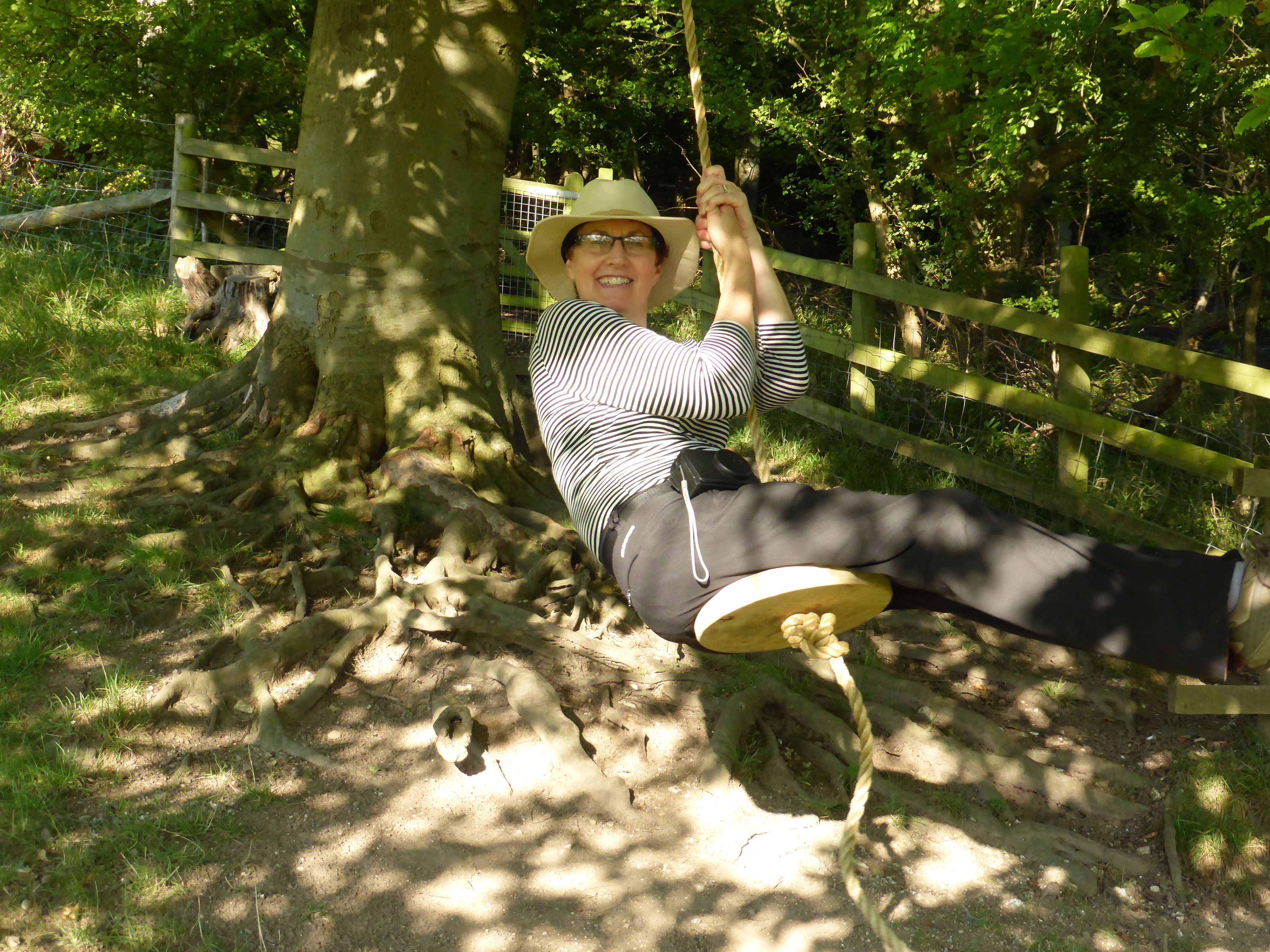
    After a week on my own in the caravan I have been joined by Lynnie.  She has decided to join me on a walk today as part of my planned route is through Bottom Wood.  I walked there a week ago and told Lynnie how stunning it was and she is keen to see for herself.

    We set off from Cholsey Grange by the farm track, heading downhill to reach the footpath leading into Penley Wood.  At the junction of paths we turn right and head towards the woods and then in the trees take a path on the left.

    We stay on the path at the bottom of the valley until we reach a stile beside a gate leading to a track alongside an arable field. 

    Turning right on the track we stay with it skirting the field and passing fields with horses in.  At a stile besides a gate we cross and continue on the track to go through the tunnel under the M40 and walk into Stokenchurch.  We continue across the green to pass the Kings Hotel and then join Church Street following this to the junction with Park Street where we turn right besides the Royal Oak pub.

    We have now joined the Chiltern Way and at a fork in the path we go right through a gate and stay with this long distance path as it heads across fields.

    Through another kissing gate we soon join a track where we go right and follow the way-markers with the footpath running beside a hedge.

    At a junction of paths we stay with the Chiltern Way heading diagonally across a field towards farm buildings in the distance.

    At a junction of paths we turn right and within a very short distance go left to cross a stile and continue towards the farm.  After crossing a farm track the path ascends steeply towards Andridge Farm.  Stopping for a breather we get a fine view back across the valley.

    After going through gates the path joins a track.  Here we leave the Chiltern Way and follow the driveway to reach Sprigs Holly Lane where we turn right and head steadily downhill into Radnage. It was our intention to visit the church in the village, but there is a funeral service going on so we’ll return another day.

    At a junction we turn left  and follow the road towards the church and then after a couple of hundred metres we go right on the Chiltern Way heading towards Bledlow Ridge.

    This path leads into Yoesden Nature reserve, this is a thirty-two acre site managed by the Berkshire, Buckinghamshire and Oxfordshire Wildlife Trust and is a combination of chalk downland and Beech woodland.  Before becoming a nature reserve the trees in the woodland would have been managed to produce timber for the furniture industry.

    This a cracking spot and there are some great views as we ascend the ridge.

    Keeping with the Chiltern Way we follow the path to reach the village of Bledlow Ridge where we turn right and walk along the pavement until we reach St Paul’s Church.

    In 1801 a church was built to the north of the village but this was replaced in 1834 on a site more central to the village.  However, that church was then replaced in 1868 by the current building.

    This church has the feeling of one that is being regularly used for community activities.  So many churches we visit feel like they are used for a service once a week and in between hardly anyone ventures in.  

    Leaving the church we continue through the village to pass Haw Lane on our left and then 50 metres further on take a track on the right.  We stay with this track as it descends steeply to reach Bottom Road where we turn left and then after 50 metres right to follow a path besides fields.

    We reach a minor road in an area of Radnage known as The City.  Although sparsely populated Radnage village spreads across a wide area.  Apparently this part of the village once formed part of the village known as Radnage Manor, this was owned by the Crown. King Charles I mortgaged the land to the City of London.

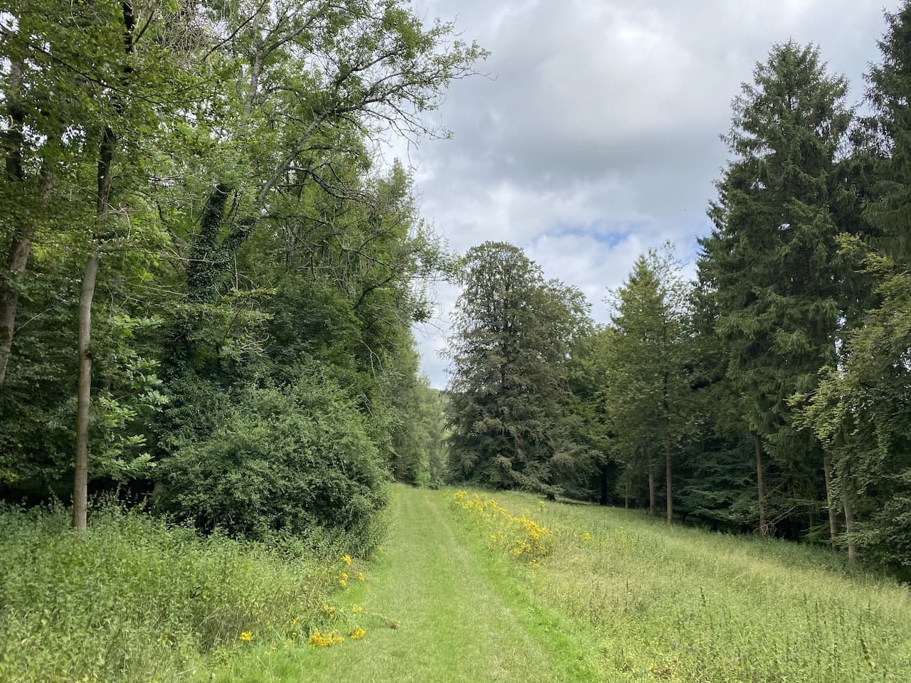
    On reaching Radnage Common Road we turn right and soon pass a playing field before continuing down the lane to reach Ashridge Farm.  At a junction of paths we keep left to follow a wide path towards Bottom Wood.

    The track leads through a gate into the woods.  Now we turn left and follow a broad track through this attractive area of woodland.  An information board explains the 36 acre Bottom Wood is owned by the Chiltern Society and was given to the charity in 1984 by nearby resident Cynthia Ercolani.  Later research suggests that Cynthia was the wife of Lucian Ercolani whose family ran the Ercol furniture business based in High Wycombe.

    Staying with the track we go through the bottom of the woods and pass a concrete slab covering a well.  Apparently this well is 100 feet deep and was once used to provide water to the nearby hamlets of Beacon’s Bottom and Radnage Common.

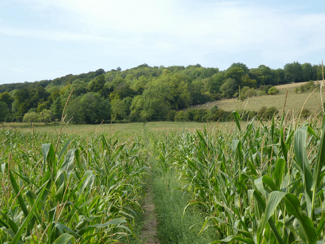
    The route through the bottom of these woods is an old packhorse trail.  After leaving the trees the route continues along a track to reach Ham Farm.

    After passing the farm we reach the A40 and cross to join a minor road opposite which is the Dashwood Roadhouse pub.  After 50 metres we leave the road and turn right onto a farm track heading towards Hillingdon Farm.

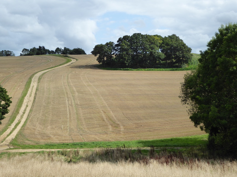
    Past the farm we continue to reach a crossing of paths, we go straight on through a belt of trees towards Barn Wood.

    After 300 metres we reach the edge of Barn Wood, at a junction of paths, we continue straight on through the woodland following a path towards Leygrove’s Wood.  On entering Leygrove’s Wood we carry straight on now on a broad track.

    On leaving the woods we go through a small clearing and then enter Pound Wood and stay with the track through the wood until we fork left onto a footpath that heads steadily uphill to reach a tunnel under the M40.

    On the far side of the tunnel we follow the track up to the B482 and turn right to join a pavement and pass a school.  We now cross the road and then a village green and follow the lane into Cadmore End. After passing the church we turn right on a footpath along a track heading out of the village.  

    At a junction of paths we turn left to stay on the track as it heads downhill to reach the edge of Hanger Wood.  As we enter the trees the path divides, we take the right fork.

    About two hundred metres further on we take a footpath on the right which heads through the trees to pass a dew pond on our left.

    The path now descends steeply to reach a gate into a field of pasture where we pass a redundant stile.

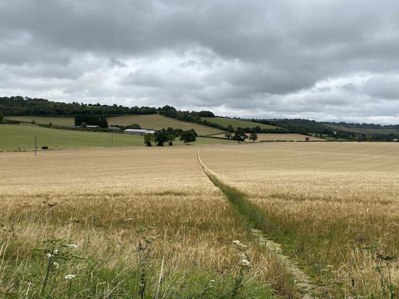
    As the path heads downhill there are fine views towards Fingest.

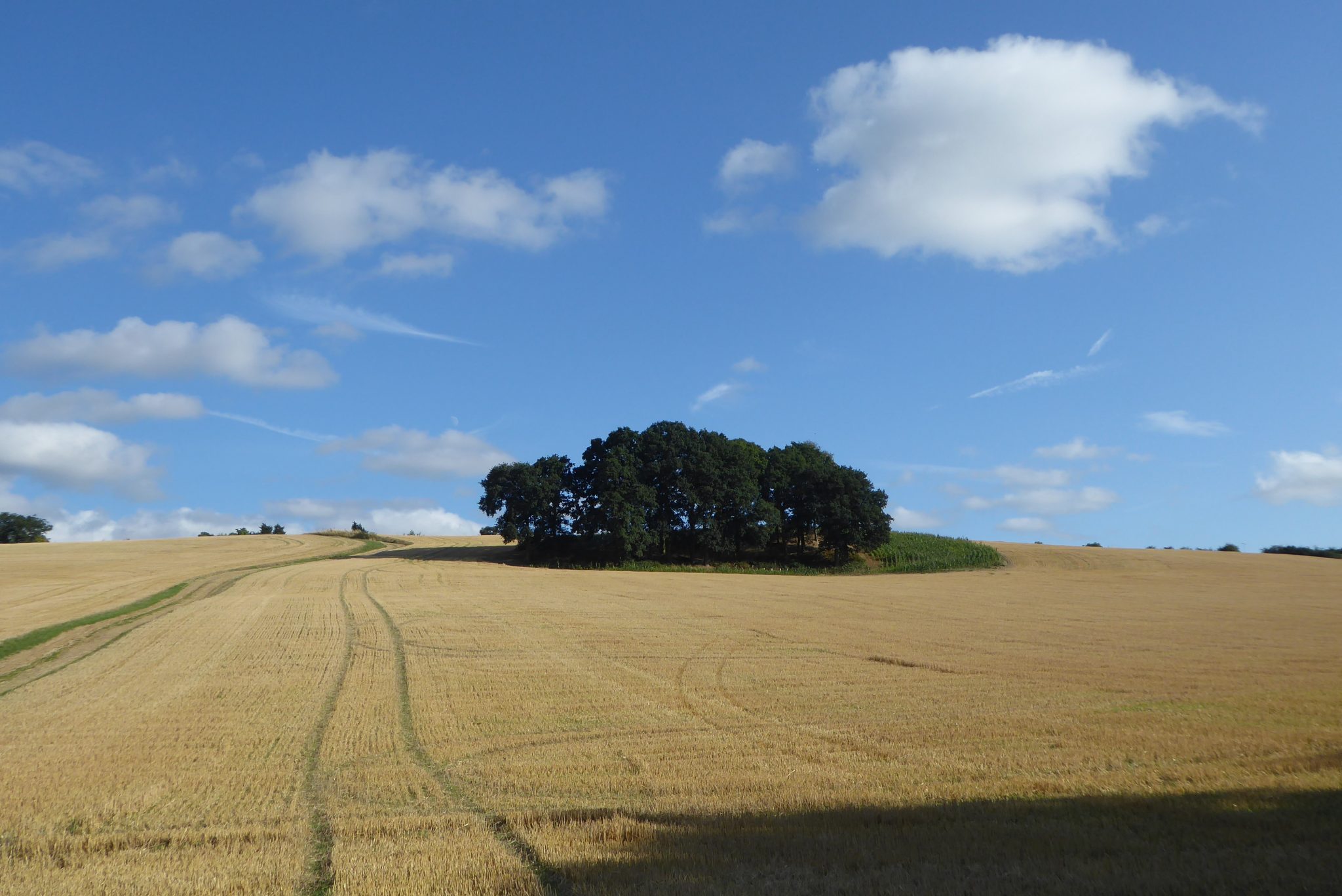
    After passing through two gates we reach a minor road, Chequers Lane, where we turn right and then very soon after turn left along a track with footpath way-markers.  We now follow this track through the bottom of the valley towards Twigside Bottom.

    After a mile and a half on this path we reach a junction of paths at a clearing and turn left to head uphill towards Cholsey Grange.

    This path brings us to the metal gate at the south side of the caravan site. 

    You can view this 14 mile walk on OS Maps and download the GPX File Here

    To follow my walk you will need Ordnance Survey Explorer Map 171 – Chiltern Hills West

    12th August 2021

    © Two Dogs and an Awning (2021)

    All information on this site is provided free of charge and in good faith and no liability is accepted in respect of damage, loss or injury which might result from it.  To the best of my knowledge the routes are entirely on public rights of way or within areas that are open for public access.
    Walking can be hazardous and is done entirely at your own risk.  It is your responsibility to check your route and navigate using a map and compass.

  • Bottom Wood from Ibstone

    Bottom Wood from Ibstone

    Most of my walking from Cholsey Grange CL has been to the west of the M40, occasionally I have wandered to the other side of the motorway but I have not really explored that area in detail.  So my walk today will take me into new territory.

    I set off leaving Cholsey Grange by the farm track heading downhill to the footpath leading into Penley Wood.

    In the woods I turn left and follow the footpath along the bottom of the valley for 200 metres and then at a junction of paths turn right to head uphill on a steep path.  This is the sort of hill that makes the calf muscles burn and lungs hurt, but I am determined to reach the top without stopping.  The path meets a kissing gate leading into a field.

    The route goes directly across the field to the far side and then turns right along the hedge line before going through a gate.  The way-markers then direct me to a fenced path leading to steps up to a minor road where I turn left and cross the M40.  On the far side of the motorway I turn right down a tarmac driveway and after 100 metres turn left onto a way-marked footpath into East Wood.

    The footpath through these woods is well marked as it initially heads to the east and then turns towards the north.

    At a junction of rides the path goes to the right and heads east towards the edge of the woodland.  At a fork in the path I go to the left and stay close to the edge of the woods to reach the A40 which I cross with care and join a footpath on the far side which heads downhill towards a copse.

    The path through the trees leads to a minor lane where I turn left and walk for 300 metres to reach a junction with a track.  Here I turn right towards Ashridge Farm.

    At a junction of tracks close to Ashridge Farm I turn right to take the track leading towards Bottom Wood.

    The track leads to a gate into the woods.  Now I turn left and follow a broad track through this attractive area of woodland.  An information board explains the 36 acre Bottom Wood is owned by the Chiltern Society and was given to the charity in 1984 by nearby resident Cynthia Ercolani.  Later research suggest that Cynthia was the wife of Lucian Ercolani whose family ran the Ercol furniture business based in High Wycombe.

    Staying with the track I go through the bottom of the woods and reach a concrete slab which is covering a well.  Apparently this well is 100 feet deep and was once used to provide water to the nearby hamlets of Beacon’s Bottom and Radnage Common.

    Apparently during World War II much of the woodland was felled to provide wood for Bryant and May to produce matches.  So the majority of the trees here were planted after 1940.

    The route through the bottom of these woods is an old packhorse trail which linked Piddington to Beacon’s Bottom.  After leaving the trees the route continues along a track to reach Ham Farm.

    After passing the farm I reach the A40 and cross to join a minor road opposite which is besides the Dashwood Roadhouse pub.

    After 50 metres I leave the road and turn right onto a farm track heading towards Hillingdon Farm.

    After passing the farm I continue to reach a crossing of paths, here I continue straight on through a belt of trees towards Barn Wood.

    After 300 metres I reach the edge of Barn Wood at a junction of paths, here I continue straight on through the woodland following a path towards Leygrove’s Wood.

    On entering Leygrove’s Wood I carry straight on now on a broad track.

    On leaving the woods I go through a small clearing and then enter the edge of Pound Wood.

    I stay with the track into Pound Wood and then fork left onto a footpath that heads steadily uphill to reach a tunnel under the M40.

    On the far side of the tunnel I follow the track up to the B482 and turn right to join a pavement and pass a school.  I now cross the road and then a village green and follow the lane into Cadmore End. After passing the church I turn right on a footpath along a track heading out of the village.  

    At a junction of paths I turn left to stay on the track as it heads downhill to reach the edge of Hanger Wood.  Just as I enter the trees the path divides, I take the right fork.

    About two hundred metres further on I take a footpath on the right which heads through the trees before descending to reach a field of pasture.

    The path heads along the edge of the field steeply downhill to a minor road, Chequers Lane, where I turn right and then very soon after turn left along a track with footpath way-markers.  I now follow this track through the bottom of the valley towards Twigside Bottom.

    After a mile and a half on this path I reach a junction of paths at a clearing and turn left to head uphill towards Cholsey Grange.

    This path brings me to the metal gate at the south side of the caravan site.  This has been a very interesting 10.5 mile walk in some cracking bits of woodland.  I will have to do another walk to Bottom Wood with Lynnie when she joins me next week.

    You can view this 10.5 mile walk on OS Maps and download the GPX File Here

    To follow my walk you will need Ordnance Survey Explorer Map 171 – Chiltern Hills West

    7th August 2021

    © Two Dogs and an Awning (2021)

    All information on this site is provided free of charge and in good faith and no liability is accepted in respect of damage, loss or injury which might result from it.  To the best of my knowledge the routes are entirely on public rights of way or within areas that are open for public access.
    Walking can be hazardous and is done entirely at your own risk.  It is your responsibility to check your route and navigate using a map and compass.

  • Leygrove’s Wood and Cadmore End

    Leygrove’s Wood and Cadmore End

    A key feature of our caravan travel over recent years has been the annual fortnightly trip to Cholsey Grange CL to look after the site whilst the owners Ted and Jackie go away on holiday.   This is the sixth year we have  kept an eye on things and it’s always a trip I look forward to.  It is a great site and there are plenty of cracking local walks to keep me occupied and I rarely go far in the car, so it is a good opportunity to relax.

    I arrived a couple of days ago with Crosby, Lynnie has stayed at home for the first week with our older dog Dexter.  Since getting here the weather has been hot, so I have not been walking too far, the midday heat is a bit much for both man and dog.  Therefore we have been doing a couple of miles early in the morning and then heading out late afternoon for a longer walk.

    After setting everything up on Thursday I did a pleasant circuit covering a couple of miles which took me from the site into Twigside Bottom and then past Ibstone House, returning to the site via woodland and Ibstone Common.  It is a walk I have previously blogged and details can be found here.

    Yesterday’s walk differed, though I again went through Twigside Bottom but then continued to Fingest and Turville before returning to Ibstone.  Whilst here I regularly do this six mile walk details of which can be found here.

    Today it is another exceedingly hot day, so I leave it until mid-afternoon to head out for a walk with Crosby.  We leave Cholsey Grange through the gate beyond pitch 5 and join the footpath at the southern side of the site and then turn left following the path downhill into Twigside Bottom. 

    On reaching a junction of paths in a clearing  I turn left.  Within a couple of metres at another junction of paths I take a waymarked footpath on the right that heads steeply uphill through the trees.

    Emerging from the trees I follow the path as it heads around an arable field. At the next field the path goes across towards houses in the distance.

    On reaching a minor road, Chequers Lane, I turn left and walk to the junction of the B482, Marlow Road, and turn right and then very quickly take a left turn to join another minor road, Bigmore Lane.

    I stay on this lane, passing the entrance to Bigmore Farm on the right and then Gibbons Farm on the left.  As the road bends to the left I take a footpath on the right which is just off the entrance to Dell’s Farm.  This fenced path leads besides a house and then turns to head towards Leygrove’s Wood. After walking between fields the path briefly runs besides trees before entering the wood.

    At a crossing of paths I turn right to follow way-markers through the trees.

    The path emerges from the trees to cross an arable field towards Pound Wood.

    At a junction of paths in the woods I turn right to follow a track heading steadily uphill towards a tunnel under the M40. On the far side of the tunnel I follow the track up to the B482 and turn right to join the pavement and pass a school.  I now cross the road and walk across a green and follow the lane into Cadmore End. 

    After passing the Church I turn right on a footpath along a track heading out of the village.  At a junction of paths I turn left to stay on the track as it heads downhill to reach the edge of Hanger Wood.  Just as I enter the trees the path divides, I take the left fork which follows along the edge of the wood. 

    Staying on the path I am soon above Hanger Farm, here the path sweeps to the right and descends steadily towards Fingest.  I ignore a footpath on my left leading down a track and go through a gate to enter the edge of pasture land.

    This leads to a fenced and then hedged path that emerges back onto Chequers Lane close to Fingest church.  I turn left towards The Chequers Inn.  At the road junction in front of the pub I turn right and follow the church wall.  As the road sweeps to the left I take a footpath on the right that leads besides a property to reach a junction of paths.  Here I turn left towards a minor road.

    I cross the road and continue along a path through trees across Turville Hill.  After going through a kissing gate I cross a field of pasture, to my right is a view of Cobstone Mill.  This mill featured in that classic film; Chitty, Chitty, Bang Bang.

    I follow the path to reach further kissing gates and then head into Turville where I turn right and walk through the village and then take a footpath on the right opposite an attractive old barn, which is currently being renovated.  This path leads between properties to reach a field.

    Following the clear path across the field I reach another set of kissing gates to enter access land and walk a few yards uphill to another gate on the left.  This leads into woodland with a clear path heading steadily uphill to a kissing gate.  There are fine views along the valley from here.

    I follow the uphill path along the fence line and then along the edge of woodland.  I ignore a path on the right leading into the trees, instead staying beside the fence to the end of the field where I turn right uphill and after twenty yards take a footpath on the left.  This path leads through the bottom of a Beech copse to reach a minor road.

    I turn right up the road and then as it sweeps to the right I turn left to reach St Nicholas’ Church.

    From the church I join a footpath that runs besides the graveyard and follow this through an attractive section of woodland.  

    I stay with this path ignoring footpaths on the right.  The final section in the woods is a short steep ascent to reach Gray’s Lane.  Here I turn right and follow this lane to reach the cricket ground at Ibstone Common.

    From the common I cross the road into the entrance driveway to Cholsey Garage and return to the caravan site.  Despite leaving my walk until late in the day it has been hot  and I have covered over eight miles.  It is time for Crosby and I to have a rehydration session!

    You can view this 8 mile walk on OS Maps and download the GPX File Here

    To follow my walk you will need Ordnance Survey Explorer Map 171 – Chiltern Hills West.

    9th August 2020

    © Two Dogs and an Awning (2020)

    All information on this site is provided free of charge and in good faith and no liability is accepted in respect of damage, loss or injury which might result from it.  To the best of my knowledge the routes are entirely on public rights of way or within areas that are open for public access.
    Walking can be hazardous and is done entirely at your own risk.  It is your responsibility to check your route and navigate using a map and compass.

  • A Circuit to Leygrove Wood from Ibstone

    A Circuit to Leygrove Wood from Ibstone

    A feature of the last week or so has been the way that the weather has been stunning first thing in the morning and then as the day progresses has become overcast and dreary.  Not what you expect or hope for in late August.  I take the view that whatever the weather there are still great benefits from getting out for a walk.  So with waterproofs packed into my rucksack I head off mid afternoon with Crosby. (more…)

  • Walking to Leygrove’s Wood from Cholsey Grange

    Walking to Leygrove’s Wood from Cholsey Grange

    Over the last few days I have walked many routes I have previously taken whilst staying at Cholsey Grange.  Today is another walk from the site but this time exploring paths we have not walked before.

    (more…)

  • Our Final Day at Cholsey Grange

    Our Final Day at Cholsey Grange

    It is our final day at Cholsey Grange, we will be heading home tomorrow. But before we depart there is still time for one more walk in this stunning countryside.

    It is another cracking day, there are clouds in the sky, but no fear of any rain. I study the map and identify a “jam about” that for the major part will cover footpaths we have not previously walked. This is my favourite kind of walking.
    (more…)