Tag: Bokerley Dyke

  • A Forgotten Dorset Village

    A Forgotten Dorset Village

    Today I am walking in the Dorset countryside with my walking buddy Nigel from New Forest Navigation. Just over a year ago, whilst still avoiding contact with others, I did a cracking twenty mile walk from Martin Down that followed a section of the Ackling Dyke Roman Road and visited the Gussages.  Today we are doing a similar, but shorter version of the route and along the way we will visit the location of a long lost Dorset village.

    We start from the large Martin Down Nature Reserve car park besides the A354.  Heading out from the southern end of the car park we pass a metal barrier beside information boards. Initially the path heads through shrub, but then opens out on to the vast expanse of the nature reserve, over 850 acres of protected land providing a haven for flora and fauna.  

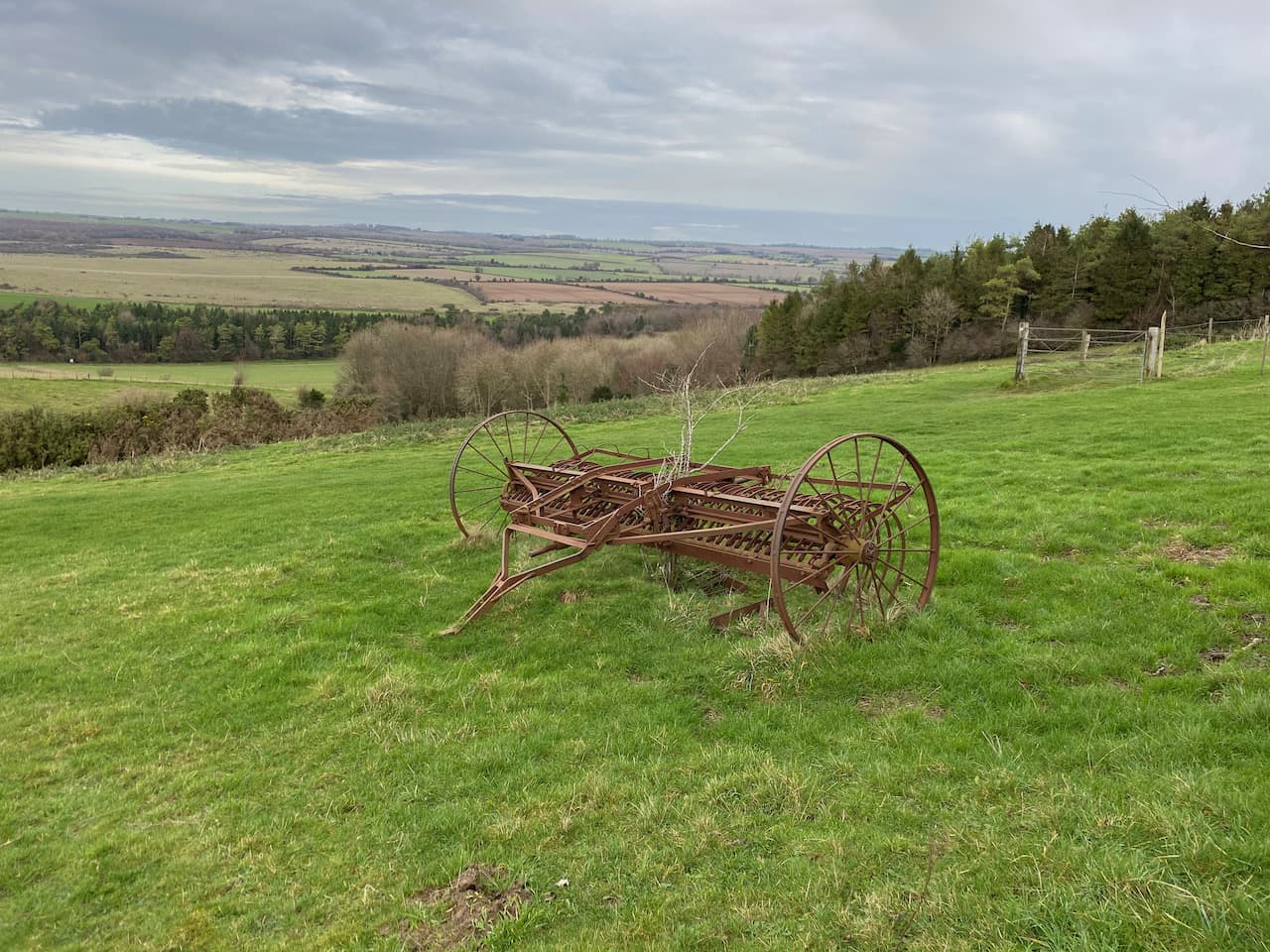
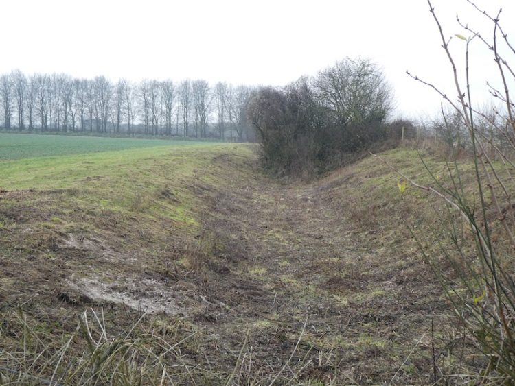
    We follow the track towards the dominant rifle range butt in front of us.  This area was used as a military rifle range up until the 1950’s and evidence is still strewn across this area of the downs.  Before reaching the butt we take a path on the right heading across the Bokerley Dyke.  This ditch is thought to have been built during the iron age and fortified in the 5th century.  It runs for around 3.5 miles and is an impressive structure.

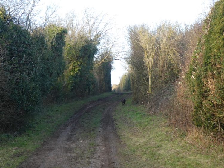
    We pass through the dyke to reach the fence-line and enter a field taking a footpath on the right that continues along the edge of the field with the fence to our right.  The path follows around the edge of the field and we are soon heading south with a hedge line to our right.  

    At a junction of paths we continue straight on to reach a gate besides a crossing of paths.  Here we continue along a tree lined path still heading south towards Pentridge.

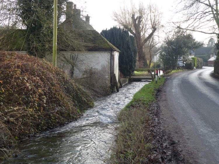
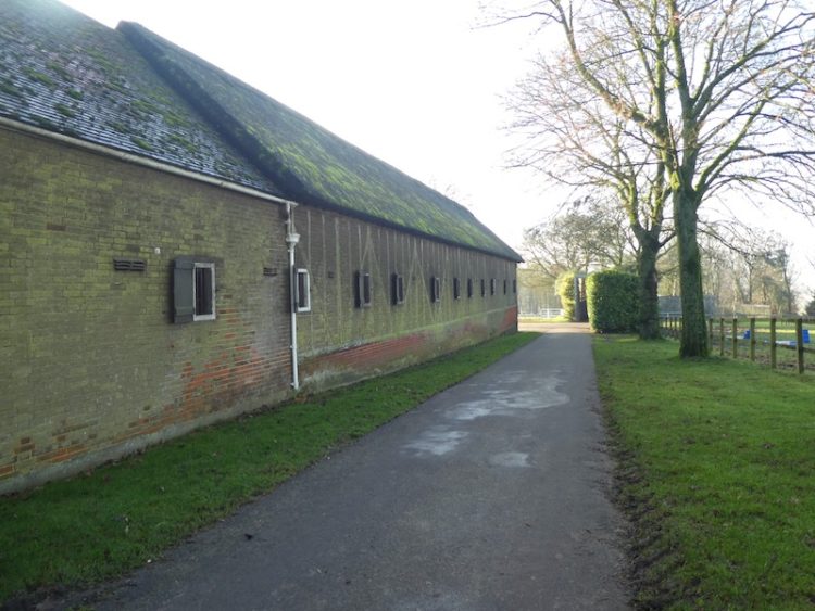
    As the path reaches farm buildings it becomes a tarmac lane and we stay with this to walk into the village. Our route continues south through the village and passes Manor Farm to join a farm track.  

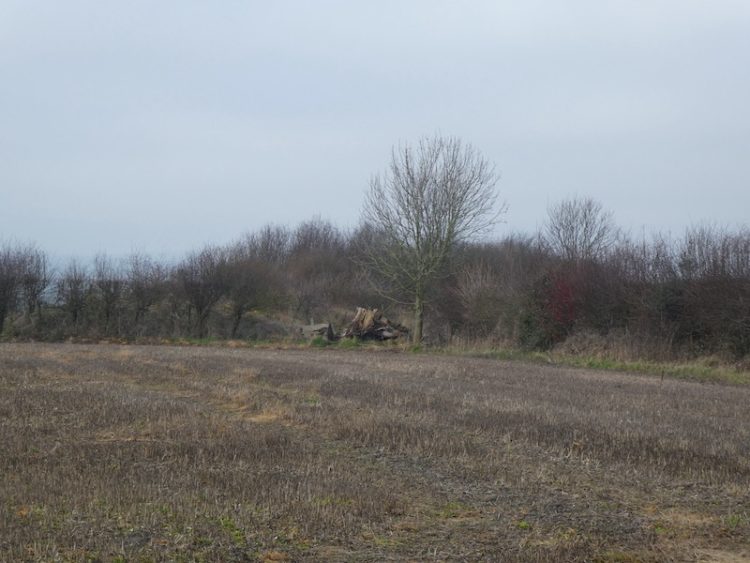
    At a junction of paths we turn right and follow a track that soon heads uphill along the edge of a field.  The map shows the area we are walking through is the location of a Cursus, despite having walked here previously I had not paid much attention to this reference which is surprising because I am usually looking out for odd things on the map.

    Like me Nigel spends time just looking at maps, there is a clue to this in his chosen line of work; teaching people to navigate.  He explains a cursus is an elongated rectilinear Neolithic (c.3000-2400 BC) earthwork usually with a bank and external ditch, but occasionally by a line of closely-set pits. Their purpose is not known, which also tells us the Neolithic’s were too busy digging ditches and banks to record their purpose and they had little regard for future generations.

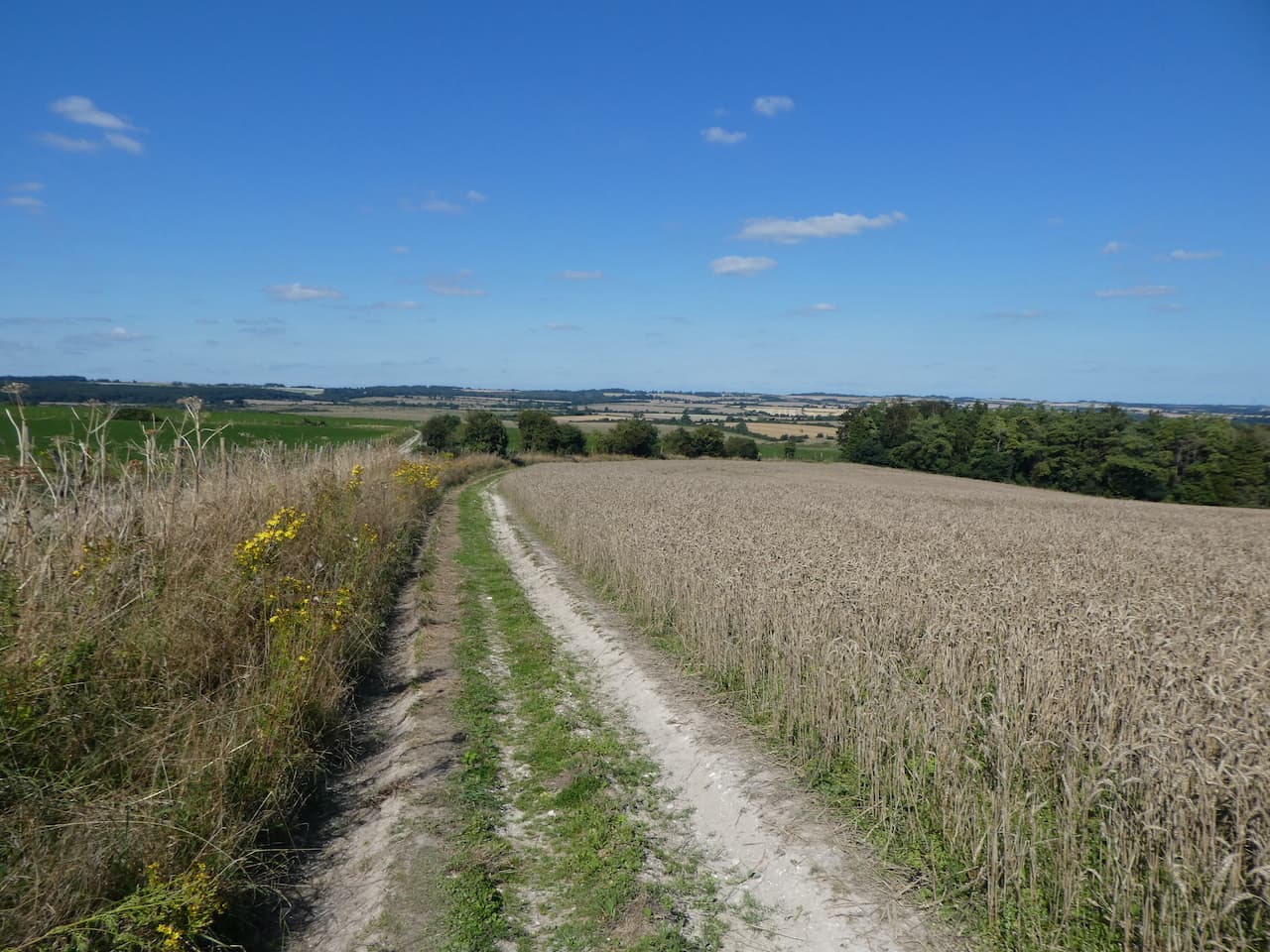
    The path shows clearly through the crops as it crosses the next field.  At a fork in the path we keep left to head towards the edge of Salisbury Plantation.

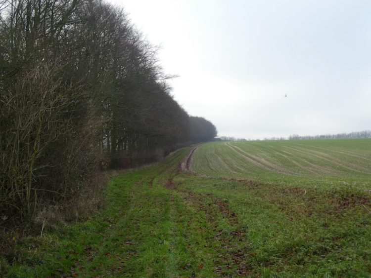
    We ignore paths to the left and right as we follow the path along the edge of the woods to reach the course of the old Roman Road, the Ackling Dyke. Here we turn left to follow its route.

    After crossing a stile there is an impressive array of tumuli in the next field.  

    Now we stay with the Roman Road as it gradually ascends to reach the B3081.  After crossing the road we go through a gate and follow a path running besides the overgrown Roman Road.

    The route descends steadily with fine views in front of us.  

    After crossing a farm track the route enters trees that form the edge of the Drive Plantation and continues on to reach a minor road.  We cross the road and continue uphill through the edge of woodland.  The Ackling Dyke covers 22 miles and connected the Roman settlements at Old Sarum on the edge of Salisbury and the Hillfort at Badbury Ring.  

    At a crossing of paths at Harley Gap we turn left and follow the Jubilee Trail along Harley Down.

    This is the first time I have walked along this track.  We soon get expansive views towards Penbury Knoll on Pentridge Hill.  This prominent landmark will form part of our route but we still have a fair few miles walking before we get there.

    At a junction of paths we turn right to leave the Jubilee Trail and within a few metres turn left to join a track (Coach Road) which heads towards All Hallows Farm.

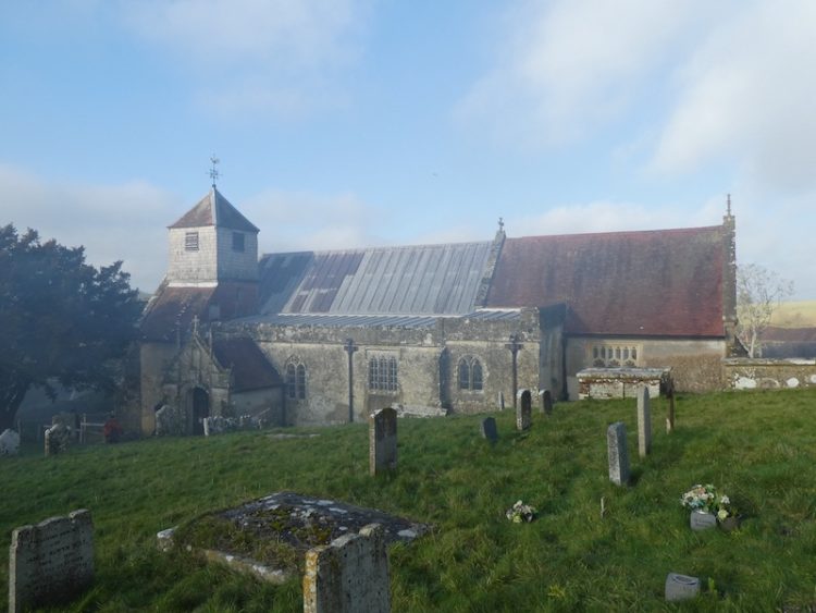
    After passing the farm we join a tarmac lane and continue straight on, soon reaching the neglected graveyard of All Hallows Church.  

    In the past this area was a thriving village known as All Hallows or Wimborne All Hallows and was far larger than nearby Wimborne St Giles.  However, in 1672 Lord Shaftesbury whose seat was in Wimborne St Giles requested that the two parishes be combined by closing the living at All Hallows. He offered King Charles II a living of his choice in exchange for his agreement.  Charles II agreed to this request and seventy years later the church was demolished and the stone used to build St Giles Church in Wimborne St Giles.

    I don’t usually link to other people’s work in my blogs, but the Dorset Rambler has done some fascinating research into the village and some of the long deceased residents that now rest in this graveyard.  It is well worth reading and can be accessed here

    From the graveyard we continue along the road heading towards Wimborne St Giles and soon pass the Bull Hotel.  Sadly this pub is currently closed, apparently the owner is seeking tenants to run it, let’s hope they find someone and it is soon returned to its former glory.

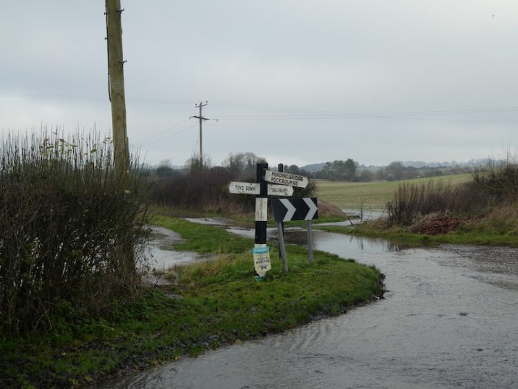
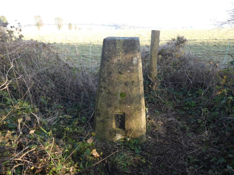
    A little further on we reach a road junction at Bull Bridge.  This junction has one of those fingerposts which is unique to Dorset in that it displays its OS Grid Reference.

    We now turn left and cross Bull Bridge and enter the heart of Wimborne St Giles.  It is not a huge village and as well as being the seat of the Earl of Shaftesbury has a row of impressive Almshouses and the fine St Giles Church.

    St Giles Church was constructed in 1732 on the site of an earlier medieval church and it incorporated masonry from the demolished All Hallows Church. Designed by the Bastard Brothers, who were architects from Blandford it stood until the early 1900’s when fire caused major damage.  It was then rebuilt to the design of Sir Ninian Comper. 

    On my previous visits the church has been locked, but today it is open so I take a look.  It is a very bright church with an elaborate font and fine carved screen.

    Outside the church there are some old carvings in the stone work which appear to date back to 1764.

    From the church we head back through the village passing the school and turning right at the village sign.

    We now follow this lane running through the village past attractive cottages.  At a road junction we turn right passing the Manor House and head north along a minor road. We have now joined the Hardy Way.  This 220 mile route links parts of Wessex connected with Thomas Hardy. 

    At a track on the right we leave the minor road for a footpath along Ringwood Lane, still on the Hardy Way we keep with the trail way markers as it turns left to head north and then right going beside a field heading towards the B3081. Nearing Creech Hill House the path goes through a gap in the hedge and after crossing the road we continue heading east along a minor road towards Cranborne.

    As the road bends to the right we stay with the Hardy Way and take a path on the left. This heads across fields to reach a common.  In the field to our right is a large chair.  This oak chair, created in 2006 was originally sited on Dartmoor, but apparently Dartmoor Park Authority issued an enforcement notice for it to be removed and it was relocated to the grounds of Cranborne Manor.

    We follow the footpath across the common into the village.  In the days of King Henry VIII  Cranborne Chase was a Royal hunting ground and this was a major centre. Henry built a hunting lodge here. 

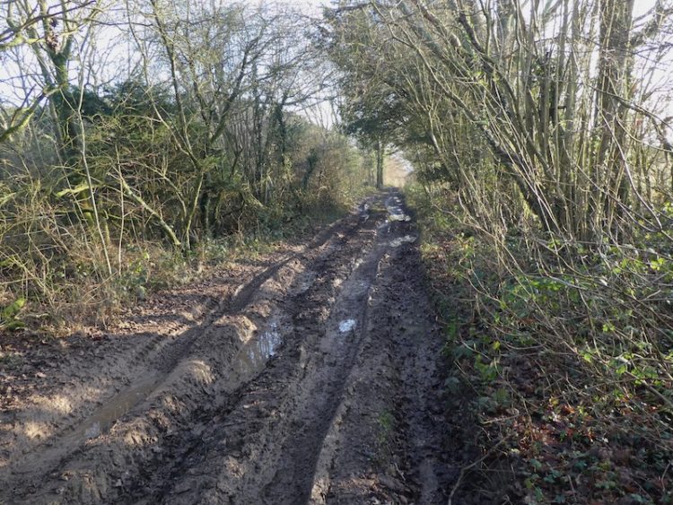
    We leave the village along Salisbury Street, at a fork in the road we take a tarmac lane signed posted “Bridleway to Pentridge”.  This lane heads steadily uphill, passing houses to reach a gate across the track.  

    We pass besides the gate and continue along the bridleway.  At a junction of paths at Jack’s Hedge Corner we stay with the bridleway.

    Four hundred metres after Jack’s Hedge Corner we take a footpath on the right.  This initially runs parallel to the track, but separated by a hedge.

    We now follow this path as it steadily ascends Pentridge Hill.  After passing through a band of trees we enter a pasture field with Shepherd’s Huts dotted about.

    We cross a stile to join a footpath on Pentridge Hill and turn right towards Penbury Knoll. The views from here are stunning.

    After going through a gate we pass Penbury Knoll and continue on a footpath along the top of Pentridge Down.  Below us on the left is a medieval field system and further extensive views.

    At a fork in the track we leave the Jubilee Trail and follow a grassy path that heads steadily downhill towards Whitey Top Farm.  After crossing a stile we join a footpath heading north besides the edge of an arable field. We have once again joined the Jubilee Trail, this is an 88 mile path crossing Dorset from Forde Abbey near the Somerset border to the Bokerley Dyke.  

    We go through a gate and then continue along the edge of a copse to reach Martin Down at Bokerley Ditch.  On the downs we turn left and walk besides the stunning Bokerley Ditch.

    The path is easy to follow and we stay by the ditch until we reach the rifle range butt where we retrace our steps to the car park.  Our walk has covered just over sixteen miles and has, as always in Nigel’s company, been a thoroughly enjoyable walk.

    To follow my walk, you will need Ordnance Survey Explorer Map 118 – Shaftesbury & Cranborne

    You can view this 16.5 mile walk on OS Maps and download the GPX File Here

    25th August 2021

    © Two Dogs and an Awning (2021)

    All information on this site is provided free of charge and in good faith and no liability is accepted in respect of damage, loss or injury which might result from it.  To the best of my knowledge the routes are entirely on public rights of way or within areas that are open for public access.
    Walking can be hazardous and is done entirely at your own risk.  It is your responsibility to check your route and navigate using a map and compass.

  • Visiting Pentridge and Martin

    Visiting Pentridge and Martin

    Today Lynnie and are walking with our friends Wendy and Gary who we have known since they moved into the village just over a year ago.  In normal circumstances I am sure we would have done a fair bit of socialising with them, but this year has been anything but normal.  So apart from the occasional drink in the garden during the summer and a weekly videocall call we have not seen a lot of them.  So it will be good to get out for a few hours and have a chat and try to put the world to rights.

    Even though we live in the same village we travel separately to the car park on Martin Down Nature Reserve besides the A354.  The weather forecast suggested there would be early morning rain, but a good chance the rest of the day would be dry and chilly.  So arriving at the car park we layer up and boots on we head off.

    We start from the southern end of the car park, passing a metal barrier beside some information boards. Initially the path heads through shrub, but then opens out onto the vast expanse of the nature reserve, there are over 850 acres of protected land here providing a haven for flora and fauna.  

    We follow the track towards the dominant rifle range butt in front of us.  This area of the downs was used as a military rifle range up until the 1950’s and evidence of this is strewn across it. Before reaching the butt we take a path on the right to head across towards the Bokerley Dyke.  This ditch is thought to have been built during the iron age and fortified in the 5th century.  It runs for around 3.5 miles and is an impressive structure.

    At the dyke we pass through to reach the fence-line of a field. Entering the field we take a footpath on the right and continue along the edge of the field with the fence to our right.  The path follows around the edge of the field and we are soon heading south with a hedge line on our right. 

    At a junction of paths we continue straight on to reach a gate besides a crossing of paths.  Here we continue along a hedge lined path still heading south towards Pentridge.

    As the path reaches farm buildings it becomes a tarmac lane, Earthpits Lane, and we stay with this to walk into the village.  At a sign for the church we turn right and wander up to visit the fine church of St Rumbold which apparently was rebuilt in 1855 in a 14th century style.

    From the church we head back to Earthpits Lane and turn right for thirty yards to take a footpath on the left leading up a driveway before heading left across grass to a narrow path besides a fence.  It is a gradual ascent to a stile leading into a pasture field.  The path continues by the fence line and then as the fence turns to the right we continue straight on towards a stile.  From here there are cracking views.

    After crossing the stile we continue up Penbury Knoll and visit the Ordnance Survey trig pillar.  I have visited this trig on a number of occasions but it is always worth a re-visit.

    From the trig we head north east on a track across the access land.  This track follows a fence to our right and we stay with it as the fence turns to the north.  At an abandoned old hay rake we turn to the right and go through a gate.

    We now follow a path along the edge of an arable field and then pass Blagdon Plantation.  On reaching a track we turn right and then take the second footpath on the left to head along the side of attractive woodland.

    The footpath reaches Martin Down and crosses the Bokerley Ditch.

    Now we follow a path that runs besides a Grim’s Ditch.  This is a common name for earthworks of this type which are found across chalk downland in southern England.  Their purpose is unclear, too small to act as military defences it is thought that they marked territorial boundaries in the Iron Age.

    We follow the ditch to reach a footpath where we turn left and head north along a track, this starts to descend with views towards the village of Martin in front of us. 

    We stay with the track as it leads to the edge of Martin Down and then continue along a hedge lined track leading towards Martin.  In the village we turn left and walk along the road, Martin Drove End, until we reach a sign towards the church.  Here we turn and wander up to see if we can locate the Ordnance Survey benchmark on All Saints Church.

    Apparently parts of this church date back to 12th century, with the tower being built in the 13th century and then late in the 18th century a spire was added.

    From the church we head back to Martin Drove End and turn right soon reaching a village green with an old pump above a covered well.  

    Also on the Green there is a millennium cross showing it is 37.5 miles to Glastonbury.  Apparently the significance of this is that back in 945 Edmund, King of Mercia bestowed the Damerham and Martin Estate to his wife Ethelfled on the condition that she should leave it to the “ancient church of the blessed Mary in the monastery of Glastonberi”, the Abbot of Glastonbury held a manor which included the village for many centuries. Close to the millennium stone is the base of the old market cross the history of which appears hard to determine.  But it is thought to date from the 5th century.

    From the green we head west along Sillens Lane to leave the village.  This road leads to a car park on the edge of Martin Down.  Here we keep heading west across the downs until we reach a junction of paths besides a Grim’s Ditch.  Here we follow a clear track heading northwest towards the rifle butts. 

    After passing the rifle butt we continue along the track to reach our starting point in the car park.  Our walk has covered almost eight miles.  The weather has been fine and not as cold as forecast and it has been great to get out and catch up after the recent Covid-19 lockdown.

    You can view this 8 mile walk on OS Maps and download the GPX File Here

    To follow this walk you will need Ordnance Survey Explorer Map OL130

    4th December 2020

    © Two Dogs and an Awning (2020)

    All information on this site is provided free of charge and in good faith and no liability is accepted in respect of damage, loss or injury which might result from it.  To the best of my knowledge the routes are entirely on public rights of way or within areas that are open for public access.
    Walking can be hazardous and is done entirely at your own risk.  It is your responsibility to check your route and navigate using a map and compass.

  • A Roman Road and Droves from Martin Down

    A Roman Road and Droves from Martin Down

    I continue to look for new locations to walk whilst staying close to home.  Until now I have coped better than I anticipated with not getting away in the caravan, but I still need some variation in my walking.  For the past year I have been exploring the Cranborne Chase and today’s walk will start on Martin Down and visit villages to the east of the A354.

    I have travelled along the A354 numerous times but never stopped at Martin Down, there is a large parking area on the edge of the nature reserve and I observe the signs asking people to leave plenty of space between vehicles as part of the social distancing.   

    I start my walk from the southern end of the car park and head out passing a metal barrier besides some information boards. Initially the path heads through shrub, but then opens out on to the vast expanse of the nature reserve, there are over 850 acres of protected land here which provide a haven for flora and fauna.  

    I follow the track towards the dominant rifle range butt in front of me.  This area was used as a military rifle range up until the 1950’s and strewn across this area of the downs remains evidence.

    Before reaching the butt I take a path on the right to head across the Bokerley Dyke.  This ditch is thought to have been built during the iron age and fortified in the 5th century.  It runs for around 3.5 miles and is an impressive structure.

    At the dyke I pass through to reach the fence-line of a field. I enter the field and take a footpath on the right and continue along the edge of the field with the fence to my right.  The path follows around the edge of the field and I am soon heading south with a hedge line to my right. 

    At a junction of paths I continue straight on to reach a gate besides a crossing of paths.  Here I continue along a tree lined path still heading south towards Pentridge.

    As the path reaches farm buildings it becomes a tarmac lane and I stay with this to walk into the village. I cannot ever recall visiting this village.  It is a quiet spot well away from the main road and has some attractive old properties.

    My route continues south through the village and passes Manor Farm to join a farm track.  At a junction of paths I turn right and follow a track that soon heads uphill along the edge of a field.  The path crosses the next field and shows clearly through the crops. At a fork in the path I keep left to head towards the edge of Salisbury Planation.

    I ignore paths to the left and right as I follow the path along the edge of the woods to reach the course of the old Roman Road, the Ackling Dyke. Here I turn left and follow the route of the Roman Road.

    After crossing a stile there is an impressive array of tumuli in the next field.  I have passed these when driving along the A354, but at 60mph it is difficult to fully appreciate them.

    Now I stay with the Roman Road as it gradually ascends to reach the B3081.  After crossing the road I go through a gate and follow a path running besides the overgrown Roman Road.

    The route now descends steadily with fine views in front of me.  After crossing a farm track the route enters trees that form the edge of the Drive Planation and continues on to reach a minor road.

    After crossing the road the route continues uphill through the edge of woodland.  The Ackling Dyke covers 22 miles and connected the Roman settlements at Old Sarum on the edge of Salisbury and the Hillfort at Badbury Ring.  

    At a crossing of paths at Harley Gap I turn right.  On this junction of paths is a memorial stone to a John Ironmonger (1919-1986) apparently he was the Manager for Lord Shaftesbury’s St Giles Estate.

    I am now walking along the edge of a field with far ranging views.  This is stunning countryside.

    At a junction of paths I turn left to follow a drove along the top of Gussage Hill.  Nearing the hedge line on the left I pop over the fence to bag the OS Trig that stands between fields.  This is the 205th OS trig pillar I have bagged.

    Back on the track I continue in a southwesterly direction, the track soon starts to descend and then turns left near a barn and after a couple of hundred yards turns right and continues steadily downhill too reach Lower Farm on the edge of Gussage St Michael.  Here the track becomes a tarmac road and leads into the village passing AG Edwards & Sons Hardware store and continuing to a junction opposite St Michael’s Church, said to have a tower dating back to the12th century.

    I turn left and walk out of the village on the country lane heading towards Gussage All Saints.  This is a very quiet lane and only one vehicle passes me.  As I reach Gussage All Saints I turn left and cross a stream to reach the War Memorial.

    I continue a bit further along the lane to visit the All Saints Church most of which was built in the 14th century.

    After visiting the church I return to the war memorial and head east through the village passing the village hall and then reach the Drovers Inn.  This pub was shut in November 2014 and there were proposals to develop it into a large house.  However the local community opposed this plan and set about establishing a Community Benefit Society to take control of the pub.  In March 2016 they managed to purchase the property and now it is run as a community pub.  I am a firm believer in community assets being owned and run but the local community, it does take a lot of effort to get established and there needs to be financial support from the community, but if successful it creates a hub for village activities.  I would sooner drink in a pub run by the community than one owned by a chain. This is one reason why you will never see me in a J D Wetherspoon pub.

    I continue on the lane, having made a note to make sure I return to the Drovers when the current pandemic is over.  The lane reaches a crossroads at Amen Corner, here I continue straight over towards Bowerswaine.

    Just before reaching a bridge over a stream I take a footpath on the left, Brockington Lane, which leads northeasterly towards Brockington Farm.

    At a minor road in front of Brockington Farm farmyard I turn left.  The farm buildings appear to be disused.  I find it sad that stunning old barns, such as these are no longer used as originally intended, they would once have been the busy hub of a thriving farm. 

    As the road bends to the left I take a path which follows a track towards Farringdon Copse.  After passing through a small copse the path continues across a field and then reaches a stile besides a minor road.  

    I turn right and follow this road into Wimborne St Giles.  Entering the village I cross the River Allen and continue into the centre.  This is a cracking spot with St Giles church prominent besides a stunning row of almshouses.

    The Almshouses date back to around 1624 and were endowed by Sir Anthony Ashley (1551-1628).  Ashley was Clerk to the Privy Council and apparently found favour with Queen Elizabeth I, it is reported that he was distinguished in the Battle of Cadiz in 1596 and was knighted soon after.

    St Giles Church was constructed in 1732 on the site of an earlier medieval church.  It was designed by the Bastard Brothers, who were architects from Blandford.  When I first left school and worked in an office there was an old boy called George working there, now long dead. George had in-laws in Blandford and he would say on a daily basis that Blandford was built by Bastards and so were the folk that lived there. However, I have always found people from that attractive Dorset town very personable.

    The church suffered a major fire in the early 1900’s and was rebuilt to the design of Sir John Cowper. It is a fine building, but currently closed to the public.

    I sit on the bench by the church to eat  my lunch and then head back through the village passing the school and turning right to take a lane that runs through the village passing attractive cottages.

    At a road junction I turn right and walk past the Manor House and head north along a minor road. I have now joined the Hardy Way.  This 220 mile route links parts of Wessex connected with Thomas Hardy.  I have walked a number of sections but not previously trod this part. My friend, Stuart, is a devotee of Hardy’s work and has encouraged me to embrace his writing. A few years ago I tried with Tess of the d’Urbervilles but after reading the Maiden chapters could take no more.  Perhaps I should try again!

    At a track on the right I leave the minor road for a footpath along Ringwood Lane, still on the Hardy Way I keep with the trail way markers as it turns left to head north and then right to go besides a field heading towards the B3081.  

    I have driven along the B3081 many times and know the section I am heading towards, so I am pleased when the path runs on the field side of the hedge rather than the road side. Nearing Creech Hill House the path goes through a gap in the hedge and after crossing the road with care I continue heading east along a minor road towards Cranborne.

    As the road bends to the right I stay with the Hardy Way and take a path on the left. This heads across fields to reach a common where I cross a stream and continue towards the village.

    I have never visited this village, in the days of King Henry VIII when the Cranborne Chase was a Royal hunting ground this was a major centre. Henry built a hunting lodge in the village.  The church of St Mary and St Bartholomew was built in the 12th century and over following centuries additions were made, the tower was added in the 15th century and the chancel rebuilt in the 19th century.

    After visiting the church I leave the village along Salisbury Street, at a fork in the road I take a tarmac lane signed posted “Bridleway to Pentridge”.  This lane heads steadily uphill, passing houses to reach a gate across the track.  I pass besides the gate and continue along the bridleway.

    I stay with the main bridleway ignoring paths to the left and right as I head towards Pentridge Hill.  The views either side of the track are stunning.

    At a gate besides a junction of paths I go through and keep to the path continuing up to the summit of Pentridge Hill with a fence to the right.  I go through another gate and continue to the trees on Penbury Knoll which top Pentridge Hill.  I stay on the path close to the fence and then take a short detour to visit the Ordnance Survey trig pillar in the trees, my 206th trig.

    This is my first time on this hill, it is a cracking place with ancient field systems and outstanding views.

    At a fork in the track I leave the Hardy Way and follow a grassy path that heads steadily downhill towards Whitey Top Farm. After crossing a stile I join a footpath heading north besides the edge of an arable field.  I have joined the Jubilee Trail, an 90 mile path crossing Dorset from Forde Abbey near the Somerset border to the Bokerley Dyke.  I go through a gate and then continue along the edge of a copse to reach Martin Down at Bokerley Ditch.

    On the downs I turn left and walk besides the stunning Bokerley Ditch.

    The path is easy to follow and I stay by the ditch until I reach the rifle range butt where I retrace my steps to the car park.  My walk has covered just over twenty miles and has been stunning throughout.  It will not be too long before I am walking around in this area again.

    To follow my walk, you will need Ordnance Survey Explorer Map 118 – Shaftesbury and Cranbourne Chase

    You can view this 20 mile walk on OS Maps and download the GPX File Here

    Additional Information

    For more information on this walk including car parking, amenities, refreshments and detailed walking directions visit my associated Walking Moonraker website.

    29th May 2020

    © Two Dogs and an Awning (2020)

    All information on this site is provided free of charge and in good faith and no liability is accepted in respect of damage, loss or injury which might result from it.  To the best of my knowledge the routes are entirely on public rights of way or within areas that are open for public access.
    Walking can be hazardous and is done entirely at your own risk.  It is your responsibility to check your route and navigate using a map and compass.

  • Following Droves from Coombe Bissett

    Following Droves from Coombe Bissett

    This is my last long walk of 2019 with my walking buddies Mandy, Glenda and Ged.  We have decided to follow tracks across the eastern end of Cranborne Chase starting at Coombe Bissett.  The four of us walk together on a regular basis usually trying to make a day of it so have covered a lot of ground together.

    The starting point for our walk is the village hall car park at Coombe Bissett and we head off along the edge of the cricket field to join a track besides the pavilion.

    On the track we turn right?? and head steadily uphill to pass the entrance to Coombe Bissett Nature Reserve.  We have a couple of dogs with us so decide not to enter the nature reserve but stay on the track to reach a tarmac lane and continue along this to a fork in the lane, we go right and follow the track by Pennings Farm.  The route now becomes muddy and we navigate a route around some large puddles.

    Soon on our left is a small caravan site at College Farm after which we reach a junction of tracks.  We turn left and follow the way to a crossing of tracks where we turn right along a track that runs parallel to a Grim’s Ditch to our left.

    At a crossing of tracks we carry straight on and soon have a band of trees on our left.

    Staying with this path we continue heading in a southern direction to reach a minor road.  We turn right and then almost immediately take a minor road on the left signposted to Toyd Down.

    At a junction of tracks we turn left and follow a grassy track to reach the burial mound at Knapp Barrow where we turn left.

    Very quickly we reach a footpath on the right, we go through a gate and pass the sizeable Long Barrow called Grans Barrow.

    At a crossing of paths, we turn left and soon enter Bokerley Dyke Planation.  The path runs through the edge of the plantation and through a hill fort before emerging into pasture.

    On reaching a hedge the path turns to the left and heads steadily uphill.  Here we make a slight diversion to visit the Damerham Knoll trig point on the hill in front of us. This is my 190th trig pillar, my joy in reaching it is not universally celebrated by my walking companions.  They tolerate my obsession of including a trig pillar on every walk we do!

    Having bagged the trig, we return to the footpath and follow it over the hill and then head down to reach a minor road. We turn right and walk into Rockbourne with a stream running besides the road. 

    We pass the Rose and Thistle pub with its signage still bearing the name of Strong’s Brewery.  In my youth there were still a number of local pubs under the Strong’s name, despite the brewery having been acquired by Whitbread in 1969.  The brewery was founded in Romsey in 1858 when Thomas Strong purchased an existing brewery. Surprisingly, despite its good reputation, the Rose and Thistle is a pub I have never ventured into.

    Soon after the pub we take a path on the left leading up to the 12th century St Andrew’s Church.

    We follow the path around the churchyard and turn left to head uphill into the edge of woodland.  On reaching a tarmac lane we turn left and follow this as it sweeps downhill through the trees.  After emerging from the trees, we take a path on the right?? heading up through the valley towards woodland.

    The path then follows a route through a band of beech trees.

    After passing  small copses on the left and the right we reach a gate leading to an avenue of trees.

    The route now takes us to Whitsbury Stud Farm where we join a road and turn right and then almost immediately turn left on a path through Manor Farm with it’s array of fine buildings.

    There are fine views as we follow a clear track steadily downhill.

    After crossing Long Steeple Lane Track we head uphill onto Breamore Down and cross South Charford Drove and continue on with woods to our left.  This path leads onto North Charford Drove where we turn left and continue along the northern side of woods.  The path then continues between fields to reach Gallows Hill where I bag my 191st trig pillar on Wick Down.

    Heading north on the track we reach a junction of paths where we turn left on a drove and then as the drove forks we go right and soon cross another track. After a few hundred yards we spot a Dew Pond in the field to our left.

    We stay on the drove towards the southern edge of Great Yews. At a four-way junction of tracks we turn right and follow a muddy track besides Great Yews.

    Soon after emerging from the woods we ignore a path on the left but then very soon take a track on the right and head towards Down Barn.

    At Down Barn the track becomes a tarmac lane and we follow this along the ridge and then down into Homington.  In the village we go straight across a road and then join Lower Road which heads west through the village to pass the small attractive church of St Mary the Virgin.

    With the light fading we follow the road from Homington to reach Coombe Bissett where we walk through the village until we reach the turning to head uphill back to the village hall car park.

    Our wander around these droves has covered just over fifteen miles and despite one or two very muddy tracks has been thoroughly enjoyable.  I am looking forward to walking the route again after a dry spell.

    To follow my walk you will need Ordnance Survey Explorer Map OL130 – Salisbury & Stonehenge

    You can view this 15.5 mile walk on OS Maps and download the GPX File Here

    Additional Information

    For more information on this walk including car parking, amenities, refreshments and detailed walking directions visit my associated Walking Moonraker website.

    30th December 2019

    © Two Dogs and an Awning (2019)

    All information on this site is provided free of charge and in good faith and no liability is accepted in respect of damage, loss or injury which might result from it.  To the best of my knowledge the routes are entirely on public rights of way or within areas that are open for public access.
    Walking can be hazardous and is done entirely at your own risk.  It is your responsibility to check your route and navigate using a map and compass.