In March I did a walk from Alderbury taking me across Barford and Standlynch Downs. Despite these downs being close to home it was the first time I had walked them and I vowed to return before too long.
Today I am out with my walking buddy Mandy and we are starting from the car park besides the village hall and recreation playing field in Rectory Road, Alderbury (SP5 3BJ). Leaving the car park we join the Southampton Road and turn left to walk along the pavement. On reaching Lights Lane we turn left and follow this minor road uphill to join School Hill. After passing the old School Building we turn left onto a track, Old Vicarage Lane.
We follow this track to the junction with Witherington Road where we turn left and stay on the road to pass Alderbury Farm. After half a mile on the road we take a bridleway on the left heading up besides Treasurer’s Dean Wood. We stay with the bridleway as it turns right going through trees and around a reservoir.

This route is part of a local circular walk and enters along the edge of the field. The map shows a footpath crossing the field to head south, but we continue on the path along the edge of the field to the north eastern corner of the field and turn right to follow a path along the edge of the field.

Our route continues alongside the disused Salisbury and Dorset Junction Railway. This 18 mile line ran from 1866 to 1964 and spurred off the Salisbury Southampton line at a junction in Alderbury, through Downton and Fordingbridge to West Moors where it connected with the main Southampton to Dorchester line.

We keep the disused railway to our left until reaching Four Gates, where we turn right along the minor road.

At a junction with Witherington Road we turn right and follow this minor road downhill towards Standlynch Farm. Just before the entrance to the farm we take a footpath on the left leading into woodland.

These woods are part of the Trafalgar Park estate and after passing through a gate we catch a glimpse of the main house. As you might imagine with a name like Trafalgar this estate has connections with Admiral Horatio Nelson. Following Horatio’s death at the Battle of Trafalgar in 1805 his brother Rev William Nelson was created 1st Earl Nelson. He lobbied Parliament for an estate in recognition of his brother’s service to the nation. Standlynch Park was the location chosen by the Treasury and it was renamed Trafalger Park. Descendants of Horatio Nelson lived here until 1948 when it was sold by the 5th Earl Nelson.

After crossing a field we go through another gate to follow a track through woods. We stay with this path to reach a concrete path. Here we turn left to walk the short distance to the now disused St Mary’s and All Angels Church. It is said that this church was founded in 1147 and rebuilt in 1677. It was the private chapel for Standlynch Park and then the Trafalgar Estate and is the last resting place of many of Nelson’s relatives. The church closed in 1947 and is not accessible.

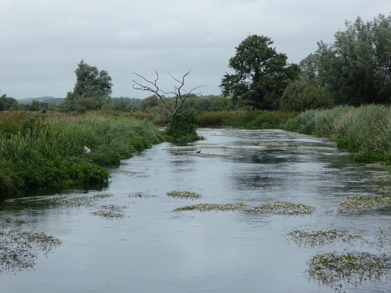
From the churchyard we turn right and follow the concrete drive down to reach the disused Standlynch Mill.

This is a cracking spot besides the River Avon.

The footpath goes over weirs on the river.

After a series of small footbridges we reach a field and fork right to head towards Charlton-All-Saints. The exit from the field is by way of an unusual turnstile gate.

We turn left along a path to reach a road running through the village where we turn left to walk through the village along Lower Road. As we pass Charlton Farm House the road bends to the right and joins Warren’s Lane. At a crossing of footpaths we turn left along a track and follow this route south to reach fields.

At a junction of paths we turn left and when we reach the Avon Valley Way footpath turn right along a farm track to pass New Court Farm and continue south to reach a lane, Gravel Close. We follow this into Downton where we turn left into The Borough.
I have driven through Downton hundreds of times but cannot recall ever stopping to take a look around. Apparently in the 12th and 13th centuries this village was a thriving town and there are many old buildings along the main route through the village, known as The Borough. Opposite the pub, that used to be called the White Horse but is now named The Goat, is the Borough Cross. It is thought that the cross on the top of the structure dates from around 1208. The cross is said to have been damaged in 1642 by Cromwell’s troops and then again during World War II. It was restored and located in its present spot in 1952.

Our route takes us along The Borough.

After crossing the River Avon we take a footpath on the left through houses built in the grounds of the converted old tannery and then continue to the splendid St Laurence’s Church.

From the churchyard we leave through the Lych Gate, traditionally this is where a corpse is taken prior to a burial service, lich was a Saxon term for corpse. In Saxon times there were no mortuaries so the dead were taken to the church and left under cover awaiting the arrival of the clergyman for the burial service.

From here we go left along a footpath to Barford Lane, we turn left and soon take a track on the right leading between Hamilton House and Wellesley Cottage. This track takes us steadily uphill to reach a road, The Sidings, here we turn left and follow a path along the route of the old railway line. At a crossing of paths we turn right and head uphill towards Barford Down. At another crossing of tracks we go straight over continuing east across a field to reach a kissing gate. Just to the right tucked away in the hedge line is an Ordnance Survey Trig point. I have bagged this trig previously but it is still worth a visit.

We go through the kissing gate and follow the path along the edge of a field. There are fine views from here.

The path descends steadily to a kissing gate and then onto a junction of paths. We turn right and head steadily uphill besides Langford Lane Wood. At a crossing of paths we turn left and follow the broad track into Cheyney’s Wood.

At a junction of tracks close to Privett Farm we turn left and follow a stony farm track with cracking views.

The farm track leads downhill to a junction with a minor road. We ignore the road and turn right to take a track heading north below the downs. We go through a copse and continue on the track below Witherington Down. The path ascends gradually towards the A36. At a junction of paths, before reaching the main road, we turn left and descend besides the edge of a field.

At the next junction of paths we turn right and head north on a path between fields going towards Whaddon. The path crosses the disused railway line and passes Matrons College Farm. Here we take a footpath on the left just before a track. This path leads along the back of properties and then across a meadow to reach Rectory Farm.

Soon after passing the farm we turn right into Rectory Lane and follow this back to our starting point at the Village Hall car park.
Our walk has covered thirteen miles and we have enjoyed some stunning views.
To follow my walk you will need Ordnance Survey Explorer Map OL130 Salisbury & Stonehenge; and OL131 Romsey, Andover & Test Valley
You can view this 13 mile walk on OS Maps and download the GPX File Here
27th June 2020
© Two Dogs and an Awning (2020)
All information on this site is provided free of charge and in good faith and no liability is accepted in respect of damage, loss or injury which might result from it. To the best of my knowledge the routes are entirely on public rights of way or within areas that are open for public access.
Walking can be hazardous and is done entirely at your own risk. It is your responsibility to check your route and navigate using a map and compass.


