Tag: Arundel Park

  • Arundel Park to South Stoke

    Arundel Park to South Stoke

    A few days ago the weather forecast for today was persistent rain from dawn to dusk, but yesterday evening it improved to show the rain moving through by early afternoon, so I spend the morning catching up with a few things in the caravan and then head out after an early lunch.

    With a only a few hours of daylight I decide to head to Arundel Park and have a bit of a jamabout.  The starting point for my walk is the roadside car park in Mill Lane near to the Wildlife and Wetland Trust entrance.  From the car park I walk downhill and go through the gate to enter Arundel Park beside Swanbourne Lake.

    This lake is thought to have originated in the 11th century as a mill pond created by damming the steam created from chalk springs.  For centuries it served as the water supply to the mill and more recently has become a recreational area.  

    I follow the path beside the lake passing a few walkers who have braved the morning rain and are looking bedraggled.  I reach a gate and go through.

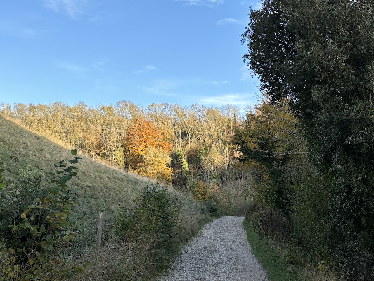
    I stay in bottom of the valley and at a junction of paths turn to the left and gradually ascend a track.

    Heading uphill I am treated to fine views back over the route I have walked so far.

    I go through a gate and then take some steps on the right onto open ground where I head across to the Hiorne Tower.  This was built in 1797 by Francis Hiorne who at the time was bidding to rebuild Arundel Castle for the Duke of Norfolk.

    In front of the tower is a relic found in a museum at Sevastopol after the siege of Sevastopol in 1855.  This siege was part of the Crimean War and Russian soldiers withdrew into the port which was the home of the Tsar’s Black Sea Fleet.  Here they became besieged by the French, Ottoman and British allied forces.  The battle that ensued lasted from October 1854 to September 1855.

    I now walk across to a tarmac drive and turn right to go through a gate and head north.

    After going through a gate I continue on the tarmac driveway and pass through an area of woodland.  

    I had hoped to leave the park at Duchess Lodge but when I get there the gates are locked so I decide to keep heading north towards Whiteways Lodge.  There are extensive views onto the South Downs and the flooded fields around Amberley.

    Nearing a junction of tracks I meet a fellow walker heading in the opposite direction.  I enquire if I will be able to exit the park at Whiteways Lodge and he thinks it unlikely, but then suggests a route I could follow that would take me back to Arundel via South Stoke.

    Always willing to heed the advice of locals I turn right at the junction of tracks and head beside Lonebeech Plantation.

    After going through a gate I head across a field towards a gate in the distance and midway turn left on a footpath which is the route of the Monarch’s Way and head towards a gate.  This was the path I followed yesterday towards the River Arun.  After going through a kissing gate I follow a track downhill with views towards Houghton and Amberley.

    The way-marked route descends through the edge of South Wood to reach a metal gate in the wall of Arundel Park, I turn right beside the river.  Yesterday my path alongside the river was low lying, today’s path quickly rises a few feet away from the water.

    After going through an area of woodland I pass through a gate to continue along the edge of a field.

    The footpath skirts around cattle barns and then passes a fine old barn apparently built in the late 1800’s and now used as a wedding and events venue.

    After the barn I turn left at a junction and follow a lane passing cottages to reach St Leonard’s church.  This old church was built in the 11th century and serves the small community around South Stoke Farm.

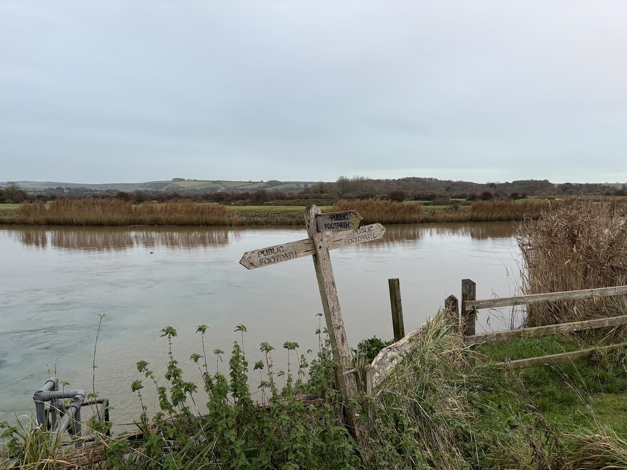
    From the church I continue on a track heading towards the River Arun and just before reaching the river go over a stile on the right to join a footpath by the river.

    The footpath follows the embankment with the river to my left and goes over several stiles heading towards Offham Farm.

    At a track leading to Offham Farm I pass a bridge and continue along the embankment and then go through a copse to emerge into the car park of the Black Rabbit pub.  Apparently the building dates to 1894 and was built by the Duke of Norfolk.  It is an unusual name for a pub and after walking by it yesterday I did an unsuccessful search on the internet to see why it was given this name.

    The pub has a beer garden with a fine views along the river.  It must be very popular in the summer.

    I have two options here I can either walk along the road to the car park or take the route alongside the river.  The light is fading but I should have enough time to take the longer route by the river.  I follow the footpath along the embankment to a junction of footpaths where I turn right back towards Arundel.

    The path goes besides the stream flowing from Swanbourne Lake.  Across the fields I get a good view of Arundel Castle.  This castle was originally built in the 11th century, it was damaged during the English Civil War and then restored in the 18th and 19th century.

    At a footbridge I turn right joining the road to walk back to my starting point.  The route was not what I planned when I set off but nevertheless has been a cracking walk covering 7.5 miles.

    You can view this 7.5 mile walk on OS Maps and download the GPX File Here

    To follow this walk you will need Ordnance Survey OS Explorer OL10 – Arundel & Pulborough

    16th November 2023

    © Two Dogs and an Awning (2023)

    All information on this site is provided free of charge and in good faith and no liability is accepted in respect of damage, loss or injury which might result from it.  To the best of my knowledge the routes are entirely on public rights of way or within areas that are open for public access.
    Walking can be hazardous and is done entirely at your own risk.  It is your responsibility to check your route and navigate using a map and compass.

  • A Trig, Seal and Fleeing King

    A Trig, Seal and Fleeing King

    With the weather looking set fair for the day I have decided to head out for a bit of a jamabout from Arundel.  It is an area I have not previously walked, part of my route will be through Arundel Park where I gather there is permitted walking in some areas whilst others have no access, so I may have to adapt my walk as I go.

    I start from the roadside parking area in Mill Road close to the entrance to Arundel Park and the Wildlife and Wetland Trust nature reserve.  I head north up Mill Road and soon go by the entrance to the nature reserve and then pass the Black Rabbit Pub.  Apparently this building dates to 1894 and was built by the Duke of Norfolk.  It is an unusual name for a pub.  Searching later I can’t find anything about the origins of the name.

    The road passes through a cut in the chalk to reach a junction.  Here I turn left towards South Stoke and continue up to the grand gates to Arundel Park.

    Going through the gates I join a footpath following a track steadily uphill.  It is a cracking day and after yesterday’s inclement weather it is refreshing to see clear blue sky.

    As I head uphill there are fine views out to my right over the River Arun with some flooding in the fields.  It is an ominous sign, I intend to follow a path close to the river later and hope it won’t be submerged.

    Nearing the top of the hill I fork to the left and wander over the open access land to bag the Drylodge Plantation Ordnance Survey trig pillar, my number 416 bagged.

    Near the trig I meet a local couple out for a walk in Arundel Park, they share their ideas for some local walks and also helpfully advise me where I can walk in the Park.  Following their advice I continue across the access land and go through a gate onto more access land with Drylodge Plantation to my left.

    The path goes along the top of the hill with views across the South Downs to flooded fields around Houghton and Amberley.

    After going through another gate I continue on the track towards Lonebeech Plantation and mid-way across the field turn right to join a footpath on the route of the Monarch’s Way.  This leads to a gate.

    The way-marked route goes downhill through the edge of South Wood to a metal gate in the wall of Arundel Park.

    On the path besides the River Arun I turn left and head towards Houghton.

    To my surprise I spot a seal in the river.  Apparently they are a common sight in this river, but it was not what I was expecting.

    Initially the path is dry, but as I near a disused chalk quarry it becomes flooded in parts and it takes careful navigation to avoid getting wet feet.  To make matters worse there are a couple of fallen trees across the path which have not been cleared. 

    It is with some relief that I reach the edge of Houghton and go through a gate ascending from the river into Houghton.  At a junction with the B2139 I turn left, still on the route of the Monarch’s Way and walk beside the busy road to pass the George and Dragon pub.

    A notice above the pub door states Charles II stopped for refreshments on Tuesday 14th October 1651 whilst fleeing from his defeat at the Battle of Worcester. 

    Just after the pub the Monarch’s Way follows a bridleway that initially runs parallel to the road and then goes up onto downland with fine views.  During the course of this year I have walked a number of sections of the 625-mile Monarch’s Way which roughly follows the route that Charles II took to get a boat at Shoreham after his defeat by Oliver Cromwell at Worcester.  

    The route goes along the edge of fields and then through a sunken track before heading across another field to reach the A29.  After crossing the road I keep following the Monarch’s Way way-markers into Houghton Forest.

    This is a pleasant area of woodland.  The only  thing disturbing the tranquility is the distant sound of game birds being slaughtered.

    Towards the western edge of the woods I reach a junction of paths and turn left heading south through the trees.

    The path leads to a minor road which I cross and pass through a small parking area to enter another area of woodland.  Staying with the clear path I head towards the A 29.  Approaching the road the path forks, I go left soon emerging beside the main road.  I cross with caution and on the far side ignore a footpath on my left instead taking a path going uphill through the open access woodland heading towards Yewtree Gate.

    On reaching Yewtree Gate I turn left and enter Rewell Wood.

    The track heads in a southeasterly direction passing areas of recently cleared and replanted trees and then goes alongside fields heading towards the A284.

    At a junction of paths just before reaching the main road I turn right and follow a path downhill into woodland.

    At Park Bottom Barn there is a junction of paths.  I follow the one along a track leading to Cricket Hill Farm.  There are no obvious signs of farming as I pass converted barns which are being used as offices and workshops.

    The route is now straightforward, I pass a trout fishery and follow the farm driveway back towards Arundel.  On reaching the A27 I turn left and then cross the A284 and walk into Arundel along Maltravers Street.  At the junction with Parson’s Hill I turn left and walk up towards Arundel Cathedral. 

    At a junction with London Road I turn left and pass the catholic cathedral which was commissioned by the 15th Duke of Norfolk in 1868 and completed in 1873.  

    Walking besides the wall of Arundel Park I reach a driveway into the park on my right and follow it.  

    I keep with the tarmac driveway through the park and then before reaching a gate I take a footpath on the right which leads me to Hiorne Tower.  This was built in 1797 by Francis Hiorne who at the time was bidding to rebuild Arundel Castle for the Duke of Norfolk.

    In front of the tower is a relic found in a museum at Sevastopol after the siege of Sevastopol in 1855.  This siege was part of the Crimean War and Russian soldiers withdrew into the port which was the home of the Tsar’s Black Sea Fleet and were then besieged by the French, Ottoman and British allied forces.  The battle that ensued lasted from October 1854 to September 1855.

    I am now back on the Monarch’s Way and follow this as it goes downhill with fine views across the park.

    At the bottom of the hill I leave the Monarch’s Way at a junction of footpaths and turn right and walk through the valley towards Swanbourne Lake.

    The path goes through a gate and continues on with the lake on my right hand side.  This lake is thought to have originated in the 11th century as a mill pond created by damming the stream created from chalk springs.  For centuries it served as the water supply to the mill and more recently has become a recreational area.   

    My wander about has covered twelve miles and it has been a cracking day.  The forecast does not look great for tomorrow so I will have to hope for a break in the rain to head out for some fresh air.

    You can view this 11 mile walk on OS Maps and download the GPX File Here

    To follow this walk you will need Ordnance Survey OS Explorer OL10 – Arundel & Pulborough

    15th November 2023

    © Two Dogs and an Awning (2023)

    All information on this site is provided free of charge and in good faith and no liability is accepted in respect of damage, loss or injury which might result from it.  To the best of my knowledge the routes are entirely on public rights of way or within areas that are open for public access.
    Walking can be hazardous and is done entirely at your own risk.  It is your responsibility to check your route and navigate using a map and compass.