Tag: Alton Barnes White Horse

  • A White Horse and Moonrakers

    A White Horse and Moonrakers

    At the start of the year my walking buddy Mandy suggested we try to visit all the Wiltshire White Horses in 2020.  Normally this would not be too difficult to organize, however the travel restrictions around the Covid pandemic has made it more challenging.  Today we are setting off to the Pewsey Vale to bag the Alton Barnes White Horse and in the process also visit Milk Hill the second highest point in Wiltshire.

    The starting point for our walk is the free car park at Walkers Hill besides the road between Alton Barnes and Lockridge (Grid Ref: SU116638).  Leaving the car park we cross the road and go through a gate and then immediately take a gate on our left and follow the path to reach another gate.  In front of us is Walkers Hill but we take a path that goes to the right and gradually ascends to get fine view across the Pewsey Vale.

    The path is clear and easy to follow and we soon get a great view of the Alton Barnes White Horse.  Originally there were thirteen White Horses in Wiltshire, but now only eight remain. This horse was first cut in 1812 when Robert Pile of Manor Farm in Alton Barnes paid twenty pounds to John Thorne, known as Jack the Painter, to design and cut the horse.  

    With the white horses at Pewsey, Devizes, Marlborough, Cherhill, Hackpen Hill, Broad Town and Westbury in the bag this one today completes the full set.  As we continue our walk on the path above the white horse we discuss which has been our favourite.  The most impressive is Westbury, but as that is now concrete we are not sure it really counts, on balance I favour Cherhill and we agree the most disappointing is Marlborough.

    We are following the route of the White Horse Trail and we stay with this as we head around the top of the downs enjoying stunning views.

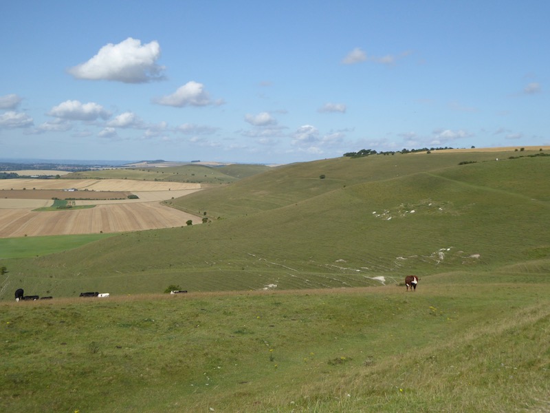
    We are now on Milk Hill, the highest point in Wiltshire standing at 968 feet above sea level.  It is said to be 26 centimetres higher than its neighbour Tan Hill.  We stay with the White Horse Way until we reach a track where we turn left and then at a junction of paths continue heading west on a path that follows the impressive medieval earthworks.

    We stay with the path on the earthworks for just over a mile and then at a junction of paths turn left to follow a path heading south along the edge of a field.  The OS Map shows there is trig point just over the fence, but from research prior to setting out today I know that it has been moved to the south west corner of the field so we continue on the path until we reach a junction of fences and then take a brief detour to visit the relocated Tan Hill trig pillar.  

    This trig is the 232nd I have bagged.  It is disappointing it has been moved, but rather that than destroyed.  It is not the first I have come across that is not in its original location, but the views from here are still impressive and we can see the Cherhill Monument in the far distance.

    From the trig we head back to the path and follow this downhill through cattle to go through a gate to reach a junction of paths.

    We take the right fork following the path to meet a minor road at Cannings Cross Farm.  Here a notice states this is the site of the real Moonraker Pond.  Legend has it that in the 1780’s locals hid smuggled contraband in a pond to avoid the revenue men. Whilst retrieving it the revenue men arrived and the locals explained their activity by pointing to the moons reflection in the pond and saying they were trying to rake the big cheese from the pond. The revenue men laughed thinking them simple folk and went on their way.  The contraband was then retrieved.  This tale has led to people born in Wiltshire being known as Moonraker’s, a term that applies to both Mandy and I.  However, there are many ponds in Wiltshire claiming to have been the source of this tale and strangely there does not appear to be a pond marked on the map at Cross Cannings Farm.

    The footpath leads through the farm and then continues across fields.  To our right the map shows a long barrow so when we reach a track we turn right to make a slight detour to explore.  This is a modern Long Barrow built in 2014 to enable 340 people to have their ashes interned.  It has been aligned so that the sunrise of the winter solstice lights up the internal chamber.

    Returning to our route we go back along the track and then cross the Woodway Bridge over the Kennet and Avon Canal and immediately turn left to join the canal towpath.  Over recent years I have walked many sections of the canal, but this is new to me.  It appears a number of permanent barge dwellers are moored here.

    We stay with the towpath to pass under All Cannings Bridge (No.127) and continue on until we reach England’s Bridge (No.126).

    It is around lunchtime so we decide to leave the canal and cross the bridge to wander into Stanton St Bernard to visit the church and hopefully find a bench for lunch.  In the field beside the track we see a World War II pillbox.  This is one of the many pillboxes along the Kennet and Avon Canal and formed what was known as the Blue Line.  This was one of a number of “Stop Lines” that were established in the event of a German invasion during the war.

    We soon reach All Saints Church.  There was originally a church here in the 13th century which had a tower added in the 15th century.  In 1832 all the church apart from the tower was rebuilt.  As anticipated we find a bench in the churchyard which is an ideal spot to stop for our refreshments.

    The church is locked so we are unable to look inside.  It is not clear if it is locked due to concerns about Covid or for security.  Either way I find it odd that buildings traditionally providing people with a place for reflection and sanctuary are locked, especially at times when so many are struggling with the impact of the pandemic. We continue our walk and Mandy, who unlike me is a believer moans about the church hierarchy and its locked church policy.  I think a letter to the diocese will be winging its way soon after she returns home.

    Rather than retrace our steps to the canal we decide to walk through the village and rejoin it at Stanton Bridge.  This is straightforward and we keep right at every junction until we get to the canal where we rejoin the towpath heading east.  This soon leads us to the Barge Inn at Honeystreet.

    We now have over three miles on the canal towpath as it heads east.

    After two miles we reach the ornate Ladies Bridge built by John Rennie in 1808.  The design was at the behest of local land owner Susannah Wroughton and the reference to Ladies refers to her and her daughter, also named Susannah.

    Almost a mile from Ladies Bridge we reach Wilcot Bridge.  Here we leave the towpath to join a minor road running parallel to the canal.  After a few hundred yards the road bends to the left away from the canal and we start to head steadily uphill.  At a junction we go left and then almost immediately right.  Reaching a crossroads we go straight across on a road signposted to Huish and Draycot and soon reach Draycot Farm.

    The road bends to the north and we stay with it for a few hundred yards and then as it turns to the right we go straight on along a footpath into a field. After a second gate the path starts to steeply ascend Draycot Hill.

    At the top of the hill we go through a gate and join the Tan Hill Way and Mid Wilts Way heading west.  This is a cracking hill to walk along with numerous inlets with great contours.  They look spectacular on the map but even better when viewed from above.

    The path is well marked and passes through gates and by a large dew pond.  These ponds are a common feature on chalk downland.  They were dug out and lined with clay so they filled naturally with rainwater, thereby providing drinking water for the grazing livestock.  

    For the last couple of hours rain has threatened, now it arrives.  We are walking directly into the wind with no protection from the elements so we quickly don our full waterproofs.

    The route is now very straightforward, the well worn path leads us back to our starting point at the car park.  Despite the last half hour of rain our walk has been a cracking 15 mile route.  

    You can view this 15 mile walk on OS Maps and download the GPX File Here

    To follow our walk you will need Ordnance Survey Outdoor Explorer Map – 157 – Marlborough & Savernake Forest

    11th November 2020

    © Two Dogs and an Awning (2020)

    All information on this site is provided free of charge and in good faith and no liability is accepted in respect of damage, loss or injury which might result from it.  To the best of my knowledge the routes are entirely on public rights of way or within areas that are open for public access.
    Walking can be hazardous and is done entirely at your own risk.  It is your responsibility to check your route and navigate using a map and compass.

  • A Circuit To Etchilhampton Hill

    A Circuit To Etchilhampton Hill

    We are nearly at the end of this short trip away, but there is still time for one more walk and an opportunity to bag a new Ordnance Survey trig pillar along the way.  Visiting trig pillars has long been a feature of our walking, for years they were ancillary.  If we happened to pass one along the way that was fine, but rarely did we make a special effort to reach one.  However, a couple of years ago a Twitter buddy suggested I start logging them.  Since then they have become a regular feature when planning my walks.

    Once again our walk starts from the pay and display car park in Station Road close to the centre of Devizes.  We leave the car park and turn left to walk up to a mini roundabout where we turn left crossing a canal bridge and then cross the road to take the towpath signed for Devizes Wharf.  As we near the Wharf, which is on the opposite side, we fork away from the towpath going up steps to join a lane with a World War II Pill Box.  This is one of a series of such boxes built along the edge of the canal to form the GHQ Blue Line a section of the General Headquarters Line which compartmentalised the country to thwart the expected German Invasion.

    We continue along the lane reaching the cemetery where we make a brief diversion to look around.  This cemetery was opened in 1878 and over the years has been extended a number of times.

    Back on the lane we cross the canal bridge and stop to look at Devizes Wharf.  In normal circumstances I imagine this is a must stop spot with its cafe, museum and theatre but today it is quiet.  Back in the days when the canal was in use as a trading route this would have been a major hub for goods coming in and out of the thriving town.

    We rejoin the towpath and head east through Devizes.  The Kennet and Avon canal goes between Reading and Bristol, 87 miles of waterway, the section from Reading to Newbury follows close to the River Kennet and from Bath to Bristol is close to the River Avon. It was designed and built by John Rennie between 1794 and 1810.

    Like most canals this one suffered competition from the railways and the opening of the Great Western Railway in 1841 removed most of its traffic. By 1852 GWR had taken over control of the canal and increased tolls significantly to persuade the remaining traffic to move to the railway.  Then in 1925 GWR sought to close the canal all together but by then pleasure boats had started to use it.

    After World War II the Transport Act 1947 saw the canal transfer to the British Transport Commission, under their stewardship the canal fell into decline with large sections becoming unnavigable.  In 1962 the charitable company the Kennet & Avon Canal Trust was established and they immediately started work on restoring sections and by 2003 the canal was fully navigable again.

    We continue to walk through this section of the canal to reach Devizes Marina.

    Now the canal heads into open countryside.  Whilst I find it interesting walking towpaths through towns I much prefer it when it is less built up, so this section is a pleasant relief and the towpath is a lot quieter.

    At Horton Bridge, with the Bridge Inn besides it, we leave the canal and join the road sign posted to Coate and Little Horton. 

    This lane heads south, initially following the route of the canal, after passing an overgrown World War II pillbox it leaves the canal. The route now follows the straight country lane to reach Little Horton and continues on to pass the smart looking cricket ground in Coate.  At a cross roads we pass the bus shelter with the telephone kiosk beside it now housing a defibrillator.   

    Now we continue to head south through the village on the Etchilhampton Road and pass the car park of the New Inn pub, our route is still on the Etchilhampton Road but first we pop up the lane to have a look at the pub for future reference.  I always take the view that if a pub looks cared for outside there is every chance it is well worth popping in.  This is adorned with flowers and looks a delight, so when things are a bit safer we will return here to sample the food and ale.

    Back on Etchilhampton Road we continue out of the village still heading south.  The road starts to ascend and we get a good view of Tan Hill and the Alton Barnes White Horse.  It was only a few weeks ago that we walked there whilst staying in Charlton St Peter.

    At the brow of the hill we leave the road and take a bridleway on the right which follows a broad grass track heading steadily uphill.

    As we ascend there are fine views across the Vale of Pewsey.  Until earlier this year I had not walked in this area, it has now become a favourite local spot.

    The path now runs besides a fence continuing up to the top of Etchilhampton Hill.

    At the top of the hill besides the path is an Ordinance Survey trig pillar, this is the 212th I have bagged.

    From the trig we follow the track descending the hill and on reaching a crossing of tracks turn left to reach a minor road.  Our route is straight across but first I make a quick detour by turning right and walking downhill for a few hundred yards to the junction with the A342 to have a look at the monument on the junction which is a lion on a plinth.  I have driven by this many times but never known why it is here.

    The monument commemorates James Long, he lived in Devizes and in 1768 he promoted a new road to connect Nursteed in Devizes to Lydeway in Urchfont.  The route he proposed avoided the steep slopes of Etchilhampton Hill and was therefore a much easier journey for horses, oxen and the drovers.  Local folklore has it that when the clock on St James Church in Devizes strikes midnight the lion leaves the plinth and visits a farm pond in nearby Stert to quench his thirst.

    I walk back up the hill to the crossing of paths and find Lynnie and Crosby sat in the shade of a tree.  It is a very hot afternoon and both decided there was little benefit in adding any distance to their walk!

    We now head across the road and follow the track down to the A342 which we cross and take the lane into Stert.  In the village we head towards the church and then at a fork in the road go left downhill.  After a few hundred yards the road becomes a track and we follow this down to reach a footpath leading over a stream.

    After crossing the foot bridge we turn right and start with the path that leads through Stert Valley with the stream to our right.  On reaching a junction with Sleight Lane we turn left heading towards Sleight Farm.

    The harvest is well under way and the dust from the combines billows across the tracks ahead and the tractors coming down the lane show little sign of slowing as they pass.  There is rain forecast for later, but the few seconds it would take to slow to a reasonable speed to pass pedestrians would not make any difference to how quickly the grain is stored.

    At a junction of tracks we turn right, thankfully walking away from the fields that are being harvested.

    This track leads north towards Devizes and as we near the outskirts of the town we pass a skatepark and football pitches to join Green Lane.  We stay with this road as it heads through a residential area and then becomes pedestrianised.  At a road junction we turn left and follow the pavement to a mini roundabout where we cross to join Wick Lane.  We walk on the pavement besides the lane to reach a junction with the Potterne Road where we turn right and then after a hundred yards take a footpath on the left.

    The footpath leads to Queens Road where we turn left and walk to the junction with Hartmoor Road.  We turn right and head to the junction with Hillworth Road.  Crossing the road we follow the footpath along the edge of the grounds of Devizes Castle.

    This path brings us to St John’s churchyard and from here we wander into the town.  We set off on our walk in mid afternoon to avoid the hottest part of the day, so it is now early evening and it is pleasant to wander around the town.  Few folk are about so it is an ideal time to look at some of the stunning old buildings.

    If we were not in the midst of a pandemic we might have stopped in one of the pubs for a bite to eat and a pint, we have earned it having walked almost twelve miles on a hot day.  But we are being extremely cautious and also should get back to the caravan to pack up for our trip home tomorrow.  With overnight rain forecast we need to get the awning down before it gets wet!

    To follow this walk you will need Ordnance Survey Explorer Map OL157 Marlborough & Savernake Forest and OL130 Salisbury & Stonehenge

    You can view this 11.5 mile walk on OS Maps and download the GPX File Here

    30th July 2020

    © Two Dogs and an Awning (2020)

    All information on this site is provided free of charge and in good faith and no liability is accepted in respect of damage, loss or injury which might result from it.  To the best of my knowledge the routes are entirely on public rights of way or within areas that are open for public access.
    Walking can be hazardous and is done entirely at your own risk.  It is your responsibility to check your route and navigate using a map and compass.

  • Walkers Hill from Pewsey

    Walkers Hill from Pewsey

    Last year with  three walking buddies I walked the Sarsen Trail, the 26-mile walk between Avebury and Stonehenge.  The route took us over Walkers Hill near the Alton Barnes White Horse and the views were absolutely stunning.  Today Lynnie and I are going there, we could start our walk from the car park on Walkers Hill, but I always think part of the enjoyment of visiting somewhere is the journey involved so we are starting nine miles away in Pewsey.

    We park in the free car park in the centre of Pewsey, off Goddard Road (Grid Ref: SU162601).  Leaving the car park we walk back to the A345 the main road through Pewsey.  We turn left and follow the road to a mini roundabout then continue besides the A345, now North Street.  We stay on the main road until we reach Buckleaze Lane on the right.  This lane goes under a railway bridge and then turns right to run parallel to the line before becoming a footpath besides an old mill.

    After crossing the River Avon we continue on the narrow path besides the railway line, when the path opens out we fork left keeping a fence on our left and soon pass gardens.  Reaching a tarmac lane we continue to a junction and turn left to head north on a bridleway, this is the route of the White Horse Trail. The path heads downhill and crosses the River Avon.

    Soon after we cross the Kennet and Avon Canal at Pains Bridge. 

    The path is now a farm track still heading north.  After passing the entrance to Inlands Farm we continue on the farm track. 

    Reaching a minor road, Sunnyhill Lane, we turn left and then soon turn right to pick up the White Horse Trail again until we reach a track.  Here we leave the White Horse Trail and turn left along the track, we are now on the route of the Mid Wilts Way.  This long distance path is a 68-mile route crossing the County from its boundary with Berkshire to Somerset.  We follow the lane, Pound Lane into the village of Oare.

    Reaching the A345 we turn right and pass The White Hart pub, sadly this pub closed in 2014 and it looks like it is a long way from re-opening.  Such pubs are key to retaining village life and it is surprising that one so close to so many good walks is not worthy of brewery investment to keep it going.  Apparently the local community had plans to try and operate the pub as a community venture, but that doesn’t seem to have progressed.

    Soon after passing the pub we take a lane on the left leading past the school and then turn right to follow a footpath heading steadily uphill on the edge of a field. We are still on the Mid Wilts Way. 

    The path enters access land on Huish Hill and then climbs steeply.  It is a hot day and this ascent is a good challenge but the views make it worthwhile.

    We follow the footpath to reach a driveway to Huish Hill House and then turn left to follow the path through the grounds of the property and into a copse.  The path now continues in a northwesterly direction across fields.

    We have now joined the White Horse Trail and Tan Hill Way; the latter is a 12-mile route from Clench Common to the Wansdyke Path.  I often wonder how walks such as this end up being named on the Ordnance Survey Map. 

    We stay with this route to reach a gate leading into a field of cattle.  I am wary of cattle, especially when Crosby is with me, there is something about him that seems to attract them.  This herd are in a frisky mood so we make a quick decision to re-plot our route.   Back at the gate we turn and follow a footpath along a grassy track heading east.

    In just under a mile we take a footpath on the left to head north towards Bayardo Farm. After passing farm buildings the track takes us to the farmhouse with a Caravan and Motorhome Club CL in the field to our right.

    We turn left and briefly follow a road, but as this sweeps sharply to the right we continue straight on along a track into Broom Copse.

    This is a cracking bit of woodland.  We stay with the track along the southern edge of the woods.

    At a junction of tracks we turn left and continue along the edge of trees now on the route of the Wansdyke and White Horse Trail, this passes Strawberry Ground and Heath Plantation to reach another crossing of paths.  We go left following the White Horse Trail way-markers south.

    The track reaches a junction of seven footpaths, we turn right into a field and head steadily uphill besides Gopher Wood to reach the top of Draycott Hill.

    We now head west along the top of the hill.  The views from here are stunning.

    A few times this year Lynnie has asked why we have not walked more in Wiltshire, she had not appreciated it was so beautiful.  The answer if that we usually head off to walk in the Yorkshire Dales, Scotland, Exmoor or the Brecon Beacons, but the views from here compare with anywhere we have been on our travels.

    The path passes through fields abundant with a wide array of wildflowers.  Despite all the challenges of the year so far being here surrounded by nature is great therapy.

    Our route descends to skirt north of the Neolithic hill fort on Knap Hill.

    We then continues through a car park.  We cross the road and turn to the left to follow a path up Walkers Hill.

    The views from the top are panoramic. 

    It is a clear day and we can see for miles.

    We head south down Walkers Hill getting a good view of the Alton Barnes White Horse.  This horse was first cut in 1812 when Robert Pile of Manor Farm in Alton Barnes paid twenty pounds to John Thorne, known as Jack the Painter, to design and cut the horse.  The figure stands on Milk Hill which is the highest hill in Wiltshire at 295metres and is reported to be the second highest chalk hill in the UK.

    On the 10th May 2011 a chap named Neville Almond recorded the longest hang gliding flight in the UK after taking off from Milk Hill.  He flew an amazing 167 miles to the Norfolk coast in less than five hours.  His record stood for a year until Carl Wallbank flew from Llangollen in Wales to Weymouth a distance of 171 miles.

    After going through a gate we continue downhill crossing the road and joining a permissive path besides paddocks.  As we near a road we turn left and follow the path along the edge of the field and then join the road and soon turn right by a fine old thatched barn in Alton Priors.

    At the back of the barn I spot a collection of old farm machinery and we wander over to have a look.

    Resuming our walk down the lane in front of the barn we see that it is full of old farm machinery.  I particularly like the seed drill.  When I was a nipper working on a farm I used to ride on the back of one of these to make sure the seed was distributed evenly.

    Now we continue down the lane, Village Street, and follow this to a gate with an interesting turnstile besides it.

    We enter the field and walk the short distance to All Saints church.  This church dates from the 12th century but it was declared redundant by the Church of England in 1972 and is now in the care of the Churches Conservation Trust.  

    It is used as a meeting place, but retains the feel of a place of worship.

    In the churchyard there is a Yew Tree which has been dated as 1,700 years old.  Faced with a tree with a hole in it Lynnie belies her years and cannot resist sticking her head through it!

    From the church we follow the footpath to another set of turnstiles on either side of a footbridge.

    From here we follow the paved footpath across a field of pasture and head towards St Mary’s Church in Alton Barnes.  

    The two churches are only a few hundred yards apart.  It would appear that the two congregations of Alton Barnes and Alton Priors were separated in 1660.  I had hoped this church would be open, when I walked by here last summer restoration work was in progress and we managed a brief peek inside and it was full of scaffolding, however a notice on the door says the church has been permanently closed.

    From the church we head along the lane to reach a minor road where we turn left and follow it into Honeystreet where we join the towpath of the Kennet and Avon Canal and head east.

    We walk along the towpath for four and a half miles, it is a cracking section of the canal going through open countryside with the occasional barge moored on the bank.  

    We pass under the ornate Ladies Bridge, built by John Rennie in 1808.  The design was at the insistence of Susannah Wroughton who owned the land the canal passed through and the name refers to her and her daughter, also Susannah.

    Just after the bridge we reach a section where the canal widens, this was also at the behest of Susannah Wroughton and her family, they would only allow the canal to pass through if an ornamental lake was created.

    From here we pass Wilcot bridge and then go under the Stowell Park suspension bridge which spans the canal.  This was built in 1845 as a bridge for a private path across the canal. It was designed and built by the noted bridge builder James Dredge (senior).  Apparently he was a brewer who later became an inventor of suspension bridges unfortunately only a few now remain. 

    We continue on, passing Pewsey Wharf, now the location for the Waterfront a pub and cafe but in the past it would have been key to local trade with goods being loaded and unloaded.  There are a few people about so conscious of the need to social distance we decide to keep going and not explore the site.

    Staying on the towpath we pass more barges, these look like they are permenantly moored.  We soon reach Pains Bridge where we leave the canal and turn right to retrace our earlier route back towards Pewsey.  As we reach houses we have the option of following our earlier route back to the car or continuing along Hollybush Lane.  We opt for the latter and take this lane along the edge of the village.  We stay with this road as it becomes more built up and then at a junction with the B3087 turn right and soon reach a guide post with a lamp at the junction with Ball Road.  The base and cast iron post date from 1880 with the lamp being added later.

    We stay with the B3087 and walk along the pavement to reach the centre of Pewsey where we turn right at the statue of King Alfred and return to our starting point.  Our walk has covered close to 16.5 miles and has had some absolutely stunning views.  

    We are heading home tomorrow.  Our first trip away since the outbreak of the Covid-19 pandemic has been really enjoyable and there have been times when we have forgotten about all the challenges going on in the world.  Hopefully it won’t be too long before we are off in the Coachman again.

    To follow this walk you will need Ordnance Survey Explorer Map OL157 Marlborough & Savernake Forest

    You can view this 16.5 mile walk on OS Maps and download the GPX File Here

    16th July 2020

    © Two Dogs and an Awning (2020)

    ll information on this site is provided free of charge and in good faith and no liability is accepted in respect of damage, loss or injury which might result from it.  To the best of my knowledge the routes are entirely on public rights of way or within areas that are open for public access.
    Walking can be hazardous and is done entirely at your own risk.  It is your responsibility to check your route and navigate using a map and compass.

  • Wilsford Hill from Charlton St Peter

    Wilsford Hill from Charlton St Peter

    It is six months since we were last away in the caravan.  The Covid-19 pandemic has made us rethink our travel plans for the year, rather than longer tours we are only going away for a week or so at a time and hope to visit a few CL’s within a fifty-mile radius of home.

    Once the initial travel restrictions were eased I started exploring parts of Wiltshire I hadn’t previously walked.  A few weeks ago I walked from the small town of Pewsey and was struck by the surrounding area.  So this is where we are.  Lynnie and I have pitched up at the attractive Charlton Manor CL, in the hamlet of Charlton St Peter.

    It is only a forty-minute drive from home and soon after our arrival we are sorted and ready to explore the local area.  We’ve only brought Crosby with us; Dexter is now too old to walk far and is staying with our neighbours where we know he will be spoilt.  

    Leaving the site we go through the farm and on reaching a track turn left and head north on the White Horse Trail, this long-distance path covers ninety miles and visits all eight of the Wiltshire White Horses.  I had hoped to walk this trail this year, but travel restrictions have made it difficult so my walking buddy Mandy and I are doing day walks visiting each horse.  

    At a junction of tracks we turn left, leaving the White Horse Trail to head towards Cuttenham Farm.  The path is hedge lined but occasionally we glimpse the surrounding countryside through clearings.

    Nearing Cuttenham Farm is a junction of paths and we turn left and walk up to a minor road where we turn left and cross a bridge to pass in front of the farm house.

    At a fork in the road we go right towards Wilsford and soon enter the attractive village.  I have recently started “bagging” Ordnance Survey benchmarks.  Some would consider this a sad pastime, but it adds interest to some walks.  I won’t make a long diversion to see one, but if on route they are worth seeking out.  A quick search of the Benchmark Database has revealed one on St Nicholas Church and as we enter the village we spot the 12th century church and soon find the cut on the wall.

    We would normally head inside for a quick look, but decide not to today.

    Leaving the churchyard we head south on a lane passing Wilsford Manor and then as the road bends to the left we take a footpath on the right to pass along the edge of a field.

    Reaching a gate we don’t go through but instead turn left to head south along the edge of the field, after going through a gate we continue on a grassy path towards the A342.

    After crossing the road we join a track that steadily ascends Wilsford Hill, as we start heading up we turn to look back to the Alton Barnes White Horse on the opposite side of the vale.

    It is a long steady ascent up Wilsford Hill on the well-maintained track.

    At the top there are cracking views, to the south there is the wide expanse of Salisbury Plain, most of which has restricted access because of the artillery ranges.  Not a sensible place to wander, or to pick up objects and there is no shortage of warning signs.

    When I was younger I used to think the plain was a desolate area, now I appreciate the beauty of the downland.  It is a pity that so much of it is inaccessible.

    At a junction of tracks we turn left and follow the broad path toward Charlton Clumps. 

    We ignore the first track on our left, but take the second which soon leads us to an Ordnance Survey trig pillar.  This is one I have already bagged, but it’s a new one for Lynnie.

    This track is Charlton Drove and it descends steadily offering fine views.

    The drove leads us back to the A342 opposite the Charlton Cat cafe, we cross carefully and take a path through a gate.  The Charlton Cat was a pub and the building dates from the 1820’s.  Apparently, it was originally called the Red Lion, but by the 1920’s it had become known locally as the Cat due to the poorly painted lion on its sign. So the name was changed.  If this is true it is a lovely tale!

    We follow this path the short distance to the outskirts of Charlton St Peter, where we turn left and follow the track back to Charlton Manor CL.

    Our walk has covered almost 6 miles and has been a great introduction to the area.  Now it is time to sit in the awning with a beer and plan a longer excursion for tomorrow.

    To follow my walk, you will need Ordnance Survey Explorer Map OL130 – Salisbury and Stonehenge

    You can view this 6 mile walk on OS Maps and download the GPX File Here (Subscription to OS Maps Required)

    12th July 2020

    © Two Dogs and an Awning (2020)

  • Avebury to Stonehenge on the Sarsens Trail

    Avebury to Stonehenge on the Sarsens Trail

    Earlier in the year with three friends, Mandy, Glenda and Ged, I walked the Clarendon Way, the 27-mile route between Winchester Cathedral and Salisbury Cathedral it was a cracking day and the four of us vowed to do another long distance walk together when our diaries permitted.  Today we are heading out again to tackle the Sarsens Trail, a 26-mile route between the stone circles at Avebury and Stonehenge.
    (more…)