Category: Travel

  • Sir William Hill

    Sir William Hill

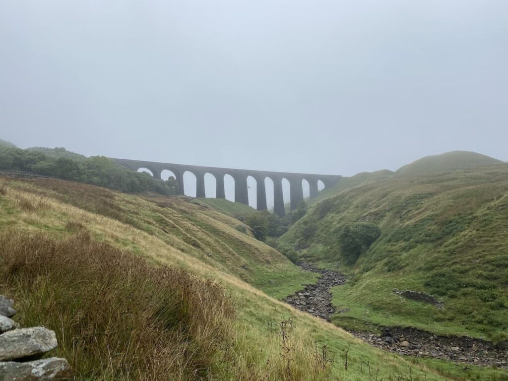
    Many years ago Lynnie and I decided to go to the Peak District for a weekend and stay in bed and breakfast.  It was before the days of the internet and a time when if you were looking for accommodation you either went to the Local Tourist Information centre or drove around looking for a sign offering B&B.  We made a couple of unsuccessful attempts to find a place for the night and then arrived at the Monsal Head Hotel.  These days the hotel is very smart, in those days it was clean and functional and we had an enjoyable stay and a room with a fantastic view out over the viaduct.

    On one of our days there we decided to go for a walk. I had purchased a walking book and worked out we could combine two walks to make a decent days walking.  We had no provisions with us as we planned to stop at Eyam for lunch.  However, on arrival we could find nowhere to eat or even buy a bar of chocolate. The place was closed.  If there is one thing Lynnie does not like it is going without her lunch! So the walk has lived long in the memory.  Today we are returning to Eyam for the first time since the eventful day, but this time we have packed some sandwiches and a flask.

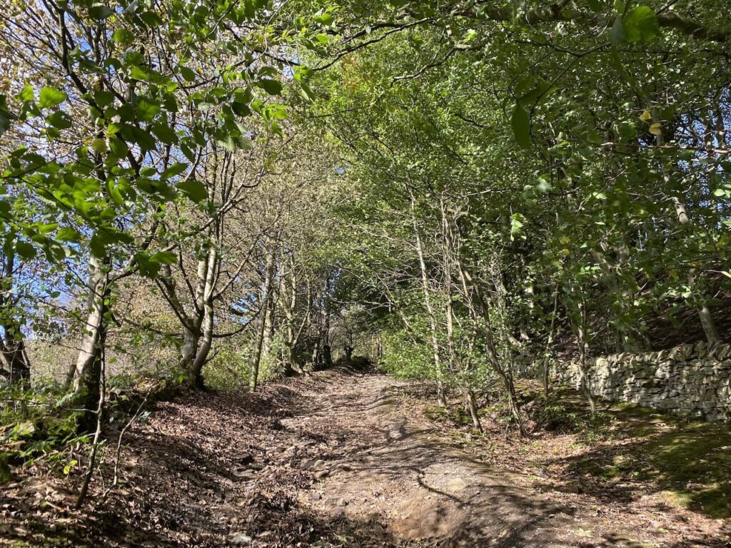
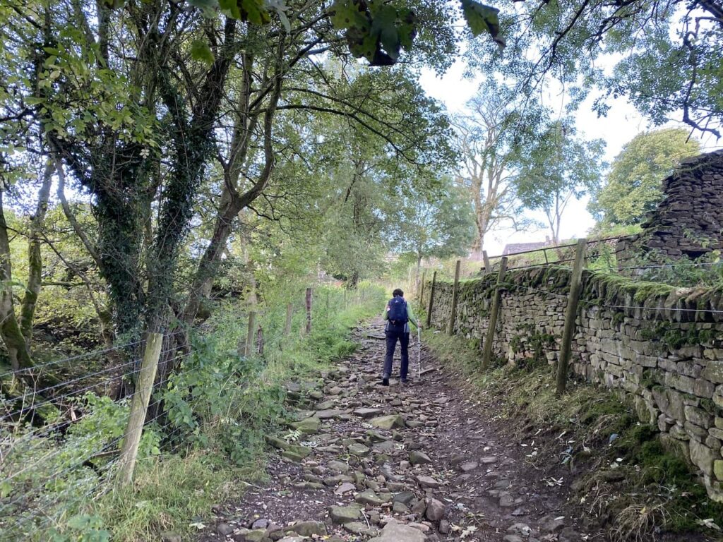
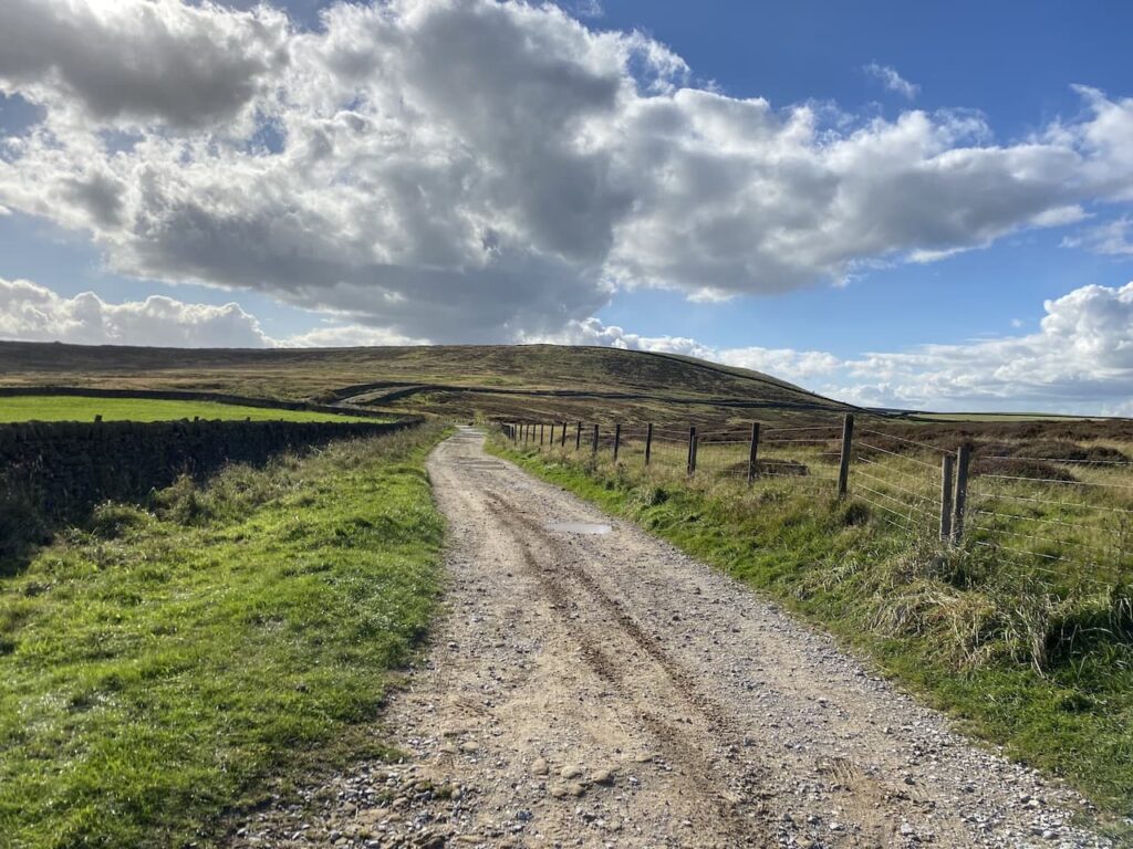
    The starting point for our walk is the public car park on Hawkhill Road in the centre of Eyam.  Leaving the car park we turn right along Hawkhill Road and head uphill out of the village. As the road bends to the right we take a lane on the left, The Nook, and continue to head uphill passing properties.  After the last property the lane becomes a track and gets steeper as it passes through woodland.

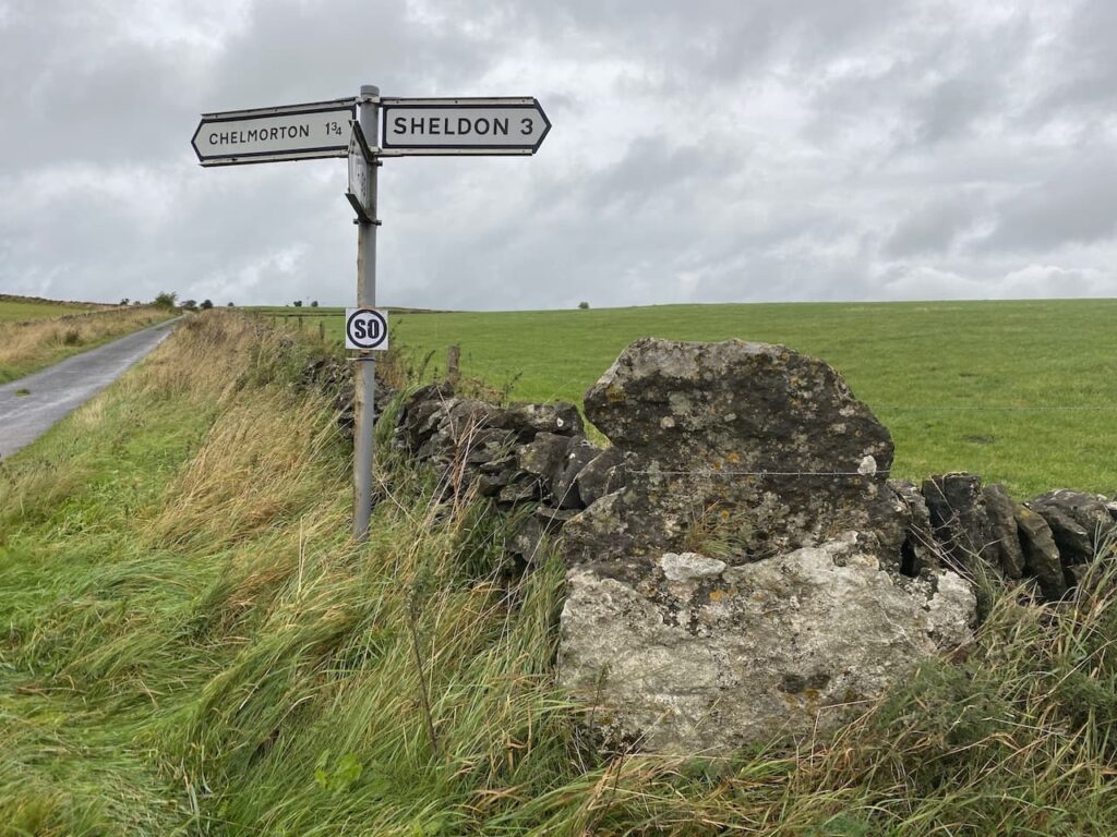
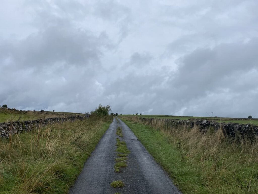
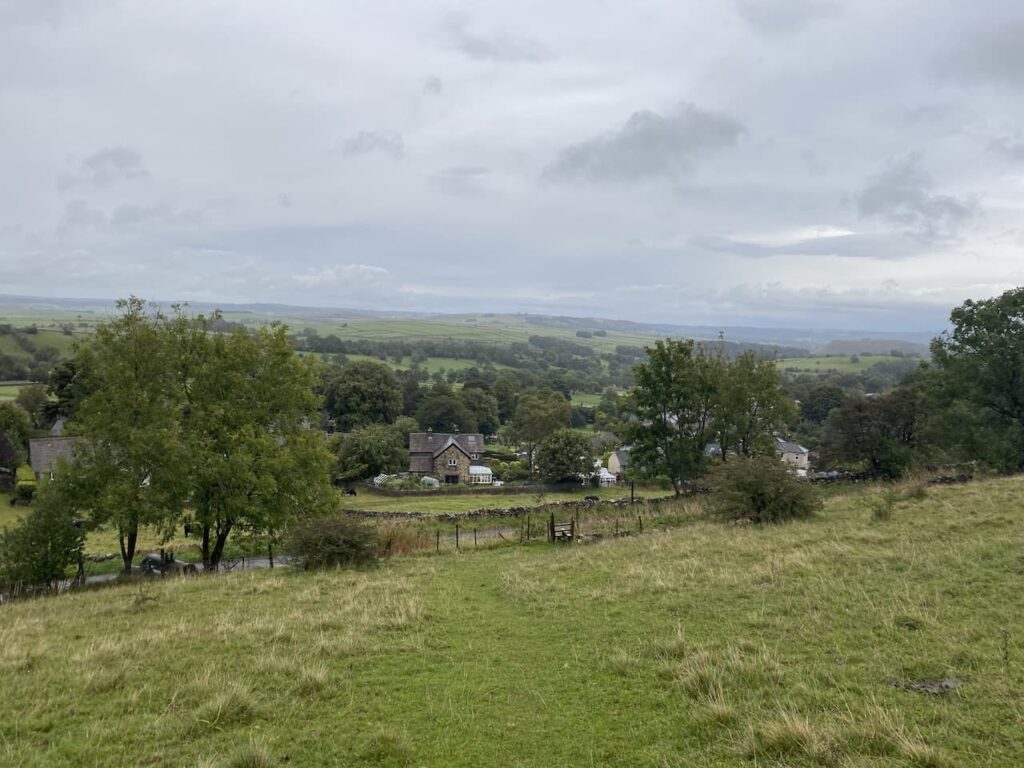
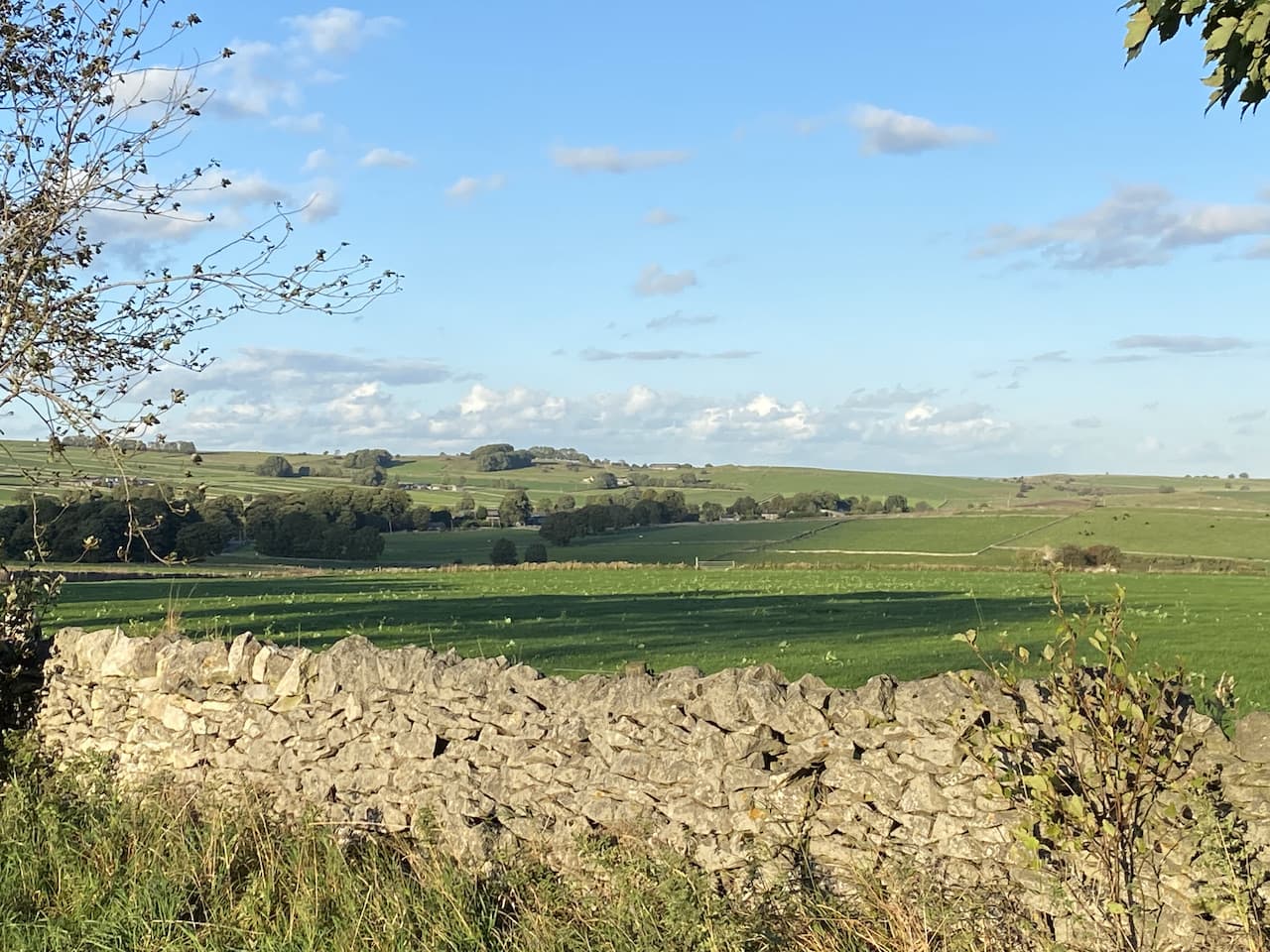
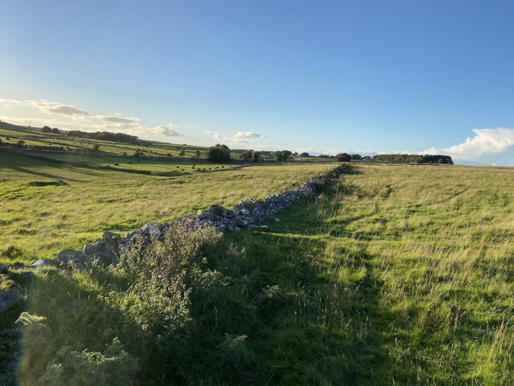
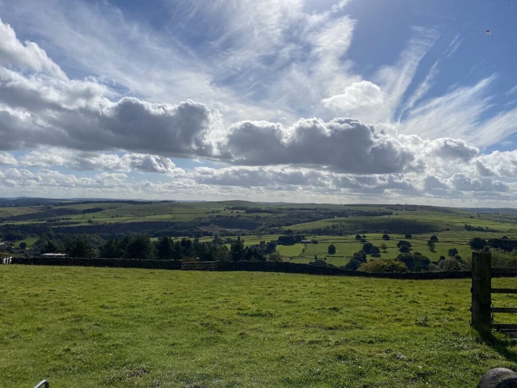
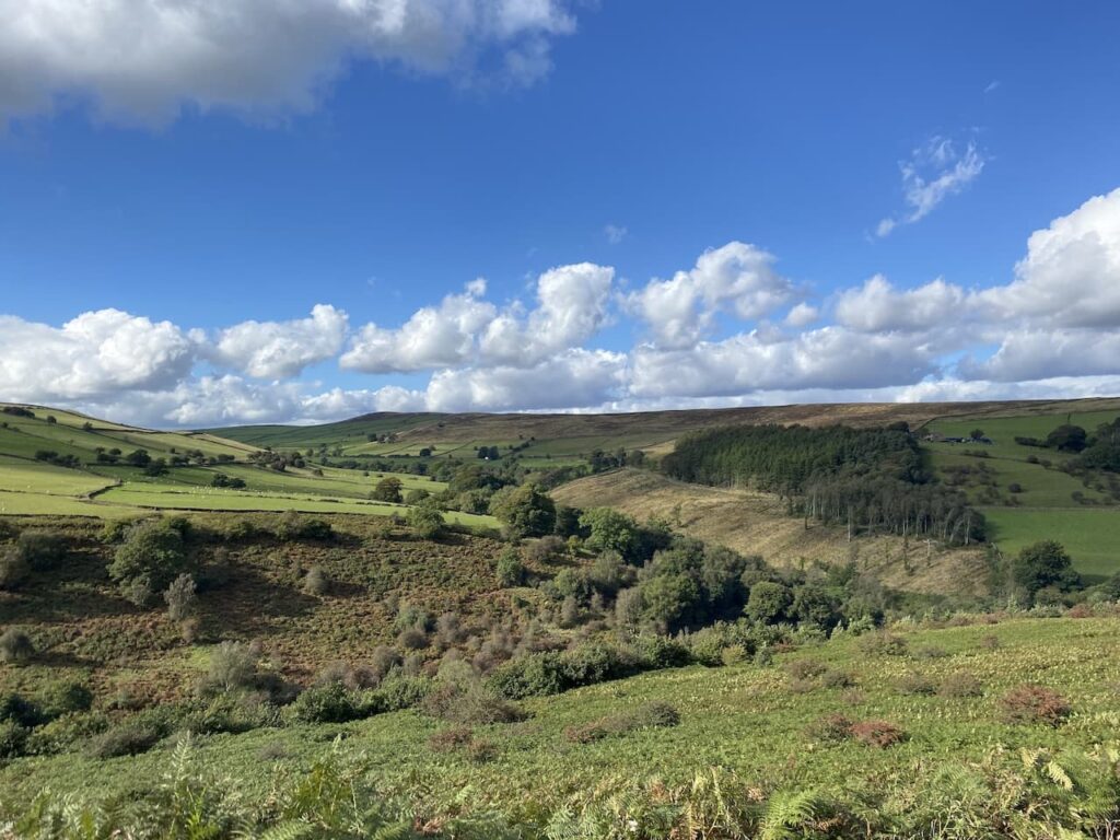
    The track leads onto a minor road where we turn left and walk past Highcliffe Barns.  After the rain of yesterday we are pleased to be walking in the dry and it looks like it should be fine for most of our walk.  The fine weather means there are some good views away to our left.

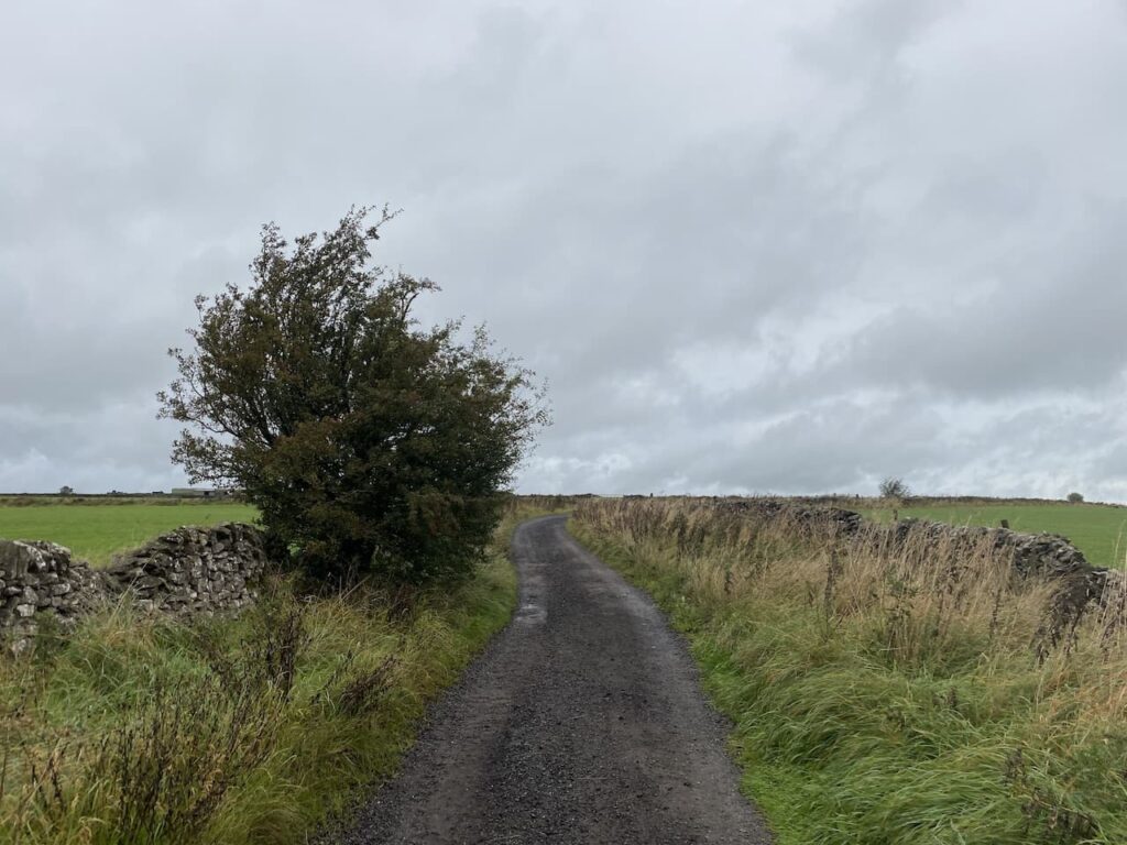
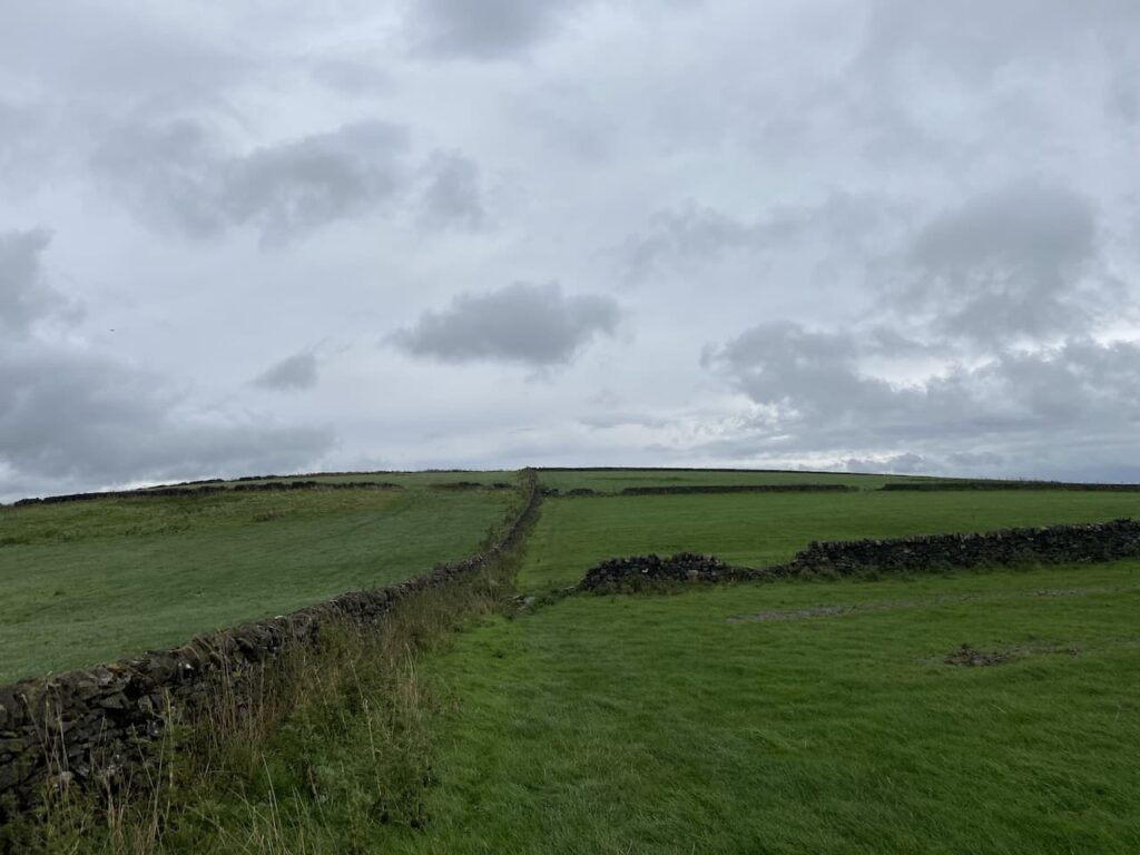
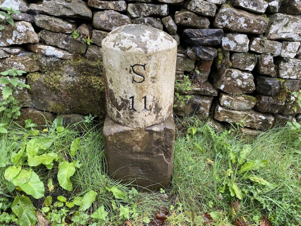
    The road bends to the right and then after a couple of hundred metres bends to the left.  Here we turn right onto a byway, Sir William Hill Road.

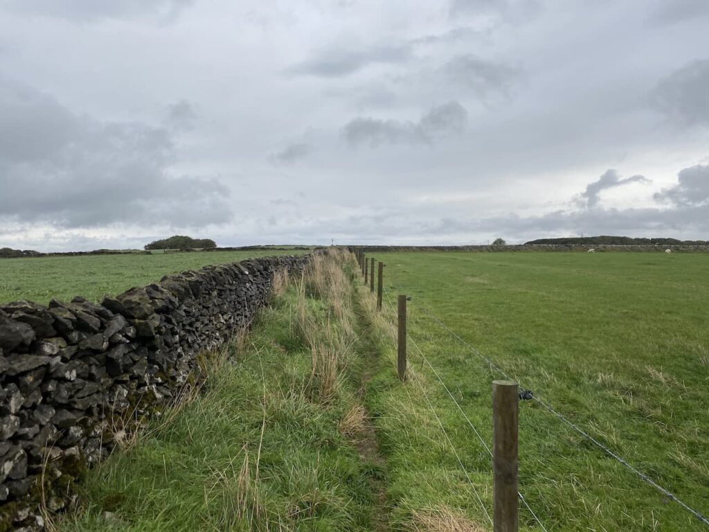
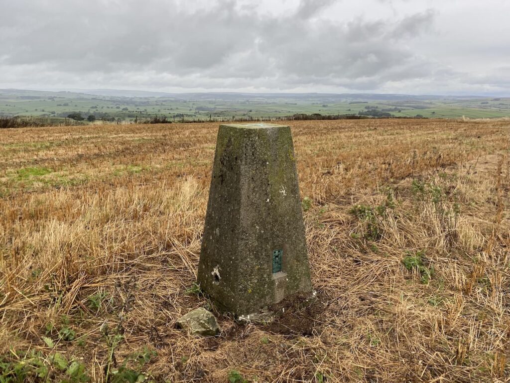
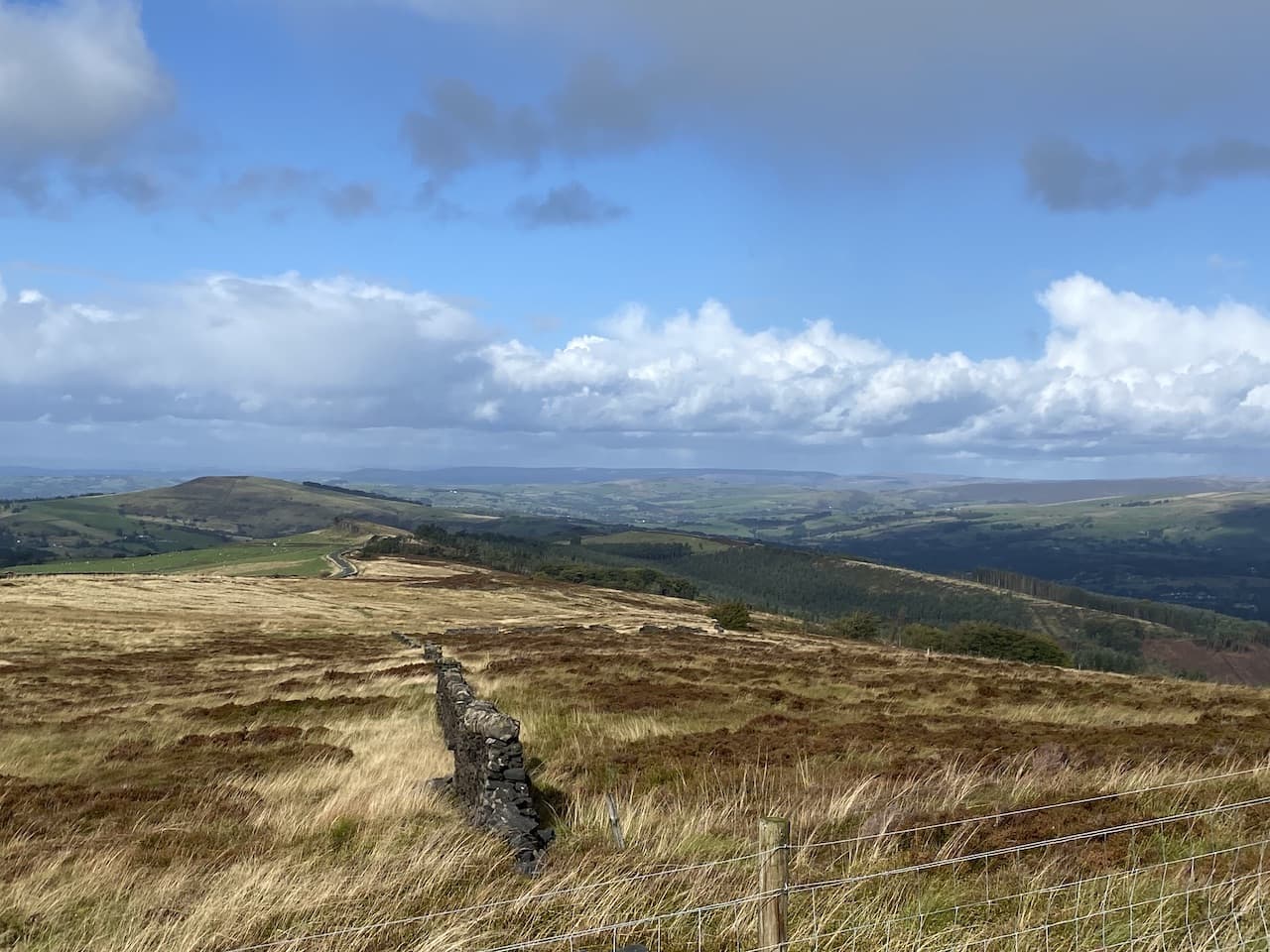
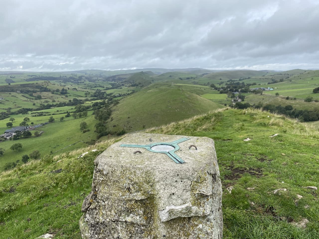
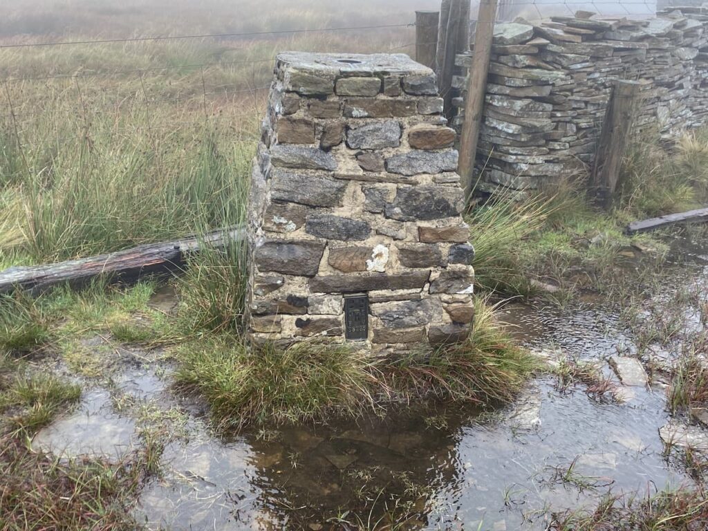
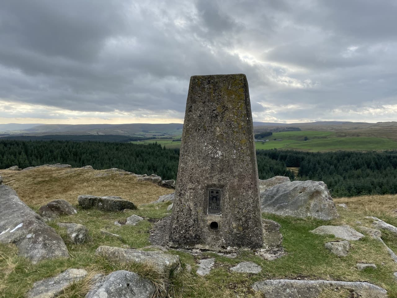
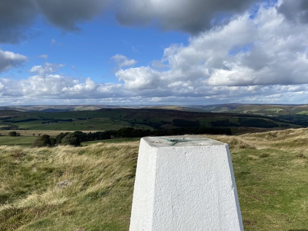
    We stay with the track to pass a tall radio tower. To our left is the trig point on Sir William Hill, it’s on open access land but we cannot gain access because of a high drystone wall.  Instead we have to continue down the track to a wall stile leading to a footpath onto the access land.  Instead of following the footpath we turn left and follow a well-worn path back up the hill to reach the Ordnance Survey trig pillar.

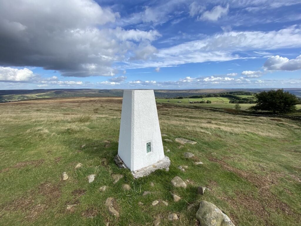
    This is the 279th trig I have bagged and there are some fine views from this hill which stands at 429 metres above sea level.  It is unclear which Sir William the hill is named after, there are plenty of candidates but apparently there are local parish records that record the hill by this name dating back to 1692.

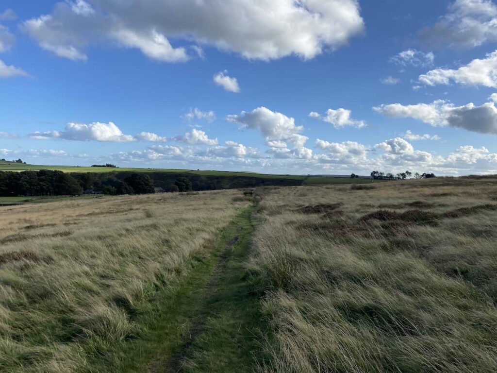
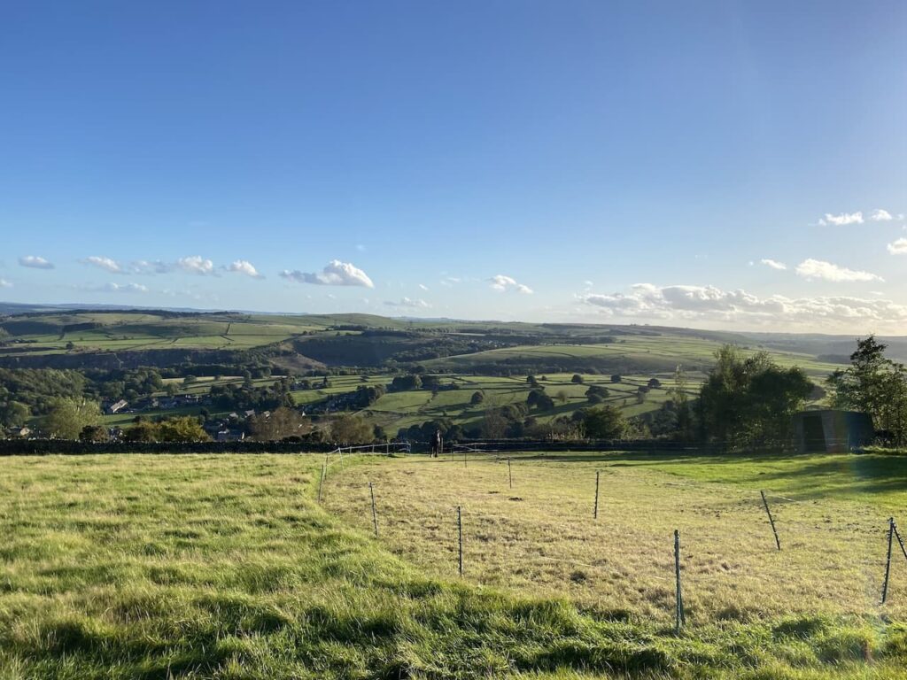
    From the trig we head north on Eyam Moor and soon pick up the route of the footpath.

    The path now goes steadily downhill to pass Gotherage Plantation. 

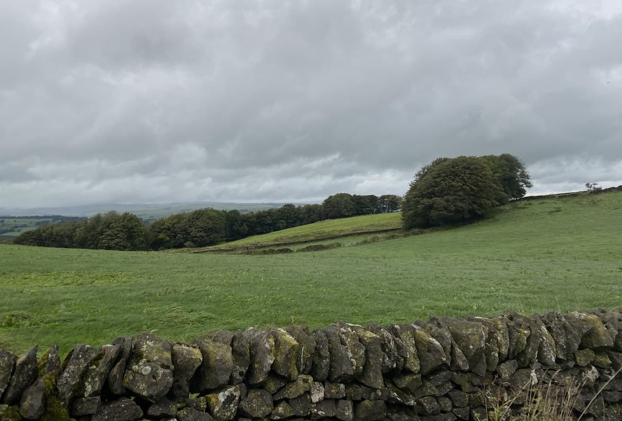
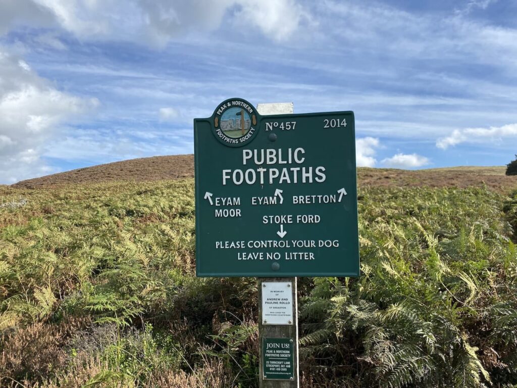
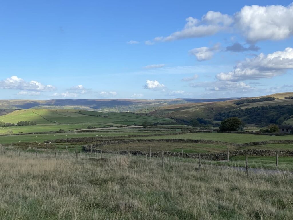
    After passing the plantation we reach a junction of paths beside a stone wall.  There is a cracking footpath sign here that was erected by the Peak and Northern Footpath Society.  

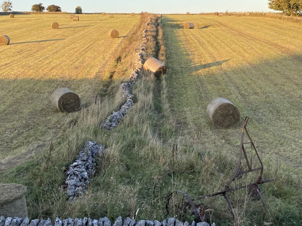
    Our route is the path in the field on the far side of the wall which heads towards Stoke Ford.  This path continues downhill with cracking views 

    As he path nears the footbridge at Stoke Ford it becomes steep and stony so we pick our route with care.  Lynnie is particularly wary going down steep uneven ground, she broke her leg a few years ago when the dogs knocked her over in our garden. So any hazardous terrain requires extra caution.

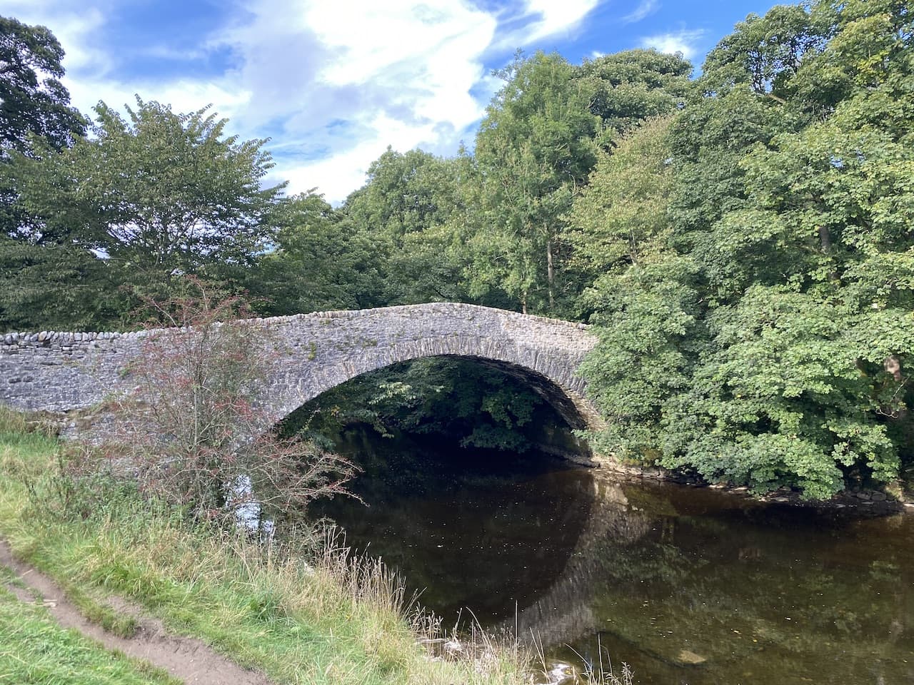
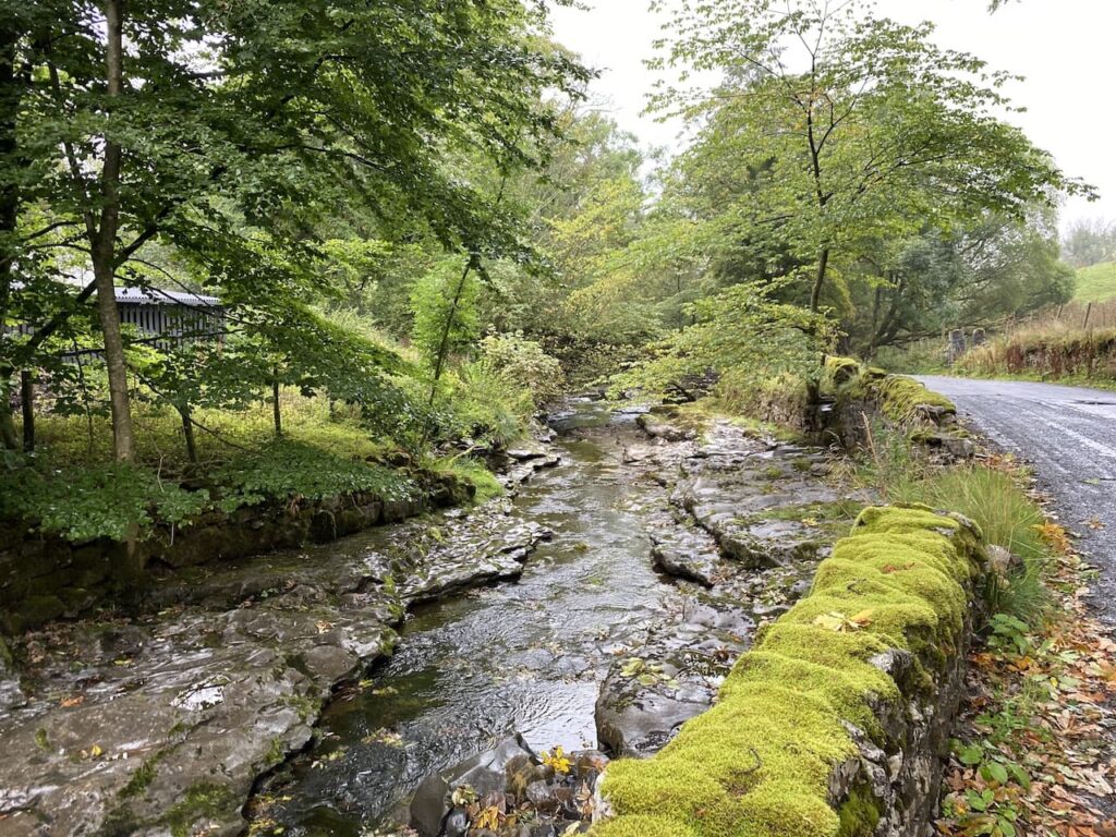
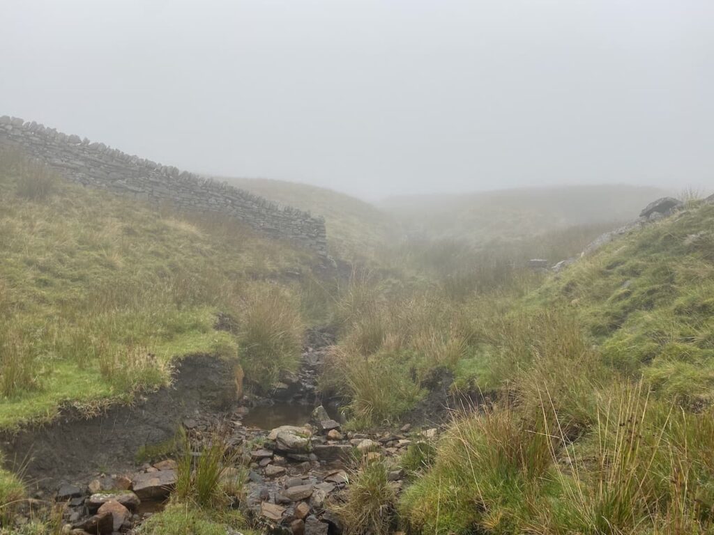
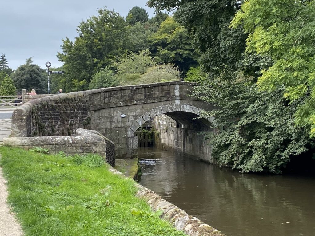
    After crossing the footbridge we take the footpath on the left which follows the stream through woodland in Abney Clough.  Being a southerner I am not familiar with landscape which is described as a Clough, apparently it is a northern term for a steep valley. What I would probably call a combe if I was walking in the west country.

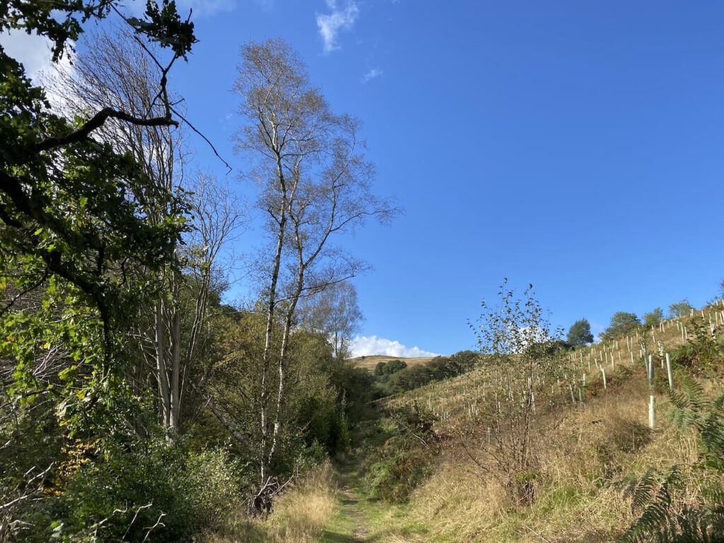
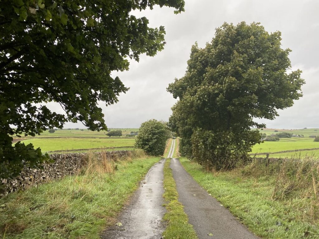
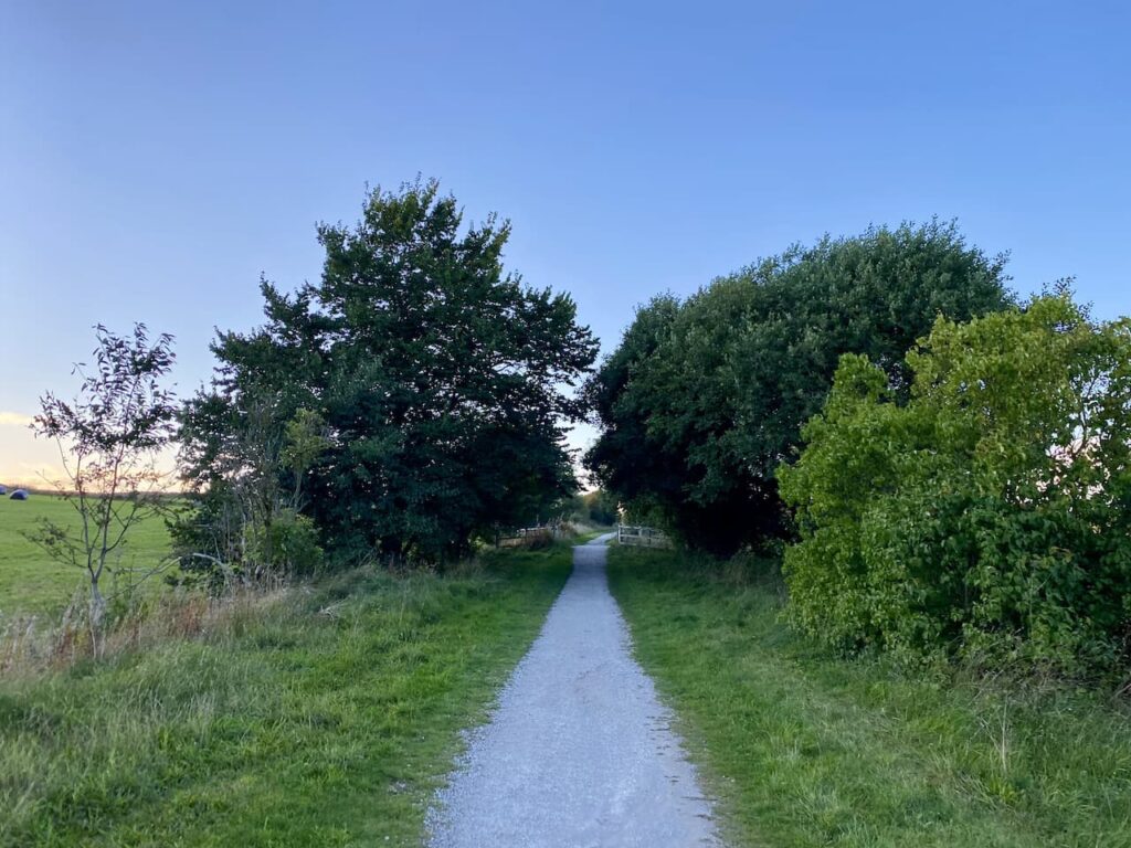
    After leaving the trees the path continues through fields and then joins a track which heads uphill to Abney.

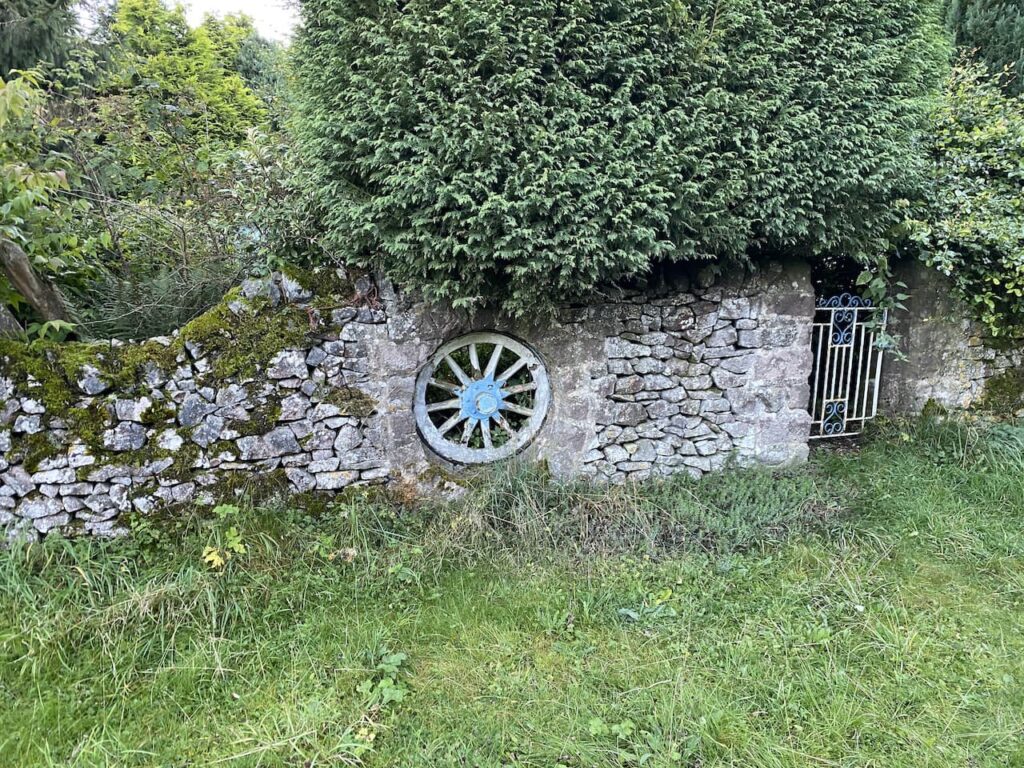
    Abney is a small hamlet and we turn left and walk past houses and farms. On the wall of a barn I spot a Victorian post box. 

    Just before reaching a telephone box we turn right into a narrow lane which is little more than a farm track. At the end of the lane there are tracks going to the left and right.  We go left heading towards Abney Moor.

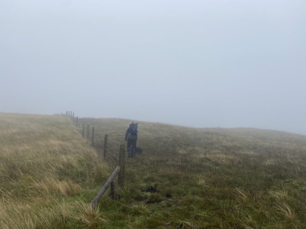
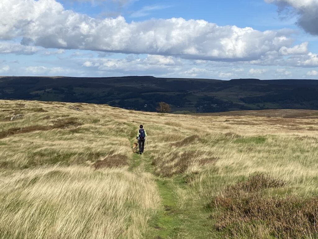
    On reaching a footpath on the left we head onto Abney Moor.  It had been my intention to walk across the moorland access land to the trig point which is in a field to the west.  However, this is one of those moors where access for dogs is restricted to public footpaths because of the grouse shooting. So whilst I am free to wander anywhere my four legged companion, despite being on a short lead, dare not venture from the designated right of way.  

    Needless to say Lynnie has to endure my full repertoire of views about grouse shooting and land management for a few wealthy individuals to kill or maim the local wildlife for the rest of the way across this moor. 

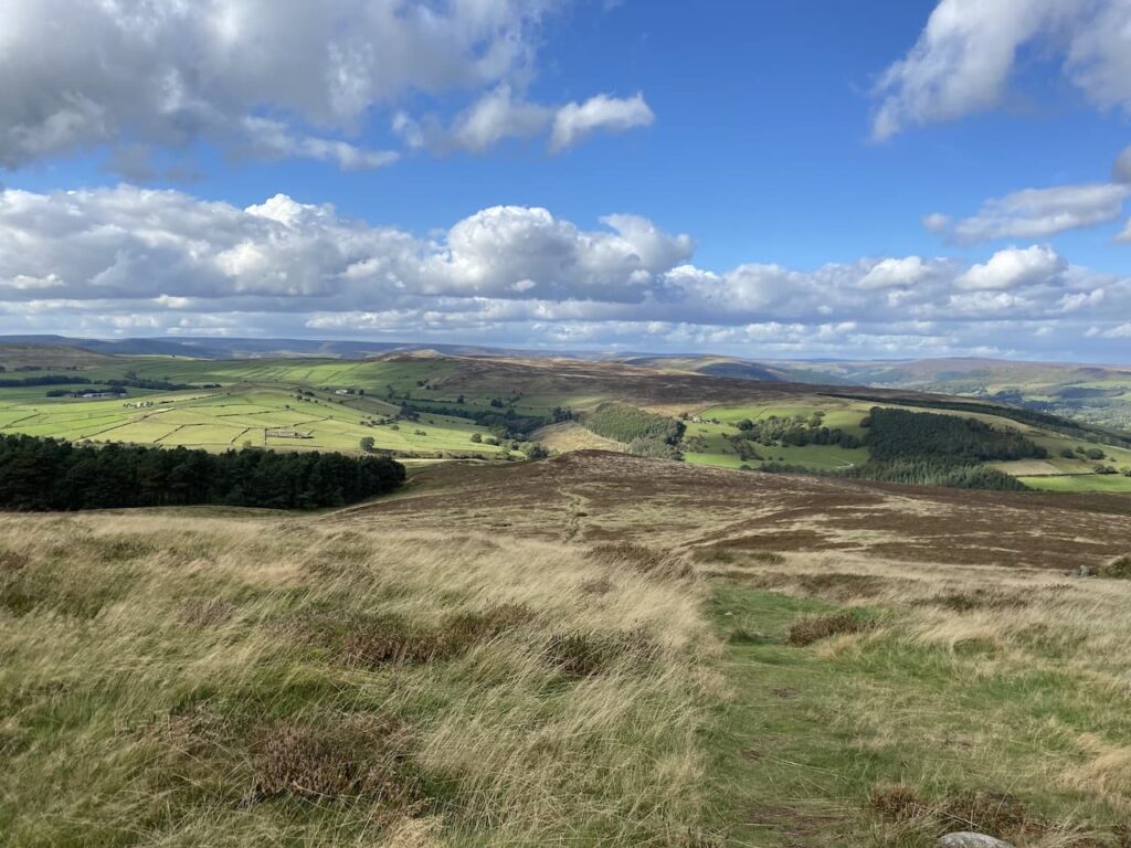
    Once I have calmed down a bit I am able to fully appreciate the views, but still can’t help thinking how good they would have been from the trig on top of the hill!

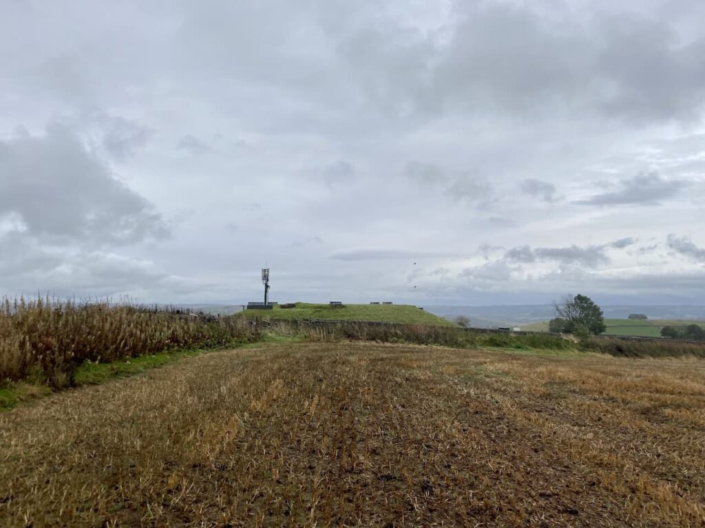
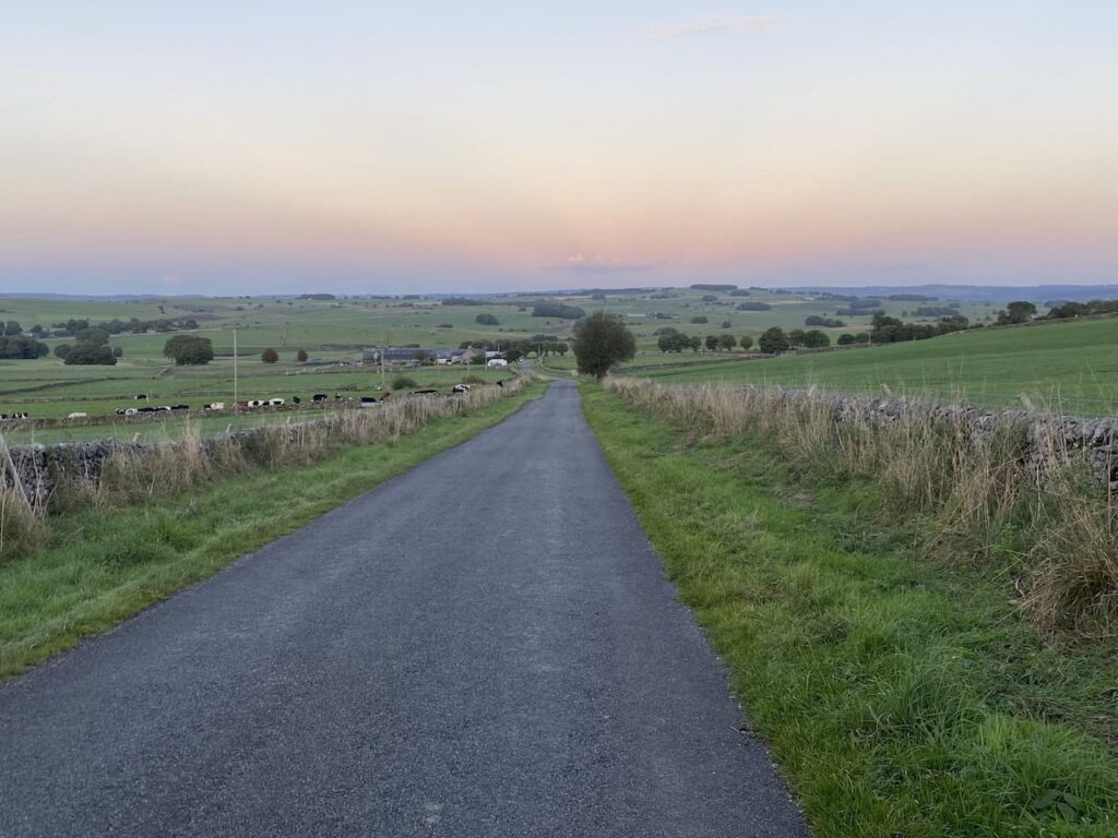
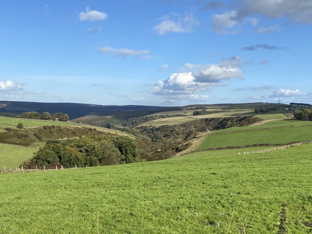
    On reaching a minor road we turn right  and continue along to pass the entrance to the Derbyshire and Lancashire Gliding Club.  The road now sweeps around the head of the valley and we get another stunning view.  It is hard to believe the weather was so bad yesterday, when it is such a cracking day now.

    At a broad junction at Hucklow Edge we continue straight on heading east.  I had thought we might take a footpath on the right to pass through the access land and visit the disused mine.  But a notice on the gate warns of significant ground failure on the site and it is impossible to predict where the next void might occur.  It is interesting that they say investigations into the cause of the collapse are ongoing.  Perhaps investing in an OS map would give then a clue, there is a disused mine and  mine shafts in this area!

    I always view a forced change in route hopefully, as an opportunity that something more interesting will materialise on our revised route.  It is not long before we pass a pair of fine disused gateposts. I find this interesting but still hope for something more unique.

    The road leads us to Bretton Mount and the Barrell pub.  Pubs are always interesting, but this one more so because it is the highest pub in Derbyshire and stands at 380 metres above sea level..  The information board at the viewpoint opposite says this former farmhouse became an Inn in 1753 (although the pub’s website claims it dates back to 1597) and served travellers on the two bridlepaths that meet beside the pub. 

    We now have a couple of options for our route back to Eyam, we decide to stay with the road we are on and continue on to the junction with the Sir William Hill track, here we turn right staying on the tarmac road to retrace our route back to the car park in Eyam.  

    We had hoped to wander around Eyam and visit the museum that charts the role the village played in the plague.  However, we started our walk a bit late and have stopped to admire too many views and we find that everything is closed in the village.  This seems to be a common occurrence when we visit!

    Next time we will have to come earlier and look around before starting our walk.  Meanwhile it is time to head back to the caravan and pack up for our return home tomorrow.

    You can view this 9.5 mile walk on OS Maps and download the GPX File Here

    To follow this walk you will need Ordnance Survey Explorer Leisure – OL24 – The Peak District, White Peak

    1st October 2021

    © Two Dogs and an Awning (2021)

    All information on this site is provided free of charge and in good faith and no liability is accepted in respect of damage, loss or injury which might result from it.  To the best of my knowledge the routes are entirely on public rights of way or within areas that are open for public access.
    Walking can be hazardous and is done entirely at your own risk.  It is your responsibility to check your route and navigate using a map and compass.

  • A Saunter to Sough Top 

    A Saunter to Sough Top 

    Occasionally when on our travels we get a day when we awake to the sound of rain drumming on the roof of the caravan.  It normally means that Crosby is reluctant to get up, he doesn’t mind getting wet if it starts raining whilst we are out, but is very reluctant to head out when it is heaving down.  After some gentle coaxing we head out for a brief walk up the lane, but at the first opportunity Crosby is turning for home and pulling on the lead to get back into the dry.

    There is an old proverb that says rain before seven, fine by eleven.  However, this fails to be true today and the rain shows no let up.  Eventually it reaches the stage where both man and dog need to go out and stretch their legs.  It’s alright for me, I have a decent set of waterproofs and soon have these on.  Meanwhile Crosby looks at me with a level of consternation, he does not want me to go without him, but equally he doesn’t fancy getting wet. Eventually the bond with his master, and a firm tug on his lead, is enough to cajole him.  Lynnie feels much the same as Crosby about heading off in driving rain, but obviously the bond is not so great as she puts the kettle on for more tea and settles down with her book.

    I have decided to walk from the caravan and leave Moor Farm CL turning left down the lane and at the road junction take the first turning on the left to head along Pasture Lane.  This is a road with grass growing in the middle so I know I am unlikely to encounter much traffic.

    Just before the entrance to High Stool Farm we attract the interest of a cow in a field.  Walking on my own I am not too perturbed by cattle, however when I have Crosby with me I much prefer to have a wall or fence between me and bovines.

    The lane passes the entrances to High Stool Farm and Town Head Farm and then reaches a junction where I turn left into Green Lane and follow this to a crossroads. My route is straight ahead but first I stop to look at the Ordnance Survey benchmark which is cut into a rock forming part of a dry stone wall.  

    Bagging benchmarks has been a feature of my walks since the first Covid lockdown, they make an interesting feature to look out for on a walk and for folk like me who are fascinated by maps they are an indicator of how the local area was mapped in the past.

    After going straight over at the crossroads I continue uphill on Green Lane, this section is another  with grass growing in the middle.

    Green Lane leads to a junction where I turn right into Moor lane and then after a couple of hundred yards turn left onto a track (Sough Lane).

    The track ends with gates at a crossing of footpaths.  Here I turn right and cross a wall stile before continuing along the path with the drystone wall to my left.

    The path crosses a number of fields some where the wall still stands, others where it has fallen.

    The sixth field I enter has a gate on the left.  Here I take a brief diversion from the footpath and go through the gate and cross the stubble to visit the Ordnance Survey trig pillar at Sough Top.  This is the 278th trig I have bagged.

    After bagging the trig I retrace my steps across the field and go through the gate to rejoin the footpath and turn left to follow the footpath east, soon passing Sough Top reservoir which provides water to Taddington.

    After two more fields the path starts to descend towards a road.  In front of me is view of Taddington.

    A few years ago we stayed at the Blackwell Hall CL which is just on the other side of Taddington.  I had not appreciated until now that it is so close to where we are currently staying.

    After crossing a stile I reach Slipperlow Lane and turn right heading uphill to reach a junction with Moor Lane where I turn left  following it to a junction with a road called The Jarnett,  It had been my intention to take a footpath at this junction and head across fields to Flagg, however, the light is beginning to fade and although I have a head torch in my bag the prospect of walking through fields of cattle shining a torch with Crosby beside me is not attractive.  So instead I turn right and follow the road downhill.  Soon on my right I spot a dew pond in the field.

    My route is now straightforward as I follow the road into Flagg and in the village turn left just before reaching the bus shelter and the Methodist Chapel.  The road I am now on is Mycock Lane, it is now dark and pouring with rain so I am grateful for the torch in my ruck sack.  I continue along this lane, as it bends right becoming Moor Lane, until I reach the crossroads where I had earlier turned into Pasture Lane.   I walk the short distance back up Stonebench Lane to return to Moor Farm CL.

    Back at the caravan my walk has covered just over 7 miles and now I must dry Crosby off before I can sort myself out.  Hopefully we will get a dry day tomorrow!

    You can view this 7 mile walk on OS Maps and download the GPX File Here

    To follow this walk you will need Ordnance Survey Explorer Leisure – OL24 – The Peak District, White Peak

    30th September 2021

    © Two Dogs and an Awning (2021)

    All information on this site is provided free of charge and in good faith and no liability is accepted in respect of damage, loss or injury which might result from it.  To the best of my knowledge the routes are entirely on public rights of way or within areas that are open for public access.
    Walking can be hazardous and is done entirely at your own risk.  It is your responsibility to check your route and navigate using a map and compass.

  • Burbage Edge and Shining Tor

    Burbage Edge and Shining Tor

    Over the years we have visited the Peak District on several occasions. Initially staying in Bed and Breakfast accommodation and in more recent years using the caravan as a base for our walking.  We have always enjoyed our walks, but I always struggle to orientate myself with previous walks.  If I am walking in the Yorkshire Dales, Exmoor or the Brecon Beacons I can quickly identify other peaks or places I have previously visited, but for some bizarre reason the same does not apply in this area.

    Today we are going to explore the area around Goyt’s Clough, we walked here previously on a walk starting at the Cat and Fiddle Inn.  On that occasion we walked towards Three Shires Head.  Today we are going to start at Derbyshire Bridge and head out around Errwood Reservoir.

    We start our walk from the car park at Derbyshire Bridge (Grid Ref: SK018715).  Leaving the car park we turn right and walk uphill on a broad stony track.

    It is a steady ascent and there are fine views as we pass the head of Berry Clough.

    Soon after we pass an old milestone, the inscription has eroded away so it is impossible to read. However, in times past this would have been the main route between Buxton and Macclesfield.

    1.1 kilometres from leaving the car park we take a footpath on our left.  We now head north for 500 metres to reach a junction of tracks where we turn right and then soon veer to the left leaving the main footpath to follow a path which heads towards the boundary line of the access land of Burbage Edge. It has started to rain which combined with the wind makes the conditions rather unpleasant.

    On reaching the edge of the access land we turn left and follow a path heading north to reach the Burbage Edge Ordnance Survey Trig Pillar, this is the 276th trig I have bagged.

    From the trig we keep heading north along the fence line as it gradually descends.

    Thankfully the rain has eased and we get stunning views in front of us with a rainbow in the distance.

    At a wall junction we turn right and follow a path which passes above Tunnel Farm and then bends to the north to join a footpath.  Here we turn left and follow the path as it goes downhill.

    This path takes us to the blocked up entrance to an old railway tunnel.  This was part of the Cromford and High Peak Railway.  It is was completed in 1831 and was built to carry minerals and goods through the Peak District.  It was one of the first railways constructed and the terrain made it challenging so there are a number of steep inclines and tight bends.  The line originally connected the canals at Whaley Bridge and Cromford, running up the Goyt Valley to Buxton and across the limestone plateau to Middleton by Wirksworth, then down to Black Rocks and down again to the Cromford Canal in the Derwent Valley. 

    Our route now follows the disused railway line as it winds its way towards a minor road.  The railway was originally powered by horses on flat sections likes this and stationary steam engines winched wagons up the steep inclines.  In 1841 steam engines, built by Robert Stephenson, were introduced to operate along the whole route.  The line operated into the 1960’s but declining traffic and the end of some of the local quarries meant that it was closed in 1967.  

    Nearing the road we pass a pond and then turn left to walk downhill besides the road (Goyt’s Lane). This road leads downhill towards the dam between the Fernilee and Errwood reservoirs, it was one of the inclines on the old railway which was powered by steam engine until the incline was abandoned in 1892.

    As the road bends to the right we continue straight on to follow a path besides a wall which heads downhill towards woodland with the Errwood reservoir behind.

    At a junction with a footpath we turn right and follow a route to reach Goyt’s Lane where we turn left and walk on the road to reach the Errwood reservoir where we stop for lunch.  

    Apparently this was the second reservoir to be constructed in the Goyt valley.  It was completed in 1967 and holds 4,215 million litres of water and like its larger neighbour Fernlee it provides water to Stockport. Fernilee was completed in i1938 and holds about 5 million litres of water. 

    After our lunch we follow the road across the dam and then join the path running parallel to the road ascending steadily.

    There are stunning views now the rain has passed. 

    On reaching a footpath on our left we take this and follow the clear route towards Oldgate Nick.

    Oldgate Nick is a distinctive rock outcrop at the northern end of Cats Tor and is popular with climbers.

    The path is now easy to follow as we head south passing the Tors.

    The wind has picked up and despite the rain having stopped it is pretty bleak up here and we continue along the path until we reach Shining Tor and stop to bag the OS trig pillar.

    Shining Tor stands at 1,834 feet above sea level and is the highest point in Cheshire.  I have not kept a record but during our travels I seem to have visited the highest point in many counties.  Perhaps it is a task for a winters evening to log them all.

    From the trig we take the paved footpath that heads in a south easterly direction. 

    At a junction of paths we turn right and then after 100 metres turn left to follow a path downhill towards the bottom of the Goyt Valley.

    This is a rugged path and takes us through Stake Clough and onto a footbridge at Deep Clough.

    We then continue on the footpath through an area of cleared woodland, keeping on the path as it heads south above the tarmac track that runs through the Goyt Valley.  The footpath steadily descends to reach the lane and we join it close to a waterfall.

    Our route is now very straightforward we continue along the lane to return to Derbyshire Bridge.  At one time this bridge stood on the border of Derbyshire, but following boundary changes it is now part of Cheshire, but still retains its original name.

    We are back at the car park.  It has been a stunning eleven mile walk, made more challenging by the rain and blustery conditions. However, it has helped me understand why folk rave about walking in the Peak District.

    You can view this 11 mile walk on OS Maps and download the GPX File Here

    To follow this walk you will need Ordnance Survey Explorer Leisure – OL24 – The Peak District, White Peak

    29th September 2021

    © Two Dogs and an Awning (2021)

    All information on this site is provided free of charge and in good faith and no liability is accepted in respect of damage, loss or injury which might result from it.  To the best of my knowledge the routes are entirely on public rights of way or within areas that are open for public access.
    Walking can be hazardous and is done entirely at your own risk.  It is your responsibility to check your route and navigate using a map and compass.

  • Trig Bagging at High Wheeldon

    Trig Bagging at High Wheeldon

    On arriving at Moor Farm CL yesterday we only had time for a short walk.  Today we plan to walk from the site again, but this time we aim to venture a bit further afield. It is not uncommon for us to walk from the site we are staying on, however, the current fuel shortages mean I have become very cautious about how much fuel we use.

    We leave the site and turn left down the lane passing the farmhouse and barns to reach a junction where we turn right and follow the road to head towards Flagg Moor Farm.  The weather is overcast and it looks like we might get a drop of rain before we are finished, but we are well prepared and have waterproofs in our rucksacks just in case.

    After passing the farm we continue along the lane to reach the A515 which we cross with care and take a footpath through a wall gate on the opposite side.

    We now head diagonally across the field to enter another field where sheep are grazing.  The path continues to steadily descend towards the disused railway line which is now the route of the High Peak Trail.

    At a junction of paths close to the disused railway line we continue straight on to go under the line and then follow a footpath across a field towards a minor road.

    At the road we turn right and continue along this country lane.  This is one of those lanes where you know there won’t be much traffic because grass is growing in the middle of it.

    The lane takes us to the small hamlet of Hurdlow Town which appears to consist of Hurdlow Farm, Hurdlow Hall and Hurdlow Grange.  The Hall is a farmhouse dating back to 1689.

    We soon pass the route of another dismantled railway.  Apparently this was the original route of the railway line which now forms the High Peak Trail.  It was known as the Hurdlow Incline and operated until 1869 when an alternative route to the north was opened.

    Continuing along the lane we see a lot of heavy machinery in the field on our right.  It is not clear what they are doing, but this field borders the massive Dowlow Limestone quarry and I have an awful suspicion that this field is about to become part of the quarry.

    As the road starts to descend we get a good view of High Wheeldon, we will soon make a detour to head up the hill but much to Lynnie’s displeasure first we go downhill.

    At a junction of roads we turn right and then almost immediately take a footpath on the left which goes across a field and then enters the open access National Trust land of High Wheeldon.

    It is a stiff ascent to reach the hilltop.  There is a well-worn route to follow but it is still a good test of the legs and lungs.  Finally we reach the top and are rewarded with some stunning views and a trig point.  This is my 275th trig bagged.

    On the trig is a plaque commemorating the property being presented to the National Trust on the 11th November 1946 by F.A Holmes of Buxton in honoured memory of the men of  Derbyshire and Staffordshire who fell in the Second World War.  It also says that the hill stands at 1,384 feet; it is a pretty exposed spot and despite it being a fine day it is decidedly chilly so we are soon heading back down the way we came.

    On reaching the road we turn left and stay with it to reach the interestingly named village of Earl Sterndale and continue to The Quiet Woman pub.  Sadly this pub closed last year after the death of the long serving landlord.  It is currently on the market hopefully someone will take it on but running a pub in a rural location like this is not an easy business.

    We turn to the right beside a green and take a look at St Michael and All Angels Church.  Apparently It was built in 1828 on the site of an ancient chapel.  It was badly damaged in 1941 when it was mistakenly hit by a German bomb, making it the only church in Derbyshire to be bombed in the war. It was restored in 1952 and still contains a Saxon font but unfortunately we are unable to gain access to look inside.

    Leaving the churchyard we turn right and then right again to walk uphill for a short distance to pass the village school. Now we turn right along a lane and then on reaching a junction of lanes turn left.  This track goes steadily uphill between fields.

    We stay with the track as it turns to the right and continues uphill to a junction of tracks on the edge of Dowlow Quarry.  Here we turn to the right and follow the fence line and can just see some of the quarry working going on below us.

    This quarry first started extracting limestone way back in 1899 and apparently has a license to continue working until 2046.  It is a huge quarry and I hate to think what it will look like in another twenty-five years time.  I guess most of the hill we are now walking on will have disappeared by then!

    It is an easy path to follow and we continue along the fence line. As we wander along we discuss the impact quarrying has on the countryside.  Obviously there is a need for it but it has such a harsh impact, leaving a permanent scar on the landscape.

    At the end of the fencing we reach a field which looks like it is being prepared for the next bout of quarrying.  The pathway is roped off from the field and either side of us heavy machinery is removing the soil from the field.  Unfortunately I can imagine what this will look like in a year or two.

    On the far side of the field we reach a track where we turn left and gradually descend to towards the High Peak Trail.

    Reaching the trail we turn right and follow the disused railway line of the Cromford and High Peak Railway.  This was completed in 1831 and was built to carry minerals and goods through the Peak District.  It was one of the first railways constructed and the terrain made it challenging so there are a number of steep inclines and tight bends.  The line originally connected the canals at Whaley Bridge and Cromford, running up the Goyt Valley to Buxton and across the limestone plateau to Middleton by Wirksworth, then down to Black Rocks and down again to the Cromford Canal in the Derwent Valley. 

    It was originally powered by horses on the flat sections with stationary steam engines winching wagons up the steep inclines.  In 1841 steam engines, built by Robert Stephenson, were introduced.  The line operated into the 1960’s but declining traffic and the end of some of the local quarries meant that it was closed in 1967.  

    We stay on the railway line until we reach a crossing of footpaths at a bridge, here we turn left and cross fields heading towards Street Farm.  We go through a gate and then continue through the farm entrance to reach the A515 where we cross and pass the Duke of York pub.

    From the pub we head south for just over a hundred yards on the broad, road verge and then turn left into Stonebench Lane and head the short distance downhill to our site at Moor Farm.

    Our walk has covered seven and a half miles and it has been interesting exploring the area local to the site. 

    You can view this 7.5 mile walk on OS Maps and download the GPX File Here

    To follow this walk you will need Ordnance Survey Explorer Leisure – OL24 – The Peak District, White Peak

    28th September 2021

    © Two Dogs and an Awning (2021)

    All information on this site is provided free of charge and in good faith and no liability is accepted in respect of damage, loss or injury which might result from it.  To the best of my knowledge the routes are entirely on public rights of way or within areas that are open for public access.
    Walking can be hazardous and is done entirely at your own risk.  It is your responsibility to check your route and navigate using a map and compass.

  • Three Miles From Moor Farm CL

    Three Miles From Moor Farm CL

    After just over two weeks at Brigholme Farm CL in Giggleswick we are on the move again.  I always find leaving this site hard.  We have been visiting regularly since 2013 and it has become like a second home to us, so all being well we will be returning in 2022.  When planning this trip we decided to stop for a few nights in the Peak District on our way home. So our next destination is Moor Farm CL close to the village of Flagg.

    After a straightforward journey we are soon set up on our spacious pitch with cracking views towards Taddington Moor.

    Moor Farm is a working dairy farm so our first meeting with the owner is as he walks his cows in for evening milking. He gives a cheery wave and briefly checks that everything is okay and says to get in touch if we need anything. We are very comfortable with this hands off approach, knowing that help or advice is at hand if needed but leaving us to our own devices in the meantime.

    All pitched up it is time for to get out for a few miles before it gets dark.  We leave the site and turn left down the lane passing the farmhouse and barns to reach a junction where we turn right and follow the road to pass Flagg Moor Farm and continue on to the main A515.  Here we cross and join a footpath opposite which leads diagonally through a pasture field to enter a second field.

    In front of us we can see a disused railway line and the path leads through a gate where we turn left and walk below the old track for a few hundred yards before it joins the railway.  As we are just jamming about we decide to walk along the track a bit further to reach a parking area with a sign post for the Royal Oak pub.  It is tempting to pop up for a pint but the light will soon be fading and I don’t fancy walking back to the site in the dark.  We turn and head in a northerly direction along the line.

    The Cromford and High Peak Railway was completed in 1831, it was built to carry minerals and goods through the Peak District.  It was one of the first railways constructed and the terrain made it challenging countryside so there are a number of steep inclines and tight bends.  The line originally connected the canals at Whaley Bridge and Cromford, running up the Goyt Valley to Buxton and across the limestone plateau to Middleton by Wirksworth, then down to Black Rocks and down again to the Cromford canal in the Derwent Valley below. 

    It was originally powered by horses on the flat sections with stationary steam engines winching wagons up the steep inclines.  In 1841 steam engines, built by Robert Stephenson, were introduced.  The line operated into the 1960’s but declining traffic and the end of some of the local quarries meant that it was closed in 1967.  Sections, including the bit we are walking on now, form part of the High Peak Trail.

    It is a cracking evening for walking and the fields besides the track are full of round bales of second cut haylage which are being wrapped in plastic. I understand the concept, but at a time when we are all being encouraged to reduce plastic consumption I wonder if there is a viable alternative.

    We stay on the railway line until we reach a crossing of footpaths at a bridge, here we turn right and cross fields heading towards Street Farm. As we approach the farm there is a reminder of how hay making used to be done with an abandoned hay turner left near the gate.

    We go through a gate and then continue through the farm entrance to reach the A515 where we cross and stop briefly to have a look at the menu outside the Duke of York. This pub is close to our site and there is every chance we will pop in during our stay.

    From the pub we head south for just over a hundred yards on the broad verge beside the road and then turn left into Stonebench Lane and head the short distance downhill to our site at Moor Farm.

    Our short walk has covered three miles and has been enough to stretch the legs after travelling and setting up.  Now it is time to plan some longer walks for the next few days.

    You can view this 3 mile walk on OS Maps and download the GPX file here.

    To follow this walk you will need Ordnance Survey Explorer Leisure – OL24 – The Peak District, White Peak

    27th September 2021

    © Two Dogs and an Awning (2021)

    All information on this site is provided free of charge and in good faith and no liability is accepted in respect of damage, loss or injury which might result from it.  To the best of my knowledge the routes are entirely on public rights of way or within areas that are open for public access.
    Walking can be hazardous and is done entirely at your own risk.  It is your responsibility to check your route and navigate using a map and compass.

  • Walled Tracks and the Ribble Way

    Walled Tracks and the Ribble Way

    This is the last full day of our stay at Brigholme Farm CL, tomorrow we are heading south to a CL we have not previously visited near Flagg in the Peak District.  The news headlines continue to be dominated by the lack of fuel at the pumps.  I have sufficient to make it to our next site, but will need to fill up there before we head home next week.

    To conserve diesel we have decided to do another walk from Brigholme Farm today.  Leaving the farm we turn right and head into Settle leaving the centre of town via Constitution Hill and then continue along the tarmac narrow lane towards Langcliffe.

    At the end of the lane we turn right and follow the pavement besides the B6479 for a short distance to reach Main Street where we turn right and wander into Langcliffe to reach a Victorian fountain which, following the First World War was converted to a War Memorial with the addition of a memorial cross to commemorate the eleven local men who died in the conflict.  It was unveiled in July 1920 and then in 1955 the names of four local men killed during World War II were added.

    I have previously researched the backgrounds of the men listed on the memorial who lost their lives in the first World War.  It is a stark reminder that they were not destined to be soldiers, before joining the conflict these men included a Bank Clerk, Policeman, Paper mill worker, Quarrymen and a Head Teacher and their ages were between 20 and 35.

    From the memorial we take a lane heading north which leads through the village to join a walled track which continues north.  Soon after leaving the village we ignore a footpath on the left and keep with the walled track heading towards the disused Langcliffe Quarry.

    Reaching a gate we enter a field of pasture and follow the path as it runs close to the wall and then starts to climb besides the quarry.  There are fine views back down the Dale from here.

    It is a short steep ascent to reach pasture land and follow the path to reach a wall gate.  We go through and turn right  on the track and head up to Upper Winskill passing through a gate besides a cattle grid.  Now we continue on the path with a wall on our left and stay with this path to reach a gate with cracking views of Peny-Ghent in the distance.

    We have joined the route of the Pennine Bridleway and stay with this as it crosses a couple of fields to reach a gate to a walled track. On our right is a path to the Catrigg Force waterfall, we ignore this and follow a path descending towards Stainforth.

    In the village we traverse the stepping stones over Stainforth Beck and continue through the village past the church of St Peter which was built in 1873.

    From the church we continue down the lane to reach the B6479 which we cross and turn right along the pavement.  We quickly reach a narrow lane on our left, Dog Hill Brow, and take this, soon crossing a bridge over the Settle to Carlisle Railway line.  The lane continues steadily downhill towards the River Ribble which we cross on an ancient pack horse bridge built in 1675 and then turn left to join a path besides the river.

    This spot by the river is popular with families to picnic and paddle.  The braver or foolhardy also wild swim here.  With the current low water levels the river looks benign, but after a storm the force of the water here can be very scary.

    We have now joined the route of the Ribble Way, a seventy-two mile long distance footpath that roughly follows the route of the river from Longton near Preston, where the river reaches the sea, to its source at Gearstones close to the Ribblehead Viaduct. 

    We stay with it through fields with the river always close on the left.  At times we are high above it and then the path heads down to be alongside the water again.  Despite being a well walked path we do not meet anyone as we head along and pass through a docile herd of cows.

    When the path reaches a weir, we turn right along a walled track towards Stackhouse Lane.  The weir was constructed to divert water to the mill pond of Langcliffe High Mill which was built in 1780 and was one of Yorkshire’s earliest and largest cotton-spinning mills.

    At Stackhouse Lane we turn left and follow the road for about half a mile, still on the route of the Ribble Way.  At a footpath on the left we go into a field and follow the Ribble Way as it heads back towards the river.

    The path leads across fields and enters the edge of Settle close to a school playing field and the Settle Football Club ground.  At Settle Bridge we have the option of staying on the Ribble Way and following this back to Brigholme Farm, or crossing the bridge and going back via the town.  We opt for the latter.

    It has been a pleasant afternoon walking, but now it is time to make our preparations for leaving in the morning for the Peak District.  Already I am trying to work out when we can slot in our 2022 visit to Settle.

    You can view this 8 mile walk on OS Maps and download the GPX File Here

    To follow this walk you will need Ordnance Survey Outdoor Leisure Map OL2 – Yorkshire Dales – Western Area

    26th September 2021

    © Two Dogs and an Awning (2021)

    All information on this site is provided free of charge and in good faith and no liability is accepted in respect of damage, loss or injury which might result from it.  To the best of my knowledge the routes are entirely on public rights of way or within areas that are open for public access.
    Walking can be hazardous and is done entirely at your own risk.  It is your responsibility to check your route and navigate using a map and compass.

  • The Weets and Malham Cove

    The Weets and Malham Cove

    We are heading back towards Malham Tarn for our walk today with plans to bag another Ordnance Survey trig pillar and possibly visit Malham Cove.  We usually avoid Malham at the weekends because it gets packed, but hopefully by the time we reach there the crowds will have thinned out.

    Our starting point is a parking area at the southern end of the tarn (Grid Ref: SD894658).  We start by walking besides the road as it heads east.

    When the tarmac lane sweeps to the right we continue straight on and go through a gate at Street Gate.  The route is now along a grassy track besides a dry stone wall.

    The track descends towards Gordale Beck, many years ago we climbed up through the waterfall at Gordale Scar and have walked besides this beck further downstream many times but it is the first time we have seen it this far up stream.

    At the beck we cross by the stone clapper bridge and then go through a gate to continue on the track.

    We carry on along the track through docile cattle scattered in the field and then stop to read an information board. Apparently we are in the vicinity of the Mastiles Lane Roman marching camp.  Such camps were temporary structures created to provide protection for Roman soldiers on the move and involved digging a trench and erecting wooden stakes so the troops could sleep inside.  There appears to be no clear sign left of the structure, although it is marked on the OS Map. 

    The track leads through the pasture field to reach a gate and then continues along a walled track.  We ignore a footpath on the right marked for Smearbottoms Lane and continue along the track for three quarters of a mile and then take a footpath on the right which heads through a gate and continues with a wall on our left.

    After walking along the edge of a field we go through gates and continue on the walled track heading towards farm buildings.

    After passing the farm the track becomes a single track tarmac lane, Smearbottoms Lane and we follow this until we reach a lane on the left which leads steadily uphill towards Weets Gate.

    Near a gate the Medieval Weets Gate boundary stone stands on the right, it is protected by an assortment of gates that appear to have formed a temporary enclosure presumably for sheep.  The stone was restored in 1955 and marks the junction of Bordley, Hetton, Hanlith and Malham parishes.  The Historic England website suggests it may once have been a Medieval cross.

    After going through a gate we turn to the left to visit The Weets Ordnance Survey Trig Pillar, number 274 bagged.

    We head back to a finger post.  This is open access land but we want to be sure to take the right route.  We are initially following a path towards Calton and then at a junction of paths we veer to the right across Hanlith Moor.  When walking on moorland I am always conscious to get the map and compass out to ensure we are on the right route.  Today this moor looks docile but any moor that has clear way-markers deserves respect.

    We are grateful for the markers, because even with them we go through a couple of boggy areas. Not anything to worry about after a dry spell in September, but this would be a different prospect in the depth of winter.  Following the markers we join the splendidly named Windy Pike Lane and follow this as it heads towards Hanlith.

    The lane descends down the steep lane into the village and just as it sweeps to the left we take a footpath on the right way-marked the Pennine Way. The path heads across a field towards a gate with a farmhouse to our left.

    We now follow the Pennine Way markers through a couple of fields into a field high above the River Aire.  The river flows out of Malham Tarn and then at Water Sink, high above Malham Cove, goes underground  and reappears below Malham at Aire Head.  By the time the river reaches the River Ouse at Airmyn it has travelled 92 miles from Malham Tarn.

    We stop to take in the view, mainly because a herd of cows with calves are between us and the exit from the field.  They are not bothered by us whilst we stand still so we wait as they make their slow progress away from our route.  When the way is clear we continue, still on the route of the Pennine Way and drop down to cross the river and then follow a clear path into Malham.  

    The village is still busy and to Lynnie’s delight the shop is open so she can sample some local ice cream.  We continue through the village passing the Lister Arms and then turn left on a lane following the route of the Pennine Way as it passes a Youth Hostel.

    We now stick with the Pennine Way as it goes along the track and through fields to reach Malham Cove.

    I have been coming to Malham Cove since I was a child , but it is a few years since we were last here and fortunately we have timed it well as there are very few people about latish in the day.  The Cove was created by a waterfall at the end of the Ice Age, more than 12,000 years ago. It is a rare occurrence for water to flow over these days, when it does it creates the highest single drop waterfall in England as the water drops 260 feet.  The last time water flowed over the cove was 15th December 2015 and the time before that is thought to have been in 1824.

    We follow the route of the Pennine Way up steps to the left of the cove.  This is a steady climb but the views are rewarding.

    At the top of the Cove we turn to the right and head across the limestone pavement, making sure we stay well away from the edge. My vertigo will not cope with being anywhere near a 260 feet drop.  The limestone pavement here is impressive and on the list for many tourists to the Dales.  There are a number of far better examples, particularly at Moughton Scar at the top of Crummack Dale, but this is probably the most accessible.

    We continue across the limestone pavement, it is late in the afternoon and there are very few folk about so we stop frequently to enjoy the views.  Where the Pennine Way goes to the left we continue straight on across a field of pasture and then turn to the left to take a footpath into Trougate. 

    It is a cracking evening and it feels like we have got this area of the Dales all to ourselves.  There are not many better places to be walking.

    As we climb towards the summit of the hill we pass through a rocky outcrop and spot an owl seeking an early supper. It is far too quick and wary for me to photograph but it is a fantastic sight.

    Our route now follows a clear path through rough pasture with stunning views towards Great Close Scar.

    We go over the brow of a hill and can see the car park in front of us with Malham Tarn in the distance. 

    It has been a cracking walk with some cracking views, our route has covered just over nine and a half miles. 

    You can view this 9.5 mile walk on OS Maps and download the GPX File Here

    To follow this walk you will need Ordnance Survey Outdoor Leisure Map OL2 – Yorkshire Dales – Western Area

    25th September 2021

    © Two Dogs and an Awning (2021)

    All information on this site is provided free of charge and in good faith and no liability is accepted in respect of damage, loss or injury which might result from it.  To the best of my knowledge the routes are entirely on public rights of way or within areas that are open for public access.
    Walking can be hazardous and is done entirely at your own risk.  It is your responsibility to check your route and navigate using a map and compass.

  • Arten Gill and Great Knoutberry Hill from Dent Head

    Arten Gill and Great Knoutberry Hill from Dent Head

    For a couple of years visiting the Ordnance Survey Trig Pillar at Great Knoutberry Hill has been in my sights.  I am not sure why it has eluded me for so long, but today I finally plan to add it my list of trigs bagged.  Today I am with my walking buddy Mandy.  We walk a lot together at home in Wiltshire but have not done much in the Dales but a couple of days ago we completed the Yorkshire Three Peaks.

    The forecast today is a bit bleak with rain and low cloud.  So we head off with a plan for a sixteen mile walk with the option of cutting it short if the conditions are not good.  The starting point for our walk is a parking area besides the Dent Head Viaduct  (Grid Ref: SD777844).

    We set off down the road towards Cowgill and Dent.  We soon pass Bridge End Cottage, continuing down the lane a Red Squirrel runs across the road in front of us.  It is years since I saw a Red Squirrel in England, I have encountered them in Scotland but today’s sighting is a rare treat.  We then pass a milestone indicating we are eleven miles from Sedburgh.

    The lane we are walking along is close to the River Dee, at times we have been high above the river but as we continue towards Stone House Bridge the river is beside the road.

    On reaching Stone House Bridge we turn right, leaving the road to pass cottages, one of which has a notice warning drivers to slow for Red Squirrels.  In the Dentdale and Sedburgh area there is an initiative to encourage Red Squirrels through developing the habitat and feeding whilst at the same time reducing the Grey Squirrel population.

    We are now on Arten Gill Lane and follow this as it goes through a gate and joins an ancient track heading towards the Arten Gill Viaduct.

    As we walk up the lane, even with poor visibility, the viaduct dominates the view.  It is a stunning bit of engineering and is listed as bridge number 84 on the Settle to Carlisle Railway.  Work on its construction started in May 1870 and was completed in July 1875.  The unstable nature of the ground in the gill meant that some of the piers are rooted to a depth of 55 feet into the ground.  

    The viaduct is 660 feet long and 117 feet high and stands 1,100 feet above sea level. Parts of the structure are constructed with Dent Marble which was quarried from the Arten Gill beneath it.  In these parts the Ribblehead Viaduct is the iconic view that tourists seek, if this was more accessible it would be equally popular.

    We continue gradually ascending and the weather continues to close in on us.  I am sure we are missing out on some stunning views of Arten Gill, but our focus is on keeping the driving rain from finding gaps in our waterproofs.

    At a junction of paths we turn left continuing on the Pennine Bridleway as it heads north and then quickly east along Dent Fell.  The now flat route goes through a succession of gates.

    The Pennine Bridleway sweeps towards the north and as we pass Green Bank we take a path on the right which follows a fence line and ascends Pikes Edge on Great Knoutberry Hill.  

    It is bleak walking up this hill, we are exposed to the elements with no cover and even with the recent dry weather the moor is boggy in parts.  Staying with the fence line we reach the trig pillar on Great Knoutberry Hill. This is the 273rd trig I have bagged.

    From the trig we keep with the line of a dry stone wall as it descends from the hill in a south easterly direction.  It is clear from the worn path that there are frequent visitors here and I later read that the views are spectacular, I’ll have to take their word for it as we can hardly see a thing.

    The path leads us downhill  passing the disused Cross Pits Colliery and then we cross a wall stile to join a track where we turn right and follow this to the junction of paths we were at earlier at the top of Arten Gill.  This time we turn left on the Pennine Bridleway and follow this route as it takes us south through Swineley Cowm.  There is no letting up with the weather and we check the map and compass to ensure we are on the right route.  

    Eventually the Pennine Bridleway route leads us to a minor road here we turn right leaving the Pennine Bridleway to head back along the road towards Dent Head Viaduct.

    As we walk along the road we discuss the merits of following our original planned route, which would take us down to Ribblehead Viaduct from a path we soon reach on the left.  We would then walk back across Blea Moor following the route of the Blea Moor Tunnel.  It is a short discussion, we both agree there are significant benefits from continuing along the road and getting out of the rain as soon as possible.  

    The route is easy to follow as the road leads back to Dent Head Viaduct.  Along the way the weather clears sufficiently for us to get a good view of the viaduct.  Construction  started on this viaduct in 1869 and was competed in 1875.  Work was hampered by the constant rain and snow, in 1872 it is said that 92 inches of rain fell on Dent Head instead of the usual 68 inches.  I think we have had a few fall on us today!

    Back at the car we have two wet dogs to dry off and soaking waterproofs to remove.  As we head back towards Settle from our nine mile walk we hear reports on the radio of impending fuel shortages, not good news when both Mandy and I have to tow caravans in the next few days.  Fortunately as we pass through Ingleton I am able to get enough fuel into my almost empty tank to get me to the Peak District next week.

    You can view this 9 mile walk on OS Maps and download the GPX File Here

    To follow this walk you will need Ordnance Survey Outdoor Leisure Map OL2 – Yorkshire Dales – Western Area

    24th September 2021

    © Two Dogs and an Awning (2021)

    All information on this site is provided free of charge and in good faith and no liability is accepted in respect of damage, loss or injury which might result from it.  To the best of my knowledge the routes are entirely on public rights of way or within areas that are open for public access.
    Walking can be hazardous and is done entirely at your own risk.  It is your responsibility to check your route and navigate using a map and compass.

  • Beside the Canal from Gargrave to Skipton

    Beside the Canal from Gargrave to Skipton

    A few years ago Lynnie and I walked a section of the Leeds and Liverpool canal from Gargrave to East Marton returning to Gargrave on a section of the Pennine Way.   Today we are going to walk besides the canal in the opposite direction from Gargrave to Skipton.  We have driven besides part of the route but never walked along the towpath.

    The starting point for our walk from Gargrave is a small parking area in Church Lane, besides a recreation ground (Grid Ref: SD933539).  We start by walking into the recreation area and following a path besides the River Aire towards Gargrave Bridge.

    After crossing the  bridge we cross the A65 and pass besides the Dalesman Cafe to join West Street.  This is the route of the Pennine Way as it goes through the village .  We stay with West Street past a car parking area and follow a sign to the Leeds and Liverpool Canal.

    It is only a short distance to reach the canal where we turn right before crossing Highland Bridge (no.170) and head towards Skipton.

    We soon reach another bridge besides Low Warehouse.

    The towpath leaves Gargrave  passing under another bridge and continuing on by a lock before going under the A65.  We then head out into open countryside to reach Highgate Swing Bridge.

    At 127 miles long the Leeds and Liverpool is the longest canal built as a single waterway.  Work first commenced on its construction in 1770 just north of Liverpool at Halsall.  Whilst at the Yorkshire end work was soon started to create a link between Bingley and Skipton, this section was the first to open in 1773.  It was in 1775 that the section we are now walking on opened when Skipton was linked to Gargrave.

    After a few miles of walking through the countryside we pass under the A59 and then the path soon has a short section between the canal and the A6069.

    We then go under the A629 to reach the outskirts of Skipton.  

    I always find it interesting walking through towns on a canal towpath.  The historic routes form part of people’s day to day travel, be it walking to school, work or to the local shops,  so are just like pavements besides the road, but far more tranquil.

    As we reach the  heart of Skipton the Spring Bank Canal, also known as the Thanet Canal joins the Leeds & Liverpool Canal.  This is a short branch which was built in 1797 for Lord Thanet who lived in Skipton Castle.  He wanted to transport limestone from his quarries behind the castle for transportation to Leeds.  A half mile section was constructed with a loading wharf which was connected to the quarries via a tramway.

    Now in Skipton we decide to have a wander around and leave the canal and cross the Belmont Bridge and then turn left in to Catch Street and continue on to cross the Spring Bank Canal where we turn left through a car park  to reach a statue of the famous Yorkshire and England cricketer Fred Trueman.

    Trueman is recognised as one of the world’s best fast bowlers and his pace and menacing approach led him to be known known as ‘Fiery Fred’ .  He was the first bowler to reach 300 test wickets and in total took 307 wickets in sixty seven tests.   His England career ended in 1965, but he continued to play first class cricket for Yorkshire until 1968.  From 1974 until 1999 he was part of the BBC Radio Test Match Special team and worked alongside the two best ever cricket commentators Brian Johnson and John Arlott.

    This statue by Yorkshire born sculpture Graham Ibbeson was unveiled in 2010 .  We have  seen many statues on our walks, many have been poor representations of the individual, an exception being the excellent Eric Morecambe statue in Morecambe, also by Ibbeson.  This one does a wonderful job of recreating the power and ferocity of Fred.  If I had seen him running in to bowl at me I would have sought refuge behind the square leg umpire!

    We now have a mooch about the town and end up outside of the large Holy Trinity Church at the top end of the High Street.  This church was built in the 1300’s and extended in the 15th century.  After being damaged in the English Civil war repair work was carried out.  It has been struck by lightning twice, in 1853 and 1925, each time repairs were needed.

    Next door to the church is the gatehouse to Skipton Castle.  During the English Civil war this was the last Royalist stronghold in the north of England and was laid siege by Cromwell’s forces for three years before surrender was negotiated in December 1645.  I cannot recall visiting the castle, we haven’t enough time today but will make a point of going inside on a future trip.

    We decide not to spend too long in Skipton as we still need to walk the four and a half miles back to Gargrave.  Instead we make our way back to the canal to start our return trip.  Lynnie’s hopes are raised when she spots an Ice Cream barge close to Belmont Bridge, but sadly for her it is closed.

    As we leave Skipton the towpath is busy with school children returning home, but it is not too long before we have walked through the urban area and are back in the countryside.

    I am not usually keen on retracing our steps when we are out walking, but today it is interesting as it gives a different perspective on the area we are walking through.  

    As we approach Thorlby swing bridge the cattle in the field on the opposite side suddenly take an interest in us and line up to watch us pass.  We are not keen on inquisitive cattle so are grateful for the water between us.

    After passing under the A65 and walking up to pass a lock we stop to look at the derelict farm buildings between the canal and main road at Holme Bridge.  I have driven across Holme  Bridge many times, but not previously spotted these buildings.  Perhaps it’s because I am usually towing the caravan and hoping I don’t meet a lorry on the bridge.

    We stay with the canal until we reach Highland Bridge (No.170).  Before heading back into town we stop on the bridge to view the lock.  In total there are ninety one locks on the main Leeds & Liverpool canal including the famous Five Rise Locks at Bingley.  

    We now head back through Gargrave and cross Gargrave Bridge and continue along until we reach Church Street.  Here we turn left and stop to look at St Andrew’s Church.  This church was built in 1521 and restored in 1852.

    From the church we only have a short distance to our starting point.  It has been an interesting walk covering twelve miles and has had less than 100 feet of ascent.  Just the sort of longer walk Lynnie likes!

    You can view this 12 mile walk on OS Maps and download the GPX File Here

    To follow this walk you will need Ordnance Survey Outdoor Leisure Map OL2 – Yorkshire Dales – Western Area

    23rd September 2021

    © Two Dogs and an Awning (2021)

    All information on this site is provided free of charge and in good faith and no liability is accepted in respect of damage, loss or injury which might result from it.  To the best of my knowledge the routes are entirely on public rights of way or within areas that are open for public access.
    Walking can be hazardous and is done entirely at your own risk.  It is your responsibility to check your route and navigate using a map and compass.

  • Through the Trees to Whelp Stone Crag

    Through the Trees to Whelp Stone Crag

    Yesterday I completed another circuit of the Yorkshire Three Peaks. This time it was with my walking buddy Mandy.  It is a while since I did the walk with someone else and we had a good day for it achieving Mandy’s target of completing the walk in less that 10 hours.  Normally on the day after this challenge I seek a quiet day’s walking, however, my legs feel good today so I suggest to Lynnie we head off to nearby Gisburn Forest for a wander about.

    The starting point for our walk is the pay and display School Lane Car Park, at Stocks Reservoir (BB7 4TS).  At the edge of the car park are the remains of the demolished St James’ church built in 1852 and demolished when the reservoir was built in 1932.

    We leave the car park and join a path running parallel to the road heading south east towards a causeway crossing the reservoir.

    On reaching the causeway we stop to look at the current low water level in the reservoir.   Stocks Reservoir opened in 1932 and was created by flooding the Dalehead valley including the hamlet of Stocks-in-Bowland.  It took 10 years to construct and had over 500 men working on it.  These were housed in a temporary village called Hollis which was situated near the dam.  

    The reservoir was formed by damming the River Hodder and covered 344 acres.  The last time we were here the water level was high but today, after a dry spell, it is very low.

    After crossing the causeway we take a path on the right through woodland and cross a stream.

    When the path sweeps to the right to head towards the dam we join a minor road, Hole House Lane and continue along this to St James’ Church.   This church was built when the reservoir was constructed using material from the old church that was demolished.  Apparently the burials in the churchyard were relocated from the old church and placed here.

    We take a look around the church and then continue along the road as it sweeps around the wall of the churchyard.  A few hundred yards further on we turn left on a path into Gisburn Forest.  

    We follow the path to a junction of tracks and then turn right heading towards the main entrance driveway to the Forest Hub.

    On reaching the driveway we turn left towards the Gisburn Forest Hub where there is a car park with cafe and toilets.  Our route passes the car park and continues on past the former Stephen Park Farmhouse.  Stephen Park was the name given to the deer park that was created in the 16th century by the Homerton family.  The farmhouse is said to date from around 1662.

    Gisburn Forest is the largest forest in Lancashire, we have just crossed the border here from North Yorkshire, and it covers around 3,000 acres of land.  Throughout the woodland is a network of forestry tracks now also used as cycle ways and walking routes.  

    At a fork in the track we keep right and follow this route as it sweeps around above Hesbert Hall Syke.  We stay with this track keeping in a north easterly direction until we reach the edge of the forest.  Here at a junction of footpaths we go left, still on a forestry track and head towards a disused quarry at Black Hill.

    Soon after the quarry we fork right and keep on the track to reach a footpath on the edge of Hesbert Hall Heights.  It is noticeable that the mountain bike tracks are well marked but footpath signs are absent.  This path follows the line of a wall as we head north between plantations.

    The path leads to an area of rough pasture on Holden Moor with Whelp Stone Crag in front of us.  

    We stay close to the wall and pick a route through the marshy moor land and then make the short stiff ascent to reach the Ordnance Survey Trig Pillar on Whelp Stone Crag.  This is the 272nd I have bagged.

    There is a stiff breeze on the summit so after taking in the views we make our way back down the hill and walk back across the moor to join a footpath on the right which leads into the trees through Bottom Heights.  This is another path which is not clearly marked, but we wind our way through the trees initially heading west and then south west.

    At a junction of paths we go right and head downhill to cross a forestry track and then fork right to pass what appears be a disused farmhouse at Hindley Head.

    We follow way-markers around the farmhouse, walking besides a wall, and then on the edge of a plantation turn right and follow the path downhill along the edge of the trees with expansive views to our right.

    On reaching a track we turn right and follow this as it swings around to cross Bottoms Beck.   At a T junction of tracks we turn left and then after a couple of hundred yards take a footpath on the right which heads steadily uphill through the trees heading east towards a parking area.

    At the parking area we join the road and turn left heading down School Lane towards our starting point.

    The lane leads us back to the car park just as the light is beginning to fade.  The problem with walking in late September is the evenings suddenly start drawing in.  Our walk has covered eight and a half miles.  I am not a fan of walking in coniferous woodland, but it was compensated by bagging a cracking trig at Whelp Stone Crag.

    You can view this 8.5 mile walk on OS Maps and download the GPX File Here

    To follow this walk you will need Ordnance Survey Outdoor Leisure Map OL41 – Forest of Bowland & Ribbledale

    22nd September 2021

    © Two Dogs and an Awning (2021)

    All information on this site is provided free of charge and in good faith and no liability is accepted in respect of damage, loss or injury which might result from it.  To the best of my knowledge the routes are entirely on public rights of way or within areas that are open for public access.
    Walking can be hazardous and is done entirely at your own risk.  It is your responsibility to check your route and navigate using a map and compass.