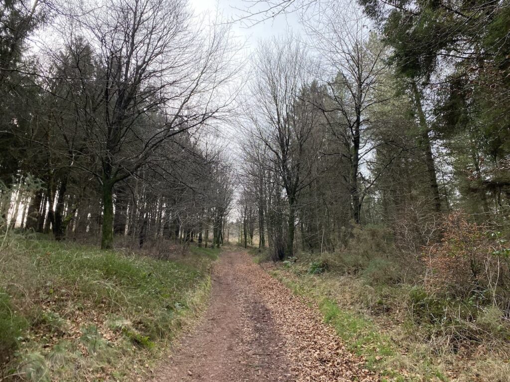
After a couple of weeks walking on and around the Brecon Beacons we have moved site and are now located at Goodleigh Hill CL on the outskirts of Pershore. We visited this site for the first time last November, it was a very cold spell and we decided to return in warmer weather.
Our journey from Llangadog was straightforward and we were warmly greeted by Emily, the site owner. It is always useful to arrive at a site and meet someone happy to share their local knowledge with you. Goodleigh Hill is a relatively new CL and it has been developed well. All pitches are fully serviced on a large hardstanding and on arrival there is a comprehensive information folder which you can peruse at your leisure during your stay.
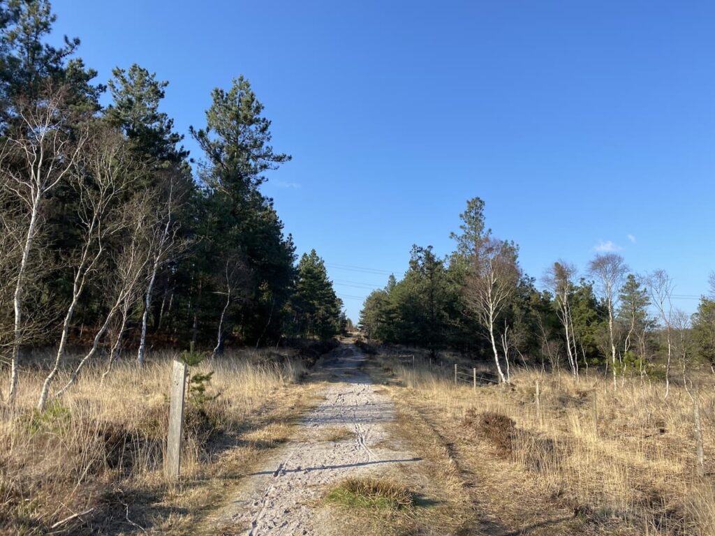
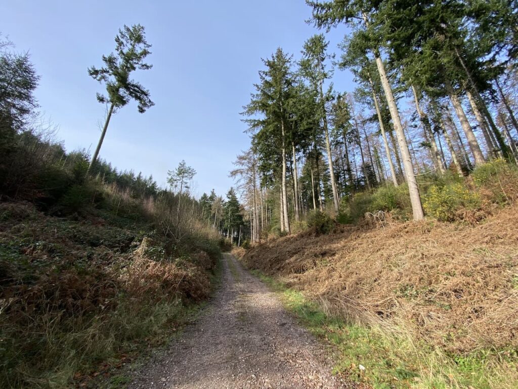
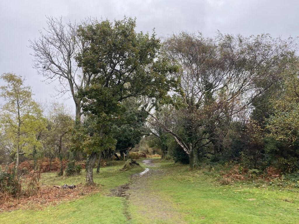
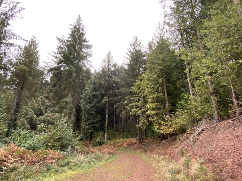
As soon as we are pitched up it is time for a quick walk from the site. We aim to walk into Pershore to pick up some shopping later so decide to do the walk that formed my morning circuit when we last stayed here.
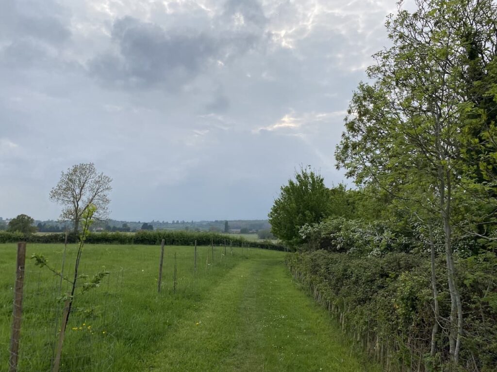
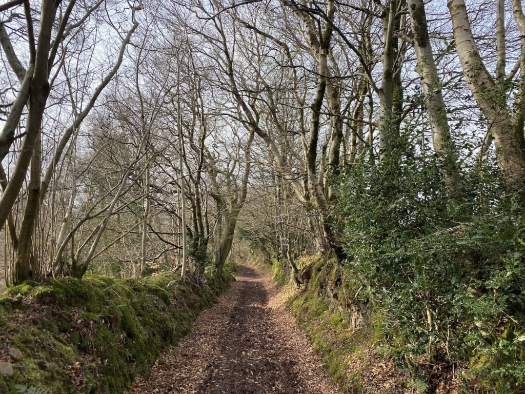
Leaving the site by the pedestrian access we walk down to the road and the turn left heading uphill into Pensham Hill. As the road levels out we take a footpath on the right beside a post box. The path follows a driveway and then goes through a gate to enter a field.
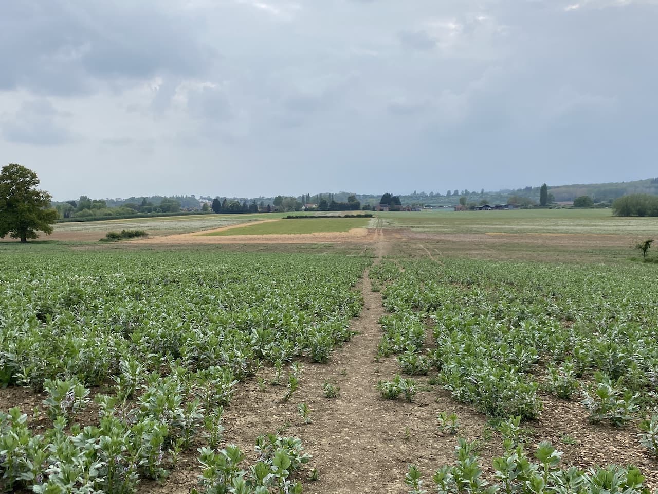
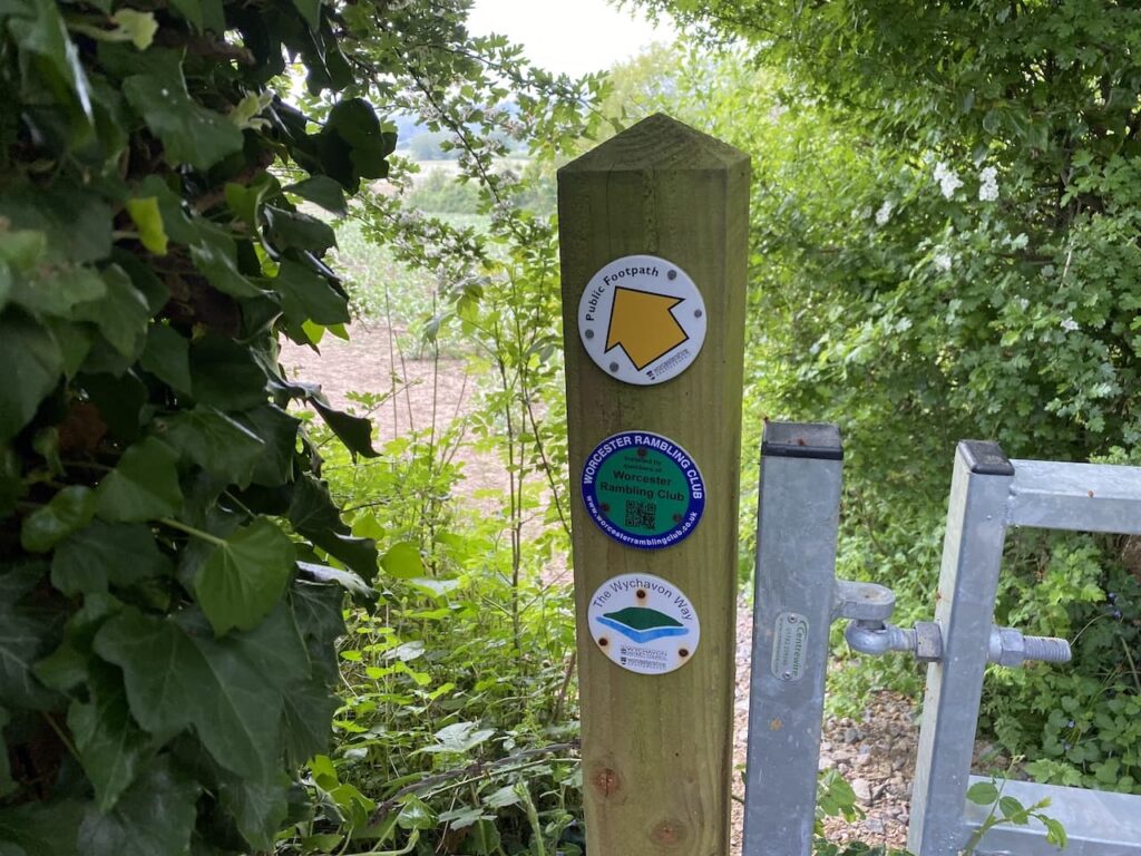
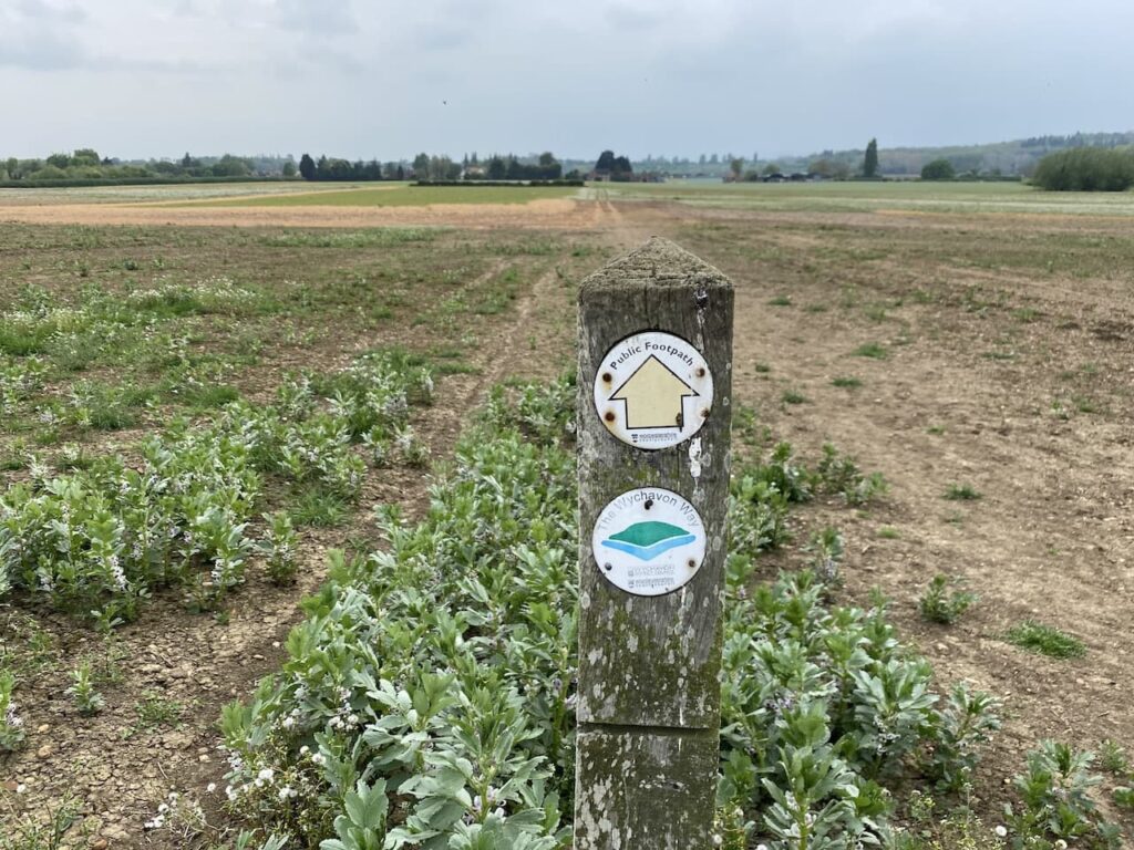
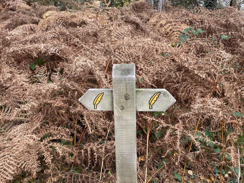
This is the route of the Wychavon Way, a forty mile long distance route between Droitwich Spa and Broadway. We go through the field with the hedge to our right to reach a kissing gate.
We now follow a clear path across fields heading towards Home Farm in Pensham.
On reaching a road in the village we turn left and soon reach a junction of minor roads where we turn left to head back to Pensham Hill. This is a long straight road with very little traffic so easy walking.
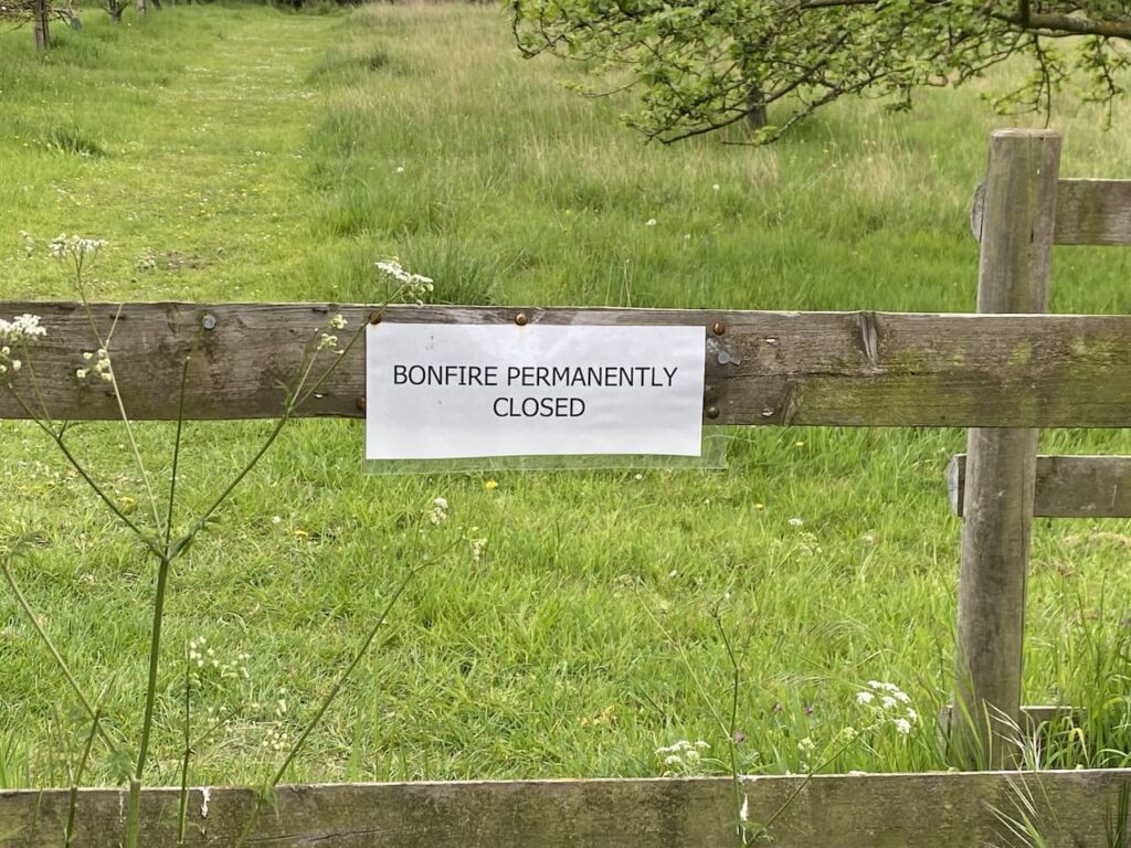
As we leave the village we pass the entrance to the village field, apparently in 2000 local residents raised funds to purchase a couple of acres of land for planting with trees and an Orchard creating a recreation area. Such initiatives are great for supporting wildlife habitat and developing communities.
At the entrance to the field is a notice saying that the Bonfire is permanently closed. I am not a fan of bonfires or those that light them on sunny afternoons when folk are trying to relax in their gardens.
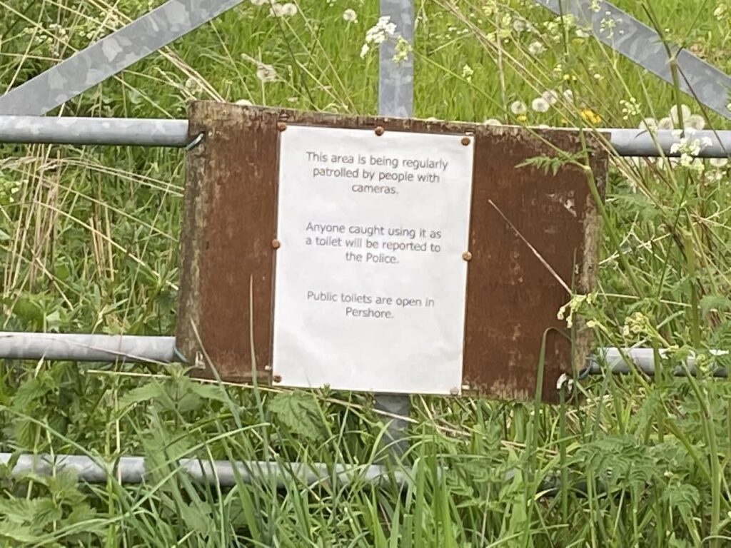
A little further along the lane is another sign. Whilst I concur with the sentiments it leads us to wonder why folk would feel the need to use the field as a toilet, presumably it is a frequent occurrence otherwise why put up such a notice. But equally concerning is that someone is lurking behind a tree with a camera just on the off chance that someone might have a desperate call of nature!
We now stay with the road returning back to Pensham Hill and continue straight on going steadily downhill to reach the entrance to the CL. This little route is just over two miles, enough for Crosby to stretch his legs after being in the car for a few hours. Now it is time to pop into Pershore and get some supplies before planning our walks for the next few days.
All information on this site is provided free of charge and in good faith and no liability is accepted in respect of damage, loss or injury which might result from it. To the best of my knowledge the routes are entirely on public rights of way or within areas that are open for public access. Walking can be hazardous and is done entirely at your own risk. It is your responsibility to check your route and navigate using a map and compass.
The interactive map below shows details of the 80 caravan sites we have visited on our travels. By clicking on the caravan you will see a link to my blogs from that site and a link more details about the caravan site. (more…)
Over the last couple of years I have been developing my navigation skills and have completed the National Navigation Award Scheme Bronze and Silver awards under the expert tuition of Nigel from New Forest Navigation. I was due to attend the Gold assessment in the Brecon Beacons last October, however Covid restrictions meant that travel to Wales at that time was not permitted so the course was rescheduled for this coming weekend.
I will be out on the Brecon Beacons for three full days, so Lynnie and I have travelled down a few days early and plan to stay for a week after so that we can make the most of the trip. We arrived yesterday and are staying a few nights at Abermarlais Caravan Park which is close to the village of Llangadog. It is unusual for us to stay on commercial sites, but this one is small and has been highly recommended to us. On arrival we had a warm greeting from the owners Tania and Steve and the facilities are excellent.
Today we are heading to nearby Llandeillo for our walk and park in a large pay and display car park in the centre of the town just off Crescent Road (SA19 6HN). From the car park we walk down to Crescent Road and turn right opposite the fine Victoria Jubilee Civic Hall.
The road soon has fine views across the valley and then just after passing an old brick building on the left we follow a footpath sign directing us downhill towards a railway line. After going under the railway we take a path on the left which runs alongside the track heading towards the River Towey.
The path leads to a suspension bridge, apparently built in 1911 to commemorate the Coronation of King George V.
We are on the route of the Heart of Wales Line Trail; this 143-mile long distance path starts in the town of Craven Arms and goes to the Millennium Coastal Park at Llanelli. It visits twenty six of the thirty railway stations along its way.
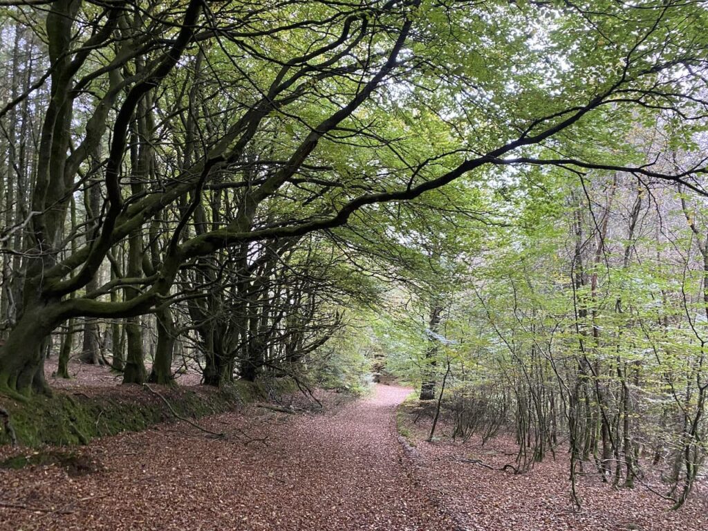
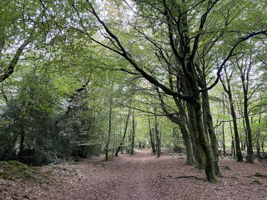
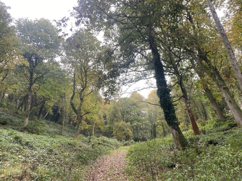
After crossing the river we follow a way-marked concrete path across a field and then a fenced path to a road. Here we turn right and walk along Bethlehem Road to reach the entrance of Coed Tregib Nature Reserve. This 107 acre woodland reserve is maintained by the Woodland Trust and is said to have a wide variety of flora and fauna.
The trail is waymarked through the reserve and the route takes us in a south easterly direction, gradually ascending through the trees.
On reaching a minor road we turn left, still on the route of the Heart of Wales Line Trail. This lane takes us past a sawmill at Cwmcîb and then goes over a stream.
We gradually ascend towards Llwyn-bedw and then as the lane turns towards farm buildings we take a footpath on the left following the Heart of Wales Line Trail across a field of pasture heading towards Hafod Farm.
After crossing a couple of arable fields the path joins a hedge lined track leading to the farm.
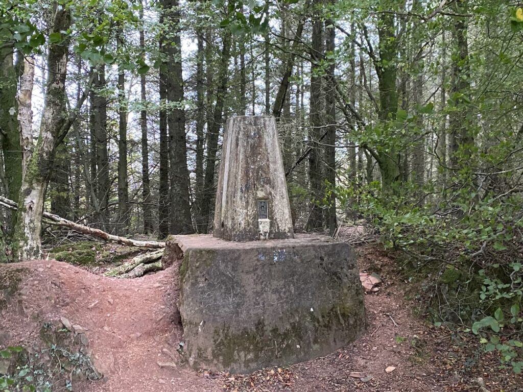
At the farmyard we turn to go in front of the farmhouse and join the farm driveway to a minor road where we turn right leaving the Heart of Wales Line route. Soon in a field on our left we spot the Llwyn-bedw Ordnance Survey trig pillar and I pop over the fence to bag my 302nd trig.
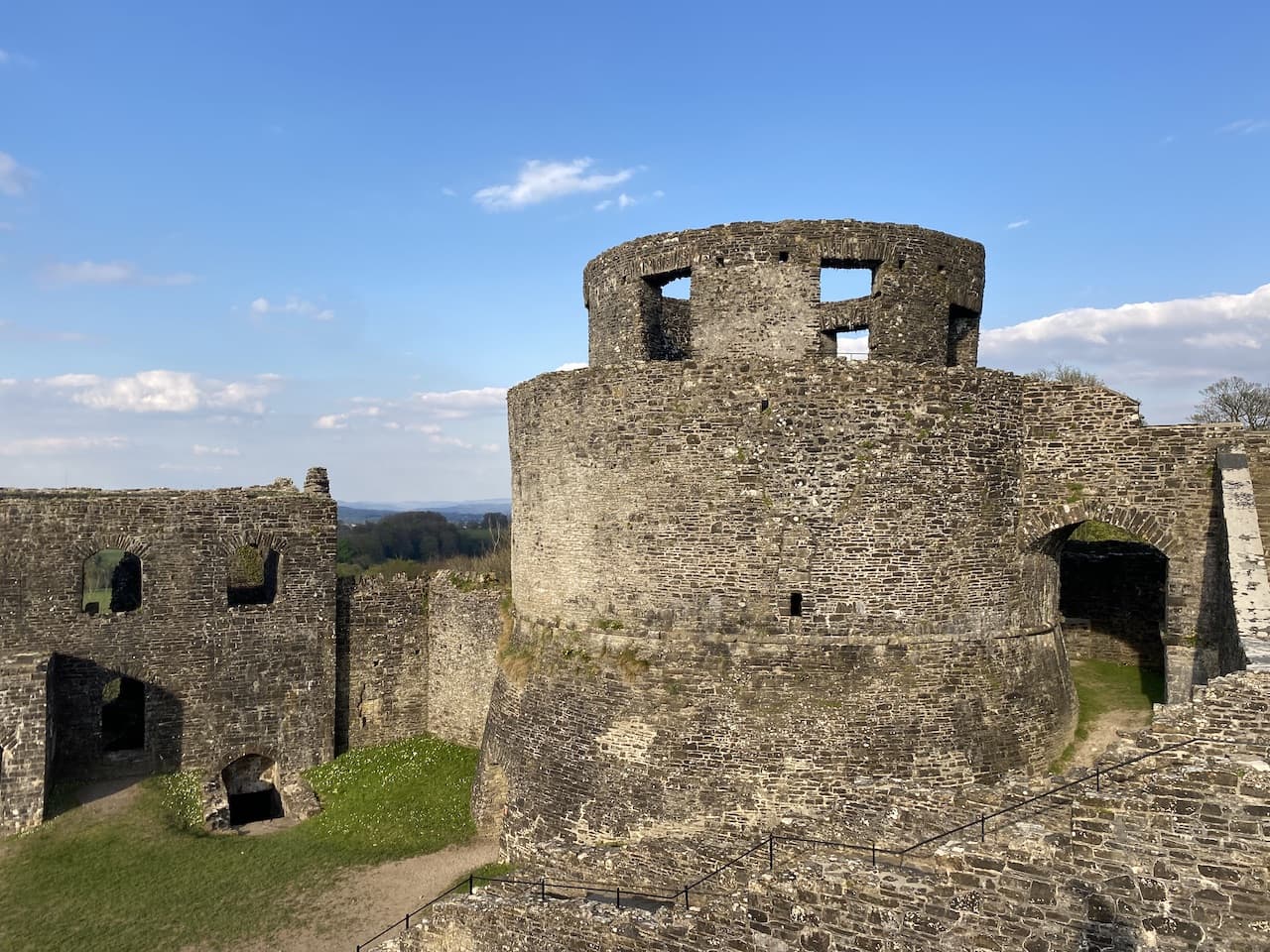
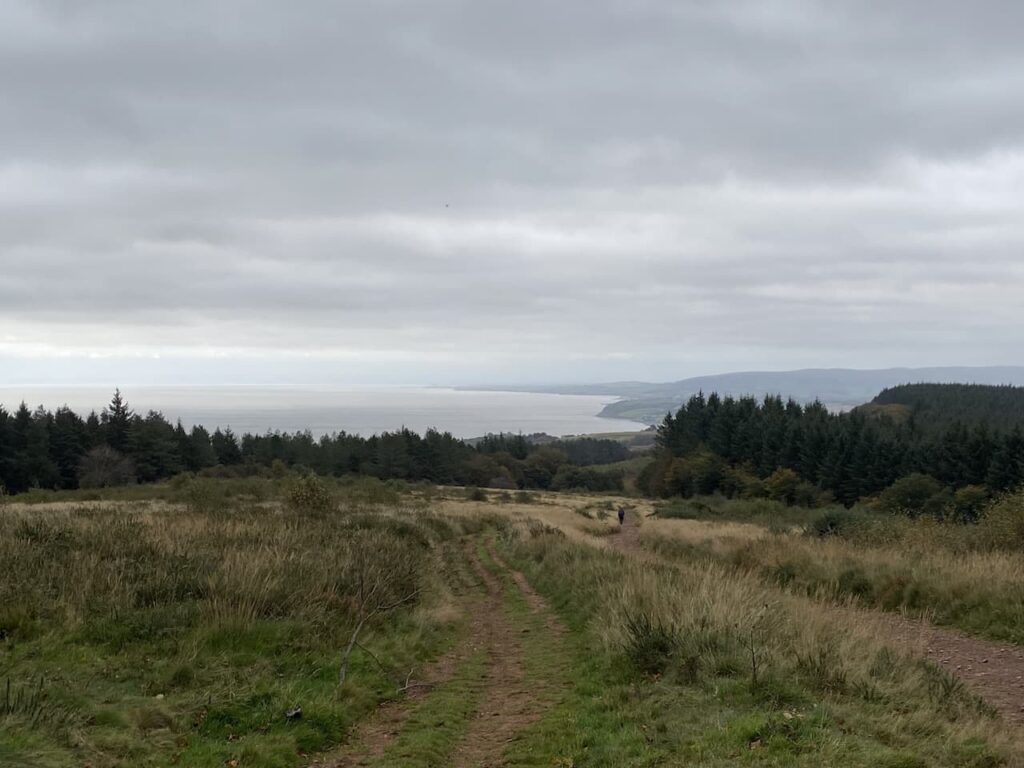
We continue along the road enjoying the fine views, away to our left we spot the impressive Carreg Cennen Castle sitting on a rocky outcrop. This was built in the 13th century by John Giffard, he was one of Edward I barons. Like many castles in these parts it changed hands between the English and Welsh many times.
During the War of the Roses it was a garrison for the Lancastrian forces and was captured in 1462 by Yorkists under the command of Sir Roger Vaughan and his men then set about dismantling the castle. It has been in a ruinous state ever since.
We leave the lane at a waymarker sign towards Gelli-groes, we have now rejoined the Heart of Wales Line Trail and follow the driveway to farm buildings and then go through a gate. At a junction of paths in front of the farmhouse we turn left through a gate and go steadily downhill following the Heart of Wales Line Trail markers across fields.
This is a well-marked route so easy to follow as it steadily descends across streams and through fields and copses to reach a minor road.
After crossing a stile we turn right along the minor road and continue downhill to reach Ffairfach. At a junction we turn left and go under a railway bridge and continue along to a crossroads where we turn right and head towards Llandeilo soon crossing Llandeilo Bridge.
A Llandeilo resident named William Williams designed this single arched bridge; he was the county bridge surveyor. It was built between 1843 and 1848 replacing a three arch bridge which in turn replaced a medieval seven arch bridge that had collapsed in 1795. The single arch spans 143 feet across the river and at the time was the third largest span in Britain. Williams died in 1846 so never saw his bridge completed.
After crossing the bridge we turn left on a lane and pause to look back at the single arch structure.
We follow this lane and then go through a gate joining a fenced path into Dinefwr Park.
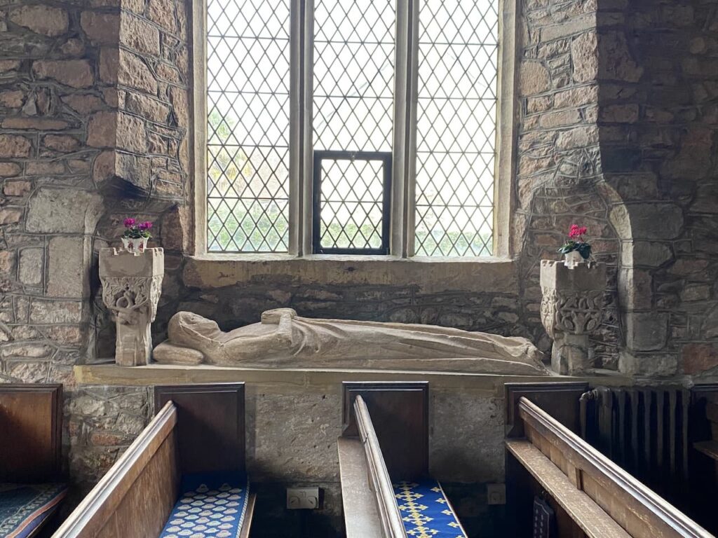
We stay with this pathway until reaching a turning on the left where we descend to reach St Tyfi’s Church. This is the former parish church of Llandyfeisant, the current building was constructed in the second half of the 19th century and replaced an earlier medieval church. It is no longer used for religious purposes and is leased by the Wildlife Trust Wales as a visitors centre but it is currently closed whilst repairs are undertaken.
From the church we go through a gate and then turn right and immediately go through another gate and then follow a path heading west across pasture land in the park. Dinefwr Park is an 800 acre estate owned by the National Trust and surrounds Dinefwr Castle and the stately home Newton House.
At a junction of pathways we turn left and head towards Castle Wood.
At the edge of the woods we turn right and follow a track through a gate continuing gradually upwards through the trees to reach Dinefwr Castle.
There was an earlier castle on this site which was rebuilt by Rhys ap Gruffydd the ruler of Deheubarth from 1155 to 1197. After his death his son Rhys Gryg took over the castle and then it changed hands a few times before Rhys Fychan gave the castle to Maredudd ap Rhys who then gave it back to Rhys Fychan. Maredudd joined forces with Edward I and his son Rhys ap Maredudd assisted Edward in the capture of the castle in 1277. He expected to be rewarded with the gift of the castle but instead Edward I had him executed in 1291.
The English held the castle for a number of years and were unsuccessfully besieged by Owain Glyndwr in 1403. At the end of the 15th century it was held by Sir Rhys ap Thomas, his grandson Rhys ap Gruffydd was executed for treason in 1531 and the castle confiscated by the crown before being returned to his family.
With the construction of Newton House in 1660 residency moved to the new house and the castle became a temporary residence before it burned down in the 18th century.
Leaving the castle we take a faint path heading north through the trees to reach a broader path and then join a wider path which goes through a gate and then continues downhill towards another gate.
The path now goes steadily uphill to pass National Trust buildings and goes through a car park to reach a tarmac lane that passes in front of Newton House. Originally built in 1660 by Edward Rice it was changed to the current Venetian Gothic style in the 1850’s. It was occupied until the mid 1970’s and then fell into disrepair before being acquired by the National Trust in 1987 and then restored.
We stick with the tarmac driveway to leave the park and reach Carmarthen Road where we turn right to head towards the centre of Llandeilo. As the road sweeps to the left in front of a pub we continue downhill on the now narrower Carmarthen Road passing colourfully painted houses.
In the town centre we turn left and head back to our starting point in the main car park. Our walk has covered almost eleven miles. Bagging a trig is always a bonus for me and Lynnie does like to visit a castle, the only downside as far she was concerned was the lack of an ice cream.
All information on this site is provided free of charge and in good faith and no liability is accepted in respect of damage, loss or injury which might result from it. To the best of my knowledge the routes are entirely on public rights of way or within areas that are open for public access. Walking can be hazardous and is done entirely at your own risk. It is your responsibility to check your route and navigate using a map and compass.
Following my solo trip in the new caravan a couple of weeks ago we are now both getting away for a few days to fully test out everything before we start our planned trips over the next six months. I have been busily organising our schedule which will see us visiting the Brecon Beacons, Northumberland, the Scottish Borders, Peak District and the Yorkshire Dales.
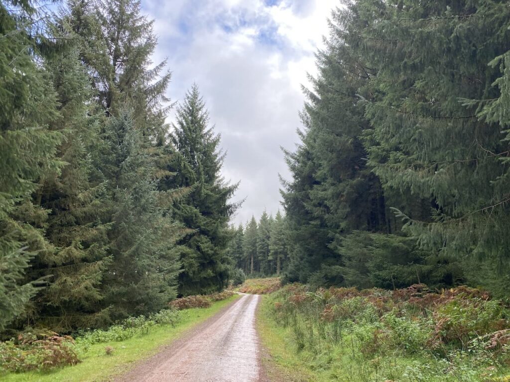
Our current trip is five nights at the Caravan and Motorhome Club main site at Hunter’s Moon in Wareham Forest. We know this part of Dorset well because Lynnie grew up in the area and still has relatives living locally. So it will be a good chance to do some walking and catch up with friends and family.
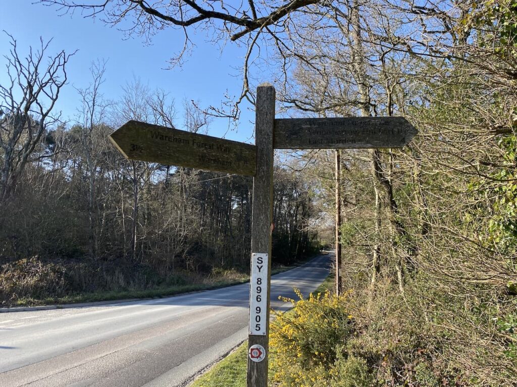
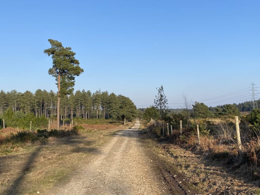
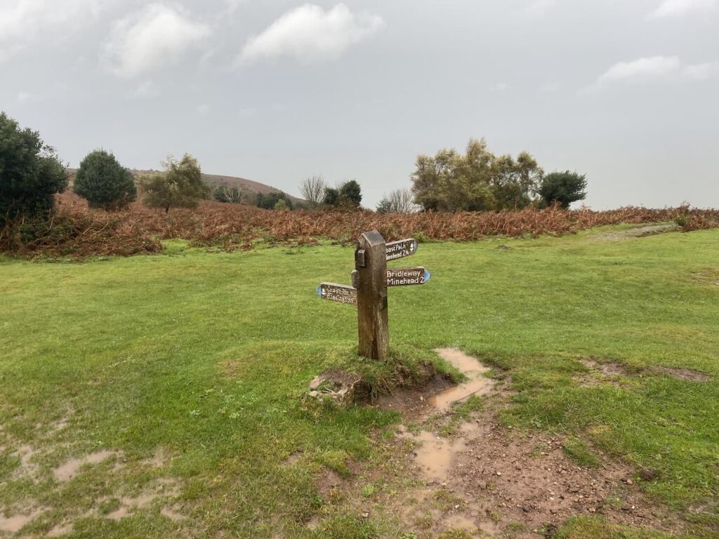
Wareham Forest is only just over forty miles from home, so a relatively short journey to reach Hunter’s Moon and it does not take long to get pitched up and sorted out. Luckily there is still plenty of daylight for a decent walk. We decide to head out from the site and exit through the main entrance and turn left along the road. It is possible to walk along the verge, but we need to keep an eye out for fast moving traffic. After passing the entrance to Birchwood Touring Park site we continue on a short distance and then turn right on a way-marked path for Woolsbarrow Hillfort. There is also a marker for the St Edward’s Way on the finger post.
We now follow the fenced footpath heading north towards the caravans in Birchwood Park.
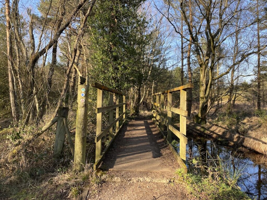
After passing the caravan site the path goes through a boggy area, fortunately it is easy enough to negotiate a route through without too much difficulty and then we cross a footbridge over a stream.
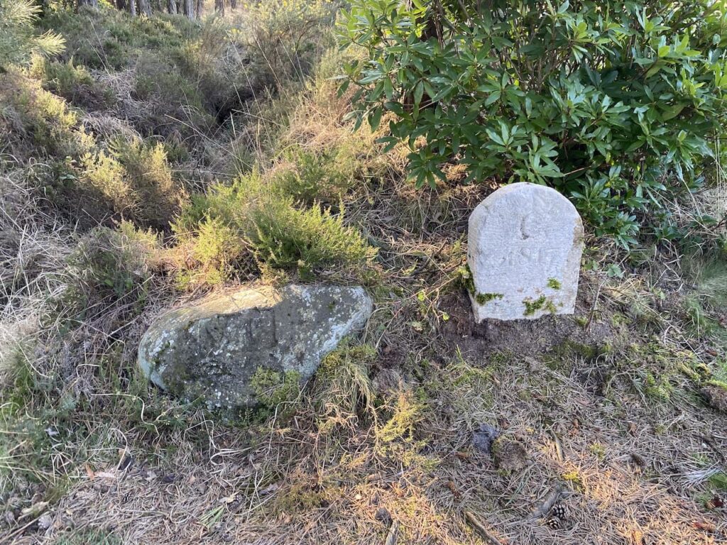
The ground becomes a bit firmer underfoot as we head towards a junction of paths besides two boundary stones at Old Ram, one of which is dated 1817. In the past this was the crossing of major routes through Wareham Forest.
At this junction of paths we continue to head north on the Wareham Forest Way towards Woolsbarrow Fort.
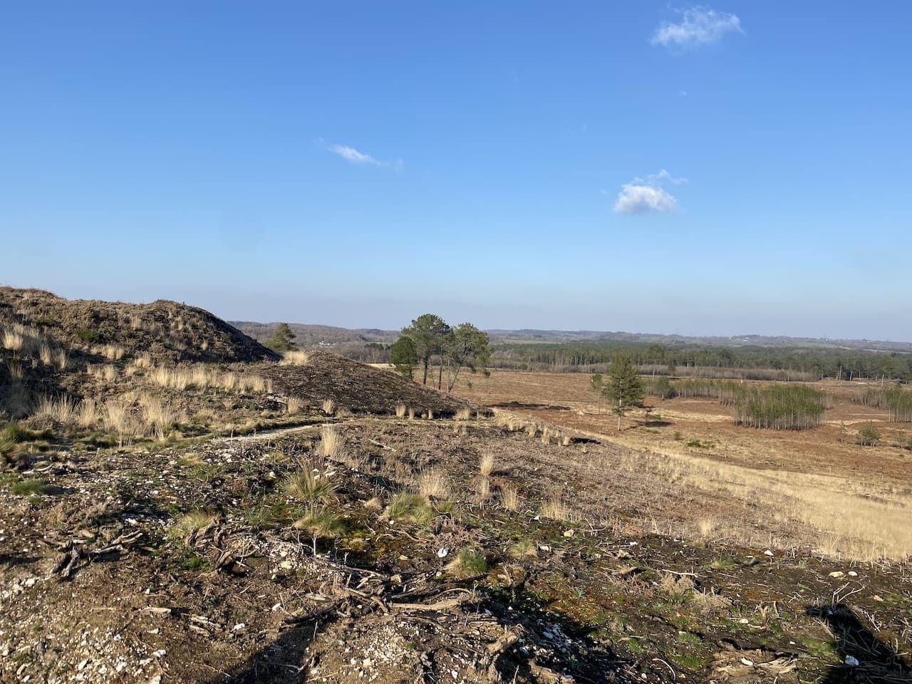
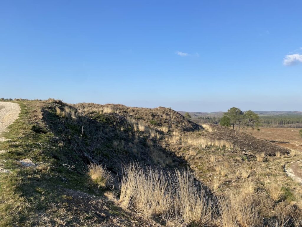
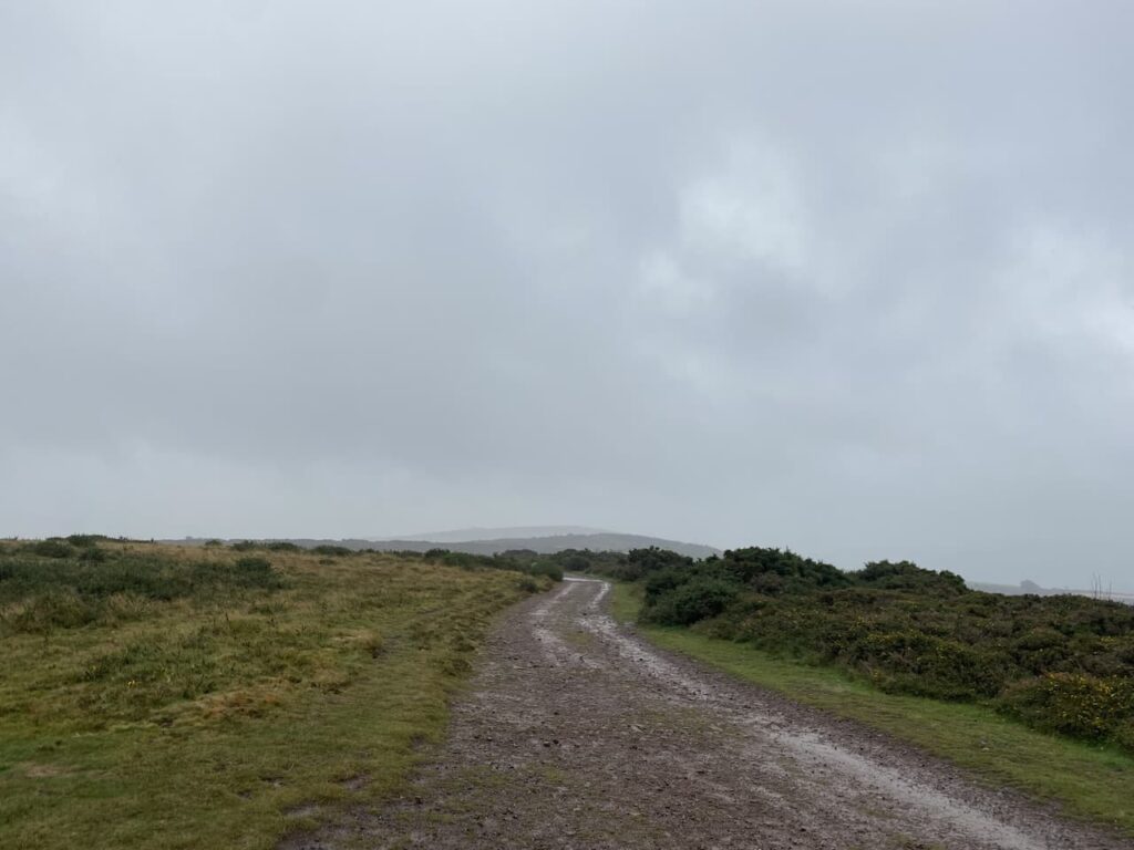
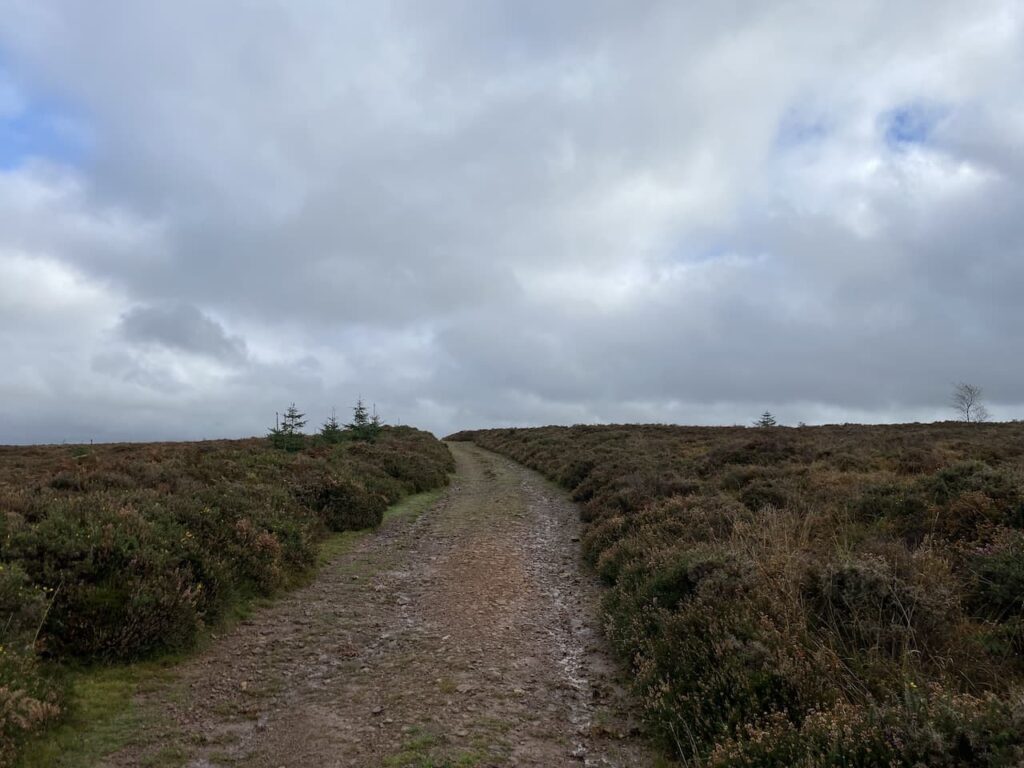
The path heads steadily uphill to reach a crossing of paths with the Hardy Way, we continue straight on and after a couple of hundred metres fork left and continue through the ramparts of the hillfort. Woolsbarrow is a late Bronze Age to Early Iron Age fort and although only 67 metres above sea level provides stunning views over the surrounding heathland.
On the ramparts there is an Ordnance Survey Trig Pillar, we have been here in the past but before I was bagging trigs so we wander over to add this one to my list. It is the 294th I’ve bagged.
From the hillfort we retrace our steps back down to the junction with The Hardy Way and head east across Morden Heath.
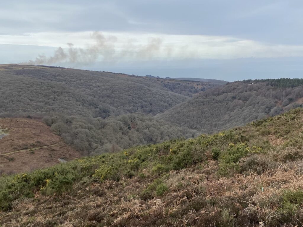
On 18 May 2020 a major fire broke out in Wareham Forest which burnt until the 29th May devastating 220 hectares of land. 150 firefighters fought the blaze and it is estimated that around 4 million litres of water were used to quell it. However, this was not the only major fire to affect the woodland. In 1947 a huge blaze went on for four days closing the road between Wareham and Bere Regis and causing ammunition left behind from World War II troop manoeuvres to explode.
At a junction of paths we leave The Hardy Way and keep heading east on a footpath leading towards Sherford Bridge. This path skirts the edge of woodland and then goes through a field to reach the B3075 at Sherford Bridge. We cross the road and join a track leading into woodland on Gore Heath.
There are a network of paths and tracks in these woods so plenty of options to choose. Our route continues along the track for a couple of hundred metres and then we turn right to head south towards the summit of Gore Hill. After crossing another track we continue south and then just before reaching another junction of tracks we follow a well-worn path that heads to the summit of Gore Hill and an Ordnance Survey trig pillar. This one has been painted a bright green colour, which is a bit off putting to a trig purest but it still counts and goes down as my 295th bagged!
From the trig we head down to a junction of tracks and continue to wend our way south. At the next two crossings of tracks we carry straight on and then at the next junction we turn right and soon after take a left leading uphill to a five way junction of tracks where we turn right and follow this track to a gateway on the edge of woodland which overlooks open heathland.
After going through the gate we head downhill on a path through gorse and heather towards a track.
On reaching the track we turn right on the route of the Poole Harbour Trail which is a network of circular and linear paths around Poole Harbour. The track leads us through a gate besides the B3075 which we cross and continue on a track on the opposite side to reach a gate which we go through and then continue with good views across Decoy Heath.
The light is beginning to fade, but I am confident we will get back to the caravan before it gets dark, the track leads steadily downhill to reach a bridge over a stream at Morden Bog.
We then turn right, briefly joining the Hardy Way, after a couple of hundred metres we take a track on the left and then a few hundred metres further on take another track on the left which is a short steep ascent to the top of a hill. At a junction of tracks we go right to follow the path towards a parking area.
After passing the parking area and crossing the road we take the path opposite. After a couple of hundred metres we turn right on a junction of paths and soon reach a crossing of paths where we go straight on along a fenced path with a solar farm to our right.
After crossing a raised walk way we soon reach a junction of paths where we turn right and head north back towards the caravan site on the route of the Wareham Forest Way and St Edward’s Way. The St Edward’s Way is a thirty-mile route from Wareham to Shaftesbury Abbey. The route is said to follow the journey that St Edward the Martyr’s remains were taken on after his murder at Corfe Castle in 972 to be buried at Shaftesbury Abbey.
Sections of this path are a bit muddy and it is just getting dark and we are relieved to reach a gate to re-enter the caravan site. Unfortunately it is locked and we do not know the code to open it. (I later discover this is shown on the other side of the gate on the assumption that anyone leaving the park will want to come back through the gate, but it is not shown on any other information about the site!) Instead we have to continue along the path, as it nears the road the route appears to head towards a quarry works service road, however, the secure gates leading to the site are now closed for the evening!
Clearly we now have a problem, but experience has taught me in such situations that it is best to take another good look at the map ensuring we have taken the right path and not just followed a path made by others. Fortunately I spot that the footpath actually veered to the right just before reaching the service road so we take this much boggier route to reach the Wareham to Bere Regis road where we turn right and walk the short distance on the verge back to the entrance of Hunter’s Moon Caravan Park.
Our quick jaunt has covered just over 8.5 miles and has been a good stretch of the legs with the added bonus of two more trigs bagged.
All information on this site is provided free of charge and in good faith and no liability is accepted in respect of damage, loss or injury which might result from it. To the best of my knowledge the routes are entirely on public rights of way or within areas that are open for public access. Walking can be hazardous and is done entirely at your own risk. It is your responsibility to check your route and navigate using a map and compass.
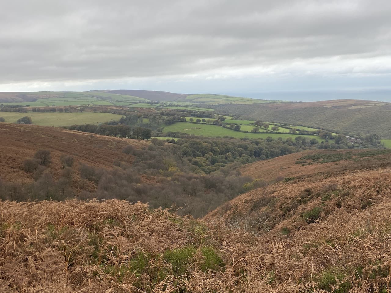
Whilst staying in Minehead in October last year Crosby and I walked from the site to Dunkery Beacon. I was hoping for a clear day to appreciate the views from the Beacon but as I was walking the weather closed in and I struggled to see as far as the North Somerset coast. I am heading towards Dunkery today but don’t plan to go to the summit.
The start of my walk follows the route I took yesterday, leaving the site I turn left and walk uphill along the pavement besides the A39, Hopcott Road. I keep with the road until I reach Periton Cross. Here I turn left and take a bridleway on a track into Periton Combe.
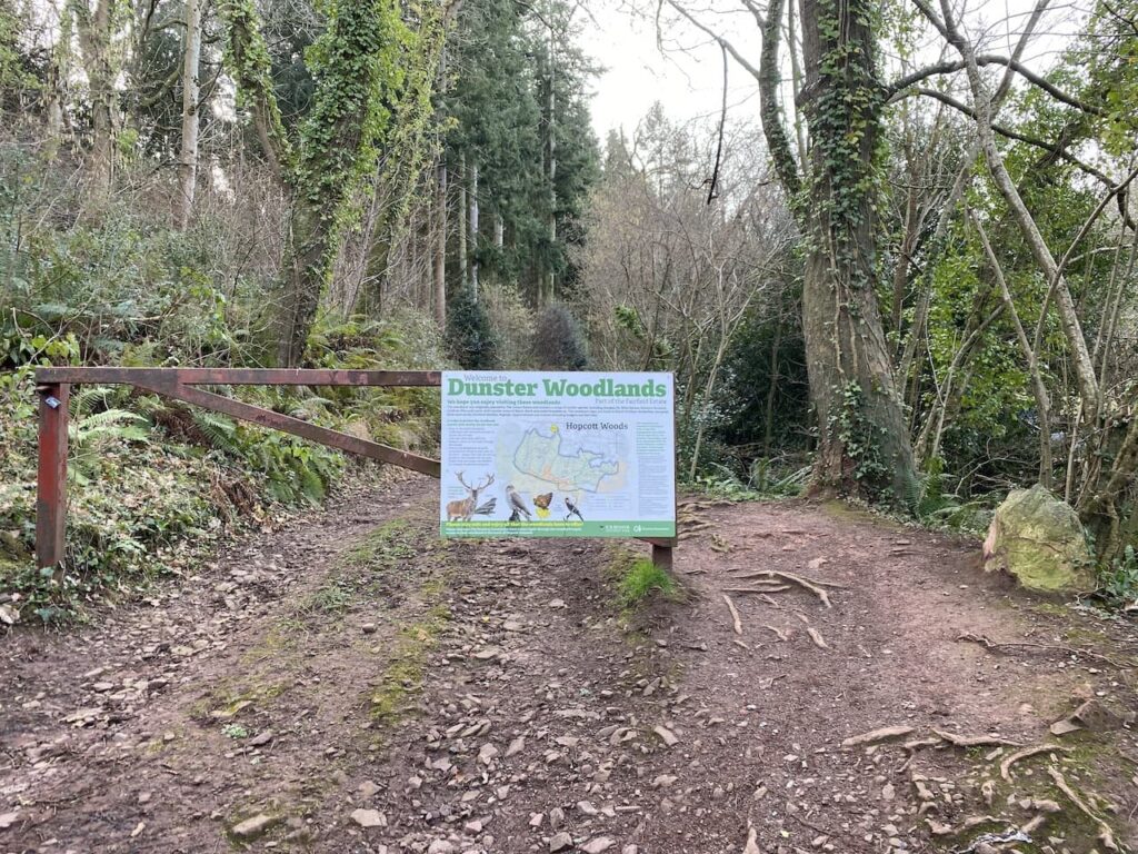
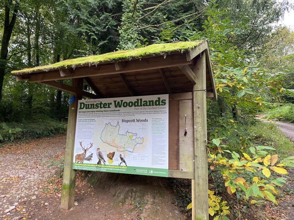
Soon I reach a metal barrier preventing vehicle access to the Combe, it has an information board about Dunster Woods attached to it.
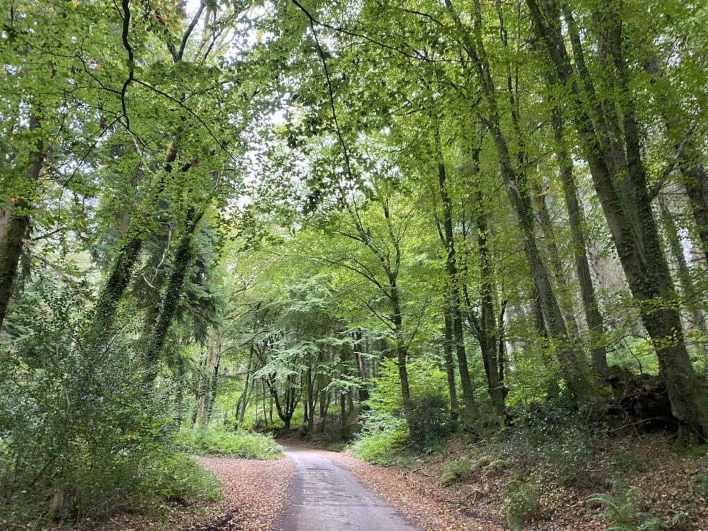
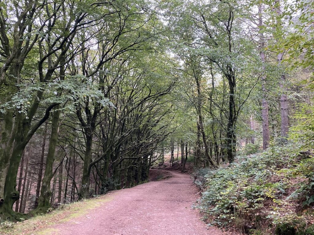
The path follows the track and then starts heading uphill. There are forestry tracks in the woods but I keep with the way-markers for the bridleway as I ascend through the trees.
It is a long steady haul up Periton Hill to reach Wootton Common, I was a bit chilly at the start of my walk but I soon warm up and start shedding layers.
At a fork in the track, as is reaches the edge of open land on Wootton Common, I fork to the left, still going uphill to reach a junction with a track running along the top of the hill where I turn right.
At a fingerpost for Wootton Courtenay I turn left onto a track initially passing through Pine woods which are dark and featureless but at a junction of paths I turn right into a cracking area of Beech woodland.
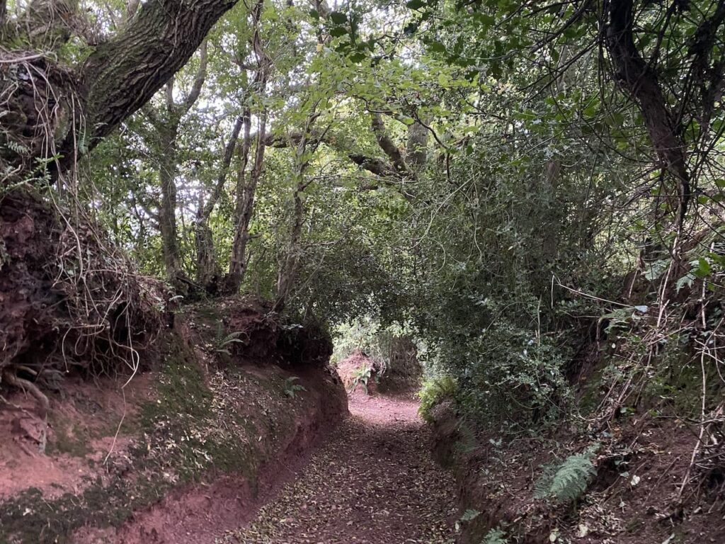
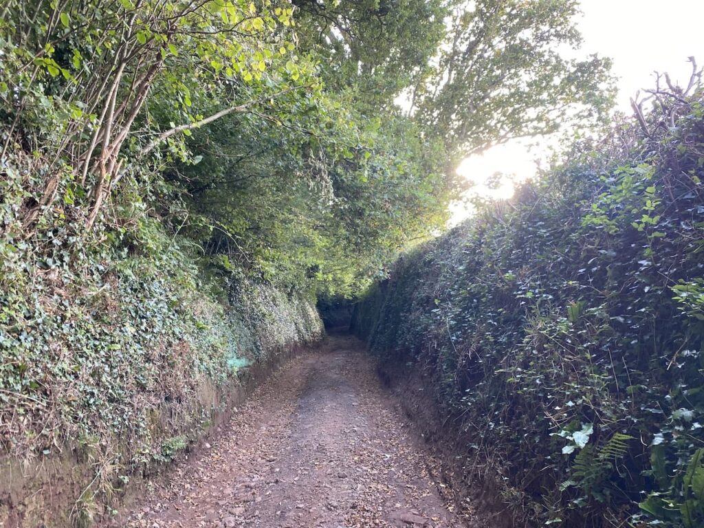
The path I am now on is marked on the map as Roadway Lane, this soon becomes a stunning sunken track descending steeply into Wootton Courtenay. Such tracks will have been used for centuries and it would have been a challenging journey dragging a cart up this hill to reach Minehead.
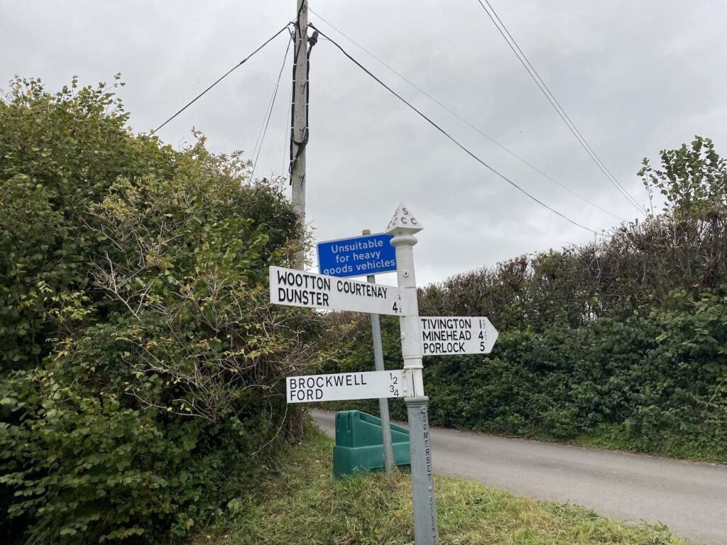
The track enters the village and passes the community hall and then reaches a road. Here I turn right and then very soon take a lane on the left which is signposted to Brockwell and Ford. This lane leads to a cattle grid with a gate beside it and then continues on to reach Brockwell. At a T-junction I leave the road and take a bridleway with a fingerpost to Dunkery Beacon.
The bridleway ascends gradually and then goes through an attractive area of woodland.
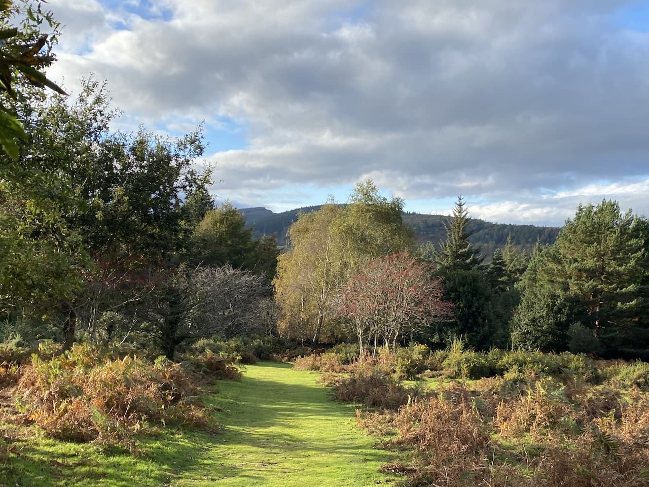
At a junction of tracks I continue straight on, still going uphill and then emerge from the trees. It had been my initial intention to turn right here and head towards Horner Wood, but it is such a pleasant day that I decide to head further up Dunkery Hill. So I continue straight on making a gradual ascent through the heather.
As I head up I decide that despite my initial plans I will walk to the summit of Dunkery Beacon. This is often a feature of my solo walking, I have a rough idea of a route but at a junction of paths will go wherever the mood takes me. So on reaching a minor road I cross and then pass a metal barrier to continue on towards the beacon.
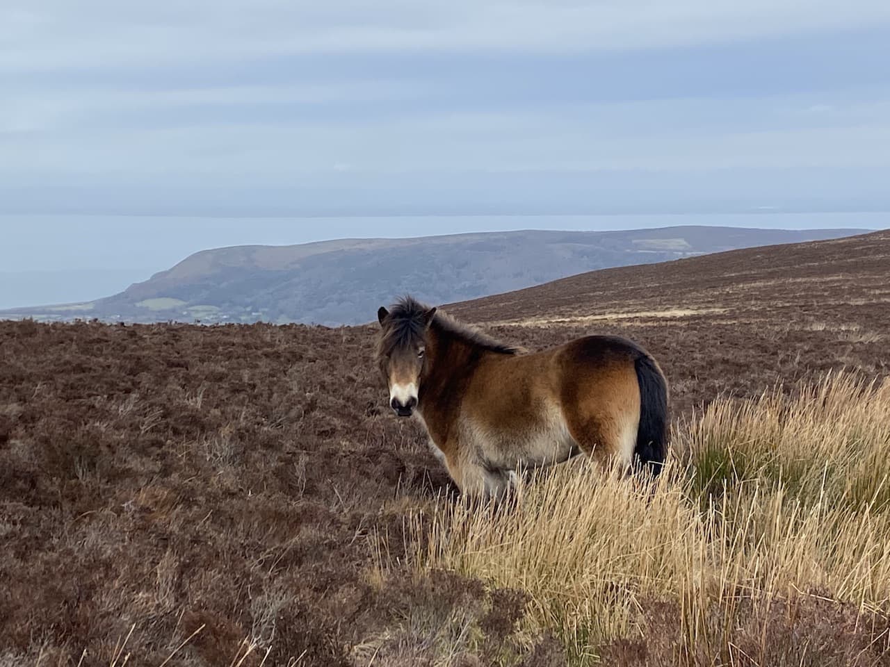
The ascent is now easier and there is a chance to take in the stunning views. Reaching four Exmoor ponies I realise I have now seen more ponies than people on my walk.
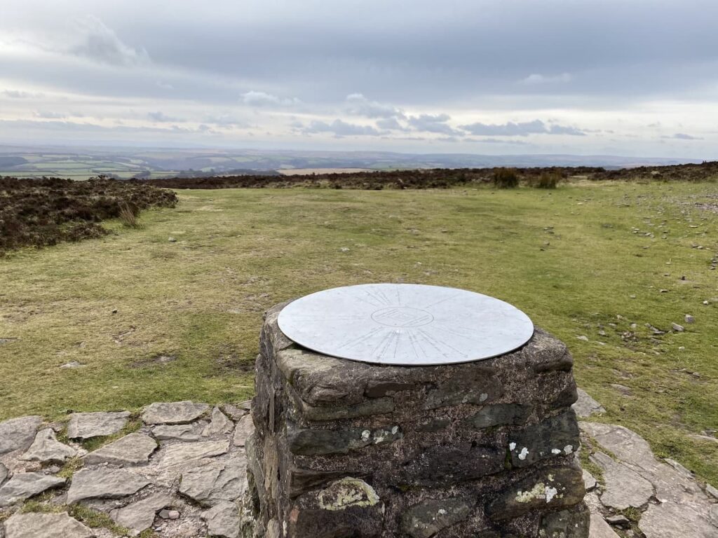
Heading towards the summit I see there are folk up there, but by the time I stop to look at the toposcope near the beacon they have moved on. I do like a toposcope, not as much as a trig point, but they are always an interesting feature on a walk.
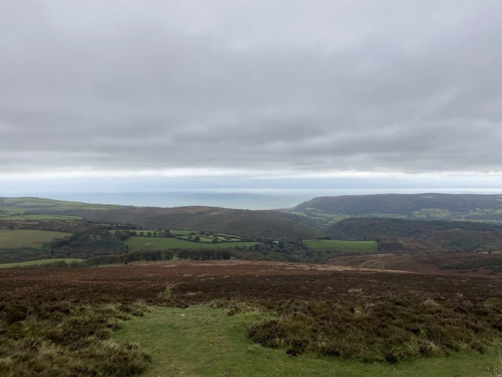
In recent times the beacon has been repointed and it looks a bit stark until it weathers in. This is the highest point on Exmoor and Somerset and as you might expect it is a bit breezy up here, but the last couple of times I have been here I have struggled to stay upright against the wind.
Dunkery Hill forms part of the Holnicote Estate which was donated to the National Trust by Colonel W.W Wiggins in 1932. The views from the summit are outstanding and today I can see all the way across to South Wales.
Close to the cairn a chap has what looks like a radio transmitter and aerial. We have a brief chat and he explains he has been there a couple of hours and has been speaking to people in Europe and now is in a conversation with someone on the Brecon Beacons. It must be a chilly hobby to participate in.
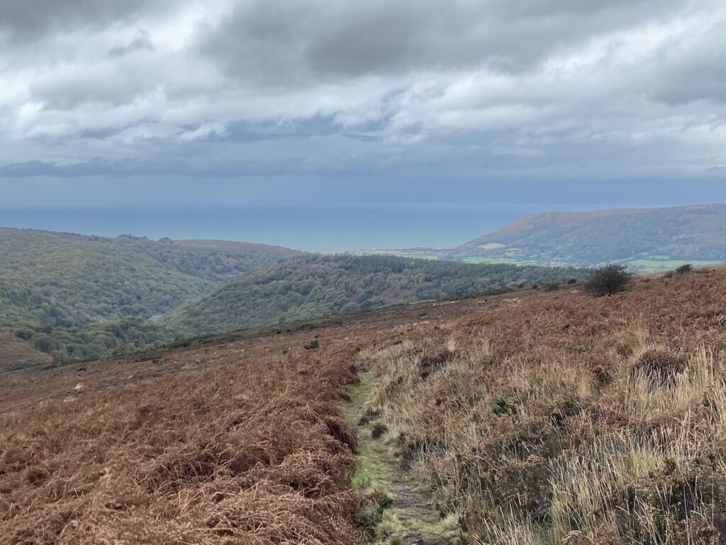
I leave the summit following a path downhill heading north towards the coast.
I ignore paths to the right and continue downhill towards a path marked on the map as Dicky’s Path.
On reaching the junction with Dicky’s Path I turn right to head towards Aller Coombe. I later try, without success, to find the origins of the naming of this path.
I follow the path into the combe and cross a ford around the head of the combe and then continue on to reach Hollow Combe.
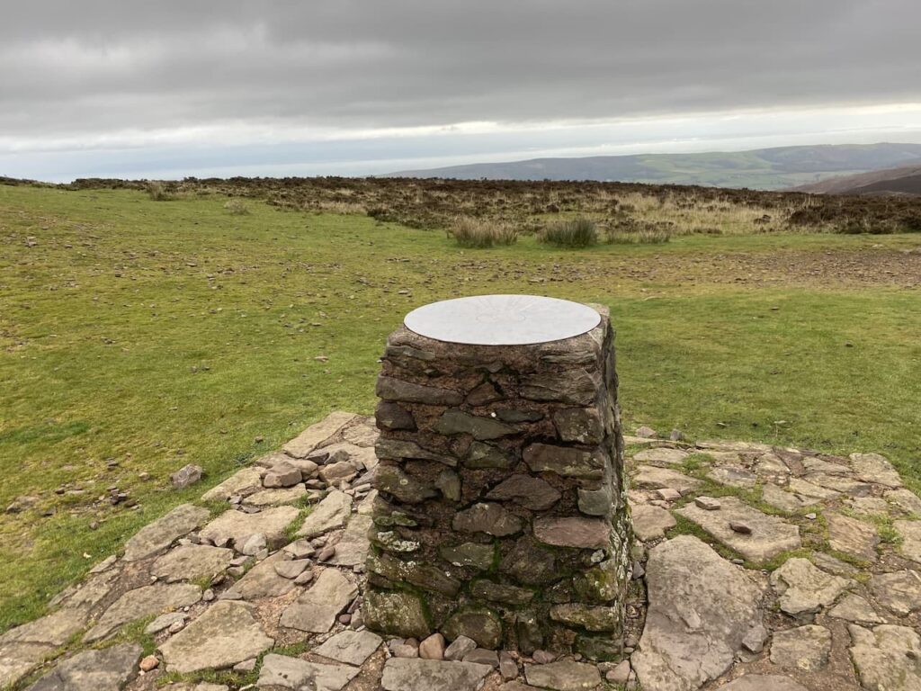
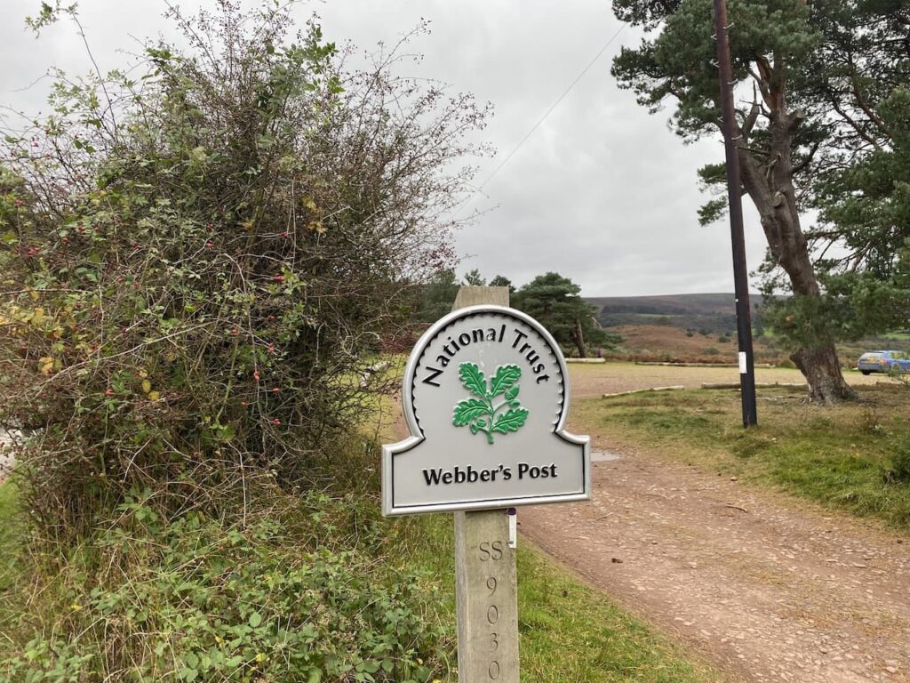
From this Combe I stay with Dicky’s Path to reach the large parking area at Webber’s Post. This is another spot with stunning views.
From the car park I join the Coleridge Way and follow the way-markers for this long distance path as it leads through Horner Wood.
The Coleridge Way is a route based on the path said to have been walked by Samuel Coleridge from Nether Stowey on the west side of the Quantock Hills to Lynmouth. This section goes through attractive woodland reaching a minor road on the outskirts of Horner after going through a deer proof gate.
At the road I turn left and walk through the hamlet, continuing along the road to reach a footpath on the left. Here I take a short diversion to view the pack horse bridge over Horner Water.
Returning to the road I turn left and head north towards West Luccombe. Before reaching the village I take a footpath on the right heading east across a field of pasture.
The way-marked route leads through kissing gates into another field and then follows the fence line to further fields to reach a minor road.
I turn left along the road and follow it to Piles Mill. This is a 16th century corn mill with an overshoot watermill. In the 1930’s and 40’s it was used as a cider mill and is now a National Trust visitor centre.
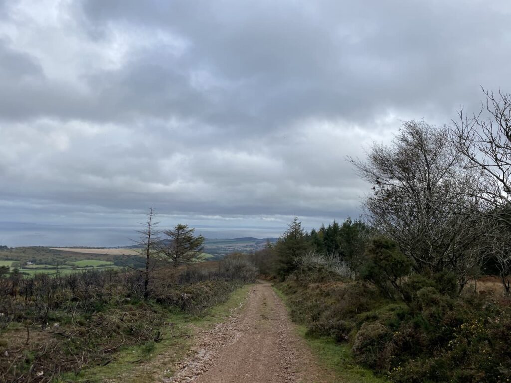
After passing the mill I cross the A39 and walk into Higher Allerford and then take a track on the right which leads steadily uphill towards Selworthy. There are great views from the track looking over the route I was on earlier today.
I pass fine old barns on the outskirts of Selworthy and then reach a road where I turn left and head uphill to pass the village church.
After passing the church I continue along the single track lane to reach a crossing of tracks at Dean’s Cross, here I continue straight on along the narrow lane to reach a junction of footpaths on the edge of Little Headon Plantation. I go through a gate straight in front of me to walk along the northern edge of the plantation.
Heading along this footpath I get a cracking view of North Hill away to my left.
The footpath leads into a pasture field where I continue with the hedge line to my left until I reach a way-marker which indicates the path goes through a gate and then downhill on a fenced path towards a minor road.
At the road I turn right and follow the lane heading back towards Minehead, soon I pass Bratton Court and then continue straight on to stay with the road to reach housing at Woodcombe. At a road I turn left and then very quickly take a path besides a stream through a park.
At a road I turn right and then almost immediately left to continue following the stream through another park. The route is marked as the Parks Walk and leads me to the outskirts of Minehead where I turn left and walk into the town centre and then wend my way back through the streets to reach the caravan park.
My walk has covered 17 miles which is further than I had intended when I set off, but it has been a cracking day to be out and I have walked through some stunning scenery.
All information on this site is provided free of charge and in good faith and no liability is accepted in respect of damage, loss or injury which might result from it. To the best of my knowledge the routes are entirely on public rights of way or within areas that are open for public access. Walking can be hazardous and is done entirely at your own risk. It is your responsibility to check your route and navigate using a map and compass.
Back in the Autumn we decided it was time to change our caravan. We had been travelling in a Coachman VIP 675 for four years and really liked the van. However, we found a couple of sites were not prepared to take a twin axle and access to others was very tight. There was also the challenge of setting up and fixing the Alco locks to both wheels. So last week we collected a Coachman VIP 575 and I am away for a few days to test it out before we start our more serious touring in the Spring.
One of my favourite winter places to pitch up is the CAMC Minehead site. It is only a few hours away from home and it is really easy to access. It is conveniently located for Minehead but more importantly it has great access to Exmoor and the Quantock Hills. I have done numerous walks from the site and today I am going to do a variation of a walk I often do whilst staying here.
On leaving the site I turn left and walk uphill along the pavement besides the A39, Hopcott Road. On reaching the Hopcott I turn left to follow the narrow tarmac lane as it heads steadily uphill passing Higher Hopcott. The road then enters woodland with a steep final ascent to reach a small car park with an information board.
I take the path to the right of the information board on the route of the Macmillan Way West heading uphill. I ignore a path on the right soon after leaving the car park and then where the Macmillan Way meets a crossing of tracks I continue straight on, staying on the route of the long distance path.
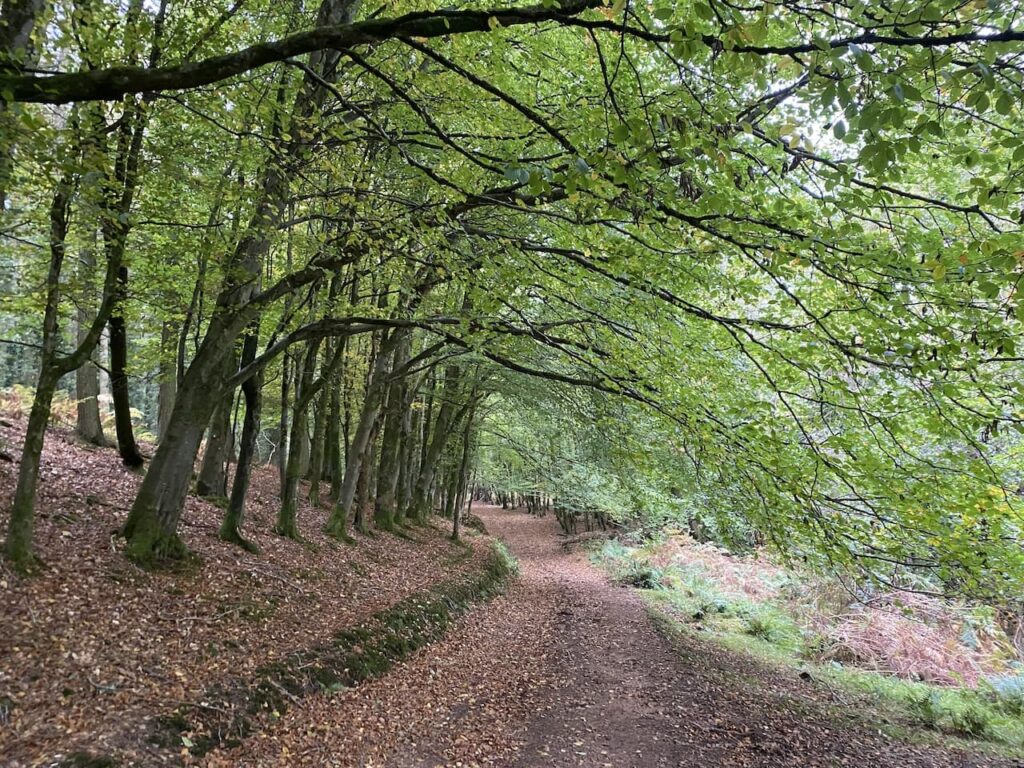
The path now goes around the head of Long Combe, this is a cracking spot with stunning Beech trees lining the path.
Leaving the trees the path continues on to reach a junction of tracks. Here I turn right still on the route of the Macmillan Way West heading towards Tivington.
I am heading across the top of Hopcott Common and at a fork in the track I go left to keep with the Macmillan Way West and head west to reach another crossing of paths. Here the Macmillan Way turns left towards Wootton Courtney, however, I keep going straight ahead soon reaching an Ordnance Survey trig point tucked to the left of the track on a high bank. This trig on Periton Hill is one which I have bagged a number of times.
At the next crossing of footpaths I continue straight on.
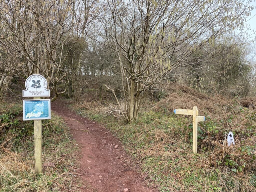
I soon reach the National Trust plaque and enter Holnicote.
Within a short distance the track forks and I go right towards Headon Cross with the path leading through the attractive woodland of Tivington Common.
It has turned out to be a cracking day there is a definite warmth to the sunshine as I walk through the trees. Initially it is a gradual descent, but then as I near Headon Cross there is a short steep descent to reach a minor road. In front of me I can see East Lynch which is on my route.
Turning right on the minor road I reach Headon Cross and go straight over to take a minor road opposite. This climbs steadily, as the road sweeps to the right I continue straight on along a track towards East Lynch with great views of Dunkery Hill away to my left.
Approaching East Lynch farm I take a footpath on the right, this runs behind a fine old barn. I stay on the wide grassy track as it sweeps by farm cottages, ignoring a footpath on the left and continuing uphill to reach a minor road at Deans Cross. Here I turn left and follow the road downhill into Selworthy where I stop on one of the many benches in the churchyard and admire the view whilst I have my lunch.
Resuming my walk I continue through the village forking right on a track heading towards Allerford. The track passes some cracking old barns and I stop to look back towards the church.
The track continues downhill and soon reaches an area where a hedge has been laid. A couple of years ago I read the Natural History of the Hedgerow by John Wright. It is a cracking book and totally transformed my walking, I am now far more observant about the way hedges are constructed and the different styles of hedging as I walk in different parts of the Country.
The track leads to the outskirts of Higher Allerford where I go straight on along a narrow lane leading to Allerford via a packhorse bridge besides a ford. The bridge is thought to be medieval, though work to enlarge the bridge was undertaken in 1886.
After crossing the bridge I turn right to walk through this attractive village. Soon after passing the old Post Office I take a footpath on the right which passes Stoates Farm and goes through a gate to reach a footbridge over the river.
On the far side of the bridge I take a footpath towards West Lynch which, initially goes besides the river before starting to ascend into the woods.
At a crossing of paths I take the route signposted towards Hurlstone Point, this path continues to steadily ascend through trees.
The path leads to a wooden gate and a crossing of paths at Lynch Combe. There is an information board explaining the work that has been done by the National Trust volunteers to restore the stone walls in the Selworthy and Cockerhill section of the Holnicote Estate. The walls are at least 200 years old and there are some fine examples in this Combe.
It is a steady ascent up through this Combe. As I near the edge of the trees I turn left on a path signposted to Hurlstone Point. This continues through trees and then emerges into Church Combe with cracking views over Porlock Beach.
At a path on the right I turn and continue up through Church Combe.
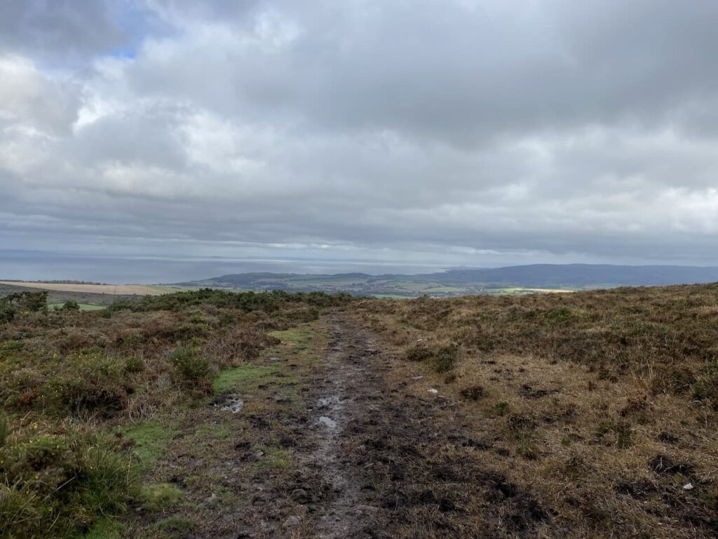
This is open access land and there is a wide choice of routes made by cattle and people. One route I choose is blocked by cattle. They seem very docile, but I decide to be cautious because I am always wary of cattle when I have Crosby with me. I take one of the other multiple options and carry on uphill skirting the cattle to eventually reach the route of the South West Coast path on Bossington Hill.
Turning right I follow the way-markers for this long distance trail. Soon Selworthy Beacon comes into view and then at a fork in the path I go to the right to leave the South West Coast path and continue uphill to reach the trig point besides the beacon.
It is an absolutely cracking day, there is a chilly breeze but it is mitigated by the warmth of the sunshine and the stunning views. I follow a track heading toward North Hill with views of the Quantock Hills in the distance.
The track leads towards a parking area and soon after passing through it I take a path on the left. This heads north and rejoins the South West Coast path where I turn right and soon go through a gate into an area of pasture.
The path ontinues with a fence and hedge on the left to reach another gate. Here I leave the pasture and continue on the South West Coast Path as it goes east across North Hill. This is an exposed spot and there is a stiff breeze, but despite it being late afternoon the sun continues to provide some warmth.
There are a network of paths that would take me back towards Minehead, but after passing a parking area I leave the South West Coastal Path and continue heading east towards woodland.
On reaching the trees I continue straight on until I reach a fork in the path, here I go to the left and descend towards a gate and then continue on the path going steadily downhill.
There are multiple paths in the trees that zig zag down through the woods. I take one that brings me down to the sea front by a park. From here I walk along the road to pass the Lifeboat Station and the Old Ship Aground pub and reach the harbour and beach.
From the seafront I turn towards the centre of Minehead and then follow the roads leading back to the caravan site. It has been a cracking day for walking and I have covered fourteen and a half miles. I am hoping that the weather is as good for another long walk tomorrow.
All information on this site is provided free of charge and in good faith and no liability is accepted in respect of damage, loss or injury which might result from it. To the best of my knowledge the routes are entirely on public rights of way or within areas that are open for public access. Walking can be hazardous and is done entirely at your own risk. It is your responsibility to check your route and navigate using a map and compass.
After a couple of days walking Lynnie has decided that Crosby and I should head out on our own today. I have long planned a walk to the top of Dunkery Beacon from Minehead. I’ve walked up Dunkery Hill on a number of occasions but never from Minehead.
Leaving the site I turn left and walk uphill along the pavement besides the A39, Hopcott Road. On reaching The Hopcott I turn left to follow the narrow tarmac lane as it heads steadily uphill passing Higher Hopcott and then reaching woodland.
I ignore footpaths leading off from the road until I reach an information board for Dunster Woods.
I take the uphill path to the right of the information board on the route of the Macmillan Way West. I ignore a path on the right soon after leaving the car park and then where the Macmillan Way meets a crossing of tracks I continue straight on, staying on the route of the long distance path. The path now goes around the head of Long Combe, this is a cracking spot with stunning Beech trees lining the path.
Leaving the trees the path continues through a section of open land with dead bracken and gorse. On reaching a junction of tracks we turn right still on the route of the Macmillan Way West heading towards Tivington across the top of Hopcott Common. At a fork in the track I go left to keep with the Macmillan Way West. There are good views from here back along the coastline towards Blue Anchor.
I continue to head west to another crossing of paths. The Macmillan Way turns left towards Wootton Courtney, however, I keep going straight ahead soon reaching an Ordnance Survey trig point tucked to the left of the track on a high bank. This trig on Periton Hill is one which I have bagged a number of times.
I continue straight on through an attractive area of woodland.
On reaching another junction of paths I turn left on a track leading to Roadway Lane.
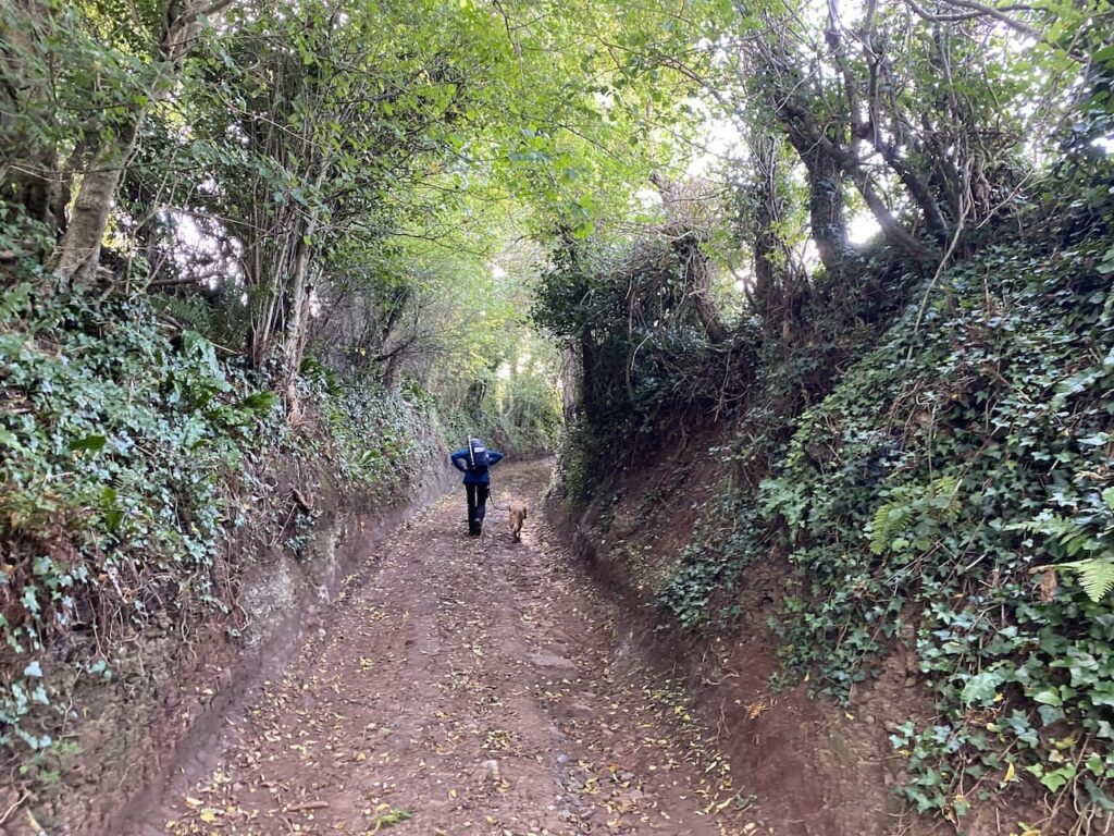
Joining Roadway Lane I follow this ancient track as it heads downhill to Wootton Courtenay.
Arriving in the village I turn right and then after 100 yards at a junction I fork left onto Brockwell Lane towards Brockwell and Ford.
I now stay with this lane to reach Brockwell Farm and then as the road sweeps to the left I continue straight on to join a footpath signed to Dunkery Beacon.
There are a couple of paths here but I follow the one heading south west which soon leads through an attractive area of beech woodland.
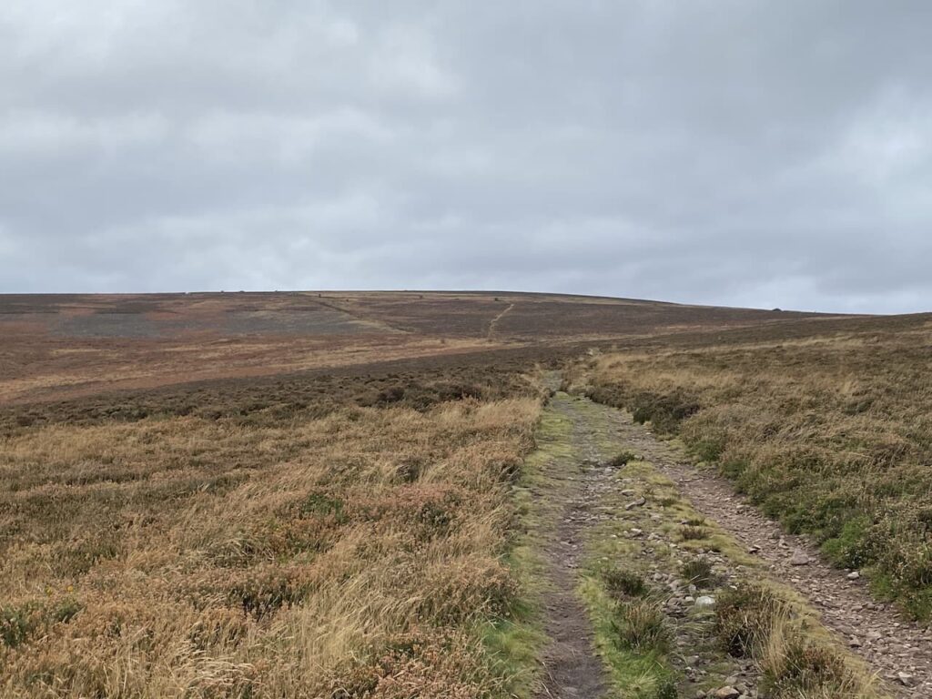
At a crossing of paths I continue straight on through the trees to reach the edge of moorland. Here I keep heading in a south westerly direction and start the gradual ascent of Dunkery Hill.
It is a long steady two mile up hill to Dunkery Beacon but I appear to have the hill to myself so I can enjoy the solitude.
After crossing a minor road I continue uphill along a broad track with the beacon in view in the distance.
As I near the beacon I stop to check out the toposcope. I have been here a number of times, but previously the visibility has been poor.
On every occasion I have been here there has been a chill wind blowing and today is no exception. This hill stands at 1,705 feet and is very exposed.
From the beacon I take a grassy path which heads north as it descends the hill.
After a couple of hundred yards I take a path on the right which heads north east towards a minor road.
Nearing the road I turn left on a path which initially runs parallel with the road but then joins it and continues downhill to Webbers Post Car Park.
From the car park I join the route of the Coleridge Way. This trail covers the fifty miles from Nether Stowey, on the east side of the Quantocks, to Lynmouth linking locations associated with the poet Samuel Taylor Coleridge.
I stay with the way-markers until I reach Jubilee Hut. This is a weather hut thought to have been built originally by the Acland’s who owned Holnicote Estate. Built in celebration of Queen Victoria’s Diamond Jubilee it became known as the Jubilee Hut. During World War II it was used as a look out post, but then fell into disrepair and collapsed in the winter of 1946. The National Trust have rebuilt it, following the original design, facing four directions it always provides shelter from wind and rain.
At the hut I leave the Coleridge Way and take a footpath on the left which soon descends steeply towards Horner Water.
On reaching the water I cross on a footbridge and turn right along a track heading towards Horner with the water flowing to my right.
After crossing a bridge I turn left along a minor road and walk through Horner.
I stay with this road heading towards West Luccombe until I reach a footpath on the right which is opposite a campsite on the left. The path goes through a gate and across a field heading east to a band of trees.
After going through a kissing gate I continue along the edge of a field and then pass through two more fields to reach a minor road where I turn left and follow this lane to Piles Mill. This 16th century mill was originally a corn mill and then between 1930 and 1940 it was used for cider making. Now it is run by the National Trust.
With care I cross the A39 and walk into Brandish Street and turn left to follow a lane to Higher Allerford. Here I turn right to follow a track signposted to Selworthy. This route heads steadily upwards along the track towards Selworthy.
At a junction of paths I turn left and go through a gate to head uphill through Holnicote Combe. Despite walking a lot in this area this is the first time I have walked through this attractive combe.
At the top of the combe I reach a minor road where I turn right and then very quickly take a track on the left leading to Selworthy Beacon.
From the Beacon I follow a track heading east across North Hill. There are a number of paths up here but I know as long as I head east and keep the minor road somewhere to my right I will be fine.
The track leads towards a parking area and soon after passing through it I take a path on the left. This heads north and rejoins the South West Coast path where I turn right and soon go through a gate into an area of pasture.
The path continues close to the road to reach another gate, now I keep going east to reach another parking area. From here I follow a waymarked path indicating it is two miles to Minehead.
During World War II North Hill was requisitioned and local farms evacuated so the area could become the Minehead Armoured Fighting Range. It is not long before I start to see signs of the construction that took place to enable the tank movements and the strategically placed Radar Station. This station was built in 1942 and formed part of a network of 244 similar stations across the Country constructed between 1937 and 1944.
The purpose of these stations was to plot the German Luftwaffe aircraft and guide British pilots. During World War II Lynnie’s mother was stationed in a unit like this in South Devon.
I now continue along a track which leads into woods above Culver Cliff.
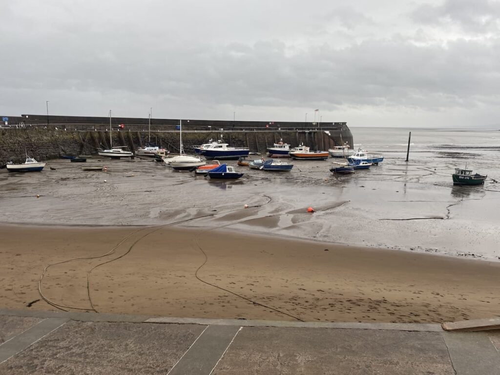
There are an extensive network of paths that zigzag down through the trees. I know that as long as I keep descending and follow the way-markers towards Minehead I will eventually end up in the town. The route I take arrives at the sea front by a park where I then walk besides the road to reach Minehead Harbour,
From here it is a case of following the roads through Minehead to return to the caravan site to find out how Lynnie has spent her day.
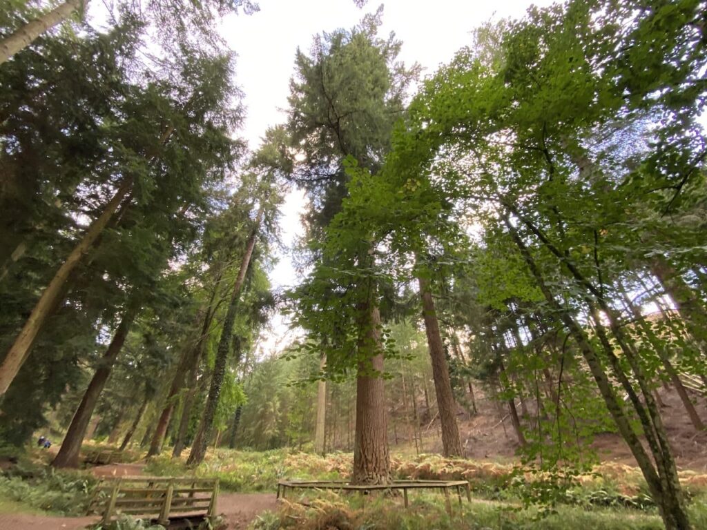
Four years ago I did an interesting walk from the delightfully named Nutcombe Bottom to Withycombe Common and on my return went close to the site of the tallest tree in England. However I decided not to visit the tree because I thought I would save it for a day when Lynnie was walking with me. Today we are going to combine the visit to the tree with a variation on my previous walk in this area.
Today’s walk starts just south of Dunster in the car park at Nutcombe Bottom, (OS Grid Ref: SU977423). We start by heading south through Nutcombe Bottom and gradually ascend into Hats Wood.
There are a network of tracks and paths in the woods but we keep heading south crossing a couple of tracks to reach Broadwood Plantation where the track sweeps in a south-easterly direction to reach a crossing of tracks. Here we go to the left and head east on a track that follows the contour line around a hill.
We stay with this track as it sweeps around Longcombe Hill and then heads south towards Long Wood. I recall from the last time I was walking here that one of the features of walking in these woods is the wood carvings created from old tree stumps.
This is another track where paths lead off to either side, but we stick with it going towards the south until we reach a crossroads of tracks where we turn left and go east towards Withycombe Common.
Emerging from the trees we keep going east to reach a point where six paths meet on the edge of Withycombe Common. Here we take the broad stony track heading up onto the Common.
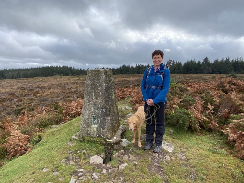
Reaching the brow of the hill we leave the track to walk the few yards to reach the Withycombe Common OS trip pillar. I have previously bagged this trig but it is the first time Lynnie has been up here so much to Crosby annoyance we stop for the obligatory trig picture.
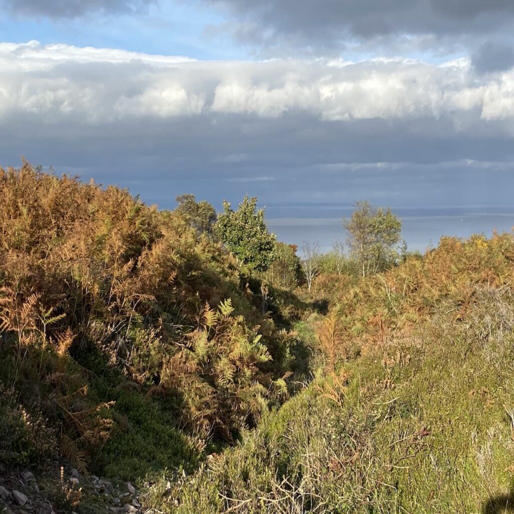
There are far reaching views along the Somerset coastline as we start to descend towards Rodhuish Common.
At a crossing of tracks on the edge of Rodhuish Common we keep heading east to follow a muddy path across the common. It looks like this path has been churned up by a number of horses, making it hard going for two legged creatures.
At the edge of the common we head towards a gate and join a track heading towards Rodhuish Cross.
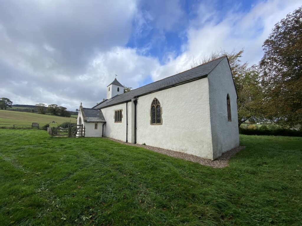
On joining a minor road we turn right and continue to Rodhuish Cross where we turn right again and then at a fork go left to follow the lane to reach the delightful, small 15th century church of St Bartholomew.
This small church is equally attractive inside as it is from the outside. After a brief internal visit we settle down on a bench besides the church to eat our lunch.
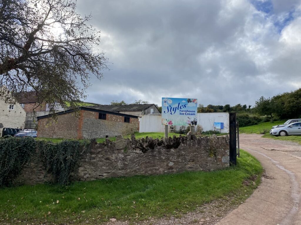
Refreshed we continue south along the road and follow it as it bends around Style’s Farm. There is a sign advertising their ice cream, this is not an ice cream Lynnie has knowingly tasted. So she makes a note to try it the next time we spot somewhere selling it.
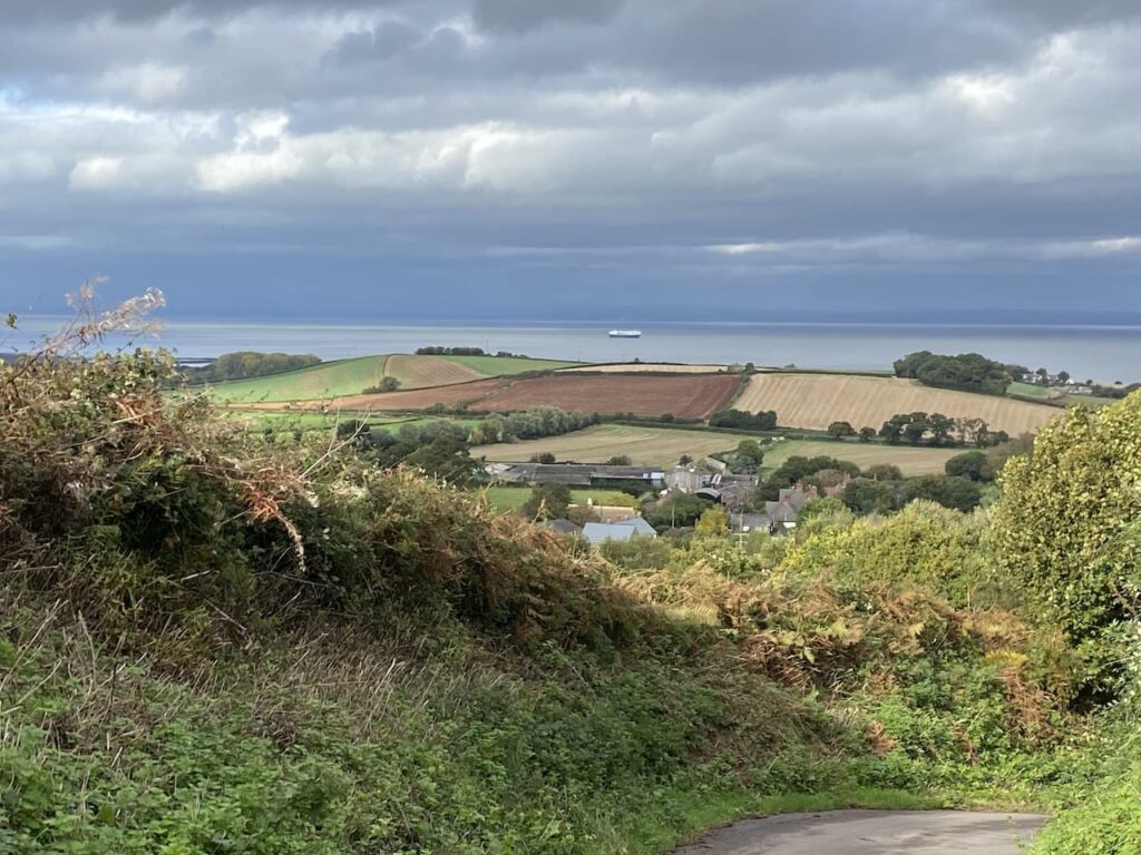
At the next junction we take the lane on the left (Sandrocks Lane) to head north. As the path descends towards Withycombe there are good views across the Bristol Channel.
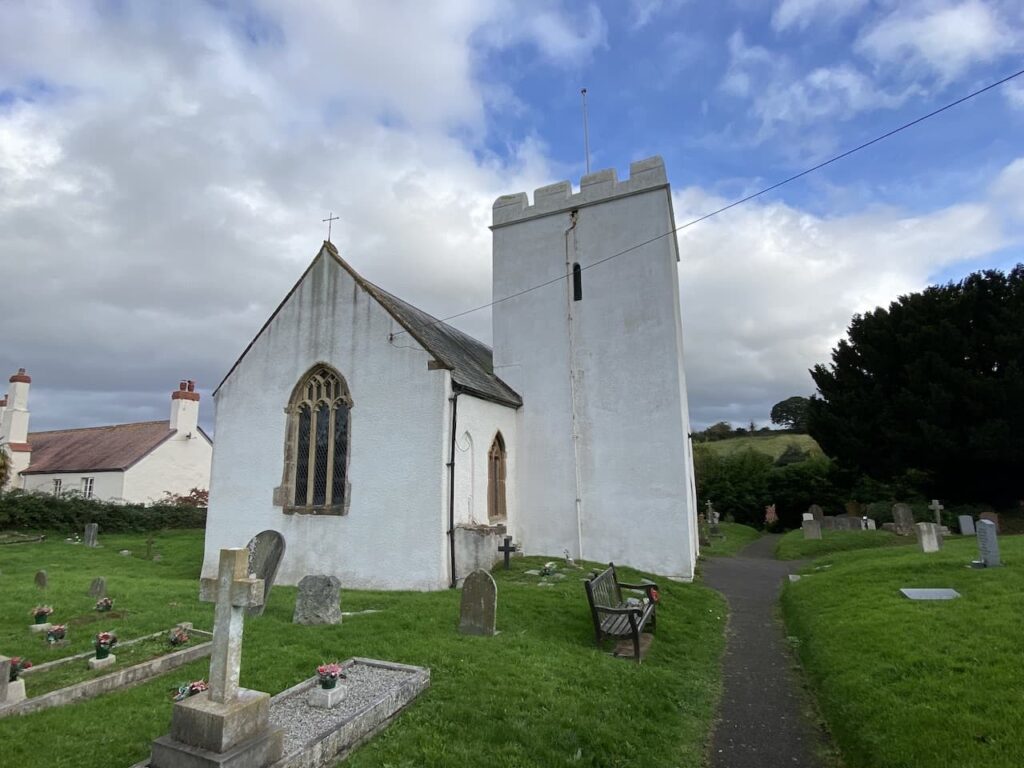
At a junction we turn left and continue downhill into Withycombe. After crossing a footbridge besides a ford we turn right to reach St Nicholas’ Church.
We take a look inside the church and are drawn to the effigy of a woman lying in a window. Either side of the effigy are elaborately carved turrets and the effigy is holding a box across her chest. I later read that this is thought to signify that only her heart is buried in the location.
From the church we take the left fork to join Withycombe Lane and follow this out of the village and then as we near the outskirts of Carhampton we take a drove on the left (Hill Lane) and follow this towards Withycombe Hill.
At a junction of tracks we continue straight on still heading up Withycombe Hill, it is a long steady haul.
As the path starts to level we reach open access land. Here we follow a track with open heathland too our left and a plantation to our right.
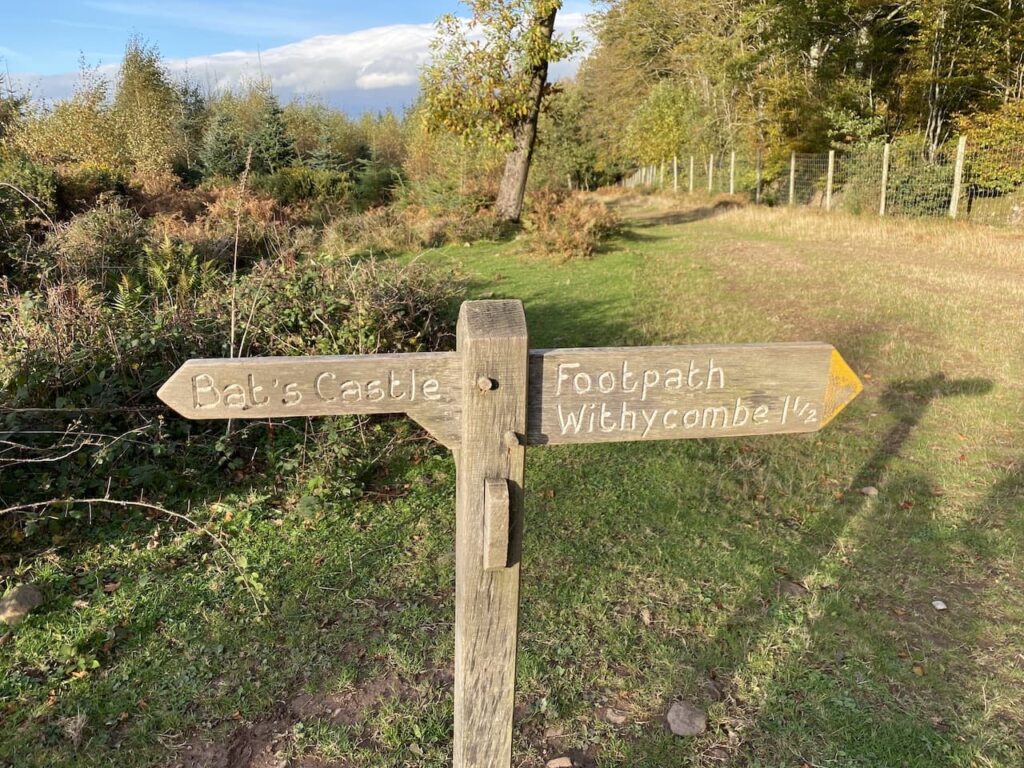
On reaching Withycombe Hill Gate we take a path to the left heading towards Bat’s Castle.
We are now heading west. It is cracking winter’s afternoon, a chill in the air is compensated by bright skies with a bit of warmth from the sun. The path leads to the ramparts of the Iron Age hillfort at Bat’s Castle.
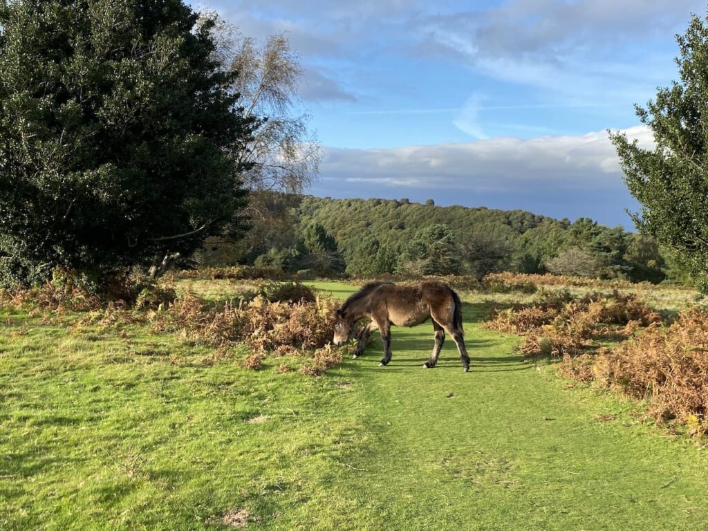
The path passes through the centre of the hillfort and then descends before rising again to reach Gallox Hill where we encounter Exmoor ponies grazing beside the path.
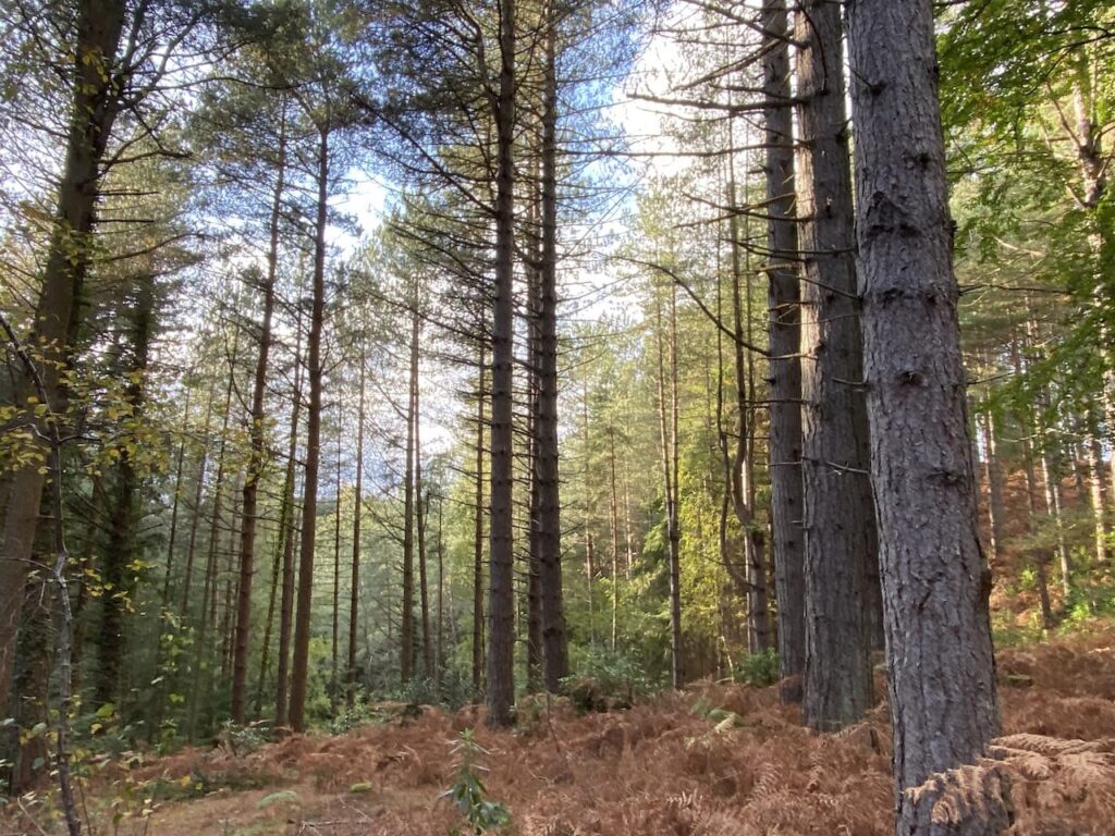
The path descends to a gate where we turn left and follow a clear path descending through coniferous trees.
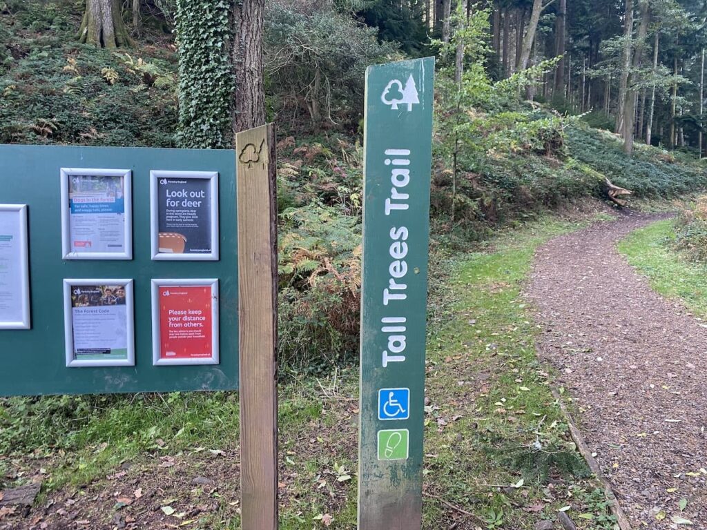
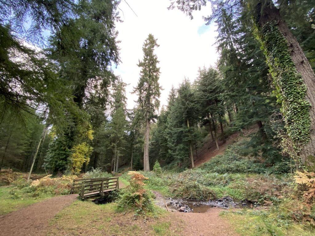
We continue through the trees and then reach a track which leads to a parking area for the Tall Tree Trail. Here we take the Trail path on the left which follows the stream.
The trees in this section of woodland are mainly Douglas Firs planted in the 1870s.
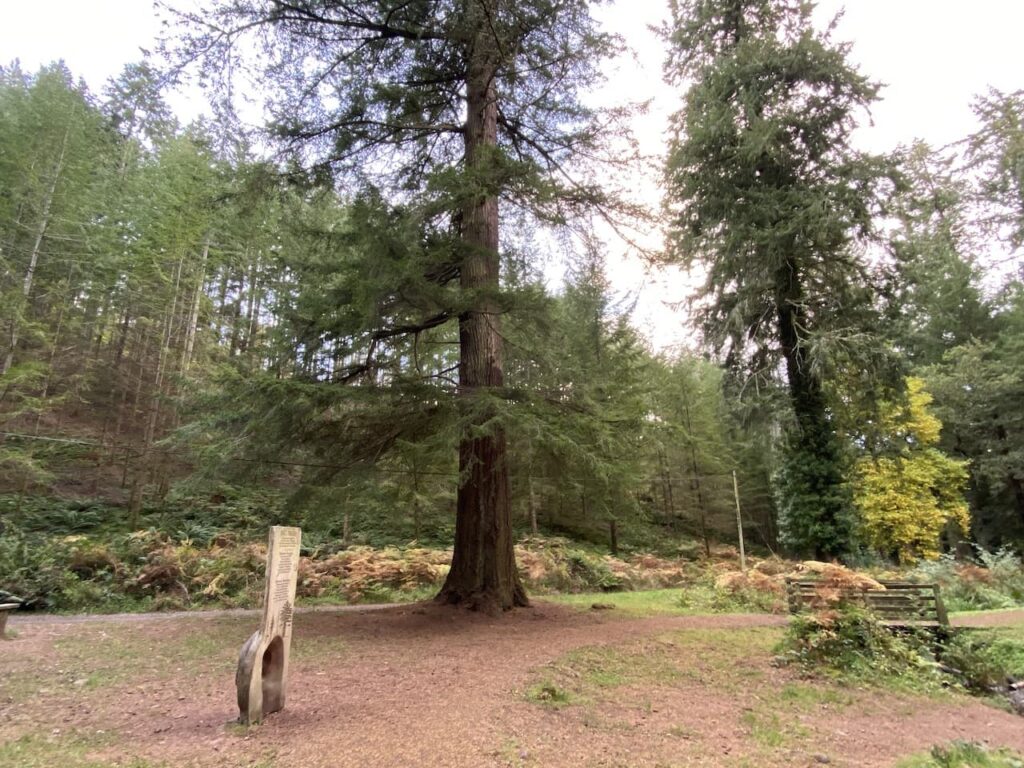
Fortunately we have chosen a very quiet afternoon to visit this spot. I imagine it would be packed in the tourist season or school holidays, but today we have the place almost to ourselves. On a day like this it is a special place.
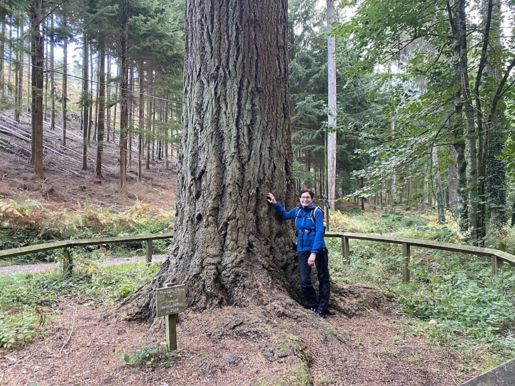
The tallest of the trees in this woodland is a Douglas Fir which reportedly is 197 feet tall. It is easy to identify because it is the only tree with a wooden surround. It also lays claim to being the tallest tree in England.
The only problem when trying to photograph a tall tree is the angle you need take the picture, consequently making the tree look pretty average in size.
Returning to the Tall Tree car park we turn left and follow a path leading back to our starting point in Nutcombe Bottom car park. It has been a cracking walk covering just over eleven miles.
All information on this site is provided free of charge and in good faith and no liability is accepted in respect of damage, loss or injury which might result from it. To the best of my knowledge the routes are entirely on public rights of way or within areas that are open for public access. Walking can be hazardous and is done entirely at your own risk. It is your responsibility to check your route and navigate using a map and compass.
Last year when staying at Minehead I walked over to Selworthy to meet up with a Twitter buddy, Sarah, at Periwinkle Cottage Tea Rooms. My meeting someone I met on social media didn’t concern Lynnie, however, going to a tea room without her was frowned upon. So today I am putting things right and we will stop for tea and scones at this excellent tea room.
Leaving the site we turn left and walk uphill along the pavement besides the A39, Hopcott Road. On reaching The Hopcott we turn left to follow the narrow tarmac lane as it heads steadily uphill passing Higher Hopcott and then reaching woodland.
We ignore footpaths leading off from the road until we reach an information board for Dunster Woods. Now we take the uphill path to the right of the information board on the route of the Macmillan Way West. We ignore a path on the right soon after leaving the car park and then where the Macmillan Way meets a crossing of tracks we continue straight on, staying on the route of the long distance path. The path now goes around the head of Long Combe, this is a cracking spot with stunning Beech trees lining the path.
Leaving the trees the path continues through a section of open land with dead bracken and gorse. On reaching a junction of tracks we turn right still on the route of the Macmillan Way West heading towards Tivington across the top of Hopcott Common.
At a fork in the track we go left to keep with the Macmillan Way West. There are good views from here back along the coastline towards Blue Anchor.
We continue to head west to another crossing of paths. The Macmillan Way turns left towards Wootton Courtney, however, we keep going straight ahead soon reaching an Ordnance Survey trig point tucked to the left of the track on a high bank. This trig on Periton Hill is one which I have bagged a number of times.
At the next crossing of footpaths we continue straight on through an attractive area of trees.
On reaching another junction of paths we follow the way-marker towards Headon Cross and soon pass a National Trust plaque and enter Holnicote Estate.
Within a short distance the track forks and we go right continuing towards Headon Cross with the path leading through the cracking woodland of Tivington Common.
Our route descends gradually, but as we near Headon Cross there is a short steep descent to reach a minor road. Turning right on the road we reach Headon Cross and go straight over to take the minor road opposite. This climbs steadily, as the road sweeps to the right we continue straight on along a track towards East Lynch. From here there is a good view of Dunkery Hill.
Approaching East Lynch Farm we take a footpath on the right, this runs behind a fine old barn. We stay on the wide grassy track as it sweeps by farm cottages, ignoring a footpath on the left and continuing uphill. On reaching a minor road at Deans Cross we turn left and follow the road downhill into Selworthy for Lynnie’s long awaited tea and scones.
Refreshed we head back up through the gardens of the tea room to the War Memorial and then take the footpath on the left, soon heading into the attractive Selworthy Combe. Where the track forks we go left to go over a bridge and follow the path as it heads uphill through the trees. Our route continues steadily uphill on an attractive path through the trees. Nearing the minor road at the top of the hill we turn left along a grassy track.
We follow the path to reach the Memorial Hut, erected in 1878 by John Barton Arundel Acland the youngest son of Thomas Dyke Acland (1787 -1871). One of the inscriptions inside reads “In remembrance of the father who during more than fifty years took Sunday walks up this Combe with his Children and Grandchildren training them in the love of nature and of Christian poetry this Wind and Weather hut was built”.
From the hut we walk uphill to a minor road and cross to follow a track leading uphill to Selworthy Beacon.
From the trig point we take a path heading east on a track running close to the road.
After going through a gate near a cattle grid we continue through an area of pasture.
The path continues close to the road to reach another gate, now we keep going east to reach another parking area and then keep going to another car park close to woodland. Here we veer to the left and take a path going east through trees and passing concrete bases that housed Nissen huts during World War II. Apparently the American Forces had a NAAFI in one of the huts on this hill.
We carry on until we reach a fork in the path, we go to the left and descend towards a gate continuing steadily downhill on the path.
There are multiple paths in the trees that descend towards the seafront. We stay with one that goes straight on to reach a tarmac lane and turn left, soon joining the Zig Zag path, enjoying views of the sea as we descend to the seafront.
At the bottom of the path we turn left and pass cottages to reach the seafront by the sculpture marking the start, or end, of the south west coast path. From here we turn right and wander through the streets of Minehead to get back to the caravan site.
All information on this site is provided free of charge and in good faith and no liability is accepted in respect of damage, loss or injury which might result from it. To the best of my knowledge the routes are entirely on public rights of way or within areas that are open for public access. Walking can be hazardous and is done entirely at your own risk. It is your responsibility to check your route and navigate using a map and compass.
Almost exactly a year ago I took a trip to Minehead CAMC without Lynnie. She decided to stay at home whilst Crosby and I walked on Exmoor. During the week I did a number of cracking walks I had not previously done. This year I have persuaded Lynnie to join us, I am not sure whether it was the thought of some new walks or the promise of visits to a few tea rooms that temped her. I am pretty sure it was the latter.
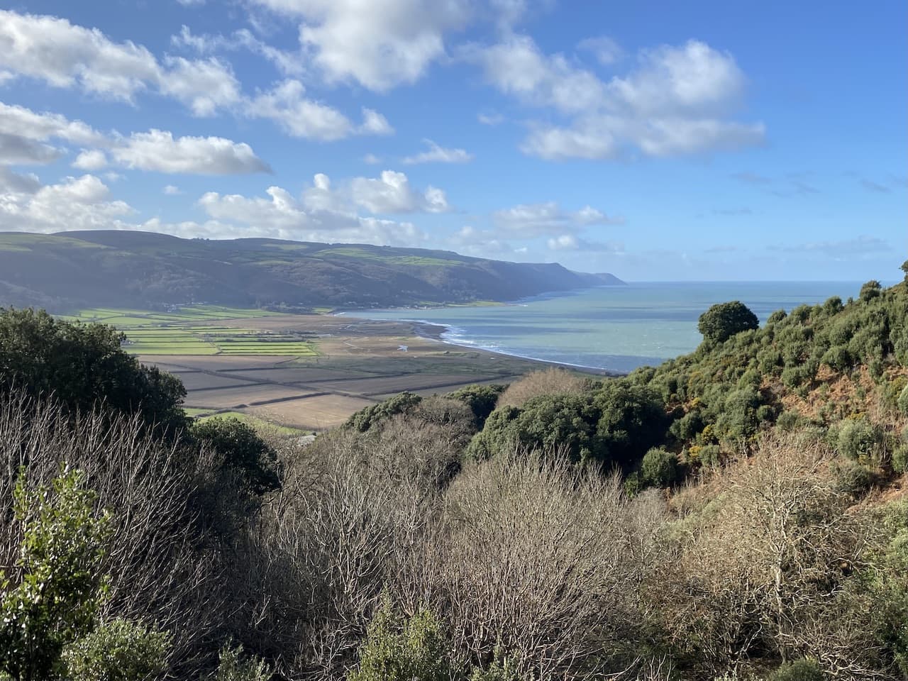
The final walk on my last trip was a stunning, circular walk from Bossington visiting Porlock Weir, Culbone Church, Worthy Wood and Porlock. At around 12 miles it is an acceptable distance for Lynnie and is a new walk she is keen to do. Our starting point is the National Trust car park in Bossington (TA24 8HF) (Grid Ref: SS898479).
From the car park we join the road and turn right and at a junction continue on a right fork to head along a dead end lane passing Bossington Farm and heading towards the beach.
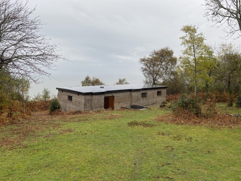
On the beach we turn left towards a World War II pillbox.
Just a bit further along is an impressive disused lime kiln. This is the last remaining one of four kilns on this beach and is thought to have been built in the early 1800’s.
Close to the lime kiln is another pillbox, this one is a bit further inland and looks better protected from the ravages of the sea.
From the pillbox we take a path that goes beside a wall over marshy pasture and then at a junction of paths we turn left and follow a raised walkway across the salt marsh heading inland. There are cracking views of Bossington Hill from here.
At a junction of paths we turn right and follow the route of the South West Coast Path towards Porlock Weir. After crossing a footbridge over a stream we reach a memorial to the crew of an American Liberator bomber that set off on 29th October 1942 from Holmsely airfield in the New Forest as part of an anti-submarine patrol in the Bay of Biscay. On its return flight it encountered bad weather and clipped Bossington Hill. The plane crashed on the marshland and eleven of the twelve man crew lost their lives.
We continue on the path through the petrified remains of ancient woodland on the marshes which formed part of a submerged forest.
We stay with the coastal path way markers and soon follow a shingle bank heading towards Porlock Weir.
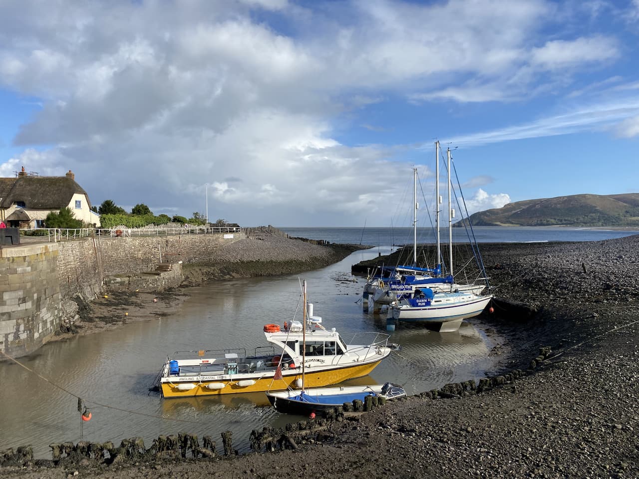
As the path reaches a road we turn right and wander into Porlock Weir passing the Ship Inn, or Bottom Ship, as it is known. This is because there is also a Ship Inn in nearby Porlock.
A bit further on we reach the harbour. There was once a thriving industry here catching Oysters and the harbour was also visited by herring fleets. These days the fishing industry is small, the harbour is mainly occupied by pleasure vessels, though oyster farming was revived in 2013 and they can be purchased at the harbour.
It is a pleasant, sunny, autumnal day and we decide to stop at a picnic bench beside the harbour and get a pot of tea from a cafe situated in the converted barns. Lynnie seizes the opportunity to look at the crafts in the gallery.
Refreshed we resume our walk and take a footpath on the left just after the barns. This goes up some steps to reach the edge of a field of pasture. Now we follow the way-markers to reach a minor road where we turn right and continue down to the gates of the private toll road at Worthy. This toll road on the Porlock Manor Estate was built in the 1840’s to provide work for local people following the Napoleonic Wars. Originally the tolls were collected at the Ship Inn in Porlock Weir, but these days they are collected at the gates.
Our route continues on the coastal path through the arch to the right of the main gate and then goes steadily uphill passing through tunnels. Apparently early in the 19th century the Earl of Lovelace built a home here for his bride, Lord Byron’s daughter Ada. This was a rambling folly called Ashley Coombe which was demolished in the 1950’s. It is said that these tunnels were built so that Ada did not have to see tradesman delivering goods to her home.
The path steadily ascends through the trees, over time landslips have meant the path has been diverted, there is the occasional section where recent erosion makes the going a bit tricky and the walking poles are deployed for extra stability. After getting the occasional view across the sea to the south coast of Wales we start to descend into the hamlet of Culbone and make our way to the churchyard.
St Beuno’s church still holds regular services and is said to be the smallest church in England seating just 30 people. It is a cracking little church dating back to pre-Norman times, the porch was added in the 13th century.
After stopping for lunch on a bench in the churchyard we leave via a gate leading to a footpath beside a stream and turn right following the way-markers to Silcombe Farm. This path goes by a cottage and then continues up through Withy Combe on a clear way-marked path.
At a junction of paths we turn left and continue heading uphill on a hedge lined track to reach a gate.
After going through the gate we continue along a track besides a field to reach another gate where we join a minor road near Silcombe Farm. Now we turn left and follow this lane, Yearnor Mill Lane, passing a series of entrances to farms, Parsonage Farm, Ash Farm and Yarner Farm. Along the way there are stunning views of the coastline.
We are now on the Coleridge Way, I have walked a number of sections of this 51 mile route which goes from Samuel Taylor Coleridge’s home in Nether Stowey to Lynmouth. It is said that he walked the route frequently to visit friends. Coleridge was mates with William and Dorothy Wordsworth, at the time Coleridge was in Nether Stowey the Wordsworth’s were also in the Quantock Hills at Alfreston, he was also a contemporary of Lord Byron.
We ignore a road to the right to Lynmouth and stay with Yearnor Mill Lane to a junction with Pitt Lane, here turning left we go steadily downhill to reach the entrance to the Worthy Hill Toll Road. The toll road is not accessible to walkers so we take a footpath on the right signed to Porlock. This goes through a gate and joins an attractive track through trees in Worthy Wood.
We are still on the Coleridge Way, but where it veers to the left we stay on the main track at the southern edge of the woods. Then at a fork in the path we go left and continue downhill to a junction of tracks and turn left. At the next junction of tracks we turn right and rejoin the Coleridge Way and follow the track to the Community Hall at Porlockford. Now we turn right up a track besides the hall and then cross a stream at a footbridge on the left.
We are still on the Coleridge Way and follow this towards Porlock. It is a wooded path but we get occasional glimpses of the coastline and Porlock Bay.
The path leads into Porlock where we turn left and wander through the village to pass the Ship Inn, or the Top Ship as it is known. This pub dates back to the 15th century and as you would expect of such an old inn there are many tales of smuggling and other goings on. The pub’s website has tales of its interesting history.
We continue through the village to pass the church of St Dubricius with its unusual spire that appears to have had the top cut off.
From the church we continue along the High Street and then take a left turn into Sparkhayes Lane and follow this out of the village towards the coast. At a junction of paths we turn right to join the South West Coast Path with a cracking view of Bossington Hill in front of us.
We now follow the way-markers back into Bossington to reach our starting point in the National Trust car park. Our walk has covered 12 miles and has gained full approval from Lynnie.
All information on this site is provided free of charge and in good faith and no liability is accepted in respect of damage, loss or injury which might result from it. To the best of my knowledge the routes are entirely on public rights of way or within areas that are open for public access. Walking can be hazardous and is done entirely at your own risk. It is your responsibility to check your route and navigate using a map and compass.