Category: North Yorkshire

  • Reaching 2,019 “Boots On” Miles

    Reaching 2,019 “Boots On” Miles

    It’s 319 days into my challenge to walk 2,019 miles in 2019 to raise funds to support the Trussell Trust and today I should reach my goal.  It became apparent a few weeks ago that I would reach my mileage target in November; it dawned on me that with a little effort the feat could be achieved on one of my favourite walks up Ingleborough.    It would be expecting too much to actually hit 2,019 miles at the summit of Ingleborough, but it will be close to it.

    My walking buddy, Mandy, joins me on today’s walk.  Over recent years we have walked together in various parts of the country, but this will be her first time walking Ingleborough.

    After parking in the Yorkshire Dales National Park car park we start by turning right up Church Avenue, staying on the road to pass the Church of St James.  After crossing a bridge we turn right and stop at the viewing platform for Clapham Falls.  The recent heavy rain has made this an impressive sight.

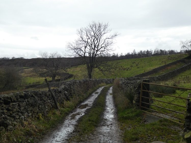
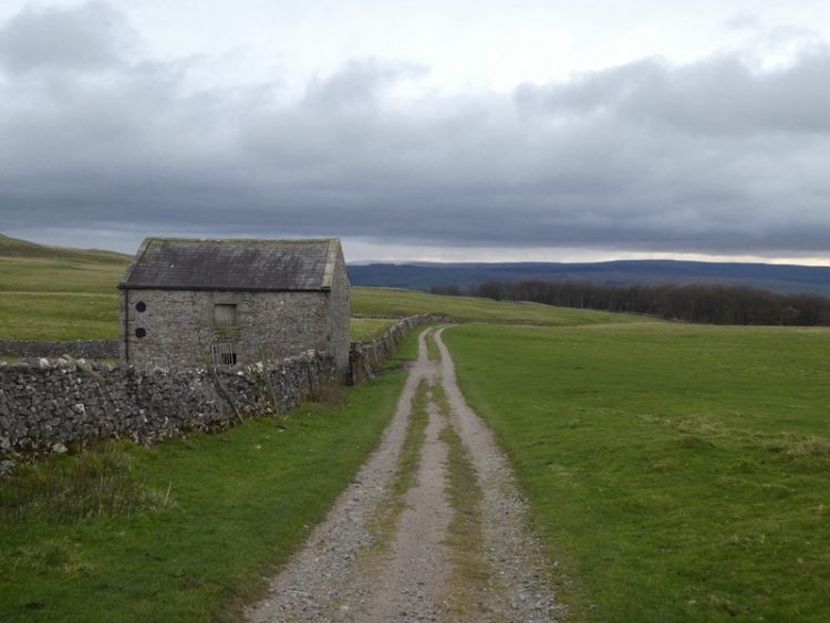
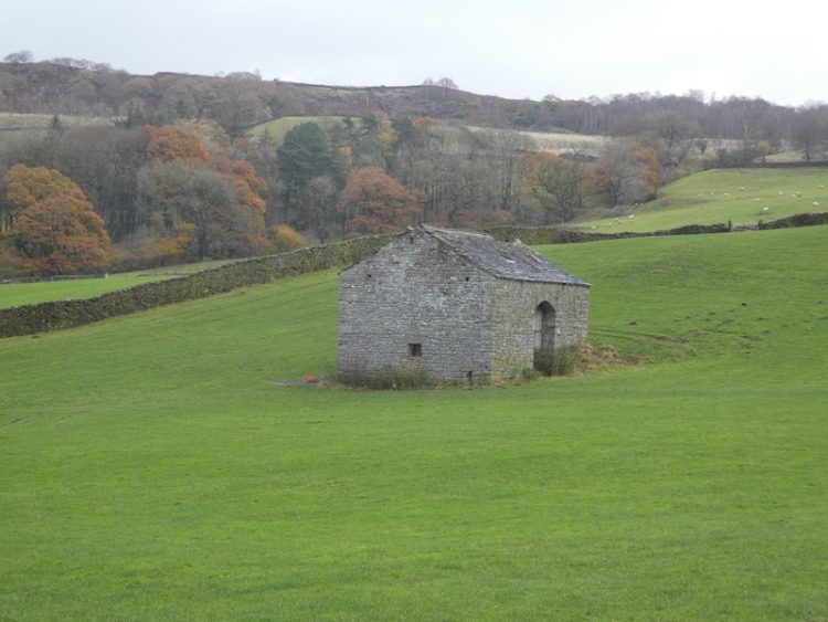
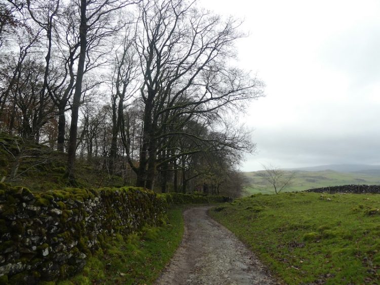
    Leaving the village the route enters the Ingleborough Estate Nature Trail; there is a machine to buy a ticket for the route through the estate.  Years ago when Lynnie and I first did this walk you started alongside the sawmill and dropped your money into an honesty box.  

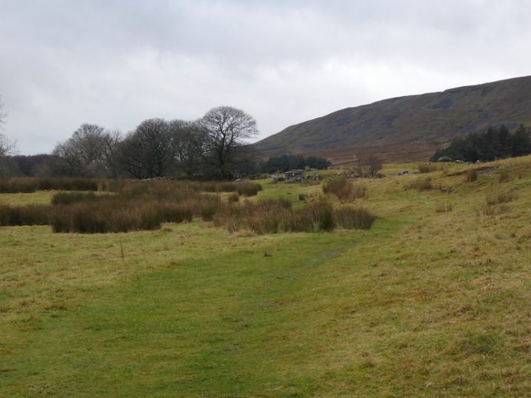
    The path quickly rises and then levels as it passes the man-made lake on the Estate.  This was created in the 19th century to provide drinking water to the village and drive the water turbine installed to provide electricity for some grand properties, the church and street lighting.

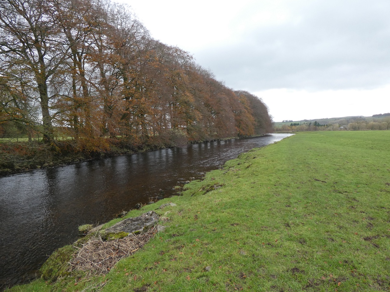
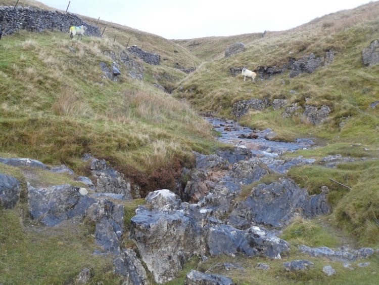
    We pass The Folly and continue on the track to go through a gate and follow the path besides the beck, going by the entrance to Ingleborough Cave.  This show cave is open to the public and apparently gives access to a 500-metre passage. 

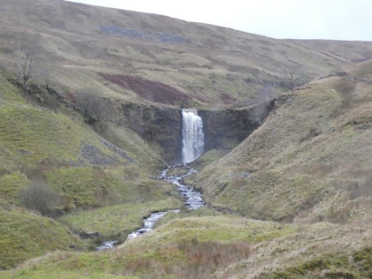
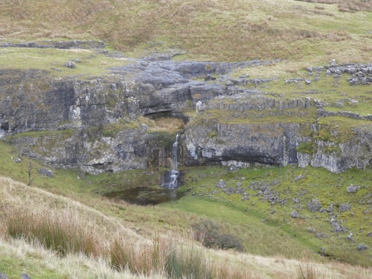
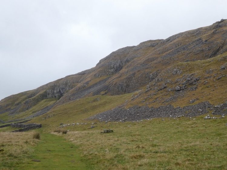
    Alongside the cave, water emerges from the rock face.  It has come off Ingleborough, down Fell Beck and then fallen into Gaping Gill.  The waterfall from Fell Beck to the bottom of Gaping Gill is the tallest unbroken waterfall in England with the water falling 322 feet, however to see it properly you have to descend into the pothole. 

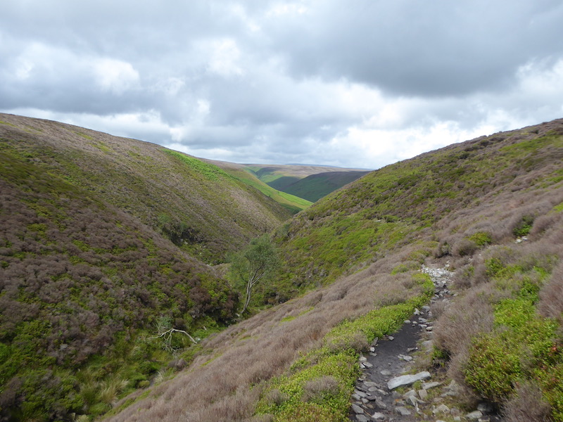
    We follow the track and go through two gates to reach the gorge of Trow Gill, this is a cracking spot.   We clamber up through, taking care on the rocks that are worn smooth by walkers’ hands and feet and made more precarious today as they are damp.

    At the top of Trow Gill we follow the rock-strewn path besides a wall. 

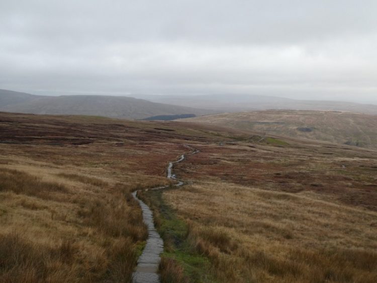
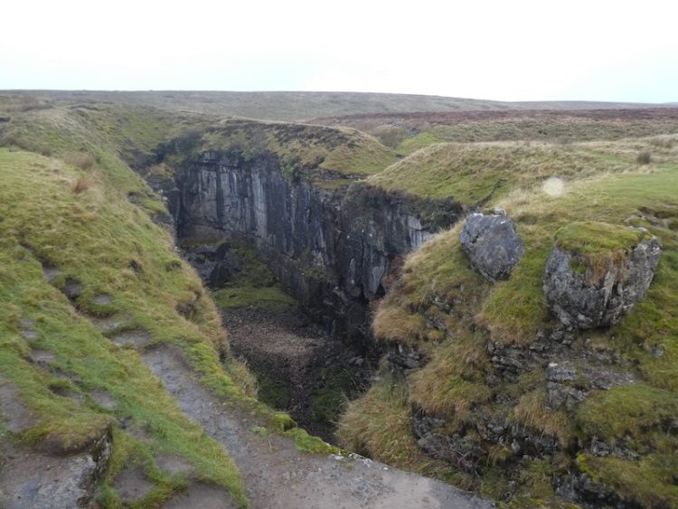
    After going through the wall gates we follow the clear path towards Gaping Gill.  I usually detour away from Gaping Gill to start the ascent of Ingleborough, but Mandy has not been here before and is keen to see this huge pothole. 

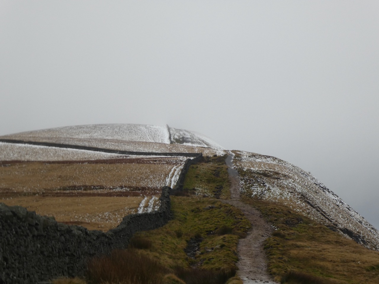
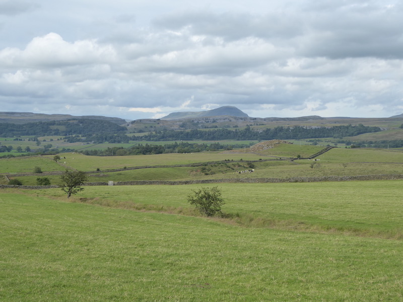
    Resuming our walk we follow the well-used path up Little Ingleborough.  It is covered in cloud and I am worried that when we reach the summit of Ingleborough itself we will not get the views I have promised Mandy.

    This is a good steady climb, as we go up the cloud appears to be lifting and we get stunning views behind us.

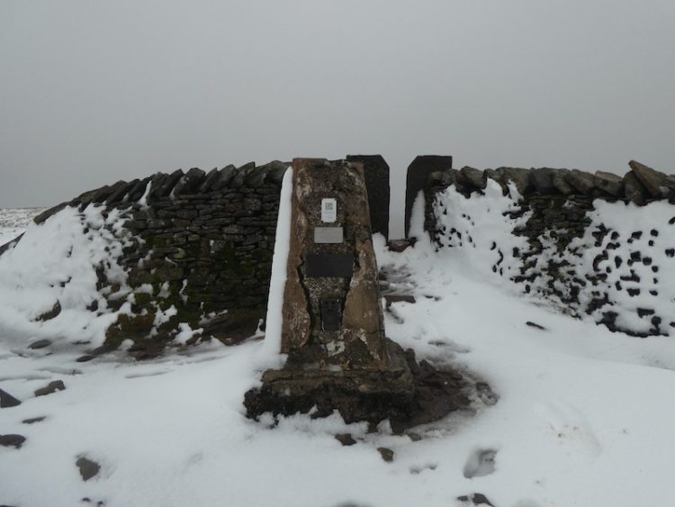
    After reaching Little Ingleborough we follow the well-defined route across the ridge before the final ascent to the top of Ingleborough itself.  At the summit there is the obligatory photo by the trig point and then we wander over to look out over Ingleton.

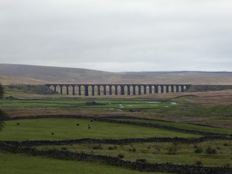
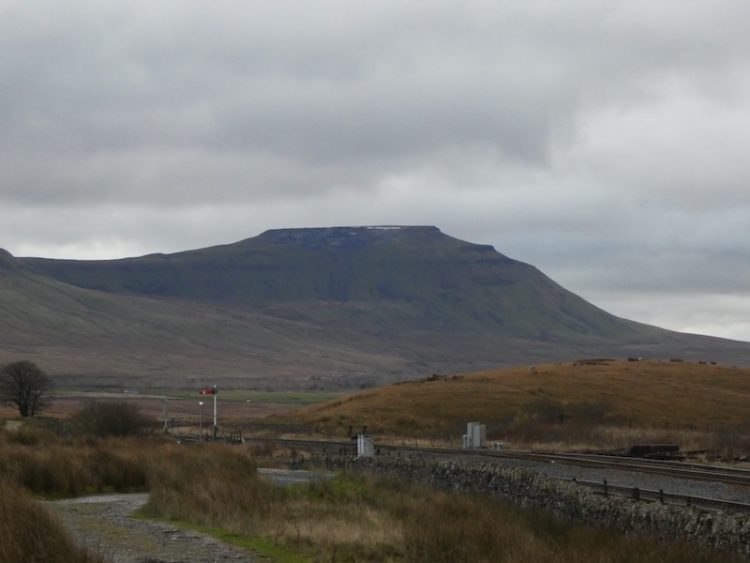
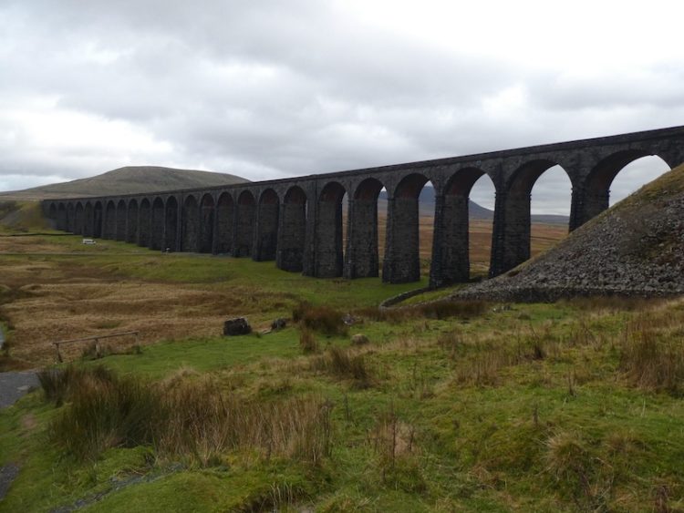
    We hen head back across the summit to view Whernside and the Ribblehead Viaduct.

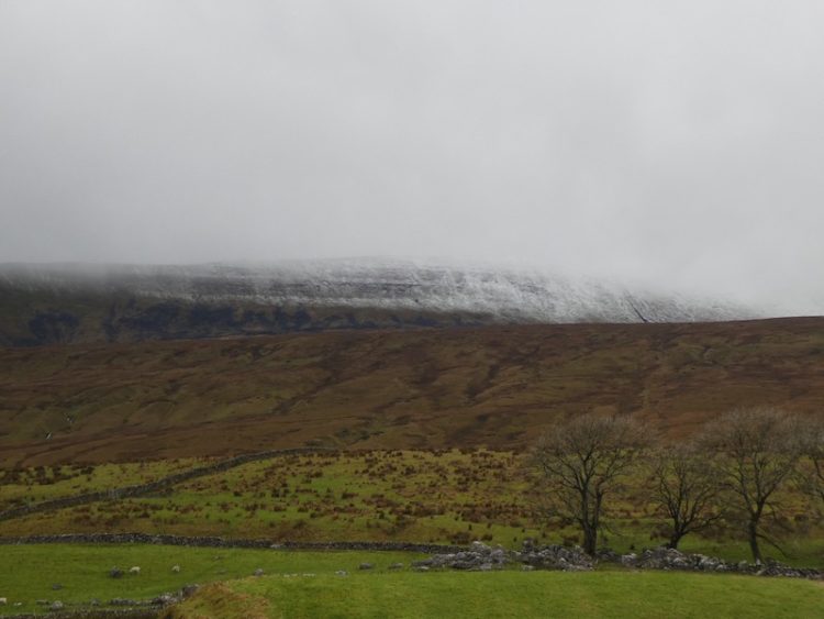
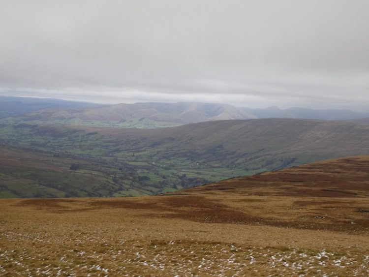
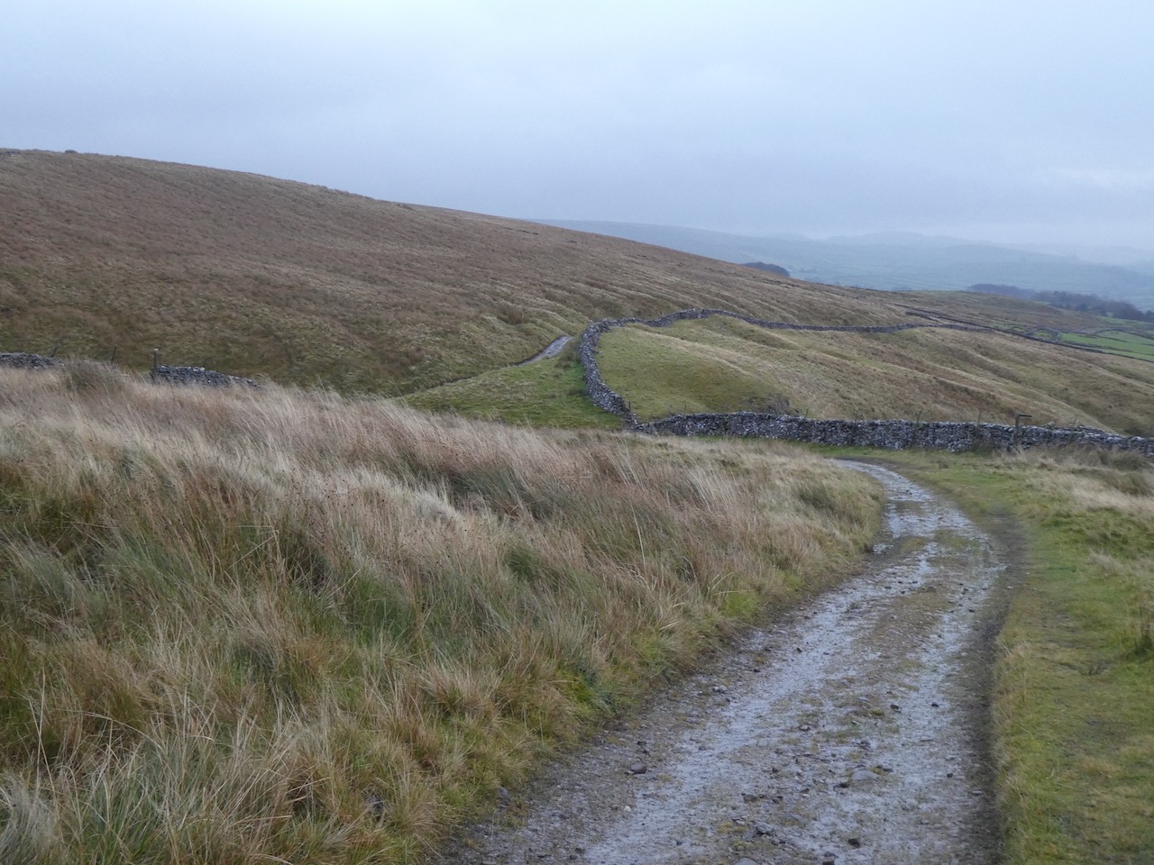
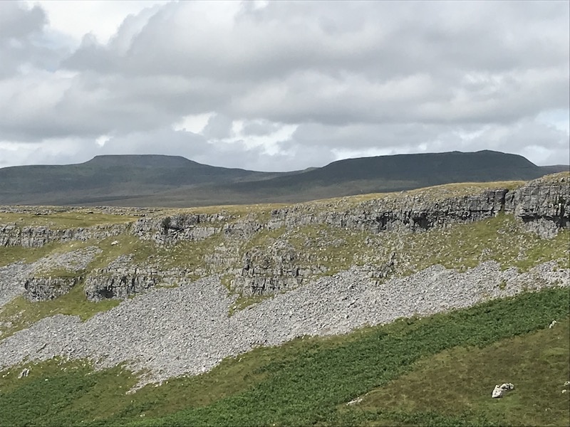
    We descend by clambering down the rocks to take the Three Peaks path towards Horton this is a long steady descent with cracking views of Pen-y-ghent in front and extensive views of limestone pavement.  

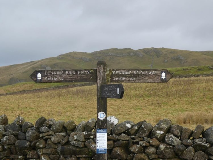
    Our route goes through a short section of limestone pavement and we continue on the Three Peaks path ignoring paths to the left and right.  After going through a gate at Sulber Nick we continue for 250 yards to reach a junction of paths.  Here we turn right, and head south on a path through the pasture to reach a gate in the wall.

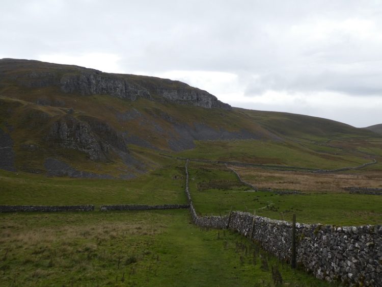
    We now follow the path besides the wall to reach a ladder stile, which we cross and follow a well worn path as it heads in a westerly direction through limestone pavement with occasional grouse butts.

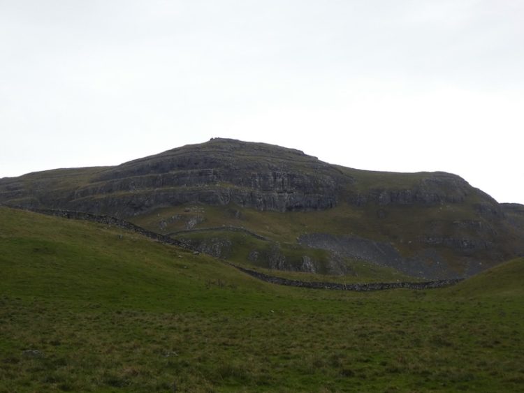
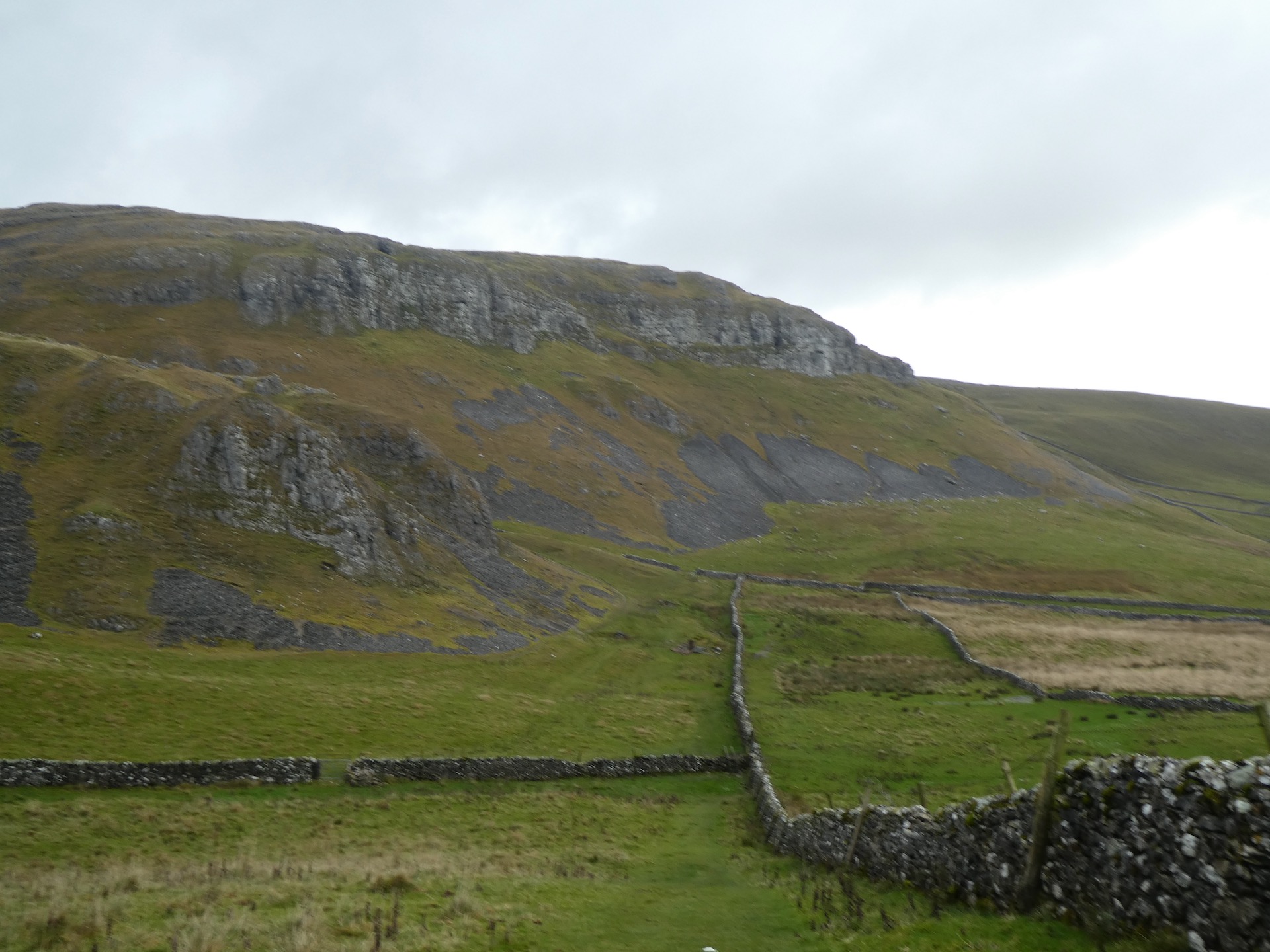
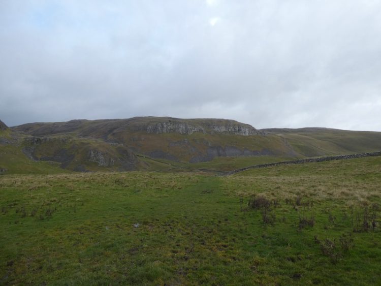
    At the edge of Moughton Scar we stop to take in the stunning view over Crummack Dale  

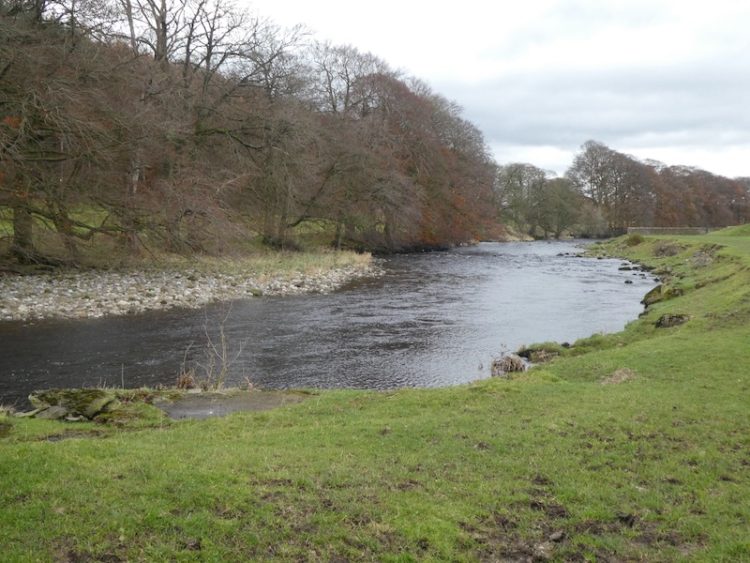
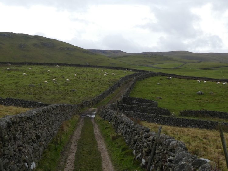
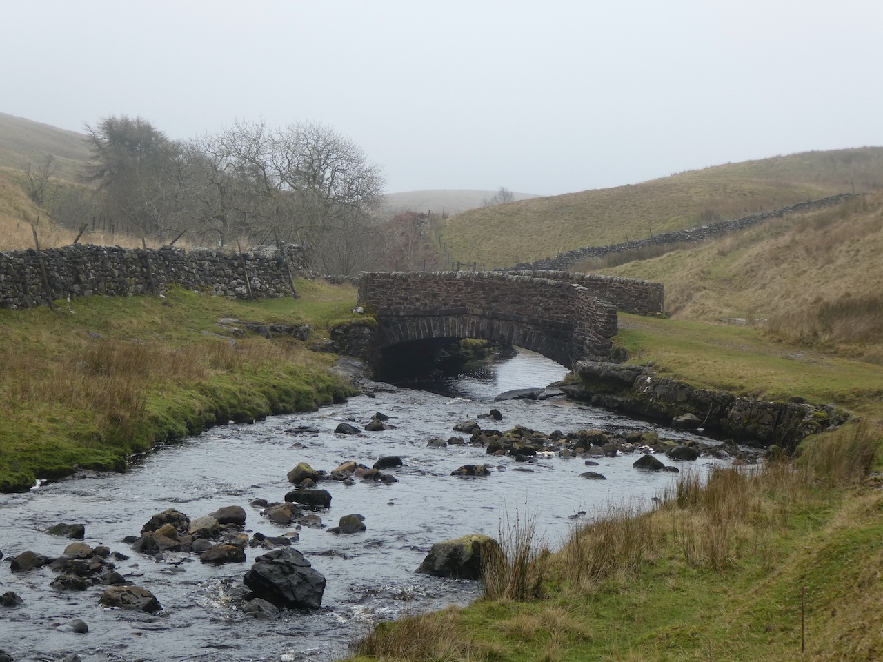
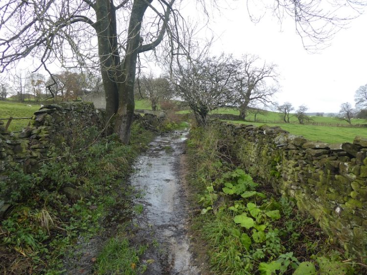
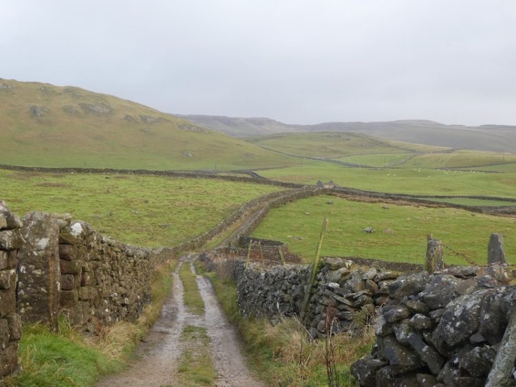
    We now follow the grass path as it descends to a gate and then follow the track as it continues to head down hill with a drystone wall to our right.  As the track bends we ignore a footpath to the right but continue on to go through a gate.  Walls on both sides now line the track and we stay with it until reaching another track.  Here we turn right and walk down to reach Austwick Beck.

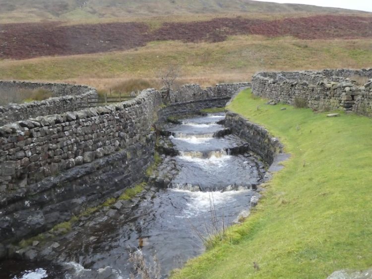
    A notice board explains that this part of the stream is known as the Wash Dub.  Prior to the introduction of chemical sheep dips the process of ridding sheep of parasites was to wash them by immersing them in water and giving them a good rub.  Local farmers would band together to help each other; the beck would be damned and the sheep driven down from nearby pastures.

    It is at this point that my total mileage for the year reaches 2,019.  A cracking spot to achieve my goal. 

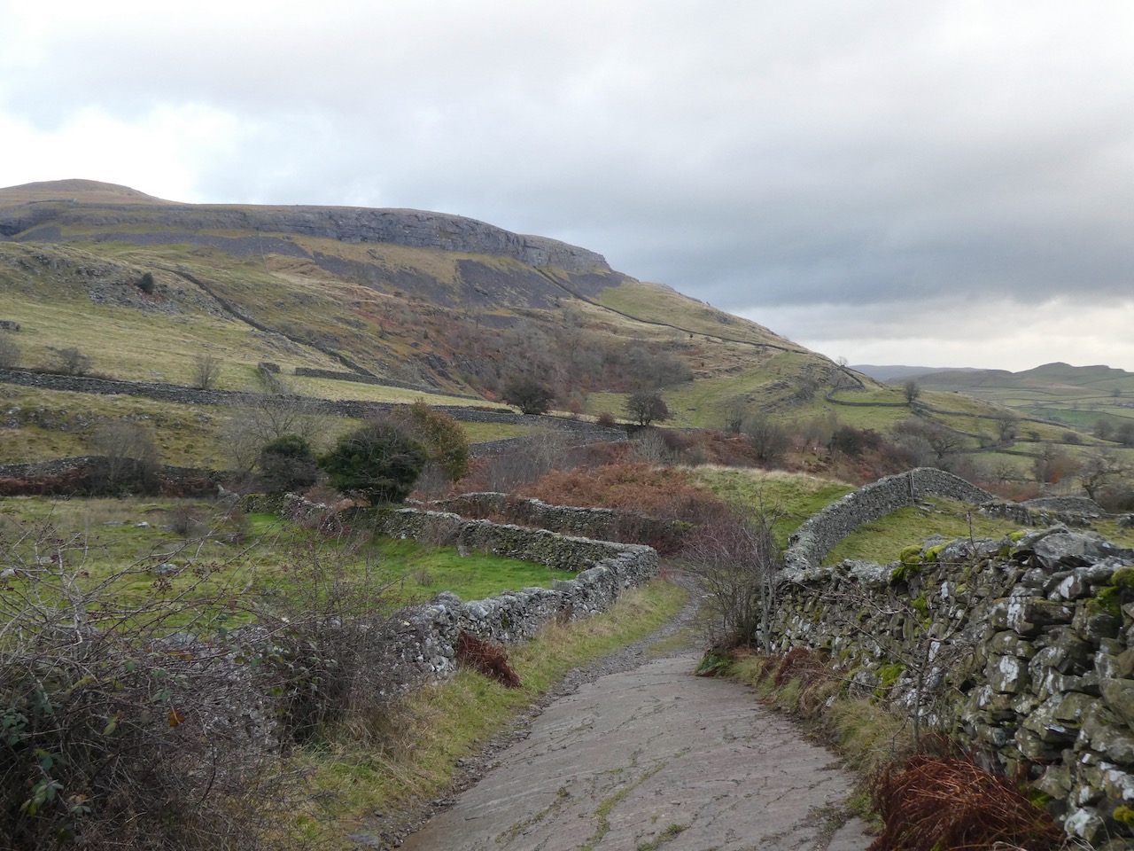
    We cross the beck and continue on the track to reach Crummack Lane, where we turn left and head south for a mile.  On reach a crossing of tracks we turn right into Thwaite Lane and follow this wall lined stony track as it heads west with the impressive Robin Proctor’s Scar to our right.

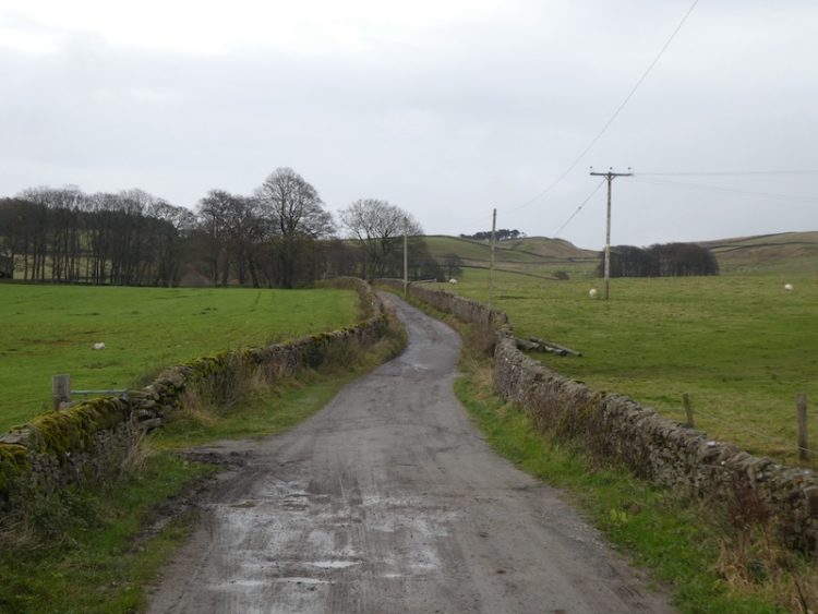
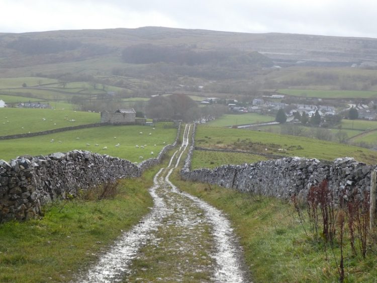
    We stay with the track as it descends through tunnels to reach Clapham besides the church of St James.  From here it is a short stroll back to our starting point.  Our walk has covered 13.5 miles and I can think of no better place to have reached my 2,019-mile target for the year.  

    To follow my walk you will need Ordnance Survey Explorer Map OL2 – Yorkshire Dales [Western Area]

    You can view this 13-mile walk on OS Maps and download the GPX File Here (Subscription to OS Maps Required)

    15th November 2019

    © Two Dogs and an Awning (2019)

  • Along the Ribble Way to Attermire Scar

    Along the Ribble Way to Attermire Scar

    Today’s walk is a variation of the walk I did a few days ago when I visited Attermire Scar and Victoria Cave.  This route takes in an attractive section of the Ribble Way before heading up to Victoria Cave.

    I leave Brigholme Farm and turn right and within a couple of hundred yards take the footpath on the right joining the Ribble Way as it crosses a field to head towards the River Ribble. The route follows close to the river, passing behind barns on Brigholme Farm to enter another field. 

    The route follows close to the river, passing behind barns on Brigholme Farm to enter another field

    The path hugs the river as it goes through a gate into a spinney and then turns to run parallel to the A65.

    Approaching a road bridge over the river I turn right over a ladder stile to climb the embankment and then cross the river on the pavement besides the A65. On the far side of the bridge I take a footpath on the left leading down the embankment and once again joining the river.  I turn right and follow a farm track as it sweeps away from the river heading towards Runley Mill.

    river heading towards Runley Mill

    On reaching the B6480 I cross and continue on the track opposite, Lodge Road.

    Lodge Road.

    The track climbs steadily to reach Lodge Farm and after going through a gate I turn left and at a fork in the track take the right option. 

    Lodge Farm

    I go through a gate and walk along the track by a plantation and then at a second gate follow the walled track.  At another gate I keep straight ahead keeping Black’s Plantation to my right. At the junction of Mitchell Lane and Lambert’s Lane I fork right into Lambert’s Lane and follow this walled track, enjoying the views.  

    Black’s Plantation

    Reaching a road I take a right turn and then shortly a left onto Stockdale Lane.  In a few hundred yards at the bend I go over a ladder stile to follow the path as it gradually climbs up alongside the wall.   

    Attermire Scar

    I head over Sugar Loaf Hill; now in front of me are wonderful views of the spectacular escarpment of Warrendale Knotts and Attermire Scar. 

    Warrendale Knotts and Attermire Scar

    My route continues under Attermire Scar, with views back to Pendle Hill.

    Attermire Scar, with views back to Pendle Hill

    After passing Victoria Cave I go through a kissing gate I turn left and go through a gate on a farm track to descend downhill to another gate. 

    I then take the path on the left way-marked the Pennine Bridleway.  Now it is case of following the path across a couple of fields below Blua Crags before descending on a walled track to return to Settle and then back to Brigholme Farm.  It has been another cracking walk covering just over seven and a half miles. 

    To follow my walk you will need Ordnance Survey Explorer Map OL2 – Yorkshire Dales [Western Area]

    You can view this 13 mile walk on OS Maps and download the GPX File Here (Subscription to OS Maps Required)

    14th November 2019

    © Two Dogs and an Awning (2019)

  • Ling Gill and Cave Hill

    Ling Gill and Cave Hill

    Over the years I have walked many of the footpaths in this area of the Yorkshire Dales and visited a lot of the OS Trig Points, but there is a trig on Cave Hill I have had my eye on “bagging” for some time.  So that’s where Lynnie and I are heading today.

    The starting point for our walk is the parking area besides the Blea Moor Road (B6255) close to Ribblehead Viaduct (Grid Reference: SD765793).  Leaving the car we head northeast following the line of the road, this used to be the main Lancaster to Richmond road and we soon pass a milestone.

    We continue besides the road to pass Gearstones and then on reaching the entrance to Far Gearstones Farm we take the Dales Way footpath on the right, which leads to a track through a field and then turns towards Gayle Beck. 

    After crossing the bridge over the beck we start the long gradual ascent on Cam High Road, this is an old Roman Road heading towards Hawes.  It is a mizzly day so there is not much of a view back down the dale to Ribblehead Viaduct.

    On reaching a junction of paths where the Dales Way meets the Pennine Way we turn right towards Old Ing.

    This is a clear track heading south across the moor.  The visibility is deteriorating so we can see little apart from the surrounding moorland and the clear track we are following.

    Staying with the Pennine Way we reach Ling Gill Bridge, we have never been here before it is a cracking spot.

    After crossing the bridge we continue south besides the deep gorge of Ling Gill.  There is a fence and warning signs not to enter the nature reserve, we can just about make out the steep sides of the gorge and even if access were possible I don’t think I would be tempted to enter.

    After passing a disused quarry we take a detour from our main route to head up the Access Land of Cave Hill on a faint track.  It is a short steep ascent but we are rewarded with some fine views when we reach the Ordnance Survey Trig Pillar, this is the 187th I have “bagged”.

    Leaving the trig point we return by the same route to rejoin the Pennine Way and resume our walk.  As the access land ends we stop to look over the wall at the beck as it disappears into what is known as Calf Holes.  Apparently this is an entrance to a cave network that reappears at Browgill Cave.

    As we near Old Ing we ignore a path on the right and stay with the Pennine Way heading east.

    As you might expect on a National Trail this route is clear and easy to follow.

    We reach an area of access land and head steadily uphill to reach a junction of paths.

    Now we turn right and head south, still on the Pennine Way.

    On reaching a sign for the Three Peaks path we turn right leaving the Pennine Way and going through a kissing gate to follow the well-made path.

    This part of the walk is familiar to me because I have walked the Three Peaks on a number of occasions, but it is the first time Lynnie has been here.  

    The route is now very straightforward we are going to follow the well-marked Three Peaks path back to Ribblehead.  

    We make good progress stopping briefly when we reach God’s Bridge.

    We pass Nether Lodge and stay with the Three Peaks Path to follow a well-made track to Ingman Lodge.

    After passing Ingman Lodge, an interesting building dating back to 1687 and still part of a working farm, we continue up the track to reach a road, the B6479, here we turn right.  This section of the walk follows the road and needs to be tackled with caution.  Forming part of the Three Peaks route it is frequently used by walkers, but there are parts where there is no other option than to walk on the road with little space to step onto the verge.  Fortunately there is not a lot of traffic and the majority of vehicles passing seem aware that this is an area where they may encounter walkers.

    Reaching the car the cloud lifts and we get a good view of the Ribblehead Viaduct.  Over the last forty years I must have taken hundreds of pictures of this viaduct, this does not stop me adding another one to the photo library.

    Our walk has covered just over ten miles and has been really enjoyable.  I look forward to repeating it on a day when the visibility is better and there is an opportunity to appreciate the views.

    To follow my walk you will need Ordnance Survey Explorer Map OL2 – Yorkshire Dales [Western Area]

    You can view this 10 mile walk on OS Maps and download the GPX File Here (Subscription to OS Maps Required)

    13th November 2019

    © Two Dogs and an Awning (2019)

  • Walking Up a Snow Covered Whernside

    Walking Up a Snow Covered Whernside

    I am walking on my own again today and plan to ascend Whernside, a regular walk I undertake when we are in this area.  Overnight we had some wintery conditions and as I drive towards Ribblehead Viaduct there is snow capping the peaks of Ingleborough and Whernside.

    My starting point is from the roadside parking at Batty Green (Grid Reference: SD765793). I take the path towards the Viaduct.

    After going under the arches of the viaduct I continue on the track through Gunnerfleet Farm and then carry on along the tarmac drive alongside Winterscales Beck heading towards Winterscales Farm.

    At a junction of paths I turn left towards Ivescar and ignore the stile leading up the steep side of Whernside.  From the track there is a view of the snowy summit of Whernside shrouded in cloud.

    After passing a farm at Ivescar I continue across a couple of fields.

    After going through Broadrake I head across another field, from here there are cracking views of Ribblehead Viaduct.

    I turn right at Bruntscar joining the Three Peaks path heading towards Whernside. 

    This is initially a steady upward route, with the occasional steeper section. It is only after passing through a gate that the really steep climb is encountered.  This year a lot of work has been done on this ascent and new steps have been put in, but it is still a tough climb to reach the ridge.

    Once on the ridge I turn right and follow along it, still upwards on the snow covered path through the low cloud.

    Finally reaching the summit of Whernside I stop for the obligatory photograph, I have “bagged” this trig point many times, but it is the first time I have been here in the snow.

    It is too chilly to hang around, at 2,415 feet above sea level with no protection from the cold wind I am soon continuing along the ridge.

    All of a sudden the cloud lifts and I get a stunning view of Dentdale.

    I am now on my descent following the clear Three Peaks path.

    At the junction of paths I turn right to descend Slack Hill.

    On reaching a gate I stop to admire the waterfall at Gill Force, the recent wet weather has swelled the volume of water flowing.

    Soon after the path goes over the aqueduct at Blea Moor.

    I follow the path with the railway on the right and go by Blea Moor signal box.  In the distance in front of me is Ingleborough.

    The clear path carries on towards Ribblehead Viaduct.

    Now it is just a short walk back to my starting point. 

    This walk has covered 8 miles, I have walked this route a number of times, but this is the first time I have encountered snow.

    [To follow our walk you will need Ordnance Survey Outdoor Leisure Map OL2 – Yorkshire Dales – Western Area]

    You can view this 8 mile walk on OS Maps and download the GPX File Here (Subscription to OS Maps Required)

    12th November 2019

    © Two Dogs and an Awning (2019)

  • Along the Pennine Way to Hull Pot

    Along the Pennine Way to Hull Pot

    Now that Dexter is getting older we have to manage the distances he walks, if it is not too hot he can still clock up a few miles, but his days of long distance walks are sadly over.  I thoroughly enjoyed my morning walk with Crosby and Lynnie is keen to get out for a few miles this afternoon so we head off to Horton in Ribblesdale.

    Our walk starts from the Yorkshire Dales National Park car park in Horton in Ribblesdale (Grid Reference: SD807725).  Leaving the car park we turn right along the road soon passing the Pen-y-ghent Café, which appears to have closed down.  We cross the road to take the track that leads past Horton Scar.

    The skyline to our right is dominated by the Pen-y-ghent.

    At the crossroads of footpaths we walk straight on towards Hull Pot. I have previously written about Hull Pot, it is a huge pothole that suddenly appears on the track.  

    We turn around and retrace our steps to the crossroads of paths and turn right to climb over Whitber Hill.  It can be bleak up here, today there is a bit of mizzle but we have been here when the visibility has been very poor.  We are grateful for the well-defined path (that forms part of the Three Peaks Walk).

    Crossing the Sell Gill Beck, we continue until we reach a junction of paths and turn left onto the Pennine Way signposted to Horton in Ribblesdale.  Soon we meet Sell Gill Beck again.  In the past we have seen people potholing here, not something I would ever fancy doing.

    The route is now very straightforward we follow the track as it steadily descends towards Horton in Ribblesdale.  

    Back at the car park our walk has covered just over four and a half miles, which is just about right for Dexter at the moment.  It is now time to head back to the caravan and start planning tomorrow’s walk.

     [To follow our walk you will need Ordnance Survey Outdoor Leisure Map OL2 – Yorkshire Dales – Western Area]

    You can view this 4.5 mile walk on OS Maps and download the GPX File Here (Subscription to OS Maps Required)

    11th November 2019

    © Two Dogs and an Awning (2019)

  • Revisiting Attermire Scar

    Revisiting Attermire Scar

    I am near to hitting my target of walking 2,019 miles in 2019.  This is the second year that I have “walked the year”; last year I reached 2,018 miles on the Quantock Hills a favourite spot for me.  This year I plan to complete my quest whilst walking in the Yorkshire Dales and hopefully somewhere near the summit of Ingleborough.  

    After a near 300-mile journey yesterday we arrived at Brigholme Farm CL in the dark.  It is the measure of our confidence in caravanning that we no longer worry about pitching up in the dark, levelling the van and erecting an awning by the light of a head torch.  Soon we were snug inside the van.

    After yesterday’s driving I am reluctant to go far in the car, so soon after breakfast I am heading off with Crosby for a walk from Brigholme Farm CL.  Leaving the site I turn right along Station road and then after crossing the Penny Bridge I take a right turn into Cammock Lane. At a crossroads I go straight across into Ingfield Lane and stay on this lane as it forks right, then within a few hundred years I turn right along Brockhole Lane, which understandably is known locally as Watery Lane.

    I follow this dry stone walled lane until the end, ignoring footpaths on the left and the right.  At the end of Brockhole Lane I turn left onto Lodge Road, despite its name this “road” is actually a track that heads uphill towards Lodge Farm. 

    At the top of the lane I reach Lodge Farm and after going through a gate I turn left and at a fork in the track take the right option. 

    I go through a gate and walk along the track by a plantation and then at a second gate follow the walled track.  At another gate I keep straight ahead keeping Black’s Plantation on our right.

    At the junction of Mitchell Lane and Lambert Lane I fork right into Lambert Lane and follow this walled track, enjoying the views.  

    Reaching a road it is a right turn and then shortly a left onto Stockdale Lane.  In a few hundred yards at the bend I go over a ladder stile to follow the path as it gradually climbs up alongside the wall.   

    I head over Sugar Loaf Hill; now in front of us is one of my favourite views in the Dales, the spectacular escarpment of Warrendale Knotts and Attermire Scar. 

    From here my route is under Attermire Scar, passing Victoria Cave.

    After going through a kissing gate I turn left and go through a gate on a farm track to descend downhill through another gate.  I then take the path on the left way-marked the Pennine Bridleway. 

    Now it is case of following the path across a couple of fields below Blua Crags before descending on a walled track to return to Settle and then back to Brigholme Farm.  It has been a cracking wander covering just over seven miles. 

    To follow my walk you will need Ordnance Survey Explorer Map OL2 – Yorkshire Dales Southern & Western

    You can view this 7 mile walk on OS Maps and download the GPX File Here (Subscription to OS Maps Required)

    11th November 2019

    © Two Dogs and an Awning (2019)

  • Trig Bagging at Moughton Scar and Sulber

    Trig Bagging at Moughton Scar and Sulber

    We are nearing the end of this trip to Brigholme Farm CL and there are still some Ordnance Survey trig pillars in the area that I have not “bagged” and as luck would have it a visit to them can be combined with a walk in Crummack Dale.
    (more…)

  • Boggy Walking on Blea Moor and Dodd Fell

    Boggy Walking on Blea Moor and Dodd Fell

    Whilst studying the map last night I was intrigued by the footpath that crosses Blea Moor following the route of the tunnel that carries the Settle to Carlisle railway line.  So today I am heading off to Ribblehead to explore the route.
    (more…)

  • Giggleswick Common from Brigholme Farm CL

    Giggleswick Common from Brigholme Farm CL

    Today I am heading out from Brigholme Farm CL to bag another trig point and visit Giggleswick Common, an area I have not previously visited.  I had thought I had bagged all the trig points within walking distance of this CL, but scanning the map last night I realised I did not have the complete set.
    (more…)

  • Around Totridge Fell, Bleadale Water and Langden Brook

    Around Totridge Fell, Bleadale Water and Langden Brook

    Whilst staying at Brigholme Farm CL I usually walk in the local area. I have rarely headed towards the Trough of Bowland over the border in Lancashire. It’s not that far away, but I was put off walking there a few years ago when I set off with the dogs only to discover that parts of the access land prohibit dogs other than on footpaths. My route that day was a clear track, both dogs were on short leads, but the signs made it clear it was not a footpath and dogs were not allowed. To avoid a similar situation I am leaving Crosby behind today and walking solo.
    (more…)