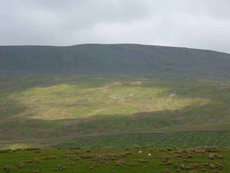
Looking at some pictures of the local area the other day I came across a shot of Hull Pot. I have seen it on the map as we have walked Penyghent but it is not a spot we have visited. After looking at the map I work out a walk that takes us by Hull Pot but not all the way to the top of Penyghent.
Category: North Yorkshire
-
A Cracking Bit Of Swaledale Gromit
For a number of years Lynnie has had a walk near Muker in Swaledale on the agenda. At three miles long it is one of the shortest walks in a walking book of the Dales purchased over twenty years ago. I have a more recent book, kindly given to me by ex-colleagues from my last job in London. This has a longer walk starting from Muker.
Our drive to Muker takes us through Hawes, currently bedecked in bunting in preparation for the Tour de France due to come through on 5th July. We drive through the town, just about every field is offering parking or camping when Le Tour comes to town. We drive along wondering at the speed that the cyclists will be travelling and find ourselves at Garsdale Head, we have gone the wrong way!
We retrace our route and then take the correct road to Muker, we are going across Buttertubs pass. As previously mentioned I am not at all keen on heights and avoid high bridges at all costs. Nothing prepared me for the drive at the top of Buttertubs. If I could, I would like to have done it with my eyes closed. Thankfully it is soon over, but the memory will live with me for a long time. I will definitely be finding another route back!
Once it is safe to pull over we stop at the viewpoint. It is a special view. Lynnie gets out, my legs are still jelly so I stay in the car. I know I have said it before whilst in Yorkshire, but this view is stunning.
We park in Muker. The bunting is out here too. Le Tour is expected to come through the village at 13.31 on 5th July, the support vehicles coming through about forty-five minutes earlier. The whole area will be locked down for hours before hand.
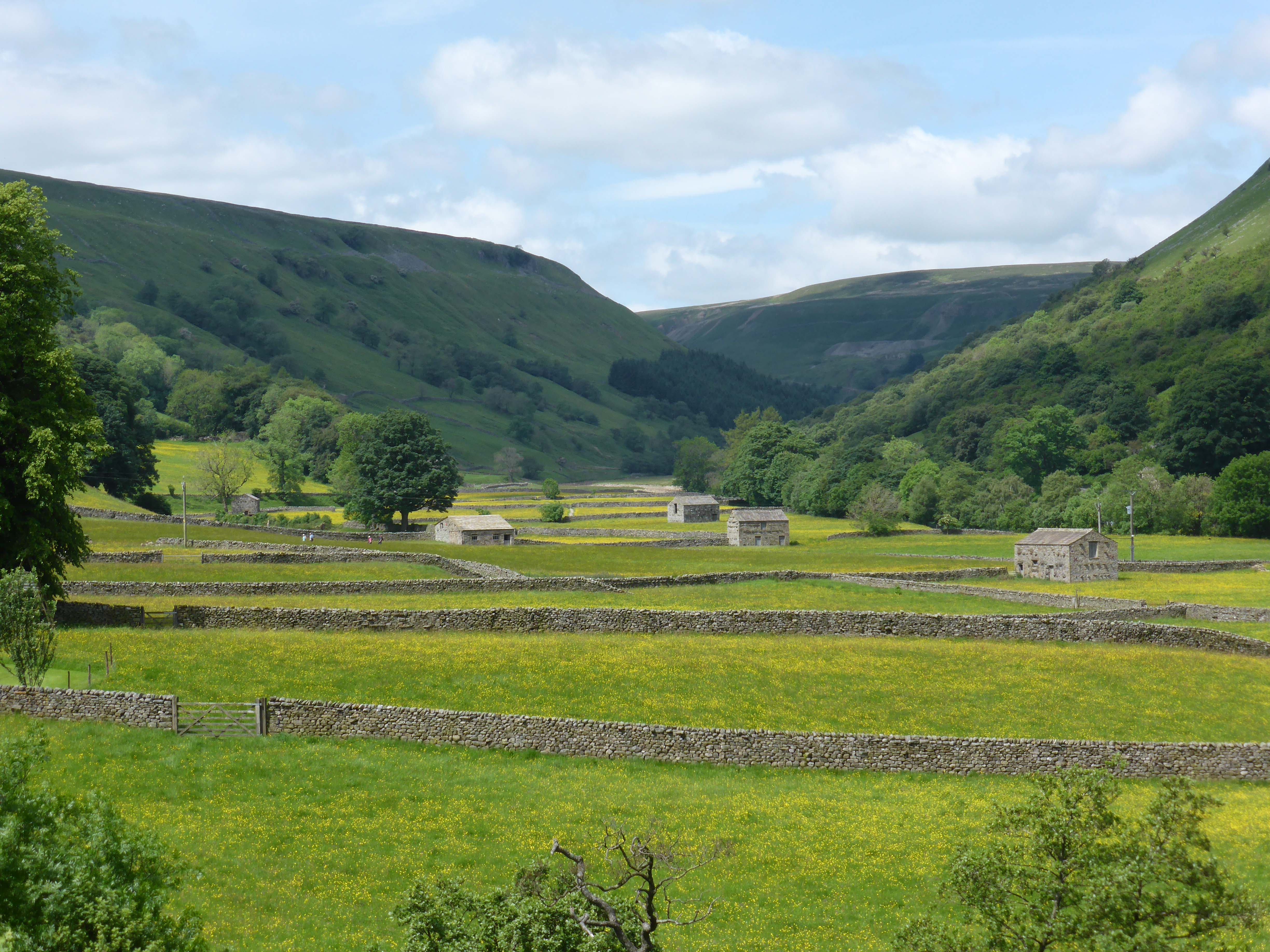
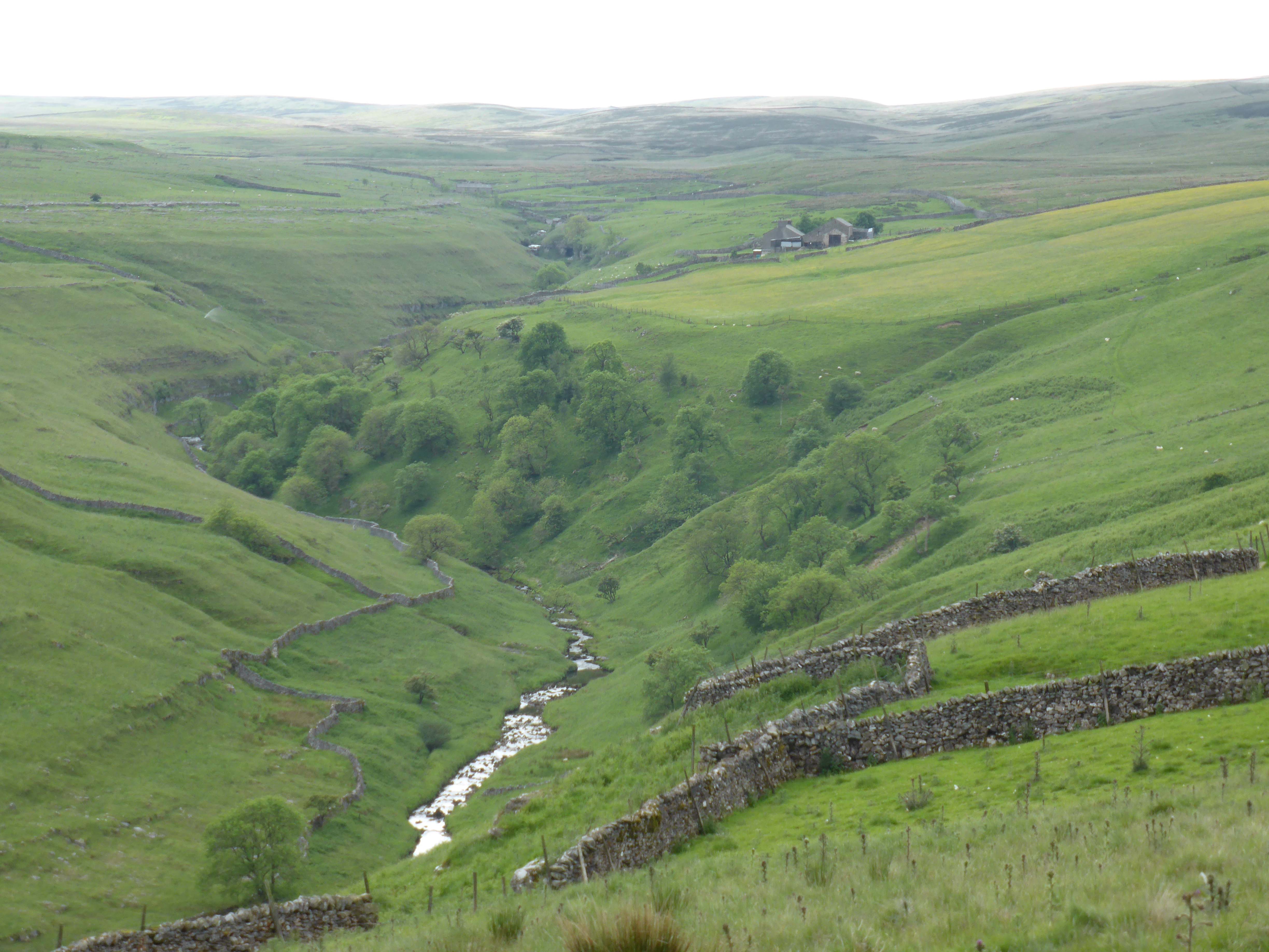
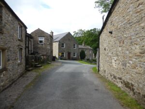
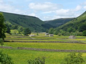
We walk through the village and over the bridge then immediately take an ascending walled lane, then turn right to walk back above Muker. There are great views back across Muker and of Kisdon hill beyond. After crossing a small bridge in the track we turn right down towards a barn. We then go through a gate and around a farmhouse in the process of renovation, what a cracking place to have a home. Several Curlews are very active above us making their distinctive call. We spot a chick running on the track, it finds cover in the marsh grass.
After crossing a couple of fields the path takes us over a small bridge that crosses a waterfall. We pause to take photos then make our way down to the road and follow it into Thwaite, another typical Dales village. This is All Creatures Great and Small Country and appears little changed from Herriot’s time.
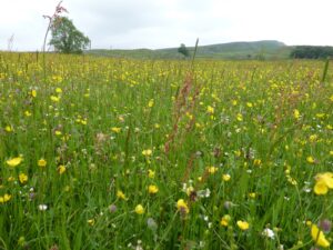
At the Kearton Hotel we turn right to pick up a path that leads us through a series of hay meadows abundant with wild flowers. It is a bit boggy in parts but the route is well walked. We spot a couple of bears with calves in a field we are passing through, all is fine they are at the bottom corner and not interested in us. However, the bull across the way takes a good look at us. We have a bit of a stare at each other, eventually he decides that one of the cows is looking particularly attractive. So we pass him whilst he starts his warm up routine.
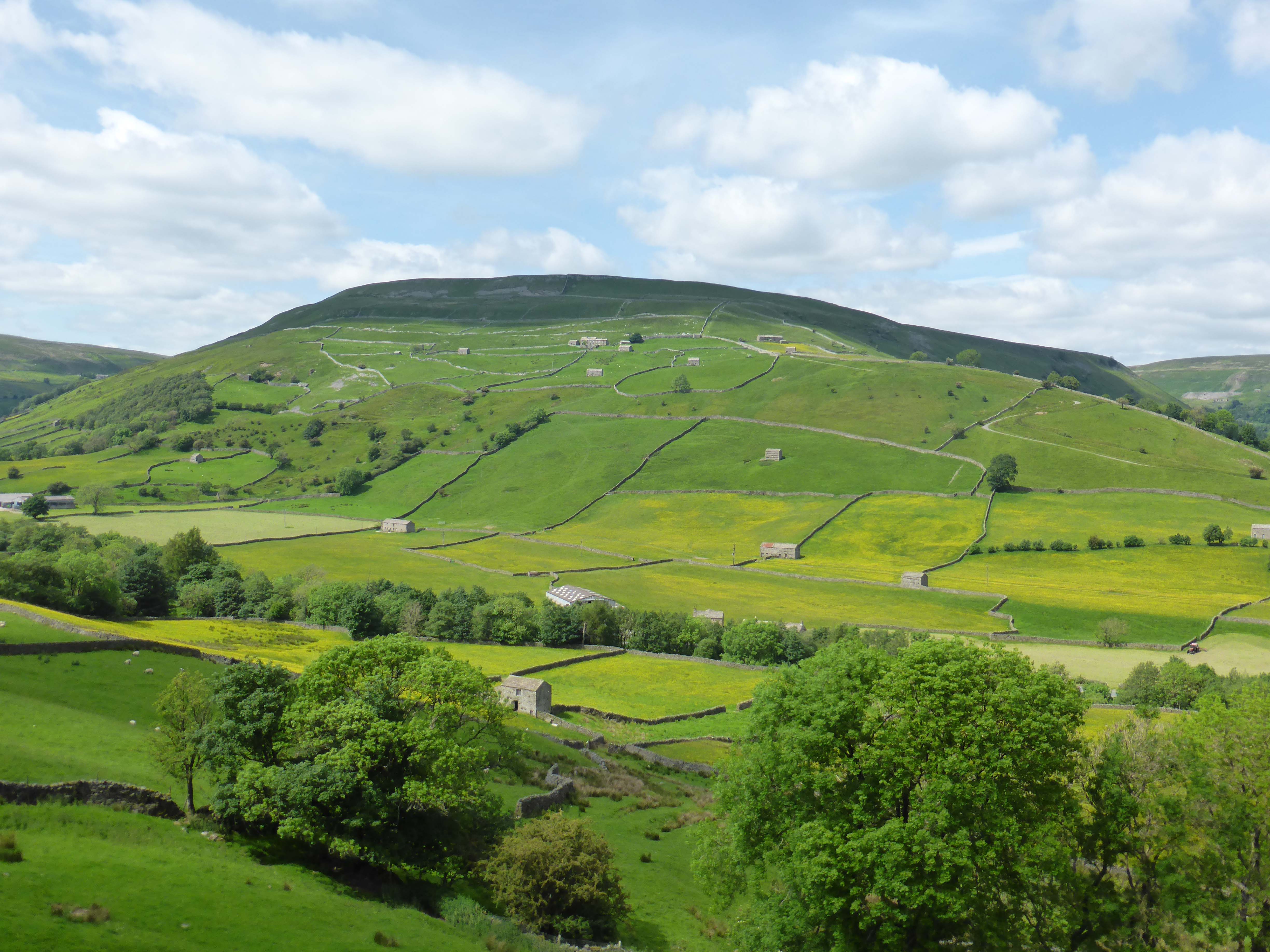
We join the road that takes us up into the small hamlet of Angram. There is a succession of properties for sale, all with stunning views across to Kisdon. Fine on a sunny June afternoon, but in January with the wind blowing and snow on the ground it must be a different prospect.
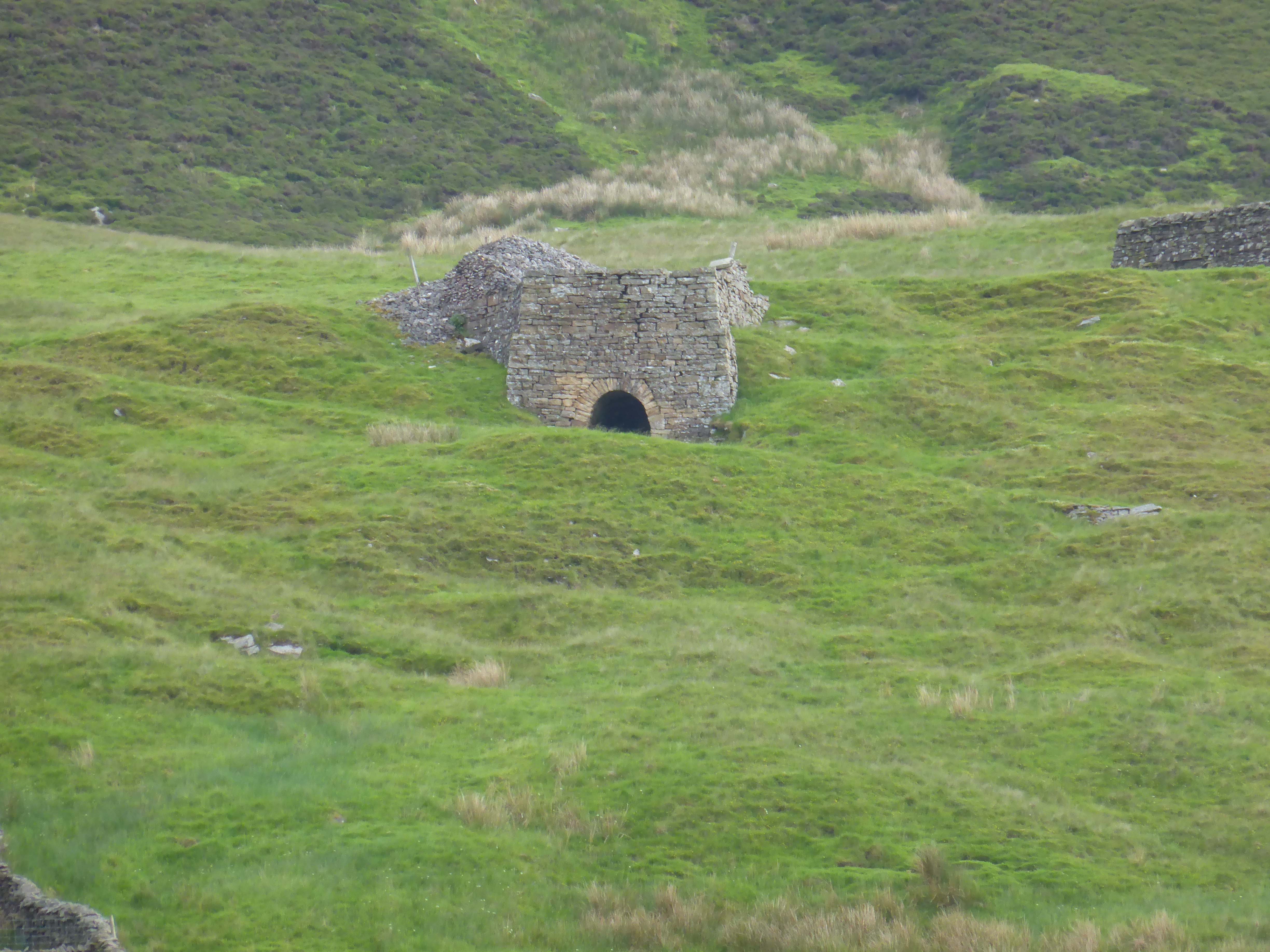
We decide to follow the road along to Keld. High on the hillside opposite there is a limekiln.
Keld is very quiet, hardly a soul about. Difficult to believe that this was once the hub of a lead mining industry and 6,000 lived in and around the village.
As Alfred Wainwright said “Keld is a very special place, at Keld a sundial records the hours but time is measured in centuries”.
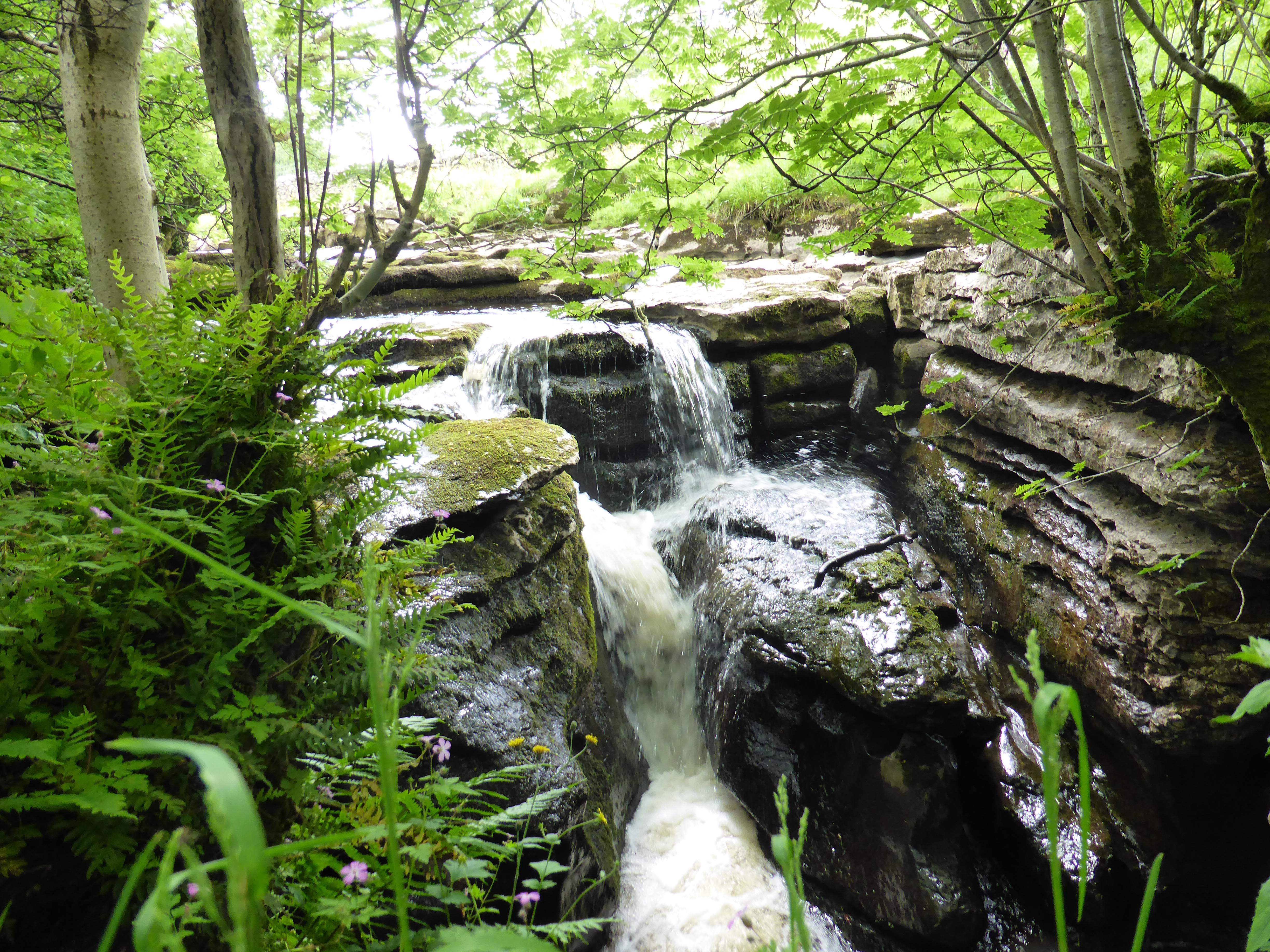
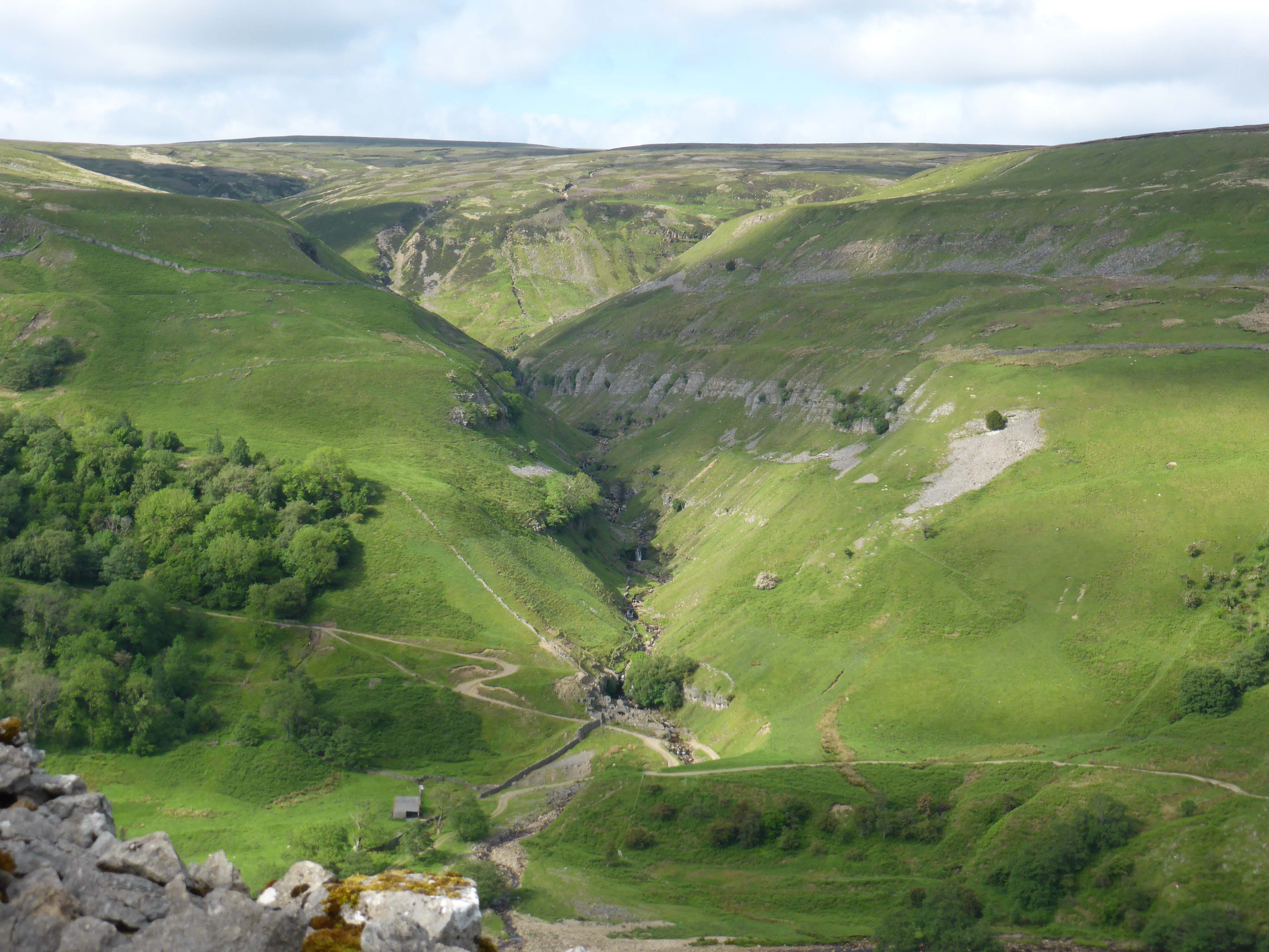
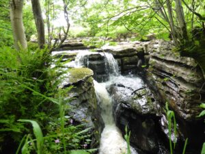
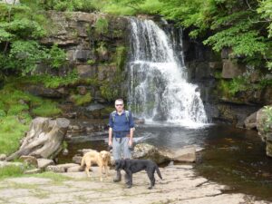
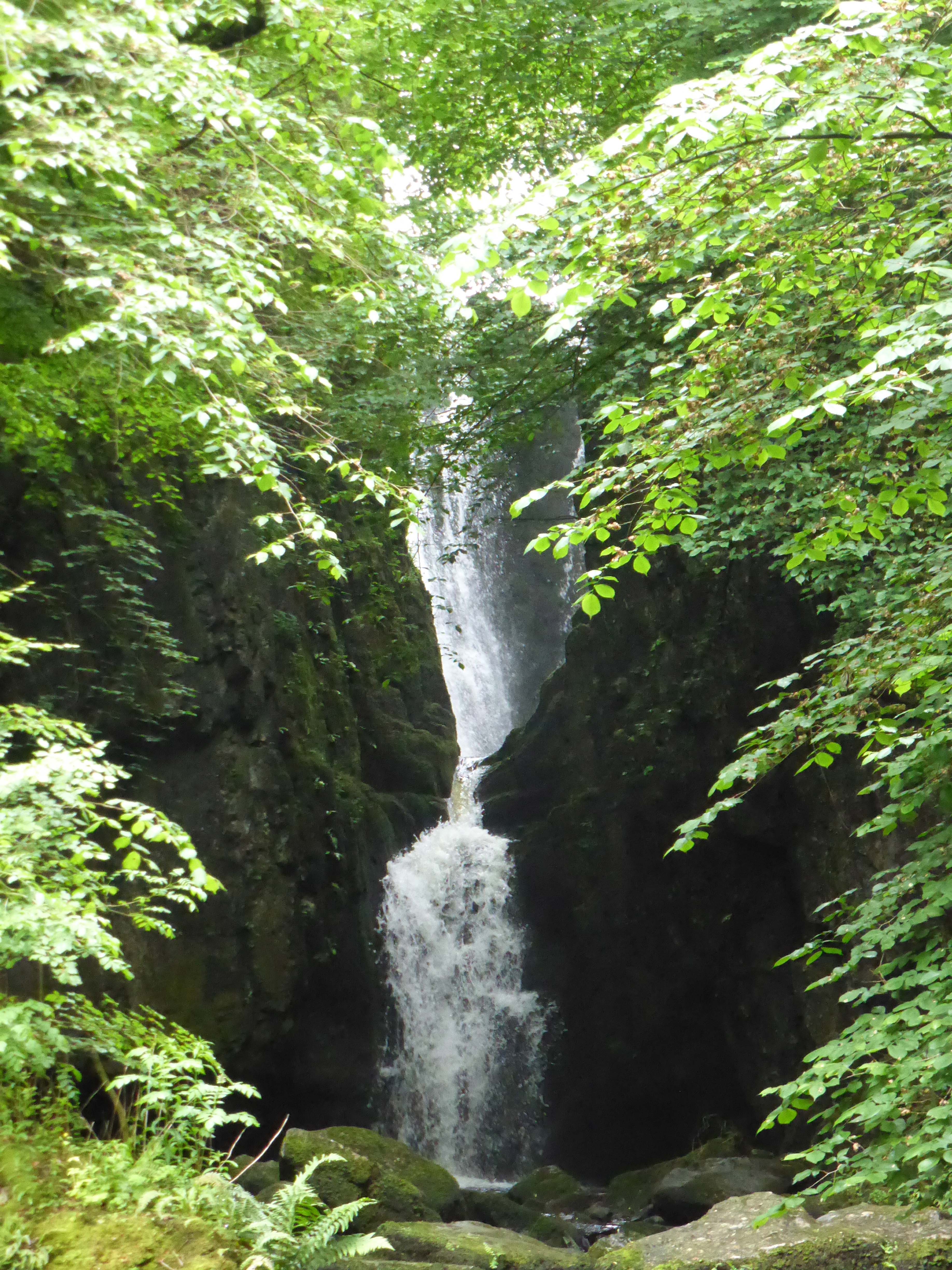
Keld is on a crossroads of two long distance paths with the Coast to Coast and the Pennine Way crossing close to the village. We take the path heading east out of the village, in a short while we take a detour down to the water to get a view of Kisdon Force, then retrace our steps to join the Pennine Way around Kisdon.
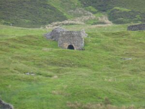
The path here is rocky and high with some steep drops to the river, fortunately either masked by trees or dry stonewalls. As we follow the path around Kisdon we get views of the disused lead mine across the valley at Beldi Hill and further on our map shows disused lead mines in the spectacular Swinner Gill.

After negotiating a field of bears, not at all bothered until they got sight of the dogs, we start the descent to Muker. Back in the village we debate having a beer but decide that we should head back as it is a bit if a trek back to Settle. Our walk has covered around eight miles, very pleasant (if you discount the two encounters with curious bears).
Our route out of Swaledale is to drive across the hills to Askrigg and then along Wensleydale. The first time I took Lynnie to Yorkshire was well over thirty years ago. After a stop in York we came to the Dales and stayed overnight in Askrigg. At the time All Creatures Great and Small could still be seen on TV and the area was very Herriot themed. She fell in love (with the Dales.) So our journey back to Hawes is a trip down memory lane. It does not seem possible that it was so long ago. All those happy years, as I frequently tell Lynnie, she is a lucky woman.
[To follow our walk you will need Ordnance Survey Outdoor Leisure Map 30 – Yorkshire Dales Northern and Central Areas]
16th June 2014
© Two Dogs and an Awning (2014)
-
Catrigg Force
Today our walking plan is to complete a walk that we first attempted over twenty years ago when our children were young. On that day we terminated our walk when we reached a field of lively young bears and Lolly refused to go through the gate.
We park in Stainforth and follow the road through the village until we reach the Craven Heifer pub, where we turn left and follow the lane round by the village green. Stainforth is an attractive Dales village, tucked away from the main road.
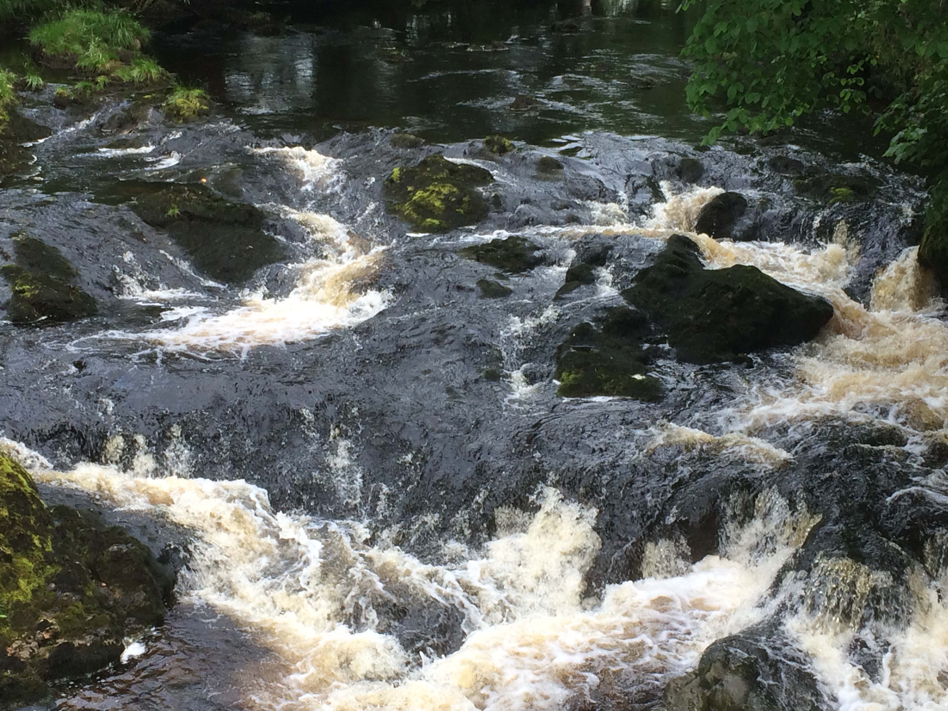
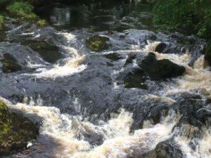
We walk up the walled track and on reaching the gate at the top we take a detour to our left to take a look at Catrigg Force. I cannot recall having been here previously, odd because we have holidayed in this area so often. The water flow is steady and the fall impressive, it must be a wonderful sight after a period of sustained rainfall. Pictures taken we walk back up to the gate at the top.
There is a choice of paths, we take the one to the right. This is the point where all those years ago Lolly had decided enough was enough and she was not going into the field of bears. No sign of any today. We cross the field, keeping an eye out just in case they are hiding and planning an ambush. We go through the gate on the far side and take the path signed towards Winskill Farm.
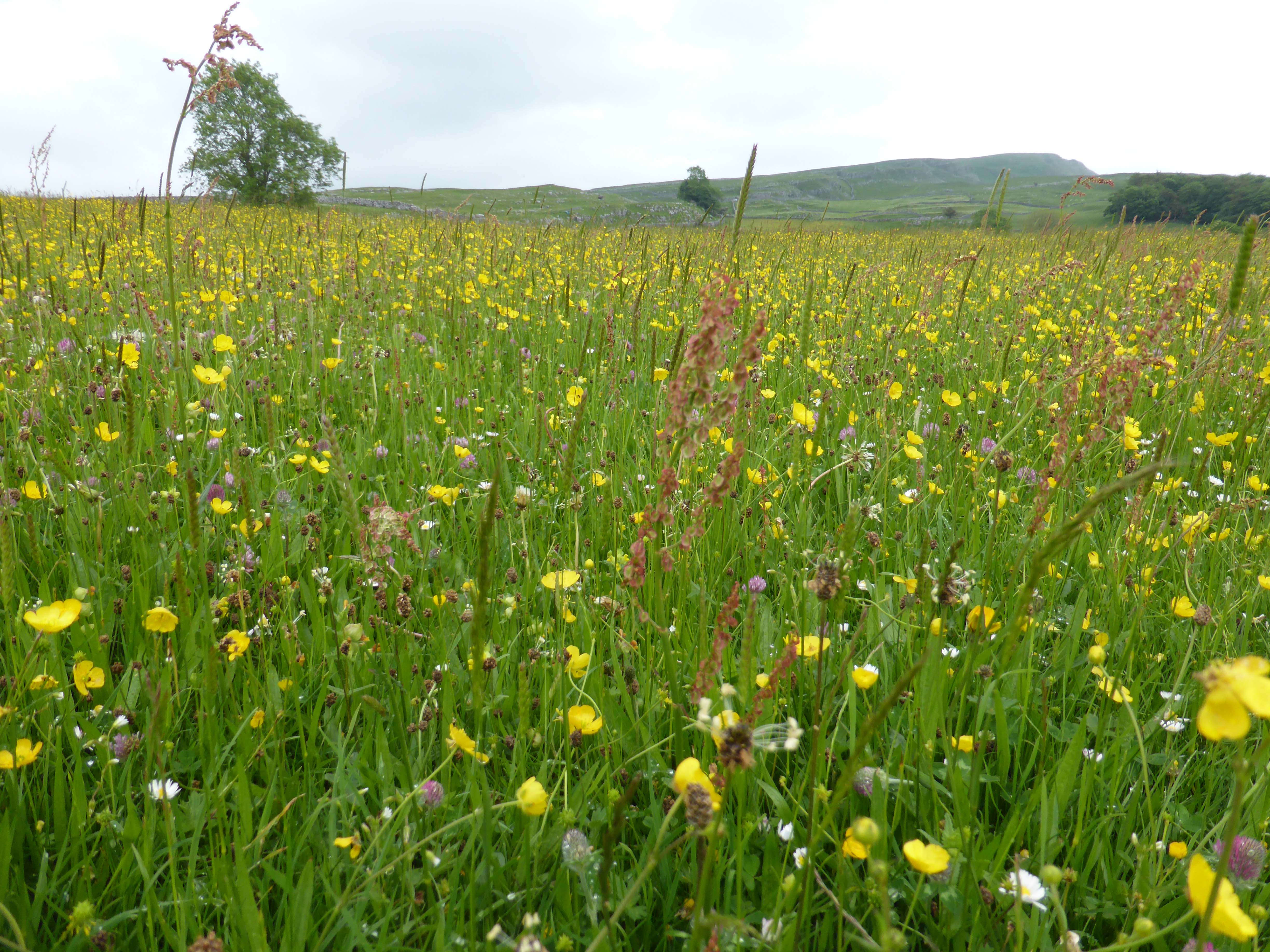
Before the farmyard we turn left down a track towards Lower Winskill and take a wall style. We have entered an attractive meadow of wildflowers, there are buttercups, red clover, vetch, daises and many others that I can’t identify.
Across another couple of equally attractive meadows and then through a gate to descend steeply by the side of Langcliffe Quarry, this quarry was worked by the Craven Lime Company and was the reason that the, now derelict, Hoffman Kiln was built alongside of it. I have a cracking book about the Limestone Industries of the Yorkshire Dales written by David Johnson, it gives a real insight into the industrial and agricultural past of the Dales.
Across another couple of fields and then along a walled track into Langcliffe. As usual the dogs are barking at the kennels. In the village we turn right down to the main road and then right again following the road, crossing the railway line and then taking the lane opposite to walk down to the River Ribble.
By cottages we take the footbridge over the river and then follow the riverside path back to Knights Stainforth. Along the way we encounter bears on the path, they do not like Dexter and Crosby, they take some persuading that we should be allowed to pass. Eventually we do, but not good for the stress levels.
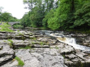
The final section of the riverside path takes us by Stainforth Force, with the water levels low this waterfall is not as impressive as Catrigg Force, but I have been here when the river has been much higher and it is then impressive. At such times it is also dangerous. A couple of weeks after I was here one year there was a tragic accident in Stainforth Beck the smaller tributary that flows here from Catrigg Force, two girls were swept away and lost their lives when their school party was river walking. Today the beck was a trickle of water that would have not caused anyone a problem. It goes to show that such places of beauty can also cause tragedy.
We cross the old packhorse bridge and follow the lane to the main road where we turn right, and then left by Stainforth church to take us back to the car. An interesting stroll, close to six miles. Just right for a Sunday afternoon.
In the evening we meet up with Maurice, Jane and Carl and go for an excellent meal at The Little House Restaurant, highly recommended. Good quality food and wine and excellent service.
[To follow our walk you will need Ordnance Survey Outdoor Leisure Map 2 – Yorkshire Dales Western Area]
15th June 2014
© Two Dogs and an Awning (2014)
-
Victoria Caves
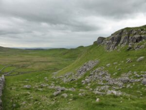
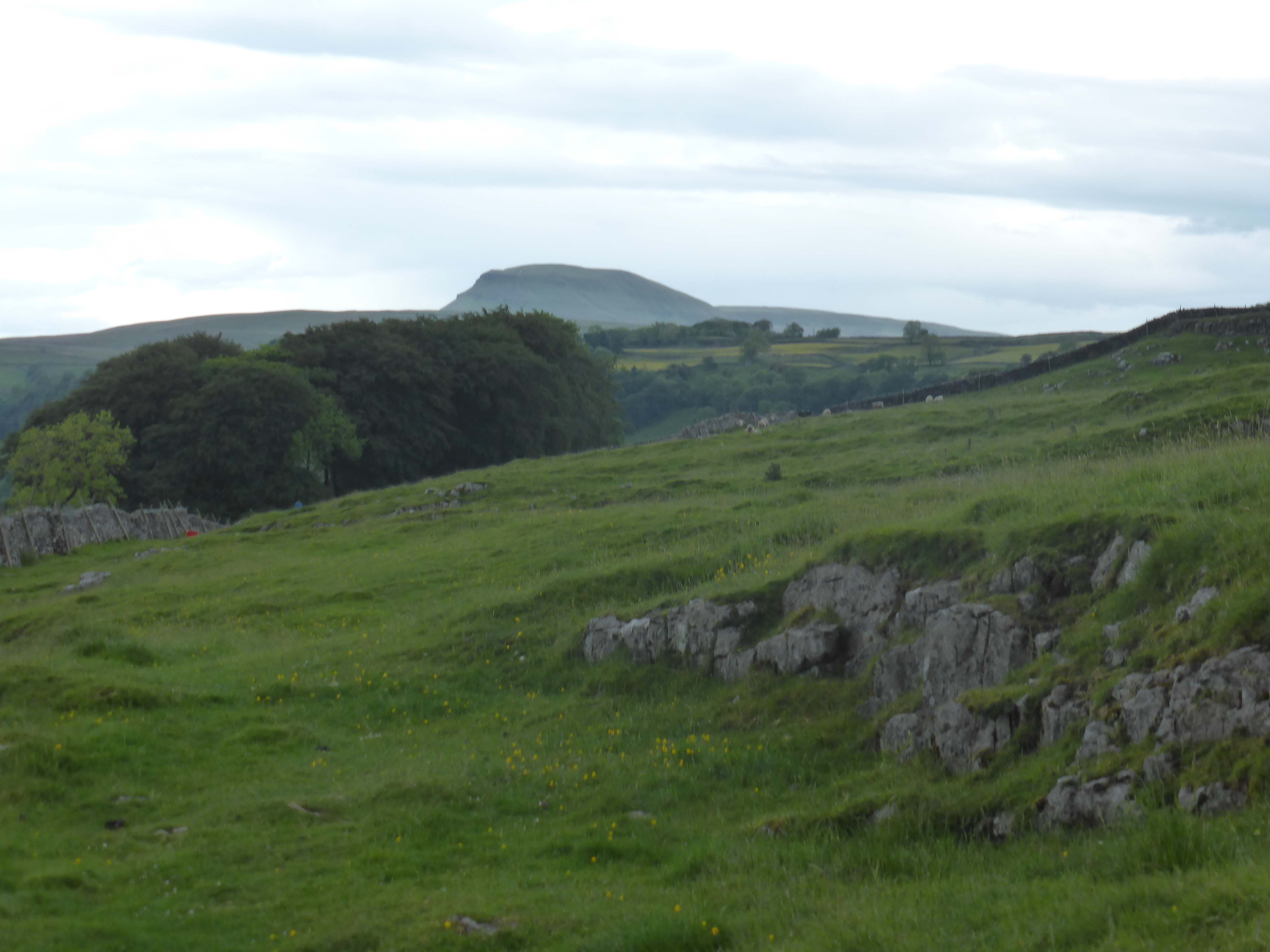
After a days rest it is time for another walk. Leaving the car on the site we go through Settle and up the old drovers track by the side of Castlebergh Plantation. This is the route we took to Langcliffe a few days ago, but today we turn right and ascend the hill. This is a very steep incline, I have to stop more times than I did going up to Ingleborough on Thursday. The weather is muggy so the breeze at the top is welcome.
Walking below the limestone Crags there is an abundance of bird song. Unusual calls, very different sounds to the birds we are used to hearing in Wiltshire. We come to a ladder stile. Crosby is up and over, but Dexter does his usual trick of standing on the top waiting to be lifted off. This is getting a bit irritating I will have to work on a way of getting him down of his own accord.
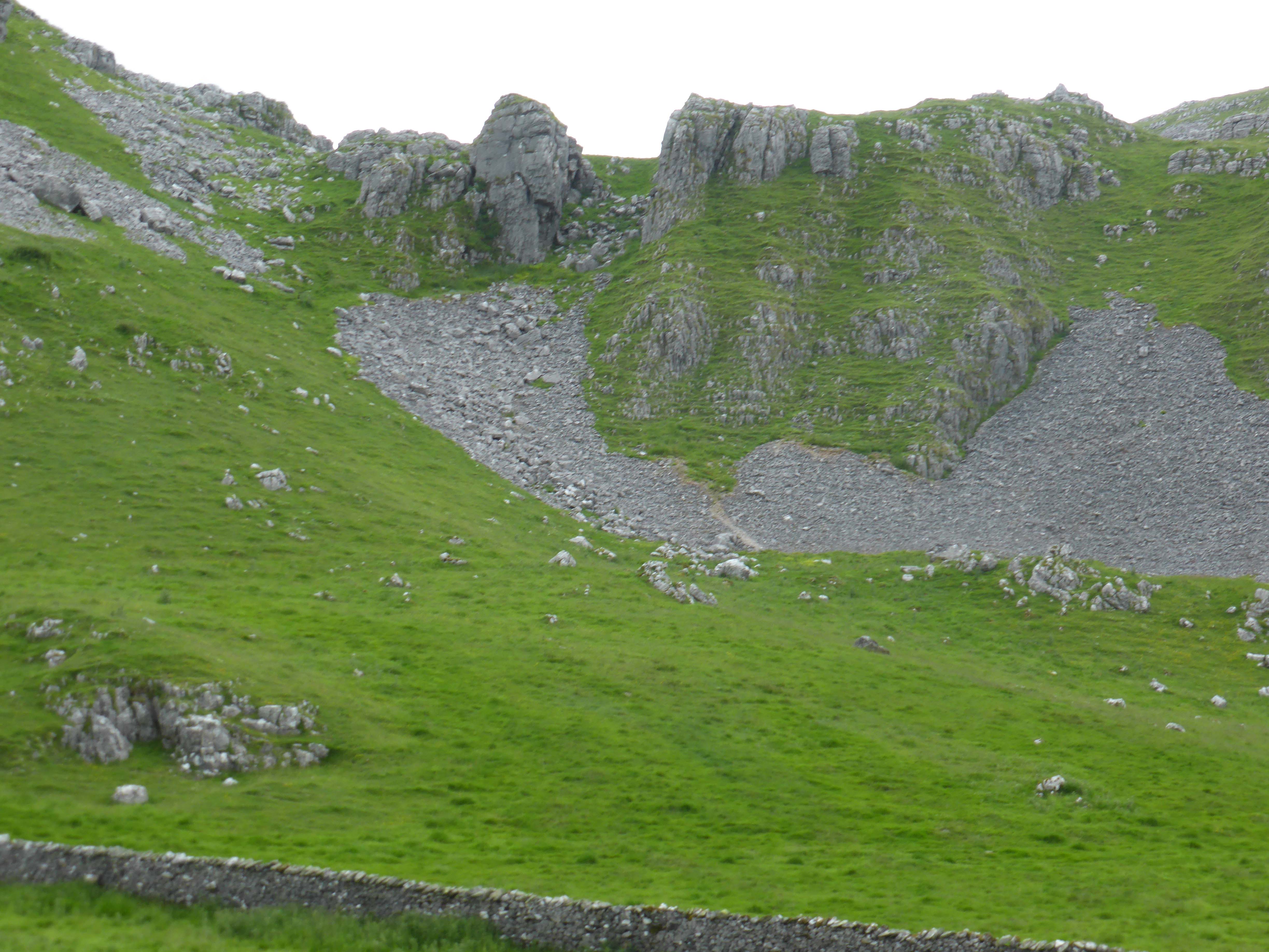
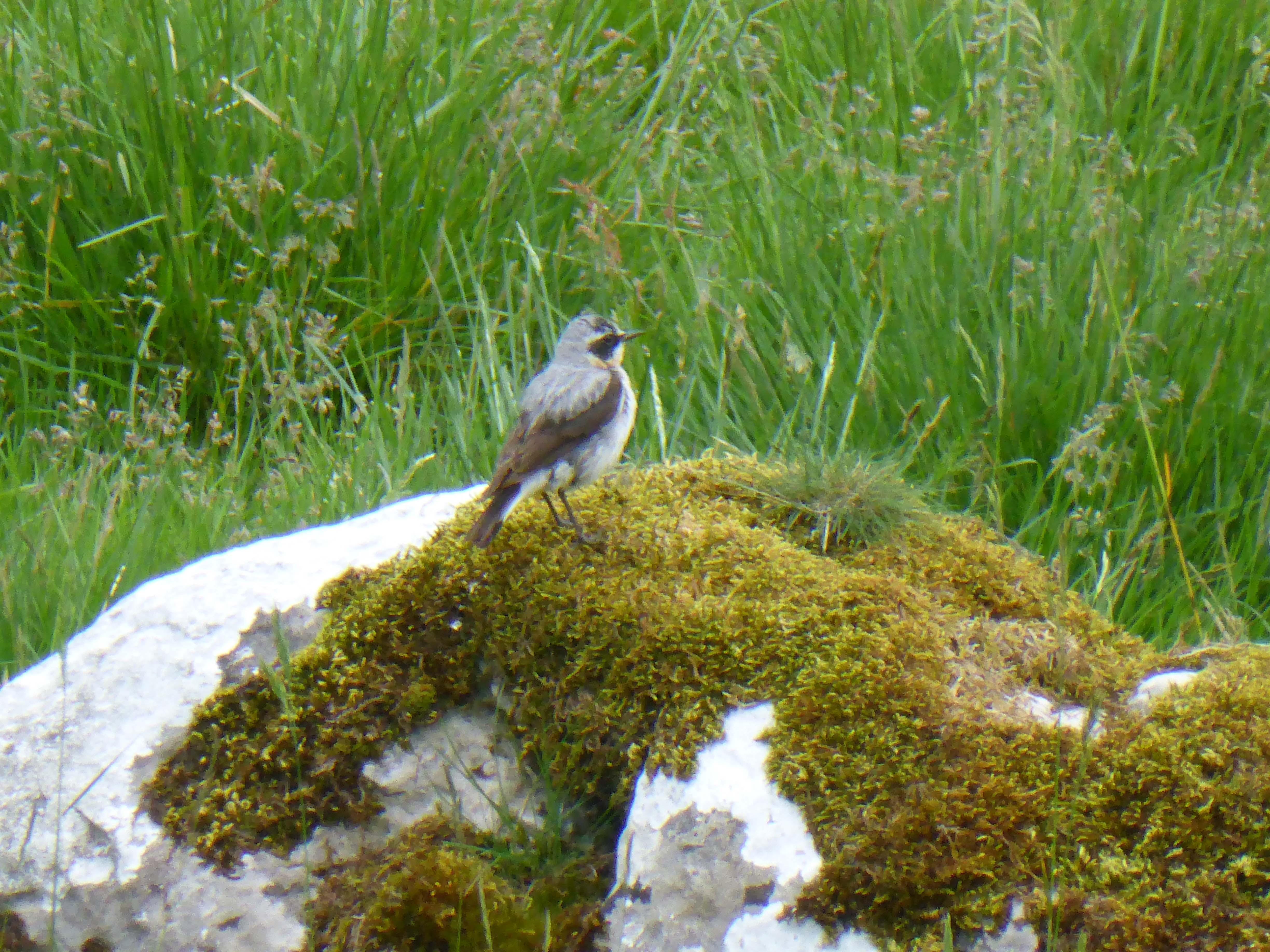
Now we turn left under Attermire Scar. The limestone here is covered in caves and potholes. We stop to watch the Wheatears not a common bird back home.
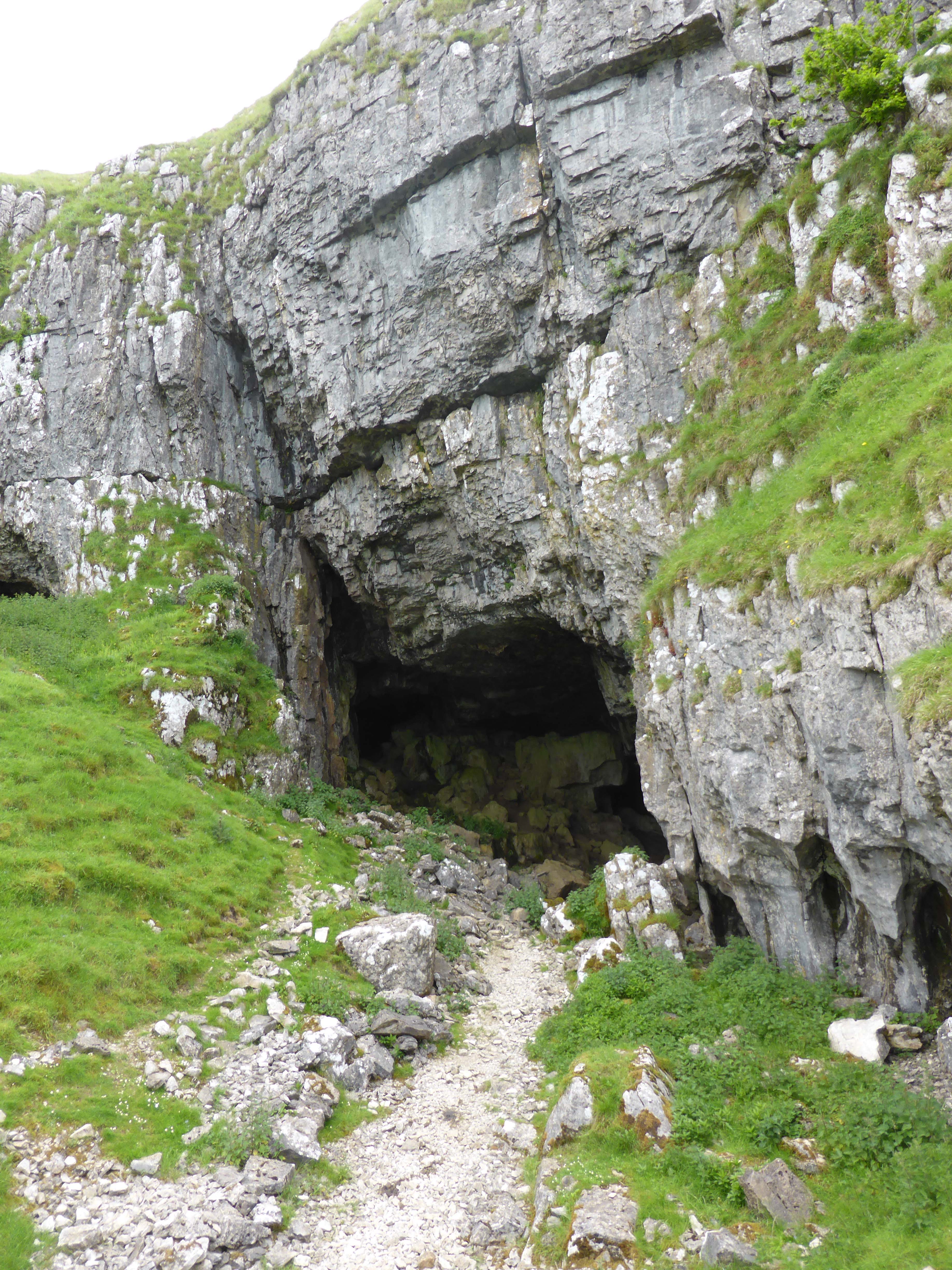
Through a gate and then the short climb to Victoria Cave. This cave gets its name because it is said to have been discovered on the day that Queen Victoria ascended to the throne. The story goes that a dog went down a hole chasing a fox this first showed that there was an entrance to a cave.
Now there is no mistaking it is a cave. The entrance has been dug out and hundreds of tons of rock have been removed to create a vast opening.
During the excavation of the cave the remains of many animals were found including the bones of mammoth, brown bear, reindeer, hippopotamus, straight-tusked elephant, spotted hyena, lion, narrow-nosed rhinoceros and giant deer. Other finds include Bronze Age pottery, Romano-British jewelry, tools and over 100 coins dating from 83 BC to 346 AD. It makes you wonder what else there might be tucked away in this cliff face.
We continue on, passing the smaller Jubilee Cave and stay on the track towards Malham until we reach a footpath on our left. Over some marshy land and we are treated to the sight of two Curlews creating a distraction so that we keep away from their young. I have rarely seen Curlews so close they are splendid birds.
Through a plantation and over a couple of ladder stiles, Dexter continues to be difficult. As if to prove a point when we reach the last stile he decides that instead of putting his muddy paw on my shoulder he will put it in my mouth instead. Now I love my dogs, but a muddy paw in the muncher is going a bit too far.
We briefly join the road as it descends to Langcliffe and then take the footpath that will lead us under Blua Crags. Our little stroll has been just over nine miles. Just right to get the legs working again.
[To follow our walk you will need Ordnance Survey Outdoor Leisure Map 2 – Yorkshire Dales Western Area]


14th June 2014
© Two Dogs and an Awning (2014)
-
Relax
I wake up and find it difficult to get out of bed. I ache all over. The exploits of yesterday have taken their toll. Followers of this blog will know that I walk a reasonable distance everyday, so I can only imagine how those that tackle the three peaks without doing any preparation must feel afterwards.
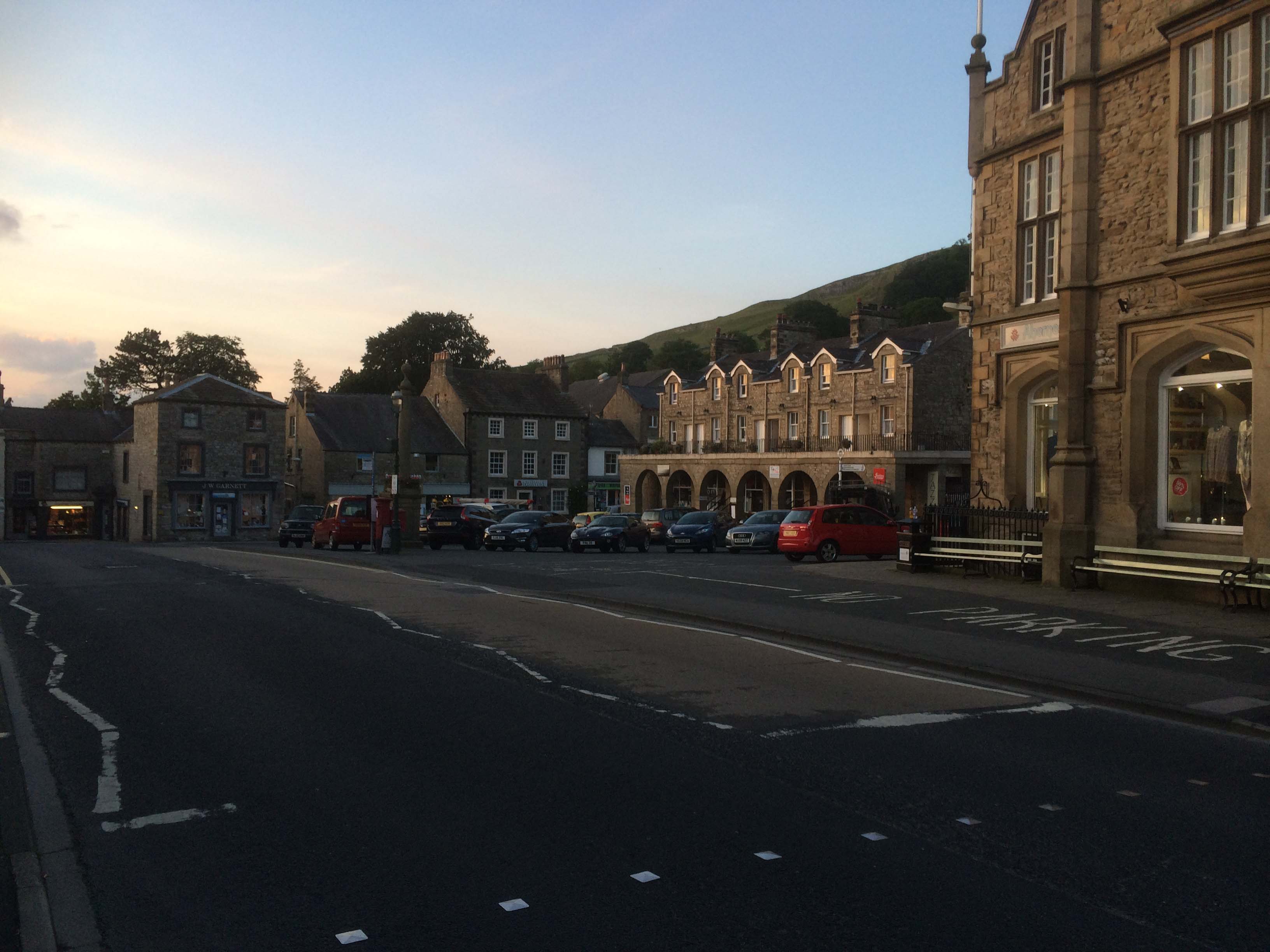
We agree that a relatively restful day is required. I do some work, it is not all holiday you know! Later we head out for a wander around Settle and take the dogs for a walk. Just a gentle wander up a steep lane so we may admire the views. Dexter is very approving of such a walk. It has everything he needs, especially the wander through the town bringing the bonus of discarded crusts and the like.
Settle is a cracking Dales town. Locally some refer to it as a village. But to my mind it has to be a town because it has supermarkets (Booth’s being our favourite – a northern version of Waitrose), pubs, restaurants, butchers and bakers. In fact everything barring the candlestick maker.
A lot goes on in and around Settle, we were here a couple of years ago and our visit coincided with the annual story telling festival. The local theatre has regular performances from well known names. If we did not live in such a lovely village in Wiltshire I could easily live in Settle.
13th June 2014
© Two Dogs and an Awning (2014)
-
Three Peaks
I have walked in the Dales for over thirty years and have been up Whernside three or four times, Pen-y-ghent half a dozen times (the latest yesterday) and Ingleborough well over a dozen times. A couple of years ago Lynnie and I did them all in consecutive days, but I have never done them all in one day.
Today is the day to fulfil a long held ambition. We are up early and the boys get a short walk and breakfast. Then I check that I have everything I need for the day and load Crosby in the car. Dexter looks a bit miffed, I explain that he can come if he wants, but we are off for the day and will be covering 26 miles. He decides that a day at the Unicorn with Lynnie sounds far more preferable.
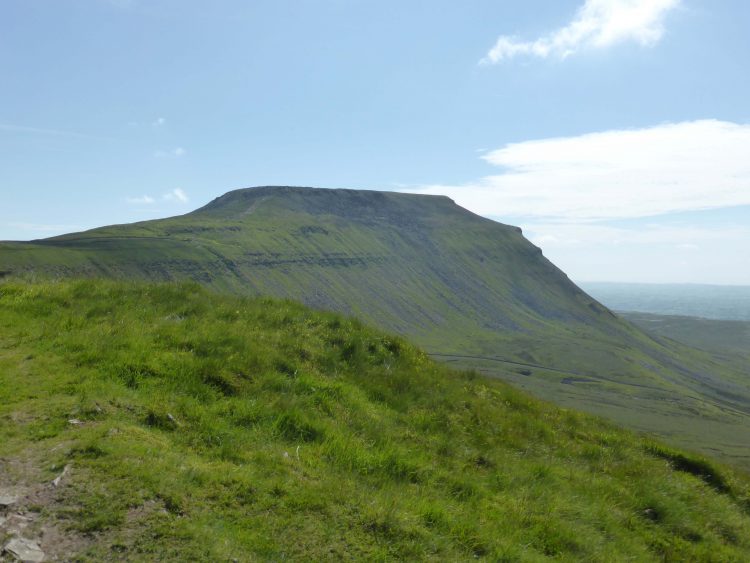
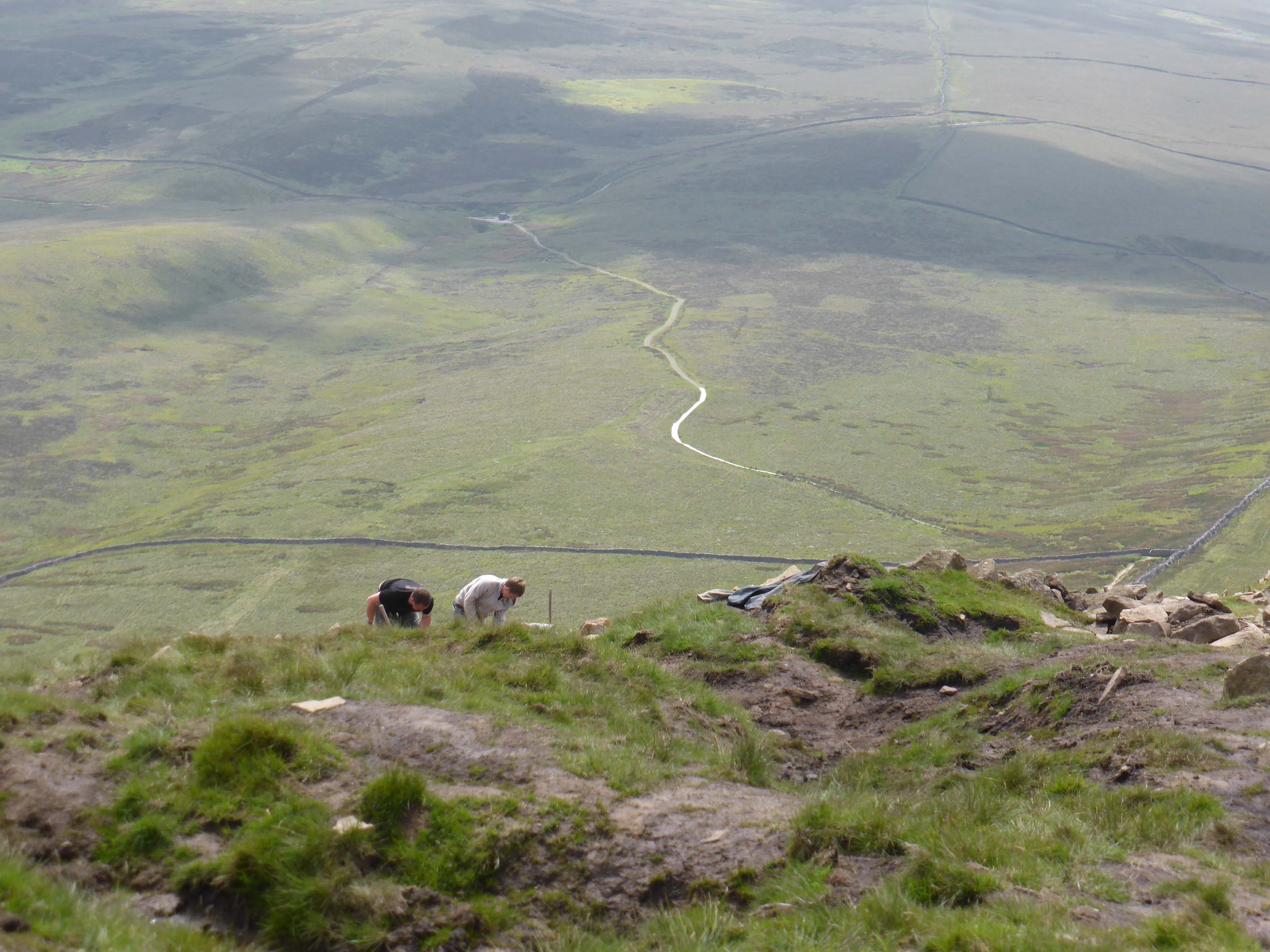
We clock in at the Café at 8.15 and then make a start. Pen-y-ghent is shrouded in cloud and it is pleasantly cool as I start the ascent. I am on the route that Lynnie and I took yesterday, just going a bit quicker. As I go over Brackenbottom Scar I see a walker ahead and gradually gain ground. Finally we meet and I realise that it is one of the chaps who was working on the path at the top of Pen-y-ghent yesterday. He is working on his own today and is enjoying his commute to work. We walk and talk for ten minutes and then I go on.

Clambering up the rock face I am reassured that I am not near the top of this peak on my own. Due to my fear of heights it is the one bit of the walk that I dislike. On the other hand Crosby is up and over and looking back wondering what is keeping me. I tell him that he is in four-wheel drive and I stuck with rear wheel drive and not designed for this type of terrain.
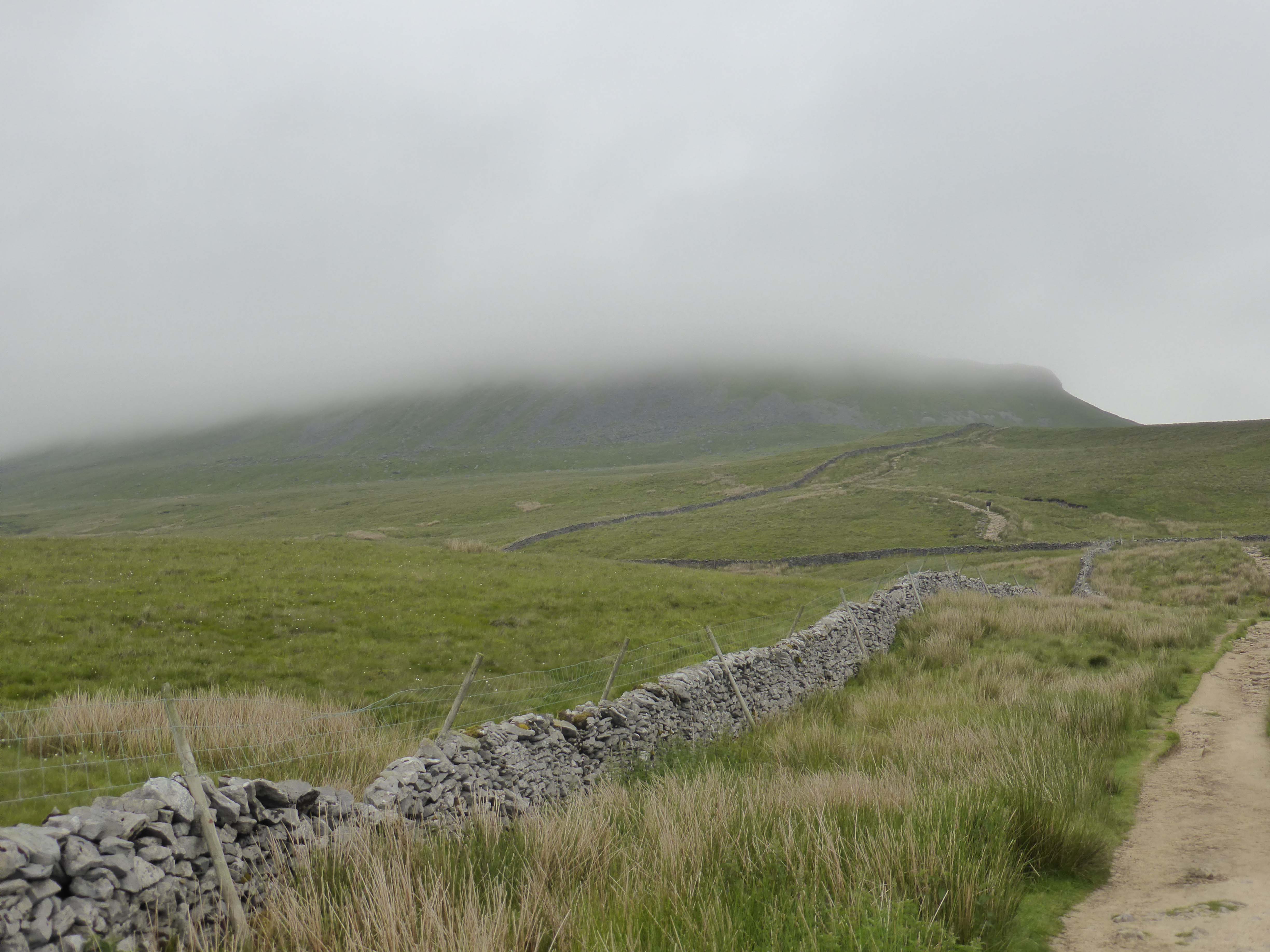
At the peak, 2,277 feet, it feels very different than yesterday. Visibility is poor, less than fifty yards. You can see how under prepared folk can get into difficulty up here. As we descend the visibility improves and we are treated to views of Ingleborough and Whernside, both cloud covered.
Yesterday Lynnie and I took the Pennine Way path down into Horton, but today it is straight on for me, over Whitber Hill. As we have been descending Crosby has been treated to an apple core, Pringles and cheese biscuits found on the wayside. Whitber Hill provides Hoolahoops. Somewhere up ahead must be a group of youngsters.
Then around Jackdaw Hill, I start to get gyp in my left boot. I can hardly believe it, all the walking I do and I get a blister just over six miles into a twenty-six mile walk. Being a good Boy Scout (although I never went to the Scouts) I am prepared. A plaster is applied and we are on our way.
Thousands of people do this walk every year, so the path can be clearly seen and although I am carrying a map there is no need to refer to it. I can now see the group of youngsters ahead and I am closing on them. Over God’s Bridge on Brow Gill and around Nether Lodge and I overtake the youngsters, about eight of them in their late teens and a couple of older chaps. They are as busy talking as walking.
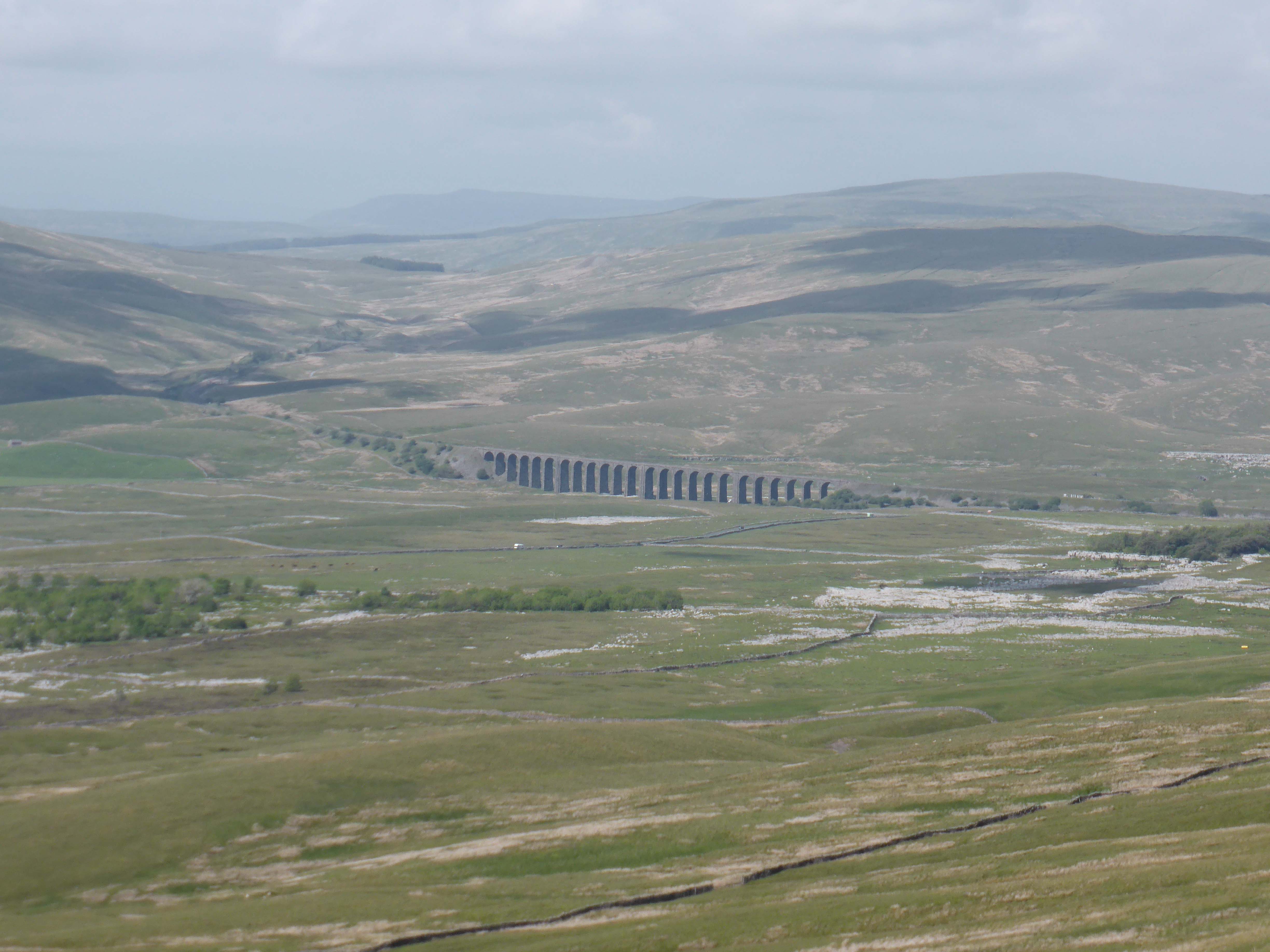
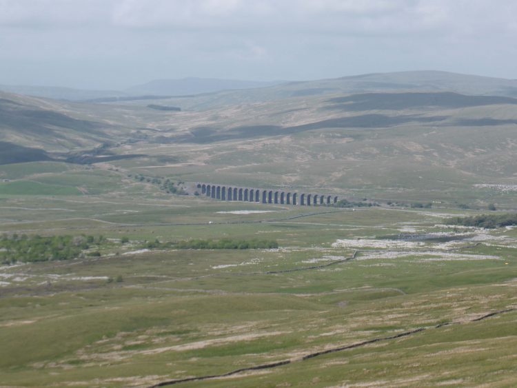
As I approach Thorns I hear steps coming behind me and turn to see that one of the students is catching me up. He asks if I mind him walking with me for a while. We walk together for thirty to forty minutes, he tells me about his College course in Leeds, I tell him about our travel. We chat about the beauty of walking and we both wonder why more young people don’t want to get out and about. We are from very different backgrounds and ages. He is a young chap of Asian descent. We share a common interest and he appears fascinated when Ribblehead Viaduct comes into view and I tell him about the construction and the mass grave at Chapel-le-Dale churchyard. At Ribblehead he rejoins others from his group. I hope he enjoyed our chat as much as I did.
Ribblehead Viaduct is an iconic feature of the Dales. It looks fantastic in photographs but in real life it is absolutely stunning. It’s an incredible feat of engineering. The Viaduct is 440 yards long with twenty-four arches that carry the Settle to Carlisle railway one hundred feet above Batty Moss. The viaduct itself is a Grade II* listed building and the areas where the navvy settlements of Batty Wife Hole, Sebastopol and Belgravia were located are scheduled ancient monuments.
The first stone of the viaduct was laid on 12 October 1870 and the last in 1874. About one thousand navvies worked on the site and they established shantytowns in which men, woman and children lived. It must have been a bleak existence, especially in the hard winter months. This place is miles from anywhere. Around one hundred men where killed in the construction, no health and safety in those days. There was also a smallpox epidemic that claimed the lives of other men, women and children. In all, over two hundred people were buried in Chapel-le-Dale churchyard a few miles down the valley. Today the area has groups of walkers about and others that have just stopped to wonder at this incredible sight.
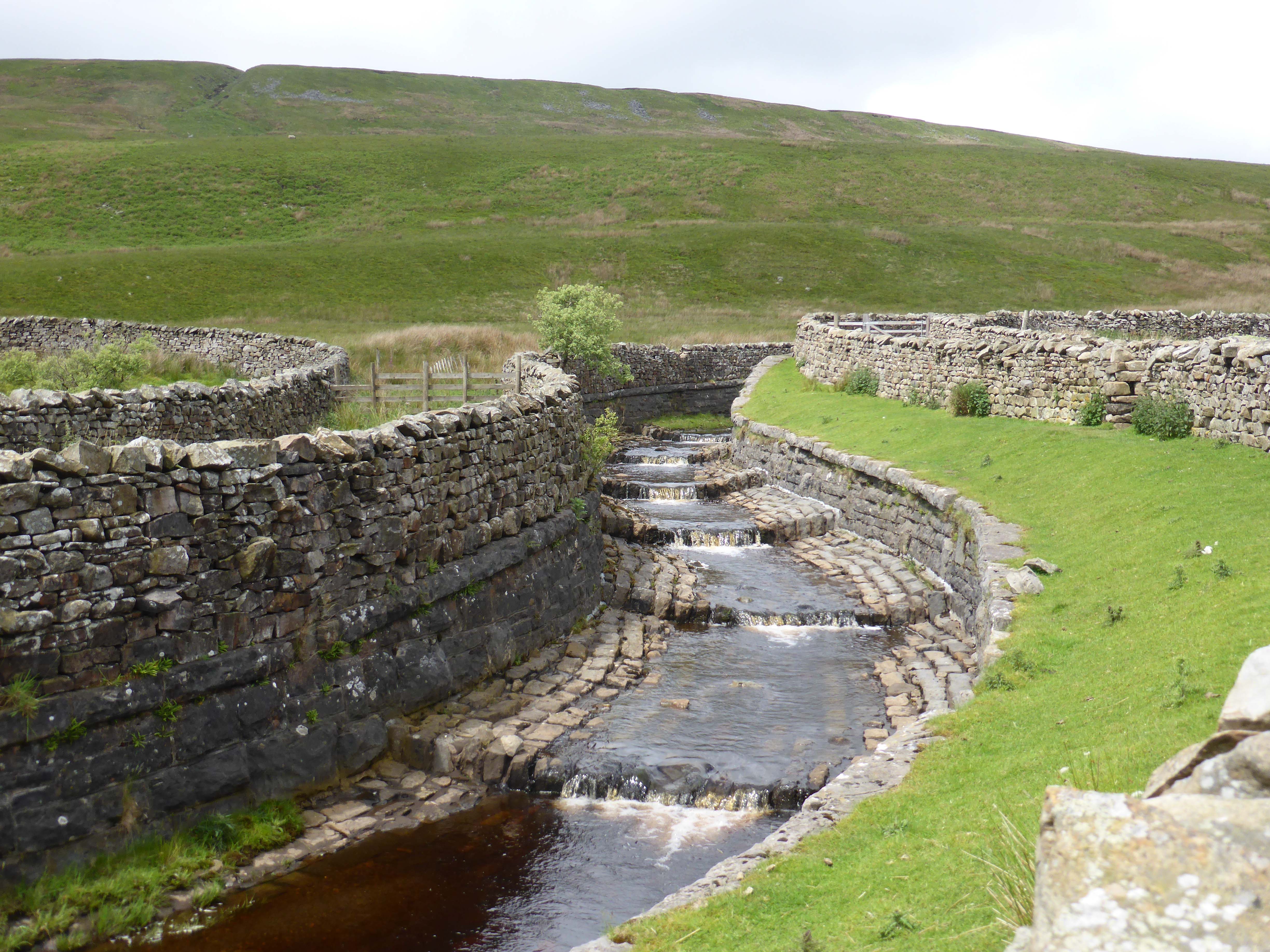
Heading on I walk alongside the viaduct and follow the path by the Settle to Carlisle railway line, passing Blea Moor Signal box. I can see a few walkers in the distance but apart from that I am alone on this approach to Whernside. Crossing the aqueduct, another wonderful bit of engineering where the stream is diverted above the railway line, we quickly reach Force Gill waterfall. Then over a stile, I chat to a couple having a drink, she tells me that she is dreading the scramble up to Ingleborough. I am not so keen on this part myself, but it is a couple of hours away and I want to enjoy the moment.

The walk up Whernside from this side is a long gradual ascent. Soon we are looking down onto Greensett Tarn, the mass of water looks strangely out of place on this moorland and then it is the final section to the top of Whernside. I am not over keen on the drop to my left at the top, but keeping focused I am okay. Whernside is the highest of the three peaks, although the easiest to climb, it stands at 2,415 feet and provides fantastic views back across Pen-y-Ghent on to Ingleborough and across towards Dent.
As I start the descent I pair up with a chap who has done this walk a number of times. We discuss the merits of walking boots, leather or canvas? He explains he has done the walk both ways round but prefers this way, especially the scramble up Ingleborough. I can now see it directly in front of us and ask how steep it is. I am told that it a short climb but very steep. I explain that I don’t like heights. “Oh dear” he replies, followed by a quick “but I am sure you will be okay”. I am not so sure.
The final descent from Whernside is steep. I leave my new walking buddy behind. The first time I hiked up Whernside was from this direction, it is a bit of a clamber. My first ascent, over twenty years ago, was an early evening in late August the cloud suddenly came down and visibility dropped dramatically. It was pretty scary. Today visibility is fantastic, but I still need to be sure footed as we descend. Mr Crosby thinks its great fun to charge on ahead at the full limit of his extendable lead. We have words and he stays closer.
We reach Bruntscar and find a convenient rock to sit and have a drink. Soon my new buddy appears around the corner and goes on ahead, a relief because I think I have exhausted by walking equipment conversation.
I check the map and realise there is an alternative route up Ingleborough, it is still steep but does not appear to have the final scramble. Somewhat relieved we set off again.
We meet the road at the Hill Inn and turn left along the road for a few hundred yards and then right into a field. There sat on the rock is my mate. We have a brief chat and I tell him that I am going to Ingleborough by the route that avoids the steep scramble. He gives a slightly bemused look, “that’s the best bit of the walk” he says.
I take the footpath but after a couple of fields turn left to walk up to Great Douk Cave. I have not previously heard of this cave, it is surrounded by a dry stone wall and is shielded by trees, it is a huge hole. A little further on I round Little Douk Pot and then cross boggy ground to the limestone crag containing Middle Washford caves. So far it has been a gradual incline. Suddenly we are going up.
I would like to say that I was stopping every fifty yards to admire the view, in reality I was catching my breath. This is a climb, but eventually we arrive on the ridge and the views are magnificent. From here you can see back over Morecambe Bay forty miles away and of course the Ribblehead Viaduct.
Walking along the ridge I glance back over the steep incline that is the preferred route up. I am sure that I could have come that way, but glad I opted for the route around Great Douk. Then it is the final climb, over big rocks and suddenly onto the rocky top of Ingleborough. This is one of my favourite places in the world. You can see so much and no matter which way you come up there is always a real sense of achievement in getting here.
I have been walking up Ingleborough for years. Ben and I walked up here when he was six. On that day Lyn and Lolly stayed behind. Mum had come to Yorkshire and was staying with her good friends Phyl and Maurice. As Ben and I left we were instructed to wave to Mum and Phyl when we reached the top. On every subsequent trip, Phyl always said I should wave to her from the top.
Sadly neither Mum nor Phyl are still with us, both are greatly missed. As I reach the summit I wave to them both. Now I will leave you to decide if it was the strong wind that was making my eyes water, or if I am just an emotional chap. I will give you a clue, I cannot watch Mary Poppins without crying when the wind changes direction.
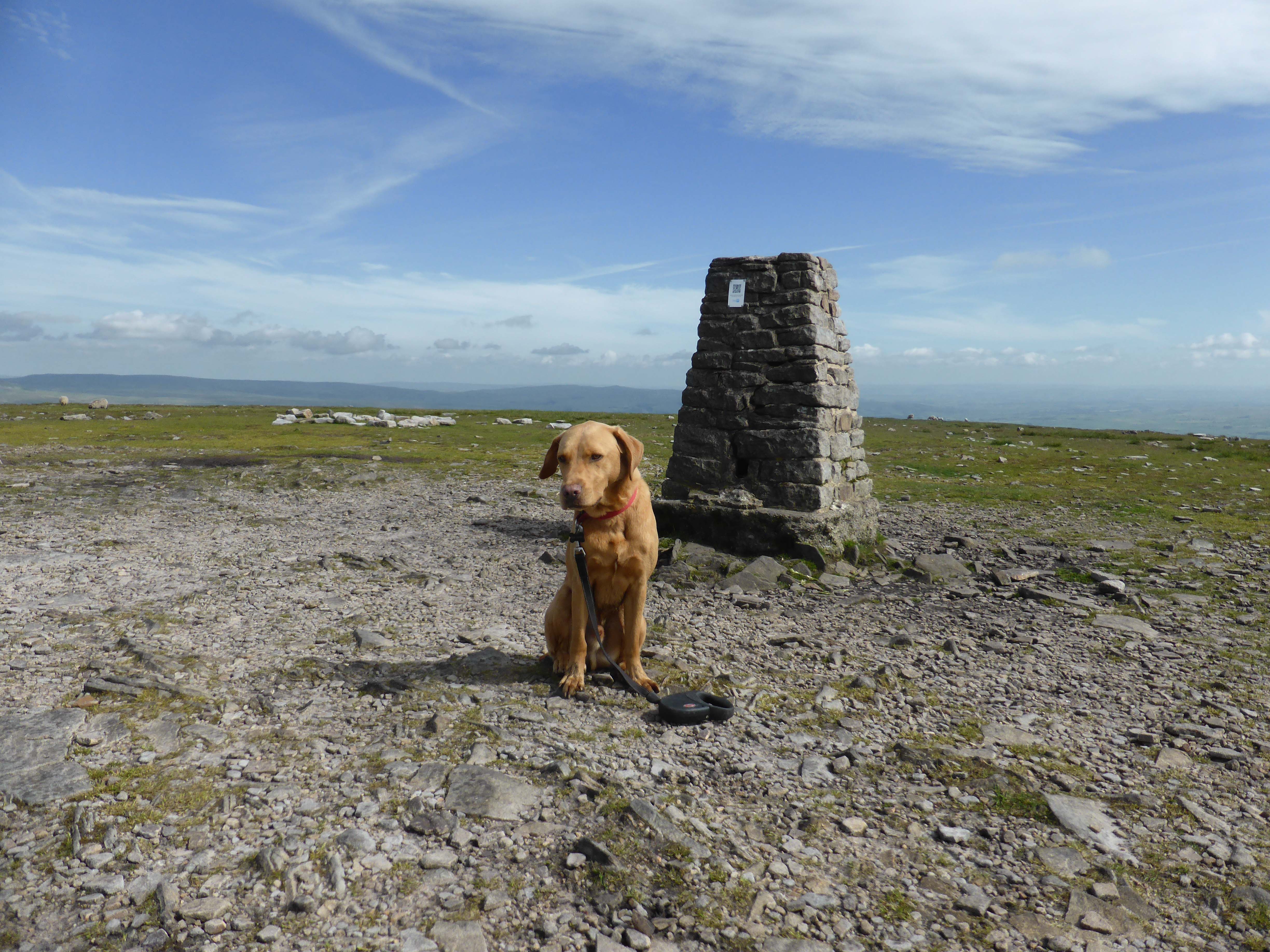
Crosby and I have a quick cuddle to celebrate our third peak of the day, this one is 2,372 feet. Our route down to Horton means that we have to retrace our steps off the summit. As we do we meet my walking buddy coming up, we bid each other the final farewell of the day and I continue down. It is a long gradual descent to Horton with Pen-y-Gent directly in front of us. Usually walking this path I admire the view, but today the focus is getting to the bottom.
As I enter Horton I see the Leeds College mini-bus, there in the front seat is my young mate from earlier. He tells me that he had to stop after Whernside, there are four or five other young chaps in the van. It goes to show that not everyone who starts this walk finishes and that adds to the sense of achievement. I was feeling a bit disappointed that I was going to be outside my target time of 9.5 hours. However, I would rather be ten minutes over than not complete.
Clocking back in at the Café, I have covered the twenty-six miles in nine hours and forty minutes. Well inside the twelve hours allowed to become entitled to join the three peaks club.
Crosby and I get back to the Unicorn to a warm welcome. Dexter look at me as if to say “Where the hell have you been all day with Crosby?” Then gives Crosby a look saying “Serves you right for stealing my Dad”.
Time for a shower and a couple of beers.
To follow our walk you will need Ordnance Survey Outdoor Leisure Map 2 – Yorkshire Dales Western Area
12th June 2014
© Two Dogs and an Awning (2014)
-
Men at Work
Today we are going for a walk. Not a long walk, but most would consider it a good walk. It is one of my favourite walks in the Dales, not one that Lynnie puts on her must do list, but one she is prepared to do.
-
Thunder and Lightning
We are going to be in Settle for a couple of weeks so time to stock up on provisions and have a bit of a sort out in the Unicorn. After a morning around the van it is time to get the boots on. I have a walk planned that involves a bit of a climb.