Category: Yorkshire

  • Through the Trees to Whelp Stone Crag

    Through the Trees to Whelp Stone Crag

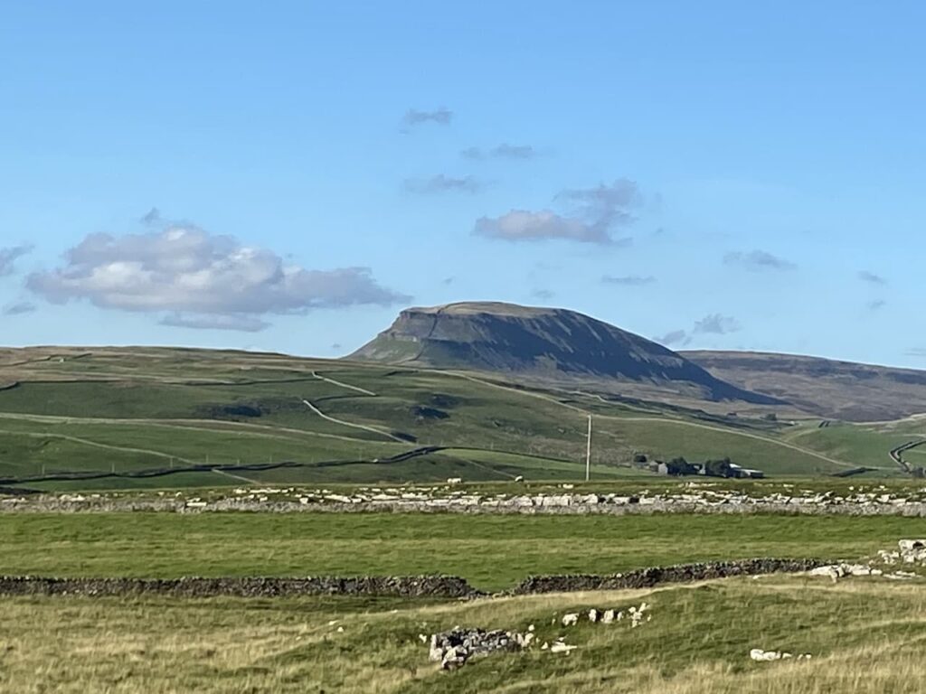
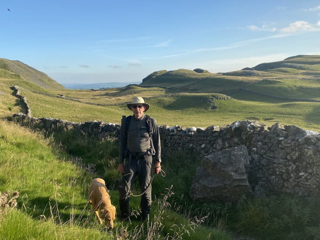
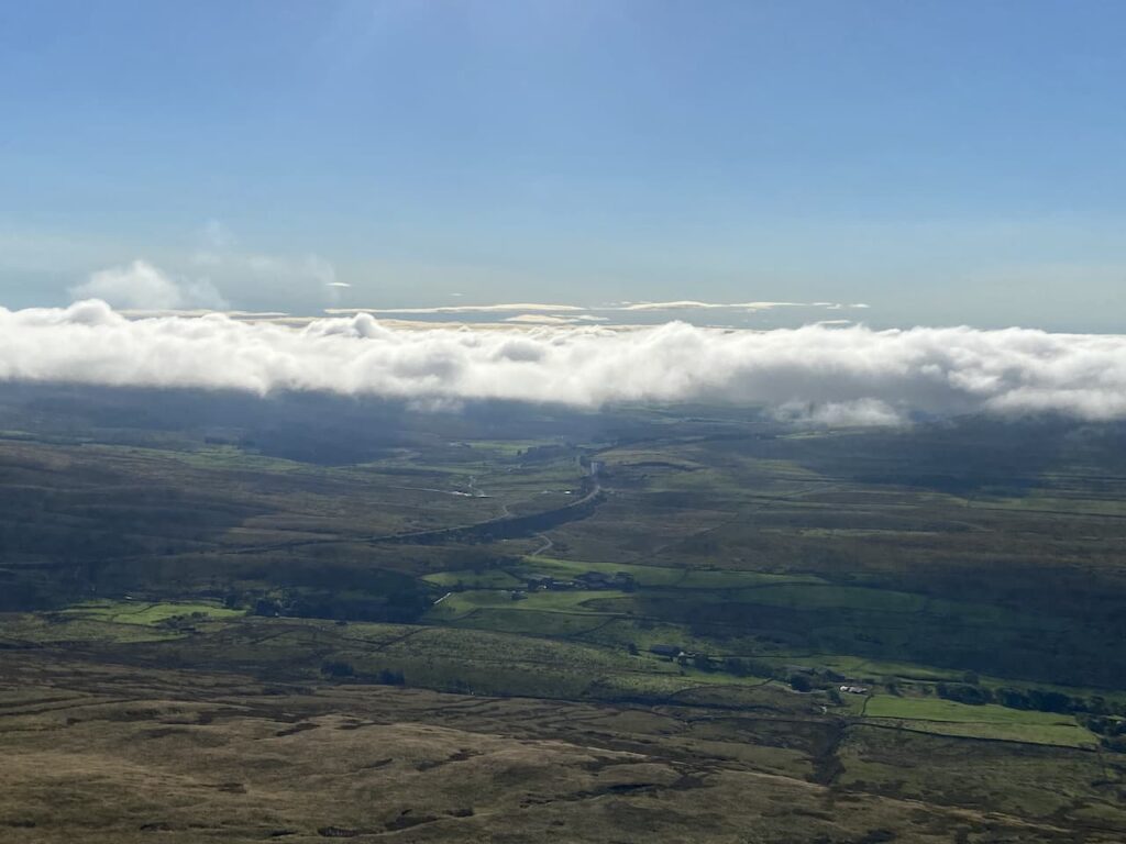
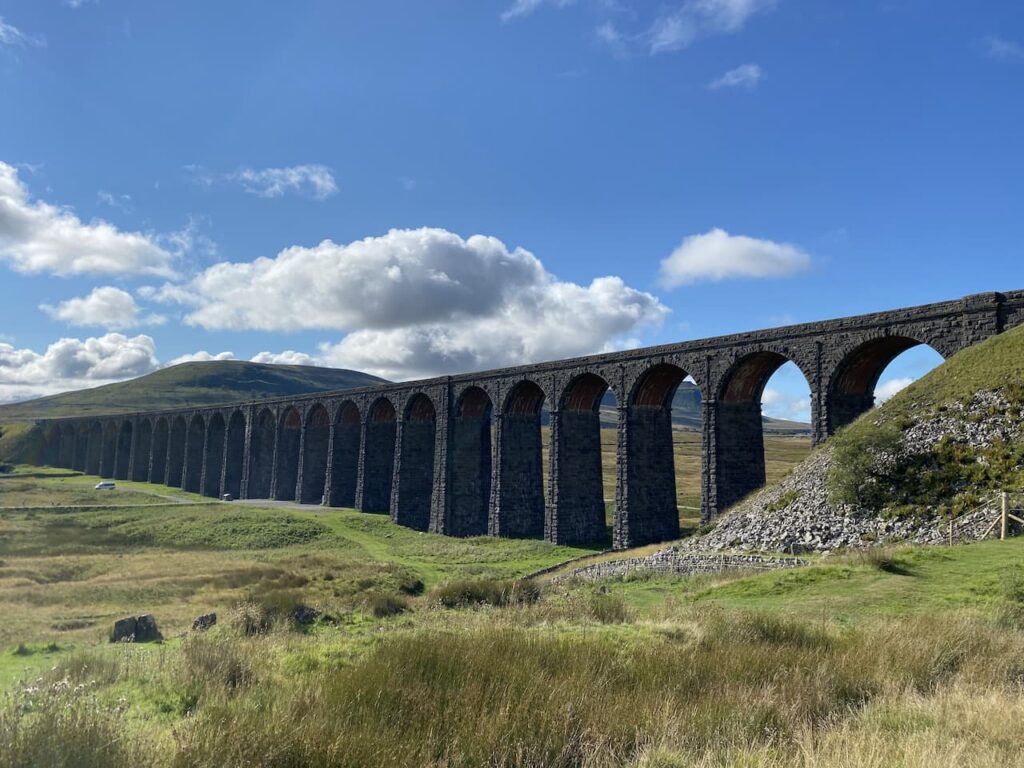
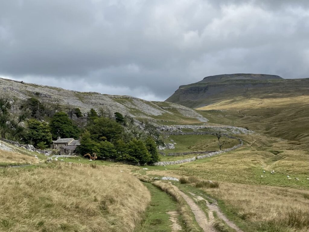
    Yesterday I completed another circuit of the Yorkshire Three Peaks. This time it was with my walking buddy Mandy.  It is a while since I did the walk with someone else and we had a good day for it achieving Mandy’s target of completing the walk in less that 10 hours.  Normally on the day after this challenge I seek a quiet day’s walking, however, my legs feel good today so I suggest to Lynnie we head off to nearby Gisburn Forest for a wander about.

    The starting point for our walk is the pay and display School Lane Car Park, at Stocks Reservoir (BB7 4TS).  At the edge of the car park are the remains of the demolished St James’ church built in 1852 and demolished when the reservoir was built in 1932.

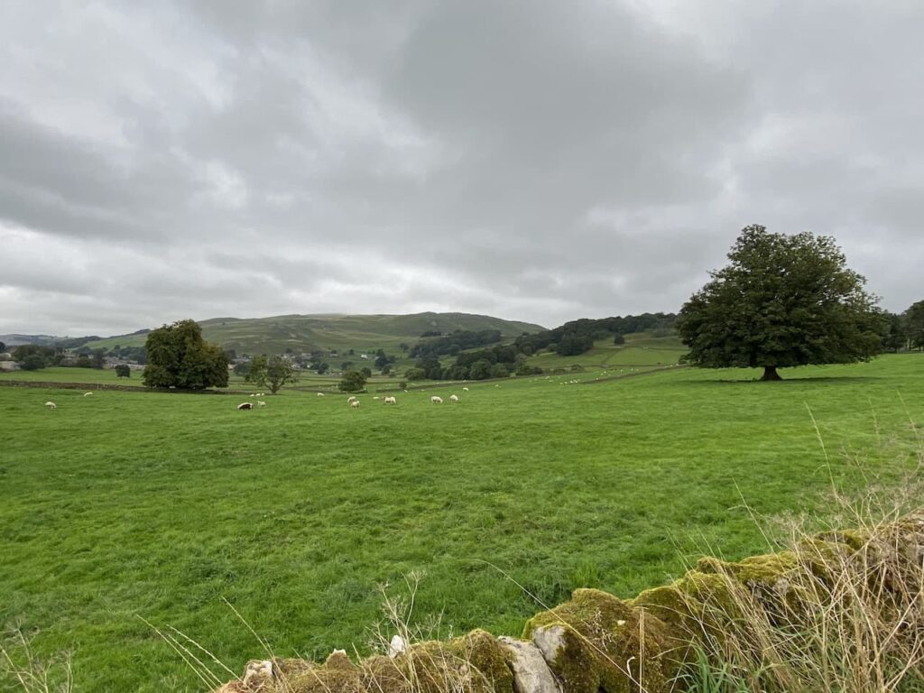
    We leave the car park and join a path running parallel to the road heading south east towards a causeway crossing the reservoir.

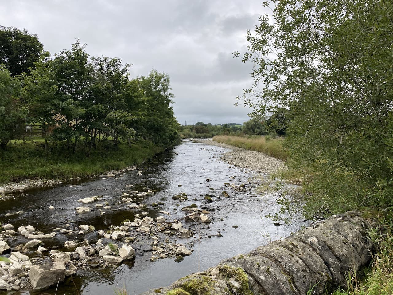
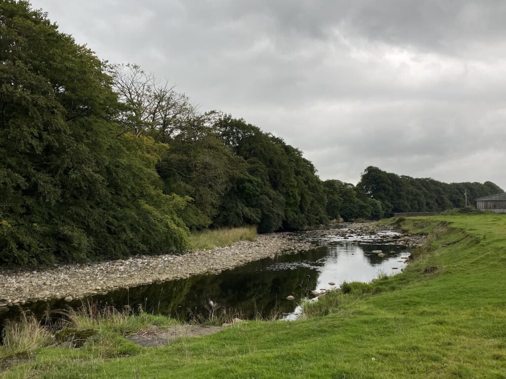
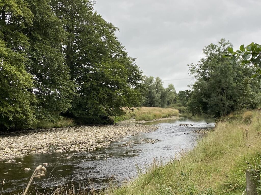
    On reaching the causeway we stop to look at the current low water level in the reservoir.   Stocks Reservoir opened in 1932 and was created by flooding the Dalehead valley including the hamlet of Stocks-in-Bowland.  It took 10 years to construct and had over 500 men working on it.  These were housed in a temporary village called Hollis which was situated near the dam.  

    The reservoir was formed by damming the River Hodder and covered 344 acres.  The last time we were here the water level was high but today, after a dry spell, it is very low.

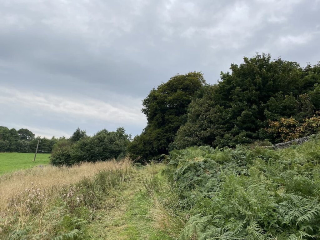
    After crossing the causeway we take a path on the right through woodland and cross a stream.

    When the path sweeps to the right to head towards the dam we join a minor road, Hole House Lane and continue along this to St James’ Church.   This church was built when the reservoir was constructed using material from the old church that was demolished.  Apparently the burials in the churchyard were relocated from the old church and placed here.

    We take a look around the church and then continue along the road as it sweeps around the wall of the churchyard.  A few hundred yards further on we turn left on a path into Gisburn Forest.  

    We follow the path to a junction of tracks and then turn right heading towards the main entrance driveway to the Forest Hub.

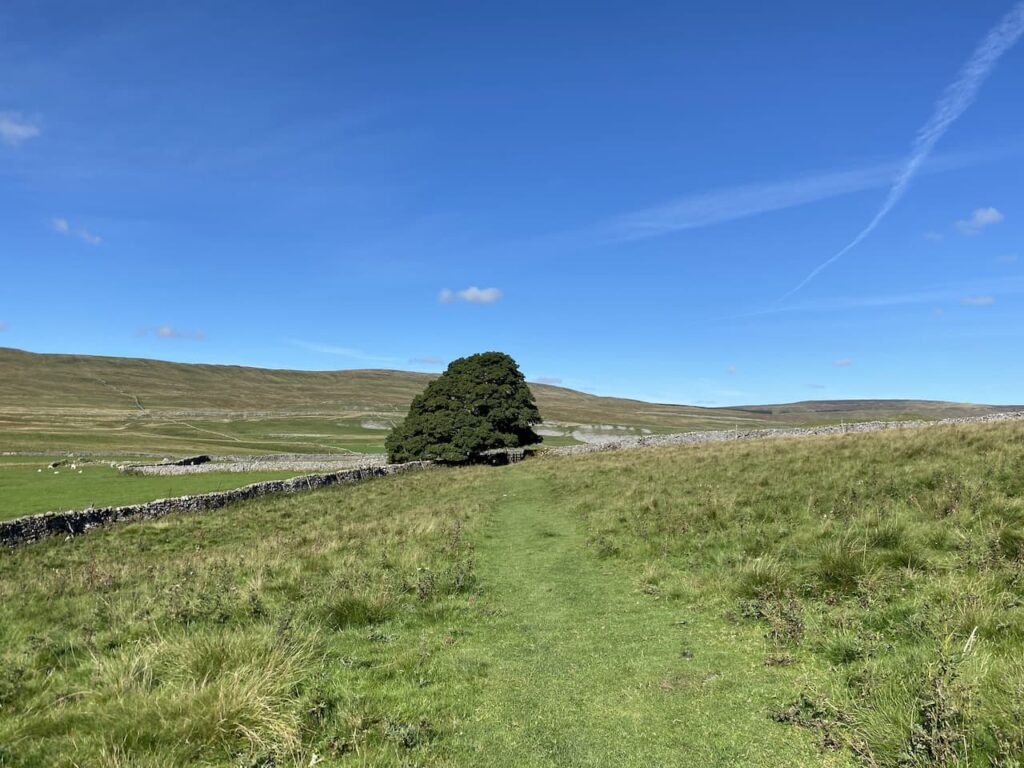
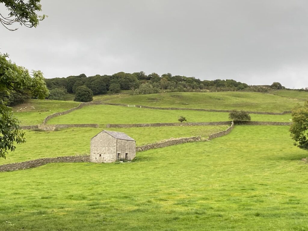
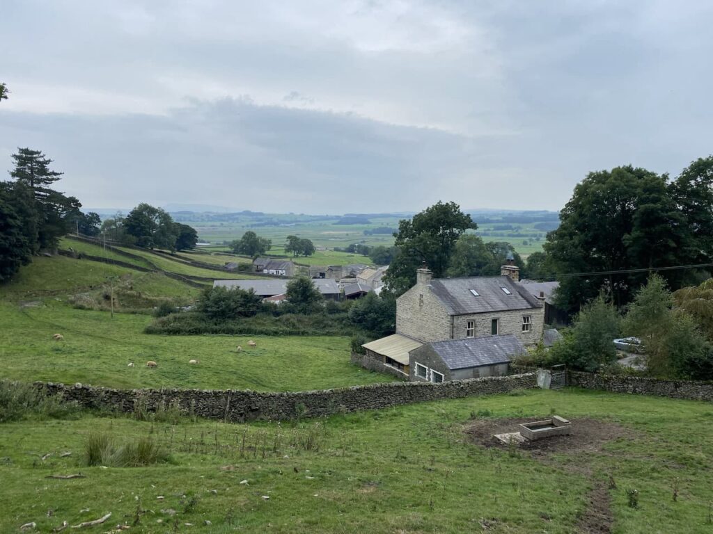
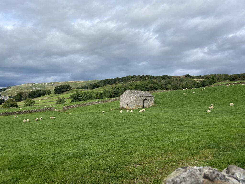
    On reaching the driveway we turn left towards the Gisburn Forest Hub where there is a car park with cafe and toilets.  Our route passes the car park and continues on past the former Stephen Park Farmhouse.  Stephen Park was the name given to the deer park that was created in the 16th century by the Homerton family.  The farmhouse is said to date from around 1662.

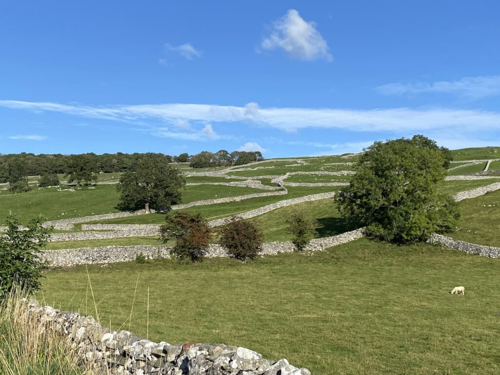
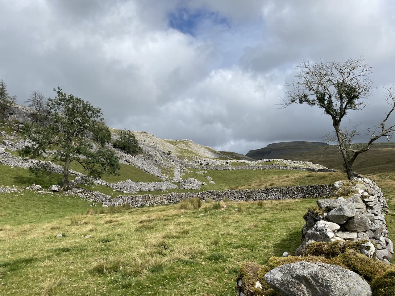
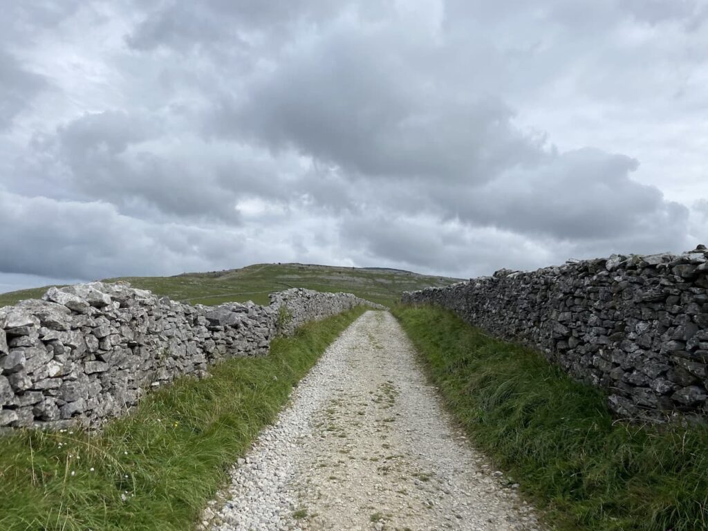
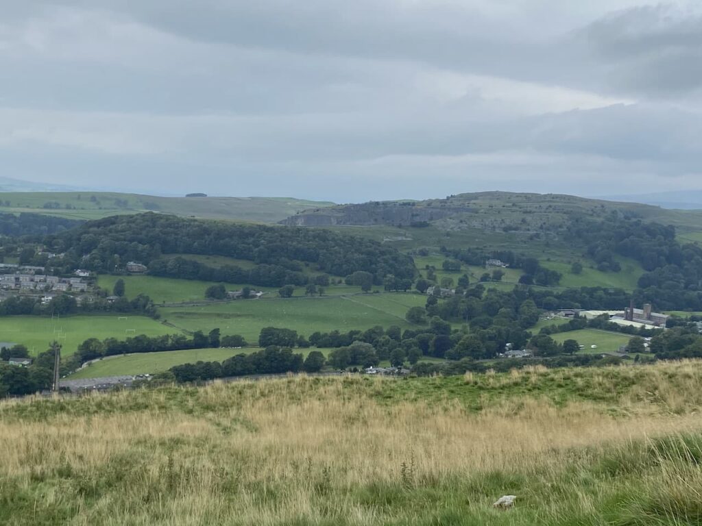
    Gisburn Forest is the largest forest in Lancashire, we have just crossed the border here from North Yorkshire, and it covers around 3,000 acres of land.  Throughout the woodland is a network of forestry tracks now also used as cycle ways and walking routes.  

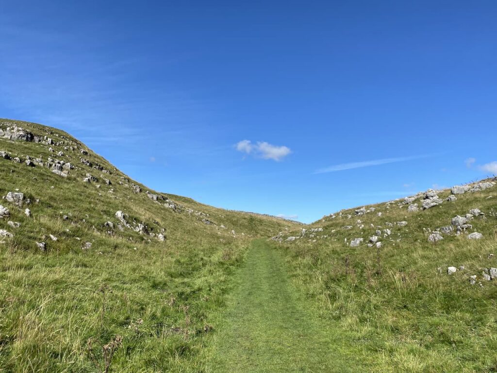
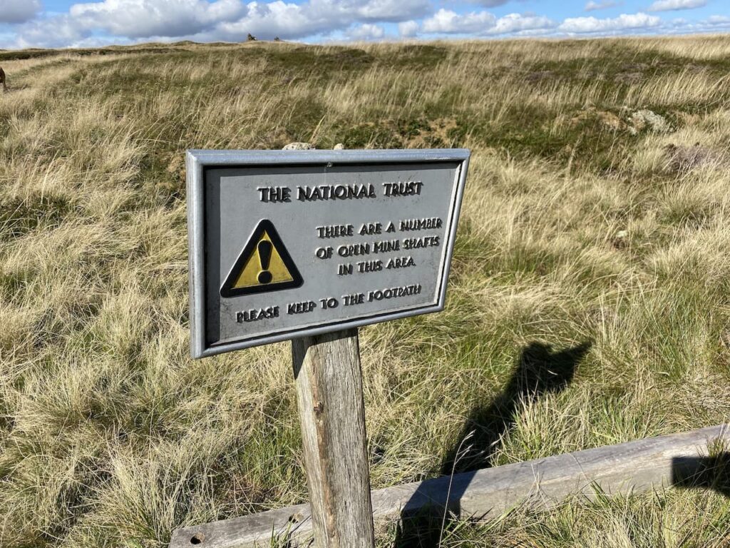
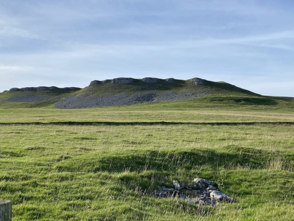
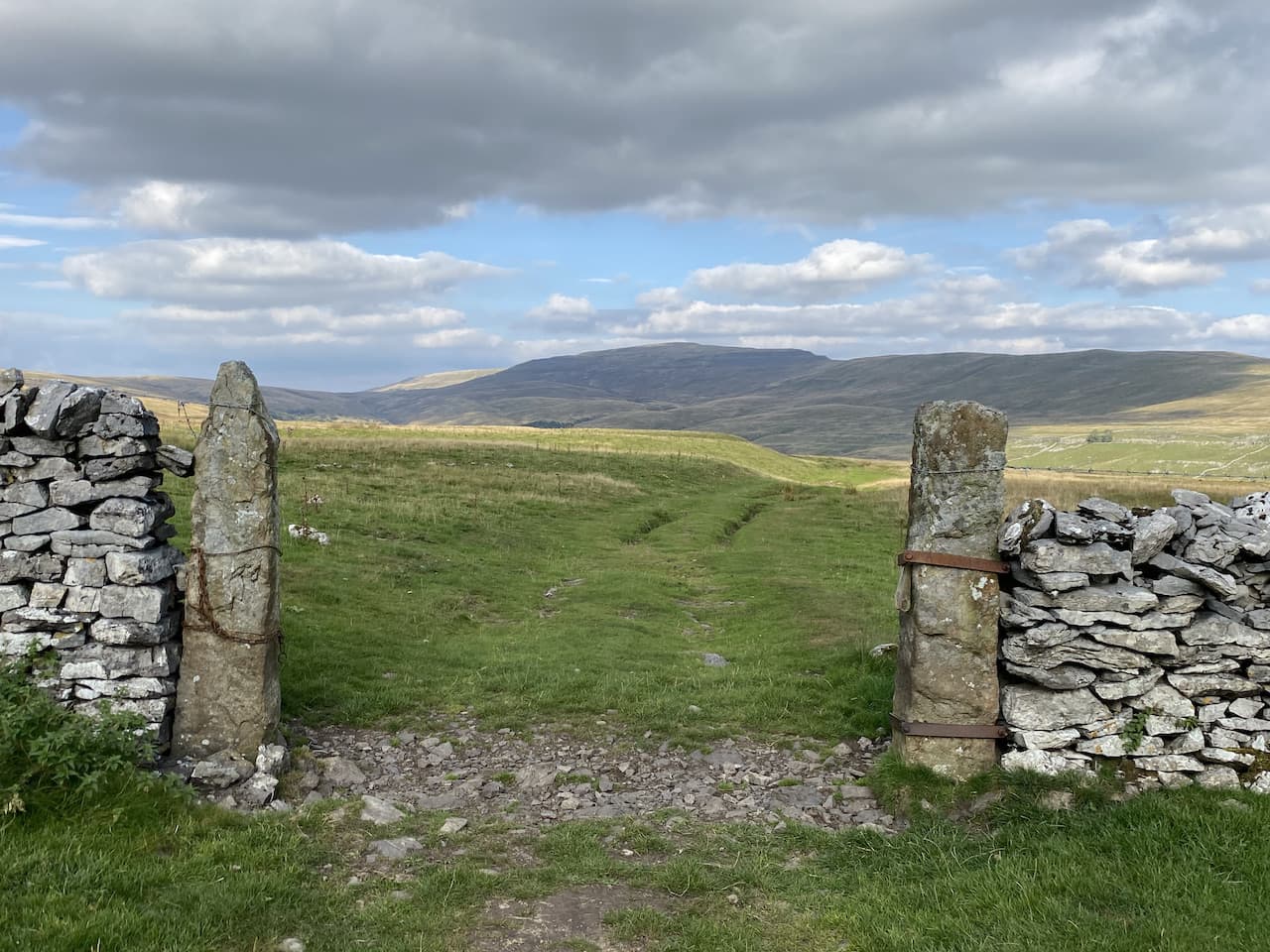
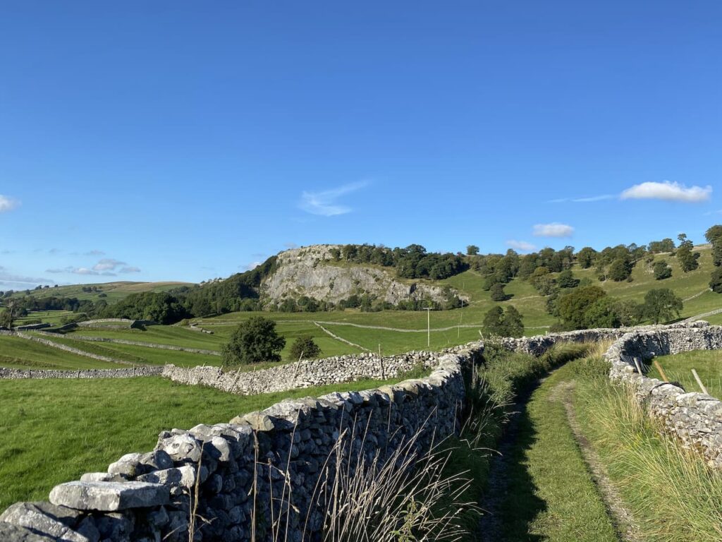
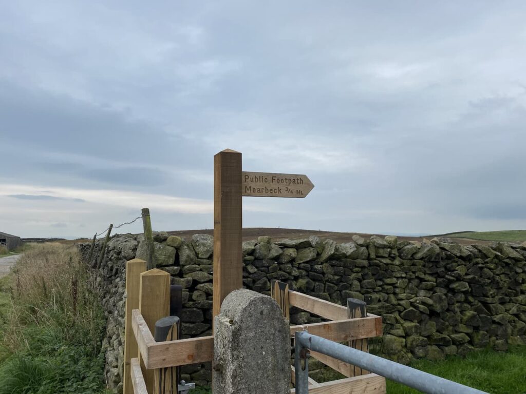
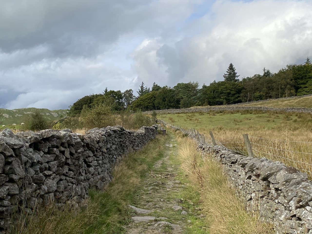
    At a fork in the track we keep right and follow this route as it sweeps around above Hesbert Hall Syke.  We stay with this track keeping in a north easterly direction until we reach the edge of the forest.  Here at a junction of footpaths we go left, still on a forestry track and head towards a disused quarry at Black Hill.

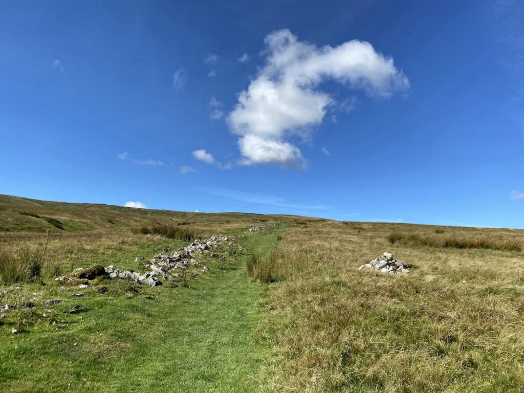
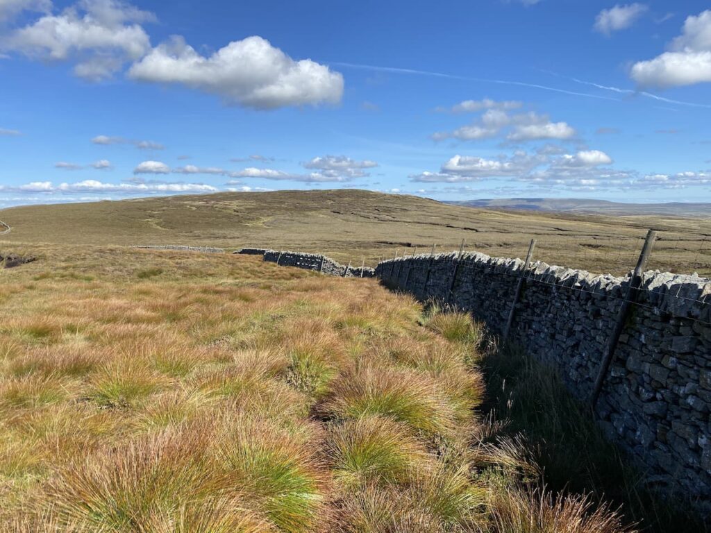
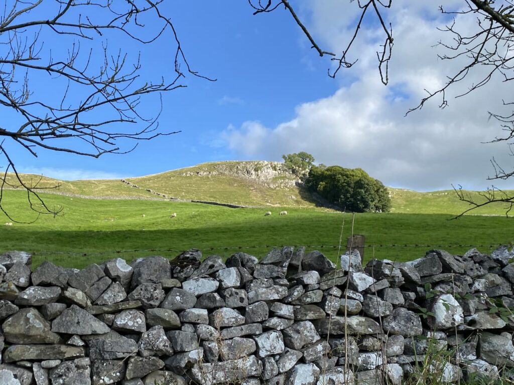
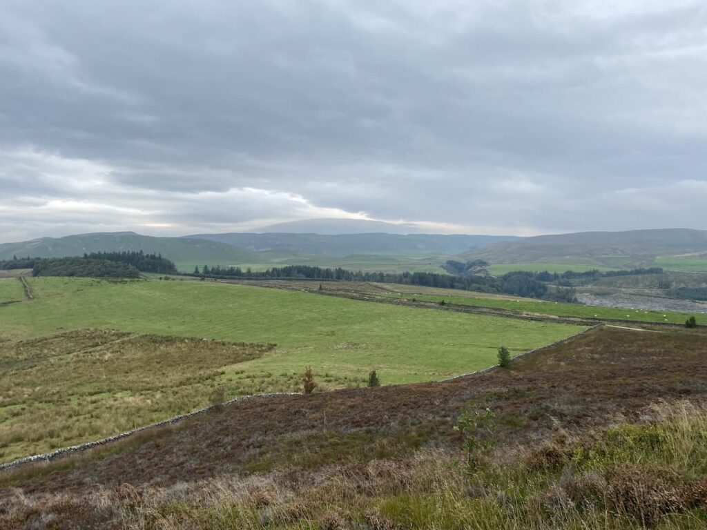
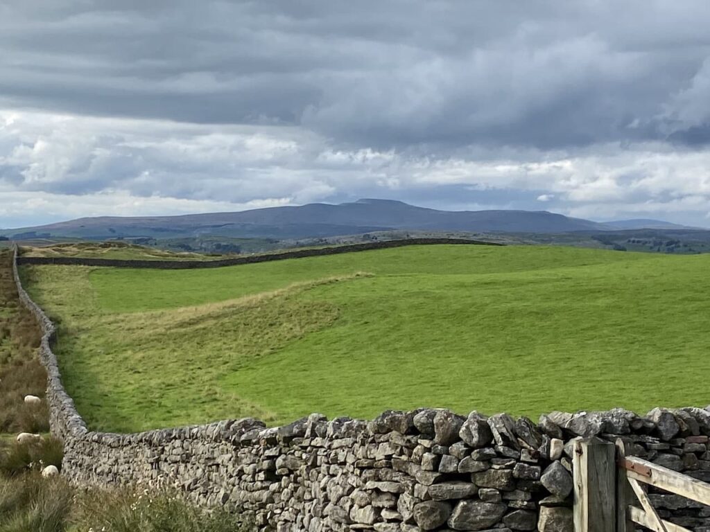
    Soon after the quarry we fork right and keep on the track to reach a footpath on the edge of Hesbert Hall Heights.  It is noticeable that the mountain bike tracks are well marked but footpath signs are absent.  This path follows the line of a wall as we head north between plantations.

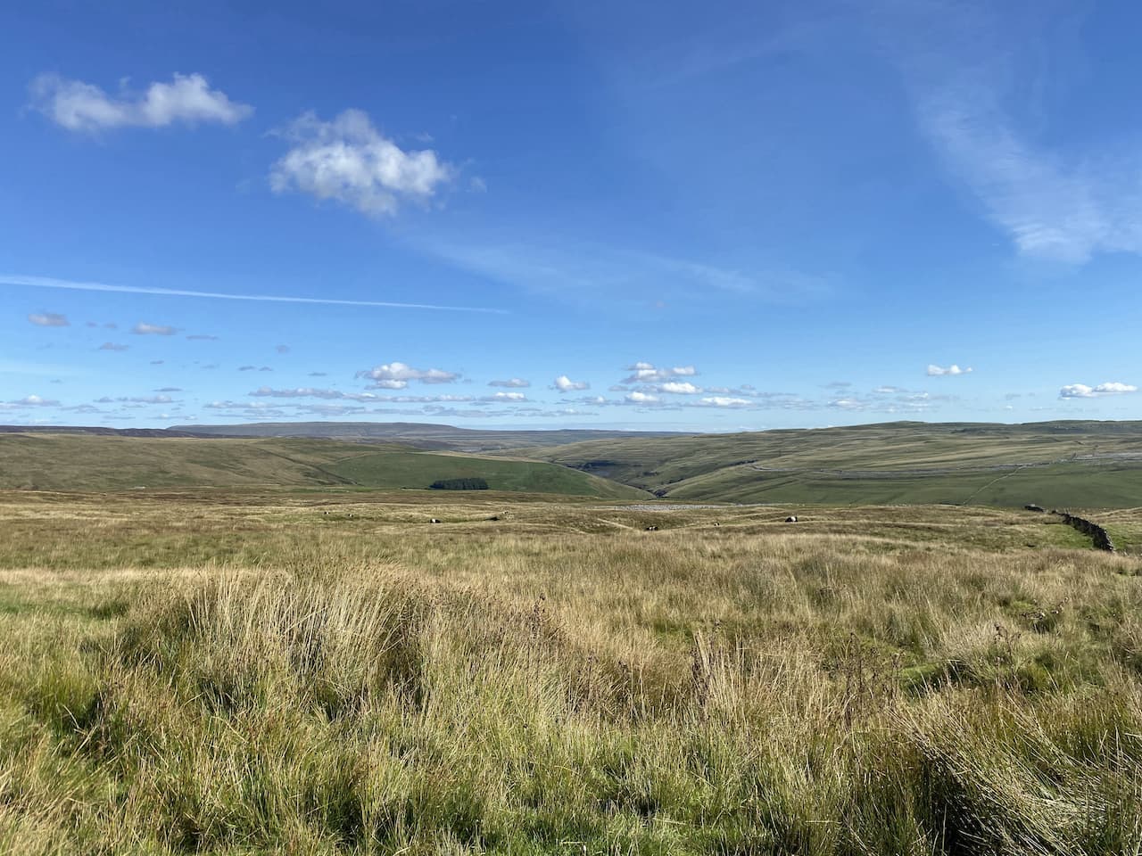
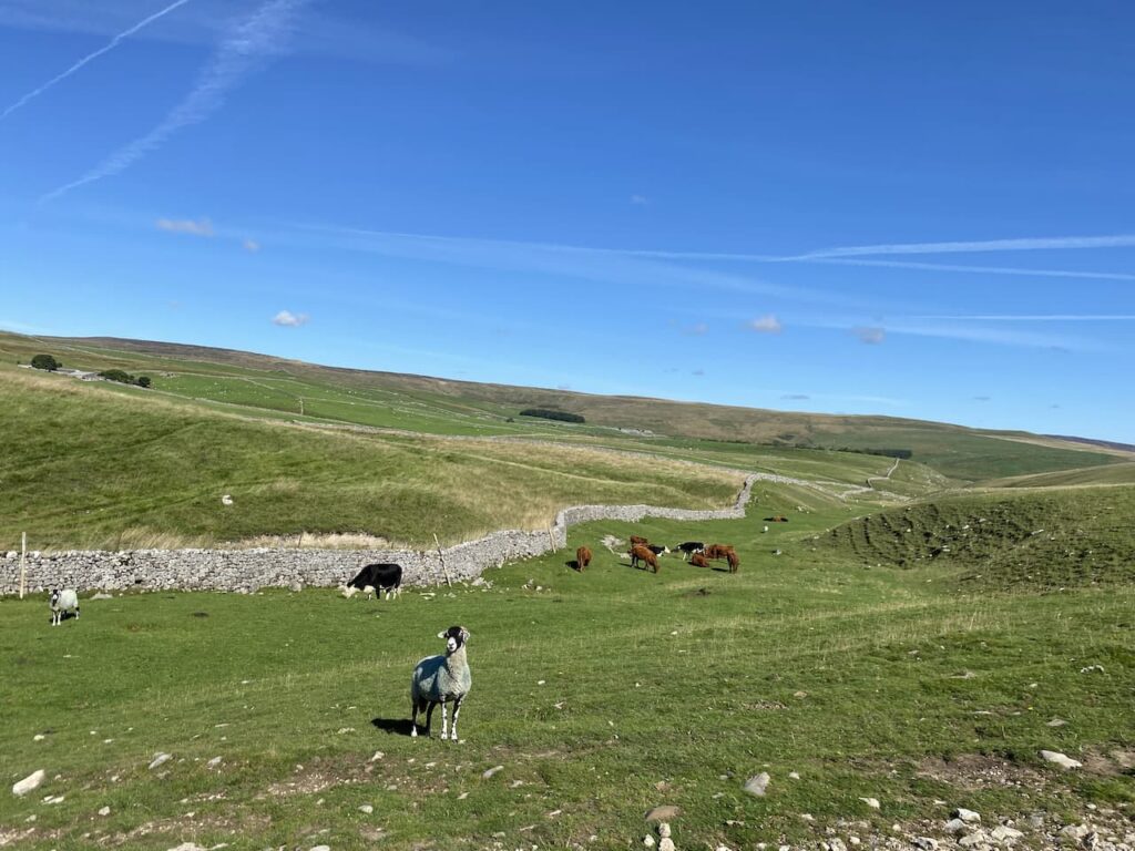
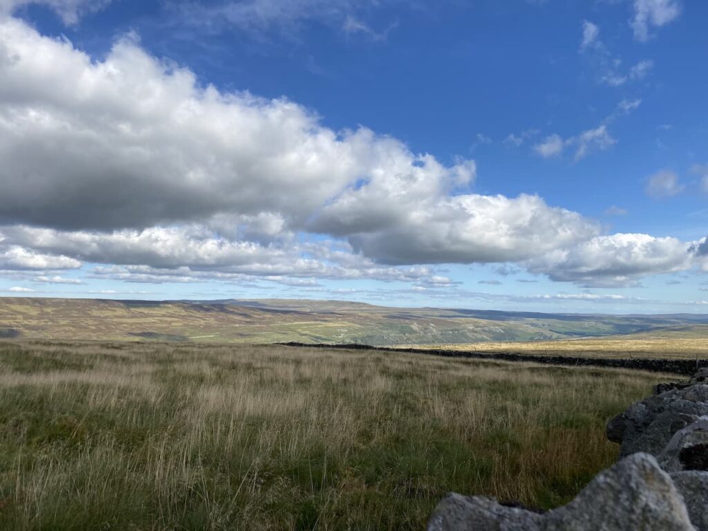
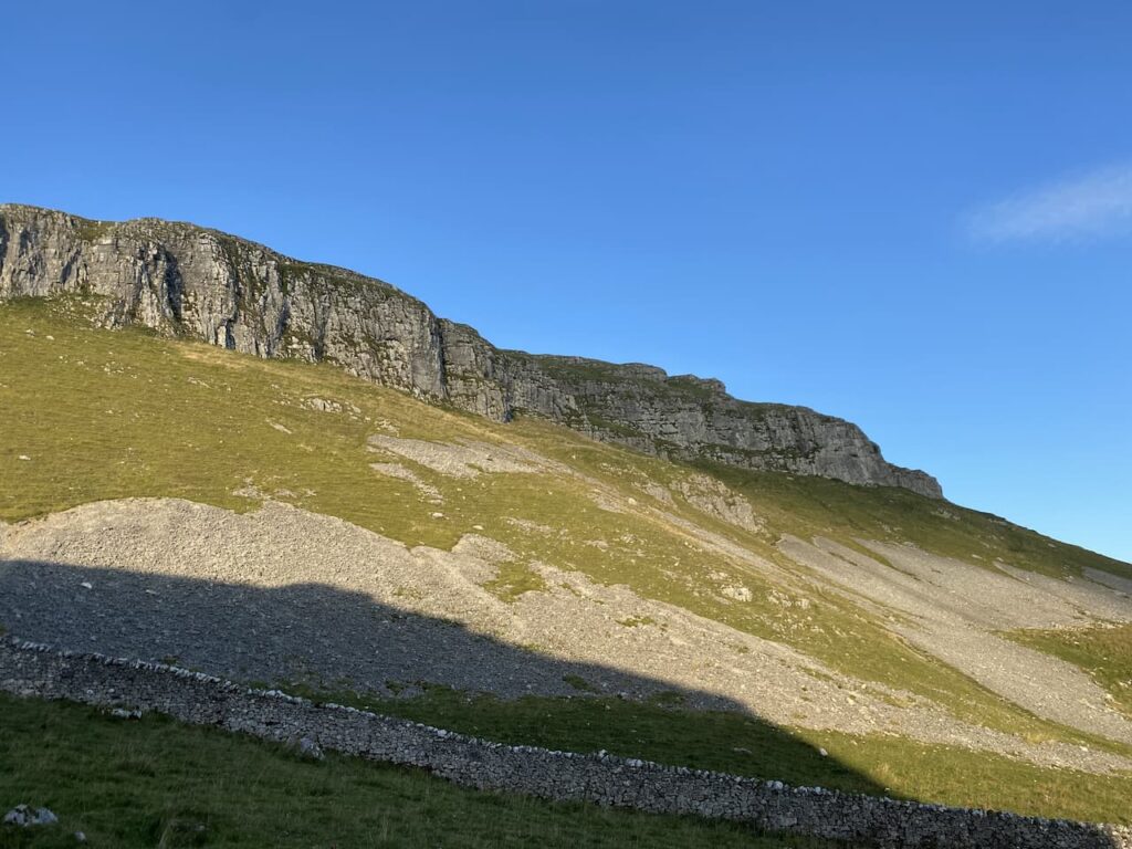
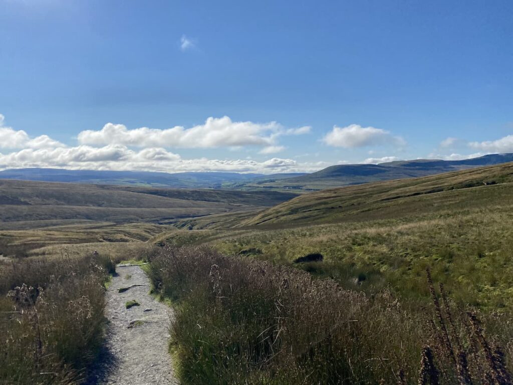
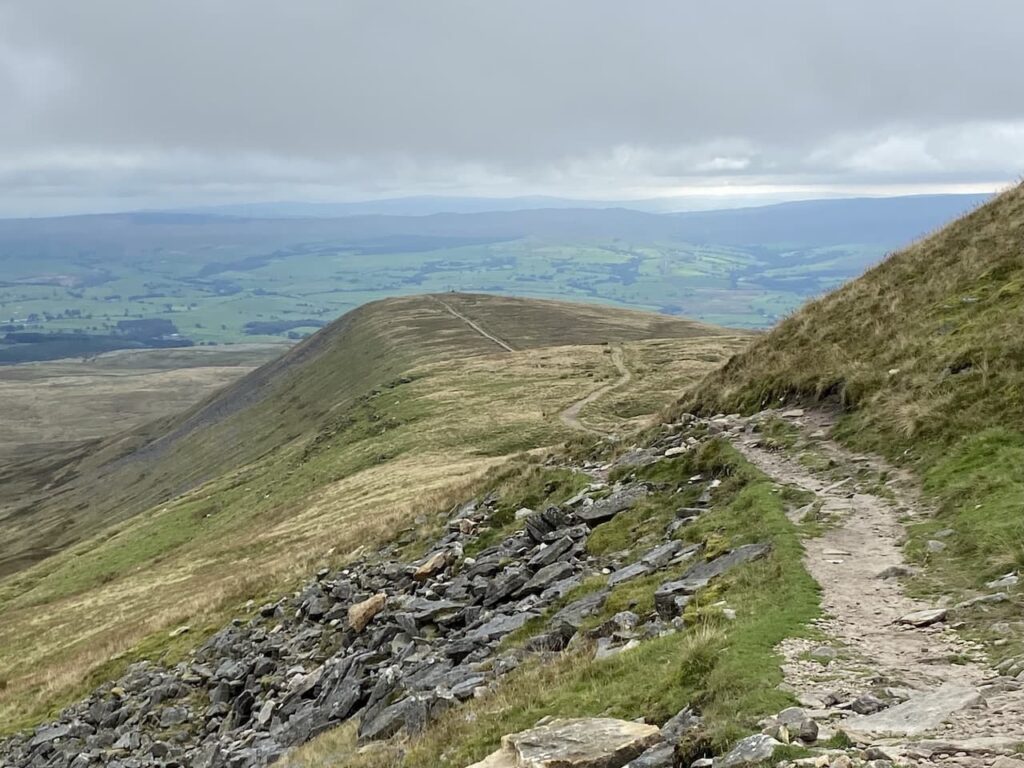
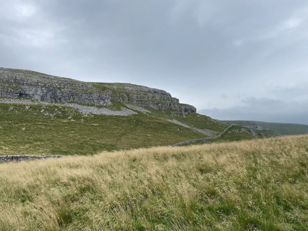
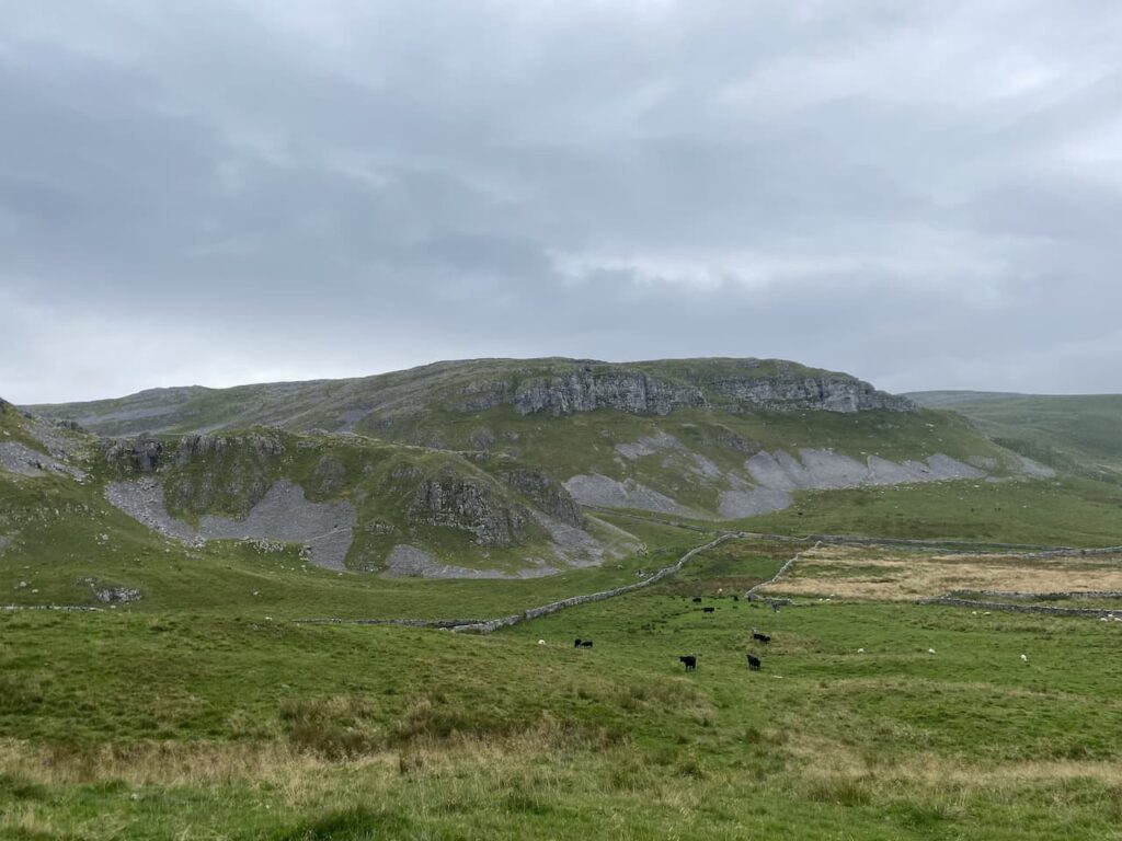
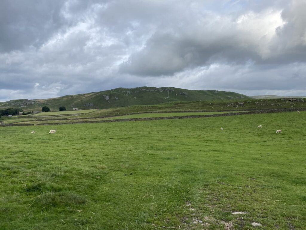
    The path leads to an area of rough pasture on Holden Moor with Whelp Stone Crag in front of us.  

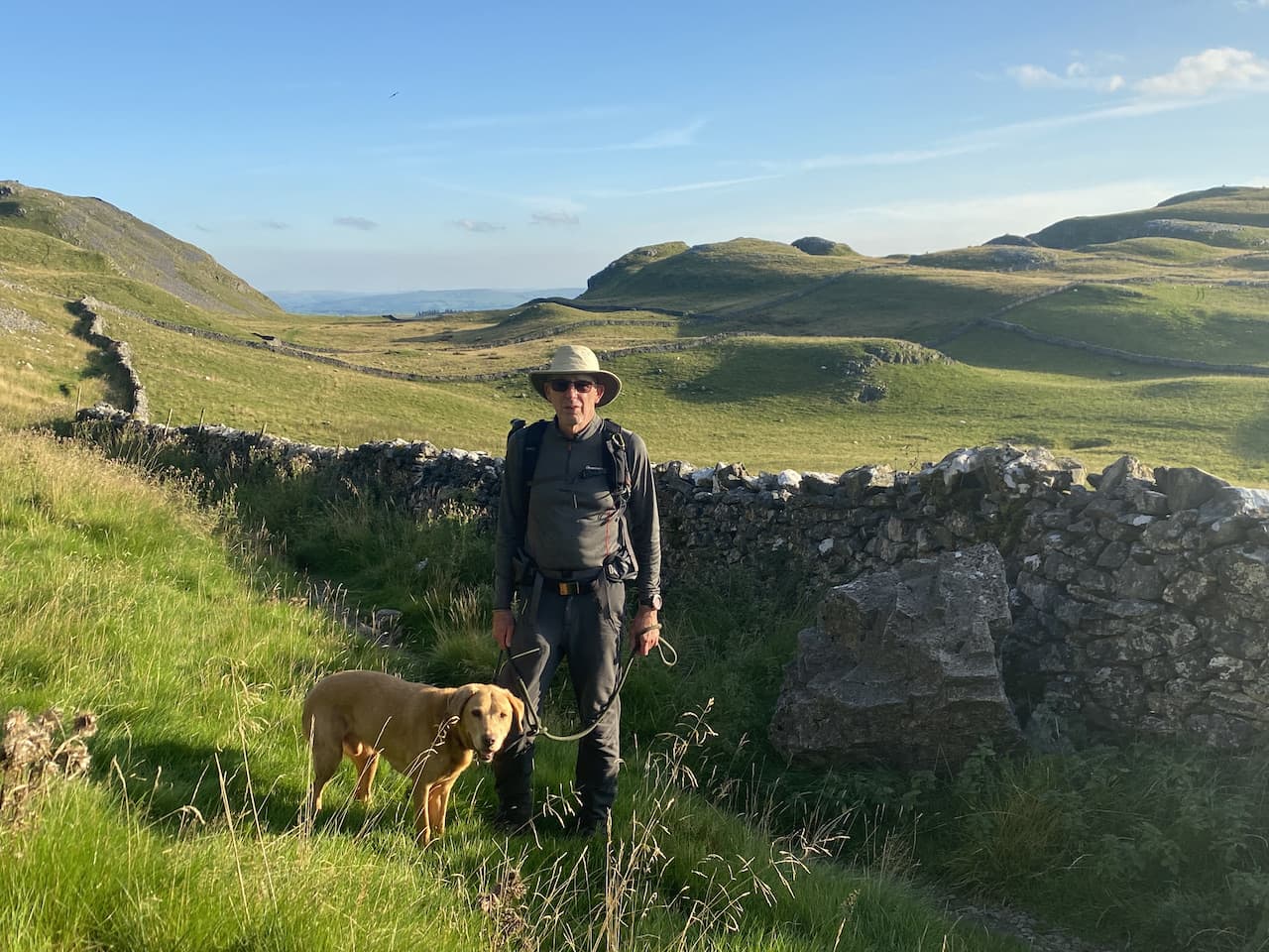
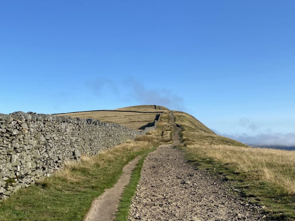
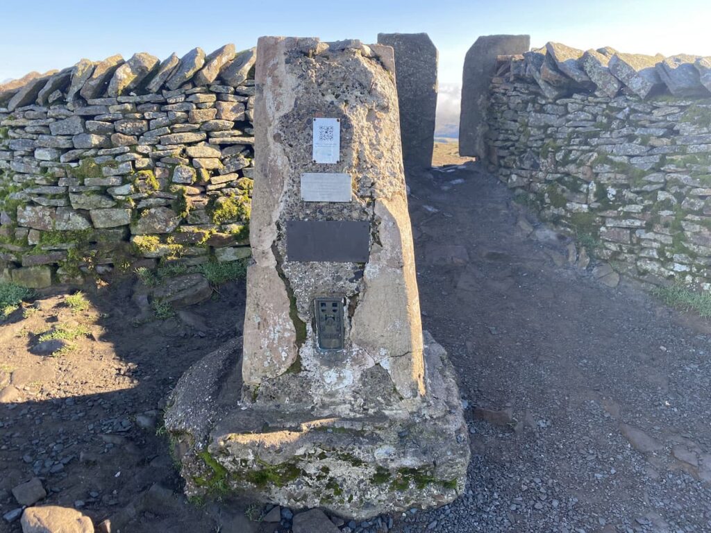
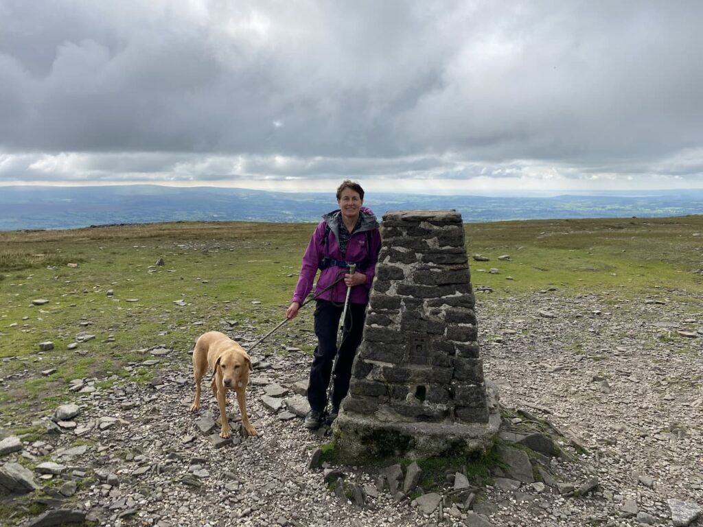
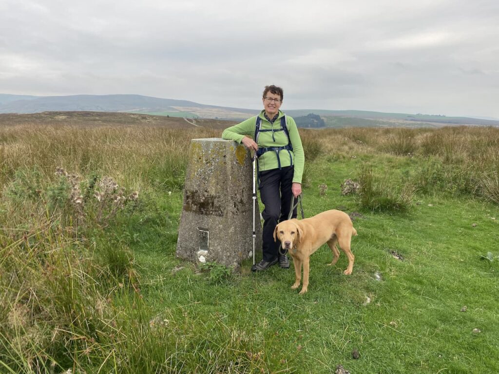
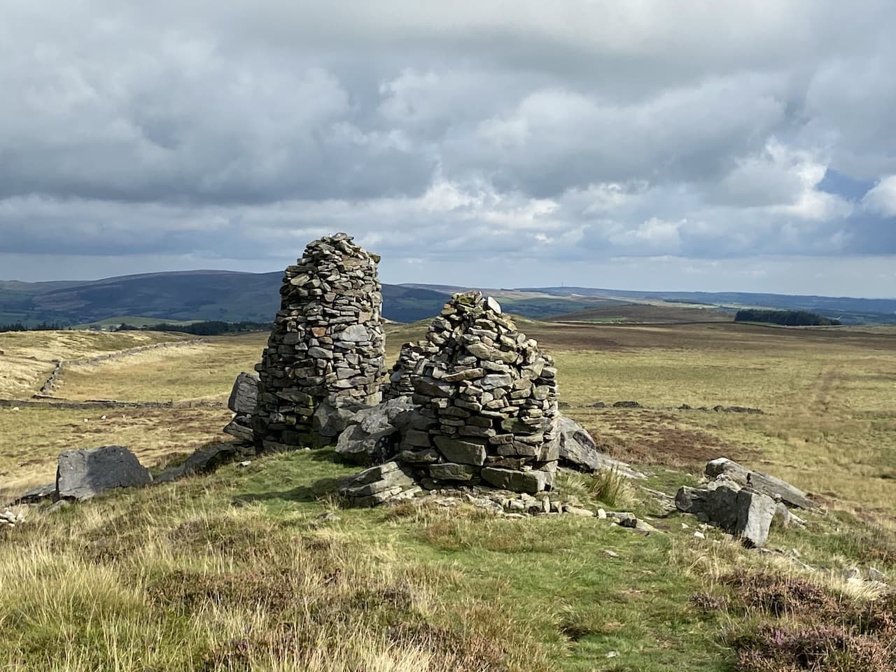
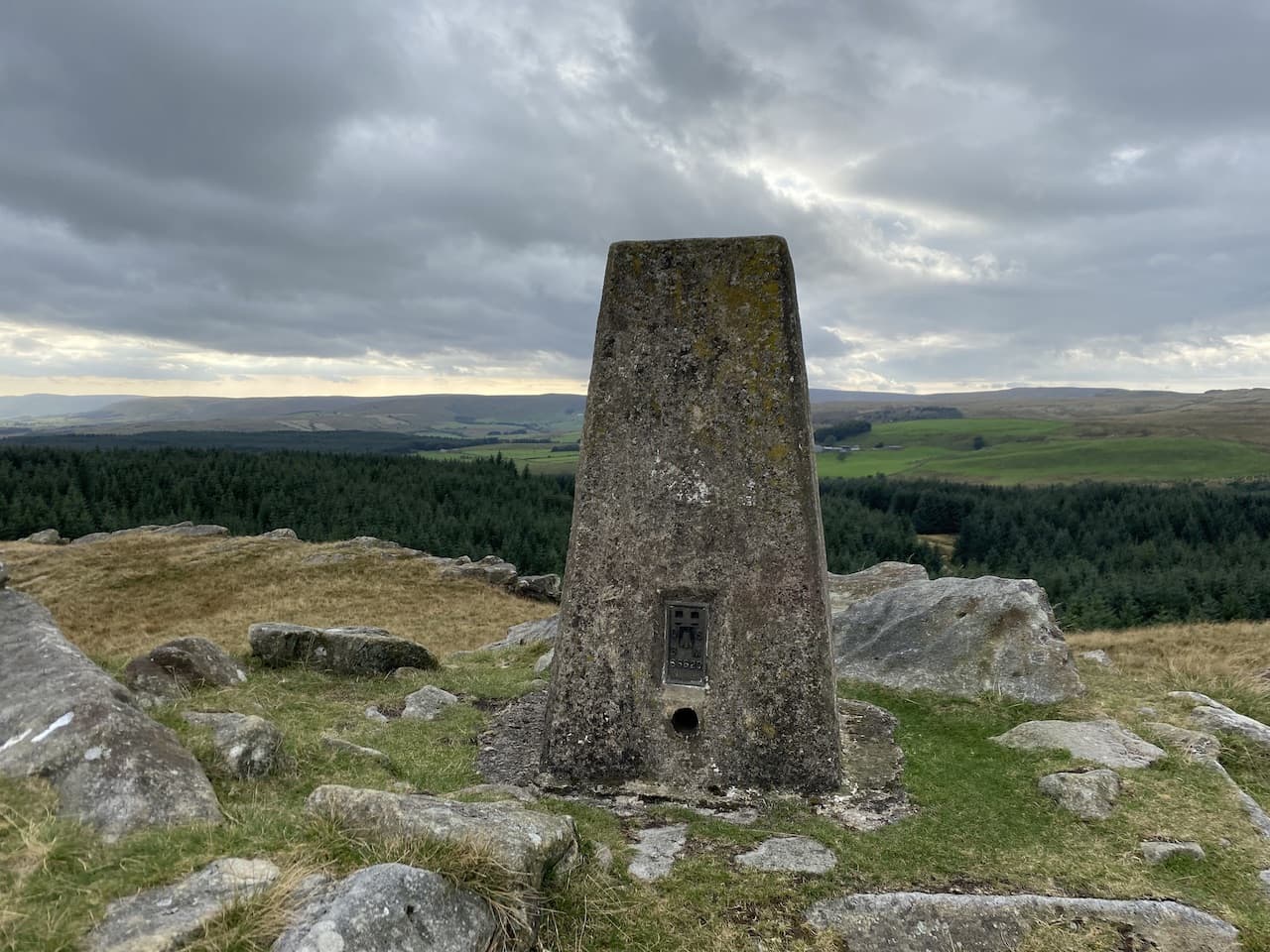
    We stay close to the wall and pick a route through the marshy moor land and then make the short stiff ascent to reach the Ordnance Survey Trig Pillar on Whelp Stone Crag.  This is the 272nd I have bagged.

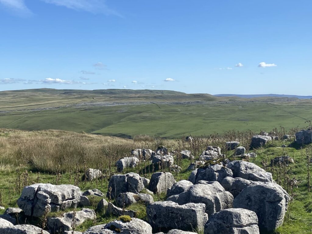
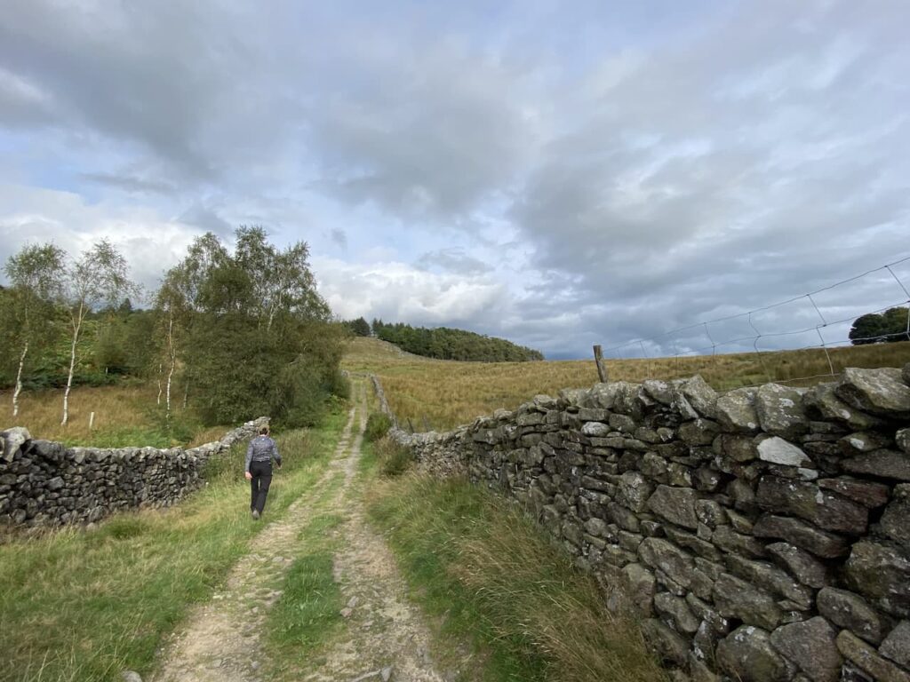
    There is a stiff breeze on the summit so after taking in the views we make our way back down the hill and walk back across the moor to join a footpath on the right which leads into the trees through Bottom Heights.  This is another path which is not clearly marked, but we wind our way through the trees initially heading west and then south west.

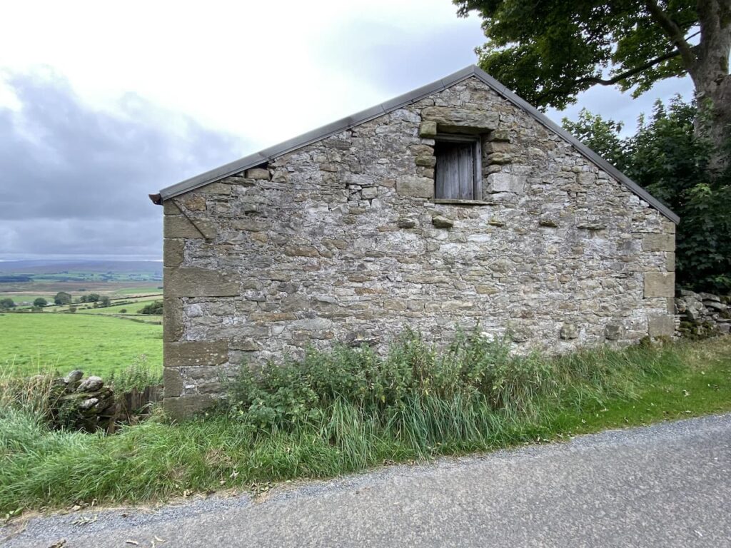
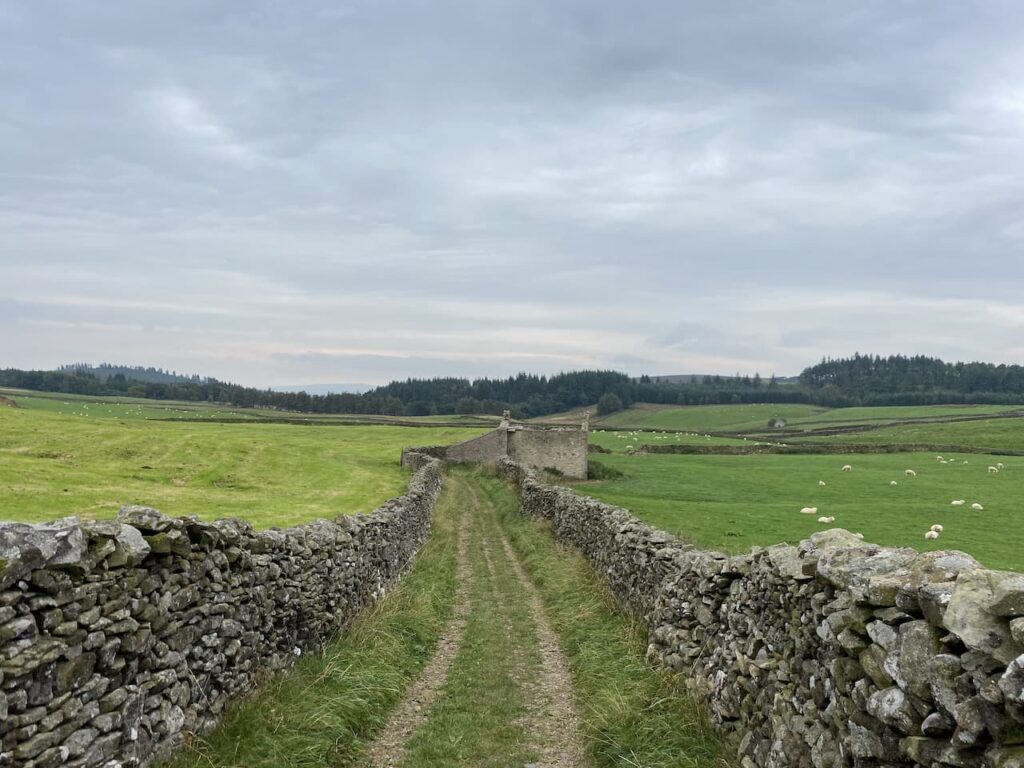
    At a junction of paths we go right and head downhill to cross a forestry track and then fork right to pass what appears be a disused farmhouse at Hindley Head.

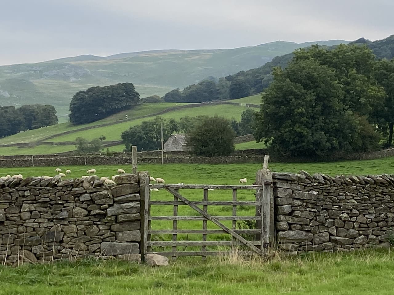
    We follow way-markers around the farmhouse, walking besides a wall, and then on the edge of a plantation turn right and follow the path downhill along the edge of the trees with expansive views to our right.

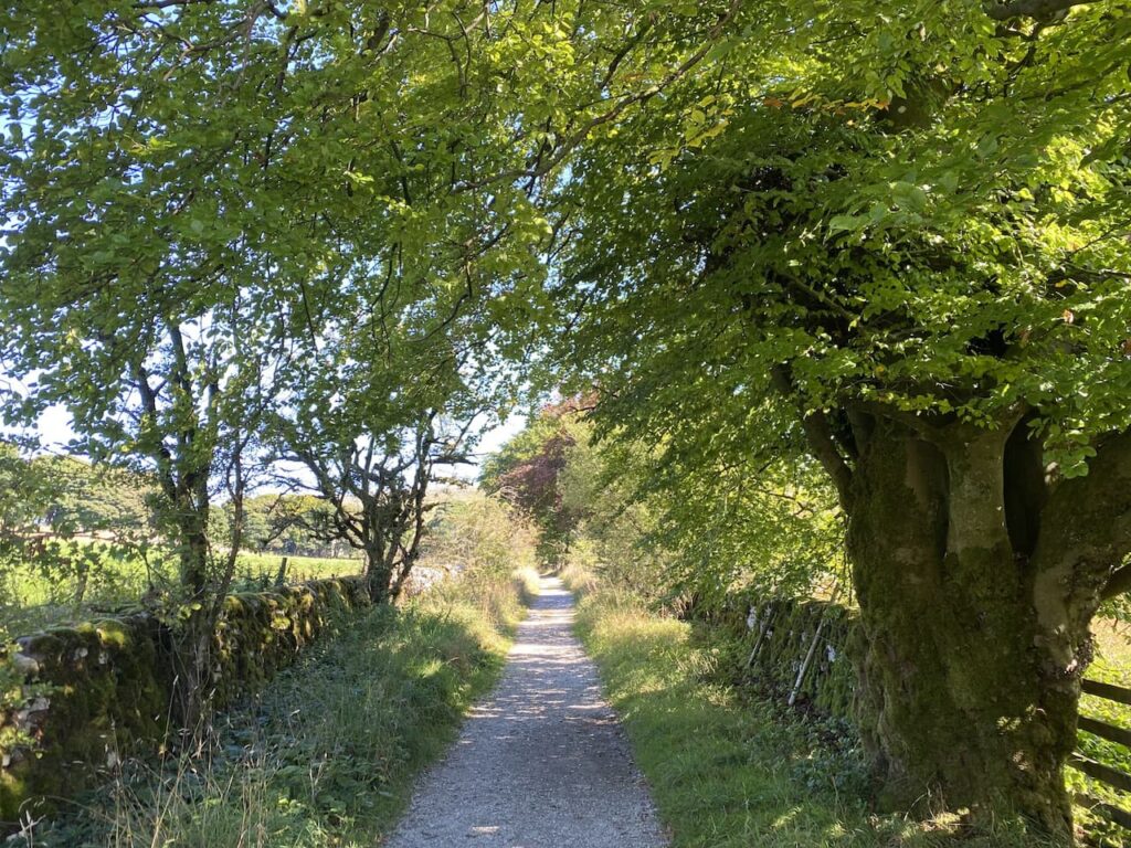
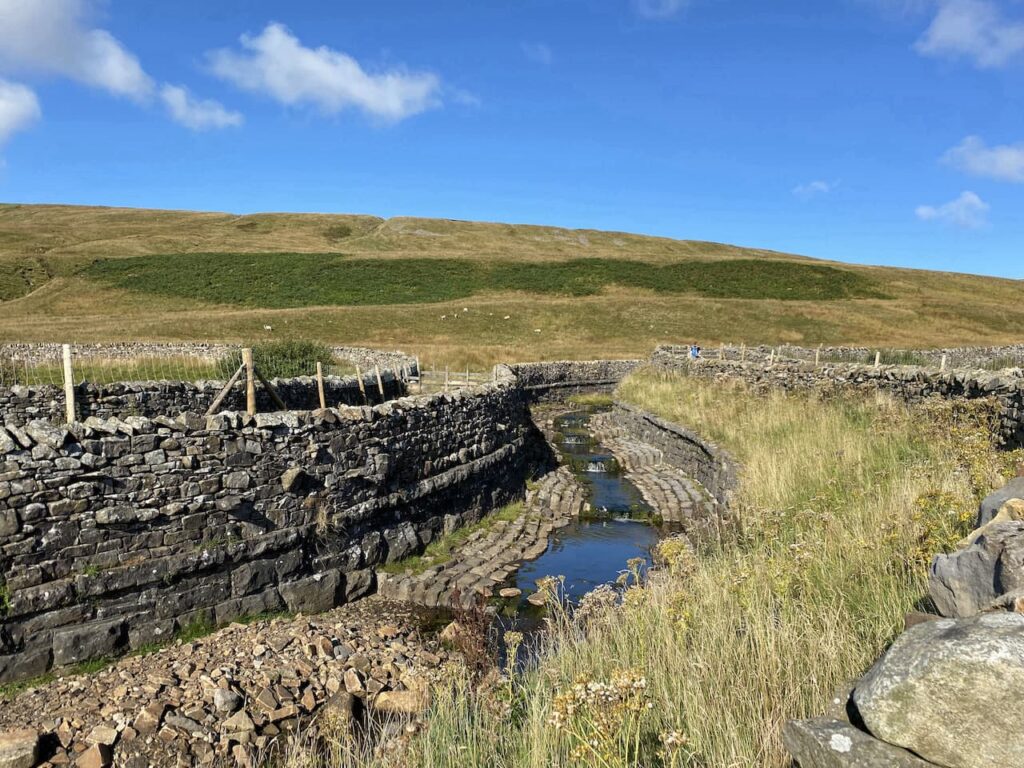
    On reaching a track we turn right and follow this as it swings around to cross Bottoms Beck.   At a T junction of tracks we turn left and then after a couple of hundred yards take a footpath on the right which heads steadily uphill through the trees heading east towards a parking area.

    At the parking area we join the road and turn left heading down School Lane towards our starting point.

    The lane leads us back to the car park just as the light is beginning to fade.  The problem with walking in late September is the evenings suddenly start drawing in.  Our walk has covered eight and a half miles.  I am not a fan of walking in coniferous woodland, but it was compensated by bagging a cracking trig at Whelp Stone Crag.

    You can view this 8.5 mile walk on OS Maps and download the GPX File Here

    To follow this walk you will need Ordnance Survey Outdoor Leisure Map OL41 – Forest of Bowland & Ribbledale

    22nd September 2021

    © Two Dogs and an Awning (2021)

    All information on this site is provided free of charge and in good faith and no liability is accepted in respect of damage, loss or injury which might result from it.  To the best of my knowledge the routes are entirely on public rights of way or within areas that are open for public access.
    Walking can be hazardous and is done entirely at your own risk.  It is your responsibility to check your route and navigate using a map and compass.

  • Fountains Fell and Darnbrook Fell

    Fountains Fell and Darnbrook Fell

    After yesterday’s walk from the caravan site we are venturing a bit further afield today to walk close to Malham Tarn.  Despite coming to the Dales for most of my life it is an area I have rarely walked.  A few years ago Lynnie and I did a circuit of the Tarn with the dogs but apart from that we have not explored this area.

    Our starting point for today’s walk is a car park in a disused quarry (Grid Reference SD883672).  Leaving the parking area we turn right down the road and then very soon take a turning on the left.  The footpath goes through a gate and continues along a wall-lined track.

    We stay with this track until the end where we turn right and soon pass some cottages and then reach a footpath on the left which is the route of the Pennine Way.  We take this path as it enters fields heading north away from the Tarn.  Being part of the National Trail this path is obviously well used and is easy to follow as we continue through pasture land. 

    It is a corking day, there is a bit of a chill to the wind but the sky is clear with only the odd wispy cloud.  Perfect conditions for walking.  

    I have often considered walking the Pennine Way, if I had a “bucket list” it would definitely be on it.  But so far managing to organise the time is difficult, but now in my early sixties I probably need to get it done before the challenge is too much for me.  Perhaps when things become a bit more settled with the Covid pandemic I will arrange it.

    We stay with the Pennine Way markers heading towards Tennant Gill.  This keeps us close to a dry stone wall and then through a field of cattle who are not interested in us or the dog.  We assume they must see a lot of walkers and as long as they are left alone are not bothered by dogs.  

    We cross a tall wall stile and then continue on to reach a minor road where we turn right and continue along for a short distance to reach the entrance driveway to Tennant Gill.  We are still on the route of the Pennine Way which goes through a gate besides a cattle grid and continues towards Tennant Gill.  The route turns left just before reaching farm buildings and skirts the farm it then heads onto Middle Fell where we keep with the Pennine Way and start to ascend through rough pasture.

    It is time for lunch so we sit on an area of limestone outcrop and admire the view.  It is a constant discussion on our walks as to when I will find somewhere with a decent view for our lunch stop.  I keep trying but one day I am bound to succeed!

    Refreshed we resume our walk along the route of the Pennine Way.  It is a steady slog uphill as we head across Fountains Fell.  A couple of years ago Lynnie and I were walking down from Pen-y-Ghent when we met two young chaps walking the Pennine Way.  One of them had clearly had enough.  At the time I wondered why the section between Malham and Horton-in-Ribblesdale would break someone.  I can see now that if you were feeling low walking up this fell with Peny-Ghent rising before you and standing between a beer and bed you might be tempted to throw in the towel.

    We continue along the Pennine Way and reach a notice warning us of mine shafts. This is a remote spot and mining up here must have been hard work.  According to the informative Northern Mine Research Society, the seam of coal here was 30 inches thick and a survey identified more that 192 shafts. The depth of these shafts varied but some seams were as deep as 50 metres.  We will be cautious and keep to well walked paths!

    We continue up the footpath towards the top of the ridge and look towards Pen-y-ghent.  For those folk walking the Pennine Way this point marks about eighty-five miles from the start at Edale and the ascent of Peny-ghent would look daunting for tired legs.

    To get a view of Peny-ghent we have walked past the path we need, so wander back and turn onto the path going in a north easterly direction below the ridge heading towards Darnbrook Fell.  To our left is the large cairn on the ridge of Fountains Fell.

    Following the path we reach a wall and turn right and walk besides the wall until a gateway.  Here we cross and continue across the fell with a wall on our right.  

    This is a remote fell and fortunately the recent dry spell means that the ground is firm under foot.  We pass through slightly boggy sections which I would not feel comfortable about in the depths of winter.  

    We continue walking besides the wall as it initially goes downhill and then rises onto Darnbrook Fell.  At a junction with another wall we turn right and follow this wall and then fence line heading east.  We reach a point where it is clear that others frequently cross the fence and go over and continue across the peat exposed summit of Darnbrook Fell to reach the Ordnance Survey trig pillar.  This is the 271st trig I have bagged.

    It is scary how much the area around the trig pillar has been eroded.  I have come across a couple of examples of this whilst trig bagging, but cannot recall another where it is so dramatic.

    From the trig we return to the point where we crossed the fence and go over and then continue to follow the fence line that rejoins a wall.

    The wall line turns to the right with stunning view.  On our left is Littondale, it is years since we last walked in that attractive dale.  I must plan another walk there soon.

    When the wall turns to the left we head across the fell on a faint path heading towards a dry stone wall and then follow the wall line to reach a gate which we go through and continue descending the fell with the wall to our left.  At the wall junction we turn right and head south with cracking views in front of us.

    We are now walking besides a brook as it heads downhill to Darnbrook Beck.  The fell we are on is open access land and it is not clear how we exit it.  There is a farm gate on our left, but no footpath.  My prior research had shown that many people walk off the fell at this point, I am always reluctant to walk on land without a footpath but there appears to be no other option so we enter the field and cross above a farm.  

    As we go we are greeted with a cheery wave from someone at the farm so it is obvious they have no issue with walkers going through their field.  We leave the field via a gate and then turn right to follow the road as it passes the farm at Darnbrook House.  My original intention was to take a footpath on the left to head up unto the fell.  However this would extend our walk significantly and Lynnie is in a bit of pain caused by walking across the uneven ground on the fell.  Instead we follow the road back towards Tennant Gill.  After walking on the exposed fell it is pleasant walking along this lane.

    We cross Thoragill Beck and then soon go through a gate besides a cattle grid.  This is a single track lane with passing places, the remote location means there is very little traffic.  After going besides another cattle grid we continue on to pass a cracking barn.

    After passing the entrance to Tennant Gill we have the option of retracing our route across fields, but this would mean crossing a wall stile and Lynnie thinks walking on the lane is better for her leg so we carry on.  After going through a gate besides a cattle grid the lane goes through a field and then on our right is the disused quarry workings on Chapel Fell.

    From here it is just a short walk to reach our starting point.  We have covered eleven miles on a cracking day and have had some outstanding views.  

    You can view this 11 mile walk on OS Maps and download the GPX File Here

    To follow this walk you will need Ordnance Survey Outdoor Leisure Map OL2 – Yorkshire Dales – Western Area

    20th September 2021

    © Two Dogs and an Awning (2021)

    All information on this site is provided free of charge and in good faith and no liability is accepted in respect of damage, loss or injury which might result from it.  To the best of my knowledge the routes are entirely on public rights of way or within areas that are open for public access.
    Walking can be hazardous and is done entirely at your own risk.  It is your responsibility to check your route and navigate using a map and compass.

  • A Four Mile Walk from Brigholme Farm CL

    A Four Mile Walk from Brigholme Farm CL

    Whilst away travelling most of my walks cover upwards of eight miles but occasionally we have a day where we do a shorter walk.  After a few days of lengthy walks Crosby is happy to have a day where he does not venture too far.  We have a relaxing morning around the caravan and then after lunch decide to head off from the site. 

    We leave Brigholme Farm and turn right and within a couple of hundred yards take the footpath on the right joining the Ribble Way as it crosses a field to head towards the River Ribble.  The route now follows close to the river, passing behind barns on Brigholme Farm to enter another field. 

    The path hugs the river as it goes through a gate into a spinney and then turns to run parallel to the A65.  

    Approaching a road bridge over the river we turn right over a ladder stile to climb the embankment and then cross the river on the pavement besides the A65. On the far side of the bridge we take a footpath on the left leading down the embankment and once again join the river.  We turn right and follow a farm track as it sweeps away from the river heading towards Runley Mill.

    On reaching the B6480 we stop to look at the Milestone beside the wall with Turnpike Cottage on the opposite side of the road.  

    We cross and continue on the track opposite, Lodge Road, this crosses the railway line giving views across the fields to Settle.

    At a junction of footpaths besides a barn we turn left into Brockhole Lane, or Watery Lane as it is known locally, and head back towards Settle.  

    Our route is now very straightforward, we stick with the lane until we reach the outskirts of Settle,  here we have two options, we can either turn left and take the shortest route back to Brigholme Farm or we can turn right and wander into Settle.  We opt for the latter and head through Upper Settle to reach the market square. After a mooch around looking in shop windows we head back to Brigholme Farm CL.  

    Our short Sunday afternoon wander has covered a pleasant four miles.

    You can view this 4 mile walk on OS Maps and download the GPX File Here

    To follow this walk you will need Ordnance Survey Outdoor Leisure Map OL2 – Yorkshire Dales – Western Area

    19th September 2021

    © Two Dogs and an Awning (2021)

    All information on this site is provided free of charge and in good faith and no liability is accepted in respect of damage, loss or injury which might result from it.  To the best of my knowledge the routes are entirely on public rights of way or within areas that are open for public access.
    Walking can be hazardous and is done entirely at your own risk.  It is your responsibility to check your route and navigate using a map and compass.

  • Ice Cream and Potholes in Kingsdale

    Ice Cream and Potholes in Kingsdale

    My quest to find new walks for Lynnie and I to undertake sees us back in Ingleton today.  I have planned a route which will enable me to bag a new trig and also take us to a few spots we have not visited for many years.  We start from the car park in Ingleton located by Ingleton Community Centre and Library and also home to the Tourist Information Centre.  

    We leave the car park to walk into Ingleton and after passing under a disused railway bridge fork left on a road heading downhill following a signpost to the Waterfalls Walk.  We soon reach a junction and turn left to pass the Ex-Servicemen’s Club and then cross a bridge over the River Doe.

    After crossing the bridge we turn right beside the Bridge End Guest House into Oddies Lane.  This lane heads north out of the village and soon starts to ascend, initially gradually but soon it is a bit of a calf burner. As we near the top we get a view of the disused quarry at Meal Bank. This quarry has not been used since 1909, but in 1868 the then owners constructed a Hoffman Kiln which over the years was developed to have eighteen entrances and is seventy metres long.  

    I have previously visited the Hoffman Kiln at Langcliffe but must visit the quarry to view this one.  It is now scheduled as an ancient monument.  Apparently the site has been transferred by the Council to the Yorkshire Wildlife Trust.

    A bit further along the lane we spot Ingleborough peaking over the hill in the distance.

    We now stay with the wall-lined lane as it heads north towards Twisleton Scar End.

    As the road reaches the driveway to Twisleton Hall we stay with Oddies Lane and continue until we reach a footpath on our left opposite the entrance to Falls Park at Beezleys.  To our right is the vast Ingleton Quarry.  This quarry is operated by Hanson and produces 350,000 tonnes a year of gritstone aggregate for road surfacing. 

    The company blurb talks of the geological interest of the site and how they will restore it when the workings are completed.  Apparently the void will become a deep water pool and the upper benches will be planted with trees and shrubs. I am a man of simple brain, but I can’t see how this counts as restoration, which I always understood to mean ‘restoring something to its original state’.

    We take the footpath on the left and follow the way-markers towards Twisleton Hall.  We meet a number of people as we go along and then realise that this public footpath links the two sections of the private Ingleton Falls walk.  After passing the buildings at Twisleton Hall we go through a gate and continue along a track underneath Twisleton Scar End.  

    At a fork in the track we keep left to stay on the track besides the wall. Then to my surprise we spot an Ice Cream van in front of us.  When Lynnie is flagging on a walk I frequently tell her there is an ice cream van around the corner, but of course there never is.  She is not going to let this opportunity pass.

    After going through another gate we continue along a walled track and pass the entrance to Thornton Force and Pecca Falls on the private Ingleton Falls walk.  Many years ago when the children were young we started the Falls walk on a busy day in the school holidays.  The signs stating there were steep drops and risk of fatalities if you ventured from the narrow path coupled with my vertigo were enough to turn me back.  It appears that accidents are now rare but I am not tempted to revisit.

    Continuing along the track we reach a footbridge over the River Twiss.

    After crossing the river the track leads to a minor road where we turn right onto Thornton Lane.  Our route now follows this lane for two miles through Kingsdale.  It is a fine day and as we head along below Keld Head Scar and then Green Laids Scar on our left, away to our right are fine views of Whernside.

    After just over two miles on Thornton Lane we reach a gate on the left leading to Yordas Wood and Yordas Cave.  The rocks beneath the cave are a perfect spot to stop for lunch and admire the view.

    Refreshed from our lunch we take a slight detour to wander up and look at the entrance to Yordas Cave.  This old show cave is now a popular spot with cavers and potholers.  I am not keen on caves and do not want to venture in with Crosby as we can hear voices echoing through the chambers.  Apparently as far back as the 1750’s folk would visit the cave and it became a show cave in the 1800’s.

    Our route takes us back down towards the gate and then on a path to the left of Yordas Wood.  This rises steeply towards Bullpot Bank.  After crossing a wall on a ladder stile we turn left on a path running besides the wall.  Stopping to look north up the valley the remote nature of this spot strikes us.

    I had planned to seek a route from here to ascend the escarpment to our right to bag Gragareth trig point, however, Lynnie makes it clear that despite having an unexpected ice cream she has no intention of tackling the steep ascent.  I am content with this as it will be one I can pick up on another day.

    Instead we head in a south westerly direction  along a clear path leading through a succession of fields.  The map is littered with references of shake holes, caves and pot holes.  Experience has taught us that pot holes in this part of the country rarely have any fencing and sometimes can be deep.  However I am still surprised when the path takes us right by the top of Jingling Pot.  This is the entrance to a 148 feet sheer drop.  

    Continuing along the path we pass through a gate and then reach the Rowten Pot, another huge pot hole, one of a number of entrances to a 17-mile long cave system in Kingsdale.  The thought of being underground in caves for 17 miles is beyond my comprehension.  I view the entrance from a distance!

    Staying with the track we continue heading south on what is marked on the map as Turbary Road.  Apparently the word Turbary means the ancient right to cut turf or peat for fuel.  Apparently this was the route the commoners used to access the moor to gain their fuel.

    We take a slight detour from the path to look at the fenced entrance to the Kail Pot. 

    After another gate we continue along the Turbary Road with a drystone wall to our right.

    Just after the end of the wall we turn left to leave the track and follow a path heading south across the access land heading over North End Scar.  The path sweeps to the right to descend into the scar.

    We stay with a grassy track turning south and heading towards Tow Scar and then soon leave the path to head up towards the Ordnance Survey Trig Point on the right.  This is the 270th trig I have bagged.

    From the trig point we head south east steadily descending to rejoin the grassy track close to a stone wall.  In front of us is a cracking view across the Dale towards Ingleborough.

    We stay with the track to continue descending across rough pasture land to reach a gate where we rejoin the Thornton Road and continue steadily downhill.  At a junction with a lane we stop to look at a toposcope.  At various times on our walk today we have had glimpses of Heysham Power Station and Morecambe Bay and speculated how far away they were.  The toposcope provides the answer with Heysham being 20.5 miles and Morecambe 15 miles away. 

    We continue on Thornton Lane heading towards Thornton in Lonsdale, we plan to wander into the village so ignore a footpath on the left close to Thornton Hall which would be a more direct route back to Ingleton.  We have two reasons to visit the village the first is to see if the Marton Arms is still operating, we used to visit the pub many years ago with our friend Julie.  We have happy memories of being there so are pleased to see it is still open.  I am tempted to have a sharpner, but we are going out in Settle this evening and Lynnie suggests I wait for a pint.

    The second reason for going to the village is to have a peak at the church and see if we can spot an Ordnance Survey benchmark.  We are not disappointed, the one on St Oswald’s church is unusual and despite having seen over 500 of these I can’t recall seeing another like it.

    St Oswald’s Church tower dates from the 15th century with most of the church being rebuilt between 1868 -70.  Apparently a fire gutted the church in 1933 and it was rebuilt again in 1934-35.  The website for the church reports that the author Sir Arthur Conan Doyle was married in St Oswald’s, but it neglects to mention to whom he was betrothed!

    We continue through the village heading towards Ingleton and reach a bridge over a disused railway line.  This was the Ingleton Branch of the North Western Railway and connected Ingleton to what is now called the West Coast Mainline, close to Tebay.  Passenger services on the line ceased in 1954 and the line finally closed in 1967.  Of interest to me is another unusual OS benchmark.

    After crossing the bridge we fork left on the road and pass the entrance to Meadow Falls Campsite and continue along the road to another junction.  Here we keep straight ahead and continue downhill to arrive in Ingleton at the railway viaduct.  

    This was built between 1848 and 1860 and is an impressive structure. However, it was fraught with controversy, initially North Western Railway (NWR) was given permission to build the route.  However, they fell into financial difficulty and the Lancaster and Carlisle Railway (L&CR) agreed to build the viaduct and branch line.  By the time the viaduct was completed NWR was owned by Midland Railway and L&CR was owned by rivals London and North Western Railway. The two companies were such committed rivals that they would not share a station so another was built on the other side of the viaduct.  This sounds okay, but passengers wanting to make a through trip were not able to cross the viaduct, they had to disembark and haul their luggage the one and a half miles.  It was not until 1923, when the two rival lines merged, that the first passengers were able to make the through journey.

    We continue on the road to pass the entrance to the Ingleton Falls walk and then cross the River Twiss and River Doe to retrace our steps back to our starting point.  It has been a cracking day for a walk and we have covered eleven miles with Lynnie having the added bonus of an unexpected ice cream along the way.

    You can view this 11 mile walk on OS Maps and download the GPX File Here

    To follow this walk you will need Ordnance Survey Outdoor Leisure Map OL2 – Yorkshire Dales – Western Area

    17th September 2021

    © Two Dogs and an Awning (2021)

    All information on this site is provided free of charge and in good faith and no liability is accepted in respect of damage, loss or injury which might result from it.  To the best of my knowledge the routes are entirely on public rights of way or within areas that are open for public access.
    Walking can be hazardous and is done entirely at your own risk.  It is your responsibility to check your route and navigate using a map and compass.

  • Reaching 2,021 “Boots On” Miles

    Reaching 2,021 “Boots On” Miles

    Lynnie has suggested that today I should take it easier having completed the clockwise route of the Three Peaks yesterday.   I am broadly in agreement, but have in mind that I am nearing reaching 2,021 “boots on” miles in 2021 and want to make sure I achieve the target somewhere memorable.

    One of Lynnie’s favourite spots in this area is Winskill Stones, it is a place we visit on every journey.  The last time we went there we did a short circuit from Langclffe because Dexter was getting too old to walk far.  Today we are going to walk from the caravan.  Leaving Brigholme Farm CL we turn right and head into Settle and leave the centre of town via Constitution Hill and then continue along the tarmac narrow lane towards Langcliffe.

    At the end of the lane we turn right and follow the pavement besides the B6479 for a short distance to reach Main Street where we turn right and wander into Langcliffe.

    We have visited Langcliffe many times but I do not recall wandering around the green so we head across to the former Wesleyan Chapel.  This was built in 1903 as an extension to the next door Sunday school which was built in 1852.  The chapel and school building were converted into a private house in 2001.  

    We continue around the green to pass the entrance to the church and then cross the road and go through a car park besides the former school and join Pike Lane and then continue along a walled track lane.  The fields on either side of the track are a stunning patchwork of dry stone walls.

    The path continues heading north towards the former Langcliffe Quarry.  Reaching a gate we meet another walker, she is unsure of the route she needs to reach Stainforth.  I explain the two options and she chooses to walk with us for a while until she reaches the path down to Stainforth.  

    Through the gate we enter a field of pasture and follow the path as it runs close to the wall and then starts to climb besides the quarry. It is a short steep ascent to reach pasture land.  In the Spring this is an abundance of wild flowers.  After going through a wall gate we turn right on the track and head up to Upper Winskill passing through a gate besides a cattle grid.  Now we continue on the path with a wall on our left.  There are cracking views of Peny-Ghent from here.

    At this point we bid farewell to our fellow walker.  We turn right heading across the access land towards Winskill Stones.  The limestone pavement around here is stunning, but sadly there is not as much as there once was.  For some reason, probably greed, it was thought a good idea to dig up the limestone for people’s rockeries.  The gardener Geoff Hamilton campaigned against this and after his death in 1996 the charity Plantlife was able to buy and safeguard the area for future generations.

    After looking at a section of limestone pavement we join a farm driveway and follow this to reach a minor road. 

    We turn right soon passing a cattle grid and within a hundred yards take a grassy track on the left leading across access land to a gate in the wall.   We continue heading south across the access land on a grassy track to reach a stony track.  

    Here we turn left and go up to a gate then almost immediately turn right through a kissing gate and follow the path besides a drystone wall.  To our left is Brent Scar and as we reach the path leading up to Victoria Cave I reach the point where I have walked 2,021 “boots on” miles in 2021.

    This is the earliest I have reached my walking target, last year I achieved the target on 16th October and the two previous year it was in November.  Lynnie suggests I ease up on the walking now with no need to keep notching up miles. It is an interesting idea but I want to walk further this year than last when I clocked up 2,542 miles.

    We continue besides the drystone wall to another kissing gate. The path now goes across a field below Attermire Scar to a gate in the wall.

    Through the gate we continue downhill through limestone outcrops and then turn right to follow the route of the Dales High Way heading west. There are cattle spread about in these fields and we are very conscious of avoiding getting between any cow and her calf.  We are now below the impressive scar of Warrendale Knotts.

    After going through a gate we start to descend steeply.  The views are stunning.  It is so clear we can see for miles with Ingleborough standing out in the distance.

    We keep heading downhill on the steep grassy path and then veer to the left to pick up a walled track heading back towards Settle.

    We arrive back in Settle at the Market Square and then head back to Brigholme Farm CL.  It has been a cracking walk on a stunning day.  Since losing Dexter we have revisited many places we had taken him but being at Winskill Stones without him was particularly sad.

    As it is a milestone day reaching 2,021 miles we decide to pop along the road to the Craven Arms and enjoy a couple of pints of excellent ale from the Bowland Brewery.

    You can view this 7 mile walk on OS Maps and download the GPX File Here

    To follow this walk you will need Ordnance Survey Outdoor Leisure Map OL2 – Yorkshire Dales – Western Area

    16th September 2021

    © Two Dogs and an Awning (2021)

    All information on this site is provided free of charge and in good faith and no liability is accepted in respect of damage, loss or injury which might result from it.  To the best of my knowledge the routes are entirely on public rights of way or within areas that are open for public access.
    Walking can be hazardous and is done entirely at your own risk.  It is your responsibility to check your route and navigate using a map and compass.

  • Clockwise Around The Three Peaks

    Clockwise Around The Three Peaks

    I have walked the Yorkshire Three Peaks on four occasions.  Each time I have taken the traditional anti-clockwise route .  The first three trips started at Horton-in-Ribblesdale going up Pen-y-ghent first followed by Whernside and finally Ingleborough.  It was walking this route in 2018, a couple of weeks before my sixtieth birthday, that I clocked my personal best time of seven hours and forty four minutes.  I will never try and better that time so have since taken a more leisurely approach to the walk.

    The last time I took on the Three Peaks I started in a lay-by just up from the Old Hill Inn.  That day I stuck with the anti-clockwise route, tackling Ingleborough first and then Pen-y-ghent before finishing with Whernside.  I found it enjoyable because I was behind those who started at Horton and had the walk almost to myself.  I plan to walk that route again next week with my walking buddy.  It will be her first time around the Peaks.

    In 2016, my first time doing the walk, I met a chap part way round and we walked together for the best part of an hour.  He had done the walk a number of times and mentioned how enjoyable it was to do in a clockwise direction.  The conversation has stuck with me so today I am going to see what it is like.

    I park at the  small parking area just north of the Old Hill Inn on the Ingleton to Ribblehead road.  Ingleborough looks almost clear as I set off and it appears I am in for a cracking day.

    Leaving the car I have a short section on the road heading south and soon pass the Old Hill Inn.   I don’t plan to describe the route in detail because it is well way-marked.  I leave the road and follow the tarmac Philpin Lane soon passing the farm with its barns and campsite.  This section of the walk is one of the easiest and I strike out at a reasonable pace to warm my legs up in anticipation of the steep ascent of Whernside that is coming soon.

    Heading towards Bruntscar there is a cracking view of the Ribblehead Viaduct. I am not sure I have ever looked at it from here.  Usually when I am walking along this lane I am focused on the ascent of Ingleborough or looking at my watch to check the time I will record for the Three Peaks.

    After passing Bruntscar the first ascent of the day starts.  I have walked this route up Whernside many times, but always as a circular walk from Ribblehead when only going up this one peak.  

    Initially this is a gradual ascent interspersed with flagstone steps.  It then becomes ferocious, but has been made easier in recent years by the addition of new rocks replacing the old steps which were narrow and sloping the wrong way.  It is warm as I go up and I am soon shedding a layer.  As I reach the top of the scar I meet a couple walking the anti-clockwise route from Ribblehead.

    I still have some ascending to do to reach the summit of Whernside, the conditions are perfect for walking and the visibility is far better than I have ever encountered before on this peak.  Down to my right the Settle to Carlisle Railway looks stunning.

    Soon I am on top of Whernside and stop at the trig pillar.  This is looking a bit worse for wear with the spider at the top exposed.  I hope this is because of the adverse weather it faces for most of the year rather than folk wanting to take a souvenir home with them.

    Leaving the trig I start to pass walkers who are heading in the opposite direction and soon realise that I am destined to spend most of the day saying hello to folk.  I always find it amazing how people might walk by you in the street without any acknowledgement, but once out on a walk everyone wants to say “Hi”.  I find it refreshing and only wish they were friendlier in normal day to day life.

    The views are truly stunning.  I have often seen Morecambe Bay and the Lake District from Ingleborough, but never from Whernside before.  I am pleased I am not out to set a good time, but can just enjoy the day’s walking.  Heading down there is a great view of the tarn on Greensett Moss.

    Walking in this direction it is a long steady descent down Whernside.  I have been walking this peak for over thirty years and in that time the path has been improved significantly.  There was a time when even during a dry spell of weather a boggy section would be encountered.  Now it is almost guaranteed to be firm underfoot all year round.

    Going down Slack Hill there is a steady stream of people passing me. Not all looking in great shape, I can only assume they had a very early start from Horton-in-Ribblesdale and are now feeling the pressure.  One of my favourite architectural features on this walk is the aqueduct carrying the water flowing from Force Gill across the Settle to Carlisle Railway.  

    The path starts to level and I am soon passing Bleamoor signal box then soon after the Ribblehead Viaduct comes into view.  

    As usual close to the viaduct there are a lot of people about.  I just hope a few of them take time to think about the lives of the workers that built this impressive structure.  It would have been extremely bleak during the winters and in the shanty towns where the 2,300 workers and their families lived, they were rife with disease. In the construction of the viaduct over 100 men lost their lives, but a similar number of women and children died of smallpox and other diseases.

    The next section is beside the road before turning off and passing Ingman Lodge and continuing on to cross the River Ribble which is very low after the recent dry spell.

    This is such a well-marked route that in good weather conditions like today you do not need to be constantly looking at a map.  After passing Nether Lodge I head on towards Birkwith.

    After the earlier sections where I was frequently passing people walking in the opposite direction I have a few quiet miles.  The Three Peaks Path joins the Pennine Way for a while and I get a good view of Pen-y-ghent.  I always thing this mountain looks more challenging than it actually is.

    The Three Peaks path leaves the Pennine Way and heads over Sell Gill Hill and Whitber Hill before starting the long steady ascent of Pen-y-ghent.  I have walked up this path many times and it is a long steady slog.  I soon catch up with a group of junior school children who are out on an adventure walking to the summit and back from Horton-in-Ribblesdale.  It is great to see these young people being introduced to the pleasures of being out walking. Although some of the stragglers don’t look as if it is something they are enjoying.

    I am soon at the trig point on the summit and pause to take the obligatory picture of the trig before starting my descent.

    I have been down the steep side of Pen-y-ghent on a few occasions.  Today there is a steady stream of people coming up and one or two are in danger of becoming rock fast.  I am not keen on heights but the section here does not worry me but I can understand why if someone is approaching it for the first time they might get concerned.  The initial steep descent is not a place to hurry, the rocks are worn smooth and it is not a good place to take a tumble so with so many people coming up I proceed with caution.

    At the foot of the steep descent I turn to the right to follow the flagstone path downhill.  Over recent years this path has improved significantly and it makes the going much easier.  

    Going around Brackenbottom Scar I see posts have been erected to try and keep folk on the main route, gradually over time the volume of foot traffic here has spread the path.  Hopefully people will respect the notices and prevent further erosion.

    After the long drag up Pen-y-ghent it is pleasant heading downhill into the village where I cross the River Ribble again.

    After crossing the Settle to Carlisle railway line at Horton Station I start my final ascent of the day.  There are a steady stream of people heading downhill, many of whom I recognise from passing earlier.  As I head towards Sulber Nick it is clear that significant work has been done to this section of the route since I was last here.  What was once a boggy difficult area has now been laid as a clear path.  

    Heading up Ingleborough I come to the conclusion that walking the peaks in this direction is harder than doing it anti-clockwise.  I had thought the long steady ascents of Pen-y-ghent and Ingleborough would make things easier, but the opposite is true.  Added to which I am expending further energy acknowledging everyone passing in the opposite direction.

    Near the summit of Ingleborough I pass a group of guys I met earlier as I was descending Whernside. One chap is particularly pleased to see me because he has had a bet with his fellow walkers that I was doing the Three Peaks the “wrong way”. He is confident that he is going to be drinking free beer when they reach the pub!

    Even though I was on Ingleborough yesterday I still walk over to the trig point.  Failure to do so would mean that I would not be able to count today’s walk as a successful circuit of the peaks.

    I make my way off the summit and due to the volume of walkers coming up Ingleborough decide it is safer not to try to pass them on the steep path.  Instead I follow the path along the top of the escarpment towards Simon Fell.

    At a junction of paths I turn left and make the steep descent towards Humphrey Bottom.  I have come up this path many times and over recent years it has obviously been used a lot more. What was once a faint route is now well-worn and in parts eroded away.

    At the foot of the hill I turn right and follow the path past the Great Douk pothole.  From there it is only a short walk back to my starting point.  The 25 mile route has taken me 9 hours and 9 minutes, which is almost an hour and a half slower than my quickest time on this challenge.  However, today was never about trying to record a spectacular time, it was more about being out for the pure pleasure of being able to undertake this walk again.

    You can view this 25  mile walk on OS Maps and download the GPX File Here

    To follow our walk you will need Ordnance Survey Outdoor Leisure Map 2  – Yorkshire Dales Southern & Western Area

    15th September 2021

    © Two Dogs and an Awning (2021)

    All information on this site is provided free of charge and in good faith and no liability is accepted in respect of damage, loss or injury which might result from it.  To the best of my knowledge the routes are entirely on public rights of way or within areas that are open for public access.
    Walking can be hazardous and is done entirely at your own risk.  It is your responsibility to check your route and navigate using a map and compass.

  • Returning to Ingleborough

    Returning to Ingleborough

    Somethings are a given when we stay at Brigholme Farm CL, top of the list is that during the stay I will walk up Ingleborough.  Usually I manage it at least twice during our stay and I will definitely be there tomorrow when I take on the Three Peaks again.  Lynnie does not share my enthusiasm for this mountain.  She has walked it plenty of times and is usually reluctant to ascend it again. So imagine my surprise when she suggests we both walk to the top!

    The route we are taking is via Ingleton, this is a walk we did back in 2018 with both dogs.  Sadly Dexter passed away in the Spring so it is just us and Crosby heading up today.  It is a route we stupidly attempted when the children were small.  Lolly was in a buggy at the time and we did not get far! 

    Today we start from the car park in Ingleton; this is the location of the Community Centre and Library and is also home to the Tourist Information Centre.  We leave the car park to walk into Ingleton and then follow the road towards Hawes.

    On reaching Storrs Common we fork right to follow a track continuing uphill across the common.  At a fine old gate post with an Ordnance Survey benchmark we continue along the now walled track.

    We follow the track uphill to join the wall-lined track, Fell Lane. This is an easy route to follow and pleasant walking on a fine day.  I still find it hard to imagine why I thought it was a good idea to try and push Lolli up here in a buggy.

    We go through a gate and the track continues ahead towards the remote farmhouse at Crina Bottom.  

    As we near the farmhouse the track forks to the right away from the farm driveway. The path is still well defined as we pass the stunning White Scars where we find a spot to stop for lunch.

    The other side of this scar is the entrance to the White Scar caves.  These are said to be the longest show caves in England and contain the Battlefield Chamber which is 90 metres long.  The caves were first discovered in 1923 by two amateur geologists. Christopher Long and J.H Churchill first spotted a small entrance which led to a waterfall.  At that time they were not able to progress further, but over the years further discoveries were made.  We visited the caves when our children were small.  I am not keen on the claustrophobic feel of caves so will not be venturing in again.

    Refreshed from our lunch we continue up the path towards the summit of Ingleborough. The ascent is now steep and I am grateful for the hill walking I have done over the summer to prepare for a fortnight in the Dales.  Lynnie is finding it hard going and is regretting suggesting we walk up here.

    We arrive on the plateau at the top and walk over to the trig point for the obligatory photo.  This is the trig I have visited most on my walks but I still take a picture every time I get here.   Lynnie suggests I take her photo with Crosby because she has no intention of walking up this hill again.  I am not sure if she means on this trip or ever again. 

    Whilst at the trig we are joined by a couple undertaking the Three Peaks Challenge, the chap is overjoyed at getting to the summit of the final peak.  He explains that on his first attempt to complete the walk, on a hot day last year, he had to bail out after descending Whernside because he was badly dehydrated.  A good reminder to ensure that I put an extra water bottle in tomorrow before I head off on my clockwise route around the peaks.

    Our route off the summit is the path leading over Little Ingleborough.  I know this route across the plateau well but decide it would be good to take a compass bearing from the trig to our descent route.  Since doing a navigation course a couple of years ago I have made a habit of using a map and a compass to ensure I retain the skills for when I really need them.  We leave the plateau by a cairn and start the clear descent across Little Ingleborough.

    At the cairn on the summit of Little Ingleborough we leave the main track and take a footpath on the right.  This is a lot clearer than the last time we walked it in 2018 and is easy to follow as it descends across Newby Moss.  

    Approaching Newby Cote I take a peek over the wall at the lime kiln.  A few years ago I purchased an excellent book by Dr David Johnson on Lime Kilns in the Yorkshire Dales.  It has provided a fascinating insight into the importance of these kilns on the agricultural development of the Dales. I now keep an eye out for these old structures as I walk around.

    Following a farm track we reach a particularly high ladder stile besides a gate.  The gate is locked and it is a real challenge getting Crosby over the stile without injuring him, or me!  I understand wanting to keep the field secure, but do not believe it needs to be so challenging to access.  We continue on a farm track to reach a minor road where we turn right beside some farm barns .

    We head along the minor road (Old Road) towards Ingleton.  This is a very quiet road and pleasant walking, it passes a collection of small farms and cottages.  At each farm I keep an eye out for any sign of an Ordnance Survey benchmark.  Details of all the logged benchmarks can be found on the ordnance Survey website, but I prefer to go “wild” and look for them as we go along.  There are over 500,000 dotted around Britain so one is never too far away.

    Entering Ingleton we turn left downhill to walk through the village back towards the car park.  Our walk has covered close to ten miles.  I think it has been a cracker and Lynnie is relieved to tick off Ingleborough safe in the knowledge she won’t be walking up there again soon.

    You can view this 10  mile walk on OS Maps and download the GPX File Here

    To follow our walk you will need Ordnance Survey Outdoor Leisure Map 2  – Yorkshire Dales Southern & Western Area

    14th September 2021

    © Two Dogs and an Awning (2021)

    All information on this site is provided free of charge and in good faith and no liability is accepted in respect of damage, loss or injury which might result from it.  To the best of my knowledge the routes are entirely on public rights of way or within areas that are open for public access.
    Walking can be hazardous and is done entirely at your own risk.  It is your responsibility to check your route and navigate using a map and compass.

  • Hunter Bark and Mearbeck

    Hunter Bark and Mearbeck

    On our last trip to Giggleswick I did a walk that took me to nearby Long Preston and on the way I bagged a trig point at Hunter Bark.  Before setting off on this trip Lynnie requested, even though we have not been here for almost two years, we did some new walks whilst staying at Brigholme Farm.  So I have planned a route taking in a couple of familiar spots but also walking paths we have not previously covered.

    We leave Brigholme Farm by turning right and heading into Settle.  On reaching the market square we leave the town via Constitution Hill and follow the road until it reaches the wide footpath that continues steeply upwards between two dry stone walls. 

    Through the gate at the top of the track we soon veer right to continue even more steeply uphill. As we climb we stop to admire the views back behind us. To the left is Settle and Giggleswick and to the right in the foreground is Langcliffe High Mill.

    We are now on the route of the Dales High Way and follow the well-worn grass path to reach a gate.  We go through and continue along the path with the impressive looking Warrendale Knotts on our left.

    The scenery here is stunning and it gets even better as we go over the brow of a hill and head towards Attermire Scar.

    On reaching a junction of footpaths we go right and head uphill to skirt the side of Sugar Loaf  Hill and then as we head towards a gate stop to look at an Old Lime Kiln.  These kilns are part of agricultural history, the lime was burnt and then spread on the fields as a fertiliser.   If you look carefully you can frequently spot these features on farmland around the Dales.

    We reach a ladder stile and cross to join Stockdale Lane and continue along this track to reach High Hill Lane where we turn right and then very soon left into Lambert Lane.  This is a cracking walled track which soon passes Preston’s Barn.

    We are now on the route of the Pennine Bridleway and we stay with this by turning left at a junction of Lambert Lane and Mitchell Lane.  This broad track leads us past Black’s Plantation, we stay left at a fork in the track to stay on the Pennine Bridleway heading south.  As the track reaches the access land of Hunter Bark we detour right to follow a path which leads uphill around the disused quarries.  There are cracking views from the top of the hill.

    We follow the path as it descends to rejoin the track and continue past a fenced section of access land to reach a newly installed kissing gate with a footpath signposted to Mearbeck.

    The footpath leads along the edge of the field; however we take a detour over the open access land to head up a grassy track to reach the summit of the hill in order to bag the Hunter Bark trig pillar.  I have been here before but it is a new one for Lynnie.

    From the trig we head to the south west corner of the access land and rejoin the footpath.  After going through a gate this route continues across fields of pasture towards High Mearbeck Farm.  

    At the farm the farmer points us in the direction of the path we need to head back towards Settle.  This way-marked path goes to the right passing a cottage and heading north to Mearbeck Wood.  In the woods at a fork in the footpath we go right keeping close to a boundary wall and the top of the wood.

    As the path emerges from the trees it descends steeply to a field of pasture and then goes through a wall gate to reach Cleatop Wood.  This area is owned by the Woodland Trust.

    The clear path leads us to a field of pasture, here we follow the path along the edge keeping a wall on our right had side.  We then cross two further fields to reach the farm track to Lodge Farm.  We cross this track and join Brockhole Lane and follow this back towards Settle.

    Nearing Settle we pass allotments and then reach a road, we turn left then at the junction with Ingfield Lane we go left and then continue on to a crossroads where go straight over and then follow the road back towards Brigholme Farm CL.  Our walk has covered eight and a half miles and ticked the box for being a new walk for us in this area.  Tomorrow I have plans to walk a more familiar route and head up Ingleborough, but I will have to break the news to Lynnie gently.

    You can view this 8.5 mile walk on OS Maps and download the GPX File Here

    To follow this walk you will need Ordnance Survey Outdoor Leisure Map OL2 – Yorkshire Dales – Western Area

    13th September 2021

    © Two Dogs and an Awning (2021)

    All information on this site is provided free of charge and in good faith and no liability is accepted in respect of damage, loss or injury which might result from it.  To the best of my knowledge the routes are entirely on public rights of way or within areas that are open for public access.
    Walking can be hazardous and is done entirely at your own risk.  It is your responsibility to check your route and navigate using a map and compass.

  • Back in Settle

    Back in Settle

    After a few days at Hall Croft CL we are on the move to Giggleswick to stay at Brigholme Farm.  Over the years it has been the CL we have visited most on out travels because it is so closely located to Settle which is a favourite location for us.  It only takes us an hour to get from Ilkley to Giggleswick so soon after packing up we are setting up again.

    It is great to be back at Brigholme Farm, our last visit was in November 2019 and who could have imagined what was just around the corner with the Covid -19 pandemic.  There have been times in the last eighteen months that I have wondered if we would ever get back to the Dales.  

    From Brigholme Farm CL we turn right and soon cross Penny Bridge over the Ribble. We turn right to go under the railway bridge. At the crossroads we go straight over into Ingfield Lane and at the bottom fork right around the retirement housing complex.  In a few hundred yards we reach Brockhole Lane on the right.  We often walk along this lane, known locally as Watery Lane.  At the end of the lane we go through a gate and at a crossing of paths close to a modern barn, turn left to follow the lane steadily uphill to Lodge Farm.   

    It is a steady ascent up the farm track to Lodge Farm where we go through a gate and turn left. Soon after at a fork in the track we take the right option. We go through a gate and walk uphill on the track besides Hudsa plantation and then at a second gate follow a walled track. 

    At another gate we keep straight ahead keeping Black’s Plantation on our right.  There are fine views and in the distance is Ingleborough.  I have a couple of walks planned up that peak over the next couple of weeks, hopefully I will be able to persuade Lynnie to join me on one of them.

    At the junction of Mitchell Lane and Lambert Lane there is a cracking view of High Hill in front of us.  

    We now turn left and follow Mitchell Lane downhill into the centre of Settle and from there head back to Brigholme Farm CL.  Our stroll around has covered four and a half miles and has been a welcome reminder of why we come here so often.  

    You can view this 4.5 mile walk on OS Maps and download the GPX File Here

    To follow this walk you will need Ordnance Survey Outdoor Leisure Map OL2 – Yorkshire Dales – Western Area

    12th September 2021

    © Two Dogs and an Awning (2021)

    All information on this site is provided free of charge and in good faith and no liability is accepted in respect of damage, loss or injury which might result from it.  To the best of my knowledge the routes are entirely on public rights of way or within areas that are open for public access.
    Walking can be hazardous and is done entirely at your own risk.  It is your responsibility to check your route and navigate using a map and compass.

  • On Skipton Moor

    On Skipton Moor

    Whilst scanning the map yesterday evening I spotted the Ordnance Survey Trig Pillar on Skipton Moor, it is one I have not bagged and it can be reached from our pitch at Hall Croft CL.  I invite Lynnie to join me, but seemingly the prospect of a 16 mile walk does not hold much attraction, especially when the alternative is to wander into Ilkley for a mooch about.

    I leave Hall Croft CL by crossing the entrance driveway to join the footpath running between a fence and hedge. 

    At a junction of paths close to the River Wharfe I turn left and follow the Dales Way beside the river through a meadow.  On the opposite side of the river is Ilkley Golf Course and being a Saturday morning there are plenty of people out for a round.

    On reaching Ilkley Road I turn right along the pavement, still on the Dales Way and follow the footpath sign to Addingham.  The path follows along the pavement to a junction with Old Lane, I continue on the Ilkley Road to the outskirts of Addingham.  I cross Church Street and continue into the village along Main Street.  Soon I pass the village cricket pitch, where players and officials are arriving for the start of the afternoon’s fixture.

    Cricket is big in this part of the world and Addingham CC has a long history dating back to 1870. The Club’s website lists the overseas players that have represented them.  This is a strange concept to me, when I played village cricket almost the whole team were either born or currently lived in two local villages.  It never crossed our minds to look much further afield and when we had a couple of players join from Salisbury, seven miles away, it was considered adventurous!

    Addingham is an attractive place, I first came here in the late 1970’s and have happy memories of  staying with friends in the village.  My route goes up through the village along Main Street and on reaching the Craven Heifer pub I fork left onto Silsden Road soon passing the old village poorhouse.  It was built in 1686 and inhabited until around 1910.  It was later used as a venue for the village band to practice and after falling derelict it was fully refurbished in 2009.

    I follow the Silsden Road through allotments on either side of the road.  Then just after passing a bus stop I take a footpath on the right along the Dales High Way into a recreational playing field. The path heads to the north west corner of the playing field into Turner Lane where I turn right, staying with this road to reach Moor Lane where I turn left.  This lane heads uphill towards the A65.  To my right there are good views of Beamsley Moor. 

    I cross the A65 with care and then continue on the Dales High Way now on Crossbank Lane.

    The lane continues as a tarmac road heading steadily uphill towards the moor, I soon pass a farm with an interesting water tower and buildings.

    It is a long steady ascent along this road, as it is a dead end I encounter no traffic and the surrounding views are cracking.  I pass through a gate still on the Dales High Way that is now a track heading towards the moor.

    After going through another gate I enter a field of sheep and from here I get a good view of the Chelker Reservoir.  It was built in 1866 to provide water to homes in Bradford.  I have driven by it on the A65 but the view is better from up here.

    After going through another gate the route of the Dales High Way follows a track besides a dry stone wall on the edge of Draughton Moor.  Stone walls are not a feature of my walking at home in Wiltshire and I am always impressed with the craftsmanship that goes into constructing these walls that stand for so many year.  The physical challenge of erecting some of the gate posts must have been immense.

    Further along I see an old boundary stone inscribed ‘JC’, this provides a convenient spot to perch and take in the view.  Later research proved it impossible to identify the source of the JC and I found I was not alone.  In 1959 writing in the Ilkley Gazette, Alan Shackleton, who appeared to be a local historian, outlined the research he had undertaken trying to find the source of the inscription. He concludes it related to the old stage coach road running between Skipton and Otley.

    Resuming my walk I continue to a metal gate to reach a road.  On the right is an old milestone.  The inscription is very weathered and difficult to make out.  But it is said to be hundreds of years old and was there to direct the stage coaches at a junction of tracks.

    I now continue on a well-made track towards Skipton Moor.  Prior to being an old stage coach route this lane was once the Roman Road that connected Ilkley with Skipton.  I always find it amazing to walk along routes that have been used for so many years.  

    After passing through a couple of gates the track continues with the edge of the moor to my left.  The views from here looking over Skipton and Embsay towards Malham and the Dales are stunning.

    I stay with the track to pass a plantation on the edge of the moor and then after a couple of hundred yards I reach a small gate on the left which leads onto the moor.  This is access land and a clear path heads diagonally back towards the plantation.  

    It is a stiff ascent across the steep escarpment and reaching the edge of the trees I realise that there is still more up to do to get to the top of the moor.  This area of Skipton Moor is known as Vicar’s Allotment

    After one final short sharp ascent I am on the ridge at the top of the moor. The path brings me straight to the Vicar’s Allotment Ordnance Survey trig pillar.  This is the 269th trig I have bagged and I have chosen a cracking day to visit it.  The views are stunning in every direction.

    I wander along the ridge in both directions to look at the cairns and rock outcrops.  This is the first time I have been on this moor and had not expected such views.

    Back at the trig pillar I head south across the moor on a path leading to a rocky outcrop, Standard Crag and then turn left to follow a path besides a drystone wall.

    I stay with this clear path as it goes through a couple of boggy areas and continues through a gate and then reaches a wall stile.  Over the years Crosby has mastered these stiles and despite not climbing one for a while he is over without any assistance.

    I am now on High Bradley Moor and follow a path that heads south easterly towards Low Edge Farm.

    There are a network of paths converging near Low Edge Farm.  I take one down to cross a stream and then is clearly signed around the back of the farmhouse before going along the farm driveway.  I follow this until I reach a footpath on the right which goes across a field to a gate.  Through the gate I go across another field to reach Jenkin Farm.

    Now I turn left and follow the farm driveway heading towards a minor road with the interestingly named Schoolmaster Place Farm in the distance.

    On reaching the road I cross and follow the footpath to pass the farm and cross fields to reach another minor road where I turn left towards Cringles.  

    This is a quiet country lane and I am passed by a car and tractor before reaching the A6034.  Here I turn left and follow the pavement besides the road.  On my left is a tower standing beside a covered reservoir.  Initially I think this must be related to mining because there is a nearby shaft marked on the map. However, later I discover an archive article in the Keighley News about the tower, it was built in 1853 to survey the proposed conduit and aqueduct for supplying water to Bradford.  Apparently the norm was to build such platforms out of wood and remove them when they had served their purpose, but this stone one survives .

    After a few hundred yards along the road I turn right onto a track, Lippersley Lane.  This lane heads uphill and then levels.  In front of me I can see Addingham High Moor.

    When the lane reaches a junction of roads I go straight across and follow Lightbank Lane as it rises gradually to reach a footpath on the left leading towards the moor.  This is a steep ascent towards a rocky outcrop.  I pause to take in the view behind me.

    I now follow a path with a stone wall on my right to pass a plantation.  I cross a wall stile on the right and continue uphill heading south east to Windgate Nick.  As I reach the top of the ridge I stop to look at the memorial to the two man crew of de Haviland Mosquito Mk 11 Aircraft DD750.  This plane from RAF Church Fenton (now known as Leeds East Airport) crashed into the side of the hill close to this spot at 21.00 hours on 23rd March 1943. The pilot, Sergeant John Hudson Staples, and navigator, Sergeant Ralph Ernest Andrews were both killed in the crash.  The plane had been returning from RAF Cotishall in Norfolk when it crashed.

    The clear path now heads east along the top of the escarpment. It is a cracking place to be walking on a sunny afternoon.  The cairns I pass are a reminder that in the depth of winter this is a bleak spot and navigation is far more difficult.  

    The path continues and passes through stone walls to reach the Noon Stone.  Apparently mention of this stone dates back to 1579, it was then recorded as the None Stone, it is assumed that it derives its name as the stone over which the noon sun appears. But I suppose that depends on where you are stood at the time.

    This part of Addingham High Moor is scattered with stones with ancient cup and ring markings, the most famous being the Swastika Stone, which my route passes.  An ancient carving on it is thought to date from the Bronze or Neolithic age, although the one visible today is a Victorian replica placed close to the original which was severely eroded.

    From the stone I continue along the path and then take a footpath on the left leading down into Heber’s Ghyll. This is an amazing path that winds its way steeply downhill frequently crossing Black Beck on footbridges.  

    On reaching a minor road, Heber’s Ghyll Drive, I turn right and then almost immediately take a footpath that heads up steps to continue behind gardens to reach another minor road, Hollin Hall Drive.  Now it is time for me to wind my way back downhill towards the A65 so I take a left into Hollingwood Drive and then on reaching Victoria Avenue I head downhill towards the A65.

    At the A65 I turn left and follow the road the short distance back to Hall Croft CL.  I have had a cracking walk covering just over sixteen and a half miles.  Tomorrow is a moving day and we are heading a few miles further north into the Dales to spend a couple of weeks at Brigholme Farm CL in Giggleswick a regular favourite of ours. 

    You can view this 16.2 mile walk on OS Maps and download the GPX File Here

    To follow this walk you will need Ordnance Survey Explorer Map 297  Lower Wharfdale & Washburn Valley

    11th September 2021

    © Two Dogs and an Awning (2021)

    All information on this site is provided free of charge and in good faith and no liability is accepted in respect of damage, loss or injury which might result from it.  To the best of my knowledge the routes are entirely on public rights of way or within areas that are open for public access.
    Walking can be hazardous and is done entirely at your own risk.  It is your responsibility to check your route and navigate using a map and compass.