Category: West Midlands

  • A Camp, Cave and Obelisk on the Malvern Hills

    A Camp, Cave and Obelisk on the Malvern Hills

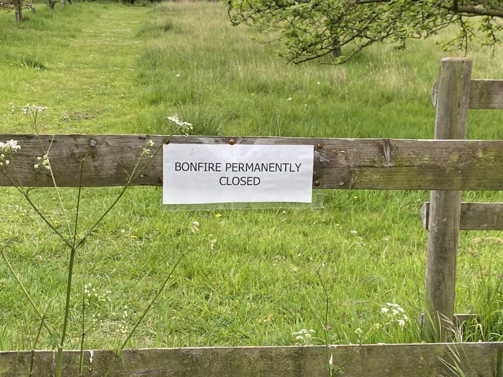
    On our previous trip to Goodleigh Hill CL in November I did a couple of walks on the Malvern Hills.  On the first Lynnie accompanied me, but on the second I visited British Camp on a very cold day with snow forecast and Lynnie declined to join me, preferring to spend a few hours wandering around Pershore.  It was a stunning walk and is top of my list of places to revisit during this stay. 

    It is about fifteen miles from the caravan site to the British Camp car park (WR13 6DW) besides the A449.  This is a pay and display car park with a set fee for the day, the proceeds are used to maintain the Malvern Hills as an area of outstanding natural beauty.  Leaving the car park we go through a gate and follow a broad path that gradually ascends the hill.

    At a junction of paths we continue straight on, ignoring steps which lead to British Camp.  The path we are on hugs the contour line below the camp and soon take us above the British Camp Reservoir.  

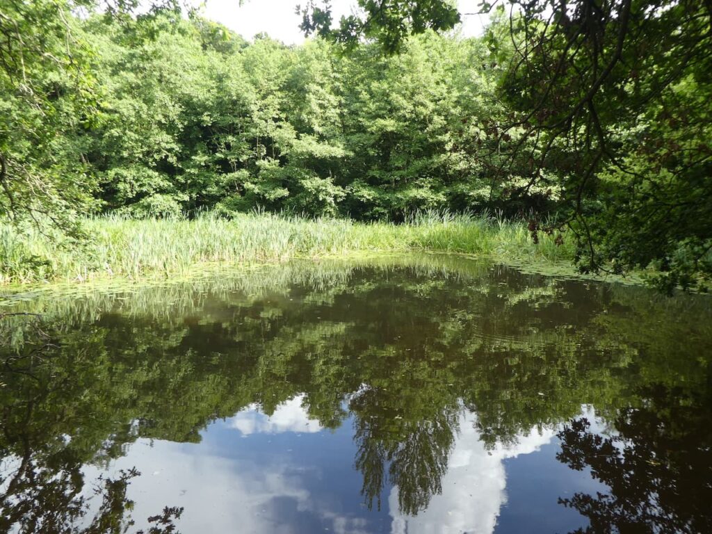
    Apparently following water shortages, the 1891 Malvern Water Act was introduced.  This allowed the reservoir to be built and it was opened in 1895, it collects water from the springs in the area.   It is a fine looking small reservoir, the current low level of water reflects the recent dry spell we have been experiencing.

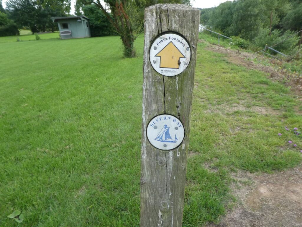
    The path we are on is the route of the Three Choirs Way, a 100-mile long distance walk which links the cathedral towns of Worcester, Hereford and Gloucester.  After passing the reservoir we start to  gradually ascend to a point where a number of paths join.  Here we stay with the route of the Three Choirs Way as it leads past Clutter’s Cave.  According to the Malvern Hills Trust this is a folly created in Edwardian or Victorian times, however, others describe it as a small quarry or a medieval hermit’s dwelling.  Confusingly it is also known as Hermit’s Cave, Giant’s Cave or Waum’s Cave.

    The pat continues along the ridge and then at a junction of paths we stay with the Three Choirs Way as it gradually descends towards Gullet Wood.  There is a stone marker here pointing the way to The Gullet and Midsummer Hill.

    It is a cracking afternoon and we pass an area of bluebells and continue along the path to go through a gate besides a cattle grid.

    We now continue on the track to reach a junction of tracks, we turn right and go through a kissing gate and head uphill on the route of the Geopark Way.  This long-distance path goes 109 miles between Bridgnorth and Gloucester exploring the geological changes along the way.  We are only following for a short distance to reach Eastnor Obelisk at the top of the hill.

    This obelisk was erected in 1812 and is a monument to various members of the Somers Cocks family.  Those commemorated include John Somers, Lord Chancellor in 1700 who was an adviser to William III, and Philip James Cocks, who was an intelligence officer on Wellington’s staff and died during the siege of Burgos in the Peninsular War in 1812. Afterwards his father, Earl Somers, had the obelisk erected.

    From the obelisk we retrace our route down the hill to the junction of paths.

    After going through the gate we continue along the route of the Geopark Way and the Three Choirs Way heading south towards the A438.

    As we head along this track we get a good view back across to the Eastnor Obelisk.

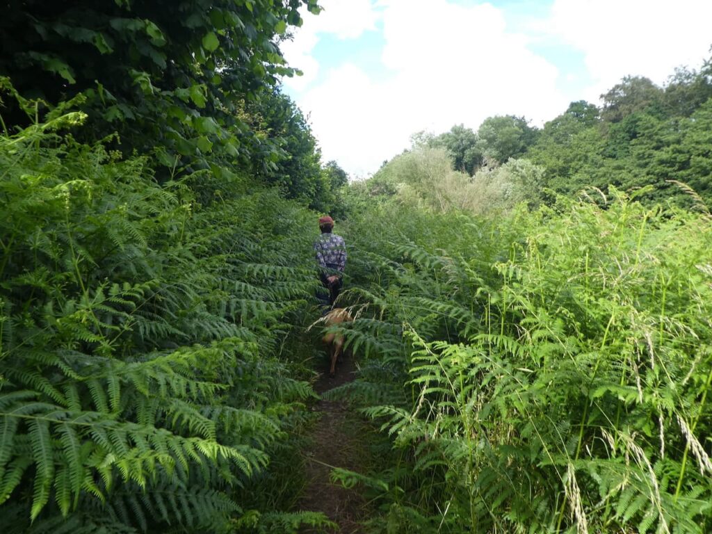
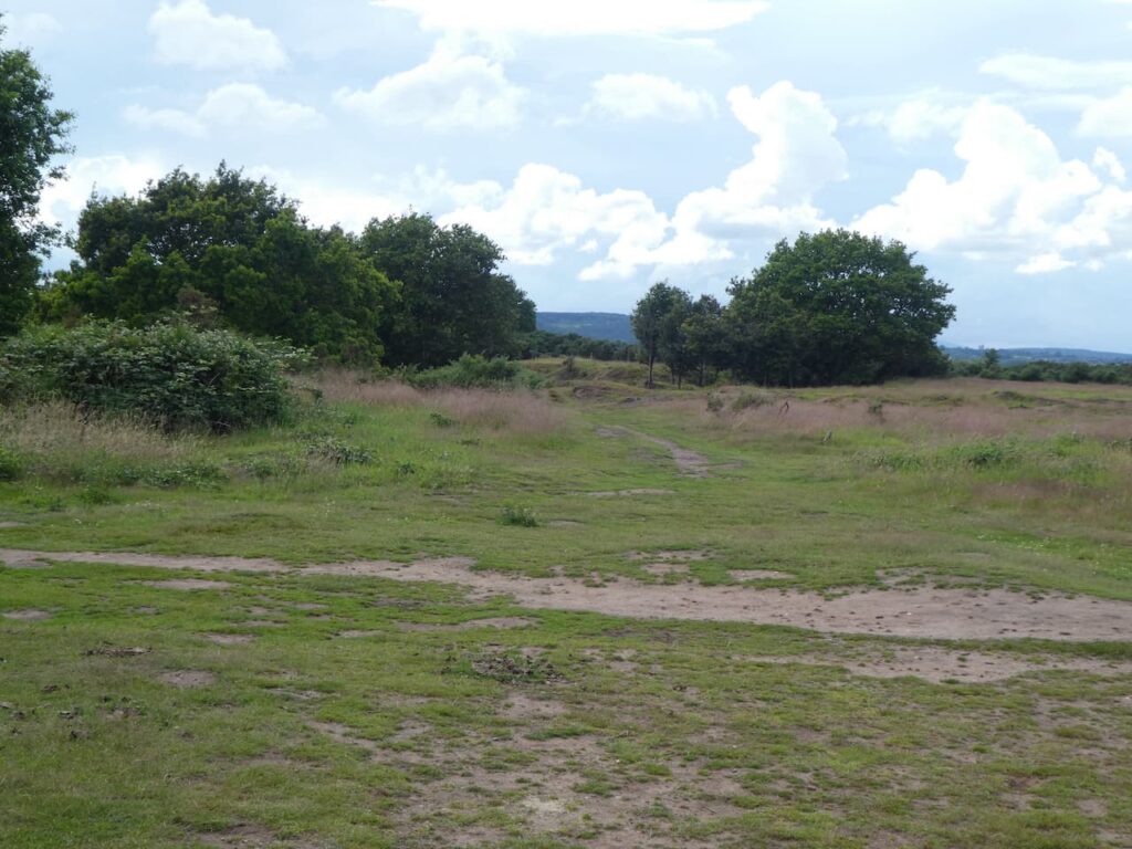
    On reaching the A438 we turn right at the entrance to a small car park and walk along the road for just over a hundred yards and then cross the road with care to go through a kissing gate leading to Ragged Stone Common.  This is open access land but we choose to initially stick to the route of the Geopark Way which goes to the right and skirts around the hill passing through an area of stunning Bluebells.

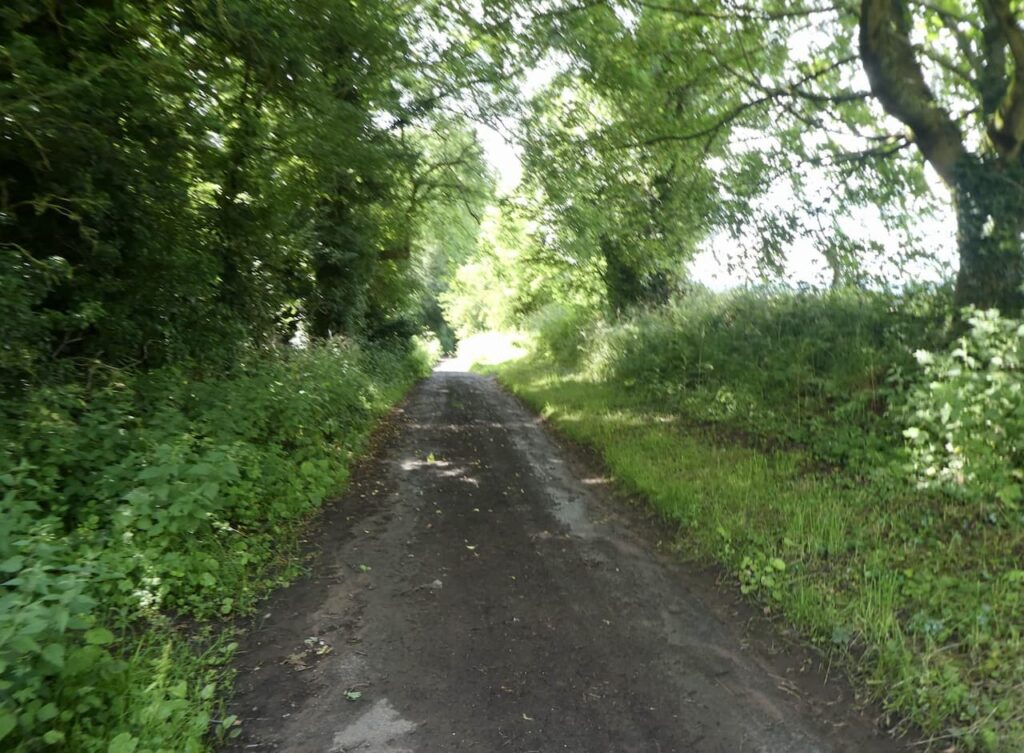
    When the Geopark Way turns to the right we continue on a clear path leading to Whiteleaved Oak.  In this attractive hamlet we turn right and then almost immediately turn left on a path which goes besides a cottage and continues along a sunken track.

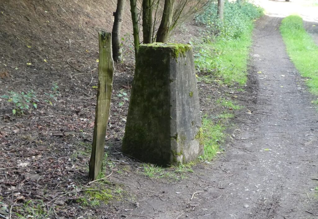
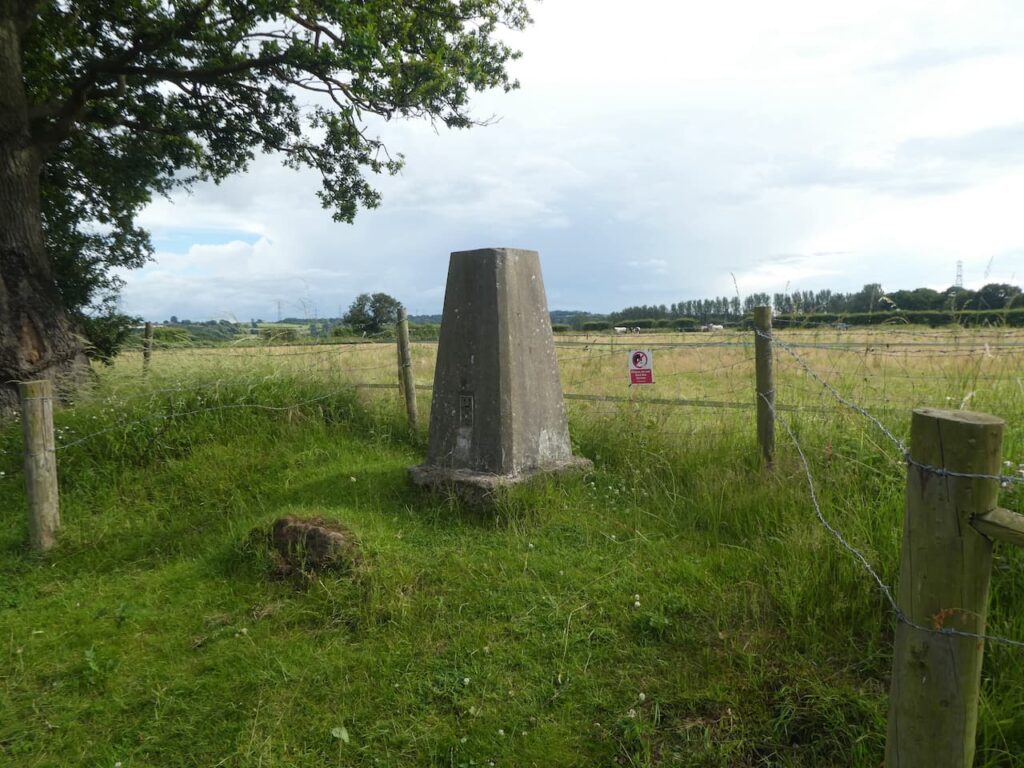
    The track leads to open access land where we continue on a well-worn path that ascends Chase End Hill.  This is a short steep ascent and we are soon on the top of the hill standing beside the Ordnance Survey trig pillar.  I bagged this trig back in November but it is Lynnie’s first visit here.

    It is a cracking day and the views from Chase End Hill are stunning.

    We continue on heading downhill to a junction of paths where we turn left and then left again to follow a track through woodland.

    At a junction paths we turn right to leave the track and briefly go downhill to reach the Three Choirs Way where we turn left and follow what appears to be an old tramway heading north.  We soon cross a bridge over a minor road in Whiteleaved Oak.

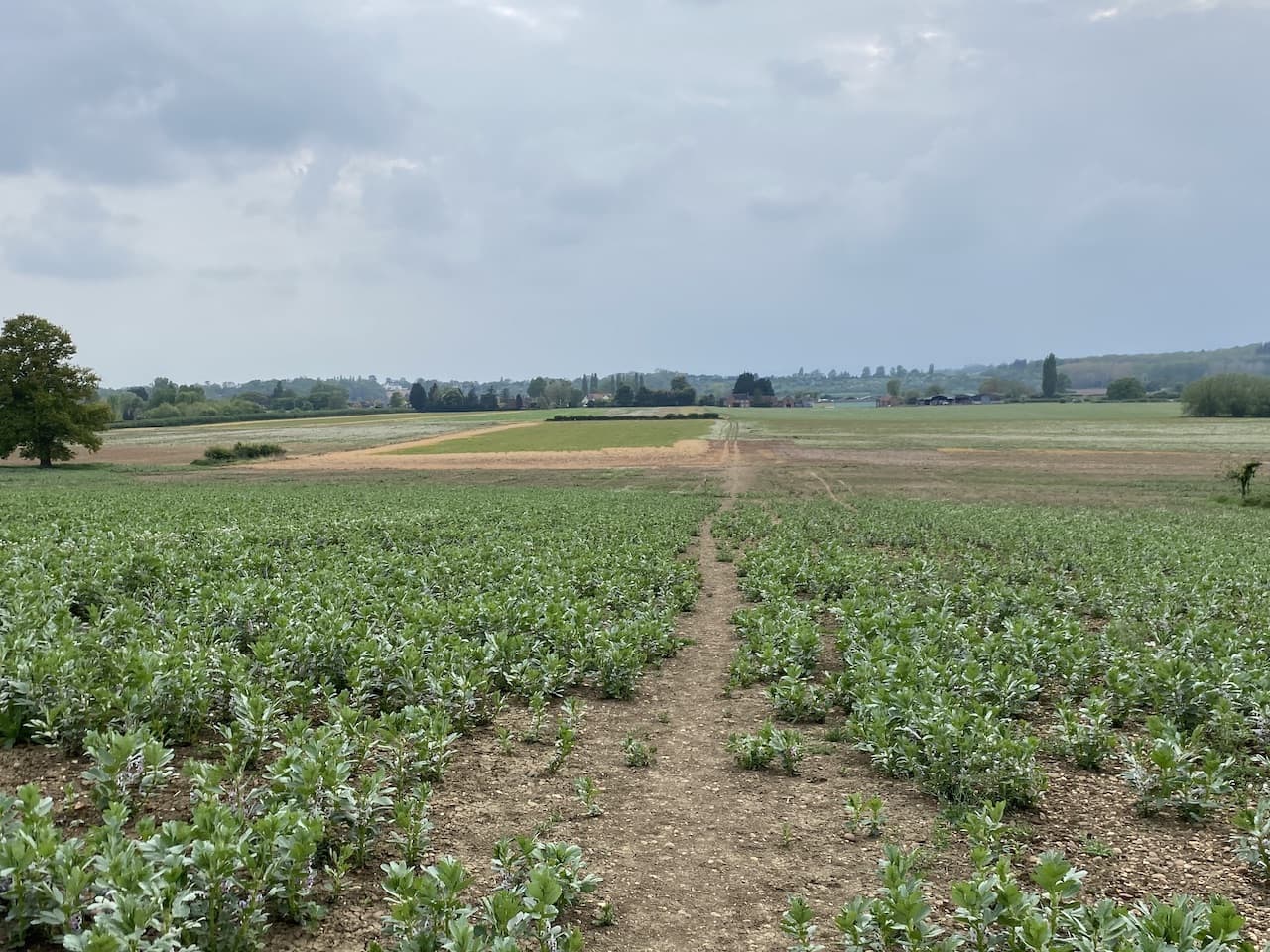
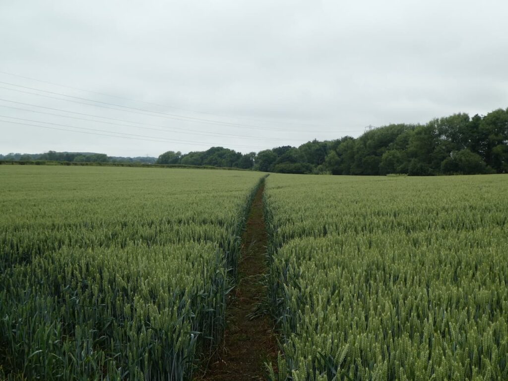
    On leaving the woodland the route continues across fields.

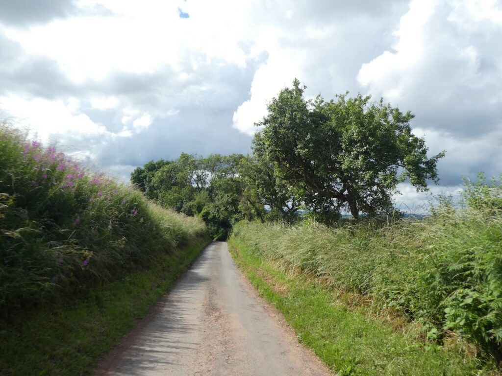
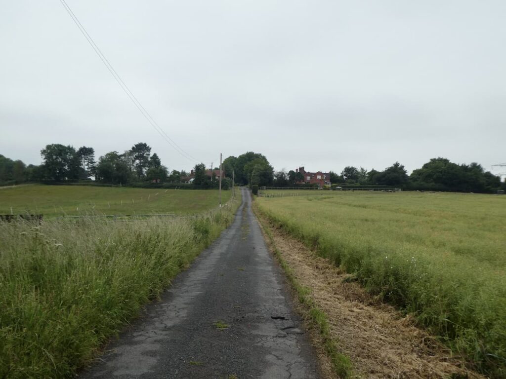
    After passing an interesting thatch cottage we join a minor road and follow this towards the A438.

    After passing Hollybush village hall we cross the main road and continue along a minor road.

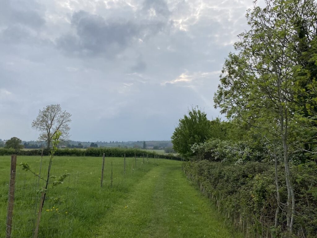
    This minor road goes north along the edge of woodland and then as we near The Gullett we fork left on a path, the map shows this a minor road, but clearly it is a long time since a vehicle travelled along it.

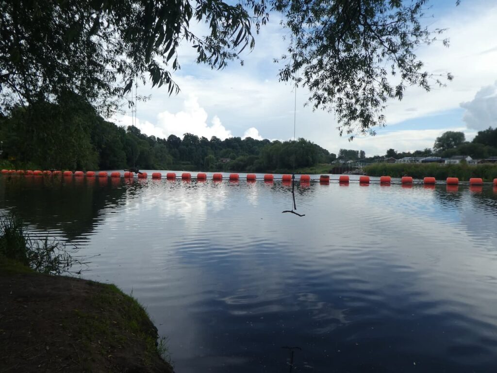
    This path goes above a stream and then on reaching a bridge over the water we turn right to cross the bridge and then turn right again to follow a path alongside the disused Gullet Quarry.  In the early 1900’s many quarries were opened on the Malvern Hills to extract granite for road making.  In 1953 the government of the day decided that extraction should stop and most of the quarries closed, but an exception was made for this quarry and it continued to be worked for another twenty years before closing around 1977.

    There are numerous signs about the dangers of wild swimming and every effort has been made to make the quarry inaccessible, however, people foolishly continue to try and access the water to swim.  Sadly there are numerous reports of deaths, mainly of young men.  In 2020 the Herefordshire and Worcestershire Fire and Rescue service told the BBC that there had been 5 deaths in the previous 14 years.  

    The information board besides the quarry explains the geological structure of the hills.  We walk along a track and then as it nears a road turn left to head steadily up Swinyard Hill.  

    One of the features about walking around the Malvern Hills is the old waymarkers that indicate various routes.  We reach one of these and take the route to Giant’s Cave and British Camp.

    This is the path we walked down earlier as we descended from the cave and it soon comes into view again.

    Continuing on past the cave we reach a point where there are multiple options, we take the route towards British Camp.

    The route goes uphill giving good views back across the British Camp Reservoir.

    I visited British Camp last November for the first time, on that occasion Lynnie was not with me so it is her first visit and it could not be a better evening for it.

    British Camp was originally an Iron Age hillfort and thought to be bonded around the time of the Roman invasion.  It was later the location of a medieval castle which was constructed within the iron age ramparts.

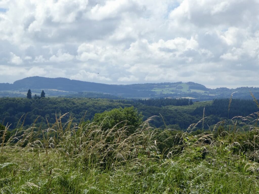
    The summit of the hill is known as Herefordshire Beacon, this is not the highest point of Herefordshire, but it still stands at 338 metres, or if you prefer 1,109 feet, above sea level and on a day like this the views are panoramic.

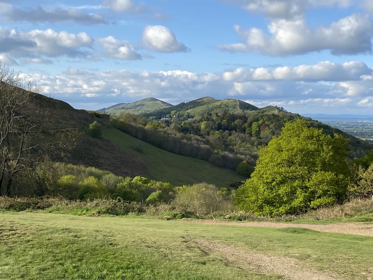
    In front the northern ridge of the hills stretch into the distance, we plan to walk along that ridge tomorrow and the number of ascents and descents look a bit daunting from here.

    We have one last descent on our walk today making our way down the hill back to our starting point in the British Camp car park.  It has been a cracking walk covering nine miles, which is shorter than I would normally walk, but there has been 1,555 feet of ascent along the way so not a bad day’s exercise.

    You can view this 9 mile walk on OS Maps and download the GPX File Here

    To follow my walk, you will need Ordnance Survey Maps: OS Explorer Map – 190 – Malvern Hills & Bredon Hill

    4th May 2022

    © Two Dogs and an Awning (2022)

    All information on this site is provided free of charge and in good faith and no liability is accepted in respect of damage, loss or injury which might result from it.  To the best of my knowledge the routes are entirely on public rights of way or within areas that are open for public access.
    Walking can be hazardous and is done entirely at your own risk.  It is your responsibility to check your route and navigate using a map and compass.

  • A Short Walk from Goodleigh Hill CL

    A Short Walk from Goodleigh Hill CL

    After a couple of weeks walking on and around the Brecon Beacons we have moved site and are now located at Goodleigh Hill CL on the outskirts of Pershore.  We visited this site for the first time last November, it was a very cold spell and we decided to return in warmer weather.  

    Our journey from Llangadog was straightforward and we were warmly greeted by Emily, the site owner.  It is always useful to arrive at a site and meet someone happy to share their local knowledge with you.  Goodleigh Hill is a relatively new CL and it has been developed well.  All pitches are fully serviced on a large hardstanding and on arrival there is a comprehensive information folder which you can peruse at your leisure during your stay.

    As soon as we are pitched up it is time for a quick walk from the site.  We aim to walk into Pershore to pick up some shopping later so decide to do the walk that formed my morning circuit when we last stayed here.  

    Leaving the site by the pedestrian access we walk down to the road and the turn left heading uphill into Pensham Hill.  As the road levels out we take a footpath on the right beside a post box.  The path follows a driveway and then goes through a gate to enter a field.

    This is the route of the Wychavon Way, a forty mile long distance route between Droitwich Spa and Broadway.  We go through the field with the hedge to our right to reach a kissing gate.

    We now follow a clear path across fields heading towards Home Farm in Pensham.

    On reaching a road in the village we turn left and soon reach a junction of minor roads where we turn left to head back to Pensham Hill.  This is a long straight road with very little traffic so easy walking.  

    As we leave the village we pass the entrance to the village field, apparently in 2000 local residents raised funds to purchase a couple of acres of land for planting with trees and an Orchard creating a recreation area.  Such initiatives are great for supporting wildlife habitat and developing communities.

    At the entrance to the field is a notice saying that the Bonfire is permanently closed.  I am not a fan of bonfires or those that light them on sunny afternoons when folk are trying to relax in their gardens.  

    A little further along the lane is another sign.  Whilst I concur with the sentiments it leads us to wonder why folk would feel the need to use the field as a toilet, presumably it is a frequent occurrence otherwise why put up such a notice.  But equally concerning is that someone is lurking behind a tree with a camera just on the off chance that someone might have a desperate call of nature!

    We now stay with the road returning back to Pensham Hill and continue straight on going steadily downhill to reach the entrance to the CL.  This little route is just over two miles, enough for Crosby to stretch his legs after being in the car for a few hours.  Now it is time to pop into Pershore and get some supplies before planning our walks for the next few days.

    You can view this 2 mile walk on OS Maps and download the GPX File Here

    To follow my walk, you will need Ordnance Survey Maps: OS Explorer Map – 190 – Malvern Hills & Bredon Hill

    3rd May 2022

    © Two Dogs and an Awning (2022)

    All information on this site is provided free of charge and in good faith and no liability is accepted in respect of damage, loss or injury which might result from it.  To the best of my knowledge the routes are entirely on public rights of way or within areas that are open for public access.
    Walking can be hazardous and is done entirely at your own risk.  It is your responsibility to check your route and navigate using a map and compass.

  • Titterstone Clee Hill

    Titterstone Clee Hill

    We have had an enjoyable stay at the Old Orchard CL but it is almost over and tomorrow we are heading home for a couple of days before setting off for a week at a newly opened CL near Oldbury-on-Severn.  This being our last day in the area we decide to hop in the car and drive a bit further than we would normally so we can walk up Titterstone Clee Hill.

    The starting point for our walk is the Clee Hill Viewpoint car park beside the A4117 on the edge of Cleehill (Grid Ref: SO948753).  Leaving the car park we walk on the pavement into Cleehill and just after passing the Golden Cross pub we turn right into Golden Cross Lane.

    We keep with this lane as it heads steadily uphill and then after passing barns turn to the left along a path which follows a broad track passing disused quarry buildings.

    Staying with this path we reach colourful housing built for quarry workers and turn right to continue uphill on a minor road.

    After a few hundred yards we leave the road and take a footpath on the left which goes over a ladder stile beside a gate and continues along a track.  In front of us rises the summit of Titterstone Clee Hill.

    The track leads past cottages and then the footpath goes along a path into a field.

    We then cross Benson’s Brook on a footbridge.

    Staying with the footpath we reach the Titterstone Incline.  

    We head onto the incline and follow this uphill towards the old quarry works.

    Over the years this hill has been quarried and mined to a great extent and there are a number of old quarry buildings around.

    We follow a footpath which is the route of the Shropshire Way, this a 200-mile long distance path that does a figure of eight through the County so can be done as a north or south circular walk.  This section leads around the edge of the quarry towards the distinctive radar stations.  The larger is used by the Civil Aviation Authority as part of the National Air Traffic Control Service and the smaller one by the Met Office as a weather radar station.

    The path leads us to the Ordnance Survey Trig Pillar on the summit of the hill, this is the 263rd trig I have bagged.

    At 1,749 feet Titterstone Clee Hill is the third highest point in Shropshire, with only Brown Clee Hill and Stiperstones being higher.  The views from here are expansive and we take a while to take it all in.

    The top of this hill was the location of a hill fort in the Bronze and Iron Age and close to the summit is a collection of large boulders known as the Giant’s Chair.

    We descend from the summit on the Shropshire Way path heading north.  It is a steep descent as we head towards Callowgate.

    At a boundary fence we turn right and follow a path to reach a minor road at Cleetongate.  Now we turn right and walk along this road to reach Cleeton St Mary and pass the village church.

    Continuing through the village we reach Catherton Common and stay parallel to the road until we almost reach a junction with a B road.  Now we turn right and follow a track leading up Magpie Hill.

    After passing cottages the path continues uphill and then levels out a bit as we pass disused quarries near Whatsill.

    We stay with the track as it heads in a westerly direction to extensive quarry works.  This quarry opened in the late 1980’s, roughly fifty years after the other quarries on the hill closed down.  I understand the need for materials for road and building construction but I am always saddened to see the destruction of the landscape.

    Our route is now straight forward we follow the track around the quarry and then continue on this main driveway to reach the A4117 where we cross the road and turn right to walk over access land back to the car park.  Before leaving we stop to look at the vista from the viewpoint.

    Our wander about has covered just over eight and a half miles and to see all the industrial archaeology relating to the quarries and mines has been interesting.  Now it is time to head back to the caravan and prepare for our trip home tomorrow.  

    You can view this 8.5 mile walk on OS Maps and download the GPX File Here

    To follow our walk you will need Ordnance Survey Outdoor Explorer – 203 – Ludlow

    5th July 2021

    © Two Dogs and an Awning (2021)

    All information on this site is provided free of charge and in good faith and no liability is accepted in respect of damage, loss or injury which might result from it.  To the best of my knowledge the routes are entirely on public rights of way or within areas that are open for public access.
    Walking can be hazardous and is done entirely at your own risk.  It is your responsibility to check your route and navigate using a map and compass.

  • The Battle of Worcester

    The Battle of Worcester

    Every walker will know that not all routes go exactly as planned, we have encountered missing footbridges, totally impassable paths, path closures for safety reasons following landslip or storms and of course the field of lively cattle.  It all becomes part of being out and about, but when someone tells me walking is stress free I wonder where they have been walking.  This might be a bit of a spoiler for what is to follow.

    Over the last few years some of my walks have taken in sections of the Monarch’s Way, this 625-mile long route traces the journey that Charles II took after suffering defeat to Cromwell’s Army at the Battle of Worcester.  It winds its way from Worcester to the south coast at Lyme Regis and then heads east through Dorset, South Wiltshire and Hampshire before crossing the South Downs and finishing in Shoreham.

    As we are staying close to the site of the Battle of Worcester it seems a shame not to take the opportunity to walk the first few miles of the Monarch’s Way.  We head to Worcester and park in a small car park in Grandstand Road and then head north besides the road to reach a footbridge spanning the river.

    From the footbridge we get a view of the racecourse.  When I was working I visited Worcester on a number of occasions, but normally did not venture far from the City centre.  I had not appreciated that the racecourse was so central.

    From the bridge there is a fine view down the river.

    On the far side of the river we turn left and head in a southerly direction besides the river and pass a plaque explaining the 12th century legend of an illicit love affair which ended in tragedy when a young nymph named Sabrina drowned in the river.  The river was therefore called the Severn after her.

    This is a good story but I prefer that it was given the name Sabrina by the Romans.  Wales borders much of the river and the Welsh for Sabrina is Hafren which means boundary.

    We pass the impressive Worcester Bridge, this was first built in 1781, but by the early 20th century it was clear it needed to be improved for increased traffic, so it was fully reconstructed and widened in 1931.

    We stay with the river to our left and continue to walk along the bank through a pleasant wooded area besides playing fields.  We pass a weir and further across out of our sight is a lock which we should pass on the way back.

    Soon after the weir we reach four iron statues, they commemorate Sir Charles Hastings (1794 – 1866) a medical surgeon and founder of the British Medical Association who used his money to improve housing in Worcester; Ernest Powell (1884 -1961) who won a gold medal in track cycling in the 1908 Olympic Games in London and was known as ‘The Worcester Wonder’; and a Royalist and a Parliamentarian to commemorate the Battle of Worcester.

    We stay besides the river following a footpath which enters fields.  The map shows this as the site of the Battle of Worcester, fought on 3rd September 1651.  The Royalists under the command of Charles II totalled 16,000 men, they were heavily outnumbered by 28,000 Parliamentarians led by Oliver Cromwell. There are reports of fierce fighting on theses meadows around Powick Bridge on the land between the River Severn and the River Teme.

    I know it was nearly 400 years ago, but it does feel strange having a pleasant walk in the countryside over land where so many men were slain.  

    We are obviously on the route of the Monarch’s Way and the familiar way markers guide us towards Powick Bridge.

    We pass an information board indicating that the building away to our left is St Cuthbert’s Barn dating back to 1165.  For two hundred years it was used as a chapel for worship and then became a barn for local farmers, in the 18th century it was used as a workhouse for the poor and  then a prison following an outbreak of Prison Fever at Worcester Old Castle Jail.  Between 1850 and 1922 it was used for hop drying, since then it has been used as a cattle store and stables.

    As we continue besides the River Teme towards Powick Bridge we can see the chimney of Powick Mill, this former water mill was reportedly converted in 1894 to become the world’s first combined steam/hydroelectric power station.  It continued to supply electricity to houses in Worcester until the 1950s.

    The footpath follows the bank of the meandering River Teme and then goes under a cast iron road bridge built in 1837.

    After the bridge we go through a field and then join a minor road where we turn left to cross the historic Powick Bridge, this bridge was built before 1447 and then partially rebuilt in the 16th century.

    It was at this bridge that the first skirmishes of the English Civil War took place on 23rd September 1642.  It was also around this bridge that the final battle of Worcester took place at the end of the civil war.

    Apparently after the final battle the radical preacher Hugh Peters gave a sermon in which he proclaimed that Worcester was where England’s sorrows began and where they ended,  Sadly like so many religious sermons Peters’ proved to be incorrect.

    Powick Bridge is the official start of the Monarchs Way and it is a fine place to start a long distance walk.  Unfortunately for us it is the start of a walking disappointment.  I had mapped a route from here that would follow footpaths and then join the A4440 to cross the River Severn and then we would turn left to walk along the east bank of the Severn.  However, my best laid plans failed to take into account major roadworks and the temporary closure of paths.  Therefore, we set off across fields and then walk beside the A4044 before realising there is no way to cross the river and so we need to retrace our steps to Powick Bridge.  

    We now have the option of retracing our steps besides the river or walking through Lower Wick beside the road and then taking a footpath which will lead us back to the river beside the iron statues.  We go for the latter.  At the statues we cross the Diglis footbridge over the Severn and then turn left and soon reach Diglis Lock besides Diglis Island.

    Completed in 1844, Diglis Island is a man-made island in the River Severn. It was once heavily used for carpentry and blacksmithing, and apparently the workshops still remain.

    According to the Canal and River Trust Diglis Lock is the largest and deepest on England’s inland waterways.

    We stay by the river and soon reach the Diglis Dock, built in 1893.  Between 1926 and 1968 it was the location of a Shell Oil depot.  Apparently in 1979 a stolen Aston Marin DB6 was recovered from the lock.

    Very close to the dock is the start of the Worcester and Birmingham Canal.  As the name suggests this 29-mile canal connects Worcester with Birmingham.  Its construction began in 1792 and it fully opened in 1815.  

    We now leave the path besides the river and walk besides the canal to reach Diglis Basin which opened on the completion of the canal.  There are reports of a fire here in 1836 which destroyed the warehouse of Messrs Pickford and Co.

    In 1877 Thomas Henry Wilmott an employee of the canal company discovered the body of an unidentified man drowned in the basin; and then in 1901 Thomas Henry Wilmott  (the same chap) heard shouts and discovered seven year old William Gradson had fallen into the basin. Wilmott jumped in and rescued the boy.

    We follow the canal away from the basin and walk besides converted warehouses.  These days the canal is busy with leisure craft, but when fully operating in would have been a commercial carriage. Apparently a major user of the canal was the Cadbury Chocolate factories at Bournville and Blackpole.

    On reaching a bridge we leave the canal and join Mill Street and turn left to follow this street back to the river where we turn right and head along the riverside path to return to our starting point.

    Our walk has covered just over eight-miles, of which a couple were on the footpath where we could get no access to cross the river, so we would have been better to off just doing a six mile circuit to Powick Bridge to take in the historic sight of the battle of Worcester which is shown on the route below. 

    You can view this 6.5 mile walk on OS Maps and download the GPX File Here

    To follow our walk you will need Ordnance Survey Outdoor Explorer – 204 – Worcester & Droitwich Spa

    4th July 2021

    © Two Dogs and an Awning (2021)

    All information on this site is provided free of charge and in good faith and no liability is accepted in respect of damage, loss or injury which might result from it.  To the best of my knowledge the routes are entirely on public rights of way or within areas that are open for public access.
    Walking can be hazardous and is done entirely at your own risk.  It is your responsibility to check your route and navigate using a map and compass.

  • A Jamabout to Hartlebury Common

    A Jamabout to Hartlebury Common

    Yesterday evening I spent some time studying the Ordnance Survey maps for the local area around Old Orchard CL.  As far as Lynnie is concerned my studying maps is ominous, she knows I will be planning a route to bag a couple of trig points.  In times past I would roughly work out the distance of a route with a method I learnt at school fifty years ago.  It was not wholly accurate, but gave a rough approximation.  Strangely, and to Lynnie’s dismay, the walk was always further than I calculated.  These days after studying the paper map I plot the route on OS Maps giving a pretty accurate distance, so there should be no unwelcome surprises.

    Heading out today we know our planned route is about 12 miles, I say about because there is always scope for deviation if we see something interesting along the way.   The first section of our walk is on local lanes, we have walked a few of these since our arrival and know they are relatively free of traffic.

    Leaving the site by the main entrance we turn left and follow the road steadily downhill to pass a junction on the right and then fifty yards further on fork right on to a single track lane, Little Battenton.  

    We stay with this lane for just over 500 metres and then turn left into another narrow lane, Tattle Street.  This leads to a road, Blacksmith’s Bank where we turn right.  There are fine views from this road across the River Severn to Abberley Hill where we were walking a few days ago.

    We continue along this road for 250 metres to reach a grass triangle at a junction.  Here we turn left onto the road sign-posted towards Hartlebury and Stourport.  We walked this lane in the opposite direction a few days ago and soon pass Ombersley Golf Club.

    We stay on this lane for 500 metres, ignoring footpaths leading off of on both sides and a junction on the left, to reach a driveway to Bishops Wood Nursery.  We follow this towards the car park for the nursery and then spot the Ordnance Survey Trig Pillar that is located on land to the right.  This is the 261st trig I have bagged.

    After bagging the trig we walk back to the road and then turn left, at which point Lynnie realises we have detoured from the route to bag a trig.  She has become resigned to this and sighs exasperatedly whilst mentally chalking up that it is worth an ice cream.  After 500 metres we turn right into Lincomb Bank and follow this road downhill.

    On reaching houses in Lincomb we turn right to pass Lincomb Farm and continue along Lincomb Lane to reach the A4025 which we cross to continue along a narrow lane.  After 750 metres we turn left into Titton Lane and follow this downhill to Hillditch Pool.  Just after crossing a stream we turn right onto a footpath that leads to Hillditch Coppice.

    Apparently this pool and surrounding bog area is a rare habitat, it is an acid bog and attracts a variety of wildlife.  There are signs advising people not to swim in the pool, strangely it had not crossed my mind that anyone would want to venture into the murky water.

    Our route heads north, the footpath is surrounded by bracken, which is tall at this time of year.

    Soon the path becomes clearer and runs besides paddocks to reach a junction of paths, we turn left and head uphill towards Upper Poollands Farm and the Stourport Riding Centre.  After passing the riding centre barns the footpath continues along a track to reach Hartlebury Common where we stay close to the fence line to reach the Hartlebury Common Ordnance Survey trig pillar, my 262nd.

    We now head across Hartlebury Common in a westerly direction.  There are a network of paths on this common, which according to Worcestershire County Council is the largest and most important area of heathland remaining in Worcestershire.

    We are nattering away and taking in the views so I am not fully concentrating on our route, it does not matter because we soon find a path that will take us across the common to reach the A4025 at a car park opposite Cook’s Garden Centre.  Here we turn right and walk along the pavement for 200 metres and then take a lane on the left which we follow to reach Power Station Road where we turn left and then follow the way-markers to reach the River Severn.

    On the riverbank we turn left  and stay with the easy to follow Severn Way to pass Stourport Marina.

    A few hundred metres further on down the river we reach a barrier across part of the river which diverts boats away from a weir and into Lincomb Lock.

    We quickly reach the lock.  This is one of a series of locks built in the 1830’s to enable the River Severn to be navigable up to Stourport.

    Walking on a route besides a river or canal is very straightforward and this one is no exception.  The path is clearly way-marked as we continue to head south through woodland and then into fields.

    We pass a campsite and continue along the river bank until we reach a footpath on the left which takes us across a field towards Lyth Farm.

    From the field we join a track and pass the farm, staying on the track to reach a minor road at a junction.  We turn right and follow this lane to another junction where we turn left and then at the next junction go right.  In around 100 metres we take a footpath just before a 16th century timber framed property, Tytchney Gables.

    From here we follow the footpath back across the fields to return to our caravan at Old Orchard.  The walk has covered just over 11.5 miles which was just about what I promised Lynnie before we set off!

    You can view this 11.5 mile walk on OS Maps and download the GPX File Here

    To follow our walk you will need Ordnance Survey Outdoor Explorer – 204 – Worcester & Droitwich Spa, and OS Explorer – 218 – Kidderminster & Wyre Forest

    3rd July 2021

    © Two Dogs and an Awning (2021)

    All information on this site is provided free of charge and in good faith and no liability is accepted in respect of damage, loss or injury which might result from it.  To the best of my knowledge the routes are entirely on public rights of way or within areas that are open for public access.
    Walking can be hazardous and is done entirely at your own risk.  It is your responsibility to check your route and navigate using a map and compass.

  • Archers Country

    Archers Country

    Crosby and I are walking on our own today, Lynnie has decided a day spent around the caravan is just what she needs.  I am not sure if my mention of heading out for a day’s trig bagging had an influence or if it was the chance to get a day’s undisturbed reading of a good book that was too good an opportunity to miss.

    It is just a short drive to the starting point for my walk which is a parking space for a few cars on a road triangle close to Astwood Bridge (Grid Ref: SO942656).  From here I head south on a minor road  (Eastwood Lane) and stay with this to reach a T-junction where I turn left.  I keep going until I reach the turning for the church of St Mary the Virgin in Hanbury up a short lane to the left of the road.

    Parts of this church date back to 1210 with alterations in the 14th century and a rebuild in the late 18th century.  The church has strong associations with the Vernon family who lived at nearby Hanbury Hall and the interior houses the Vernon Chapel.  Unfortunately, due to Covid restrictions, the church is locked so I can’t view the interior but there is plenty of interest outside including the ornate tomb of Thomas Bowater Vernon embedded into the church wall.

    This church will be familiar to listeners of the BBC Radio 4 series The Archers because it doubles as St Stephens Church in the series.  According to the church’s website it was first used over 65 years ago.  The creator of the Archers, Godfrey Baseley lived nearby in Bromsgrove and mixed with many of the farmers around Hanbury.  It is said he based the series on the local area and used St Mary’s when a location was required for broadcasting scenes from Ambridge village church.  Lynnie introduced me to the Archers when we met over 40 years ago and I have avidly followed the events in Ambridge ever since.

    From the church I return to the road and cross to join a footpath onto National Trust land surrounding Hanbury Hall.  The path immediately divides, I follow the path heading through Hanbury Park towards the Hall.

    Hanbury Hall was built in the early 1700’s by Thomas Vernon a wealthy chancery lawyer. It stayed in the Vernon family until 1962 when the National Trust took over the property.  Initially it was rented to tenants and only opened occasionally, however it now opens daily and is a popular local attraction.

    After passing the hall I continue through the park to reach a junction with a road.  I proceed south besides the road (School Lane) to reach a junction with Salt Way.  Here I cross the road and enter a field and head south.

    This way-marked path passes through fields to reach a junction of paths where I turn left and head east towards Becknor Manor.  I ignore a footpath on the right and stay on the route until I near Becknor Manor where I take a path on the right heading south towards a lane.

    At the lane I turn left and follow along a track and as it bends to the left I go through a gate on the right and take a footpath heading uphill. The route reaches a crossing of footpaths where I turn right and skirt a property and then head across fields towards Broughton Green.  At a minor road in the village I turn left and continue to a junction where I go right on a lane signposted to Bradley Green and Stocks Green.

    This is another single track lane with wide verges so pleasant for walking along and I soon ignore a footpath on the right.  Then after passing a property I turn right on a footpath which goes over a stile into a field.  The map shows the path heading diagonally across the field but there are standing crops and no clear path so I follow the tractor tramlines to eventually reach a point where the footpath is close to the hedge line where I turn right and walk close to the hedge.

    At a junction of paths I turn left and head through fields towards Ward’s Farm.  

    The path heads uphill and then in a field on my right is an Ordnance Survey trig pillar.  This is the 259th trig I have bagged.

    From the trig I continue along the footpath into another field and then into a further field where the path forks, I go left and in the next field turn left and head down to a minor road where I turn right towards Middle Hollowfields Farm.

    At a junction I turn right and pass the farm and then take a footpath on the left which heads east across fields towards Bradley Green.

    The path enters the village besides the church of St John the Baptist which was built in 1864/65. This church has an interesting tower and a striking stained glass window, installed in 1921 commemorating  twelve men of the village who lost their lives in World War I.  Unfortunately the church is locked so I can’t go inside to fully appreciate  the window.

    From the church I continue on the path along a driveway to reach a road running through the village.  I go left along this long straight road to a junction with a B road where I go left again and then almost immediately right following a footpath along a track leading towards Perry Mill Farm.  After passing the farm I turn right at a junction of tracks to follow a bridleway way-marked to Berrow Hill and Feckenham.

    This route passes along the edge of Bushyhill Coppice  and at a crossing of paths I turn left and head up towards Berrow Hill.  I pause to take in the view to the south.

    The path leads to the top of the hill and then across the summit to the Berrow Hill Ordnance Survey trig pillar.

    My 260th trig safely bagged I continue across the field and then enter woodland and descend to reach a track where I turn left and follow the footpath way-markers.  At a fork in the footpath I go to the right to skirt around Littleworth Farm.

    On reaching a minor road I turn left and follow this road until it turns sharply to the right.  At this point I continue straight on along a bridleway and stay with it until I reach a road which I cross and follow a bridleway passing Forest Farm and then continue along a broad farm track.

    At a junction of paths I turn left and follow a path along a track that soon goes downhill through a field to reach another track below Forest Hill.  Here I turn right and stay with the track to reach a minor road.

    At the road I go left, this is a quiet country lane so I decide to stay with it and not take the option of a footpath on the right which leads to Piper’s Hill Farm.  I do not encounter any traffic and then as I near the B4091 I take a footpath on the right leading into woodland on Piper’s Hill.

    I keep the road to my left as I go through the woods.  This is a popular dog walking area and there are a network of paths in the trees, but the road serves as a useful handrail.  At the northern edge of the trees I cross the road and enter woods on the opposite side and follow a path that goes steadily downhill towards Hillfields Farm.  Nearing the farm the path turns into a minor road and my route is now very straight forward because I stick with this lane for over a mile to return to my starting point near Astwood Bridge.

    I have covered sixteen miles on my jamabout, bagging two trigs is a bonus and finding the connection with The Archers has been interesting.  Time to head back to the caravan to see how Lynnie has been getting on with her book.

    You can view this 16-mile walk on OS Maps and download the GPX File Here

    To follow our walk you will need Ordnance Survey Outdoor Explorer – 204 – Worcester & Droitwich Spa

    2nd July 2021

    © Two Dogs and an Awning (2021)

    All information on this site is provided free of charge and in good faith and no liability is accepted in respect of damage, loss or injury which might result from it.  To the best of my knowledge the routes are entirely on public rights of way or within areas that are open for public access.
    Walking can be hazardous and is done entirely at your own risk.  It is your responsibility to check your route and navigate using a map and compass.

  • Around Abberley

    Around Abberley

    Since arriving at The Old Orchard CL we have been treated to a cracking view with hills in the distance.  To me the sight of hills means one thing, a potential trig point to bag.  To Lynnie they indicate a challenging walk.  Over the years we have been walking I know that Lynnie is not that keen on hills, but we try and sneak up on them when they are not looking and sometimes they become docile and easy to tame.  So that’s the plan for today’s walk up Abberley Hill.

    The starting point for our walk is the large village hall car park in the village of Abberley (WR6 6AZ).  From the car park we turn left heading towards Abberley Village and then at a road junction turn left into Suffolk Lane and stop to look at the cracking Victorian church of St Mary’s.  This church was built between 1850 and 1852 and then rebuilt in 1876 after a fire.

    From the church we turn right and walk a couple of hundred yards through the village and then take a footpath on the right passing through a garden before entering an arable field which we cross and then on reaching a lane turn right.  We stay with the lane for 500 yards until we reach Worsley Farm.

    For a number of years Worsley Farm has apparently been an equine health and rehabilitation centre, prior to that it was the base for the trainer Henry Oliver.  We take a footpath on the left going besides the stables and then continuing along besides gallops.

    The path reaches a property and then skirts around a fence.  It is not entirely clear where the footpath goes as it reaches woodland.  What is clear is that others have been walking down a ride between the trees so we follow this route as it heads steadily downhill.

    At the bottom of the hill we turn left and walk along to join a footpath on the right which enters woodland and leads towards a stream.  Initially the path is clear, but as we near the river it becomes overgrown and it takes a while to identify the path leading to a slightly dilapidated footbridge across the stream.

    On the far side of the bridge we head uphill towards Palmer’s Farm where we turn right along a track to join the route of the Worcestershire Way.  This is a long distance path  which covers 31 miles from Bewdley ending in Great Malvern.

    We now follow the Worcestershire Way as it heads downhill through fields towards Dick Brook. We cross the stream and stay with the Worcestershire Way as it heads towards Ivyhouse Cottages and then reaches a minor road where we turn right and then go left on a path across fields towards Netherton House.

    At a minor road we go left and pass a roadside pond.

    Then very quickly take a track on the left, still on the route of Worcestershire Way.  The path follows the track steadily downhill to pass another pond.

    The route then goes uphill along the edge of a field heading towards a minor road and woodland.

    At the road we turn left to stay with the Worcestershire Way.  We ignore a footpath on the  right and then after passing the disused Shavers End limestone quarry we go right following a path besides the edge of the quarry.  Quarrying here started back in the early 1900’s but became a major commercial activity in 1951 when permits were first issued for limestone extraction.

    The path soon heads steeply uphill at the end of the quarry towards the hill ridge.  Apparently the water in the quarry is somewhere local youngsters think is a good place to swim and ignore the fencing and warning signs.  Swimming in old quarries is particularly dangerous because of the cold nature of the deep water, in recent years there are reports of three young men who have tragically lost their lives here.

    Going along the ridge we get a cracking view of Abberley Clock Tower, this was built in 1883 as part of Abberley Hall.  It stands at 161-feet and it is claimed it is visible from six counties.  Apparently during World War II it was used as an observation tower to spot enemy aircraft heading towards Birmingham.

    There are a network of paths here, but we stay with the Worcestershire Way along the ridge at the top of the hill and through Flagstaff Wood to reach an Ordnance Survey Trig Pillar.  This is the 258th trig I have bagged.

    The path now descends through the trees to reach a minor road where we turn left.

    The road continues downhill to the A443 which we cross and then take a footpath opposite going along a track heading towards Abberley Hall. This are is part of a medieval deer park given to Ralph de Toni by William the Conqueror.  

    We carry on along to reach the grounds of Abberley Hall, this is now a public school and our hopes of getting a close up view of the Clock Tower are thwarted because it would mean  diverting off the footpath into the grounds of the school.  

    We retrace our steps from the school grounds and then take a footpath on the left along a track heading in a north westerly direction.  Initially this is easy to follow but as we meet a junction of paths it becomes rather overgrown.  I assume this is a combination of the time of year and a path that is not regularly walked.

    We join the A443, which was the Worcester to Tenbury turnpike road and turn right on the pavement to head towards Abberley.  At a fork in the road we leave the A443 and go left into the village and continue on to our starting point at the village hall.

    Our walk has covered just over ten miles, it has been a marred by sections of overgrown footpaths but that it is one of the hazards of country walking in the summer months.

    You can view this 10 mile walk on OS Maps and download the GPX File Here

    To follow our walk you will need Ordnance Survey Outdoor Explorer – 204 – Worcester & Droitwich Spa

    1st July 2021

    © Two Dogs and an Awning (2021)

    All information on this site is provided free of charge and in good faith and no liability is accepted in respect of damage, loss or injury which might result from it.  To the best of my knowledge the routes are entirely on public rights of way or within areas that are open for public access.
    Walking can be hazardous and is done entirely at your own risk.  It is your responsibility to check your route and navigate using a map and compass.

  • Droitwich Barge Canal

    Droitwich Barge Canal

    We have been at The Old Orchard CL for a couple of days and as yet I have not bagged any of the local Ordnance Survey trig points, so in planning today’s walk I have ensured we will visit one.  There will also be an opportunity to walk along a section of the Droitwich Canal which will be a new canal for us. 

    Once again we are starting our walk from the caravan.  Leaving the site by the driveway we turn right and walk down through the hamlet passing Yewtree House.  We keep with the road and carry straight on at a junction and follow this quiet lane as it heads in a southerly direction.  Soon the hedges disappear and we pass arable fields of rich loamy soil. 

    We stay with the road heading south and pass Pipestyle House and continue on towards Uphampton.  At a T-junction we turn left on a road signposted towards Ombersley, after about 100 yards we reach a lane on the right and turn here and follow this lane until it bends to the right.  Here we go straight on along a dead end land. After a while the lane narrows to a footpath and continues into Ombersley.  

    On reaching Ombersley we turn left and walk besides the road and then at the roundabout turn right and walk through the village to pass the Cricket Pitch and then turn left into Sinton Lane. At the corner of this lane there is an interesting property which has a horseshoe shaped entrance on one end.  This is the former Sinton Forge, at one time there were five forges in Ombersley, in 1911 this one was operated by Samual Sanders, the third generation to run the forge.  He employed his two sons Samual and Fred.

    We walk along Sinton Lane and then cross the A449 before continuing on along the lane for a short distance, we then turn left on a footpath opposite a barn.

    After going through a gate we turn right and follow the fence line continuing on a clear path through crops.

    The footpath continues into another field and now follows the hedge line and goes steadily uphill.  As we reach the top of the hill we spot the Sinton Farm Ordnance Survey trig pillar, this is the 257th trig I have bagged.

    On entering the next field at a crossing of paths the map shows the footpath crossing the field, however this is one of those fields with a wide margin and it appears that rather than walk through the crops people are encouraged to walk around the edge.  

    We stay on the margin of the field around woodland and then turn to head towards a minor road.  At the road we turn right and walk on the tarmac to a junction where we turn left and then turn right onto a lane signposted towards Porters Mill.  This lane takes us past Woodside House, Hunt Green Farm and Tapenhall Farm to reach Porter’s Mill.

    After a passing the mill we turn left into Porter’s Mill Lane just before a bridge over the Droitwich Canal.  This lane runs besides the canal and then as the road bends to the left we go through a car park and join the canal towpath.

    We now walk along the canal towpath for just over a mile.  This is the first time we have walked along a section of the Droitwich Barge Canal which runs from Droitwich Spa to the River Severn at Hawford Bottom Lock.  It opened in 1771 with the main purpose of carrying salt from Droitwich which was extracted from the natural brine springs.  It was abandoned in 1939, by which time the railway network had made the transport of the salt much easier.

    In 1973 work started to restore the canal and it was fully opened in 2010.

    It is getting towards lunchtime so after passing under a bridge at Salwarpe we briefly leave the canal and wander up to St Michaels and All Angels church and find a bench to sit on and eat our sandwiches.  This Norman church was extended in 1400 and the chancel rebuilt in the 18th century.

    Refreshed from our lunch we return to the canal and now carry on along a very pleasant section of the towpath.

    After passing under the A38 the canal is close to the edge of Droitwich and there are houses on the opposite bank.  We leave the canal at bridge 11 and join the road turning left to walk past Droitwich Leisure Centre.  We carry on crossing a road bridge over the A38 and then at a roundabout turn left into Westwood Way.  Since joining the canal towpath we have been following the route of the Monarchs Way and now we follow the waymarkers on a footpath that goes to the right heading towards Westwood Park.

    For a while the path goes through trees and then crosses the driveway to Westwood House.

    We  stick with the Monarchs Way, a 589-mile long distance path which follows the route taken by Charles II as he fled following defeat at the Battle of Worcester.  Starting in Worcester it heads to the south coast at Lyme Regis and then heads east to end in Shoreham.

    The path goes by Westwood House, this stately home was built in the 1600s as an Elizabethan banqueting hall.  Henry VIII granted the house to Sir John Pakington and his family continued to live here for several centuries, it has now been subdivided into twelve self-contained apartments.

    At the edge of Nunnery Wood we leave the Monarchs Way and continue west on a footpath along a track which leads to a minor road.  We continue along the road to a junction where we go right  and at the next junction go right again into Haye Lane and stay with this lane until we reach the A449.

    At the main road we turn right on the pavement and then cross and head up Holly Lane which leads between houses.  This lane turns into a footpath and after passing a house continues into a field.  It is clear that this route is not well walked and we struggle to find a clear route across the neglected field.  It is therefore with relief that we reach a junction with a clear path and turn right and head towards a minor road at Fruitlands Farm.

    At the road we make a diversion turning right to walk a few hundred yards down the lane to the Fruitier’s Arms.  We popped into this pub near the end of our walk yesterday and the beer was excellent so I need to sample another pint or two to check it is as good today.

    From the pub we turn around and walk back up the road and continue on until we reach Pipestyle House and then turn right and from here we follow the route we took when we started our walk staying with the road until we reach the Old Orchard CL.

    You can view this 14 mile walk on OS Maps and download the GPX File Here

    To follow my walk, you will need Ordnance Survey Explorer Map – 204 – Worcester & Droitwich Spa

    30th June 2021

    © Two Dogs and an Awning (2021)

    All information on this site is provided free of charge and in good faith and no liability is accepted in respect of damage, loss or injury which might result from it.  To the best of my knowledge the routes are entirely on public rights of way or within areas that are open for public access.
    Walking can be hazardous and is done entirely at your own risk.  It is your responsibility to check your route and navigate using a map and compass.

  • The Severn Way and Ombersley

    The Severn Way and Ombersley

    On today’s walk I am keen to walk a section of the Severn Way besides the River Severn.  We often walk besides canals, but a riverside walk is not such a regular occurrence and I am interested to see what wildlife we might see along the river bank.  Looking at the map I can see the river is only a short walk from our pitch at The Old Orchard CL so we will head off from the site.

    From the caravan we head to the field margin to the north which runs close to the minor road and follow this until the top margin of the third field , here we turn left to reach the edge of the field and then go right on a footpath heading downhill towards a minor road and properties at Tytchney.

    At the road our route is to the right, but first we have a look at Tytchney Gables a 16th century timber framed property which is just to our left.

    Heading north along the lane we soon reach a crossroads where we turn left into Boreley Lane signposted to Lincomb and follow it to a T-junction where we turn right keeping on this country lane until we reach a junction.  Here we turn left into Lyth Lane and follow this steadily downhill towards Lyth Farm.

    After passing the farm we keep on the track as it descends through trees and then reaches the edge of a field of pasture, which we diagonally cross passing a flock of sheep. 

    On the far side of the field we reach the Severn Way and turn left to walk with the river bank on our right.  Our route is now straightforward as we are staying on this path besides the river for a few miles as it wends its way through fields.

    The Severn Way is a 224-mile long distance path which starts at the source of the River Severn on the Plynlimon plateau in Mid Wales and roughly follows the river until Severn Beach and then follows the River Avon into Bristol City Centre.

    I had hoped we would see the river as we walked along but most of the time there are hedges or trees obscuring the view, however, it is pleasant walking on a well-marked route and most of the fields have yet to be cut for hay.

    A fallen tree with a good view of the river provides a grand spot to stop for our lunch and soon a couple of barges pass by.

    Continuing our walk we go through an area of woodland and emerge besides a lake and continue with water on both sides heading towards a static caravan site.

    On the opposite side of the river is the Lenchford Inn which from the sound of it is gearing up for the international football match this evening when England play West Germany.  I have never been a great fan of international football so will not be making an effort to try and watch the match.

    After passing the static caravan park we are back in fields and then pass holiday chalets before reaching Holt Lock.  This lock was built in the 1830’s to enable the river to be navigable for vessels heading further upstream towards Stourport.

    Alongside the lock is the old Lock Keepers cottage also built in the 1830’s, this was still occupied by the lock keeper up until 2010 but has now been sold and converted into holiday accommodation.  It is interesting to note how the windows on the front of the building enabled the lock keeper to have a clear view up and down the river if he was downstairs or upstairs.

    We continue along a tarmac lane beside the river with Holt Fleet Bridge in front of us.  Built in 1828 this bridge was designed by Thomas Telford and has a single 150 foot span across the river.  It was reinforced and the road widened in 1928 and carries the A4133 over the Severn.

    We take a footpath which passes under the bridge with the Holts Fleet pub on the far side of the river. This former hotel was rebuilt in 1937, but apparently the location was a popular stop for Victorian riverside cruises visiting Telford’s Bridge.  

    Our path now takes us onto a caravan park with the pitches dotted around lakes.

    The footpath stays close to the river and goes through the terrace garden of the Wharf Inn.

    After passing more caravans we continue on to reach open fields and follow the path close to the river going through a number of fields until we reach Hawford Wood.

    At the woods the path turns inland and joins a track that heads uphill towards the A449 where we turn left and walk on the pavement besides the road.

    We now stay besides the A449 to pass the entrance to Park Farm and Sinton Lodge at the gates to Ombersley Park. 

    There is pavement all the way along so it is easy going, the only downside being the noise of the traffic.  Soon after passing the lodge we turn left to leave the A449 and head into Ombersley. At this point there is a milestone besides the two roads which has had the metal plate stolen from it. I despair at such vandalism.  The plate showed it is 7 miles to Stourport.

    We follow the road into Ombersley.  I have driven through this attractive village on numerous occasions but this is the first time I have walked here and it is full of fascinating buildings.

    We pass the Crown and Sandys, this unusually named pub’s origins date back to the English Civil War when King Charles I and then King Charles II had close links with the Sandys family who lived at Ombersley Court.  Originally the coaching house was known as the Crown but when the building underwent an extensive Georgian renovation in 1810 its name changed to the Crown and Sandys.

    Next door is the Kings Arms pub, you can quickly tell whose side the locals where on during the Civil War, this is said to be named after Charles II who travelled through Ombersley with his troops on their way to defeat at the Battle of Worcester.

    We briefly stop to look at the exterior of the fine St Andrews Church, built in the 1820’s by the famous Gothic architect Thomas Rickman for the Marchioness of Downshire.   Due to Covid measures the church is locked so we are unable to view the inside.

    Back on the road we head through the village and continue straight on at a roundabout.  Just to the right of the roundabout is the weighbridge hut.  Originally situated on the opposite side of the road the hut housed the equipment for the County Councils weighbridge.  Apparently it was moved to its current location in 1930 at which time the equipment was removed.

    We now stay on the pavement besides the road heading north out of the village until we pass the Ombersley Medical Centre, here we turn left into Woodall Lane towards Uphampton. We stay on this lane until we reach a footpath on the right. This path takes us in a northerly direction across fields heading towards Fruitlands Farm.

    Arriving at a minor road we make a diversion from our route and turn right and walk a few hundred yards down the lane to reach the Fruitier’s Arms.  I walked past here a few days ago, but on that occasion did not stop for a drink. Apparently it has been run by generations of the same family since 1848 and is said to be a traditional boozer, focussing on selling local beer and serving light snacks.  It would be rude not to pop in and sample some beer.

    Refreshed from our excellent pint, or two, we return to the road and head uphill and turn right at the junction besides Pipestyle House.  We now keep heading north along the lane, at a junction we ignore a turning on the right still going northwards and then as the road sweeps to the right by an entrance to a caravan and camping site we go straight on joining a footpath which goes through a gate into a field.

    After a brief section through the long grass the footpath emerges on our caravan site at the Old Orchard and we wander back to the caravan.  Our walk has covered almost twelve miles and whilst we did not get the river views I expected we did visit a number of interesting historical places.

    You can view this 12 mile walk on OS Maps and download the GPX File Here

    To follow my walk, you will need Ordnance Survey Explorer Map – 204 – Worcester & Droitwich Spa

    29th June 2021

    © Two Dogs and an Awning (2021)

    All information on this site is provided free of charge and in good faith and no liability is accepted in respect of damage, loss or injury which might result from it.  To the best of my knowledge the routes are entirely on public rights of way or within areas that are open for public access.
    Walking can be hazardous and is done entirely at your own risk.  It is your responsibility to check your route and navigate using a map and compass.

  • A Seven Mile Circuit from The Old Orchard CL

    A Seven Mile Circuit from The Old Orchard CL

    One of the things I always look for before booking a new caravan site is how easy it is to walk a dog without encountering a busy road.  Having a safe morning walk is essential to a relaxing stay.  Here at the Old Orchard CL worrying about a safe walk is not an issue at all.  Very thoughtfully the margins of the fields have been left so that those staying can go for an extensive wander on the farm without encountering any traffic or livestock.

    After my early morning walk with Crosby it is time to settle down and plan today’s main walk.  As usual I am keen to do a few walks from the site.  Today we head off from the site through the main entrance and turn right and walk down the lane and then as the road sweeps to the right in front of Yew Tree Cottage we take a footpath on the left and head into fields.

    We now head downhill on the path, going straight on at a crossing of footpaths and continue besides edge of the field towards Sytchampton Farm.

    We follow the footpath past properties to reach Dark Lane and turn right on this minor road and head down to a junction with the busy A449.  Fortunately there is a large central reservation on this dual carriageway and we are able to cross safely to reach the far side and then continue along a track that passes Sytchampton village hall.

    The track now continues heading east with a stream to our left.

    At a junction of paths we turn left and cross the stream and then head north for a few hundred yards and then at a junction of paths go right to head across the field towards Doverdale Mill.  We leave the field via a footbridge and then follow the waymarkers to pass around the mill which is now a residential property.

    We follow the footpath along the driveway of the mill and then at a junction of lanes turn left towards Doverdale and soon reach St Mary’s Church.  This small attractive church was originally built in the 14th century and remodeled in 17th century before being restored in 1860.

    From the church we continue along the lane to reach a minor road where we turn left and stay with this road to reach a junction besides the Honey Bee pub.  Here we turn right on the lane signposted to Snead’s Green and Elmley Lovett and stay on it until the lane bends to the right, at this point we go straight on through a gate to join a footpath across a field.

    The path reaches a belt of trees and we continue along besides the field and then go through the trees to enter another field where we head in a north westerly direction across fields in the direction of Acton Manor.

    As we near the Manor the paths marked on the map are not clear on the ground, we therefore, head through a gate and continue besides a paddock next to Acton Hall and then join a driveway and turn left towards the A449.

    I find it difficult to understand why when footpaths cross land close to a property the owners don’t ensure the route is clearly marked. I assume it is to make it more difficult for walkers and discourage them, however the result is that folk are likely to end up inadvertently walking across private land.

    On reaching the A449 we turn right and walk besides the dual carriageway on a wide grass verge and then cross via the central reservation and head east along Mount Pleasant Lane.

    After passing a permanent caravan park Mount Pleasant Lane becomes Dog Lane and continues steadily uphill with a golf course on the opposite side of the hedge to our right.

    At the end of the lane we take a footpath on the right that goes through the hedge line besides a large electricity pylon and follow the footpath across Ombersley Golf Club.  This course is relatively new, built in 1990 by the farming family that owned the land, the eighteen holes are made up of two nine holes either side of a road.

    We continue across the Course to reach a junction of paths at Bishops Wood Lane.  Our original plan was to take a path here leading down towards the River Severn, however, we decide to take a quicker way back and turn left to walk along the road soon passing the entrance to the golf course club house.

    At the end of the lane we take a left turn into Owlhill Lane towards Dunhampton and then within fifity yards turn right into Lineholt Lane at Battenton Farm.  We now stay on this narrow lane passing a turn for Dark Lane and then at a T-junction turn left into Woodfield Lane.  From here it is only a short walk up a slight hill to return to the caravan site entrance.

    Our walk has covered seven miles.  There has been more road walking than we would like, but they have been quiet lanes and we have encountered very little traffic so it has not been much of an issue.

    You can view this 7 mile walk on OS Maps and download the GPX File Here

    To follow my walk, you will need Ordnance Survey Explorer Map – 204 – Worcester & Droitwich Spa

    28th June 2021

    © Two Dogs and an Awning (2021)

    All information on this site is provided free of charge and in good faith and no liability is accepted in respect of damage, loss or injury which might result from it.  To the best of my knowledge the routes are entirely on public rights of way or within areas that are open for public access.
    Walking can be hazardous and is done entirely at your own risk.  It is your responsibility to check your route and navigate using a map and compass.