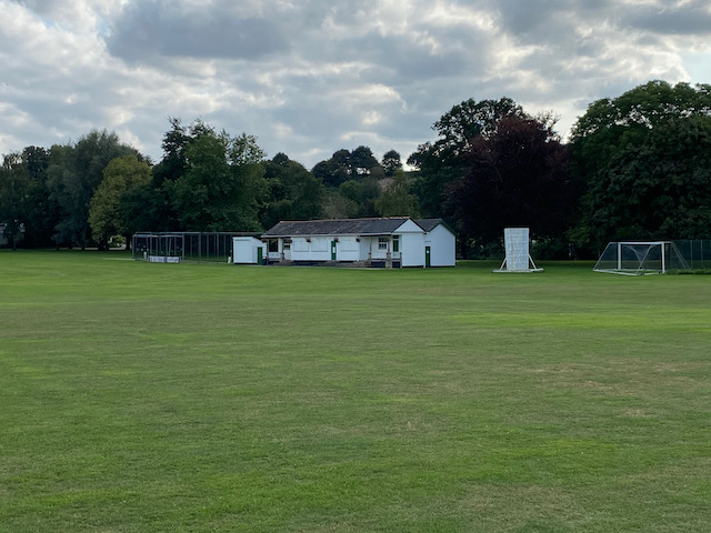
After my early morning walk I headed off to Perry’s Cider Farm Shop at Dowlish Wake. I hasten to add that I was not in search of cider, but a pint of milk. However, the shop had a range of local produce and a wonderful collection of old farm machinery. So we have decided to plan a walk which will take us to Dowlish Wake so that Lynnie can have a look around.
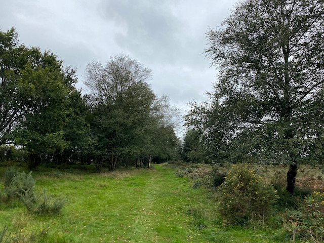
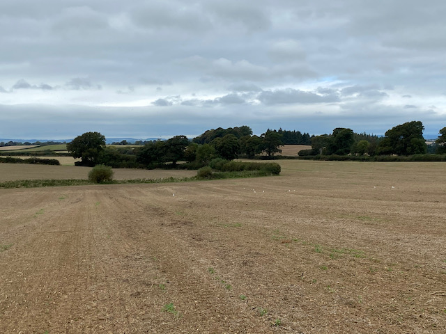
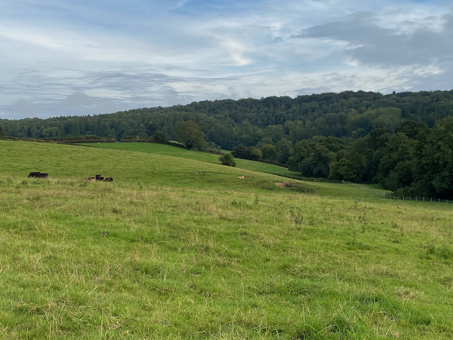
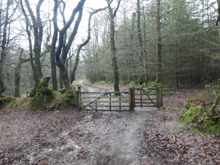
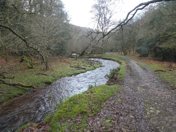
Leaving the site by the pedestrian gate in the south west corner we join a footpath and head downhill to cross a brook and then enter pasture fields.
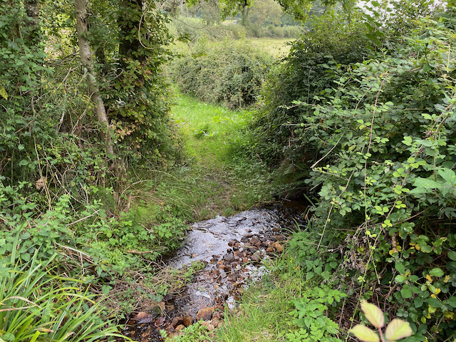
Keeping the hedge line to our right we head steadily uphill to reach a gate. Here we follow the footpath across an arable field to reach a minor road, Nash Lane, where we turn right and we stay with the lane until we reach a footpath on the left leading along the driveway to Chibley Farm. We follow the driveway to cross a stream and then take the footpath to the left as it follows the hedge line and then crosses fields to Chillington.
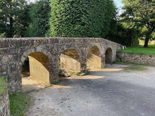
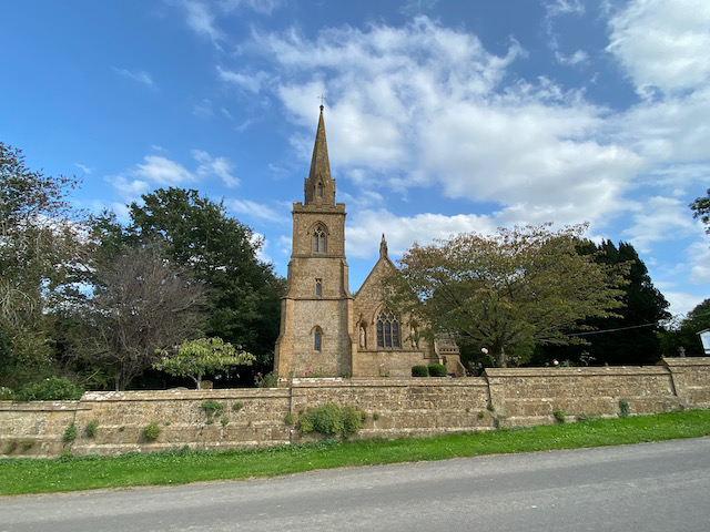
In Chillington we turn right by St James’ church and then follow the lane out of the village heading north. On reaching a junction we turn left into Mill Lane following the signs to Dowlish Wake. In the village we turn left to pass the 17th century packhorse bridge which crosses Dowlish Brook.
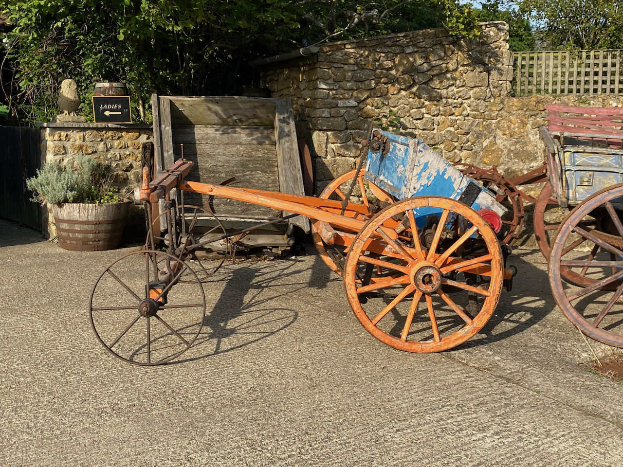
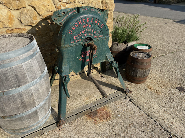
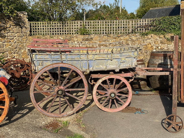
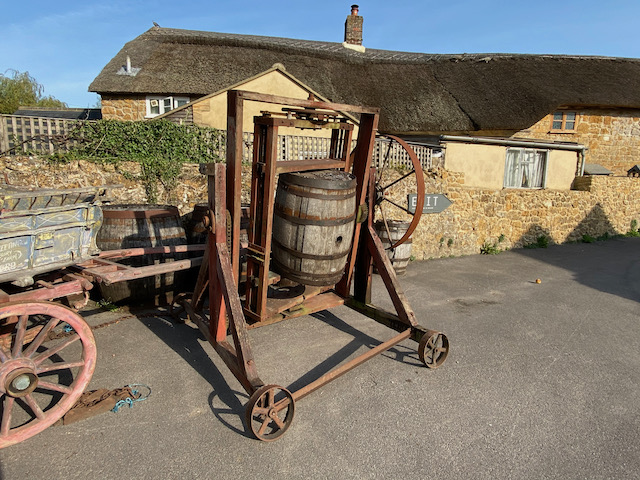
Just after the bridge we turn right to reach Perry’s Cider Farm Shop. Apparently William Churchill began Perry’s Cider here in 1920 as a side line to his work as a Blacksmith. I am not a fan of cider, I have tried it a couple of times but I do not take to it and much prefer a beer. However, I am fascinated by the plethora of old cider making equipment scattered around the car parking area.
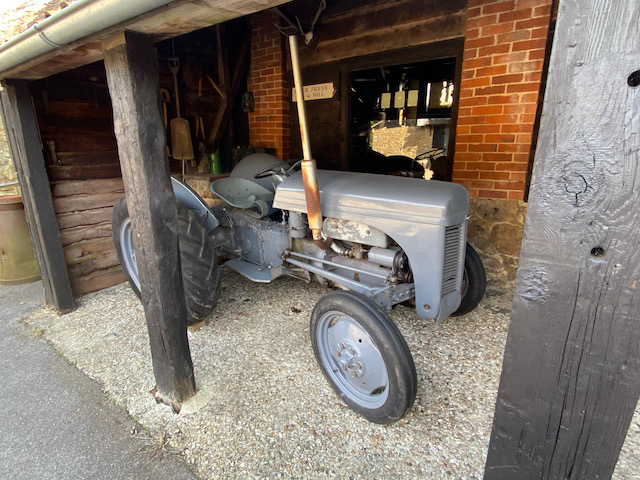
As well as cider presses there is an old Ferguson tractor in a shed. For years I drove a tractor like it when cutting the village cricket pitch at Farley.
Lynnie continues to browse around the shop which is not a problem to me I could spend hours looking at all this old kit.
Having done her circuit of the farm shop Lynnie rejoins me, I try to show her some of the bits I have been looking at. She is interested, but does not share the same level of enthusiasm as me.
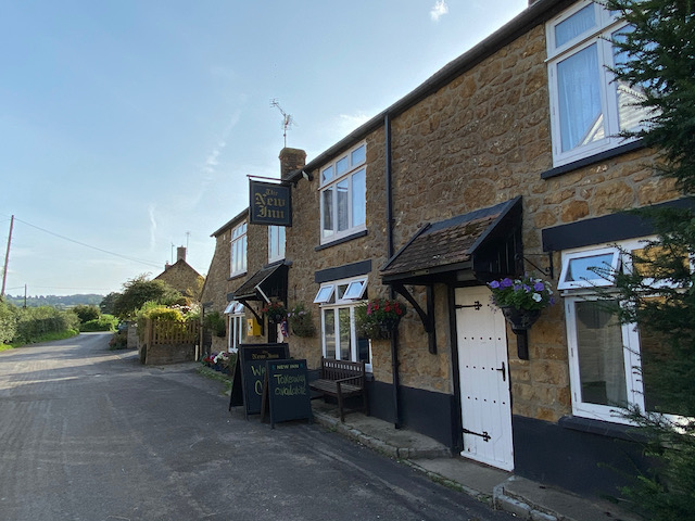
On rejoining the road we turn right and wander through the village and at a fork in the road go left and pass the New Inn pub.
Just after the pub we turn right on a tarmac lane and pass an interesting old corrugated iron barn.
At a junction of lanes we turn left and walk out of the village. After a few hundred yards we turn left into Chard Lane and pass Chard Lane Farm. At the end of the lane we turn left and follow a narrow lane to reach a junction where we turn left and then after passing West Farm turn right following a lane to reach the 12th century St Michael’s church.
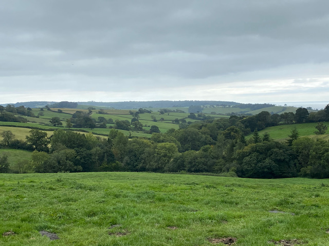
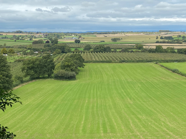
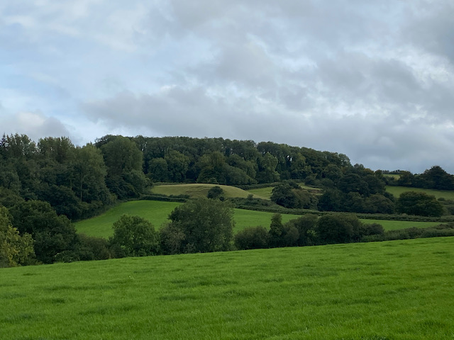
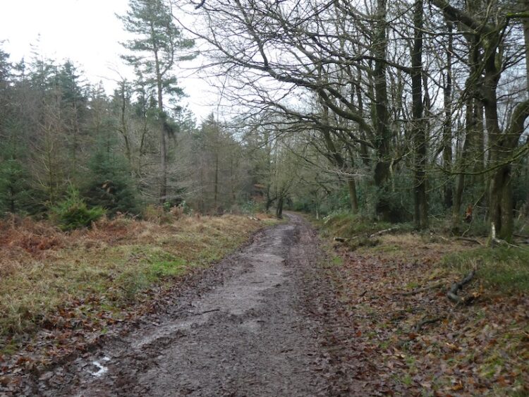
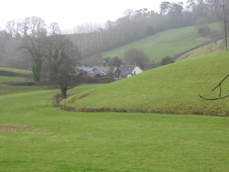
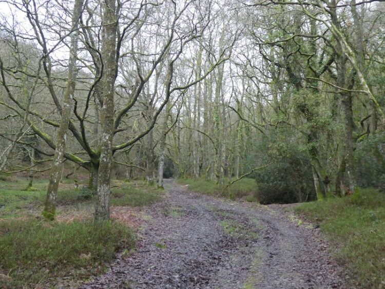
We stay with the lane until it reaches a junction with Dowlish Lane here we turn right and head steadily uphill and are soon walking through an area of woodland. At a junction we turn left and follow this lane as it heads downhill to Higher Chillington where there are fine views across the valley.
In Higher Chillington we keep heading north east along the road to reach a crossroads we continue straight on to join Nash Lane and then after a couple of hundred yards take the footpath on the right and retrace our route back to Hill Farm.
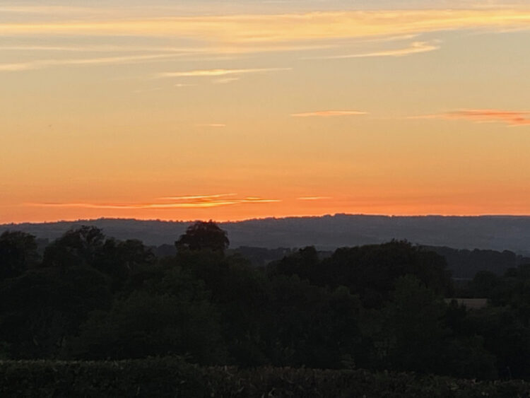
Back at the site it is time to start packing up, we are heading home tomorrow. Whilst enjoying another stunning sunset.
Hopefully we will be away in the caravan in another week or two.
All information on this site is provided free of charge and in good faith and no liability is accepted in respect of damage, loss or injury which might result from it. To the best of my knowledge the routes are entirely on public rights of way or within areas that are open for public access. Walking can be hazardous and is done entirely at your own risk. It is your responsibility to check your route and navigate using a map and compass.
Before the year is out I plan to visit the highest point in Wiltshire at Milk Hill on a walk which will include bagging the Alton Barnes White Horse. It is therefore interesting to discover we are currently staying not too far away from what for years was thought to be the highest point in Dorset at Pilsdon Hill.
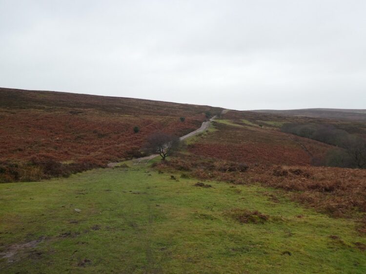
The starting point for our walk is the Lay-by besides the B3164 at the southern side of the hill fort (Grid Ref: SY414009). From the lay-by we cross the road and enter the National Trust land around Pilsdon Pen.
After reading the information board we commence the steady ascent up to the summit of the hill.
There are cracking views as we go up so stop to look behind us.
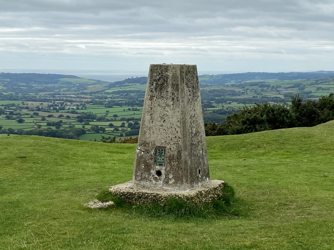
The path reaches the plateau on the top of the hillfort and we stop to bag the Ordnance Survey Trig Pillar, my 217th successfully bagged.
The Iron Age hill fort is built on what was for many years thought to be the highest hill in Dorset standing at 909 feet above sea level. More recently it was discovered that nearby Lewesdon Hill is about six feet taller.
Our route takes us north across the plateau on the route of the Monarch’s Way, on reaching the ramparts on the northern side of the hill fort we turn right.
This route is now both part of the Monarchs Way and the Wessex Ridgeway and on reaching a gate we follow the way-markers.
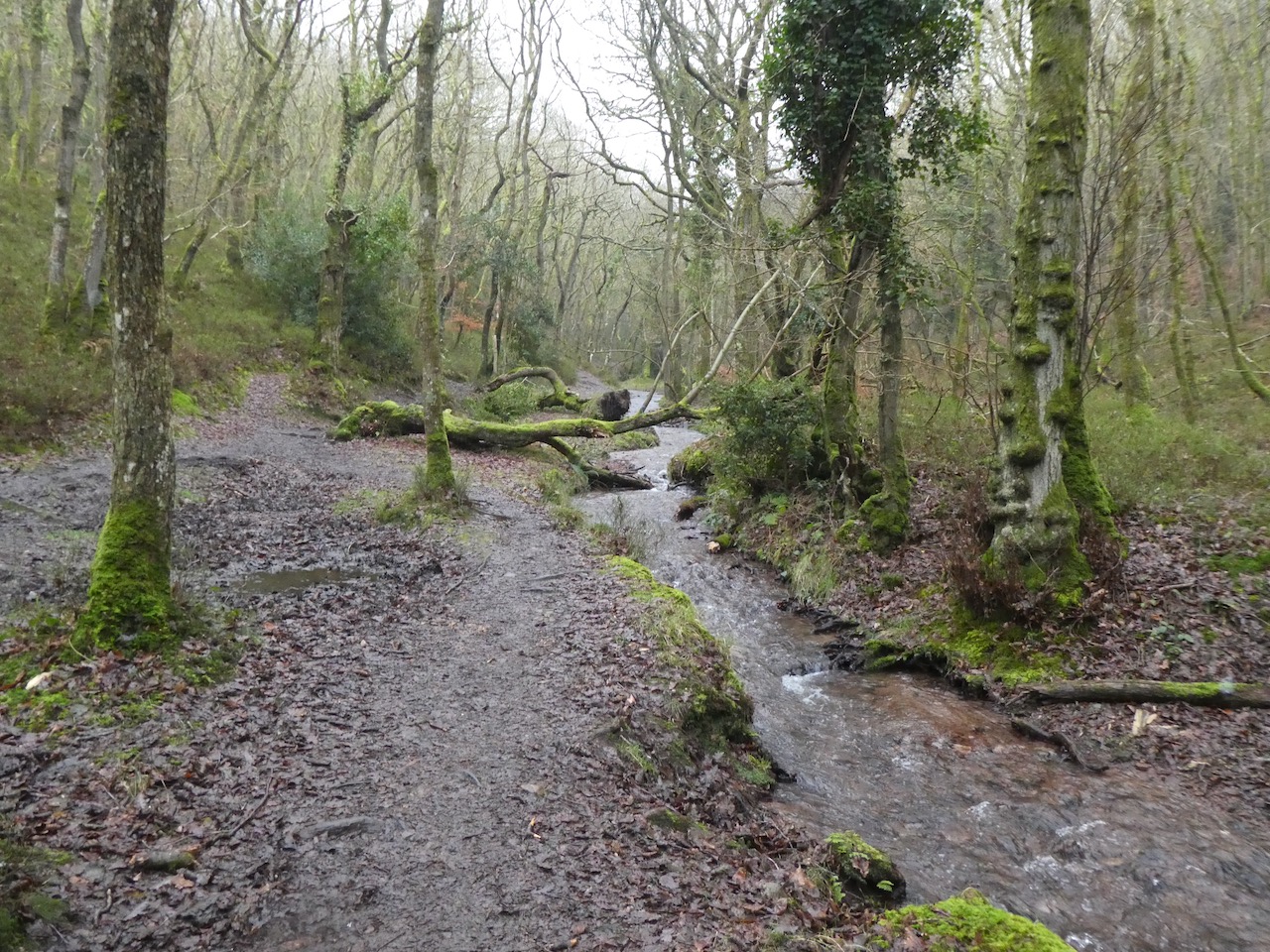
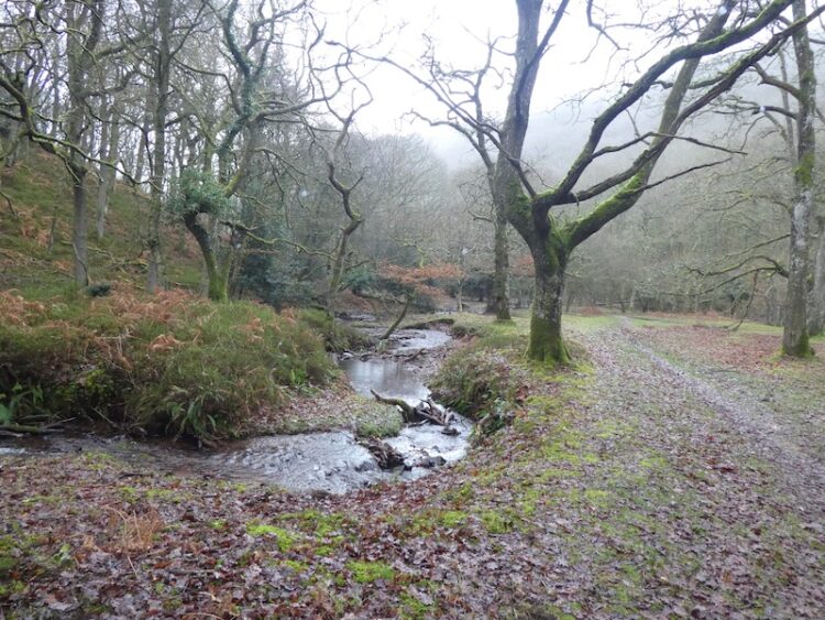
We descend across fields to cross a minor road and join a farm track towards Lower Newnham Farm. As the track nears the farm house we follow a permissive path diverting the footpath away from the front of the house. I have no problems with such diversions as long as they are well maintained and clearly marked, as this is. Leaving the farm we follow a track and then cross a stream and head uphill across a couple of fields. At a junction of paths we turn right, leaving the Monarch’s Way but staying with the Wessex Ridgeway along an old lane, Sheepwash Lane.
At the B3164 we turn left and walk a couple of hundred yards besides the road to reach an old lock-up where we leave the road and take the left fork on a footpath to follow the Wessex Ridgeway as it gradually ascends Lewesdon Hill Lane.
We keep with this path as it goes uphill.
On reaching a three way split in the track we go right, I had initially intended to go to the top of Lewesdon Hill but there are quite a few folk about and as we are being very careful we decide it will be easier to social distance on the quieter lower path.
We stay with the clear path as it goes through the trees to reach a junction of paths at Crabb’s Hill, here we turn right and follow the clear path as it steadily descends to a lane. We turn left and the very quickly take a footpath on the right heading diagonally across fields .
On reaching a lane we turn right and follow it steadily downhill to Blackney. At a junction in the village , next to a cracking carving of an owl, we take the lane signposted to Pilsdon.
This lane heads west and after half a mile, when the lane bends to the right, we carry straight on along a driveway for Gerrard’s farm. In a couple of hundred yards the driveway sweeps to the left but we continue straight on taking a footpath heading west across fields towards a copse. On reaching the copse we take a path on the right going through the trees and then continuing across fields towards Pilsdon.
We pass through a gate and join a farm track for Pilsdon Dairy Farm and carry on to St Mary’s Church which forms part of the Pilsdon Community. This Community was founded in 1958 by Reverend Percy Smith and Gaynor Smith to provide a refuge for people in crisis, supporting them through prayer and community living. Up to twenty-five people are accommodated in Pilsdon Manor and the church forms part of their daily prayer routine.
From the church we continue along the lane towards the village and on reaching a junction go right heading north on a lane signposted to Broadwindsor. We stay with this lane as it heads out of the village, then turn left at a T-junction to ascend to the B3164 and our starting point at the car park.
Our walk has covered just over seven miles and we stop to look at the view from the car park which is out towards the coast and Lyme Bay. We decide to pop down to Lyme Regis for a wander about and a fish and chip supper. Crosby is very excited at this news, he has a liking for both fish and chips!
All information on this site is provided free of charge and in good faith and no liability is accepted in respect of damage, loss or injury which might result from it. To the best of my knowledge the routes are entirely on public rights of way or within areas that are open for public access. Walking can be hazardous and is done entirely at your own risk. It is your responsibility to check your route and navigate using a map and compass.
Today we are going to take a walk from Chard and head up to Ilminster to bag a trig point on Herne Hill. It is just a short drive from Hill Farm CL to the Car park at the southern end of the reservoir which is off Touches Lane (TAS20 1HU).
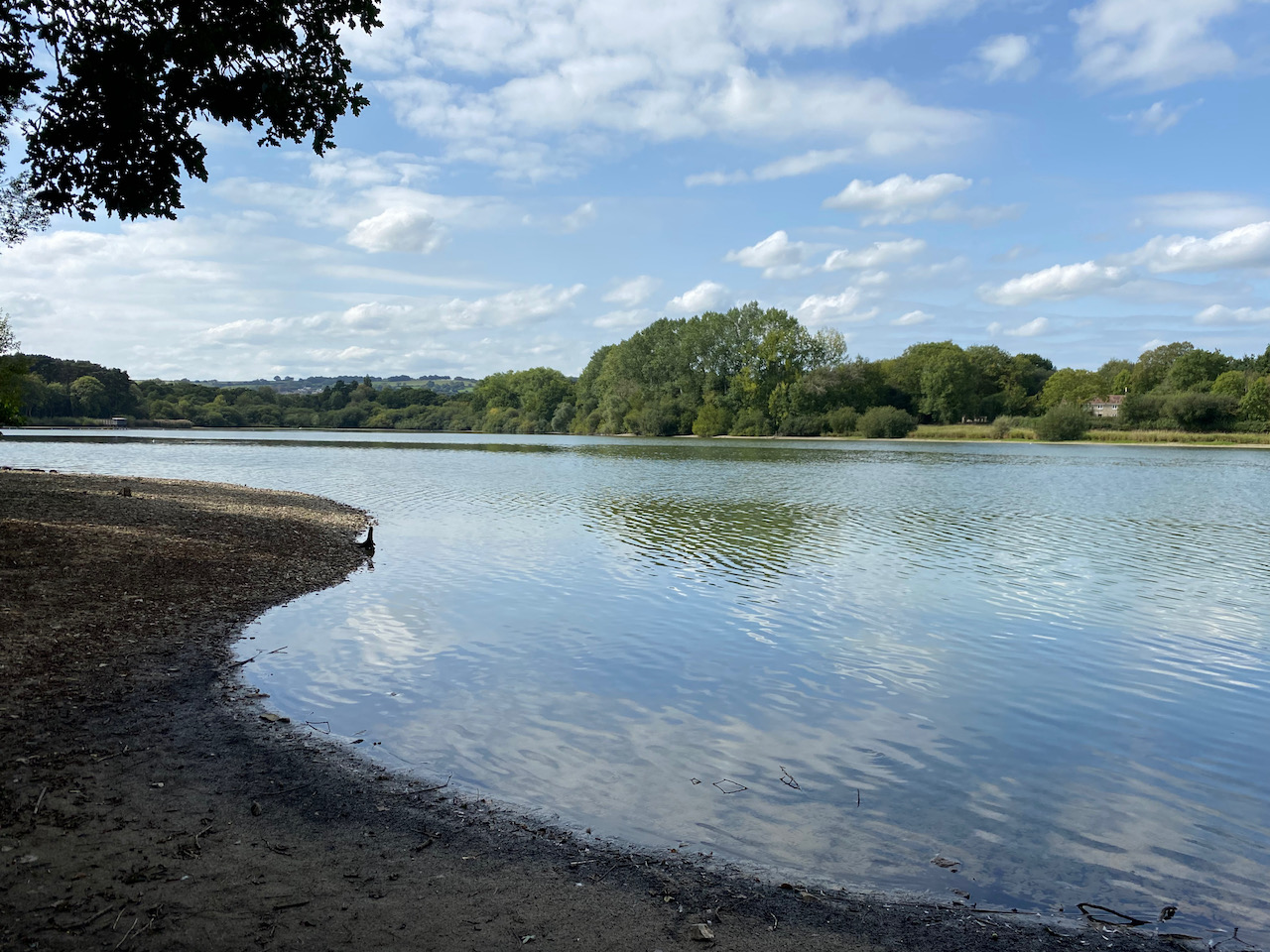
Leaving the car park we follow the path going north west to a minor road and cross to Chard Reservoir and continue on the path heading north east across the grassy area which is in the process of being made into hay.
The path turns to the left and reaches trees besides the reservoir and we continue north with glimpses of the water between the trees.
This reservoir was originally built in 1839 to provide water for the Chard Canal but these days it is a local nature reserve managed by South Somerset District Council and covers ninety-one acres. During World War II it was opened as Chard Lido and swimming and boating was allowed.
These days neither of these pastimes are allowed and later I read on the Chard Reservoir website this is because of the poor water quality due to a number of sewer overflow outlets from the town being discharged into the water. I struggle with the concept that it is still permissible for water companies to discharge sewage into the water system.
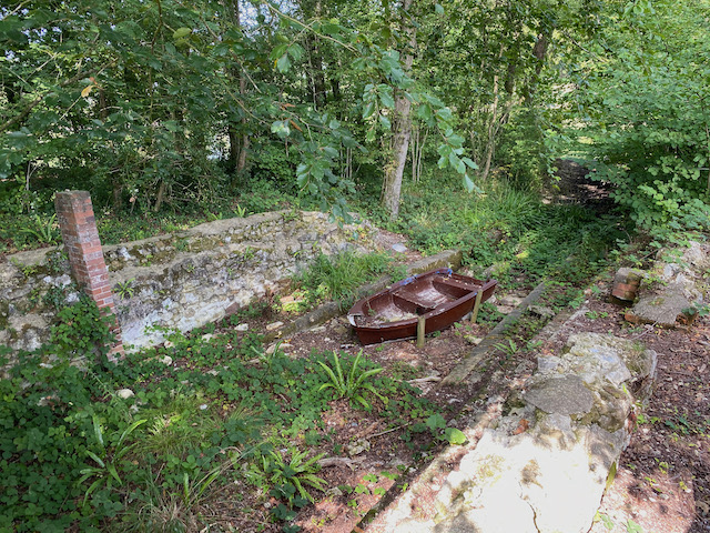
The reservoir’s time as the water supply for the canal was short lived, by 1866 the Chard Canal was replaced by a railway line. However, the reservoir was retained as a sporting estate for fishing and duck shooting. The path reaches the site of an old boathouse, which is thought to have been built as part of the sporting estate. I am never sure why an activity which involves shooting birds is called sport and chunter on to Lynnie about this as we continue on to reach a minor road.
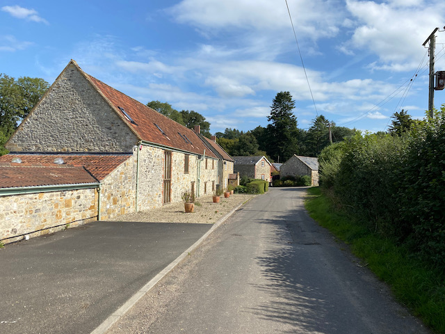
We now stay with this country lane as it heads north east to pass Chaffcombe Gate Farm with its barns converted to homes.
After passing the farm the road becomes Cricket Lane and heads steeply uphill. We continue straight on at a junction pausing briefly to admire a splendid dead tree in a field.
We continue on to reach Cricket Cross where we turn left to head north towards Cricket Malherbie.
We stop to have a look at the impressive Church of St Mary Magdalene, apparently rebuilt in 1855 on the site of a 12th century church. In the churchyard we meet a chap out walking his neighbours dog and spend a pleasant five minutes passing the time of day with him.
Leaving the church we continue to head north on the lane and stay with it to reach a crossroads. The map has this marked as Mary Hunt’s Grave, we spend a few minutes trying to locate the grave, but later discover it has long since disappeared.
In the past crossroads were often the site of public punishments or for the burial of people barred from being buried in consecrated ground because of their crimes. Apparently local folklore has a number of explanations as to why Mary Hunt was buried here, one suggests she may have killed one of her children and another that she may have taken her own life.
We take a footpath from the crossroads that goes through bushes to reach the edge of a farmyard. Following the path around the yard we reach a field of sweetcorn and manage to get through to cross a stream and then enter a field of pasture. We spot evidence of cattle, but it is not until we are halfway across the field that we see a large herd congregated at our point of exit. It only takes us a few seconds to weigh up our options. With Crosby we try to avoid cattle if at all possible, so we turnaround and retrace our route to the crossroads and Mary Hunt’s Grave.
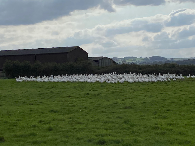
Back at the crossroads we turn right, heading northeast along the lane to reach a junction where we turn right and follow the road for 450 yards to join a footpath on the left close to the Ilminster town sign. We now follow this path along the edge of a field occupied by a flock of geese.
Then we head across fields through a series of unusual gates. I cannot recall passing through anything like them before.
At a junction of paths we turn left to join a track heading steadily uphill towards Herne Hill.
We now follow a path than soon leads along the southern edge of the trees to reach Herne Hill trig pillar. This is the 216th trig pillar I have bagged.
We follow an attractive path through the trees. There are a network of paths, but as strangers in these parts we decide to stick to the route of the footpath and at a junction of paths on the map we turn right to descend the hill.
Leaving the woods we follow a path around the edge of fields, following the footpath into Ilminster by a Health Centre. We turn right along the pavement besides Canal Way to pass a playing field.
At a junction we turn left besides a petrol station and follow Ditton Street into the town centre and stop to look at the Market House which was built around 1813.
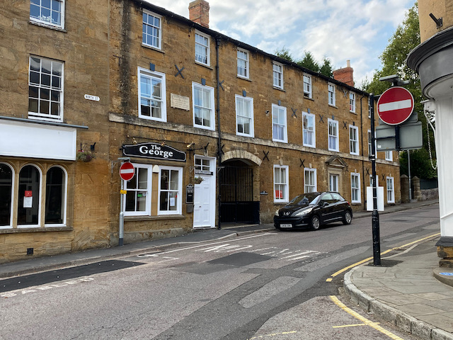
In North Street besides the Market Square I spot a sign on The George Hotel. This is an old building built in the mid 17th century with refurbishments over the next two centuries. When a new turnpike was opened in 1809, which went from Honiton through Ilminster, on the route between London and Exeter, the hotel became a popular stop off point. In 1819, on their way to Sidmouth, The Duke and Duchess of Kent stopped here with the infant Princess Victoria, later to become Queen Victoria, apparently it was the first time she had ever stayed in a hotel.
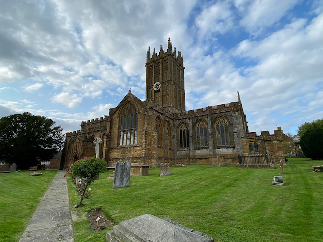
We leave the Market Square along Silver Street heading west to pass the church of St Mary which is also known as the Minster. Originally built in the 15th century it has had a number of refurbishments, the last being in 1902.
We follow Silver Street into West Street and then continue heading out of the town on the B3168, Station Road. After passing a petrol station we reach a roundabout where we turn left passing a Harvester before reaching a second roundabout. Here we turn right into Canal Way. Soon we take a footpath on the left and follow this to a junction of paths where we turn right to head away from the town.
We are on the route of the old Chard Canal. This canal ran for 13.5 miles between Chard and the Bridgewater and Taunton Canal at Creech St Michael. The canal opened in 1841 but went into receivership in 1853 and was purchased by a new Chard Railway company in 1860 who closed it in 1868.
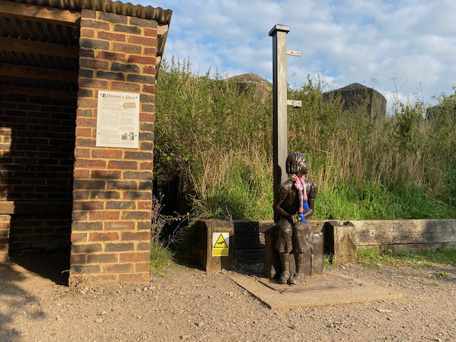
The London & South Western Railway purchased the Chard Railway in 1861 and then it was bought by the Bristol & Exeter Railway who opened the line in November 1866, it ran for a hundred years before closing in 1966. We are now at Donyatt Halt which was constructed in 1928 with its small shelter and poignant tale of Doreen a seven year old evacuated from London to Somerset in 1939.
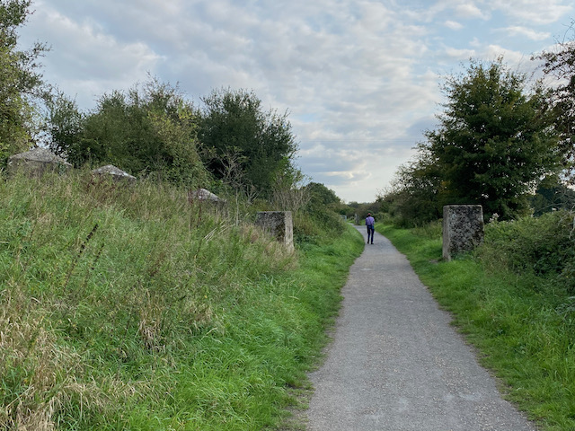
A little further along we reach the Stop Line Defences that were erected during World War II to create a barrier in the event of an invasion by the German’s.
The route we are on is also Cycle Way 33 and is popular with walkers, joggers and cyclists. We stay with way-markers as the route turns to the left and then right along a short section of minor road before going along another track to join a minor road at Peasmarch Farm. As we near the main road we turn left to follow the footpath along the cycle way and soon rejoin the route of the old railway line.
We stay with the cycle way as it continues on to pass the western side of Chard Reservoir. Reaching a minor road at the southern end of the reservoir we turn left still on the National Cycle Way. After a few hundred yards the cycle way turns right towards Chard, however, we stay on the lane until we reach an entrance to the Nature Reserve on the left.
We now follow a path through the southern edge of the nature reserve to reach a point where we head back to our starting point in the car park.
Our historic walk in this interesting part of Somerset has covered 12 miles. Time to head back to the caravan and plan tomorrow’s outing.
All information on this site is provided free of charge and in good faith and no liability is accepted in respect of damage, loss or injury which might result from it. To the best of my knowledge the routes are entirely on public rights of way or within areas that are open for public access. Walking can be hazardous and is done entirely at your own risk. It is your responsibility to check your route and navigate using a map and compass.
A few years ago Lynnie and I visited Lambert’s Castle hill fort. In those days I was not “bagging” trig points. Although I am pretty sure we visited the trig I have no pictorial evidence, so we are heading that way today as it is not too far from Hill Farm CL.
We start our walk from the National Trust parking area at Lambert’s Castle (EX13 5UT) and rather than go through the gate onto the access land around the castle we walk a few hundred years along the driveway and then take a footpath on the left heading alongside an area of access land.
On reaching a minor road, Fishpond Bottom Road, we cross and join an attractive tree lined track heading south.
This track steadily descends to Trevett’s Corner where we join a minor road soon reaching a junction where we take the lane signposted to Fishpond. After a quarter of a mile, just as the road bends to the left in front of a house, we reach a footpath on the right. It was my intention to take this path across the fields to eventually reach Wootton Fitzpaine, however, a herd of frisky steers means we re-consider.
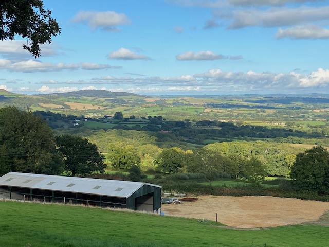
I am always cautious around cattle, but even more so when walking with a dog, so a quick look at the map has a new route plotted. We now continue along the road as it turns east and then north to ascend towards Sheepwash Farm. From a gateway we get far ranging views.
The road bends to the left on reaching Sheepwash Farm, we take a bridlepath besides the farm and then continues along a track to ford a stream.
We continue on the bridleway to reach Little Coombe Farm where we join a track and turn right. We continue on the track to pass Great Combe Farm and then head uphill to reach a minor road, Long Lane, here we turn right.
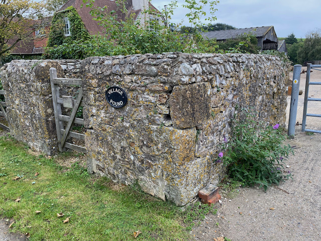
We stay with this quiet country lane for just over half a mile to reach Wooton Cross where we turn right and follow the lane into Wootton Fitzpaine. On entering the village we pass the old village pound. Such structures were used in medieval villages to impound stray livestock. They would be handed back to the owner on a payment of a levy.
We continue into the village to reach the gates of the Manor House.
We go through the gates and follow the driveway to the village church which was built in the 13th and 15th centuries. It was restored in 1872. Unfortunately it is locked so we cannot have a look at the interior.
From the church we head up the manor driveway and after going through the gates turn right and head east out of the village to return to Wootton Cross where we continue along the road to reach Baker’s Cross. We now turn left into Abbott’s Wootton Lane and pass Lower Abbott’s Wootton Farm and then Higher Abbott’s Wootton Farm. After just over a mile and a half we reach a road junction where we go right and then after a hundred yards turn right again into a narrow country lane.
This lane runs below Lamberts Hill for three quarters of a mile with fine views across the valley.
At a fork in the road we go left and pass cottages and then just as we reach the B3165 we take a path on the left leading steeply uphill into woods.
There is a network of paths in the woods, but we stay with the main path, which is the route of the Wessex Ridgeway, to reach the clear summit of Lambert’s Hill Fort.
We follow a clear path across the access land. Soon we spot the Ordnance Survey trig pillar and we make our way across to it. This is the 215th I have bagged.
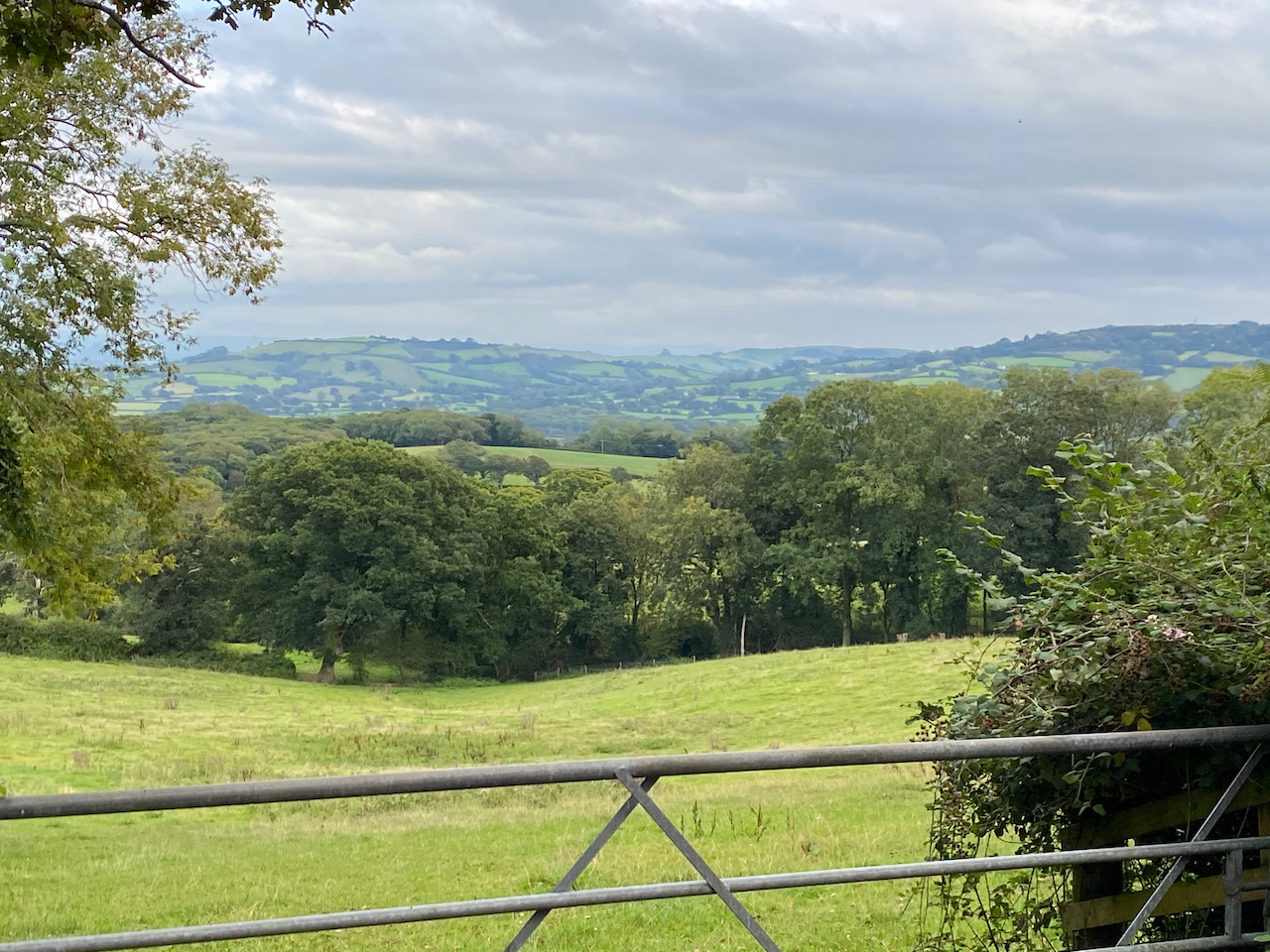
There are some cracking views from this hillfort and we continue along the ridge and stop to look at the view towards Lyme Bay.
Nearing a tree line we turn right and head back to our starting point in the car park. Our wander around has been close to eight miles. Rather more road walking than planned, but the lanes have been quiet country roads and we have only seen a couple of cars.
All information on this site is provided free of charge and in good faith and no liability is accepted in respect of damage, loss or injury which might result from it. To the best of my knowledge the routes are entirely on public rights of way or within areas that are open for public access. Walking can be hazardous and is done entirely at your own risk. It is your responsibility to check your route and navigate using a map and compass.
For a few years now I have been dabbling in researching my family tree. It is an interesting pastime which I delve into now and then. I have tried to be disciplined in order to ensure that I have triangulated information so I know the folk I am looking at are actually relatives.
It is surprising what you uncover and how much information is out there. As well as using a Genealogy site I have made a few trips to the Local History centres in Dorchester and Southampton. Both of which are wonderful resources and I look forward to getting back into both when the Covid-19 pandemic has eased.
Also of interest are church records and details held by local history groups. I have found these very accommodating and willing to share what snippets of information they hold. A while ago using census records I discovered my great, great, great grandfather, Thomas Coombes, was born in Hinton St George and that his father was a chap called Zachariah Coombes.
I contacted both St George’s Church and the local history group and whilst they were unable to help with baptism or marriage records, these are held at the County History Centre in Taunton, they were able to tell me that Zachariah was a wheelwright and lived on the Hinton Estate. So today we are taking a walk from Hill Farm CL to look at where my ancestors lived in the early 1800’s.
We leave the site and walk towards the farm barns, turning right on a footpath that leads past the old farmhouse and continues along a track until it bends to the right, here we go left along a footpath through trees to reach a field. We go north to reach another field, then north east to a stile leading to a road.
Turning left and walking besides the road for about a hundred yards we reach a footpath on the right. This goes through a belt of trees to enter a field continuing north easterly across fields to Diana Pond located in a copse.
The path crosses an arable field which has been recently ploughed. It is tough going and when we reach the point where we should enter another field there is no obvious crossing point. We go along the hedge line a couple of times before realising there is a gap near trees at the north east corner of the field. The path appears to have been unofficially diverted, but without any signage.
We are now on a track heading east near to a belt of trees and then going through the trees to reach a minor road, Pit Road, where we turn right. This road is heading towards Hinton St George and runs along the top of an escarpment. From a gap in the hedge line we get fine views across the valley.
Nearing the edge of the village we pass the entrance to Hinton House. The house is not visible from the road, for over 500 years it was the home of the Poulett family who until the 20th century retained feudal control over the village. Apparently it is a fine house with stables designed by Sir John Soane in the late 18th century. A few years ago Lynnie and I were in London and had a few hours to spare so popped into the Soane Museum in Lincoln Inn Fields. We could have spent all day there looking at the designs and the wonderful collection of paintings including an amazing series of eight works by William Hogarth depicting “A Rake’s Progress”.
We continue along the pavement to reach the entrance driveway to St George’s Church, I had hoped we would be able to go inside but sadly this is another church that is locked during the pandemic. Instead we spend a while wandering around the churchyard reading old headstones to see if we can find any family links, without success.
From the church we take a loop of the attractive village and stop to admire the medieval preaching cross, or village cross.
In 1863 Hinton St George became one of the first gas lit villages in the Country with coal gas produced on the Hinton Estate. Our walk takes us past the village community shop and the Poulett Arms before heading back towards the church.
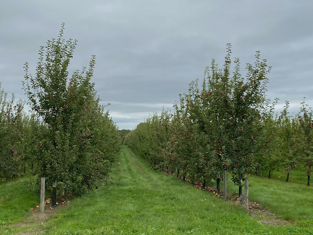
We leave the village heading back to the entrance gate to Hinton Park and then take a right turn down a lane opposite the park gate. This lane, Shoot Hill, goes steeply down and then passes orchards. The sight of apple orchards in Somerset was once a very familiar sight, but many were ripped out in the 1990’s when cider drinking became less popular. Now with a resurgence in popularity of apple based drinks orchards are being replanted which is good news for wildlife.
We stay with this quiet country lane for three quarters of a mile to pass Mill farm. Just after we take a footpath on the left and follow a path around the field boundary and then go across fields to reach Dinnington, close to the Dinnington Docks pub.
This pub was originally known as the Rose and Crown and its name was changed because the locals referred to it as the docks due to its close proximity to the now long gone canal docks. As tempting as it is to stop for a pint on a warm afternoon we decide to save a visit for a future trip to the area.
We turn left along the road and within a hundred yards take a footpath along a track on the right. This soon leads across fields to reach a minor road on the outskirts of Allowenshay. We turn right and walk up into the village turning left by an attractive cottage with a Victorian Postbox in the wall.
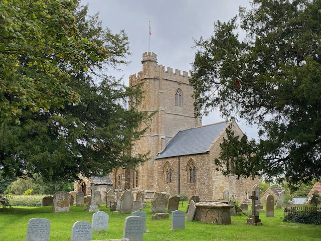
We follow the lane out of the village for just over half a mile to reach a busier road which we follow for a quarter of a mile to reach Kingstone where we stop to look at the exterior of the Church of St John the Evangelist and All Saints with its unusual tower.
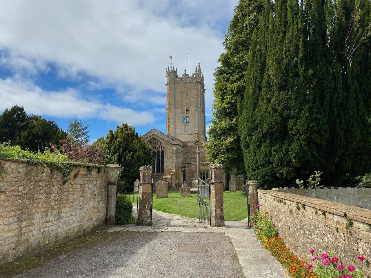
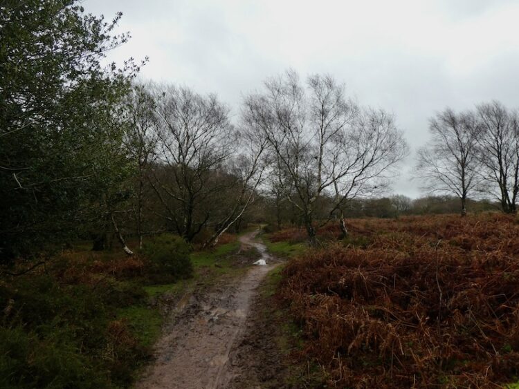
From the church we cross the road and join a footpath heading across fields towards Dowlish Wake. At a minor road we turn left and follow the road into the village to pass St Andrew’s Church.
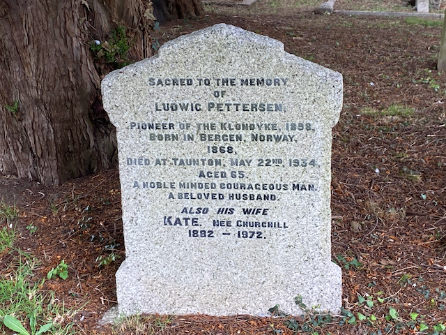
In the churchyard is a gravestone to Ludwig Pettersen, he was a pioneer of the Klondike in 1898. Following the discovery of gold in Rabbit Creek in the Yukon Territory of Canada in 1896 there began what became known as the Klondike Gold Rush. Aged thirty Pettersen left his native Norway and headed to join the gold rush and travelled the notorious White Pass and survived an avalanche. Within a few years the gold was running out and Pettersen traveled the world before settling in Dowlish Wake in 1921 where he married a local girl and set up a poultry farm. He died in Taunton in 1934 aged sixty five..
We continue into the village to reach the 17th century packhorse bridge which crosses Dowlish Brook.
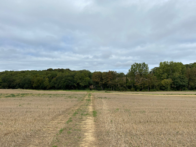
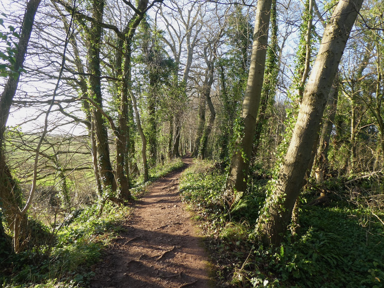
We leave the village via Mill Lane, signposted towards Chillington. At a junction with Ludney Lane we turn right towards Chillington and follow this lane for a mile to reach St James Church. From the church we follow a footpath sign along a lane between the church and the Old School House. This lane leads to a field which we cross heading north.
After passing through a kissing gate we follow the footpath downhill, with a hedge to our right to reach a farm driveway. Here we turn right crossing a stream and then head uphill on the drive to reach Nash Lane where we turn right. After a third of a mile on Nash Lane we reach a point where footpaths lead to the right and left. We take the path on the left going up steps in the roadside bank to reach a stile into a field.
We head east across the pasture field to cross the brook. On the far side we continue uphill heading for the barns at Hill farm. Besides the barns we go through a gate and turn right back to the caravan.
We have walked just over 10 miles and though we found no hoped for trace of past relatives it has been an interesting insight into the area where they lived over 200 year ago. Now it is time to enjoy the sunset whilst planning tomorrow’s walk.
All information on this site is provided free of charge and in good faith and no liability is accepted in respect of damage, loss or injury which might result from it. To the best of my knowledge the routes are entirely on public rights of way or within areas that are open for public access. Walking can be hazardous and is done entirely at your own risk. It is your responsibility to check your route and navigate using a map and compass.
After a couple of weeks at home we are away in the caravan again. This time we are heading west to Hill Farm CL close to Hinton St George in Somerset. This is an area I have wanted to visit for some time because my Great, Great, Great, Grandfather was born in Hinton St George in 1817.
We receive a warm welcome from Donald the site owner. It is our first visit here but it feels like we are longtime friends. It does not take too long to set up and we’re soon lacing the boots up for a short stroll from the site.
Leaving the site by the pedestrian gate in the south west corner we join a footpath and head downhill to cross a brook and then enter pasture fields.
Keeping the hedge line to our right we head steadily uphill to reach a gate. Here we follow the footpath across an arable field to reach a minor road, Nash Lane, where we turn left. In a couple of hundred yards at a crossroads we carry straight on, now on Fisherway Lane. This soon starts to head uphill to reach houses in the hamlet of Higher Chillington. On reaching a junction we turn right with extensive views in front of us.
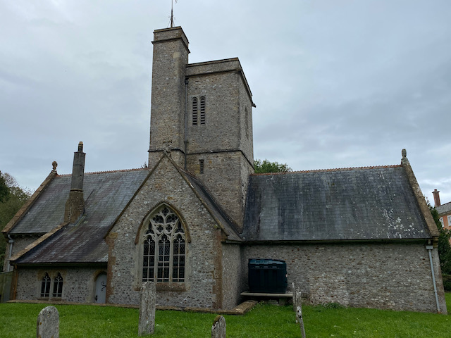
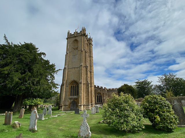
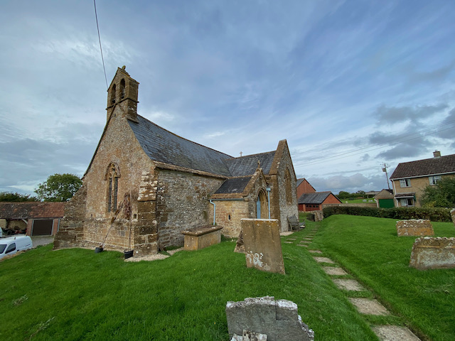
We are now on Coley Lane, it is odd how being so far inland the roads around here have fishy names. After a third of a mile on this lane we reach a junction. We continue straight on along Lambert Lane. This lane leads us to the village of Chillington where we turn right to reach St James Church.
This church originates from the 13th century with modifications in the 14th and 15th centuries. It then underwent restoration in 1842 and 1909 . We are unable to go inside but it has an interesting exterior.
From the church we follow a footpath sign up a lane between the church and the Old School House. This lane leads to a field which we cross heading north. After passing through a kissing gate we follow the footpath downhill, with a hedge to our right to reach a farm driveway. Here we turn right crossing a stream and then head uphill on the drive to reach Nash Lane where we turn right.
After a third of a mile on Nash Lane we reach a point where footpaths go to the right and left. We take the path on the left which goes up steps in the roadside bank to reach a stile into a field.
We head east across the pasture field to reach a crossing over a brook. On the far side we continue uphill to cross a field heading for the barns at Hill farm.
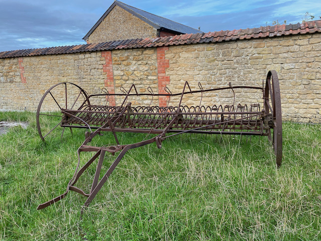
Besides the barns we go through a gate. Before heading back to the caravan we take a look at the old hay rake that stands close to the barn.
Our evening stroll has covered 3 miles and it has been good to get a feel for this area. Now it is time to look at the map and plot a walk to Hinton St George in search of some family history.
All information on this site is provided free of charge and in good faith and no liability is accepted in respect of damage, loss or injury which might result from it. To the best of my knowledge the routes are entirely on public rights of way or within areas that are open for public access. Walking can be hazardous and is done entirely at your own risk. It is your responsibility to check your route and navigate using a map and compass.
I am back on the Quantock Hills today, the weather forecast is not great and Lynnie has decided to stay in the caravan and catch up with some reading whilst keeping an eye on Dexter who is unable to walk more than a couple of miles.
I start my walk from the car park at Dead Woman’s Ditch (Grid Ref: ST161381) and head south from the parking area, after a few hundred yards I reach a path by a row of beech trees where I turn left to walk in an easterly direction.
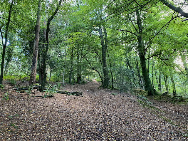
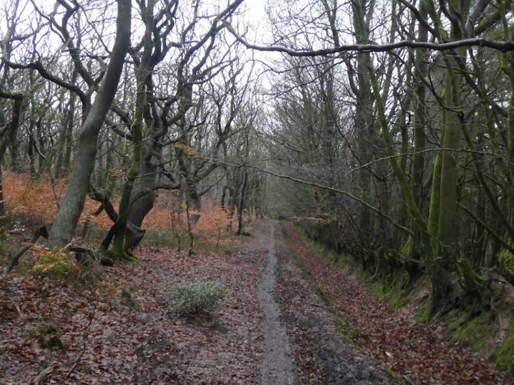
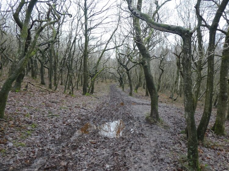
Following a network of paths, I soon reach a gate to a forestry track leading into Seven Wells Wood.
As the forestry track sweeps to the left I take a narrower path directly in front of me.
This track goes through the trees to re-join a forestry track, where I turn right to head steadily downhill towards the edge of the woodland. Continuing on the footpath I ignore a forestry track on my left and take a footpath through a gate into pasture. My route is now uphill looking over to the hamlet of Adscombe on my right.
The footpath joins a minor road and I turn left to walk towards Friarn. After a couple of hundred yards I take a track on my left back into woodland where I turn right on a path alongside trees with pasture on my right.
At a junction of paths I continue straight on soon crossing a minor road to follow a clear footpath through the trees.
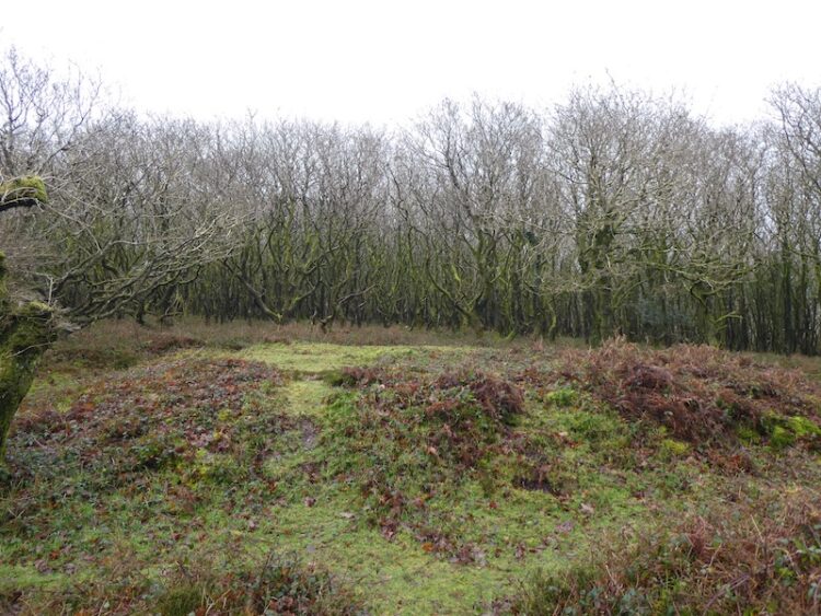
I cross another minor road and start heading steadily uphill to Dowsborough Hill Fort.
After admiring the view from the Hill Fort I follow the clear path in front of me heading north over Woodlands Hill.
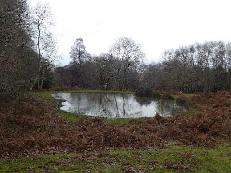
Going by the cairn on the summit of the hill I continue downhill into the trees passing a pond to reach a gate by a minor road.
Through the gate I turn left walking along the lane into Holford then turning right at the triangle to take the next left which leads to the Bowling Green. Here I turn left up a track heading towards Hodder’s Combe.
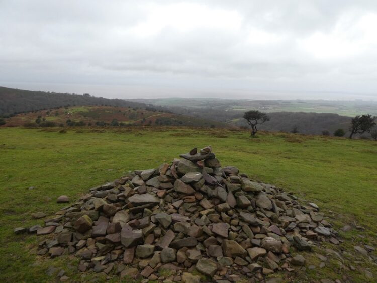
At the top of the Combe I fork left into Somerton Combe and then very quickly take a steep path heading up through the trees and continue to a crossing of paths on Lower Hare Knapp and turn right to head uphill to the cairn on Higher Hare Knapp.
From the cairn I take a path heading south on the ridge between Street Combe and Frog Combe. At a junction of paths I turn left and rejoin the track heading east back to the car park at Dead Woman’s Ditch.
We are heading home tomorrow so it is now time to return to Cadeside CAMC site and start packing for an early start. Although brief this trip to Somerset has given us a chance to walk some familiar routes and catch up with a few friends.
To follow my walk you will need Ordnance Survey Explorer Map OL140 – Quantock Hills & Bridgewater.
Additional Information
For more information on this walk including car parking, amenities, refreshments and detailed walking directions visit my associated Walking Moonraker website
All information on this site is provided free of charge and in good faith and no liability is accepted in respect of damage, loss or injury which might result from it. To the best of my knowledge the routes are entirely on public rights of way or within areas that are open for public access. Walking can be hazardous and is done entirely at your own risk. It is your responsibility to check your route and navigate using a map and compass.
Whilst at the Cadeside CAMC site last January we did an interesting walk along a disused section of the Grand Western Canal and we’ve decided to combine part of that route into today’s walk.
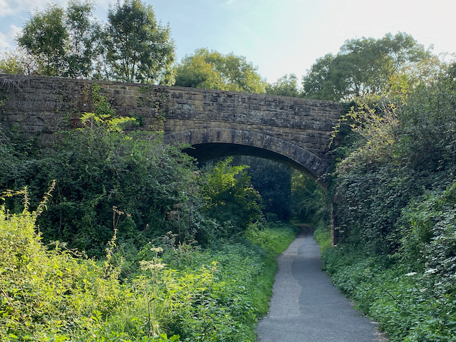
Our walk starts by leaving Cadeside CAMC site and turning right along the lane. It is only a short distance along the lane to a junction, but caution is needed because it is a busy stretch of road leading to the local recycling centre. At a junction we continue straight on alongside the road signposted to Nynehead and Milverton. This soon takes us under a railway bridge carrying the Penzance to Paddington line.
Within a couple of hundred yards we reach Wharf Cottage, which sits besides the disused Grand Western Canal. Here we take a footpath on the left that runs along the route of the canal towpath besides the old wharf.
Within a couple of hundred yards we reach the remains of the Nynehead Boatlift. This is one of seven on the canal and reportedly they were the first commercially successful boatlifts in Britain and operated on a balance principle. Work was done in the late 1990’s to clear this site and it is now possible to get a good view of the remains.
We go up besides the top level of the boatlift, and are now on a bridge spanning the carriage driveway to Nynehead House. To the south is the railway bridge built in the 1840’s to take the Bristol to Exeter railway line across the driveway.
Our route follows a section of the old towpath. The Grand Western Canal ran between Taunton and Tiverton and was part of a plan to link the Bristol Channel with the English Channel. The lower section of the canal between Lowdwells and Tiverton was constructed first, between 1810 and 1814, and passed through mainly flat land. The second phase linking Taunton to Lowdwells is the part we are now walking along.
Construction on this section started in 1831 and was completed in 1838. The main traffic along the canal was limestone being transported to limekilns along the way to be converted to quicklime used as a fertiliser on farmland and in the construction of houses.
Like so many of the canals we have walked this fell victim to the introduction of steam trains. The Great Western Railway line ran alongside the canal and the competition from the railway saw the decline of the canal. Just to make sure their railway was dominant GWR leased the canal in 1854 and then purchased it in 1865. The Somerset section of the canal was closed in 1867.
Continuing on the waymarked path we reach the B3187 which we cross and continue our route along the footpath, this is part of the West Deane Way. The well-used fenced route is extremely muddy so it is slow going.
The next section of path has been flooded by the recent heavy rain so we have to negotiate a way through without getting wet feet.
On entering a field we see the clear remains of the canal in front of us, but our route leaves the West Deane Way as we turn left to walk uphill to a stile.
We now head south across fields to reach a track besides a field of solar panels and stay with the track as it passes Tonedale farm and heads into Lower Westford. At a minor road we turn left and then almost immediately take a footpath on the right which goes down a driveway besides a thatched cottage. The footpath then enters a field and we continue in a southerly direction on the path towards trees.
After entering the trees we reach a crossing on the railway. This is a mainline so we cross with extreme care and join a footpath on the far side which heads east through the trees.
We stay besides the stream to reach a tarmac path which we follow to reach lakes next door to the Wellington Sports Centre.
On reaching Corams Lane we turn right and follow the pavement besides the B3187 Waterloo Road. As this road nears the centre of Wellington it becomes North Street. At a crossroads with traffic lights we turn left and follow the High Street. After a set of traffic lights, we continue straight on to pass the church of St John the Baptist. From here we follow the Taunton Road until we reach the entrance to Cadeside Caravan Park.
Our walk has covered just over four and a half miles. Thankfully, despite the forecast, we have avoided the rain which arrives soon after when we are already sat comfortably in the caravan.
To follow my walk you will need Ordnance Survey Explorer Map OL128 – Taunton & Blackdown Hills.
Additional Information
For more information on this walk including car parking, amenities, refreshments and detailed walking directions visit my associated Walking Moonrakerwebsite. (Please note the Walking Moonraker walk route starts in the centre of Wellington)
All information on this site is provided free of charge and in good faith and no liability is accepted in respect of damage, loss or injury which might result from it. To the best of my knowledge the routes are entirely on public rights of way or within areas that are open for public access. Walking can be hazardous and is done entirely at your own risk. It is your responsibility to check your route and navigate using a map and compass.
On yesterday’s walk on the Quantock Hills Lynnie managed to lose one of her expensive Sealskin walking gloves, so today we plan to do the same walk but in reverse in the hope that we might find it. We start once again from the parking area just off the Crowcombe Road to the east of Wilmot’s Pool.
Leaving the parking area, we head north west on a grassy track to join a stony track heading west skirting the summit of Black Hill. There is a keen wind and fortunately I have a spare pair of gloves so Lynnie’s hands are protected from the cold.
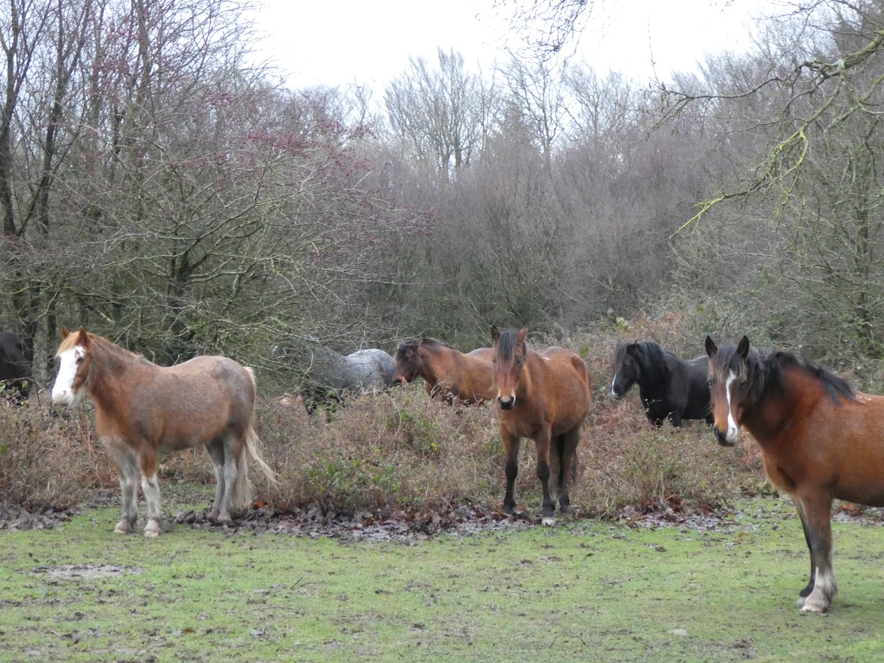
At a crossing of tracks we turn right and head north along the ridge between Street Combe and Frog Combe, as we skirt the summit of Higher Hare Knapp the ponies are seeking protection from the cold wind.
At a crossing of paths at Lower Hare Knapp we turn left and are soon in the trees and grateful for some respite from the wind. Normally we walk reasonably close together and chat, but today Lynnie is focused on the glove search and is striding out ahead of me.
The path descends steeply into Somerton Combe, where we ford the stream and turn right to head into Hodder’s Combe where we ford another stream.
It is always a pleasure walking through Hodder’s Combe with the stream babbling besides the path.
The path leads into Holford besides the Bowling Green where we turn right?. With joy Lynnie sees her glove besides the road. Reunited with the lost item we reassess our options. The weather is quite miserable so we decide there is little attraction to walk along the ridges with the wind and rain biting at us. Instead we turn and walk through Holford, turning right at a junction and then at a grassy triangle follow the road towards Holford Combe.This is another very attractive combe with a stream running besides the path.
At the head of Holford Combe we fork right to follow the path through Frog Combe. When the children were small we used to walk this combe regularly but it is a while since we walked here together.
After emerging from the trees we follow a path for a short distance uphill to reach a track and turn left to head back to the car park.
By our standards this has been a short walk of just over 5 miles, but success in the glove hunt has been a real bonus!
To follow my walk you will need Ordnance Survey Explorer Map OL140 – Quantock Hills & Bridgewater.
For more information on this walk including car parking, amenities, refreshments and detailed walking directions visit my associated Walking Moonraker website.
All information on this site is provided free of charge and in good faith and no liability is accepted in respect of damage, loss or injury which might result from it. To the best of my knowledge the routes are entirely on public rights of way or within areas that are open for public access. Walking can be hazardous and is done entirely at your own risk. It is your responsibility to check your route and navigate using a map and compass.
Today we are returning to a familiar spot to walk on the Quantock Hills. The forecast is for a bright but chilly day. Ideal to enjoy one of my favourite parts of the Country. The starting point for our walk is a parking area just off of the Crowcombe Road to the east of Wilmot’s Pool.
Leaving the parking area we head north west on a grassy track that joins a stony track heading west skirting the summit of Black Hill.
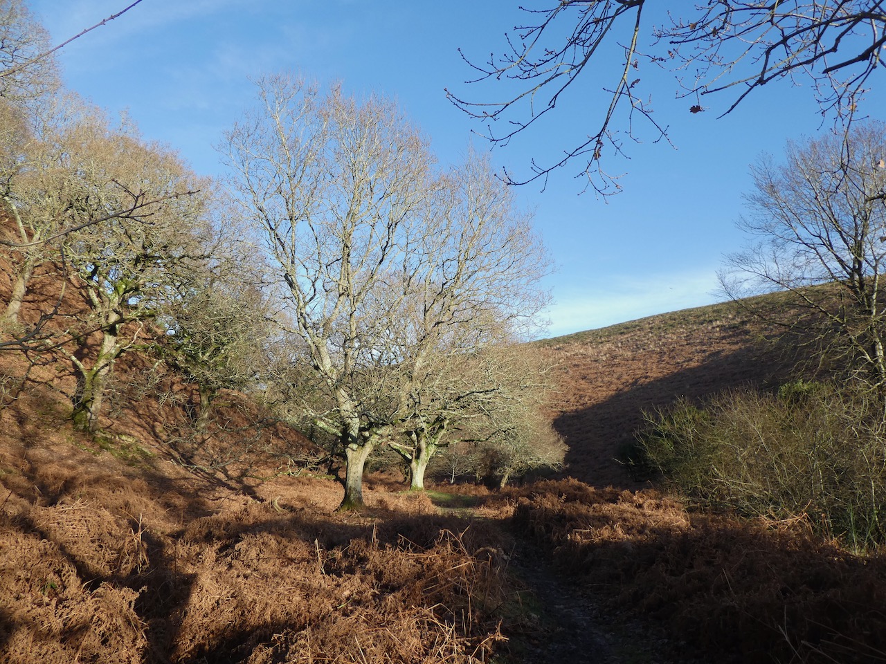
After yesterday’s rain the sunshine is a welcome relief and there is great visibility into Frog Combe with Dowsborough Hillfort standing prominently behind.
We stay with the track until we reach Halsway Post where we stop to take in the view of the Brendon Hills to the west.
At the junction of tracks we follow the route heading north west towards Lowsey Thorn at the head of Slaughterhouse Combe soon spotting a herd of deer camouflaged in the dead bracken.
We stay with the track to Bicknoller Post, from here there is a network of paths we head north and then at a fork in the track go left to reach the summit of Beacon Hill. On the summit there is an Ordnance Survey trig pillar that we have visited many times. One memorable day in 2014 it was so windy here that we could hardly stand up.
Today there is a gentle breeze and the views towards Minehead are stunning.
From the trig pillar we continue north and then head north east down a path into Herridge Combe. Despite having walked extensively on the Quantocks I cannot recall previously walking down this small combe. It is a cracker.
At the junction of Herridge Combe and Gay’s House Combe we cross the stream and continue north along the attractive Smith’s Combe.
At a junction with the Coleridge Way we turn right and head west. This is a section of the 50-mile trail between Nether Stowey on the east side of the Quantocks and Lynmouth and links places associated with Samuel Taylor Coleridge.
We follow the Coleridge Way until just after Dens Combe, here we fork right to head up hill on the eastern side of the Combe.
At a junction of tracks we turn and head back downhill and to rejoin the Coleridge Way which soon passes cottages. Our route heads steadily downhill to pass Alfoxton House which appears in need of repair.
The route is now a tarmac driveway and we follow this through the edge of Alfoxton Wood to reach the old Dog Pound on the edge of Holford. This is where the local stray dogs used to be housed.
Apparently local hunting dogs were kept on the Alfoxton Estate, cared for by the huntsman. The meat for the hounds was hung in trees attracting local stray dogs who unsettled the hounds. One night the huntsman was woken by the sound of dogs and went to investigate, unfortunately he did not put on his normal hunting garments and as a result was attacked and killed by his own dogs. To prevent strays causing a repeat occurrence the dog pound was built.
After passing the Bowling Green we turn right up a track heading towards Hodder’s Combe. Over the years I have walked this Combe hundreds of times, but I am still struck by its beauty.
At the top of the Combe we fork left into Somerton Combe and then very quickly take a steep path heading up through the trees. As we near the top of the ascent Lynnie suddenly realises she has dropped one of her expensive Sealskin walking gloves. So, I head back down in search of it. I walk back to Hodder’s Combe but find no trace of the missing item and trudge back up the hill.
Rejoining Lynnie we continue to a crossing of paths on Lower Hare Knapp and turn right to head uphill to the cairn on Higher Hare Knapp.
From the cairn we take a path heading south on the ridge between Street Combe and Frog Combe, the light is now beginning to fade so we maintain a steady pace.
At a junction of paths we turn left and rejoin the track heading back to the car park. As we get back to the car the moon has risen over Bridgewater Bay.
Our walk has covered nine miles and has taken us to parts of the Quantocks we have not previously visited. We have already decided that tomorrow we will return to the hills to see if we can find Lynnie’s missing glove!
To follow my walk you will need Ordnance Survey Explorer Map OL140 – Quantock Hills & Bridgewater.
All information on this site is provided free of charge and in good faith and no liability is accepted in respect of damage, loss or injury which might result from it. To the best of my knowledge the routes are entirely on public rights of way or within areas that are open for public access. Walking can be hazardous and is done entirely at your own risk. It is your responsibility to check your route and navigate using a map and compass.