Category: Somerset

  • Landacre Bridge and Brightworthy Barrows

    Landacre Bridge and Brightworthy Barrows

    The weather forecast suggests I will get wet at some point on my walk today.  This is hardly surprising when walking on Exmoor in late October.  I don’t mind walking in rain, there is little point in spending money on fancy wet weather walking gear and then sitting inside if there is the slightest sign of precipitation.  

    Today I am going to walk from Landacre Bridge which is a few miles west of Withypool.  The starting point for my walk is the parking area (Grid Ref: SS815360).  As expected on arrival at the car park rain is sweeping across the moor in front of me, so it is a case of getting the waterproofs on before I start.

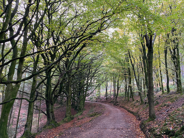
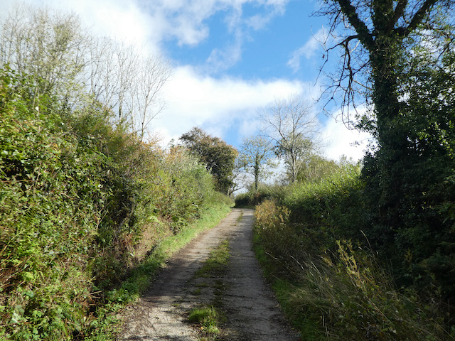
    Leaving the car park I follow a clear path heading south to cross a stream and then join a footpath heading east across Withypool Common.

    At the hedge line I turn right and follow a path heading south which steadily ascends along the hedge line.

    The rain has eased a bit but the odd squall keeps blowing across the moor.  After 300 yards I take a path on the right that rises steadily onto the moor heading towards Brightworthy Barrows.  The sky briefly clears and I get a cracking view towards Withypool.

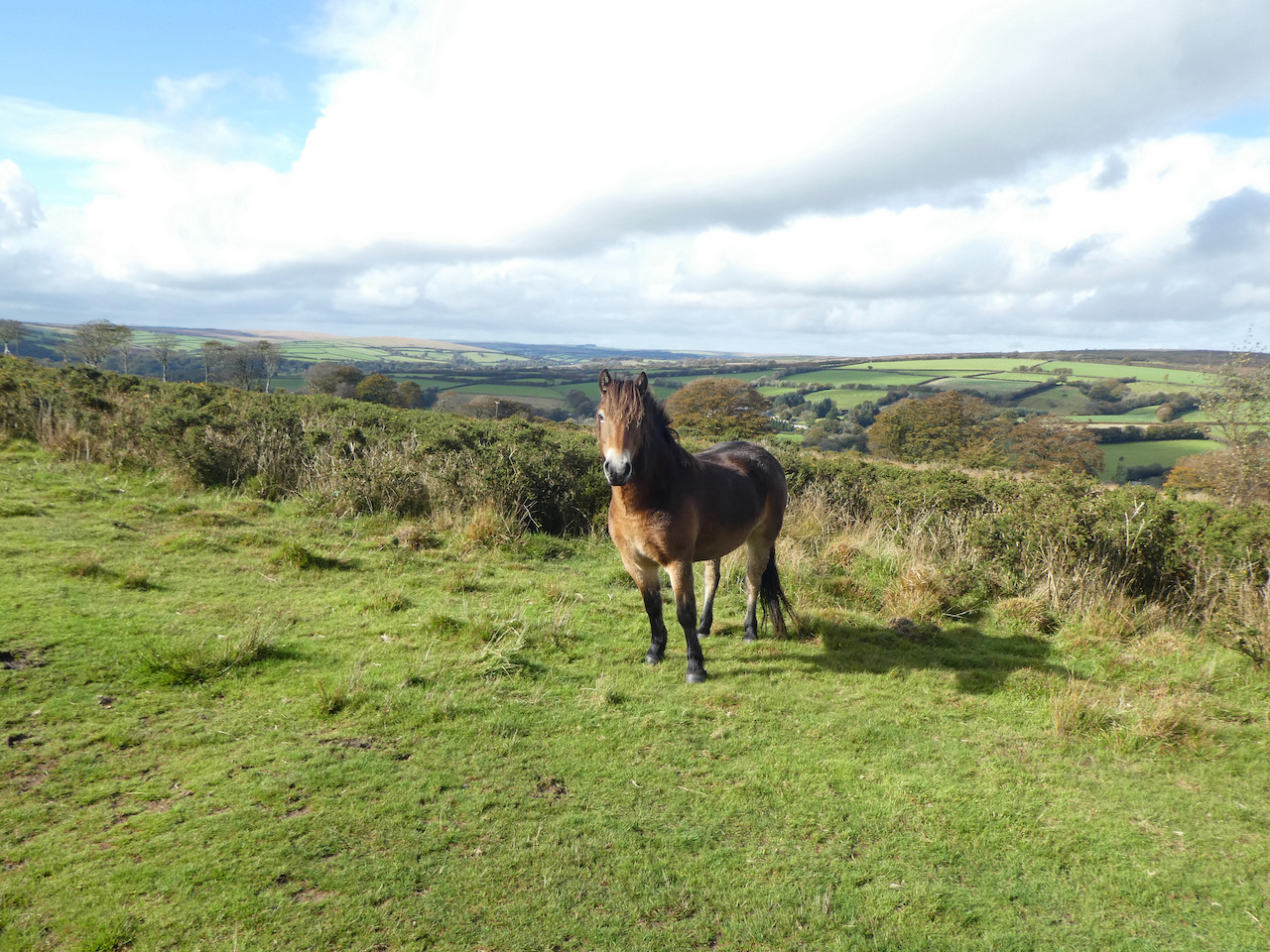
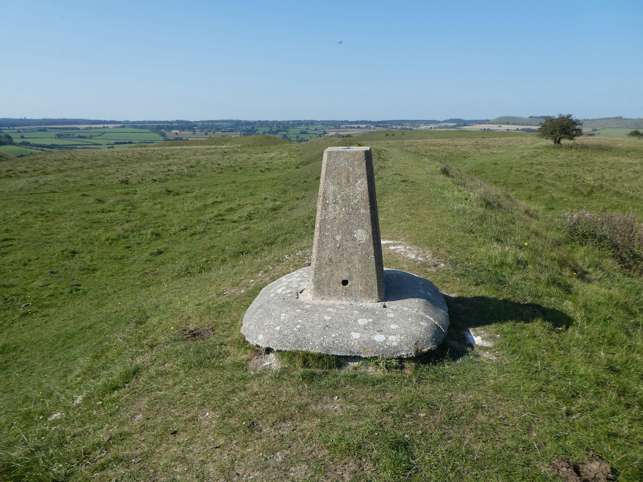
    As the path starts to level I fork to the right to visit the Withypool Common Ordnance Survey trig pillar at Brightworthy Barrow, this is the 229th trig I have bagged.  The rain has stopped but the wind is blowing a gale and Crosby is less than impressed at having to pose for a picture by the trig.

    From the trig I pick up a well-used path that heads south across the moor towards a minor road.  The recent rain has made this path sodden, but despite the surface water it is still firm underfoot.

    On reaching the road I turn right and follow it to pass a cattle grid and continue on to a junction at Withypool Cross.  Here I turn right and follow the road steadily downhill in the direction of Landacre.

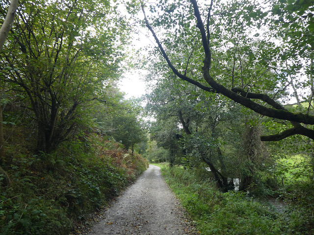
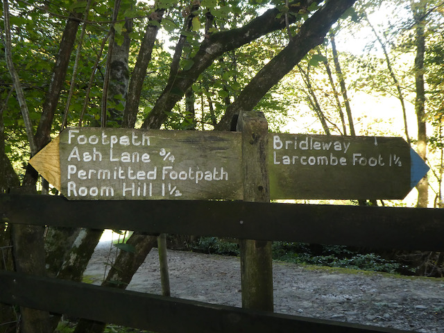
    After 200 yards I turn left to follow a bridleway along a track signposted to Horsen via Sherdon Farm.

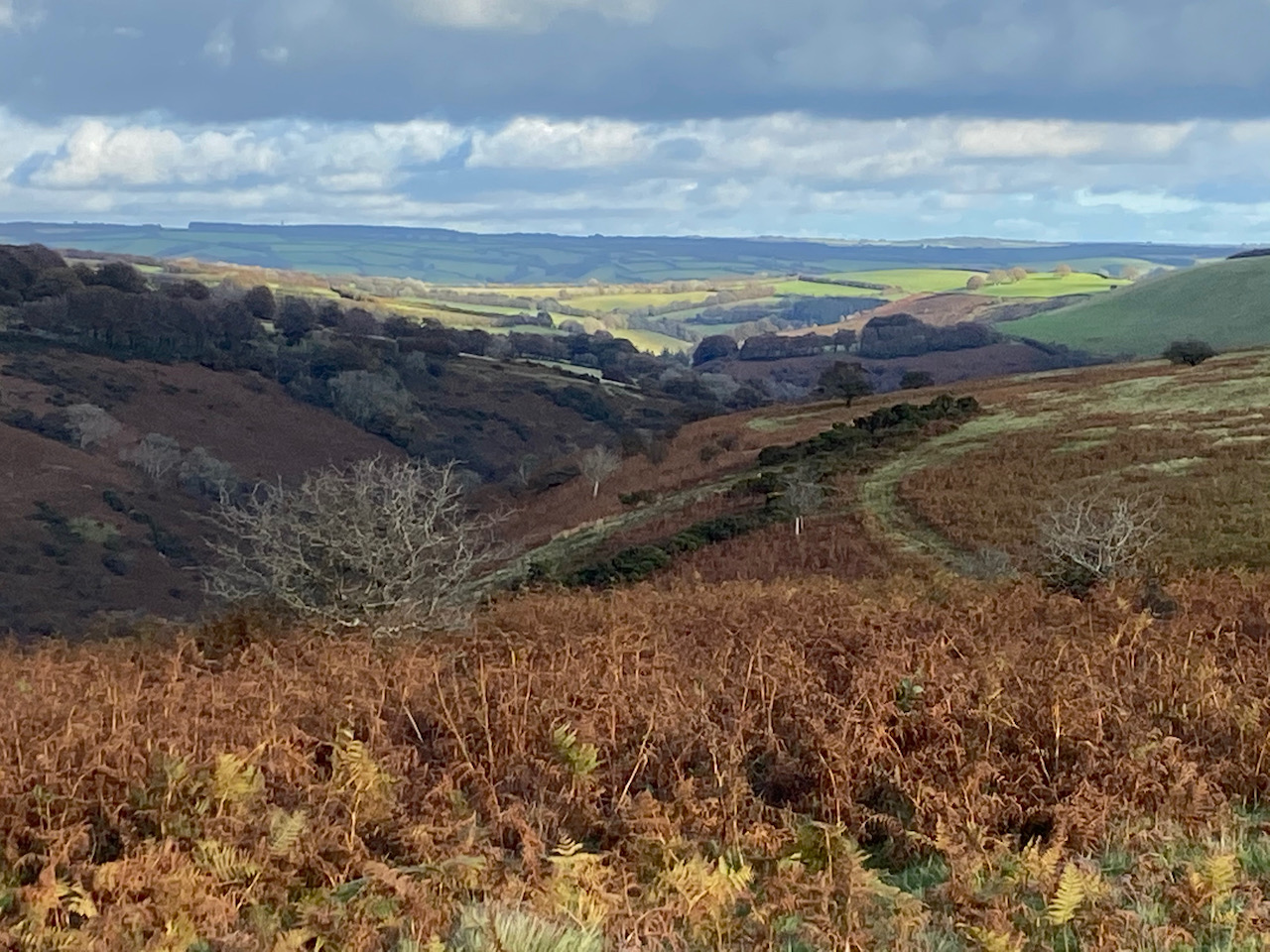
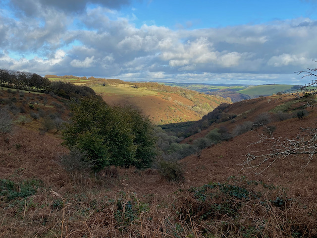
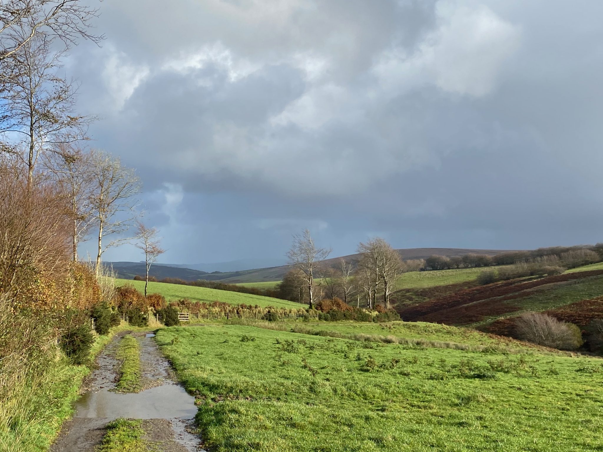
    This is a fine track with great views as it steadily descends towards Sherdon Bridge.

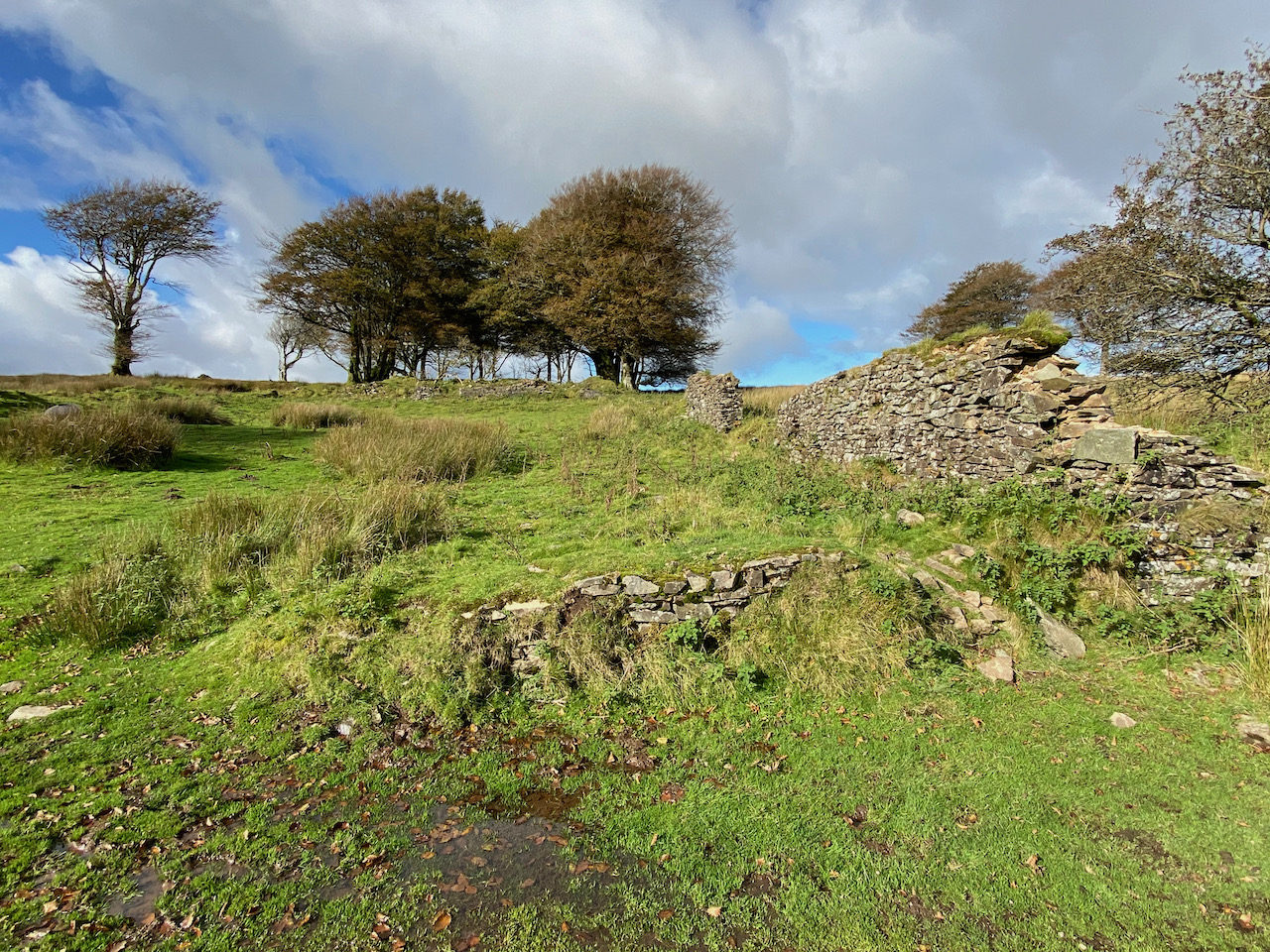
    After crossing the bridge I pass a cottage and stay with the main track to reach the now abandoned Sherdon Farm.  

    It is an isolated spot and it must have been a harsh existence which even the stunning view could not compensate for.  I am sure that at some point the site will be developed, but at the moment it stands as a reminder to the past.

    I stay with the track as it passes through gates and then after 350 yards I reach a footpath on the right.  I leave the track and take the footpath along the edge of a field of pasture.

    After crossing another field the footpath reaches access land on Horsen Hill, I stay with the clear path heading north.  I leave the access land to follow a way-marked path around fields to reach a minor road near Horsen Farm.

    At the road I turn right and then within a short distance, before reaching the farm, I turn right on a track heading towards Cow Castle.

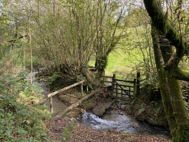
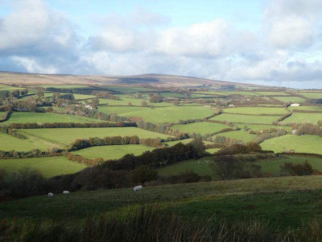
    The track has stunning views and continues steadily downhill to cross a brook at a ford.  Fortunately there is a footbridge besides the ford so I can cross without getting wet feet.

    Staying with the footpath I continue along a track in a lovely valley.

    On reaching the River Barle I take a footbridge over the river and then turn right on the route of the Two Moors Way.

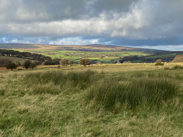
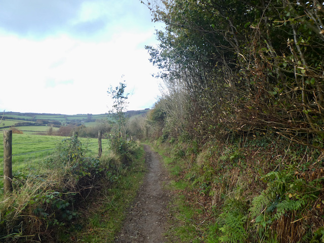
    The route is now very straightforward.  I stay with the Two Moors Way route markers following the path through an area of cleared forest land and then pass through gates to cross moorland.  There are some cracking views as I go along and the storm has blown through so it is now a pleasant autumnal afternoon.

    At a junction of footpaths I stay with the Two Moors Way as it sweeps across access land with views down to the Landacre Bridge crossing the River Barle.

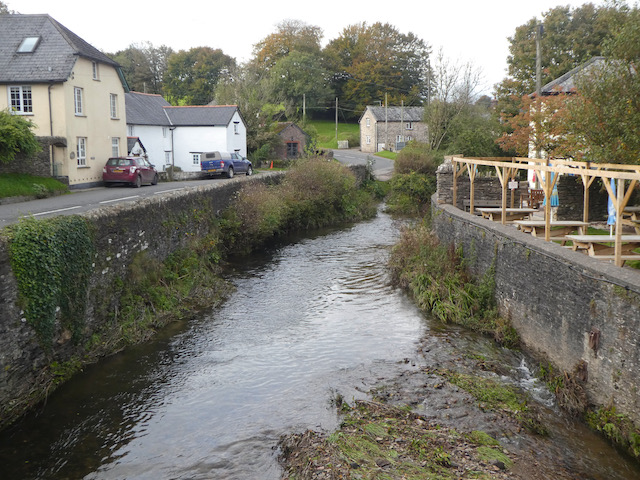
    Eventually the Two Moors Way leads to Landacre Lane, here I turn right and follow the lane to pass a farm and continue steadily downhill to reach Landacre Bridge.  There has been a bridge here across the River Barle since medieval times, apparently it is documented in 1610.  The bridge was restored in 1875 and then further work was carried out following flood damage in 1952.  

    After crossing the bridge it is only a short distance back to the car park, which is now occupied by cattle.  Fortunately not the sort of cattle that seem interested in me or Crosby so we are able to reach the car without incident.

     I have covered just over nine miles and it has been a cracking wander around the moor.  I haven’t seen another walker.  Time now to head back to the caravan and plan tomorrow’s route.

    You can view this 9 mile walk on OS Maps and download the GPX File Here

    To follow our walk you will need Ordnance Survey Outdoor Explorer Map OS9 Exmoor

    27th October 2020

    © Two Dogs and an Awning (2020)

    All information on this site is provided free of charge and in good faith and no liability is accepted in respect of damage, loss or injury which might result from it.  To the best of my knowledge the routes are entirely on public rights of way or within areas that are open for public access.
    Walking can be hazardous and is done entirely at your own risk.  It is your responsibility to check your route and navigate using a map and compass.

  • Dunster Forest from Minehead CAMC

    Dunster Forest from Minehead CAMC

    This week I was due to be walking in the Brecon Beacons, but the Welsh Governments Covid 19 restrictions mean I am unable to travel to the Principality.  A quick search for a pitch has resulted in my heading back to Minehead Caravan and Motorhome Club site for a week’s walking on Exmoor.

    I usually favour the smaller CL’s, but as I am travelling on my own and likely to be out walking for most of the day this site is perfect as an autumnal destination.   I am away with Crosby whilst Lynnie stays home with Dexter; sadly the poor old fellow is struggling on his legs and getting in and out of the caravan or walking more than a mile is now beyond him.

    It doesn’t take me long to get pitched and erect the awning, the weather forecast this week is  wet and the small porch awning is a must for drying Crosby off after our walks.  Usually after arriving at this site I head off for a walk towards the harbour, but today I decide on a different route.

    Leaving the site I turn left and walk up the hill on the pavement besides the A39 until I reach a minor road on my left at Lower Hopcott.  This lane heads steadily uphill, passing Higher Hopcott to reach a car park with an information board about the network of paths in the Dunster Forest.

    I take a path to the right of the information board, after a few yards I ignore a track on the right way-marked to Periton Cross and stay on the track as it steadily ascends the hill.  At the next junction of paths I ago straight on ignoring paths to the left and right.  The path now heads around the top of the valley in Staunton Plantation.  This is a cracking spot the ancient beech trees are magnificent.

    I stay with the track, ignoring a bridleway on the left and carry on for a few hundred yards to reach a crossing of tracks.  Here I turn left to follow a Bridleway way-marked to Dunster.  

    Since leaving Lower Hopcott I have been following the route of the Macmillan Way West, this is part of the 102 mile section of this trail going between Castle Cary in Somerset and Barnstaple in Devon.  It is known as the Macmillan Way as it was set up to raise funds for the Macmillan Cancer Trust.  

    The broad track I am on reaches Holes Corner with a junction of tracks.  I continue straight on still on the Macmillan Way with fine views along the coast in front of me.

    At a fork in the track I keep left and head towards trees in front of me.  

    On reaching the trees I turn left leaving the Macmillan Way to follow a downhill path to a junction of paths.  Here I turn left and follow the path as it continues to descend. 

    I stay on this path, ignoring footpaths to the left and right until I reach a crossing of paths, I now go right towards Alcombe.  

    The track continues downhill to reach a junction with another track.  I turn right still heading for Alcombe.

    On reaching the village I continue through on Manor Road to reach the Britannia Inn where I turn left into Church Street.

    At a junction with the main A39 I go left and then at the mini roundabout take Hopcott Road to return to the caravan site.  My walk has covered 4.5 miles and has been a good stretch of the legs after driving and pitching up.

    To follow my walk, you will need Ordnance Survey Explorer Map OL9 – Exmoor

    You can view this 4.5 mile walk on OS Maps and download the GPX File Here (Subscription to OS Maps Required)

    26th October 2020

    © Two Dogs and an Awning (2020)

  • Pinkery Canal and Larkbarrow Farm

    Pinkery Canal and Larkbarrow Farm

    It is the final day of this short trip to Minehead and my last chance to get out on Exmoor before returning home tomorrow.  On this trip I have been trying to “bag” a few of the Ordnance Survey Trig Points on the Exmoor National Park and today’s route has been plotted so I can visit the trig on the moor at Elsworthy.

    The start of my walk is from the car park besides the B3223 (Grid Ref SS 767410).  On leaving the car park I head south on the verge besides the B3223 for a couple of hundred yards to reach a footpath onto the moor at Prayway Gate.  

    The path soon turns to the left to head east along the boundary of the moor and stays on the moorland at a junction of paths.  I stay on the moor heading east.  The trees up here demonstrate this is a pretty exposed area.

    There is a clear route for me to follow and I stick with this around the boundary of the moor soon heading north to reach a gate on the right. 

    Through the gate I continue along the edge of the moorland. 

    The path I am on runs high above the River Exe and there is an option to turn left on the route of the Macmillan Way West as it descends steeply to Warren Bridge.  However, I ignore this path and continue along the fence line to reach a tarmac lane.

    At the lane I stop to look at part of a waterway which was known as Pinkery Canal.  It was constructed by John Knight in 1833.  Knight had purchased the Royal Forest of Exmoor in 1818 and had set about turning much of the 10,262 acres into agricultural use. There are various theories as to why Knight built the canal, which was in fact a linear ditch. It has been suggested it was for land irrigation or to harness the water power for industrial use.  However, a detailed survey by English Heritage in 2004 dismissed both these options. In fact the survey failed to shed any light onto the purpose of the canal.  All I know is that I am currently stood at one end of it.

    I now turn left to follow the tarmac lane steadily downhill towards Warren Bridge.  There are cracking views as I descend to cross the river Exe on the bridge.

    I continue on the track past Warren Farm, this is the route of the Macmillan Way West and I stay with this through a gate to head back onto moorland.  The path follows close to the boundary with fields on the right and then turns to the north.

    The route I am following will take me on the MacMillan Way to Larkbarrow Corner, however, I take a slight detour to head across the moor to reach the Elsworthy Ordnance Survey trig pillar.  This is the 224th trig I have bagged.

    From the trig I head east and soon rejoin the Macmillan Way and follow this towards Larkbarrow Corner.  Shortly before reaching a road I stay on the moor and follow a path heading in a northeasterly direction parallel to the road.  On reaching a gate by the road I turn left and follow a track besides a fence line heading north onto the moor.

    On reaching a junction of tracks I turn left and follow a stunning path towards Larkbarrow.

    Not much remains these days of what was once Larkbarrow Farm.  It was built in 1850 by John Knight as part of his reclamation of the moor for agriculture.  A tenant arrived in 1850, but by 1852 had found life at this remote spot too challenging and left the farm.  Apparently they struggled to find another tenant and the farm fell into disrepair.

    The Knights had the idea of introducing Scottish shepherds to the moor and for a while the farm was occupied, but this venture proved unsuccessful and by the 1900’s the farmhouse was only used as a shelter when hunting.  However, Larkbarrow Cottage continued to be occupied and in July 1923 its resident, Will Little, was killed by a lightning strike as he headed across the moor from haymaking at Warren Farm.

    I stay with the path passing the remains of Tom’s Hill Farm.  This was built around the same time as Larkbarrow Farm and suffered a similar fate.

    At a five way junction of paths I follow a route heading west and stay on this path as it descends towards a footbridge over the Badgworthy Water.

    I cross the bridge and turn right to follow a path with the river to my right. I stay with this route until I reach a junction of paths near the site of a medieval village.  Now I turn left and head away from the river heading towards Badgworthy Lees.

    This was the area where Richard Doddridge Blackmore based his book “Lorna Doone”.  It is here that the Doone’s were said to have lived.  Whilst Blackmore’s story is fiction it is based on historical characters.  An exiled Scottish clan, the Doones, were known to live on this part of Exmoor in the 1600’s.

    The route now heads up onto the moor.  I stay with the clear path and enjoy the scenery around me.  I have walked this path a few times so don’t bother checking the map or the route on my phone.

    The path leads through a gate and I continue along the clear track along the side of Withycombe Ridge.  It is only now that I remember that I planned to take a path across the moor back to the car.  However, a quick check of the map shows I can keep going on my current route and will be fine, it will add a few miles to my walk but there is no pressing need to get back to the caravan so it’s not a problem,.

    The track leads down to a stream at Lankcombe Ford.  On the opposite side of the stream I take a path to the left which heads uphill to join a track where I turn left and follow it back towards the B3223.

    Here I turn left and follow a path besides the road, the light is starting to fade so I am grateful to have the road to follow.  The moor here is pretty desolate and I would not want to be wandering around trying to find my way in the dark.

    At Brendon Two Gates I cross the border between Devon and Somerset.

    Still besides the B3223 I pass Blackpitts Gate and continue over Exe Head Bridge before heading back uphill to my starting point in the car park,

    My walk has covered 15 miles, a bit further than initially planned but it has been a cracking route.  I have only seen a handful of people so it has felt at times that I was the only person out on the moor.  I am already planning a return visit to Exmoor in a few weeks’ time but for now that’s the end of my moorland walking.

    To follow my walk you will need Ordnance Survey Outdoor Explorer OL9 – Exmoor

    You can view this 15 mile walk on OS Maps and download the GPX File Here

    11th October 2020

    © Two Dogs and an Awning (2020)

    All information on this site is provided free of charge and in good faith and no liability is accepted in respect of damage, loss or injury which might result from it.  To the best of my knowledge the routes are entirely on public rights of way or within areas that are open for public access.
    Walking can be hazardous and is done entirely at your own risk.  It is your responsibility to check your route and navigate using a map and compass.

  • Room Hill from Exford

    Room Hill from Exford

    Today I am going to jam about from Exford.  It is an area I haven’t walked much before so I am off to explore.  I have a rough idea for a route, but it may well change as I go along.  It is a benefit of walking alone, you can just go where the mood takes you.  If it turns out to be uninspiring there is no one to remind you of your bad decisions.

    I leave the car park via the footpath at the far end of the parking area and head in a south-easterly direction along the edge of a field following the route of the River Exe.

    At a junction of paths I turn left on a path signposted to Higher Combe.

    I am now heading east along a track and keep going in that direction when the path enters a field of pasture.  

    The path crosses a footbridge over a stream in a band of trees.

    On the far side of the stream I head uphill across a field to join a track close to Higher Combe. I turn left and continue uphill.

    At a junction with a minor road I turn left and follow the lane to a road junction with a B road at Rock Bungalow.  I turn right and follow this lane for two and half miles to reach a turning on the right to Kemps Farm.  Here there are two bridges across the River Exe, I take the one on the left and follow a track with the River Exe to the right.

    I stay with this path to a junction of tracks near West and East Nethercote.  Here I take a Permitted Footpath towards Room Hill.

    I keep with the path as it hugs the river.

    At a junction of paths I turn left following the way markers for Room Hill, this path ascends steeply.  As the path emerges from woodland there are stunning views back into the valley.

    I am now on open access land but follow a well walked path across the summit of Room Hill heading towards Room Hill Road.  Near the road I turn right to follow another clear path heading north on the route of the Exe Valley Way, this is a long distance 52-mile path from Exford to Starcross where the River Exe reaches the sea.

    The views from this hill are stunning and get even better as I follow the Exe Valley Way to Road Hill.

    I am heading towards a line of Beech trees that are bathed in sunshine though the sky ahead is dark and as Christopher Robin would say “Tut Tut It Looks Like Rain”.

    After passing the trees I get a fantastic view of Dunkery Beacon to the north in front of me.  It is a while since I have been there and must visit it again before too long.

    After passing along the edge of a field the Exe Valley Way turns left through a gate and descends towards Court Copse.

    The route is now very straightforward keeping with the Exe Valley Way as it follows a clear path towards Court Farm.

    At Court Farm I have an option of routes, but decide to keep on the Exe Valley Way, which soon reaches a junction at Monk Cross and then descends on a road into Exford where I turn right to cross the bridge over the River Exe.

    I follow the road the short distance back to the car park.  My route has covered just over 9 miles, there has been more road walking than I planned, but it has been compensated by the stunning views from Room Hill.  

    To follow my walk you will need Ordnance Survey Outdoor Explorer OL9 – Exmoor

    You can view this 9 mile walk on OS Maps and download the GPX File Here

    10th October 2020

    © Two Dogs and an Awning (2020)

    All information on this site is provided free of charge and in good faith and no liability is accepted in respect of damage, loss or injury which might result from it.  To the best of my knowledge the routes are entirely on public rights of way or within areas that are open for public access.
    Walking can be hazardous and is done entirely at your own risk.  It is your responsibility to check your route and navigate using a map and compass.

  • Hawkridge and Tarr Steps from Marsh Bridge

    Hawkridge and Tarr Steps from Marsh Bridge

    On my trips to Exmoor I have “bagged” a number of the Ordnance Survey Trig Pillars dotted around the National Park.  However, there are still a few on my list to visit, so today I have planned a route to encompass them and take me to places I have not previously visited.

    The starting point for my walk is the small parking area close to Marsh Bridge, which is off the B3223 to the west of Dulverton (Grid Ref: SS907289).  From the parking area I cross the B3223 and take a way-marked path along a restricted byway towards Court Down. 

    It is a long steady ascent up this ancient track.  I always find it interesting to look at a map and try to work out why some of these old tracks were turned into roads while others were left. 

    As the track starts to level out I reach a junction of paths, here I turn right to take a slight diversion from my route to follow the footpath uphill to reach a gate into a field of pasture.  From the gate I continue across the field to visit the trig pillar on Court Down, this is the 222nd I have bagged.

    From the trig I return to the gate, here there are two footpaths and I take the one on the right which heads across the field to rejoin the track I was on earlier.  Turning right along the track I follow it through a gate and then continue along a hedge lined route offering occasional cracking views.

    On reaching a junction of paths I turn left to join a tarmac lane, Leigh Lane, and then follow this lane for just over a mile to reach the farm at Leigh.

    Soon after passing the farm I take a footpath on the left that leads along a track towards access land on an area of moorland marked on the map as The Allotment.

    On reaching the access land I turn left and follow a track to a junction of paths.  Here I turn left again to follow the route way-marked to Mounsey Hill Gate.

    On reaching Mounsey Hill Gate at the B3223 I cross and continue on a path that follows the fence line to reach a cattle grid on a minor road.  I go through the gate besides the cattle grid and then fork left away from the road on a track heading across Varle Hill.

    At a fork in the track I go right and follow a well-worn path across Ashway Side that descends gradually towards a band of trees.

    I follow the path as it descends through trees to cross a stream and reach a minor road where I turn left towards the clapper bridge at Tarr Steps.  Because of the Covid restrictions there is a one way system in place across the bridge to enable folk to maintain a social distance whilst crossing.  Sadly not everyone thinks the rules apply to them, especially if their visit has involved driving a car to the beauty spot and walking halfway across to get a picture and then returning to the car to “experience” the next location on their itinerary. 

    There was a time when I would have engaged with such people to explain the error of their ways, but these days I choose to ignore them knowing they will soon be gone.  I wait until the bridge is clear and then make my way across and continue along the minor road at the far side to reach Penny Bridge.  

    I had intended to turn right here on a footpath but the road is so quiet I decide to continue on as it climbs steadily up Marshclose Hill.

    Eventually the lane leads me into Hawkridge near the church of St Giles. Originally built in the 14th century it underwent major restoration in 1878, but parts of the original church remain.

    I have visited a number of churches on our travels, not many have such a stunning view from the churchyard as this one.

    From the churchyard I turn left and walk along Broad Lane at a fork in the road by the telephone kiosk I go left and pass the village hall.  

    I stay with Broad Lane as it heads out of the village to reach West Hollowcombe where I take a footpath on the left which is the route of the Two Moors Way heading towards Slade Bridge.

    This way-marked route heads across pasture fields and gradually descends to a gate where it joins a minor road, Slade Lane.   Here I turn left and follow the road downhill to reach Slade Bridge.

    After crossing the bridge I continue with the road as it heads uphill to reach a cattle grid, here I turn right along a broad track.  I stay with this track towards a minor road, Ridge Road.  Just short of the road I take a brief diversion onto the moor to visit the Ordnance Survey trig pillar on West Ansty Common, this is number 223 for me.

    From the trig pillar I continue to the road and then turn left along it.  I had originally planned to take a path across Venford Moor and then drop down to the River Barle, but I know I need to be on the north bank of the river at some point and the map only shows fords and not footbridges.  There is not a lot of daylight left, so I don’t want to find it impossible to cross the river.  A quick check of the map and I work out an alternative route.  This entails walking along the road for a couple of miles, but it is straight and there is little traffic about.

    One of the benefits of walking on the road is I can pick up my pace so daylight should not be an issue.  After a mile and a half on the road I reach Five Cross Ways and continue straight on for another half a mile to reach a footpath on the left at Chilcott Cross.  This path follows the hedge line in a field as it descends towards a minor road.

    On reaching the road I turn left and continue downhill to a track on the left which continues to head steadily downhill through trees towards the river.

    At the River Barle I turn right and follow the path besides the south bank of the river. 

    The route is now very straightforward.  I stay with the path as it heads east with the river to my left.  There are times that the path departs from the river briefly but it is never too far away and I am soon back beside it.

    I stay with the path besides the River for just over a mile and a half to reach the tearooms besides Marsh Bridge.  Here I turn left and cross the bridge to return to my starting point.  Marsh Bridge is thought to have been built in the 18th century, but over the years it has been altered.  In 1866-67 the iron bridge was constructed and this has had many repairs over the years.

    My walk has covered just over 14 miles through some stunning scenery. Before I head off I take a look at the packhorse bridge close to the parking area.  This would have been the original route for pack horses travelling between Dulverton and Ansty.

    To follow my walk you will need Ordnance Survey Outdoor Explorer OL9 – Exmoor

    You can view this 14 mile walk on OS Maps and download the GPX File Here

    9th October 2020

    © Two Dogs and an Awning (2020)

    All information on this site is provided free of charge and in good faith and no liability is accepted in respect of damage, loss or injury which might result from it.  To the best of my knowledge the routes are entirely on public rights of way or within areas that are open for public access.
    Walking can be hazardous and is done entirely at your own risk.  It is your responsibility to check your route and navigate using a map and compass.

  • Dunster and Blue Anchor

    Dunster and Blue Anchor

    After yesterday’s trip out in the car to Countisbury I have decided that today I will walk from the caravan.  I have stayed on this site at Minehead a few times now and done a number of walks from here, but looking at the map last night I realised there were paths from Alcombe to Dunster I had not yet walked.  

    Leaving the caravan site I turn right and walk besides the A39 to the roundabout by the parade of shops.  I stay with the A39 and continue for just over a hundred yards before turning right into Church Street.  I soon reach the modern St Michael the Archangel Church which was built in 1903.

    I continue up Church Street to reach a crossroads close to the Brittania pub, here I turn right into Manor Road.

    Despite being so close to the caravan site I have not been here before and it is a delightful area.  Once a village in its own right it has now been subsumed into the rest of Minehead, but it retains the feel of a village.

    I stay with the lane as it goes through the village and then becomes a track leading into woods.

    At a junction of paths I go left and head uphill on a path through the trees.

    On reaching a junction of footpaths with a way-marker I go left following the route towards Dunster.

    This clear path was apparently the medieval route between Dunster and Alcombe, it goes in a south easterly direction and crosses a couple of other paths to reach a third crossing of paths.  Here I go left on a path heading towards Dunster.  I like walking tracks that have been used for centuries, it is amazing to think of the people that have trod this path in earlier times and the lives they led.

    As I go along I get fine views across the Bristol Channel and can see the coastal path route I will be walking later on my return to Minehead.

    The path descends to a gate which I go through and soon pass St Leonard’s Well.  This is a medieval Holy Well which is now housed in a 16th century well house.   It is thought it supplied water to a Benedictine priory which was dissolved in 1539 and was located a bit further down this lane. 

    Staying with the lane I continue to head steadily downhill towards Dunster.  On reaching a junction with a minor road I turn left and then within a few yards turn right at the Butter Cross.  This trading post dates from the late 14th century and once stood in the High Street in Dunster.  It was the centre for a market that traded local produce.  It was originally taller and although the exact date of moving to this site is not known it is thought to have been in the late 1700’s or early 1800’s. 

    I follow the path, passing a community orchard.  These local community initiatives are great ideas, not only growing produce, but also providing a community hub, thereby, tackling the issues related to social isolation.

    At a minor road I continue straight on and follow this lane into Dunster arriving in the centre of the village close to the Yarn Market.  My route is to the right, but I turn left and walk the short distance  to pick up a pasty at the Dunster Estate Ice Cream Shop.  I am not usually a fan of pasties but sampled one here a couple of years ago and it was excellent so Crosby and I share one for our lunch.

    Lunch consumed we resume our walk to head back into the village and pass the octagonal Yarn Market cross. This was originally built around 1609 by the Lutterall family, who were major landowners in the area, including Dunster Castle.  As the name suggests the Yarn Market was predominantly used for trading cloth and wool. At the time Dunster was a major centre in the wool trade.

    I stay with the road through the village to reach St George’s Church.  This church originally dating from the 11th century also served as the church for the monks of the nearby Priory.  It underwent major restoration between 1875 and 1877 and is an impressive building.

    Keeping by the road I continue through the village to reach The Foresters Arms where I turn left into Park Street and follow this lane to reach the Gallox Bridge.  This grade 1 listed medieval packhorse bridge crosses the River Avill, at one time this was the main route into Dunster from the south. Its name derived from its proximity to the village gallows, which stood on nearby Gallox Hill.

    I cross the bridge and head towards the woods in front of me and then at a junction of paths take the path way-marked to Aller Hill.

    This path soon reaches a gate and then goes steeply uphill through the trees.

    It is a long steady ascent and I stay with the main path heading south towards Withycombe Hill gate.

    On reaching the gate I go through and turn left to follow a cracking walled path, Park Lane, as it heads downhill towards Carhampton Gate.

    At a junction of paths at Carhampton Gate I turn right and stay with the lane to head into the village of Carhampton where I turn left down the High Street to reach the A39. Here I turn right and cross the road to continue along the pavement to the church of St John the Baptist.  The current church was built in the 1860’s but still retains many of its original features.  A few years ago Lynnie and I popped inside to look at the stunning painted rood screen.

    I continue besides the A39 to reach a crossroads where I turn left onto the B3191 signposted to Blue Anchor.  My route now follows this road for a mile to reach Blue Anchor, there is no pavement so I am a bit wary of the occasional vehicle, but fortunately it is not too busy today.  On reaching Blue Anchor I cross the railway line of the West Somerset Railway and pass the signal box.  This station was added to the line in the 1870’s and is now a popular stop on this heritage railway line.

    Before heading back to Minehead I decide to take a walk along the seafront and see if there is any sign of the Blue Anchor pub re-opening.  It is also a pleasant walk  besides the high sea defences with good views of the coastline.

    The Blue Anchor pub looks as if it has become a casualty of the sea erosion and is now closed permanently, or at least until Somerset Council can come up with a plan to stabilise the cliff.  A number of options have been under consideration, some leaving the pub to the mercy of the sea.  It is always a pity when pubs close down, especially if like this one they are in a cracking location.  Hopefully a solution can be found to save it.

    I now head back along the sea wall to reach a World War II pillbox and pass this on the beach to join the footpath heading towards Minehead.

    After a section on the pebbles the route becomes a tarmac path and I stay with this to reach a car park at Dunster Beach. After going through the  car parking area I pass an estate of holiday chalets and reach the end of the Minehead and West Somerset golf course.  

    The path now skirts another World War II pillbox before continuing alongside the golf course.

    Despite walking this route before I am surprised how long it takes to get from  Blue Anchor to Minehead.  No matter how long you walk for Butlins holiday camp does not seem to get any closer.  Eventually I reach the club house of the golf club and join the path besides the sea wall.  The light has been fading fast and I am treated to a cracking sunset.

    From the sea wall I head along the Avenue and then turn left to follow the roads back to the caravan site.  My walk has covered thirteen and a half miles and has been a cracking wander made even more enjoyable with the stop for a good pasty. 

    To follow my walk you will need Ordnance Survey Outdoor Explorer OL9 – Exmoor

    You can view this xx mile walk on OS Maps and download the GPX File Here (Subscription to OS Maps Required)

    8th October 2020

    © Two Dogs and an Awning (2020)

  • Countisbury to Lynmouth

    Countisbury to Lynmouth

    Yesterday when I met Sarah, my Twitter buddy, at Periwinkle Cottage tea rooms in Selworthy we chatted about walks on Exmoor.  A number of the places that Sarah mentioned I had previously visited but there were a few I hadn’t.  One of those locations was Countisbury which Sarah told me had stunning views of the coastline.

    The starting point for my walk is the free car park besides the A39 at Barna Barrow, which is just east of Countisbury (Grid Ref SS752496).  My plan is to walk from the top of the hill into Lynmouth, but first I want to head east to Countisbury Common to bag the OS trig point on the hill.  Leaving the car park I initially head north and then follow a track as it sweeps to the right to head east. 

    After crossing a driveway the path continues east to pass Kipscombe Farm and then goes through fields.  After passing through a gate I make a brief diversion from the path by following the fence line uphill and then enter a field where the OS trig point sits on top of Kipscombe Hill.  This the 220th I have bagged.

    After admiring the views from the trig pillar I retrace my steps downhill and on reaching the gate turn right along the footpath to head through fields.  At a junction of paths. I go left to enter access land above the cliff.

    The path I’m on heads north towards the sea and then at a junction I turn left and follow this path as it enters trees and then fords a stream.

    It was my original intention to walk through Chubhill Wood to pick up the coastal path, but it is clear that this will mean walking through trees and missing out on the views so instead I follow a well-worn path which heads west across the top of the access land to reach a gate.  Going through the gate I rejoin the footpath I was on earlier and head west back towards Kipscombe Farm.

    On reaching the track just beyond the farm I take a path heading north west heading towards a telecoms mast.

    I stay with this track to pass the mast and reach the Ordnance Survey trig point close to it.  This is my 221st and has more cracking views.

    From the trig pillar I continue along a broad path heading towards Countisbury Church and then stop at a bench to enjoy the view and eat my lunch.

    Heading off again I pass Countisbury Church and briefly join the South West coastal path before going left through a gate and heading down to cross the A39. 

    On the far side of the road there is a choice of three paths.  I take the central one heading steadily downhill in a valley through South Hill Common.

    At a junction of paths I turn right and follow the Coleridge Way footpath above the river.  

    There are a network of paths heading west through this valley I stay with the Coleridge Way and then drop down to cross the river and walk a short distance on the south bank before crossing the river again.

    The recent weather means the river is fast flowing.  But this is nothing compared to how the river would have looked back on the on the night of the 15th August 1952.  Then torrential rain fell on the already saturated surrounding moorland.  Over the course of a couple of hours the East Lyn and West Lyn river levels rose and the power of the water was enough to move rocks and debris downstream.  As the force of the rivers met at Watersmeet their combined power was enough to cause devastation to anything in its wake.  

    Sadly this resulted in total disaster in Lynmouth with 34 lives lost and many properties destroyed,  420 people were made homeless.

    My route now runs close to the river as it approaches Lynmouth.

    On reaching the village I cross the bridge and then turn right to walk towards the harbour.

    After months of avoiding crowds and busy spots the village is a bit too crowded for me.  So I wander around to the Lynton and Lynmouth cliff railway.  This was opened in 1890 and was built to transport freight arriving at Lynmouth to Lynton high above it on the cliff.  With the emergence of tourism in the last 1890’s the railway was soon carrying passengers and it has run continuously ever since.  It is water powered by a clever water system using two cars, water is put into the top car and emptied when it reaches the bottom.

    I walk back around past the harbour and at the junction turn right and quickly left into Watersmeet Road and follows this for a hundred yards to reach a footpath on the right way-marked for the Two Moors Way.

    This path heads steeply through houses and then enters woodland and continues to climb as it zig zags its way up.  I stay with the Two Moors Way as it emerges from the trees and continues heading east along the fence line.

    At a junction of footpaths I turn right to leave the Two Moors Way and head south across fields.

    At a junction of paths I go left heading along the edge of a field and then go through a gate to follow a wall-lined grassy path to reach Lower East Lyn Farm.

    The path passes the farm and continues on through Higher East Lyn Farm and then goes through a gate onto a grassy track.

    There are soon good views in all directions as I stay with the path ignoring others leading off to the left.

    The path I am on soon starts to sweep round the top of the hill and turns towards the south to reach Myrtleberry South Iron Age Enclosure.

    Now the path descends gradually through the trees heading towards the A39.

    On reaching the road I walk besides it for a short section heading downhill to Hillsford Bridge where I cross the river and take a footpath on the left heading into the Watersmeet Estate.

    The path follows the course of the river to reach Watersmeet. 

    Crossing the river I pass the cafe.  The water level is not too high, but its force is still noticeable as it squeezes through the rocks.

    There are a few path options here but I stay with the route that heads north besides the river.

    Soon the path goes away from the river to reach the junction of paths I was at earlier in my walk.  This time I go uphill retracing my steps along the steep path heading through the valley on South Hill Common.

    I get caught in a heavy rain shower, it has been threatening for much of the afternoon but had managed to evade me until now.  Nearing the A39 I turn right taking a permitted path that avoids the road to arrive in the village at a pavement.  I continue up the hill to pass the Blue Ball Inn and then turn left on a minor road heading up to the entrance to St John the Evangelist church.

    The path leads through the churchyard and through a gate where I turn right and follow a path heading west back to my starting point in the car park.  My walk has covered just over 11 miles and I have enjoyed stunning views all the way round.

    You can view this 11 mile walk on OS Maps and download the GPX File Here

    To follow my walk you will need Ordnance Survey Explorer Map OL9 Exmoor

    7th October 2020

    © Two Dogs and an Awning (2020)

    All information on this site is provided free of charge and in good faith and no liability is accepted in respect of damage, loss or injury which might result from it.  To the best of my knowledge the routes are entirely on public rights of way or within areas that are open for public access.
    Walking can be hazardous and is done entirely at your own risk.  It is your responsibility to check your route and navigate using a map and compass.

  • Meeting a Twitter Buddy

    Meeting a Twitter Buddy

    Social media gets a lot of bad press but there are some positive benefits from it.  I have accounts with Facebook, Instagram and Twitter, but find that being active on all three is too time consuming so these days mainly confine my activities to Twitter.  Over the couple of years I have been tweeting I have met a few of the people I engage with through this medium and today I have arranged to meet Sarah and her cocker spaniel Jack for a cup of tea at the Periwinkle Cottage tea rooms in Selworthy.

    I have decided not to use the car today but walk directly from the Caravan and Motorhome Club’s site in Minehead. On leaving the site I turn left and walk uphill along the pavement besides the A39, Hopcott Road. On reaching Hopcott I turn left to follow the narrow tarmacked lane as it heads steadily uphill passing Higher Hopcott and then entering woodland with a steep final ascent to reach a small car park.

    There are a network of paths leading from this car park, I take the route of the Macmillan Way West still heading uphill. I ignore a path on the right soon after leaving the car park and then where the Macmillan Way forks to the left I take the right fork to follow a footpath along a track.

    I am still heading steadily uphill; the path starts to level slightly on leaving the trees to enter an area covered in gorse offering fine views.

    On reaching a crossing of paths I turn right to follow the route towards Tivington.  I am now back on the Macmillan Way heading west to reach another crossing of paths.  Here the Macmillan Way turns left towards Wootton Courtney, however, I keep going straight ahead soon reaching an Ordnance Survey trig point tucked to the left of the track on a high bank. I have already bagged this trig on a previous walk.

    At the next crossing of footpaths I continue straight on to pass the National Trust plaque and enter Holnicote. Within a short distance the track forks and I take the left route towards Tivington.

    I leave the trees to join a hedge-lined track and get a cracking view over towards Dunkery Beacon.

    The track reaches Tivington near to the thatched 14th century Chapel of St Leonard. Apparently this chapel of ease closed during the dissolution of the monasteries it was restored in 1896 and re-consecrated in 1940. Sadly it is locked so I cannot take a peek inside.

    Back on the road I head north through the hamlet and at a fork in the road go left to soon pass Tivington Farm and then carry on to Venniford Cross where I go over the A39 and join a track, Eight Acre Lane, going steadily uphill.

    At a junction of tracks I turn left and follow the farm drive towards East Lynch Farm.  As I approach the farm I take a footpath on the right, which runs behind a fine old barn.  I stay on the wide grassy track as it sweeps by farm cottages, ignoring a footpath on the left and continuing uphill.

    On reaching a tarmac lane I turn left and follow this road steadily downhill to reach the attractive 15th century white washed All Saints Church at Selworthy.

    Soon after the church I go through the gate besides the War Memorial to meet up with Sarah at Periwinkle Tea room.  In the current circumstances meeting up with anyone is rather different than normal.  But the way things are set up at this attractive tea room means we can chat whilst social distancing.  Over a cup of tea Sarah shares with me some of her local knowledge of walking on Exmoor and I pass on details of some of my favourite local walks.

    After chatting with Sarah for an hour or so it is time for us to part ways.  I head back up through the gardens of the tea room to the War Memorial.  I now take the footpath on the left that soon heads into the attractive Selworthy Combe.  Where the track forks I go left to go over a bridge.

    The path now heads steadily uphill on an attractive path through the trees.

    On reaching a small dam in the stream I stop to search for an Ordnance Survey rivet.  Over the last few months rivets and cut benchmarks have been added to the list of things to “bag” whilst out walking. 

    It takes a bit of searching, but in the end I spot the small metal rivet that formed part of the OS mapping of this area.

    I continue up the combe to reach the Memorial Hut that was erected in 1878 by John Barton Arundel Acland the youngest son of Thomas Dyke Acland (1787 -1871).  One of the inscriptions inside reads “In remembrance of the father who during more than fifty years took Sunday walks up this Combe with his Children and Grandchildren training them in the love of nature and of Christian poetry this Wind and Weather hut was built”.

    From the hut I walk uphill to a minor road and turn left and follow the road to reach a car park with a stunning viewpoint towards Porlock Weir.

    From the car park I turn around and follow a footpath besides the road heading back towards the Memorial Hut.  As I near the hut I cross the road and take a track north east to reach the trig point at Selworthy Beacon.

    From the trig point I take a path heading east on a track running close to the road.

    Through a couple of gates the path sweeps to the left towards a car park.  There are a network of paths back to Minehead from here. I continue to the east heading towards trees in the distance.  On reaching the trees I turn to the right to cross the road and then take a footpath on the left running parallel to the road and heading downhill through gorse bushes.

    This track joins the road by a cattle grid and the route is then downhill along the road to enter Higher Town and reach the 15th century St Michael’s Church.   Apparently in the past a beacon was shone from the tower of this church to guide ships into the harbour below.

    I continue along the road for a short distance and then turn right onto a road called The Ball and follow this to a junction with Ballfield Road where I turn right and continue heading downhill into Minehead.  In the centre of the town I turn left into the Parade and then wander through the residential streets to return to the caravan site.

    It has been a good wander.  I have covered twelve and a half miles.  It was good to meet up with Sarah and her lovely dog Jack.  Hopefully on another visit to this area we can catch up again on a walk.

    You can view this 12.5 mile walk on OS Maps download the GPX File Here (Subscription to OS Maps Required)

    To follow my walk you will need Ordnance Survey Explorer Map OL9 Exmoor

    6th October 2020

    © Two Dogs and an Awning (2020)

  • Minehead Harbour

    Minehead Harbour

    After a week at home I am off with Crosby for a week of walking on Exmoor.  Lynnie has decided  to stay at home with Dexter and catch up with a few bits in the garden.  Also to her the prospect of trudging across the moor in all weather conditions is not appealing.

    My base for the week is the Caravan and Motorhome Club site in Minehead.  I am not usually a fan of large sites but this  one is conveniently located and its layout makes it feels like a smaller site.  It does not take long to set up and after a couple of hours in the car Crosby is itching to get out for a walk.  

    A few days ago I was talking to friends and told them how attractive Minehead harbour was.  Their view of the town was tainted by a day trip one summer when they saw Butlins and quickly left.  So I promised to send them some pictures to show what they had missed.

    I leave the site and turn right down Hopcott Road and at the roundabout take a left turn into Townsend Road and then fork right along Ponsford Road.  Reaching the Parade I turn right and continue to the Esplanade where I turn left.

    I soon reach Owen Cunningham’s outstanding sculpture marking the start, or finish, of the 630 miles South West Coastal Path.  I would love to be able to do this walk, however, my fear of heights prevents me doing the sections along cliffs.

    I continue along with the harbour  to my right.  I have visited this harbour a number of times and the tide has always been out.  I’ll have to check the tide times before my next visit.

    On reaching the Old Ship Aground pub I turn to walk along the harbour wall.

    There has been a harbour here since the late 1500’s.  Over the centuries the number of  vessels increased with trade routes established to Wales and Ireland.  There was once a small local commercial fishing fleet but this declined in the 20th century and has now ceased.

    I wander along the harbour wall with its interesting history depicted by a series of plaques on the wall.

    From the harbour I take a look at the Lifeboat Station which was built in 1901.

    Now I turn and head back towards the town besides the sea wall.  Instead of turning into the Parade I cross the road and take a look at the West Somerset Railway Station.  This was originally the station for the train connection between Taunton and Minehead which opened in 1874 and ran until it was closed by British Rail in 1971.

    In 1976 a group was formed to re-establish the line and now regular steam services run between Bishops Lydeard and Minehead a distance of just over twenty miles.  This makes it the longest heritage railway line in the country.  When we lived in Taunton we often considered taking a trip on the train, but never got around to it.  Perhaps I will have to book it on a future trip here with Lynnie.

    From the station I head to the Parade and then retrace my route back to the caravan to start making plans for walking on Exmoor over the next few days.

    5th October 2020

    © Two Dogs and an Awning (2020)

     .  

  • Castle Hill and White Sheet Hill

    Castle Hill and White Sheet Hill

    Over the last thirty years I have frequently travelled between Salisbury and Taunton and driven past Mere on the A303.  I can’t recall ever visiting the town and have often looked at the hill close to the main road which has flag pole on the top and wondered what remained of the castle that once stood there.  Wyndham Farm CL is only a couple of miles from Mere so today we are heading there to visit the castle and walk on White Sheet Hill.

    The starting point for our walk is the free car park in Castle Street (BA12 6JE) close to the centre of Mere.  Leaving the car park we turn left and then on reaching the first house after the car park we cross the road and take a footpath up an alley way between a house and a wall.  This leads to Castle Hill Lane which we cross and continue uphill on a path besides a children’s playground.

    After the playground we turn left and take a path leading to a gate into the castle site and then proceed heading west under the ramparts of the castle to reach the western end where we take a path leading steadily up to the summit.

    There is no trace of the castle that once stood here.  It was built in 1253 by Richard the Earl of Cornwall.  He was the brother of Henry III.  After Richard’s death his son Edmund inherited the castle but on his death it returned to the Crown. In the 14th century Edward III made the site part of the Duchy of Cornwall where it has remained. On top of the hill stands a Memorial to the 43rd (Wessex) Infantry Division.

    There are fine views from this spot and to help identify points on the horizon there is a toposcope. However, not all points are visible. As hard as we look we cannot spot John O’Groats which is apparently 530 miles away.

    From the summit of the hill we descend by the route we came up and then head west along a path that follows the ridge of Long Hill.  A herd of goats appear beside the path, some take umbrage that we are walking through their territory and are reluctant to let us pass along the track.

    The route descends to a gate where we turn right and join a track that soon reaches a bridge across the A303 and then continues along the edge of a field.

    We stay with this track as it heads  through fields towards Search Farm.  There are fine views of White Sheet Hill to our right and it looks like it is going to be a good ascent to reach the top later.

    After passing Search Farm we reach a junction of tracks where we turn right on a tree lined path.

    This path leads us to Beech Clump where, besides the path, is a memorial dedicated to the crew of Dakota III TS436.  On 19th February 1945 this plane took off from the nearby wartime airfield at RAF Zeals with a crew of airmen heading back to their base in Leicester.  In low patchy cloud the pilot failed to gain enough height  and hit the trees on Beech Clump.  As a result the plane burst into flames and the lives of twenty airmen were lost.  The only survivor was the pilot.

    Apart from the memorial there is no indication now of the tragedy that occurred in this clump of trees.

    We continue along the track to reach a parking area and then at a fork in the path follow a route that gradually ascends the ridge.  

    Heading upwards we enjoy the cracking views of the chalk escarpment of White Sheet Hill.

    The path leads us to the top of the hill where we spot the remains of an old metal fence post.

    Our route is to the right but first we go left across the access line to reach the fence line so that we can view the old milestone that sits beside the Drove which is known as the London Road.  The inscription reads XXIII Miles from Sarum 1750.  Below the inscription there is an Ordnance Survey cut benchmark which would have been used as part of a mapping survey of this area.

    We now head back to the metal fence post and follow a path heading south east along the top of the escarpment.  On reaching the ramparts of White Sheet Castle we turn left and walk up to the Ordnance Survey trig point on the summit of White Sheet Hill, this is the 218th I have “bagged”.

    White Sheet Castle was an Iron Age Hillfort and much of the site is preserved so it is easy to imagine the scale of the fort. Being some distance from the nearest car park it is amazingly quiet and despite it being a stunning day we can only see two other people enjoying the views.

    From the trig we head south east to reach a fence line and follow this north to a gate entering another access area.  Here we turn left and follow the fence line back up to a gate besides a covered reservoir.  We cross the track and take a footpath heading diagonally across a field to reach anther track where we turn left and then besides cattle pens enter a field on the right.  We head northwesterly across this field following the contours around the top of a valley.

    The path then heads north across White Sheet Down.  There are stunning views as we continue along the top of the downs and then start to descend to a gate which leads to a track.

    Joining the footpath along the track we pass through the yard of Coombe Barn farm and continue to a junction of tracks where we turn right.  Soon we enter a field  and continue through a second field to reach the farm driveway to Rodmead Farm.  

    We turn right along this track following the footpath as it skirts around Rodmead Farm with its attractive barns.

    At a fork in the track we go right and start a long steady ascent up the side of the escarpment passing Rodmead Wood and continue on until we reach a junction with the Mid Wilts Way (MWW) long distance trail. 

    Now we turn right and go through a gate and follow the route of the MWW as it follows the fence line above the attractive valley.

    On reaching a track we cross and continue on the MWW through a field of pasture.  This is access land but we stick to the route of the path until we reach a fine stone bench erected by the Mere Footpath Group.

    Just after the bench we leave the Mid Wilts Way by forking right on a track heading steadily downhill.

    As we descend there are cracking views of the escarpment of White Sheet Hill.

    The track leads to a lane, Manor Road, where we turn left and follow this lane to pass Manor Farm and then take the bridge over the A303.  Now we continue on the road into the centre of Mere close to the Clock Tower.  Apparently this was built in 1868 and was given to the town by Albert the Prince of Wales.

    From here we take Castle Road passing the George Inn and the fine Old Ship Hotel.  Unfortunately the Ship is permanently closed and looks in need of a full renovation.  The stunning building dates from 1711 and is Grade II listed because of its many fine external and internal features.  Castle Street, on which the pub stands, was once the main Exeter to London route so this would have been an important staging point.

    It is sad to see such fine old buildings no longer in use as pubs.  Hopefully, someone will buy it and re-open it as a hotel again.  We now continue along Castle Street to our starting point at the Castle Street car park.

    Our walk has covered nine miles and we have been treated to some stunning views.  It is a walk we hope to do again before too long.

    You can view this 8.6 mile walk on OS Maps and download the GPX File Here

    To follow my walk you will need Ordnance Survey Explorer Map 143 Warminster & Trowbridge and 142 Shepton Mallet & Mendip Hills East.

    21st September 2020

    © Two Dogs and an Awning (2020)

    All information on this site is provided free of charge and in good faith and no liability is accepted in respect of damage, loss or injury which might result from it.  To the best of my knowledge the routes are entirely on public rights of way or within areas that are open for public access.
    Walking can be hazardous and is done entirely at your own risk.  It is your responsibility to check your route and navigate using a map and compass.