Category: South West

  • A Walk In The Woodford Valley

    A Walk In The Woodford Valley

    It is a long time since I did a walk up the Woodford Valley.  I have covered sections of it on walks but haven’t done a route going up and down the valley for well over twenty years.  So today I am exploring this attractive valley with my walking pals Mandy and Gary.

    The starting point for our walk is a small parking area at Stratford-sub-Castle besides the River Avon (OS Grid Ref: SU12943295).  We start by heading south besides the road heading back towards Salisbury.

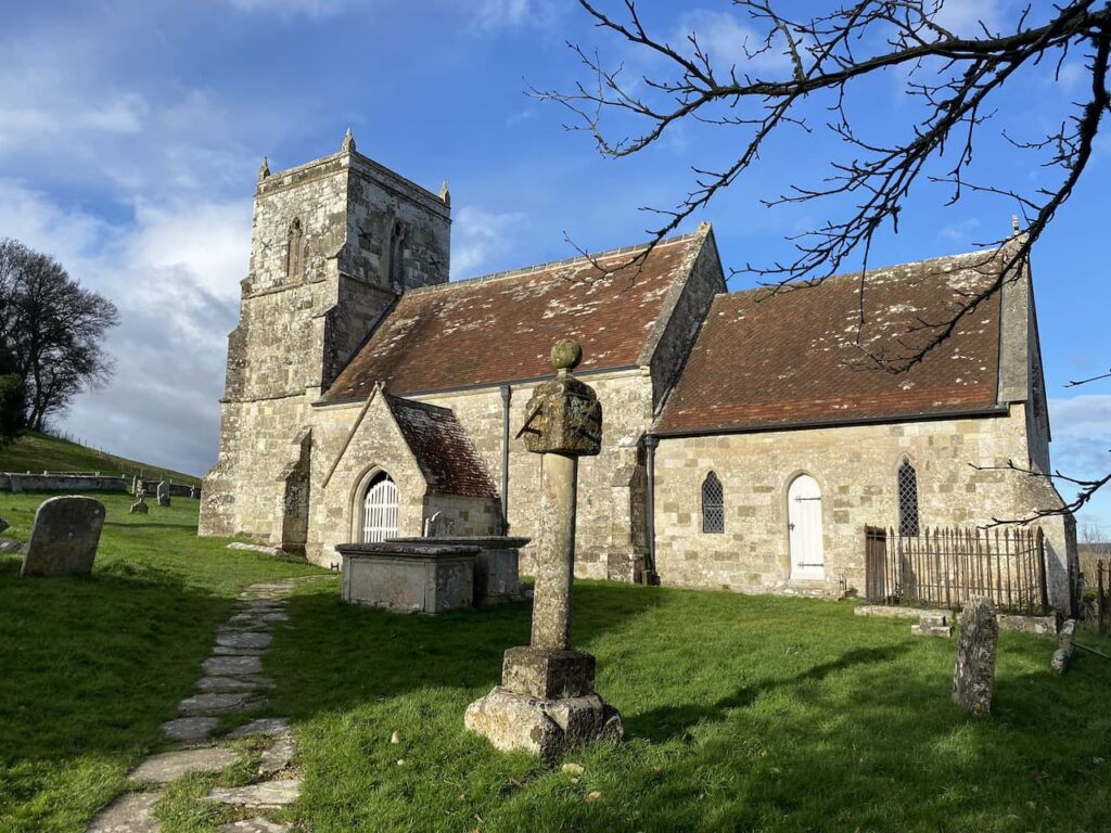
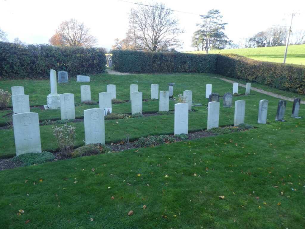
    Within a few hundred yards we reach St Lawrence’s Church, there has been a church on this site since at least 1326.  It houses a 12th century font, thought to have come from elsewhere. At various times over the centuries bits have been added, the naive was built in the 16th century and the tower rebuilt in the 17th century.  Major renovations were conducted in 1904-05 and again in 1957-58.  It is a church I have never been inside and that will not be rectified today because the door is locked.

    We stay with the pavement until we reach a footpath along a track on the left and take this going towards Old Sarum Castle.  

    As the path starts to ascend we take a gate on the right to enter the site of Old Sarum and follow a well-worn path uphill towards the ramparts.  As we ascend we get a cracking view of Salisbury Cathedral in the early morning mist.

    On reaching the ramparts we turn left on the outer ring of the castle.  There is evidence that the site of the castle was used as an Iron Age settlement in 400BC.  A motte and bailey castle was built in 1069 and the site was well populated until the cathedral which had been built there was relocated to its current location two miles away.  This relocation was due to a fall out between the church and the troops guarding the castle, local legend has it that an arrow was fired from the castle and wherever it landed would be the site of the new cathedral. It would not be physically possible to fire an arrow two miles, so the story has it that the arrow landed in a deer who ran until dropping at the site of the new cathedral.

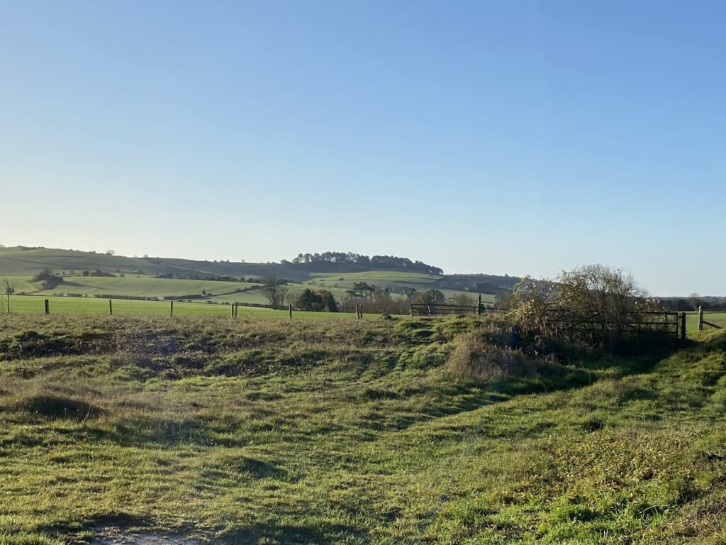
    Whatever the myths around this site it is clear that building the ramparts would have required a lot of physical effort.  It is years since I visited the site and must return with Lynnie and look at the old remains.  Nearing the entrance we drop off the rampart to go through a gate and then turn to the left on a drove and head north-west crossing a minor road and continuing towards Shepherds Corner.

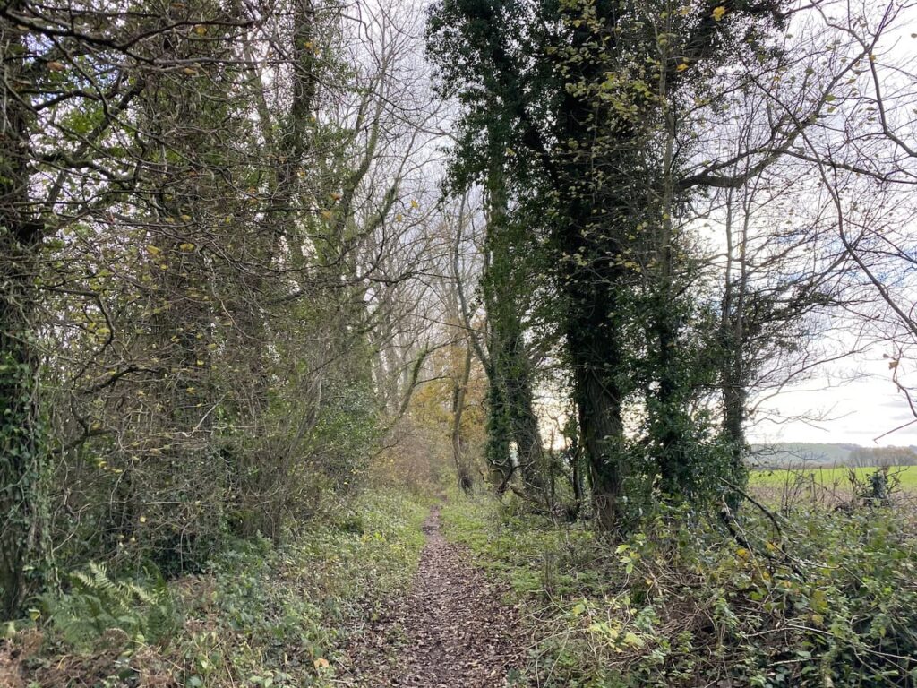
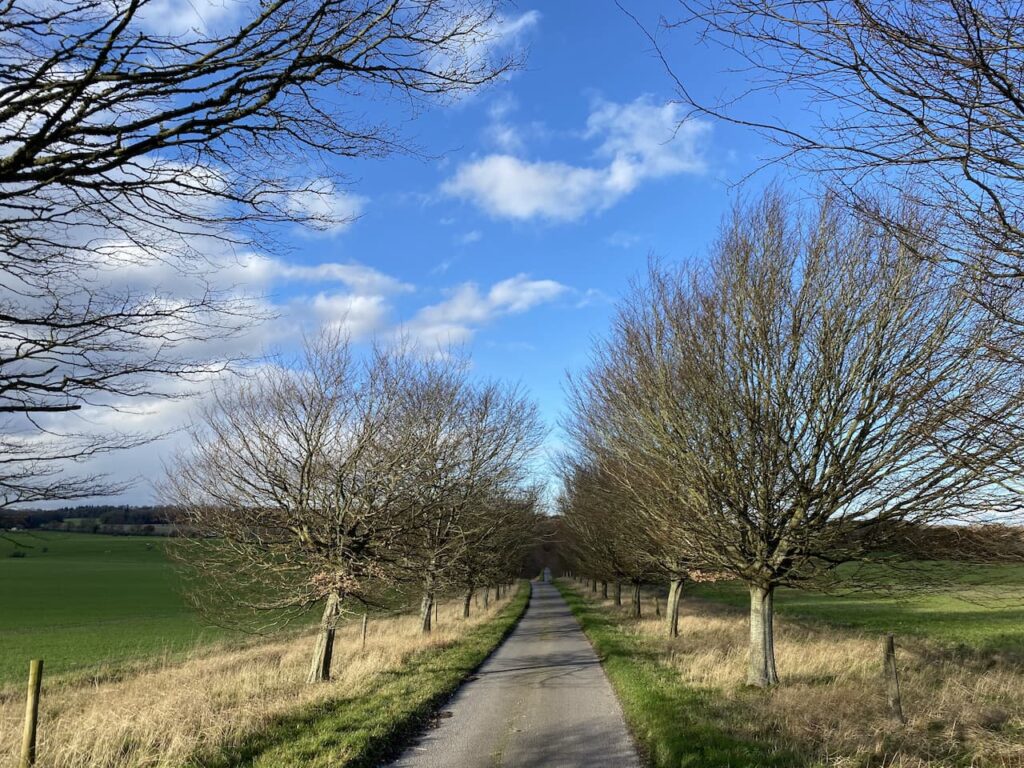
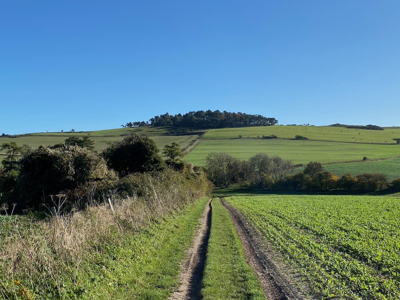
    This route is easy to follow, it stays with the track as it passes belts of trees.  At a junction of tracks at Keeper’s Cottage we continue straight on along the bridleway.

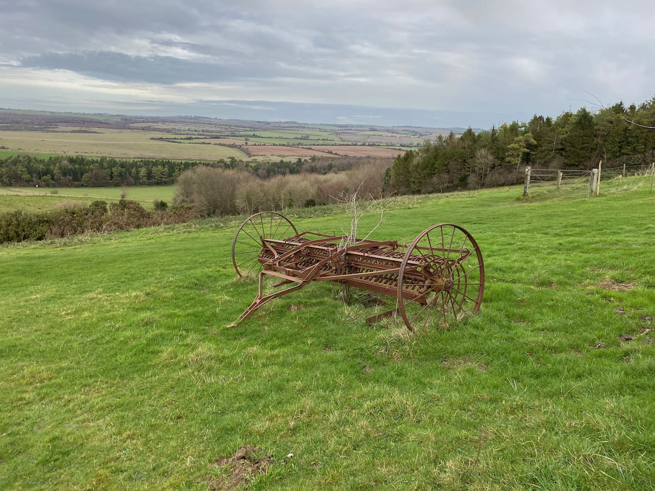
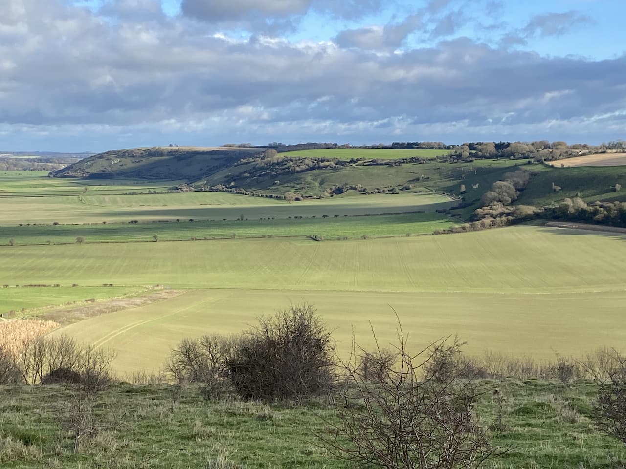
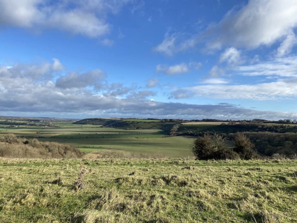
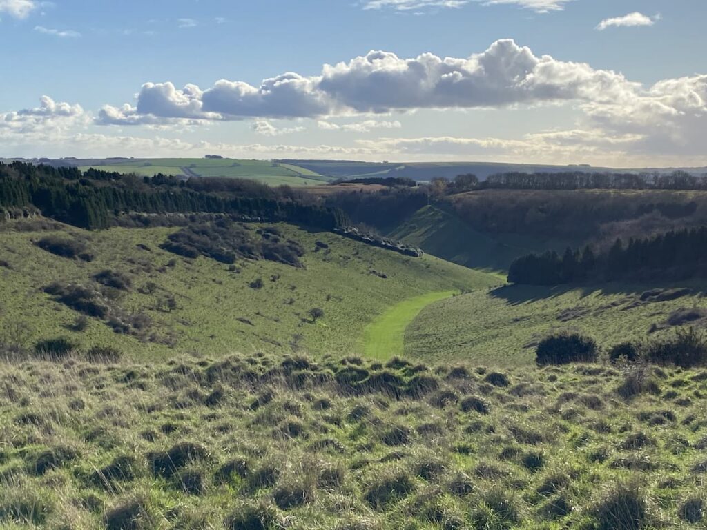
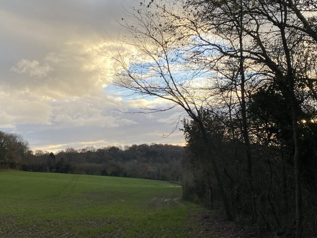
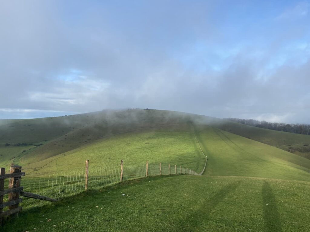
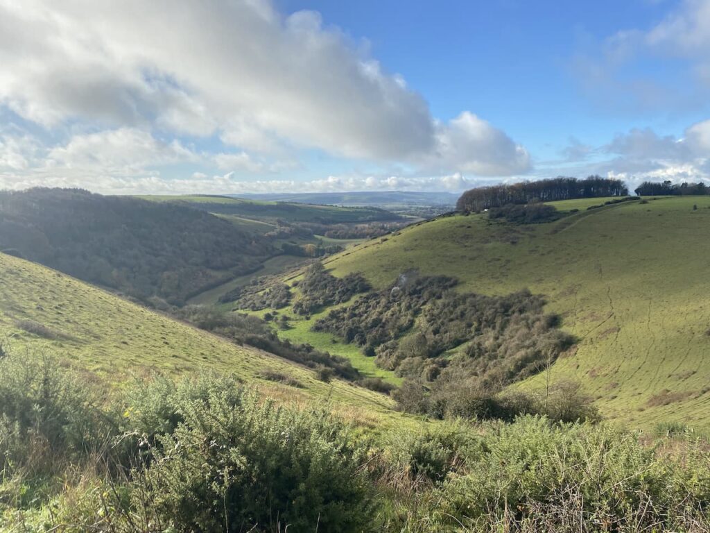
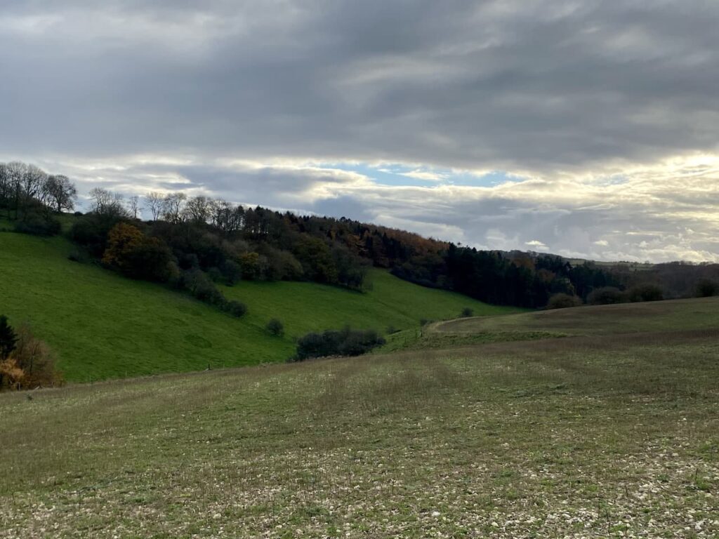
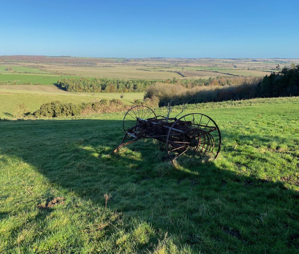
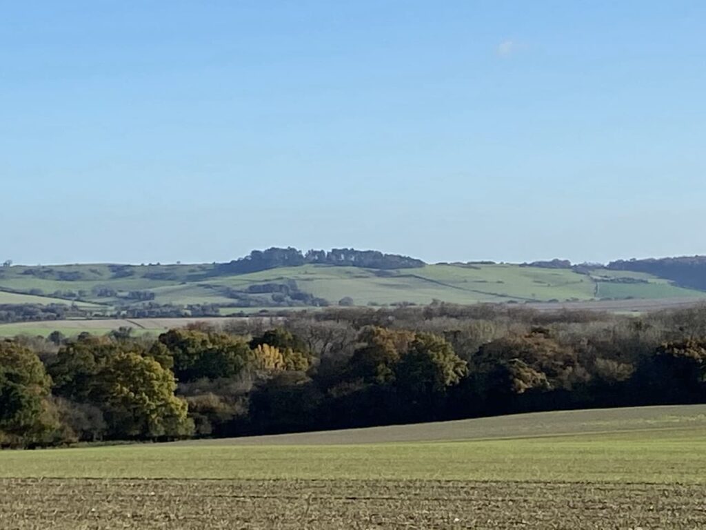
    The track now ascends Little Dunford Hill and after going through trees we get some cracking views across the valley.

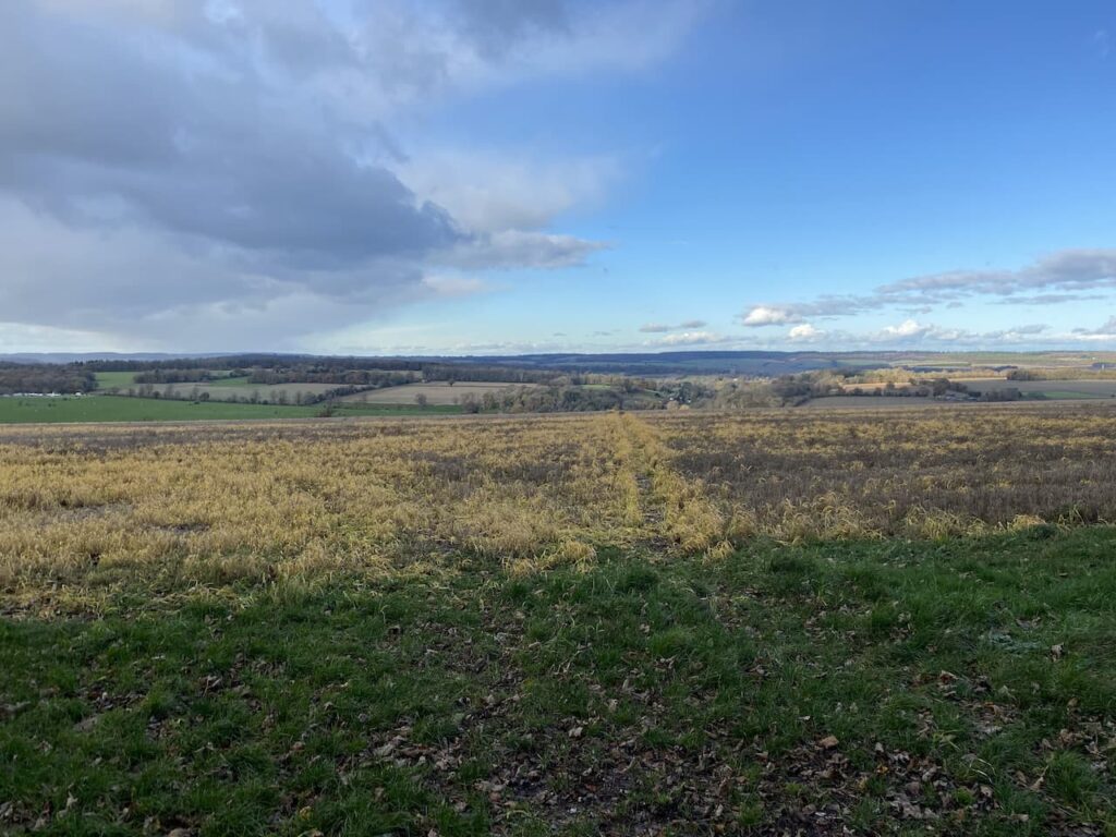
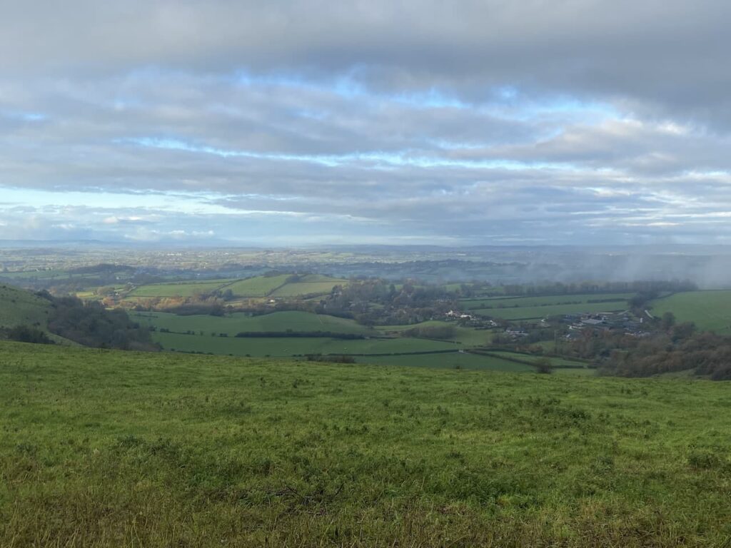
    At a junction of tracks, where the Monarchs way crosses the route, we keep straight ahead and a few hundred yards further on take a footpath on the left.  The track passes fields and then reaches a concrete road.  This road was part of the site of the old High Post Airfield, which opened in 1931 as a civil airfield, the site came a military base in World War II.  

    When the manufacture of Spitfires was disbursed from Woolston following the bombing of the Supermarine Works one location used was Salisbury.  Various sites were commandeered around the City and sections manufactured then transported for final assembly and test flying at this airfield.  My maternal Grandfather worked for Supermarine in Southampton and was moved to Salisbury to be the Foreman for the assembly and installation of the fuselage at the Wessex Garage in New Street, Salisbury.  

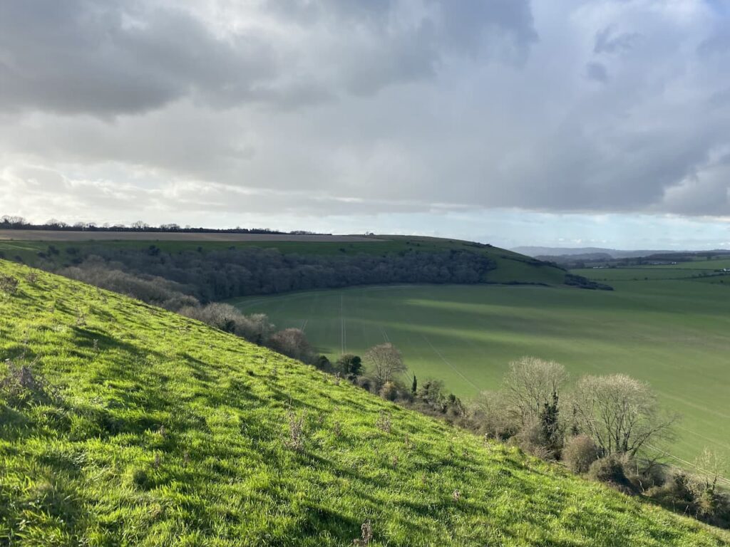
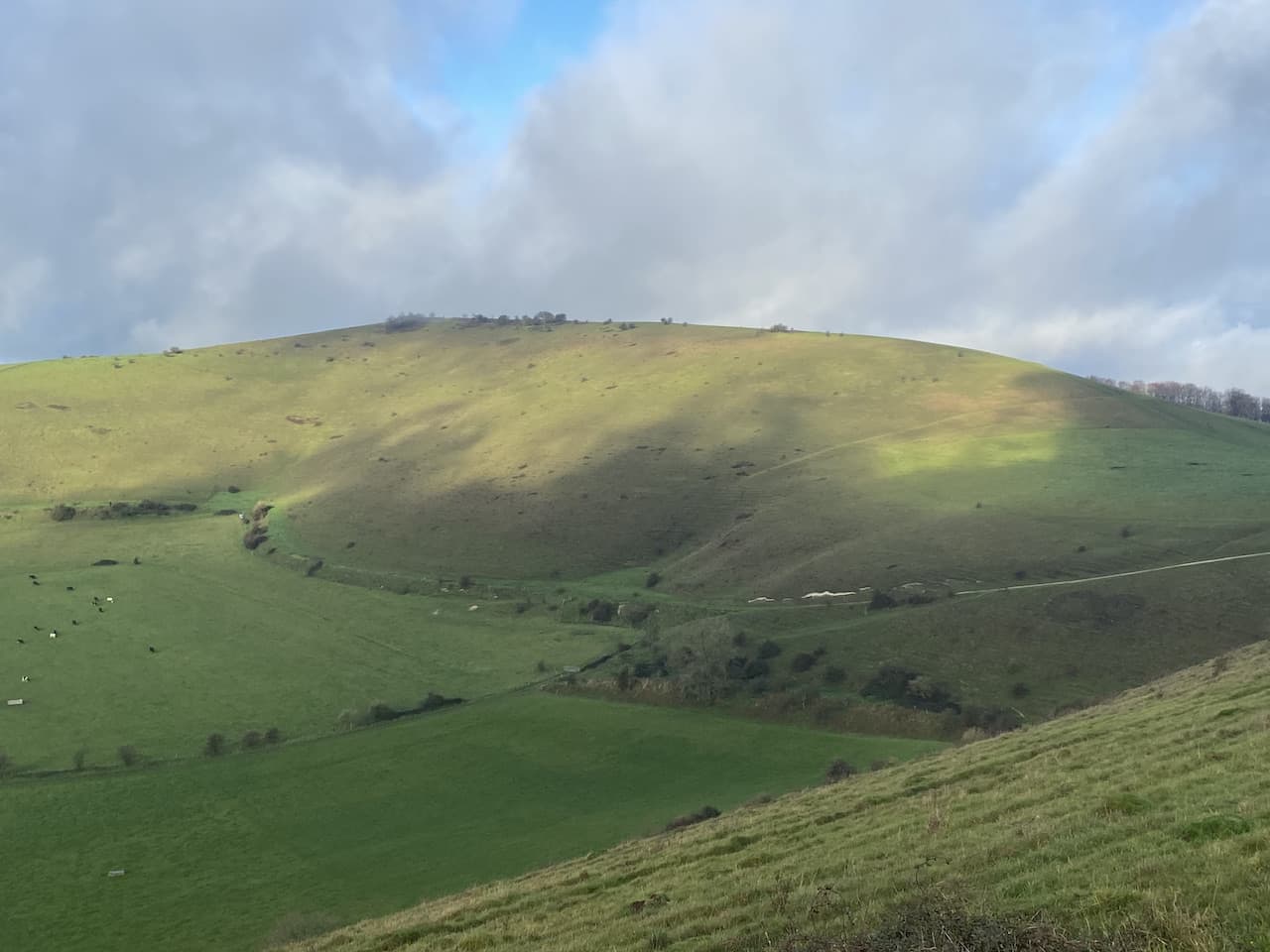
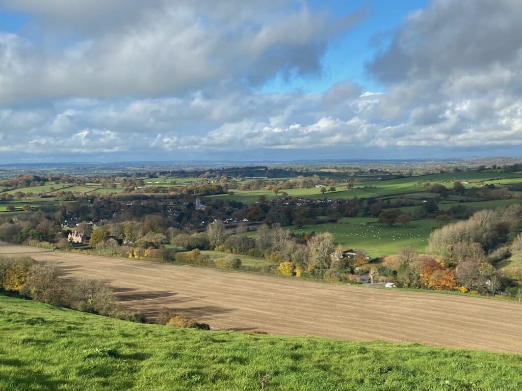
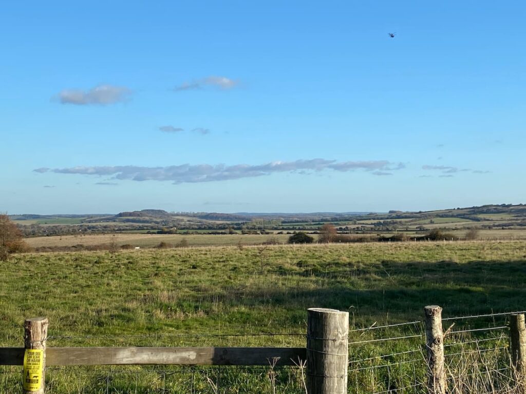
    On reaching a minor road we turn right and then very quickly take a road on the left signposted to  Durnford.  This road runs alongside the site of the Chemring Factory, but for years this was the location of Pains Wessex Fireworks.  The road starts to descend Jubilee Hill giving good views up the valley.

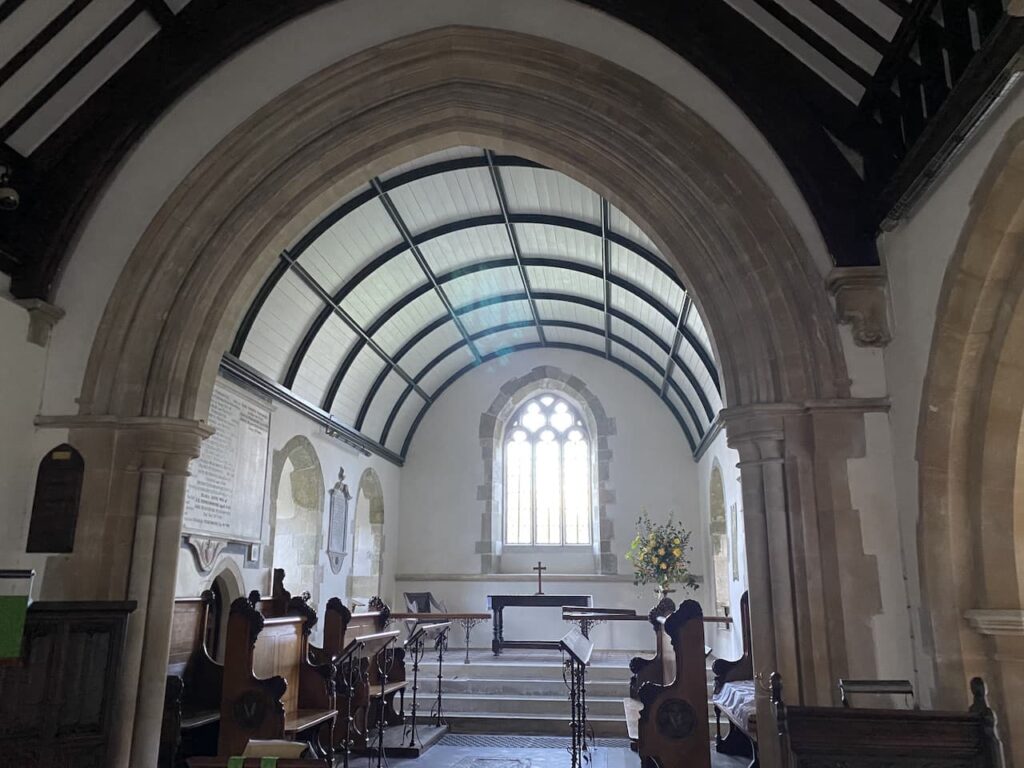
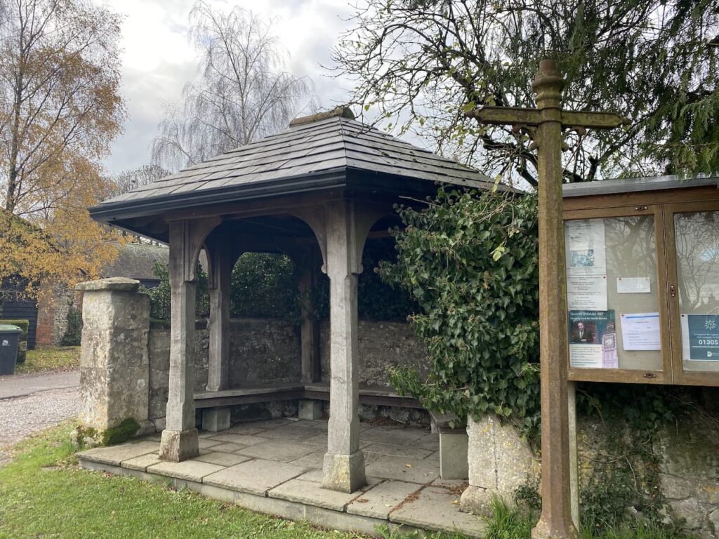
    As we reach the houses in Great Durnford we turn right on a footpath that heads through a field to reach a track.  Here we turn left and descend to the village and make a brief diversion to visit the Norman church of St Andrew.

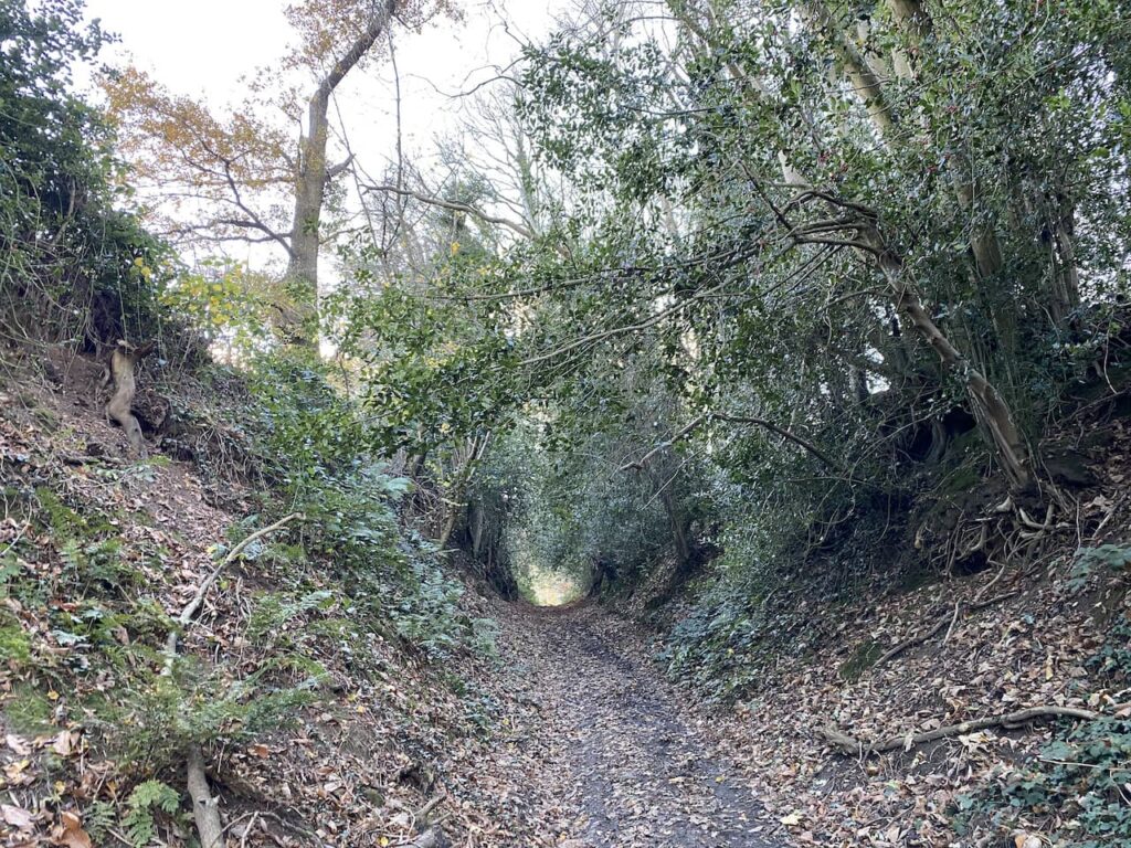
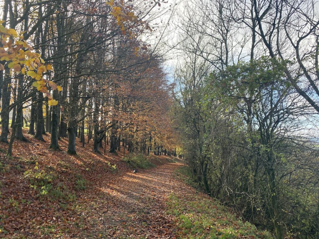
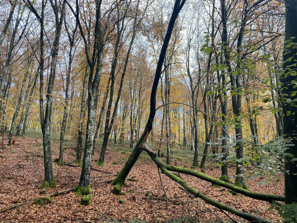
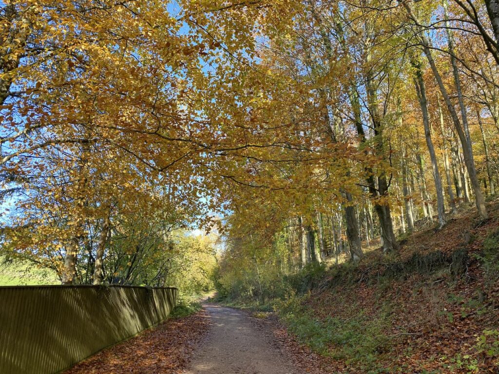
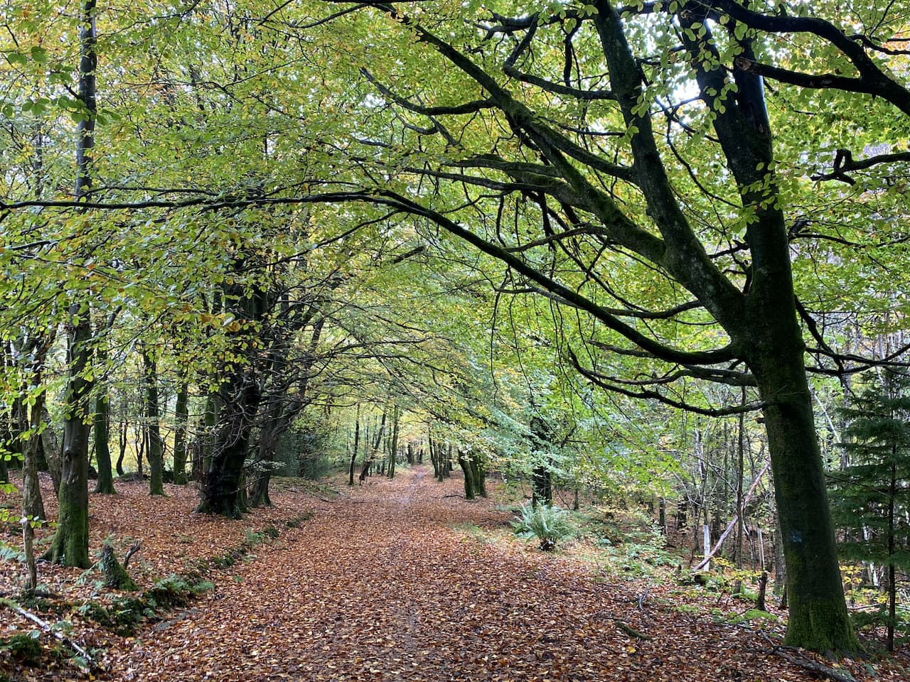
    Returning to the road we head north through the village around the boundary of Great Durnford Manor.  The road descends and then we take a footpath along a track which heads north into Ham Wood.  After heading through the trees we continue along the clear track.  

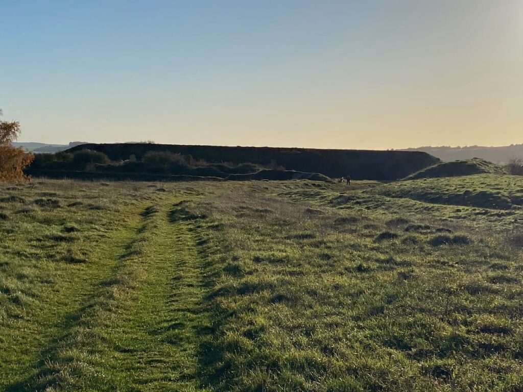
    At a fork in the path we go right keeping with the top of the ridge and then it steadily descends to a large disused chalk pit.

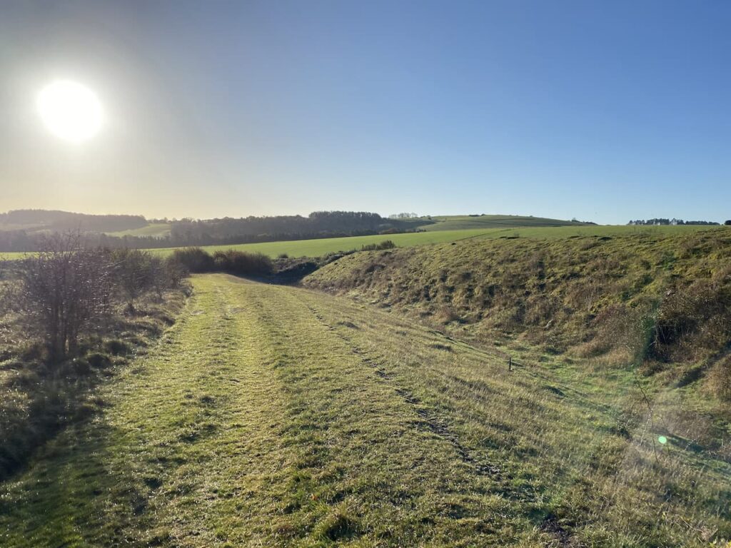
    We now turn and take a path heading south along the bottom of the downs until we reach a path on the right which we take and follow footbridges over branches of the River Avon.

    We continue on the path to cross the main branch of the River Avon and then continue into Normanton.

    At a minor road we turn left and stay with this road until we reach the lane leading to Wilsford church.  There is a suitable bench here for us to stop for lunch. Refreshed we continue down the lane to visit St Michael’s church.

    After visiting the church we return up the lane and then turn right onto the minor road for a few hundred yards before turning left on a track heading west and steadily uphill.

    Now we go downhill and pass Springbottom Farm and then turn left and follow a path into Lake Bottom.

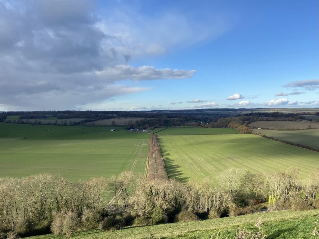
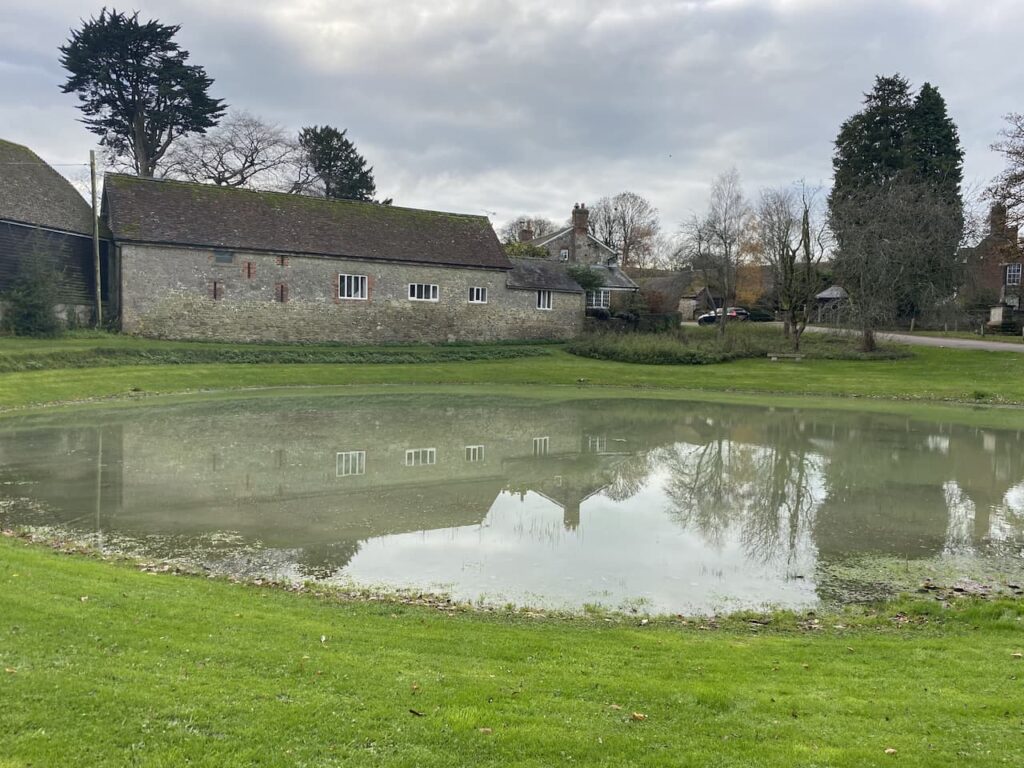
    At a junction of paths we turn right and follow the path along the top of a field with woods to our right.  Below us is Lake House.  This house originates from 1578 with various additions made over the years.  It was gutted by fire in 1912 and was added to in 1933.  In 1990 it was purchased by the musician Sting and he is actress wife Trudie Styler.

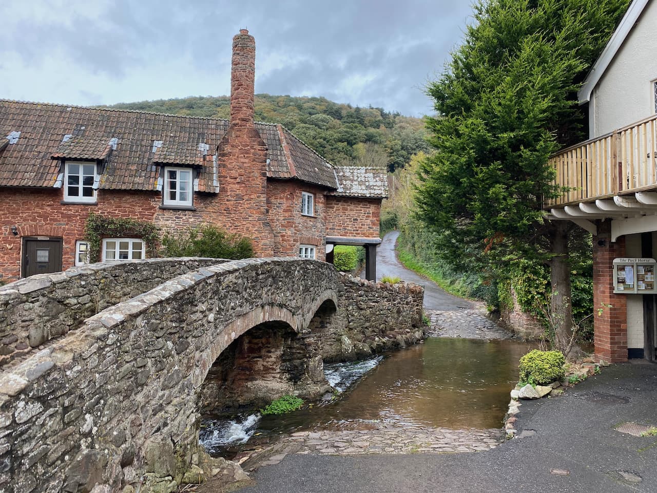
    Reaching a minor road we cross and join a track heading steadily downhill towards the River Avon.  At a junction of paths we do not cross the river but stay on a footpath keeping to the west of the river to enter Upper Woodford.  At a minor road in the village we turn left soon passing The Bridge Inn.

    The road leads through the village and continues past the entrance to Heale House and then into Middle Woodford passing All Saints Church.  

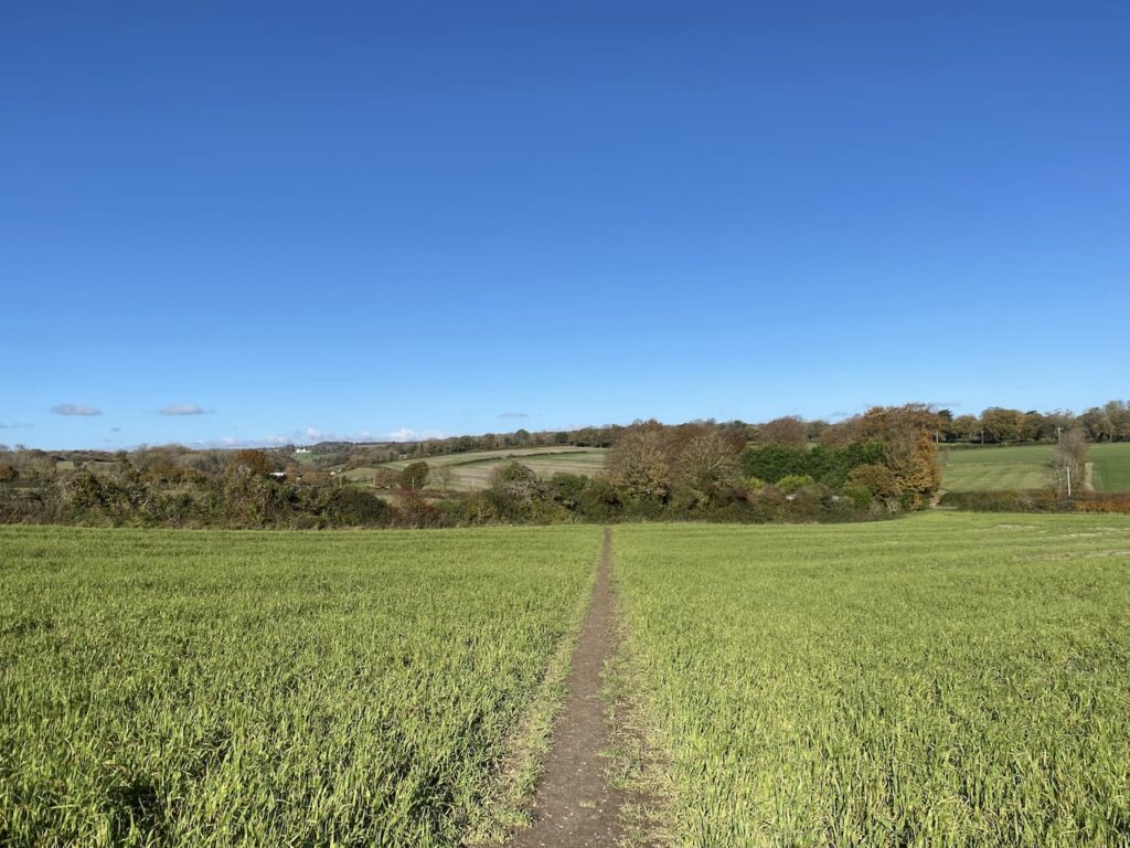
    We stay with the road, which is also the route of the Monarchs Way, until we reach a footpath on the right.  Here we follow the Monarchs Way markers and head across a field.  We cross a minor road and continue over fields towards another minor road.

    After crossing the road our path is through fields towards meadows following the way markers to reach the driveway to Little Durnford House.  We turn left and follow the driveway over  the river and then past a series of paddocks with a variety of animals.

    The driveway leads to a minor road where we turn right and follow this road back to our starting point.  We have covered 15 miles and kept dry which is a bonus for a walk in December.

    You can view this 15 mile walk on OS Maps and download the GPX File Here

    To follow this walk you will need Ordnance Survey Explorer Map OL130 Salisbury & Stonehenge

    17th December 2020

    © Two Dogs and an Awning (2020)

    All information on this site is provided free of charge and in good faith and no liability is accepted in respect of damage, loss or injury which might result from it.  To the best of my knowledge the routes are entirely on public rights of way or within areas that are open for public access.
    Walking can be hazardous and is done entirely at your own risk.  It is your responsibility to check your route and navigate using a map and compass.

  • Visiting Pentridge and Martin

    Visiting Pentridge and Martin

    Today Lynnie and are walking with our friends Wendy and Gary who we have known since they moved into the village just over a year ago.  In normal circumstances I am sure we would have done a fair bit of socialising with them, but this year has been anything but normal.  So apart from the occasional drink in the garden during the summer and a weekly videocall call we have not seen a lot of them.  So it will be good to get out for a few hours and have a chat and try to put the world to rights.

    Even though we live in the same village we travel separately to the car park on Martin Down Nature Reserve besides the A354.  The weather forecast suggested there would be early morning rain, but a good chance the rest of the day would be dry and chilly.  So arriving at the car park we layer up and boots on we head off.

    We start from the southern end of the car park, passing a metal barrier beside some information boards. Initially the path heads through shrub, but then opens out onto the vast expanse of the nature reserve, there are over 850 acres of protected land here providing a haven for flora and fauna.  

    We follow the track towards the dominant rifle range butt in front of us.  This area of the downs was used as a military rifle range up until the 1950’s and evidence of this is strewn across it. Before reaching the butt we take a path on the right to head across towards the Bokerley Dyke.  This ditch is thought to have been built during the iron age and fortified in the 5th century.  It runs for around 3.5 miles and is an impressive structure.

    At the dyke we pass through to reach the fence-line of a field. Entering the field we take a footpath on the right and continue along the edge of the field with the fence to our right.  The path follows around the edge of the field and we are soon heading south with a hedge line on our right. 

    At a junction of paths we continue straight on to reach a gate besides a crossing of paths.  Here we continue along a hedge lined path still heading south towards Pentridge.

    As the path reaches farm buildings it becomes a tarmac lane, Earthpits Lane, and we stay with this to walk into the village.  At a sign for the church we turn right and wander up to visit the fine church of St Rumbold which apparently was rebuilt in 1855 in a 14th century style.

    From the church we head back to Earthpits Lane and turn right for thirty yards to take a footpath on the left leading up a driveway before heading left across grass to a narrow path besides a fence.  It is a gradual ascent to a stile leading into a pasture field.  The path continues by the fence line and then as the fence turns to the right we continue straight on towards a stile.  From here there are cracking views.

    After crossing the stile we continue up Penbury Knoll and visit the Ordnance Survey trig pillar.  I have visited this trig on a number of occasions but it is always worth a re-visit.

    From the trig we head north east on a track across the access land.  This track follows a fence to our right and we stay with it as the fence turns to the north.  At an abandoned old hay rake we turn to the right and go through a gate.

    We now follow a path along the edge of an arable field and then pass Blagdon Plantation.  On reaching a track we turn right and then take the second footpath on the left to head along the side of attractive woodland.

    The footpath reaches Martin Down and crosses the Bokerley Ditch.

    Now we follow a path that runs besides a Grim’s Ditch.  This is a common name for earthworks of this type which are found across chalk downland in southern England.  Their purpose is unclear, too small to act as military defences it is thought that they marked territorial boundaries in the Iron Age.

    We follow the ditch to reach a footpath where we turn left and head north along a track, this starts to descend with views towards the village of Martin in front of us. 

    We stay with the track as it leads to the edge of Martin Down and then continue along a hedge lined track leading towards Martin.  In the village we turn left and walk along the road, Martin Drove End, until we reach a sign towards the church.  Here we turn and wander up to see if we can locate the Ordnance Survey benchmark on All Saints Church.

    Apparently parts of this church date back to 12th century, with the tower being built in the 13th century and then late in the 18th century a spire was added.

    From the church we head back to Martin Drove End and turn right soon reaching a village green with an old pump above a covered well.  

    Also on the Green there is a millennium cross showing it is 37.5 miles to Glastonbury.  Apparently the significance of this is that back in 945 Edmund, King of Mercia bestowed the Damerham and Martin Estate to his wife Ethelfled on the condition that she should leave it to the “ancient church of the blessed Mary in the monastery of Glastonberi”, the Abbot of Glastonbury held a manor which included the village for many centuries. Close to the millennium stone is the base of the old market cross the history of which appears hard to determine.  But it is thought to date from the 5th century.

    From the green we head west along Sillens Lane to leave the village.  This road leads to a car park on the edge of Martin Down.  Here we keep heading west across the downs until we reach a junction of paths besides a Grim’s Ditch.  Here we follow a clear track heading northwest towards the rifle butts. 

    After passing the rifle butt we continue along the track to reach our starting point in the car park.  Our walk has covered almost eight miles.  The weather has been fine and not as cold as forecast and it has been great to get out and catch up after the recent Covid-19 lockdown.

    You can view this 8 mile walk on OS Maps and download the GPX File Here

    To follow this walk you will need Ordnance Survey Explorer Map OL130

    4th December 2020

    © Two Dogs and an Awning (2020)

    All information on this site is provided free of charge and in good faith and no liability is accepted in respect of damage, loss or injury which might result from it.  To the best of my knowledge the routes are entirely on public rights of way or within areas that are open for public access.
    Walking can be hazardous and is done entirely at your own risk.  It is your responsibility to check your route and navigate using a map and compass.

  • Trigs and Handsel Sisters in Grovely Wood

    Trigs and Handsel Sisters in Grovely Wood

    I am continuing my quest to walk areas close to home I have not previously explored.  So today I am off to Grovely Wood on the west side of Wilton for a walk with my friend Mandy.  There are a number of options for parking around the woods, we choose the small car park on Grovely Road to the south west of Great Wishford.

    We start our walk by heading up the forestry track into the woods on the route of the Monarch’s Way.

    It is a steady ascent through the trees and we stay with this track until meeting a crossing of tracks close to Grovely Lodge here we turn right along a wide track and soon pass a gate and continue along the track.

    After passing Four Sisters Copse we leave the main track and follow a path through the trees heading northwest towards the Little Langford Down Nature Reserve.  Like much of Grovely Wood this is open access land so there are no way markers and we take care to ensure we skirt the top of a valley before turning north through Langford Woods.

    This is a stunning section of woodland maintained as a nature reserve by the Wiltshire Wildlife Trust.

    We stay with a broad ride through the trees to reach the northern end of Langford Woods where there is a barbed wire fence.  This marks the edge of the access land.  Here we make a brief excursion into the field to bag the Ordnance Survey trig pillar on the ramparts of the Grovely Castle Iron Age hill fort.  

    This is the 233rd trig I have bagged and the views from here are stunning.

    We spend a few minutes just taking in the far ranging views and once again I am blown away by the beauty of the Wiltshire downland.

    Back in the woods we retrace our steps through the nature reserve, this time when we reach the top of the valley we fork right on a ride passing and area marked on the map as Powten Stone.  I had hoped this would mean there was a stone here we could seek out, but whilst planning the route I discovered that despite much searching the location of the stone is unknown.

    On reaching a junction with a footpath following the line of a Grim’s Ditch we turn right following the path as it goes along the edge of the woodland besides the ditch.  A Grim’s Ditch is not an uncommon site when walking on chalk downland.  Apparently their exact purpose is unclear, they are not large enough for military purposes it is therefore thought they were used to mark territorial boundaries and date from around 300 BC.  The ditch is to our right and we soon pass a small pond.

    Our route is now very straightforward, we stay on the path along the edge of the woodland with the occasional clearing to our right giving stunning views.

    We pass a barn and stay with the track until we reach a minor road at Dinton Beeches, here we turn right along the road for a couple of hundred yards to make a brief diversion from our route to visit the Ordnance Survey trig pillar at West Hill, my 234th.

    This is another trig with great views across the Wylye Valley. Now we head back along the road to Dinton Beeches and take a track into the trees which heads south.  At a junction of paths we turn left and head along the southern edge of the copse to reach a minor road.

    We cross and pass a parking area and head along the drove on the route of the Monarch’s Way.

    The Monarch’s Way is a long distance walking route retracing the journey made by Charles II after the battle of Worcester.  The 615-mile route starts from Worcester and after a convoluted route reaches the Dorset coast and then heads east to finally end at Shoreham-on-Sea.  Over recent years I have walked a number of sections of the route, but this is the first time I have walked this stretch.

    This track is also an Ox Drove, a common term in this area for a track which was used to drive cattle to market.  This particular route linked Chicklade and Wilton. 

    The route is easy to follow we stay with the Monarch’s Way along the Ox Drove passing through farmland to reach a junction of paths with Fir Drove, here we stay with the Monarch’s Way to head uphill heading east.

    At a junction of tracks before reaching West Thornhills copse we leave the Monarch’s Way, which forks to the left, and take the right fork staying on the Ox Drove passing the copse and carrying on to reach East Thornhills.  Here we take a diversion from the track to hop into the field to bag the clearly visible trig point on Crouch’s Down, my 235th.

    When bagging trig points on arable land I always seek to visit them at a time when there are no crops in the field.  This is perfect, the field is still stubble from last year’s harvest.  This is another trig with cracking views.

    Back on the Ox Drove we continue east, ignoring footpaths off the main track to reach a junction at the end of a minor road.  There is a small parking area here and at the crossway of paths there is a milestone with the inscription “VI Miles from Sarum 1750”.

    We continue on the Ox Drove heading east and the track now heads uphill with more stunning views.

    Then we come across another milestone to the right of the track.  This is a large stone but the inscription has eroded.  We can just make out a “V”, but the rest is too faint to read.  Apparently it said “V Miles to Sarum 1750”.

    We come to a crossing of paths, but continue straight on towards Ugford Red Buildings.

    At a junction of paths by the farm buildings we turn left and keep left as the path forks, this takes us along a line of attractive beech trees.  

    As we near a hedge line of a field we take a diversion to follow the hedge line south to the Ordnance Survey trig pillar on Grovely Hill.  I have previously bagged this trig, but it is worth a revisit.

    Leaving our fourth trig of the day we walk back to the footpath and then continue north west through the trees.  At a junction of paths we turn right and then after a couple of hundred yards take a left along the wide track called First Broad Drive.  After 650 yards, just before the Grim’s Ditch joins the drove, we turn left into the trees in search of the Handsel Sisters.  These are ancient beech trees within this section of pine woodland.

    The Handsel sisters were born in Denmark and moved to the Wilton area.  Soon after they arrived an outbreak of small pox claimed 136 lives.  Locals were convinced the sisters were responsible for the deaths and they were accused of witchcraft and an alliance with the devil.  Without an official hearing they were taken to Grovely Woods and bludgeoned to death.  They were then buried some distance apart to stop them conspiring against their murderers.

    There are conflicting tales about the origins of the beech trees, one is that they were planted to mark the graves as a warning to others who might consider practicing witchcraft.  The other is that the trees grew on top of the unmarked graves as a reminder to locals of their murders.

    Of the four original trees three remain.  The largest of the trees is strewn with offerings to the sisters.  There are reported sightings of the ghosts of the sisters in this area of the woods and pages on the internet dedicated to the spooky goings on here.  I am not sure what to believe, but the trees have grown in a very strange way and there is certainly a feel about this area that made me slightly uneasy.  I would definitely not wander up here after dark!

    Back on the First Broad Drove we head west to soon pass a permitted bridleway on the right.  

    A few hundred yards further on at the next ride we turn right and follow this to a five ways junction of tracks here we go left following a ride going northwest and keep heading in this direction at two further ride junctions.  The path we are on starts to descend steadily towards the forestry track we had started our walk on.

    On reaching the track we turn right and walk a couple of hundred yards back to our starting point.  Our walk has covered just over fifteen miles.  It has been a cracking day with sunshine all round and some stunning views.  I am sure I will be returning here again very soon to walk with Lynnie.

    You can view this 15 mile walk on OS Maps and download the GPX File Here

    To follow our walk you will need Ordnance Survey Outdoor Explorer Map OS 130 Salisbury & Stonehenge 

    26th November 2020

    © Two Dogs and an Awning (2020)

    All information on this site is provided free of charge and in good faith and no liability is accepted in respect of damage, loss or injury which might result from it.  To the best of my knowledge the routes are entirely on public rights of way or within areas that are open for public access.
    Walking can be hazardous and is done entirely at your own risk.  It is your responsibility to check your route and navigate using a map and compass.

  • The Old Shaftesbury Drove from Fovant

    The Old Shaftesbury Drove from Fovant

    We are in the midst of a second lockdown so my walking in the last few weeks has been restricted to being out with one other person.  When I was planning my walking for this week and checking with Lynnie if there were any days I should avoid she asked “When is it my turn to come out walking with you?” So today it is Lynnie’s day for a walk!

    We start out from the small parking area close to St George’s Church, Fovant (SP3 5LA) (Grid Ref: ST996295) and head south along Church Lane to walk back towards the village.  On reaching a grass triangle with a bench we turn right into Moor Hill.  As the road bends to the right we take a track on the left that soon leads through hedges.

    We stay on this track for just over half a mile to the outskirts of the village of Sutton Mandeville.  Here we turn right towards the village along a lane, Sutton Hill.  At a sign to the church we turn right to make a detour to visit the 13th century church of All Saints. The tower was added to the church in the 15th century and restoration work carried out in 1862.  In the churchyard there is an unusual sundial.

    Leaving the church we head back to Sutton Hill and turn right to continue along the lane and stay with this to pass Cromwell Manor. At a junction of roads we turn right and follow Lagpond Lane.  At the point where this lane turns sharp to the right we take a drove on the left, Hut Lane Path, towards the A30.  Hut Lane gets its name because it was the route to Cribbage Hut public house, this is now closed and known as Lancers House.

    After crossing the A30 we continue straight on along another track, Buxbury Hollow, which heads towards woodland where it starts a steady ascent up Buxbury Hill.  After going through a gate onto access land we continue up the track.  At a fork in the path we go left, there are stunning views along the escarpment from here.

    Following a grassy track we reach a gate and go through to take a path along the edge of the next field with a fence to our right.  This leads to another gate, after going through we join the Old Shaftesbury Drove and turn left.  Dating from medieval times this was the main route between Salisbury and Shaftesbury and drovers would lead cattle and livestock along this route.  These days it is a popular route for people who gain pleasure from driving their 4X4 vehicles along country tracks, as a result many sections have deep puddles making it necessary to skirt around on the muddy banks.

    We stay with the drove, ignoring footpath to the right and left to reach the Fovant Hut.  Now a private home this was once the location of an Inn on the drover’s route.  According to the local history group this inn dates from around 1757 when the landlord was a chap called William Kennell.  Apparently there is no record of when it ceased to be a pub, its demise brought on by the turnpiking of the Lower Road (now the A30) in 1787.

    After crossing a minor road we pass disused poultry houses on the right and continue along the drove.  This section of the route is less rutted and is easy going.  We pass the Chiselbury hill fort on our left and stop to admire the contours of Gurston Holes.

    At a crossing of footpaths besides a reservoir we go left through a gate, leaving the drove, and head across an arable field.

    After crossing a stile we enter Access Land on Compton Down.  There are splendid views along the escarpment from here.  During World War I the fields below were the location of Army Camps for troops preparing to fight in the conflict.

    Our route goes straight down the steep escarpment with an avenue of trees in front of us as our bearing.

    At the foot of the hill we cross a stile and then join the tarmac track between the trees heading towards Manor Farm.

    After passing the farm buildings and houses we reach the A30, here we turn right and then soon cross with care to take the road leading into Compton Chamberlayne.  As a nipper I recall coming to this village to watch my father play cricket, the ground was tucked in between the lane we are on and the A30.  Sadly like so many village cricket clubs this one has folded and the ground is no longer used.  As we enter the village we reach the cemetery on our left, this is the location of a number of Commonwealth War Graves.

    Reading the names and regiments of those buried here is a poignant reminder of the tragedy of war.  Many of these graves are for Australian servicemen.  Some of whom, just boys, had joined up to fight and spent months travelling by sea, leaving the Australian summer to arrive in a British winter, sadly their lives were ended by respiratory disease.

    Leaving the cemetery we continue through this attractive village to reach St Michael’s Church. This church was originally built in the 13th century with additions in later years, in 1877 a major restoration was undertaken paid for by the villagers.  

    We briefly pop inside to admire its impressive interior.

    Leaving the Church we turn right and then almost immediately take a footpath on a track on the left.  This leads steadily uphill and becomes a fine sunken track.

    As the path levels out it continues besides woodland to reach Home Farm.  Here we keep heading west along a farm track, passing barns and then continuing between fields.  From here we get a good view of the Fovant Regimental Badges.   These were created by soldiers garrisoned in the valley below the Downs during World War I.  The first badge was cut in 1916 and a further nineteen badges were created.  Of the originals nine remain and further badges have been added to the surrounding downs.  

    The path now leads along the edge of woodland with a steep slope to our right.  On reaching a track, Green Drove, we turn right and head steadily downhill.

    At a junction with a road we turn left and walk along the road, Catherine Ford Lane, with military security fencing to our right.  As the lane bends to the left we take a footpath on the right and then within a few yards another on the left to head along on the edge of a field with a hedge on our right.

    Following the footpath signs we leave the field and enter woodland and descend gradually to reach a bridge over a stream.

    The path continues besides the stream and then joins Church Lane where we turn right and return to our starting point.  Our walk has covered eleven miles on a cracking November day.  There have been showers about but thankfully we have avoided getting wet.  As we leave Fovant on the A30 we spot a stunning rainbow so pull into a lay-by to capture the scene.

    You can view this 11-mile walk on OS Maps and download the GPX File Here

    To follow our walk you will need Ordnance Survey Outdoor Explorer Map 118 Shaftesbury & Cranborne Chase and  OS 130 Salisbury & Stonehenge 

    19th November 2020

    © Two Dogs and an Awning (2020)

    All information on this site is provided free of charge and in good faith and no liability is accepted in respect of damage, loss or injury which might result from it.  To the best of my knowledge the routes are entirely on public rights of way or within areas that are open for public access.
    Walking can be hazardous and is done entirely at your own risk.  It is your responsibility to check your route and navigate using a map and compass.

  • A White Horse and Moonrakers

    A White Horse and Moonrakers

    At the start of the year my walking buddy Mandy suggested we try to visit all the Wiltshire White Horses in 2020.  Normally this would not be too difficult to organize, however the travel restrictions around the Covid pandemic has made it more challenging.  Today we are setting off to the Pewsey Vale to bag the Alton Barnes White Horse and in the process also visit Milk Hill the second highest point in Wiltshire.

    The starting point for our walk is the free car park at Walkers Hill besides the road between Alton Barnes and Lockridge (Grid Ref: SU116638).  Leaving the car park we cross the road and go through a gate and then immediately take a gate on our left and follow the path to reach another gate.  In front of us is Walkers Hill but we take a path that goes to the right and gradually ascends to get fine view across the Pewsey Vale.

    The path is clear and easy to follow and we soon get a great view of the Alton Barnes White Horse.  Originally there were thirteen White Horses in Wiltshire, but now only eight remain. This horse was first cut in 1812 when Robert Pile of Manor Farm in Alton Barnes paid twenty pounds to John Thorne, known as Jack the Painter, to design and cut the horse.  

    With the white horses at Pewsey, Devizes, Marlborough, Cherhill, Hackpen Hill, Broad Town and Westbury in the bag this one today completes the full set.  As we continue our walk on the path above the white horse we discuss which has been our favourite.  The most impressive is Westbury, but as that is now concrete we are not sure it really counts, on balance I favour Cherhill and we agree the most disappointing is Marlborough.

    We are following the route of the White Horse Trail and we stay with this as we head around the top of the downs enjoying stunning views.

    We are now on Milk Hill, the highest point in Wiltshire standing at 968 feet above sea level.  It is said to be 26 centimetres higher than its neighbour Tan Hill.  We stay with the White Horse Way until we reach a track where we turn left and then at a junction of paths continue heading west on a path that follows the impressive medieval earthworks.

    We stay with the path on the earthworks for just over a mile and then at a junction of paths turn left to follow a path heading south along the edge of a field.  The OS Map shows there is trig point just over the fence, but from research prior to setting out today I know that it has been moved to the south west corner of the field so we continue on the path until we reach a junction of fences and then take a brief detour to visit the relocated Tan Hill trig pillar.  

    This trig is the 232nd I have bagged.  It is disappointing it has been moved, but rather that than destroyed.  It is not the first I have come across that is not in its original location, but the views from here are still impressive and we can see the Cherhill Monument in the far distance.

    From the trig we head back to the path and follow this downhill through cattle to go through a gate to reach a junction of paths.

    We take the right fork following the path to meet a minor road at Cannings Cross Farm.  Here a notice states this is the site of the real Moonraker Pond.  Legend has it that in the 1780’s locals hid smuggled contraband in a pond to avoid the revenue men. Whilst retrieving it the revenue men arrived and the locals explained their activity by pointing to the moons reflection in the pond and saying they were trying to rake the big cheese from the pond. The revenue men laughed thinking them simple folk and went on their way.  The contraband was then retrieved.  This tale has led to people born in Wiltshire being known as Moonraker’s, a term that applies to both Mandy and I.  However, there are many ponds in Wiltshire claiming to have been the source of this tale and strangely there does not appear to be a pond marked on the map at Cross Cannings Farm.

    The footpath leads through the farm and then continues across fields.  To our right the map shows a long barrow so when we reach a track we turn right to make a slight detour to explore.  This is a modern Long Barrow built in 2014 to enable 340 people to have their ashes interned.  It has been aligned so that the sunrise of the winter solstice lights up the internal chamber.

    Returning to our route we go back along the track and then cross the Woodway Bridge over the Kennet and Avon Canal and immediately turn left to join the canal towpath.  Over recent years I have walked many sections of the canal, but this is new to me.  It appears a number of permanent barge dwellers are moored here.

    We stay with the towpath to pass under All Cannings Bridge (No.127) and continue on until we reach England’s Bridge (No.126).

    It is around lunchtime so we decide to leave the canal and cross the bridge to wander into Stanton St Bernard to visit the church and hopefully find a bench for lunch.  In the field beside the track we see a World War II pillbox.  This is one of the many pillboxes along the Kennet and Avon Canal and formed what was known as the Blue Line.  This was one of a number of “Stop Lines” that were established in the event of a German invasion during the war.

    We soon reach All Saints Church.  There was originally a church here in the 13th century which had a tower added in the 15th century.  In 1832 all the church apart from the tower was rebuilt.  As anticipated we find a bench in the churchyard which is an ideal spot to stop for our refreshments.

    The church is locked so we are unable to look inside.  It is not clear if it is locked due to concerns about Covid or for security.  Either way I find it odd that buildings traditionally providing people with a place for reflection and sanctuary are locked, especially at times when so many are struggling with the impact of the pandemic. We continue our walk and Mandy, who unlike me is a believer moans about the church hierarchy and its locked church policy.  I think a letter to the diocese will be winging its way soon after she returns home.

    Rather than retrace our steps to the canal we decide to walk through the village and rejoin it at Stanton Bridge.  This is straightforward and we keep right at every junction until we get to the canal where we rejoin the towpath heading east.  This soon leads us to the Barge Inn at Honeystreet.

    We now have over three miles on the canal towpath as it heads east.

    After two miles we reach the ornate Ladies Bridge built by John Rennie in 1808.  The design was at the behest of local land owner Susannah Wroughton and the reference to Ladies refers to her and her daughter, also named Susannah.

    Almost a mile from Ladies Bridge we reach Wilcot Bridge.  Here we leave the towpath to join a minor road running parallel to the canal.  After a few hundred yards the road bends to the left away from the canal and we start to head steadily uphill.  At a junction we go left and then almost immediately right.  Reaching a crossroads we go straight across on a road signposted to Huish and Draycot and soon reach Draycot Farm.

    The road bends to the north and we stay with it for a few hundred yards and then as it turns to the right we go straight on along a footpath into a field. After a second gate the path starts to steeply ascend Draycot Hill.

    At the top of the hill we go through a gate and join the Tan Hill Way and Mid Wilts Way heading west.  This is a cracking hill to walk along with numerous inlets with great contours.  They look spectacular on the map but even better when viewed from above.

    The path is well marked and passes through gates and by a large dew pond.  These ponds are a common feature on chalk downland.  They were dug out and lined with clay so they filled naturally with rainwater, thereby providing drinking water for the grazing livestock.  

    For the last couple of hours rain has threatened, now it arrives.  We are walking directly into the wind with no protection from the elements so we quickly don our full waterproofs.

    The route is now very straightforward, the well worn path leads us back to our starting point at the car park.  Despite the last half hour of rain our walk has been a cracking 15 mile route.  

    You can view this 15 mile walk on OS Maps and download the GPX File Here

    To follow our walk you will need Ordnance Survey Outdoor Explorer Map – 157 – Marlborough & Savernake Forest

    11th November 2020

    © Two Dogs and an Awning (2020)

    All information on this site is provided free of charge and in good faith and no liability is accepted in respect of damage, loss or injury which might result from it.  To the best of my knowledge the routes are entirely on public rights of way or within areas that are open for public access.
    Walking can be hazardous and is done entirely at your own risk.  It is your responsibility to check your route and navigate using a map and compass.

  • Melbury Beacon and Ashmore

    Melbury Beacon and Ashmore

    There are not many positives coming from the Covid-19 pandemic, but one is that I have done a lot more walking closer to home.  In normal circumstances Lynnie and I travel a lot in the caravan, usually spending about one hundred and fifty nights a year away.  However in 2020 our travel has been restricted to just sixty nights and given the Covid situation we are currently not planning any travelling in 2021.

    Today I am meeting up with my walking buddy Nigel, from New Forest Navigation.  The starting point for our walk is the National Trust Spread Eagle Hill car park (Grid Ref ST886187).  From the car park we go through a gate and head north across a field.  There are stunning views and it looks like we are going to be in for a cracking day.

    After going through a gate we veer to the left to follow a footpath heading north west across Compton Down towards Melbury Hill which is currently shrouded in low cloud.

    The path descends and then has a stiff ascent to the summit of Melbury Hill where we go through a gate and wander across to the Ordnance Survey Trig Pillar which sits 839 feet above sea level.  This is the 230th trig pillar I have bagged. 

    Since we started walking together I have been trying to get Nigel to share my enthusiasm for trigs, it is a slow process, but I will persist and I am sure that sooner or later he will get the bug.  On top of this trig is a Toposcope.  I always find these interesting features, unfortunately the visibility is poor today so we cannot see any of the points in the distance.

    From the trig point we turn and retrace our route heading downhill to a point where a footpath crosses the access land.  Here we go through a gate and take a path along the top of an area of access land which skirts the top of a cracking contoured inlet.

    As we walk the cloud starts to clear and we get good views across the Blackmore Vale.

    The path leads us to a track where we turn left and walk uphill to the car park from where we started our walk.  So far we have completed two and a half miles, but there are still a few more to do.  From the car park we go through a gate and follow a fence lined path heading south to reach the Fontmell Down Nature Reserve.

    This nature reserve is owned by Dorset Wildlife Trust and covers 155 acres of land.  It is a stunning area to walk.  Our route soon leads through a belt of trees heading towards a minor road.

    on reaching the road there is an option to turn left to follow the road a short distance to a junction.  This would cut a corner from our walk but would also mean missing out on another trig point so we turn right and follow the road downhill to reach a footpath on the left which leads off a small parking area.  This path heads west and after passing through bushes soon reaches a field with fine views across the valley.

    On reaching a junction with a path we turn left and follow the path across fields to reach a gate leading to a minor road.  We turn left along the road  and go steadily uphill to reach the summit of Sutton Hill.  Tucked away in the hedgerow on the left is an Ordnance Survey trig pillar, my 231st.  In November this trig is difficult to spot so I would imagine in the Spring and Summer it would be impossible to see.

    At a junction of roads at Sutton Clump we turn left and walk besides the ‘B’ road.  This road is busier than we anticipated and there is a narrow verge so we proceed with care.  Had we not been so keen to visit the trig pillar it would have been a safer option to have turned left earlier and not done this extra little loop.  At a crossroads we turn right and take the road signposted towards Ashmore.  This minor road leads downhill passing Fontwood House to reach a wide entrance to Forestry Commission land at Ashmore Wood.  Here we turn right and follow the forestry track into the woods.

    We follow this track through the trees into Stubhampton Bottom. Late autumn and winter are my favourite times of the year to walk through woods.  At this time of the year it is possible to appreciate the full structure of trees and the ground below them.

    We stay with the track until we reach a crossing of footpaths near to Hanging Coppice, here we turn left to join the Wessex Ridgeway and follow this path steadily uphill along the edge of the woods with fields to our right.

    We stay with the path, ignoring a path on the left where the Wessex Ridgeway turns to the north and then pass a gateway to Ashmore Bottom.  Years ago Lynnie and I walked in this area and until now I had forgotten about it, but I do recall going through Ashmore Bottom and trying to avoid a herd of inquisitive cows.  Our route today stays besides the edge of the woodland and then continues on the path heading east as it follows a track to reach a copse where it turns left and continues on to pass through Wiltshire Copse.  At a footpath sign on the left we follow a fence-lined path towards Ashmore.  

    On reaching a minor road we turn right and walk into Ashmore and past the village pond.  This is a dew pond, which means that it is only fed by rain water.  The village sits on chalk so the pond is lined with clay and would have been created to provide drinking water for local livestock and those being driven through the village along the droves.  Apparently the last time the pond dried out was during Queen Victoria’s Golden Jubilee in 1887.

    Each year locals hold the Filly Loo around the pond.  The event is led by a Green Man and involves dancing and merriment around the pond.  The origins of the event and the meaning of Filly Loo have been lost in time but being held around the time of the summer solstice it is thought to have Pagan influences.  It is therefore ironic that proceeds from the event now go to support the local church and chapel, as well as other local amenities.

    Besides the pond sits the village bus shelter.  This is a grand affair, but it is not clear if it still serves its original purpose as it is difficult to find details of buses running to the village.

    Close to the pond is the village church of St Nicholas.  There has been a church at this location since medieval times but according to Historic England the current church was built in 1874 by Charles Edwards of Exeter.

    On the church is a very clear Ordnance Survey benchmark.  In recent times I have been “bagging” these marks along with my trig bagging.  There are over half a million in the Country so plenty to keep me occupied for the rest of my days.  Strangely, despite stating he has no interest in these marks, Nigel is quick off the mark to see if he can spot this one first.

    From the churchyard we turn right heading out of the village past Manor Farm and then take a footpath on the right going northwest to Shepherds Bottom Plantation.  Entering another field we follow the path to the right and then turn left to head into the attractive valley of Shepherds Bottom.

    The path goes uphill to pass West Wood.  On reaching a road we cross and then go over a stile onto Compton Abbas Airfield.  The footpath runs diagonally across the grass runway of the airfield, but the warning notices indicate that this might be a bit precarious.

    It was from this airfield that Asil Nadir fled the UK in 1993 following the collapse of his company Polly Peck and an investigation by the Series Fraud Office.  He was a fugitive until 2010 and then was tried and convicted and given ten years imprisonment for false accounting and theft totalling £32 million.  As we head across the runway I keep an eye out for planes taking off and landing, but fortunately we encounter no flights.

    After crossing the runway we go over another stile and then turn left to follow a footpath along the perimeter fence of the airfield.  To our left there are fine views over Melbury.

    On reaching a road we cross and enter a parking area where we turn left and follow the fenced path besides the road heading back to our starting point.  Our walk has covered fourteen miles and throughout we have had cracking views.  I will have to return to Melbury Beacon on a clear day to get the full value and see just how far can be seen from the toposcope.

    You can view this 14 mile walk on OS Maps and download the GPX File Here

    To follow our walk you will need Ordnance Survey Outdoor Explorer Map OL118 Shaftesbury & Cranborne Chase

    10th November 2020

    © Two Dogs and an Awning (2020)

    All information on this site is provided free of charge and in good faith and no liability is accepted in respect of damage, loss or injury which might result from it.  To the best of my knowledge the routes are entirely on public rights of way or within areas that are open for public access.
    Walking can be hazardous and is done entirely at your own risk.  It is your responsibility to check your route and navigate using a map and compass.

  • Martin Down and Sixpenny Handley

    Martin Down and Sixpenny Handley

    I am out again today walking from Martin Down with my friend Nigel from New Forest Navigation.  We have plotted a thirteen mile route that will take us to Pentridge Knoll and then across to Sixpenny Handley.  I have walked to Sixpenny Handley from Martin Down previously, but on that occasions it was an anticlockwise route whereas today we are going clockwise.

    The starting point for our walk is the Martin Down Nature Reserve car park besides the A354 (Grid Ref SU036200). We start our walk from the southern end of the car park and head out passing a metal barrier besides some information boards.  Initially the path heads through some shrub but soon reaches the vast expanse of the 850 acre nature reserve.

    We continue down the track to reach the disused rifle range butt and here turn right on a path that heads a few hundred yards besides the butt to reach the Bokerley Ditch where we turn left .

    This ditch is thought to have been built in the iron age and fortified in the 5th century.  It runs for around 3.5 miles and is an impressive structure.  

    We follow it heading south westerly for almost a mile and a half before turning right at a junction of paths.  This path leads through trees to reach a track where we turn right and within a few hundred yards turn left  at a junction of three paths.   After going through a belt of trees we follow the path besides a field to reach a metal gate onto the access land of Pentridge Down.

    Now we turn to the left and follow a path around the boundary of the access land heading towards Penbury Knoll.

    After passing through a copse on Penbury Knoll we go through a gate and continue along the top of a field to a junction of paths close to a wooden gate.  Here we turn right and head downhill through a field of pasture containing cattle.  They show no interest in us so we pass without incident and then join a track still heading downhill.  We go through a gate to reach a junction of tracks and then turn left to follow a path heading west on the route of the Hardy Way which is a 220-mile route linking locations across Wessex associated with Thomas Hardy.

    The path initially follows a track and then heads uphill across an arable field towards Salisbury Plantation.  At a fork in the track we go right, still on the Hardy Way, heading towards a garage besides the A354.  After crossing the main road we continue on a path which soon heads between fields towards Sixpenny Handley.

    On reaching a minor road we turn left and wander into the village, turning right at a junction and heading up the High Street.  The village website explains that their odd name derives from two medieval hundreds: “Sexpena (meaning Saxon Hill) and Hanlega (high clearing).  Apparently in the 14th century it was known as Sixpenne et Hanle. But later was known as Handley or Handley St Mary.  It was only in the middle of the 19th century that it became known as Sixpenny Handley which is often written as 6D Handley.

    On reaching the church we head through the churchyard to join a footpath heading north across fields towards Dean Lane.

    At Dean Lane we turn left and walk along the country lane to Shermel Gate.  There are a network of paths here, we take a track that goes to the right of a property and leads to a metal barrier.

    This woodland is open access land.  We follow the track past the barrier and continue to a wide crossing of tracks where we turn right and then at the next junction go left on a track through Stonedown Wood.  

    At a junction of footpaths in the north east corner of the woods we go through a gate and head east across a field of pasture on a footpath leading to Middle Chase Farm.  After crossing a minor road we continue along a broad track towards East Chase Farm.  There are stunning views across to Penbury Knoll from here.

    This track leads to a minor road where we continue straight on to reach Cutler’s Corner where we turn right onto a hedge lined track which leads into the woods of Venditch Chase.  The map shows that Kitt’s Grave is located in this area.  On previous visits I have searched for evidence of the grave and with Nigel’s superior navigation skills I hope we might find it today.  But despite finding the grid reference where the grave is said to be we can see no evidence of it on the ground.  

    Local folklore is unclear of the origin of the person buried at Kitt’s Grave, however it is widely thought to be either a young girl or a Romany woman who had taken her own life. Therefore she could not be buried on consecrated ground and with no parish willing to claim her she was buried at the meeting point of three local parish boundaries.  However, it could also be an ancient long barrow, so it is a case of picking whichever tale you prefer.

    Our route now follows a clear path through the woods with a fence line to our left.

    Venditch Chase is littered with long barrows and also has an ancient Grim’s Ditch running through it.  I have walked through it a number of times but have never wandered about in the woods.  I will have to make a point of coming up here one day to explore a bit.  Our route today takes us in a south easterly direction towards the A354.  We emerge from the trees as we near the road and get a cracking view towards Clearbury Ring.

    We cross the A354 to enter the car park where we started our walk.  We have covered 13 miles and despite having walked some of the paths previously it has been interesting and a great opportunity to catch up with Nigel.  It won’t be too many weeks before we are walking together again.

    You can view this 13-mile walk on OS Maps and download the GPX File Here (Subscription to OS Maps Required)

    To follow our walk you will need Ordnance Survey Outdoor Explorer Map OL118 Shaftesbury & Cranborne Chase

    4th November 2020

    © Two Dogs and an Awning (2020)

  • Porlock Weir and Culbone

    Porlock Weir and Culbone

    Before I left home I mentioned to a friend that I was heading to Minehead to do some walking on Exmoor and she asked if I had ever walked to Culbone church from Porlock Weir.  Despite my many visits to this area I confessed to never having visited Culbone so today I plan to rectify that.

    The starting point for my walk is the National Trust car park in Bossington (TA24 8HF) (Grid Ref: SS898479).  From the car park I rejoin the road and turn right and then at a junction continue on a right fork to head along a dead end lane that passes Bossington Farm.

    I stay with the tarmac lane until it becomes a track and then continue towards the coast, ignoring two footpaths leading off to the left.

    On reaching the pebble beach I take a moment to look to the right at Bossington Hill.  A few days ago I had a cracking walk up there and it has been added to my list of places to walk again on a return visit.

    My route now follows the path along the coastline heading towards Porlock Weir and I soon reach a World War II pillbox.

    Soon after the pillbox I arrive at a cracking old disused lime kiln.  This is the last remaining one of four kilns on this beach and is thought to have been built in the early 1800’s.

    The path now goes through a gate to enter an area of marshy pasture and then at a junction of paths I turn left and follow a raised walkway heading inland.

    As I head across the walkway there are stunning views in both directions.

    At a junction of paths I turn right and follow the route of the South West Coast Path heading to Porlock Weir.  I soon reach a memorial to the crew of an American Liberator bomber that set off on 29th October 1942 from Holmsely airfield in the New Forest as part of an anti-submarine patrol in the Bay of Biscay.  On its return flight it encountered bad weather and  clipped Bossington Hill.  The plane crashed on the marshland and eleven of the twelve man crew lost their lives.

    I continue on the path through an area of ancient woodland on the marshes which form part of a submerged forest.

    I stay with the coastal path way markers and soon follow a shingle bank as I near Porlock Weir.

    As the path reaches a road I turn right and wander into Porlock Weir passing the Ship Inn to reach the harbour.  

    It is the first time I have been here and I am sure by normal standards it is quiet, but after months of avoiding people there are more folk around than I am comfortable with so I decide not to hang around and continue on the route of the coast path.  This passes a converted barn housing shops and food outlets and then at a junction of paths goes right up some steps before heading along the edge of a field.

    The path reaches a minor road where I turn right and continue down to the gates of the private toll road at Worthy.  This toll road on the Porlock Manor Estate was built in the 1840’s to provide work for local people following the Napoleonic Wars.  Originally the tolls were collected at the Ship Inn in Porlock Weir, but these days they are collected at the gates.

    My route continues on the coastal path through the arch to the right of the main gate and then goes steadily uphill passing through tunnels.

    The South West Coast Path now goes up through Yearnor Wood. There are warning signs to follow a diversion as the cliff has eroded and the original path is no longer considered safe.  This is an attractive path through woodland.

    As I near Culbone the path descends to reach a cottage by the church.  I go through a gate into the churchyard to visit the church of St Beuno.  This is said to be the smallest church in England and seats just 30 people.  

    It is a cracking little church dating back to pre-Norman times, the porch was added in the 13th century.  It is surprising that on this pleasant afternoon at the end of October I am the only person here.

    I leave the churchyard by a gate that leads to a footpath besides a stream and turn right following the way-marker to Silcombe Farm.

    This path goes besides a cottage and then continues up through Withy Combe on a clear way-marked path.

    After going through a gate I continue along a track besides a field of pasture to reach another gate and then join a minor road near Silcombe Farm.

    I turn left along this lane, Yearnor Mill Lane, and pass a series of entrances to farms, Parsonage Farm, Ash Farm and Yarner Farm.  Along the way there are stunning views of the coastline.

    I ignore a road to the right to Lynmouth and stay with Yearnor Mill Lane to a junction with Pitt Lane, then turn left going steadily downhill to reach the entrance to the Worthy Hill Toll Road.   The toll road is not accessible to walkers so I take a footpath on the right signed to Porlock.

    Since joining Yearner Mill Lane I have been on the route of the Coleridge Way. This is a 51-mile walk from Nether Stowey on the east side of the Quantock Hills to Lynmouth and is said to follow a route through the countryside that inspired Samuel Taylor Coleridge’s writing.  The section I am on leads through the trees of Worthy Wood.

    Where the Coleridge Way veers off to the left I stay on the main track at the southern edge of the woods.  Then at a fork in the path I go left and continue downhill to a junction of tracks and turn left.  At the next junction of tracks I turn right and rejoin the Coleridge Way and follow the track to the Community Hall at  Porlockford.

    At the Community Hall I turn right up a track and then cross a stream, still following the route of the Coleridge Way I stay with the way-markers through an area of woodland with occasional glimpses of the coastline.

    The path leads into Porlock where I turn left and wander through the village to pass the church of St Dubricius with its interesting spire which appears to have had the top cut off.

    From the church I continue along the High Street and then take a left turn into Sparkhayes Lane and follow this out of the village towards the coast. At a junction of paths I turn right to join the route of the South West Coast Path and follow this back to my starting point in Bossington.  It has been a cracking 12 mile walk and by the time I get back to the car it is dusk.  I am heading home tomorrow so need to get back to the caravan to start packing up for an early start.

    You can view this 12 mile walk on OS Maps and download the GPX File Here

    To follow our walk you will need Ordnance Survey Outdoor Explorer Map OS9 Exmoor

    31st October 2020

    © Two Dogs and an Awning (2020)

    All information on this site is provided free of charge and in good faith and no liability is accepted in respect of damage, loss or injury which might result from it.  To the best of my knowledge the routes are entirely on public rights of way or within areas that are open for public access.
    Walking can be hazardous and is done entirely at your own risk.  It is your responsibility to check your route and navigate using a map and compass.

  • Wootton Courtenay and Dunster from Minehead

    Wootton Courtenay and Dunster from Minehead

    Over many trips to this area I have walked Hopcott Common and Periton Hill and seen footpath signs for Wootton Courtenay but have never ventured into the village.  So today’s walk will take me to the village, but I have no set route in mind, I am just going to jamabout and pick a route as I go along.

    I leave the caravan site and turn left to walk along the pavement besides the A39 and stay with this for just over a mile until I reach a junction with Periton Lane on the right.  I cross the A39 and take a bridleway, opposite, way-marked to Wootton Common.

    This bridleway follows a track uphill through the attractive woodland of Periton Combe.

    The path continues to the top of Periton Hill and I stay with the footpath to a junction with the track that runs along the top of the hill.  I turn right and then left on a track leading to Roadway Lane.

    Joining Roadway Lane I follow this ancient track as it heads downhill to Wootton Courtenay.

    Arriving in the village I turn right and then after 100 yards at a junction I fork left onto Brockwell Lane towards Brockwell and Ford.  At an outbuilding I turn left and follow a lane.

    Reaching a minor road I turn left and walk through the village to reach All Saints Church.  In front of the church is a convenient bench to stop for lunch.

    From the church I follow the lane heading east out of the village.  This is a quiet country lane and it is pleasant walking, I stay with it for 3 miles heading towards the A396.  There are fine views across the valley.

    On reaching the A396 I take a footpath on the left just before reaching the main road.  This leads uphill onto Grabbist Hill.

    I stay with this path as to follows the contour around the hill to reach a junction of paths where I turn right and walk through Dunster cemetery and then past allotments.  At a junction I turn right and follow a lane to reach a school on the corner of St George’s Street, here I turn right and then very quickly take a left into Priory Green.  After going under a stone arch I reach Dunster Dovecote.

    This dovecote was built as part of the Benedictine Priory of Dunster and is thought to date back to the 13th or 14th century.  Repairs were carried out in the 18th and 19th century and then more recently in 1990 a full restoration was undertaken to repair the damage caused by a storm in 1987.

    Opposite the dovecote stands a Tithe Barn, this was also part of the Benedictine Priory and was used to store produce collected as part of the tithe for the priory. It is known that a barn has stood here since the 14th century and the existing barn was given a major restoration in 2002.

    I continue along Priory Green until I reach a junction with a lane called The Ball, here I turn right and follow the lane to reach the A396 where I turn left and head out of Dunster.  As I approach the junction with the A39 I cross the A396 and take a path way-marked to Minehead via a subway.  This leads under the A39 and passes the old Dunster Police Station which has now been converted into homes.

    At a junction I turn right into Marsh Street and follow this to a junction with Station Road where I turn right and follow the lane to reach Dunster Railway Station.  This station was opened in 1874 by the Minehead Railway, later becoming part of Great Western Railway which operated until the line closed in 1971.  Fortunately the West Somerset Railway company was then formed as a heritage line and the station reopened in 1976.

    From the station I continue on the lane to cross the railway line and keep with it to the Old Manor at Lower Marsh Farm.  Here the footpath continues past the manor house and farm and goes along a track heading towards the coast.

    Reaching the coast path I turn left and follow the path along the edge of Minehead and West Somerset Golf course.  So far I have managed to avoid the rain today, but the clouds ahead look rather ominous and I am not sure my luck will hold.

    The path leads to the seafront in Minehead passing the entrance to Butlins.

    Heading into Minehead I follow residential streets back to the caravan site on Hopcott Road.  My walk has covered 12 miles and it has been pleasant walking on an autumnal day.

    You can view this 12 mile walk on OS Maps and download the GPX File Here (Subscription to OS Maps Required)

    To follow our walk you will need Ordnance Survey Outdoor Explorer Map OS9 Exmoor

    30th October 2020

    © Two Dogs and an Awning (2020)

  • Allerford and Bossington from Minehead

    Allerford and Bossington from Minehead

    Later in the week I plan to walk around Porlock Weir and think I will start from Bossington.  I have not walked from there before so decide that today I will check out the parking facilities.  I suppose the logical thing would be to drive there and have a look, but it is easy to include it in a circular walk from the caravan site in Minehead, which has the added benefit of providing an opportunity to walk through Allerford and head up Bossington Hill. 

    On leaving the site I turn left and walk uphill along the pavement besides the A39, Hopcott Road.  On reaching the Hopcott I turn left to follow the narrow tarmac lane as it heads steadily uphill passing Higher Hopcott. The road then enters woodland with a steep final ascent to reach a small car park.

    A network of paths lead from this car park, I take the route of the Macmillan Way West still heading uphill. I ignore a path on the right soon after leaving the car park and then where the Macmillan Way forks to the left I take the right fork to follow a footpath along a track.

    It is still a steep ascent and then the path starts to level slightly on leaving the trees to enter an area covered in gorse.  At a crossing of paths I turn right to follow the route towards Tivington.

    I am now back on the Macmillan Way heading west to reach another crossing of paths.  Here the Macmillan Way turns left towards Wootton Courtney, however, I keep going straight ahead soon reaching an Ordnance Survey trig point tucked to the left of the track on a high bank. This trig on Periton Hill is one I have previously bagged, but Crosby insists on having his picture taken at the trig.

    At the next crossing of footpaths I continue straight on to pass the National Trust plaque and enter Holnicote.  Within a short distance the track forks and I go right towards Headon Cross.

    This path goes through an attractive area of woodland before descending steeply to reach the minor road where I turn right to cross the A39.  I now follow the minor road opposite as it climbs steadily, as the road sweeps to the right I continue straight on along a track towards East Lynch.

    As I approach the farm I take a footpath on the right, which runs behind a fine old barn.  I stay on the wide grassy track as it sweeps by farm cottages, ignoring a footpath on the left and continuing uphill to reach a minor road at Deans Cross.  Here I turn left and follow the road downhill into Selworthy.

    After passing Selworthy Church which has fine views from its car park I continue through the village forking right on a track heading towards Allerford.  The track passes some cracking old barns and then continues steadily downhill.

    At Higher Allerford I go straight on along a narrow lane leading to Allerford, accessing the village by a ford to reach a packhorse bridge which is thought to be medieval, though work to enlarge the bridge was undertaken in 1886.

    After crossing the bridge I turn right to walk through this attractive village.  Passing through Lower Allerford I stay with the lane and follow this all the way to reach West Lynch where I stop to look at the Lynch Medieval Chapel of Ease.  Originally constructed around 1530 this chapel was built for the monks from nearby Athelney Abbey, it was later used as a store for a local farm and then in 1880 was restored as a place of worship.

    I continue along the lane to pass the Exmoor Owl and Hawk Centre.  At a junction on the outskirts of Bossington I take a turning on the left to make a brief detour to visit the interestingly designed Methodist Chapel which was built in the early 20th century.

    From the chapel I retrace my steps to the junction and turn left to walk through Bossington.  Despite many trips to this area this is my first visit to this pretty village.

    After passing Kitnors Tea Room I turn right to walk through the National Trust car park and take a bridge over the River Horner.

    Now I turn left and follow the route of the South West Coastal Path as it follows the river towards the sea.   Soon the path turns to the right and starts ascending towards Hurlstone Point.  I stop and take a look at the view behind me across Porlock Weir.

    Before Hurlstone Point I turn right at a junction of paths and start a ferocious climb up Hurlstone Combe on Bossington Hill.

    This is one of those ascents that really make the leg muscles burn, but the view from the top is worth all the effort.

    I now have a choice of routes to return to Minehead.  I opt to stay with the South West Coast Path.  This route passes just to the north of Selworthy Beacon and is the inland coastal path, as opposed to the rugged coastal path nearer the sea.

    The route initially follows a gorse lined track with occasional views across the Bristol Channel.  The visibility is poor today so it is not possible to see South Wales.

    I stay with the South West Coastal path until I reach a car park at the top of Burgundy Chapel Combe, here I turn right to take a path from the car park running parallel to a road and soon reach another car park near woodland.  I cross the road and take a path on the left which runs alongside the road heading downhill with fine views ahead.

    This track joins the road by a cattle grid and the route is then downhill along the road until I reach a footpath on the right.  This path soon goes through a kissing gate to continue downhill through a paddock to reach a gate onto the driveway of a house and then Moor Road. I turn right and wander through Higher Town in old Minehead.

    This is a very attractive part of the town, where the original fisherman’s cottages and other homes grew around the harbour.  It is far removed from the Holiday Camp image that is so often associated with this town.

    I now follow roads downhill into the centre of Minehead and then wander through the residential streets to return to the caravan.  My walk has covered thirteen and a half miles and has been a cracking jamabout.

    You can view this 13.5 mile walk on OS Maps and download the GPX File Here (Subscription to OS Maps Required)

    To follow our walk you will need Ordnance Survey Outdoor Explorer Map OS9 Exmoor

    29th October 2020

    © Two Dogs and an Awning (2020)