Category: South West

  • Wandering in the Vale of Pewsey

    Wandering in the Vale of Pewsey

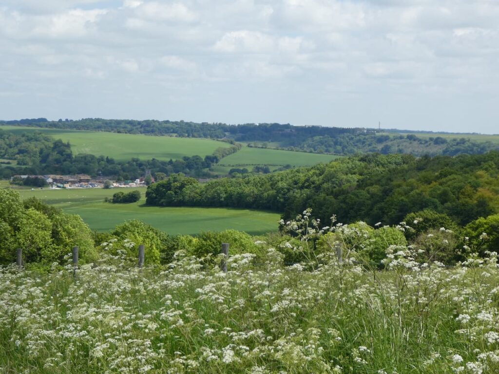
    One of the benefits of staying at a site not too far from home is we can still keep in touch with friends and today Mandy a close friend from home has popped up to join Lynnie and I on our walk.  Mandy and I have walked together in the Vale of Pewsey on a number of occasions so we both know the area pretty well but we have not done today’s walk before.

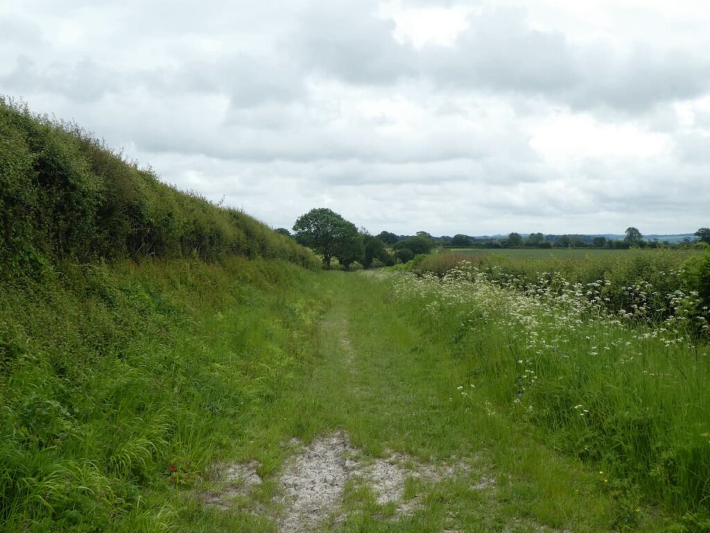
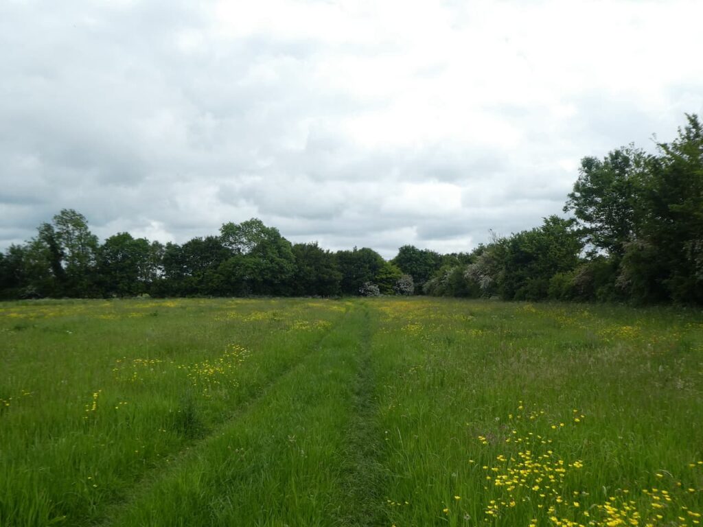
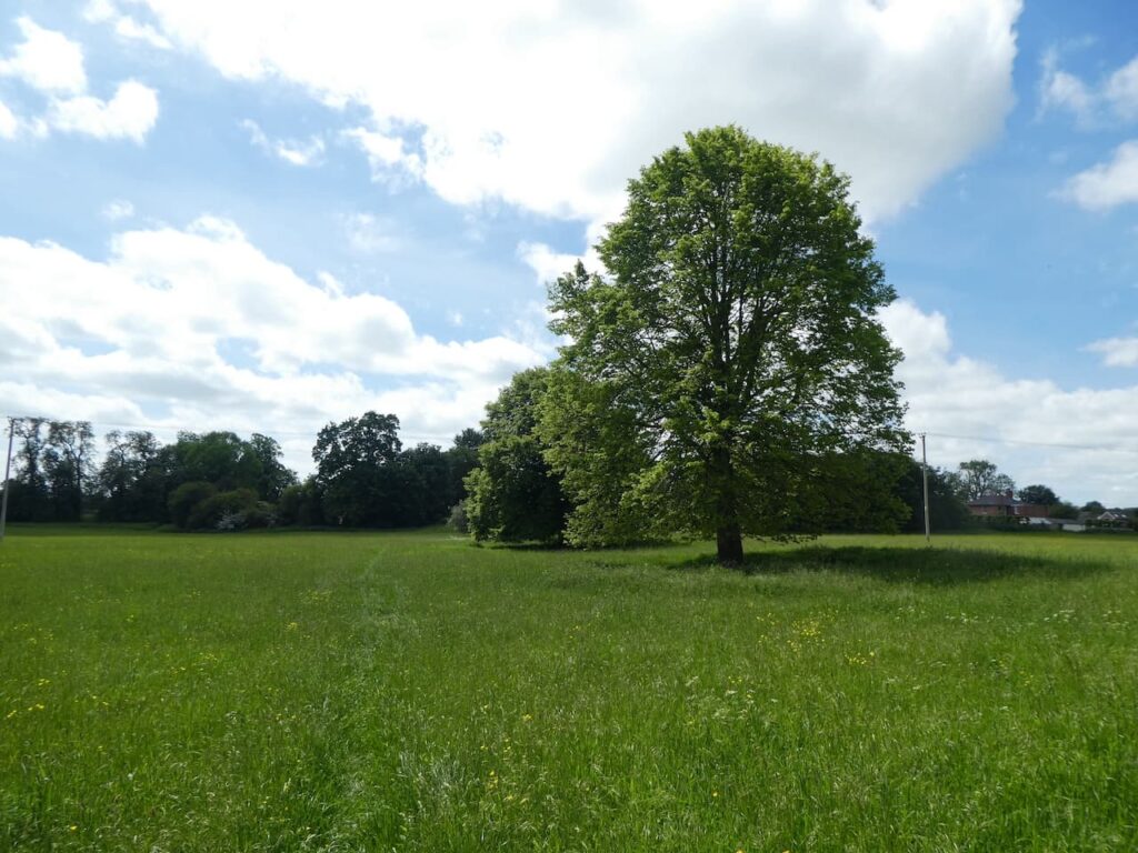
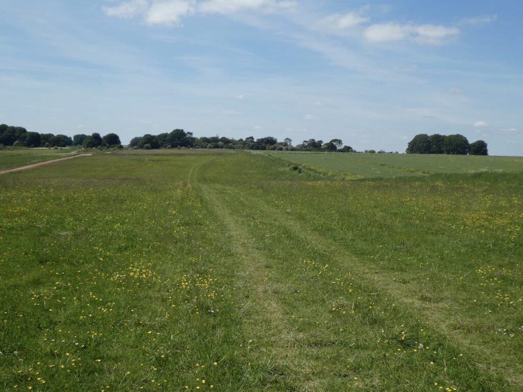
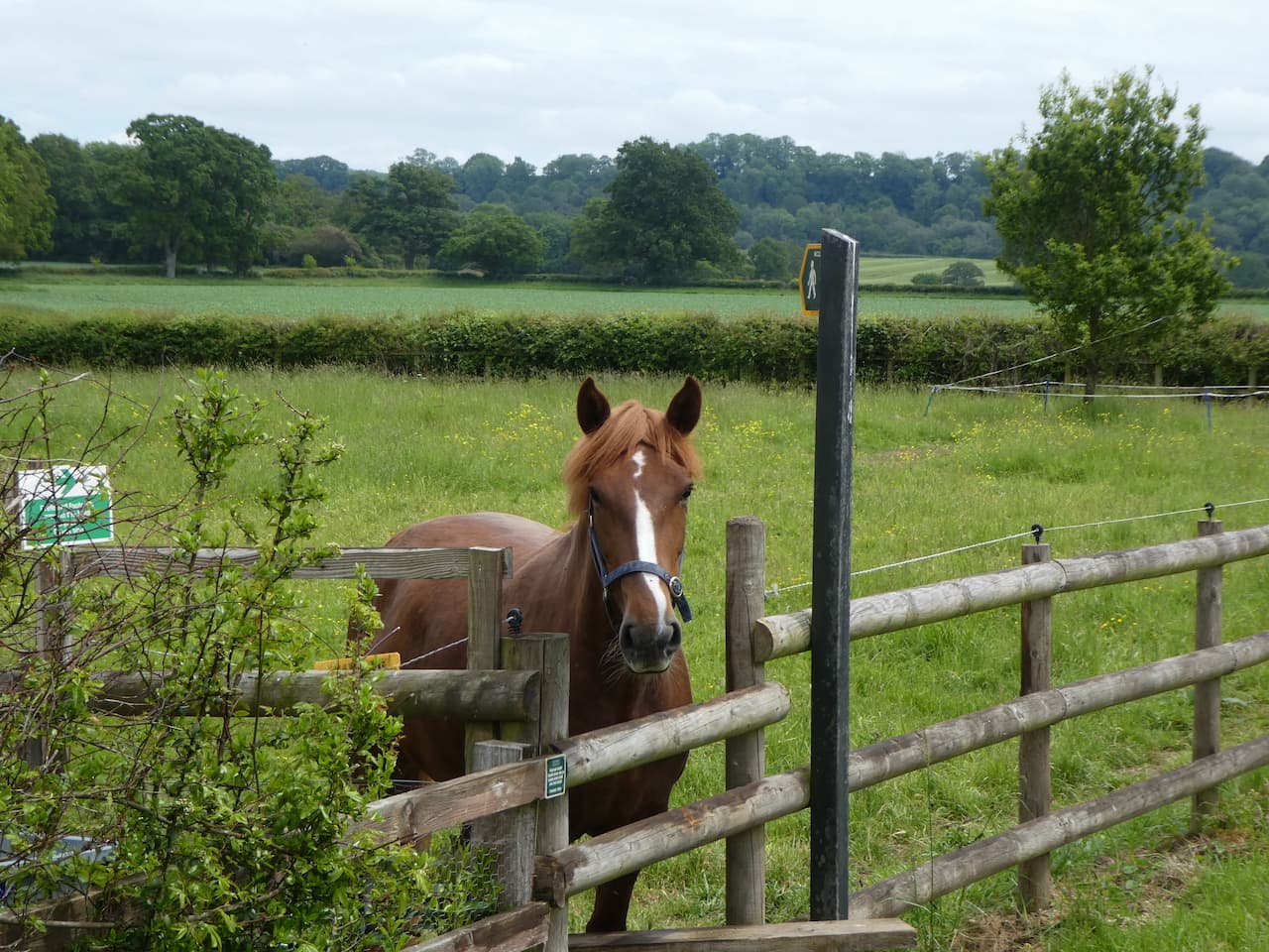
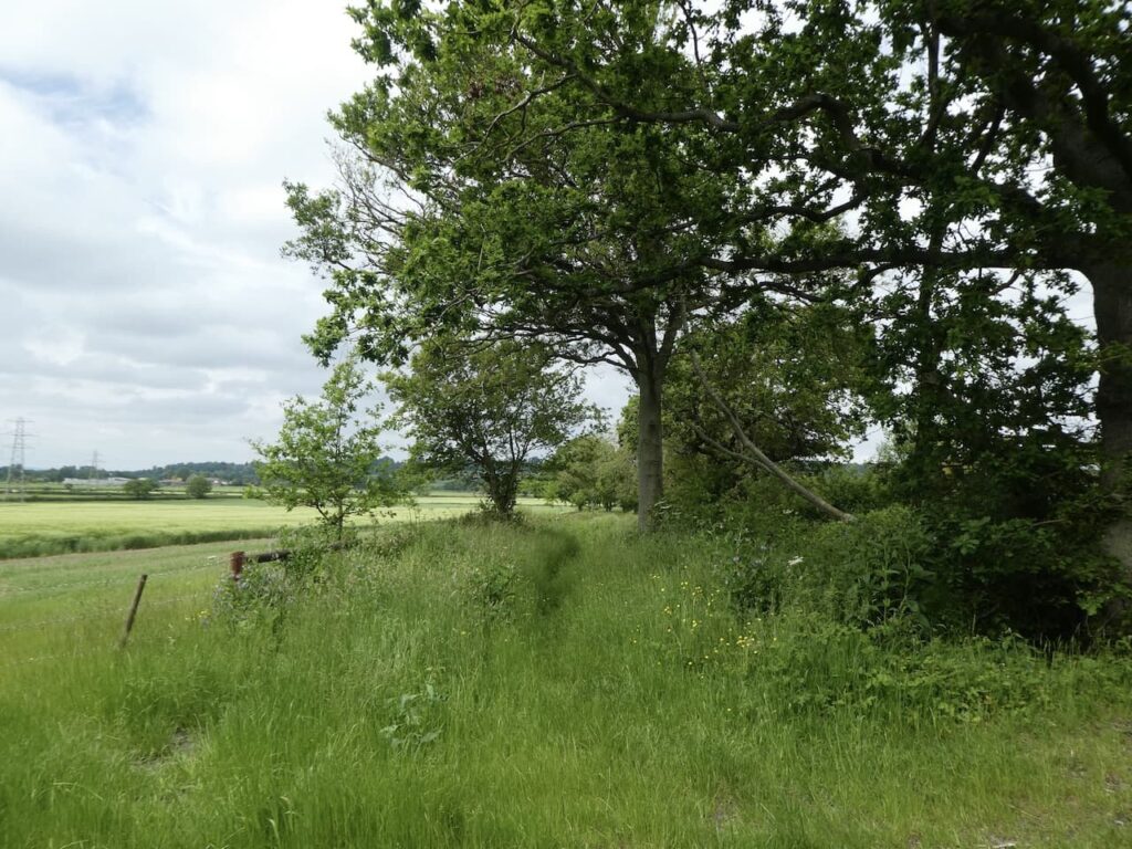
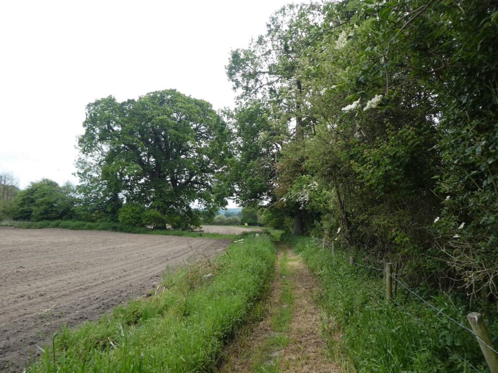
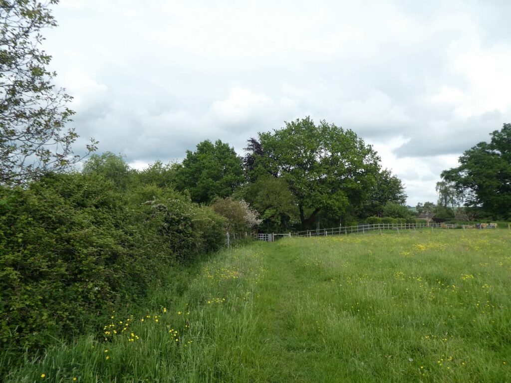
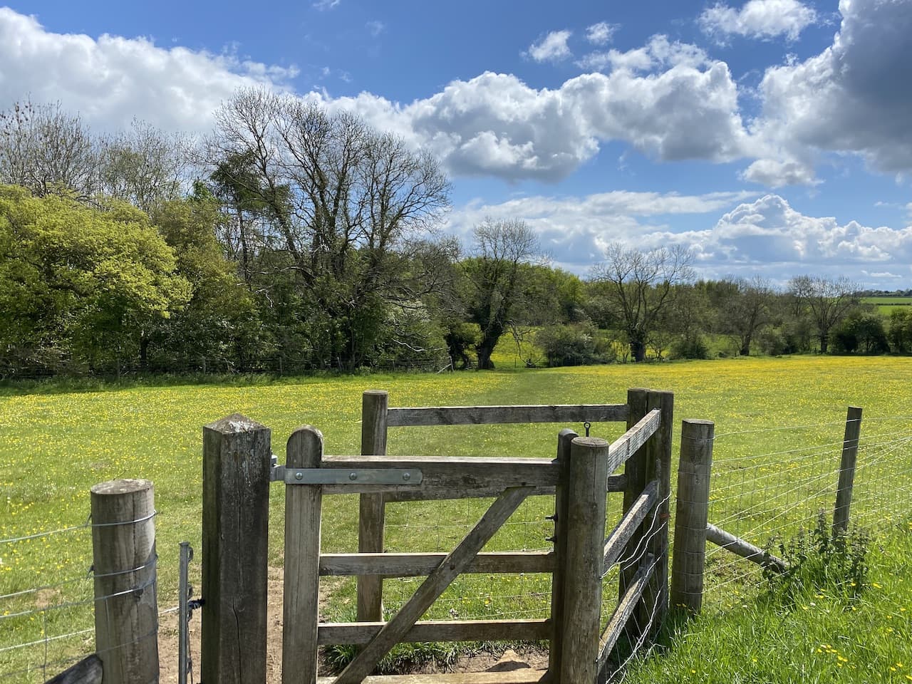
    Leaving the site we turn left to walk up a track following the route of the White Horse Trail. We stay with this long distance path ignoring two paths on the left and then at a fork we stay with the White Horse Trail heading towards Falkner’s Farm.

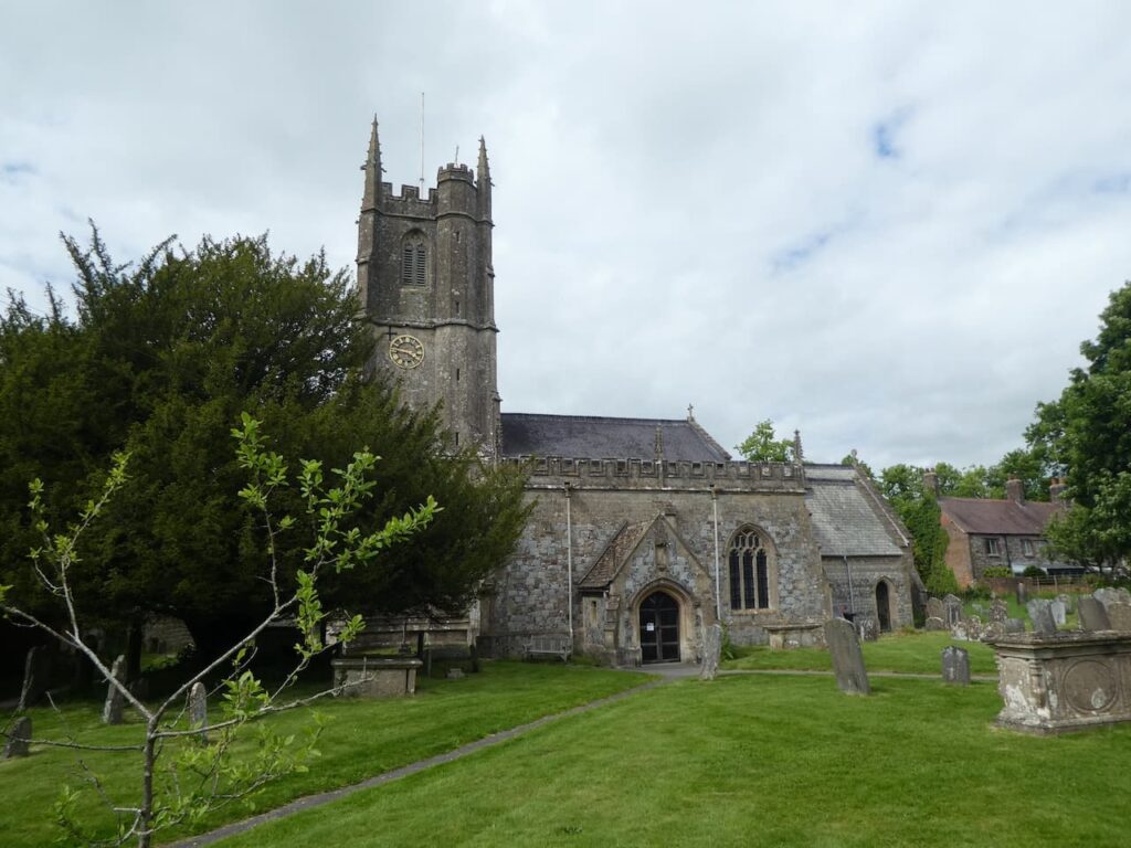
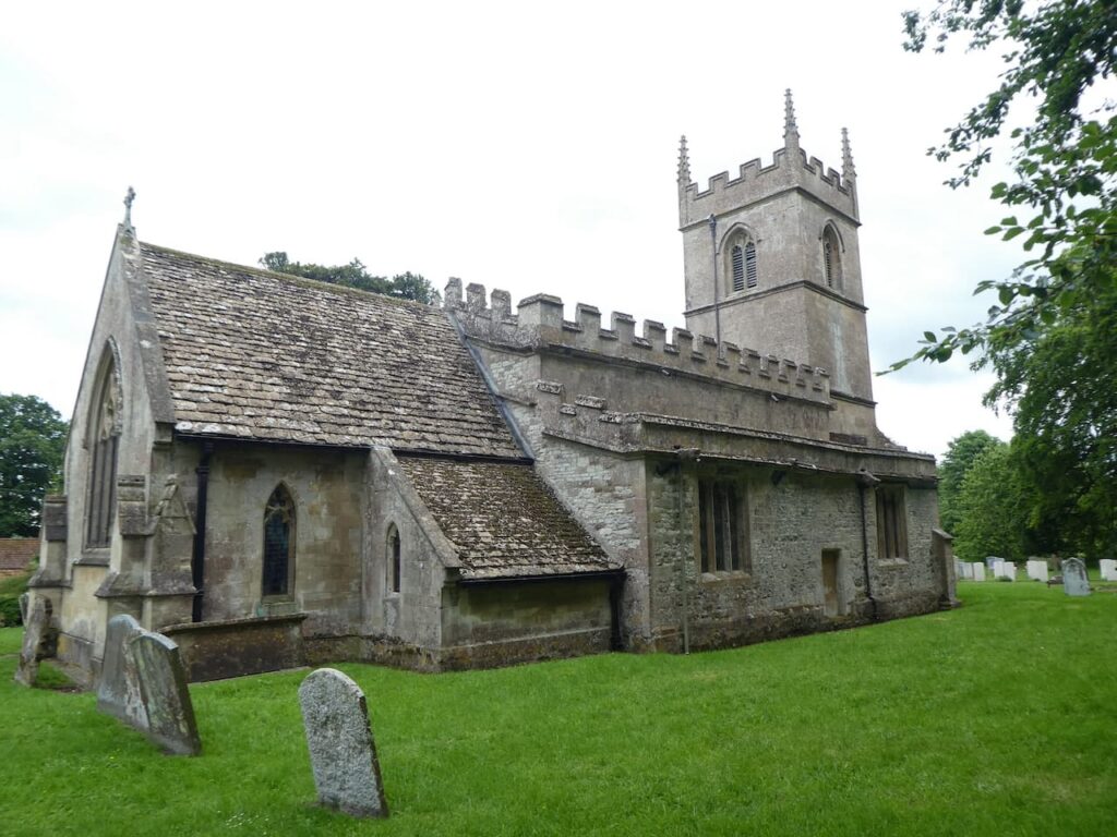
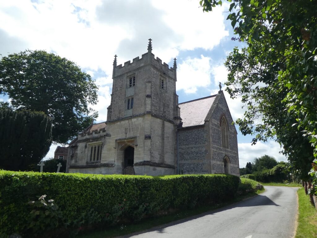
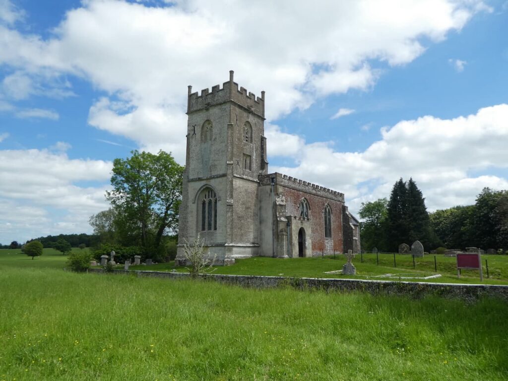
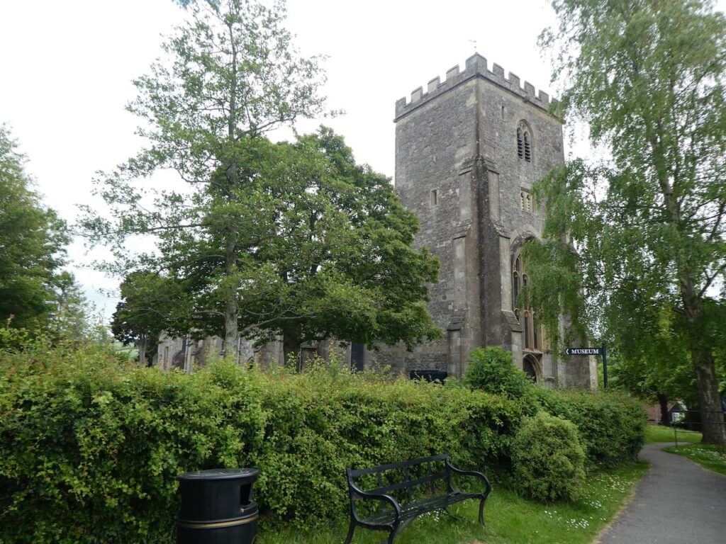
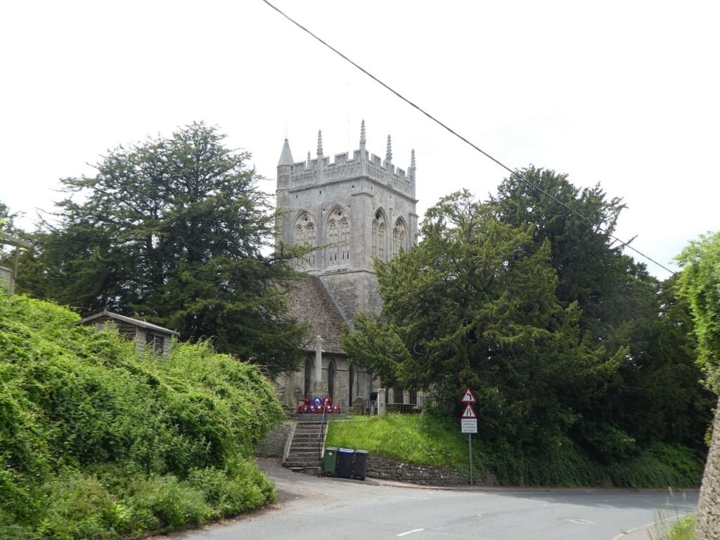
    After passing the farmyard we cross a minor road and continue along a tarmac lane passing old barns.  We follow the lane to reach St James’ Church, apparently there was a church on this site back in 963, part of the current building dates from the 13th century.  The tower dates from the 15th century and the church underwent a restoration in the 1950’s.

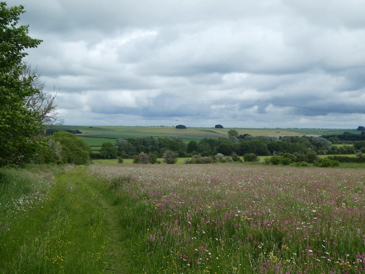
    From the church we head through trees to pass the lakes of Manningford Trout Fishery. According to this fishery’s website it has some of the best trout fishing in the south of England.

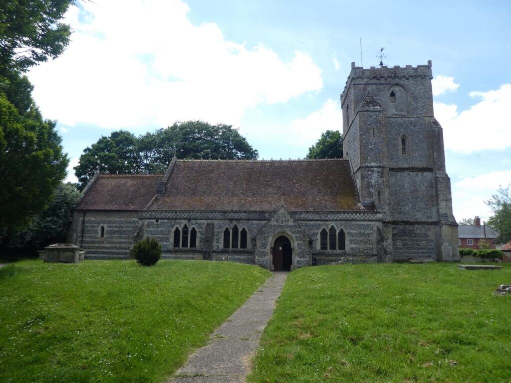
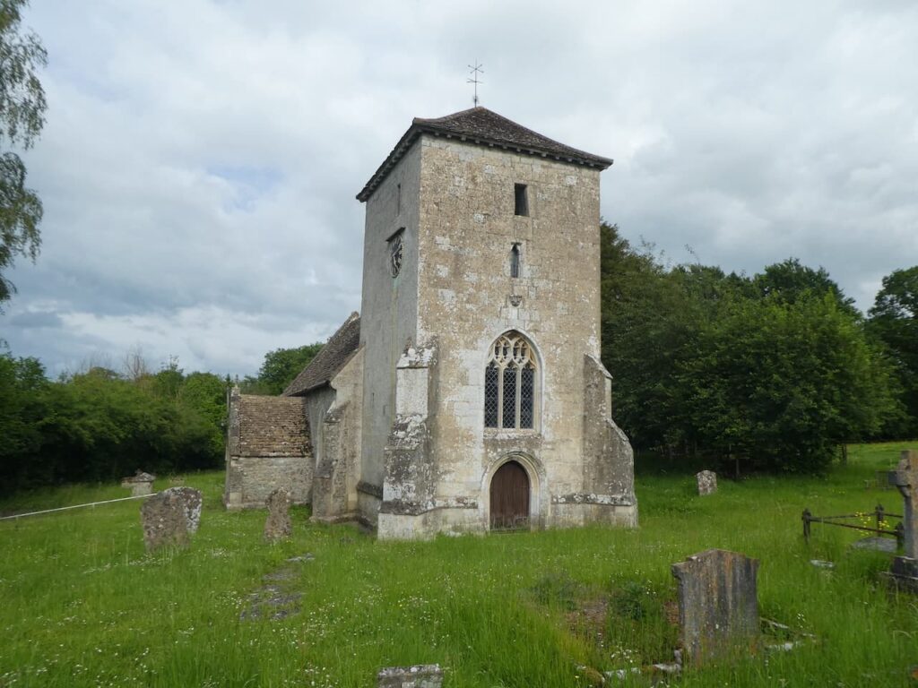
    We stay with the White Horse Trail to reach a minor lane which we cross and then in a field of pasture we leave the trail by taking the right fork to follow a footpath along the edge of the field to reach St Peter’s Church in Manningford Bruce.

    This church has elements from the 12th century and was restored in 1882.  We decide to pop in side, it is a fine building. 

    We leave the churchyard via a footpath at the north corner of the graveyard and follow this path besides the walled garden of The Manor.

    The footpath enters a field and then at a junction of paths we turn right back onto the White Horse Trail heading towards a minor road.  After crossing the road we continue on the Trail and then at a junction of footpaths go across a field to visit the church at Manningford Abbots.  Apparently there is no recorded dedication for this church which was rebuilt between 1861-64. 

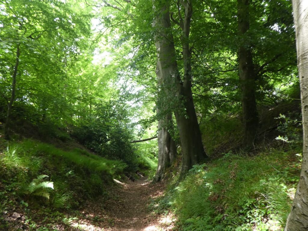
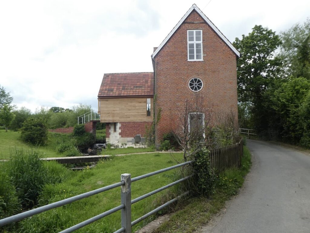
    From the church we head back across the field to rejoin the White Horse Trail and follow it heading north through woods to pass over a stream and under power lines to reach a converted mill.

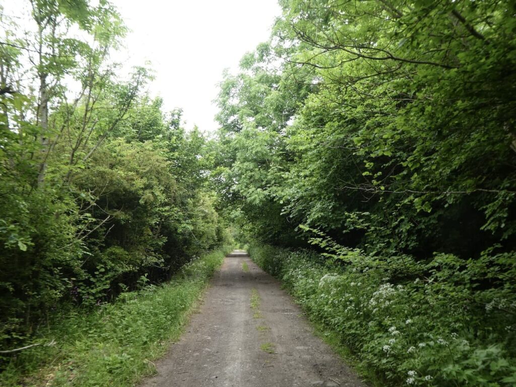
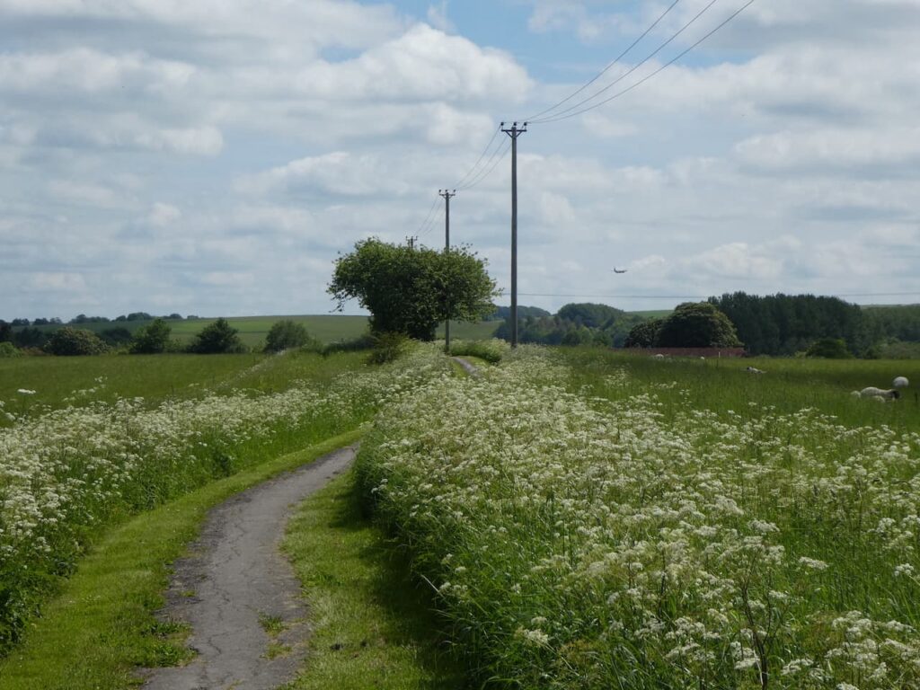
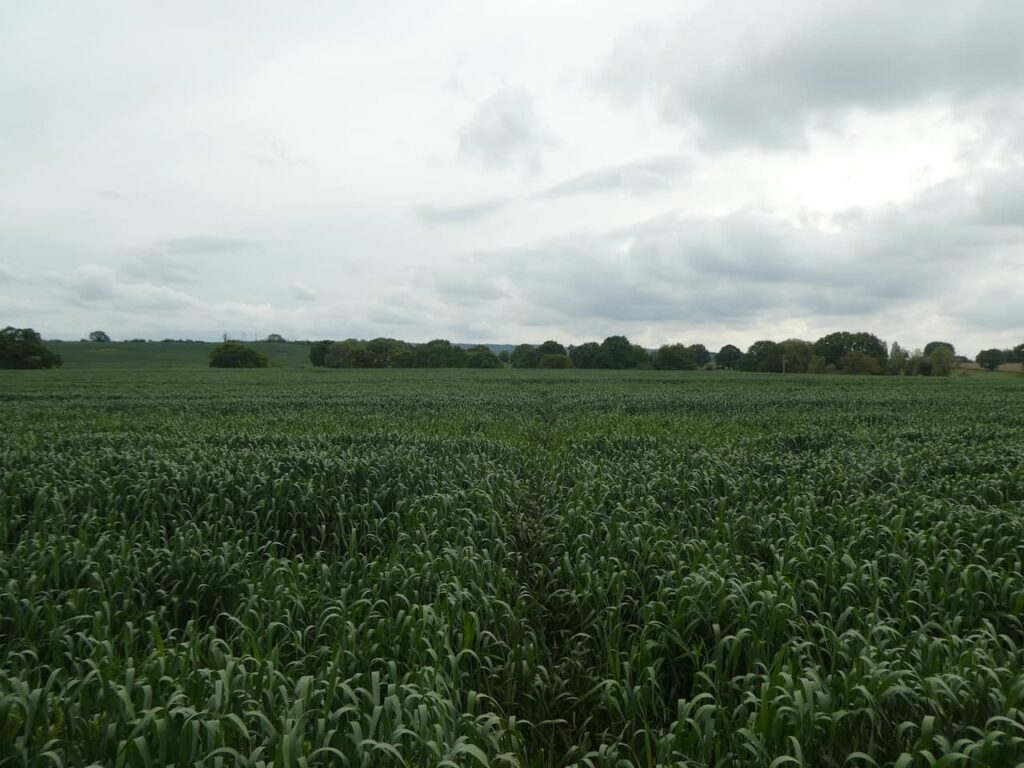
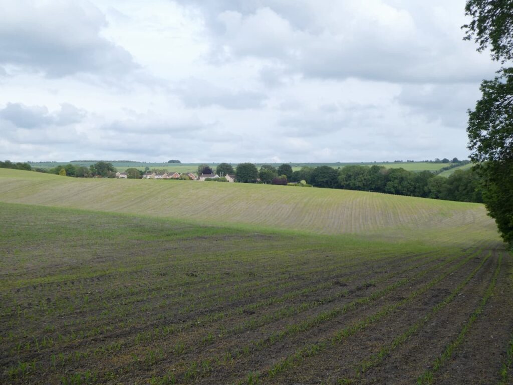
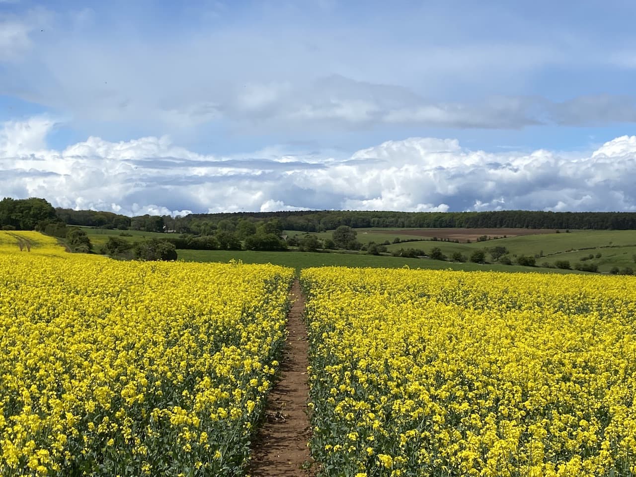
    On reaching a minor road we stay with the White Horse Trail and turn left to follow the road past houses and then we take the first right into Dragon Lane.  This heads north away from the village and soon becomes a byway which continues across a railway line and then follows a clear path through fields of salad crops.

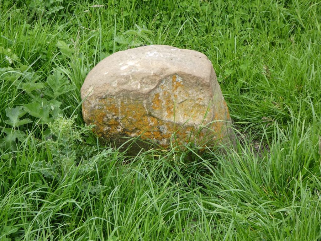
    The path reaches a minor road at Swanborough Tump, there is a sarsen stone and a plaque commemorating the history of this site which was the meeting place of Hundred Moot of Swanborough in Saxon Times.  In 871 King Alfred and his brother Ethelred met here on their way to fight the invading Danes and each swore that if either should die in battle the dead man’s children would inherit the lands of their father King Aelthelwulf.

    We cross the road and continue north on the White Horse Trail along a tarmac driveway to Cocklebury Farm.  After the farm the path reaches the ornate Ladies Bridge over the Kennet and Avon canal.  The bridge was built by the canal’s engineer John Rennie in 1808.  The design was at the behest of Susannah Wroughton who lived at Wilcot Manor and the reference to Ladies refers to her and her daughter, also named Susannah.

    We now join the canal towpath and head east towards Wilcot and soon reach Bowden’s Bridge (No.119).

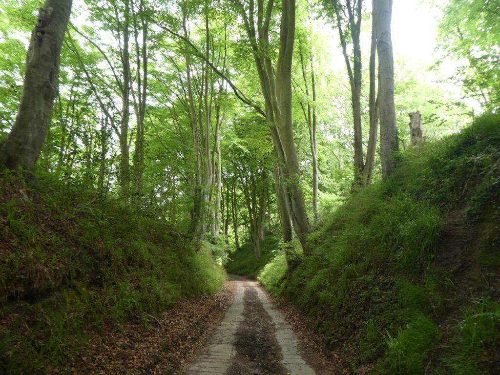
    We continue along the canal to Wilcot Bridge.  Here we leave the towpath to join a minor road running parallel to the canal.  After a few hundred yards the road bends to the left away from the canal and we start to head steadily uphill.  At a junction we go left and then almost immediately right.  Reaching a crossroads we go straight across on a road signposted to Huish and Draycot and soon pass Draycot Farm.  The road bends to the north and we stay with it for a few hundred yards and then as it turns to the right we go straight on along a footpath into a field. 

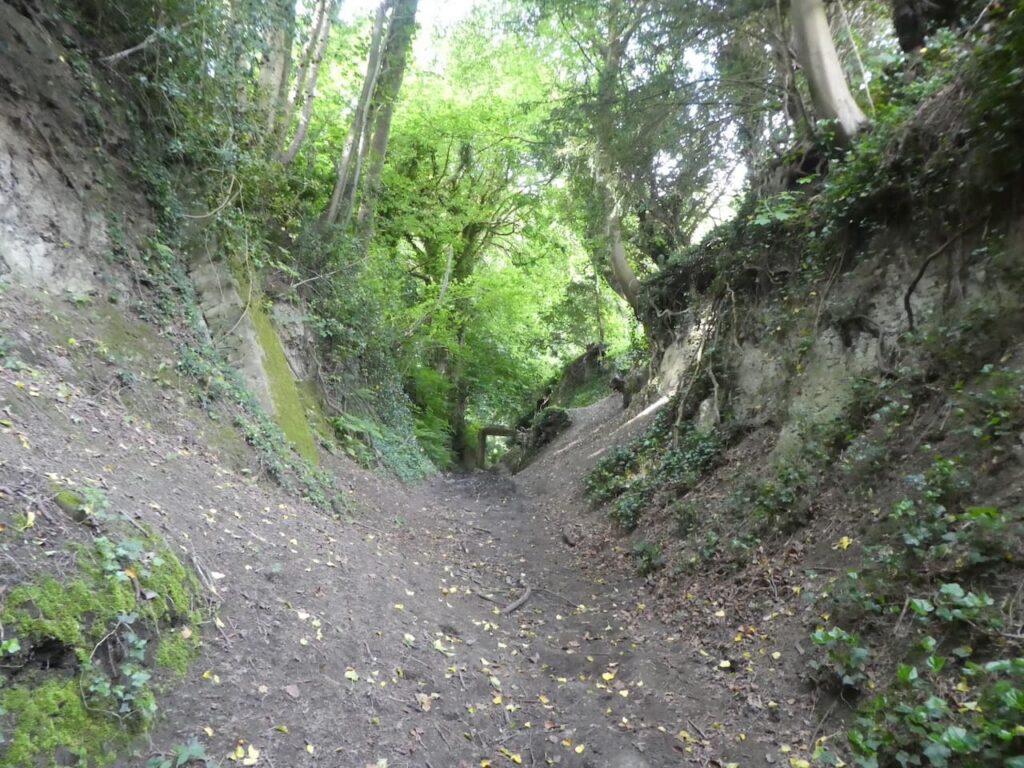
    After a second gate the path starts to steeply ascend Draycot Hill.  

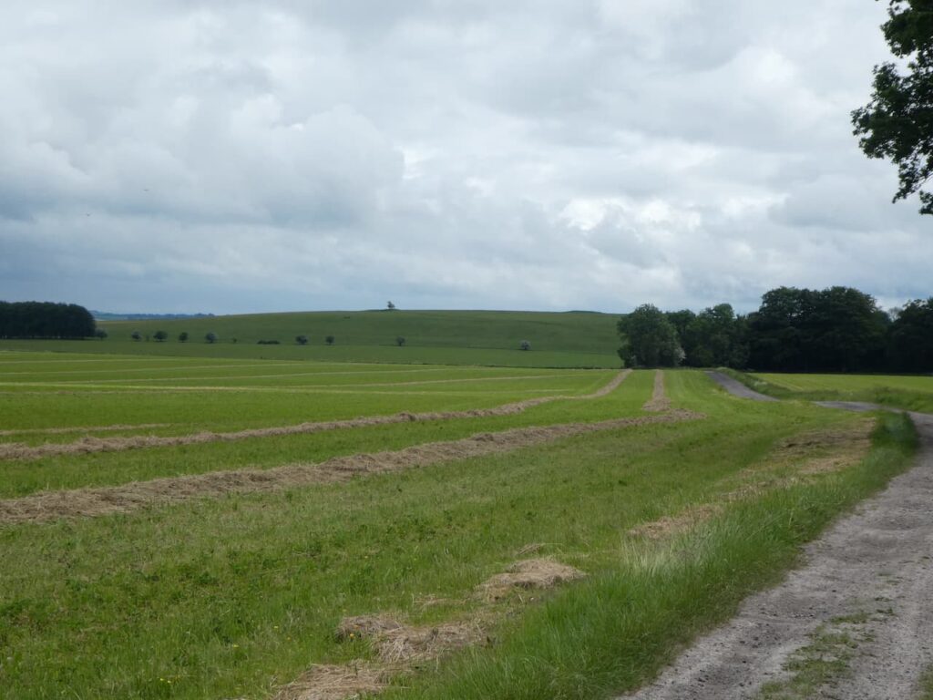
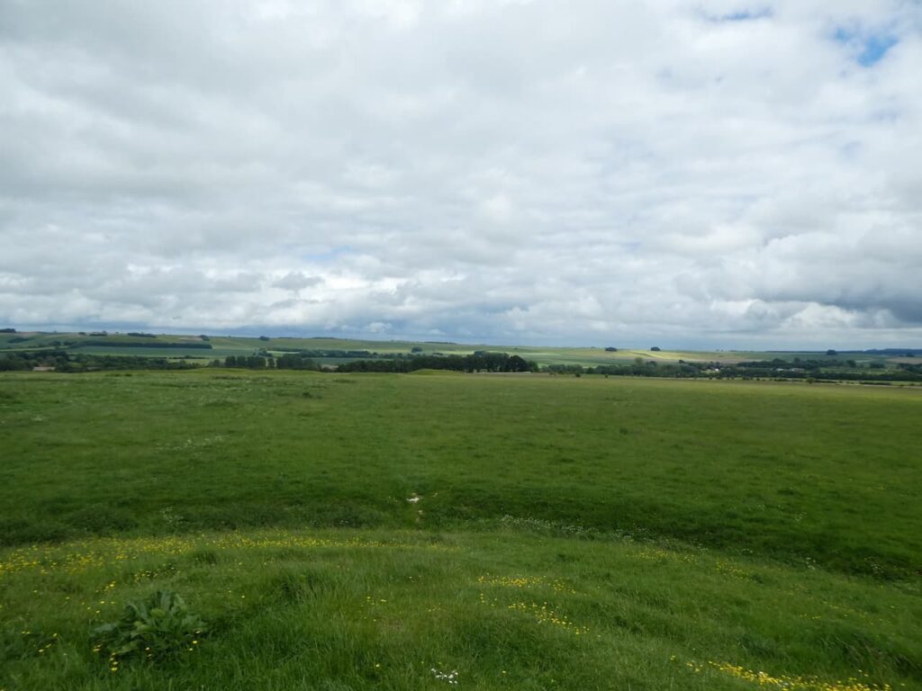
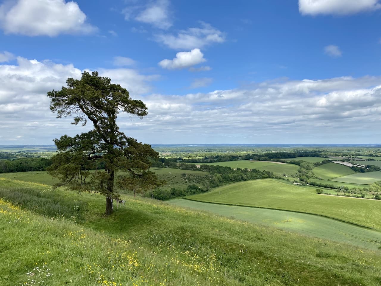
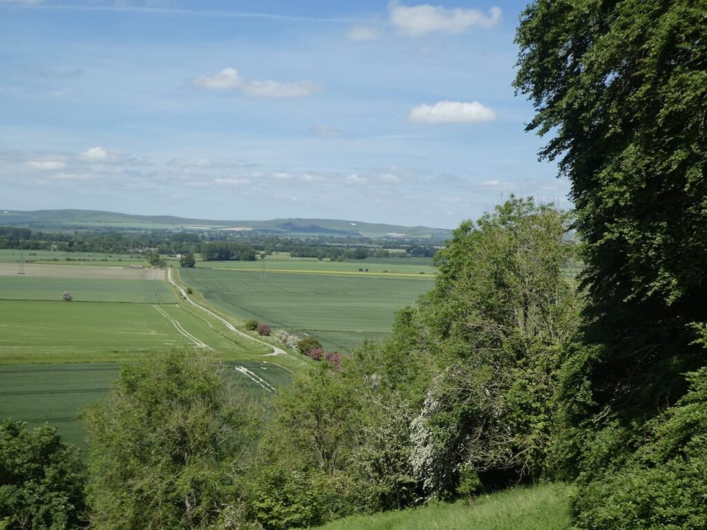
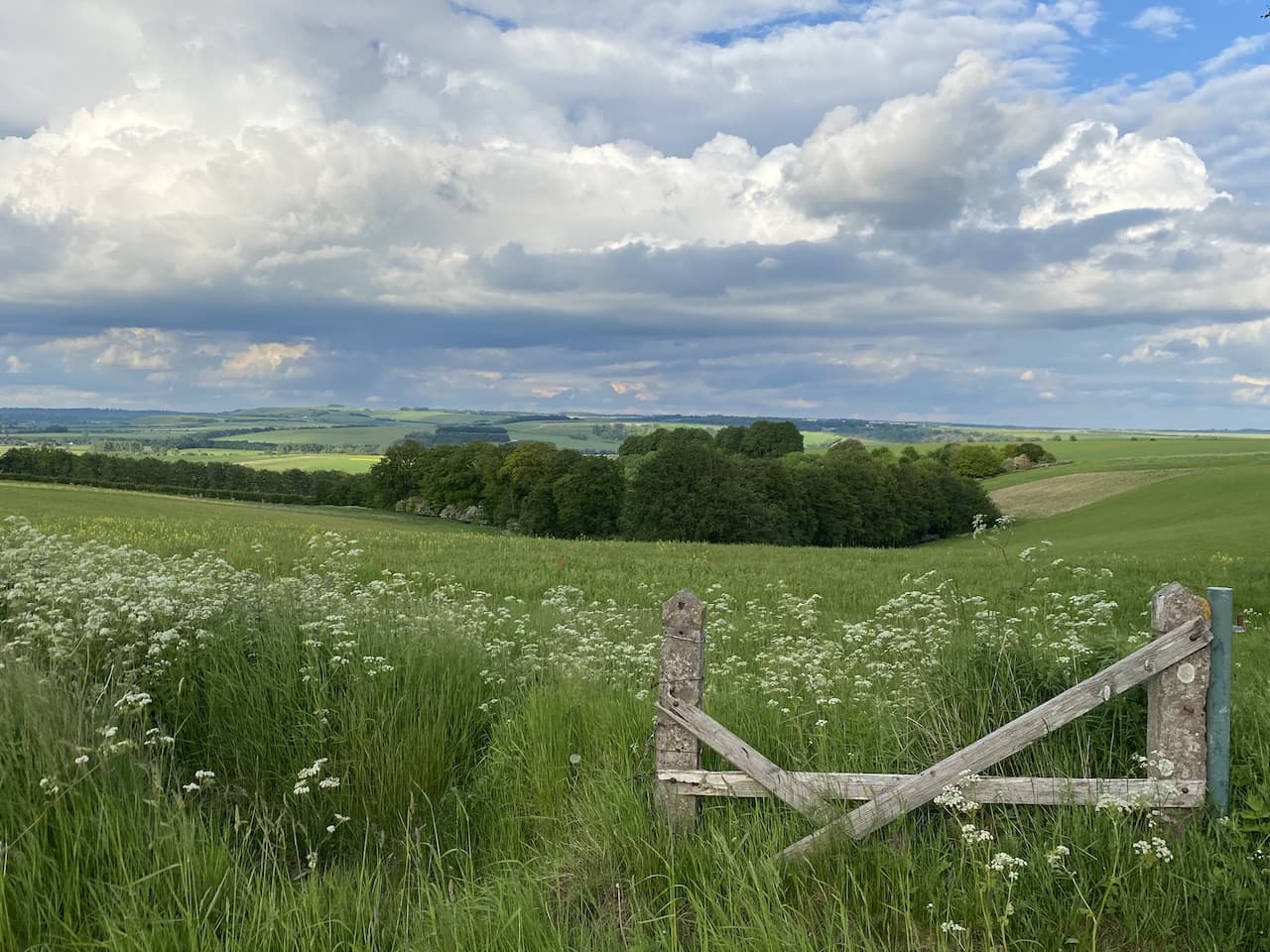
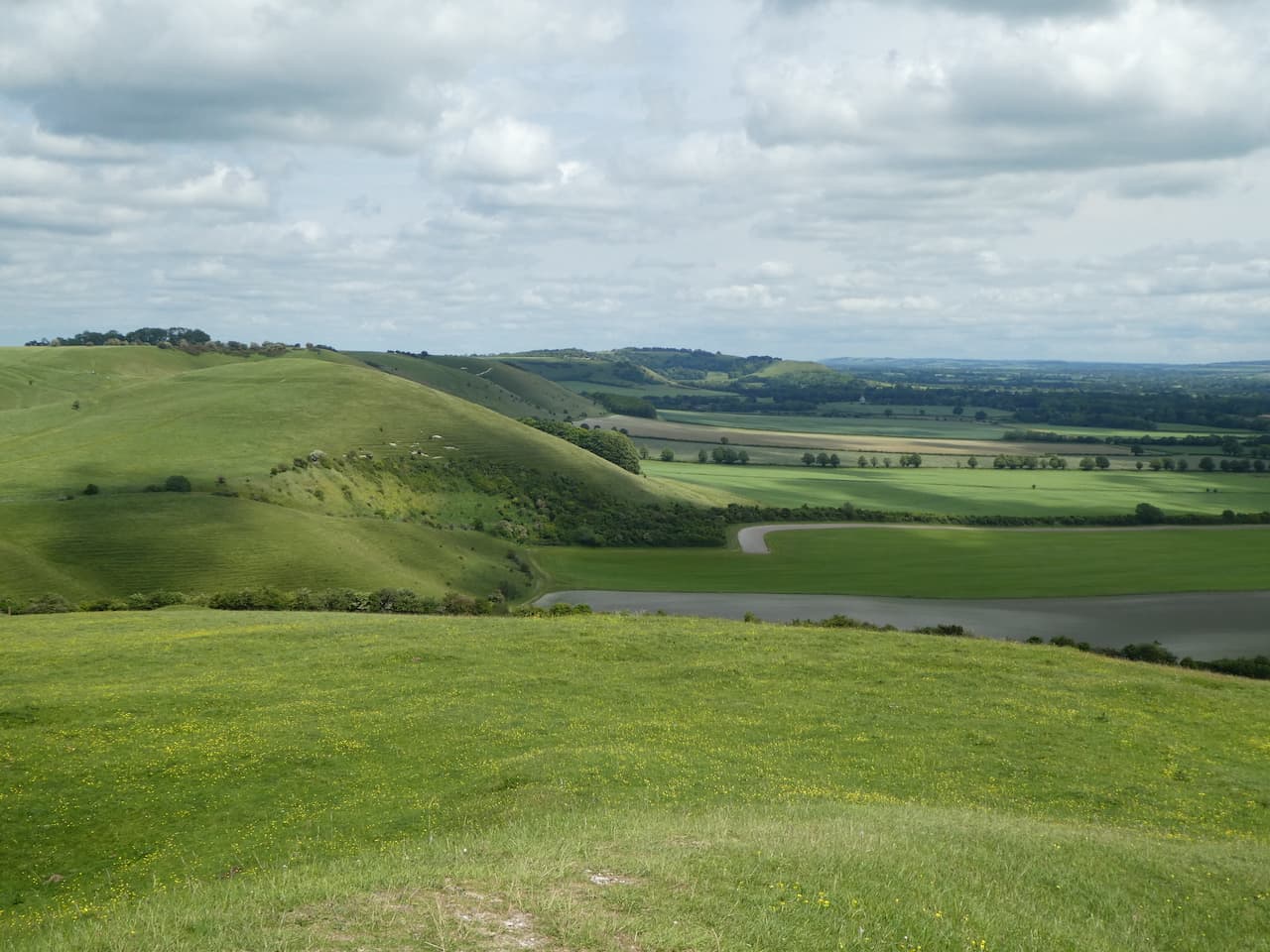
    At the top of the hill we go through a gate and join the Tan Hill Way and Mid Wilts Way heading west.  This is a cracking hill to walk along with numerous inlets with great contours.  They look spectacular on the map but even better when viewed from above.

    The path is well marked and passes through gates and by a large dew pond.  When Mandy and I walked along this hill last November it was raining but today it is clear and the views are spectacular.

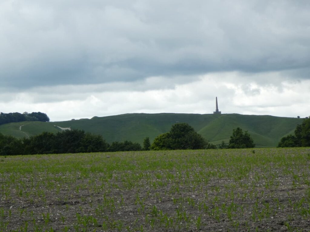
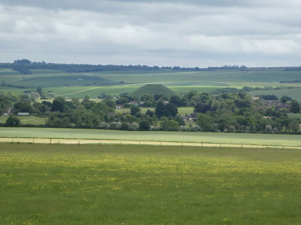
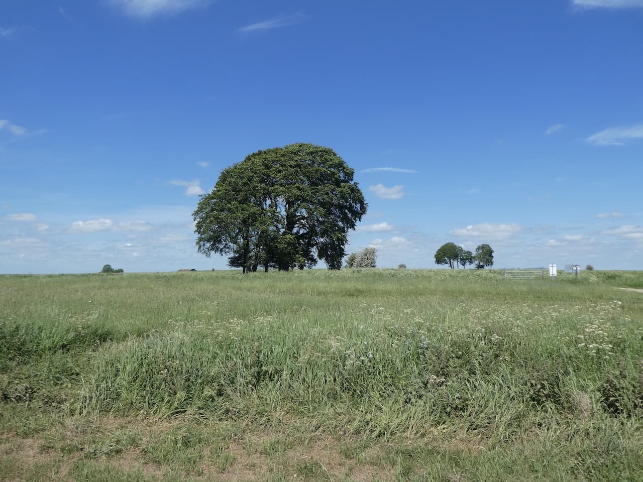
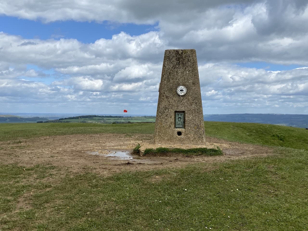
    We take a slight diversion from the Mids Wilts Way to visit Knap Hill, the site of a Neolithic Camp.

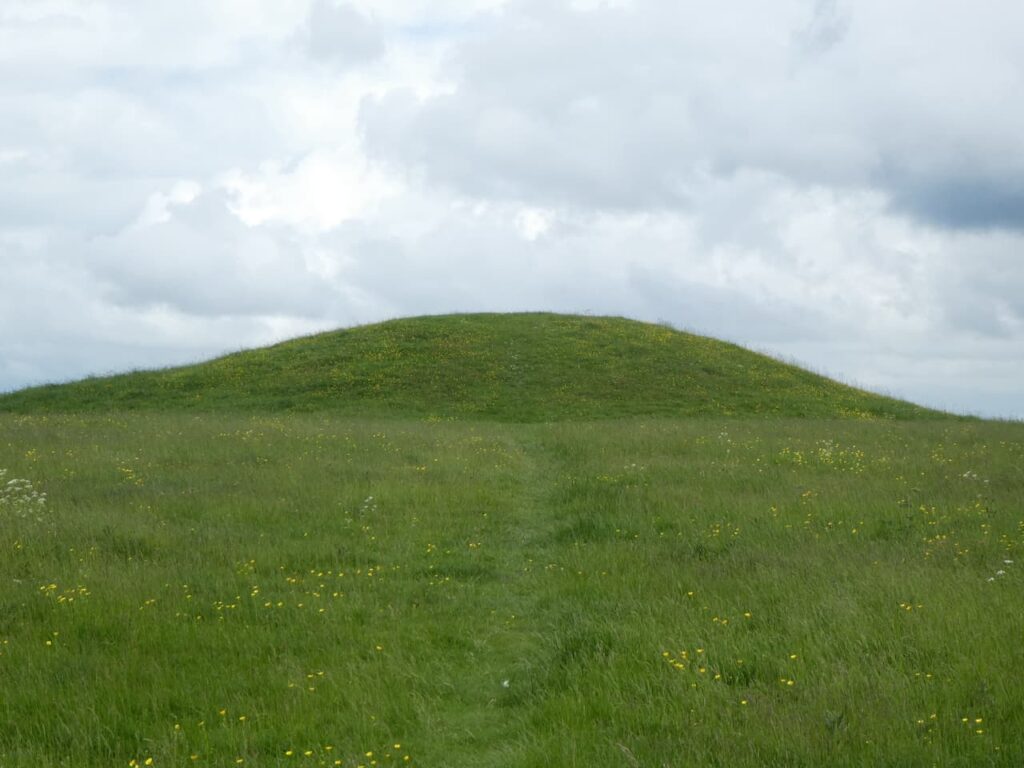
    From the top the hill we walk to a gate and through the car park for Walker’s Hill and then cross the road.  We turn left to follow the path to the top of Walker’s Hill and Adam’s Grave Long Barrow.  This is a stunning spot and the views are outstanding, but Crosby prefers to have a rest  while we stop and take in the vista.

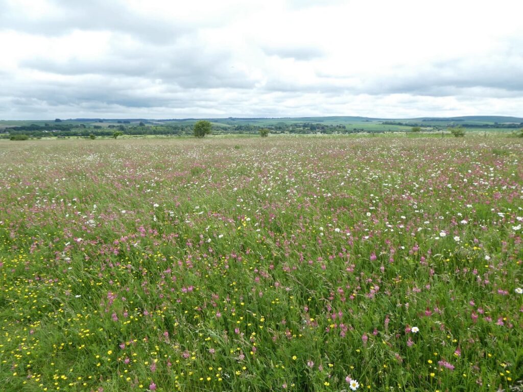
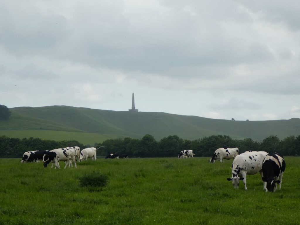
    We continue downhill across the access land heading towards Alton Barnes, to our right we get a good view of the Alton Barnes White Horse.  This horse was first cut in 1812 when Robert Pile of Manor Farm in Alton Barnes paid twenty pounds to John Thorne, known as Jack the Painter, to design and cut the horse.  The figure stands on Milk Hill which is the highest hill in Wiltshire at 295 metres and is reported to be the second highest chalk hill in the UK.

    After going through a gate we continue downhill to walk on a path besides the edge of a field with the road to our left.  This is not marked on the map as a path, but is clearly well used and is obviously a permissive path.  It takes us across the road and then continues downhill besides paddocks.  As it nears a junction the path turns to the left and continues besides the road heading towards Alton Priors.  We join the road briefly and then turn right down a lane besides a stunning old thatched barn which is packed with old farm machinery.

    Now we continue down the lane, Village Street, and follow this to a gate with a turnstile beside it.  We enter the field and walk the short distance to All Saints church.  This church dates from the 12th century but it was declared redundant by the Church of England in 1972 and is now in the care of the Churches Conservation Trust. 

    In the churchyard there is a Yew Tree believed to be 1,700 years old.

    From the church we follow a path across a stream and through further turnstile gates.

    We follow the paved footpath across a field of pasture and head towards St Mary’s Church in Alton Barnes.  The two churches are only a few hundred yards apart.  It would appear that the two congregations of Alton Barnes and Alton Priors were separated in 1660.  From the church we head along the lane to reach a minor road where we turn left and follow it into Honeystreet where we join the towpath of the Kennet and Avon Canal and head east.

    I have walked this section of the canal on a number of occasions and noticed a sign into a field to a memorial.  Although off the footpath I assume that the fact it is signed means there is access to the field.  We enter the field and follow the fence line to reach the memorial which is dedicated to Flt Sgt Thomas C Newton and Sgt John A C Wilson, both of the RAFVR, who lost their lives when their Albemarle Bomber V1755 of No 22 HGCU RAF Keevil crashed nearby on 25th October 1944.

    We carry on along the hedge line and return to the towpath.  This is a cracking section of the canal.

    We are only on the canal towpath for a short while, leaving at the next bridge to take a path that heads to the right towards the village of Woodborough.  Reaching the outskirts of the village we leave the lane to enter the churchyard of St Mary Magdalene Church which was built in 1850.

    We leave the church by the main gate and follow the road south through the village, at a junction we turn right and then after a hundred yards take a footpath on the left going towards the railway line.  After crossing the line with care, we continue on a path which soon goes besides paddocks to emerge in Bottlesford close to the Seven Stars pub, we turn right along the lane.

    On reaching a junction we go straight over to walk along Gores Lane which goes between cottages and then reaches fields.  At a junction of paths we turn left and head south, soon crossing  a minor road, Yard’s Lane, before continuing on the way-marked path through fields to reach meadows close to the River Avon.

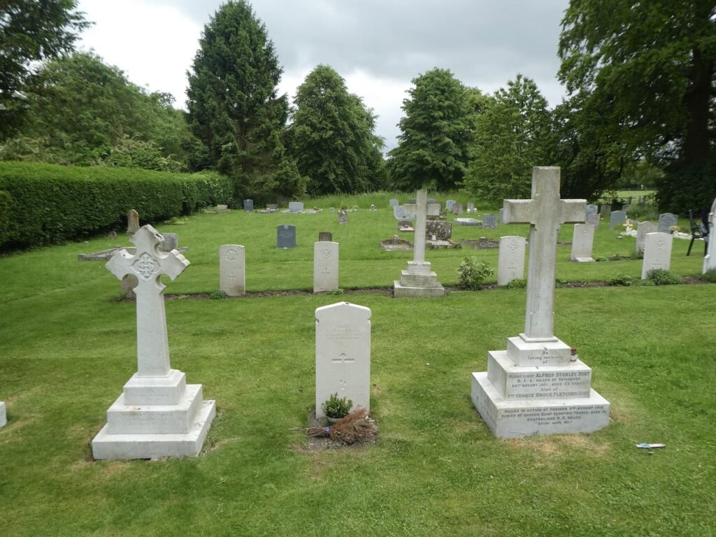
    At a fork in the path we keep to the right soon arriving at the western edge of Wilsford.  We turn left and follow the road through the village to reach Holy Cross Church, this is the seventh church we have passed on our walk!

    Leaving the church we continue through the village heading east and then on reaching a road junction go south and then after a couple of hundred yards take a bridleway on the left which heads across fields towards Charlton St Peter.  To our right is a fine example of ancient field systems known as Strip Lynchets.

    At a junction of paths we continue straight on with the Charlton Cat tea rooms in front of us.

    This path brings us back into Charlton St Peter where we turn left to cross the River Avon and return to the caravan site.  It has been a cracking walk through the Pewsey Vale with stunning views throughout.  Wiltshire really is a cracking county to walk in.

    You can view this 17 mile walk on OS Maps and download the GPX File Here

    To follow my walk, you will need Ordnance Survey Explorer Map 130 – Salisbury & Stonehenge: and OS Explorer Map 157 – Marlborough & Savernake Forest

    11th June 2021

    © Two Dogs and an Awning (2021)

    All information on this site is provided free of charge and in good faith and no liability is accepted in respect of damage, loss or injury which might result from it.  To the best of my knowledge the routes are entirely on public rights of way or within areas that are open for public access.
    Walking can be hazardous and is done entirely at your own risk.  It is your responsibility to check your route and navigate using a map and compass.

  • Windmill Hill and Avebury from Cherhill

    Windmill Hill and Avebury from Cherhill

    There are days when our planned walk is scuppered even before we start and today seems to be such a day.  I planned today’s walk to start at Avebury from the large National Trust car park in the village.  However, arriving at Avebury I discover the car park closes at 17.00 which I find a bit odd when we are only a few days from the longest day of the year.  I can only assume they don’t want people to visit the famous stone circles in the evening.

    I quickly look at the route of our planned walk for an alternative starting location and identify Cherhill as the best option.  So we set off west along the A4 and then turn into Cherhill and find a parking area outside of the village church.  

    After checking to ensure there are no notices of planned services in the church we head off through the village heading east.  At a road junction we turn left into Park Lane  heading downhill to reach a fork in the lane, we go to the left to continue along the tarmac lane which is shown as a dead end.  Soon we get views across to the Monument and White Horse on Cherhill Hill.

    We stay with the lane to pass barns on a farm and then just before reaching the farmhouse, at a crossing of footpaths, we go right on a path heading north, very soon at a fork in the path we go right to head along the edge of a field with Mount Wood to our left.

    We reach a junction of paths and turn right along a hedge-lined a track heading east to reach a crossing of paths where we turn left onto the route of the White Horse Trail and head north.

    We keep on the White Horse Trail as it heads along the top of Compton Hill ignoring paths on the left which lead off the hill.  At a T-junction of tracks where the White Horse Trail turns left towards Highway we go right and head along a track in a south easterly direction.

    At the next junction of tracks we turn left and follow a track (Yatesbury Lane), as it goes through the edge Yatesbury Withybed.  A withybed was an area of woodland where willow withies, thin rods of willow were cut to be used in basket making, fish traps and a range of other items.  Willow grows fast so the main stump of the tree would be left and the withies harvested every year ensuring a regular crop.

    After passing the withybed we reach a junction of tracks and turn right to head south east and follow a track through open farmland heading towards Windmill Hill in the distance.

    We follow the footpath to Windmill Hill, the site of the largest Neolithic causeway enclosure in Britain .  The site covers 21 acres and was first occupied in 3800 BC which is a very long time ago.  

    It is an amazing site and we are the only people here, whereas nearby Avebury was busy when we drove through earlier today.

    The OS map shows a Boundary Stone on the site and I go off in search of it whilst Lynnie takes in the view.

    The White Horse Trail runs through Windmill Hill and we follow this route heading east.  Away to our right is a good view of Silbury Hill which is the largest artificial prehistoric mound in Europe.  It was built between 2470 and 2350 BC though it’s purpose is unknown.

    As the path descends it leaves the Windmill Hill open access area going through a stunning area of wildflower meadow.

    At a crossing of paths we turn right, to stay with the White Horse Trail, and head across fields towards Avebury.

    On reaching a lane we turn left and wander into Avebury and stop to have a look at St James’ Church.  Much of this church was rebuilt in 1879 but some parts from previous centuries remain, the oldest dates from the 10th century.  We had hoped to look inside but unfortunately it is locked.

    We decide to have a wander around and visit the stone circle, Lynnie is also on the lookout for an ice cream but has no success as most of the shops seem to be closing up.  It seems I was right in my earlier assessment about Avebury. 

    After a good wander about we head out of the village on the route we came in on and at the edge of the village continue along the lane heading west.  This soon becomes a minor road, Bray Street, and passes houses.  At a junction of tracks close to barns and silage clamps we continue straight on along a track.

    We stay with this track as it continues in a westerly direction to reach a minor road on the outskirts of Yatesbury.  Here we turn left and follow the road, The Avenue, and then take a detour along a minor road on the right to visit All Saints Church which has 12th century origins with the tower and nave roof dating back to the 15th century.

    In the graveyard there are a number of Commonwealth War Graves relating to airmen that were based at the nearby RAF Yatesbury which opened in 1916 as a Royal Flying Corps training school.

    Leaving the church we head back to The Avenue and turn right.  When we reach a T-junction we turn right and then after a couple of hundred yards turn left along Juggler’s Lane.  After passing through woodland we pass the redundant hangers of the RAF airfield.  The Flying Training Corps operated for three year from 1916 and then the airfield returned to farmland.  From 1936 the site once more became an airfield and pilot training resumed.  Apparently Guy Gibson who led the “Dambusters Raid” trained here.

    In 1939 the RAF took over the site for the training of wireless operators and this continued until its closure in 1965.  The hangers here are listed but apparently there have been attempts to turn the site into housing.  Not much can be seen from the track but the World War II pillboxes alongside  are evidence of wartime activity.

    Our route is now very straightforward as we stay with this track heading back towards Cherhill, to our left are good views of the Landsdowne Monument on Cherhill Hill. The monument stands at 125 feet high and is a clear landmark.  It was erected in 1845 by the 3rd Marquis of Lansdowne to commemorate his ancestor Sir William Petty (1623-1687) and was designed by Sir Charles Barry, the architect of the Houses of Parliament.  Petty was the son of a cloth maker and studied to become Professor of Anatomy at Oxford.  He served as Physician General in Oliver Cromwell’s Army in Ireland and whilst there reportedly conducted the first land survey of the Country.  After the restoration of the Monarchy he was appointed a Commissioner of the Royal Navy by Charles II.  He was a founding member of the Royal Society and accumulated great wealth.

    The track leads to the outskirts of the village and we retrace or steps back to the church car park.  Our wander about has covered just over 14 miles and we have walked some interesting tracks with the stand out feature  being the stunning wildflower meadow near Windmill Hill.

    You can view this 14 mile walk on OS Maps and download the GPX File Here

    To follow my walk, you will need Ordnance Survey Explorer Map 157 – Marlborough & Savernake Forest

    10th June 2021

    © Two Dogs and an Awning (2021)

    All information on this site is provided free of charge and in good faith and no liability is accepted in respect of damage, loss or injury which might result from it.  To the best of my knowledge the routes are entirely on public rights of way or within areas that are open for public access.
    Walking can be hazardous and is done entirely at your own risk.  It is your responsibility to check your route and navigate using a map and compass.

  • Wootton Rivers and Martinsell Hill

    Wootton Rivers and Martinsell Hill

    Overgrown and poorly maintained footpaths marred our walk yesterday and I am not keen to repeat the experience so have planned a walk in an area I know will be hassle free.  It will combine a section of the Kennet and Avon Canal and also take us to the stunning Martinsell Hill.

    The starting point for our walk is the free car park in the centre of Pewsey off Goddard Road (Grid Ref: SU162601).  Leaving the car park we walk back to the A345 the main road through Pewsey and turn right by the Post Office and follow the road as it goes through the village and when it bends to the right we turn left into Church Lane.   

    We soon cross the River Avon and then follow a footpath skirting the grounds of Offices and follow this past Pewsey Vale football ground to reach Eastern Lane.  Here we turn right and then very soon reach Ball Lane where turn left into Ball Road and head north to reach a junction with a fine old lamp post and signpost. 

    Here we turn right and then very soon meet a mini roundabout where we turn left into Hollybush Lane.  We are on the route of the White Horse Trail and at a fork in the road go right where Hollybush Lane continues along a single track lane.  After going under a railway bridge we continue past cottages.  Here we stay with the White Horse Trail as it heads steadily downhill on a path leading towards a footbridge over the River Avon.

    After crossing the river we are very soon at Pains Bridge where we take the footpath on the right to join the towpath of the Kennet and Avon Canal.  We have walked many sections of this canal, but this is the first time on this section.

    It is a cracking afternoon to be walking along the canal and this is a very quiet length of towpath.  As we walk along we spot a World War II pillbox in a field on the opposite side of the canal.  This is one of a series of such boxes built along the edge of the canal to form the GHQ Blue Line a section of the General Headquarters Line which compartmentalised the Country to thwart the expected German Invasion.

    The next bridge we reach is the Milkhouse Water Bridge (No.112) which we pass under and continue on the towpath through the open countryside. 

    I enjoy walking on canal towpaths and find the engineering involved in constructing these waterways very interesting.  Lynnie is less keen, especially if we spend hours walking along them, however, she does enjoy walking along the level path with no hills to climb.  Although, I have planned a bit of that for later on.

    After around two miles on the towpath we reach Wootton Rivers Bridge and Lock.  Here we cross the bridge to walk into the village.

    It has turned into a very hot day and on reaching St Andrew’s Church we look for a bench in the shade to stop for lunch.  This church was rebuilt in 1860 and the steeple has a three faced clock which was built in 1911 to commemorate the coronation of King George V.

    Refreshed we resume our walk and continue through the village heading north to pass the Royal Oak pub.

    We leave the road at a fork to take a footpath along a track to the left of a thatched cottage.

    The track soon starts to head uphill between fields.

    On reaching the top of the track we turn right to take a footpath that skirts along the southern edge of the field.

    On joining another track we turn left to walk uphill to a junction with a tree lined track, Mud Lane, here we turn left and follow the lane along the top of the ridge.

    At this time of the year there is not much mud in Mud Lane, however, a couple of areas still remain a bit sticky so it is easy to see how it acquired it’s name.  We stay with the lane to reach a minor road and then cross to go through a car park to enter the open access land of Martinsell Hill.  

    This is a stunning spot and although we can wander anywhere we stay with the route of the Mid Wilts Way.  This 68-mile route crosses the County from the Berkshire border at Ham, near Hungerford and ends at Mere, close to the Dorset border.  It is a walk that I have thought about doing, but the pandemic has made planning it very difficult.  Hopefully in 2022 things will have eased and I will be able to fit it in.

    We stay with the route way-markers which take us around a copse and then along the top of the steep escarpment of the hill.  I have been here a few times, but still wonder at the stunning view.

    This is the third highest spot in Wiltshire and on the summit is an Iron Age hill fort with the ramparts still visible.

    We follow the path through a gate and pass a bench where a couple are admiring the view.  We have a brief conversation and continue on our way.  As we walk I say to Lynnie that I think I recognised one of the women on the bench but I can’t place where from.  Lynnie says she had the same feeling, it takes about ten minutes for us to realise it was a well known actress.  Respect for her privacy prevents me from naming her.

    We now go through the edge of woodland and then the path leads along the edge of a field heading towards a gate.

    Through the gate we continue along the ridge towards Giant’s Grave which is the site of an Iron Age Promontory Fort which resembles a long barrow.

    We pass through the ramparts of the fort to reach the Ordnance Survey trig pillar which is located on the opposite side of the fence.  I have bagged this trig a number of times but still admire the views from this cracking spot.

    It is now a steep descent from the hill along the fence line.  On our previous visits to Martinsell Hill we have walked up this route, but it is far easier on the lungs going down, but harder on the knees.  We go through a kissing gate and follow the well-worn path to reach another gate to join a track.  Here the Mid Wilts Way turns to the right to head towards Oare, but our route is straight over the track to follow the route of the White Horse Trail.

    On reaching Sunnyhill Lane we turn left and then after a couple of hundred yards take a track on the right that leads south towards the Kennet and Avon Canal and Pains Bridge.

    After crossing the bridge we continue along the path to cross the River Avon and then as we reach houses turn right to follow a footpath that soon runs besides the railway line and passes an old mill.

    We then join a minor road which soon goes under the railway line to reach the A345 where we turn left and follow the pavement down into the centre of Pewsey.  There are some interesting independent shops in the village and I am also fascinated by the Shed Alehouse.  It is closed, but I later discover that this is a small, basic pub serving ales and ciders from micro-breweries. It lists  an amazing number of beers it has served in the past.  Just the sort of place I would love to visit, but not when driving.

    Soon after passing the Shed Alehouse we reach the Post Office and turn right to return to our starting point.  I hope it won’t be too long before we get a chance to visit Martinsell Hill again.

    You can view this 11 mile walk on OS Maps and download the GPX File Here

    To follow my walk, you will need Ordnance Survey Explorer 157 – Marlborough & Savernake Forest

    9th June 2021

    © Two Dogs and an Awning (2021)

    All information on this site is provided free of charge and in good faith and no liability is accepted in respect of damage, loss or injury which might result from it.  To the best of my knowledge the routes are entirely on public rights of way or within areas that are open for public access.
    Walking can be hazardous and is done entirely at your own risk.  It is your responsibility to check your route and navigate using a map and compass.

  • Jamming About from Charlton Manor CL

    Jamming About from Charlton Manor CL

    There is something special about waking up in the caravan to the sound of early morning bird song.  It encourages me to get out and enjoy the early morning and Crosby never needs asking twice.   There is a great early morning loop from Charlton Manor CL covering just under 3 miles. An hours walk before breakfast suits me fine.

    We have a relaxing start to the day, there is no rush, at this time of the year there is plenty of daylight for walking and we have planned a walk from the site so don’t need to travel anywhere.  It is late morning before we head off, with lunch packed in our rucksacks, for a jam about in the Pewsey Vale.  

    I use the term “jam about” to refer to a walk when we have a rough idea of where we will go, but take a flexible approach, deciding on the route as we go along.  It means we wander off in another direction if we see something of interest and aren’t restricted to a particular pre-planned route.  Invariably on a “jam about” we walk further than originally intended, but that is one of the attractions.

    We leave Charlton Manor CL and turn right to walk into the village of Charlton St Peter.  This is a tranquil hamlet with most of the houses sitting along the one lane, Friday Lane.  This leads nowhere other than into the village, so there is no through traffic.  We wander along the lane and stop to look at St Peter’s Church.  This was rebuilt in 1858 but parts of a 12th century church survive and the tower is said to date from the 15th century.

    We stay with Friday Lane heading east.  At the edge of the village the lane turns into a well maintained path which we follow towards Rushall.

    We enter Rushall by the village allotments and continue along a lane to reach the Pewsey Road, passing the village school on our right. We continue along the pavement until we pass the last house on the right, here we turn right to take a footpath across fields of pasture.

    Staying with this footpath we cross fields heading towards St Matthew’s Church.  Apparently the church was first recorded in 1086 and was then rebuilt in 1332.  There was further rebuilding in 1812 and restoration in 1873 and 1905, the tower contains three bells dating from 1400, 1606 and 1740.

    From the church we join Church Lane and turn right back towards the village and then almost immediately take a path on the left which enters a field.  This path is not marked on the map but is well worn and is obviously regularly used by locals.  It takes us across a field heading towards trees.

    At a junction of paths in the trees we continue straight on heading towards Upavon and enter the village beside allotments and stop to have a chat with a chap bemoaning the state of his vegetables.  I grow a few vegetables in the garden at home, developing a good crop is not compatible with our travelling lifestyle, so I am grateful for whatever we manage to harvest.  As far as I can see this chap’s produce looks to be in good shape, but it is not unusual for gardeners, or farmers, to complain that something is preventing them getting a better crop.

    Now in Upavon we turn left down Jarvis Street and then at a junction turn right to walk into the centre of the village.  Just before we reach the shop we take a turning on the left with a finger post pointing towards the church.  We follow this lane around to have a look at the exterior of St Mary’s Church parts of which date from the 13th and 15th century.  A refurbishment was undertaken in 1875.  

    From the church we cut through to the High Street.  The village has two pubs which are almost directly opposite each other.  The Antelope is in front of us, apparently the first mention of this pub dates back to 1604 and the current building dates back to 1729.  Like many of the older properties in this area it originally had a thatched roof which has now been replaced with tiles.

    Opposite it is the thatched Ship Inn.  This building dates back to the 16th century.  I am always intrigued when a pub which is miles from the sea is called the Ship.  I can understand it in a coastal village, but not on the edge of Salisbury Plain.  I am sure there is a reason, but a quick internet search later does not reveal anything.

    The walking from Upavon is limited by the restricted access on the nearby Ministry of Defence Land.  There are footpaths across the ranges but these are only open when military manoeuvres are not taking place and I neglected to check the firing times before we set off.  Therefore, we  walk back through the village the same way as we came in, from the High Street turning up Jarvis Lane and then past the allotments to head across the field towards the Green Way Track.  

    On reaching the track we turn left and continue up to the A 342.  After crossing the road we continue straight on along Rushall Drove and soon pass Rushall Manor.  This is a tarmac drove but it only leads to a few barns and the edge of the Larkhill Artillery Range.

    The drove soon starts to ascend and as we head up we get fine views back over the area we have just  walked.

    At the top of Rushall Hill the drove continues to reach the edge of the artillery range.  The warning signs are clear and there is no way I would consider trying to enter these ranges where live firing takes place.

    We turn right and walk along the perimeter of the range.  Lynnie keeps an ear out for the sound of gunshots.  When we were walking another section of this range last year there were army manoeuvres taking place and despite us being on the safe side of the fence Lynnie was very uneasy.  I reassure her that we will not encounter any military activity on this track.  Then in the distance a cloud of dust erupts.  

    Heading towards us is a convoy of army vehicles, we quickly ensure we are on the right side of the track not to have the dust blown in our faces and very soon the heavily armed convoy reaches  us.  I admit to being a bit disconcerted at having so many machine guns pointing in our direction as they pass by.  They do look as if they mean business.

    When the dust settles we resume our walk heading along the track towards Charlton Clumps.

    At Charlton Clumps we ignore the path on the right which would lead us back to Charlton St Peter and stay with the track to reach another footpath on the right which we also ignore.  This one would also lead us back towards the caravan site.  It is a pleasant afternoon to carry on walking on this chalk downland.

    We continue along the perimeter of the range and pass two more footpaths on the right which lead towards Wilsford.  The beauty of this track is there are numerous options to make a circular walk.  Eventually we decide to take a path on the right and choose the one that leads towards Marden Copse.  As this starts to descend there are cracking views over the Vale of Pewsey.

    As we pass besides the trees the path descends steeply.  After crossing a stile we join a track and follow this heading north towards Marden.  After crossing the A342 we continue heading towards Marden on a minor road.  When this straight road starts to bend to the left we take a track on the right and pass a recently converted barn and Marden Cricket Club.  The tractor and game mowers for cutting the outfield look as if they have been abandoned in the field.  Presumably there are no fixtures coming up.

    We now follow this track heading east. 

    We continue on to cross a track and then reach a minor road where we turn left and then in just over a hundred yards we take a turning on the right continuing between fields to reach a minor road where we continue straight on and then at a junction turn left and then soon take a footpath on the right.   We are now heading across fields and soon the Charlton Cat comes into view.  

    We keep following the path as it heads towards Charlton St Peter and then in the village turn left to cross the River Avon and return to the caravan site.

    Our jamabout has covered just over ten and a half miles and it has been a cracking day to be out.  Now it is time to start planning tomorrow’s walk.

    You can view this 10.5 mile walk on OS Maps and download the GPX File Here

    To follow my walk, you will need Ordnance Survey Explorer Map OL130 – Salisbury and Stonehenge

    8th June 2021

    © Two Dogs and an Awning (2021)

    All information on this site is provided free of charge and in good faith and no liability is accepted in respect of damage, loss or injury which might result from it.  To the best of my knowledge the routes are entirely on public rights of way or within areas that are open for public access.
    Walking can be hazardous and is done entirely at your own risk.  It is your responsibility to check your route and navigate using a map and compass.

  • The Cheverells from Market Lavington

    The Cheverells from Market Lavington

    Last year whilst driving from home for a walk in the Pewsey Vale I had to make a diversion due to a road closure.  The revised route took me through Market Lavington and I realised I had never visited the village.  On numerous occasions I have driven along the A360 which goes through nearby West Lavington, but had never turned off.  So today we are going to explore the area and start a walk from Market Lavington.

    The starting point for our walk is the car park of Market Lavington Community Hall in St Mary’s Road (SN10 4DG) (Grid Ref: SU013541).  We start by walking up towards St Mary’s Church, parts of which date from the 13th century with further additions in the 14th and 15th centuries.  Major restorations took place in 1864 and 1910.

    We take a path that goes north besides the church wall and then through the corner of the churchyard to reach houses.  We we follow the estate road down to reach Grove Road where we turn right and follow the pavement to a mini roundabout.  Here we take the first left into Canada Rise and head uphill.  Just before reaching houses we take a footpath on the right and follow this until we reach a road where we turn left and walk along the pavement for just over a hundred yards and then take a bridleway on the right.

    This track soon forks and we go right and follow a path between fields to reach a junction of paths where we turn left and then at the end of that field fork right and continue on to reach a junction of tracks beside a cottage on Kings Road.  In the wall of the cottage is a Victorian post box.

    We now follow Kings Road, which is a narrow lane, to reach a junction.  Here we go straight on along a lane called Eastern Sands and keep going until we reach Sands Farm.  We fork left and then almost immediately take another fork to the right to follow a lane down through West Wood.

    This lane leads past Forest Farm and then goes under a railway line and continues on a grassy track in open countryside.

    On reaching a gate we turn left and follow a farm track which soon bends to the right and heads west towards Potterne Wick. The path leads us to a paddock where the horse is very interested in us and follows us towards a stile on the far side.

    We have now joined the driveway to Potterne Park Farm and we continue along this towards Potterne Wick.  At a junction of paths we continue along the lane and then a few hundred yards later take a footpath on the right leading through a field of free range chickens and then over a stile to a lane which we cross to continue along Saddleback Lane.

    This lane heads uphill and when the houses end we continue on a footpath following a fine sunken track lane.

    On reaching a cottage we join a tarmac lane and continue downhill to a junction of lanes where we go right uphill on a lane heading north.  After passing the post office we turn left to walk on the pavement besides the A360 to reach the entrance to St Mary’s Church.  

    It is time for lunch so we enter the churchyard in search of a bench and find a spot tucked behind the tower providing a pleasant view.  The A360 passes below the church but we are high above it so not disturbed.  Refreshed we resume our walk and return to the road and follow the pavement to reach a junction we leave the A360 to join Mill Lane heading downhill until we reach a lane where we turn left and then almost immediately take a footpath on the left besides a water pump.

    This path leads through a farmyard and then continues across fields to reach a lane where we turn left and then after about 100 yards take a footpath on the right and stay with this path in a south-westerly direction towards Ware Farm.

    At a crossing of tracks near a barn at Ware Farm we go left and follow the path through a large arable field.

    We go into another field and continue heading east across fields.  At a junction of paths we turn right and continue across fields on a path that goes close to Larborough Farm.  The path descends to a large indoor pig unit.  It is not particularly well marked and in parts is overgrown as we cross a stream and beat a route which continues with the farm barns on our left.  It is irritating when landowners neglect footpaths or allow the way-markers to become obscured.  I often wonder if this is a deliberate act to try and discourage walkers.

    On reaching a road we turn right and walk with care beside the road to reach South Cross Lane where we turn left and follow this lane past farms and Great Cheverell Mill, this was built in the 19th century and has now been converted to a private house.

    We stay with the lane which has now become Cheverell Green Road and then The Green which leads into Great Cheverell.  The sign announcing the village is a long way from the centre and when we finally reach the High Street we turn right and head uphill. At the Kyte’s Garage we turn left at Hill Corner.

    After passing some houses the lane becomes School Lane and we follow this into Little Cheverell.  On reaching the B3098 we turn left and walk on the pavement until we reach the entrance to St Peters Church.  The tower on this church was built in 1291 whilst the rest of the church was rebuilt in 1850.

    From the church we continue downhill besides the B3098 and then turn left into Low Road.  Just before we reach The Owl pub we turn right into a lane and follow this as it curves around heading back towards the B3098.  Shortly before reaching the road we take a footpath on the left which heads across fields towards Littleton Panell.

    As we near houses we take a footpath on the right and follow this as it continues around to meet the A360.  Here we turn left and then soon take a right turn into Russell Mill Lane.  We stay with this lane until we reach the entrance driveway to Park Farm here we fork right and follow the path uphill to enter woods.  

    The path continues along the northern edge of the woodland and then at a junction of paths we turn right and follow a footpath towards Beech Wood.

    The path continues through the woodland and leads us to the mini roundabout at the junction of Grove Road and Canada Rise.  Here we turn right and retrace our steps back to our starting point at Market Lavington Community Centre.

    Our walk has covered twelve miles.  It has been interesting to visit the villages of Potterne, Great Cheverell and Little Cheverell, however the enjoyment of the walk has been hampered by the lack of signage and poorly maintained footpaths and stiles on the section between Potterne and Great Cheverell. 

    You can view this 12 mile walk on OS Maps and download the GPX File Here

    To follow my walk, you will need Ordnance Survey Explorer 130 – Salisbury & Stonehenge; and OS Explorer 143 – Warminster & Trowbridge

    7th June 2021

    © Two Dogs and an Awning (2021)

    All information on this site is provided free of charge and in good faith and no liability is accepted in respect of damage, loss or injury which might result from it.  To the best of my knowledge the routes are entirely on public rights of way or within areas that are open for public access.
    Walking can be hazardous and is done entirely at your own risk.  It is your responsibility to check your route and navigate using a map and compass.

  • Back at Charlton Manor CL

    Back at Charlton Manor CL

    Following the lockdowns of 2020 and whilst still in the early stages of the Covid pandemic we made a short trip to Charlton Manor CL and had a good break.  The CL is only 30 minutes drive from home and yet whilst out walking it felt like we were in a totally different part of the Country and we began to appreciate what a beautiful, gem the Vale of Pewsey is.

    After our wet trip to the Cotswolds a couple of weeks ago we are ready for a dry sunny stay and the forecast for the week is good.  It does not take long for us to get set up and erect the awning.  Crosby and I are itching to get out for a walk so are soon ready to head off.

    Leaving the site I go through the farm and on reaching a track turn left and head north on the White Horse Trail, this long-distance path covers ninety miles and visits all eight of the Wiltshire White Horses.  During the course of 2020 I walked to all the White Horses but because of the pandemic had to do it as a series of days out.

    After half a mile I reach a junction of tracks and turn left to leave the White Horse Trail.  I continue along this hedge lined track for three quarters of a mile to reach a junction of paths where I turn left.  The path heads through a field to cross a stream and then heads along the edge of another field.  At a crossing of paths I continue straight on towards the A342.  On my left on the side of the chalk down is an ancient Strip Lynchets field system.

    Reaching the A342, besides Combe Cottage,  I cross the road and continue along a footpath opposite which soon starts to ascend the escarpment of the downs. 

    The clear path goes uphill and then continues between fields to reach the perimeter of the military firing range on Salisbury Plain.  

    I now turn left and follow a path heading south east towards a clump of trees in the distance.  This is one of the many groups of trees in this area marked on the map as Charlton Clumps.

    On reaching the trees I take a footpath along a track on the left and am once again on the White Horse Trail.  Soon on my right hand side is an Ordnance Survey trig pillar.  I have bagged this one a couple of times, it is in a cracking setting with good views across the Vale of Pewsey.

    The track I am on is Charlton Drove and it descends steadily with far ranging views in front of me.  Across the vale in the far distance is the Alton Barnes White Horse.  

    The drove leads back to the A342 opposite the Charlton Cat cafe, I cross carefully and take a path through a gate.  The Charlton Cat was a pub and the building dates from the 1820’s.  Apparently, it was originally the Red Lion, but by the 1920’s had become known locally as the Cat due to the poorly painted lion on its sign. So the name was changed. 

    I follow this path the short distance to the outskirts of Charlton St Peter, where I turn left and follow the track back to Charlton Manor CL.  This has been a cracking stroll in the late afternoon sunshine and has covered just under five miles. 

    You can view this 5 mile walk on OS Maps and download the GPX File Here

    To follow my walk, you will need Ordnance Survey Explorer Map OL130 – Salisbury and Stonehenge

    6th June 2021

    © Two Dogs and an Awning (2021)

    ll information on this site is provided free of charge and in good faith and no liability is accepted in respect of damage, loss or injury which might result from it.  To the best of my knowledge the routes are entirely on public rights of way or within areas that are open for public access.
    Walking can be hazardous and is done entirely at your own risk.  It is your responsibility to check your route and navigate using a map and compass.

  • Fountains and Trigs

    Fountains and Trigs

    We are heading home tomorrow so today is our last opportunity to get out for a walk in the Cotswolds.  The rain has eased over the last couple of days and the forecast looks as if we should be able to get a good walk in without getting too wet.  

    We have planned a walk from nearby Chipping Norton and our starting point is the pay and display New Street car park (OX7 5NF) (Grid Ref: SP 311269). Leaving the car park we head back to New Street and turn right uphill and then right again along West Street and then at a mini roundabout turn left on the road signposted to Burford.  

    We soon reach another mini roundabout and continue towards Burford.  We head steadily uphill on the pavement and at a parking area in front of a school take a left to follow a footpath which passes between the car park and school and then joins a track by playing fields.

    We follow the footpath past Glyme Farm with its assortment of old farm machinery alongside the barns.

    We now head through a kissing gate and head across a field of pasture to cross a stream on a footbridge.

    We continue across another field and then go through a couple of thickets to reach a junction of paths where we turn right and then within a few yards fork right to follow the route of Wychwood Way as it heads along a track towards the B4026.

    On reaching the road we turn left and walk along the grass verge for a couple of hundred yards and then take a minor road on the left signposted to Lidstone and Enstone.  We stay with this lane until we reach a footpath on the right which enters a field by a metal barrier.

    The footpath goes along the hedge line heading south and we soon reach an Ordnance Survey trig pillar tucked away in the hedge on Lidstone Hill.  This is the 251st trig I have bagged.

    The path continues along the hedge line and then on reaching another field there is a fork in the footpath, here we go left across the field to meet the B4026. Rather than join the road we turn left  following the Wychwood Way along a restricted by-way.

    The Wychwood Way is a 37-mile circuit starting in Woodstock, we are just doing a few miles on the route today.  We cross a minor road and continue along the track opposite until we reach the B4022 which we cross and continue along the track, still on the Wychwood Way.  This track is marked as the Salt Way, which is one of the ancient Salt Way routes from Droitwich where salt was mined and then transported around the country.  

    It is a cracking day and we are walking on firm ground in sunshine, which makes a change from the weather earlier in the week.  I have a feeling that we have not seen this part of the Cotswolds at its best on this trip.

    The track leads us to the edge of Shallot Wood and a junction of tracks.  We continue along the track in a south-easterly direction for just over a hundred yards so I can bag the Ordnance Survey trig pillar that is tucked away in the hedge.  I am not sure what it is with trigs in hedges around here, but I eventually locate what the OS database records as Inotts Clump trig pillar.  

    From the trig we turn around and walk back to the fork in the track, this time we go left and follow the lane which continues to a crossroads with the B4022, we cross and continue down a narrow tarmac lane towards Taston.  Just as we enter the village we pass a memorial fountain.  Apparently this was built in 1862 as a memorial to Henrietta, Viscountess Dillon, wife of the 13th Viscount Dillon.

    In the centre of the village there are the remains of a medieval preaching cross.  In the 1600’s such crosses were damaged by Oliver Cromwell’s forces and this one’s cross has been removed and only a stump remains.

    From the cross we take a lane heading west and soon take a footpath on the left leaving the village to cross fields and go through a spinney heading towards Spelsbury.

    On reaching a minor lane on the edge of the village we turn left  and then very soon go right along a road leading to the centre of the village where there is another memorial fountain.  This one was once the main fresh water supply for the village and is dedicated to Constantine Dillon, the son of the 13th Viscount Dillon,  who drowned in 1855 aged 40 whilst crossing a flooded river in New Zealand.   

    At the memorial we turn left and head down Church Lane to reach All Saints Church, parts were built around 1300 and it had major rebuild in the 18th century.  Much of the church is now covered in scaffolding and the building is locked so we are unable to look at the interior which apparently has a number of impressive memorials.

    We return to Church Lane and turn left and then very soon take a footpath on the left which leads along a track and then goes to the right besides a cottage and then at a junction of paths turn left and follow a path towards Coldron Mill.  Apparently there has been a mill on this site for over a thousand years, the building looks like it is undergoing a makeover with a relatively new waterwheel installed.

    At a junction of paths close to the mill we go right and follow a path over a footbridge into Dean Grove where we turn right to follow a footpath through the woods.

    On leaving the woods the path continues besides a paddock and then at a crossing of paths we turn left to continue uphill between paddocks.  On reaching a lane, Grove Lane, we turn right to follow the lane as it passes farm buildings and discarded farm equipment.

    Reaching a road we turn left and head towards Chadlington.  In the village we pass the church and then turn right beside the Primary School to head along Church Lane.  When the lane reaches the bowling green it bends to the left, we carry straight on heading north.

    We follow this lane for a mile and a half as it goes between fields with some far reaching views.

    The track leads us to a minor road where turn right and walk past East Downs Farms.  Just short of half a mile we reach a footpath on the left signposted to Chipping Norton.  We take this path into a field.

    The clear path soon heads diagonally across arable fields.  From June 1940 until October 1953 this was the site of RAF Chipping Norton.  Little evidence of the airfield remains.

    We now follow the footpath way-markers which lead us to the outskirts of Chipping Norton.  From there we follow the pavement besides the A361 and return to the centre of the town.  We have not been here before so have a wander around before returning to our starting point in New Street car park.

    Our walk has covered over 15-miles and it is time to head back to Pebbly Hill Nurseries to start packing up for our return home tomorrow.  When we get back home everything is going to need a good wash to remove the mud from the caravan and awning.

    You can view this 15 mile walk on OS Maps and download the GPX File Here

    To follow my walk you will need Ordnance Survey Outdoor Explorer OL 45 – The Cotswolds

    26th May 2021

    © Two Dogs and an Awning (2021)

    All information on this site is provided free of charge and in good faith and no liability is accepted in respect of damage, loss or injury which might result from it.  To the best of my knowledge the routes are entirely on public rights of way or within areas that are open for public access.
    Walking can be hazardous and is done entirely at your own risk.  It is your responsibility to check your route and navigate using a map and compass.

  • Exploring the Cotswolds from Cleeve Common

    Exploring the Cotswolds from Cleeve Common

    Our trip today is to Cleeve Common on which sits Cleeve Hill which is the highest point in  Gloucestershire and the Cotswolds. It is a spot we have not previously visited but I have seen details of it in walking magazines and in posts by folk I follow on social media.  It is about twenty miles to the west of where we are staying at Pebbly Hill Nurseries.

    The starting point for our walk is a car park (Grid Ref: SO989271) located on the edge of the common very near to the clubhouse of Cleeve Hill Golf Club.   Boots on we head the short distance back towards the clubhouse.

    There is a network of paths across the access land of Cleeve Common, but we decide to stay with the way-marked Cotswold Way as it heads south.  

    The route takes us past disused quarries, these provided the famous Cotswold Stone used in local house building.

    It is a cracking day and there are extensive views as we continue along the way-marked path.

    The Cotswold Way leads us to an Ordnance Survey trig pillar at The Ring on Cleeve Common.  I had initially thought that this must be the highest point but soon realise that nearby Cleeve Hill is a few metres higher.  This is my 249th trig and the first I can recall having a way-marker attached to it.

    We continue on the route of the Cotswold Way as it crosses part of the golf course.  Playing golf on the common dates back to 1891 when the Cheltenham Golf Club was formed, over the years it has changed its name a few times and is now known as Cleeve Hill Golf Club.  

    Its future was in doubt recently when Tewkesbury Borough Council, the owners of the common, announced they would not renew the license for Cleeve Common Trust to operate a golf course. However, in January it was announced that agreement had been reached for a new company to operate the golf course.  This has to be good news, it would be a pity to lose such an old course.

    Our route across the common continues to follow the Cotswold Way with distant transmitter masts as our point of reference.

    Soon we get a good view across Cheltenham Racecourse on the edge of the town below us.  It is many years since we have been to the races.  When Lynnie and I lived close to Kempton Park and Sandown Park racecourses we occasionally spent an afternoon at the races, but that was forty years ago.

    At the point where the Cotswold Way veers to the right to descend the hill we continue straight on along the top of the common with the path heading towards the transmitter masts on Cleeve Hill.

    After passing the masts we soon reach the Ordnance Survey Cleeve Hill Trig Pillar, this is my 250th trig bagged and it is fitting that at 1,080 feet above sea level it is the highest point in Gloucestershire and the Cotswolds .  

    We stay close to the boundary fence and continue in a south easterly direction over the access land towards a car parking area on West Down.  After going through the car park we join a minor road heading south.  This passes entrances to farms and we ignore a minor road on the left.  After a mile and a half and beyond Nash Barn we take a footpath on the left that heads east towards Sevenhampton.

    The path descends to reach a minor road which we cross and continue downhill on a lane leading to the church of St Andrew.  This church was built in the 12th and 13th centuries with the tower  added in the 15th century.

    We venture inside the church where strangely an old trowel on a plaque is on the wall. Apparently it was found in the stonework of the west wall during restoration work in 1893 and is thought to be medieval.

    Leaving the church we turn left and head downhill on Church Lane.  When the tarmac ends we continue on a footpath that crosses a stream and then on reaching a minor road we turn left along a country lane heading towards Brockhampton.  We reach the village at a grass triangle with a post box and continue straight on towards the Memorial Hall.  

    This hall was donated to the village by Col. Fairfax Rhodes in 1902 in memory of his son John who was killed in the Boar War.  Rhodes lived at Brockhampton Hall and in 1909 he had the foresight to build a cottage alongside the Memorial Hall for the hall caretaker.  The cottage is now let to provide an income which supports the upkeep of the hall.

    We carry on along the lane and just after the last house there is a water fountain in the wall with the inscription “Those occupying houses built prior to 1935 are welcome to use this water supply for domestic cooking and drinking purposes only during the pleasure of the owner of Brockhampton Park or his representatives”

    Almost immediatly after the water fountain the road bends sharply to the right, here we carry straight on along a footpath which goes through a metal kissing gate and continues north through fields.

    On reaching a minor road we turn left and continue along this lane ignoring a junction to the right.  At a crossroads we go straight over to join a dead end lane.  This takes us to a cottage besides a gate where the path continues along an estate road.

    The path is clearly way-marked as it continues along the track passing through trees heading towards Westwood House.

    After passing the house the route starts to head west and ascends towards the derelict farmhouse and farm building at Wontley Farm.  This farm was built in 1824 but has been derelict since 1964.  It is a pity to see old buildings falling into total disrepair and the structure now looks a bit fragile with significant cracks in the walls so we decide not to venture too close.

    At the farm we have reached a crossing of footpaths, we turn right and follow a track for about a quarter of a mile to reach a footpath on the left, we follow this path as it heads across a field towards woodland.  We are now on the route of the Cotswold Way and we follow this as it descends through Breakheart Plantation.

    We follow the way-marked route through the trees and besides a cottage and then turn left still on the Cotswold Way to descend through another plantation to cross a stream at a footbridge.

    We then go through a metal gate and continue uphill on the path besides the edge of a field and then goes through a gate to join a track, as we near farm buildings we take a permitted path to the left, this avoids taking the footpath through the farmyard and rejoins the track on the far side of the buildings.  Now we are on a tarmac lane with Postlip Hall soon in view in front of us.

    The main parts of Postlip Hall were built in the 17th century with some bits going back further.  The building underwent major renovations in 1878/79.  In 1969 the house was purchased by a group of people wishing to set up a community living project and has operated under these principles ever since.   

    As we near the Hall we take a footpath on the left to stay with the Cotswold Way, which now follows a boundary wall.

    After passing some farm buildings we reach a junction of paths, we go right still on the Cotswold Way to go through gates and continue by the wall as it passes paddocks.  After going through another gate we enter the edge of Cleeve Common and follow the path uphill.

    We pass some small disused quarries and then go through a gate to join a track which leads to another gate onto another section of the Common.  

    This track leads us back to our start point at the quarry car park.  Our walk has been just over 12 miles and we have been fortunate with the weather.  It stayed dry all the way round until we reached the car park at which point it started to rain just as we were taking our boots off.

    You can view this 12 mile walk on OS Maps and download the GPX File Here

    To follow my walk you will need Ordnance Survey Outdoor Explorer OL 45 – The Cotswolds

    25th May 2021

    © Two Dogs and an Awning (2021)

    All information on this site is provided free of charge and in good faith and no liability is accepted in respect of damage, loss or injury which might result from it.  To the best of my knowledge the routes are entirely on public rights of way or within areas that are open for public access.
    Walking can be hazardous and is done entirely at your own risk.  It is your responsibility to check your route and navigate using a map and compass.

  • Two Trigs From Condicote

    Two Trigs From Condicote

    Today we are finally getting in the car to start a walk away from Pebbly Hill Nurseries.  The better weather over the last couple of days means the site is drier, but I am still cautious leaving the site as I don’t want to scar the grass too much.  We are heading to  the village of Condicote which is on the other side of Stow-in-the-Wold.

    The starting point for our walk is the village hall car park in Condicote (Grid Ref SP153282). Leaving the car park we turn left and follow the road to the village green where we stop to look at St Nicholas’ Church.  Parts of this church date to the 12th century, but it has a more modern look due to a major refurbishment in 1888.

    From the church we continue around the green, which is apparently called the pound by the locals, to look at the village cross.  It is said to be over 500-years old and at one time there was a fresh water spring close to it.

    From the cross we turn and walk past the village bus shelter housing a George V post box within it.

    We head out of the village in a north-westerly direction on the route of the Gloucestershire Way.  This 96-mile, long distance trail starts in Chepstow and winds it’s way to Tewksbury.  When the road sweeps to the right near Cedar Gables Farm we stay on the Gloucestershire Way along a farm track.

    At a junction with a road we turn right and after a few hundred yards turn left on a track leading into a plantation still on the route of the Gloucestershire Way.  

    At a fork in the track on the northern edge of the plantation we go left staying with the Gloucestershire Way.  The path goes along the edge of a field and then diagonally across two fields to reach a junction of paths, we go right leaving the Gloucestershire Way for the Diamond Way.  After heading across another arable field to reach a gate we follow the path along a track.

    When the Diamond Way turns to the right, heading to Cutsdean Lodge, we continue straight on following the track besides a copse.

    We stay with this track to a minor road and then continue along the road to reach a crossroads, and turn left to walk on the grass verge beside Buckle Street.  About half a mile along we reach the Ordnance Survey trig pillar on Cutsdean Hill. This is my 247th trig.

    Our route continues beside the road, which doesn’t have much traffic but what there is is mostly lorries going to and from a nearby quarry.  A mile from the trig we reach a crossroads and continue straight over and then just short of another mile we turn left to join a track, this is opposite a turning to Kineton.

    The track heads besides arable fields towards a barn and then the footpath is way-marked through a gate into a field of pasture.  The footpath signs continue as we go through a succession of gates and fields with a series of old barns at regular intervals on our left.

    On reaching a minor road we turn right and follow this lane for a mile to reach a junction close to Nosehill Farm, here we turn left.  This is a quiet lane and we only encounter a couple of vehicles.  After about a mile and a quarter we stop to look at a fine old barn with a post box in the wall.

    We continue along the road heading in an easterly direction.  It is unusual for us to walk so far on tarmac but the views from the lane are cracking and with so little traffic it is pleasant to be walking on firm ground after our recent experiences of sploshing around in mud.

    A mile from the post box barn we reach a junction with a drove on the left.  We follow the drove, Condicote Lane, as it ascends gradually northwards.  This is the route of the old Roman Road known as Ryknield Street, or Icknield Street.  It appears that the name changes at regular intervals as the Roman Road travels between Bourton-on-the-Water and Templeborough in South Yorkshire.

    In just under half a mile we reach the brow of the hill on which sits the Condicote Ordnance Survey trig pillar.  This is my 248th trig bagged.

    Continuing north along the track towards Condicote the sky in front of us looks very ominous and we decide to put our waterproofs on before the rain reaches us.  

    After crossing the B4077 we continue along Condicote Lane and then cross a minor road before reaching a junction of paths where we turn right and walk back towards the village.

    From the village green we retrace our steps back to our starting point in the Village Hall car park.

    The accompanying rain over the last couple of miles has put a bit of a damper on our day.  We had been encouraged by the sunshine and hoped we might get a full day without rain.  Let’s hope for a drier day tomorrow!

    You can view this 12 mile walk on OS Maps and download the GPX File Here

    To follow my walk you will need Ordnance Survey Outdoor Explorer OL 45 – The Cotswolds

    24th May 2021

    © Two Dogs and an Awning (2021)

    All information on this site is provided free of charge and in good faith and no liability is accepted in respect of damage, loss or injury which might result from it.  To the best of my knowledge the routes are entirely on public rights of way or within areas that are open for public access.
    Walking can be hazardous and is done entirely at your own risk.  It is your responsibility to check your route and navigate using a map and compass.

  • Medieval Paintings

    Medieval Paintings

    A couple of days ago I went on a very muddy walk and passed St Nicholas’ Church in Lower Oddington.  At  the time there was funeral service taking place so I was unable to visit the church.   I have read that it has an interesting interior so we are heading there today.  After our walk in the sunshine yesterday Lynnie has decided to join me as long as I can find a route that does not involve mud!

    We are once again walking from the caravan site leaving Pebbly Hill Nurseries CL by the gate to turn left along the track passing the converted barns.  At the road we turn left and then after a few yards take a footpath on the right which heads between fields.

    The path leads us across a couple of fields towards Jay Farm, on reaching the B4450 we turn right and walk along the wide grass verge until we reach a footpath on the left which leads along the driveway of Bledington Grounds.

    The footpath follows the driveway as it goes around properties and barns and continues towards woodland at Lower Oddington Ashes.  Reaching the woodland we turn to the left to follow a track along the edge of the woodland towards Lower Oddington.

    Near the village we reach St Nicholas’ Church, parts of which date back to the 12th century.

    Inside there is a medieval wall painting which is thought to be one of the largest in the country.  We have seen a few of old wall paintings in churches on our travels but I don’t remember one as clear as this.

    After visiting the church we continue along the lane into the village of Lower Oddington.  At a road junction we turn left through the village to pass the church of the Holy Ascension. Soon after passing the church we reach a junction and carry straight on towards Upper Oddington.  There is a pavement beside the road connecting the two villages.  In Upper Oddington we stick with the road and ascend through the village passing the Horse and Groom pub. 

    Just after leaving the village we take a footpath on the right following the Macmillan Way.  This narrow path heads downhill to a field and then goes diagonally uphill across the field on the route of the Macmillan Way heading towards a junction of paths to go left to a covered reservoir.

    The path leads through bushes and emerges on the grounds of Stow-on-the-Wold Rugby Club.  We follow the way-markers past the clubhouse and continue on the southern edge of the grounds.

    Leaving the rugby ground we join a path which soon goes beside paddocks.  Over the hedge to the right is Millay Tower.  This former sawmill was built in 1307 and is believed to have been used by the monks of Maugersbury.  It has now been converted into a residential home.

    The path heads south to reach the B4450 where we turn right heading towards Stow-in-the-Wold.  Just as this road joins the A436 we take a minor road on the left heading for Maugersbury.

    In the village we continue along the route of the Macmillan Way until we reach a junction here the Macmillan Way continues into a no through road but we turn left and follow this lane until we reach a track on the right leading downhill towards Oxleaze Farm.  After passing the parapets of a bridge on the dismantled Banbury to Cheltenham Direct Railway the footpath continues along the track to pass the farm buildings of Oxleaze Farm.

    We then continue up Maugersbury Hill until the track joins a road. Here we continue straight on heading towards Icomb.  In the village we turn right to pass Home Farm.

    At a junction in the village we turn left passing the church of St Mary and continue along a track leading towards Middle Farm.  

    The track heads downhill to reach a footpath on the left which we follow across a stream and continue heading east across fields.  After going through gates the path runs beside a field as we head towards Lower Farm.

    The path goes alongside the wall of Lower Farm.  The route is clearly marked and carries on across further fields to reach a pleasant meadow.

    After going through another field the path arrives beside the gate of Pebbly Hill Nurseries CL.  We have covered just over nine miles.  It has been pleasant walking and much of the route was a repeat of a walk I did a few days ago, however, this time it was a lot less muddy!

    You can view this 9 mile walk on OS Maps and download the GPX File Here

    To follow my walk you will need Ordnance Survey Outdoor Explorer OL 45 – The Cotswolds

    23rd May 2021

    © Two Dogs and an Awning (2021)

    All information on this site is provided free of charge and in good faith and no liability is accepted in respect of damage, loss or injury which might result from it.  To the best of my knowledge the routes are entirely on public rights of way or within areas that are open for public access.
    Walking can be hazardous and is done entirely at your own risk.  It is your responsibility to check your route and navigate using a map and compass.