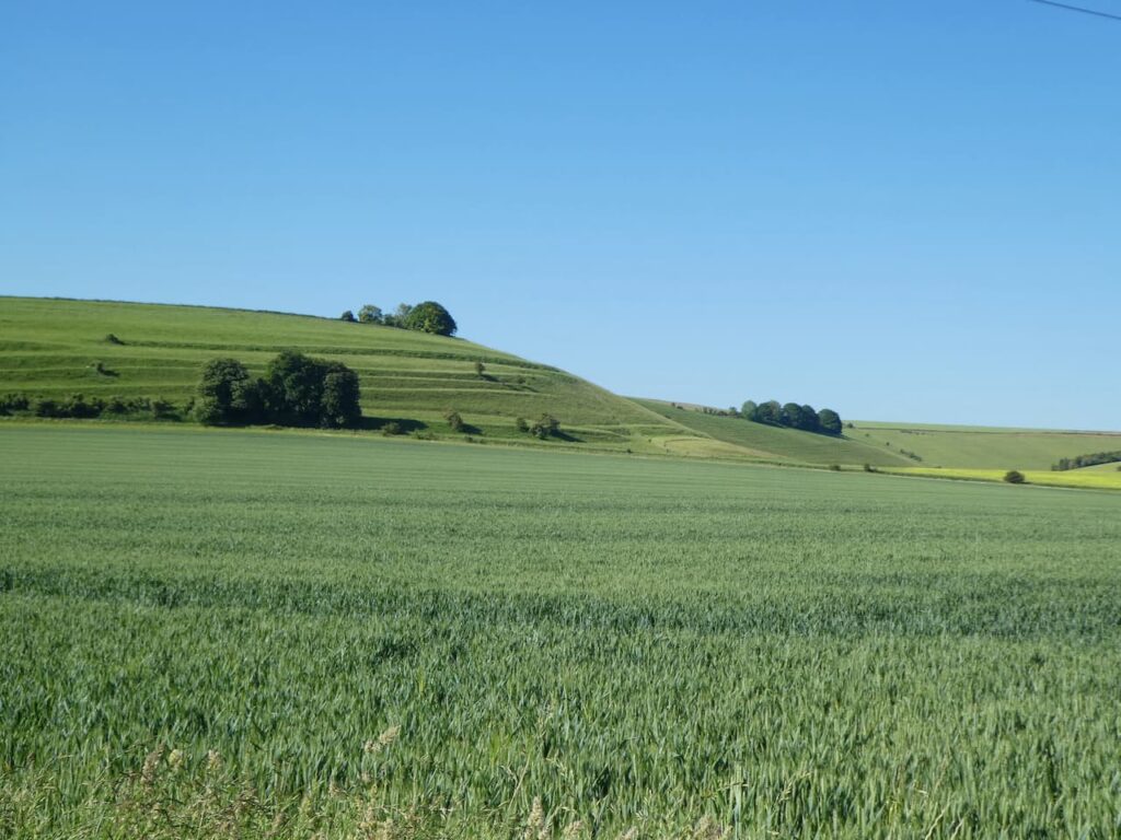
After my early morning walk Lynnie and I discuss our plans for the day. Later we are heading to the Anchor Inn in Oldbury on Severn for our evening meal so decide a short walk will be in order. My definition of a short walk is around six miles, whereas Lynnie would say around three.
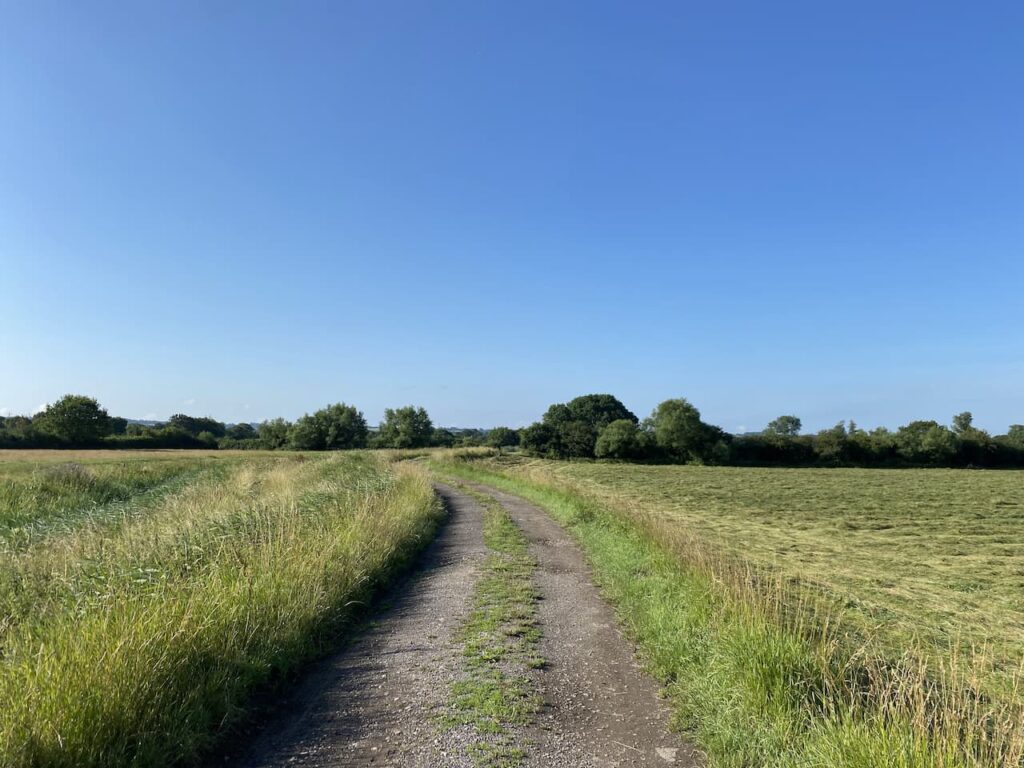
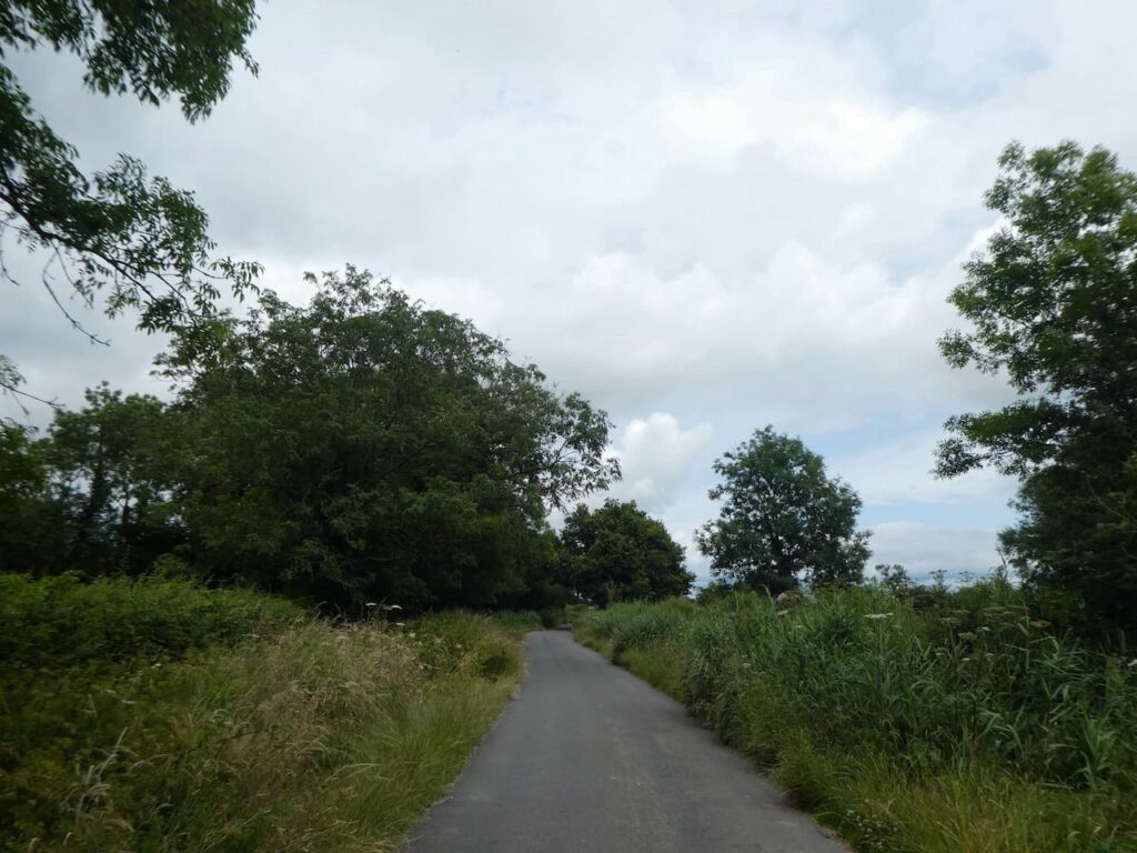
Leaving the site we turn left into the minor road Stoneyard Lane, and then at a junction in a hundred yards turn left into Shepperdine Road, signposted to Shepperdine and the River. We stay with Shepperdine Road until it turns to the right just after passing Knight’s Farm, the road bends to the right and we carry straight on. We are now on a lane heading towards Jobsgreen Farm.
Nearing the farmhouse we take a bridleway on the left and follow this to reach a gate.
We don’t go through the gate but turn left onto a bridleway running along the perimeter of Oldbury Nuclear Power Station.
On reaching a road we turn right and then almost immediately left to take a path that follows the high fence line of the Power Station.
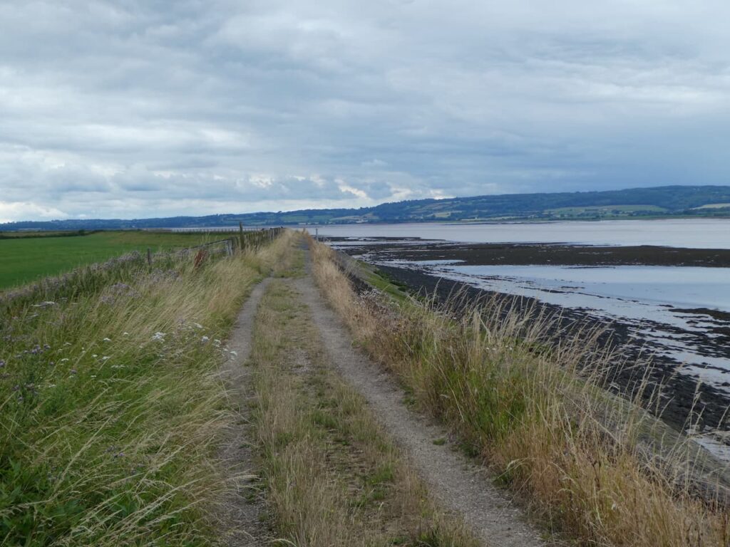
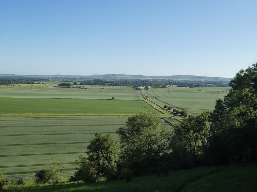
This path leads to the River Severn besides Oldbury Power Station. This power station was commissioned in 1967 and the nuclear reactors created enough electricity each day to serve a city twice the size of Bristol. It has two nuclear reactors, the second was commissioned in 1968. The power station was decommissioned in 2012 and is now going through the decommissioning process. The defueling process will continue until 2027 and apparently the demolition of the reactor buildings and clearance of the site is scheduled for 2096 to 2101.
We now turn left to join the Severn Way and follow this footpath besides the River Severn.
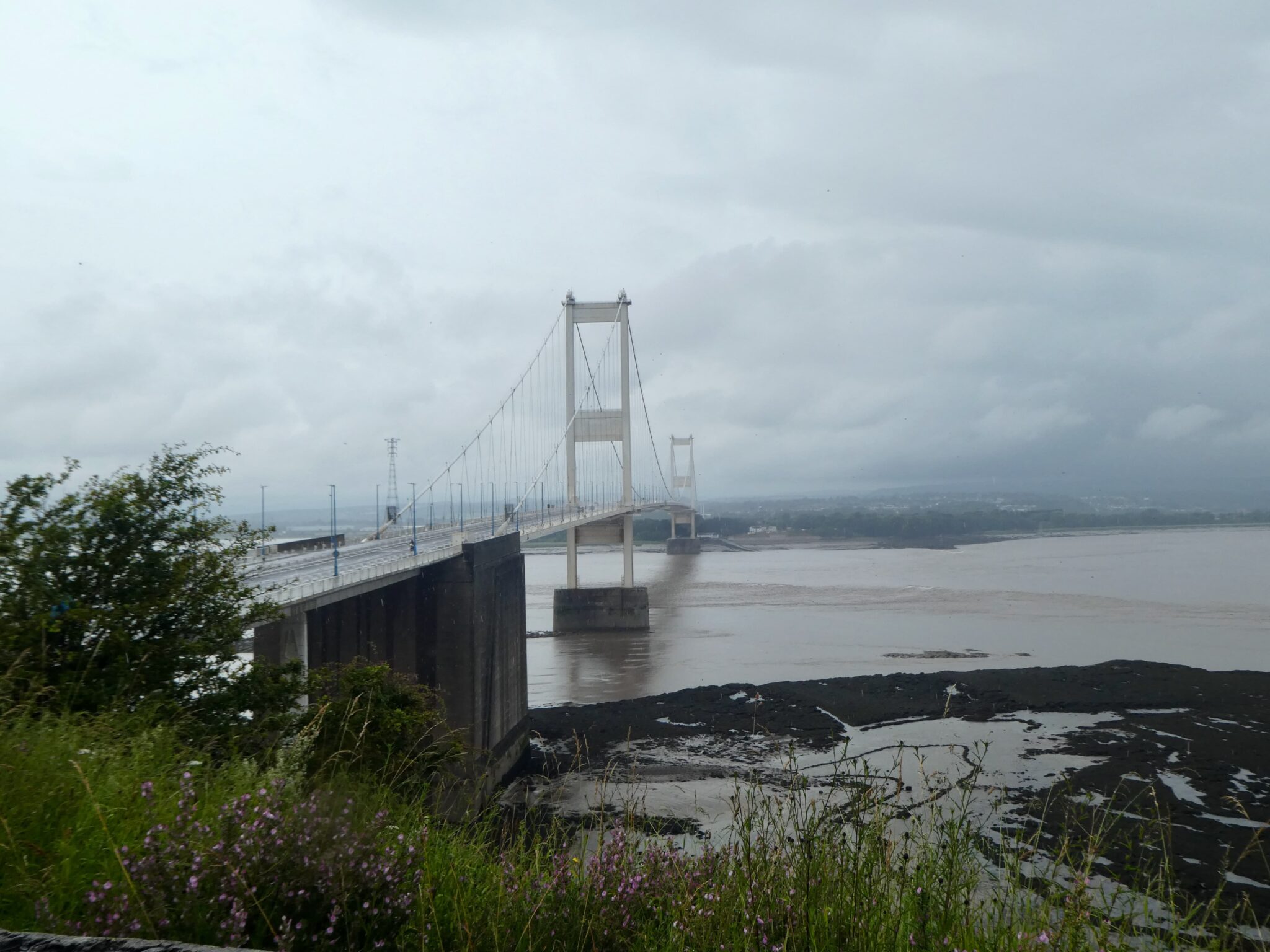
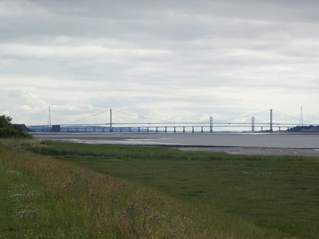
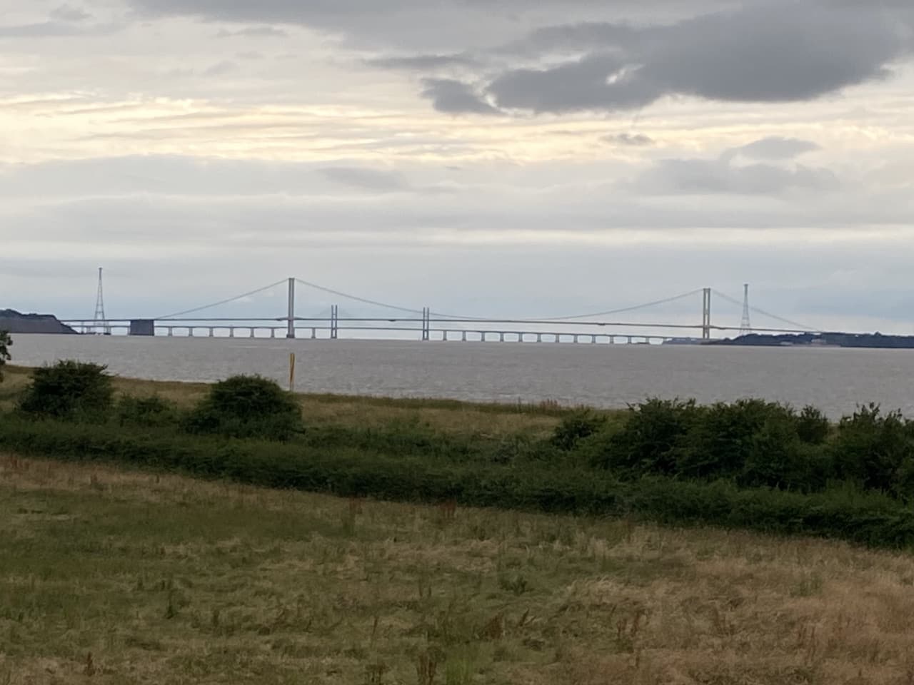
In front of us are the two road bridges crossing the River Severn. The closest suspension bridge was opened in 1966 by Queen Elizabeth II, this originally carried the M4 linking England to Wales. The second, newer bridge, The Prince of Wales Bridge, opened in 1996 and now carries the rerouted M4, whilst the old bridge has been designated as the M48.
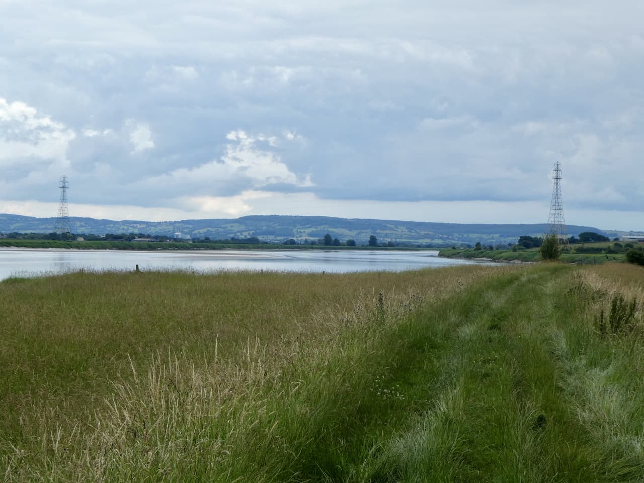
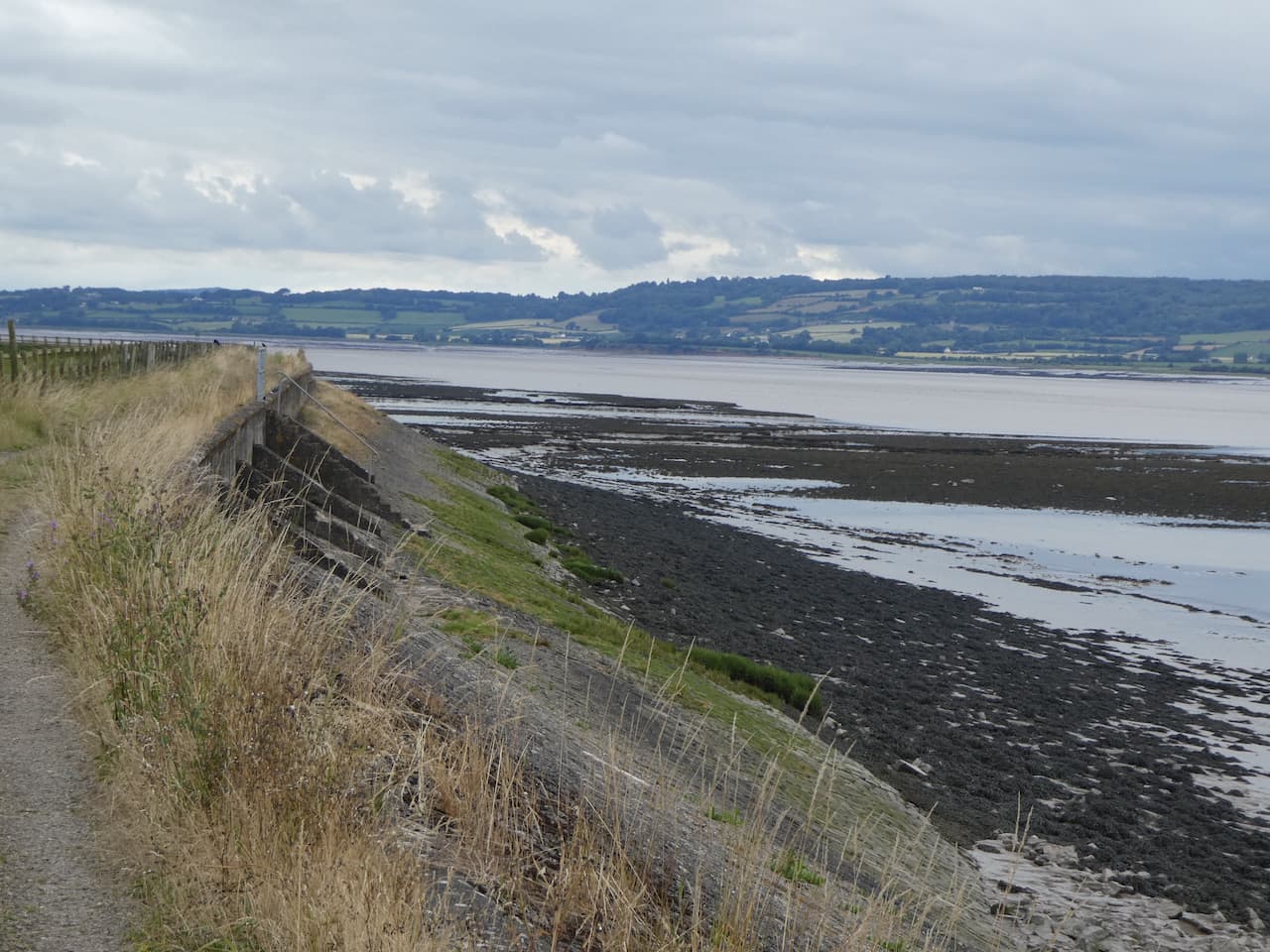
It is pleasant walking along the flood defence embankment and across the river we can see the Forest of Dean.
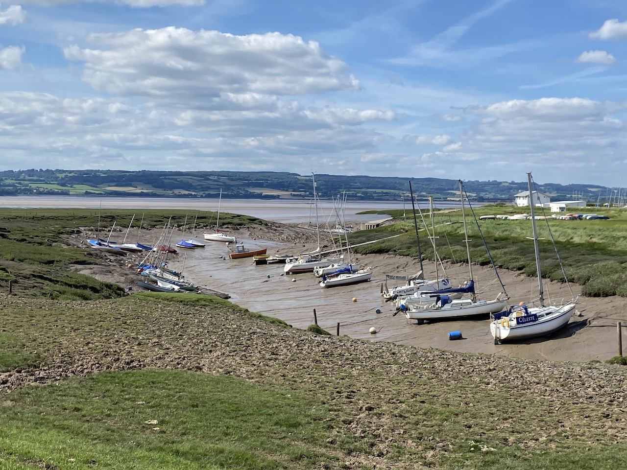
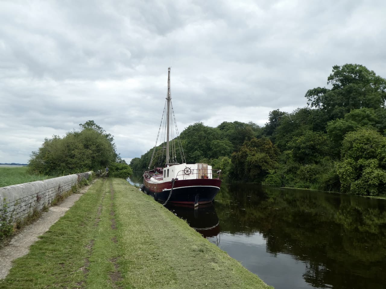
We stay with the path to Oldbury Pill with the Thornbury Sailing Club tucked into the inlet.
The path now goes inland and then besides the driveway to the Sailing Club and at a gate we go right to cross through a gates and over the pill to a second gate and now head down the other side of the pill still on the Severn Way heading towards the river.
We now follow the grass flood defence embankment heading towards the Severn Bridge.
After passing through a gate we continue along the embankment to reach a gate at Littleton Pill. Here we turn left and walk down off the embankment to another gate which leads to a lane besides Whale Wharf Business Centre. We follow the road to Littleton-upon-Severn at a junction in the village we follow the lane towards Kingston and Thornbury and keep heading in the same direction at the next junction.
We pass Lodge Farm and then Stock Farm before heading up Stock Hill. Where the road bends to the right we turn left into Stock Lane and follow this broad grassy track heading north.
When we reach a minor road we cross and stay with Stock Lane which continues to reach a minor road where we turn right to pass the village school and head downhill into Oldbury on Severn. In the village we pass the Anchor Inn and community shop and then on reaching the War Memorial continue straight on into Camp Road.
We stay with this lane as it leads through houses and then becomes a grass track.
There are a number of footpaths off this track which we ignore, then at a fork we go right and continue on to reach a minor road where we turn right and then at the crossroads turn left into The Naite and walk the short distance back to Golden Valley House CL.
Our walk has covered nine and a half miles, which is further than I originally planned but it has been pleasant afternoon and we still have plenty of time before we head off to walk to the Anchor Inn for our evening meal.
All information on this site is provided free of charge and in good faith and no liability is accepted in respect of damage, loss or injury which might result from it. To the best of my knowledge the routes are entirely on public rights of way or within areas that are open for public access. Walking can be hazardous and is done entirely at your own risk. It is your responsibility to check your route and navigate using a map and compass.
We arrived at Golden Valley House CL on Friday to a very warm welcome from Vic and Kate. They have great knowledge of the area and were able to advise on some local walks. They suggested a walk from the site covering a couple of miles around local fields.
The weather so far this week has been showery and we have been doing long walks during the day so my morning walks have been brief strolls up the local lane. Today a sunny day is forecast and we have an eight mile walk planned for after lunch, so as it is a cracking morning I decide to do a longer early morning circuit.
I turn left along the lane from the site and continue to reach a bridleway on the right, into Stoneyard Lane.
I stay with the lane ignoring footpaths to the left and right to reach a gate on the left with a way marker on the post. From the gate I head across a meadow.
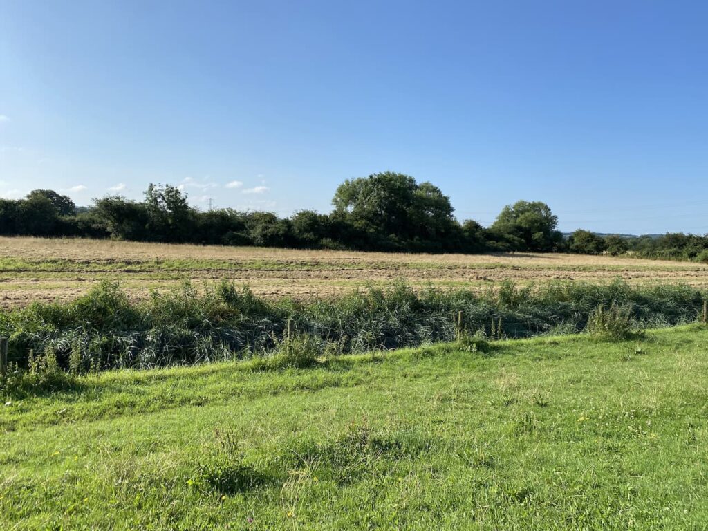
The path goes through another gate and then goes to the right before bending to the left on a farm track. The path continues to the right along a track on the ridge besides Rockhampton Rhine drainage ditch. This is one of the many ditches that keep this low lying area of land drained and suitable for agriculture and habitation.
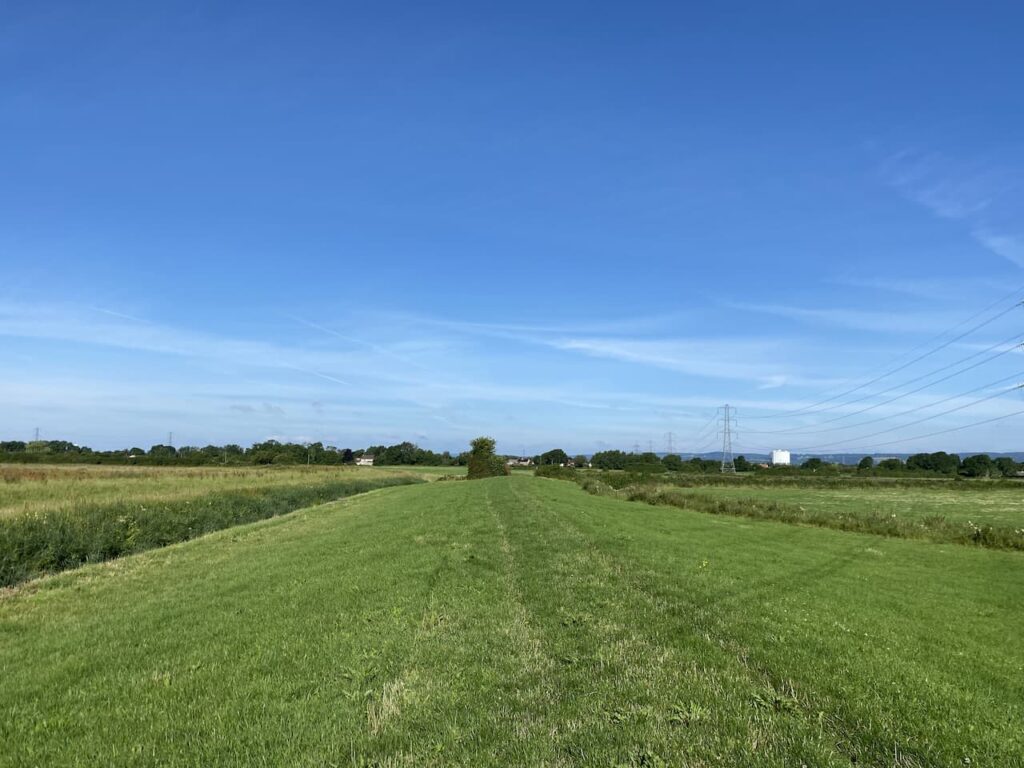
At a footpath on the right I go through a kissing gate and follow the path along a grass bank, still with the drainage ditch to my left.
I now stay on the grass bank as the footpath navigates a series of kissing gates. It is a beautiful morning and I have not seen anyone. The path leads to two sets of gates and a minor road. Opposite me is the office of the Lower Severn Internal Drainage Board. This is the public body responsible for ensuring the drainage and biodiversity of the flood plains of the River Severn.
I turn right along the lane to reach a crossroads where I turn right into the Naite and walk the few hundred yards back to the caravan. My walk has covered just under 3 miles and has been a cracking start to what looks like a gloriously sunny day.
ll information on this site is provided free of charge and in good faith and no liability is accepted in respect of damage, loss or injury which might result from it. To the best of my knowledge the routes are entirely on public rights of way or within areas that are open for public access. Walking can be hazardous and is done entirely at your own risk. It is your responsibility to check your route and navigate using a map and compass.
A few days ago one of my Twitter buddies Olly recommended that whilst in this area we walk the loop of the Severn Way from Frampton on Severn as it took an interesting circuit around a large bend in the river that goes around Arlingham. I follow Olly’s walking blog and know if he recommends it it must be a good walk.
Our starting point is the Canal and River Trust car park besides the Gloucester and Sharpness Canal which is besides the Sandfield Swing Bridge (GL2 7LA). The pay and display car park also serves the Cotswold Canal Trust Visitor Centre and the Stables Cafe.
Leaving the car park we start our walk by walking back past the Stable Cafe and Swing Bridge.
The Gloucester and Sharpness Canal opened in 1827 to enable vessels to avoid dangerous channels in the River Severn where it loops around Arlingham. It starts at Sharpness Dock and covers 16 miles to Gloucester Dock. Apparently when it opened it was the widest and deepest canal in the world.
We soon reach the Shipton Mill on the far side of the canal. This mill was originally built by Cadbury’s in 1917. The location was chosen so cocoa beans imported into Bristol Docks could be transferred to barges and carried up the canal to the mill, there they were mixed with milk from surrounding farms to create chocolate crumb. This was then transported by canal to Gloucester and then continued on the canal network to the Bournville factory in Birmingham. Cadbury’s closed their mill here in 1982 and it is now a flour mill.
We continue towards a road where Fretherne Bridge crosses the canal. Or at his moment does not cross because a barge is about to go through the swing bridge.
At the road we turn right and then almost immediately as the road bends to the right we continue straight on a lane towards Fretherne and Arlingham. In about 100 yards, just after passing a bungalow we take a footpath on the left which is way marked for the Severn Way.
At the end of the lane the footpath goes to the right and follows a fence line besides trees. It is the time of year when paths are overgrown and we have to contend with nettles and brambles. I assume we are unlucky because this must be a well walked route as it forms part of the Severn Way.
After a couple of hundred yards we reach a gate in front of us, here we turn to the left to enter a field, thankfully this is easier going as the path continues towards the River Severn. On entering another field we turn to the right and follow the path along the fence line.
At the end of the field we follow the fence as it sweeps to the left and then join a flood defence embankment and continue on with the River Severn to our left.
Our route is now very straightforward, we are going to stick with the Severn Way as it follows the River Severn on a large loop around Arlingham. We soon pass Hock Ditch and then across the fields we can see the gothic steeple of St Mary’s Church in Fretherne. Built in 1847 this church is apparently known as Gloucestershire’s mini cathedral.
We continue to enter a meadow above Hock Cliff with a warning sign to beware of getting too close to the edge because of recent cliff erosion. The path is fenced but then we notice that in some parts the erosion has come under the fence. Fortunately there is plenty of room in the field so there is no need to get close to the edge.
Leaving the meadow we enter woodland above the cliff. Apparently the shoreline below is popular with fossil hunters looking for treasures amongst the Blue Lias rocks. The erosion of the cliff face frequently provides new rocks to scour.
We cross a footbridge and leave the woods to be greeted by an expansive view in front of us.
The path now descends gradually through fields to once again join a flood defence embankment. In front of us is the Forest of Dean on the western side of the River Severn.
Across the river we can see the small shipyard at Bullo Pill.
The river has started to bend now and we soon see the shipyard at the old docks at Newnham on Severn. Apparently this dock was once a major trading post, however, that stopped soon after the Gloucester and Sharpness Canal opened in 1827.
Staying with the embankment we pass through a gate and reach the Old Passage Inn, I offer Lynnie a cup of tea, but she opts to sit on a bench besides the river looking across to the other side. There are warning signs that it is dangerous to enter the river. Frankly it was the last thing on my mind.
Heading off again we go through a gate and continue along the flood defence embankment through fields of cattle, which show no interest in us or Crosby. The river is starting to bend again so we get an ever changing view and soon see the impressive Garden Cliff.
As we pass Milton End Farm we stop to talk to a chap who is a regular visitor to this spot. He enthusiastically regales how impressive the Severn Bore is when it passes this farm. He caveats the statement by saying it is a lot more impressive further up where the river narrows. He says it is strange because you can hear the volume of water and debris coming up the river before you see it and then within seconds the river has risen so it is over the banks and in a high bore up towards the top of the flood defences.
It is something that neither Lynnie or I have seen. The next one is towards the end of the month around the time of the full moon. Unfortunately we will not be in these parts then, but we agree we should plan a trip so we can catch a bore.
Soon the path goes along the edge of a field with electric fencing keeping cattle away from the path.
We continue along the edge of narrow fields to reach a metal gate leading to a minor road which we follow until it bends sharp to the right. Here we go along a dead end lane which leads to a footpath heading towards Upper Framilode. We join a lane to pass St Peter’s church and continue on until we reach a footpath on the right which goes besides the disused Stroudwater Navigation canal.
We follow the canal past the Ship Inn and continue along a section of the canal that appears to have been cleared of weeds.
On reaching a road at Saul Bridge we cross and continue besides the old canal and then along the edge of fields to reach the Gloucester and Sharpness Canal at Junction Bridge. This is the point where the Stroudwater Navigation crossed the main canal.
We stop to read an information board and then notice that a barge is approaching and the swing bridge has opened. The barge is entering the marina and has to go up and turn around before making the turn into the marina.
We now turn to the right and follow the canal towpath the short distance back to our starting point in the car park.
All information on this site is provided free of charge and in good faith and no liability is accepted in respect of damage, loss or injury which might result from it. To the best of my knowledge the routes are entirely on public rights of way or within areas that are open for public access. Walking can be hazardous and is done entirely at your own risk. It is your responsibility to check your route and navigate using a map and compass.
On our travels we frequently walk along canal tow paths. I particularly like them because they are usually fine feats of engineering and part of our great industrial heritage. Today we are heading to Sharpness and plan to walk a section of the Gloucester and Sharpness Canal.
The starting point for our walk is the Canal and River Trust car park at Sharpness Viewpoint (GL13 9UF). This a free car park located besides the entrance to Sharpness Docks.
We start by leaving the car park and following the Severn Road to head back to the entrance to the docks. Here we turn right on the B4066 and follow the pavement to a footpath on the left that goes through a metal kissing gate. We are on the route of the Severn Way, which leads us through a field to a railway line crossing. On the other side of the line we continue on a path besides a playing field and then turn left on Oldminster Road and soon pass the Pier View Hotel.
We stay with the Severn Way and reach the old Severn Bridge and Railway Hotel which is now private accommodation. The path bends to the left and heads towards the docks with the old railway line soon running alongside.
To our left is a good view of Sharpness Docks. The docks were built in 1874 to develop Sharpness as a port. Prior to that there was a dock further to the north that opened in 1827 to provide access to the Gloucester and Sharpness Canal which took vessels to Gloucester docks. The new dock continues to be used as a commercial port which is only accessible to vessels at high tide.
We go over the swing bridge and continue on to reach a road where we turn right following the Severn Way way-markers. We then turn right along a lane with a large grassy car parking area to our right. Very soon we reach a monument to the Training Ship Vindicatrix. From 1939 to 1966 the Vindicatrix was moored in Sharpness Docks and used as a training ship for boys going into the merchant navy as deck hands or stewards. The training lasted between two and three months and they lived under the same conditions as if they were at sea. During its 27 years in operation 70,000 boys were trained on the vessel. After it finished being used as a training ship it was taken to a yard in Newport and broken up.
The track passes the Sharpness Dockers Club and then heads down to a parking area for the canal. The footpath is on the right of the car park and leads down to a marina area where we cross the canal.
To our left is the original Sharpness dock which opened in 1827. Now the gates to the port have been permanently closed so that the dock area maintains a constant water level with the canal.
We turn and walk along the towpath with the canal to our right to pass a plaque on a building which indicates where Vindicatrix was moored.
The towpath soon leads away from the marina and heads along the canal. When it was built in 1827 the Gloucester and Sharpness canal was apparently one the broadest and deepest canals in the world. This was required in order to carry the vessels into Gloucester Dock.
The canal runs parallel to the river and was built to cut out the tidal river and a dangerous area where the River Severn does a big loop around Arlington.
We soon reach the parapets for the Severn Railway Bridge. This bridge opened in 1879 to carry coal from the coalfields in the Forest of Dean across the river from Lydney to Sharpness. Unfortunately the amount of coal transported was not as high as anticipated and the single track railway was barely viable.
There were 21 spans to the bridge causing some challenges to vessels using the river with a number of incidents when the bridge was struck and vessels sank with the loss of life. There are also reports of RAF Spitfires flying below the arches, eventually the RAF court martialed individuals involved in this practice which proved sufficient deterrent to others.
Tragedy struck when on 25th October 1960 two barges overshot Sharpness Dock due to thick fog. The barges collided and smashed into a bridge pillar causing a partial collapse of the bridge. One barge, carrying petroleum, caught fire and exploded, the other vessel had a cargo of black oil that ignited. A significant fire ensued and five people lost their lives. It was decided that it was uneconomical to repair the bridge so the whole bridge would have to be demolished and by 1968 it was all removed.
The tower on the towpath side of the canal used to house a steam engine which drove the mechanism for opening the swing section of the bridge over the canal to enable tall vessels to pass.
We continue along the towpath and reach a milestone indicating that it is 15 miles to G (Gloucester) and 1 from S (Sharpness).
There is little traffic on this stretch of the canal and few barges are moored beside it. Approaching Purton there is a sign to the Purton Ship Graveyard. An information board explains that from 1909 to 1965 unwanted vessels were beached on the foreshore of the River Severn and allowed to fill with silt. This was done to stop the erosion of the river bank endangering the canal.
There are said to be 86 vessels beached here, with some on top of others and difficult to distinguish. To assist there are small plaques providing information on some of them.
It is low tide and the wrecks of Arkendale H and Wasdale H, the two barges that collided with the Severn Rail Bridge, can be seen still lying in the middle of the river.
This is a fascinating spot and we wander around for a while, but I think a couple of hours is really needed to take in all the maritime history here. As we head back to the canal there is a monolith with a list of vessels wrecked here.
We continue past some canal side cottages and then two swing bridges close to the village of Purton.
We now have a two and a half mile section on the canal as it heads through open countryside. It is very tranquil and very few others are out enjoying the scenery. To our left on the banks of the River Severn I spot a World War II pillbox.
As we near Patch Bridge there are more boats moored besides the river.
We leave the towpath at Patch Bridge and cross the swing bridge.
I offer Lynnie a pot of tea at the cafe besides the canal, but much to my surprise she declines. We walk by the Tudor Arms pub, which appears very busy and has a caravan park behind it. Our route now involves a bit of road walking, but these are quiet lanes so we are not going to be bothered by too much traffic. We head away from the canal on Kingston Road, this passes the carpark for Slimbridge Nature Reserve.
At the next junction we turn right into Lightenbrook Lane and follow this for just over half a mile to reach a junction with Moorend Lane where we turn right. In just under half a mile we reach Folly Bridge where we turn right into Tyndale Road. After nearly a mile we reach Hurst Farm which has a fine collection of old barns and farm machinery.
After crossing Gilgal Bridge the lane becomes Slimbridge Lane and we stay with this to pass the entrance to the Ernest Cook Trust – Redwood Outdoor Learning Centre. This site is used to provide children and young people with opportunities for outdoor learning. After a mile on Slimbridge Lane we reach a junction where we turn right on Riddle Street following a signpost to Purton and Hinton. A couple of hundred yards along the lane, we take a footpath on the left besides the Parish Council notice board. We are now on Lip Lane and this soon becomes a grassy track and then a clear path.
The track leads to a minor road where we turn left and pass a row of cottages in Brookend and walk steadily uphill to reach the Lammastide Inn. Sadly this pub has recently permanently closed after the long term landlords decided it was not economically viable to continue. Let’s hope they find someone willing to take it on and make a go of it. I cannot recall previously seeing a pub with this name, so later look it up and discover the Lammastide was the festival of wheat harvest, thus explaining the sheaf of wheat on the pub sign.
We continue along the road the reach a junction where we turn right and follow the road through Newtown passing the village school and then at a junction soon after the Post Office we turn right into Oldminster Road. After passing the allotments on our left we turn left onto the footpath that leads down past the playing field and crosses the railway line. After crossing a field we turn right and then retrace our route back to the viewpoint car park.
All information on this site is provided free of charge and in good faith and no liability is accepted in respect of damage, loss or injury which might result from it. To the best of my knowledge the routes are entirely on public rights of way or within areas that are open for public access. Walking can be hazardous and is done entirely at your own risk. It is your responsibility to check your route and navigate using a map and compass.
The weather forecast for today suggests there will be rain after lunch so Lynnie is reluctant to head out for a walk, instead opting to stay in the caravan with a good book. A bit of wet weather will not stop me from heading out. Apart from thunderstorms I am comfortable walking in most weather conditions, but avoid woodland when there are very strong winds.
So with lunch packed in my rucksack I head off with Crosby for a walk which will take me to the original Severn Bridge. I have no intention of walking across the bridge, although that is possible, I don’t think my poor head for heights would stand it. However, I aim to revisit a spot that Lynnie and I went to about forty years ago,
Leaving the site I turn right and walk along the lane to the crossroads. I go straight across on The Naite heading towards Oldbury on Severn.
At a junction I turn right into Chapel Street and continue through the village with the Rhine, the term they use for drainage ditches in this area, to my left.
On reaching a junction by the War Memorial I turn left into Church Lane and pass the Community Shop which is doing a brisk trade in drinks at the outside tables. This is the route of cycle way 41 on the National Cycle Network. This 120 mile cycle way connects Bristol with Gloucester, Stratford-on-Avon and Rugby. There are plenty of cyclists stopping for refreshments today. Soon after I reach the Anchor Inn and there are folk waiting outside for the doors to open.
At a junction in the road I keep left and head up Church Hill to pass Oldbury-on-Severn primary school. The school dates back to 1854 when it was built from public subscriptions and a government grant. It is good to see a thriving village school, all too often these days they get subsumed into larger units and lose the benefits of small school teaching.
Just after the school the road bends to the right but I take a bridleway to the left, Stocks Lane, this initially goes besides the Rectory and then at a fork in the lane I go to the right, still on Stocks Lane, which is now a grassy track.
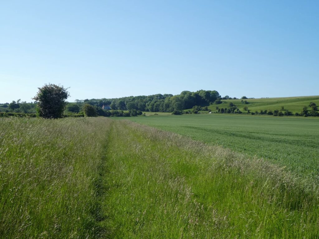
The lane crosses a minor road and continues along another grassy track to reach another minor road where I turn right and walk along Stock Hill soon passing Stock Farm. On reaching a footpath on the left I go through a metal gate and walk south across a pasture field with Sacks Hill to my left.
To my right is a fine view of the Severn Bridge.
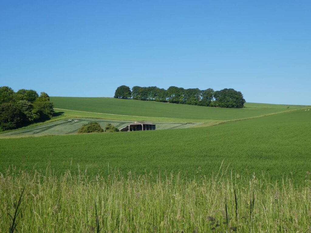
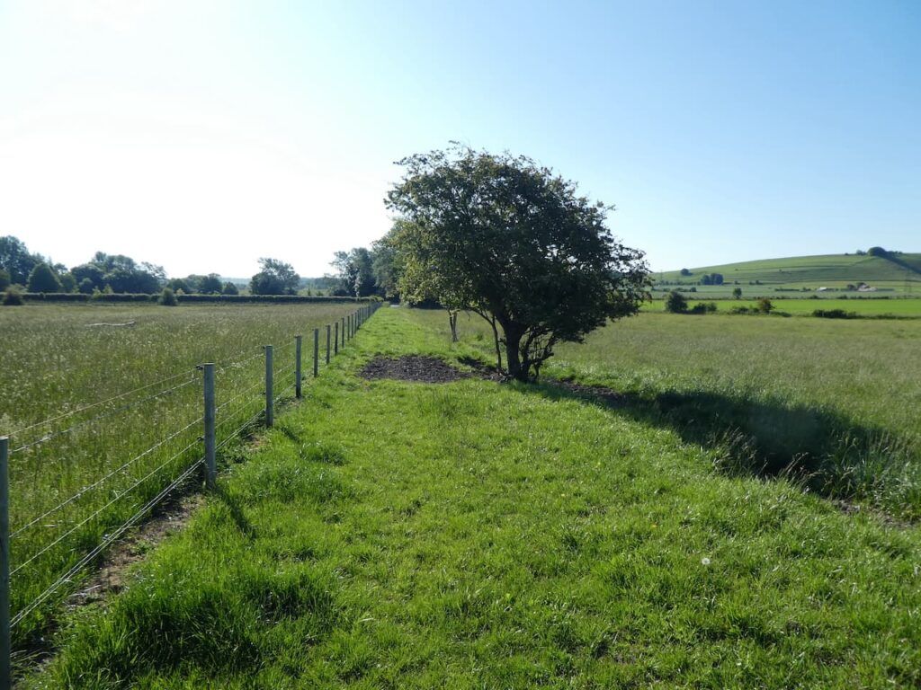
I reach a gate and go through to enter Wood Well Meadows Local Nature Reserve. Apparently the two fields that form this nature reserve have never had any pesticides or fertiliser used on them so it is an abundance of wild flowers. After being in private ownership for many years and cared for as a wildlife meadow, it is now owned by Aust Parish Council. They plan to improve the fencing and graze cattle on it in the late summer and autumn thereby maintaining the biodiversity.
The grass in the meadow is long at the moment but there is a clear path which I follow to a kissing gate. Now I follow a footpath alongside a paddock and then go across stiles through further paddocks and then over a stile by a metal gate onto a lane where I turn right and walk a short distance to a minor road. Here I carry straight on to soon pass the Water Treatment Works and then continue on to reach the B4461 Redhill Lane where I turn right and then almost immediately left into Elberton Road. After passing through the village I come to a driveway leading to the church of St John the Evangelist.
The spire on the church dates to the 14th century but most of the rest of the building was rebuilt in 1858. I find a bench beneath a tree and decide this is as good a spot as any to stop for lunch. I am not at all religious but often avail myself of a bench in a churchyard on my walks. It is usually a tranquil spot to sit and observe the wildlife.
Refreshed from lunch, both Crosby and I are topped up with water so we head off again back to the minor road and turn left along the Elberton Road and follow this to reach Olveston. At a junction in the village I turn right and join Aust Road. This heads downhill and passes a parking area where I spot a battered milestone besides the road. It is difficult to read but it is 10 miles from it’s unreadable destination.
I continue on past the entrance to the Harnhill Landfill site. This site was originally a quarry and then became a landfill site which is now used for biomes generation producing power for the national grid. I turn left off Aust Road into Ingst Road. This is a narrow lane passing Priestpool Farm and Box Bush Farm before crossing the M48.
After crossing the motorway the lane leads into Ingst where soon after passing Old Manor Farm I take a footpath on the right. The path goes over a stile and enters a field and then quickly through a gate into a field of rough pasture. I am grateful for the OS Map app on my phone because the path is not immediately clear but soon joins a track. Nearing the end of a field the track continues on, but I take a poorly marked path on the right into a field and head for a footbridge over a drainage ditch. I am now in a meadow which I cross to reach another footbridge over a drainage ditch.
The footpath follows the edge of an arable field and then heads across the corner of the field on a diagonal path to reach a farm track. I cross the track and head across another arable field. The rain that was forecast has arrived and it is a constant drizzle and looks well set in.
I go over a stile and join a lane where I turn left. The M48 is just the other side of the fence as I walk along the lane and pass a parking area. The lane then continues on into Aust where I pass houses to reach the Boars Head pub.
I follow the road through the village and pass an old petrol station.
I stay with the road past the village church and then reach the Village Hall at a junction of a road. I always think the size of a village hall reflects on the number of active members within a community. Village meetings in this hall must be cosy affairs.
I now cross the A403 with care to take a path through trees which leads me to a road which I cross and then follow the Severn Way signs on an access road to the Severn Services. I stay with the Severn Way markers to cross the M48. From here you get a good impression of the scale of the suspension towers on the bridge.
The Severn Way path now leads away from the new service area, which was opened in 1999 and in 2019 voted the worst motorway service station in the Country. I soon emerge on the site of the old Severn View Services, it is a nearly forty years since I visited here with Lynnie on our first holiday away together in South Wales. The services were opened in 1966 by Top Rank. It was a spot where travellers stopped to take in the view of the bridge. With the advent of the second river crossing and the diversion of the M4 the main service area moved and the old building was sold and is currently owned by Brightside Insurance which was founded by Aaron Banks. I will resist commenting on this individual and the role he has played in recent British politics for fear of making a defamatory statement.
I follow the footpath to the wall which is on the edge of Aust Cliff. I am a man with vertigo, so cliffs are not an area I feel comfortable. However I was determined to revisit this spot, in a photo album I have a picture of Lynnie sat on this wall nearly forty years ago.
The Severn Bridge was opened in 1966 and took three years to build. It replaced what was previously a ferry crossing between Aust Cliff and Beachley Peninsula. Construction of the bridge cost £8m and was recovered through toll charges. Originally it carried the M4, but in 1996 the second crossing, The Prince of Wales Bridge, opened and the M4 was diverted. This old bridge now carries the M48.
I now follow the way markers leading along the top of Aust Cliff, thankfully the edge is well away and protected by undergrowth. On reaching a pasture field I start to descend and I am soon down on an embankment besides the River Severn looking back at the bridge.
There is no protection from the rain besides the river, but it is at my back as I head along the Severn Way.
The route is very easy to follow. I stay on the embankment through a couple of herds of cattle, who show no interest in us whatsoever. In the far distance is Oldbury Nuclear Power Station. The path cuts inland slightly around the Littleton Pill and then continues on to Oldury Pill where the Thornbury Sailing Club is located.
After crossing Oldbury Pill I continue on to reach the lane which serves the sailing club. Here I turn right and walk back into Oldbury on Severn. In the village I turn left and pass the community shop.
and then on reaching the War Memorial continue straight on into Camp Road and stay with this lane as it leads through houses and then becomes a grass track.
There are a number of footpaths off this track which I ignore, then at a fork I go right and continue on to reach a minor road where I turn right and then at the crossroads turn left into The Naite and walk the short distance back to Golden Valley House CL.
I have had a cracking walk, a bit more road walking than I would normally choose, but it has been on quiet lanes and I have only seen a handful of cars. Visiting the Severn View brought back many happy memories. I have covered 15 miles and for the last couple of hours it has been raining. So I hang up my jacket and dry Crosby before planning tomorrow’s walk.
All information on this site is provided free of charge and in good faith and no liability is accepted in respect of damage, loss or injury which might result from it. To the best of my knowledge the routes are entirely on public rights of way or within areas that are open for public access. Walking can be hazardous and is done entirely at your own risk. It is your responsibility to check your route and navigate using a map and compass.
We have decided to walk from the caravan site today. I am never keen on driving far when we are away. Years ago I used to find driving pleasurable, but nowadays it is something to be done out of necessity and I try to limit our mileage as much as possible. Walking from the site also gives us a great opportunity to get to know the area in more detail.
After chatting to the CL owner Kate this morning I have checked the map and plotted a walk that will take Lynnie and I along a section of the River Severn. Leaving the site we turn left and follow the minor road Stoneyard Lane, which soon becomes Hill Lane, towards the village of Hill. Clearly the locals around here were not that imaginative when they named their villages, but then again the land around here is fairly flat.
This is a very quiet lane and forms part of Route 41 on the National Cycle way. This is a 120 mile cycle way connecting Bristol with Gloucester, Stratford-on-Avon and Rugby.
We follow the road into Hill and decide it is time for lunch, we find a convenient spot on one of the two benches besides the Millennium Pump. Areas like this are always a blessing to walkers looking for a suitable spot to stop and take on some refreshments.
Apparently Hill is recorded in the Doomsday Book as Hilla and then between 1250 and 1455 it was recorded as Hulla, but since 1733 it has been known just as Hill. After our lunch we continue along the road and pass the entrance to St Michael and All Angels Church and Hill Court. We stay with the road passing Blisbury Farm with its collection of fine old brick barns.
Up on the escarpment to our right is Catgrove Wood. These woods were the scene of a murder on the night of 18th January 1816. Sixteen poachers took part in a mass poaching intended as a protest, feelings were running high following the death of a local man, killed by a spring gun two months earlier. The group encountered gamekeepers and in the resulting melee an assistant gamekeeper, William Ingram, was shot dead. Eleven men stood trial for his murder, two were executed and the remaining nine were transported as convicts to Australia.
On reaching a crossroads we turn left onto Severn Lane and follow this to reach Severn House Farm. Here we go through a gate and turn left to join the Severn Way as it follows a path along the sea wall.
Following the Severn Way we pass the White House, apparently this house dates from 1845 and has long been associated with navigation on the River Severn. It now has a navigation beacon beside it.
In front of us we can see the two road crossings over the River Severn. The suspension bridge closest to us, The Severn Bridge, was opened in 1966 by Queen Elizabeth II, it was granted Grade 1 listed status in 1999 . It originally carried the M4 to link England and Wales. With the opening of the second river crossing, The Prince of Wales Bridge, in 1996 the main M4 was rerouted to cross the new bridge, whilst the old bridge was designated as the M48. Both started life as toll bridges but are now free to cross.
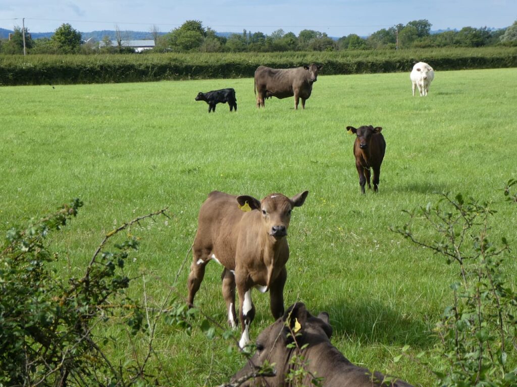
On reaching a gate to a minor road we leave the Severn Way and walk along Shepperdine Road heading back inland. This lane passes farms, there are options to cut corners on footpaths, but it is pleasant walking on the quiet lane so we stick with it as we wend our way back. As we pass a field of cattle the inquisitive calves watch us carefully.
At the junction with Stoneyard Lane we turn right and walk the short distance back to the entrance to Golden Valley House CL. Our walk has covered ten and a half miles and it has been a pleasant jamabout.
All information on this site is provided free of charge and in good faith and no liability is accepted in respect of damage, loss or injury which might result from it. To the best of my knowledge the routes are entirely on public rights of way or within areas that are open for public access. Walking can be hazardous and is done entirely at your own risk. It is your responsibility to check your route and navigate using a map and compass.
A couple of weeks ago Lynnie’s brother John mentioned he had recently stayed in a holiday cottage at Oldbury Naite, close to the River Severn in South Gloucestershire, where a new CL was about to open. It is a part of the Country we have not previously visited so decided to give it a go.
Following an email exchange with Vic the CL owner we find ourselves booked in as the first visitors to their brand new site at Golden Valley House CL. Access to the site is really good and as you would expect from a new CL the facilities are top notch. After pitching up Crosby and I are out for a walk to stretch our legs and explore the area.
Leaving the site I turn left into the minor road Stoneyard Lane, and then at a junction in a hundred yards turn left into Shepperdine Road, signposted to Shepperdine and the River. I stay with Shepperdine Road until it turns to the right just after passing Knight’s Farm. I am now on a lane heading towards Jobsgreen Farm, nearing the farmhouse I take a bridleway on the left and follow this to reach a gate. I don’t go through the gate but turn left onto a bridleway running along the perimeter of Oldbury Nuclear Power Station.
On reaching a road I turn right and then almost immediately left to take a path that follows the high fence line of the Power Station to reach the River Severn.
Oldbury Power Station was commissioned in 1967 and the nuclear reactors created enough electricity each day to serve a city twice the size of Bristol. It has two nuclear reactors, the second being commissioned in 1968. The power station was decommissioned in 2012 and is now going through the decommissioning process. The defuelling process will continue until 2027 and apparently the demolition of the reactor buildings and clearance of the site is scheduled for 2096 to 2101. A stark reminder that nuclear fuel leaves a legacy for future generations to clear up.
I now turn left to join the Severn Way and follow this footpath besides the River Severn. Last week we were walking on the Severn Way around Worcester, then we would only get an occasional glimpse of the water, here the full expanse can be enjoyed as I look across towards the Forest of Dean.
In front of me are the two road bridges crossing the River Severn. The closest suspension bridge was opened in 1966 by Queen Elizabeth II, this originally carried the M4 linking England to Wales. The second, newer bridge, The Prince of Wales Bridge, opened in 1996 and now carries the rerouted M4, whilst the old bridge has been designated as the M48.
I stay with the path to Oldbury Pill with the Thornbury Sailing Club tucked into the inlet. I am not keen on being on water and have never ventured out sailing, the Isle of Wight ferry is my type of sea transport. However, it is obviously a popular activity and this club was formed back in 1949 and according to its website is thriving.
The footpath soon joins the tarmac driveway to the sailing club and on reaching a gate the Severn Way goes to the right over Oldbury Pill, but I stay on the tarmac drive and walk into the village of Oldbury on Severn. The lane comes out almost opposite the Anchor Inn.
After a long day a pint would be very welcome, but it is getting late and I know that Lynnie will be preparing food back at the caravan. So I turn left away from the pub and walk through the village passing the Community Shop and then following the road as it bends to the right into Chapel Lane. On reaching a junction I turn left into The Naite and follow this minor road to reach a crossroads where I go straight over and then walk the short distance back to Golden Valley House CL.
My stroll has covered five miles and it has been an interesting introduction to the area. Time now to plan some walks for the next few days.
All information on this site is provided free of charge and in good faith and no liability is accepted in respect of damage, loss or injury which might result from it. To the best of my knowledge the routes are entirely on public rights of way or within areas that are open for public access. Walking can be hazardous and is done entirely at your own risk. It is your responsibility to check your route and navigate using a map and compass.
For a while now my walking buddy Mandy and I have been discussing walking the perimeter path around the Imber Range on Salisbury Plain. It is a long walk of over thirty miles so we have been waiting for a day when the weather forecast is set fair. I don’t mind walking in the rain, but it is uncomfortable wearing waterproofs for hours on end in the summer.
We plan to start from Tilshead and are dropped off by Mandy’s husband ,Stuart outside the Rose and Crown Inn (SP3 4RZ) in the centre of the village beside the A360. The beauty of starting from a pub means there is an opportunity for a pint at the end of the walk. After walking over thirty miles I will be ready for one!
Leaving the pub we cross the road and turn left following the pavement besides the A360 and just after passing Ash Tree House take a footpath on the right which leads between properties and then becomes a tree lined path.
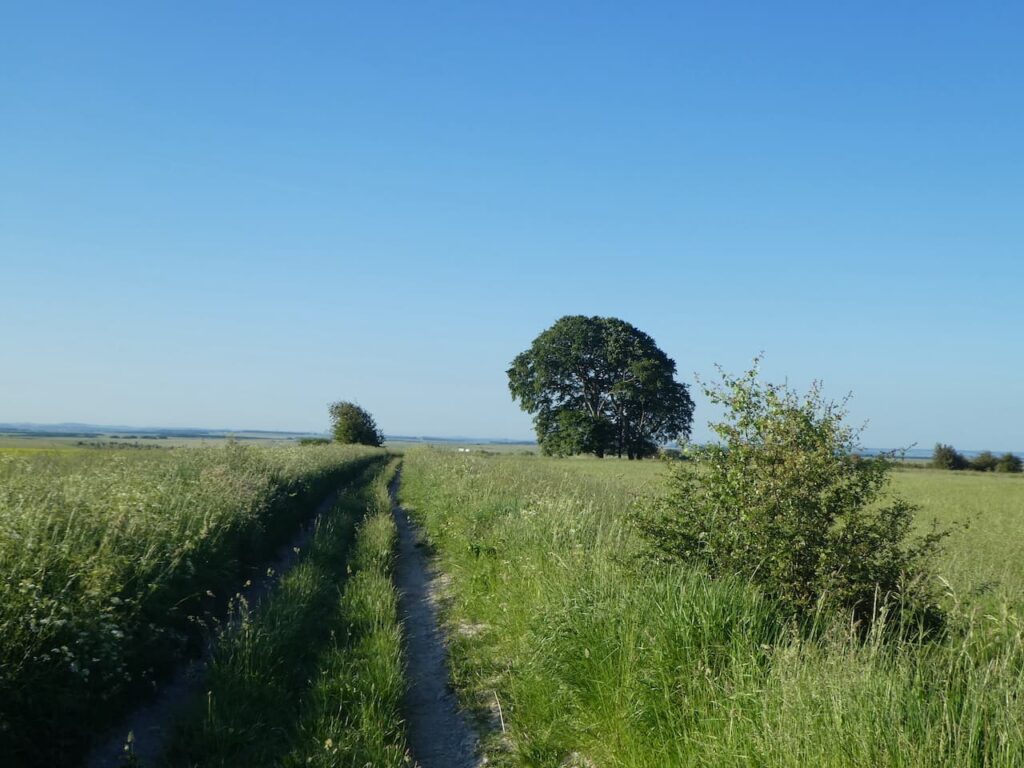
At a junction of paths we turn left and soon reach the Imber Range Perimeter path, here we have the option of going clockwise or anti-clockwise on the circular walk around the range. We opt to go clockwise so continue to head south on a grassy path.
On reaching a junction with a track we turn right and head steadily uphill.
We soon pass the access land around White Barrow and then at a fork in the path go to the right continuing up Copehill Down. There are a network of military tracks on these downs, but our route is straightforward keeping with the way-markers for the Perimeter path. On the summit of the Down we make a slight diversion by turning left to visit the Ordnance Survey Trig Pillar on Copehill Down, this is the 254th trig I have bagged.
Back on the Perimeter path we continue across a junction of footpaths and then pass houses that have been built for training the military.
Soon we head across another junction of paths and descend into the village of Chitterne.
On entering the village we turn right along a minor road following the suggested new route of the Perimeter Path which avoids walking besides the B390.
The lane we are on provides a good view of All Saints Church, parts of which date back to 1450 but most of it was rebuilt in the 1860’s. We would normally make a diversion to visit the church, but we have a full day’s walking ahead of us so don’t want to delay our progress.
At a junction of roads we turn left and then after a couple of hundred yards follow the way-markers on the right up a track running alongside old barns and then we keep going steadily uphill back onto the downs.
One of the benefits of walking a route like this is there are plenty of way-markers and we stick with these as the path goes over Breakheart Hill and then goes along a track at the boundary of the restricted area.
Soon we pass Quebec Barn and at a junction of paths keep heading west. To our right is the Knook Barrow OS trig pillar, it is one I have not bagged, but the red flags are flying on the range so it is not safe to visit.
The path joins a well-made track and then bends to head downhill towards East Hill Farm.
On reaching a minor road at East Hill Farm we turn left and follow the road heading towards Heytesbury. Shortly before reaching Heytesbury House we go right on a path which goes steadily uphill to Cotley Hill Woods.
After going through the trees we stay with the path over Cotley Hill.
We are now walking along a ridge heading towards Scratchbury Hill on which sits the Iron Age hillfort of Scratchbury Camp. After a gradual ascent we reach the camp and turn right to walk along the ramparts.
After Scratchbury Hill we drop down to a track and then head over Middle Hill.
Descending from Middle Hill the path leads to a track where we turn right and then soon left to start the steady ascent to the summit of the Battlesbury Hill. This was the location of another Iron Age hillfort. The 360 degree views from up here make it a good location for spotting enemies approaching.
Rather than walk around the ramparts we follow a well-worn path towards the centre of the fort where there is an Ordnance Survey Trig Pillar, my 255th bagged.
From the hillfort the way-markers direct us downhill to reach a minor road, Sack Hill, where we turn left and walk along the road, soon passing military barracks behind secure fencing. After the barracks we turn right into Elm Hill and pass the modern St Giles Garrison Church.
This is not the most attractive of places to walk but we know we will soon be back on the edge of the Plain. We follow Elm Hill to a junction keeping with the way-markers and turning left to follow a rural lane downhill to the driveway of West Wilts Golf Club. Our route turns right up the driveway and then forks to the right to follow a path besides a house before heading through trees to reach open countryside overlooking the wonderfully named Kidnappers Hole.
Apparently this was the site of a chalk pit used in the lime kilns. I have been unable to find out why it is called Kidnappers Hole, but in researching I did find reports of UFO sightings here in the 1960’s.
To our left is the West Wilts Golf Course, this is a course I have never played and it is now so long since I last picked up my clubs, I doubt I ever will.
As well as being the route of the Imber Range Perimeter Path, this is the route of the Wessex Ridgeway, a long distance path travelling 138 miles between Marlborough and Lyme Regis.
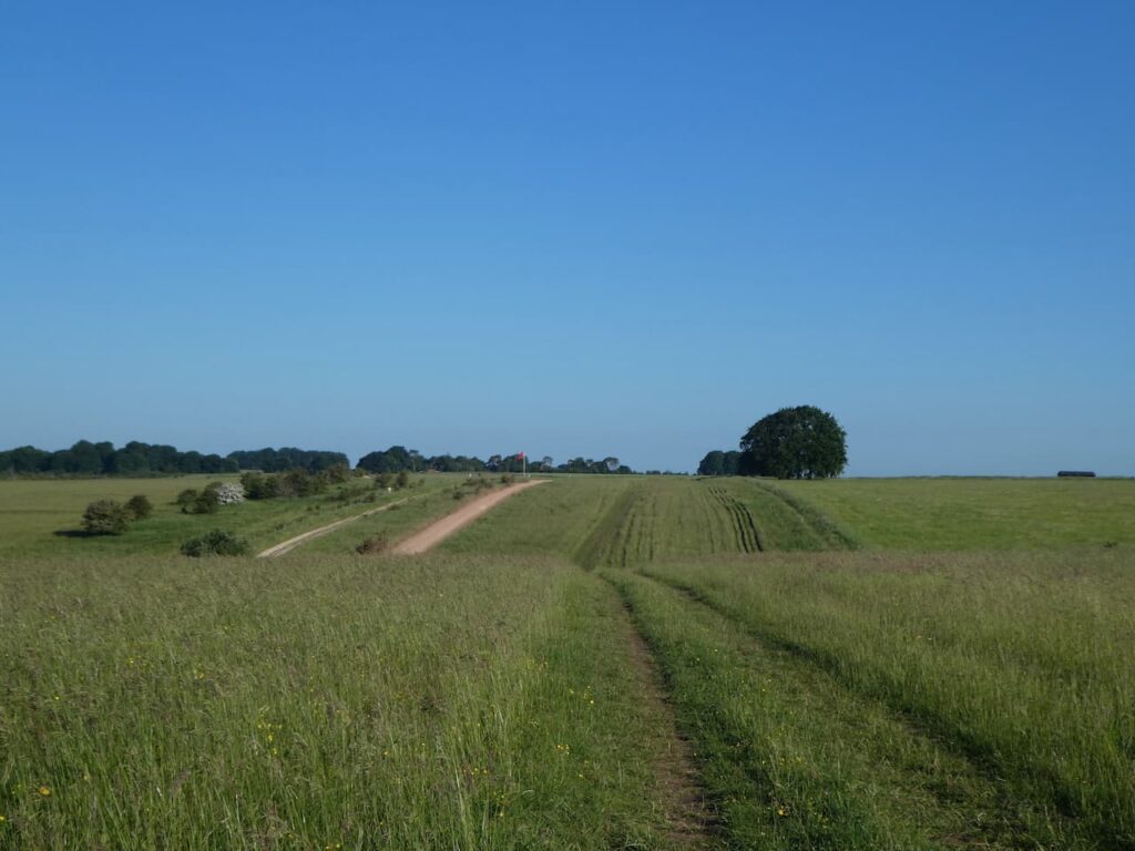
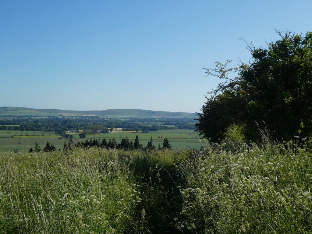
At a junction of tracks we turn to the left and head north to stay with the Imber Range Perimeter Path. There are cracking views in front of us and we can clearly see the path on the horizon a mile away. There is a good stretch of downland walking before we get there.
After passing a barn in a hollow we leave the track to go through a gate on the right following the Imber Range path signs. The path drops into a hollow and then ascends steeply up a chalk escarpment. It is a warm day so as we near the top we stop to admire the view behind looking back across where we were twenty minutes ago.
After a kissing gate we turn right along a well-made track following the Imber Range Path signs. The route has now joined the Mid Wilts Way, a sixty-eight mile long distance path crossing Wiltshire between the village of Ham, on the Berkshire border, and Mere on the Somerset border.
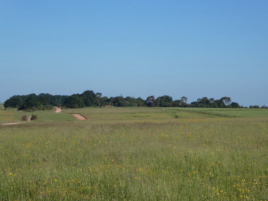
We continue in a northerly direction passing a massive chalk quarry. Permission for this quarry was granted following a ministerial decision in 1947, over the years it has expanded massively. The chalk extracted fed the nearby cement works in Westbury.
We pass the perimeter of the quarry and join a path besides the road leading to a car park. As we proceed we get a good view of the Westbury White Horse.
There are a group of paragliders on the edge of the escarpment waiting for the correct wind conditions to launch themselves off the side of the hill. It is a pastime that would not suit me, I am far more comfortable with two feet on the ground.
Near the car park we take a slight detour on a path to the left which has benches overlooking the valley. This is a cracking spot for us to have lunch and the nearby toposcope provides details of the points we can see in the distance.
Refreshed from lunch we return to the track and pass the car park and then turn right to reach the barns of White Horse Farm and then left along a wide stony track.
We are now over twenty miles into our walk, but still have ten to do. The track enables us to make good progress and there is no delay in identifying our route. It is straightforward. We just keep the boundary of the range to our right. As we head along there are some cracking views.
The track leads to the entrance road to Imber village. From the late 1800’s the War Office had been purchasing land on Salisbury Plain for military training. By 1920 land close to Imber village was being purchased and farms around the village were gradually acquired for military use.
On the 1st November 1943 the village residents were called to a meeting and informed they had 47 days to move out, the village was required for training for the Allied Invasion of mainland Europe. All 150 villagers left their homes for what they thought was a temporary move. Some even left tinned food in cupboards ready for their return. Unfortunately, they were never allowed to return to their homes apart from a brief annual visit when the Ministry of Defence enables public access.
Our route continues along a stony track, we are now getting a bit bored of walking on this surface. It made a pleasant change earlier but is becoming tedious, but at least there are good views to distract us.
The trail soon heads north towards Coulston Hill and then turns to the east leading us to the Ordnance Survey trig pillar on Stoke Hill, our third trig of the day and my 256th.
Shortly after the trig we pass another area constructed for the military to practice urban warfare.
The track heads towards the A360 and shortly before reaching the road we turn right just after passing barns and head south along another track until we reach a way-marker directing us left between fields. It is good to be walking on grass again.
At a junction of paths we turn right and follow the path across Lavington Down.
On reaching a minor road we turn left and walk through trees to pass an impressive, brick water tower apparently this is all that remains of a military camp on this site.
Emerging from the trees we see Tilshead below us, we have just a mile to do and are both relieved that it is downhill all the way.
On entering the village we head back to the Rose and Crown and are soon sat in the bar rehydrating on beer. After thirty-two miles the first does not touch the sides. We are both pleased to have ticked off this walk, it has been on our list for a while and there is a good sense of achievement in completing it. My walking app shows that our walking speed averaged 3.2 miles per hour which is not too shabby over such a long distance.
To follow my walk, you will need Ordnance Survey Explorer Map -OS Explorer – 130 – Salisbury & Stonehenge; and OS Explorer – 143 – Warminster & Trowbridge
All information on this site is provided free of charge and in good faith and no liability is accepted in respect of damage, loss or injury which might result from it. To the best of my knowledge the routes are entirely on public rights of way or within areas that are open for public access. Walking can be hazardous and is done entirely at your own risk. It is your responsibility to check your route and navigate using a map and compass.
We are heading back home today after a great week walking in the Pewsey Vale. Usually on the day of our departure I take a short early morning walk with Crosby and then get busy packing. Over the years of caravanning we have worked out how long it takes us to be ready to leave a site and I know if I make an early start I will have plenty of time today to sort things out before our scheduled departure.
It is another cracking morning as I leave Charlton Manor CL, turning right to walk towards the village. Soon after crossing the River Avon I take a lane on the right and then after a couple of hundred yards fork left to head uphill on a footpath to reach the Charlton Cat Cafe. This dates from the 1820’s and used to be a pub. Apparently, it was originally called the Red Lion, but by the 1920’s it had become known locally as the Cat due to the poorly painted lion on its sign, so the name was changed.
I cross the A342 to join the track opposite, this is Charlton Drove and I follow it on a long steady ascent.
The track passes barns and continues on to pass the Charlton Clumps trig pillar. I have bagged this trig on a number of occasions. I continue along the lane towards a junction of paths.
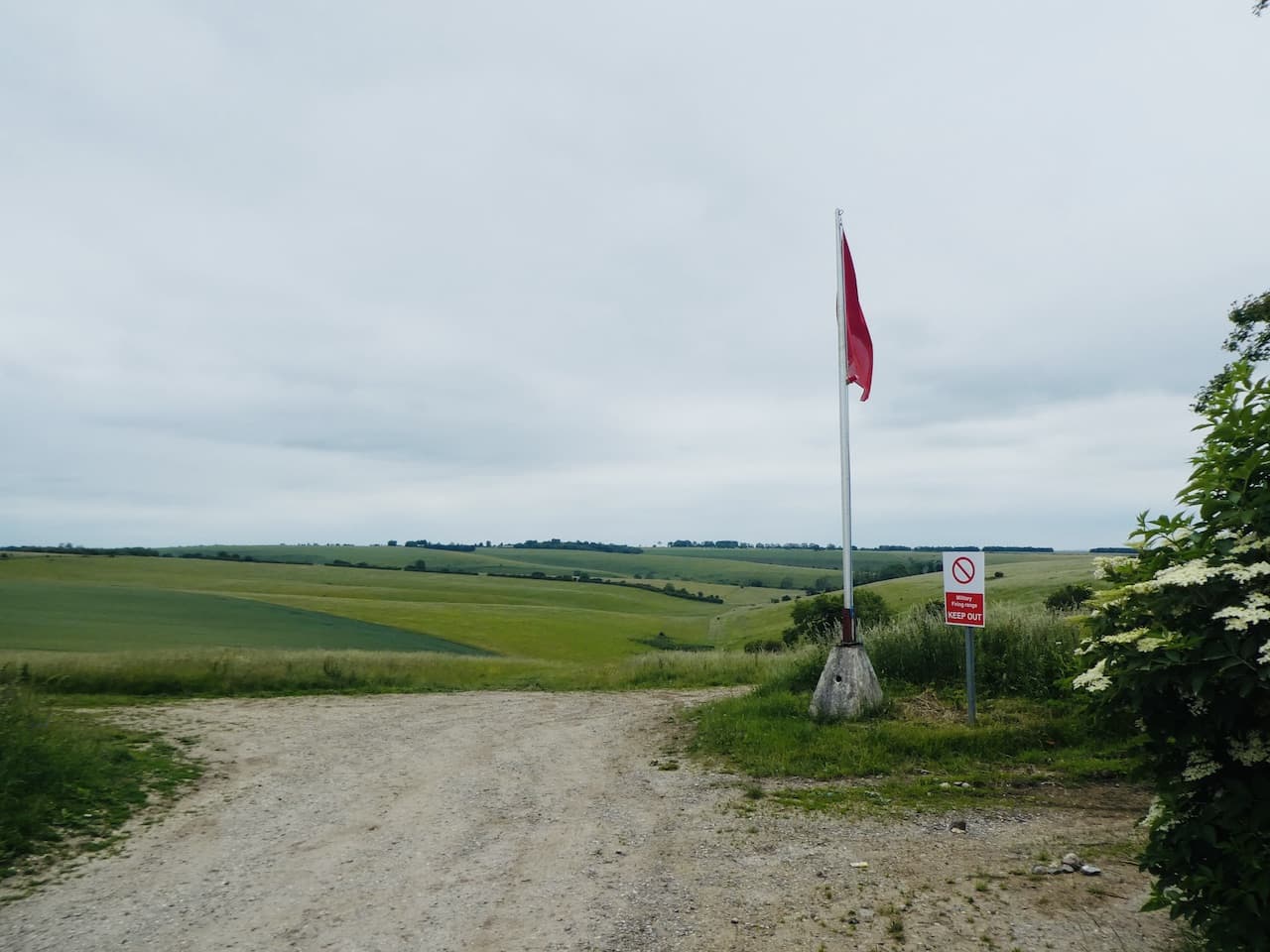
At the junction of tracks I turn right to follow a path besides the edge of the Ministry of Defence danger area. It was back in 1898 that the army first conducted training exercises on the plain and started acquiring land. This continued until the 1940’s and now there is about 150 square miles of land with restricted access, or in some parts no access at all because of live firing.
It is a cracking morning to be out walking. My route follows the path keeping the fence for the firing range on my left.
There are a number of paths on the right which lead downhill into the Vale of Pewsey. I ignore three paths choosing a path that leads towards Marden Copse.
The path soon goes steeply downhill with cracking views.
At the bottom of the hill I join a track and continue heading north towards the A342. It is a stunning place to be walking, if we were not heading back today I would be thinking about extending my morning walk, but unfortunately I need to take the awning down and pack the car.
At the A342 I cross and continue along the road heading for Marden. When this straight road starts to bend to the left I take a track on the right passing a recently converted barn and Marden Cricket Club. I now follow this track heading east. I cross another track and then reach a minor road where I turn left and in just over a hundred yards I take a turning on the right and follow the path between fields.
The path leads to a minor road where I continue straight on and then at a junction turn left and then soon take a footpath on the right.
As I head along this path I get a good view of the medieval Strip Lynchets field system to my right.
At a junction of paths I go straight over heading east, soon the Charlton Cat is on my right.
I keep following the path as it heads towards Charlton St Peter and then in the village turn left to cross the River Avon and return to the caravan site. It has been worth getting up early to experience such a wonderful morning, I have covered just over 7 miles. Now it is time for breakfast and a quick pack so we can head home.
All information on this site is provided free of charge and in good faith and no liability is accepted in respect of damage, loss or injury which might result from it. To the best of my knowledge the routes are entirely on public rights of way or within areas that are open for public access. Walking can be hazardous and is done entirely at your own risk. It is your responsibility to check your route and navigate using a map and compass.
It is the last full day of our stay at Charlton St Peter so we are making the most of it by walking in the Vale of Pewsey and taking in a few historic locations. It is only a short drive from the site to the village of Burbage.
Our walk starts from a parking area in East Sands Lane besides the village cricket club pitch (Grid Ref: SU 237 611). To start we walk a few yards along the track and then opposite the gate to the cricket ground we take a footpath on the right which heads in a southerly direction towards the A338. Initially the path goes along the edge of trees and then crosses a field before heading to the main road.
On reaching the road we turn left and walk a few yards along the wide verge until we reach a footpath on the right, we cross the road with care and follow the path along the edge of a field.
At two junctions on the path we keep left until we reach a minor road. We turn left down the road towards West Grafton and soon pass an electricity sub-station on the right. Shortly after we take a footpath on the right signposted to East Grafton.
The path now crosses fields heading towards Manor Farm and then goes through a paddock and besides a spinney to reach East Grafton.
We emerge in the village almost opposite St Nicholas’ Church. It is a warm day so we stop at the bench by the church gate for a drink and then wander in to look at the fine church.
This relatively modern church opened in 1844 following a campaign for a church in the village. Apparently the Marquess of Aylesbury was persuaded to give sufficient land to build a Church, parsonage and school. The style of the design is Romanesque and apparently it has a fine interior, but unfortunately the door is locked so we are unable to see for ourselves. Instead we content ourselves with looking at the elaborate stonework around the main door.
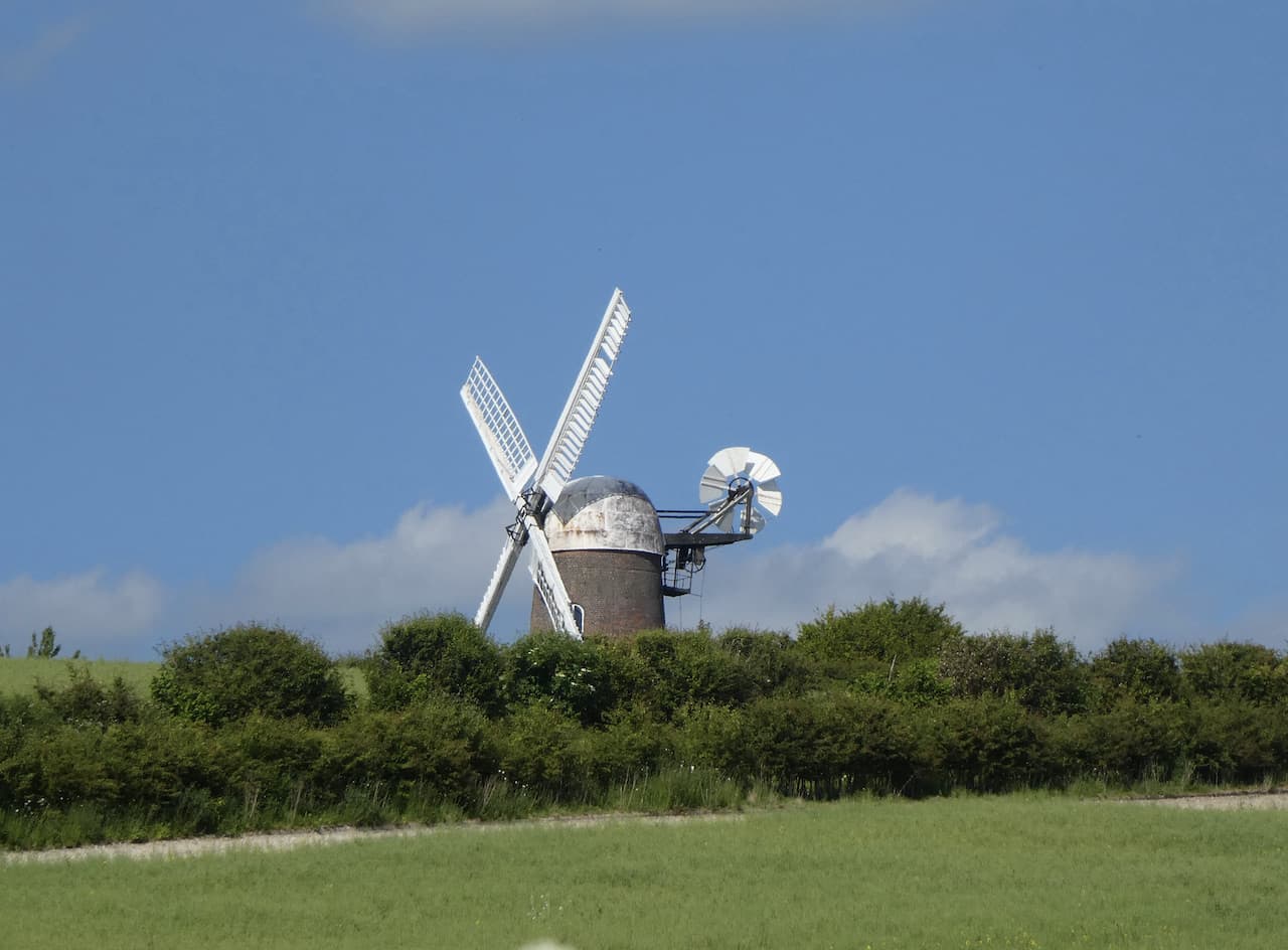
From the church we briefly head south along the road and then take a lane on the left which runs besides the edge of the churchyard to reach paddocks. We go through the paddocks using the stiles and then follow the footpath across arable fields with a view of Wilton Windmill away to our left.
The footpath reaches a track where we turn right and head south towards electricity pylons. At a junction on the track we turn left and follow the tree lined path as it heads steadily uphill through shrubland and then crosses an arable field to reach a reservoir with a fine brick structure besides it.
The Historic England website says this is a pumphouse for the reservoir that served nearby Wexcombe, however, I have read elsewhere that it was a folly built by William Finch in 1899 and contains two water taps. Apparently Finch was the person who installed the water supply for the hamlet.
We reach a road besides the reservoir and cross to go over a stile into an arable field following the route of the footpath as marked on the map. This shows that we should go through woodland to reach Wexcombe. When we reach the far side of the field at the point the path should enter the woodland it is thick with brambles and no sign of any footpath. After a bit of a curse we follow the fence line to the south to reach a wide gap in the hedge. Here we turn left and follow the field margin down to the edge of Wexcombe where we turn right on a chalk track.
This track initially goes steadily uphill but on reaching the escarpment of Wexcombe Down it becomes a steep ascent to tackle on a hot afternoon.
The benefit of walking up steep chalk hills is that you know there is bound to be a cracking view and this one along the northern edge of Wexcombe Down certainly lives up to expectation.
It is a relief for both of us when the path levels out and continues heading south with expansive views. Soon on our left is an Ordnance Survey trig pillar and I make a brief diversion from the track to visit it. This is the 253rd trig I have bagged.
Back on the track we continue heading south and soon pass a concrete water tower.
Shortly after the tower at a junction of tracks we take a footpath on the left which leads across an arable field heading towards Tidcombe.
After crossing one field the path joins a track going between fields and continues on to a junction of tracks on the edge of the access land of Tidcombe Down. We carry straight on along the track as it descends into Tidcombe. On reaching St Michael’s Church we pop in to have a look around.
There are parts of this church dating from the 14th century and the tower was added in the 17th century. Inside I am taken by the font, usually they are elaborate but this one is very basic and apparently dates back to Saxon times.
From the church we go north through the village and just after passing The Manor take a footpath on the left which passes woodland and then goes along the edge of fields heading towards Marten.
Nearing Marten we reach Manor Farm and follow a diversion of the path as it follows around the margins of a wildlife area to reach a minor road.
On the road we turn right and walk a short distance to a junction where we turn left and walk along the road through Marten. It is a very warm day for walking and I encourage Lynnie by promising there will be an ice cream van around the corner. This is a regular promise on a walk and Lynnie knows there is little chance of it coming true. However, to my surprise and Lynnie’s delight we reach Pickneys Farm and there is a small shop selling refreshments and ice creams!
After we have both had an ice cream and Crosby has topped up with water we resume our walk down the road to reach a junction with the A338 where we turn left and pass the former Nags Head pub which has been converted into a private house. Apparently a pub first opened on this site in 1724 and was rebuilt in 1902. It is a pity to see pubs close, but I imagine trying to run a business here was very difficult.
We are only on the A338 for a short distance, immediately after passing the former pub we turn right onto a lane heading towards Wilton. Soon to our right there are good views of the Wilton Windmill. Apparently this is the only remaining operating windmill in Wiltshire. It was built in 1821 to replace local mills that had been lost when the Kennet and Avon Canal cut through nearby water meadows. It was used for 100 years until it was abandoned and fell into disrepair. After a restoration project it fully reopened in 1976 and now welcomes visitors.
At a junction we go straight over to join a track with a finger post pointing to Crofton Beam Engine. As the track starts to descend we climb the bank on the left to get a good view of the Beam Engine. This is a remarkable industrial site which we visited many years ago when our children were small. It was built in 1807-09 and was used to pump water to the highest point on the Kennet and Avon Canal.
The building houses a 1812 Boulton & Watt steam powered beam engine which is the oldest working beam engine in the world that is still in its original location. It survives thanks to the efforts of the Kennet and Avon Canal Trust which purchased the derelict site in 1968 and by 1971 it was fully restored and operating. Despite it being over thirty years since I visited I can still recall the magic of watching this piece of industrial heritage working.
We continue down the track to reach the Kennet and Avon Canal and turn left onto the towpath to pass a lock. We soon reach Wilton Water the reservoir from where water is pumped by the Crofton Beam Engine to top up the canal.
The beam engine sits on the far side of the canal and we pass it and continue along the towpath heading west, soon passing Crofton Bridge and the Sam Farmer Lock.
This is a tranquil stretch of the canal and even though it is a sunny Saturday afternoon in June we see very few people as we continue to head west. Soon we pass the parapets of the disused Andover to Marlborough railway line that crossed the canal until the line was closed in 1970.
A short distance after we reach Wolfhall Bridge and leave the canal, turning left to follow a track going steadily uphill to Wolfhall Farm.
At Wolfhall Farm we turn right along the minor road in front of Wolfhall Manor. This house has a long history dating back to the 11th century and it was here in the 16th century that the then owner Sir John Seymour invited King Henry VIII to stay in 1535. A year later Seymour’s daughter Jane became Henry’s third wife, just a year later she died in childbirth.
The building has had many additions over the years and is a combination of Tudor, Georgian and Victorian architecture. Apparently, it has one of the best preserved Tudor sewers in Britain. Walking by this interesting house there is no sign of its historical significance.
Reaching a footpath on the left we leave the road and head south besides a field to reach a five way junction of paths, we continue along a made-up track opposite, passing cottages and then reaching the starting point of our walk at the edge of a playing field on the outskirts of Burbage.
Our walk has covered just over twelve miles in a cracking part of the Vale of Pewsey which is packed with historical sites. Now we must get back to Charlton Manor CL and start our preparations for our return home tomorrow.
To follow my walk, you will need Ordnance Survey Maps: OS Explorer Active – 157 – Marlborough & Savernake Forest; OS Explorer Active – 131 – Romsey, Andover & Test Valley & OS Explorer Active – 158 – Newbury & Hungerford
All information on this site is provided free of charge and in good faith and no liability is accepted in respect of damage, loss or injury which might result from it. To the best of my knowledge the routes are entirely on public rights of way or within areas that are open for public access. Walking can be hazardous and is done entirely at your own risk. It is your responsibility to check your route and navigate using a map and compass.