Category: South West

  • Milestones and Bunkers

    Milestones and Bunkers

    Like so many people I find the winter months a gradual drain on my mood.  In years gone by when I commuted to London for work we headed to Lanzarote for a couple of weeks winter sunshine to lift my spirits.  It is over ten year since we did that and increasingly the lack of daylight and dull skies wear me down and I lose my bounce.

    Spending time out walking helps lift my spirits, but during the winter there is always a spell when each walk is a trudge through the mud, or I am heading into driving rain.  My mood is not helped by having Raynaud’s disease meaning that in colder weather my fingers and toes turn numb making even simple tasks very difficult.

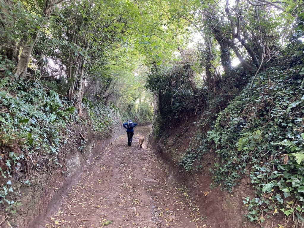
    Most of my winter walking is a solitary pastime. Lynnie is occasionally tempted to join me but apart from that and the odd day out with walking buddies I am on my own with Crosby.  I like walking on my own, but there are times when the company of others perks up a walk.

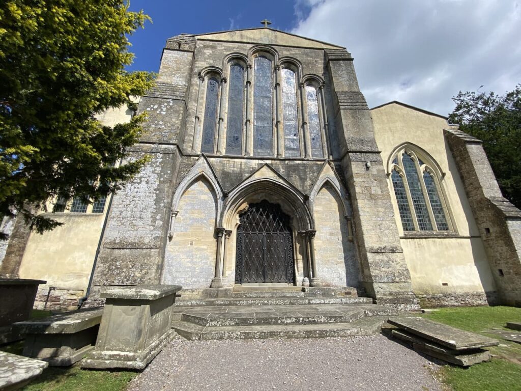
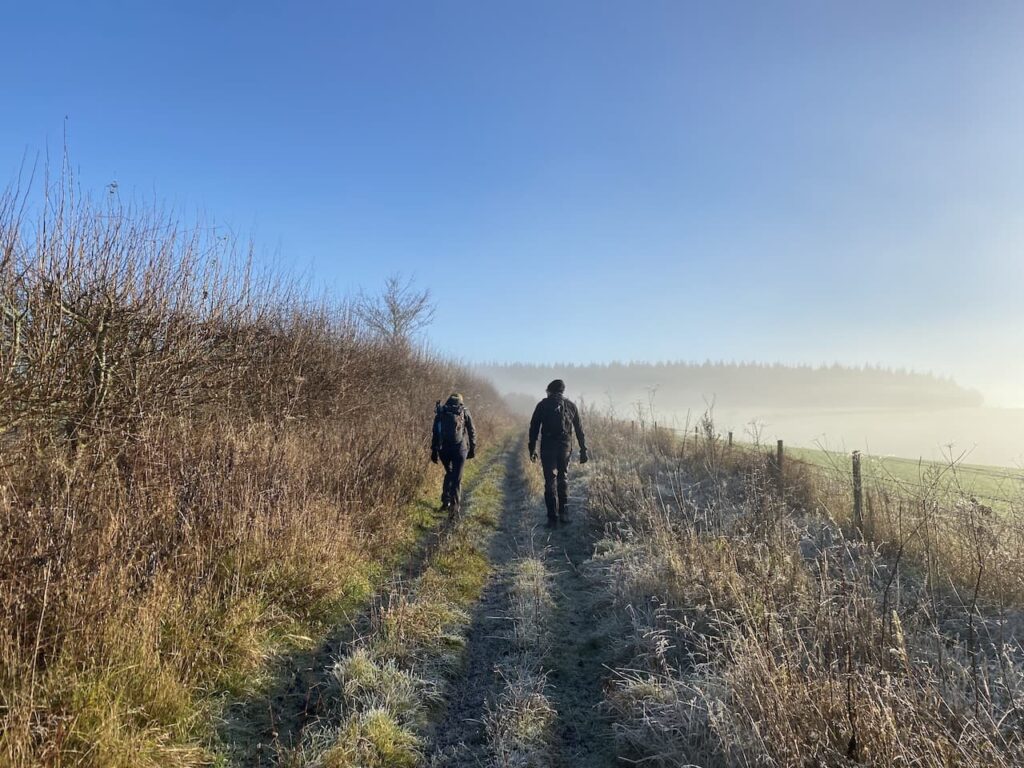
    Today I am out with my walking buddies Mandy, Nigel and Gary.  We are going to have a jamabout around Grovely Wood and as luck would have it we are forecast a bright day once the morning mist has lifted.  

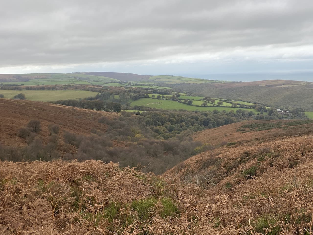
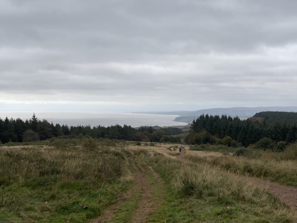
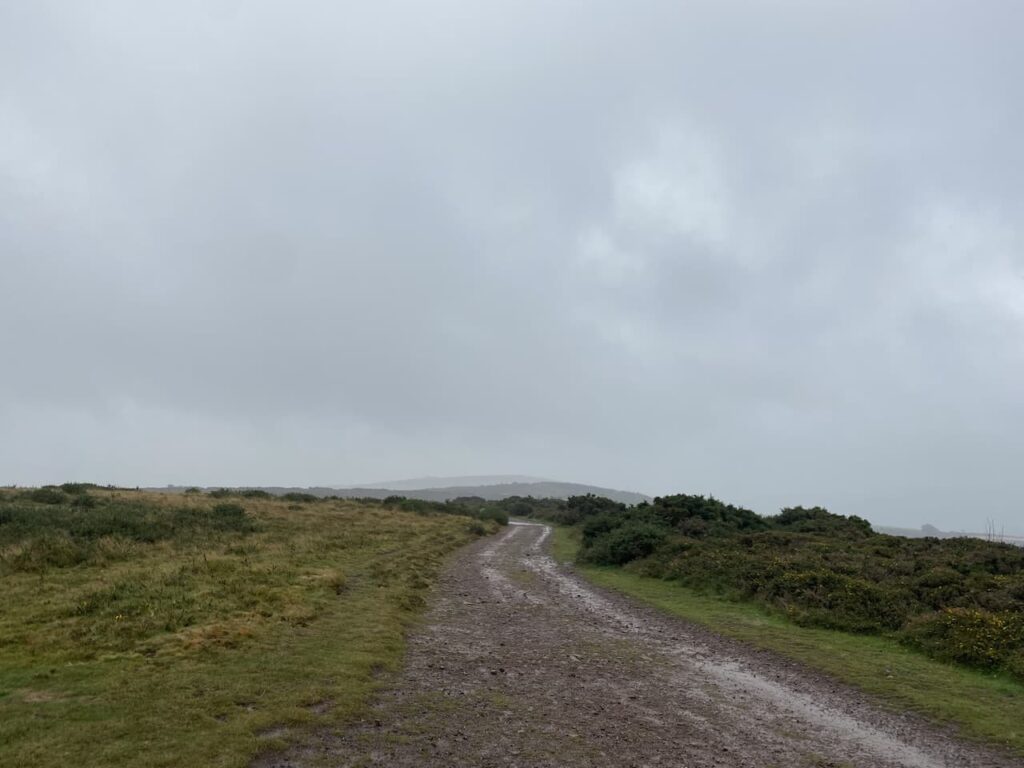
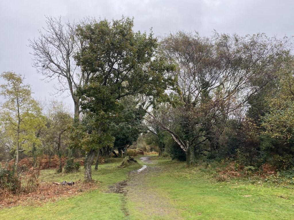
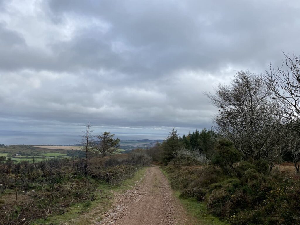
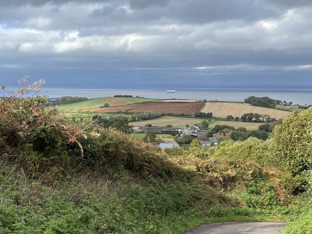
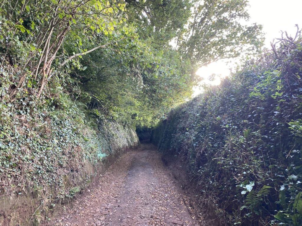
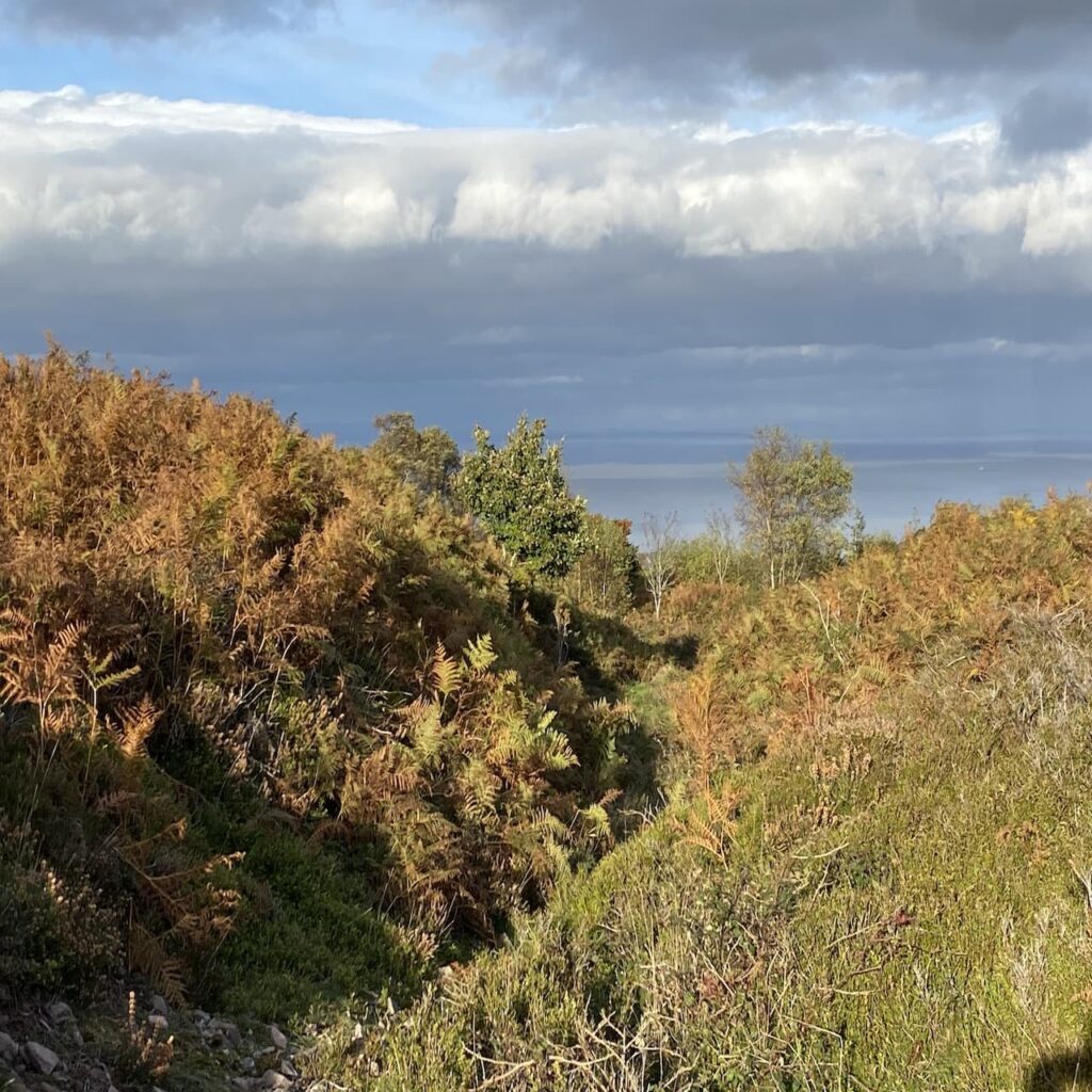
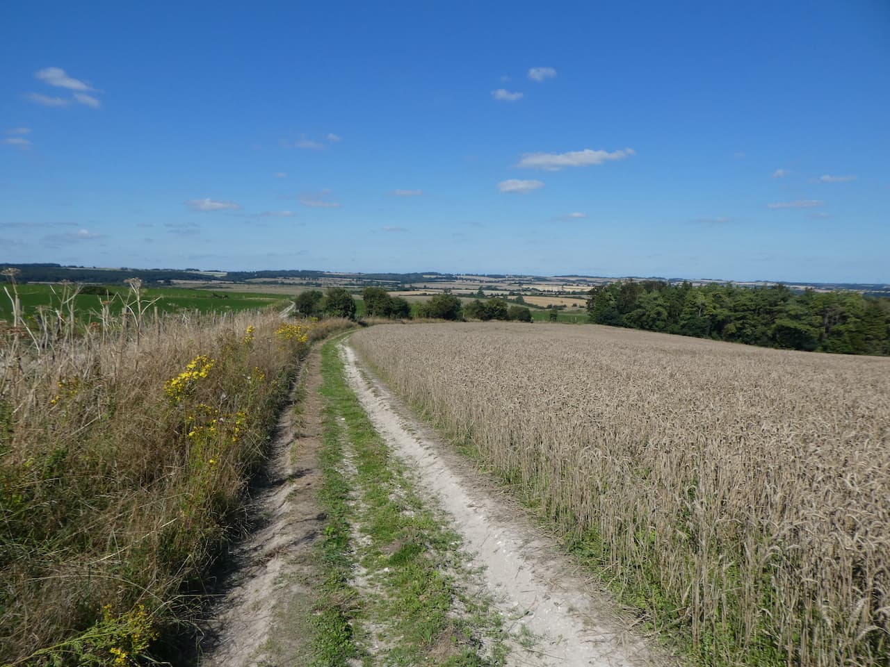
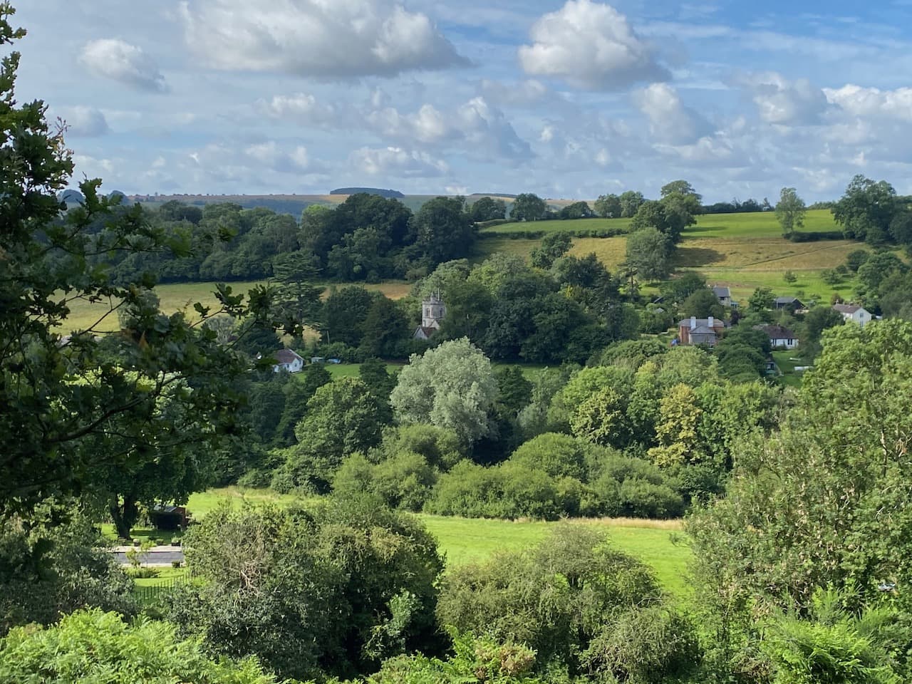
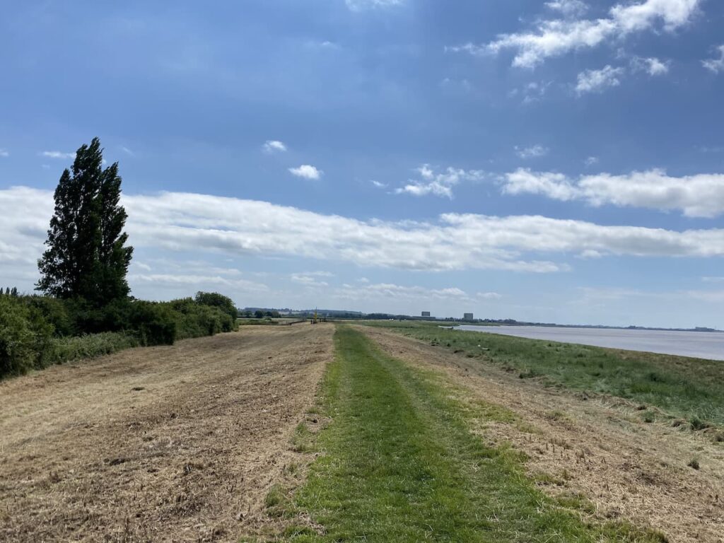
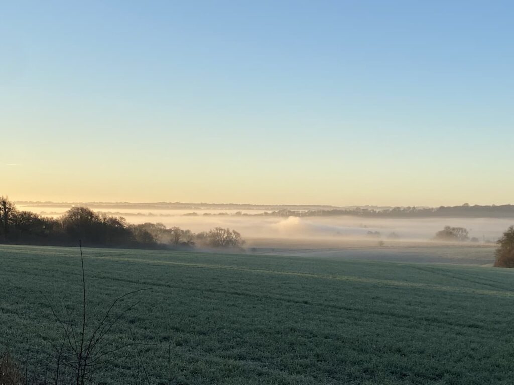
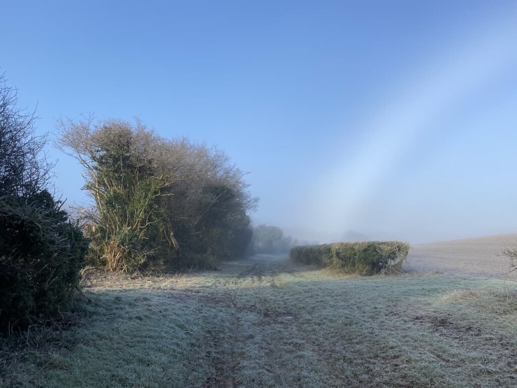
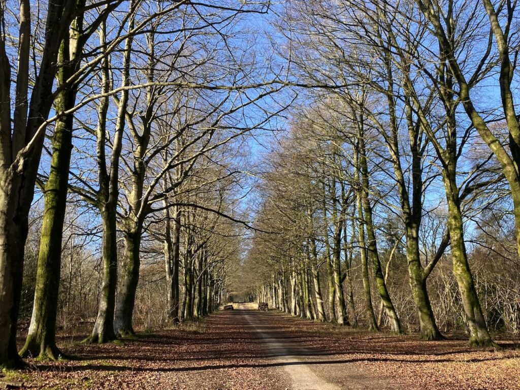
    Our starting point is a parking area besides a drove at the west end of the woods (Grid Ref: SU007347).  We set off along the drove heading in a south-easterly direction.  It is a chilly start to the day but the sky is clear and we have a good view across the valley with the fog hanging below us.

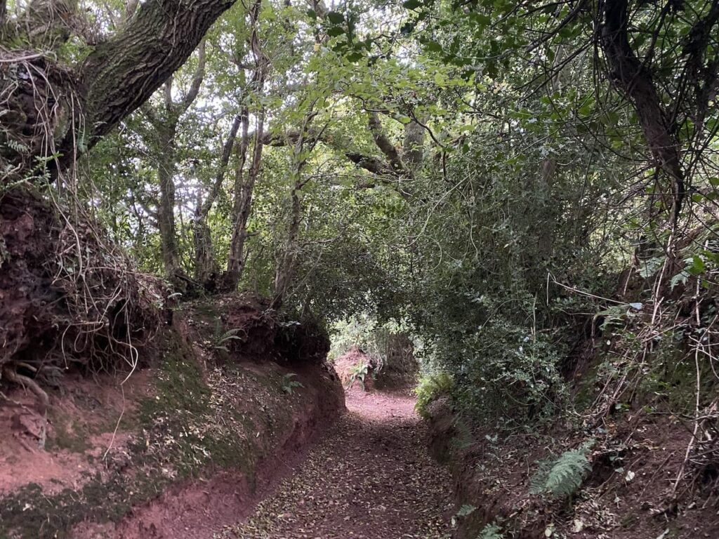
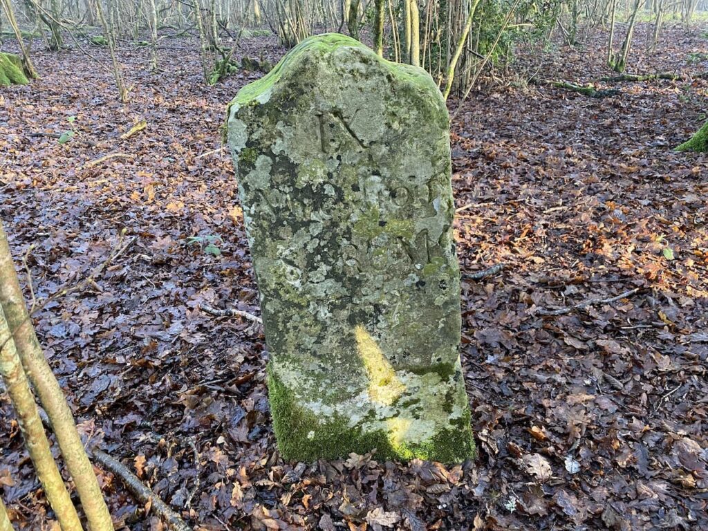
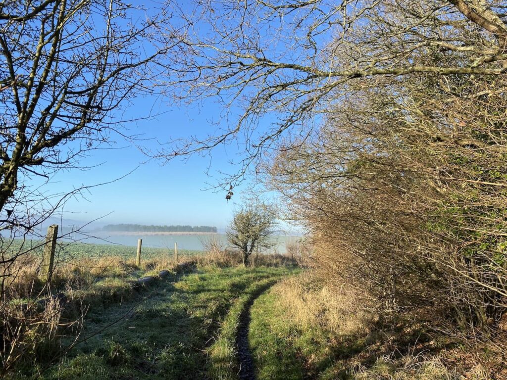
    This track is an ancient drove known as Ox Drove, a common term in this area for a track which was used to drive cattle to market.  This particular route linked Chicklade and Wilton and we soon encounter an old milestone sitting to the left of the track.  It is dated 1759 and indicates that we are 9 miles from Sarum, the old name for Salisbury.

    It is a cracking morning and the frost still lies on the ground as we head along the drove.

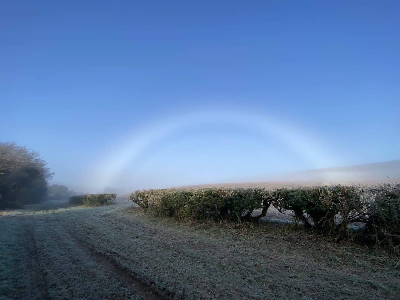
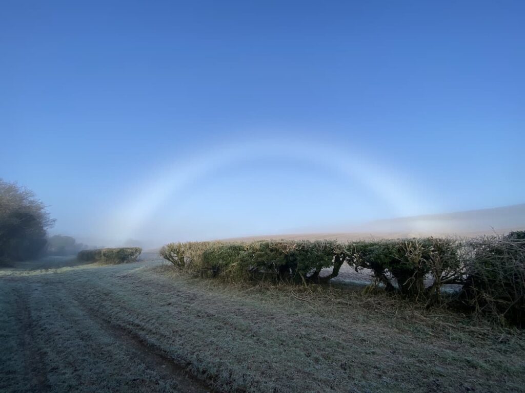
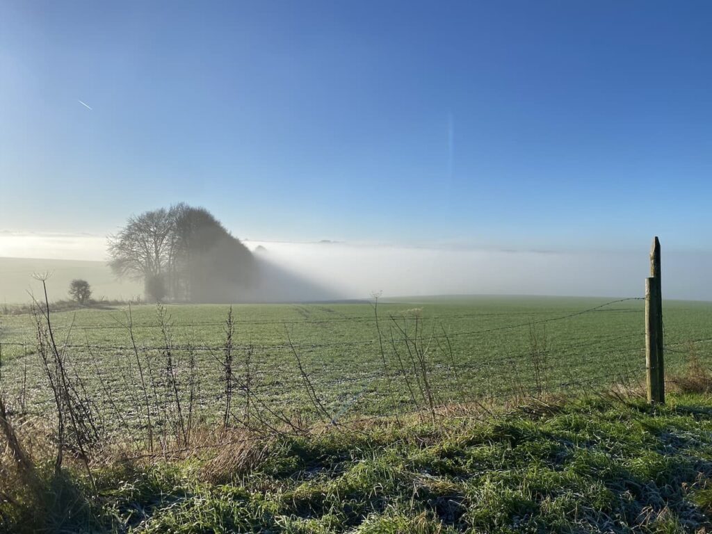
    Stopping to take in the view behind us I spot a stunning fog bow.  This is similar to a rainbow, but is created by the sun interacting with water droplets in the fog.  I cannot recall seeing one before.

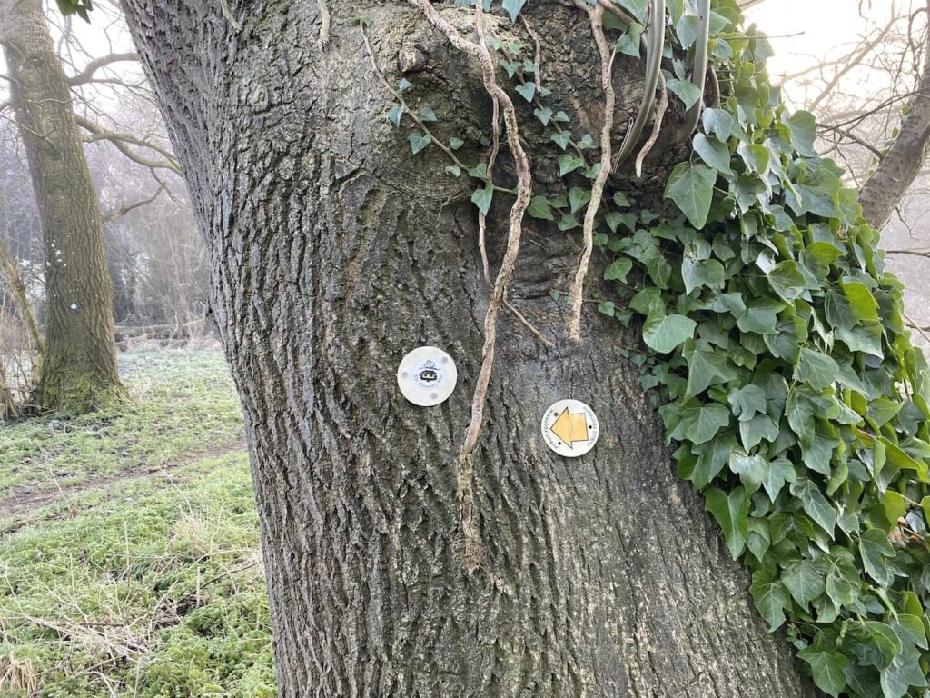
    The Ox Drove we are following is also part of the Monarch’s Way, a long distance walking route retracing the journey made by Charles II after the battle of Worcester.  The 615-mile way starts from Worcester and after a convoluted route reaches the Dorset coast and then heads east to finally end at Shoreham-on-Sea. 

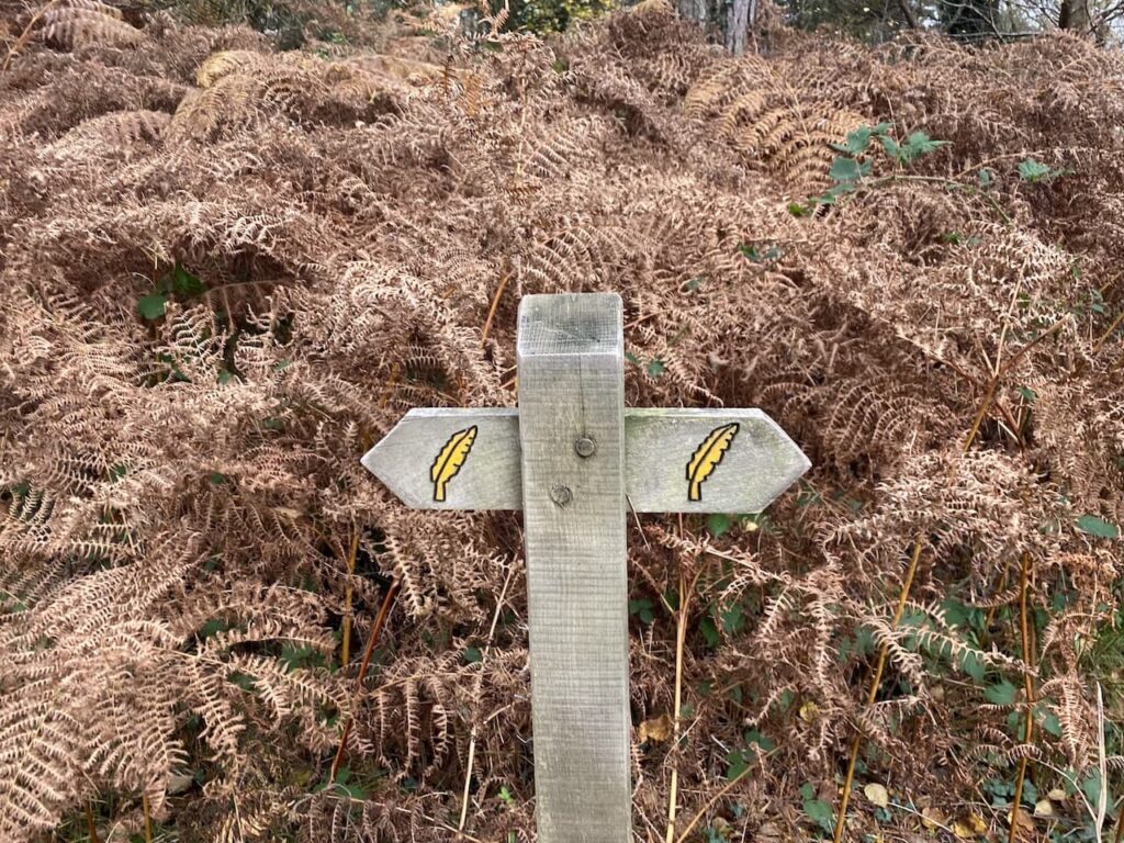
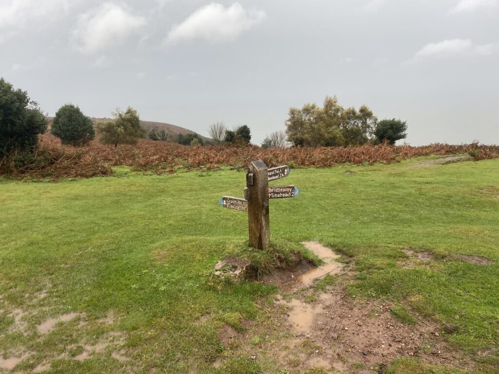
    At a junction with Fir Drove we stay with the Ox Drove and Monarch’s Way to head uphill in an easterly direction.

    At a junction of tracks just before West Thornhills copse we leave the Monarch’s Way, which forks to the left.  We stay on Ox Drove forking right to pass the copse and carry on to reach East Thornhills.

    The track now descends to a junction of paths and a minor road.  There is a small parking area here and another milestone beside the path bears the inscription “VI Miles from Sarum 1750” .

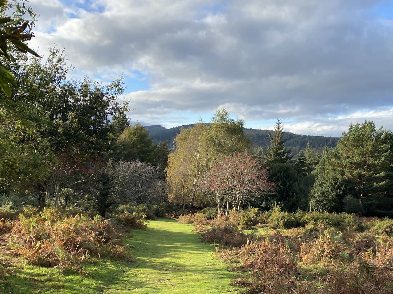
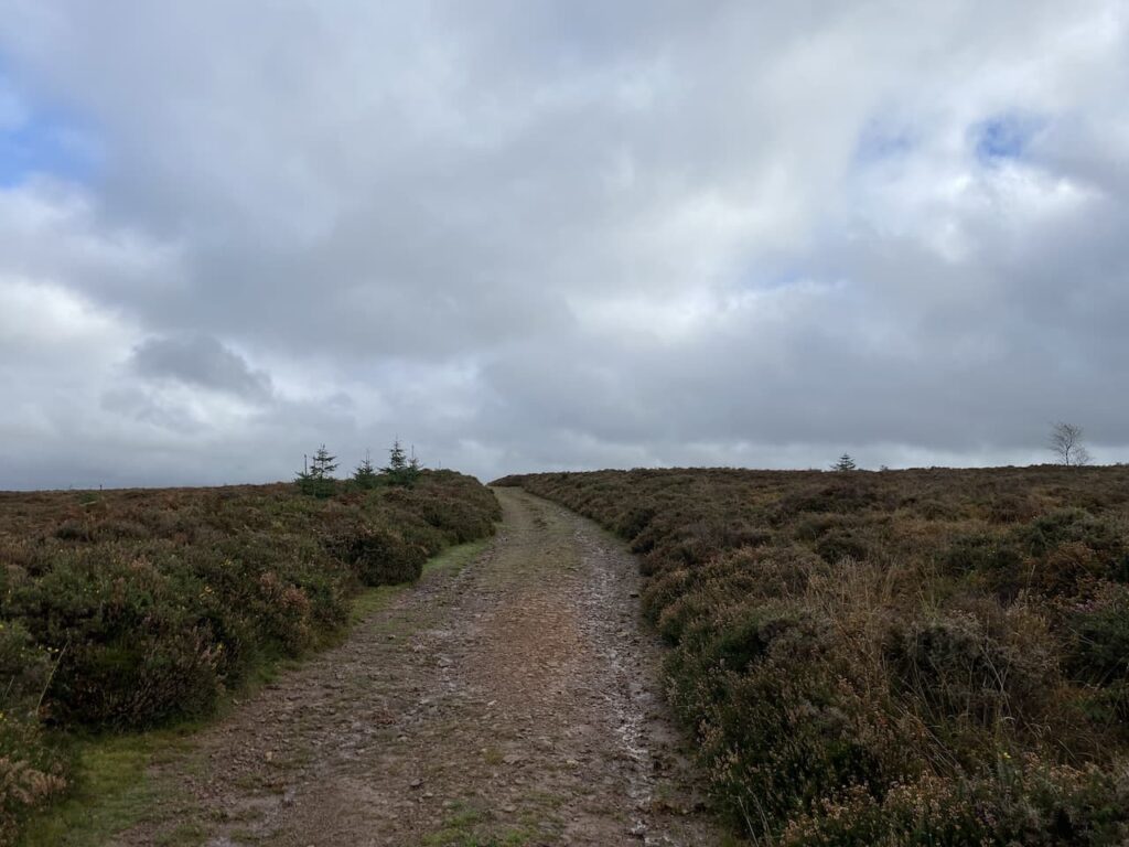
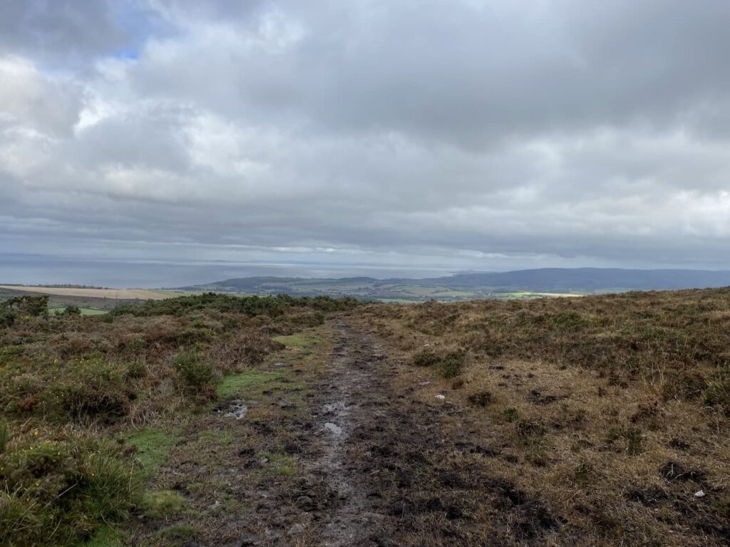
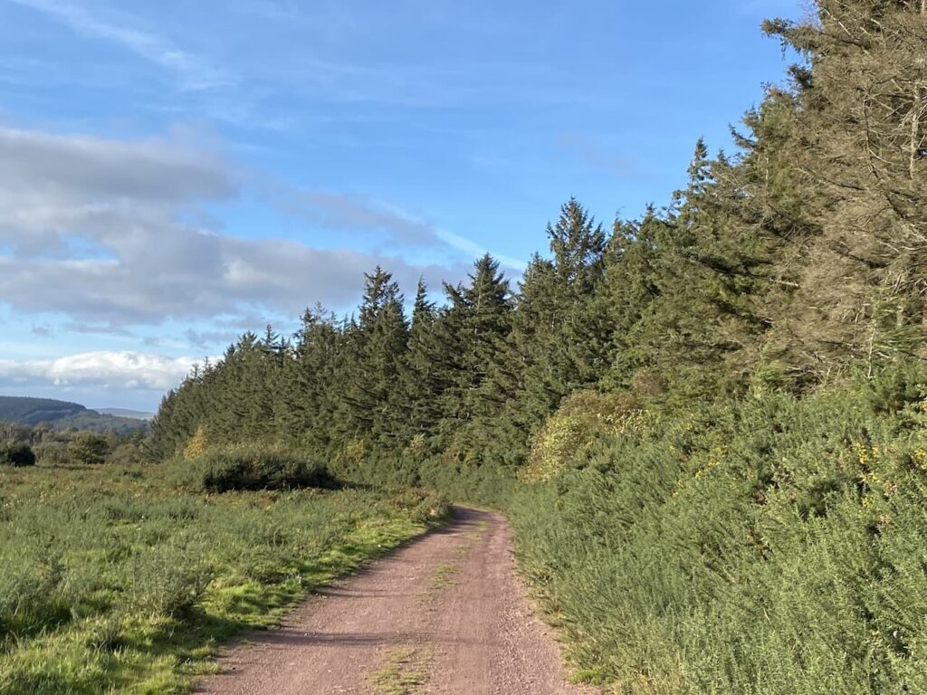
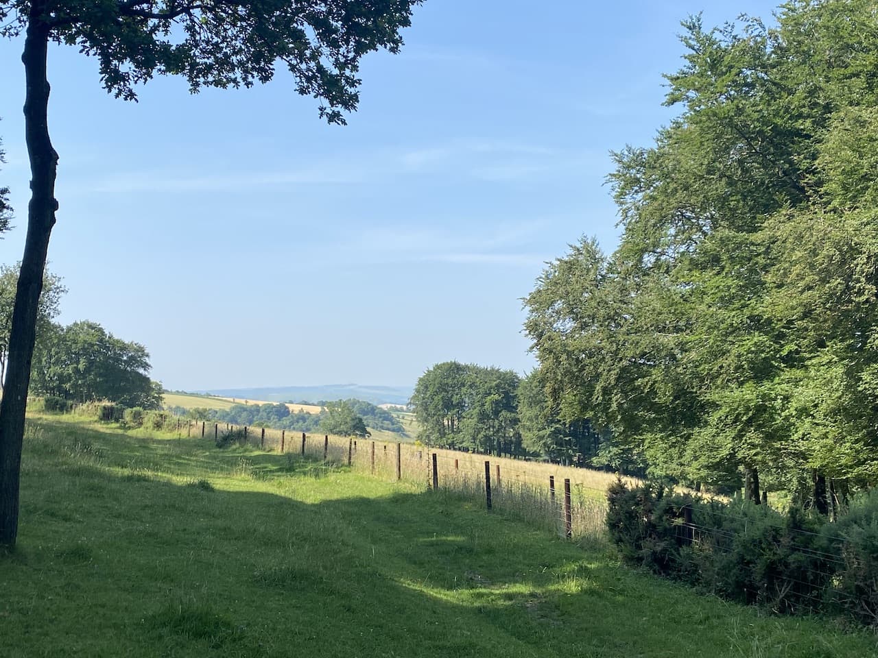
    We continue east on the Ox Drove, ascending again we get fine views across to Cranborne Chase with the fog still lingering in the valley to the south.

    Just before reaching a junction of paths we pass another milestone.  The inscription on this stone is difficult to make out, apparently it said “V Miles to Sarum 1750”.

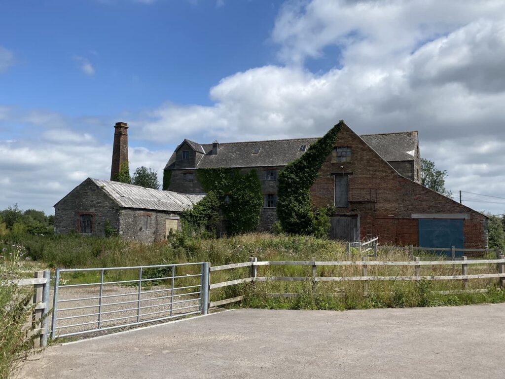
    At the junction of paths we continue straight on towards Ugford Red Buildings.

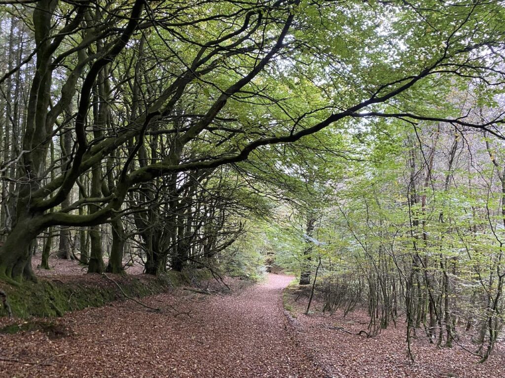
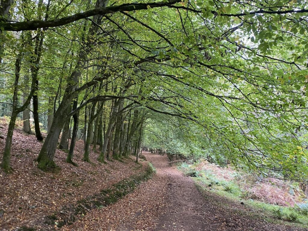
    At a junction of paths by the farm buildings we turn left and keep left as the path forks, this takes us along a line of attractive beech trees. 

    At a junction of paths we turn right and then after a couple of hundred yards take a left along the wide track called First Broad Drive.

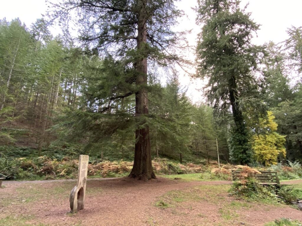
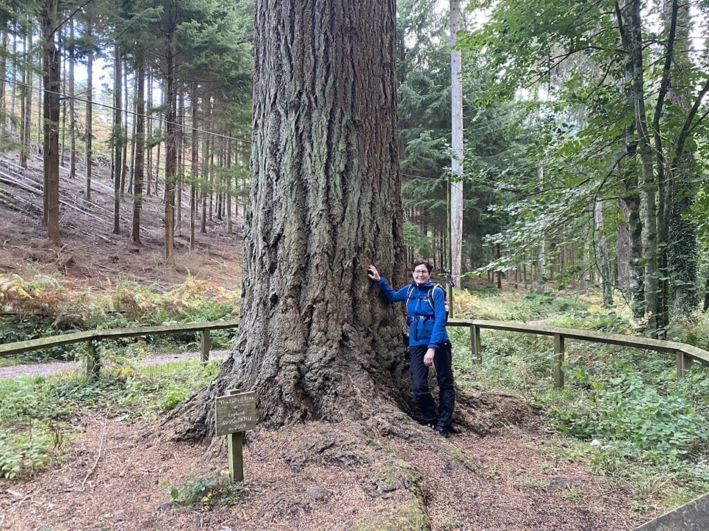
    After 500 yards, shortly before the Grim’s Ditch joins the drove, we turn left into the trees to visit the Handsel Sisters.  These are ancient beech trees within this section of pine woodland.

    The Handsel sisters were born in Denmark in the 1700’s and moved to the Wilton area.  Soon after they arrived an outbreak of smallpox claimed 136 lives.  Locals were convinced the sisters were responsible for the deaths and they were accused of witchcraft and an alliance with the devil.  Without an official hearing they were taken to Grovely Woods and bludgeoned to death.  They were then buried some distance apart to stop them conspiring against their murderers.

    There are conflicting tales about the origins of the beech trees, one is that they were planted to mark the graves as a warning to others who might consider practicing witchcraft.  The other that the trees grew on top of the unmarked graves as a reminder to locals of their murders.

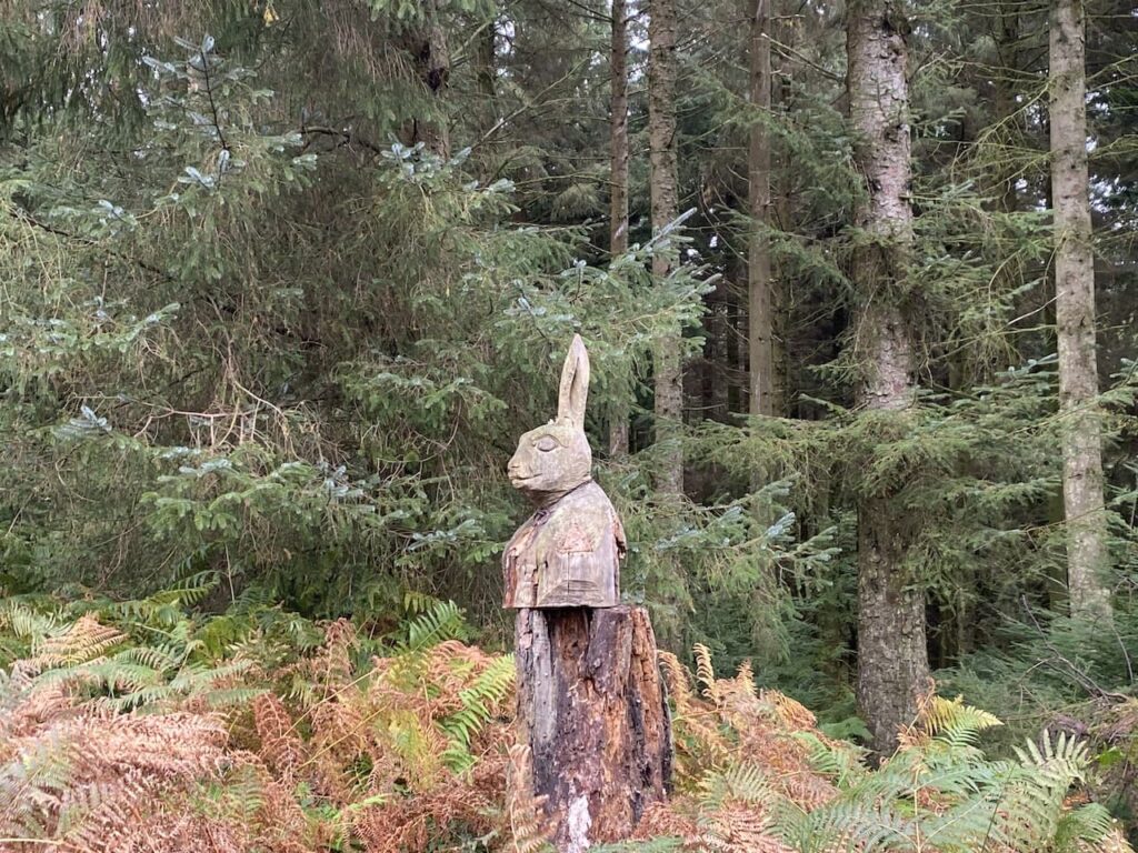
    Of the four original trees three remain.  The largest of the trees is strewn with offerings to the sisters.  There are reported sightings of the ghosts of the sisters in this area of woodland and pages on the internet dedicated to the spooky goings on here.  I am not sure what to believe, but the trees have grown in a very strange way and there is certainly a feel about this area that makes me slightly uneasy.

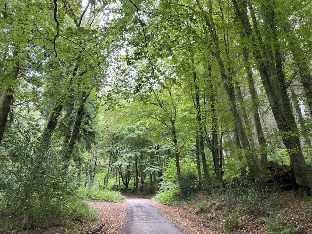
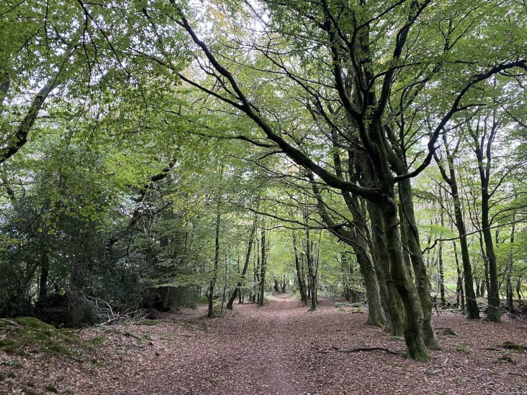
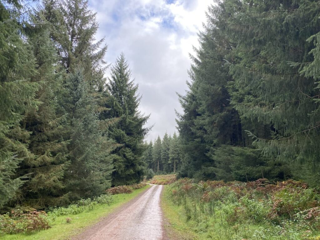
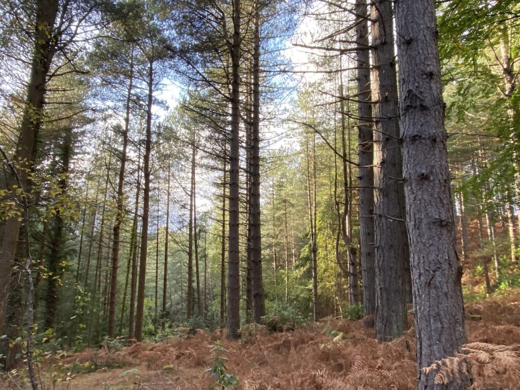
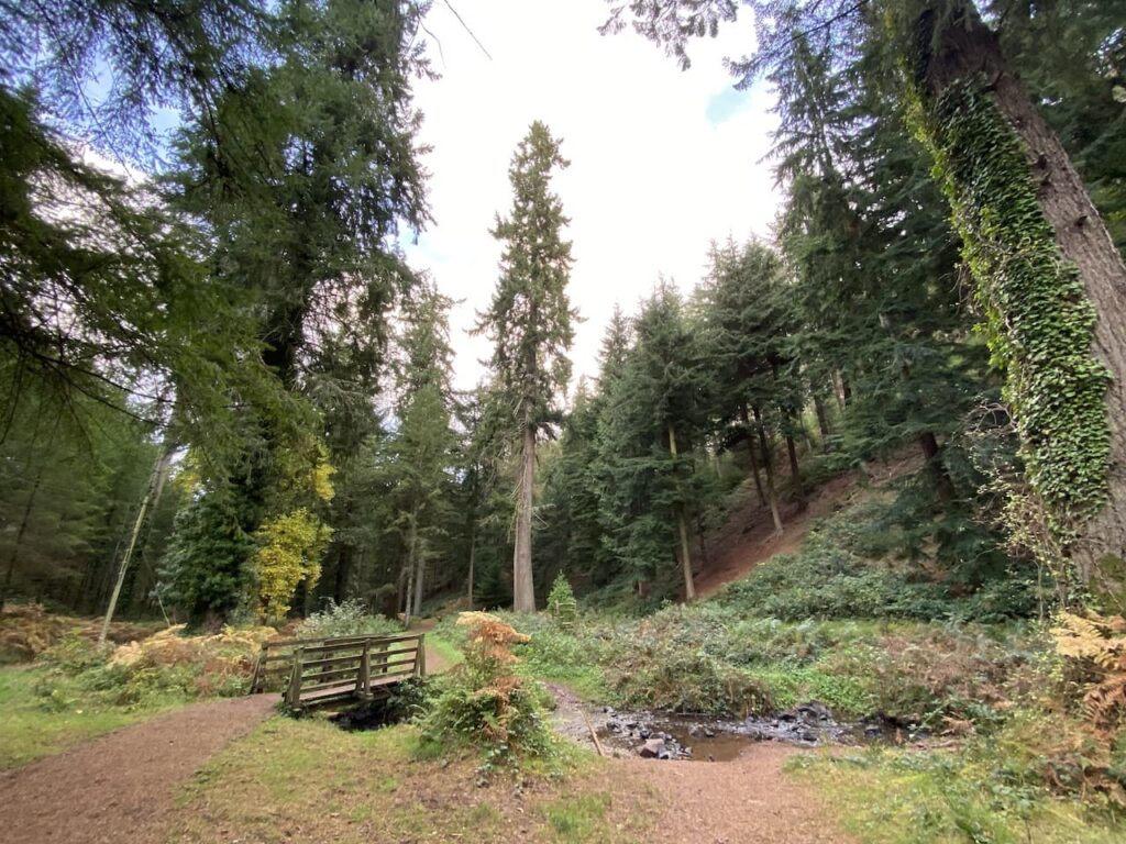
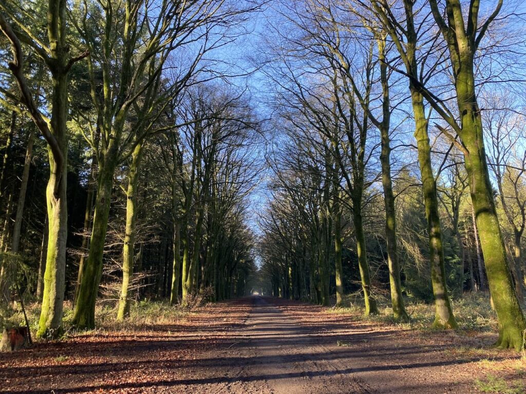
    Having visited the trees we make our way back to First Broad Drive and follow this heading west.  Shafts of sunlight are shining through the trees giving a dramatic effect.

    It is very pleasant walking along the wide track feeling the warmth of the sun.  This is just the sort of thing to lift the spirits, walking with friends in cracking woodland in the sunshine!

    At a crossing of tracks close to Grovely Lodge we continue straight on to join Second Broad Drive.  We decide to take advantage of the sunshine and stop besides the track for some lunch.  

    We don’t hang about too long because despite the sun it soon feels chilly when you are inactive.  Continuing along Second Broad Drive we pass Four Sisters Copse and then leave the main track turning right to follow a path through the trees heading northwest towards the Little Langford Down Nature Reserve.  Like much of Grovely Wood this is open access land so there are no way-markers and we take care to ensure we skirt the top of a valley before turning north through Langford Woods.

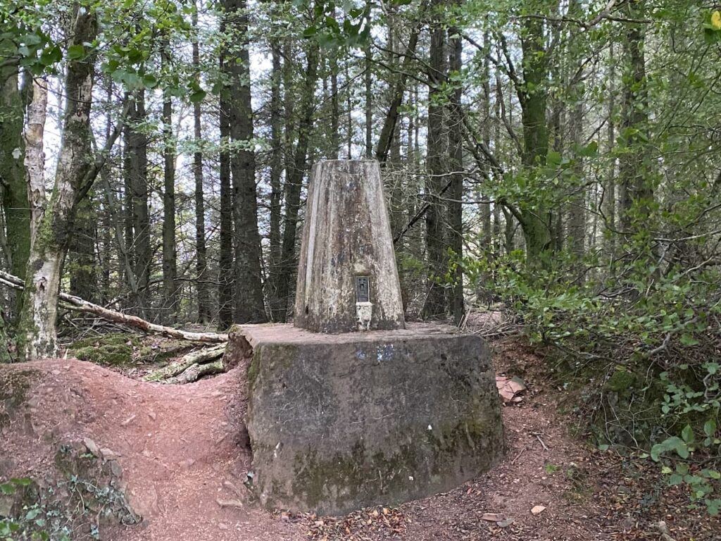
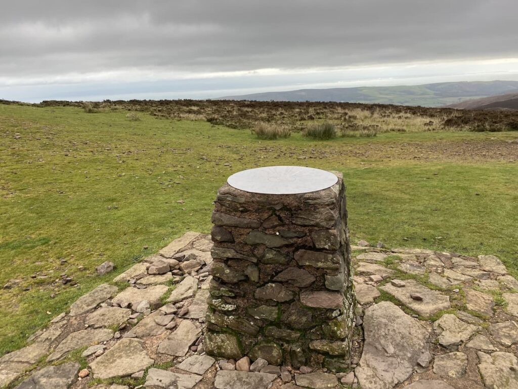
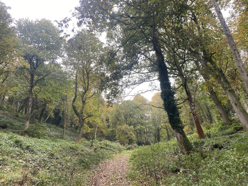
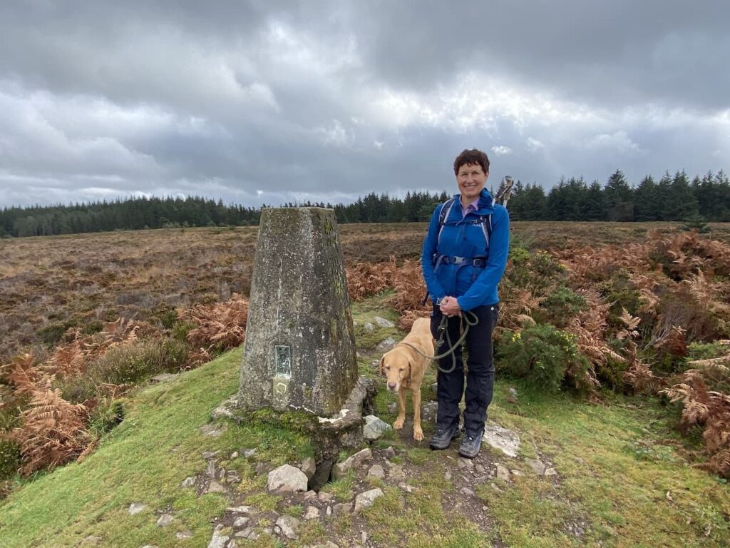
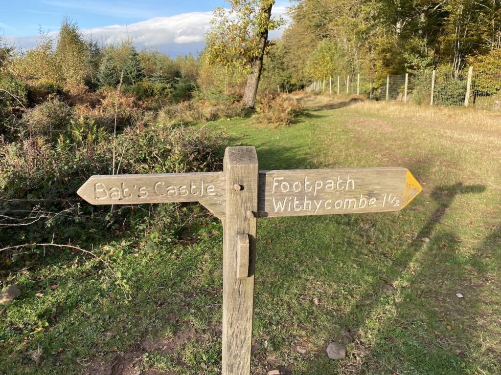
    This is a stunning section of woodland maintained as a nature reserve by the Wiltshire Wildlife Trust.  We stay with a broad ride through the trees to reach the northern end of Langford Woods where there is a barbed wire fence.  This marks the edge of the access land.  Here we make a brief excursion into the field to visit the Ordnance Survey trig pillar on the ramparts of Grovely Castle Iron Age hill fort.

    Back in the woods we retrace our steps through the nature reserve, this time when we reach the top of the valley we fork right on a ride passing an area marked on the map as Powten Stone.  Despite searches over many years by many people the actual location of the stone is unknown but it still justifies being recorded on the map.

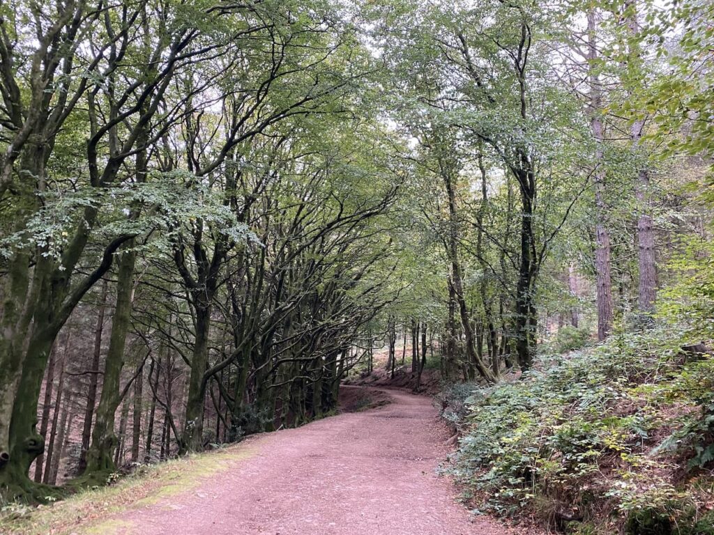
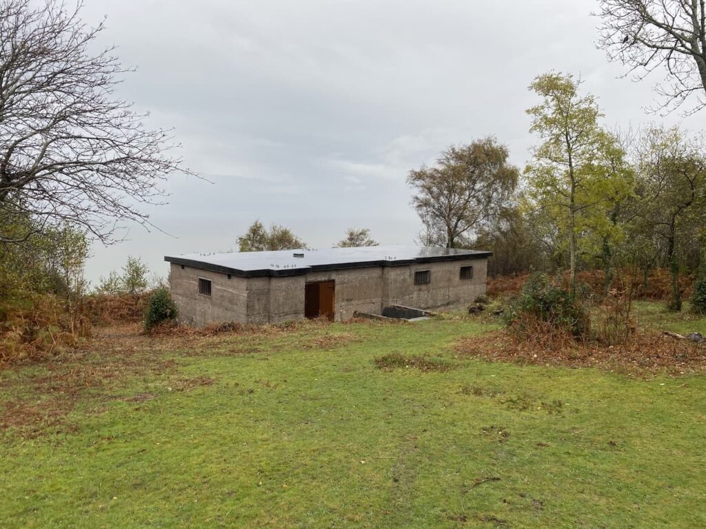
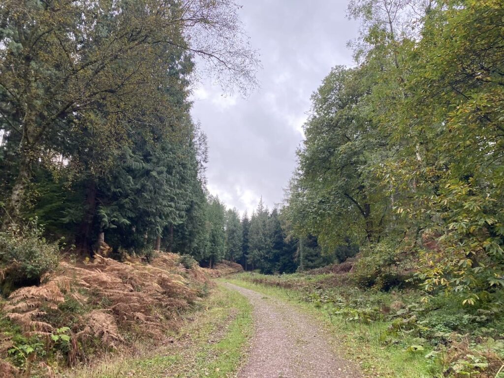
    We rejoin the Second Broad Drive and turn right to head west.  During the Second World War these woods played an important role as a storage location for ordnance.  As a result the old Roman Road which we are now walking along was paved to allow easy access for military vehicles.

    Apparently bombs were stored in the woods and fuses and other volatile munitions were stored in hundreds of bunkers.  A couple of these bunkers still remain and one is located by the track, it is easy to identify because someone has sprayed ‘Bunker” by the entrance.

    We stop to have a peek inside, I am not sure I would have wanted to be in such a confined space with volatile ordnance.

    Our route continues along Second Broad Drive, it is getting late in the afternoon and the sun has lost its warmth and there is a definite chill to the air.

    We keep our eyes peeled for a second bunker besides the track, this one is not so easy to find because it is overgrown.  This one has been bricked up presumably to prevent it from being damaged.

    We stay with Second Broad Drive until we reach the edge of the woods, here we turn left besides a barn and follow a track along the northern edge of the wood to reach a minor road.  We turn left to walk through Dinton Beeches and return to our starting point.

    We have covered over thirteen and half miles and it has been a cracking walk.  The sunshine and company of friends has gone a long way to lifting my spirits.  Roll on spring!

    You can view this 13.5 mile walk on OS Maps and download the GPX File Here

    To follow this walk you will need Ordnance Survey Outdoor Explorer Map OS 130 Salisbury & Stonehenge 

    13th January 2022

    © Two Dogs and an Awning (2022)

    All information on this site is provided free of charge and in good faith and no liability is accepted in respect of damage, loss or injury which might result from it.  To the best of my knowledge the routes are entirely on public rights of way or within areas that are open for public access.
    Walking can be hazardous and is done entirely at your own risk.  It is your responsibility to check your route and navigate using a map and compass.

  • Visiting Beacons on Exmoor

    Visiting Beacons on Exmoor

    After a couple of days walking Lynnie has decided that Crosby and I should head out on our own today.  I have long planned a walk to the top of Dunkery Beacon from Minehead.  I’ve walked up Dunkery Hill on a number of occasions but never from Minehead.

    Leaving the site I turn left and walk uphill along the pavement besides the A39, Hopcott Road.  On reaching The Hopcott I turn left to follow the narrow tarmac lane as it heads steadily uphill passing Higher Hopcott and then reaching woodland.

    I ignore footpaths leading off from the road until I reach an information board for Dunster Woods.  

    I take the uphill path to the right of the information board on the route of the Macmillan Way West. I ignore a path on the right soon after leaving the car park and then where the Macmillan Way meets a crossing of tracks I continue straight on, staying on the route of the long distance path.  The path now goes around the head of Long Combe, this is a cracking spot with stunning Beech trees lining the path.

    Leaving the trees the path continues through a section of open land with dead bracken and gorse.  On reaching a junction of tracks we turn right still on the route of the Macmillan Way West heading towards Tivington across the top of Hopcott Common.  At a fork in the track I go left to keep with the Macmillan Way West.  There are good views from here back along the coastline towards Blue Anchor.

    I continue to head west to another crossing of paths.  The Macmillan Way turns left towards Wootton Courtney, however, I keep going straight ahead soon reaching an Ordnance Survey trig point tucked to the left of the track on a high bank. This trig on Periton Hill is one which I have bagged a number of times.

    I continue straight on through an attractive area of woodland.

    On reaching another  junction of paths I turn left on a track leading to Roadway Lane.

    Joining Roadway Lane I follow this ancient track as it heads downhill to Wootton Courtenay.

    Arriving in the village I turn right and then after 100 yards at a junction I fork left onto Brockwell Lane towards Brockwell and Ford. 

    I now stay with this lane to reach Brockwell Farm and then as the road sweeps to the left I continue straight on to join a footpath signed to Dunkery Beacon.

    There are a couple of paths here but I follow the one heading south west which soon leads through an attractive area of beech woodland.

    At a crossing of paths I continue straight on through the trees to reach the edge of moorland.   Here I keep heading in a south westerly direction and start the gradual ascent of Dunkery Hill. 

    It is a long steady two mile up hill to Dunkery Beacon but I appear to have the hill to myself so I can enjoy the solitude.

    After crossing a minor road I continue uphill along a broad track with the beacon in view in the distance.

    As I near the beacon I stop to check out the toposcope.  I have been here a number of times, but previously the visibility has been poor.

    On every occasion I have been here there has been a chill wind blowing and today is no exception.  This hill stands at 1,705 feet and is very exposed.

    From the beacon I take a grassy path which heads north as it descends the hill.

    After a couple of hundred yards I take a path on the right which heads north east towards a minor road.

    Nearing the road I turn left on a path which initially runs parallel with the road but then joins it and continues downhill to Webbers Post Car Park.

    From the car park I join the route of the Coleridge Way.  This trail covers the fifty miles from Nether Stowey, on the east side of the Quantocks, to Lynmouth linking locations associated with the poet Samuel Taylor Coleridge. 

    I stay with the way-markers until I reach Jubilee Hut. This is a weather hut thought to have been  built originally by the Acland’s who owned Holnicote Estate.  Built in celebration of Queen Victoria’s Diamond Jubilee it became known as the Jubilee Hut.  During World War II it was used as a look out post, but then fell into disrepair and collapsed in the winter of 1946.  The National Trust have rebuilt it, following the original design, facing four directions it always provides shelter from wind and rain.

    At the hut I leave the Coleridge Way and take a footpath on the left which soon descends steeply  towards Horner Water.

    On reaching the water I cross on a footbridge and turn right along a track heading towards Horner with the water flowing to my right.

    After crossing a bridge I turn left along a minor road and walk through Horner.

    I stay with this road heading towards West Luccombe until I reach a footpath on the right which is opposite a campsite on the left.  The path goes through a gate and across a field heading east to a band of trees.

    After going through a kissing gate I continue along the edge of a field and then pass through two more fields to reach a minor road where I turn left and follow this lane to Piles Mill.  This 16th century mill was originally a corn mill and then between 1930 and 1940 it was used for cider making.  Now it is run by the National Trust.

    With care I cross the A39 and walk into Brandish Street and turn left to follow a lane to Higher Allerford.  Here I turn right to follow a track signposted to Selworthy.  This route heads steadily upwards along the track towards Selworthy.

    At a junction of paths I turn left and go through a gate to head uphill through Holnicote Combe.  Despite walking a lot in this area this is the first time I have walked through this attractive combe.

    At the top of the combe I reach a minor road where I turn right and then very quickly take a track on the left leading to Selworthy Beacon.

    From the Beacon I follow a track heading east across North Hill.  There are a number of paths up here but I know as long as I head east and keep the minor road somewhere to my right I will be fine.

    The track leads towards a parking area and soon after passing through it I take a path on the left.  This heads north and rejoins the South West Coast path where I turn right and soon go through a gate into an area of pasture.

    The path continues close to the road to reach another gate, now I keep going east to reach another parking area.  From here I follow a waymarked path indicating it is two miles to Minehead.

    During World War II North Hill was requisitioned and local farms evacuated so the area could become the Minehead Armoured Fighting Range. It is not long before I start to see signs of the construction that took place to enable the tank movements and the strategically placed Radar Station. This station was built in 1942 and formed part of a network of 244 similar stations across the Country constructed between 1937 and 1944.

    The purpose of these stations was to plot the German Luftwaffe aircraft and guide British pilots. During World War II Lynnie’s mother was stationed in a unit like this in South Devon.

    I now continue along a track which leads into woods above Culver Cliff.

    There are an extensive network of paths that zigzag down through the trees.  I know that as long as I keep descending and follow the way-markers towards Minehead I will eventually end up in the town. The route I take arrives at the sea front by a park where I then walk besides the road to reach Minehead Harbour,

    From here it is a case of following the roads through Minehead to return to the caravan site to find out how Lynnie has spent her day.

    You can view this 19 mile walk on OS Maps and download the GPX File Here

    To follow my walk, you will need Ordnance Survey Explorer Map OL9 – Exmoor

    28th October 2021

    © Two Dogs and an Awning (2021)

  • England’s Tallest Tree

    England’s Tallest Tree

    Four years ago I did an interesting walk from the delightfully named Nutcombe Bottom to Withycombe Common and on my return went close to the site of the tallest tree in England.  However I decided not to visit the tree because I thought I would save it for a day when Lynnie was walking with me.  Today we are going to combine the visit to the tree with a variation on my previous walk in this area.

    Today’s walk starts just south of Dunster in the car park at Nutcombe Bottom, (OS Grid Ref: SU977423).  We start by heading south through Nutcombe Bottom and gradually ascend into Hats Wood.

    There are a network of tracks and paths in the woods but we keep heading south crossing a couple of tracks to reach Broadwood Plantation where the track sweeps in a south-easterly direction to reach a crossing of tracks.  Here we go to the left and head east on a track that follows the contour line around a hill.

    We stay with this track as it sweeps around Longcombe Hill and then heads south towards Long Wood.  I recall from the last time I was walking here that one of the features of walking in these woods is the wood carvings created from old tree stumps.  

    This is another track where paths lead off to either side, but we stick with it going towards the south until we reach a crossroads of tracks where we turn left and go east towards Withycombe Common.

    Emerging from the trees we keep going east to reach a point where six paths meet on the edge of Withycombe Common.  Here we take the broad stony track heading up onto the Common.

    Reaching the brow of the hill we leave the track to walk the few yards to reach the Withycombe Common OS trip pillar.  I have previously bagged this trig but it is the first time Lynnie has been up here so much to Crosby annoyance we stop for the obligatory trig picture.

    There are far reaching views along the Somerset coastline as we start to descend towards Rodhuish Common.

    At a crossing of tracks on the edge of Rodhuish Common we keep heading east to follow a muddy path across the common.  It looks like this path has been churned up by a number of horses,  making it hard going for two legged creatures.

    At the edge of the common we head towards a gate and join a track heading towards Rodhuish Cross.

    On joining a minor road we turn right and continue to Rodhuish Cross where we turn right again and then at a fork go left to follow the lane to reach the delightful, small 15th century church of St Bartholomew.

    This small church is equally attractive inside as it is from the outside.  After a brief internal visit we settle down on a bench besides the church to eat our lunch.

    Refreshed we continue south along the road and follow it as it bends around Style’s Farm.  There is a sign advertising their ice cream, this is not an ice cream Lynnie has knowingly tasted.  So she makes a note to try it the next time we spot somewhere selling it.

    At the next junction we take the lane on the left (Sandrocks Lane) to head north.  As the path descends towards Withycombe there are good views across the Bristol Channel.

    At a junction we turn left and continue downhill into Withycombe.  After crossing a footbridge besides a ford we turn right to reach St Nicholas’ Church.

    We take a look inside the church and are drawn to the effigy of a woman lying in a window. Either side of the effigy are elaborately carved turrets and the effigy is holding a box across her chest. I later read that this is thought to signify that only her heart is buried in the location. 

    From the church we take the left fork to join Withycombe Lane and follow this out of the village and then as we near the outskirts of Carhampton we take a drove on the left (Hill Lane) and follow this towards Withycombe Hill. 

    At a junction of tracks we continue straight on still heading up Withycombe Hill, it is a long steady haul.

    As the path starts to level we reach open access land.  Here we follow a track with open heathland too our left and a plantation to our right.

    On reaching Withycombe Hill Gate we take a path to the left heading towards Bat’s Castle.

    We are now heading west.  It is cracking winter’s afternoon, a chill in the air is compensated by bright skies with a bit of warmth from the sun.  The path leads to the ramparts of the Iron Age hillfort at Bat’s Castle.

    The path passes through the centre of the hillfort and then descends before rising again to reach Gallox Hill where we encounter Exmoor ponies grazing beside the path.

    The path descends to a gate where we turn left and follow a clear path descending through coniferous trees.

    We continue through the trees and then reach a track which leads to a parking area for the Tall Tree Trail.  Here we take the Trail path on the left which follows the stream.

    The trees in this section of woodland are mainly Douglas Firs planted in the 1870s.

    Fortunately we have chosen a very quiet afternoon to visit this spot.  I imagine it would be packed in the tourist season or school holidays, but today we have the place almost to ourselves.  On a day like this it is a special place.

    The tallest of the trees in this woodland is a Douglas Fir which reportedly is 197 feet tall.  It is easy to identify because it is the only tree with a wooden surround.  It also lays claim to being the tallest tree in England.

    The only problem when trying to photograph a tall tree is the angle you need take the picture, consequently making the tree look pretty average in size.

    Returning to the Tall Tree car park we turn left and follow a path leading back to our starting point in Nutcombe Bottom car park.  It has been a cracking walk covering just over eleven miles.

    You can view this 11 mile walk on OS Maps and download the GPX File Here 

    To follow my walk you will need Ordnance Survey Explorer Leisure – OL9 – Exmoor

    27th October 2021

    © Two Dogs and an Awning (2021)

    All information on this site is provided free of charge and in good faith and no liability is accepted in respect of damage, loss or injury which might result from it.  To the best of my knowledge the routes are entirely on public rights of way or within areas that are open for public access.
    Walking can be hazardous and is done entirely at your own risk.  It is your responsibility to check your route and navigate using a map and compass.

  • Tea For Two at Periwinkle Cottage

    Tea For Two at Periwinkle Cottage

    Last year when staying at Minehead I walked over to Selworthy to meet up with a Twitter buddy, Sarah, at Periwinkle Cottage Tea Rooms.  My meeting someone I met on social media didn’t concern Lynnie, however, going to a tea room without her was frowned upon.  So today I am putting things right and we will stop for tea and scones at this excellent tea room.

    Leaving the site we turn left and walk uphill along the pavement besides the A39, Hopcott Road.  On reaching The Hopcott we turn left to follow the narrow tarmac lane as it heads steadily uphill passing Higher Hopcott and then reaching woodland.

    We ignore footpaths leading off from the road until we reach an information board for Dunster Woods.  Now we take the uphill path to the right of the information board on the route of the Macmillan Way West. We ignore a path on the right soon after leaving the car park and then where the Macmillan Way meets a crossing of tracks we continue straight on, staying on the route of the long distance path.  The path now goes around the head of Long Combe, this is a cracking spot with stunning Beech trees lining the path.

    Leaving the trees the path continues through a section of open land with dead bracken and gorse.  On reaching a junction of tracks we turn right still on the route of the Macmillan Way West heading towards Tivington across the top of Hopcott Common.  

    At a fork in the track we go left to keep with the Macmillan Way West.  There are good views from here back along the coastline towards Blue Anchor.

    We continue to head west to another crossing of paths.  The Macmillan Way turns left towards Wootton Courtney, however, we keep going straight ahead soon reaching an Ordnance Survey trig point tucked to the left of the track on a high bank. This trig on Periton Hill is one which I have bagged a number of times.

    At the next crossing of footpaths we continue straight on through an attractive area of trees.

    On reaching another  junction of paths we follow the way-marker towards Headon Cross and soon pass a National Trust plaque and enter Holnicote Estate. 

    Within a short distance the track forks and we go right continuing towards Headon Cross with the path leading through the cracking woodland of Tivington Common.

    Our route descends gradually, but as we near Headon Cross there is a short steep descent to reach a minor road.  Turning right on the road we reach Headon Cross and go straight over to take the minor road opposite.  This climbs steadily, as the road sweeps to the right we continue straight on along a track towards East Lynch.  From here there is a good view of Dunkery Hill.

    Approaching East Lynch Farm we take a footpath on the right, this runs behind a fine old barn.  We stay on the wide grassy track as it sweeps by farm cottages, ignoring a footpath on the left and continuing uphill.  On reaching a minor road at Deans Cross we turn left and follow the road downhill into Selworthy for Lynnie’s long awaited tea and scones.

    Refreshed we head back up through the gardens of the tea room to the War Memorial and then take the footpath on the left, soon heading into the attractive Selworthy Combe.  Where the track forks we go left to go over a bridge and follow the path as it heads uphill through the trees.  Our route continues steadily uphill on an attractive path through the trees.  Nearing the minor road at the top of the hill we turn left along a grassy track.

    We follow the path to reach the Memorial Hut, erected in 1878 by John Barton Arundel Acland the youngest son of Thomas Dyke Acland (1787 -1871).  One of the inscriptions inside reads “In remembrance of the father who during more than fifty years took Sunday walks up this Combe with his Children and Grandchildren training them in the love of nature and of Christian poetry this Wind and Weather hut was built”.

    From the hut we walk uphill to a minor road and cross to follow a track leading uphill to Selworthy Beacon.

    From the trig point we take a path heading east on a track running close to the road.

    After going through a gate near a cattle grid we continue through an area of pasture.

    The path continues close to the road to reach another gate, now we keep going east to reach another parking area and then keep going to another car park close to woodland.  Here we veer to the left and take a path going east through trees and passing concrete bases that housed Nissen huts during World War II.  Apparently the American Forces had a NAAFI in one of the huts on this hill.

    We carry on until we reach a fork in the path, we go to the left and descend towards a gate continuing steadily downhill on the path.  

    There are multiple paths in the trees that descend towards the seafront.  We stay with one that goes straight on to reach a tarmac lane and turn left, soon joining the Zig Zag path, enjoying views of the sea as we descend to the seafront.

    At the bottom of the path we turn left and pass cottages to reach the seafront by the sculpture marking the start, or end, of the south west coast path. From here we turn right and wander through the streets of Minehead to get back to the caravan site.

    You can view this 12 mile walk on OS Maps and download the GPX File Here

    To follow my walk, you will need Ordnance Survey Explorer Map OL9 – Exmoor

    26th October 2021

    © Two Dogs and an Awning (2021)

    All information on this site is provided free of charge and in good faith and no liability is accepted in respect of damage, loss or injury which might result from it.  To the best of my knowledge the routes are entirely on public rights of way or within areas that are open for public access.
    Walking can be hazardous and is done entirely at your own risk.  It is your responsibility to check your route and navigate using a map and compass.

  • The Smallest Church in England

    The Smallest Church in England

    Almost exactly a year ago I took a trip to Minehead CAMC without Lynnie.  She decided to stay at home whilst Crosby and I walked on Exmoor.   During the week I did a number of cracking walks I had not previously done.  This year I have persuaded Lynnie to join us, I am not sure whether it was the thought of some new walks or the promise of visits to a few tea rooms that temped her.  I am pretty sure it was the latter.

    The final walk on my last trip was a stunning, circular walk from Bossington visiting Porlock Weir, Culbone Church, Worthy Wood and Porlock.  At around 12 miles it is an acceptable distance for Lynnie and is a new walk she is keen to do.  Our starting point is the National Trust car park in Bossington (TA24 8HF) (Grid Ref: SS898479).  

    From the car park we join the road and turn right and at a junction continue on a right fork to head along a dead end lane passing Bossington Farm and heading towards the beach.

    On the beach we turn left towards a World War II pillbox.

    Just a bit further along is an impressive disused lime kiln.  This is the last remaining one of four kilns on this beach and is thought to have been built in the early 1800’s.

    Close to the lime kiln is another pillbox, this one is a bit further inland and looks better protected from the ravages of the sea.

    From the pillbox we take a path that goes beside a wall over marshy pasture and then at a junction of paths we turn left and follow a raised walkway across the salt marsh heading inland.  There are cracking views of Bossington Hill from here.

    At a junction of paths we turn right and follow the route of the South West Coast Path towards Porlock Weir.  After crossing a footbridge over a stream we reach a memorial to the crew of an American Liberator bomber that set off on 29th October 1942 from Holmsely airfield in the New Forest as part of an anti-submarine patrol in the Bay of Biscay.  On its return flight it encountered bad weather and  clipped Bossington Hill.  The plane crashed on the marshland and eleven of the twelve man crew lost their lives.

    We continue on the path through the petrified remains of ancient woodland on the marshes which formed part of a submerged forest.

    We stay with the coastal path way markers and soon follow a shingle bank heading towards Porlock Weir.

    As the path reaches a road we turn right and wander into Porlock Weir passing the Ship Inn, or Bottom Ship, as it is known.  This is because there is also a Ship Inn in nearby Porlock.

    A bit further on we reach the harbour.  There was once a thriving industry here catching Oysters and the harbour was also visited by herring fleets.  These days the fishing industry is small, the harbour is mainly occupied by pleasure vessels, though oyster farming was revived in 2013 and they can be purchased at the harbour.

    It is a pleasant, sunny, autumnal day and we decide to stop at a picnic bench beside the harbour and get a pot of tea from a cafe situated in the converted barns.  Lynnie seizes the opportunity to look at the crafts in the gallery. 

    Refreshed we resume our walk and take a footpath on the left just after the barns.  This goes up some steps to reach the edge of a field of pasture.  Now we follow the way-markers to reach a minor road where we turn right and continue down to the gates of the private toll road at Worthy.  This toll road on the Porlock Manor Estate was built in the 1840’s to provide work for local people following the Napoleonic Wars.  Originally the tolls were collected at the Ship Inn in Porlock Weir, but these days they are collected at the gates.

    Our route continues on the coastal path through the arch to the right of the main gate and then goes steadily uphill passing through tunnels.  Apparently early in the 19th century the Earl of Lovelace built a home here for his bride, Lord Byron’s daughter Ada. This was a rambling folly called Ashley Coombe which was demolished in the 1950’s.  It is said that these tunnels were built so that Ada did not have to see tradesman delivering goods to her home.

    The path steadily ascends through the trees, over time landslips have meant the path has been diverted, there is the occasional section where recent erosion makes the going a bit tricky and the walking poles are deployed for extra stability.  After getting the occasional view across  the sea to the south coast of Wales we start to descend into the hamlet of Culbone and  make our way to the churchyard.

    St Beuno’s church still holds regular services and is said to be the smallest church in England seating just 30 people.  It is a cracking little church dating back to pre-Norman times, the porch was added in the 13th century.

    After stopping for lunch on a bench in the churchyard we leave via a gate leading to a footpath beside a stream and turn right following the way-markers to Silcombe Farm.  This path goes by a cottage and then continues up through Withy Combe on a clear way-marked path.

    At a junction of paths we turn left and continue heading uphill on a hedge lined track to reach a gate.

    After going through the gate we continue along a track besides a field to reach another gate where we join a minor road near Silcombe Farm. Now we turn left and follow this lane, Yearnor Mill Lane, passing a series of entrances to farms, Parsonage Farm, Ash Farm and Yarner Farm.  Along the way there are stunning views of the coastline.

    We are now on the Coleridge Way, I have walked a number of sections of this 51 mile route which goes from Samuel Taylor Coleridge’s home in Nether Stowey to Lynmouth. It is said that he walked the route frequently to visit friends.  Coleridge was mates with William and Dorothy Wordsworth, at the time Coleridge was in Nether Stowey the Wordsworth’s were also in the Quantock Hills at Alfreston, he was also a contemporary of Lord Byron.

    We ignore a road to the right to Lynmouth and stay with Yearnor Mill Lane to a junction with Pitt Lane, here turning left we go steadily downhill to reach the entrance to the Worthy Hill Toll Road.   The toll road is not accessible to walkers so we take a footpath on the right signed to Porlock.  This goes through a gate and joins an attractive track through trees in Worthy Wood.

    We are still on the Coleridge Way, but where it veers to the left we stay on the main track at the southern edge of the woods.  Then at a fork in the path we go left and continue downhill to a junction of tracks and turn left.  At the next junction of tracks we turn right and rejoin the Coleridge Way and follow the track to the Community Hall at Porlockford.  Now we turn right up a track besides the hall and then cross a stream at a footbridge on the left.

    We are still on the Coleridge Way and follow this towards Porlock.  It is a wooded path but we get occasional glimpses of the coastline and Porlock Bay.

    The path leads into Porlock where we turn left and wander through the village to pass the Ship Inn, or the Top Ship as it is known.  This pub dates back to the 15th century and as you would expect of such an old inn there are many tales of smuggling and other goings on.  The pub’s website has tales of its interesting history.

    We continue through the village to pass the church of St Dubricius with its unusual spire that appears to have had the top cut off.

    From the church we continue along the High Street and then take a left turn into Sparkhayes Lane and follow this out of the village towards the coast. At a junction of paths we turn right to join the South West Coast Path with a cracking view of Bossington Hill in front of us.

    We now follow the way-markers back into Bossington to reach our starting point in the National Trust car park.  Our walk has covered 12 miles and has gained full approval from Lynnie.

    You can view this 12 mile walk on OS Maps and download the GPX file here

    To follow our walk you will need Ordnance Survey Outdoor Explorer Map OS9 Exmoor

    25th  October 2021

    © Two Dogs and an Awning (2021)

    All information on this site is provided free of charge and in good faith and no liability is accepted in respect of damage, loss or injury which might result from it.  To the best of my knowledge the routes are entirely on public rights of way or within areas that are open for public access.
    Walking can be hazardous and is done entirely at your own risk.  It is your responsibility to check your route and navigate using a map and compass.

  • Wiltshire’s Thankful Village

    Wiltshire’s Thankful Village

    It is taking me a while but I am gradually bagging the Ordnance Survey trig pillars in Wiltshire. I have yet to work out how many there are, but I know a few sit on Ministry of Defence Land with limited or no access, so getting them all is unlikely.  There are also a few others where access might prove difficult, so for the time being I am going for those that are easy to get.  Today I have my sights set on a couple more and I am joined on my jaunt by my walking buddy Mandy.

    The starting point for our walk is the village of Stapleford, just off of the busy A36 in the Wylye Valley.   We start from the parking area in the village just past the village church (Grid Ref SU070373).  From here we walk back along the road to the visit St Mary’s Church.

    On my walks I frequently pop into churches to admire the architecture rather than the spiritual aspect.  For me it is usually a cursory glance, but Mandy is more into churches so we spend time having a good look inside.  Immediately I am glad we have as there are many interesting features in this church.  Behind the 12th century font in a window is a notice explaining that Stapleford is a Thankful Village.

    During my walks I have stumbled on a few Thankful Villages, these are villages where residents served in the First World War and all returned.  The exact number of “Thankful Villages” is unclear.  In 1930 the writer Arthur Lee identified thirty-two such villages and then later research in 2013 identified fifty-three villages.  Neither list contains any Wiltshire Village.

    However, the notice says that Stapleford is the only “Thankful Village” in Wiltshire and lists the names of nine men who fought in the so called “Great War”.  However, there is a caveat in the notice saying it is unclear exactly how many men from the village went to fight in the War and how many returned.

    I have driven along the A36 passing the edge of Stapleford hundreds of times, but I am sorry to say that I have never ventured into this attractive village.  Along with being a “Thankful Village” apparently it is where, in the summer of 1938, the composer Ralph Vaughan Williams stayed and composed part of his Fifth Symphony.

    Just before reaching a bus stop we turn right into Chapel Lane and then take a footpath between walls and follow the path across a field to reach the A36.  After carefully crossing this busy road we turn right and then take a footpath on the left between the Petrol Station and the Pelican Bridge. This path soon leads us to meadows besides the River Wylye.

    The path takes us through fields to cross the river at Kingsmead Bridge.

    Over the bridge we continue to a road and turn right.  This is a quiet country lane and it is pleasant walking along with good views of the edge of Cranbourne Chase to our left.

    After just over a mile on the road we reach a junction at the edge of Little Langford.  Here we turn right and cross the railway line and then take a path on the left heading towards the church of St Nicholas.  This is an attractive small church originally dating from the 12th century and the interior was refurbished in 1864.  

    The church is locked but there’s plenty to see on the outside as the walls are littered with interesting stone carvings.

    From the church we continue on a footpath taking us through a pasture field to join a road which we follow for half a mile to reach Hanging Langford where we pass the village hall and continue along the road for a further two miles to reach Wylye.  

    In this attractive village we turn right opposite the old Chapel and continue through the village to reach St Mary’s church.

    There are a number of interesting features in this church but I am drawn to the notice explaining the background to the Popjay Tomb. This stands opposite the south porch and is an ornate tomb inside railings. According to the story, an 18th century local man by the name of Popjay was convicted of crimes and transported to Australia. When he eventually returned to Wylye it was in a fine carriage, and he was dressed with all the trappings of great wealth.  Popjay lodged at the Bell Inn and enquired after his mother and sister. He was dismayed to find that in his absence both had died and been buried in pauper’s graves. He ordered an elaborate tomb and had his relatives reburied.  But when the bills arrived for the work on the tomb Popjay disappeared, leaving the bills unpaid. He was never seen again, and the rector of St Mary’s had to pay the bills out of his own pocket. In 1840 Rev Francis Baker chose to be buried within the Popjay tomb.

    Leaving the churchyard we turn right and pass the Bell Inn and then the Village Hall.  We soon cross the River Wylye and then take a footpath on the left which passes under the busy A303 and leads into fields besides the river.

    The path leads us to the small village of Fisherton de la Mere where we stop at St Nicholas’ Church.  Dating back to the 14th century the church had substantial rebuilding in the 1830s and 1860s.

    The church is maintained by the Churches Conservation Trust.  Inside is a 12th century font.

    From the church we head west and then at a junction of lanes turn right to reach the A36.  We turn right for a few yards and then cross this busy road to take a track on the opposite side leading to Manor Farm.  The track takes us through farm buildings and then continues north through arable fields.

    This is a long straight track with stunning views over rolling down land.  

    The track turns to the left and then at junction of tracks we go right to continue north to reach a crossing of tracks.  Here we turn left to make a short detour to the Ordnance Survey Trig Pillar on Clay Pit Hill.  This the 286th I have bagged.

    From the trig we return to the crossing of tracks and this time go east on a route which skirts the edge of a copse.

    From the corner of the trees the path heads across a field to reach a track where we turn right and follow it in a south easterly direction across Deptford Down.

    There are soon signs to our left warning of an active airstrip and then a helicopter flies low overhead.  It continues to do a range of manoeuvres, we assume this is part of a training regime rather than a private show for our benefit.

    We stay with this main track heading in a south easterly direction towards Yarnbury Castle.  On reaching the edge of the castle site I take a brief diversion from the public right of way to enter the site of the old hill fort.

    Yarnbury Castle is a large iron age hillfort covering an area of 28.5 acres.  There are panoramic views from the site and well maintained ramparts.  It is now designated as a site of special scientific interest, but from the 1700’s through to 1916 it was the site of the Winterbourne sheep fair.  In 1916 the area was commandeered by the Ministry of Defence as a training area.  Now it is used for pasture.

    On the south eastern side of the hillfort there is an ordnance survey trig pillar, I have passed this on many occasions driving along the nearby A303 but have never noticed it.

    Returning to the track we carry on towards the A303.  This section of the road is a dual carriageway and there is a large refuge area in the centre so we are able to cross comfortably.  However, I would not want to try and get across here in peak holiday season when it is really busy.

    Our route continues along a drove and we soon pass a milestone. The engraving is worn but it is dated 1750 and indicates that it is IX miles to Sarum (Salisbury) and XXVII Miles to Bath.

    Staying with the track we soon start to descend and go straight on at a crossing of tracks.  As we descend there are fine views across the Wylye Valley.

    At the next junction of tracks we turn left, leaving the main track and heading towards Stapleford Castle.  

    Stapleford Castle is a medieval Ring and Bailey castle that sits beside the River Till.  It is not accessible and hard to make out from the path.  On reaching a minor road we continue straight on.  After crossing a bridge over a stream we turn right onto the B3083 and follow this road through the village to reach our starting point in the church car park.

    Our walk has covered 16.5 miles and despite the early section along minor roads it has been a cracking day out exploring a part of the Wiltshire countryside I have not previously visited.

    You can view this 16.5 mile walk on OS Maps and download the GPX File Here 

    To follow my walk you will need Ordnance Survey Explorer Map – 130 – Salisbury & Stonehenge

    22nd October 2021

    © Two Dogs and an Awning (2021)

    All information on this site is provided free of charge and in good faith and no liability is accepted in respect of damage, loss or injury which might result from it.  To the best of my knowledge the routes are entirely on public rights of way or within areas that are open for public access.
    Walking can be hazardous and is done entirely at your own risk.  It is your responsibility to check your route and navigate using a map and compass.

  • A Forgotten Dorset Village

    A Forgotten Dorset Village

    Today I am walking in the Dorset countryside with my walking buddy Nigel from New Forest Navigation. Just over a year ago, whilst still avoiding contact with others, I did a cracking twenty mile walk from Martin Down that followed a section of the Ackling Dyke Roman Road and visited the Gussages.  Today we are doing a similar, but shorter version of the route and along the way we will visit the location of a long lost Dorset village.

    We start from the large Martin Down Nature Reserve car park besides the A354.  Heading out from the southern end of the car park we pass a metal barrier beside information boards. Initially the path heads through shrub, but then opens out on to the vast expanse of the nature reserve, over 850 acres of protected land providing a haven for flora and fauna.  

    We follow the track towards the dominant rifle range butt in front of us.  This area was used as a military rifle range up until the 1950’s and evidence is still strewn across this area of the downs.  Before reaching the butt we take a path on the right heading across the Bokerley Dyke.  This ditch is thought to have been built during the iron age and fortified in the 5th century.  It runs for around 3.5 miles and is an impressive structure.

    We pass through the dyke to reach the fence-line and enter a field taking a footpath on the right that continues along the edge of the field with the fence to our right.  The path follows around the edge of the field and we are soon heading south with a hedge line to our right.  

    At a junction of paths we continue straight on to reach a gate besides a crossing of paths.  Here we continue along a tree lined path still heading south towards Pentridge.

    As the path reaches farm buildings it becomes a tarmac lane and we stay with this to walk into the village. Our route continues south through the village and passes Manor Farm to join a farm track.  

    At a junction of paths we turn right and follow a track that soon heads uphill along the edge of a field.  The map shows the area we are walking through is the location of a Cursus, despite having walked here previously I had not paid much attention to this reference which is surprising because I am usually looking out for odd things on the map.

    Like me Nigel spends time just looking at maps, there is a clue to this in his chosen line of work; teaching people to navigate.  He explains a cursus is an elongated rectilinear Neolithic (c.3000-2400 BC) earthwork usually with a bank and external ditch, but occasionally by a line of closely-set pits. Their purpose is not known, which also tells us the Neolithic’s were too busy digging ditches and banks to record their purpose and they had little regard for future generations.

    The path shows clearly through the crops as it crosses the next field.  At a fork in the path we keep left to head towards the edge of Salisbury Plantation.

    We ignore paths to the left and right as we follow the path along the edge of the woods to reach the course of the old Roman Road, the Ackling Dyke. Here we turn left to follow its route.

    After crossing a stile there is an impressive array of tumuli in the next field.  

    Now we stay with the Roman Road as it gradually ascends to reach the B3081.  After crossing the road we go through a gate and follow a path running besides the overgrown Roman Road.

    The route descends steadily with fine views in front of us.  

    After crossing a farm track the route enters trees that form the edge of the Drive Plantation and continues on to reach a minor road.  We cross the road and continue uphill through the edge of woodland.  The Ackling Dyke covers 22 miles and connected the Roman settlements at Old Sarum on the edge of Salisbury and the Hillfort at Badbury Ring.  

    At a crossing of paths at Harley Gap we turn left and follow the Jubilee Trail along Harley Down.

    This is the first time I have walked along this track.  We soon get expansive views towards Penbury Knoll on Pentridge Hill.  This prominent landmark will form part of our route but we still have a fair few miles walking before we get there.

    At a junction of paths we turn right to leave the Jubilee Trail and within a few metres turn left to join a track (Coach Road) which heads towards All Hallows Farm.

    After passing the farm we join a tarmac lane and continue straight on, soon reaching the neglected graveyard of All Hallows Church.  

    In the past this area was a thriving village known as All Hallows or Wimborne All Hallows and was far larger than nearby Wimborne St Giles.  However, in 1672 Lord Shaftesbury whose seat was in Wimborne St Giles requested that the two parishes be combined by closing the living at All Hallows. He offered King Charles II a living of his choice in exchange for his agreement.  Charles II agreed to this request and seventy years later the church was demolished and the stone used to build St Giles Church in Wimborne St Giles.

    I don’t usually link to other people’s work in my blogs, but the Dorset Rambler has done some fascinating research into the village and some of the long deceased residents that now rest in this graveyard.  It is well worth reading and can be accessed here

    From the graveyard we continue along the road heading towards Wimborne St Giles and soon pass the Bull Hotel.  Sadly this pub is currently closed, apparently the owner is seeking tenants to run it, let’s hope they find someone and it is soon returned to its former glory.

    A little further on we reach a road junction at Bull Bridge.  This junction has one of those fingerposts which is unique to Dorset in that it displays its OS Grid Reference.

    We now turn left and cross Bull Bridge and enter the heart of Wimborne St Giles.  It is not a huge village and as well as being the seat of the Earl of Shaftesbury has a row of impressive Almshouses and the fine St Giles Church.

    St Giles Church was constructed in 1732 on the site of an earlier medieval church and it incorporated masonry from the demolished All Hallows Church. Designed by the Bastard Brothers, who were architects from Blandford it stood until the early 1900’s when fire caused major damage.  It was then rebuilt to the design of Sir Ninian Comper. 

    On my previous visits the church has been locked, but today it is open so I take a look.  It is a very bright church with an elaborate font and fine carved screen.

    Outside the church there are some old carvings in the stone work which appear to date back to 1764.

    From the church we head back through the village passing the school and turning right at the village sign.

    We now follow this lane running through the village past attractive cottages.  At a road junction we turn right passing the Manor House and head north along a minor road. We have now joined the Hardy Way.  This 220 mile route links parts of Wessex connected with Thomas Hardy. 

    At a track on the right we leave the minor road for a footpath along Ringwood Lane, still on the Hardy Way we keep with the trail way markers as it turns left to head north and then right going beside a field heading towards the B3081. Nearing Creech Hill House the path goes through a gap in the hedge and after crossing the road we continue heading east along a minor road towards Cranborne.

    As the road bends to the right we stay with the Hardy Way and take a path on the left. This heads across fields to reach a common.  In the field to our right is a large chair.  This oak chair, created in 2006 was originally sited on Dartmoor, but apparently Dartmoor Park Authority issued an enforcement notice for it to be removed and it was relocated to the grounds of Cranborne Manor.

    We follow the footpath across the common into the village.  In the days of King Henry VIII  Cranborne Chase was a Royal hunting ground and this was a major centre. Henry built a hunting lodge here. 

    We leave the village along Salisbury Street, at a fork in the road we take a tarmac lane signed posted “Bridleway to Pentridge”.  This lane heads steadily uphill, passing houses to reach a gate across the track.  

    We pass besides the gate and continue along the bridleway.  At a junction of paths at Jack’s Hedge Corner we stay with the bridleway.

    Four hundred metres after Jack’s Hedge Corner we take a footpath on the right.  This initially runs parallel to the track, but separated by a hedge.

    We now follow this path as it steadily ascends Pentridge Hill.  After passing through a band of trees we enter a pasture field with Shepherd’s Huts dotted about.

    We cross a stile to join a footpath on Pentridge Hill and turn right towards Penbury Knoll. The views from here are stunning.

    After going through a gate we pass Penbury Knoll and continue on a footpath along the top of Pentridge Down.  Below us on the left is a medieval field system and further extensive views.

    At a fork in the track we leave the Jubilee Trail and follow a grassy path that heads steadily downhill towards Whitey Top Farm.  After crossing a stile we join a footpath heading north besides the edge of an arable field. We have once again joined the Jubilee Trail, this is an 88 mile path crossing Dorset from Forde Abbey near the Somerset border to the Bokerley Dyke.  

    We go through a gate and then continue along the edge of a copse to reach Martin Down at Bokerley Ditch.  On the downs we turn left and walk besides the stunning Bokerley Ditch.

    The path is easy to follow and we stay by the ditch until we reach the rifle range butt where we retrace our steps to the car park.  Our walk has covered just over sixteen miles and has, as always in Nigel’s company, been a thoroughly enjoyable walk.

    To follow my walk, you will need Ordnance Survey Explorer Map 118 – Shaftesbury & Cranborne

    You can view this 16.5 mile walk on OS Maps and download the GPX File Here

    25th August 2021

    © Two Dogs and an Awning (2021)

    All information on this site is provided free of charge and in good faith and no liability is accepted in respect of damage, loss or injury which might result from it.  To the best of my knowledge the routes are entirely on public rights of way or within areas that are open for public access.
    Walking can be hazardous and is done entirely at your own risk.  It is your responsibility to check your route and navigate using a map and compass.

  • Forts, Trigs and Castles

    Forts, Trigs and Castles

    For some time I have had a walk planned to bag a couple of Ordnance Survey trig points near Tisbury but I have never fixed a date to do it.  However, whilst out with my walking buddy Mandy last week we were chatting about areas we would like to visit and she mentioned Old Wardour Castle as a spot she had not walked.  The castle formed part of my planned trig route so today we are out to kill two birds with one stone.  

    We are joined by our friend Gary, who walked with us last week up Melbury Hill and Win Green.  Having sneaked in an extra hill on that walk Gary has taken close interest in today’s route to ensure he has no unwelcome surprises!   

    Today’s starting point is the public car park in Nadder Close, near the village centre (Grid Ref: ST945293).  From the car park we take a footpath that goes between properties and then joins a road where we turn left pass the village football pitch.

    We soon cross the River Nadder and on the far side of the river turn left to join a footpath where we almost immediately fork right to follow the path across the railway line close to the station.  Despite being single track this is a section of the mainline that runs from Exeter to London via Salisbury. 

    From the railway track the path goes uphill and then besides the northern edge of a field.  In the next field it goes diagonally across towards a minor road.

    At the road we turn right and then after a couple of hundred yards take a bridleway on the left and follow this towards Haredene Wood.  The path goes into the woods and then sweeps to the right to reach a junction of paths, here we go to the left and at the next junction of paths go right towards Whitmarsh Wood.

    At a junction of paths in the wood we go right to head uphill and then as we leave the trees turn right along a field margin.  To the south there are views across to Cranborne Chase.

    The path takes us to a track which leads into the Iron Age hill fort of Castle Ditches.  Here we take a diversion from the footpath to visit the sizeable fort which covers over 24 acres.  On the far side of the fort is an Ordnance Survey trig pillar, this is the 264th I have bagged.

    Sitting high on the hill the fort would have commanded a fine view of the surrounding countryside. Now much of the hill is surrounded by trees but towards the north edge some have been felled which gives an indication of how unwanted visitors would have been spied from some distance away.

    Returning to the footpath we turn right and almost immediately head south across a field to reach Swallowcliffe Wood.  At the edge of the wood at a crossing of paths we continue straight on towards Swallowcliffe.

    On entering the village we pass the village hall and then turn right at a junction and then after a short distance turn left at a small village green.  This is the site of the original St Peter’s Church which was built in the 12th century at the lowest point in the village besides the stream.  Unfortunately the church flooded  and by 1840 it was declared unsafe and a new church built higher up.

    Continuing up the hill we pass the Royal Oak pub, apparently this is a former tannery which closed in the mid 1800’s and became a pub.  The pub closed in 2007 but a consortium of villagers purchased it and it reopened in 2015.  In 2020 the pub gained national coverage when the TV presenter James May became a part owner.

    The road now takes us to St Peter’s Church built in 1843 to replace the earlier church lower down in the village.  

    From the church we take a footpath almost opposite and head uphill to Green Close Copse and then drop down into Ansty where we turn left and pass the village pond.  A dam was constructed in the 1700’s to enlarge the pond and it is now an attractive feature in this village.

    Just after the pond is the St James’ Church parts of which are thought to date back to 1210, but most of it was rebuilt and added to in the 14th and 19th century.

    The font in the church apparently dates from the 1100’s.

    After stopping for elevenses on a bench in the churchyard we resume our walk by returning past the pond and then turn left on a lane signposted to Ansty Coombe.  We soon pass the former Maypole Inn which closed in the 1990’s and is now a private residence. 

    This lane goes steadily uphill and we ignore two lanes on the right, then shortly after the second we take a footpath on the right,  Almost immediately at a fork in the path we go left and continue uphill into Twelve Acre Copse.  In the trees the path continues uphill to reach a track where we turn left.

    Now the path continues through the trees and we go straight on at a junction of paths and follow a fenced path towards Old Wardour Castle.

    The path leads into woods and descends towards the castle.  We get the occasional glimpse of the ruined structure as we descend.  

    In 1393 King John granted permission to Baron Lovell for the construction of a castle here.  The Lovell family fell after supporting the Lancastrian’s in the War of the Roses and the castle was confiscated in 1461 and changed hands a few times before being purchased in 1544 by Sir Thomas Arundell.  He was executed for treason in 1552 and the castle confiscated.  However his son Sir Matthew Arundell regained the castle in 1570.  

    During the English Civil War the Arundell’s were Royalists and Thomas Arundell supported the King and left his wife and a 25 man garrison to defend the castle.  On 2nd May 1643 the Parliamentarian Sir Edward Hungerford arrived with 1,300 men and demanded entry to search for Royalists. Lady Blanche Arundell refused entry so a five day siege ensued which caused significant damage to the castle.  Eventually Lady Arundell surrendered but by this time the castle was inhabitable.

    I have not been here for over fifty-five years and have little recollection of the site apart from playing around parts of the ruins.  The site is now managed by English Heritage and not a lot can been see without paying the entrance fee.  We take a footpath going around a wall beside a lake.

    The path goes around the lake and then at a junction of paths we turn right and follow a path across fields to Wardour Castle.

    This house has an interesting history. It was built in 1776 for the Arundell family with generations living there until 1944.  It was then leased to the Society of Jesus before being taken over in 1956 by the Leonard Cheshire Foundation who used it to house beneficiaries. In 1961 it became the home of Cranborne Chase School and then in 1992 it was sold and converted into flats.

    The footpath goes in front of the house and on reaching a junction of paths we go left heading west towards Westfield Farm.  After crossing a track we go across a field to reach Park Pond and then continue on to Park Gate Farm where we fork left and follow a footpath heading south into Donhead St Andrew.

    At a road junction we go straight over and walk through the village to pass the Forester Pub which is being rethatched.  Originally called the New Inn this building has been a pub since the 17th century.

    At a road junction in the village we turn right to pass St Andrew’s Church which has 12th century origins but over the centuries has had a number of alterations including the rebuilding of the tower in the 1800’s.  Apparently one of the four bells in the tower dates back to the 15th century.  Much to Mandy’s annoyance this church is locked.

    We now continue along the lane and on reaching a footpath on the left take this going through a gate to follow the footpath past a pond.

    At a junction of paths we turn right and head towards Donhead St Mary and enter the village by walking besides an apple orchard of Donhead Apples, apparently this company, set up in 2011, makes award winning cider.  I have never enjoyed drinking cider and whilst living in Taunton witnessed the impact on folk having a night out drinking the apple.

    At a minor road we turn left and then almost immediately right to reach St Mary’s church.  This is another church with 12th century origins and over the centuries it has been significantly enlarged.  After the disappointment of not being able to get into St Andrew’s church Mandy now spots an open door and is keen to visit.

    The font dates back to the 12th century and the Historic England website describes it as drum like in design.

    Continuing our walk we head west through the village and gradually go uphill to a junction of lanes where there is a well house.  Apparently it became derelict and then through the initiative of a couple of people interested in sacred wells work was undertaken to restore the building and the well.

    From the well we take the left fork along a lane called North Down and follow this to pass North Down Farm and then reach a gateway to Castle Rings Iron Age hillfort.  Apparently in 1985 a metal detectorist dug up a hoard of stater coins at this fort and after trying to sell them to the Salisbury and Wiltshire Museum was prosecuted and fined for looting an ancient monument.

    We continue along the road to a junction and then turn right and follow the road signposted towards Semley.  On reaching woodland we join a footpath on the right and follow a path through the trees.  Rather bizarrely there is a discarded boat in this woodland.

    Keeping with the path close to the eastern edge of the woods we reach the Tittle Path Hill Ordnance Survey trig pillar.  Sadly this trig has been subjected to some graffiti, it is a new trig for me bringing my total to 265.

    Continuing along the path through the trees we soon start to descend to a minor road and turn right to Gutch Common.  At a junction we turn left and then at a fork in the lane keep left and follow the lane towards Oysters Farm.  Shortly before reaching the farm we take a bridleway on the right that goes east towards a minor road where we turn left and head north. At a junction we fork right and then at a junction with a B road we cross and join a footpath opposite which heads downhill to cross the River Sem.

    We then cross the railway line and continue along a track to reach a minor road where we turn right to Bratch Farm.

    After the farm buildings we reach a junction and turn left and head uphill and then take a footpath on the right which crosses fields to pass the southern side of Ham Wood.  Then at junction of paths on the edge of Bottom Copse we turn left and head towards Newtown.

    On reaching a road we are chatting away and turn left.  After about half a mile we realise we should have turned right, however, we work out it is now just about the same distance if we continue along the road and pass Pythouse Farm and then turn right to go along a lane at the edge of Pythouse Plantation.  As we reach the entrance to a chicken farm we rejoin the route we should have been on.  There is an Ordnance Survey Trig Pillar just over the fence in the field with the chickens, so it is easy to bag without having to enter the field.

    Our route is now back along the road to reach a junction where we cross and follow a path into White Mead Wood.  Walking through the woods we pass a chap going in the opposite direction.  Mandy engages him in conversation and discovers that he visits the woods regularly to measure the size of an ancient oak tree.  Apparently the tree is over 800-years old.

    We keep our eyes peeled and spot the tree and it is certainly impressive.

    We reach a road and cross to follow a footpath beside Oddford Brook.  Gary has been tracking our walk.  When we set off I said it was going to be an eighteen-mile route.  He has started to get twitchy because we have exceeded that distance and there is still no sign of Tisbury. Last week I told him we were only walking up one hill and then added an ascent of Win Green, so he is worried about how far we will be walking today!

    At the point where Gary was considering calling Lowland Rescue  we reach the outskirts of Tisbury  and follow the roads through the village to reach our starting point.  Our walk has covered twenty-one miles, further than planned but purely due to taking a couple of interesting diversions along the way.

    You can view this 21-mile walk on OS Maps and download the GPX File Here

    To follow our walk you will need Ordnance Survey Outdoor Explorer Map OL118 Shaftesbury & Cranborne Chase

    29th July 2021

    © Two Dogs and an Awning (2021)

    All information on this site is provided free of charge and in good faith and no liability is accepted in respect of damage, loss or injury which might result from it.  To the best of my knowledge the routes are entirely on public rights of way or within areas that are open for public access.
    Walking can be hazardous and is done entirely at your own risk.  It is your responsibility to check your route and navigate using a map and compass

  • Melbury Beacon and Win Green

    Melbury Beacon and Win Green

    On a chilly day last November I headed out with my walking buddy and we visited Melbury Beacon at the western end of Cranborne Chase.  On that day visibility was limited and I have been intending to revisit the area ever since.  

    We are in the midst of a mini heatwave and today I had penciled in to walk the Clarendon Way between Winchester and Salisbury cathedrals.  I intended walking with friends Mandy and Gary, however, we have concluded with temperatures predicted to be 30 degrees it is not sensible to walk twenty-four miles.  Instead we are doing a route which will include Melbury Beacon so I should get a chance to admire the views.

    The starting point for our walk is the National Trust Spread Eagle Hill car park (Grid Ref ST886187).  From the car park we go through a gate and head north across a field.  There are stunning views and it looks like we are in for a cracking day.

    After going through a gate we veer to the left to follow a footpath heading north west across Compton Down, towards Melbury Hill there are cracking views as we follow a path that soon  heads uphill.

    The path descends and then has a stiff ascent to the summit of Melbury Hill where we go through a gate and wander across to the Ordnance Survey Trig Pillar which sits 839 feet above sea level.  I bagged this trig last November  but the views on that day were not as splendid as today. 

    We stop for a while and pick out points on the horizon with the aid of the toposcope which has been attached to the trig.  

    From the trig point we turn and retrace our route heading downhill to a point where a footpath crosses the access land.  Here we go through a gate taking a path along the top of an area of access land which skirts above a cracking contoured inlet.

    The path leads to a track where we turn left and walk uphill to the car park from where we started our walk.  So far we have completed two and a half miles, but there are still a few more to do.  From the car park we go through a gate and follow a fence lined path heading south to reach the Fontmell Down Nature Reserve.

    We ignore a footpath on the left and continue on to reach a junction of paths.  Here we do not go through the gate but cross a stile on the left to walk through a copse, on reaching a road we cross and enter Fontmell Woods.

    At a junction of paths we turn right and head along the edge of the woods to reach a minor road where we turn left and then almost immediately right at a wide entrance to Forestry Commission land at Ashmore Wood and follow the forestry track into the woods.

    The track goes through Stubhampton Bottom and we stay with the track until we reach a crossing of footpaths near Hanging Coppice, here we turn left joining the Wessex Ridgeway and follow this path steadily uphill along the edge of the woods with fields to our right.

    We stay with the path, ignoring a turning on the left where the Wessex Ridgeway goes to the north and soon pass a gateway to Ashmore Bottom.  Our route continues along the edge of the woodland and then the path heads east to reach a minor road at Tollard Green.

    We cross the road and follow a minor road towards Tollard Royal.  We pass Tollard Park Farm and then continue into the village to arrive at the church of St Peter ad Vincula which dates from 1291.  I have no religious interest in churches. But do find them interesting from a historical and architectural perspective.  The interior of this one contains an intricately carved 14th century tomb to a knight, Sir William Payne.

    From the church we continue through the village a short distance to reach a junction.  Here we cross the road and pass the village pond along a track and soon fork left to head through a gate and pick up The Wessex Ridgeway path going below an escarpment.

    On reaching a gate we take a path on the right that follows an estate track, part of the Rushmore Estate, and continue on the Wessex Ridgeway through Ashcombe Bottom. 

    The track divides as it nears Ashcombe House with the footpath following the left fork.  Over the years Ashcombe House has had some interesting residents, back in 1930 the photographer and designer Cecil Beaton leased the property for fifteen years, apparently part of the lease was that he restored the building.  More recently it has been the home of Madonna and Guy Ritchie with Ritchie retaining the property after they divorced.

    Staying on the Wessex Ridgeway path we enter woods before taking a left turn to head steadily up through woodland.

    Emerging from the trees we continue uphill on access land.  This is a stiff ascent on a hot day so we stop occasionally to admire the view behind us.

    After going through a gate we head across the access land to the Ordnance Survey trig pillar on Win Green, this is another trig I have previously visited. It stands 909 feet above sea level and is the highest point on Cranborne Chase and the views from up here are extensive, on a clear day you can see Salisbury, the Quantock Hills, Glastonbury Tor, the Isle of Wight and Bournemouth.

    From the trig we head to the National Trust car park and then follow the driveway to reach a road where we turn left and then at a crossroads take the road signposted towards Blandford.  We soon reach a path onto the access land of Melbury Down.  

    We have a brief discussion about taking this route, but the general consensus is that if we go downhill here we will have to head back uphill at some point to reach the car park and as it’s a very hot afternoon this is not a good option.  So we walk besides the road until we reach the entrance to Compton Abbas Airfield.  Here we stop and get an ice cream from a kiosk.

    It was from this airfield that Asil Nadir fled the UK in 1993 following the collapse of his company Polly Peck and an investigation by the Serious Fraud Office.  He was a fugitive until 2010 and then was tried and convicted and given ten years imprisonment for false accounting and theft totalling £32 million.

    From the airfield we rejoin the road and continue along it and then turn right to reach our starting point in the Spread Eagle car park.  Our walk has covered just over 15-miles with two good ascents, which since heading up Win Green Gary has been reminding us is one more than he signed up for at the start of the walk!

    You can view this 15-mile walk on OS Maps and download the GPX File Here

    To follow our walk you will need Ordnance Survey Outdoor Explorer Map OL118 Shaftesbury & Cranborne Chase

    22nd July 2021

    © Two Dogs and an Awning (2021)

    All information on this site is provided free of charge and in good faith and no liability is accepted in respect of damage, loss or injury which might result from it.  To the best of my knowledge the routes are entirely on public rights of way or within areas that are open for public access.
    Walking can be hazardous and is done entirely at your own risk.  It is your responsibility to check your route and navigate using a map and compass

  • Jenner and Jester

    Jenner and Jester

    Our stay at Golden Valley House CL has almost come to an end, we head home tomorrow. So today is our last chance to explore some more of the local area.  We have decided to return to Sharpness and do a circular walk visiting the historic town of Berkeley.

    Our starting point is once again the Canal and River Trust free car park at Sharpness Viewpoint (GL13 9UF), located besides the entrance to Sharpness Docks.  Before starting our walk we stop for lunch on one of the benches at the viewpoint overlooking the River Severn.

    Our walk starts along the Severn Way heading south with the river on our right hand side.  From the viewpoint we pass a row of cottages and then reach a stile into a field where we walk along the flood defence embankment.

    We continue along the flood defence to reach the navigation beacon on Panthurst Farm.  A navigation post was established here in 1894 to guide vessels through the narrow channel that had been blasted through Bull Rock. In 1912 a lit beacon was installed and was replaced in 1974.  The current beacon was installed in 1987 with the Blue LED light being added in April 2020.

    Staying with the flood embankment we cross a stile and continue beside the river with Berkeley Power station in the distance.  Construction of this power station started in 1956 and it was commissioned in 1962. It created power for 27 years before being decommissioned in 1987.   The process of tidying up the site continues and it will be around 2070 before the radioactivity levels fall low enough for it to be demolished.

    On reaching Berkeley Pill the path turns inland besides the side of the inlet.  Across the other side of the inlet is another navigation light.  This one was installed in 1906 and originally ran on gas.  In 1951 the gas was replaced by batteries and then in 1964 it was supplied by electricity from the conveniently located power station next door.  

    The path goes through a gate and then enters a meadow which we cross heading towards a small industrial estate.

    After going through a kissing gate we turn right and follow the path as it passes through shrubland besides the stream.  At a road we turn right and cross a bridge over the Berkeley Pill.  We stay with this minor road for a few hundred yards to reach a junction where we turn left into Hamfield Lane and follow this past Floodgates Farm and then reach the disused Castle Grain Mill which looks ripe for redevelopment.  

    After passing the mill the lane leads into Ham and reaches the village besides the Salutation Inn, this pub is a frequent winner of Campaign for Real Ale awards and has its own small brewery attached.  It is the sort of pub that I like to visit, but sadly it is currently running restricted opening times due to Covid restrictions.

    We turn right to pass the pub and then fork left besides the village green which retains its water pump.  Later I discover there is a website dedicated to village pumps. It contains very little detail about this one apart from it being made by Llewellins & James, of Bristol.

    Leaving the green we continue on a lane to pass Brownsmill Farm and then at a junction of paths turn left to follow a route besides a stream.  In front of us we soon see Berkeley Castle.  This is one of the Marches Castles, built to defend the border with Wales and as such was at the centre of many battles.  It has been in the ownership of the Berkeley family since it was built in the 11th century and the castle’s website talks about the strong association the family had with the monarchy.  It was so close that Edward II was murdered at the castle in 1326 whilst being held by Thomas de Berkeley.

    The first castle was built in 1067 as a motte and bailey then over time was gradually developed starting with the shell keep being built between 1153 and 1156.  In the 14th century most of the rest of the castle was built.

    We stay besides the stream and then reach a tree lined path which heads north towards Berkeley.

    Th path soon crosses a stile and then joins a pavement besides a road to cross a bridge and head into Berkeley.  Heading into Berkeley we pass the house built by Edward Jenner and his brother Stephen Jenner.  Edward Jenner gained fame as the person that was at the forefront of immunology and famously discovered a vaccination for smallpox.

    We turn right up a lane with a way marker to the Jenner Museum and follow this uphill towards the churchyard to pass the house that Edward Jenner left to James Phipps.  As an eight year old Phipps was the first person that Jenner inoculated against smallpox.  Jenner observed that dairy workers who had caught Cowpox appeared immune from Smallpox.  He therefore inoculated Phipps with Cowpox and then eight weeks later gave him a dose of smallpox without any adverse reaction.  Jenner went on to give Phipps more than twenty doses of smallpox.  No wonder he left him a cottage!

    A bit further on we turn right into the churchyard and take a while reading the information board and plan of the graves.  There are a number of interesting graves here not least the tomb of Dicky Pearce. He is said to have been the last court jester.  Born in 1665 he was originally the Earl of Suffolk’s fool before joining the Berkeley household.  As a jester he would have been an accomplished musician and would also have performed sleight of hand tricks and acrobatics.  Sadly his acrobatic skills let him down while performing in the minstrels gallery at Berkley Castle and he fell to his death.  

    He was held in such high regard by Lord Berkeley that he was buried in an elaborate tomb in the churchyard with the inscription “Here lies the Earl of Suffolks Fool, Men called him Dicky Pearce, his folly served to make folks laugh when wit and mirth were scarce.  Poor Dick Alas! Is dead and gone, what signifies to cry! Dickys enough are still behind to laugh at by and by.”

    There is a chap cutting the grass and he points us towards the Clock Makers Grave.  This is the chest tomb of Thomas Pearce (also spelt as Pierce on the grave) who died in 1665, he was a clockmaker and five times Mayor of Berkeley.  The inscription on the tomb reads “Here lyeth Thomas Peirce, whom no man taught / Yet he in Iron Brasse and Silver wrought / He Jacks and Clocks, and watches (with Art) made / And mended too when others worke did fade / of Berkeley five tymes Mayor this Artist was / And Yet this Mayor this Artist was but Grasse / when his owne watch was Downe on the last Day / He that made watches, had not made A Key / To winde it Up, but Uselesse it must lie / Untill he Rise AGaine no more to die”.

    This is a fascinating graveyard with numerous chest tombs.  We could easily spend more time wandering around but we still have a few miles to cover so take a quick look at the church of St Mary.  Most of this church was built between 1225 and 1250.

    Unusually the tower for the church stands separately to the main building, this was built in 1753.

    From the churchyard we continue along the lane towards the town passing The Chantry, this was Edward Jenner’s House from 1785 until his death in 1823.  It was from here that he started his vaccinations for smallpox. Over the years he also had homes in London and Cheltenham, but this remained his main residence and is now the home of the Jenner Museum.

    We stay with Church Lane and on reaching the High Street turn right.  To our right is the impressive looking Berkeley Arms Hotel a former 16th century coaching inn.

    After a wander around we leave the centre of Berkeley on Marybrook Street which soon passes Almshouses and continues past the town cemetery.  Passing the last house on the left, just before reaching a roundabout, we take a footpath on the left which initially follows a track besides houses and then continues into fields.  At a junction of paths we go right and join Saniger Lane.

    We stay with Saniger Lane to the B4066 which we cross to join a track opposite, this heads steadily downhill between the road and railway line.  After passing cottages we reach the B4066 and continue besides this initially on the broad verge and then a pavement to pass industrial units.  The road leads to a mini roundabout at the entrance to the docks.  Here we turn left into Severn Road and follow this the short distance back to our starting point at the Sharpness Viewpoint car park.

    You can view this 7.5 mile walk on OS Maps and download the GPX File Here

    To follow our walk you will need Ordnance Survey Outdoor Explorer OL167 Thornbury, Dursley & Yate

    15th July 2021

    © Two Dogs and an Awning (2021)

    All information on this site is provided free of charge and in good faith and no liability is accepted in respect of damage, loss or injury which might result from it.  To the best of my knowledge the routes are entirely on public rights of way or within areas that are open for public access.
    Walking can be hazardous and is done entirely at your own risk.  It is your responsibility to check your route and navigate using a map and compass.