Category: Gloucestershire

  • Gloucester and Sharpness Canal

    Gloucester and Sharpness Canal

    On our travels we frequently walk along canal tow paths.  I particularly like them because they are usually fine feats of engineering and part of our great industrial heritage.  Today we are heading to Sharpness and plan to walk a section of the Gloucester and Sharpness Canal.

    The starting point for our walk is the Canal and River Trust car park at Sharpness Viewpoint (GL13 9UF).  This a free car park  located besides the entrance to Sharpness Docks.

    We start by leaving the car park and following the Severn Road to head back to the entrance to the docks.  Here we turn right on the B4066 and follow the pavement to a footpath on the left that goes through a metal kissing gate.  We are on the route of the Severn Way, which leads us through a field to a railway line crossing.  On the other side of the line we continue on a path besides a playing field and then turn left on Oldminster Road and soon pass the Pier View Hotel.

    We stay with the Severn Way and reach the old Severn Bridge and Railway Hotel which is now private accommodation.  The path bends to the left and heads towards the docks with the old railway line soon running alongside.

    To our left is a good view of Sharpness Docks.  The docks were built in 1874 to develop Sharpness as a port.  Prior to that there was a dock further to the north that opened in 1827 to provide access to the Gloucester and Sharpness Canal which took vessels to Gloucester docks.   The new dock continues to be used as a commercial port which is only accessible to vessels at high tide.

    We go over the swing bridge and continue on to reach a road where we turn right following the Severn Way way-markers.  We then turn right along a lane with a large grassy car parking area to our right.  Very soon we reach a monument to the Training Ship Vindicatrix.  From  1939 to 1966 the Vindicatrix was moored in Sharpness Docks and used as a training ship for boys going into the merchant navy as deck hands or stewards. The training lasted between two and three months and they lived under the same conditions as if they were at sea.  During its 27 years in operation 70,000 boys were trained on the vessel.  After it finished being used as a training ship it was taken to a yard in Newport and broken up.

    The track passes the Sharpness Dockers Club and then heads down to a parking area for the canal.  The footpath is on the right of the car park and leads down to a marina area where we cross the canal.

    To our left is the original Sharpness dock which opened in 1827.  Now the gates to the port have been permanently closed so that the dock area maintains a constant water level with the canal.

    We turn and walk along the towpath with the canal to our right to pass a plaque on a building which indicates where Vindicatrix was moored.

    The towpath soon leads away from the marina and heads along the canal.  When it was built in 1827 the Gloucester and Sharpness canal was apparently one the broadest and deepest canals in the world.  This was required in order to carry the vessels into Gloucester Dock.

    The canal runs parallel to the river and was built to cut out the tidal river and a dangerous area where the River Severn does a big loop around Arlington.

    We soon reach the parapets for the Severn Railway Bridge.  This bridge opened in 1879 to carry coal from the coalfields in the Forest of Dean across the river from Lydney to Sharpness.  Unfortunately the amount of coal transported was not as high as anticipated and the single track railway was barely viable.

    There were 21 spans to the bridge causing some challenges to vessels using the river with a number of incidents when the bridge was struck and vessels sank with the loss of life.  There are also reports of RAF Spitfires flying below the arches, eventually the RAF court martialed individuals involved in this practice which proved sufficient deterrent to others.

    Tragedy struck when on 25th October 1960 two barges overshot Sharpness Dock due to thick fog. The barges collided and smashed into a bridge pillar causing a partial collapse of the bridge. One barge, carrying petroleum, caught fire and exploded, the other vessel had a cargo of black oil that ignited.  A significant fire ensued and five people lost their lives.  It was decided that it was uneconomical to repair the bridge so the whole bridge would have to be demolished and by 1968 it was all removed.

    The tower on the towpath side of the canal used to house a steam engine which drove the mechanism for opening the swing section of the bridge over the canal to enable tall vessels to pass.

    We continue along the towpath and reach a milestone indicating that it is 15 miles to G (Gloucester) and 1 from S (Sharpness).

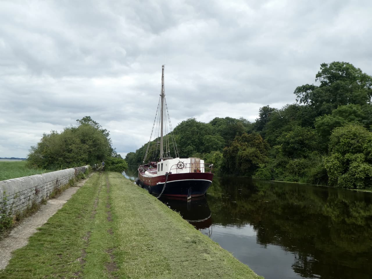
    There is little traffic on this stretch of the canal and few barges are moored beside it.  Approaching Purton there is a sign to the Purton Ship Graveyard.  An information board explains that from 1909 to 1965 unwanted vessels were beached on the foreshore of the River Severn and allowed to fill with silt.  This was done to stop the erosion of the river bank endangering the canal.

    There are said to be 86 vessels beached here, with some on top of others and difficult to distinguish.  To assist there are small plaques providing information on some of them.

    It is low tide and the wrecks of Arkendale H and Wasdale H, the two barges that collided with the Severn Rail Bridge, can be seen still lying in the middle of the river.

    This is a fascinating spot and we wander around for a while, but I think a couple of hours is really needed to take in all the maritime history here.  As we head back to the canal there is a monolith with a list of vessels wrecked here.

    We continue past some canal side cottages and then two swing bridges close to the village of Purton.

    We now have a two and a half mile section on the canal as it heads through open countryside.  It is very tranquil and very few others are out enjoying the scenery.  To our left on the banks of the River Severn I spot a World War II pillbox.

    As we near Patch Bridge there are more boats moored besides the river.

    We leave the towpath at Patch Bridge and cross the swing bridge.

    I offer Lynnie a pot of tea at the cafe besides the canal, but much to my surprise she declines.  We walk by the Tudor Arms pub, which appears very busy and has a caravan park behind it.  Our route now involves a bit of road walking, but these are quiet lanes so we are not going to be bothered by too much traffic.  We head away from the canal on Kingston Road, this passes the carpark for Slimbridge Nature Reserve. 

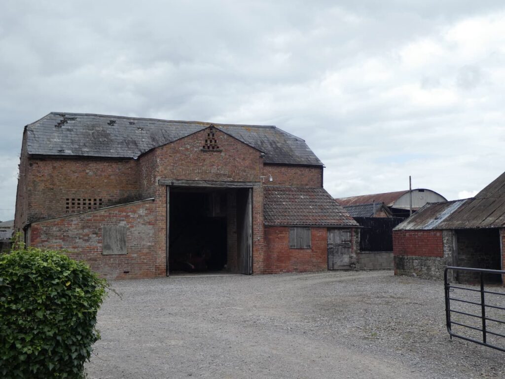
    At the next junction we turn right into Lightenbrook Lane and follow this for just over half a mile to reach a junction with Moorend Lane where we turn right.  In just under half a mile we reach Folly Bridge where we turn right into Tyndale Road.  After nearly a mile we reach Hurst Farm which has a fine collection of old barns and farm machinery.

    After crossing Gilgal Bridge the lane becomes Slimbridge Lane and we stay with this to pass the entrance to the Ernest Cook Trust – Redwood Outdoor Learning  Centre.  This site is used to provide children and young people with opportunities for outdoor learning.  After a mile on Slimbridge Lane we reach a junction where we turn right on Riddle Street following a signpost to Purton and Hinton.  A couple of hundred yards along the lane, we take a footpath on the left besides the Parish Council notice board. We are now on Lip Lane and this soon becomes a grassy track and then a clear path.

    The track leads to a minor road where we turn left and pass a row of cottages in Brookend and walk steadily uphill to reach the Lammastide Inn.  Sadly this pub has recently permanently closed after the long term landlords decided it was not economically viable to continue.  Let’s hope they find someone willing to take it on and make a go of it.  I cannot recall previously seeing a pub with this name, so later look it up and discover the Lammastide was the festival of wheat harvest, thus explaining the sheaf of wheat on the pub sign.

    We continue along the road the reach a junction where we turn right and follow the road through Newtown passing the village school and then at a junction soon after the Post Office we turn right into Oldminster Road.  After passing the allotments on our left we turn left onto the footpath that leads down past the playing field and crosses the railway line.  After crossing a field we turn right and then retrace our route back to the viewpoint car park.

    You can view this 13 mile walk on OS Maps and download the GPX File Here

    To follow our walk you will need Ordnance Survey Outdoor Explorer OL167 Thornbury, Dursley & Yate

    12th July 2021

    © Two Dogs and an Awning (2021)

    All information on this site is provided free of charge and in good faith and no liability is accepted in respect of damage, loss or injury which might result from it.  To the best of my knowledge the routes are entirely on public rights of way or within areas that are open for public access.
    Walking can be hazardous and is done entirely at your own risk.  It is your responsibility to check your route and navigate using a map and compass.
  • Down Memory Lane at Severn View

    Down Memory Lane at Severn View

    The weather forecast for today suggests there will be rain after lunch so Lynnie is reluctant to head out for a walk, instead opting to stay in the caravan with a good book.  A bit of wet weather will not stop me from heading out.  Apart from thunderstorms I am comfortable walking in most weather conditions, but avoid woodland when there are very strong winds.

    So with lunch packed in my rucksack I head off with Crosby for a walk which will take me to the original Severn Bridge.  I have no intention of walking across the bridge, although that is possible, I don’t think my poor head for heights would stand it.  However, I aim to revisit a spot that Lynnie and I went to about forty years ago,

    Leaving the site I turn right and walk along the lane to the crossroads.  I go straight across on The Naite heading towards Oldbury on Severn.  

    At a junction I turn right into Chapel Street and continue through the village with the Rhine, the term they use for drainage ditches in this area, to my left.

    On reaching a junction by the War Memorial I turn left into Church Lane and pass the Community Shop which is doing a brisk trade in drinks at the outside tables.  This is the route of cycle way 41 on the National Cycle Network.  This 120 mile cycle way connects Bristol with Gloucester, Stratford-on-Avon and Rugby.  There are plenty of cyclists stopping for refreshments today.  Soon after I reach the Anchor Inn and there are folk waiting outside for the doors to open.  

    At a junction in the road I keep left and head up Church Hill to pass Oldbury-on-Severn primary school.  The school dates back to 1854 when it was built from public subscriptions and a government grant.  It is good to see a thriving village school, all too often these days they get subsumed into larger units and lose the benefits of small school teaching.

    Just after the school the road bends to the right but I take a bridleway to the left, Stocks Lane, this initially goes besides the Rectory and then at a fork in the lane I go to the right, still on Stocks Lane, which is now a grassy track.

    The lane crosses a minor road and continues along another grassy track to reach another minor road where I turn right and walk along Stock Hill soon passing Stock Farm.  On reaching a footpath on the left I go through a metal gate and walk south across a pasture field with Sacks Hill to my left.

    To my right is a fine view of the Severn Bridge.

    I reach a gate and go through to enter Wood Well Meadows Local Nature Reserve.  Apparently the two fields that form this nature reserve have never had any pesticides or fertiliser used on them so it is an abundance of wild flowers.  After being in private ownership for many years and cared for as a wildlife meadow, it is now owned by Aust Parish Council.   They plan to improve the fencing and graze cattle on it in the late summer and autumn thereby maintaining the biodiversity.

    The grass in the meadow is long at the moment but there is a clear path which I follow to a kissing gate.  Now I follow a footpath alongside a paddock and then go across stiles through further paddocks and then over a stile by a metal gate onto a lane where I turn right and walk a short distance to a minor road.  Here I carry straight on to soon pass the Water Treatment Works and then continue on to reach the B4461 Redhill Lane where I turn right and then almost immediately left into Elberton Road.  After passing through the village I come to a driveway leading to the church of St John the Evangelist.

    The spire on the church dates to the 14th century but most of the rest of the building was rebuilt in 1858.  I find a bench beneath a tree and decide this is as good a spot as any to stop for lunch.  I am not at all religious but often avail myself of a bench in a churchyard on my walks.  It is usually a tranquil spot to sit and observe the wildlife. 

    Refreshed from lunch, both Crosby and I are topped up with water so we head off again back to the minor road and turn left along the Elberton Road and follow this to reach Olveston. At a junction in the village I turn right and join Aust Road.  This heads downhill and passes a parking area where I spot a battered milestone besides the road.  It is difficult to read but it is 10 miles from it’s unreadable destination.

    I continue on past the entrance to the Harnhill Landfill site.  This site was originally a quarry and then became a landfill site which is now used for biomes generation producing power for the national grid.  I turn left off Aust Road into Ingst Road.  This is a narrow lane passing Priestpool Farm and Box Bush Farm before crossing the M48.

    After crossing the motorway the lane leads into Ingst where soon after passing Old Manor Farm I take a footpath on the right.  The path goes over a stile and enters a field and then quickly through a gate into a field of rough pasture.  I am grateful for the OS Map app on my phone because the path is not immediately clear but soon joins a track.  Nearing the end of a field the track continues on, but I take a poorly marked path on the right into a field and head for a footbridge over a drainage ditch.  I am now in a meadow which I cross to reach another footbridge over a drainage ditch.

    The footpath follows the edge of an arable field and then heads across the corner of the field on a diagonal path to reach a farm track.  I cross the track and head across another arable field.  The rain that was forecast has arrived and it is a constant drizzle and looks well set in.

    I go over a stile and join a lane where I turn left.  The M48 is just the other side of the fence as I walk along the lane and pass a parking area.  The lane then continues on into Aust where I pass houses to reach the Boars Head pub.

    I follow the road through the village and pass an old petrol station.

    I stay with the road past the village church and then reach the Village Hall at a junction of a road.  I always think the size of a village hall reflects on the number of active members within a community.  Village meetings in this hall must be cosy affairs.

    I now cross the A403 with care to take a path through trees which leads me to a road which I cross and then follow the Severn Way signs on an access road to the Severn Services.  I stay with the Severn Way markers to cross the M48.  From here you get a good impression of the scale of the suspension towers on the bridge.

    The Severn Way path now leads away from the new service area, which was opened in 1999 and in 2019 voted the worst motorway service station in the Country.  I soon emerge on the site of the old Severn View Services, it is a nearly forty years since I visited here with Lynnie on our first holiday away together in South Wales.  The services were opened in 1966 by Top Rank.  It was a spot where travellers stopped to take in the view  of the bridge.  With the advent of the second river crossing and the diversion of the M4 the main service area moved and the old building was sold and is currently owned by Brightside Insurance which was founded by Aaron Banks.  I will resist commenting on this individual and the role he has played in recent British politics for fear of making a defamatory statement.

    I follow the footpath to the wall which is on the edge of Aust Cliff.  I am a man with vertigo, so cliffs are not an area I feel comfortable.  However I was determined to revisit this spot, in a photo album I have a picture of Lynnie sat on this wall nearly forty years ago. 

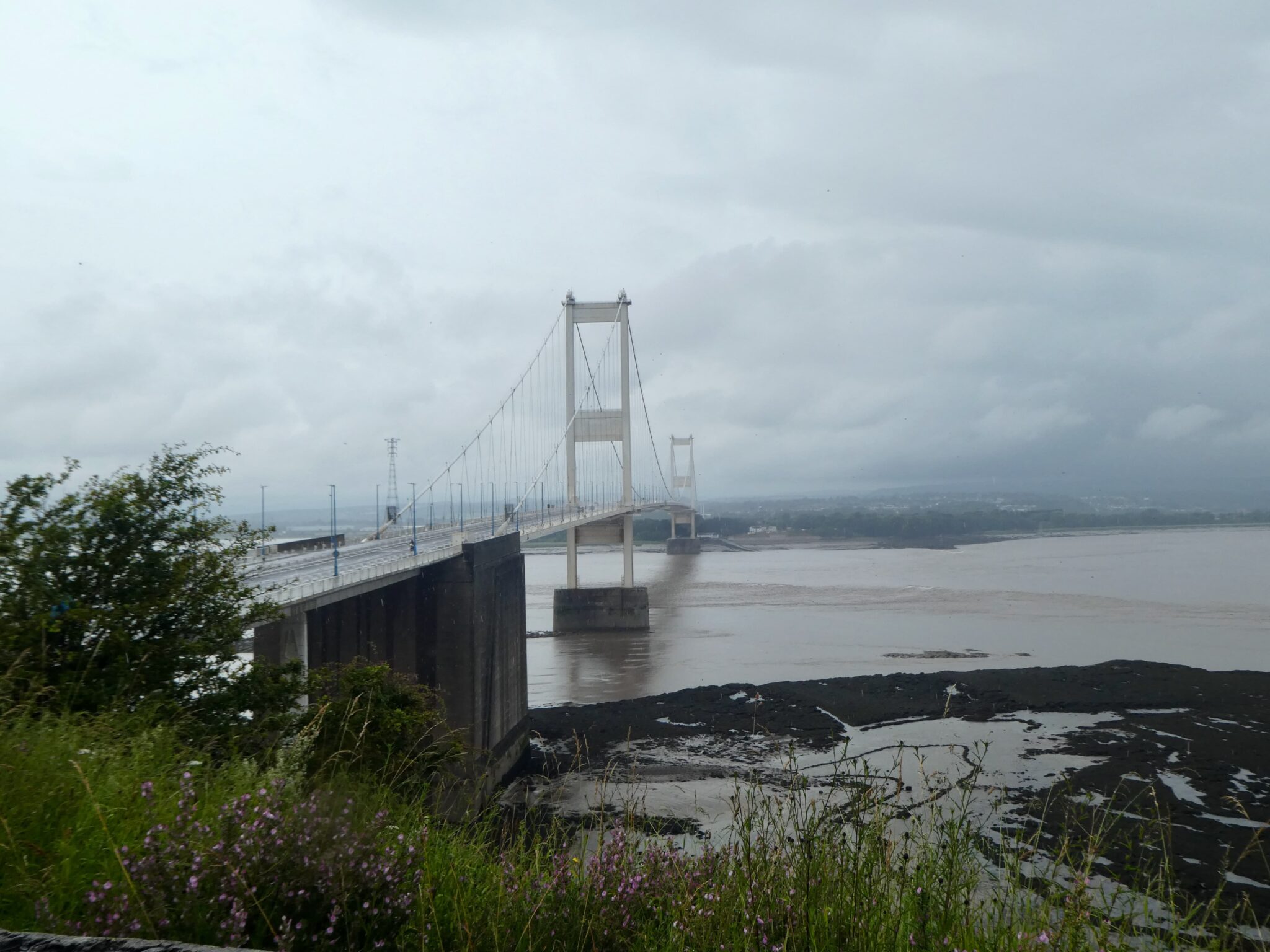
    The Severn Bridge was opened in 1966 and took three years to build.  It replaced what was previously a ferry crossing between Aust Cliff and Beachley Peninsula.  Construction of the bridge cost £8m and was recovered through toll charges.  Originally it carried the M4, but in 1996 the second crossing, The Prince of Wales Bridge, opened and the M4 was diverted.  This old bridge now carries the M48.

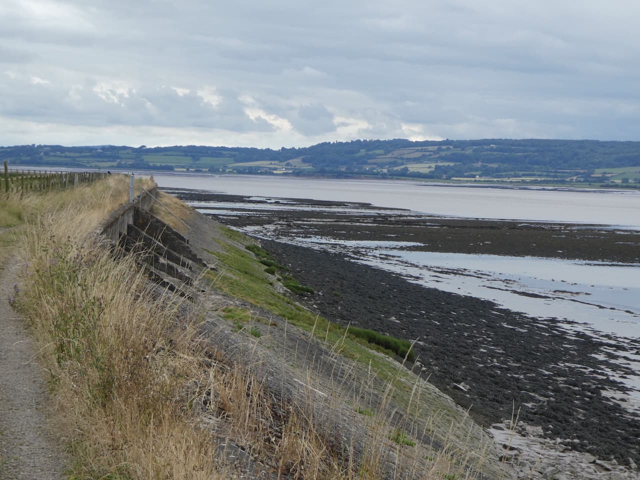
    I now follow the way markers leading along the top of Aust Cliff, thankfully the edge is well away and protected by undergrowth.  On reaching a pasture field I start to descend and I am soon down on an embankment besides the River Severn looking back at the bridge.

    There is no protection from the rain besides the river, but it is at my back as I head along the Severn Way.

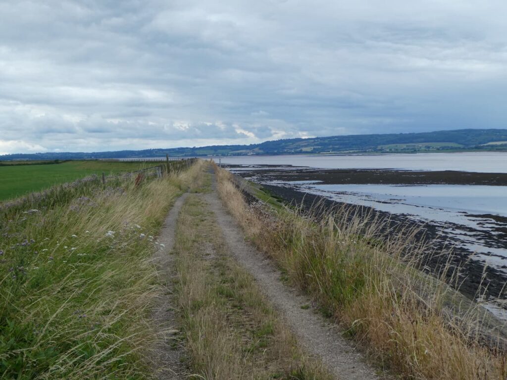
    The route is very easy to follow.  I stay on the embankment through a couple of herds of cattle, who show no interest in us whatsoever.  In the far distance is Oldbury Nuclear Power Station.  The path cuts inland slightly around the Littleton Pill and then continues on to Oldury Pill where the Thornbury Sailing Club is located.  

    After crossing Oldbury Pill I continue on to reach the lane which serves the sailing club.  Here I turn right and walk back into Oldbury on Severn.  In the village I turn left and pass the community shop.

    and then on reaching the War Memorial continue straight on into Camp Road and stay with this lane as it leads through houses and then becomes a grass track.

    There are a number of footpaths off this track which I ignore, then at a fork I go right and continue on to reach a minor road where I turn right and then at the crossroads turn left into The Naite and walk the short distance back to Golden Valley House CL.

    I have had a cracking walk, a bit more road walking than I would normally choose, but it has been on quiet lanes and I have only seen a handful of cars.  Visiting the Severn View brought back many happy memories. I have covered 15 miles and for the last couple of hours it has been raining.  So I hang up my jacket and dry Crosby before planning tomorrow’s walk.

    You can view this 14.5 mile walk on OS Maps and download the GPX File Here

    To follow our walk you will need Ordnance Survey Outdoor Explorer OL167 Thornbury, Dursley & Yate

    11th July 2021

    © Two Dogs and an Awning (2021)

    All information on this site is provided free of charge and in good faith and no liability is accepted in respect of damage, loss or injury which might result from it.  To the best of my knowledge the routes are entirely on public rights of way or within areas that are open for public access.
    Walking can be hazardous and is done entirely at your own risk.  It is your responsibility to check your route and navigate using a map and compass.
  • Poachers and Bridges

    Poachers and Bridges

    We have decided to walk from the caravan site today.  I am never keen on driving far when we are away.  Years ago I used to find driving pleasurable, but nowadays it is something to be done out of necessity and I try to limit our mileage as much as possible.  Walking from the site also gives us a great opportunity to get to know the area in more detail.

    After chatting to the CL owner Kate this morning I have checked the map and plotted a walk that will take Lynnie and I along a section of the River Severn.  Leaving the site we turn left and follow the minor road Stoneyard Lane, which soon becomes Hill Lane, towards the village of Hill.  Clearly the locals around here were not that imaginative when they named their villages, but then again the land around here is fairly flat.

    This is a very quiet lane and forms part of Route 41 on the National Cycle way.  This is a 120 mile cycle way connecting Bristol with Gloucester, Stratford-on-Avon and Rugby.  

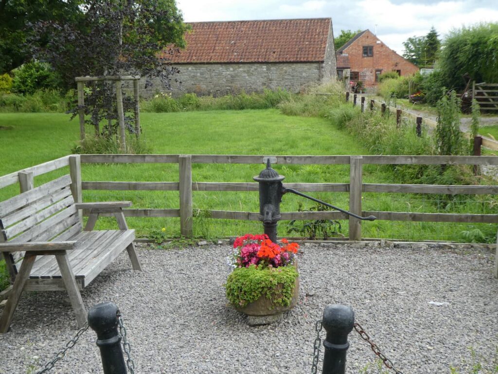
    We follow the road into Hill and decide it is time for lunch, we find a convenient spot on one of the two benches besides the Millennium Pump.  Areas like this are always a blessing to walkers looking for a suitable spot to stop and take on some refreshments.

    Apparently Hill is recorded in the Doomsday Book as Hilla and then between 1250 and 1455 it was recorded as Hulla, but since 1733 it has been known just as Hill.  After our lunch we continue along the road and pass the entrance to St Michael and All Angels Church and Hill Court.  We stay with the road passing Blisbury Farm with its collection of fine old brick barns.

    Up on the escarpment to our right is Catgrove Wood.  These woods were the scene of a murder on the night of 18th January 1816. Sixteen poachers took part in a mass poaching intended as a protest, feelings were running high following the death of a local man, killed by a spring gun two months earlier.  The group encountered gamekeepers and in the resulting melee an assistant gamekeeper, William Ingram, was shot dead.  Eleven men stood trial for his murder, two were executed and the remaining nine were transported as convicts to Australia.

    On reaching a crossroads we turn left onto Severn Lane and follow this to reach Severn House Farm.  Here we go through a gate and turn left to join the Severn Way as it follows a path along the sea wall.

    Following the Severn Way we pass the White House, apparently this house dates from 1845 and has long been associated with navigation on the River Severn. It now has a navigation beacon beside it.

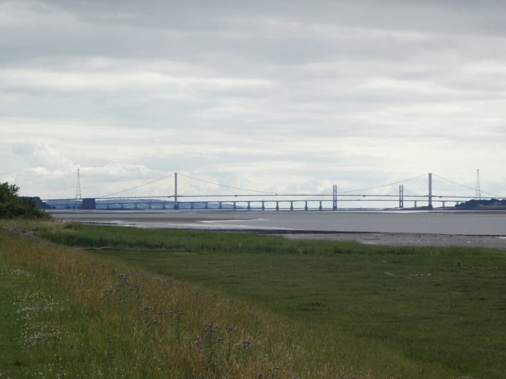
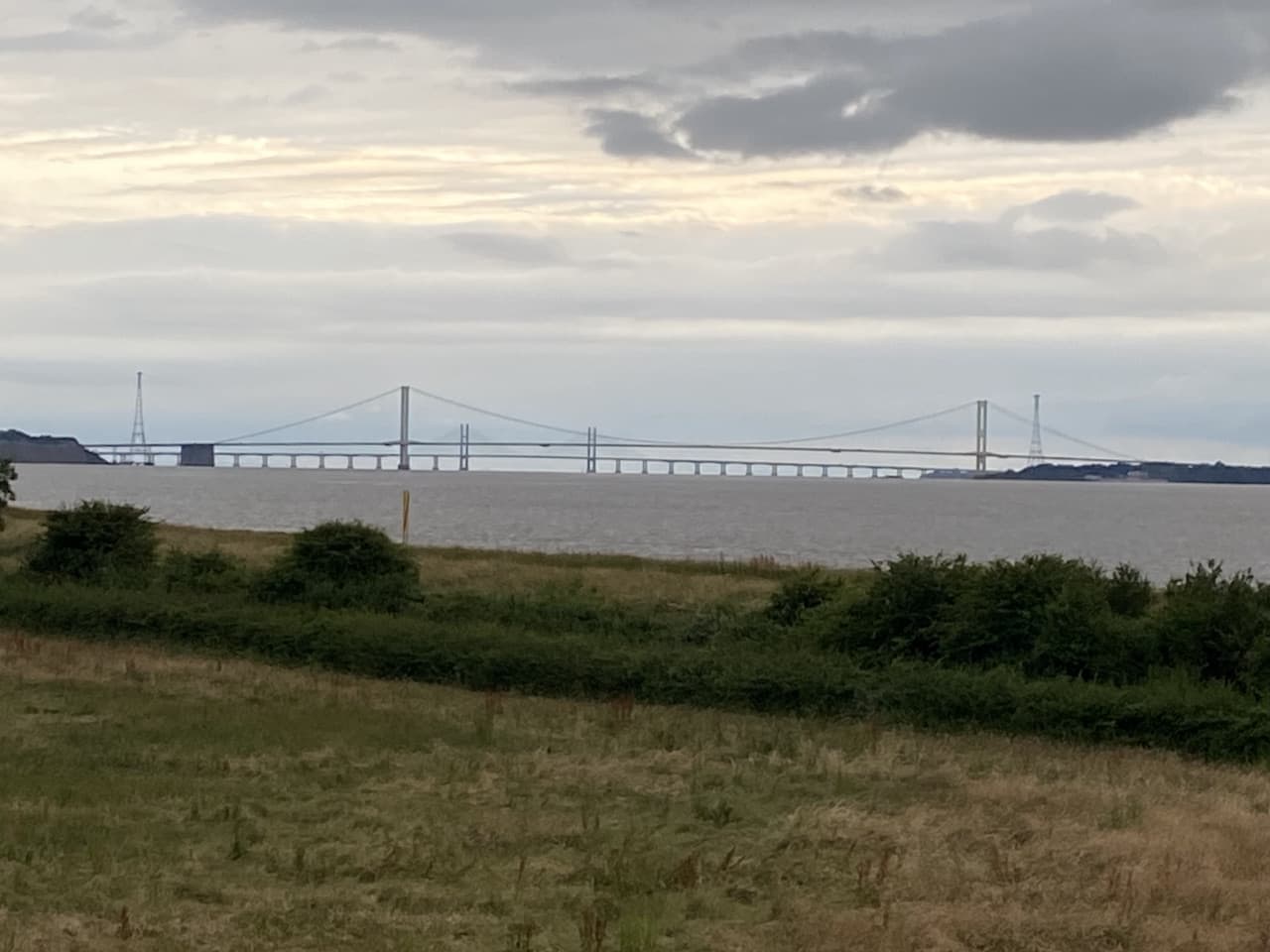
    In front of us we can see the two road crossings over the River Severn.  The suspension bridge closest to us, The Severn Bridge, was opened in 1966 by Queen Elizabeth II, it was granted Grade 1 listed status in 1999 .  It originally carried the M4 to link England and Wales.  With the opening of the second river crossing, The Prince of Wales Bridge, in 1996 the main M4 was rerouted to cross the new bridge, whilst the old bridge was designated as the M48.  Both started life as toll bridges but are now free to cross.

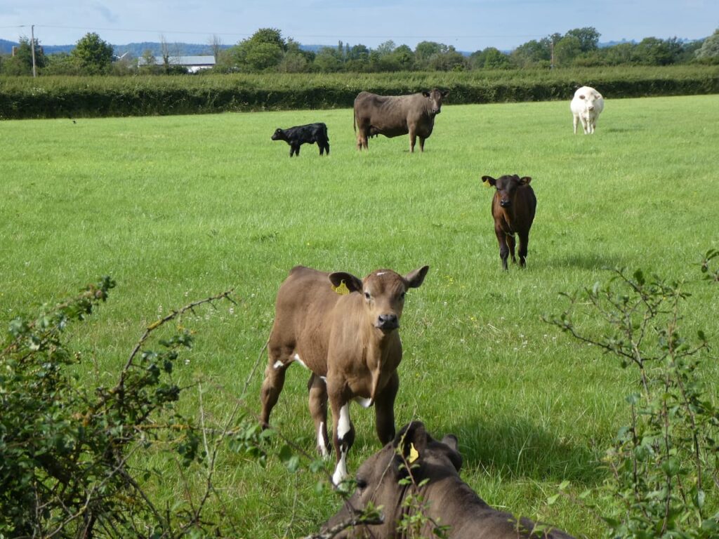
    On reaching a gate to a minor road we leave the Severn Way and walk along Shepperdine Road heading back inland.  This lane passes farms, there are options to cut corners on footpaths, but it is pleasant walking on the quiet lane so we stick with it as we wend our way back.  As we pass a field of cattle the inquisitive calves watch us carefully.

    At the junction with Stoneyard Lane we turn right and walk the short distance back to the entrance to Golden Valley House CL.  Our walk has covered ten and a half miles and it has been a pleasant jamabout.

    You can view this 10.5 mile walk on OS Maps and download the GPX File Here

    To follow our walk you will need Ordnance Survey Outdoor Explorer OL167 Thornbury, Dursley & Yate

    10th July 2021

    © Two Dogs and an Awning (2021)

    All information on this site is provided free of charge and in good faith and no liability is accepted in respect of damage, loss or injury which might result from it.  To the best of my knowledge the routes are entirely on public rights of way or within areas that are open for public access.
    Walking can be hazardous and is done entirely at your own risk.  It is your responsibility to check your route and navigate using a map and compass.

  • A Five Mile Walk from Golden Valley House CL

    A Five Mile Walk from Golden Valley House CL

    A couple of weeks ago Lynnie’s brother John mentioned he had recently stayed in a holiday cottage at Oldbury Naite, close to the River Severn in South Gloucestershire, where a new CL was about to open.  It is a part of the Country we have not previously visited so decided to give it a go.

    Following an email exchange with Vic the CL owner we find ourselves booked in as the first visitors to their brand new site at Golden Valley House CL.   Access to the site is really good and as you would expect from a new CL the facilities are top notch.  After pitching up Crosby and I are out for a walk to stretch our legs and explore the area.

    Leaving the site I turn left into the minor road Stoneyard Lane, and then at a junction in a hundred yards turn left into Shepperdine Road, signposted to Shepperdine and the River.  I stay with Shepperdine Road until it turns to the right just after passing Knight’s Farm.  I am now on a lane heading towards Jobsgreen Farm, nearing the farmhouse I take a bridleway on the left and follow this to reach a gate.  I don’t go through the gate but turn left onto a bridleway running along the perimeter of Oldbury Nuclear Power Station.

    On reaching a road I turn right and then almost immediately left to take a path that follows the high fence line of the Power Station to reach the River Severn.

    Oldbury Power Station was commissioned in 1967 and the nuclear reactors created enough electricity each day to serve a city twice the size of Bristol.  It has two nuclear reactors, the second being commissioned in 1968.  The power station was decommissioned in 2012 and is now going through the decommissioning process.  The defuelling process will continue until 2027 and apparently the demolition of the reactor buildings and clearance of the site is scheduled for 2096 to 2101.  A stark reminder that nuclear fuel leaves a legacy for future generations to clear up.

    I now turn left to join the Severn Way and follow this footpath besides the River Severn.  Last week we were walking on the Severn Way around Worcester, then we would only get an occasional glimpse of the water, here the full expanse can be enjoyed as I look across towards the Forest of Dean.

    In front of me are the two road bridges crossing the River Severn.  The closest suspension bridge was opened in 1966 by Queen Elizabeth II, this originally carried the M4 linking England to Wales.  The second, newer bridge, The Prince of Wales Bridge, opened in 1996 and now carries the rerouted M4, whilst the old bridge has been designated as the M48.

    I stay with the path to Oldbury Pill with the Thornbury Sailing Club tucked into the inlet.  I am not keen on being on water and have never ventured out sailing, the Isle of Wight ferry is my type of sea transport.  However, it is obviously a popular activity and this club was formed back in 1949 and according to its website is thriving.

    The footpath soon joins the tarmac driveway to the sailing club and on reaching a gate the Severn Way goes to the right over Oldbury Pill, but I stay on the tarmac drive and walk into the village of Oldbury on Severn.  The lane comes out almost opposite the Anchor Inn.  

    After a long day a pint would be very welcome, but it is getting late and I know that Lynnie will be preparing food back at the caravan.  So I turn left away from the pub and walk through the village passing the Community Shop and then following the road as it bends to the right into Chapel Lane.  On reaching a junction I turn left into The Naite and follow this minor road to reach a crossroads where I go straight over and then walk the short distance back to Golden Valley House CL.  

    My stroll has covered five miles and it has been an interesting introduction to the area.  Time now to plan some walks for the next few days.

    You can view this 5 mile walk on OS Maps and download the GPX File Here

    To follow our walk you will need Ordnance Survey Outdoor Explorer OL167 Thornbury, Dursley & Yate

    9th July 2021

    © Two Dogs and an Awning (2021)

    All information on this site is provided free of charge and in good faith and no liability is accepted in respect of damage, loss or injury which might result from it.  To the best of my knowledge the routes are entirely on public rights of way or within areas that are open for public access.
    Walking can be hazardous and is done entirely at your own risk.  It is your responsibility to check your route and navigate using a map and compass.

  • Fountains and Trigs

    Fountains and Trigs

    We are heading home tomorrow so today is our last opportunity to get out for a walk in the Cotswolds.  The rain has eased over the last couple of days and the forecast looks as if we should be able to get a good walk in without getting too wet.  

    We have planned a walk from nearby Chipping Norton and our starting point is the pay and display New Street car park (OX7 5NF) (Grid Ref: SP 311269). Leaving the car park we head back to New Street and turn right uphill and then right again along West Street and then at a mini roundabout turn left on the road signposted to Burford.  

    We soon reach another mini roundabout and continue towards Burford.  We head steadily uphill on the pavement and at a parking area in front of a school take a left to follow a footpath which passes between the car park and school and then joins a track by playing fields.

    We follow the footpath past Glyme Farm with its assortment of old farm machinery alongside the barns.

    We now head through a kissing gate and head across a field of pasture to cross a stream on a footbridge.

    We continue across another field and then go through a couple of thickets to reach a junction of paths where we turn right and then within a few yards fork right to follow the route of Wychwood Way as it heads along a track towards the B4026.

    On reaching the road we turn left and walk along the grass verge for a couple of hundred yards and then take a minor road on the left signposted to Lidstone and Enstone.  We stay with this lane until we reach a footpath on the right which enters a field by a metal barrier.

    The footpath goes along the hedge line heading south and we soon reach an Ordnance Survey trig pillar tucked away in the hedge on Lidstone Hill.  This is the 251st trig I have bagged.

    The path continues along the hedge line and then on reaching another field there is a fork in the footpath, here we go left across the field to meet the B4026. Rather than join the road we turn left  following the Wychwood Way along a restricted by-way.

    The Wychwood Way is a 37-mile circuit starting in Woodstock, we are just doing a few miles on the route today.  We cross a minor road and continue along the track opposite until we reach the B4022 which we cross and continue along the track, still on the Wychwood Way.  This track is marked as the Salt Way, which is one of the ancient Salt Way routes from Droitwich where salt was mined and then transported around the country.  

    It is a cracking day and we are walking on firm ground in sunshine, which makes a change from the weather earlier in the week.  I have a feeling that we have not seen this part of the Cotswolds at its best on this trip.

    The track leads us to the edge of Shallot Wood and a junction of tracks.  We continue along the track in a south-easterly direction for just over a hundred yards so I can bag the Ordnance Survey trig pillar that is tucked away in the hedge.  I am not sure what it is with trigs in hedges around here, but I eventually locate what the OS database records as Inotts Clump trig pillar.  

    From the trig we turn around and walk back to the fork in the track, this time we go left and follow the lane which continues to a crossroads with the B4022, we cross and continue down a narrow tarmac lane towards Taston.  Just as we enter the village we pass a memorial fountain.  Apparently this was built in 1862 as a memorial to Henrietta, Viscountess Dillon, wife of the 13th Viscount Dillon.

    In the centre of the village there are the remains of a medieval preaching cross.  In the 1600’s such crosses were damaged by Oliver Cromwell’s forces and this one’s cross has been removed and only a stump remains.

    From the cross we take a lane heading west and soon take a footpath on the left leaving the village to cross fields and go through a spinney heading towards Spelsbury.

    On reaching a minor lane on the edge of the village we turn left  and then very soon go right along a road leading to the centre of the village where there is another memorial fountain.  This one was once the main fresh water supply for the village and is dedicated to Constantine Dillon, the son of the 13th Viscount Dillon,  who drowned in 1855 aged 40 whilst crossing a flooded river in New Zealand.   

    At the memorial we turn left and head down Church Lane to reach All Saints Church, parts were built around 1300 and it had major rebuild in the 18th century.  Much of the church is now covered in scaffolding and the building is locked so we are unable to look at the interior which apparently has a number of impressive memorials.

    We return to Church Lane and turn left and then very soon take a footpath on the left which leads along a track and then goes to the right besides a cottage and then at a junction of paths turn left and follow a path towards Coldron Mill.  Apparently there has been a mill on this site for over a thousand years, the building looks like it is undergoing a makeover with a relatively new waterwheel installed.

    At a junction of paths close to the mill we go right and follow a path over a footbridge into Dean Grove where we turn right to follow a footpath through the woods.

    On leaving the woods the path continues besides a paddock and then at a crossing of paths we turn left to continue uphill between paddocks.  On reaching a lane, Grove Lane, we turn right to follow the lane as it passes farm buildings and discarded farm equipment.

    Reaching a road we turn left and head towards Chadlington.  In the village we pass the church and then turn right beside the Primary School to head along Church Lane.  When the lane reaches the bowling green it bends to the left, we carry straight on heading north.

    We follow this lane for a mile and a half as it goes between fields with some far reaching views.

    The track leads us to a minor road where turn right and walk past East Downs Farms.  Just short of half a mile we reach a footpath on the left signposted to Chipping Norton.  We take this path into a field.

    The clear path soon heads diagonally across arable fields.  From June 1940 until October 1953 this was the site of RAF Chipping Norton.  Little evidence of the airfield remains.

    We now follow the footpath way-markers which lead us to the outskirts of Chipping Norton.  From there we follow the pavement besides the A361 and return to the centre of the town.  We have not been here before so have a wander around before returning to our starting point in New Street car park.

    Our walk has covered over 15-miles and it is time to head back to Pebbly Hill Nurseries to start packing up for our return home tomorrow.  When we get back home everything is going to need a good wash to remove the mud from the caravan and awning.

    You can view this 15 mile walk on OS Maps and download the GPX File Here

    To follow my walk you will need Ordnance Survey Outdoor Explorer OL 45 – The Cotswolds

    26th May 2021

    © Two Dogs and an Awning (2021)

    All information on this site is provided free of charge and in good faith and no liability is accepted in respect of damage, loss or injury which might result from it.  To the best of my knowledge the routes are entirely on public rights of way or within areas that are open for public access.
    Walking can be hazardous and is done entirely at your own risk.  It is your responsibility to check your route and navigate using a map and compass.

  • Exploring the Cotswolds from Cleeve Common

    Exploring the Cotswolds from Cleeve Common

    Our trip today is to Cleeve Common on which sits Cleeve Hill which is the highest point in  Gloucestershire and the Cotswolds. It is a spot we have not previously visited but I have seen details of it in walking magazines and in posts by folk I follow on social media.  It is about twenty miles to the west of where we are staying at Pebbly Hill Nurseries.

    The starting point for our walk is a car park (Grid Ref: SO989271) located on the edge of the common very near to the clubhouse of Cleeve Hill Golf Club.   Boots on we head the short distance back towards the clubhouse.

    There is a network of paths across the access land of Cleeve Common, but we decide to stay with the way-marked Cotswold Way as it heads south.  

    The route takes us past disused quarries, these provided the famous Cotswold Stone used in local house building.

    It is a cracking day and there are extensive views as we continue along the way-marked path.

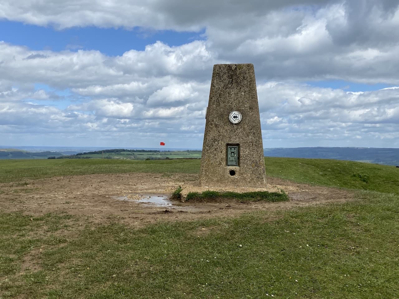
    The Cotswold Way leads us to an Ordnance Survey trig pillar at The Ring on Cleeve Common.  I had initially thought that this must be the highest point but soon realise that nearby Cleeve Hill is a few metres higher.  This is my 249th trig and the first I can recall having a way-marker attached to it.

    We continue on the route of the Cotswold Way as it crosses part of the golf course.  Playing golf on the common dates back to 1891 when the Cheltenham Golf Club was formed, over the years it has changed its name a few times and is now known as Cleeve Hill Golf Club.  

    Its future was in doubt recently when Tewkesbury Borough Council, the owners of the common, announced they would not renew the license for Cleeve Common Trust to operate a golf course. However, in January it was announced that agreement had been reached for a new company to operate the golf course.  This has to be good news, it would be a pity to lose such an old course.

    Our route across the common continues to follow the Cotswold Way with distant transmitter masts as our point of reference.

    Soon we get a good view across Cheltenham Racecourse on the edge of the town below us.  It is many years since we have been to the races.  When Lynnie and I lived close to Kempton Park and Sandown Park racecourses we occasionally spent an afternoon at the races, but that was forty years ago.

    At the point where the Cotswold Way veers to the right to descend the hill we continue straight on along the top of the common with the path heading towards the transmitter masts on Cleeve Hill.

    After passing the masts we soon reach the Ordnance Survey Cleeve Hill Trig Pillar, this is my 250th trig bagged and it is fitting that at 1,080 feet above sea level it is the highest point in Gloucestershire and the Cotswolds .  

    We stay close to the boundary fence and continue in a south easterly direction over the access land towards a car parking area on West Down.  After going through the car park we join a minor road heading south.  This passes entrances to farms and we ignore a minor road on the left.  After a mile and a half and beyond Nash Barn we take a footpath on the left that heads east towards Sevenhampton.

    The path descends to reach a minor road which we cross and continue downhill on a lane leading to the church of St Andrew.  This church was built in the 12th and 13th centuries with the tower  added in the 15th century.

    We venture inside the church where strangely an old trowel on a plaque is on the wall. Apparently it was found in the stonework of the west wall during restoration work in 1893 and is thought to be medieval.

    Leaving the church we turn left and head downhill on Church Lane.  When the tarmac ends we continue on a footpath that crosses a stream and then on reaching a minor road we turn left along a country lane heading towards Brockhampton.  We reach the village at a grass triangle with a post box and continue straight on towards the Memorial Hall.  

    This hall was donated to the village by Col. Fairfax Rhodes in 1902 in memory of his son John who was killed in the Boar War.  Rhodes lived at Brockhampton Hall and in 1909 he had the foresight to build a cottage alongside the Memorial Hall for the hall caretaker.  The cottage is now let to provide an income which supports the upkeep of the hall.

    We carry on along the lane and just after the last house there is a water fountain in the wall with the inscription “Those occupying houses built prior to 1935 are welcome to use this water supply for domestic cooking and drinking purposes only during the pleasure of the owner of Brockhampton Park or his representatives”

    Almost immediatly after the water fountain the road bends sharply to the right, here we carry straight on along a footpath which goes through a metal kissing gate and continues north through fields.

    On reaching a minor road we turn left and continue along this lane ignoring a junction to the right.  At a crossroads we go straight over to join a dead end lane.  This takes us to a cottage besides a gate where the path continues along an estate road.

    The path is clearly way-marked as it continues along the track passing through trees heading towards Westwood House.

    After passing the house the route starts to head west and ascends towards the derelict farmhouse and farm building at Wontley Farm.  This farm was built in 1824 but has been derelict since 1964.  It is a pity to see old buildings falling into total disrepair and the structure now looks a bit fragile with significant cracks in the walls so we decide not to venture too close.

    At the farm we have reached a crossing of footpaths, we turn right and follow a track for about a quarter of a mile to reach a footpath on the left, we follow this path as it heads across a field towards woodland.  We are now on the route of the Cotswold Way and we follow this as it descends through Breakheart Plantation.

    We follow the way-marked route through the trees and besides a cottage and then turn left still on the Cotswold Way to descend through another plantation to cross a stream at a footbridge.

    We then go through a metal gate and continue uphill on the path besides the edge of a field and then goes through a gate to join a track, as we near farm buildings we take a permitted path to the left, this avoids taking the footpath through the farmyard and rejoins the track on the far side of the buildings.  Now we are on a tarmac lane with Postlip Hall soon in view in front of us.

    The main parts of Postlip Hall were built in the 17th century with some bits going back further.  The building underwent major renovations in 1878/79.  In 1969 the house was purchased by a group of people wishing to set up a community living project and has operated under these principles ever since.   

    As we near the Hall we take a footpath on the left to stay with the Cotswold Way, which now follows a boundary wall.

    After passing some farm buildings we reach a junction of paths, we go right still on the Cotswold Way to go through gates and continue by the wall as it passes paddocks.  After going through another gate we enter the edge of Cleeve Common and follow the path uphill.

    We pass some small disused quarries and then go through a gate to join a track which leads to another gate onto another section of the Common.  

    This track leads us back to our start point at the quarry car park.  Our walk has been just over 12 miles and we have been fortunate with the weather.  It stayed dry all the way round until we reached the car park at which point it started to rain just as we were taking our boots off.

    You can view this 12 mile walk on OS Maps and download the GPX File Here

    To follow my walk you will need Ordnance Survey Outdoor Explorer OL 45 – The Cotswolds

    25th May 2021

    © Two Dogs and an Awning (2021)

    All information on this site is provided free of charge and in good faith and no liability is accepted in respect of damage, loss or injury which might result from it.  To the best of my knowledge the routes are entirely on public rights of way or within areas that are open for public access.
    Walking can be hazardous and is done entirely at your own risk.  It is your responsibility to check your route and navigate using a map and compass.

  • Two Trigs From Condicote

    Two Trigs From Condicote

    Today we are finally getting in the car to start a walk away from Pebbly Hill Nurseries.  The better weather over the last couple of days means the site is drier, but I am still cautious leaving the site as I don’t want to scar the grass too much.  We are heading to  the village of Condicote which is on the other side of Stow-in-the-Wold.

    The starting point for our walk is the village hall car park in Condicote (Grid Ref SP153282). Leaving the car park we turn left and follow the road to the village green where we stop to look at St Nicholas’ Church.  Parts of this church date to the 12th century, but it has a more modern look due to a major refurbishment in 1888.

    From the church we continue around the green, which is apparently called the pound by the locals, to look at the village cross.  It is said to be over 500-years old and at one time there was a fresh water spring close to it.

    From the cross we turn and walk past the village bus shelter housing a George V post box within it.

    We head out of the village in a north-westerly direction on the route of the Gloucestershire Way.  This 96-mile, long distance trail starts in Chepstow and winds it’s way to Tewksbury.  When the road sweeps to the right near Cedar Gables Farm we stay on the Gloucestershire Way along a farm track.

    At a junction with a road we turn right and after a few hundred yards turn left on a track leading into a plantation still on the route of the Gloucestershire Way.  

    At a fork in the track on the northern edge of the plantation we go left staying with the Gloucestershire Way.  The path goes along the edge of a field and then diagonally across two fields to reach a junction of paths, we go right leaving the Gloucestershire Way for the Diamond Way.  After heading across another arable field to reach a gate we follow the path along a track.

    When the Diamond Way turns to the right, heading to Cutsdean Lodge, we continue straight on following the track besides a copse.

    We stay with this track to a minor road and then continue along the road to reach a crossroads, and turn left to walk on the grass verge beside Buckle Street.  About half a mile along we reach the Ordnance Survey trig pillar on Cutsdean Hill. This is my 247th trig.

    Our route continues beside the road, which doesn’t have much traffic but what there is is mostly lorries going to and from a nearby quarry.  A mile from the trig we reach a crossroads and continue straight over and then just short of another mile we turn left to join a track, this is opposite a turning to Kineton.

    The track heads besides arable fields towards a barn and then the footpath is way-marked through a gate into a field of pasture.  The footpath signs continue as we go through a succession of gates and fields with a series of old barns at regular intervals on our left.

    On reaching a minor road we turn right and follow this lane for a mile to reach a junction close to Nosehill Farm, here we turn left.  This is a quiet lane and we only encounter a couple of vehicles.  After about a mile and a quarter we stop to look at a fine old barn with a post box in the wall.

    We continue along the road heading in an easterly direction.  It is unusual for us to walk so far on tarmac but the views from the lane are cracking and with so little traffic it is pleasant to be walking on firm ground after our recent experiences of sploshing around in mud.

    A mile from the post box barn we reach a junction with a drove on the left.  We follow the drove, Condicote Lane, as it ascends gradually northwards.  This is the route of the old Roman Road known as Ryknield Street, or Icknield Street.  It appears that the name changes at regular intervals as the Roman Road travels between Bourton-on-the-Water and Templeborough in South Yorkshire.

    In just under half a mile we reach the brow of the hill on which sits the Condicote Ordnance Survey trig pillar.  This is my 248th trig bagged.

    Continuing north along the track towards Condicote the sky in front of us looks very ominous and we decide to put our waterproofs on before the rain reaches us.  

    After crossing the B4077 we continue along Condicote Lane and then cross a minor road before reaching a junction of paths where we turn right and walk back towards the village.

    From the village green we retrace our steps back to our starting point in the Village Hall car park.

    The accompanying rain over the last couple of miles has put a bit of a damper on our day.  We had been encouraged by the sunshine and hoped we might get a full day without rain.  Let’s hope for a drier day tomorrow!

    You can view this 12 mile walk on OS Maps and download the GPX File Here

    To follow my walk you will need Ordnance Survey Outdoor Explorer OL 45 – The Cotswolds

    24th May 2021

    © Two Dogs and an Awning (2021)

    All information on this site is provided free of charge and in good faith and no liability is accepted in respect of damage, loss or injury which might result from it.  To the best of my knowledge the routes are entirely on public rights of way or within areas that are open for public access.
    Walking can be hazardous and is done entirely at your own risk.  It is your responsibility to check your route and navigate using a map and compass.

  • Medieval Paintings

    Medieval Paintings

    A couple of days ago I went on a very muddy walk and passed St Nicholas’ Church in Lower Oddington.  At  the time there was funeral service taking place so I was unable to visit the church.   I have read that it has an interesting interior so we are heading there today.  After our walk in the sunshine yesterday Lynnie has decided to join me as long as I can find a route that does not involve mud!

    We are once again walking from the caravan site leaving Pebbly Hill Nurseries CL by the gate to turn left along the track passing the converted barns.  At the road we turn left and then after a few yards take a footpath on the right which heads between fields.

    The path leads us across a couple of fields towards Jay Farm, on reaching the B4450 we turn right and walk along the wide grass verge until we reach a footpath on the left which leads along the driveway of Bledington Grounds.

    The footpath follows the driveway as it goes around properties and barns and continues towards woodland at Lower Oddington Ashes.  Reaching the woodland we turn to the left to follow a track along the edge of the woodland towards Lower Oddington.

    Near the village we reach St Nicholas’ Church, parts of which date back to the 12th century.

    Inside there is a medieval wall painting which is thought to be one of the largest in the country.  We have seen a few of old wall paintings in churches on our travels but I don’t remember one as clear as this.

    After visiting the church we continue along the lane into the village of Lower Oddington.  At a road junction we turn left through the village to pass the church of the Holy Ascension. Soon after passing the church we reach a junction and carry straight on towards Upper Oddington.  There is a pavement beside the road connecting the two villages.  In Upper Oddington we stick with the road and ascend through the village passing the Horse and Groom pub. 

    Just after leaving the village we take a footpath on the right following the Macmillan Way.  This narrow path heads downhill to a field and then goes diagonally uphill across the field on the route of the Macmillan Way heading towards a junction of paths to go left to a covered reservoir.

    The path leads through bushes and emerges on the grounds of Stow-on-the-Wold Rugby Club.  We follow the way-markers past the clubhouse and continue on the southern edge of the grounds.

    Leaving the rugby ground we join a path which soon goes beside paddocks.  Over the hedge to the right is Millay Tower.  This former sawmill was built in 1307 and is believed to have been used by the monks of Maugersbury.  It has now been converted into a residential home.

    The path heads south to reach the B4450 where we turn right heading towards Stow-in-the-Wold.  Just as this road joins the A436 we take a minor road on the left heading for Maugersbury.

    In the village we continue along the route of the Macmillan Way until we reach a junction here the Macmillan Way continues into a no through road but we turn left and follow this lane until we reach a track on the right leading downhill towards Oxleaze Farm.  After passing the parapets of a bridge on the dismantled Banbury to Cheltenham Direct Railway the footpath continues along the track to pass the farm buildings of Oxleaze Farm.

    We then continue up Maugersbury Hill until the track joins a road. Here we continue straight on heading towards Icomb.  In the village we turn right to pass Home Farm.

    At a junction in the village we turn left passing the church of St Mary and continue along a track leading towards Middle Farm.  

    The track heads downhill to reach a footpath on the left which we follow across a stream and continue heading east across fields.  After going through gates the path runs beside a field as we head towards Lower Farm.

    The path goes alongside the wall of Lower Farm.  The route is clearly marked and carries on across further fields to reach a pleasant meadow.

    After going through another field the path arrives beside the gate of Pebbly Hill Nurseries CL.  We have covered just over nine miles.  It has been pleasant walking and much of the route was a repeat of a walk I did a few days ago, however, this time it was a lot less muddy!

    You can view this 9 mile walk on OS Maps and download the GPX File Here

    To follow my walk you will need Ordnance Survey Outdoor Explorer OL 45 – The Cotswolds

    23rd May 2021

    © Two Dogs and an Awning (2021)

    All information on this site is provided free of charge and in good faith and no liability is accepted in respect of damage, loss or injury which might result from it.  To the best of my knowledge the routes are entirely on public rights of way or within areas that are open for public access.
    Walking can be hazardous and is done entirely at your own risk.  It is your responsibility to check your route and navigate using a map and compass.

  • Ridge and Furrow

    Ridge and Furrow

    When planning today’s walk I decided it would be good to set off from the site again.  The continuing rain showers mean there is no sign of the site drying out and I am very conscious that moving the car will create a mess of the field.  Scanning the map yesterday evening I spotted a nearby trig point baggable on a circular walk to Bourton-on-the-Water.

    We leave the site and turn right along the track to pass the nursery’s polytunnels and stay with the track as it passes riding stables and then heads downhill to a junction of paths.  Here we turn right to join the route of the Oxfordshire Way. 

    The path continues as a track and we stay with it ignoring a path on the left which leads over a bridge, we are walking with the Westcote Brook to our left and the path soon becomes muddy.  It is not clear if this is due to the recent rain or if it is always a muddy spot, but we are able to find a way through the puddles and are grateful when the route reaches the edge of fields.

    We stay with the Oxfordshire Way along the edge of a field passing ponds.  There is a notification from the Council that the route has been officially diverted, meaning we go around the headland of the field rather than straight across.  I am always happy to see such diversions as long as the path is clearly signed.  There is nothing more frustrating than trying to follow a route which is not on the map.  Fortunately this route is well marked.

    At a junction of paths with the Diamonds Way we stay with the Oxfordshire Way heading towards Gawcombe.  This is an old estate with Gawcombe House dating back to the late 1600’s.  As we near the farm buildings the path goes to the right around barns.

    As we pass the farm there are bits of old farm machinery by the barns.  It is always good to see old machinery being displayed rather than left discarded in the hedgerow.

    From the farm we continue up the driveway to reach the A424 where we turn left and then cross the road to follow the Oxfordshire Way as it heads through woodland.

    The path leads through the trees and then stays with a fenced path between fields.  After all the recent rain we have experienced it is good to be walking in sunshine.  I know the trig point I am aiming to bag is in a small clump of trees in the field to our right.

    As the path nears a road I make a brief diversion by hopping over the fence to bag the Ordnance Survey trig pillar at Wyck Beacon.  This is the 246th trig I have bagged.

    From the trig I rejoin Lynnie and Crosby and then we continue along the path to reach the road.  Where we turn right and then almost immediately take a single tracked road on the left signposted to Wyck Rissington.

    The road descends towards Wyck Rissington and at the bottom of the hill we follow it as it turns to the right into the village.  We avail ourselves of a bench in St Lawrence’s churchyard for our lunch stop.  The church was built in 1269 and it is reported that the composer Gustav Holst, of The Planets fame, was the resident organist in the early 1890s.

    Refreshed we leave the churchyard and turn left to walk out of the village heading south.  Where the road bends to the left we continue straight on along a track and continue through a gate.  After all the muddy walking we have done over the last few days it is a relief to be on firm ground.

    The track leads us to a pasture field which is particularly interesting as it is a ridge and furrow field.  This is an amazing example of these ancient fields which were created by the continuous ploughing in the same direction. In the Middle Ages each strip would be farmed by one family.  Modern farming ploughing and cultivating methods would destroy these ridges so it is hundreds of years since this field was last cultivated. Fields like this tend to remain on boggy land, the ridges providing drier pasture for livestock.

    We stay with the path heading south across fields to reach St Peter’s Church on the edge of Little Rissington.  Parts of this church date back to 13th 14th and 15th centuries.  It was restored around 1850 and further altered in 1883.

    Our route turns west on a path descending fields close to a gate on the north west corner of the churchyard.  This route, which is not initially clear in the field, heads downhill heading towards Rissington Mill. 

    After crossing three fields we reach the mill driveway and continue on a footpath along it.  As the drive nears the mill we take footpath on the left and continue heading west to cross a stream. 

    We now follow a well walked path to reach a gate to access land.  Here we encounter a very deep puddle on the far side of the gate.  I take a look but there is absolutely no way we are going to get through without getting our boots full of water.  It is clear that the depression in the field is not a recent thing and the landowner must be aware that it fills with water, but I suppose it is one way of keeping folk off your land!  

    Cursing I consult the map and spot an alternative route, so we turn around and head back across the field to cross the stream.  Just before reaching the driveway to Rissington Mill we take a footpath on the right which heads south towards the sewage works.

    After following the path around the fenced sewage works we cross a field towards a minor road

    On reaching the road we turn right and follow the lane down to reach a road heading to Bourton-on-the-Water.  Soon there is a pavement beside the road and we walk along until just after the Bourton-on-the-Water sign where we turn right to take a footpath heading towards lakes.  The path soon passes the lakes which were created from redundant gravel pits and are now popular spots for fishing.

    There are a network of paths here leading to the centre of the village, we choose to keep on the same path until we reach a track where we turn left and wander down to the main road where we turn right.  Since the start of the Covid pandemic we have been avoiding crowded places and we are surprised at how many people are wandering around Bourton-on-the-Water, it’s packed.  It is an attractive quintessential Cotswold village, but is a bit too chocolate boxey for me. 

    In normal circumstances I would tolerate the crowds, but currently they make me feel uneasy so we take the obligatory picture of one of the bridges over the River Windrush and then plot our route out.

    We wander down to the High Street and turn left and follow the road along until we reach the entrance to St Lawrence’s Church.  Now we take a footpath which leads through the churchyard heading north.

    After going through some metal barriers we turn right along a path besides the edge of the church yard.  This eventually leads to Moore Road where we cross and continue along a footpath which has a sign for car parking.  The path leads to Station Road where we turn left and pass a large car park and petrol station.  

    At a junction we go right into Roman Way and then fork right into Moor Lane.  This lane is on the route of the Oxfordshire Way and is heading towards Moors Farm.  When we reach a footpath on the right we leave the lane, and the Oxfordshire Way and take the path across a field and cross a stream.  We are now on part of the Greystones Farm Nature Reserve and we follow a path going in a north easterly direction to rejoin the Oxfordshire Way.

    The sun is shining and after the hustle and bustle of being in Bourton-on-the-Water it is very pleasant to be back in the open countryside.  The route is clear and easy to follow and we soon reach a tranquil spot where a bridge crosses a stream.

    The Oxfordshire Way leads us to a minor road in Wyck Rissington where we turn right and then soon take a footpath on the left which follows a track across the village green.

    We follow the track until it reaches a house, here the footpath goes through a gate on the left to enter a field.  The path gradually ascends to woodlands and there are some good views across the valley.

    The path skirts the edge of a copse and then goes through a gate to continue ascending through the trees.

    The route is waymarked and we follow the signs to reach the A424 which we cross and continue to follow the way-markers as we head towards The Granary.  To our left across the field is a TV transmitter mast.

    The path leads through the woods close to the Granary and then passes farm buildings as it heads east towards a minor road where we cross and follow the footpath sign to cross a field.

    After going through another field we continue downhill to reach a cracking old metal kissing gate with the grounds to Icomb Place to our right.

    Arriving in Icomb we turn right and continue through the village to pass the church of St Mary and continue along a track leading towards Middle Farm.  

    On reaching a footpath on the left we leave the track and cross a stream and continue heading east across fields.  After going through gates the path continues beside a field and runs alongside the wall of Lower Farm.  

    The route is clearly marked and continues across further fields to reach a meadow.

    Through a further field we arrive beside the gate of Pebbly Hill Nurseries CL. 

    You can view this 13.5 mile walk on OS Maps and download the GPX File Here

    To follow my walk you will need Ordnance Survey Outdoor Explorer OL 45 – The Cotswolds

    22nd May 2021

    © Two Dogs and an Awning (2021)

    All information on this site is provided free of charge and in good faith and no liability is accepted in respect of damage, loss or injury which might result from it.  To the best of my knowledge the routes are entirely on public rights of way or within areas that are open for public access.
    Walking can be hazardous and is done entirely at your own risk.  It is your responsibility to check your route and navigate using a map and compass.

  • Mud, Mud, Glorious Mud

    Mud, Mud, Glorious Mud

    We continue to be battered by heavy rainfall so the caravan site remains very boggy.  The brief appearance of the sun yesterday evening led us to hope things would start to improve but more rain overnight means we are squelching about again.  At the end of our walk yesterday Lynnie said she had no intention of wading through mud today and the further downfall has reaffirmed her position.  So it is just Crosby and I heading out.

    Our walk starts on the now familiar route of leaving the site and turning right along the track to pass the Pebbly Hill nursery’s polytunnels and stay with the track as it passes riding stables and then heads downhill.

    At a junction of paths I turn left to join the Oxfordshire Way and enter a field with the Westcote Brook to my right.  After a short spell beside the brook the path heads across a field, the overnight rain has made this even muddier than it was yesterday.

    After crossing a footbridge over a stream I follow the Oxfordshire Way as it continues to Bledington.  I enter the village and pass St Leonard’s Church and then turn left into Church Street and walk through the village.

    I continue on Church Lane until I reach a junction where I turn left to walk beside the B4450 signposted to Stow-on-the-Wold.  Across the village green is the Kings Head pub.  In normal circumstances we would visit the local pub during our stay in the area, but since the start of the Covid pandemic we have been avoiding pubs unless we can sit outside and given the weather this week I doubt it will stay dry long enough for me to sup a pint in the garden.

    My route now follows the broad verge besides the B4450 until I reach the last house in the village on the right hand side.  Here I take a footpath along a track and I congratulate myself on picking this route because it is firm under foot.

    The track takes me over the route of the dismantled Banbury to Cheltenham Direct Railway which fully opened in 1887.  It provided a rural train service but also carried iron ore from the East Midlands to South Wales.  Passenger trains stopped in 1962 and the railway closed altogether in 1964.

    The fields alongside the track are flooded, with so much water about it is difficult to believe it is almost the end of May.

    Continuing along the track it becomes less well maintained and heavily rutted and I realise I was premature in thinking this would not be a muddy route.

    The track bends to the right and soon after to the left.  Staying with this main track I ignore footpaths off to the right and left.  The route takes me to a gate on the edge of woodland, there is a serious amount of water laying here and I carefully pick my way to join the footpath as it turns to the left to go along the edge of the woodland.

    After a very muddy section the track turns to the right to continue along a clear path on the edge of the trees of Lower Oddington Ashes.

    At a junction of paths I take the route waymarked to Lower Oddington and Daylesford.  I am aware that the Cotswolds is an affluent area but had not appreciated that this would extend to very smart way-markers on footpaths.

    The track I am now on is well made and it is a lot easier going than the mud I have been tramping through for the last few miles.  I continue towards Lower Oddington beside the woodland of Lower Oddington Ashes and then nearing the village pass St Nicholas’ Church.  There is a funeral service in progress at this old Norman Church so I will return another day with Lynnie.

    The track becomes a tarmac lane before entering the village of Lower Oddington.  At a road junction I turn left through the village to pass the church of the Holy Ascension which was built in 1852.

    Soon after passing the church I reach a junction and carry straight on towards Upper Oddington.  There is a pavement besides the road connecting the two villages.  In Upper Oddington I stick with the road and ascend through the village passing the Horse and Groom pub.  Like most of the pubs I have seen since arriving in the Cotswolds this looks to be another “Gastro Pub”, fine if you like that sort of thing but not to my taste.

    Just after leaving the village I take a footpath on the right following the Macmillan Way.

    This narrow path heads downhill to a field and then goes diagonally uphill across the field on the route of the Macmillan Way as it heads towards a junction of paths and then goes left to a covered reservoir.

    The path leads me through bushes and emerges on the grounds of Stow-on-the-Wold Rugby Club, heading towards the clubhouse I pass what appear to be newly created caravan pitches.

    I follow the way-markers past the clubhouse and continue on the southern edge of the grounds to join a path which soon goes beside paddocks.  Over the hedge to my right is Millay Tower.  This is a former sawmill built in1307 and is believed to have been used by the monks of Maugersbury.  It has now been converted into a flash home which has recently been on the market for £2m.

    The path heads south to reach the B4450 where I turn right heading towards Stow-in-the-Wold.  Just as this road joins the A436 I take a minor road on the left which leads towards Maugersbury.

    In this attractive Cotswold village I turn left at a junction and follow the road steadily downhill to reach a lane leading towards Oxleaze Farm.  Before taking the lane I walk a few yards further on to have a look at Half Moon House, this was formerly known as The Crescent, and is a former estate school and four adjoining cottages built in the 1800’s.  It is now a single dwelling.

    I return to the lane and head downhill to reach the parapets of a bridge on the dismantled Banbury to Cheltenham Direct Railway.

    The footpath continues along the track to pass the farm buildings of Oxleaze Farm and then continues up to Maugersbury Hill.  On a clear day there would be extensive views from here.

    The track joins a road and I continue straight on heading towards Icomb.

    Nearing the outskirts of Icomb I turn right at a junction just past a disused quarry and follow the road for a few hundred yards to another junction. Here I turn left and pass a memorial bench to follow the road downhill into Icomb and continue through the village to reach the church of St Mary.  Parts of the church date back to the 12th and 13th centuries with the tower being added around 1600.

    From the church I continue along a track leading towards Middle Farm.  This heads downhill to reach a footpath on the left, here I leave the track and cross a stream to continue heading east across fields.  After going through gates the path runs beside a field and then alongside the wall of Lower Farm.  The route is clearly marked and carries on across further fields to reach a pleasant meadow.

    After going through a further field the pathway arrives beside the gate of Pebbly Hill Nurseries CL.  I have been fortunate with the weather on this ten mile walk with only the odd shower, however, the extreme muddiness on the section between Bleddington and Lower Oddington proved challenging.  Perhaps Lynnie made a good choice.

    You can view this 10 mile walk on OS Maps and download the GPX File Here

    To follow my walk you will need Ordnance Survey Outdoor Explorer OL 45 – The Cotswolds

    21st May 2021

    © Two Dogs and an Awning (2021)

    All information on this site is provided free of charge and in good faith and no liability is accepted in respect of damage, loss or injury which might result from it.  To the best of my knowledge the routes are entirely on public rights of way or within areas that are open for public access.
    Walking can be hazardous and is done entirely at your own risk.  It is your responsibility to check your route and navigate using a map and compass.