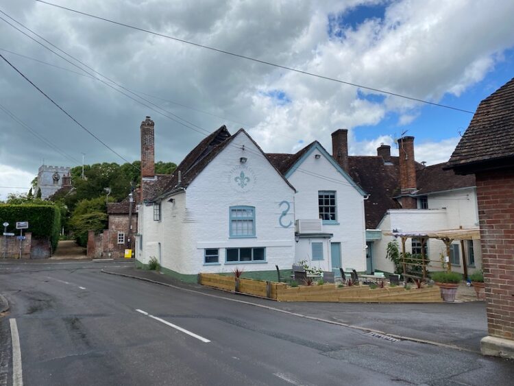
When we were looking for a place to stay on this trip I presented Lynnie with a list of potential locations, one of which was near Gillingham, the decision was quickly made. When at home Lynnie occasionally watches Escape to the Country, this is despite us living in a very rural location in Wiltshire. Anyway, one programme featured a couple looking to buy a property around Gillingham and Lynnie said she was surprised to see how attractive and interesting it appeared. So today we are walking from Wyndham Farm CL into Gillingham to see if it lives up to expectations.
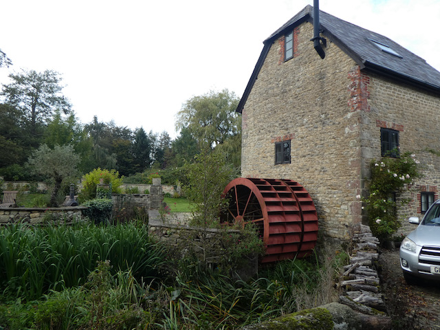
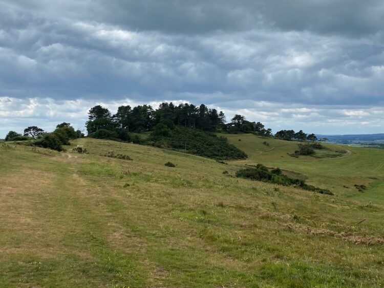
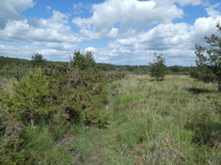
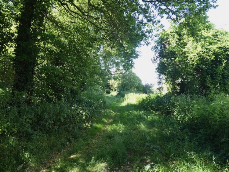
Leaving the site we turn left along Waterloo Lane and follow this towards Silton soon passing Waterloo Mill and then continuing on to reach a road junction. Here we turn left into a lane called Pierston Fields. We are now on the route of the Stour Valley Way.
The Stour Valley Way runs for 64 miles between Stourhead and Christchurch we walked a small section a couple of days ago, but today we are going to follow it for a few miles. After passing Pierston Farm we turn right and pass Milton Farm and cross a river.
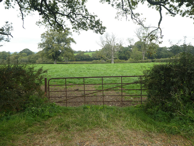
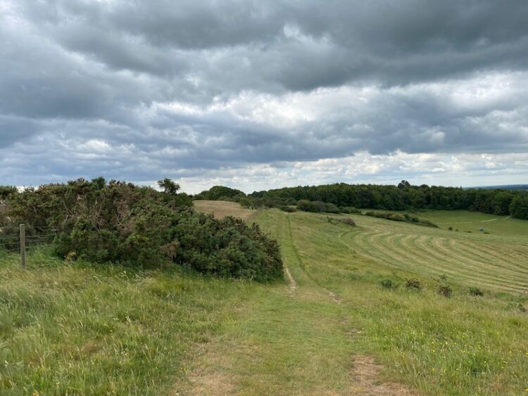
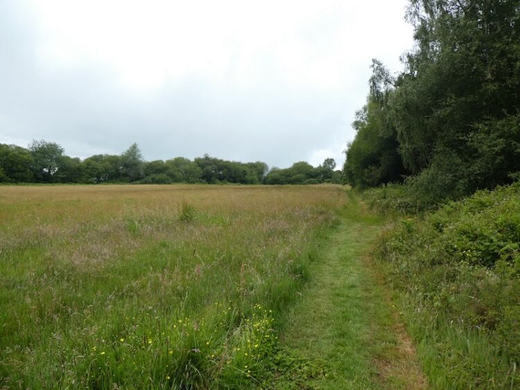
We continue heading south along the road and then as the road bends to the right we take a footpath on the left through a gate and continue across a field.
We stay with the Stour Valley Way to reach a minor road and cross and join Pound Lane and follow this into the village of Wyke. On reaching the B3081 we briefly turn right to view the old brewery building. From the early 1800’s this was the home of Matthews & Co and they produced ale for the pubs of Gillingham. The company was acquired by Hall and Woodhouse in 1963 and the brewery is now converted into residential accommodation.
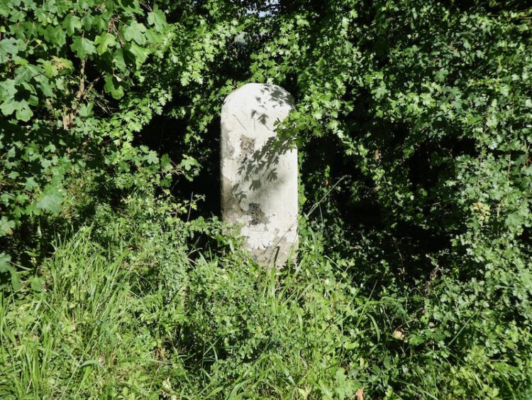
We leave the Stour Way to head east along the pavement besides the B3081 towards the centre of Gillingham passing an old milestone along the way. Apparently this was erected in the 1800’s by the Shaftesbury & New Road to Blandford Turnpike Trust. It shows it is five miles to Shaston (Shaftesbury) and six miles to Wincanton.
At a junction with the B3092 we cross the road besides Plank House. During World War I this house was used as an auxiliary hospital to treat wounded troops.
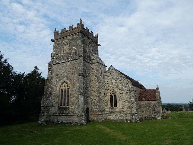
After crossing the road we continue into The Square at the centre of Gillingham and then turn left to visit St Mary’s Church.
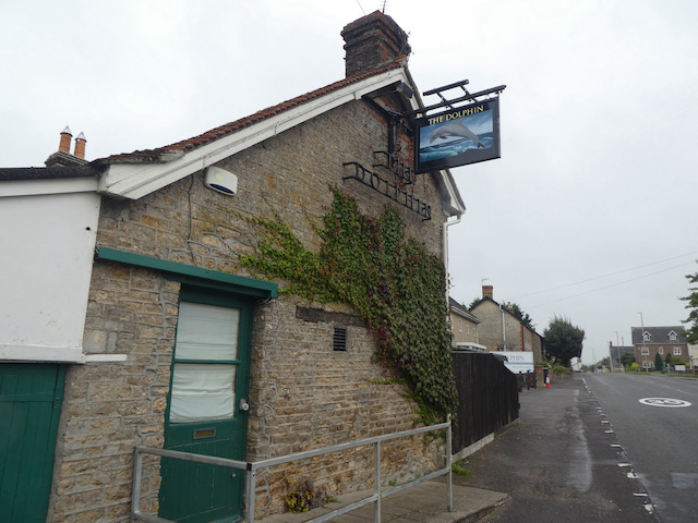
We now have a wander around the town before returning to St Mary’ Church and taking St Martin’s Road to head north out of the town. We follow this road to reach a junction with Queens Street, here we turn right still heading north to reach a roundabout close to a Co-op store. At the roundabout we take the B3092 heading towards Milton on Stour and follow the pavement to head out of the town, passing the Dolphin pub along the way.
We go straight across at the next roundabout, still besides the B3092 and then as we pass the last house the path goes inside the hedge line and continues on to pass the war memorial and entrance to a school. We stop to look at the church of St Simon and St Jude, built in 1868.
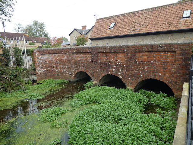
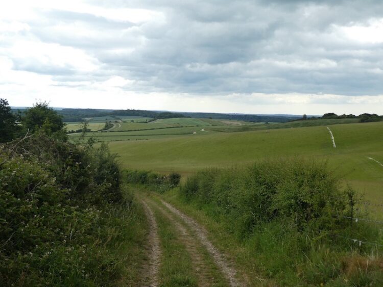
From the church we cross the road and head back south to reach the War Memorial and then turn right into the village along Post Office Road. At a junction we turn left on a lane signposted to Wyke. We stay with this lane to cross the River Stour.
On reaching the junction with Pierston Fields we turn right and retrace our steps back towards Silton. At Waterloo Lane we turn right and wander back to Wyndham Farm CL. Our walk has covered just over 6.5 miles and it was interesting to visit Gillingham. It was not as I expected from Lynnie’s description from Escape to the Country, nor did it meet her expectations. We decided there must have been some judicious use of camera angles there were a few old attractive buildings in the town but the more modern housing developments have not added to its charm.
All information on this site is provided free of charge and in good faith and no liability is accepted in respect of damage, loss or injury which might result from it. To the best of my knowledge the routes are entirely on public rights of way or within areas that are open for public access. Walking can be hazardous and is done entirely at your own risk. It is your responsibility to check your route and navigate using a map and compass.
When we are away in the caravan we try to do as much walking as possible from the site and avoid travelling too far in the car. This is an area we have not previously visited so today we plan to explore the area to the north of the site. The first section of our route repeats the walk I did yesterday afternoon.
Leaving the site we turn left into Waterloo Lane and follow this towards Silton soon passing the recently restored Waterloo Mill apparently dating from 1815 and sited on the River Stour.
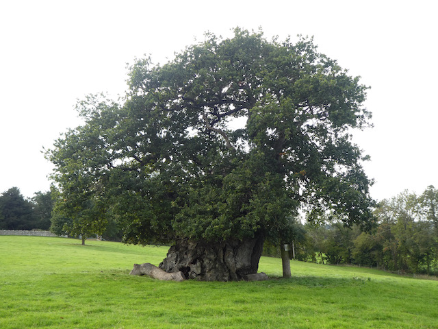
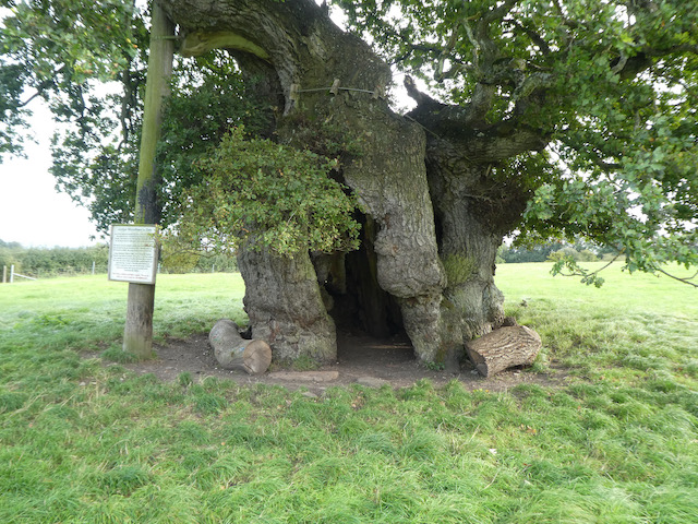
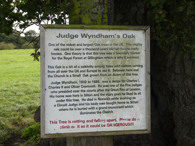
Soon we take a footpath on the left leading through a kissing gate into a field and follow this up to reach another field with a large oak tree in front of us. This is Wyndham’s Oak apparently over 1,000 years old with a circumference of 38 feet making it the greatest of any tree in the Country.
Named for Sir Hugh Wyndham (1602 -1684), who lived an eventful life. He was appointed a judge of common pleas by Oliver Cromwell and was imprisoned after the restoration of the Monarchy and later pardoned by Charles II. After the fire of London he was a Judge at the Fire Court, which determined responsibility for payment of property rebuilding.
He lived much of his life in Silton and is buried in the village church. He is said to have spent hours sitting in the shade of this oak tree and as a result it is named after him.
We continue across the field towards the church and after going through a gate turn left into the churchyard of St Nicholas’ Church parts of which date from the 12th century but most of what can be seen today is the result of a major restoration project in 1869.
Through the churchyard we reach a road and turn right to walk down the hill through the village. This is a well spread out village and we carry on for half a mile after passing the last house to reach the village hall. This was built in 1886 as a school with an attached cottage for the school mistress. The school closed in 1926 and the building then became the Village Hall.
On reaching a B road we turn left and pass under the A303 and walk up to Bourton and turn left. This road used to be the main A303 and back in the days when I first travelled daily to work in Taunton I sat for many hours in traffic through this village. These days, after the creation of the dual carriageway to the south of the village the road is much quieter.
After a quarter of a mile we turn right into Bridge Street at a signpost to Bullpits Golf Course. We follow this road to reach new houses on what not so long ago was the site of Bourton Mill. In the 18th century it was the site of a flax mill, built to harness power from the River Stour. This later became a foundry and then during World War I became a munitions factory.
Above the mill is New Lake created to provide the water for the mill. On 28th June 1917 after a violent thunderstorm the dam failed and the foundry was wrecked. Fortunately no lives were lost and the site was used to produce parts for shipbuilding and then later became a plant for producing dried milk. Now it is a housing estate with little evidence of its history.
Our route now follows the road up Factory Hill and at the driveway to Bullpits Golf Course we turn left and follow the footpath across a few holes of the course. This is a relatively modern course built in 1986 and is mainly Par Three. It is in a stunning setting so whilst not being long it must be an attractive place to play.
Following the footpath we soon reach Pen Mill Hill and turn left following the lane as it starts to descend on Coombe Street to Penmill and across the River Stour.
Just after passing the Wessex Water pumping station we take a footpath on the right which leads between barns.
The path now crosses fields and at a junction of paths close to a barn we turn right and descend to cross a tributary to the River Stour and then enter woodland and follow a path to reach a bridge across the River Stour.
We do not cross the bridge, instead we follow a path that heads north west besides the river to reach a ford with a bridge beside.
This track leads to a minor road close to Gasper Farm. We turn left and follow the road through woodland forming part of the Stourhead Estate.
We stay with the lane to a junction where we turn left following a signpost towards Penselwood. This continues uphill passing through the site of Pen Hill Fort and then at a track on the left we turn to follow this south east through Castle Wood.
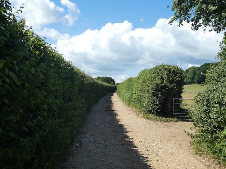
There are a network of paths in the woods but we stay with the track which keeps close to the right hand edge of the woodland. The track brings us to cottages where we turn right along a minor lane to Pear Ash Farm. At a junction opposite the farmhouse we turn left heading south along the minor road to a junction with Field Lane. Here we turn left and continue heading south, passing Bleak Farm and then as the road turns right to head west we take a track on the left along a lane.
At a crossroads of footpaths we turn right and follow a footpath downhill across fields heading south towards Bourton with the church as our target.
On reaching the road through Bourton we turn left and stop to visit St George’s Church. According to the church website it was built in 1810 to commemorate the Golden Jubilee of King George III.
We now continue on the pavement heading east soon reaching the war memorial where we turn right into a lane signposted to West Bourton. We go over the A303 on a bridge and then within a hundred yards take a footpath on the left along a farm drive. This leads to Feltham Farm and a minor road. It was our intention to take a footpath across a field here, but the field is full of cattle.
To avoid the cattle we follow the lane, which soon turns left on Grimsey Lane and continues on to a junction with Church Road. Here we turn right and retrace our steps back to Silton church. At the church we decide to continue on past Manor Farm with its impressive barns.
We stay with the lane to the junction with Waterloo Lane where we turn left and head back to Wyndham Farm. Our walk has covered close to twelve miles and has taken us into Dorset, Wiltshire and Somerset.
All information on this site is provided free of charge and in good faith and no liability is accepted in respect of damage, loss or injury which might result from it. To the best of my knowledge the routes are entirely on public rights of way or within areas that are open for public access. Walking can be hazardous and is done entirely at your own risk. It is your responsibility to check your route and navigate using a map and compass.
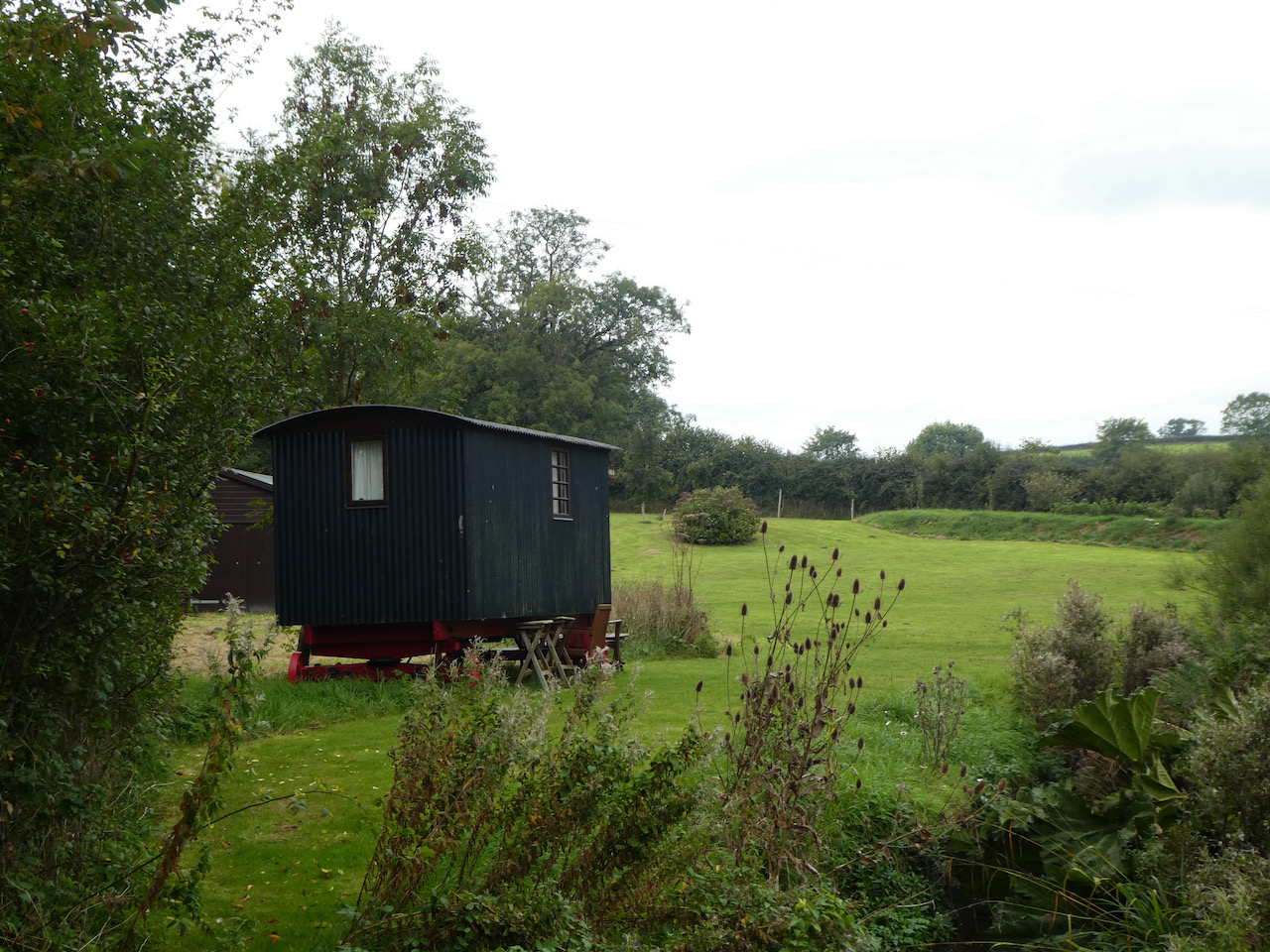
After just under a week at home we are back in the caravan. Once again we have not ventured far from home and it takes us less than an hour to get to Wyndham Farm CL on the edge of the village of Silton which is just west of Mere.
It does not take us too long to get pitched up and whilst Lynnie sorts out stuff around the van I head off for a short walk with Crosby. These days Dexter does not travel with us in the caravan, he is too old to walk far and much prefers to stay with our neighbours whilst we are away.
Leaving the site I turn left into Waterloo Lane and follow this towards Silton soon passing Waterloo Mill, apparently dating from 1815 it has been recently restored and sits beside the River Stour.
Soon I take a footpath on the right which leads through a kissing gate into a field and I follow this up to another field with a large oak tree in front of me. This is Wyndham’s Oak, said to be over 1,000 years old with a circumference of 38 feet apparently the greatest of any tree in the Country.
It gets its name from Sir Hugh Wyndham (1602 -1684). He lived an eventful life being appointed a judge of common pleas by Oliver Cromwell, he was imprisoned after the restoration of the Monarchy and later pardoned by Charles II. After the fire of London he was one of the Judges to sit as at the Fire Court which determined responsibility for payment of property rebuilding.
He lived much of his life in Silton and is buried in the village church. It is said that he spent hours sitting in the shade of this oak tree. As a result it is named after him.
I continue across the field heading towards the church and after going through a gate turn left into the churchyard of St Nicholas’ Church, parts date from the 12th century but most of what is seen today is the result of a major restoration project in 1869.
I head through the churchyard and on reaching a road turn left to walk up the hill to pass Manor Farm with its fine barns.
As the road bends to the left I follow footpath along a track on the right and descend to pass an attractive old barn.
I now follow this track for just over half a mile to reach a barn and continue along the track to the B3081. The road is busier than I anticipated so I decide not to walk beside it, instead I turn around and retrace my steps along the track to return to the road in Silton. Now I turn right and follow the road downhill and then at a junction turn left into Waterloo Lane and follow this back to the caravan site at Wyndham Farm.
My walk has covered just over 3.5 miles and has been a pleasant introduction to the area. Now it is time to settle down with the map and plan tomorrow’s walk with Lynnie.
To follow my walk you will need Ordnance Survey Explorer Map 129 Yeovil & Sherborne
All information on this site is provided free of charge and in good faith and no liability is accepted in respect of damage, loss or injury which might result from it. To the best of my knowledge the routes are entirely on public rights of way or within areas that are open for public access. Walking can be hazardous and is done entirely at your own risk. It is your responsibility to check your route and navigate using a map and compass.
After our trip away in the caravan last week I am back walking on Cranborne Chase today in the company of my walking buddy Mandy. This is a regular walking location for us and today we are going to do a circuit from Martin Down to the village of Sixpenny Handley.
The starting point for our walk is the Martin Down Nature Reserve car park besides the A354 (Grid Ref SU036200). From the car park we walk back to the entrance by the A354 and cross the main road with care to join a footpath on the opposite side heading towards Vernditch Chase.
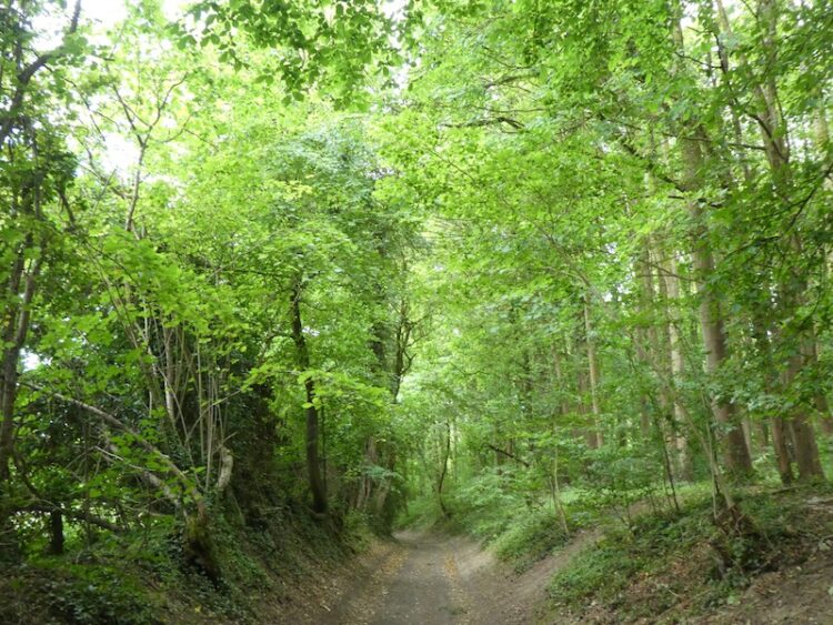
The route soon crosses an old Roman Road and enters woodland. This section of woodland is also part of the Martin Down nature reserve and there are a network of paths. However we stay with the route of the footpath as is heads in a northerly direction .
The path leads us to a spot marked on the map as Kitt’s Grave. Local folklore is unclear of the origin of the person buried here, however it is widely thought to be either a young girl or a Romany woman who had taken her own life. Therefore, she could not be buried on consecrated ground and with no parish willing to claim her she was buried at the meeting point of three local parish boundaries. However, it could also be a long barrow, so it is a case of picking whichever tale you prefer. We walked in these woods last November and tried to locate the grave without success. We have another look today, but it is not easily identifiable.
The path now follows a hedge-lined route to reach a minor road at Cutler’s Corner. We turn left and follow the road to a crossing of tracks. The road turns to the left, but we continue straight on in a westerly direction.
We pass a barn with a light aircraft stored in it. I am not keen on flying and could not imagine a scenario where I would be tempted to get into a plane like this. It is years since we last flew and that was to go on holiday to Lanzarote. I enjoyed the winter sun, but hated the flight there and back!
We now cross a minor road and continue on the footpath as it passes Middle Chase Farm and enters a field. We follow the path with the fence to our left and then just before reaching a gate into Stonedown Wood we take a footpath on the left which goes through a gate and goes along the edge of the woodland.
We stay with this footpath as it becomes a hedge lined path and descends to Shermel gate.
There is a junction of five paths and tracks here. We take the path on the right which leads uphill heading west into Chase Woods. We stay with this path to a junction of footpaths on a track at the bottom of a valley. Now we turn left and follow the track through the attractive woodland.
The track reaches houses at New Town and becomes a minor road. We follow this to a junction where we turn right and head south on Dean Lane. After half a mile on the lane we ignore a bridleway on the right and then a hundred yards further on take a footpath on the right which heads diagonally uphill.
On reaching the hedge line we turn left and then after fifty yards take a path on the right leading besides a camp site towards the church at Sixpenny Handley.
Parts of St Mary’s Church date from 1450, but a major rebuild took place between 1876 and 1878.
The font is said to be Norman and is made of Purbeck stone.
As we leave the churchyard to enter the village we spot an interesting wheel fixed to the wall. The inscription reads “In May1892 a spark from wheelwright’s shed lit the High Street thatch and the village burned for three days. So many clothes were sent for the 186 homeless that you could tell a Handley man because he wore two waistcoats.”
The fire resulted in much of the village being rebuilt. The village website explains that their odd name derives from two medieval hundreds: “Sexpena (meaning Saxon Hill) and Hanlega (high clearing). Apparently in the 14th century it was known as Sixpenne et Hanle. But later was known as Handley or Handley St Mary. It was only in the middle of the 19th century that it became known as Sixpenny Handley which is often written as 6D Handley.
We go down the High Street and it is pleasing to see that the village still has a Butchers shop, however the Post Office store is now a private house and next door the Roebuck Inn has closed and permission has been granted to convert it into flats. I am an advocate of retaining shops and pubs in rural communities, without them the soul of the village is lost.
It is a pity this village could not follow the example of nearby Gussage All Saints who took over The Drovers Arms and now run it as a Community Pub. However, the positive is that this village have set up a bar “The Penny Tap” in the Sports Pavilion and it gets rave reviews.
We continue down the High Street to pass the Newsagents and then turn left into Dean Lane. We follow the lane to reach a minor road on the right, Oakley Lane, this is a dead end road, but continues as a footpath on the route of the Hardy Way; a 220-mile route linking locations across Wessex associated with Thomas Hardy.
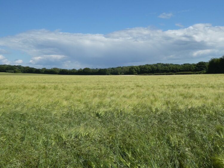
We stay with the Hardy Way across Oakley Down. The route leads us through arable fields to the A354 which we cross by a garage and the Yew Tree Farm Shop. The path goes down the side of the garage to reach a field. Now we head south east across the field to a junction of paths where we turn left.
The path soon starts to descend through the field with cracking views in front of us.
On reaching a track we continue on the Hardy Way to a junction of tracks and turn left still on the Hardy Way to reach Manor Farm on the edge of the village of Pentridge. Soon after passing the farmyard we take a footpath on the right, still the Hardy Way, leading up a driveway and then heading left across grass the path narrows besides a fence. It is a gradual ascent to a stile into a pasture field.
The path continues by the fence line and then as the fence turns to the right we continue straight on towards a stile. From here there are cracking views.
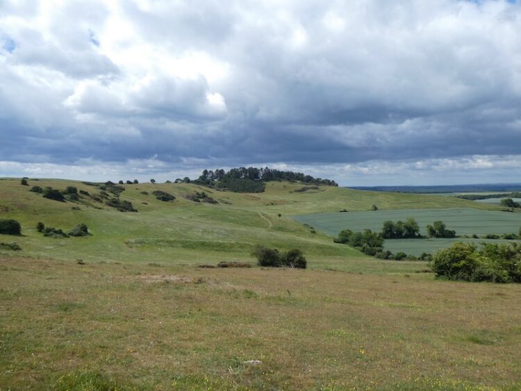
After crossing the stile we continue up Penbury Knoll to visit the Ordnance Survey trig pillar. I have visited this trig on a number of occasions but it is always worth a re-visit.
From the trig we head north east on a track across the access land. This track follows the fence to our right and we stay with it as the fence turns to the north. At an abandoned old hay rake we turn to the right and go through a gate.
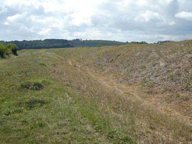
We now follow a path along the edge of an arable field and then pass Blagdon Plantation. On reaching a track we turn right and take the first track on the left which leads to Martin Down and the Borkerley Ditch. This ditch is thought to have been built in the iron age and fortified in the 5th century. It runs for around 3.5 miles and is an impressive structure.
Our route is now very straight forward, we stay besides the ditch heading in a north westerly direction until we reach the Rifle Butts which remain from when this site was used as an Army firing range. Here we go right to join a main track and turn left to head back up to the car park and our starting point.
Our walk has covered almost fourteen miles. Once again we have explored a part of Cranborne Chase I have not previously visited. It will be a few weeks before I’m back here again as I am off later in the week to look after Cholsey Grange CL, whilst the site owners, Ted and Jackie, go away on holiday.
To follow my walk, you will need Ordnance Survey Explorer Map 118 Shaftesbury & Cranborne Chase
All information on this site is provided free of charge and in good faith and no liability is accepted in respect of damage, loss or injury which might result from it. To the best of my knowledge the routes are entirely on public rights of way or within areas that are open for public access. Walking can be hazardous and is done entirely at your own risk. It is your responsibility to check your route and navigate using a map and compass.
Recently I have done a couple of walks starting on Martin Down it has been good to explore this area that is close to home but not somewhere I have previously visited. Since the start of the Covid-19 lockdown Lynnie has not ventured out of the village and is beginning to feel the need to broaden her horizons. So today she is going to join me on a walk to Pentridge Hill.
We start my walk from the southern end of the car park and head out passing a metal barrier besides some information boards. Initially the path heads through some shrub but soon reaches the vast expanse of the 850 acre nature reserve.
We continue down the track to reach the disused rifle range butt and here turn right on a path that heads a few hundred yards besides the butt to reach the Bokerley Ditch. This ditch is thought to have been built in the iron age and fortified in the 5th century. It runs for around 3.5 miles and is an impressive structure.
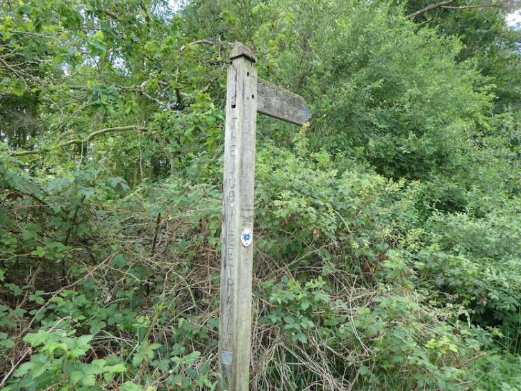
On reaching the ditch we turn left and follow it heading south westerly for almost a mile towards a belt of trees. We turn right on a footpath with a finger post for the Jubilee Trail and follow along besides the trees. The Jubilee Trail is an 88-mile route across Dorset from Forde Abbey to the Bokerley Ditch.
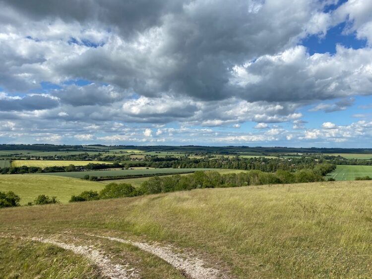
After passing through a metal gate we continue along the edge of an arable field to reach a stile onto access land on Pentridge Down. Now we follow a track that steadily ascends the downs. This is a cracking spot with stunning views, so although we have only walked a few miles decide to stop to eat our lunch.
At a junction of paths we turn right towards Penbury Knoll at the summit of Pentridge Down. I have visited this summit a couple ofttimes in the last few weeks, but it is a first for Lynnie and it gives here the opportunity to bag the trig point.
After admiring the view we retrace our steps along the top of Pentridge Down and keep the fence line to our right to reach the north east corner of the access land. Here we turn left, staying on the access land, with the fence still to our right. This leads us steadily downhill to reach an old hay rake which has been abandoned on the downs.
Now we turn right and go through a metal gate too follow a path along the edge of an arable field and then pass Blagdon Plantation.
On reaching a track we turn right and then with a few hundred yards take a track on the left which leads us to the Borkerly Ditch on the edge of Martin Down.
We have options here, we could turn left and follow the ditch back to the car park, but instead we go right and walk follow the ditch heading south east to reach Tidpit Common Down.
We stay with the footpath to descend on Tidpit Common Down to reach a gate, we do not go through instead turn left and follow a path with a hedge line to our right. This leads back across the down, ascending steadily to reach a gate onto Martin Down Nature Reserve close to a Grim’s Ditch. Here we take the track that heads to the north and then goes left.
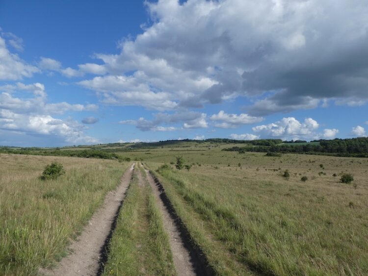
At a junction of paths we go right and continue on this track as it continues across the down to join a bridleway with a car park across the downs to our right.
There is a network of paths we could take, but we stay with the bridleway to a junction of tracks besides a Grim’s Ditch. Here we take a track heading north east across the downs towards the Rifle Range.
From the Rifle Range Butt we stay with the track to return to our starting location in the car park.
To follow my walk, you will need Ordnance Survey Explorer Map 118 Shaftesbury & Cranborne Chase and OL22 New Forest
Following my trip to Martin Down last week I have decided to explore more of the area. It is an ideal place to start a walk with a large car park providing immediate access to cracking countryside. Today my aim is to walk further east to Cranborne Common which is close to the edge of the New Forest.
I start my walk from the southern end of the car park and head out passing a metal barrier besides some information boards. Initially the path heads through some shrub but soon reaches the vast expanse pf the 850 acre nature reserve.
I continue down the track to reach the disused rifle range butt and here turn right on a path that heads a few hundred yards besides the butt to reach the Bokerley Ditch. This ditch is thought to have been built in the iron age and fortified in the 5th century. It runs for around 3.5 miles and is an impressive structure.
On reaching the ditch I turn left and follow it heading south westerly for almost a mile towards a belt of trees. I turn right on a footpath with a finger post for the Jubilee Trail and follow along besides the trees. The Jubilee Trail is an 88-mile route across Dorset from Forde Abbey to the Bokerley Ditch.
After passing through a metal gate I continue along the edge of an arable field to reach a stile onto access land on Pentridge Down. Now I follow a track that steadily ascends the downs. This is a cracking spot with stunning views.
At a junction of paths I turn right towards Penbury Knoll at the summit of Pentridge Down.
I pass though the trees and continue on a path to reach a gate, after going through I stay on the track as it runs along the top of the down. I have joined the Hardy Way which is a 220-mile route linking locations across Wessex associated with Thomas Hardy.
At a junction of paths close to a wooden gate I keep left still following the Hardy Way as it starts to descend around Blackbush Down.
I walked up this track towards the end of my walk last week, it was a hot day and I had covered over fifteen miles when I reached this point and it was a long haul up. Today it is easy progress as I stride down the hill to reach Jack’s Hedge Corner.
Here the Jubilee Trail goes to the right, but I stay with the Hardy Way and keep heading downhill on the track. After passing a metal gate the track becomes a tarmac lane and continues down to reach Salisbury Street on the edge of Cranborne. I follow this minor road into the village.
After passing the Sheaf of Arrows pub I continue to reach the village store and turn right into Wimborne Street and then turn left into Castle Street passing the Fleur de Lys pub.
Following Castle Street I walk through the village and as the road bends to the left I take a minor road on the right, Castle Hill Lane. After a quarter of a mile I take a bridleway on the left which heads below the Motte and Bailey castle, I will make a return visit here with Lynnie to explore the castle site.
Following the broad bridleway, Mill Lane, I am grateful for the tree covering as a shower sweeps through overhead.
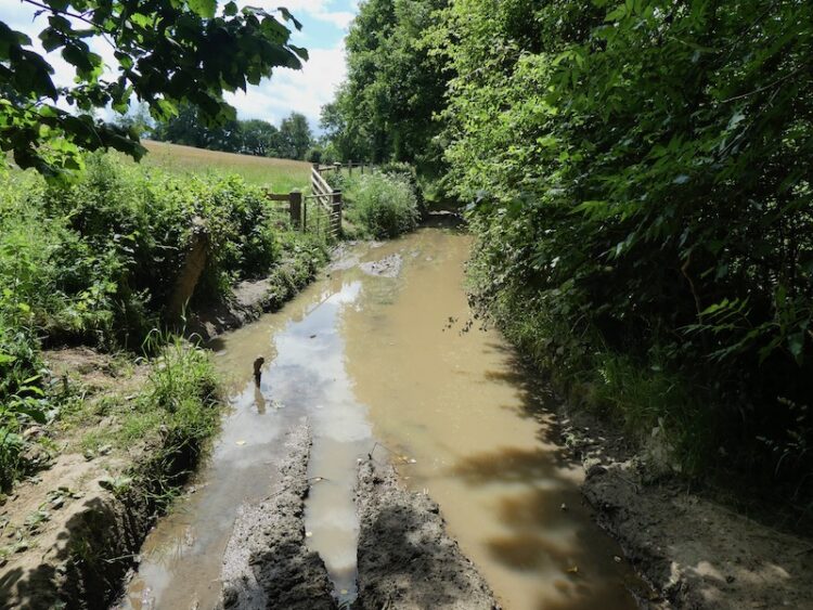
I stay with Mill Lane ignoring a footpath on the right and then a track on the left to ford a stream to reach the site of an old mill. There is very little to see here apart from the foundations of a few buildings.
I ignore a lane on the left and continue south on Mill Lane, this is now heavily rutted and then I reach a section that is flooded. Given that it is June and we have experienced weeks of dry weather I hate to think what this is like in winter!
I manage to negotiate a route around without getting wet feet and then stay with the lane as it continues to the entrance driveway of the Dorset Heavy Horse Centre. I recall visiting a heavy horse centre in Devon with my children thirty years ago, it was an interesting day, but I am not into horses so once was enough for me.
I follow the entrance drive to a junction with a road. I continue straight on heading east beside the road, initially with a wide verge, but it soon narrows so I have to take care in the traffic. It is with some relief when after a quarter of a mile the road bends to the left and I continue straight on along a track soon crossing a disused railway line.
This is the southern section of the disused Salisbury and Dorset Junction Railway. This 18 mile line spurred off the Salisbury Southampton line at a junction in Alderbury through Downton and Fordingbridge to West Moors where it connected with the main Southampton to Dorchester line. The line was completed in 1866 and operated until May 1964. In March I walked a few miles besides the northern section of the line near Alderbury.
At a junction of tracks I ignore the track on the right and continue straight on soon entering woods. At the next junction of tracks I take the footpath heading through the trees up Pistle Hill.
The footpath soon joins a forestry track heading towards a telecommunications mast and then I turn left on a track towards Cranborne Common. Nearing the common I make a brief diversion to seek out an Ordnance Survey trig point tucked away amongst the bracken and brambles. The area around my 207th bagged trig is a bit clearer.
Back on the path I continue towards Cranborne Common. At a bench overlooking the common I stop for lunch. There are fine views from here.
I follow the path heading north easterly across the common.
On reaching a track I turn right and soon after left. At a fork in the path I go left and then through trees to reach a car park for anglers. The route now follows a track to reach the B3078 which I cross and take a track into Further Daggons Wood. After passing houses the track continues through the trees to reach Hart’s Farm.
I go over a stile and follow the footpath as it heads downhill to a junction of track. Here I go right passing farm buildings at Lower Daggons two reach a minor road. After crossing the road I join footpath on the opposite side that leads along the edge of Lopshill Common.
At a junction of paths I turn right heading towards Lopshill Farm. I stop to check the route on the map and two women come along the path. They enquire where I am heading and I explain I am going back to Martin Down. It appears they think I am hopelessly lost and despite my explaining that I know where I am and where I am going they decide to change their plans to guide me through the woods and then onto Ashley Park Farm.
I go through a gate and fork left to cross access land and then enter woodland and cross a stream. The path heads north through the trees to reach Hyde Cross where I ignore a track on the left. A few hundred yards later we take a path on the right which goes north east between arable fields.
It is obvious that the two women know these paths well and they chat about their local walks as we go along. It is unusual for me to join up with anyone whilst walking. But it is interesting to meet these two and after a couple of miles walking together we part company at Ashley Park Farm where I go left through the farm yard and join Stony Lane.
I cross a minor road at Four Corners and continue on a track heading north west, this briefly joins a minor road and then as the road goes to the left I continue on a track heading towards a pig farm. I smell it well before I reach it and the overflow from some yards has washed down the track making sections unpleasant to walk along.
After passing the pig units I continue along the track and thankfully the wind is blowing in the right direction to make the air more pleasant. I am used to the smell of pigs, as a nipper in the early 1970’s I worked on a pig farm, it had 300 sows which I fed at the weekends. It was tiny compared to the operation I have just passed. These days I much prefer to see pigs in fields rather than sheds.
The track continues to a minor road where I stop to look at an old milestone on the right.
Crossing the road I take the track as it heads steadily uphill and then at a junction of paths go through a gate onto Tidpit Common Down. This is a cracking spot and a great place to be on a warm afternoon.
I stay with the footpath across the down as it ascends steadily to reach a gate onto Martin Down Nature Reserve close to a Grim’s Ditch. I now have a number of options to cross the downs to return to the car park. I choose the track that heads to the north and then goes left.
At a junction of paths I go right and continue on this track as it continues across the down to join a bridleway with a car park across the downs to my right.
There are a few folk walking onto the down from the car park so I choose the quietest route which is to stay with the bridleway to a junction of tracks besides a Grim’s Ditch. Here I take a track heading north east across the downs towards the Rifle Range.
From the Rifle Range Butt I stay with the track to return to my starting location in the car park.
To follow my walk, you will need Ordnance Survey Explorer Map 118 Shaftesbury & Cranborne Chase; and OL 22 New Forest
For more information on this walk including car parking, amenities, refreshments and detailed walking directions visit my associated Walking Moonraker website.
All information on this site is provided free of charge and in good faith and no liability is accepted in respect of damage, loss or injury which might result from it. To the best of my knowledge the routes are entirely on public rights of way or within areas that are open for public access. Walking can be hazardous and is done entirely at your own risk. It is your responsibility to check your route and navigate using a map and compass.
I continue to look for new locations to walk whilst staying close to home. Until now I have coped better than I anticipated with not getting away in the caravan, but I still need some variation in my walking. For the past year I have been exploring the Cranborne Chase and today’s walk will start on Martin Down and visit villages to the east of the A354.
I have travelled along the A354 numerous times but never stopped at Martin Down, there is a large parking area on the edge of the nature reserve and I observe the signs asking people to leave plenty of space between vehicles as part of the social distancing.
I start my walk from the southern end of the car park and head out passing a metal barrier besides some information boards. Initially the path heads through shrub, but then opens out on to the vast expanse of the nature reserve, there are over 850 acres of protected land here which provide a haven for flora and fauna.
I follow the track towards the dominant rifle range butt in front of me. This area was used as a military rifle range up until the 1950’s and strewn across this area of the downs remains evidence.
Before reaching the butt I take a path on the right to head across the Bokerley Dyke. This ditch is thought to have been built during the iron age and fortified in the 5th century. It runs for around 3.5 miles and is an impressive structure.
At the dyke I pass through to reach the fence-line of a field. I enter the field and take a footpath on the right and continue along the edge of the field with the fence to my right. The path follows around the edge of the field and I am soon heading south with a hedge line to my right.
At a junction of paths I continue straight on to reach a gate besides a crossing of paths. Here I continue along a tree lined path still heading south towards Pentridge.
As the path reaches farm buildings it becomes a tarmac lane and I stay with this to walk into the village. I cannot ever recall visiting this village. It is a quiet spot well away from the main road and has some attractive old properties.
My route continues south through the village and passes Manor Farm to join a farm track. At a junction of paths I turn right and follow a track that soon heads uphill along the edge of a field. The path crosses the next field and shows clearly through the crops. At a fork in the path I keep left to head towards the edge of Salisbury Planation.
I ignore paths to the left and right as I follow the path along the edge of the woods to reach the course of the old Roman Road, the Ackling Dyke. Here I turn left and follow the route of the Roman Road.
After crossing a stile there is an impressive array of tumuli in the next field. I have passed these when driving along the A354, but at 60mph it is difficult to fully appreciate them.
Now I stay with the Roman Road as it gradually ascends to reach the B3081. After crossing the road I go through a gate and follow a path running besides the overgrown Roman Road.
The route now descends steadily with fine views in front of me. After crossing a farm track the route enters trees that form the edge of the Drive Planation and continues on to reach a minor road.
After crossing the road the route continues uphill through the edge of woodland. The Ackling Dyke covers 22 miles and connected the Roman settlements at Old Sarum on the edge of Salisbury and the Hillfort at Badbury Ring.
At a crossing of paths at Harley Gap I turn right. On this junction of paths is a memorial stone to a John Ironmonger (1919-1986) apparently he was the Manager for Lord Shaftesbury’s St Giles Estate.
I am now walking along the edge of a field with far ranging views. This is stunning countryside.
At a junction of paths I turn left to follow a drove along the top of Gussage Hill. Nearing the hedge line on the left I pop over the fence to bag the OS Trig that stands between fields. This is the 205th OS trig pillar I have bagged.
Back on the track I continue in a southwesterly direction, the track soon starts to descend and then turns left near a barn and after a couple of hundred yards turns right and continues steadily downhill too reach Lower Farm on the edge of Gussage St Michael. Here the track becomes a tarmac road and leads into the village passing AG Edwards & Sons Hardware store and continuing to a junction opposite St Michael’s Church, said to have a tower dating back to the12th century.
I turn left and walk out of the village on the country lane heading towards Gussage All Saints. This is a very quiet lane and only one vehicle passes me. As I reach Gussage All Saints I turn left and cross a stream to reach the War Memorial.
I continue a bit further along the lane to visit the All Saints Church most of which was built in the 14th century.
After visiting the church I return to the war memorial and head east through the village passing the village hall and then reach the Drovers Inn. This pub was shut in November 2014 and there were proposals to develop it into a large house. However the local community opposed this plan and set about establishing a Community Benefit Society to take control of the pub. In March 2016 they managed to purchase the property and now it is run as a community pub. I am a firm believer in community assets being owned and run but the local community, it does take a lot of effort to get established and there needs to be financial support from the community, but if successful it creates a hub for village activities. I would sooner drink in a pub run by the community than one owned by a chain. This is one reason why you will never see me in a J D Wetherspoon pub.
I continue on the lane, having made a note to make sure I return to the Drovers when the current pandemic is over. The lane reaches a crossroads at Amen Corner, here I continue straight over towards Bowerswaine.
Just before reaching a bridge over a stream I take a footpath on the left, Brockington Lane, which leads northeasterly towards Brockington Farm.
At a minor road in front of Brockington Farm farmyard I turn left. The farm buildings appear to be disused. I find it sad that stunning old barns, such as these are no longer used as originally intended, they would once have been the busy hub of a thriving farm.
As the road bends to the left I take a path which follows a track towards Farringdon Copse. After passing through a small copse the path continues across a field and then reaches a stile besides a minor road.
I turn right and follow this road into Wimborne St Giles. Entering the village I cross the River Allen and continue into the centre. This is a cracking spot with St Giles church prominent besides a stunning row of almshouses.
The Almshouses date back to around 1624 and were endowed by Sir Anthony Ashley (1551-1628). Ashley was Clerk to the Privy Council and apparently found favour with Queen Elizabeth I, it is reported that he was distinguished in the Battle of Cadiz in 1596 and was knighted soon after.
St Giles Church was constructed in 1732 on the site of an earlier medieval church. It was designed by the Bastard Brothers, who were architects from Blandford. When I first left school and worked in an office there was an old boy called George working there, now long dead. George had in-laws in Blandford and he would say on a daily basis that Blandford was built by Bastards and so were the folk that lived there. However, I have always found people from that attractive Dorset town very personable.
The church suffered a major fire in the early 1900’s and was rebuilt to the design of Sir John Cowper. It is a fine building, but currently closed to the public.
I sit on the bench by the church to eat my lunch and then head back through the village passing the school and turning right to take a lane that runs through the village passing attractive cottages.
At a road junction I turn right and walk past the Manor House and head north along a minor road. I have now joined the Hardy Way. This 220 mile route links parts of Wessex connected with Thomas Hardy. I have walked a number of sections but not previously trod this part. My friend, Stuart, is a devotee of Hardy’s work and has encouraged me to embrace his writing. A few years ago I tried with Tess of the d’Urbervilles but after reading the Maiden chapters could take no more. Perhaps I should try again!
At a track on the right I leave the minor road for a footpath along Ringwood Lane, still on the Hardy Way I keep with the trail way markers as it turns left to head north and then right to go besides a field heading towards the B3081.
I have driven along the B3081 many times and know the section I am heading towards, so I am pleased when the path runs on the field side of the hedge rather than the road side. Nearing Creech Hill House the path goes through a gap in the hedge and after crossing the road with care I continue heading east along a minor road towards Cranborne.
As the road bends to the right I stay with the Hardy Way and take a path on the left. This heads across fields to reach a common where I cross a stream and continue towards the village.
I have never visited this village, in the days of King Henry VIII when the Cranborne Chase was a Royal hunting ground this was a major centre. Henry built a hunting lodge in the village. The church of St Mary and St Bartholomew was built in the 12th century and over following centuries additions were made, the tower was added in the 15th century and the chancel rebuilt in the 19th century.
After visiting the church I leave the village along Salisbury Street, at a fork in the road I take a tarmac lane signed posted “Bridleway to Pentridge”. This lane heads steadily uphill, passing houses to reach a gate across the track. I pass besides the gate and continue along the bridleway.
I stay with the main bridleway ignoring paths to the left and right as I head towards Pentridge Hill. The views either side of the track are stunning.
At a gate besides a junction of paths I go through and keep to the path continuing up to the summit of Pentridge Hill with a fence to the right. I go through another gate and continue to the trees on Penbury Knoll which top Pentridge Hill. I stay on the path close to the fence and then take a short detour to visit the Ordnance Survey trig pillar in the trees, my 206th trig.
This is my first time on this hill, it is a cracking place with ancient field systems and outstanding views.
At a fork in the track I leave the Hardy Way and follow a grassy path that heads steadily downhill towards Whitey Top Farm. After crossing a stile I join a footpath heading north besides the edge of an arable field. I have joined the Jubilee Trail, an 90 mile path crossing Dorset from Forde Abbey near the Somerset border to the Bokerley Dyke. I go through a gate and then continue along the edge of a copse to reach Martin Down at Bokerley Ditch.
On the downs I turn left and walk besides the stunning Bokerley Ditch.
The path is easy to follow and I stay by the ditch until I reach the rifle range butt where I retrace my steps to the car park. My walk has covered just over twenty miles and has been stunning throughout. It will not be too long before I am walking around in this area again.
To follow my walk, you will need Ordnance Survey Explorer Map 118 – Shaftesbury and Cranbourne Chase
For more information on this walk including car parking, amenities, refreshments and detailed walking directions visit my associated Walking Moonraker website.
All information on this site is provided free of charge and in good faith and no liability is accepted in respect of damage, loss or injury which might result from it. To the best of my knowledge the routes are entirely on public rights of way or within areas that are open for public access. Walking can be hazardous and is done entirely at your own risk. It is your responsibility to check your route and navigate using a map and compass.
The last few weeks have been very busy, too busy to get away in the caravan. For some time we have been having work done on our home so have needed to be around for that and, more importantly, there was the wedding of our daughter Lolly to her long-time partner Toby.
Having had my trip to Oswestry and the Welsh borders cut short due to Crosby going lame I have spent a few weeks at home. My early return has meant I have been able to crack on with some decorating and we can push forward with the next stage of the refurbishment of our home. However, it has meant I have been restricted in my walking and it is a few weeks since I last had a good stretch of the legs.
A few years ago if I had suggested to Lynnie that we go away in the caravan in mid December I would have got a very short reply. Indeed when I first suggested that we buy a caravan I got a frosty response.
Back in 2012 when the “let’s get a caravan” discussion took place Lynnie suggested that we hire one for a week to see if we liked it. I had memories of wet caravanning family holidays as a nipper and knew that if we were unfortunate with the weather our caravanning life could be scuppered before it had had a chance to get going. So we agreed to buy one and if after two years we didn’t like it and hadn’t made much use of it we would sell it. (more…)