Category: Devon

  • Buck’s Mills from Parkham

    Buck’s Mills from Parkham

    One of my favourite places to visit on the North Devon Coast is Buck’s Mills.  Whilst the hordes descend on Clovelly, which I concede is a pretty spot but I am not inclined to pay a fee to walk into a village.  You can walk through Buck’s Mills and hardly see a soul.  What’s more it is free!

    We were first introduced to this attractive fishing village by Betty, she was a friend of Lynnie’s Uncle Derrick.  Over dinner one evening Betty told me all about her background and how she was born a Braund and came from Buck’s Mills.  Sadly Betty died a couple of years ago, but the evenings we spent in her company were a real pleasure.  She had a zest for life and a wicked sense of humour and an evening in her company always lifted the spirits.

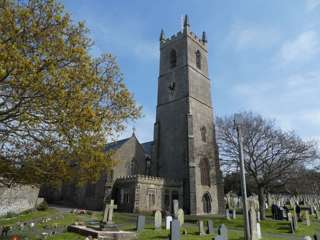
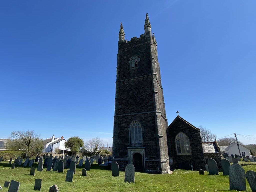
    This is the last day of our trip and we have decided to walk to Buck’s Mills, rather than start in the village we will head there from Parkham, a few miles inland.  Our starting point is a parking area in the centre of the village outside St James’ Church.  

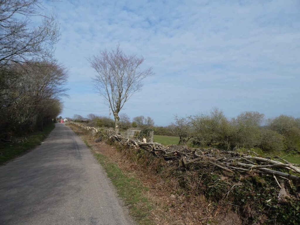
    From the church we head in a southwesterly direction through the village on Barton Road to reach a crossroads beside the Bell Inn, here we turn right to join Melbury Lane and pass the school.  We stay with this lane until we reach a junction where we turn right on a lane signposted to Clovelly and Hartland. 

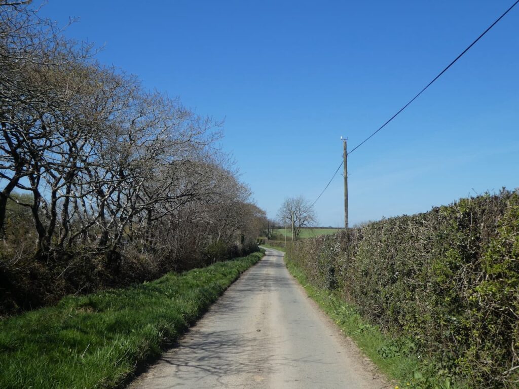
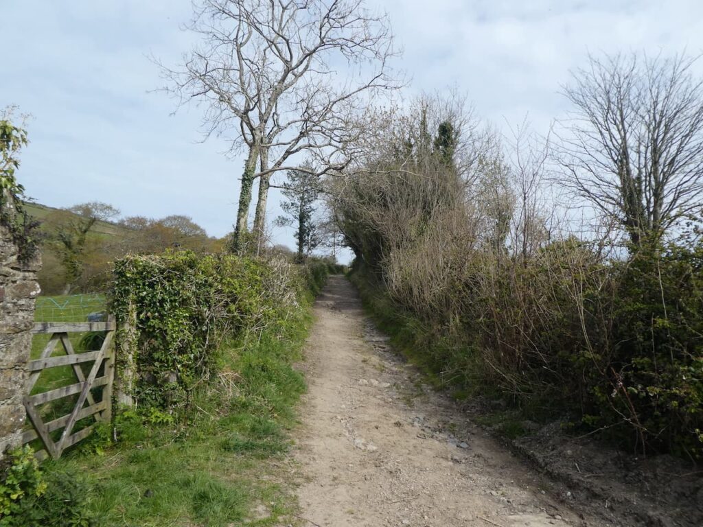
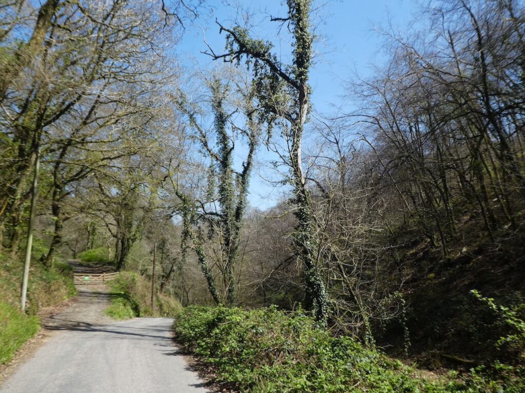
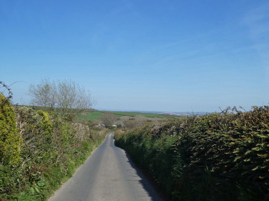
    The road is a very quiet country lane and it is pleasant walking in the spring sunshine.  We ignore two roads off to our left and then three quarters of a mile after the second turning we turn right into the wonderfully named Galloping Lane. 

    On reaching a road we turn left and then after almost half a mile we turn right at a crossroads to follow a lane signposted to Buck’s Mills.  At a junction we keep straight ahead to head into Buck’s Cross.  On reaching the A39 we cross with care and continue straight on to start heading downhill towards Buck’s Mills.

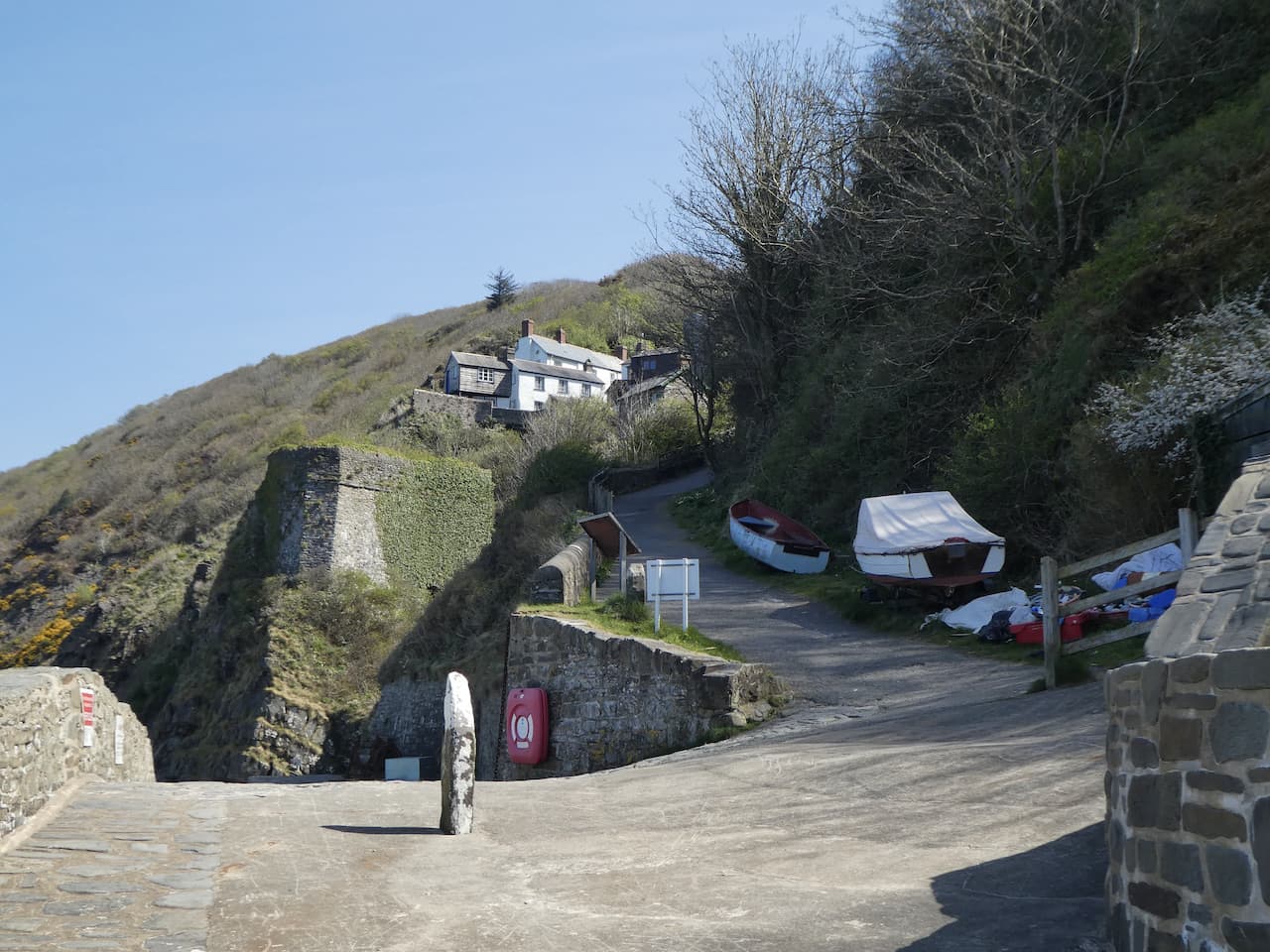
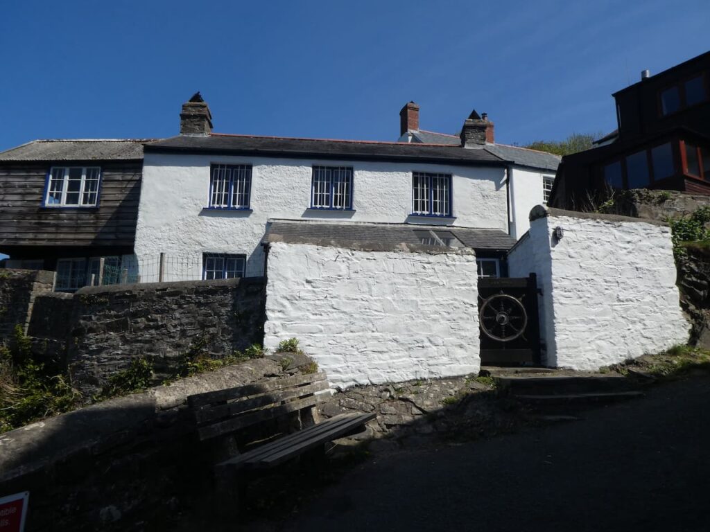
    As I mentioned earlier this is a cracking village, there is still a sense of the past and whilst there is the odd nod to tourism it is a location where it is easy to get a feel of how things would have been over hundred years ago.

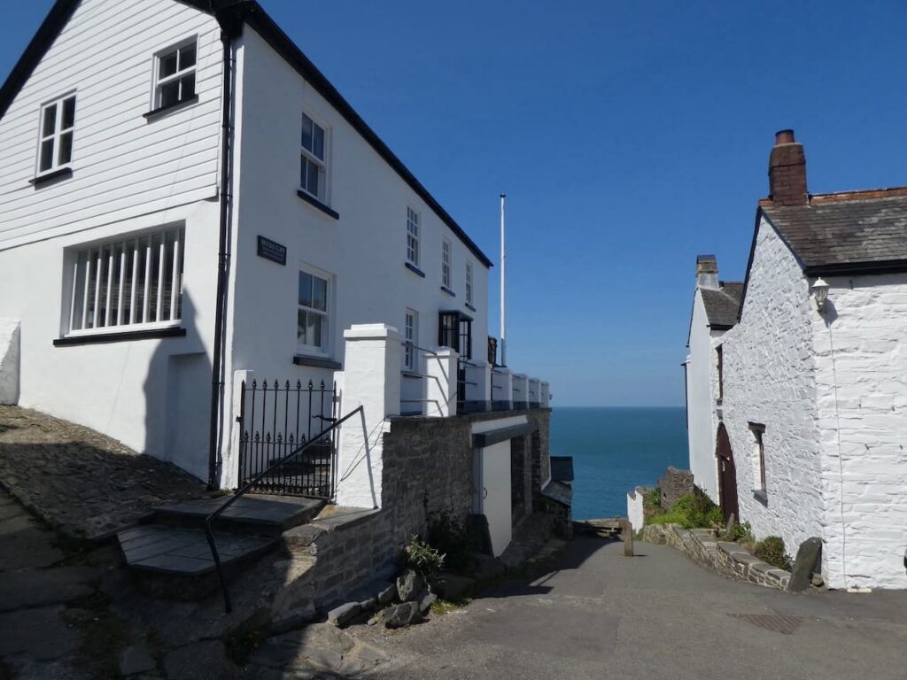
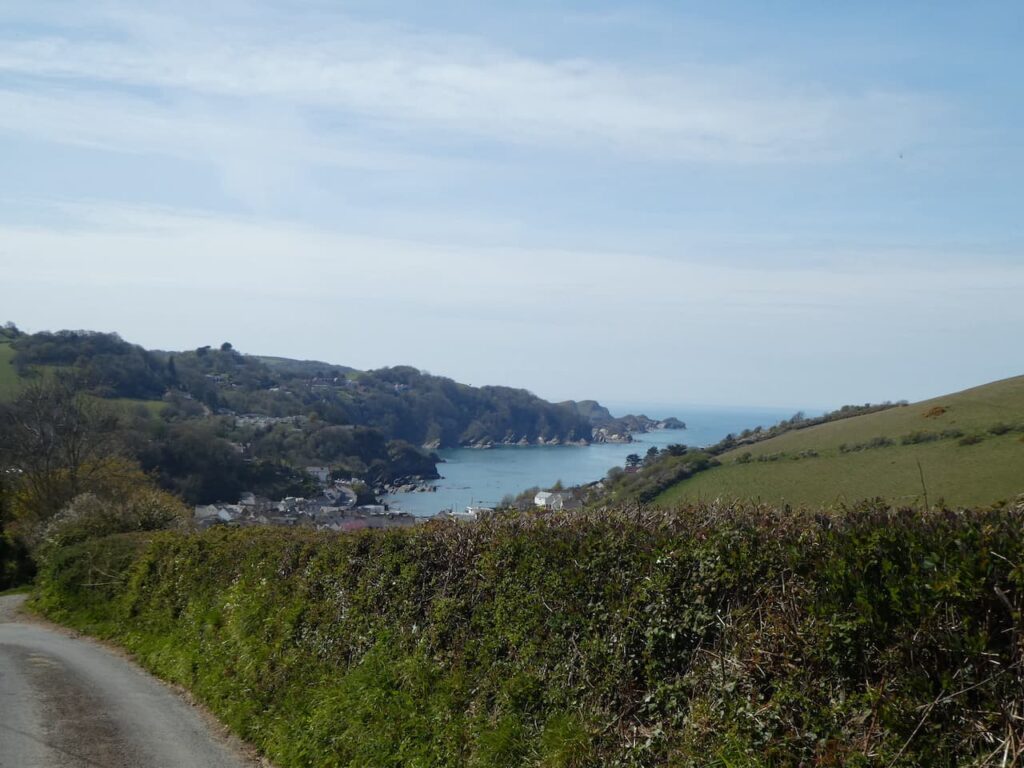
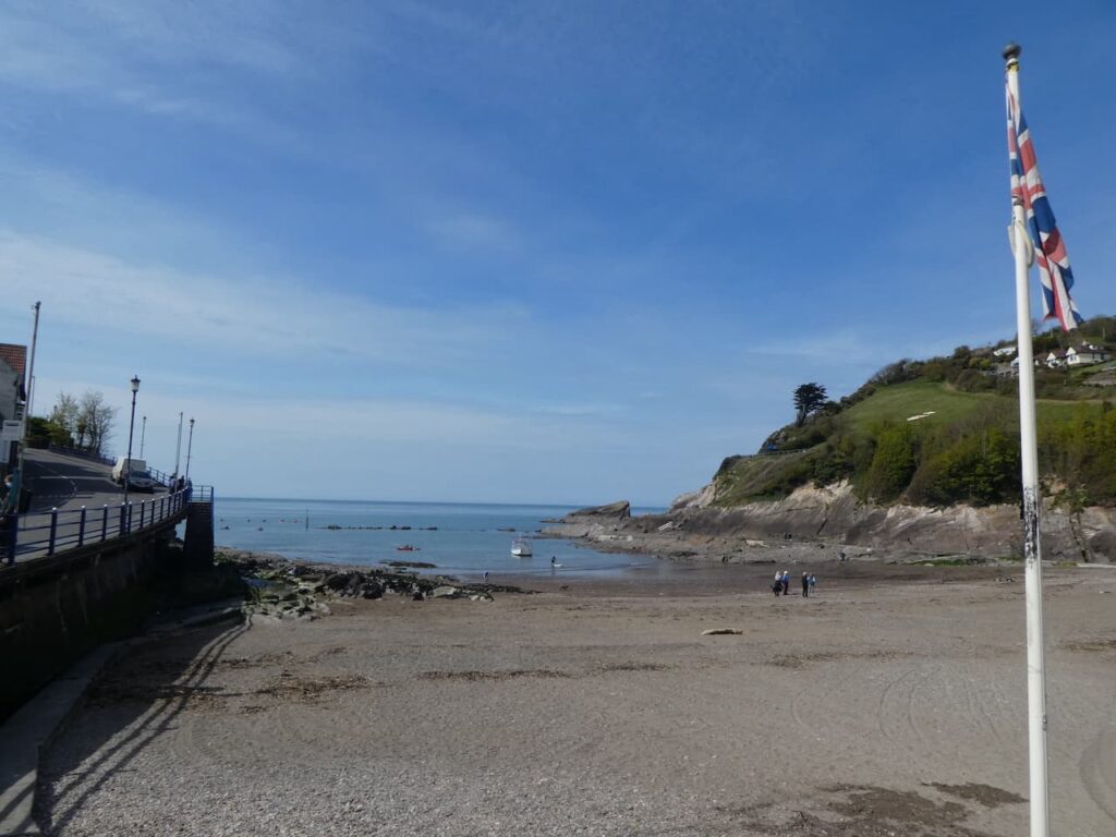
    Back in 2016 when Betty was telling me about being a Braund she said that her grandfather was known as the ‘King of Buck’s’. During the 1800’s the Braund family made up the majority of the population of the village and there is a house in the village built by the Braund’s known as King’s Cottage.  It was fascinating spending time talking to Betty about her early life and as we go through the village I keep an eye out for the King’s Cottage which is located at the end of the village overlooking what would have been the harbour.

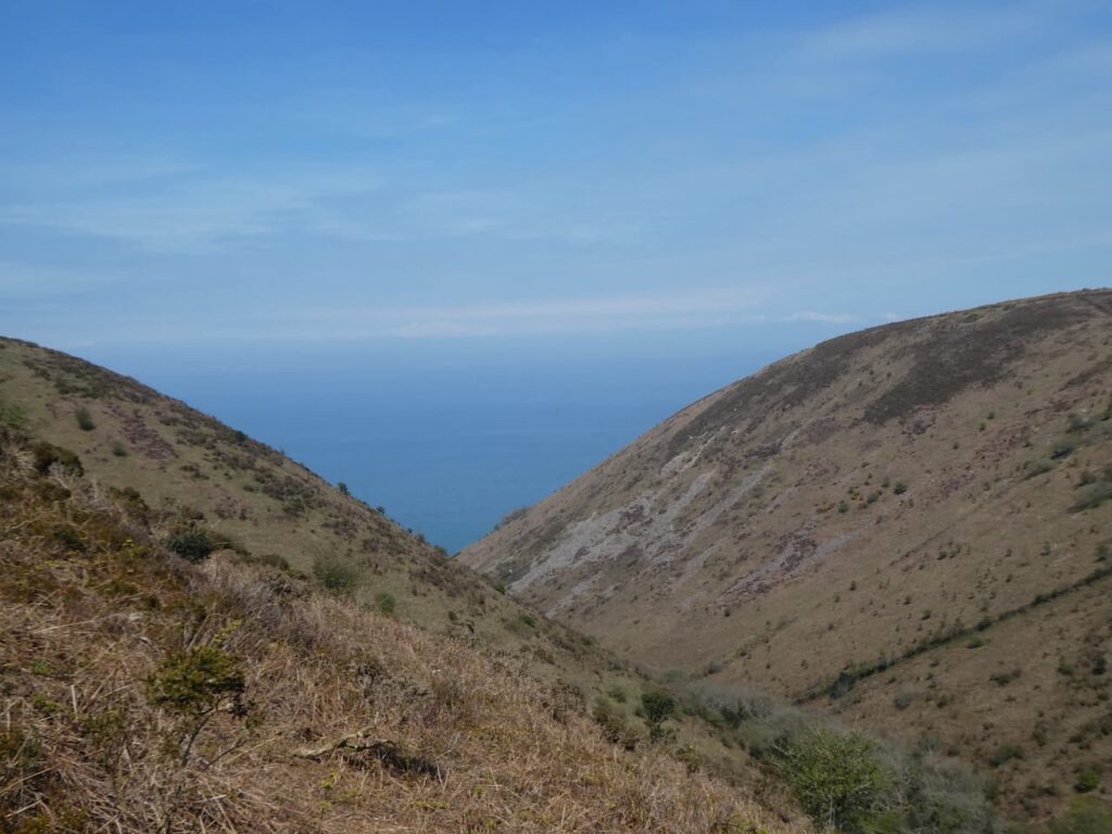
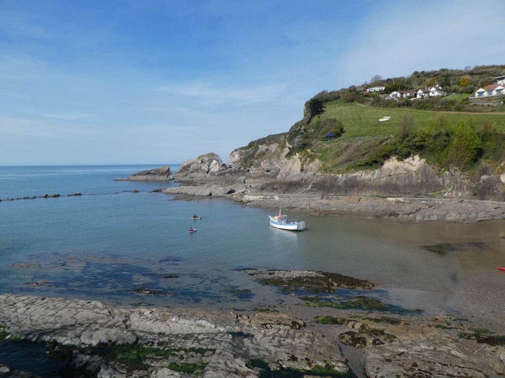
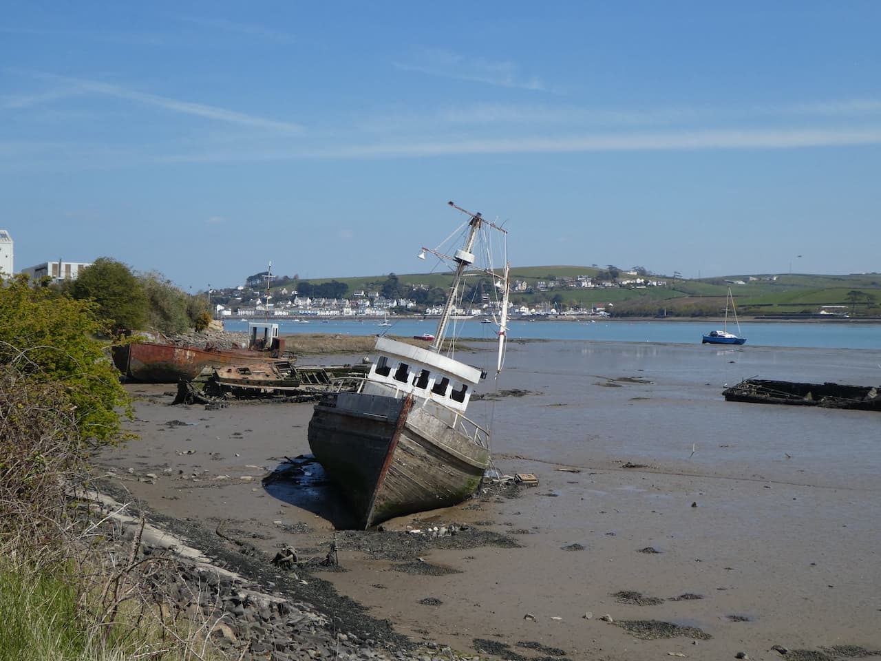
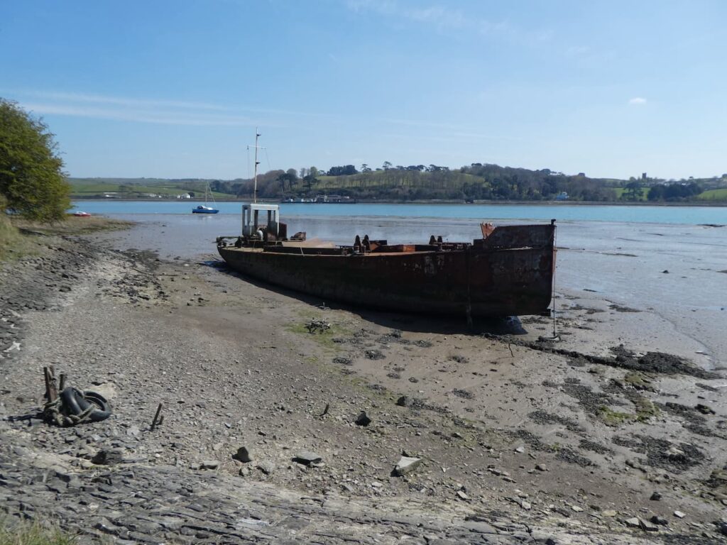
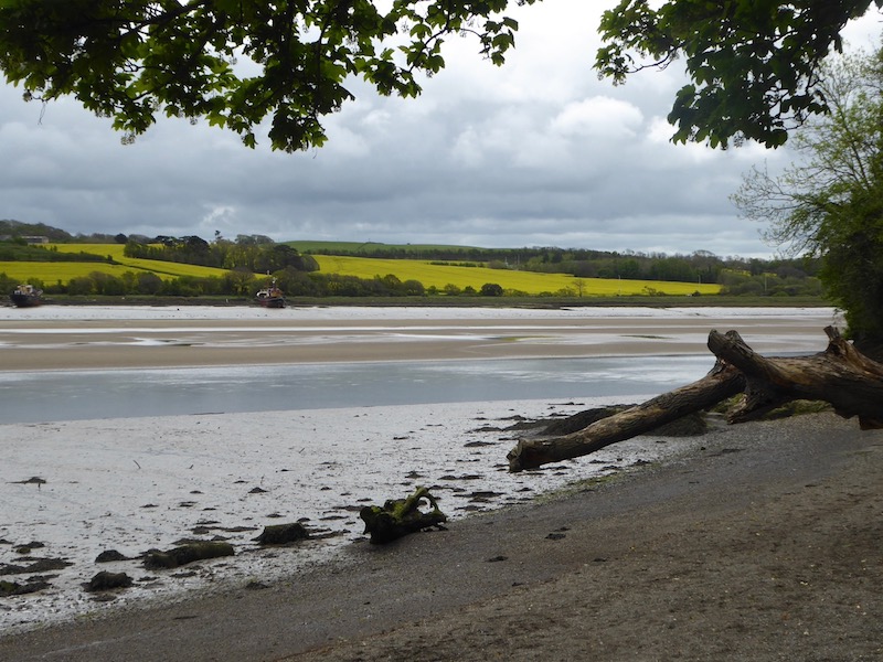
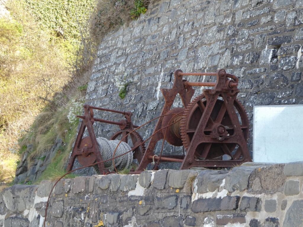
    We follow the steep path down. Apparently back in 1598 Richard Cole of Woolfardisworthy, thought to be the ‘Old King Cole’ of the nursery rhyme, built a harbour here to provide shelter for cargo ships.  The harbour is long gone but the remnants of fishing remain with the rusty old winches.

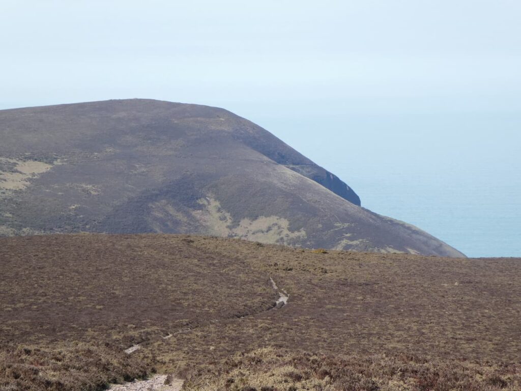
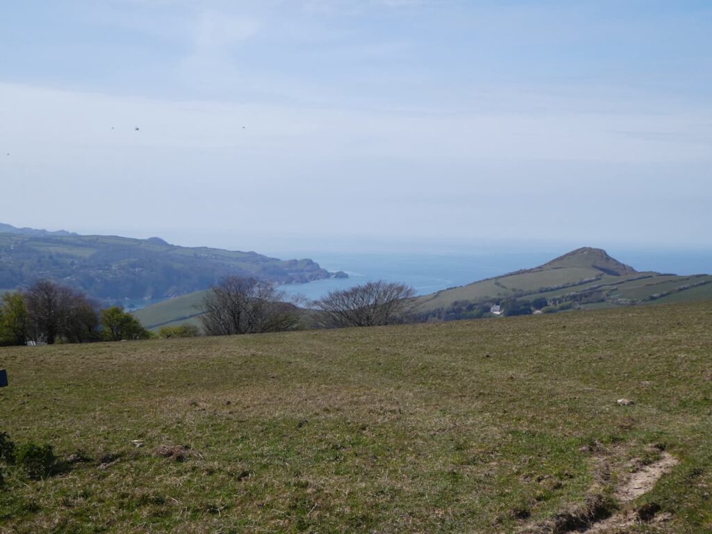
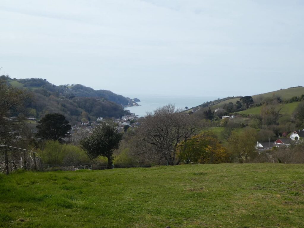
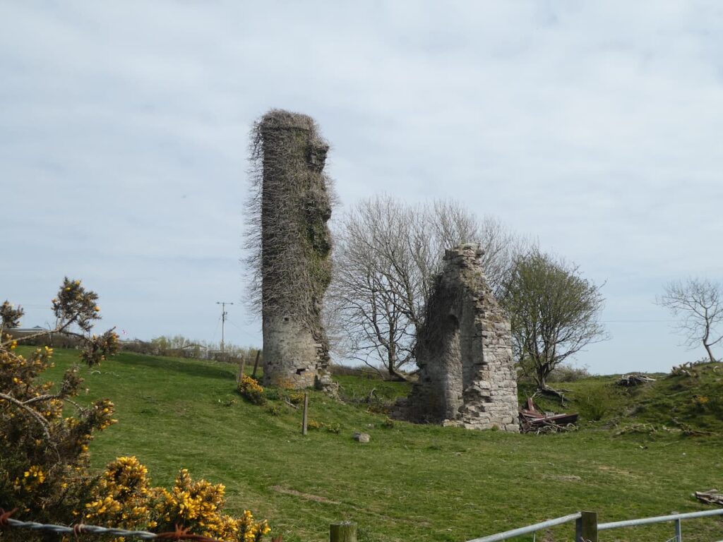
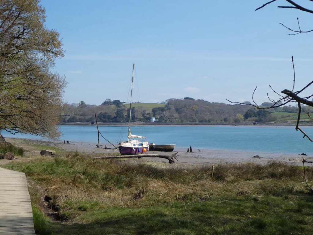
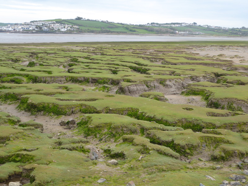
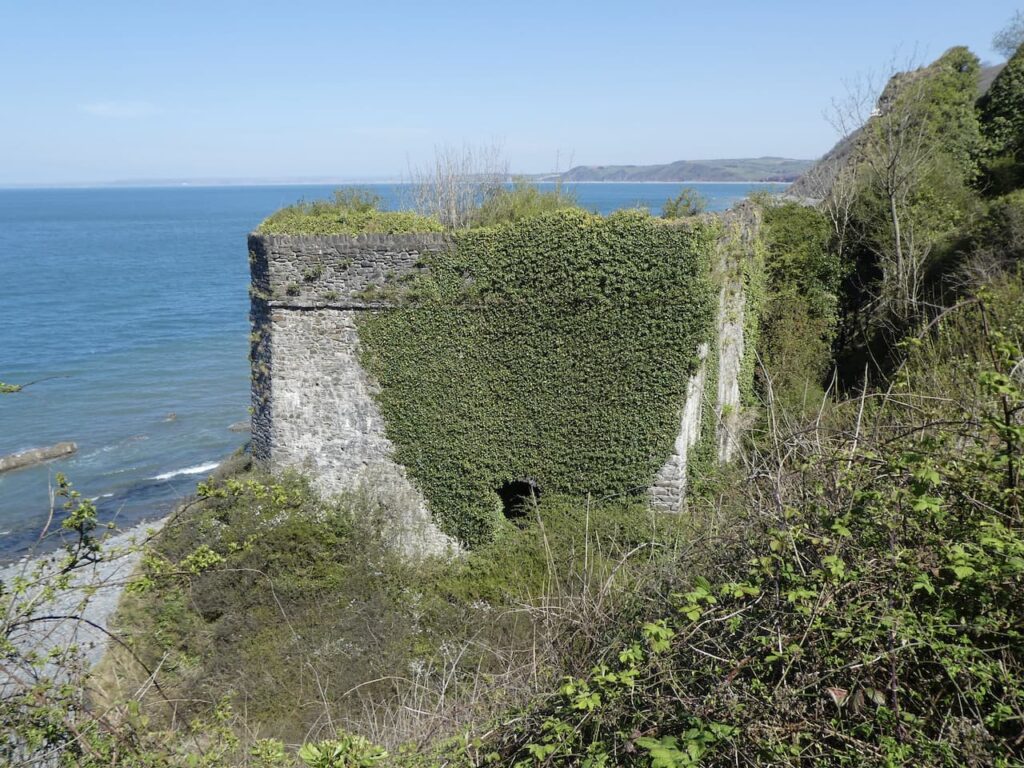
    The industrial past of Buck’s Mills can be seen from the limekilns under the cliff.  The coal to fire the kilns would’ve been transported across the Bristol Channel from South Wales.  The movement of goods and people across this channel was a common occurrence.  When Lynnie’s mother was in her teens she moved from Swansea to Bideford with her mother and siblings.  Along the coast to our left is Clovelly.  This is where Lynnie’s great grandmother lived and when Lynnie’s mother was a young child she used to make trips across the Bristol Channel from Swansea to Ilfracombe to see relatives.

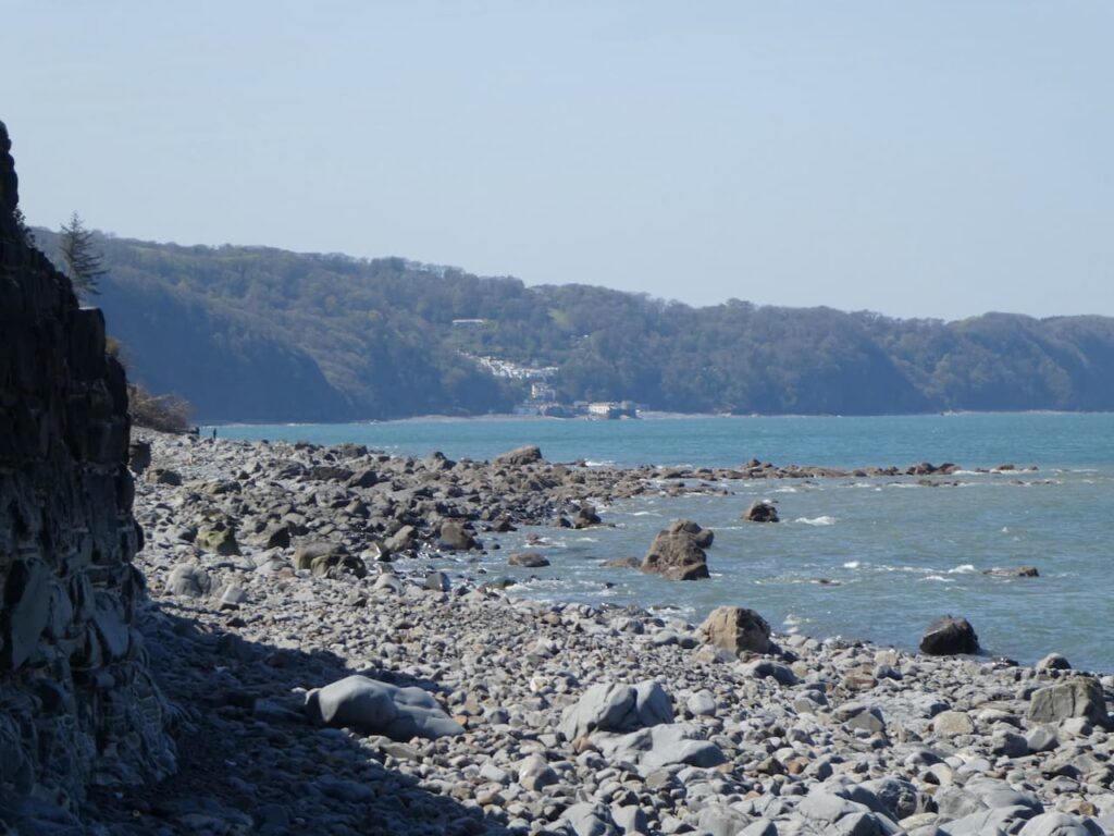
    There are two sets of limekilns here, sadly the ones nearest the beach are fenced off because they are unsafe.  It is therefore difficult to get a good view of them.  The kiln higher up near the village is still in a good condition, although access does not appear possible.

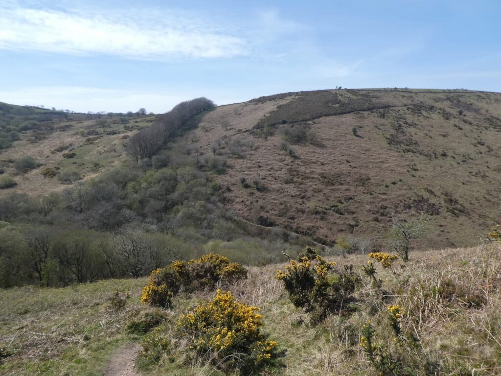
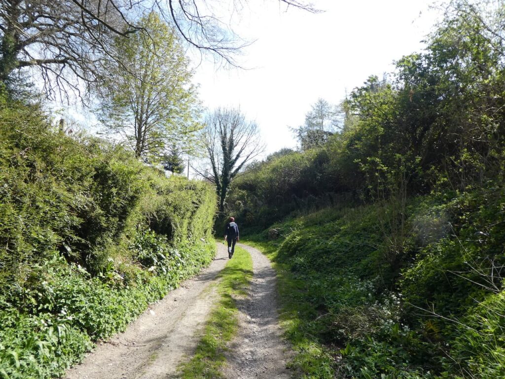
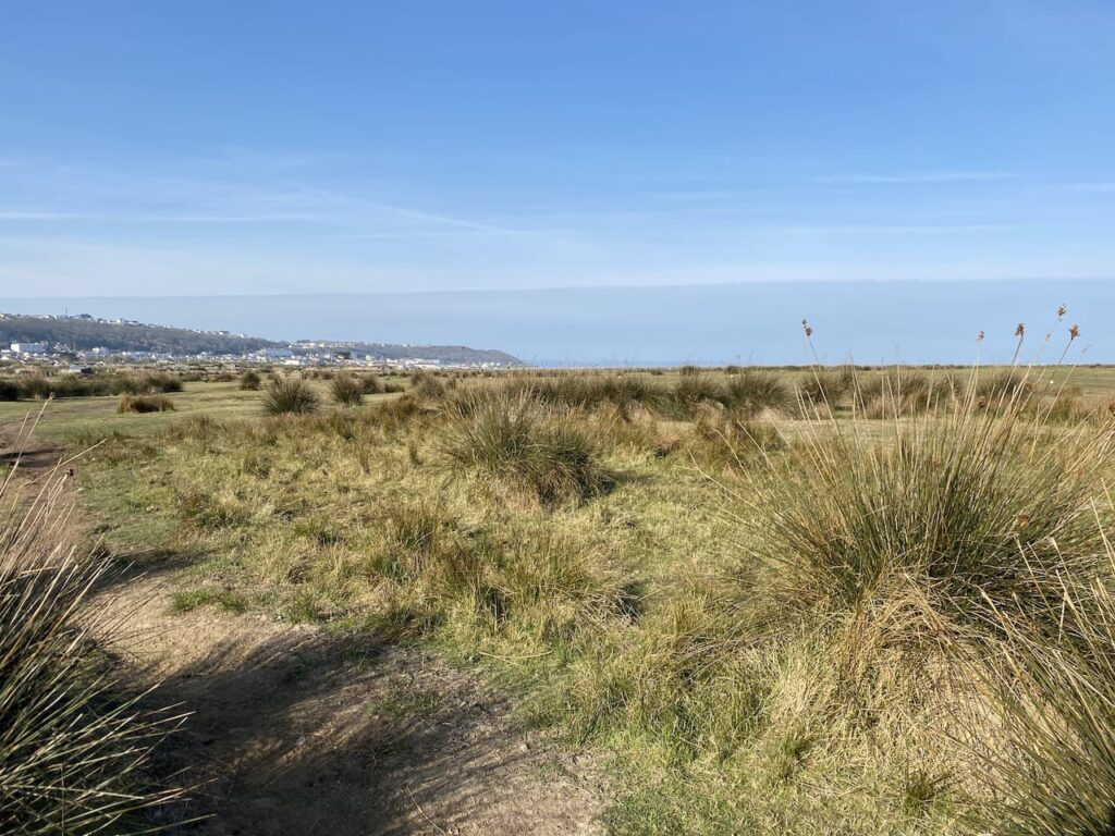
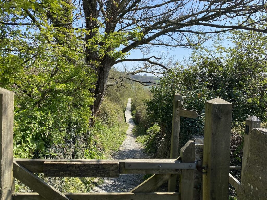
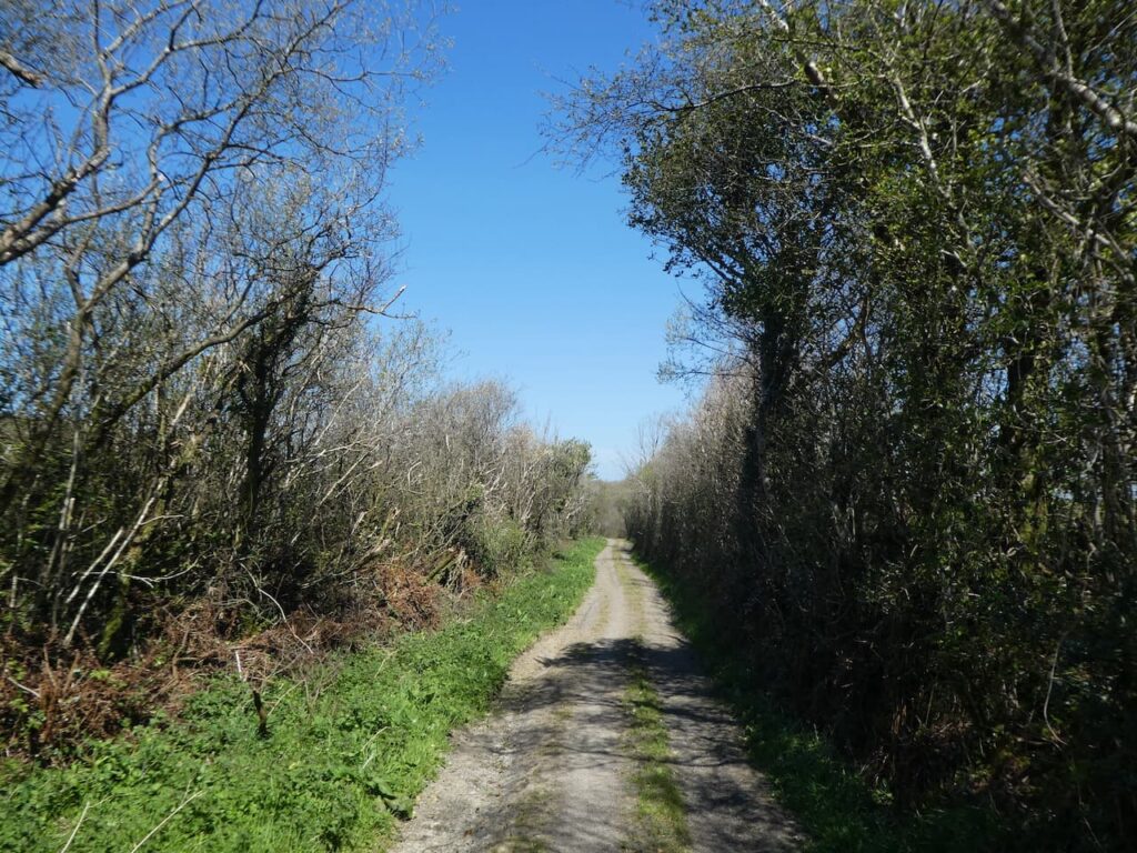
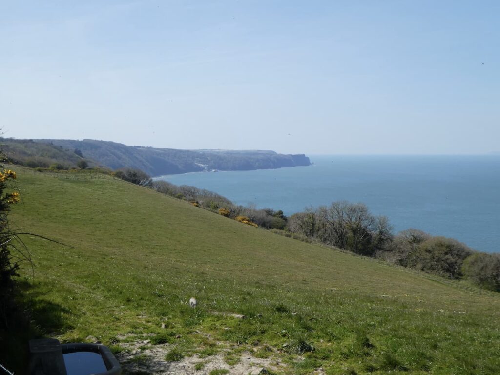
    We walk up from the beach and take the sign for the Coastal Path on our left. This path has steps and is a ferocious climb and we are soon above the village and the cliffs and entering woodland.  On reaching a junction of paths where the South West Coast Past goes to the left, we carry straight on and soon join a grassy lane between hedges.

    This lane leads to a junction with a minor road where we go straight on with the coastline to our left.

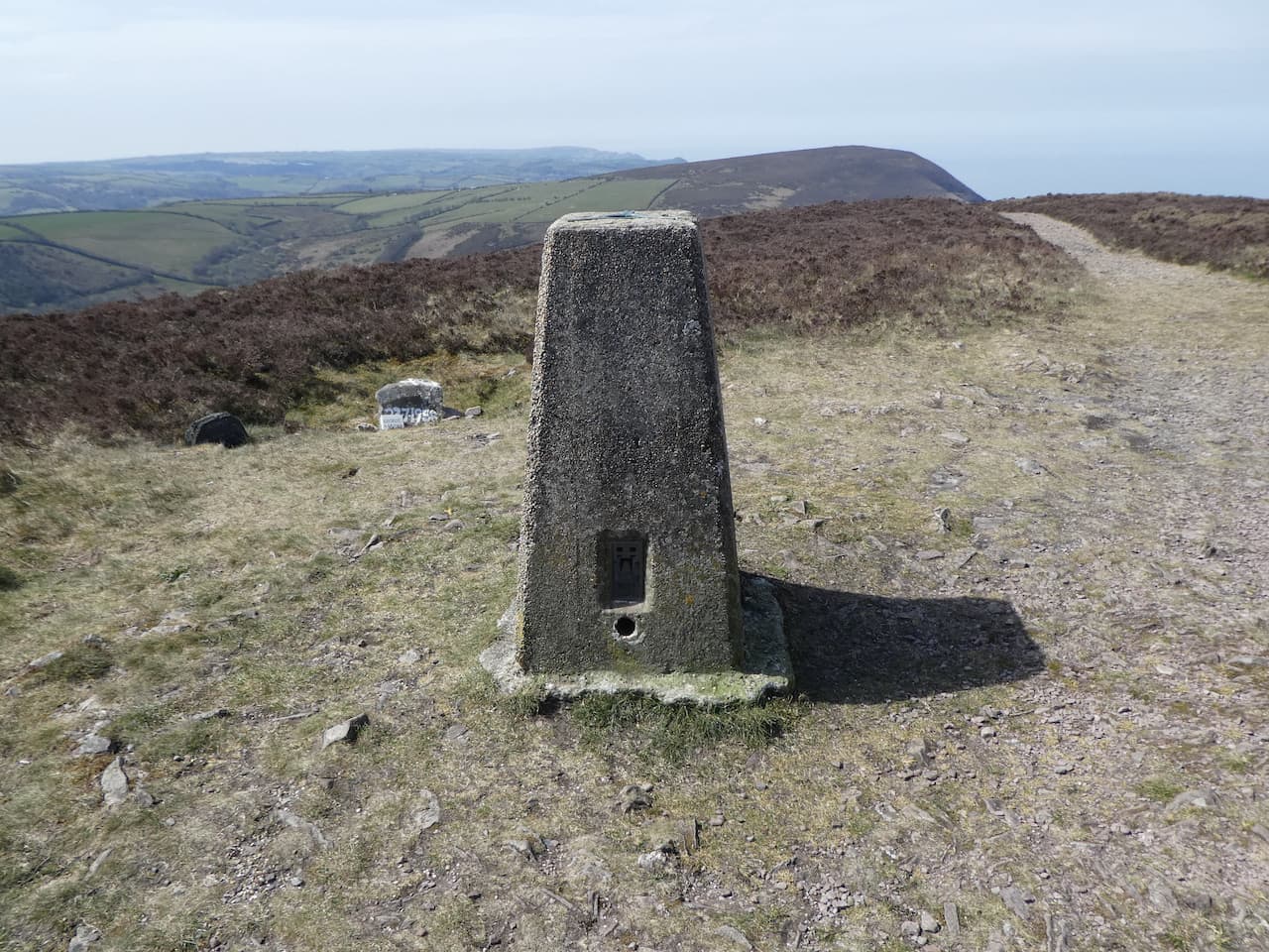
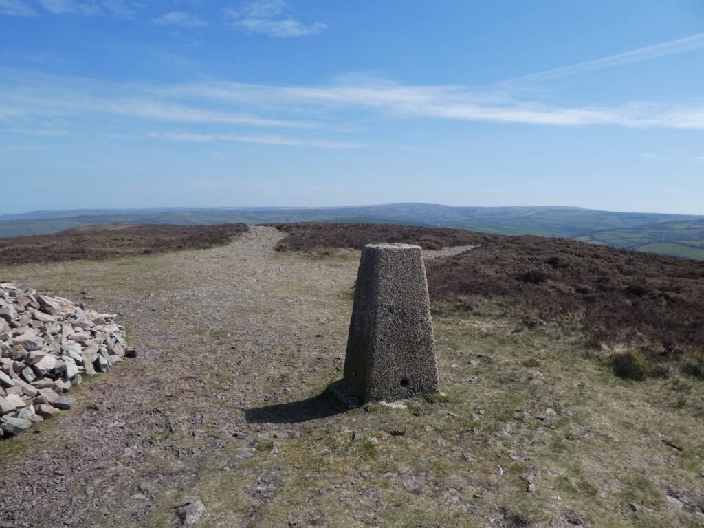
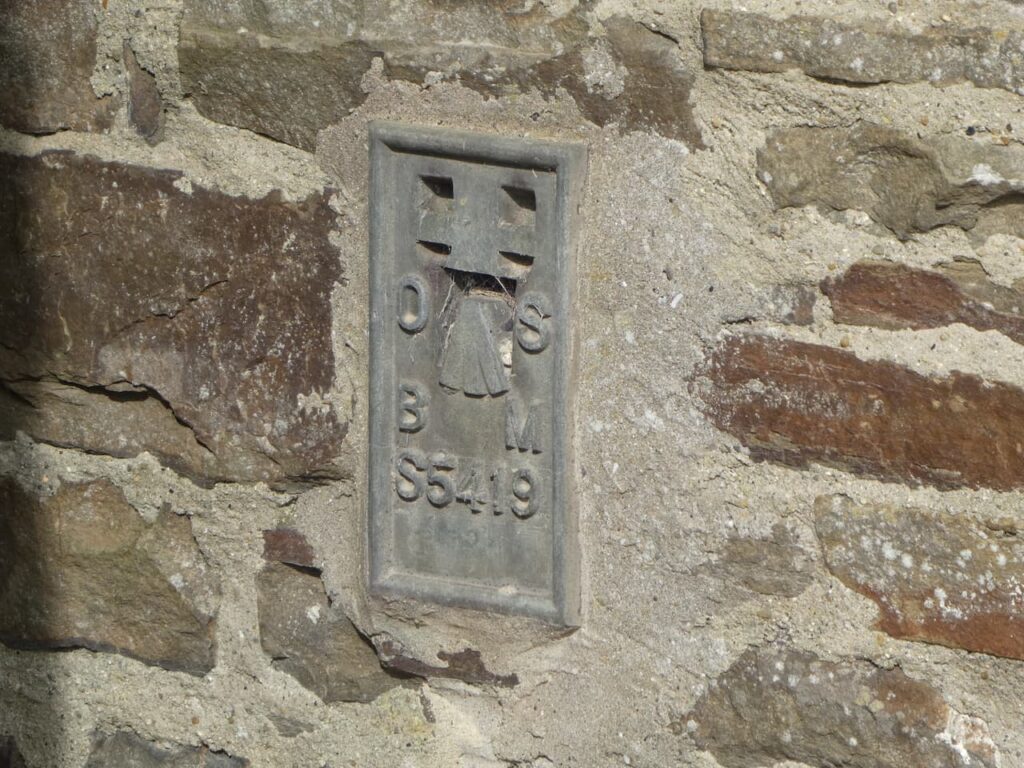
    We stay with this lane to pass Sloo Farm and soon after on our right we reach the Northway Farm Ordnance Survey trig pillar standing high in the hedge line.  This is the 242nd I have bagged.

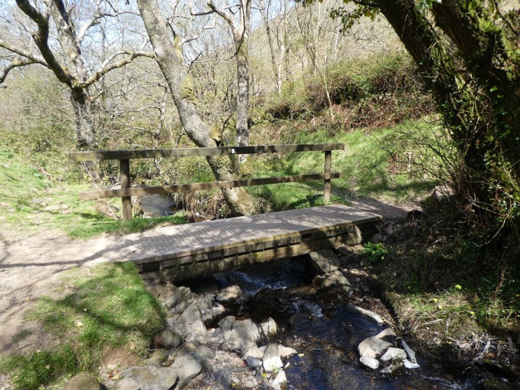
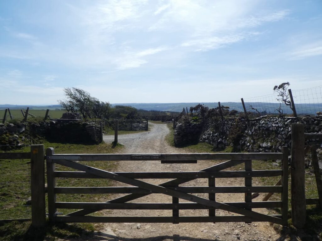
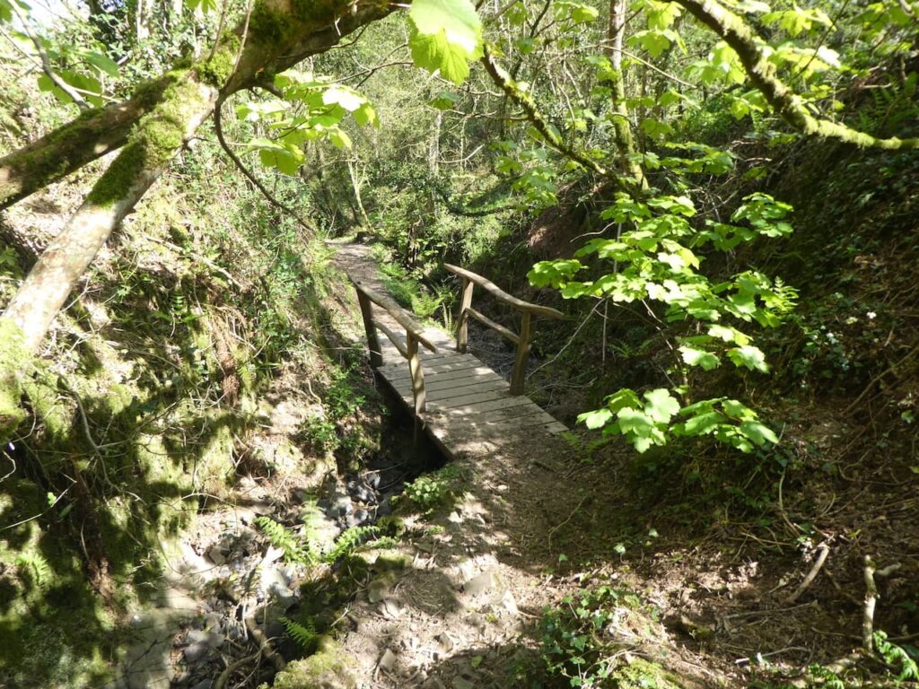
    On reaching Northway Farm with its fine collection of barns we turn left down a lane marked as being unsuitable for motor vehicles and then after a couple of hundred yards take a lane on the right leading downhill to cross a stream. 

    On reaching a junction of tracks we go right on the route way marked to Horns Cross.

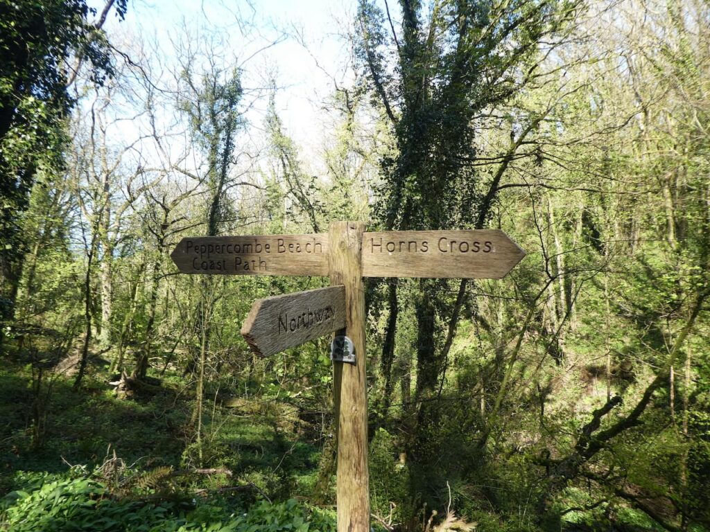
    We stay with this lane as it heads steadily uphill to Horns Cross where we cross the A39 besides the Coach and Horses Inn.  We now head south on Acre Lane and stay with this lane as it bends to the right and continues towards Goldworthy.

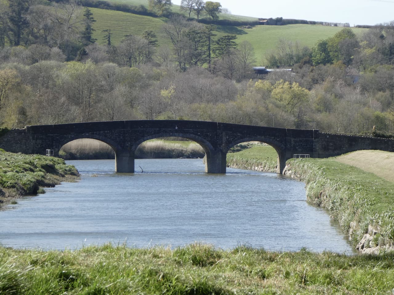
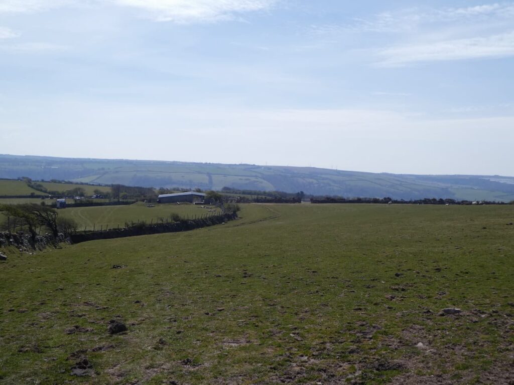
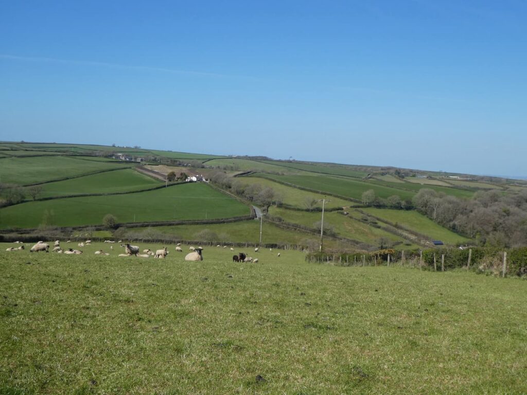
    In Goldworthy we keep right at a road junction and continue downhill to cross the River Yeo at Newhaven.  Immediately after crossing the bridge we leave the road and turn right on a track heading steeply uphill towards Parkham.  As we ascend there are fine views across the valley behind us.

    As the track levels out we pass farm buildings and then continue along the track to reach a minor road in the Parkham.  Here we continue straight on to reach our starting point outside St James’ church.  We have covered nine and a half miles and despite having rather more road walking than I would normally choose it has been a pleasant walk.  These are very quiet lanes and we have only encountered a handful of cars on our route.  

    Now it is time to head back to Seabreeze CL and start packing up for our return home tomorrow morning.

    You can view this 9.5 mile walk on OS Maps and download the GPX File Here

    To follow this walk you will need Ordnance Survey Explorer Leisure Map 126 – Clovelly & Hartland

    24th April 2021

    © Two Dogs and an Awning (2021)

    All information on this site is provided free of charge and in good faith and no liability is accepted in respect of damage, loss or injury which might result from it.  To the best of my knowledge the routes are entirely on public rights of way or within areas that are open for public access.
    Walking can be hazardous and is done entirely at your own risk.  It is your responsibility to check your route and navigate using a map and compass.

  • Gammaton Cross and Halfpenny Bridge

    Gammaton Cross and Halfpenny Bridge

    One of the things about returning to a CL site is that we are familiar with the local area and will have done walks we want to repeat.  Seabreeze CL being located so close to the Northam Burrows has seen us out with Crosby early in the morning for at least three miles just wandering around the open access land.

    The last two days has also seen us repeat walks from previous visits.  On Wednesday we walked from the site along the South West Coastal path to Westwood Ho! and then up to Kipling Tor, you can see details of that route here. Yesterday saw us heading off to Great Torrington to walk a section of the Rolle Canal and the Tarka Trail, I have walked this route a few times and details can be found here.

    Today Lynnie is meeting her cousins in Appledore whilst I take Crosby out from Great Torrington on a quest to bag an Ordnance Survey Trig Pillar.  My starting point is the large car park on Great Torrington Common and I begin by heading north west on the common and then gradually descending on a path towards the A386.

    Just before reaching the road I turn right on a track and then take a left across a stream, keeping to the left along the base of Furzebeam Hill and then after a couple of hundred yards turn right on a footpath heading east uphill.

    I stay with this path to meet a junction of paths at the top of the hill, here I turn right following a path besides the edge of the common.

    I stay with this path as it turns to the left to join a minor road where I turn right and head downhill to a four way junction where I turn left and follow a minor road signposted for Gammaton and soon cross a bridge.  My route now stays with this lane for three miles to reach Gammaton.  Along the way there are a number of ancient milestones harking back to the days when this would have been a major route to Bideford and Barnstaple.  Thankfully now it is a very quiet lane and I only meet a handful of cars.

    At Gammaton Cross I go straight over and soon fork right to reach the Gammaton Cross Ordnance Survey Trig Pillar.  This is the 241st I have bagged and like many in this part of Devon is situated on top of the hedge line and is overgrown.

    From the trig I retrace my steps to Gammaton Cross and go straight over, after passing a milestone I fork right on a lane signposted to Weare Giffard.

    After a few hundred yards at a fork in the road I keep left still heading for Weare Giffard and stay with the signs to the village as I pass junctions heading steadily downhill.  This is another very quiet lane and I see even less cars that I did on the lane up from Great Torrington.  In Weare Gifford I turn right and follow the road as it leads through the village.  Just after passing a playing field I stop on a stone bench for lunch whilst enjoying a fine view of the River Torridge.

    Resuming my walk I stay with the road leading through the village to reach Holy Trinity church, which was built in the 13th century and enlarged in the 15th century.

    Back on the road I continue through the village and soon get a fine view of the Halfpenny Bridge spanning the River Torridge.  Built in 1835 the bridge apparently gets its name from the toll fee that was payable to cross.

    At a junction of roads I turn left and cross the Halfpenny Bridge to reach the houses dotted around Annery Kiln.  The place derives its name from the large lime kiln that was built here as part of the Annery Estate.  The cottages were built to house the kiln workers. Its location was chosen to be  close to the Torridge at the furthest navigable point on the tidal estuary.  Later, in 1827 when the Rolle Canal was built that served as the transportation point for the limestone and coal required in the kiln.

    After passing under a disused railway bridge I join the Tarka Trail besides the A386 and head in a southerly direction towards Great Torrington.

    The route is easy to follow and I stay with the Tarka Trail crossing the River Torridge on a couple of occasions.

    On reaching the old Railway Station I leave the Tarka Trail and cross the road, turning left to walk up the hill on the pavement besides the A386 returning to my starting place in the car park.  It has been a fine day out, despite doing a lot of walking on tarmac the lanes have been quiet and there have been some good views.

    To follow this walk you will need Ordnance Survey Explorer Map OL 139 – Bideford Ilfracome and Barnstable

    You can view this 12  mile walk on OS Maps and download the GPX File Here

    23th April 2021

    © Two Dogs and an Awning (2021)

    All information on this site is provided free of charge and in good faith and no liability is accepted in respect of damage, loss or injury which might result from it.  To the best of my knowledge the routes are entirely on public rights of way or within areas that are open for public access.
    Walking can be hazardous and is done entirely at your own risk.  It is your responsibility to check your route and navigate using a map and compass.

  • Holdstone Hill to Combe Martin

    Holdstone Hill to Combe Martin

    When planning walks for this trip I realised we had not walked around Combe Martin.  A couple of years ago we drove by and had a brief stop in the village, but that is the extent of my visits.  Lynnie remembers trips there many years ago but apart from our brief stop has not been for nearly fifty years.  Like most walks I plan, this one will start a few miles away from where I want to visit.  We start from the car park in the old quarry on Holdstone Hill EX34 0PF (Grid Ref: SS263474). 

    From the car park we go northwest uphill on Holdstone Down on a clear path through the gorse and heather.

    After months of walking on the chalk downs in Wiltshire it makes a welcome change to get a rocky path beneath our boots.  Soon we are at the hill summit on which sits a large cairn and an Ordnance Survey trig pillar.  This is the 239th trig I have bagged, but it is 140 days since I bagged the last one.

    From the trig point we head west on a clear path that steadily descends through the gorse, we stay with this path until we reach a junction with the South West Coast Path.

    We turn left onto the South West Coast Path and stay with this route as it passes through a gate and descends steeply into Sherrycombe.

    This is a cracking combe, the path leads to a footbridge over a stream.

    After crossing the bridge the path takes us out of the combe onto the aptly named Girt Down.  This is a stiff ascent the likes of which we have not tackled for a long time and it gets the calf muscles burning.

    As the route begins to level we reach a junction of paths, here we turn left leaving the South West Coast Path to take a route signposted to “County Road”.

    We now head along the boundary of access land and a field to reach a stile.  After crossing the stile and entering a pasture field we continue with the fence line to our left to reach a gate onto a track.

    Staying with the track we pass Girt Down Farm and then soon after take a track on the right with a way marker for Combe Martin.  There are some cracking views of the village and coastline as we steadily descend.

    The track joins a minor road where we turn right and continue downhill.  When the road bends sharp to the left we continue straight on along a track which descends steadily into the village.

    At a road in the village there are a number of options to reach the sea front.  We go to the right to take a narrow path that leads across a stream.  We then turn left to walk by a school and continue on to reach a car park overlooking the bay.

    From the bay we join the A339 and walk south out of the village.  There are cracking views over the bay which due to the pandemic seems a lot quieter than the last time we were here a couple of years ago.

    We stay with the pavement until we reach a footpath on the left just before a bridge. Here we go left and follow the path downhill which soon joins a track initially heading south and then sweeping to the left to head east.

    The path heads steadily uphill and then goes through gates to cross fields.

    We reach a lane and descend towards the church of St Peter ad Vincula which means St Peter in Chains.  Parts of the church date to the 13th century with most of it from the 15th and early 16th century.  Restoration was undertaken in 1858 and 1881.

    We are a fair distance from the sea, but still in Combe Martin.  The village is strung out alongside a road and because of the local geography the housing has stretched out within the valley.  We cross the A339 and join Corner Lane and continue on this as it becomes a concrete track going uphill.  At a junction of tracks we go right and head east still going uphill towards Silver Mines Farm.

    As we continue up there are some cracking views back across the village and out to sea.

    Besides the path are some interesting metal gates.  They are definitely not the usual farm gates and it is unclear why they are built in this way.

    We pass Silver Mines Farm and then reach the disused Silver Mine on Knapp Down.  This is one of the many silver mines in and around Combe Martin.  The only aspect of this mine now visible is part of the engine house and chimney.  It was built around 1859 as part of the workings to extract the lead silver.

    On reaching a junction of tracks we turn left and walk a few hundred yards to a junction with a minor road where we turn right and walk along Vellacot Lane towards Stoney Corner.  The hedge on one side of the road has recently been laid and looks impressive.  Earlier in the year I read a very interesting book “The Hedgerow” by John Wright in which hedges like this were mentioned.

    At Stoney Corner we cross and take the lane signposted to Trentishoe and Hunters Inn.  This road soon meets a junction.  It had been my original intention to take a right here and go along Verwell Lane but this would add another three or four miles and a couple more steep ascents.  However, after months of walking in Wiltshire we decide adding more ascent to our walks is not required today.  So we take the left and follow the lane back to our starting point in the quarry car park.

    Our walk has covered 8.5 miles and the Outdoor Active tracking app shows we have done 3 miles uphill walking with 1,798 feet of ascent.  A good afternoons walking.

    To follow this walk you will need Ordnance Survey Explorer Map OL9 Exmoor

    You can view this 8.5 mile walk on OS Maps and download the GPX File Here

    20th April 2021

    © Two Dogs and an Awning (2021)

    All information on this site is provided free of charge and in good faith and no liability is accepted in respect of damage, loss or injury which might result from it.  To the best of my knowledge the routes are entirely on public rights of way or within areas that are open for public access.
    Walking can be hazardous and is done entirely at your own risk.  It is your responsibility to check your route and navigate using a map and compass.

  • A Wander into Bideford

    A Wander into Bideford

    It has been a long time since we were away in the caravan .  Our last trip together was in September 2020 when we had a week away in Silton, near Mere.   After that I made a couple of trips to Minehead to walk on Exmoor.  The Covid restrictions then put pay to our plans for travel so it has been over five months since the caravan was used.

    As soon as we were able to make plans we decided to resume our touring with a trip to North Devon and a stay at Seabreeze CL which is just outside Appledore.  We have used this CL a few times in the past and always received a warm welcome from the site owner Alice.  So when I called to book I was surprised to find out that she had sold the business .  However, there was no need to worry because the new owners, Jason and Maria were equally welcoming and very enthusiastic about their new venture.

    After arriving yesterday we went for a stroll on Northam Burrows which is right next door to the site.  It’s open access land so it is easy to find a quiet route for a good stroll and Crosby was up early for three miles on the Burrows this morning.

    Our main walk of the day is going to be a trip into Bideford following sections of the South West Coastal Path.  We leave Seabreeze CL and turn right for a few yards along Long Lane before turning left into Primrose Lane which we follow uphill to reach a crossroads with the A386 where we cross and join Wooda Road.  We stay with this road for a few hundred yards to reach a footpath on the right.  This is the South West Coastal Path and we will follow it into Bideford.  We head through fields to reach a minor road which we cross and then continue on the path as it turns towards the River Torridge.

    On reaching the River we turn right along the bank.  There are a number of abandoned vessels, it is not clear how they came to be here.  Whilst being picturesque it is odd that a ship can be left tied up to rot in the water.

    This is a cracking spot to walk.  After months of walking from home it feels so good to be away and have some different views so we do not rush and frequently stop to just look around.

    We stay with the coast path as it goes through woodland on top of a cliff besides the river.  I am not keen on heights but feel comfortable walking along here. 

    The path leads around coves and then drops down to the attractive Cleave Quay.

    From here we go under the Torridge Road Bridge and head through houses to reach the Council Offices.  The path now runs alongside a car park at the side of Victoria Park and this leads us into Bideford.  We have decided to have a mooch around the town whilst avoiding busy areas.  We continue along the side of the river to reach Rowan Fawdon’s sculpture of Tarka the Otter.

    The plaque by the statue quotes a section from Henry Williamson’s book “Tarka passed under the ancient Long Bridge which the monks built across their ford …”.   The statue is right beside the medieval Old Bideford Bridge, or Long Bridge, it has 24 arches spanning 677 feet across the River Torridge; it is thought to be one of the longest remaining medieval bridges.  The bridge was widened in 1865 and 1925, but was struck by disaster on 19th January 1968 when a combination of heavy rain and high tide led to a couple of bridge arches collapsing.

    There is much to admire about Bideford, there are many old buildings including the attractive Panier Market.  Unlike nearby Appledore the town has yet to become popular with second home owners and holiday lets so some properties have a slightly neglected feel.  Architecturally there are some cracking buildings so we wander through the streets but Lynnie becomes more interested in securing a Hocking’s Ice Cream. We head back to the entrance to Victoria Park where a van is sited.

    We now wander through Victoria Park to the north west corner where we join Park Lane and turn right to reach Chanters Road where we turn left.  At the A386 we turn right and follow this as it heads uphill to the A39.  Here we cross and continue on the A386 toward Northam.  When the A386 forks right we keep on along the B3236 for a short distance and then turn right into Fore Street to head to the centre of Northam where we take a detour to look at St Margaret’s Church.  

    The last time we were here was for the sad occasion of the funeral of Lynnie’s Uncle Derrick.  I am not a man of faith but was stuck by the warm and sympathetic manner from the vicar who led the service.  Whilst Lynnie looks for the memorial stones to her relatives in the graveyard I wander around to locate the Ordnance Survey Flush Bracket which is on the church.

    Across the road from the church is an interesting flag pole on Bone Hill, it was first erected in 1897 and then rebuilt after it was damaged by a storm in the 1980’s.  Since we were last here names of ship captains have been painted on some of the stones.

    We now turn right and walk along Tower Street and then turn left into Diddywell Road which we follow through Northam to reach Diddywell where we turn left into Primrose Lane and then head back to the caravan park.

    To follow this walk you will need Ordnance Survey Explorer Map 139 – Bideford, Ilfracombe and Barnstaple. 

    You can view this 7.5 mile walk on OS Maps and download the GPX File Here

    19th April 2021

    © Two Dogs and an Awning (2021)

    ll information on this site is provided free of charge and in good faith and no liability is accepted in respect of damage, loss or injury which might result from it.  To the best of my knowledge the routes are entirely on public rights of way or within areas that are open for public access.
    Walking can be hazardous and is done entirely at your own risk.  It is your responsibility to check your route and navigate using a map and compass.

  • Along the Tarka Trail from East Yarde

    Along the Tarka Trail from East Yarde

    Today Crosby and I are back on the Tarka Trail, our starting point is the small hamlet of East Yarde a few miles outside of Great Torrington.
    (more…)

  • A Wander Around Appledore

    A Wander Around Appledore

    After my lengthy walk yesterday we decide on a quiet day, only strolling into Appledore so Lynnie can “bag” another Hockings Ice Cream van.  From previous visits she knows one parks near the quay and it seems to have been calling her for the last couple of days!
    (more…)

  • Bagging A Trig Point From Seabreeze CL

    Bagging A Trig Point From Seabreeze CL

    Today I am walking from Seabreeze CL, unfortunately, these days Dexter cannot walk far on consecutive days, so he is going to stay with Lynnie and relax whilst Crosby and I go in search of another trig point.

    (more…)

  • Around Northam Burrows to Kipling Tor

    Around Northam Burrows to Kipling Tor

    We have decided to walk from the caravan today, one of the advantages of being at Seabreeze CL is its close proximity to the Northam Burrows National Park and we plan to walk around it to visit Westward Ho! In so doing Lynnie can “bag” another Hockings Ice Cream van. (more…)

  • The Rolle Canal and Tarka Trail from Great Torrington

    The Rolle Canal and Tarka Trail from Great Torrington

    On our last visit to Seabreeze CL in September 2017 I went for an interesting walk along a section of the Tarka Trail from Great Torrington.  On that occasion Lynnie didn’t join me, instead she had a wander around Bideford.  I have enticed her to join me today with the promise of ice cream from the Hockings’ van that parks at Great Torrington common.
    (more…)

  • Revisiting Seabreeze CL

    Revisiting Seabreeze CL

    After a few weeks at home we are back on the road and heading west again, this time our destination is Seabreeze CL close to Appledore in Devon.  This is a caravan site we have visited a couple of time in the past, it is ideally located for us to catch up with Lynnie’s Uncle and her cousin.

    (more…)