Category: South East

  • Bagging Trigs on the South Downs

    Bagging Trigs on the South Downs

    One of the benefits of walking on the South Downs are the extensive network of tracks and footpaths in the area.  Many of these routes are ancient byeways and the area is littered with old settlements and burial mounds.  

    Today the starting point for my walk is a car park (Grid Reference TQ273093) on the Devils Dyke Road close to the entrance to the Brighton and Hove Golf Club.  Leaving the car park I pick up the footpath running parallel to the road and head north westerly to reach a crossing of paths.  Here I turn left and cross the road to join the driveway of the Golf Club.

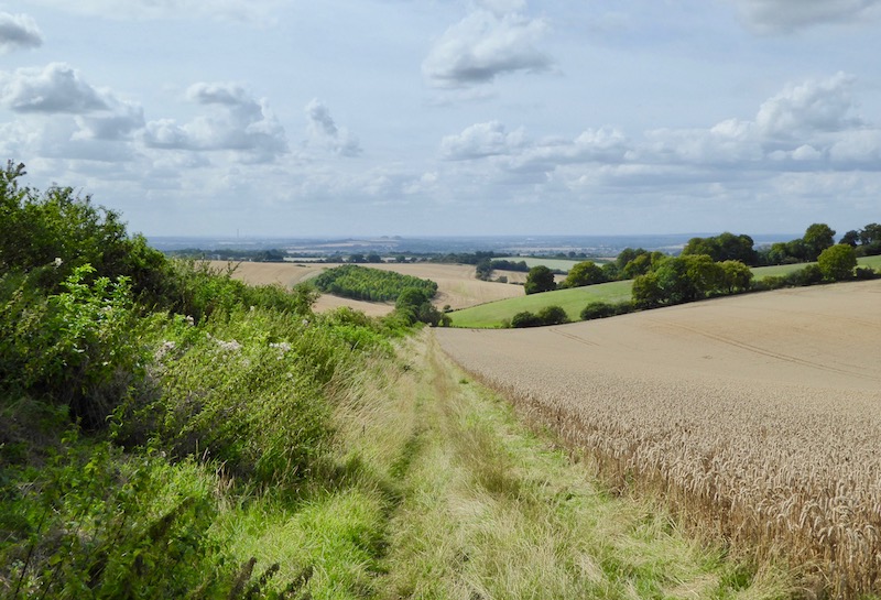
    After passing the club car park I have an option of paths, I follow the route of the Monarch’s Way which follows a hedge line besides a field.

    The Monarch’s Way is a 625-mile trail roughly following the route taken in 1651 by King Charles II after the defeat of Worcester.  It starts in Worcester and ends in Shoreham-by-Sea.  Part of the route runs close to where we live in Wiltshire.  It is a trail I would like to tackle at some point, but finding the time to walk 625 miles in one go will be challenge.  

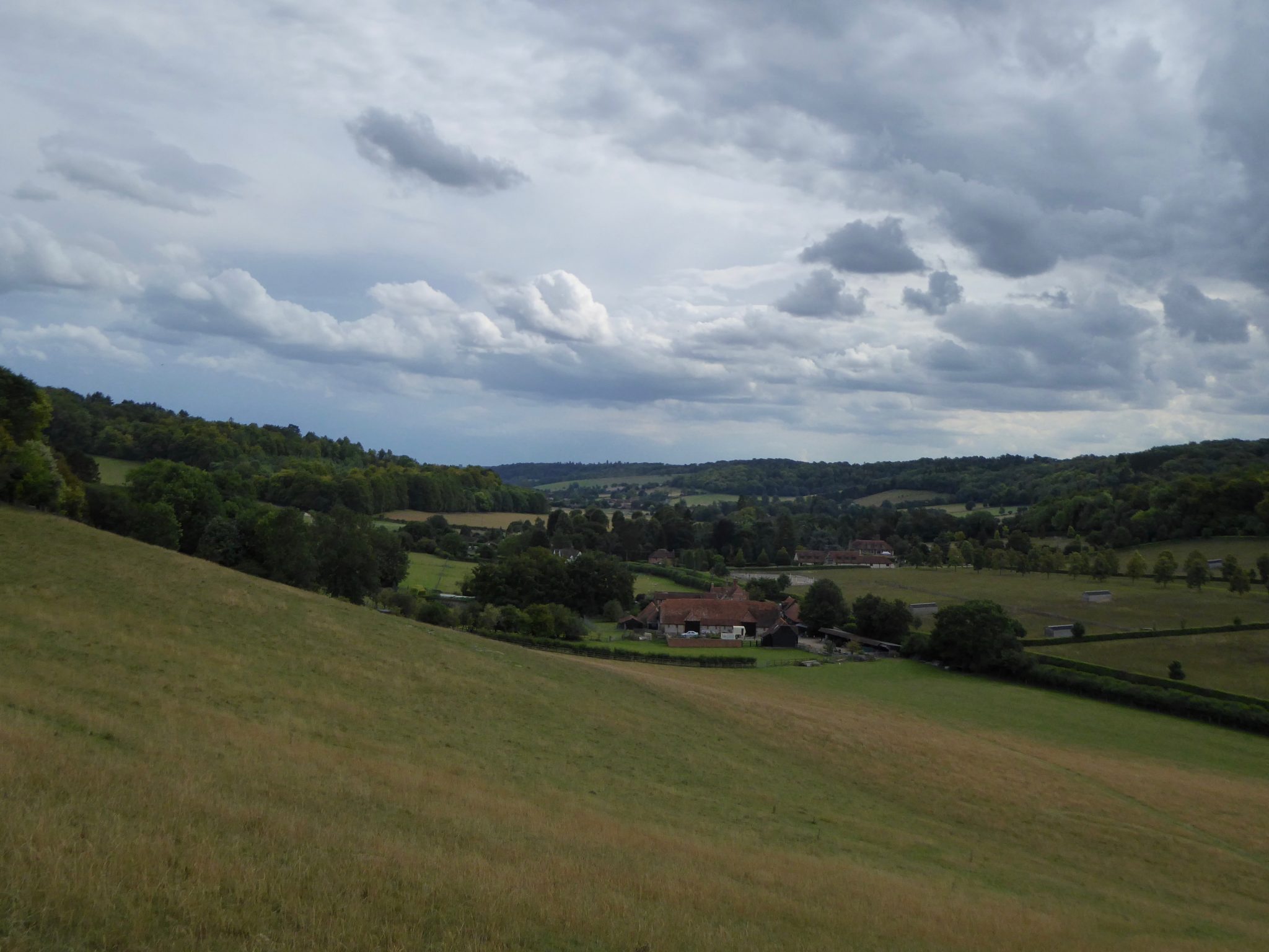
    I stay with the trail as it crosses footpaths on Benfield Hill before heading down through an area of farmland dominated by horse paddocks.

    The track leads through stables and then heads uphill towards a bridge crossing the A27.  Just before the bridge I turn right on a track, still following the route of the Monarch’s Way.  I have a clear views of the route I have taken since leaving the Brighton and Hove Golf Club.

    After a quarter of a mile the Monarch’s Way goes left off the main track, here I continue heading north to reach the site of an old dewpond.  These ponds are common sites on chalk downland.  They were built to provide livestock with water.  The chalk means natural ponds do not form so these shallow pits were dug and lined with a mixture of clay and straw, beneath which there is a layer of lime to prevent worms from puncturing the clay.  An upper layer of flints means the hooves of the livestock do not pierce the clay.  

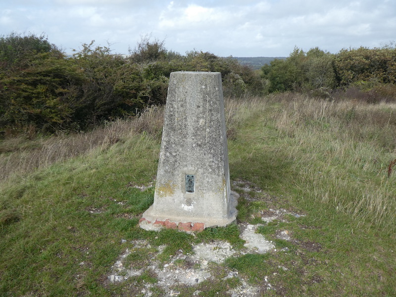
    Continuing along the track I pass the Ordnance Survey trig pillar on Mount Zion.  This is a trig I have previously bagged so not one I can add to my list.

    About half a mile after passing the trig pillar I leave the path and turn left along a track, now on the route of the Sussex Border Path.

    In the distance to the north I can see the aerial masts at Truleigh Hill.  I will be passing there later in the day.

    I pass Mile Oak Dew Pond in a field to my right. 

    At a fork in the track I go right, staying with the Sussex Border Path, I head downhill to a junction of paths and turn right before quickly turning left to enter access land on Southwick Hill.

    I proceed up the hill. At a fork in the path I go right to cross the summit of the hill, the A27 runs below this hill in the Southwick Tunnel.  The tunnel was constructed in 1996 and it contains a number of “service doors”, there has been much speculation locally as to the purpose of these doors with suggestions they provide access to large underground secret military bunkers. 

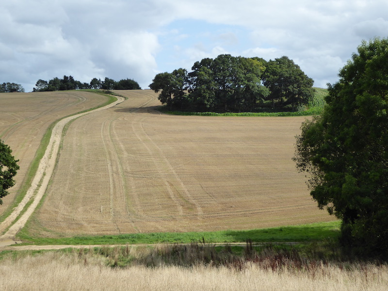
    I continue in a southwesterly direction across the access land to reach a track, which I stay on heading steadily downhill, this is a slight detour with the purpose of visiting the Rest and be Thankful Stone.  The stone is located just off the track close to a fence.  This is a block of sarsen stone that was originally part of Southwick Church but moved here in the 19th century to be used a as boundary stone.  It is thought that its name derives from its location on the hill besides the track and its shape akin to a seat.

    From the stone I turn around and retrace my steps back up the hill and follow the track that heads initially north and then north westerly to reach an Ordnance Survey trig pillar, this is the 175th I have bagged.

    A short distance after passing the trig I take a path on the left which heads west towards Mossy Bottom Barn.  

    From this track I get a good view out to sea.

    The path takes me by Mossy Bottom Barn and then onto Erringham Farm before reaching a minor road.  Here I turn left to make a diversion to bag the trig point on Mill Hill.  This is a trig located on private land and there is no obvious easy access so I have to be content with taking a picture of my 176th trig from the edge of the field.

    I now turn around and head north on the road, this leads close to the eastern edge of the Beeding Cement Works before continuing on to the car park on Beeding Hill.  As I approach the car park I pass Anchor Bottom to my left.

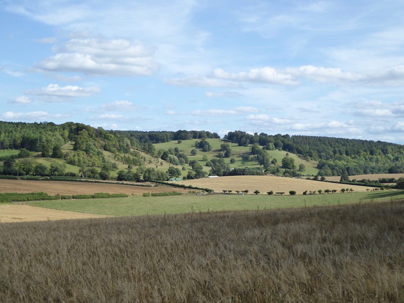
    At a junction of six paths I go right on the South Downs Way, the path runs besides a minor road heading to the Youth Hostel on Truleigh Hill.  I walked this path last year whilst travelling the South Downs Way and it has some fine views.

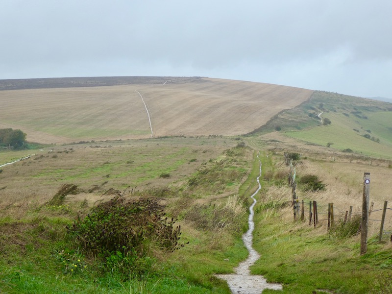
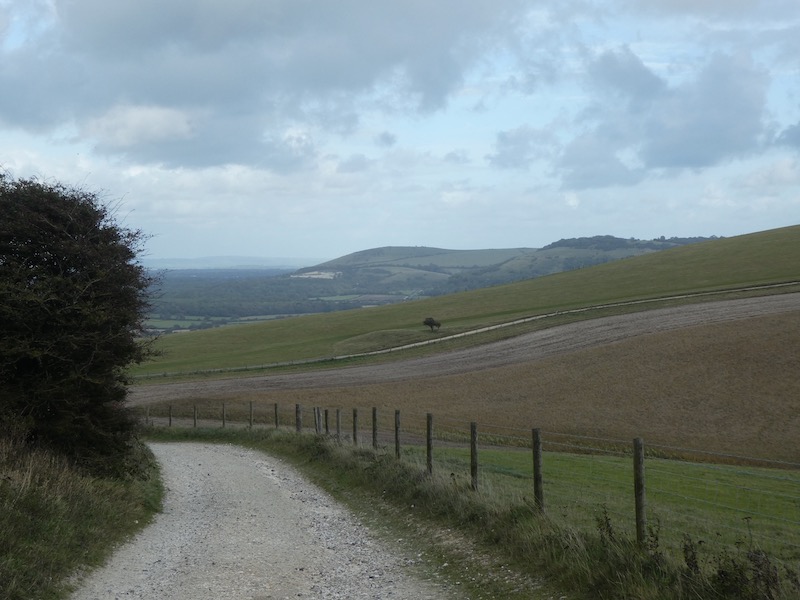
    My route is now easy to navigate, I follow the route of the South Downs Way heading east towards Devils Dyke.  This is a cracking section of the South Downs Way, the views are stunning.  

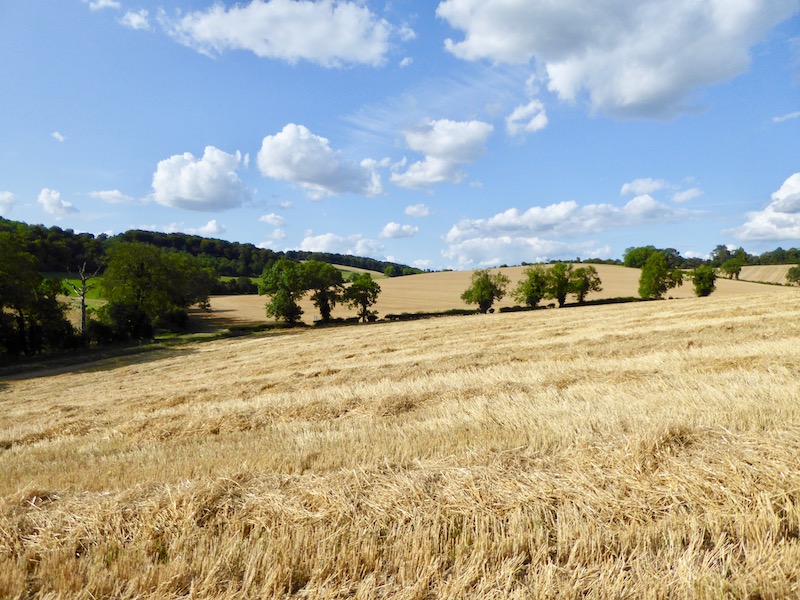
    The path undulates as it crosses Edburton Hill, Perching Hill and Fulking Hill.  It is wonderful chalk downland walking, with cracking views in every direction.

    There are a busy network of paths around Fulking Hill.  I stay with the South Downs Way, but after going through a gate I veer to the right to leave the National Trail and follow a path heading towards Devil’s Dyke Road.  To my left I can see the Devil’s Dyke OS trig pillar, this is one I have bagged previously.

    On reaching the road I join a permissive path running parallel to the road with the Dyke Golf Club to my left.

    I stay on the path back to the car park where I started my walk.  I have covered 15 miles, it has been a cracking walk with some stunning views.

    You can view this 15 mile walk on OS Maps and download the GPX File Here

    To follow my walk you will need Ordnance Survey Explorer Map OL11  – Brighton & Hove

    28th September 2019

    © Two Dogs and an Awning (2019)

    All information on this site is provided free of charge and in good faith and no liability is accepted in respect of damage, loss or injury which might result from it.  To the best of my knowledge the routes are entirely on public rights of way or within areas that are open for public access.
    Walking can be hazardous and is done entirely at your own risk.  It is your responsibility to check your route and navigate using a map and compass.

  • A Route Around Cissbury Ring, Botolphs and Steep Down

    A Route Around Cissbury Ring, Botolphs and Steep Down

    One of the locations on my list of places to visit on this trip to West Sussex is Cissbury Ring.  Whilst walking the South Downs Way National Trail in September 2018 I could see the Iron Age hillfort in the distance as I walked by Chanctonbury Ring.  So today I have plotted a walk that will give me an opportunity to visit Cissbury.

    My starting point is the car park in Findon Valley (GR TQ133066).  Leaving the car park I take the footpath going uphill on a track heading east.  I stay with the track ignoring paths on the right leading onto an area of access land.

    At the top of the hill I reach a track and turn left to follow this besides the edge of Worthing Golf Course.  Initially the track is hedge lined but soon opens out to offer cracking views.

    This path takes me to a gate leading to the National Trust land around Cissbury.

    I take an anti-clockwise route around the edge of Cissbury Ring.

    Then follow around the ramparts of this Iron Age Hillfort constructed around 400BC. It’s location provides extensive views and it is, therefore, not surprising that over the years it has served as a military base.  The Roman’s had an encampment here and during the Tudor period it was used as a lookout to view over seventy miles of coastline.

    This Iron Age Hillfort is the second largest in England; only Maiden Castle in Dorset is bigger.  During World War II an anti-tank ditch was dug around the whole fort and it housed anti-aircraft guns.  However, its history is not all about military use.  The area around the fort was used extensively for flint mining, there are said to be over 200 shafts, some up to 39 feet deep.

    Given the height of the hill, over 600 feet above sea level and the wide-ranging views it is hardly surprising that it is also the location of an Ordnance Survey trig point.  On reaching a gap in the ramparts I walk towards the summit of the hill to “bag” the trig.  This is my 173rd.

    After bagging the trig I head back through the gap in the ramparts and continue my route around the fort until I reach a footpath on the north east corner of the ring, this path heads downhill parallel to a chalky track.  As I walk down I see a steady stream of walkers heading towards me on the track below.

    At the foot of the hill I go through a gate to reach a junction of paths, here I continue straight on in a northerly direction, first enquiring of a marshal why so many walkers are out today.  He explains it is the Worthing High School sponsored walk to Chanctonbury Ring, a distance of 12 miles.  There are over a thousand participants and heading up the track I appear to pass the vast majority of them.  It is therefore, with some relief that I reach a junction of paths and turn right along the route of the Monarchs Way.  I have this track to myself.

    I stay with the Monarch’s Way route until I reach a junction with the South Downs Way, here the two trails turn right at a flint memorial to Walter Langmead who farmed this land for many years.

    The route now heads downhill to reach a minor road; the footpath follows a well-defined route along the fence line overlooking Steyning bowl.

    I ignore a turning on the left, where the Monarch’s Way leaves the South Downs Way, and then take the next path on the left to follow the South Downs Way route as it heads east towards Botolphs.

    When I walked the South Downs Way last September I hardly saw a soul, it was only on this section that I walked with someone.  At the time I enjoyed the company, but now realise that chatting whilst walking meant I failed to fully appreciate the views.

    As I near Botolphs I follow the South Downs Way markers to reach a minor road where I turn right and wander through the village.  I keep on the road as the South Downs Way veers to the left, and soon find myself at the 11th century church of St Botolph’s.

    Resuming my walk I continue along the minor road, with views across the valley to the disused Beeding Cement Works.  It is a bit of an eyesore, but is an interesting industrial archaeological site.  Cement production began on this site in 1883 and continued until 1991.  The site is now derelict, but apparently there are plans to transform it into an eco-village with 2,200 low carbon properties.

    It had been my intention to take a footpath on the right at Coombes Farm, however, the lane is quiet and I fancy getting a closer view of Lancing College.  I saw it in the distance earlier as I descended around Steyning Bowl and I have driven past on numerous occasions, but never had the opportunity to get a good look at it.  So I stay on the road almost until it reaches the A27, here I turn right taking a road leading to properties and then turn right again following a footpath up the College driveway.

    Lancing College is an independent boarding school established in 1848, a Gothic Chapel standing high on the hill dominates the site.  I confess to not being a fan of independent schools, I have no issue with people choosing to pay the £30k plus per year to educate their children, but I do object to the tax relief the schools receive as a charity. 

    After passing houses I leave the driveway to follow a footpath on the left heading west. 

    From this path I get a fine view of the Gothic Chapel.

    The path becomes a track and heads to Lancing Ring Nature Reserve.  I ignore paths onto the nature reserve instead keeping on the track as it follows the eastern edge of the reserve.  As I head over the hill the wind and rain start to pick up and I can clearly see my route ahead of me.

    At a junction of paths I take the clear route through the fields heading to the summit of Steep Down.  This hill is not exceptionally high, standing at 489 feet above sea level, but it is exposed and the wind has seriously picked up making it difficult to stand up when I reach the ordnance survey trig pillar.  This is the 174th I have bagged.

    From the trig point I continue on the path heading north, this descends steeply to a junction of paths where I turn left and head west along the track towards a minor road.  After crossing the road I continue along the track passing through Canada Bottom.

    Eventually the track brings me to the point I had been at earlier when I left the National Trust land around Cissbury Ring.  I turn left and re-enter that National Trust site, this time I follow a path leading to steps directly in front of me.  

    This leads to the ramparts of the Iron Age hillfort, I turn right and follow the ramparts.

    There are fine views of the South Downs to the west.

    Reaching the point where I first joined the ring earlier on my walk I turn right and head down to a gate leading to the access land.  After going through the edge of an area of woodland I continue across the open access land to reach a track.  Here I turn right and head back down to the car park where I started my walk.

    My wander around has covered 15 miles and has been extremely interesting.  The more I walk on the South Downs the more I appreciate the beauty of the area.  Apart from the school children on their sponsored walk I have only bumped into a handful of people all day.

    You can view this 15 mile walk on OS Maps and download the GPX File Here (Subscription to OS Maps Required)

    To follow my walk you will need Ordnance Survey Explorer Map 121 – Arundel & Pulborough

    27th September 2019

    © Two Dogs and an Awning (2019)

  • Highdown Hill

    Highdown Hill

    Having been home for just over a week I am off again in the caravan on another solo trip, this time I am heading east along the south coast to stay at the Caravan and Motorhome Club Site at Northbrook Farm on the outskirts of Worthing.
    (more…)

  • A Circuit from Barton on Sea to Hurst Point

    A Circuit from Barton on Sea to Hurst Point

    When at home most of out walking is done from the village, occasionally I venture a bit further afield but not often.  I grew up here and have walked the local footpaths for well over fifty years and I can always find something interesting even on the most familiar of walks.  Lynnie hails from Dorset and having grown up near Poole has an attachment to the coastline, which I do not always share, especially when it involves cliffs.  However, today it is our wedding anniversary and Lynnie has requested a visit to the coast.

    (more…)
  • Danebury Hillfort from Middle Wallop

    Danebury Hillfort from Middle Wallop

    It is only a couple of days since I returned from walking in the Black Mountains and it is time for the car to go for a service. Rather than take a courtesy car for the day I prefer to head out for a walk from the garage, so my starting point is in the village of Middle Wallop, which is just over the Hampshire border from home.

    (more…)
  • Bagging Trig Pillars on a Circuit from Ewelme

    Bagging Trig Pillars on a Circuit from Ewelme

    Today I am making the short drive to Ewelme on the edge of the Chiltern Hills.  We have previously done a few walks from this attractive South Oxfordshire village.  The starting point for my walk is the public car park close to the village playing field.
    (more…)

  • A Circuit to Leygrove Wood from Ibstone

    A Circuit to Leygrove Wood from Ibstone

    A feature of the last week or so has been the way that the weather has been stunning first thing in the morning and then as the day progresses has become overcast and dreary.  Not what you expect or hope for in late August.  I take the view that whatever the weather there are still great benefits from getting out for a walk.  So with waterproofs packed into my rucksack I head off mid afternoon with Crosby. (more…)

  • Mausoleums, a Deep Well and a Trig Point in the Chilterns

    Mausoleums, a Deep Well and a Trig Point in the Chilterns

    After a couple of days of short walks, today I am heading out for a fifteen-mile walk.  Increasingly I find that at least once a week I need to lace up the boots and head out for a good chunk of the day.  Yesterday evening I spotted a trig point in the area that I have yet to bag, it is about seven miles from Ibstone so perfect for combining with a decent walk.
    (more…)

  • Ibstone to Christmas Common – A Nine Mile Circuit

    Ibstone to Christmas Common – A Nine Mile Circuit

    My walk for today will be a nine mile circuit in the Chiltern Hills starting from Cholsey Grange CL.
    (more…)

  • Visiting Hanger Wood from Cholsey Grange CL

    Visiting Hanger Wood from Cholsey Grange CL

    Whilst studying the Ordnance Survey map yesterday evening I spotted a path through nearby Hanger Wood I have not previously walked.  Obviously this oversight needs to be rectified as soon as possible.  So this afternoon that’s where I am heading.
    (more…)