Category: South East

  • Hanger Wood Dew Pond

    Hanger Wood Dew Pond

    After almost four weeks at home I am away again in the caravan, this time it is for my annual fortnight trip to Cholsey Grange Farm CL.  Lynnie is staying at home for the first week so Crosby and I will be on our own.  The injury to my ankle is gradually improving and in the last week at home I managed a sixteen and fourteen mile walk in my walking boots so I am hoping I will be fully fit for our upcoming trip to the Yorkshire Dales.

    The beauty of returning to the Chilterns is there are some good hills to test my ankle and build up some stamina in my legs.  I intend walking the Yorkshire Three Peaks towards the end of September so I definitely need to build up the muscles following on from over two months of recuperation. 

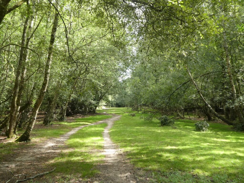
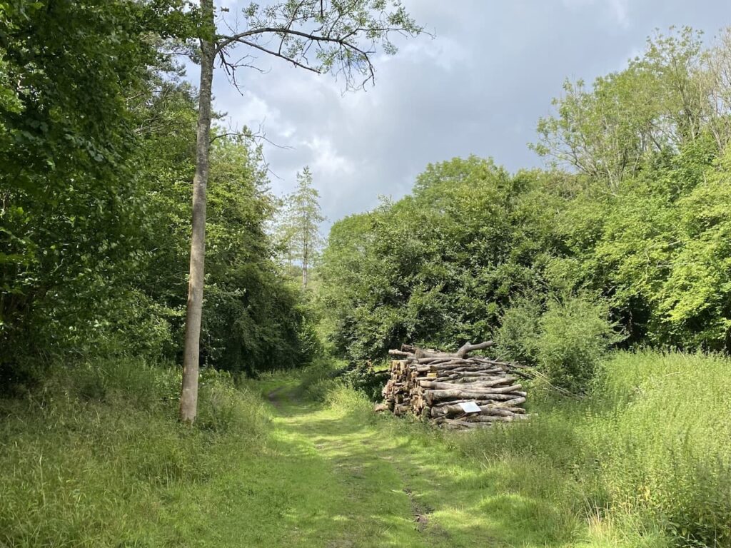
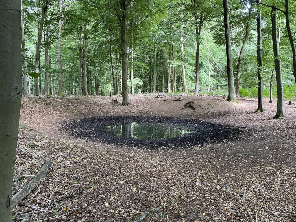
    After pitching up yesterday I went for a short walk in the woods below the site but today I plan to get out for a couple of hours.  There are many potential routes from the site but the one I choose will take me into Hanger Wood, this is a walk I have done a couple of times previously but I am particularly interested to see if the Dew Pond in the woods has any water in it after such a prolonged dry spell.

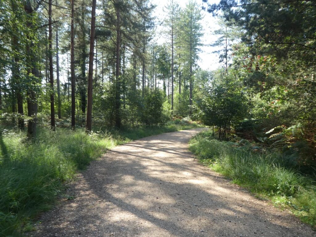
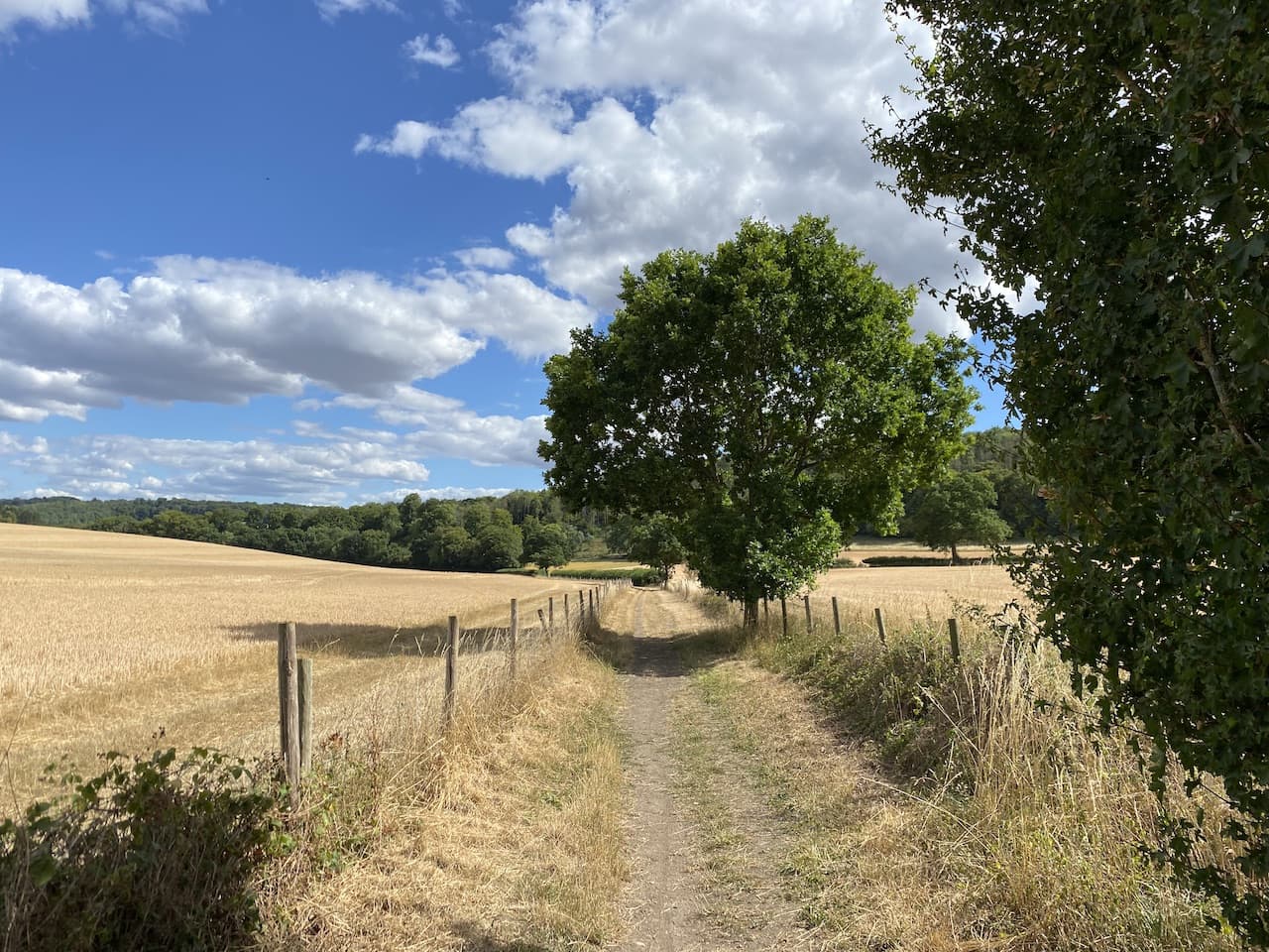
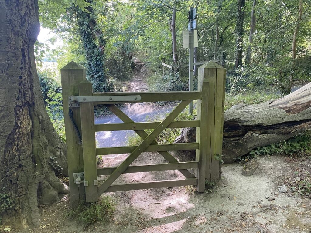
    I leave the caravan site by going through the gate at the far end and turning left onto the footpath to head downhill into the woods.  

    At a junction of paths I turn right to follow the clear waymarked route through Twigside Bottom.

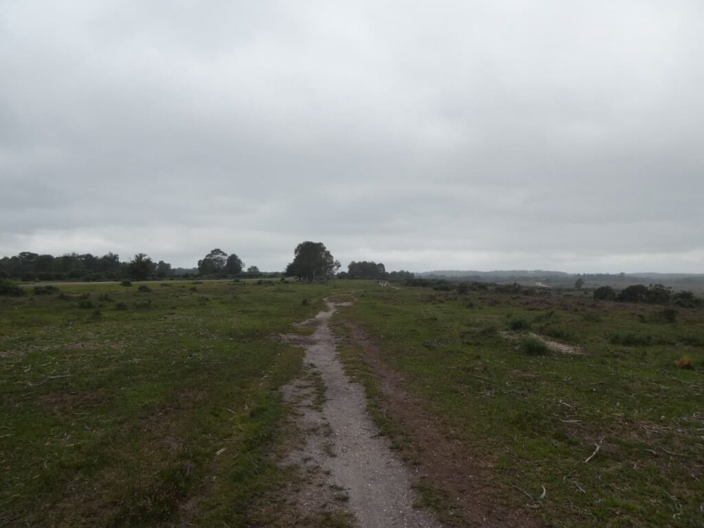
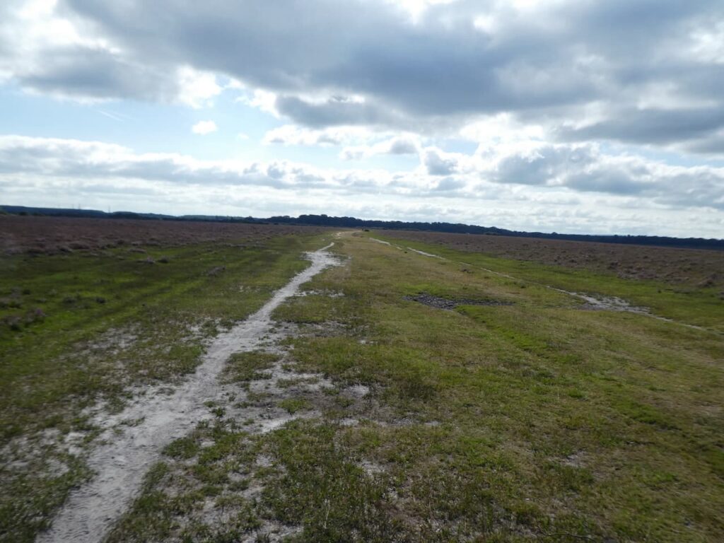
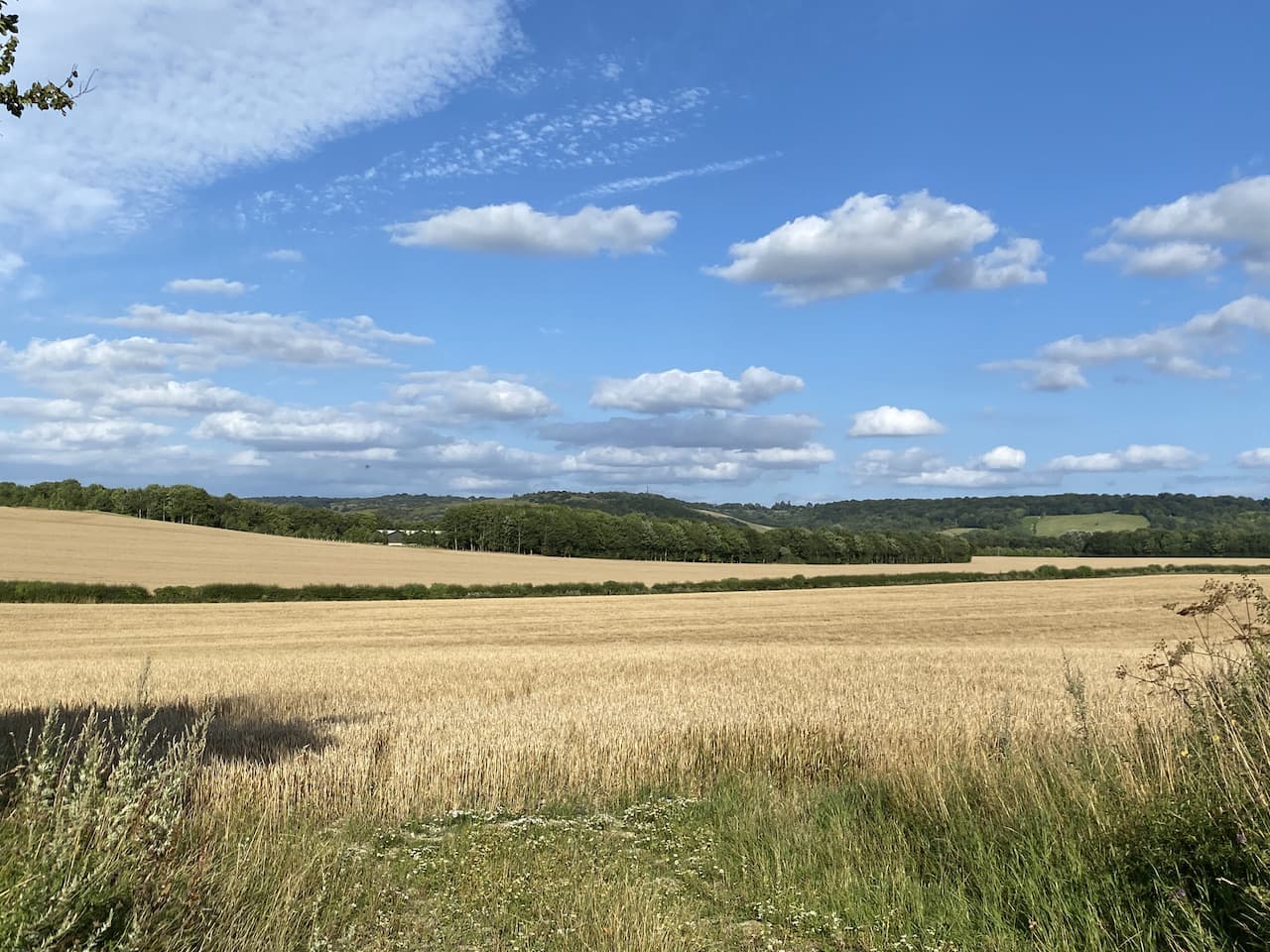
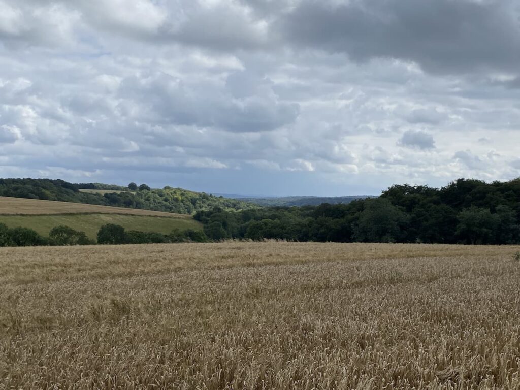
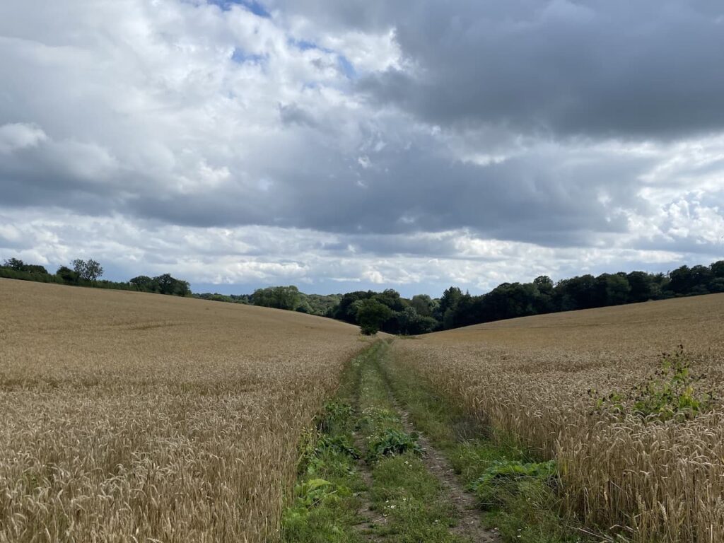
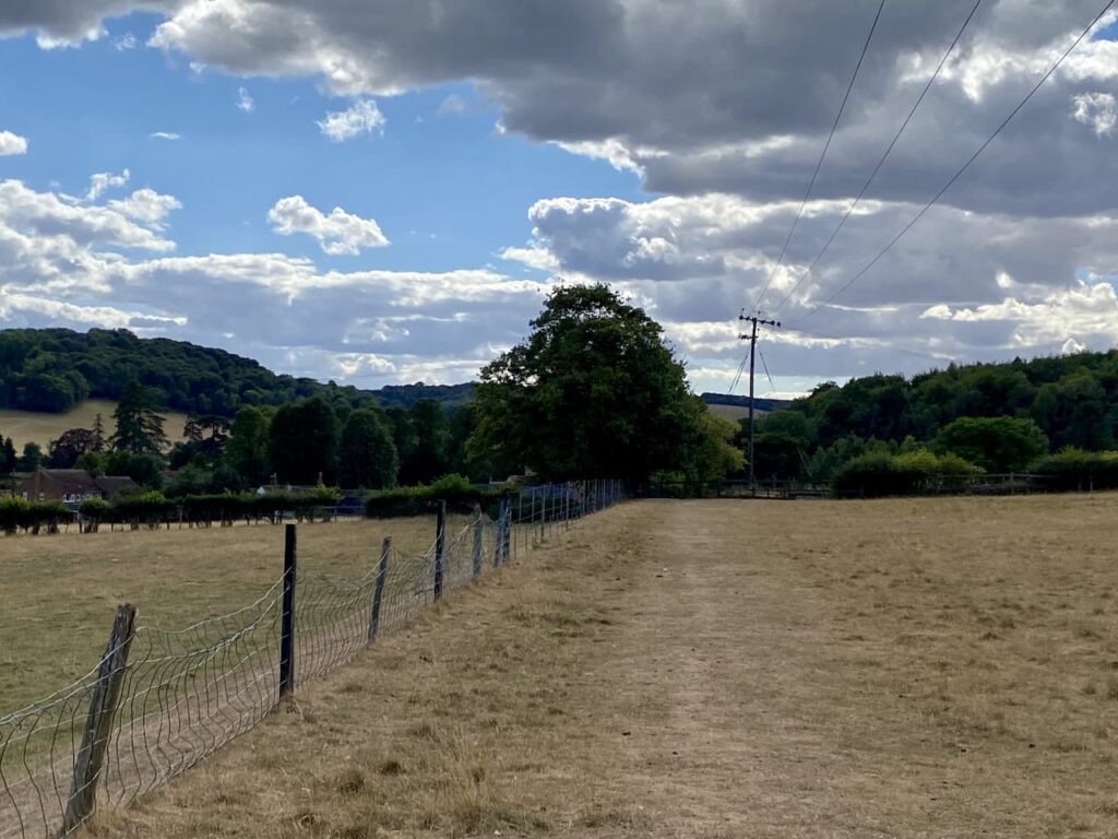
    I keep with the path through the bottom of the valley ignoring footpaths that head to the left and right.  It is a cracking afternoon, sunny but not too hot.  I am not looking forward to next week when the temperatures look set to soar again.

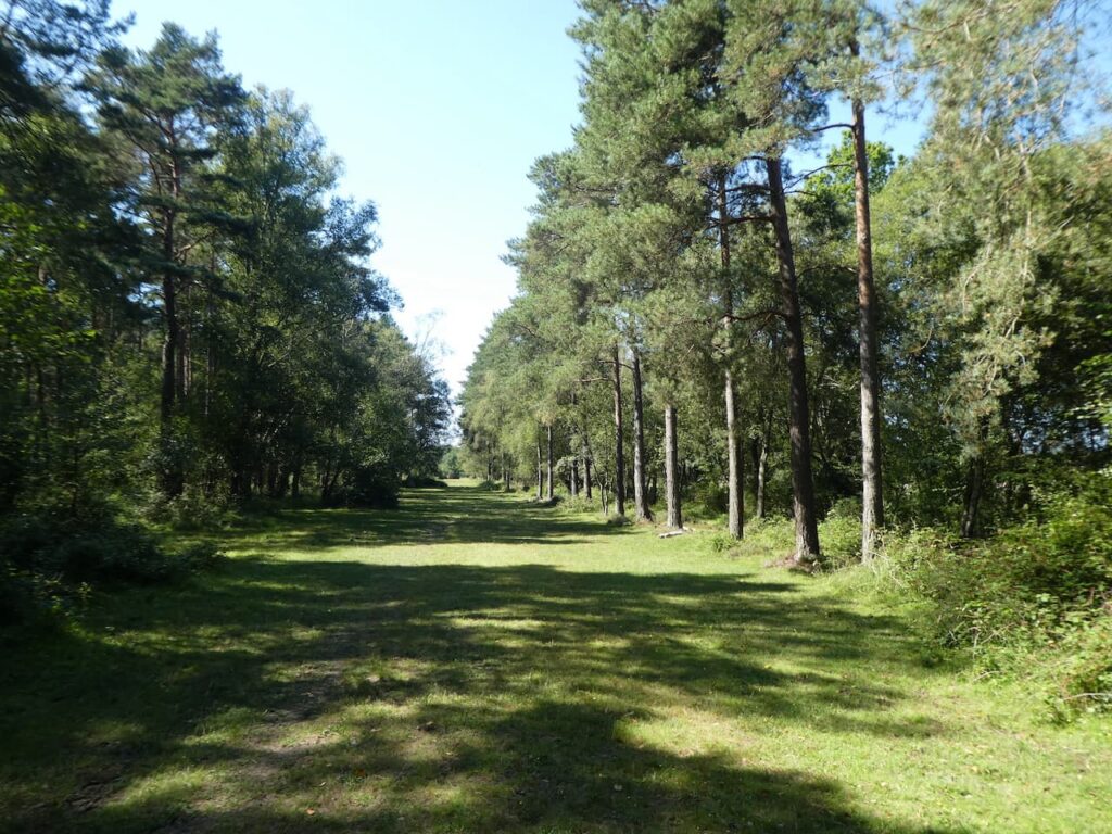
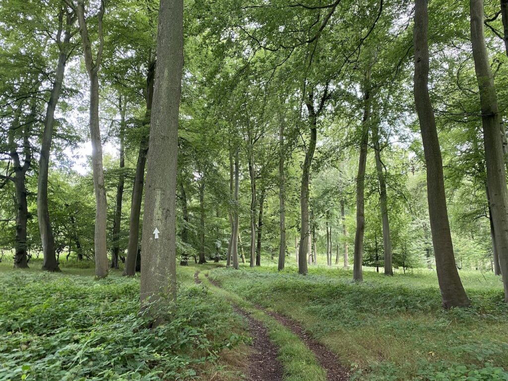
    I stay on the path until I reach Chequers Lane, a minor road at Gravesend, here I turn right and then within a short distance take a footpath on the left which heads uphill towards Hanger Wood.

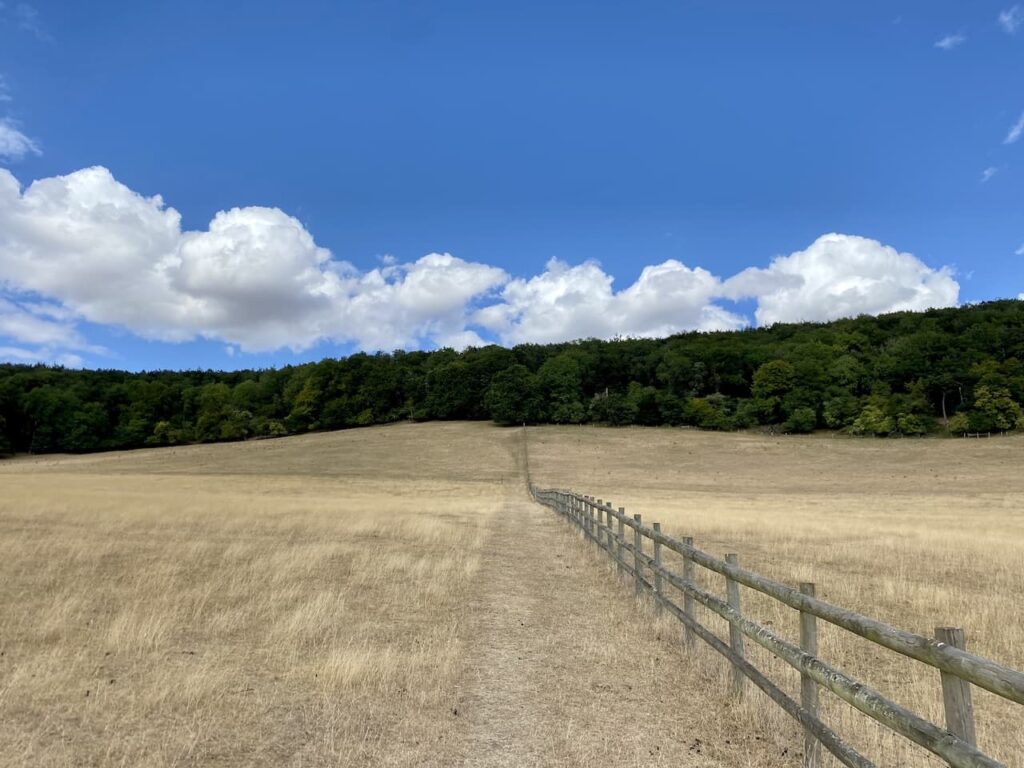
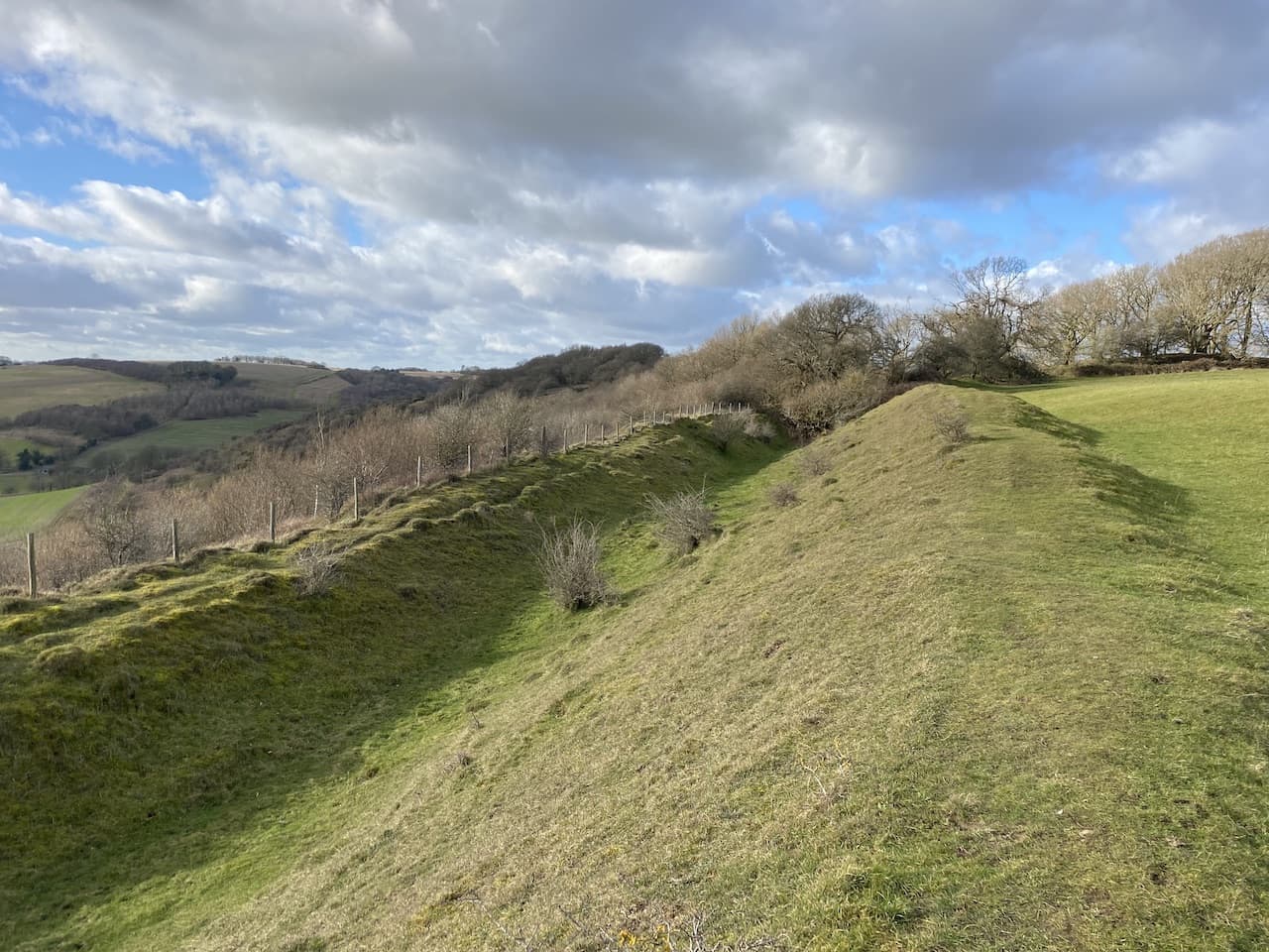
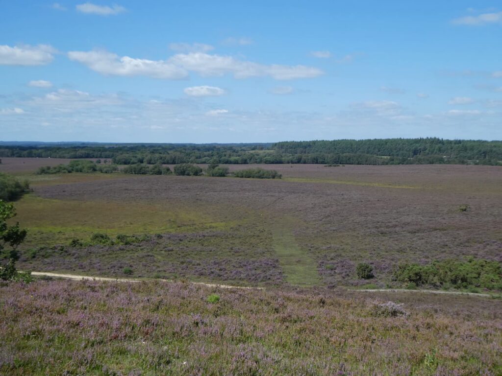
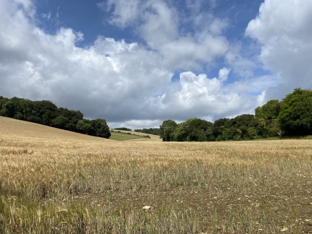
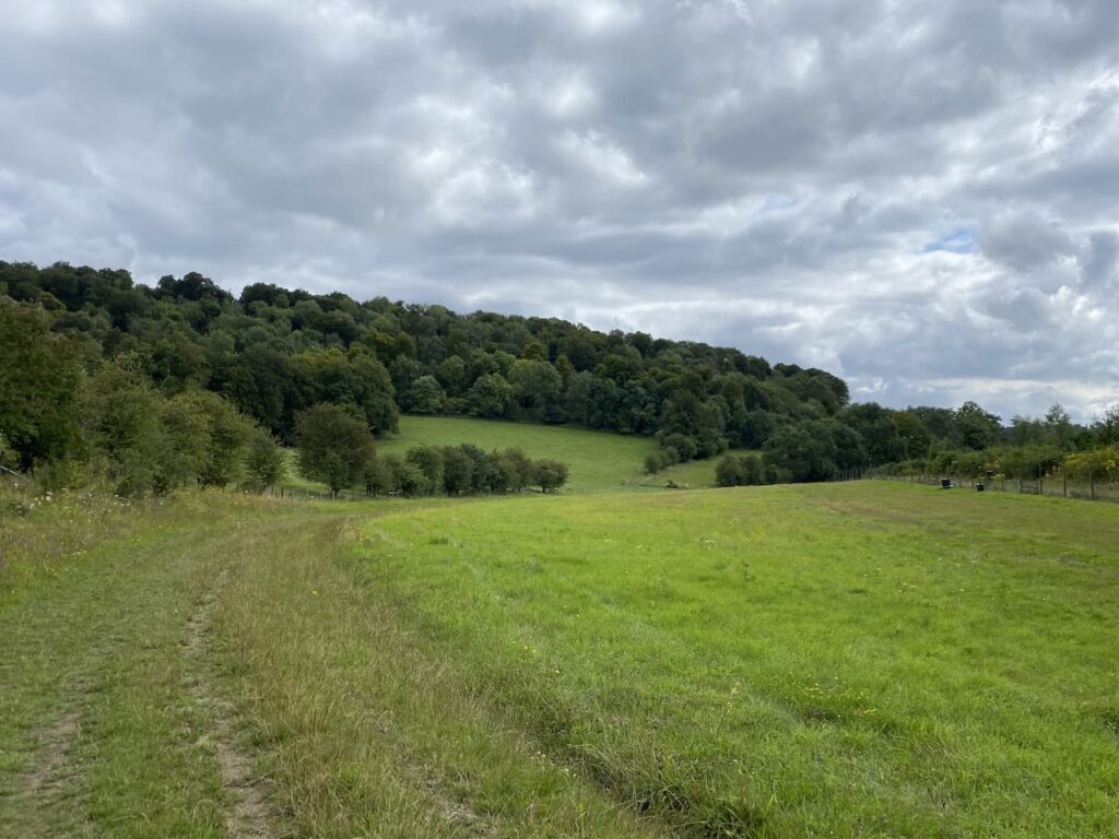
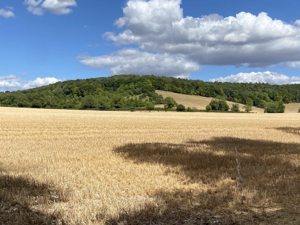
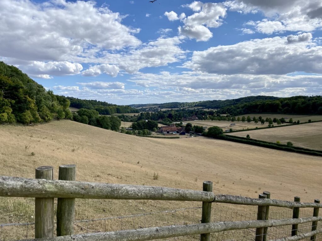
    This ascent is a good test for my legs and I maintain a good pace as I head up the hill. As I near the woods there are  fine views down the valley over Fingest.

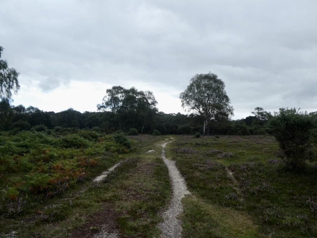
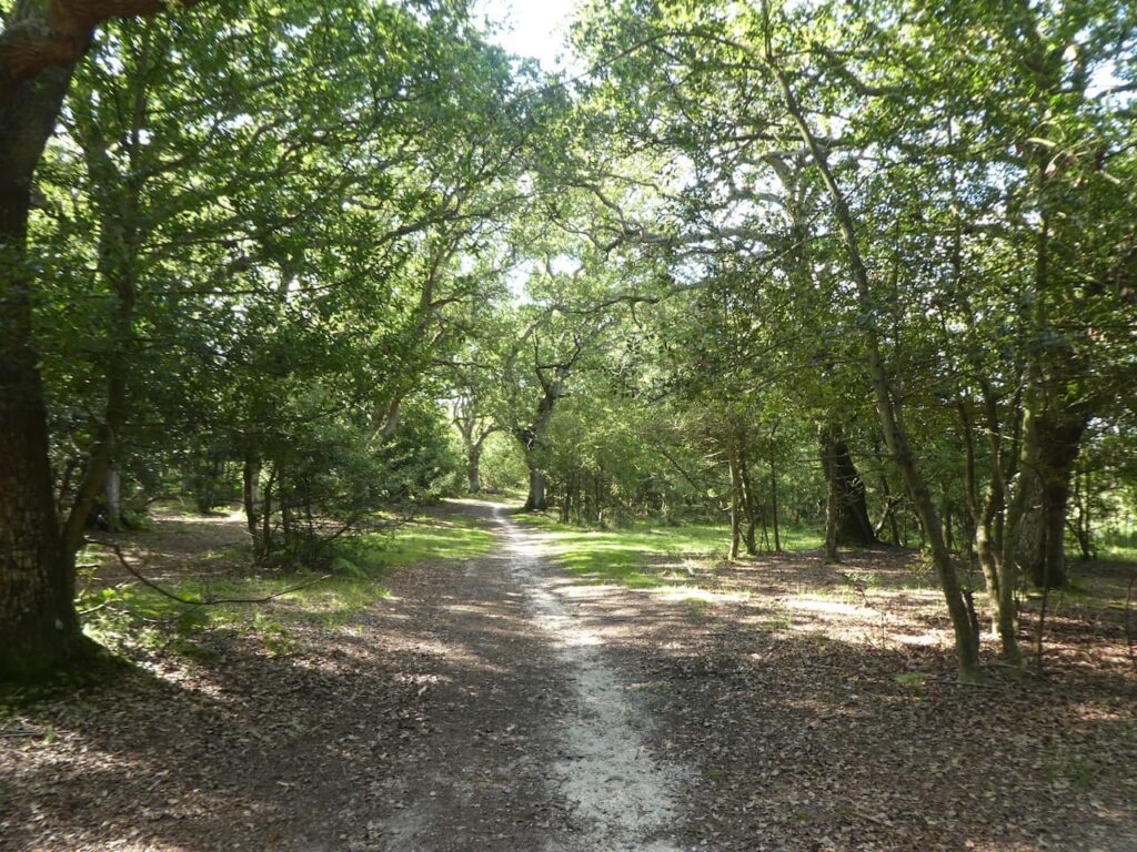
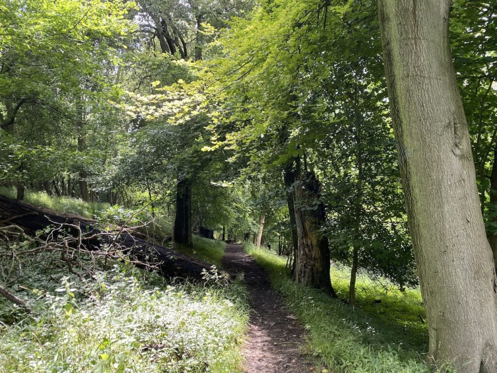
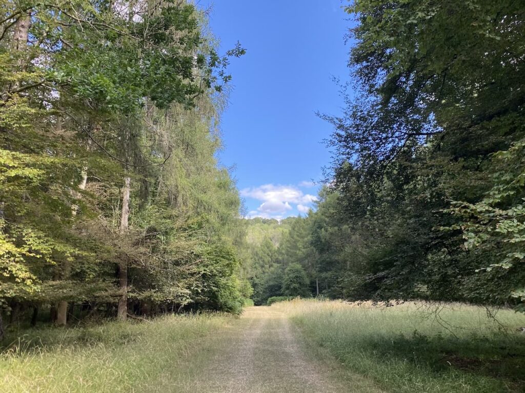
    After going through a gate the path continues to ascend into the woods.  Soon on my right is the Dew Pond that would have been dug into this woodland to provide water for livestock.  A dew pond has no water running into it, so only gathers rainfall.  After such a lengthy dry spell I fully expected to see it dry, however, remarkably there is water in it and evidence that it is being used by animals as a source of refreshment.

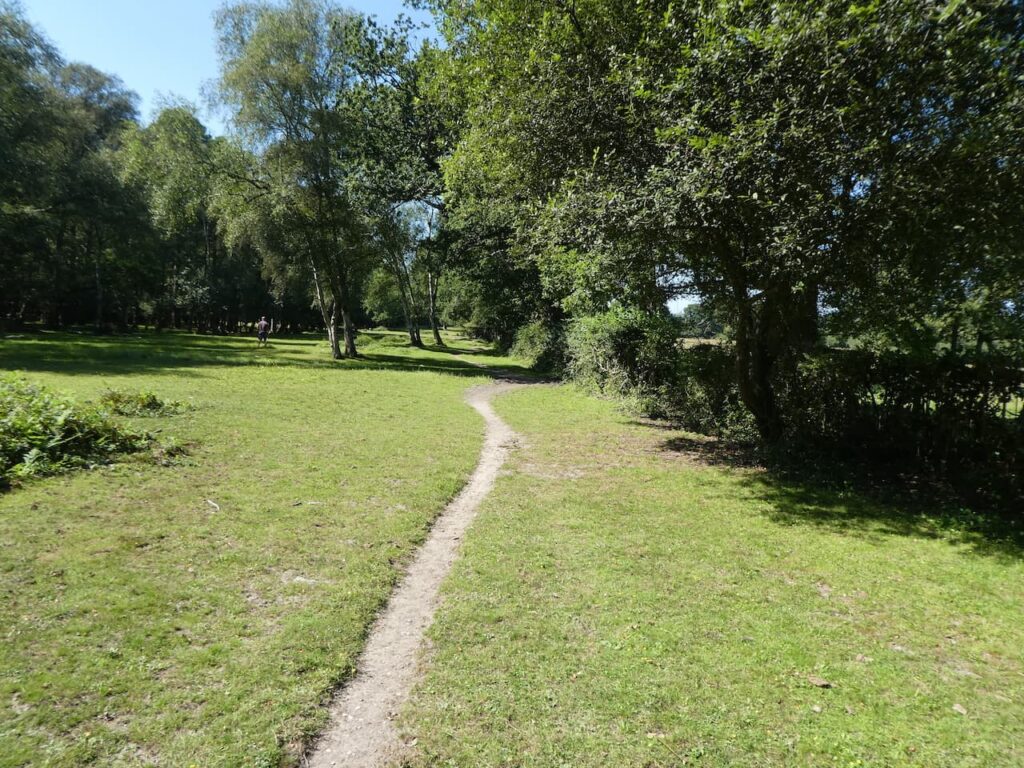
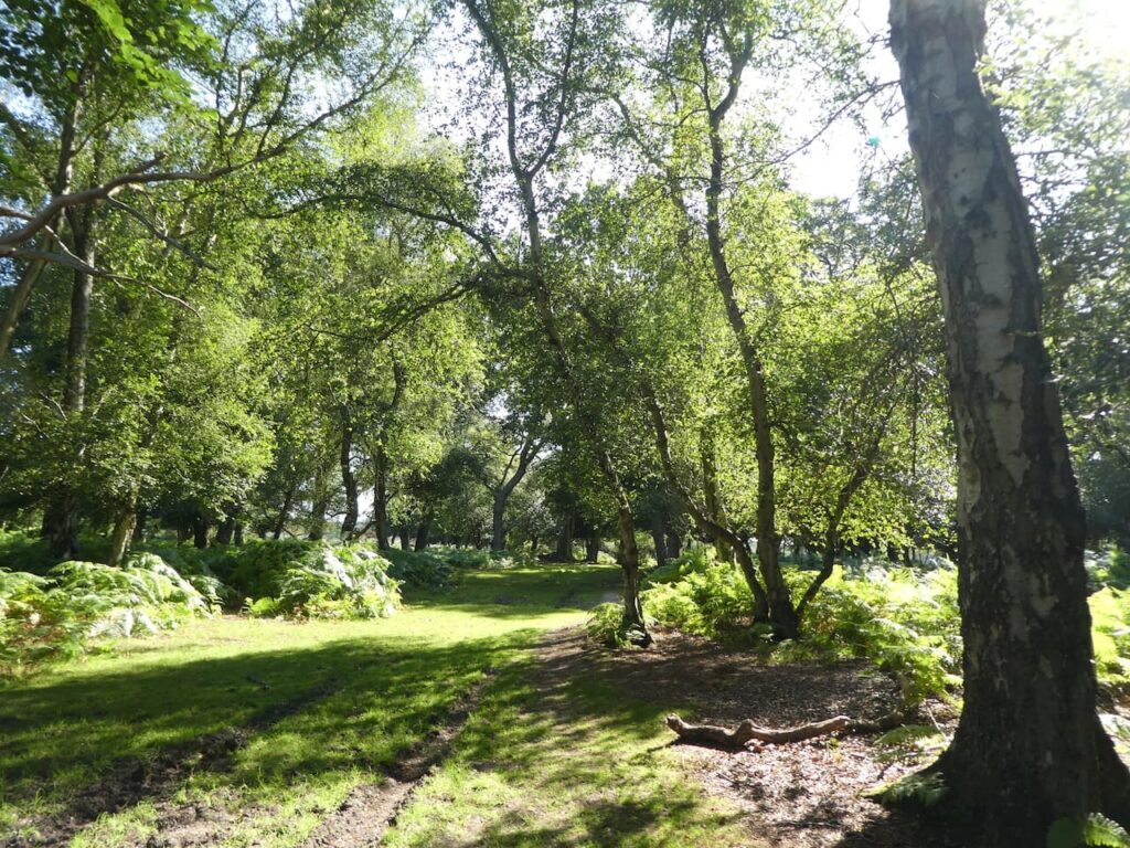
    On reaching a junction of paths I turn left and then at the next junction almost double back on myself following a path to the right.  This footpath follows the edge of the woodland.

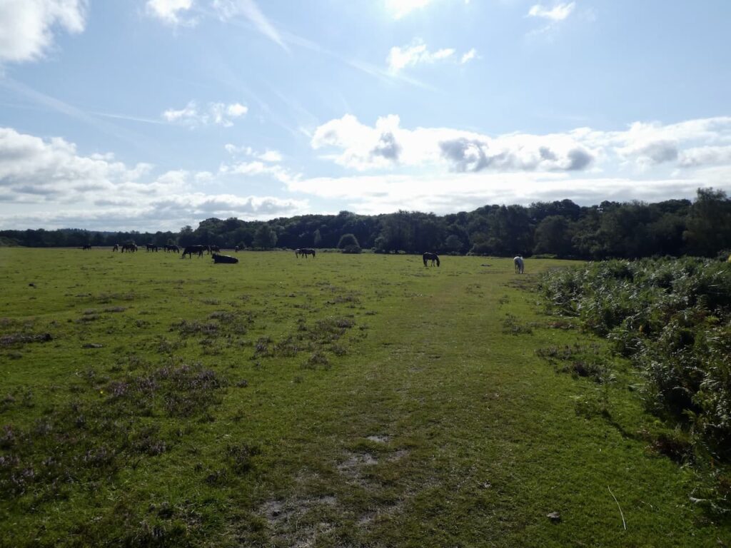
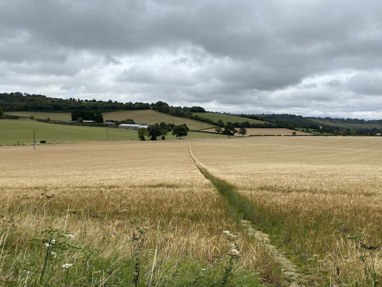
    Staying on the path I am soon above Hanger Farm, here the path sweeps to the right and descends steadily towards Fingest.  I ignore a footpath on my left leading down a track and go through a gate to enter the edge of pastureland.

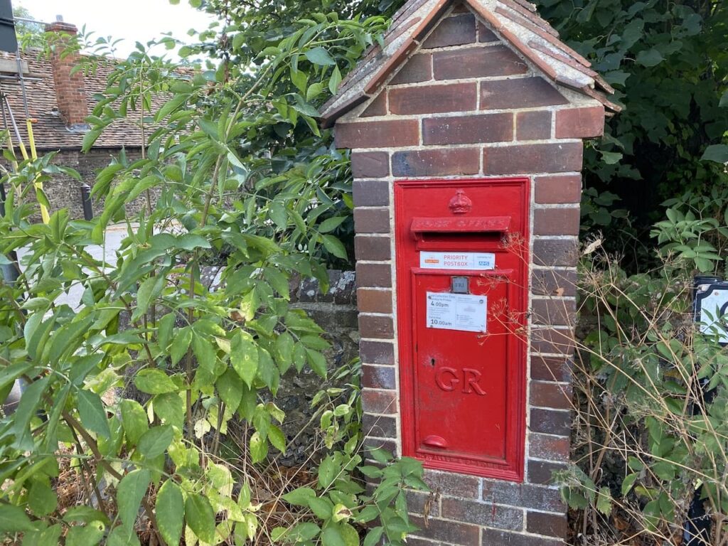
    This leads to a fenced and then hedged path that emerges back onto Chequers Lane near to Fingest church.  I turn left towards The Chequers Inn, in the church wall is a post box dating from the reign of King George V.

    At the junction I meet two women who are walking along each carrying a pint of beer. I comment on how it is a novel way of keeping hydrated when out walking and they explain they are on a walking pub crawl.  They started at the Stag and Huntsman in Hambledon, then visited the Frog at Skirmett and now in Fingest they are going to pop into the Chequers for another pint.  Just to ensure they keep topped up they are leaving each pub with a pint to drink along the trail.  They are American and are very enthusiastic about the countryside and the quaint pubs.  Apparently they are going to end their walk at the Bull & Butcher in Turville and then get a cab back to Henley-on-Thames for a night out!  

    I enjoy a pint and like a walk, but I never mix the two.  I am not sure what state these two are going to be in come 10.00 tonight.

    I now turn right and head past St Bartholomew’s church.  This Norman church has an unusual tower with a double gable, apparently it is the only one of its kind in the Country.

    As the road sweeps to the left I take a footpath on the right leading besides a property to reach a junction of paths.  Here I turn left and soon cross a minor road.

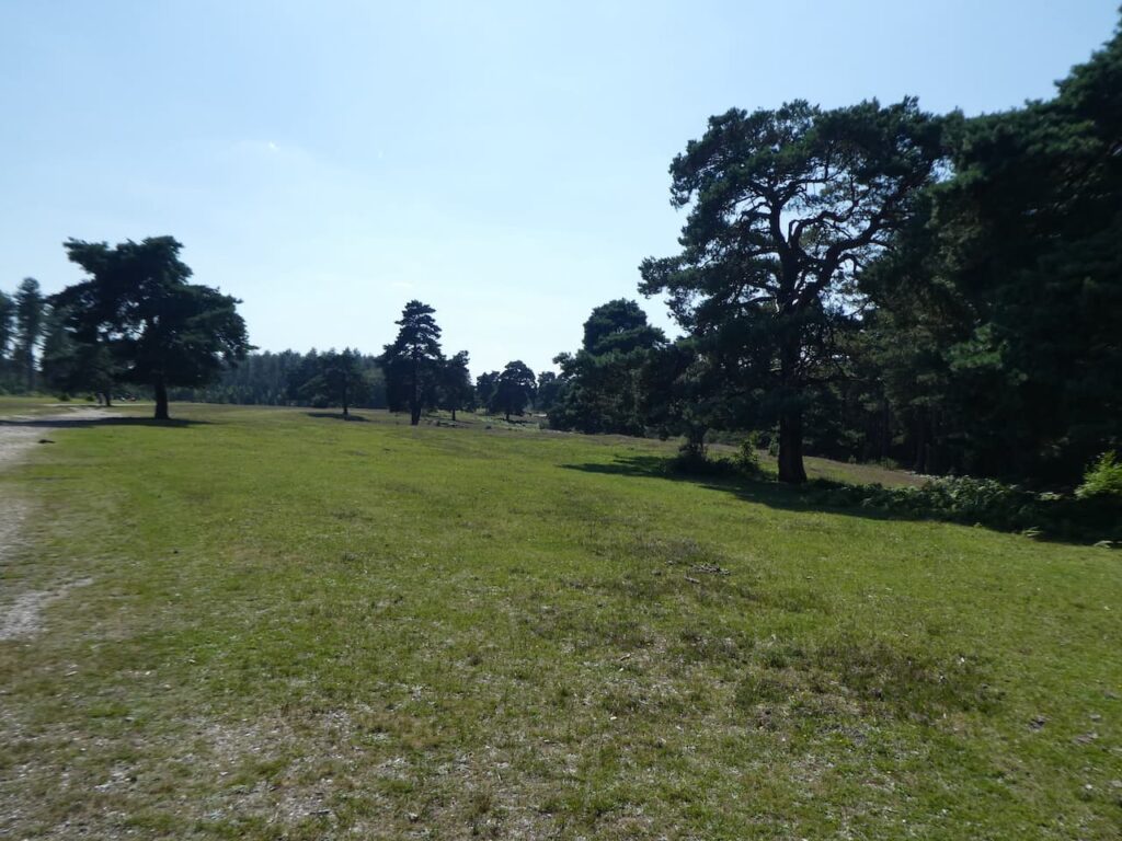
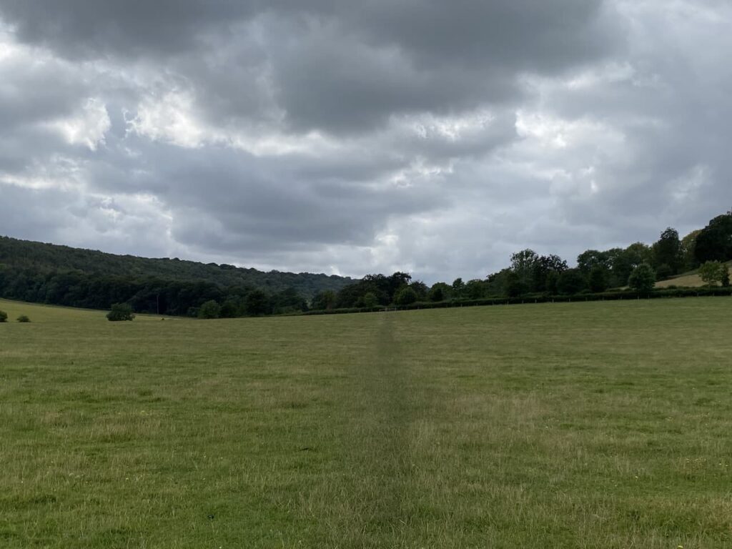
    Now the path continues under Turville Hill.  After going through a kissing gate I keep straight ahead across the Downs. On the hill to my right is Cobstone Mill which has featured in a number of films including Chitty-Chitty-Bang-Bang.  The two Americans I met earlier were very excited at the prospect of seeing this windmill.

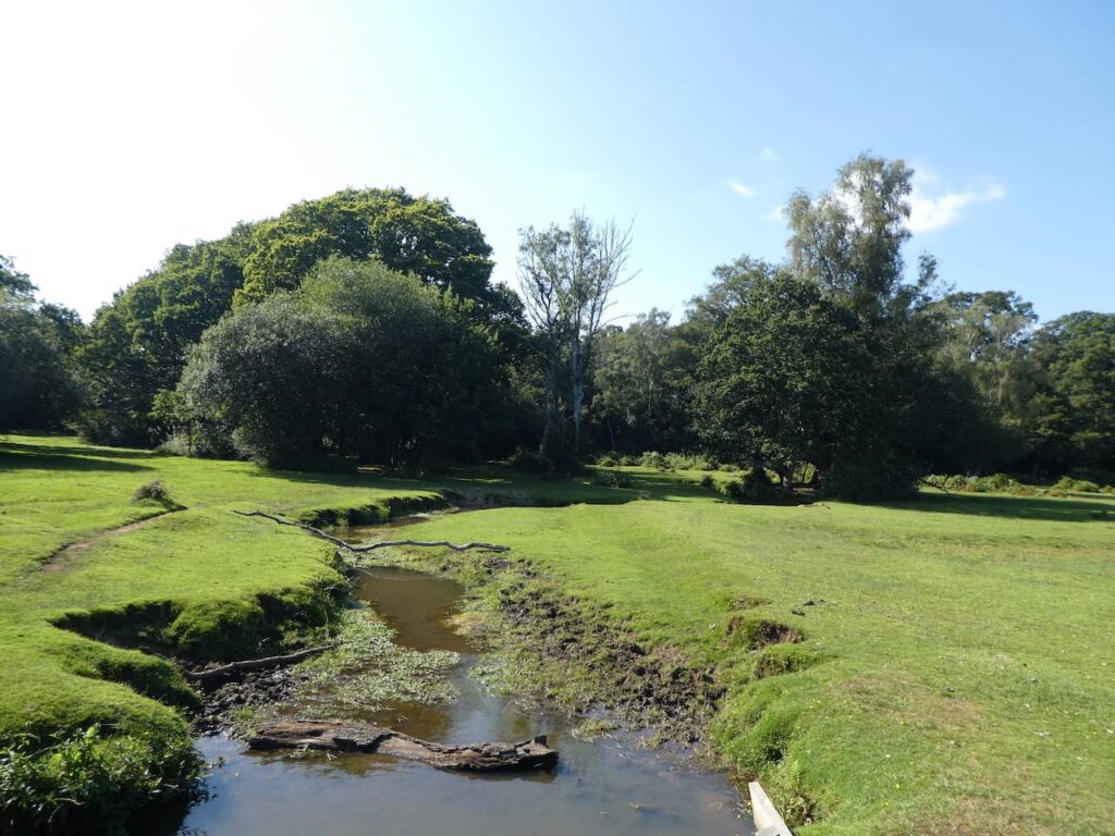
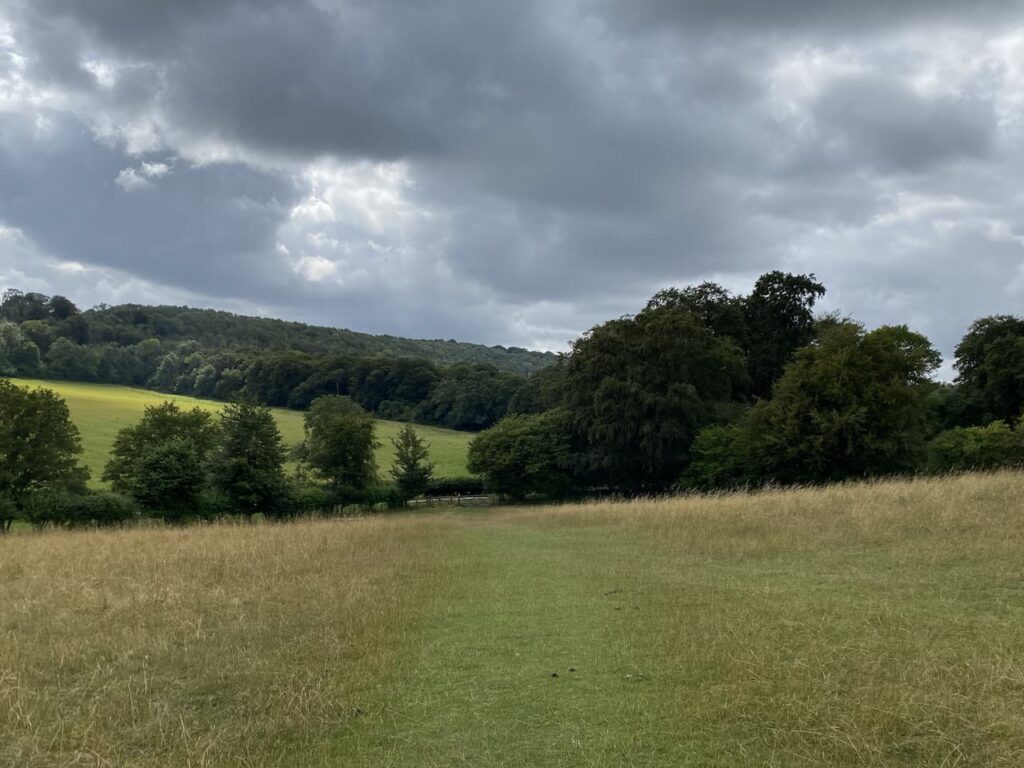
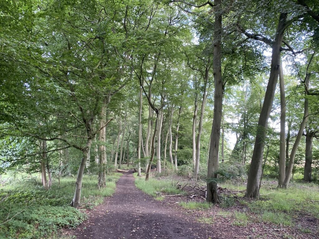
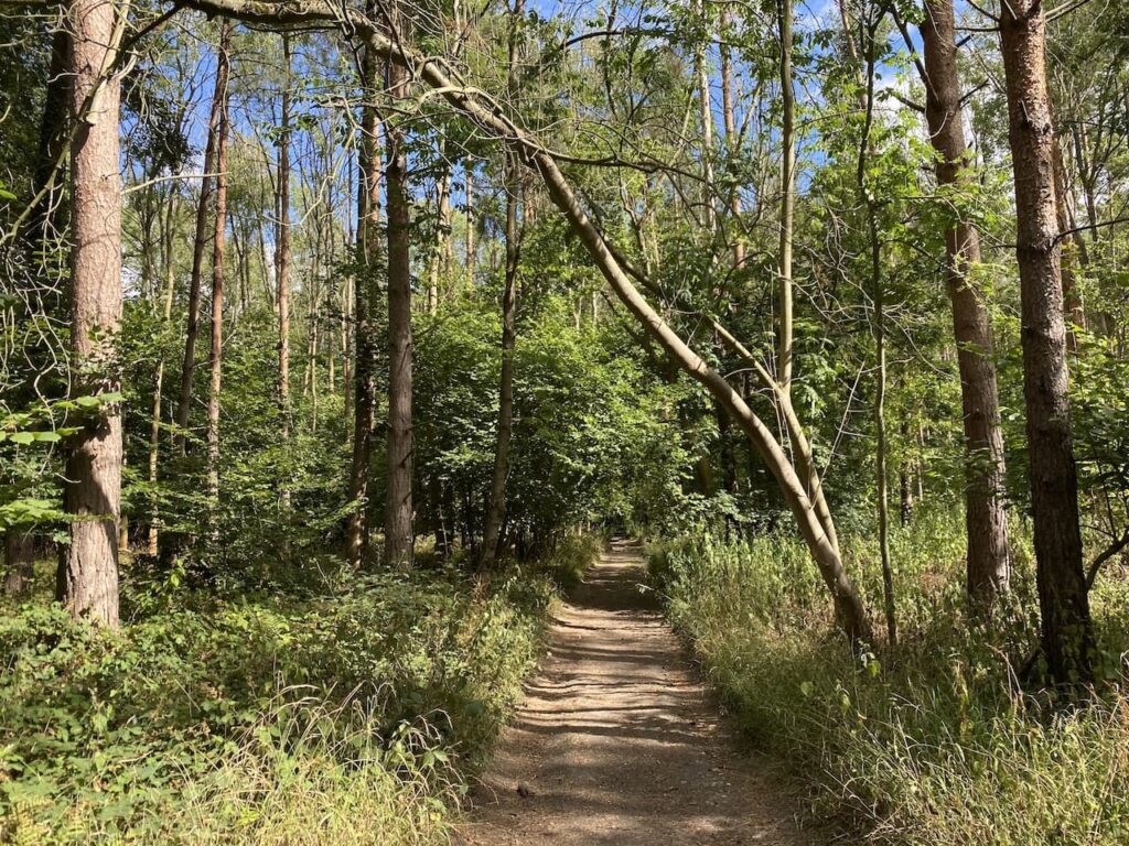
    At a junction of paths I turn left into Turville and then turn right to walk by the church and then stay on this minor road as it heads out of the village.  Shortly before reaching Turville Valley Farm I join a bridleway on the right that runs through woodland parallel to the road. 

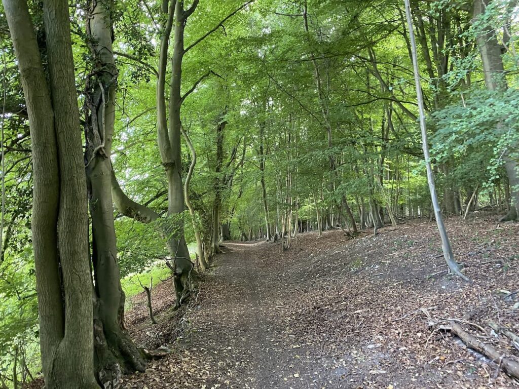
    After crossing a minor road I continue through Turville Wood and when the path forks go right to head steadily uphill on a track.

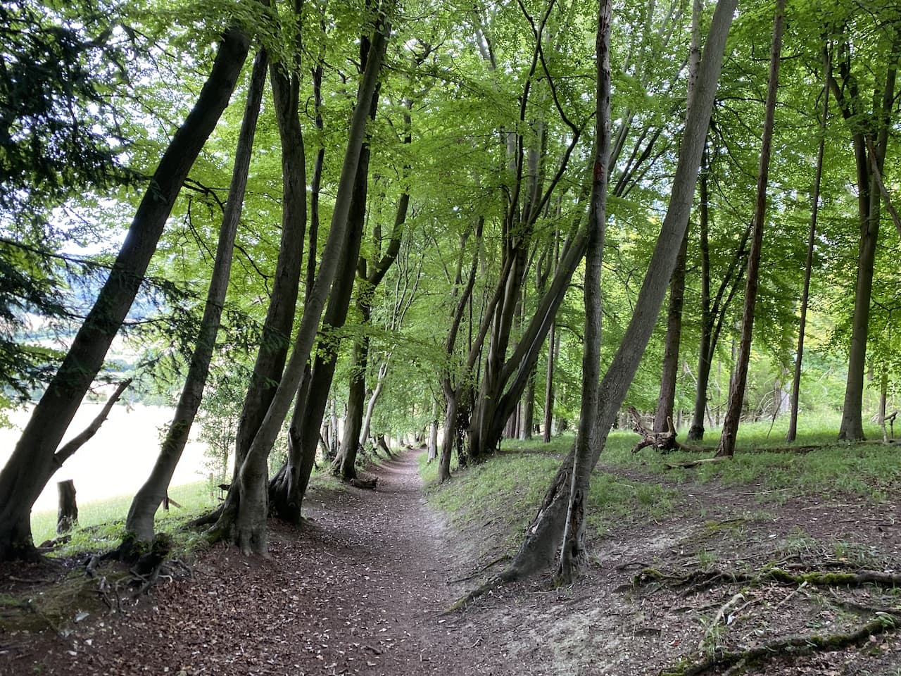
    This is another steady ascent and a good test of legs and lungs on a warm afternoon.   The path bends to the right and continues through a fine avenue of beech trees.

    Eventually as it starts to level out the path reaches a tarmac lane and I follow this back to Ibstone Common where the preparations are underway for the village fete tomorrow.

    At a junction I cross the road and return to the caravan down the driveway of Cholsey Grange.  It has been a cracking afternoon to be out, my walk has covered just over seven miles and my leg is showing no ill effects.  So tomorrow I will venture a bit further.

    You can view this 7 mile walk on OS Maps and download the GPX File Here

    To follow my walk you will need Ordnance Survey Explorer Map 171 – Chiltern Hills West

    5th August 2022

    © Two Dogs and an Awning (2022)

    All information on this site is provided free of charge and in good faith and no liability is accepted in respect of damage, loss or injury which might result from it.  To the best of my knowledge the routes are entirely on public rights of way or within areas that are open for public access.
    Walking can be hazardous and is done entirely at your own risk.  It is your responsibility to check your route and navigate using a map and compass.

  • Hippenscombe Bottom and Fosbury Camp

    Hippenscombe Bottom and Fosbury Camp

    It is with relief that I wave goodbye to January and we enter February.  At this time of year the end of winter is only a few weeks away and when the sun shines it radiates a bit of warmth.  Snowdrops and Catkins have started to appear and the days are becoming noticeably longer.  The other thing that lifts the spirits is exploring somewhere new with a walking buddy.  

    Today I am heading out with Nigel, one of my regular walking partners.  We meet up at the Lower Chute Club car park (SP11 9DU) (Grid Ref: SU308530) and plan to do a circuit from the village to the Hillfort at Fosbury Camp.  After the recent mild spell it is a chilly start to the day and there is a bit of drizzle about so we get kitted up in waterproofs and then leave the car park and turn right along Hatchet Hill and very quickly take a footpath on the right which leads between gardens to reach farmland where we continue along the edge of a field heading towards Malthouse Lane.

    At Malthouse Lane we turn left and continue into Upper Chute where we follow the road as it bends to the right soon reaching the Church of St Nicholas.  Apparently there are records of a church on this site dating back to 1320, but this was almost completely rebuilt in 1869-72.

    In the churchyard, close to the entrance path is an old water pump and trough.

    From the church we continue along the road and then at the end of the graveyard wall we go through a gate on the right and head diagonally across a field to reach a gate where we turn right and follow a track heading east.

    After crossing Dummer Lane we continue on the track.

    The path turns to the left at a gate, the map now has it marked as Breach Lane (Track).  We follow this to reach a junction with the Causeway, which was the route of the Roman Road between Winchester and Cirencester. After crossing the road I make a short diversion to walk along the field margin on the left and then briefly pop into the field to bag the Ordnance Survey trig pillar besides the Causeway.  This is my 290th trig.

    Returning to the track we continue to head north, soon we are walking besides Cleves Copse and the path starts to descend steeply and soon becomes fine sunken track.  Such tracks are centuries old and their sunken nature has been created by continuous use by drovers and cart wheels. 

    At the bottom of the hill we turn left and walk through the small hamlet of Hippenscombe and continue along a track as it passes through fields in the attractive Hippenscombe Bottom.

    The sun is breaking through and the rain appears to have blown over.  So we make use of a felled tree trunk to stop for our elevenses and take the opportunity to shed our waterproofs.  Refreshed we head off again still following the track which is now heading north and then sweeps to the left and continues through Hippenscombe Bottom to reach Scotspoor plantation.

    At a junction of paths in the plantation we continue straight on with the fence line to our right, this leads us to a minor road where we turn right and walk about a two hundred yards before taking a track on the left going in a northerly direction towards Tidcombe Down.

    We reach the southern edge of the open access land of Tidcombe Down and turn right at a junction of tracks to head downhill into Tidcombe.  This is a cracking spot, Lynnie and I walked this section of track on a very hot day last June.  It is a lot chillier today, but is still a great place to be.

    It is now a steady descent into Tidcombe where we make a brief diversion to visit the 14th century church of St Michael.

    From the church we turn right and retrace our steps for fifty yards and then take a way-marked path on the left which goes through a gate and descends across a field.

    The path, which is not marked on the OS Map, leads to a track where we turn right and follow this soon passing besides fields.

    When we reach a minor road we turn left and then very quickly take a footpath on the right which goes besides fields heading towards Beacon Farm.

    On reaching the driveway to Beacon Farm we turn right and follow the track as it skirts around the farm buildings and then continues to pass Tummer Copse .  At a junction of paths above Hippenscombe we look to find a way to enter the access land, but there is no clear way through the undergrowth so we go left and then through an open gate on the right which takes us along a track in a pasture field on the edge of the access land.  We spot walking boot tracks so assume that although this is not marked it is probably a permissive path.

    Entering another field the track continues along the edge of the access land and then we reach a point where we enter an area of shrubland and soon turn left to walk across the shrub to reach the Fosbury Camp trig pillar.

    Whilst we are looking at the view from the trig a quad bike approaches across the field.  We are aware that we are off the access land but are greeted warmly by the farmer who seems pleased to meet someone visiting his trig pillar.  We chat about trigs, farming on chalk downland and the New Forest.  We tell him the route we have walked and he seems content that we have walked along the edge of his field and he points the way to Fosbury Camp.

    Resuming our walk we continue along the edge of the access land to reach a gate to Fosbury Camp, the gate has a sign on it reminding people to close it which reinforces our thoughts that this is a permissive route.  Immediately we are in the ramparts of Fosbury Camp.

    Our route will follow the southern edge of the ramparts but we decide to have a look at the ramparts on the left which lead round to a cracking Dewpond.  These ponds sit on downland and have no flowing water supply, instead all the water comes from precipitation.  They are constructed to provide drinking water for livestock.

    Fosbury Camp is an Iron Age hill fort which covers an area of around 26 acres and sits on Knolls Down.  There are cracking views back over Hippenscombe.

    We follow the ramparts around to reach a footpath where we turn right and descend Knolls Down and follow the footpath along the edge of Oakhill Wood.

    We reach a minor road and turn right beside a cottage and then fork right along a track heading towards Hippenscombe.  We stay with the tarmac drive through Conholt Bottom until we reach a footpath on the left which we take and head diagonally back across Conholt Hill.

    We ascend the hill to reach a minor road and after going through a kissing gate turn right along the road and stay with this to reach a junction close to the entrance of Conholt Farm.  Here we take a footpath on the right which goes through a gate into Conholt Park.

    The path follows a clear route as it descends towards a gate and then follows a fenced path which leads into Chute Cadley. 

    We continue along a minor road through the village to reach a green in Lower Chute. 

    Here we go right passing the Hatchet Pub and then fork left to go up Hatchet Hill and reach our starting point in the Club car park.  It has been a cracking 14 mile walk and it won’t be too long before I return to this area for another walk.

    You can view this 14 mile walk on OS Maps and download the GPX File Here 

    To follow my walk you will need Ordnance Survey Outdoor Explorer 131 – Romsey, Andover & Test Valley

    4th February 2022

    © Two Dogs and an Awning (2022)

  • Three New Forest Trigs from Burley

    Three New Forest Trigs from Burley

    I am still exploring parts of the New Forest I have not previously walked.  Despite being so close to home it has never been high on my list of locations to walk.  However, since doing a navigation course there early last year I have begun to visit more frequently and have started to piece together the landscape.  An unexpected benefit of doing the navigation course was meeting the course leader Nigel, we have become walking buddies and his knowledge of the Forest means we visit some cracking spots.

    Today I am meeting Nigel at the car park besides Burley Cricket Club, (Grid Ref: SU215029).  The car park also serves as a drop off point for the village school located across the Green so it is pretty busy with comings and goings.  I played cricket locally for nearly thirty years but never played at Burley, which is a pity because it is a cracking spot.  The club was formed back in 1875 and moved to this pitch in 1912.  The outbreak of the World War I saw the club suspend play, but they resumed again in 1918 and have played here ever since.

    We leave the car park and cross the road and head west and then on meeting a minor road, Moorhill Road, we turn left and head south.  We leave Moorhill Lane to join a track signposted to Goats Pen Cottage.

    The track leads over Shappen Hill where we start to descend towards a disused railway line.

    On reaching the disused railway we turn right.  This is a section of the railway line that linked Brockenhurst and Ringwood, it was part of the line between Northam and Dorchester.  It was opened in 1847 and created at the instigation of a Wimborne solicitor called Charles Castleman.  The line took a circuitous route through the forest and was called ‘Castleman’s Snake’.  

    The route leaves the disused railway line and goes through a car park to cross a road and continue towards Long Pond.

    We are now on open heathland surrounded by heather and dead bracken.  It is interesting that most other places I have walked recently the bracken has only just started to brown, whereas here it is dead.  Nigel tells me that in the forest the bracken comes up much earlier and therefore dies back earlier too.

    We follow a path almost parallel to the railway line and then cross it on a bridge to head south towards Dur Hill Inclosure.

    Soon at a junction of tracks we turn left and then very quickly take another track on the right which goes South and starts to ascend the hill.  Many of the trees in the inclosure have been felled, so what looks like woodland on the map is heathland.  We reach a four way junction of tracks where we turn left  and then at the next junction we turn right to head south along a track by a few remaining trees.  Soon on our right is the Dur Hill Ordnance Survey trig pillar.  This is the 283rd I have bagged.

    From the trig post we head south on Dur Hill Down, along the way we meet a solitary cow.  There is no sign of any others so presumably she has become separated from the herd.  She stands in the path and nonchalantly watches as we pass by.  

    At the southern edge of the down we turn left and follow a path to cross a minor road at Cross Ways and then continue on the heathland opposite across Thorney Hill Holms towards Holmsley Inclosure.

    We head through the inclosure in an easterly direction following clear tracks to reach a minor road where we right.  We now have a short section besides this lane we it leads to the A35.  At the main road we turn left and then cross almost immediately opposite the Holmsley Toll House.  I am intrigued that the house has a crest of Edward VII on it.  The association with royalty is unclear, apparently Edward VII liked to visit the forest, but why he would have a crest on a toll house is not recorded.  It is odd given that the toll house stood on an old turnpike and these were abolished in the 1880’s.  

    After crossing the road we continue heading east  on a cycleway through Brownhill Inclosure. Our route continues into Wootton Coppice Inclosure to reach a minor road at Wootton Bridge.  We turn left and cross the bridge and then stay on the verge beside the road.  Just before reaching a junction we go right on a cycleway which soon joins the track bed of the old disused Brockenhust to Ringwood railway.

    We stay with the route of the railway until we reach caravans parked in the woods of Set Thorns Inclosure.  We have stayed at nearly a hundred caravan sites on our travels but never one that looks like this.  There are vans parked apparently haphazardly amongst the trees.  The wood is dense here and there is little light.  Many of the vans look like they have been pitched up for the season.  I prefer open spaces so it would definitely not be for me.

    We follow a track through the caravans to reach the Set Thorns Inclosure car park.  Here we turn left and walk besides the road to reach a T- junction where we turn right and follow a path running parallel to the road signposted to Brockenhurst and Battramsley.  Soon after passing a track to the Longslade View car park we spot the Sway Ordnance Survey Trig Pillar on our left and wander across to bag my 284th trig.

    From the trig we head in a northerly direction through the heather to pick up the track to the Longslade View car park and then continue along the track still heading north. The track soon starts to descend across Hincheslea Bog.  The recent rain means the water level here is high and has started to encroach on the track.

    This is a cracking spot and an area of the forest I have not visited.  I must bring Lynnie here before too long.  The path starts to rise and enters Hincheslea Wood where it turns to the left through the trees.

    Emerging from the trees we stay with a track heading across the gorse covered Horseshoe Earth to cross a minor road and then continue on a track to reach Wilverley Plain. Heading diagonally across this open space we see an abundance of sweet chestnuts.  This is odd because we are a long way from woodland and start to speculate as to how they could have ended up there.  We are heading towards Wilverley Inclosure, but before reaching the boundary of the trees we turn right along a broad grass path heading towards Wilverley Post.

    Our intended route is across the A35.  The best option is to use an underpass a bit further north, so we before reaching Wiverley Post we turn right along a track that heads towards Markway  Inclosure. 

    As the track ascends we veer to the left towards the A35 and then pick up a path running parallel to the main road.  This path soon becomes an old tarmac road with the cat’s eyes still visible.  This was the route of the old road before the new road was constructed.  We descend to the subway and pass under the main road.  The last time I used one of these underpasses it was in the heat of the summer and the tunnel was congested with ponies trying to get some shade. Today it is much cooler so we have the passage to ourselves. On the far side of the road we turn to the left and follow a track before heading across the heather to reach the Markway Hill Ordnance Survey Trig Pillar, this is number 285 for me.

    Returning to the track we turn left and head across heathland towards the Clay Hill car park.

    The car park is fenced off and looks as if it is going to be permanently closed, however, I later discover the closure relates to work being carried out on the nearby Holmsley Rail Bridge, so presumably it will reopen at some point in the future.

    We now follow a tarmac driveway from the car park that heads west.  This passes a pond at Holman’s Bottom.

    After the pond we carry on to reach a road junction, we cross a minor road and continue west on a path besides Wilverley Road heading towards Burley.  On either side of this road is the attractive Burley golf course.  I played here about forty years ago, in those days green fees were paid into an honesty box and the clubhouse facilities were very basic.  The course opened in 1906 and although not particularly long it is interesting and challenging, not least because of the livestock that roam around the fairways. There are nine holes, but played off separate tees to make up a full eighteen. If I pick up my clubs and start playing again I will make a point of revisiting this course.

    Staying parallel to the road leads us back to our starting point besides Burley Cricket pitch.  We have walked sixteen and a half miles through some places in the forest I have never been.  Gradually Nigel is changing my perception of walking in the New Forest so there is every chance I will be heading here again before too long.

    You can view this 16.5 mile walk on OS Maps and download the GPX File Here

    To follow our walk you will need Ordnance Survey Outdoor Explorer Map 22  – New Forest

    19th October 2021

    © Two Dogs and an Awning (2021)

    All information on this site is provided free of charge and in good faith and no liability is accepted in respect of damage, loss or injury which might result from it.  To the best of my knowledge the routes are entirely on public rights of way or within areas that are open for public access.
    Walking can be hazardous and is done entirely at your own risk.  It is your responsibility to check your route and navigate using a map and compass.

  • Three Trigs and an Observatory

    Three Trigs and an Observatory

    We have been home for a week following our caravan trip in Yorkshire and I have caught up with most of the gardening jobs so it is time for me to get in a full day’s walking.  Since arriving home I have popped out with Crosby for a couple of hours each day usually covering around seven miles, but I feel the need to get at least one good walk of over fifteen miles in each week.  So today I am heading out on my own to explore an area just over the county border in Hampshire.

    The starting point for my walk is West Down Car Park located just off the A3057 on Coley Lane (Postcode SO20 6AZ) (Grid Ref SU383389).  Leaving the car park I walk down to Coley Lane and take a footpath on the opposite side of the road to the left.  At a fingerpost I turn right to follow the path towards Andover.

    The path is now on the route of a disused railway line and to my left is the road bridge carrying the A 3057 over the former rail track.

    This section of the walk follows what was the route of the Andover to Redbridge railway line.  Opened in 1865 the line was apparently known as the Sprat and Winkle Line, the origins of which are unclear.  Like many other railways built in the mid 1800’s it followed the route of a canal.  The Andover and Redbridge Canal was completed in 1794 and operated for 63 years before the canal company decided the future was in railways.  They changed the company name to the Andover and Redbridge Railway company and set about filling in the canal and laying tracks.

    During World War I and II the railway was used to transport troops from their training camps on Salisbury Plain to the docks at Southampton and being a rural line also transported agricultural goods.  It was one of the lines that fell victim of the “Beeching Cuts” and ceased to operate in 1963.

    The footpath leads to a tarmac lane and I follow this heading towards the A3057, shortly before reaching the road I take a path on the left which goes under the road and then parallel to it to reach an attractive thatched cottage opposite Fullerton Mill.  This former corn mill was originally built in the late 1700’s and sits aside the River Anton.

    The road soon reaches a junction and I go to the right to continue steadily uphill.  For the time being I ignore a footpath on the right opposite the entrance of Fullerton Manor.  Instead I make a slight diversion to continue uphill beside the road to bag a trig point.

    This is a very quiet tree lined lane and it is a steady ascent to the top where the trees stop and there are good views.  But I have not come up here to admire the vista, I am after bagging the Fullerton Ordnance Survey trig pillar.  Sadly this one sitting beside the road has been knocked over, presumably by farm machinery entering the field via the nearby entrance.  It is a pity that whoever knocked it over did not take the time to put it back again.

    From the trig I return down the hill to the footpath, now on my left, opposite the entrance to Fullerton Grange.  This path takes a track across fields and becomes tree lined as it heads downhill to rejoin a section of the dismantled railway.  At a junction of paths I turn right following a way marker for the River Anton Way.

    I am not aware of having walked any of the River Anton Way prior to today.  It is a ten mile route from Charlton Lakes to the north of Andover to West Down car park where I started today’s walk.  Apparently the route crosses the River Anton seventeen times so is obviously never far from the river.

    The footpath heads towards the river and then briefly goes alongside it.  This is a tranquil spot, perhaps I should consider walking the whole of the River Anton Way one day.

    The footpath turns to the left crossing the river via a footbridge.  I pause to take in the beauty of this spot before continuing to a junction of footpaths where I turn right.

    The footpath emerges from a copse and goes besides fields to reach the A3057.  I cross and take a footpath on the opposite side leading onto Red Hill.  It is now a steady ascent following the path uphill with wide ranging views.

    Once over the hill the footpath descends to a minor road on the edge of Wherwell.  Here I turn left and follow the road for a few hundred metres and then take a footpath on the right which leads to a wooden footbridge crossing the River Test.

    There are a succession of bridges because at this point the river splits into a number of sections.  I am soon on firm ground at the edge of Chilbolton Cow Common.  This is open access land and there are a number of paths where folk regularly walk, however, I  keep with the Test Way as it heads across the common towards a footbridge where true to the name of the common a herd of cattle are grazing.

    I leave the route of the Test Way and take a path where a fingerpost points towards the Village Shop and Pub.

    The path leads into the village of Chilbolton where I turn left and soon pass the Abbotts Mitre pub.  When this pub first opened in 1924 on the site of the former blacksmiths and post office, it was known as the New Inn.  It kept that name until 1969 when it was renamed the Abbotts Mitre.

    I keep going through the village to reach the 12th century church of St Mary-the-Less, apparently this unusual name came about because in the 1400’s St Peter’s Church in nearby Andover was rededicated to St Mary. This made two St Mary’s churches in the same deanery so to distinguish them the Chilbolton church being smaller was named St Mary-the-Less.  The interesting spire was erected in 1872.

    From the church I return to a grass triangle and take the lane (Winchester Street)  heading south out of the village signposted to Newton Stacey and Barton Stacey.  At a road junction the lane I am on sweeps to the left and heads east to pass Gravel Hill Farm. 

    On reaching a cross roads I go straight over to follow the road signposted to Newton Stacey.  I now stay with this lane as it passes the Manor House and continues through the hamlet of Newton Stacey.  Staying with the lane to leave the hamlet I pass a couple of cottages and then as the road sweeps sharply to the right I take a footpath in front of me over a stile in a gap cut in the hedge.

    After the section on the tarmac lane it is good to be walking in a field again.  The well-worn footpath is easy to follow as it heads towards another minor road.

    At the road I turn left ignoring the footpath sign opposite leading across Moody’s Down and the MOD firing range at Barton Stacey. Apparently the footpath is known locally as Postman’s Walk, but it should only be attempted when there is no Red Flag.  When the Red Flag is hoisted there is live firing on the range so it would take a foolish postman to attempt it!

    My route along the road soon leads to my second Ordnance Survey trig pillar of the day.  This handsome trig has a bench conveniently besides it where I stop for a short break.

    Resuming my walk along another section of road I reach Barton Stacey.  Fortunately it is a back lane and I do not encounter any traffic.  In the village I pass All Saints Church, parts of which date back to the 12th century, and head into the village.

    I can’t recall visiting this village before.  Apparently it suffered a major fire in 1792 when most of the buildings were destroyed so the village was rebuilt.  At a junction by the church I turn left and then almost immediately take a right to join a single track lane (Bullington Lane) signposted to Bullington and Micheldever Station.  At a junction I fork to the right and keep going beside houses and then after the last house join a track, Barton Drove, which heads in an easterly direction.

    I stay with this track, which as it nears the A30 becomes a service road for the Sutton Scotney Services on the A34.  After carefully crossing the A30 I follow the path running parallel to the A34 before crossing on a road bridge and then passing Manor Farm.  I reach a road and turn left to walk along the pavement into the village of Sutton Scotney.  In the village I turn right by the Victoria Hall.

    At this junction is the war memorial with a convenient bench to stop for my lunch.

    Refreshed I resume my walk and take the lane from the War Memorial that heads east, but almost immediately take a footpath on the right beside a car park.  The way markers show I have now joined the Watercress Way.

    This is another long distance path I have not previously walked.  It is a 27 mile circular route going between Alresford, Kings Worthy and Sutton Scotney and much of the route follows the old Watercress railway line and the Didcot-Newbury-Southampton Railway.  The section I am now on is going over fields parallel to the old line to Southampton.

    The footpath brings me to a minor road where I turn right and then almost immediately take a left into the driveway of Wonston Manor Farm.  I now stay with this path as it heads in a southerly direction to pass West Stoke Farm.  On reaching a road I turn left and then at a crossroads at Wallers Ash I turn right and follow the road until I reach a track on the right, Ox Drove.  This track heads west.

    As I near South Wonston the path is blocked whilst the route is being re-laid.  Fortunately there is a diversion which leads me through fields and then rejoins the track in South Wonston.

    I reach a road which I cross and then take a bridge over the A34 and then follow a path which passes the South Wonston Water Tower. Just after the tower fencing I divert from my route and take a path on the left into a field.  This is not a footpath but is obviously well used by locals.  The field appears not to have been used for crops for some time and I walk across it to the Ordnance Survey Worthy Down trig pillar. The is my third trig of the day and the 282nd I have bagged.

    From the trig I retrace my steps to the footpath, pausing on the way to have a good look at the water tower.  This is the first time I have viewed it close up, previously I have seen it whilst driving along the A34.

    Rejoining the track I turn left and follow it towards the A272, along the way passing a World War II pillbox.

    At the road I turn right and walk along the wide verge for a few hundred yards before taking a bridleway on the left.

    I follow this track in a westerly direction, soon crossing a minor road and then at a crossing of tracks go straight on.  A bit further on I cross another crossing of tracks and then ignore a path on the left.  I take the next drove on my right and head in a north westerly direction towards the A30.  Arriving at the main road I cross and take a lane beside the Leckford Hutt.

    I continue along this lane until I reach the point where electricity wires cross above.  Here I take a bridleway on the right.  The path is a bit overgrown but I manage to find a way through without any problem.

    The route turns to the left and then continues along to reach the fence besides the Radio Telescope at the Chilbolton Observatory.  Established in the 1960’s this observatory is used for meteorological research and satellite tracking.  

    The track’s now a lot clearer and easy to follow.  At a junction of tracks I turn left and stay with this footpath as it goes through an area of downland and then reaches the track leading back to my starting point in West Down Nature Reserve car park.

    It has been a cracking walk, although with a bit more road walking than I would normally like but this has enabled me to bag three OS trig pillars.  I have covered twenty two miles and now it is time to head home and take Crosby out for a walk. 

    You can view this 22 mile walk on OS Maps and download the GPX File Here 

    To follow our walk you will need Ordnance Survey Explorer Map 131 – Romsey, Andover & Test Valley; OS Explorer – 144 – Basingstoke, Alton & Whitchurch, Odiham, Overton & Hook; and OS Explorer Leisure – OL32 – Winchester

    8th October 2021

    © Two Dogs and an Awning (2021)

    All information on this site is provided free of charge and in good faith and no liability is accepted in respect of damage, loss or injury which might result from it.  To the best of my knowledge the routes are entirely on public rights of way or within areas that are open for public access.
    Walking can be hazardous and is done entirely at your own risk.  It is your responsibility to check your route and navigate using a map and compass.

  • Three Trigs from Lyndhurst

    Three Trigs from Lyndhurst

    Over the last couple of years my walking buddy Mandy and I have been brushing up our navigation skills by attending the National Navigation Award Scheme courses run by Nigel from New Forest Navigation.  So far we have achieved the Bronze and Silver awards and will soon be heading off to the Brecon Beacons for the Gold course.  

    I quickly realised that the skills learnt on the courses needed to be frequently used to ensure they  embedded.  So today Mandy and I are heading out into the New Forest with map and compass whilst leaving our electronic navigation devices in our rucksacks.

    The starting point for our walk is the Bolton’s Bench car park, this is just off the A35 near the centre of Lyndhurst (Grid Ref: SU 303081).  From the car park we head across the grazing land gradually ascending to Bolton’s Bench.   This circular bench around Yew Trees on top of a natural hillock dates back to the 18th century and commemorates the Duke Of Bolton, whose family were apparently Master Keepers of the Burley Bailiwick.

    To our left is the Lyndhurst and Ashurst Cricket Ground, in the past I played cricket on a number of Forest pitches but this is one I never visited.  It is a cracking location and has a stunning old thatched pavilion.

    After passing the pavilion we soon reach a sandy area and head uphill to reach a fine water trough with and inscription indicating it was installed in 1902.

    Close to the water trough is the Lyndhurst Trig Pillar, this was my 236th trig when I bagged it last December.

    We are now heading in an easterly direction along a broad ridge, marked on the map as Park Pale.  Apparently this bank was the edge of a medieval deer park which is recorded as far back as 1291, on top of the ridge stood a paling fence which enclosed deer in the Lyndhurst Old Park.  This is one of the benefits of following a map, you spot references that could easily be missed if just following a line on an electronic device.

    As the path nears a minor road we keep to the left of it and then follow a path around Matley Wood.

    After passing around the side of the woods we cross a footbridge on King’s Passage and soon turn left to cross open land towards the railway line at Fulliford Passage.

    We don’t go through the railway bridge but instead turn to the right and walk parallel to the line and then on reaching another bridge go under the railway line.

    We now head east towards Decoy Pond Farm and then at a junction of paths fork to the right and follow a broad path towards the OS trig pillar on Yew Tree Heath.

    The trig is close to the track so easily located.

    Soon after passing the trig we reach a driveway to a parking area and turn right to reach a road which we cross and then continue heading south to go through a copse at the edge of Ferny Crofts.

    At a boundary we turn left and follow a path through trees and out onto open heathland which is marked on the map as Gurnetfields Furzebrake.  Along this ridge the map shows the location of a monument so we divert from our route to explore.  “This stone is erected to mark the spot where S Carter was killed whilst hunting with the N F hounds 16 Jan 1883” This is historically interesting, but I have never been a supporter of hunting with hounds and welcome the fact it is no longer legal.

    Returning to the main path we continue along the ridge and follow the path as it veers south and then heads east again to cross North Lane.  Our route continues heading east along an attractive forest path.

    We stay with this track as it heads onto Beaulieu Heath going towards Beaulieu Road, just before reaching the road we head south to bag the Ordnance Survey Trig point at Hill Top.  This is a slightly odd name because it sits on a large plateau and is only 40 metres above sea level.  A more accurate name would be “Little Hill Top” trig pillar.  When I first bagged this trig last December it was my 238th.

    From the trig we retrace our steps rejoining the main track and following it for a couple of hundred metres before turning to the right and heading north towards Dibden Inclosure.

    The track heads down to cross a footbridge beside a pond and then at a junction of paths we turn right and head north.

    We are now following a broad track with expansive views away to the west.  

    The route skirts the edge of woodland and then drops to cross a minor road before heading into Marchwood Inclosure through Sleepy Hollow.  We now follow a path along a wide avenue of trees as we head to the northern edge of the inclosure.

    We stay along the edge of the inclosure to reach a minor road which we cross and continue along the edge of the woods towards Foxhill Farm.  Today the ground is firm underfoot but when I walked this route in the winter it was very boggy.

    After passing Foxhiil Farm we stay close to the fence line until we reach a minor road near the edge of Longdown Inclosure.  Turning left and then very quickly right we follow a path around the northern edge of the inclosure, this leads to a car park where we turn left on a broad track besides the woods.

    At a junction of tracks, close to the railway line we turn right and head in a northwestern direction through Deerleap Inclosure.

    At a fork in the track we go left and soon turn left again to cross the railway line and continue towards Ashurst Lodge.  On reaching the tarmac driveway to the Lodge we turn right and  walk beside the single track driveway towards the A35.  Shortly before reaching the road we turn left to follow a grassy path beside trees to head south towards Beaulieu River on Longwater Lawn.

    We cross the river on a footbridge and then turn right and follow a clear path through Foxhill Moor.  This path enters trees and then turns to the left to head south towards Lyndhurst cemetery.

    We skirt around the cemetery and follow the driveway back to the car park.  Our nineteen mile route has been interesting and we have only used the map and compass.  Like many walks in the New Forest this one is difficult to describe because there are multiple options of paths which appear on the ground but are not shown on the map.  I therefore suggest that if you plan to follow this route you download the GPX file or make sure you mark up your paper map before setting off.

    To follow my walk, you will need Ordnance Survey Explorer Map OL22 – New Forest

    You can view this 19 mile walk on OS Maps and download the GPX File Here

    26th August 2021

    © Two Dogs and an Awning (2021)

    All information on this site is provided free of charge and in good faith and no liability is accepted in respect of damage, loss or injury which might result from it.  To the best of my knowledge the routes are entirely on public rights of way or within areas that are open for public access.
    Walking can be hazardous and is done entirely at your own risk.  It is your responsibility to check your route and navigate using a map and compass.

  • A Loop Around Studdridge Farm

    A Loop Around Studdridge Farm

    When staying at Cholsey Grange CL I don’t do many short walks, the exception being my regular couple of miles through the woods in the morning with Crosby.  However, I have a few things to do today and don’t have a lot of time for walking so have decided rather than rush a long walk I will take a steady stroll from the site.

    Leaving the caravan I go through the metal gate at the far end of the site and turn left and walk downhill into the woods and then in the valley in the woods I turn left and follow the clear path. 

    My route from here is very straightforward, I stay on the path at the bottom of the valley for just over two kilometres until I reach a stile besides a gate leading to a track besides an arable field. 

    Turning right I stay on the track as it skirts the field and passes fields with horses in.  On reaching a stile beside a gate I cross and then almost immediately go through a gate on the left to join the Chiltern Way.  This fenced path goes uphill and then through another gate to follow the hedge line around the edge of an arable field.

    I follow the path through a belt of trees and then through a gate to enter another field and continue besides the hedge.

    At a junction of paths besides a gate I follow the way-marker pointing left on the Chiltern Way and head diagonally across a field towards a clump of trees encircling a pond.

    After going through a gate I cross the driveway to Studdridge Farm and enter a field, within a few metres the Chiltern Way goes to the left through a gate and I follow it across a couple of fields towards Commonhill Wood.

    At a fork in the path I go to the right to stay with the Chiltern Way as it heads down through trees to the edge of a field.

    The footpath now runs along the edge of the field as it descends to a corner where the path divides.  I go left leaving the Chiltern Way to follow a footpath  steadily ascending through Hartmoor Wood.

    This path brings me back up to the farm buildings of Cholsey Grange where I return to the site via a gate into the caravan and motorhome storage area and head back down the driveway to the caravan where I get a good view of most of the four mile route I have just walked.

    You can view this 4 mile walk on OS Maps and download the GPX File Here

    To follow my walk you will need Ordnance Survey Explorer Map 171 – Chiltern Hills West

    16th August 2021

    © Two Dogs and an Awning (2021)

    All information on this site is provided free of charge and in good faith and no liability is accepted in respect of damage, loss or injury which might result from it.  To the best of my knowledge the routes are entirely on public rights of way or within areas that are open for public access.
    Walking can be hazardous and is done entirely at your own risk.  It is your responsibility to check your route and navigate using a map and compass.

  • Skirmett’s Roman Bricks

    Skirmett’s Roman Bricks

    On our travels I am always keen to find something interesting in an area which might not be a major tourist attraction but provides an insight into local history.  Around Ibstone many local villages have featured in films and TV programmes and I am sure keen followers flock to identify where scenes were shot.  Not being into TV or modern films I have little interest in these, but I do enjoy passing Cobstone Mill which features in Chitty Chitty Bang Bang.

    My interest lies in the slightly more obscure, and often the place or building I am interested in is identified by chatting to a local or looking at websites developed by local people.  The other evening I was looking at the Hambledon Parish Council website and discovered that a few buildings in Skirmett contain Roman bricks. I have previously walked through Skirmett but haven’t noticed the bricks, so today we are off to explore.

    We leave Cholsey Grange by heading along the farm driveway to reach Ibstone Common, we cross the road and continue along the lane (Gray’s Lane) until we reach a footpath on the left just before a white cottage.  This path leads steeply downhill into Parsonage Wood.  It is a cracking afternoon and this is a stunning bit of Beech woodland to be walking through.

    We stay with the path until we reach the edge of the churchyard of St Nicholas’ Church.  According to the church’s website there has been a church here for over a thousand years, the current building dates from about 1125. Unfortunately the church is locked so we can’t look inside.

    The church feels separated from the village, but apparently, until the time of the Black Death, the village of Ibstone was mainly located at the top of the lane.  Following the plague the main centre of the village moved a mile or so up the road towards the Common.

    From the church car park we turn left and then almost immediately right to head steeply downhill on a lane.  Within a few hundred metres we take a footpath on the left leading along the edge of Park Wood.  Sections of this woodland have been cleared recently opening up views into the valley.

    At a fork in the path we keep right and the path now follows the edge of the woods with a fence to our right.

    After passing through a kissing gate we head downhill on a clear footpath through trees and bushes.  This brings us to a gate onto access land where we go right to reach a gate into an arable field and cross this heading towards Turville.

    Following the footpath we reach a road in the village and turn left to pass the church and then take a right at the green to join School Lane.   

    Turville is one of those villages popular with film crews, amongst the programmes filmed here was the Vicar of Dibley.  Not something I watched but its popularity still draws people to this attractive village.  

    After passing the old school, which is now a nursery, we reach the end of School Lane and join a footpath.  After going through a gate we go straight on ignoring a path on the left and then soon pass another footpath on the right.  We then cross the field to our left on a path that leads diagonally across towards a minor road and woodland.

    After going through a gate we cross the road and enter Poynatts Wood.  We soon reach a field where we ignore a path to the right but keep straight on to re-enter the trees.  The footpath goes to the left and follows the contour line through another cracking bit of woodland.

    On leaving the woods the path descends towards Poynatts Farm.  To our left there are extensive views up the valley.

    On reaching a minor road in Skirmett we turn right and walk through the village passing the Frog pub and a number of attractive cottages.  We pass Stud Farm House and the road bends sharp to the right, but we turn left into Shogmoor Lane.  The barn to our left is one pf the properties in the village where roman bricks were re-used.

    Apparently the Romans had a number of villas along this valley as it was an important link between the River Thames and the Icknield Way and Ridgeway long distance routes.  When these villas fell into disrepair the bricks were incorporated into new buildings.  They can be identified by their thin irregular shapes.

    We now follow this lane for 250 metres to reach a bridleway on the right which we take to head uphill towards Hatchet Wood.  As we enter the woods there is a fork in the path and we keep to the right to head towards St Katherine’s Parmoor.

    This estate was once owned by the Knights Templar. In the 16th century it was the home of the Saunders family and in 1603 Mary Saunders and her husband Timothy Doyle extended the property. In 1860 Henry William Cripps QC purchased the property, this later passed to his son Charles Alfred Cripps QC who in 1914 became Lord Parmoor of Frieth.  His youngest son was Stafford Cripps the post war Chancellor of the Exchequer.

    When Lord Parmoor died in 1941 the house was let to King Zog of Albania, he had been forced into exile when Mussolini invaded his Country. In 1946 King Zog left for Egypt and the house lay empty for a while before the second Lord Parmoor sold it to the Community of St Katharine of Alexandria who had been bombed out of their home in Fulham.  In 1995 the last remaining member of the Community, Mother Christine, gave the house to Lady Ryder of The Sue Ryder Foundation, it has remained a separate charity providing a spiritual retreat.

    After passing the edge of the retreat we reach a minor road which we cross and turn left to join a path on the other side of the trees which runs besides the edge of a field.

    We stay with the path to go through gates and pass farm buildings and then at a junction of paths keep heading in a northerly direction towards Frieth.  In the village we turn left along a road and then very quickly take a right to follow a lane (Innings Road) towards Little Frieth.  At a junction with Spurgrove Lane we continue straight on along Innings Lane which soon becomes a track.  

    We ignore a path on the left leading to Adam’s Wood and continue along the track to reach Mousells Wood.  Here we stay with the track, not entering the woods, to reach a gateway into a field, joining the Chiltern Way to head across the field.

    On the far side of the field we enter Fingest Wood.

    The clear path leads us through the trees to a stile beside a gate.  From here there are fine views down the valley and in the distance we can see the caravans at Cholsey Grange.

    We now follow the Chiltern Way as it heads downhill into Fingest.

    At a minor road we turn left and walk through the village to pass the Chequers pub and church and then take a footpath on the right.  This goes through a gate and continues besides a wall to reach a junction of paths where go right to walk through Mill Hanging Wood.

    On reaching a junction of paths at Gravesend we turn left and follow the path through the bottom of the valley towards Twigside Bottom.

    After a mile and a half on this path we reach a junction of paths at a clearing and turn left to head uphill towards Cholsey Grange.

    It has been a cracking ten mile walk through some stunning woodland and we achieved our aim of finding some of the Roman bricks in Skirmett. 

    You can view this 10 mile walk on OS Maps and download the GPX File Here

    To follow my walk you will need Ordnance Survey Explorer Map 171 – Chiltern Hills West

    15th August 2021

    © Two Dogs and an Awning (2021)

    All information on this site is provided free of charge and in good faith and no liability is accepted in respect of damage, loss or injury which might result from it.  To the best of my knowledge the routes are entirely on public rights of way or within areas that are open for public access.
    Walking can be hazardous and is done entirely at your own risk.  It is your responsibility to check your route and navigate using a map and compass.

  • Brightwell Baldwin and Britwell Salome

    Brightwell Baldwin and Britwell Salome

    Having spent over a week walking from Cholsey Grange CL today the car is moving for the first time since we arrived.  The starting point for our walk is the attractive Oxfordshire village of Ewelme which is about ten miles from Ibstone.

    We park in the car park besides the village playing field and then start our walk by heading into the village, soon reaching the fine building that is the primary school.  The school was originally founded in 1437 by the Duchess of Suffolk, Alice Chaucer (the granddaughter of Geoffrey Chaucer).  The medieval buildings are still used today as classrooms.

    We continue into the village and pass the village pond and turn right to pass the Village Shop, which is also a tea room.

    Walking up the road we reach the village pound, this is where stray animals would have been penned until their owners could be identified.  These days you rarely see stock wandering freely, but when I was a nipper it was a frequent occurrence in my home village.  I recall waking in the middle of the night to find a herd of heifers in the back garden and on another occasion it was a flock of sheep.

    Opposite the pound is a building which was once the stable of Nancy the Warhorse.  A notice board explains the story of how Nancy was Sergeant Thomas Champion Orpwood’s mount with the Queen’s Own Oxfordshire Hussars in France  during World War I.  After the war Orpwood and Nancy returned to England and unloaded at Culham Railway Station, near Abingdon. As they reached the edge of the village Orpwood stopped at the Shepherd’s Hut for a pint and the horse continued on her own back to her stable.

    At a junction we turn left into Chaucer Court and then follow the footpath as it goes left again to pass converted barns and then right past more converted barns.  We are now on a bridleway heading north towards the B4009 besides fields.

    We stay with this path to reach the B4009, ignoring paths to the left and right.  At the road we cross and take a minor road opposite signposted to Brightwell Baldwin and Cuxham.  In just over a hundred yards we take a track on the left, Rumbolds Lane, going north towards Rumbolds Farm.  This is a clear track, but because of the time of year it is slightly overgrown in parts.

    After passing the barns of Rumbolds Farm we continue on the track to reach a crossing of paths.  Here we turn right on a broad track between fields.

    The track leads through gates into fields and then joins a track heading downhill towards Brightwell Baldwin.  On reaching a junction with a track we turn right and then at a minor road turn left to pass a gate house and continue into the village to reach St Bartholomew’s church.  Parts of this church, including the stair turret, date to the 13th century.

    Opposite the church is the attractive Lord Nelson Inn, we rarely stop at a pub on our walk as I am not keen on drinking in the daytime.  So we decide to pass and pop back another time to take a look.

    We continue through this pretty village, apparently its name derives from the old English for bright spring and the Baldwin part relates to the name of the family who once owned the manor.

    We stay with the road through the village and pass the Old Rectory on the right and soon after reach a crossing of tracks.  Here we turn right onto Turner’s Green Lane waymarked to Britwell Salome.  We have now joined the route of the Shakespeare’s Way and follow this to reach Britwell Salome.

    Just before reaching the road we take a path on the left which goes through a gate besides a cattle grid, still on the route of the Shakespeare’s Way.  The way-markers lead us around the field to reach a gate onto a lane where we turn left and follow this to reach St Nicholas Church.  Originally built in the 12th and 13th century it underwent major renovations between 1865-67.

    The church is open so we pop inside.  It has a fine 13th century font with a 17th century cover and behind it a very grand organ for the size of the church.

    From the churchyard we turn left and follow the track to cross a cattle grid and continue along a path and then through a paddock to reach the B4009.  

    We cross with care and turn right for about twenty yards and then turn left to join a track.  This is still the Shakespeare’s Way; this long distance path stretches 146 miles from Stratford-on-Avon to the Globe theatre in London.  This section leads us to the Ridgeway path where we turn right.

    The route now follows the Ridgeway soon crossing a minor road and continuing to North Farm where the Ridgeway veers to the left. Here we stay on the track and soon go by the edge of Icknieldbank Plantation.  

    Reaching a minor road we continue straight along it for a few hundred yards and then turn right on the Chiltern Way heading uphill.  We pass an area of outdoor reared pigs and then an arable field.

    We continue with the Cotswold Way to reach a minor road where we turn left and walk the short distance back to our starting place.  

    You can view this 9.5 mile walk on OS Maps and download the GPX File Here

    To follow our walk you will need Ordnance Survey Outdoor Explorer 171 Chiltern Hills West

    14th August 2021

    © Two Dogs and an Awning (2021)

    All information on this site is provided free of charge and in good faith and no liability is accepted in respect of damage, loss or injury which might result from it.  To the best of my knowledge the routes are entirely on public rights of way or within areas that are open for public access.
    Walking can be hazardous and is done entirely at your own risk.  It is your responsibility to check your route and navigate using a map and compass.

  • Returning to Bottom Wood

    Returning to Bottom Wood

    After a week on my own in the caravan I have been joined by Lynnie.  She has decided to join me on a walk today as part of my planned route is through Bottom Wood.  I walked there a week ago and told Lynnie how stunning it was and she is keen to see for herself.

    We set off from Cholsey Grange by the farm track, heading downhill to reach the footpath leading into Penley Wood.  At the junction of paths we turn right and head towards the woods and then in the trees take a path on the left.

    We stay on the path at the bottom of the valley until we reach a stile beside a gate leading to a track alongside an arable field. 

    Turning right on the track we stay with it skirting the field and passing fields with horses in.  At a stile besides a gate we cross and continue on the track to go through the tunnel under the M40 and walk into Stokenchurch.  We continue across the green to pass the Kings Hotel and then join Church Street following this to the junction with Park Street where we turn right besides the Royal Oak pub.

    We have now joined the Chiltern Way and at a fork in the path we go right through a gate and stay with this long distance path as it heads across fields.

    Through another kissing gate we soon join a track where we go right and follow the way-markers with the footpath running beside a hedge.

    At a junction of paths we stay with the Chiltern Way heading diagonally across a field towards farm buildings in the distance.

    At a junction of paths we turn right and within a very short distance go left to cross a stile and continue towards the farm.  After crossing a farm track the path ascends steeply towards Andridge Farm.  Stopping for a breather we get a fine view back across the valley.

    After going through gates the path joins a track.  Here we leave the Chiltern Way and follow the driveway to reach Sprigs Holly Lane where we turn right and head steadily downhill into Radnage. It was our intention to visit the church in the village, but there is a funeral service going on so we’ll return another day.

    At a junction we turn left  and follow the road towards the church and then after a couple of hundred metres we go right on the Chiltern Way heading towards Bledlow Ridge.

    This path leads into Yoesden Nature reserve, this is a thirty-two acre site managed by the Berkshire, Buckinghamshire and Oxfordshire Wildlife Trust and is a combination of chalk downland and Beech woodland.  Before becoming a nature reserve the trees in the woodland would have been managed to produce timber for the furniture industry.

    This a cracking spot and there are some great views as we ascend the ridge.

    Keeping with the Chiltern Way we follow the path to reach the village of Bledlow Ridge where we turn right and walk along the pavement until we reach St Paul’s Church.

    In 1801 a church was built to the north of the village but this was replaced in 1834 on a site more central to the village.  However, that church was then replaced in 1868 by the current building.

    This church has the feeling of one that is being regularly used for community activities.  So many churches we visit feel like they are used for a service once a week and in between hardly anyone ventures in.  

    Leaving the church we continue through the village to pass Haw Lane on our left and then 50 metres further on take a track on the right.  We stay with this track as it descends steeply to reach Bottom Road where we turn left and then after 50 metres right to follow a path besides fields.

    We reach a minor road in an area of Radnage known as The City.  Although sparsely populated Radnage village spreads across a wide area.  Apparently this part of the village once formed part of the village known as Radnage Manor, this was owned by the Crown. King Charles I mortgaged the land to the City of London.

    On reaching Radnage Common Road we turn right and soon pass a playing field before continuing down the lane to reach Ashridge Farm.  At a junction of paths we keep left to follow a wide path towards Bottom Wood.

    The track leads through a gate into the woods.  Now we turn left and follow a broad track through this attractive area of woodland.  An information board explains the 36 acre Bottom Wood is owned by the Chiltern Society and was given to the charity in 1984 by nearby resident Cynthia Ercolani.  Later research suggests that Cynthia was the wife of Lucian Ercolani whose family ran the Ercol furniture business based in High Wycombe.

    Staying with the track we go through the bottom of the woods and pass a concrete slab covering a well.  Apparently this well is 100 feet deep and was once used to provide water to the nearby hamlets of Beacon’s Bottom and Radnage Common.

    The route through the bottom of these woods is an old packhorse trail.  After leaving the trees the route continues along a track to reach Ham Farm.

    After passing the farm we reach the A40 and cross to join a minor road opposite which is the Dashwood Roadhouse pub.  After 50 metres we leave the road and turn right onto a farm track heading towards Hillingdon Farm.

    Past the farm we continue to reach a crossing of paths, we go straight on through a belt of trees towards Barn Wood.

    After 300 metres we reach the edge of Barn Wood, at a junction of paths, we continue straight on through the woodland following a path towards Leygrove’s Wood.  On entering Leygrove’s Wood we carry straight on now on a broad track.

    On leaving the woods we go through a small clearing and then enter Pound Wood and stay with the track through the wood until we fork left onto a footpath that heads steadily uphill to reach a tunnel under the M40.

    On the far side of the tunnel we follow the track up to the B482 and turn right to join a pavement and pass a school.  We now cross the road and then a village green and follow the lane into Cadmore End. After passing the church we turn right on a footpath along a track heading out of the village.  

    At a junction of paths we turn left to stay on the track as it heads downhill to reach the edge of Hanger Wood.  As we enter the trees the path divides, we take the right fork.

    About two hundred metres further on we take a footpath on the right which heads through the trees to pass a dew pond on our left.

    The path now descends steeply to reach a gate into a field of pasture where we pass a redundant stile.

    As the path heads downhill there are fine views towards Fingest.

    After passing through two gates we reach a minor road, Chequers Lane, where we turn right and then very soon after turn left along a track with footpath way-markers.  We now follow this track through the bottom of the valley towards Twigside Bottom.

    After a mile and a half on this path we reach a junction of paths at a clearing and turn left to head uphill towards Cholsey Grange.

    This path brings us to the metal gate at the south side of the caravan site. 

    You can view this 14 mile walk on OS Maps and download the GPX File Here

    To follow my walk you will need Ordnance Survey Explorer Map 171 – Chiltern Hills West

    12th August 2021

    © Two Dogs and an Awning (2021)

    All information on this site is provided free of charge and in good faith and no liability is accepted in respect of damage, loss or injury which might result from it.  To the best of my knowledge the routes are entirely on public rights of way or within areas that are open for public access.
    Walking can be hazardous and is done entirely at your own risk.  It is your responsibility to check your route and navigate using a map and compass.

  • Royal Blue in the Chilterns

    Royal Blue in the Chilterns

    I am continuing my quest to walk routes from Cholsey Grange CL I have not  previously walked.  I have been on all the paths I have planned for today, but I don’t recall connecting them together in this circuit.

    Heading out from the caravan I go through the metal gate at the far end of the site and turn left and walk downhill into the woods and then in the valley in the woods I turn left and follow the clear path.  Since I was here last year the Ash die back has seriously affected the Ash trees and a number have been felled.  Sadly more need to be cleared soon.

    My route from here is very straightforward, I stay on the path at the bottom of the valley for just over two kilometres until I reach a stile besides a gate leading to a track besides an arable field. 

    Turning right on the track I stay with this as it skirts the field and passes fields with horses in.  On reaching a stile besides a gate I cross and then almost immediately go through a gate on the left to join the Chiltern Way.  This fenced path goes uphill and then through another gate to follow the hedge line around the edge of an arable field.

    The path goes down through a belt of trees and then through a gate to enter another field.  I continue besides the hedge and stop to pick a few blackberries for Crosby, he prefers it when I pick them for him, whereas my old dog Dexter would happily select the ripe ones for himself!

    At a junction of paths besides a gate I continue straight on leaving the Chiltern Way.

    My route now goes along a track and through a gate to cross the driveway to Studdridge Farm and then through another gate into a field.  At a stile I enter woodland and follow the clear path through the trees to reach a minor road which I cross and then follow a path into the Wormsley Estate.  This path soon starts to descend through Bowley’s Wood towards Wellground Farm.

    On reaching an estate road near Wellground Farm I turn left and follow the road as it heads south and passes the entrance to Wormsley Cricket Ground.  The road now becomes a track and on reaching a clearing there is a fork in the footpath where I go to the right to walk along the valley.

    After 600 metres I reach a junction of paths and turn right to rejoin the Chiltern Way via a kissing gate and cross a field.

    I have walked this section of the Chiltern Way on many occasions, I keep wondering whether I should tackle the 125 mile long distance circular walk.  It looks interesting. But there are a several other long distance paths I would like to do first.

    After crossing the field I go through a kissing gate and cross an estate road to another kissing gate and then descend across a field towards a gate.

    Through the gate I briefly join an estate road before following the Chiltern Way markers and take a footpath on the left.  At a junction of paths I fork left to stay on the Chiltern Way as it goes through Blackmoor Wood.

    The path now ascends steeply, this is one of those hills in the Chilterns that make the legs burn, but I keep a steady pace and make it to the top without stopping.  However, I am grateful when it levels out and continues to reach a minor road in Northend.

    After crossing the road I follow the Chiltern Way signs which initially follow a gravel track and then go on a pathway besides a house to reach a junction of paths.  Here I turn left to stay with the Chiltern Way as it goes through arable fields.

    The path leads into the stunning beech woodland of Fire Wood.  My walks at home and on our travels frequently take me through woods, my favourite by far is walking amongst beech trees.

    On reaching a crossing of paths I turn left and follow a track through Longhill Hanging Wood and continue on to Turville Park Farm.  I have passed this farm before and I am always intrigued by the old coaches in the barns, but I have never seen anyone around to talk about the collection.  Today pride of place seems to be allocated to a Royal Blue coach which says it is heading to Cheltenham.

    Apparently the Royal Blue coaches used to operate in South West England.  The company was formed in 1880 in Bournemouth by Thomas Elliott and was initially known as the Royal Blues and Branksome Mews.  In those days it ran horse drawn carriages but in 1913 Thomas’ two sons were leading the business and purchased its first motor charabanc.

    Gradually the company acquired other local bus services and became a major operator in the south west before the Elliott brothers sold the company in 1934 to Western National and Southern National. Later Lynnie says she remembers travelling to Devon from Poole on holidays on the Royal Blue coach, but assures me it wasn’t the charabanc! 

    After passing the farm I continue along the track and then go through a gate and stay with the track between arable fields.

    At a junction of paths I turn left and head up the hill, this is another short steep ascent and at the top there is a conveniently placed bench where I sit and have a drink and admire the view.

    Refreshed I resume walking along a fence lined track towards Balham’s Lane.

    At the road I turn left and walk steadily uphill to reach Turville Heath which I cross towards the Barn cafe.

    At the cafe I turn left and then after passing a cottage take a bridleway on the right which soon starts to descend steeply on a sunken track.  At the bottom of the hill the track continues through another attractive beech copse.

    On reaching a minor road, Holloway Lane, I cross and turn right to follow a clear path heading downhill through the trees.

    At a junction of paths on an estate road I continue straight on and then after 150 metres on reaching another junction of paths I turn left.  This path soon starts the long gradual ascent back towards Ibstone.

    The path leads to a tarmac lane which I continue to follow to return into the village besides the common and cricket pitch.

    From here I cross the road and follow the farm drive back into Cholsey Grange.  My wander about has covered just over eleven miles and has taken me through some cracking woodland.

    You can view this 11.25 mile walk on OS Maps and download the GPX File Here

    To follow my walk you will need Ordnance Survey Explorer Map 171 – Chiltern Hills West

    8th August 2021

    © Two Dogs and an Awning (2021)

    All information on this site is provided free of charge and in good faith and no liability is accepted in respect of damage, loss or injury which might result from it.  To the best of my knowledge the routes are entirely on public rights of way or within areas that are open for public access.
    Walking can be hazardous and is done entirely at your own risk.  It is your responsibility to check your route and navigate using a map and compass.