Category: North East

  • Arriving at East Cawledge Park CL

    Arriving at East Cawledge Park CL

    After a couple of weeks at home we are on our travels again this time taking an extended tour and heading to Scotland for the first time since 2017.  A trip to Scotland is a long way from Wiltshire so we decided to break the journey up by staying  last night at the CAMC Poolsbrook site.  It is very convenient to the M1 and has the added bonus of having a pleasant walk around the neighbouring country park.

    Today we have travelled another 180-miles further north and pulled into East Cawledge Park CL near Alnwick.  Northumberland is not an area we have walked in much so our itinerary is to stay here for a week before heading up to Fife.

    It does not take us long to get pitched up and we are soon lacing up the boots and heading out for a walk from the caravan site.  We walk down the entrance driveway and then turn right on a track heading towards Aln Valley Heritage Railway following the waymarkers towards Alnmouth.

    We pass the gated entrance to the railway and continue on the clear path.

    This track leads us down the fenced railway line where we turn right and continue to head towards Alnmouth on a footpath along the Aln Valley Cycleway.

    This is the route of the former Alnwick branch line which ran from Alnmouth Railway Station on the East Coast Mainline to Alnwick, a distance of two and three quarters miles.   The line opened in 1850 and operated a freight and passenger service until closure in 1968.

    A mile stretch of the line is now used by the Aln Valley Railway, it is their intention to try and re-establish the line from their newly built Lionheart Station, near the A1, through to Alnmouth Station.  In 2017 they opened a mile of the line from the new station to Greenrigg Halt on the opposite side of the Cawledge Viaduct.

    After passing Greenrigg Halt the path leaves the side of the railway line and joins a track.  Here we turn right and walk up to Greenrigg where we turn left on a minor road which we follow to reach a road junction at Bilton.   Here we turn left and walk downhill to cross the railway line and entrance to Alnmouth Station.  We continue straight on at a roundabout towards Alnmouth to join the English Coastal Path.

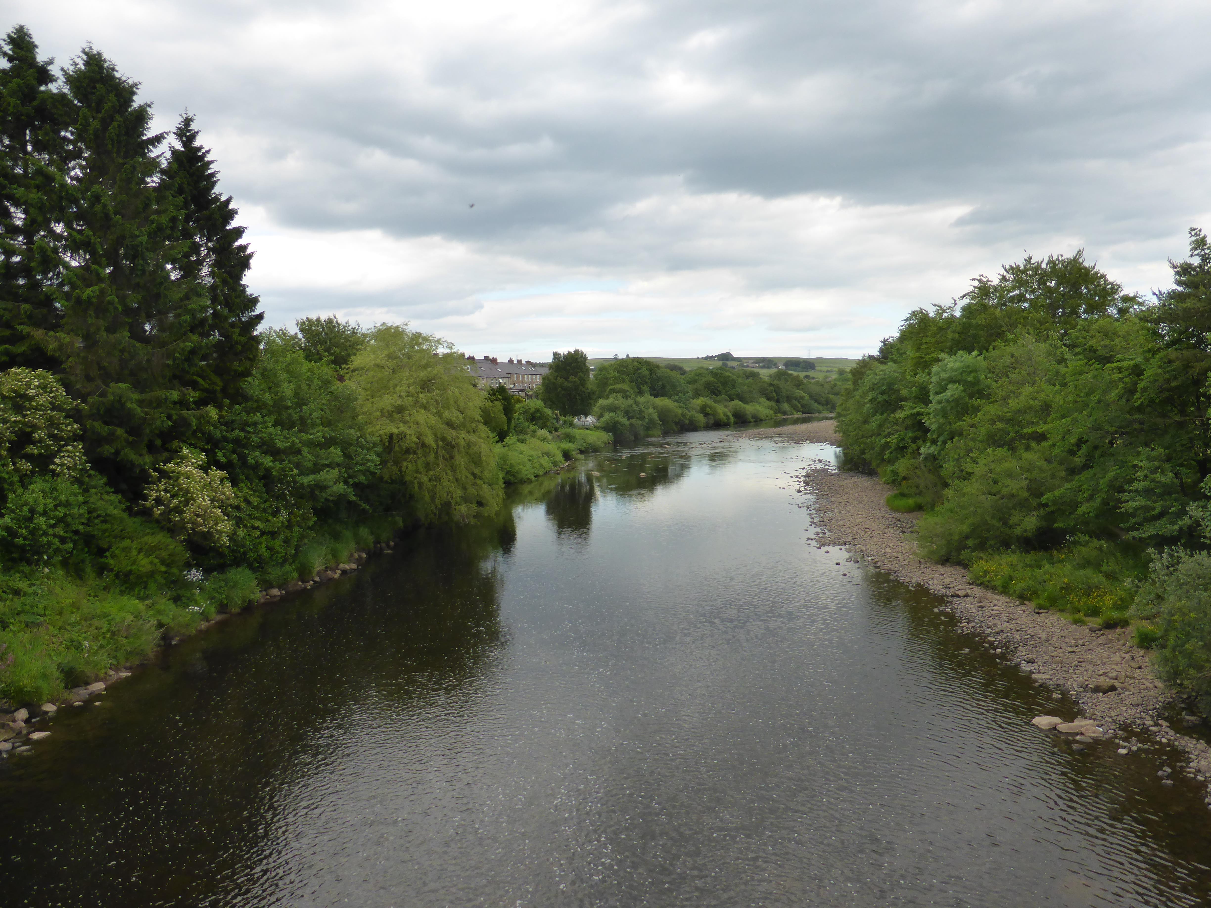
    The coastal path route goes close to the road and then crosses the River Aln at the Duchess Bridge.   After crossing the river on a walkway besides the bridge we go right to stay with the coastal path to walk beside the river on a path waymarked as Lovers’ Walk.  

    We now pause to look back at the fine Duchess Bridge.  This was built in 1864 and has a plate on the south parapet stating “To Eleanor Duchess of Northumberland the public are chiefly indebted for this stone bridge and footpath to the station”.

    We follow the path around and are soon besides Alnmouth Harbour.  In the 18th century grain and cargo were shipped between Alnmouth and London.  Then in 1806 a major storm hit the Northumberland Coast and changed the course of the River Aln to how it looks today.  Apparently this resulted in the river being much shallower and more difficult for ships to use.  Therefore the port declined and the harbour is now used for fishing boats and pleasure craft.

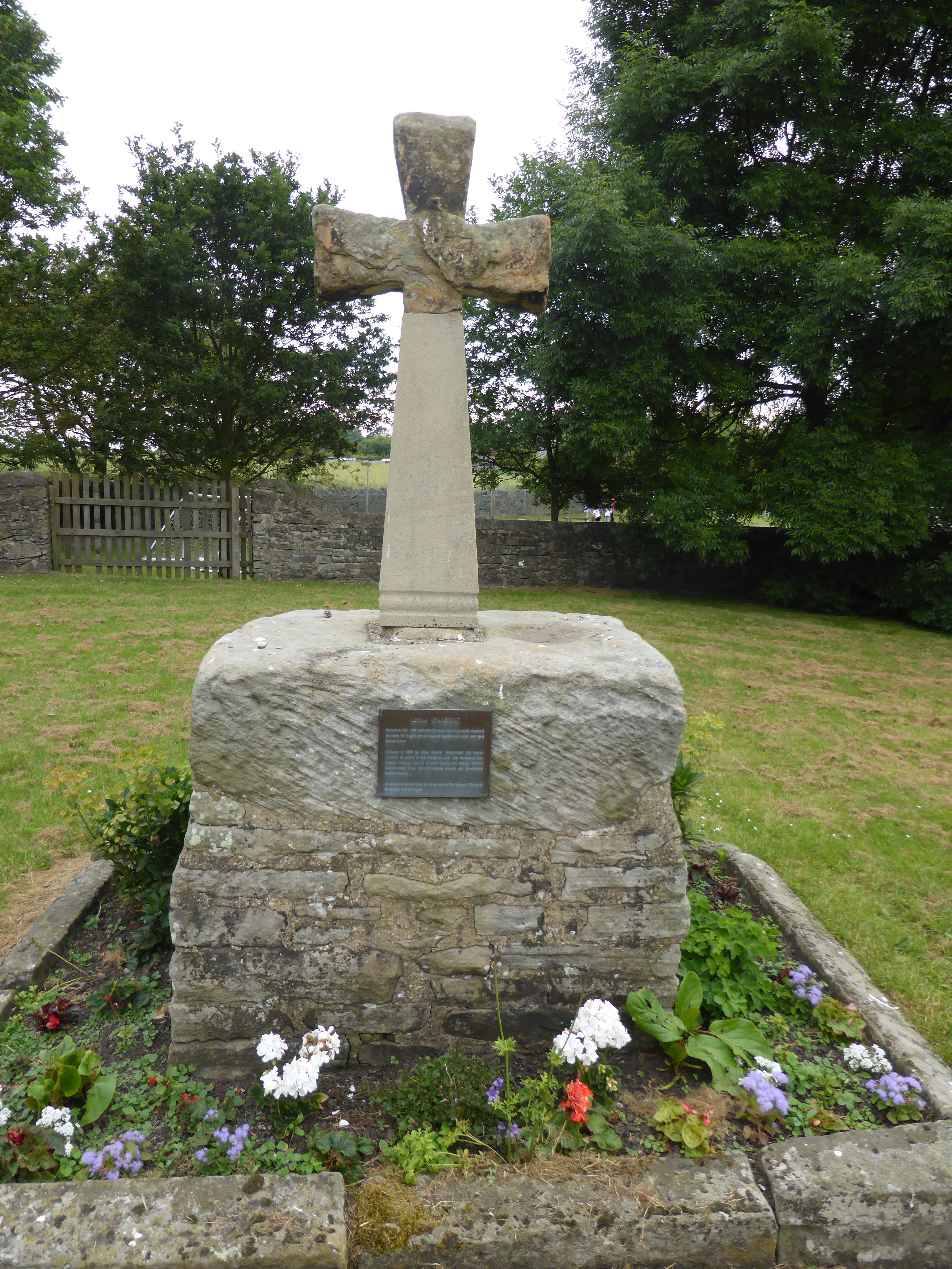
    Across the river a wooden cross marks the spot where the village church once stood before the storm of 1806 altered the course of the river and cut the church off from the village.

    We join Riverside Road and follow it until it becomes Northumberland Street, and walk along this main street through the village to reach a roundabout where we go straight on into Foxton Road.  We follow this road out of the village and then just after passing the last house on the right take a footpath which leads us uphill to the Night Fold Field Ordnance Survey Trig Pillar.  This is the 313th trig I have bagged.

    Now we have to make up our mind on the route to take back to the caravan.  I had originally planned a circular walk, but time is getting on and we have still got to eat so we decide the sensible option is to retrace our route.  We therefore descend the hill and turn back into Alnmouth and then turn right at the roundabout and follow the road to cross Duchess Bridge.

    From here it is a straightforward process of retracing our route back along the road and then rejoining the path besides the Aln Valley Railway to return to the caravan.

    Our wander has covered just over eight and a half miles and has been a pleasant stretch of the legs after a couple of lengthy days travelling.

    You can view this 8.5 mile walk on OS Maps and download the GPX File Here

    To follow my walk, you will need Ordnance Survey Maps: OS Explorer Map – 332 – Alnwick & Amble

    20th May 2022

    © Two Dogs and an Awning (2022)

    All information on this site is provided free of charge and in good faith and no liability is accepted in respect of damage, loss or injury which might result from it.  To the best of my knowledge the routes are entirely on public rights of way or within areas that are open for public access.
    Walking can be hazardous and is done entirely at your own risk.  It is your responsibility to check your route and navigate using a map and compass.

  • A Slog Around Henshaw Common

    A Slog Around Henshaw Common

    After a couple of days walking along disused railway lines I think that it would be a good idea to explore part of the Northumberland National Park just a few miles north of Haltwhistle. Our recent experience in Kielder Forest has rendered Lynnie sceptical and unconvinced at my suggestion but she is willing to give it a go.

    Our drive is pleasant and our starting point is just a couple of miles above Edges Green, the last few miles are on a narrow road across open moorland. An easy journey on a fine day in July, but I imagine a real nightmare in the depth of winter.
    (more…)

  • Featherstone Park to Lambley Viaduct

    Featherstone Park to Lambley Viaduct

    We enjoyed our wander along the South Tyne Trail yesterday so much that we decide to explore the route a bit further along today. We drive to Featherstone Park and park in the small car park opposite the disused station.

    We are picking up where we left off yesterday and head south along the trail away from Featherstone Park Station. We are high up on an embankment and get good views to our right through the trees.
    (more…)

  • Along the South Tyne Trail to Featherstone Park

    Along the South Tyne Trail to Featherstone Park

    Part of the thinking when visiting this area was to combine sections of Hadrian’s Wall into our walking plans. However, we have already realised that there are a couple of key obstacles to this.

    Firstly the footpath that follows many sections of the wall in this area crosses small fields with regular stiles, meaning that Dexter and Crosby will have to be frequently lifted over these obstacles.

    Secondly the vast majority of these fields appear to be home to bears and at this time of year many of them have calves so will be at their most protective. At the best of times bears take an unhealthy interest in Crosby, so we decide that they are best avoided.
    (more…)

  • A Walk in Kielder Forest

    A Walk in Kielder Forest

    After a cracking fortnight in North Wales we have returned to England and gone further north to a site just outside of Gilsland on the borders of Cumbria and Northumberland. We had a tortuous journey yesterday, every time there was a route option I appeared to take the wrong one and we spent hours in traffic jams.

    As mentioned previously, experience has shown that following a good week or two in a location we are bound for disappointment with a site or location before long. We have just come from Swn-Y-Mor an immaculate site, as soon as we arrived we received a warm welcome and were offered advice on where to pitch and told about the local amenities and places to visit. Our site for the next five days is Whittlees, first impressions are that it is adequate but not receiving the same level of attention as better sites we have visited. We use our initiative and pitch in a vacant spot and I head off to pay and try to elicit local information. Payment was duly taken, but I can only assume that you have to pay extra for conversation.
    (more…)

  • “It’s a Grand Day For a Gallop”

    “It’s a Grand Day For a Gallop”

    It is another cracking day weather wise, time to get the boots on and go for a decent walk. Lynnie’s back is still giving a bit if discomfort after her fall last week, so we plan a walk which is mainly flat.

    We walk from the site into Durham and on reaching the Marriott hotel turn left up the hill and at the fork in the road go right. Through the churchyard where we greet an old chap out for his daily walk, we are treated to the response “It’s a grand day for a gallop”. Indeed it is. We descend to the river and follow this until we reach the Prebends Bridge, built in 1778 it is now used only for foot traffic.

    After the bridge we leave the river on the footpath that slopes up the hill on the left and emerge on a road by Durham School. From here we follow a series of roads and footpaths until we reach the B6302, which we follow for half a mile, after crossing the main railway line we take a footpath onto the disused Lanchester Valley Railway. Soon we join the Deerness Valley Railway Path.

    The Deerness Valley Railway was an eight mile branch line that ran along the valley of the River Deerness to serve the collieries alongside the route. The line opened in 1858 and started taking passengers in 1877 with stations at Waterhouses and Esh Winning, later in 1884 a station was opened at Ushaw Moor.

    The number of collieries in this stretch is amazing to a chap from a non-mining community. The eight miles of track served seven collieries with pits at Ushaw Moor, Waterhouses, Hamsteels, Esh, Cornsay, New Brancepeth and East Hedley Hope.

    Our walk takes us by two of these mining villages, New Brancepeth on the left and Ushaw Moor on the right, but before we reach Esh Winning (what a cracking name) we leave the railway path and walk to Hag House Farm, as we climb we get a view of the valley and there is no obvious sign of the mining past. After walking through Hag House farmyard we continue up hill towards a track that with a left turn takes us to Esh Hall.

    At the Hall we turn right on to the drive and walk down towards Esh village. Just after the gates of the Hall we spot a cross, apparently this is known locally as St Cuthbert’s Cross and dates to 1687.

    On reaching the road we consult the map, there is a footpath along here somewhere but no sign. A friendly local points the way, clearly this is another of those footpaths that the landowner would prefer unused. We walk through a yard and a gate leads us down hill through a couple of fields packed with horses, one of which, much to Lynnie’s consternation, decides to follow us closely for a while.

    We emerge onto a track taking us down to a road, a left turn and after a few hundred yards we take a farm track on our right, skirting the farm we arrive at the Lanchester Valley Railway Path. Here we turn right and head back towards Durham.

    The Lanchester Valley Railway opened in 1862 and was initially built to carry iron ore from Middlesbrough to the Consett Steelworks. The track was twelve miles long and operated a passenger service until 1939.

    Soon after joining the path we skirt Langley Park with its rows of old terraced houses and then we come to Diggerland, billed as “A fantastic day out for the whole family”. I offer Lynnie the opportunity to explore this delight, but she declines. So we continue on our own fantastic day out.

    At we approach Bearpark we take a footpath on our left towards Bearpark Hall and follow the track down to a minor road, turning left we head up to and cross the busy A167 then follow the signs to lead us back to the centre of Durham.

    Our walk has been just over sixteen miles and it has indeed turned out to be a “Fine day for a gallop”. Tomorrow sees us heading north towards the Scottish border so time to once again start packing.

    [To follow our walk you will need Ordnance Survey Explorer Map 308 – Durham and Sunderland]

    P1010859

    2nd July 2014

    © Two Dogs and an Awning (2014)

  • Around Durham

    Around Durham

    A lovely sunny morning so we wander into Durham to have a look around. It is graduation week at the University so there are lots of proud parents in their finery accompanying students, many in gowns.
    (more…)