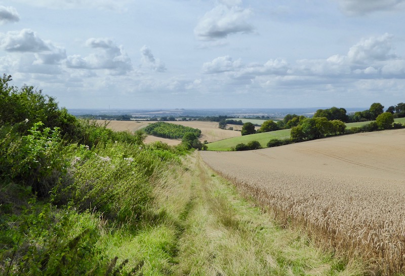
Today I am making the short drive to Ewelme on the edge of the Chiltern Hills. We have previously done a few walks from this attractive South Oxfordshire village. The starting point for my walk is the public car park close to the village playing field.
I start my walk by heading across the playing field to join a footpath running along the south west side of the playing field. After passing through a gate I follow a path by the side of Cow Common, this leads to a minor road, Day’s Lane. Here I turn left and almost as soon as I join the road I turn left along a footpath.
This path leads to a minor road, which I cross, and then join a hedge lined track, Potters Lane.
As I reach barns at Potter’s Farm I ignore a footpath on the right and then shortly after at another junction of paths turn left.
Within a couple of hundred metres I ignore a turning to the left into Grindon Lane, instead carrying on to reach a crossing of paths.
At this junction of paths I continue straight on towards Ewelme Downs and the path soon runs besides heavy security fencing. When encountering such fencing I always wonder who lives in the house and why they need such a level of security.
The path now continues uphill towards woodland.
The path leads through the trees, to my right is the large house of Ewelme Park, from the track the house is not clearly visible, but the array of chimneys make an impressive sight.
Just after passing the old farmhouse I turn left to join a footpath running besides stables, I am now on the Ridgeway national trail.
I follow the Ridgeway to a field with Straights Plantation on my right. Here the national trail turns to the left but I continue straight on walking through the pasture fields towards Haycroft Wood.
The path through the woods is clearly marked with the characteristic painted arrows on the trees
At a fork in the path I go right and then turn to the right at another junction of paths in Church Wood. The path now leads to Church Lane where I turn right and walk besides the road to reach Cookley Green. As I approach the village green I turn onto a track on the left heading towards Coates Farm. As I approach some trees there is a large water tower.
I am now on a section of the Shakespeare’s Way, this 146-mile long distance path opened in 2006 and goes from the birthplace of William Shakespeare in Stratford-upon-Avon to the Globe Theatre on the south bank of the River Thames in London. The section I am on soon passes Coates Farm with its array of fine old barns.
I continue along the track passing aerials on top of the hill.
At a minor road I turn left and follow the road past farm buildings then just before the road reaches Britwell Hill Farm and starts to descend I bag a trig point which is in the hedgerow adjacent to a metal five bar gate. This is the 156th trig pillar I have “bagged”.
I stay on this narrow country road as it heads downhill.
As the road starts to level out I reach a junction with the Ridgeway National Trail and turn left towards North Farm.
This track is shared by the Ridgeway, Swan’s Way and Chiltern Way. At North Farm the Ridgeway heads off to the left, I stay on the main track and soon go through the edge of Icknieldbank Plantation to reach a minor road. Within a few hundred metres of joining the road the Swan’s Way goes to the left, I stay with the road to reach a footpath on the right. Here I make a slight diversion to follow the hedge line on the right to reach the Ordnance trig pillar at Huntingland, my 157th “bagged”.
I return to the road and turn right onto a lane signposted to Ewelme. There is an option to walk on the access land of the Common, but there are cattle in the field and I am later than I had intended to be so decide to make quicker progress along the road. It is not too long before I reach my start point at the car park by the playing field.
My walk has covered just over eight and a half miles and I have seen two people in the almost three hours I have been out. This really is a peaceful part of the country to explore.
To follow my walk you will need Ordnance Survey Explorer Map 171 – Chiltern Hills West
21st August 2019
© Two Dogs and an Awning (2019)


Leave a Reply