Author: Fred

  • Wiltshire’s Thankful Village

    Wiltshire’s Thankful Village

    It is taking me a while but I am gradually bagging the Ordnance Survey trig pillars in Wiltshire. I have yet to work out how many there are, but I know a few sit on Ministry of Defence Land with limited or no access, so getting them all is unlikely.  There are also a few others where access might prove difficult, so for the time being I am going for those that are easy to get.  Today I have my sights set on a couple more and I am joined on my jaunt by my walking buddy Mandy.

    The starting point for our walk is the village of Stapleford, just off of the busy A36 in the Wylye Valley.   We start from the parking area in the village just past the village church (Grid Ref SU070373).  From here we walk back along the road to the visit St Mary’s Church.

    On my walks I frequently pop into churches to admire the architecture rather than the spiritual aspect.  For me it is usually a cursory glance, but Mandy is more into churches so we spend time having a good look inside.  Immediately I am glad we have as there are many interesting features in this church.  Behind the 12th century font in a window is a notice explaining that Stapleford is a Thankful Village.

    During my walks I have stumbled on a few Thankful Villages, these are villages where residents served in the First World War and all returned.  The exact number of “Thankful Villages” is unclear.  In 1930 the writer Arthur Lee identified thirty-two such villages and then later research in 2013 identified fifty-three villages.  Neither list contains any Wiltshire Village.

    However, the notice says that Stapleford is the only “Thankful Village” in Wiltshire and lists the names of nine men who fought in the so called “Great War”.  However, there is a caveat in the notice saying it is unclear exactly how many men from the village went to fight in the War and how many returned.

    I have driven along the A36 passing the edge of Stapleford hundreds of times, but I am sorry to say that I have never ventured into this attractive village.  Along with being a “Thankful Village” apparently it is where, in the summer of 1938, the composer Ralph Vaughan Williams stayed and composed part of his Fifth Symphony.

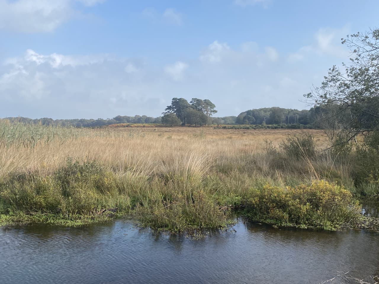
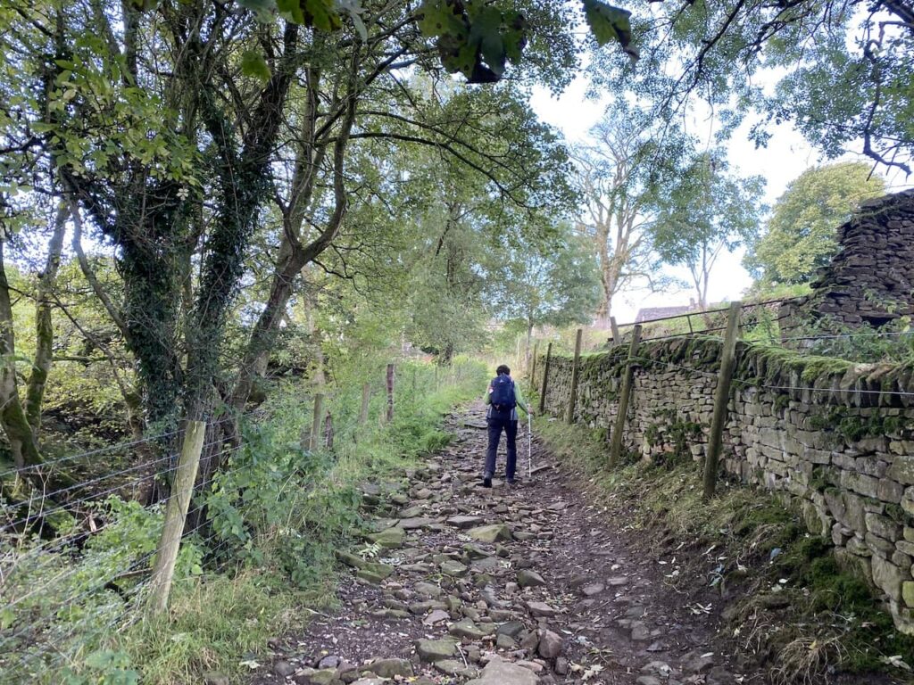
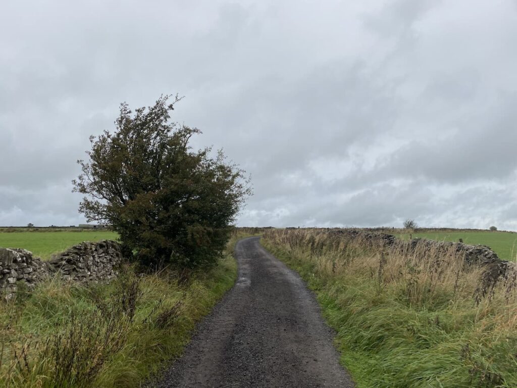
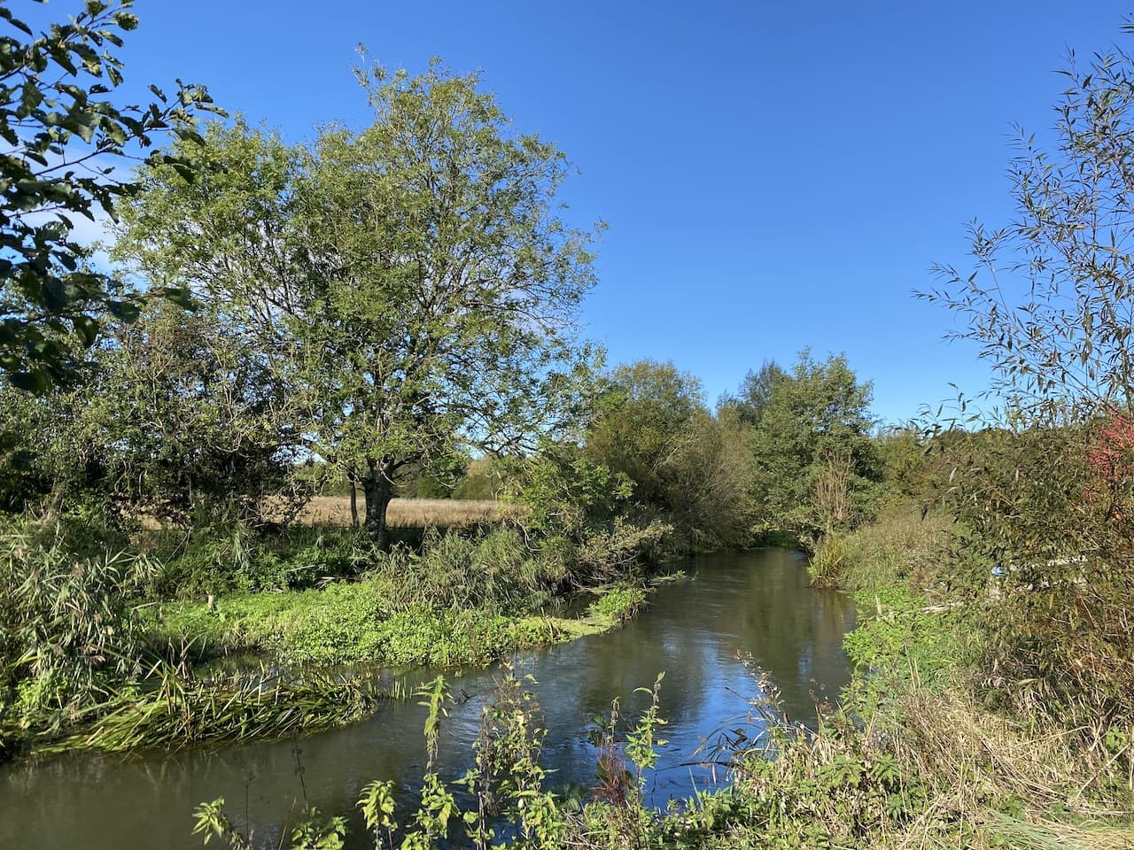
    Just before reaching a bus stop we turn right into Chapel Lane and then take a footpath between walls and follow the path across a field to reach the A36.  After carefully crossing this busy road we turn right and then take a footpath on the left between the Petrol Station and the Pelican Bridge. This path soon leads us to meadows besides the River Wylye.

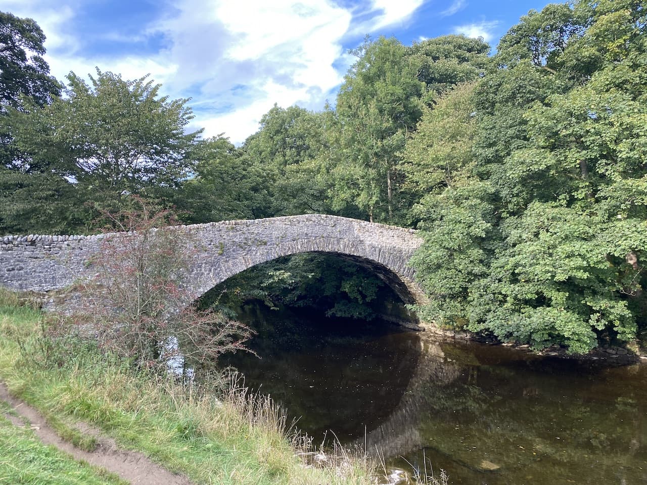
    The path takes us through fields to cross the river at Kingsmead Bridge.

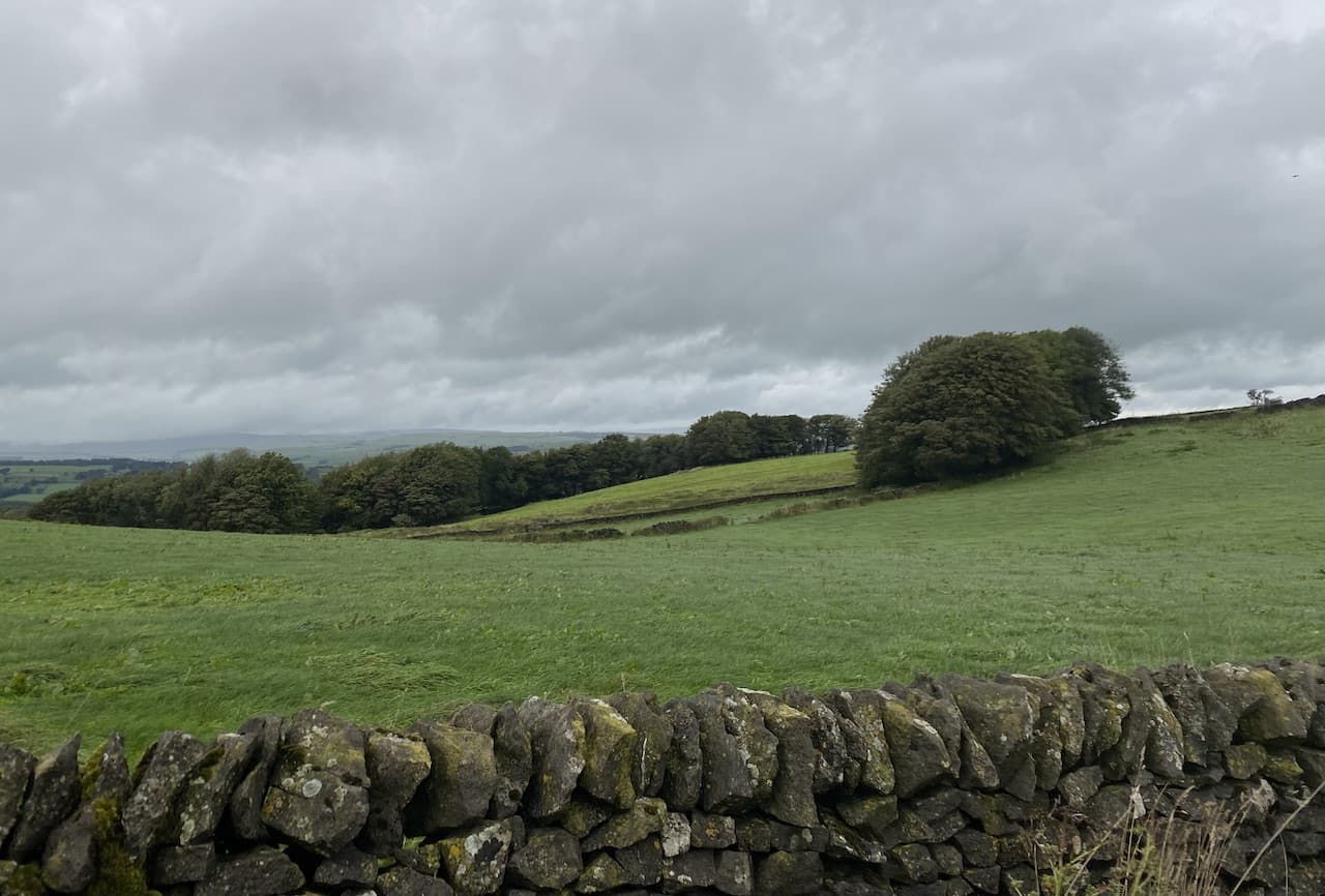
    Over the bridge we continue to a road and turn right.  This is a quiet country lane and it is pleasant walking along with good views of the edge of Cranbourne Chase to our left.

    After just over a mile on the road we reach a junction at the edge of Little Langford.  Here we turn right and cross the railway line and then take a path on the left heading towards the church of St Nicholas.  This is an attractive small church originally dating from the 12th century and the interior was refurbished in 1864.  

    The church is locked but there’s plenty to see on the outside as the walls are littered with interesting stone carvings.

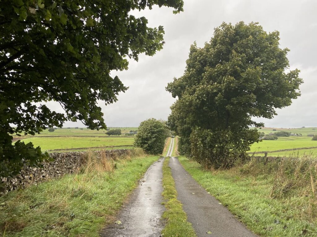
    From the church we continue on a footpath taking us through a pasture field to join a road which we follow for half a mile to reach Hanging Langford where we pass the village hall and continue along the road for a further two miles to reach Wylye.  

    In this attractive village we turn right opposite the old Chapel and continue through the village to reach St Mary’s church.

    There are a number of interesting features in this church but I am drawn to the notice explaining the background to the Popjay Tomb. This stands opposite the south porch and is an ornate tomb inside railings. According to the story, an 18th century local man by the name of Popjay was convicted of crimes and transported to Australia. When he eventually returned to Wylye it was in a fine carriage, and he was dressed with all the trappings of great wealth.  Popjay lodged at the Bell Inn and enquired after his mother and sister. He was dismayed to find that in his absence both had died and been buried in pauper’s graves. He ordered an elaborate tomb and had his relatives reburied.  But when the bills arrived for the work on the tomb Popjay disappeared, leaving the bills unpaid. He was never seen again, and the rector of St Mary’s had to pay the bills out of his own pocket. In 1840 Rev Francis Baker chose to be buried within the Popjay tomb.

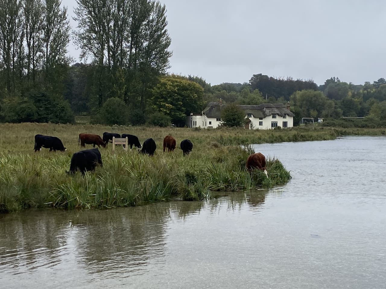
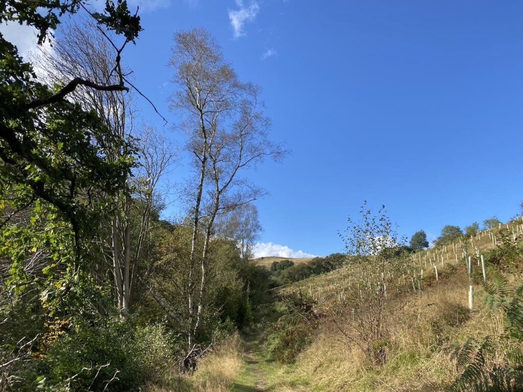
    Leaving the churchyard we turn right and pass the Bell Inn and then the Village Hall.  We soon cross the River Wylye and then take a footpath on the left which passes under the busy A303 and leads into fields besides the river.

    The path leads us to the small village of Fisherton de la Mere where we stop at St Nicholas’ Church.  Dating back to the 14th century the church had substantial rebuilding in the 1830s and 1860s.

    The church is maintained by the Churches Conservation Trust.  Inside is a 12th century font.

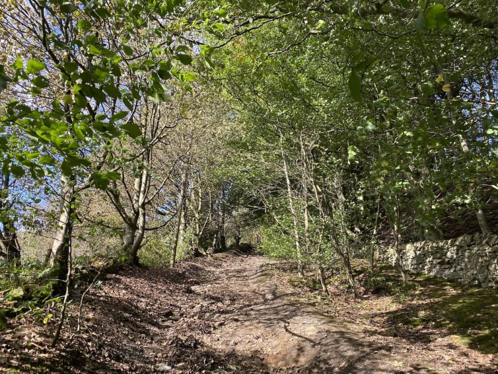
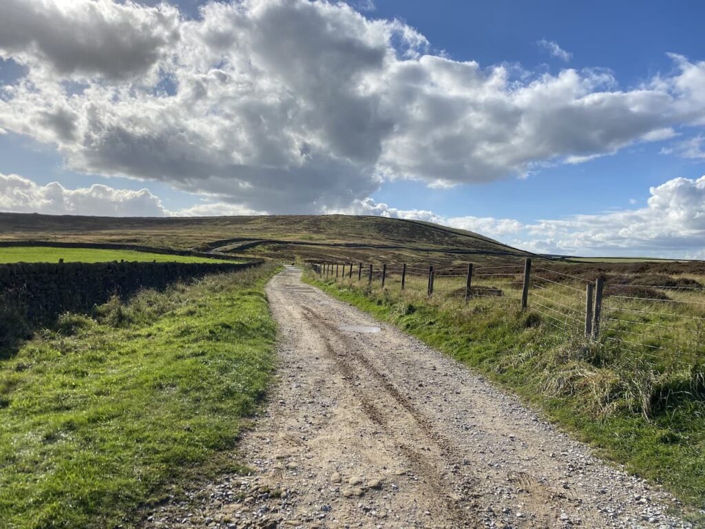
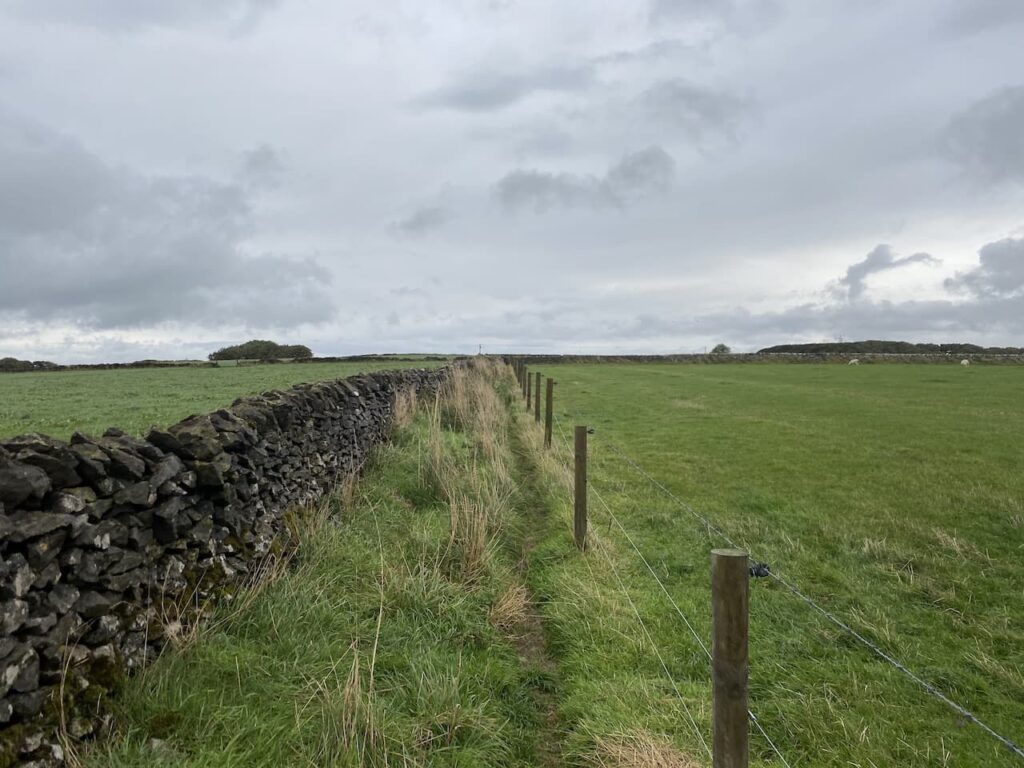
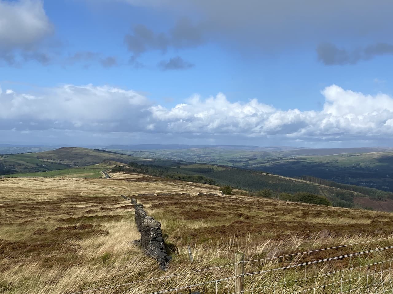
    From the church we head west and then at a junction of lanes turn right to reach the A36.  We turn right for a few yards and then cross this busy road to take a track on the opposite side leading to Manor Farm.  The track takes us through farm buildings and then continues north through arable fields.

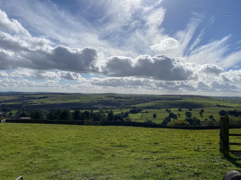
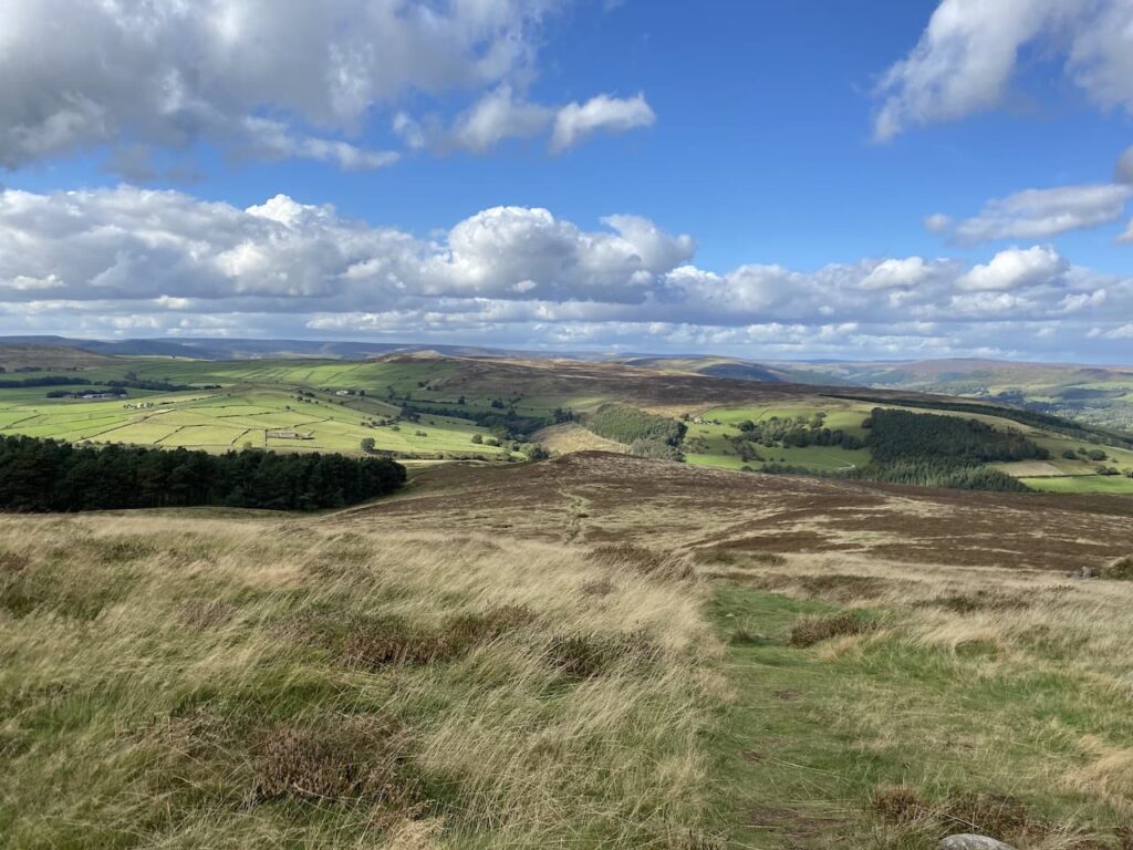
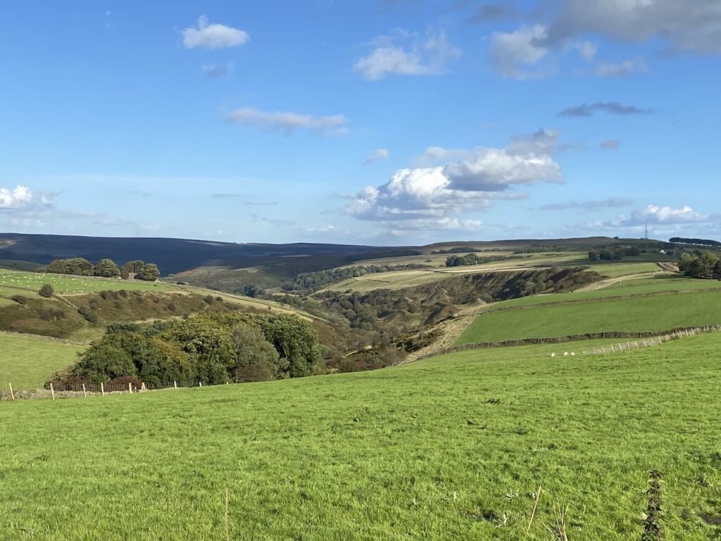
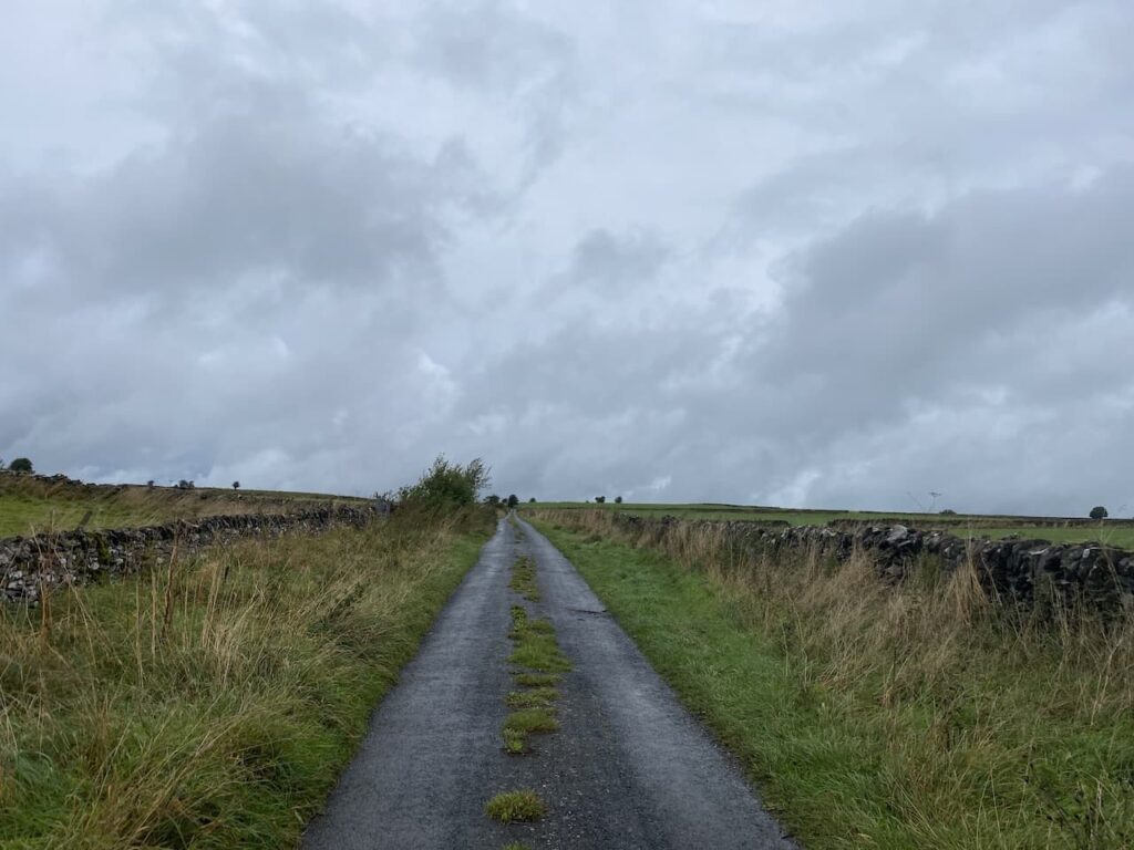
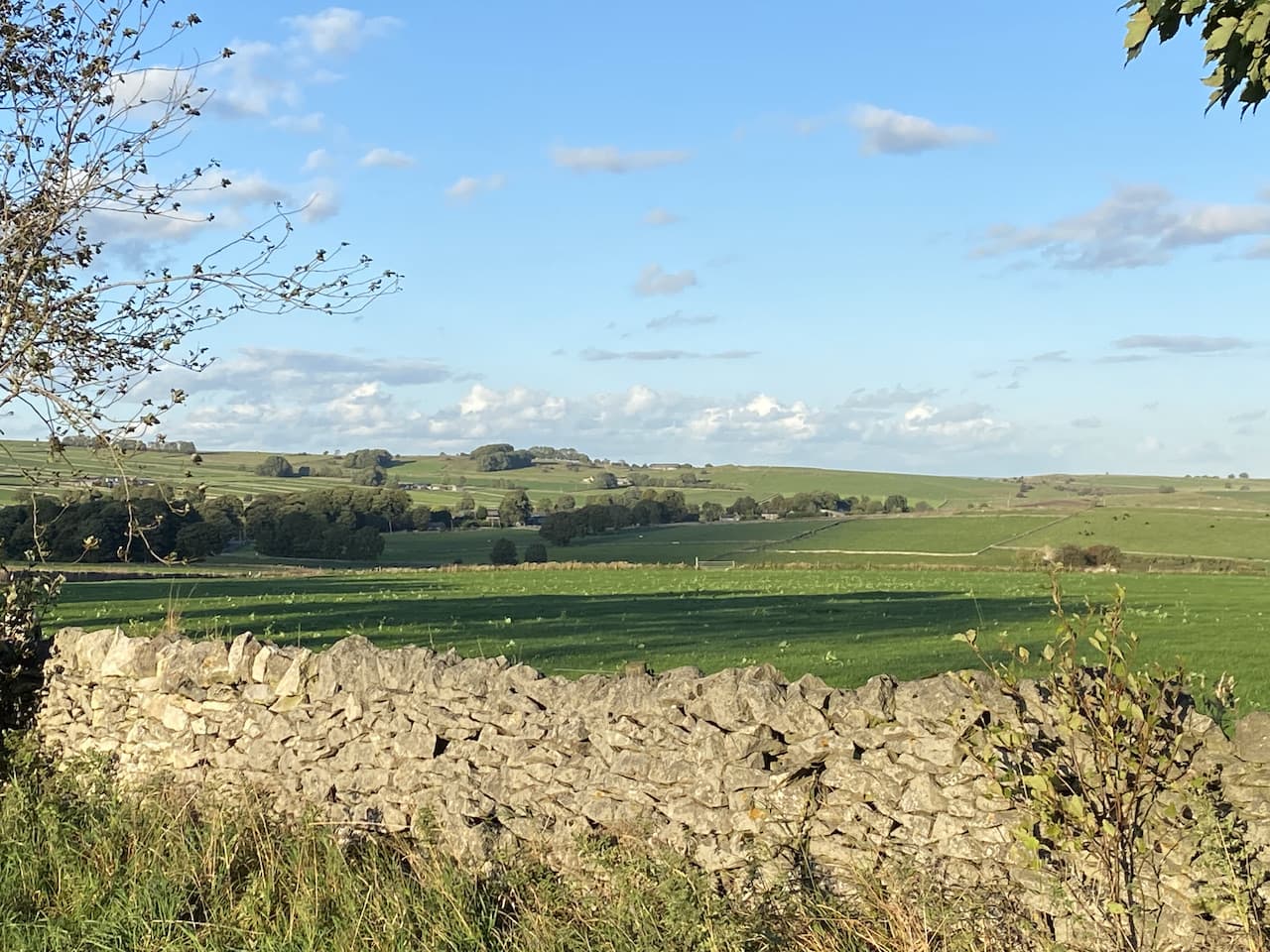
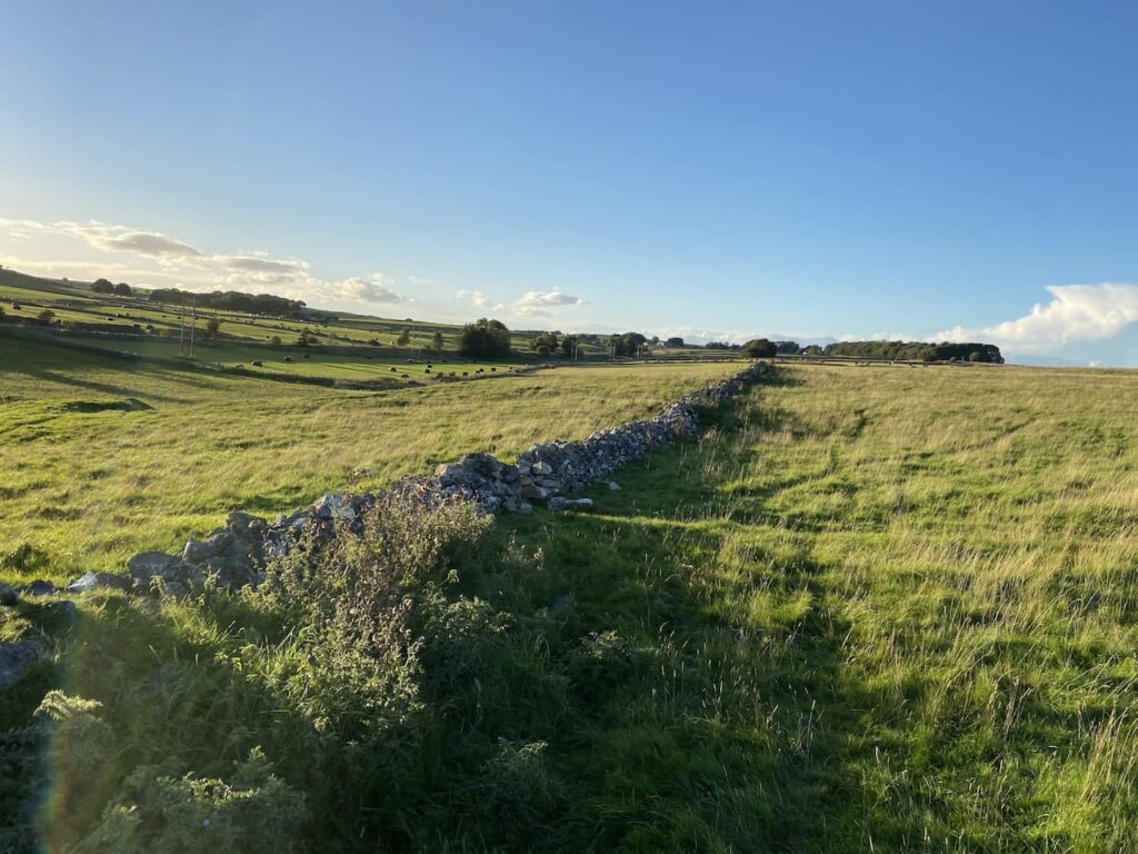
    This is a long straight track with stunning views over rolling down land.  

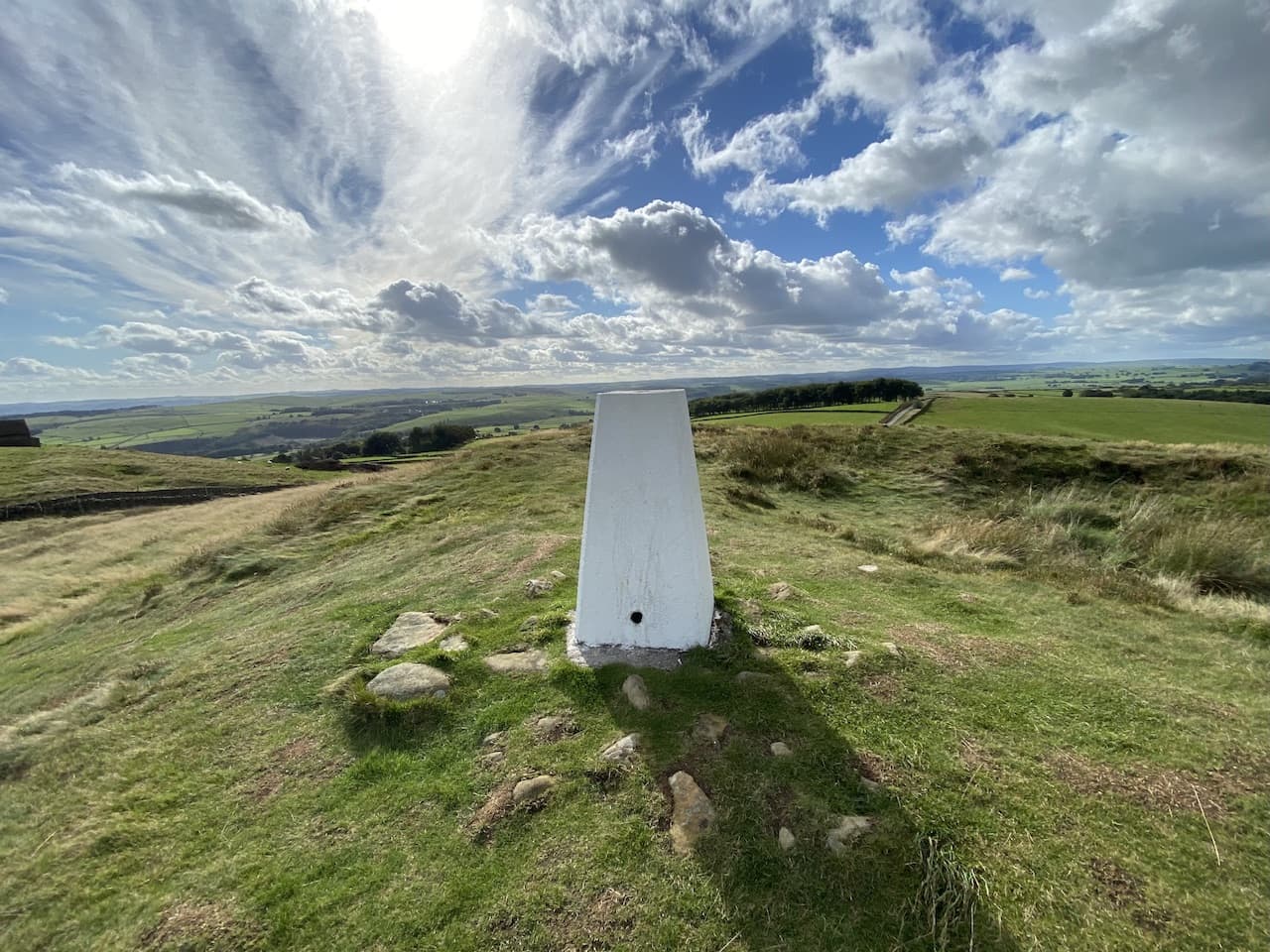
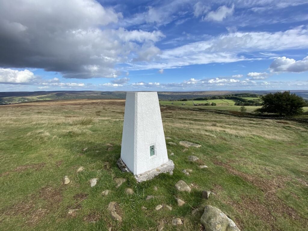
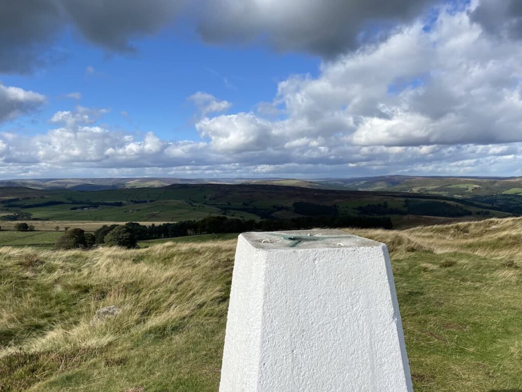
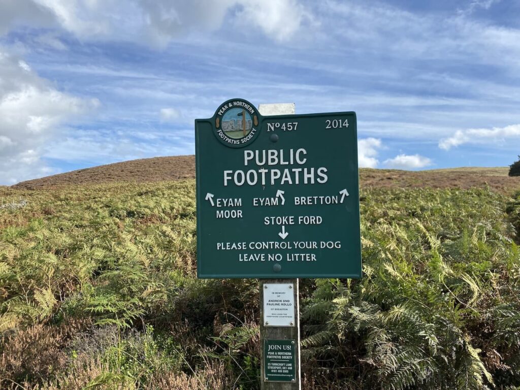
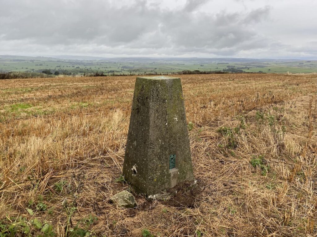
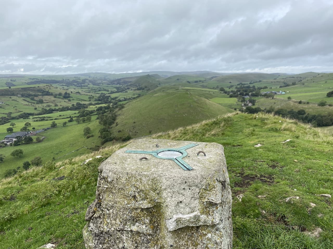
    The track turns to the left and then at junction of tracks we go right to continue north to reach a crossing of tracks.  Here we turn left to make a short detour to the Ordnance Survey Trig Pillar on Clay Pit Hill.  This the 286th I have bagged.

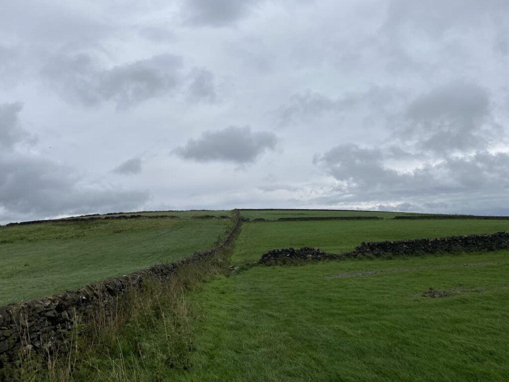
    From the trig we return to the crossing of tracks and this time go east on a route which skirts the edge of a copse.

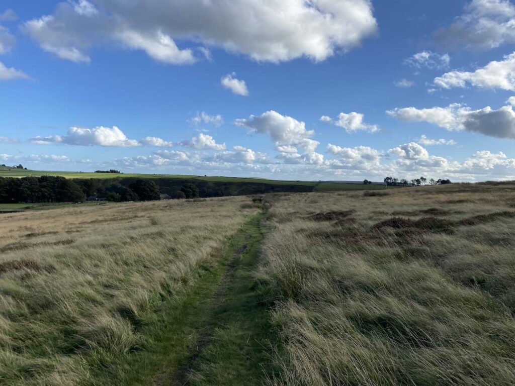
    From the corner of the trees the path heads across a field to reach a track where we turn right and follow it in a south easterly direction across Deptford Down.

    There are soon signs to our left warning of an active airstrip and then a helicopter flies low overhead.  It continues to do a range of manoeuvres, we assume this is part of a training regime rather than a private show for our benefit.

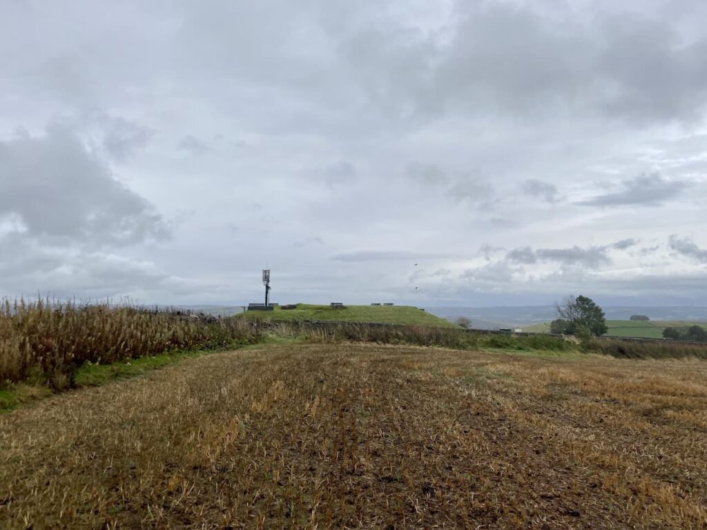
    We stay with this main track heading in a south easterly direction towards Yarnbury Castle.  On reaching the edge of the castle site I take a brief diversion from the public right of way to enter the site of the old hill fort.

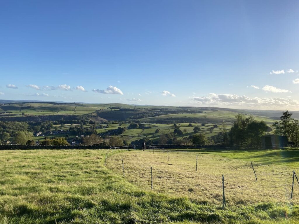
    Yarnbury Castle is a large iron age hillfort covering an area of 28.5 acres.  There are panoramic views from the site and well maintained ramparts.  It is now designated as a site of special scientific interest, but from the 1700’s through to 1916 it was the site of the Winterbourne sheep fair.  In 1916 the area was commandeered by the Ministry of Defence as a training area.  Now it is used for pasture.

    On the south eastern side of the hillfort there is an ordnance survey trig pillar, I have passed this on many occasions driving along the nearby A303 but have never noticed it.

    Returning to the track we carry on towards the A303.  This section of the road is a dual carriageway and there is a large refuge area in the centre so we are able to cross comfortably.  However, I would not want to try and get across here in peak holiday season when it is really busy.

    Our route continues along a drove and we soon pass a milestone. The engraving is worn but it is dated 1750 and indicates that it is IX miles to Sarum (Salisbury) and XXVII Miles to Bath.

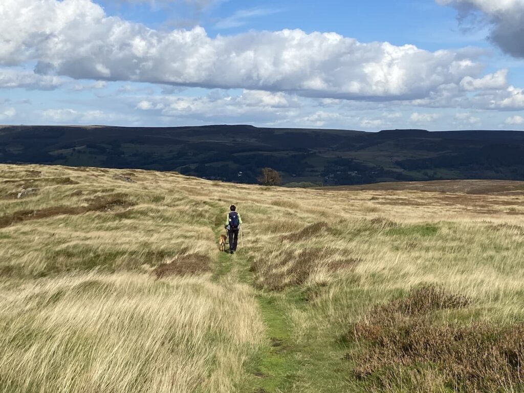
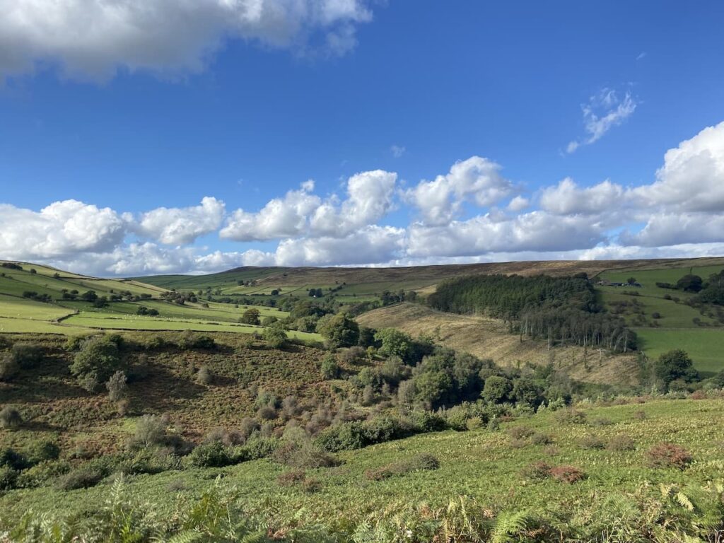
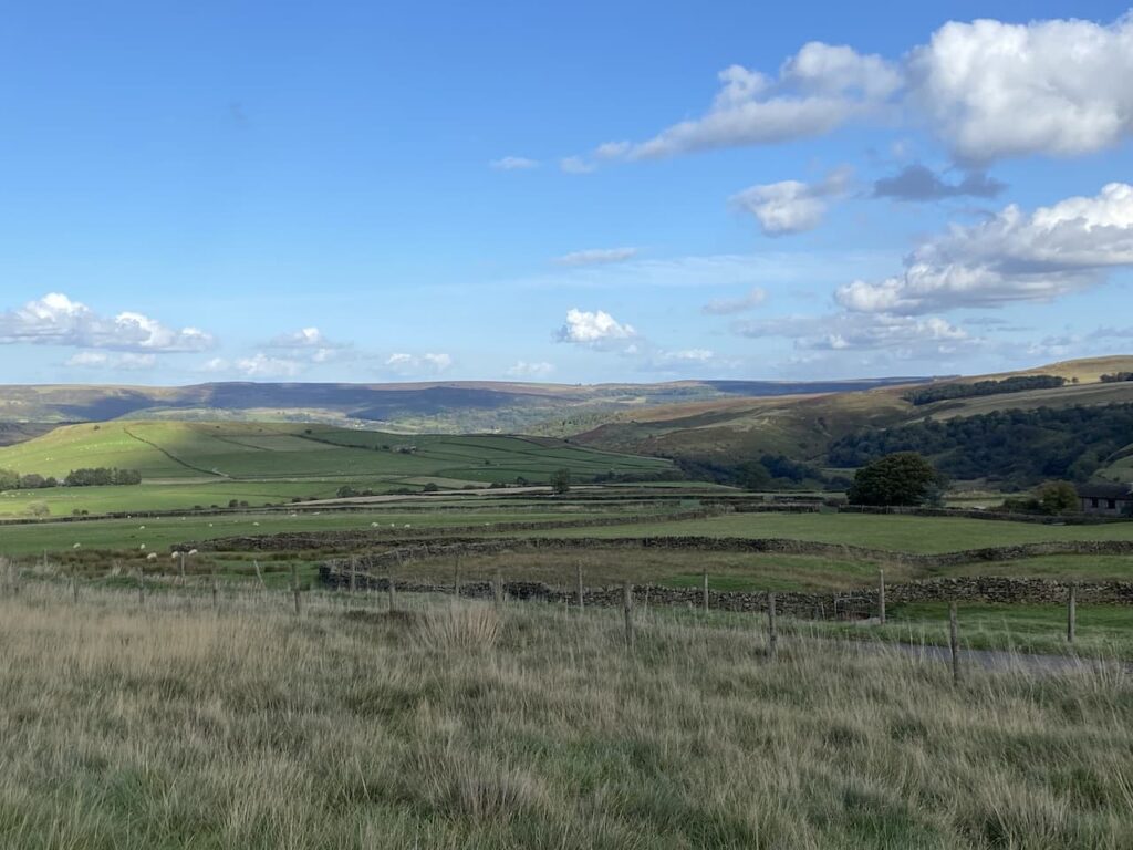
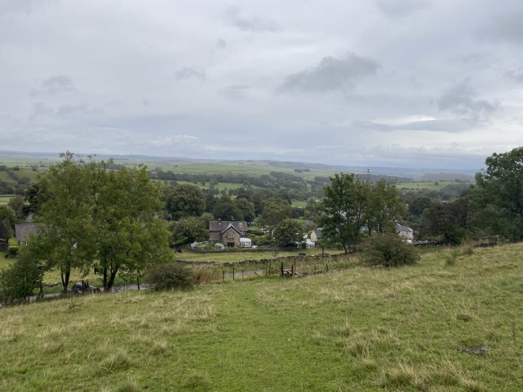
    Staying with the track we soon start to descend and go straight on at a crossing of tracks.  As we descend there are fine views across the Wylye Valley.

    At the next junction of tracks we turn left, leaving the main track and heading towards Stapleford Castle.  

    Stapleford Castle is a medieval Ring and Bailey castle that sits beside the River Till.  It is not accessible and hard to make out from the path.  On reaching a minor road we continue straight on.  After crossing a bridge over a stream we turn right onto the B3083 and follow this road through the village to reach our starting point in the church car park.

    Our walk has covered 16.5 miles and despite the early section along minor roads it has been a cracking day out exploring a part of the Wiltshire countryside I have not previously visited.

    You can view this 16.5 mile walk on OS Maps and download the GPX File Here 

    To follow my walk you will need Ordnance Survey Explorer Map – 130 – Salisbury & Stonehenge

    22nd October 2021

    © Two Dogs and an Awning (2021)

    All information on this site is provided free of charge and in good faith and no liability is accepted in respect of damage, loss or injury which might result from it.  To the best of my knowledge the routes are entirely on public rights of way or within areas that are open for public access.
    Walking can be hazardous and is done entirely at your own risk.  It is your responsibility to check your route and navigate using a map and compass.

  • Three New Forest Trigs from Burley

    Three New Forest Trigs from Burley

    I am still exploring parts of the New Forest I have not previously walked.  Despite being so close to home it has never been high on my list of locations to walk.  However, since doing a navigation course there early last year I have begun to visit more frequently and have started to piece together the landscape.  An unexpected benefit of doing the navigation course was meeting the course leader Nigel, we have become walking buddies and his knowledge of the Forest means we visit some cracking spots.

    Today I am meeting Nigel at the car park besides Burley Cricket Club, (Grid Ref: SU215029).  The car park also serves as a drop off point for the village school located across the Green so it is pretty busy with comings and goings.  I played cricket locally for nearly thirty years but never played at Burley, which is a pity because it is a cracking spot.  The club was formed back in 1875 and moved to this pitch in 1912.  The outbreak of the World War I saw the club suspend play, but they resumed again in 1918 and have played here ever since.

    We leave the car park and cross the road and head west and then on meeting a minor road, Moorhill Road, we turn left and head south.  We leave Moorhill Lane to join a track signposted to Goats Pen Cottage.

    The track leads over Shappen Hill where we start to descend towards a disused railway line.

    On reaching the disused railway we turn right.  This is a section of the railway line that linked Brockenhurst and Ringwood, it was part of the line between Northam and Dorchester.  It was opened in 1847 and created at the instigation of a Wimborne solicitor called Charles Castleman.  The line took a circuitous route through the forest and was called ‘Castleman’s Snake’.  

    The route leaves the disused railway line and goes through a car park to cross a road and continue towards Long Pond.

    We are now on open heathland surrounded by heather and dead bracken.  It is interesting that most other places I have walked recently the bracken has only just started to brown, whereas here it is dead.  Nigel tells me that in the forest the bracken comes up much earlier and therefore dies back earlier too.

    We follow a path almost parallel to the railway line and then cross it on a bridge to head south towards Dur Hill Inclosure.

    Soon at a junction of tracks we turn left and then very quickly take another track on the right which goes South and starts to ascend the hill.  Many of the trees in the inclosure have been felled, so what looks like woodland on the map is heathland.  We reach a four way junction of tracks where we turn left  and then at the next junction we turn right to head south along a track by a few remaining trees.  Soon on our right is the Dur Hill Ordnance Survey trig pillar.  This is the 283rd I have bagged.

    From the trig post we head south on Dur Hill Down, along the way we meet a solitary cow.  There is no sign of any others so presumably she has become separated from the herd.  She stands in the path and nonchalantly watches as we pass by.  

    At the southern edge of the down we turn left and follow a path to cross a minor road at Cross Ways and then continue on the heathland opposite across Thorney Hill Holms towards Holmsley Inclosure.

    We head through the inclosure in an easterly direction following clear tracks to reach a minor road where we right.  We now have a short section besides this lane we it leads to the A35.  At the main road we turn left and then cross almost immediately opposite the Holmsley Toll House.  I am intrigued that the house has a crest of Edward VII on it.  The association with royalty is unclear, apparently Edward VII liked to visit the forest, but why he would have a crest on a toll house is not recorded.  It is odd given that the toll house stood on an old turnpike and these were abolished in the 1880’s.  

    After crossing the road we continue heading east  on a cycleway through Brownhill Inclosure. Our route continues into Wootton Coppice Inclosure to reach a minor road at Wootton Bridge.  We turn left and cross the bridge and then stay on the verge beside the road.  Just before reaching a junction we go right on a cycleway which soon joins the track bed of the old disused Brockenhust to Ringwood railway.

    We stay with the route of the railway until we reach caravans parked in the woods of Set Thorns Inclosure.  We have stayed at nearly a hundred caravan sites on our travels but never one that looks like this.  There are vans parked apparently haphazardly amongst the trees.  The wood is dense here and there is little light.  Many of the vans look like they have been pitched up for the season.  I prefer open spaces so it would definitely not be for me.

    We follow a track through the caravans to reach the Set Thorns Inclosure car park.  Here we turn left and walk besides the road to reach a T- junction where we turn right and follow a path running parallel to the road signposted to Brockenhurst and Battramsley.  Soon after passing a track to the Longslade View car park we spot the Sway Ordnance Survey Trig Pillar on our left and wander across to bag my 284th trig.

    From the trig we head in a northerly direction through the heather to pick up the track to the Longslade View car park and then continue along the track still heading north. The track soon starts to descend across Hincheslea Bog.  The recent rain means the water level here is high and has started to encroach on the track.

    This is a cracking spot and an area of the forest I have not visited.  I must bring Lynnie here before too long.  The path starts to rise and enters Hincheslea Wood where it turns to the left through the trees.

    Emerging from the trees we stay with a track heading across the gorse covered Horseshoe Earth to cross a minor road and then continue on a track to reach Wilverley Plain. Heading diagonally across this open space we see an abundance of sweet chestnuts.  This is odd because we are a long way from woodland and start to speculate as to how they could have ended up there.  We are heading towards Wilverley Inclosure, but before reaching the boundary of the trees we turn right along a broad grass path heading towards Wilverley Post.

    Our intended route is across the A35.  The best option is to use an underpass a bit further north, so we before reaching Wiverley Post we turn right along a track that heads towards Markway  Inclosure. 

    As the track ascends we veer to the left towards the A35 and then pick up a path running parallel to the main road.  This path soon becomes an old tarmac road with the cat’s eyes still visible.  This was the route of the old road before the new road was constructed.  We descend to the subway and pass under the main road.  The last time I used one of these underpasses it was in the heat of the summer and the tunnel was congested with ponies trying to get some shade. Today it is much cooler so we have the passage to ourselves. On the far side of the road we turn to the left and follow a track before heading across the heather to reach the Markway Hill Ordnance Survey Trig Pillar, this is number 285 for me.

    Returning to the track we turn left and head across heathland towards the Clay Hill car park.

    The car park is fenced off and looks as if it is going to be permanently closed, however, I later discover the closure relates to work being carried out on the nearby Holmsley Rail Bridge, so presumably it will reopen at some point in the future.

    We now follow a tarmac driveway from the car park that heads west.  This passes a pond at Holman’s Bottom.

    After the pond we carry on to reach a road junction, we cross a minor road and continue west on a path besides Wilverley Road heading towards Burley.  On either side of this road is the attractive Burley golf course.  I played here about forty years ago, in those days green fees were paid into an honesty box and the clubhouse facilities were very basic.  The course opened in 1906 and although not particularly long it is interesting and challenging, not least because of the livestock that roam around the fairways. There are nine holes, but played off separate tees to make up a full eighteen. If I pick up my clubs and start playing again I will make a point of revisiting this course.

    Staying parallel to the road leads us back to our starting point besides Burley Cricket pitch.  We have walked sixteen and a half miles through some places in the forest I have never been.  Gradually Nigel is changing my perception of walking in the New Forest so there is every chance I will be heading here again before too long.

    You can view this 16.5 mile walk on OS Maps and download the GPX File Here

    To follow our walk you will need Ordnance Survey Outdoor Explorer Map 22  – New Forest

    19th October 2021

    © Two Dogs and an Awning (2021)

    All information on this site is provided free of charge and in good faith and no liability is accepted in respect of damage, loss or injury which might result from it.  To the best of my knowledge the routes are entirely on public rights of way or within areas that are open for public access.
    Walking can be hazardous and is done entirely at your own risk.  It is your responsibility to check your route and navigate using a map and compass.

  • Three Trigs and an Observatory

    Three Trigs and an Observatory

    We have been home for a week following our caravan trip in Yorkshire and I have caught up with most of the gardening jobs so it is time for me to get in a full day’s walking.  Since arriving home I have popped out with Crosby for a couple of hours each day usually covering around seven miles, but I feel the need to get at least one good walk of over fifteen miles in each week.  So today I am heading out on my own to explore an area just over the county border in Hampshire.

    The starting point for my walk is West Down Car Park located just off the A3057 on Coley Lane (Postcode SO20 6AZ) (Grid Ref SU383389).  Leaving the car park I walk down to Coley Lane and take a footpath on the opposite side of the road to the left.  At a fingerpost I turn right to follow the path towards Andover.

    The path is now on the route of a disused railway line and to my left is the road bridge carrying the A 3057 over the former rail track.

    This section of the walk follows what was the route of the Andover to Redbridge railway line.  Opened in 1865 the line was apparently known as the Sprat and Winkle Line, the origins of which are unclear.  Like many other railways built in the mid 1800’s it followed the route of a canal.  The Andover and Redbridge Canal was completed in 1794 and operated for 63 years before the canal company decided the future was in railways.  They changed the company name to the Andover and Redbridge Railway company and set about filling in the canal and laying tracks.

    During World War I and II the railway was used to transport troops from their training camps on Salisbury Plain to the docks at Southampton and being a rural line also transported agricultural goods.  It was one of the lines that fell victim of the “Beeching Cuts” and ceased to operate in 1963.

    The footpath leads to a tarmac lane and I follow this heading towards the A3057, shortly before reaching the road I take a path on the left which goes under the road and then parallel to it to reach an attractive thatched cottage opposite Fullerton Mill.  This former corn mill was originally built in the late 1700’s and sits aside the River Anton.

    The road soon reaches a junction and I go to the right to continue steadily uphill.  For the time being I ignore a footpath on the right opposite the entrance of Fullerton Manor.  Instead I make a slight diversion to continue uphill beside the road to bag a trig point.

    This is a very quiet tree lined lane and it is a steady ascent to the top where the trees stop and there are good views.  But I have not come up here to admire the vista, I am after bagging the Fullerton Ordnance Survey trig pillar.  Sadly this one sitting beside the road has been knocked over, presumably by farm machinery entering the field via the nearby entrance.  It is a pity that whoever knocked it over did not take the time to put it back again.

    From the trig I return down the hill to the footpath, now on my left, opposite the entrance to Fullerton Grange.  This path takes a track across fields and becomes tree lined as it heads downhill to rejoin a section of the dismantled railway.  At a junction of paths I turn right following a way marker for the River Anton Way.

    I am not aware of having walked any of the River Anton Way prior to today.  It is a ten mile route from Charlton Lakes to the north of Andover to West Down car park where I started today’s walk.  Apparently the route crosses the River Anton seventeen times so is obviously never far from the river.

    The footpath heads towards the river and then briefly goes alongside it.  This is a tranquil spot, perhaps I should consider walking the whole of the River Anton Way one day.

    The footpath turns to the left crossing the river via a footbridge.  I pause to take in the beauty of this spot before continuing to a junction of footpaths where I turn right.

    The footpath emerges from a copse and goes besides fields to reach the A3057.  I cross and take a footpath on the opposite side leading onto Red Hill.  It is now a steady ascent following the path uphill with wide ranging views.

    Once over the hill the footpath descends to a minor road on the edge of Wherwell.  Here I turn left and follow the road for a few hundred metres and then take a footpath on the right which leads to a wooden footbridge crossing the River Test.

    There are a succession of bridges because at this point the river splits into a number of sections.  I am soon on firm ground at the edge of Chilbolton Cow Common.  This is open access land and there are a number of paths where folk regularly walk, however, I  keep with the Test Way as it heads across the common towards a footbridge where true to the name of the common a herd of cattle are grazing.

    I leave the route of the Test Way and take a path where a fingerpost points towards the Village Shop and Pub.

    The path leads into the village of Chilbolton where I turn left and soon pass the Abbotts Mitre pub.  When this pub first opened in 1924 on the site of the former blacksmiths and post office, it was known as the New Inn.  It kept that name until 1969 when it was renamed the Abbotts Mitre.

    I keep going through the village to reach the 12th century church of St Mary-the-Less, apparently this unusual name came about because in the 1400’s St Peter’s Church in nearby Andover was rededicated to St Mary. This made two St Mary’s churches in the same deanery so to distinguish them the Chilbolton church being smaller was named St Mary-the-Less.  The interesting spire was erected in 1872.

    From the church I return to a grass triangle and take the lane (Winchester Street)  heading south out of the village signposted to Newton Stacey and Barton Stacey.  At a road junction the lane I am on sweeps to the left and heads east to pass Gravel Hill Farm. 

    On reaching a cross roads I go straight over to follow the road signposted to Newton Stacey.  I now stay with this lane as it passes the Manor House and continues through the hamlet of Newton Stacey.  Staying with the lane to leave the hamlet I pass a couple of cottages and then as the road sweeps sharply to the right I take a footpath in front of me over a stile in a gap cut in the hedge.

    After the section on the tarmac lane it is good to be walking in a field again.  The well-worn footpath is easy to follow as it heads towards another minor road.

    At the road I turn left ignoring the footpath sign opposite leading across Moody’s Down and the MOD firing range at Barton Stacey. Apparently the footpath is known locally as Postman’s Walk, but it should only be attempted when there is no Red Flag.  When the Red Flag is hoisted there is live firing on the range so it would take a foolish postman to attempt it!

    My route along the road soon leads to my second Ordnance Survey trig pillar of the day.  This handsome trig has a bench conveniently besides it where I stop for a short break.

    Resuming my walk along another section of road I reach Barton Stacey.  Fortunately it is a back lane and I do not encounter any traffic.  In the village I pass All Saints Church, parts of which date back to the 12th century, and head into the village.

    I can’t recall visiting this village before.  Apparently it suffered a major fire in 1792 when most of the buildings were destroyed so the village was rebuilt.  At a junction by the church I turn left and then almost immediately take a right to join a single track lane (Bullington Lane) signposted to Bullington and Micheldever Station.  At a junction I fork to the right and keep going beside houses and then after the last house join a track, Barton Drove, which heads in an easterly direction.

    I stay with this track, which as it nears the A30 becomes a service road for the Sutton Scotney Services on the A34.  After carefully crossing the A30 I follow the path running parallel to the A34 before crossing on a road bridge and then passing Manor Farm.  I reach a road and turn left to walk along the pavement into the village of Sutton Scotney.  In the village I turn right by the Victoria Hall.

    At this junction is the war memorial with a convenient bench to stop for my lunch.

    Refreshed I resume my walk and take the lane from the War Memorial that heads east, but almost immediately take a footpath on the right beside a car park.  The way markers show I have now joined the Watercress Way.

    This is another long distance path I have not previously walked.  It is a 27 mile circular route going between Alresford, Kings Worthy and Sutton Scotney and much of the route follows the old Watercress railway line and the Didcot-Newbury-Southampton Railway.  The section I am now on is going over fields parallel to the old line to Southampton.

    The footpath brings me to a minor road where I turn right and then almost immediately take a left into the driveway of Wonston Manor Farm.  I now stay with this path as it heads in a southerly direction to pass West Stoke Farm.  On reaching a road I turn left and then at a crossroads at Wallers Ash I turn right and follow the road until I reach a track on the right, Ox Drove.  This track heads west.

    As I near South Wonston the path is blocked whilst the route is being re-laid.  Fortunately there is a diversion which leads me through fields and then rejoins the track in South Wonston.

    I reach a road which I cross and then take a bridge over the A34 and then follow a path which passes the South Wonston Water Tower. Just after the tower fencing I divert from my route and take a path on the left into a field.  This is not a footpath but is obviously well used by locals.  The field appears not to have been used for crops for some time and I walk across it to the Ordnance Survey Worthy Down trig pillar. The is my third trig of the day and the 282nd I have bagged.

    From the trig I retrace my steps to the footpath, pausing on the way to have a good look at the water tower.  This is the first time I have viewed it close up, previously I have seen it whilst driving along the A34.

    Rejoining the track I turn left and follow it towards the A272, along the way passing a World War II pillbox.

    At the road I turn right and walk along the wide verge for a few hundred yards before taking a bridleway on the left.

    I follow this track in a westerly direction, soon crossing a minor road and then at a crossing of tracks go straight on.  A bit further on I cross another crossing of tracks and then ignore a path on the left.  I take the next drove on my right and head in a north westerly direction towards the A30.  Arriving at the main road I cross and take a lane beside the Leckford Hutt.

    I continue along this lane until I reach the point where electricity wires cross above.  Here I take a bridleway on the right.  The path is a bit overgrown but I manage to find a way through without any problem.

    The route turns to the left and then continues along to reach the fence besides the Radio Telescope at the Chilbolton Observatory.  Established in the 1960’s this observatory is used for meteorological research and satellite tracking.  

    The track’s now a lot clearer and easy to follow.  At a junction of tracks I turn left and stay with this footpath as it goes through an area of downland and then reaches the track leading back to my starting point in West Down Nature Reserve car park.

    It has been a cracking walk, although with a bit more road walking than I would normally like but this has enabled me to bag three OS trig pillars.  I have covered twenty two miles and now it is time to head home and take Crosby out for a walk. 

    You can view this 22 mile walk on OS Maps and download the GPX File Here 

    To follow our walk you will need Ordnance Survey Explorer Map 131 – Romsey, Andover & Test Valley; OS Explorer – 144 – Basingstoke, Alton & Whitchurch, Odiham, Overton & Hook; and OS Explorer Leisure – OL32 – Winchester

    8th October 2021

    © Two Dogs and an Awning (2021)

    All information on this site is provided free of charge and in good faith and no liability is accepted in respect of damage, loss or injury which might result from it.  To the best of my knowledge the routes are entirely on public rights of way or within areas that are open for public access.
    Walking can be hazardous and is done entirely at your own risk.  It is your responsibility to check your route and navigate using a map and compass.

  • Sir William Hill

    Sir William Hill

    Many years ago Lynnie and I decided to go to the Peak District for a weekend and stay in bed and breakfast.  It was before the days of the internet and a time when if you were looking for accommodation you either went to the Local Tourist Information centre or drove around looking for a sign offering B&B.  We made a couple of unsuccessful attempts to find a place for the night and then arrived at the Monsal Head Hotel.  These days the hotel is very smart, in those days it was clean and functional and we had an enjoyable stay and a room with a fantastic view out over the viaduct.

    On one of our days there we decided to go for a walk. I had purchased a walking book and worked out we could combine two walks to make a decent days walking.  We had no provisions with us as we planned to stop at Eyam for lunch.  However, on arrival we could find nowhere to eat or even buy a bar of chocolate. The place was closed.  If there is one thing Lynnie does not like it is going without her lunch! So the walk has lived long in the memory.  Today we are returning to Eyam for the first time since the eventful day, but this time we have packed some sandwiches and a flask.

    The starting point for our walk is the public car park on Hawkhill Road in the centre of Eyam.  Leaving the car park we turn right along Hawkhill Road and head uphill out of the village. As the road bends to the right we take a lane on the left, The Nook, and continue to head uphill passing properties.  After the last property the lane becomes a track and gets steeper as it passes through woodland.

    The track leads onto a minor road where we turn left and walk past Highcliffe Barns.  After the rain of yesterday we are pleased to be walking in the dry and it looks like it should be fine for most of our walk.  The fine weather means there are some good views away to our left.

    The road bends to the right and then after a couple of hundred metres bends to the left.  Here we turn right onto a byway, Sir William Hill Road.

    We stay with the track to pass a tall radio tower. To our left is the trig point on Sir William Hill, it’s on open access land but we cannot gain access because of a high drystone wall.  Instead we have to continue down the track to a wall stile leading to a footpath onto the access land.  Instead of following the footpath we turn left and follow a well-worn path back up the hill to reach the Ordnance Survey trig pillar.

    This is the 279th trig I have bagged and there are some fine views from this hill which stands at 429 metres above sea level.  It is unclear which Sir William the hill is named after, there are plenty of candidates but apparently there are local parish records that record the hill by this name dating back to 1692.

    From the trig we head north on Eyam Moor and soon pick up the route of the footpath.

    The path now goes steadily downhill to pass Gotherage Plantation. 

    After passing the plantation we reach a junction of paths beside a stone wall.  There is a cracking footpath sign here that was erected by the Peak and Northern Footpath Society.  

    Our route is the path in the field on the far side of the wall which heads towards Stoke Ford.  This path continues downhill with cracking views 

    As he path nears the footbridge at Stoke Ford it becomes steep and stony so we pick our route with care.  Lynnie is particularly wary going down steep uneven ground, she broke her leg a few years ago when the dogs knocked her over in our garden. So any hazardous terrain requires extra caution.

    After crossing the footbridge we take the footpath on the left which follows the stream through woodland in Abney Clough.  Being a southerner I am not familiar with landscape which is described as a Clough, apparently it is a northern term for a steep valley. What I would probably call a combe if I was walking in the west country.

    After leaving the trees the path continues through fields and then joins a track which heads uphill to Abney.

    Abney is a small hamlet and we turn left and walk past houses and farms. On the wall of a barn I spot a Victorian post box. 

    Just before reaching a telephone box we turn right into a narrow lane which is little more than a farm track. At the end of the lane there are tracks going to the left and right.  We go left heading towards Abney Moor.

    On reaching a footpath on the left we head onto Abney Moor.  It had been my intention to walk across the moorland access land to the trig point which is in a field to the west.  However, this is one of those moors where access for dogs is restricted to public footpaths because of the grouse shooting. So whilst I am free to wander anywhere my four legged companion, despite being on a short lead, dare not venture from the designated right of way.  

    Needless to say Lynnie has to endure my full repertoire of views about grouse shooting and land management for a few wealthy individuals to kill or maim the local wildlife for the rest of the way across this moor. 

    Once I have calmed down a bit I am able to fully appreciate the views, but still can’t help thinking how good they would have been from the trig on top of the hill!

    On reaching a minor road we turn right  and continue along to pass the entrance to the Derbyshire and Lancashire Gliding Club.  The road now sweeps around the head of the valley and we get another stunning view.  It is hard to believe the weather was so bad yesterday, when it is such a cracking day now.

    At a broad junction at Hucklow Edge we continue straight on heading east.  I had thought we might take a footpath on the right to pass through the access land and visit the disused mine.  But a notice on the gate warns of significant ground failure on the site and it is impossible to predict where the next void might occur.  It is interesting that they say investigations into the cause of the collapse are ongoing.  Perhaps investing in an OS map would give then a clue, there is a disused mine and  mine shafts in this area!

    I always view a forced change in route hopefully, as an opportunity that something more interesting will materialise on our revised route.  It is not long before we pass a pair of fine disused gateposts. I find this interesting but still hope for something more unique.

    The road leads us to Bretton Mount and the Barrell pub.  Pubs are always interesting, but this one more so because it is the highest pub in Derbyshire and stands at 380 metres above sea level..  The information board at the viewpoint opposite says this former farmhouse became an Inn in 1753 (although the pub’s website claims it dates back to 1597) and served travellers on the two bridlepaths that meet beside the pub. 

    We now have a couple of options for our route back to Eyam, we decide to stay with the road we are on and continue on to the junction with the Sir William Hill track, here we turn right staying on the tarmac road to retrace our route back to the car park in Eyam.  

    We had hoped to wander around Eyam and visit the museum that charts the role the village played in the plague.  However, we started our walk a bit late and have stopped to admire too many views and we find that everything is closed in the village.  This seems to be a common occurrence when we visit!

    Next time we will have to come earlier and look around before starting our walk.  Meanwhile it is time to head back to the caravan and pack up for our return home tomorrow.

    You can view this 9.5 mile walk on OS Maps and download the GPX File Here

    To follow this walk you will need Ordnance Survey Explorer Leisure – OL24 – The Peak District, White Peak

    1st October 2021

    © Two Dogs and an Awning (2021)

    All information on this site is provided free of charge and in good faith and no liability is accepted in respect of damage, loss or injury which might result from it.  To the best of my knowledge the routes are entirely on public rights of way or within areas that are open for public access.
    Walking can be hazardous and is done entirely at your own risk.  It is your responsibility to check your route and navigate using a map and compass.

  • A Saunter to Sough Top 

    A Saunter to Sough Top 

    Occasionally when on our travels we get a day when we awake to the sound of rain drumming on the roof of the caravan.  It normally means that Crosby is reluctant to get up, he doesn’t mind getting wet if it starts raining whilst we are out, but is very reluctant to head out when it is heaving down.  After some gentle coaxing we head out for a brief walk up the lane, but at the first opportunity Crosby is turning for home and pulling on the lead to get back into the dry.

    There is an old proverb that says rain before seven, fine by eleven.  However, this fails to be true today and the rain shows no let up.  Eventually it reaches the stage where both man and dog need to go out and stretch their legs.  It’s alright for me, I have a decent set of waterproofs and soon have these on.  Meanwhile Crosby looks at me with a level of consternation, he does not want me to go without him, but equally he doesn’t fancy getting wet. Eventually the bond with his master, and a firm tug on his lead, is enough to cajole him.  Lynnie feels much the same as Crosby about heading off in driving rain, but obviously the bond is not so great as she puts the kettle on for more tea and settles down with her book.

    I have decided to walk from the caravan and leave Moor Farm CL turning left down the lane and at the road junction take the first turning on the left to head along Pasture Lane.  This is a road with grass growing in the middle so I know I am unlikely to encounter much traffic.

    Just before the entrance to High Stool Farm we attract the interest of a cow in a field.  Walking on my own I am not too perturbed by cattle, however when I have Crosby with me I much prefer to have a wall or fence between me and bovines.

    The lane passes the entrances to High Stool Farm and Town Head Farm and then reaches a junction where I turn left into Green Lane and follow this to a crossroads. My route is straight ahead but first I stop to look at the Ordnance Survey benchmark which is cut into a rock forming part of a dry stone wall.  

    Bagging benchmarks has been a feature of my walks since the first Covid lockdown, they make an interesting feature to look out for on a walk and for folk like me who are fascinated by maps they are an indicator of how the local area was mapped in the past.

    After going straight over at the crossroads I continue uphill on Green Lane, this section is another  with grass growing in the middle.

    Green Lane leads to a junction where I turn right into Moor lane and then after a couple of hundred yards turn left onto a track (Sough Lane).

    The track ends with gates at a crossing of footpaths.  Here I turn right and cross a wall stile before continuing along the path with the drystone wall to my left.

    The path crosses a number of fields some where the wall still stands, others where it has fallen.

    The sixth field I enter has a gate on the left.  Here I take a brief diversion from the footpath and go through the gate and cross the stubble to visit the Ordnance Survey trig pillar at Sough Top.  This is the 278th trig I have bagged.

    After bagging the trig I retrace my steps across the field and go through the gate to rejoin the footpath and turn left to follow the footpath east, soon passing Sough Top reservoir which provides water to Taddington.

    After two more fields the path starts to descend towards a road.  In front of me is view of Taddington.

    A few years ago we stayed at the Blackwell Hall CL which is just on the other side of Taddington.  I had not appreciated until now that it is so close to where we are currently staying.

    After crossing a stile I reach Slipperlow Lane and turn right heading uphill to reach a junction with Moor Lane where I turn left  following it to a junction with a road called The Jarnett,  It had been my intention to take a footpath at this junction and head across fields to Flagg, however, the light is beginning to fade and although I have a head torch in my bag the prospect of walking through fields of cattle shining a torch with Crosby beside me is not attractive.  So instead I turn right and follow the road downhill.  Soon on my right I spot a dew pond in the field.

    My route is now straightforward as I follow the road into Flagg and in the village turn left just before reaching the bus shelter and the Methodist Chapel.  The road I am now on is Mycock Lane, it is now dark and pouring with rain so I am grateful for the torch in my ruck sack.  I continue along this lane, as it bends right becoming Moor Lane, until I reach the crossroads where I had earlier turned into Pasture Lane.   I walk the short distance back up Stonebench Lane to return to Moor Farm CL.

    Back at the caravan my walk has covered just over 7 miles and now I must dry Crosby off before I can sort myself out.  Hopefully we will get a dry day tomorrow!

    You can view this 7 mile walk on OS Maps and download the GPX File Here

    To follow this walk you will need Ordnance Survey Explorer Leisure – OL24 – The Peak District, White Peak

    30th September 2021

    © Two Dogs and an Awning (2021)

    All information on this site is provided free of charge and in good faith and no liability is accepted in respect of damage, loss or injury which might result from it.  To the best of my knowledge the routes are entirely on public rights of way or within areas that are open for public access.
    Walking can be hazardous and is done entirely at your own risk.  It is your responsibility to check your route and navigate using a map and compass.

  • Burbage Edge and Shining Tor

    Burbage Edge and Shining Tor

    Over the years we have visited the Peak District on several occasions. Initially staying in Bed and Breakfast accommodation and in more recent years using the caravan as a base for our walking.  We have always enjoyed our walks, but I always struggle to orientate myself with previous walks.  If I am walking in the Yorkshire Dales, Exmoor or the Brecon Beacons I can quickly identify other peaks or places I have previously visited, but for some bizarre reason the same does not apply in this area.

    Today we are going to explore the area around Goyt’s Clough, we walked here previously on a walk starting at the Cat and Fiddle Inn.  On that occasion we walked towards Three Shires Head.  Today we are going to start at Derbyshire Bridge and head out around Errwood Reservoir.

    We start our walk from the car park at Derbyshire Bridge (Grid Ref: SK018715).  Leaving the car park we turn right and walk uphill on a broad stony track.

    It is a steady ascent and there are fine views as we pass the head of Berry Clough.

    Soon after we pass an old milestone, the inscription has eroded away so it is impossible to read. However, in times past this would have been the main route between Buxton and Macclesfield.

    1.1 kilometres from leaving the car park we take a footpath on our left.  We now head north for 500 metres to reach a junction of tracks where we turn right and then soon veer to the left leaving the main footpath to follow a path which heads towards the boundary line of the access land of Burbage Edge. It has started to rain which combined with the wind makes the conditions rather unpleasant.

    On reaching the edge of the access land we turn left and follow a path heading north to reach the Burbage Edge Ordnance Survey Trig Pillar, this is the 276th trig I have bagged.

    From the trig we keep heading north along the fence line as it gradually descends.

    Thankfully the rain has eased and we get stunning views in front of us with a rainbow in the distance.

    At a wall junction we turn right and follow a path which passes above Tunnel Farm and then bends to the north to join a footpath.  Here we turn left and follow the path as it goes downhill.

    This path takes us to the blocked up entrance to an old railway tunnel.  This was part of the Cromford and High Peak Railway.  It is was completed in 1831 and was built to carry minerals and goods through the Peak District.  It was one of the first railways constructed and the terrain made it challenging so there are a number of steep inclines and tight bends.  The line originally connected the canals at Whaley Bridge and Cromford, running up the Goyt Valley to Buxton and across the limestone plateau to Middleton by Wirksworth, then down to Black Rocks and down again to the Cromford Canal in the Derwent Valley. 

    Our route now follows the disused railway line as it winds its way towards a minor road.  The railway was originally powered by horses on flat sections likes this and stationary steam engines winched wagons up the steep inclines.  In 1841 steam engines, built by Robert Stephenson, were introduced to operate along the whole route.  The line operated into the 1960’s but declining traffic and the end of some of the local quarries meant that it was closed in 1967.  

    Nearing the road we pass a pond and then turn left to walk downhill besides the road (Goyt’s Lane). This road leads downhill towards the dam between the Fernilee and Errwood reservoirs, it was one of the inclines on the old railway which was powered by steam engine until the incline was abandoned in 1892.

    As the road bends to the right we continue straight on to follow a path besides a wall which heads downhill towards woodland with the Errwood reservoir behind.

    At a junction with a footpath we turn right and follow a route to reach Goyt’s Lane where we turn left and walk on the road to reach the Errwood reservoir where we stop for lunch.  

    Apparently this was the second reservoir to be constructed in the Goyt valley.  It was completed in 1967 and holds 4,215 million litres of water and like its larger neighbour Fernlee it provides water to Stockport. Fernilee was completed in i1938 and holds about 5 million litres of water. 

    After our lunch we follow the road across the dam and then join the path running parallel to the road ascending steadily.

    There are stunning views now the rain has passed. 

    On reaching a footpath on our left we take this and follow the clear route towards Oldgate Nick.

    Oldgate Nick is a distinctive rock outcrop at the northern end of Cats Tor and is popular with climbers.

    The path is now easy to follow as we head south passing the Tors.

    The wind has picked up and despite the rain having stopped it is pretty bleak up here and we continue along the path until we reach Shining Tor and stop to bag the OS trig pillar.

    Shining Tor stands at 1,834 feet above sea level and is the highest point in Cheshire.  I have not kept a record but during our travels I seem to have visited the highest point in many counties.  Perhaps it is a task for a winters evening to log them all.

    From the trig we take the paved footpath that heads in a south easterly direction. 

    At a junction of paths we turn right and then after 100 metres turn left to follow a path downhill towards the bottom of the Goyt Valley.

    This is a rugged path and takes us through Stake Clough and onto a footbridge at Deep Clough.

    We then continue on the footpath through an area of cleared woodland, keeping on the path as it heads south above the tarmac track that runs through the Goyt Valley.  The footpath steadily descends to reach the lane and we join it close to a waterfall.

    Our route is now very straightforward we continue along the lane to return to Derbyshire Bridge.  At one time this bridge stood on the border of Derbyshire, but following boundary changes it is now part of Cheshire, but still retains its original name.

    We are back at the car park.  It has been a stunning eleven mile walk, made more challenging by the rain and blustery conditions. However, it has helped me understand why folk rave about walking in the Peak District.

    You can view this 11 mile walk on OS Maps and download the GPX File Here

    To follow this walk you will need Ordnance Survey Explorer Leisure – OL24 – The Peak District, White Peak

    29th September 2021

    © Two Dogs and an Awning (2021)

    All information on this site is provided free of charge and in good faith and no liability is accepted in respect of damage, loss or injury which might result from it.  To the best of my knowledge the routes are entirely on public rights of way or within areas that are open for public access.
    Walking can be hazardous and is done entirely at your own risk.  It is your responsibility to check your route and navigate using a map and compass.

  • Trig Bagging at High Wheeldon

    Trig Bagging at High Wheeldon

    On arriving at Moor Farm CL yesterday we only had time for a short walk.  Today we plan to walk from the site again, but this time we aim to venture a bit further afield. It is not uncommon for us to walk from the site we are staying on, however, the current fuel shortages mean I have become very cautious about how much fuel we use.

    We leave the site and turn left down the lane passing the farmhouse and barns to reach a junction where we turn right and follow the road to head towards Flagg Moor Farm.  The weather is overcast and it looks like we might get a drop of rain before we are finished, but we are well prepared and have waterproofs in our rucksacks just in case.

    After passing the farm we continue along the lane to reach the A515 which we cross with care and take a footpath through a wall gate on the opposite side.

    We now head diagonally across the field to enter another field where sheep are grazing.  The path continues to steadily descend towards the disused railway line which is now the route of the High Peak Trail.

    At a junction of paths close to the disused railway line we continue straight on to go under the line and then follow a footpath across a field towards a minor road.

    At the road we turn right and continue along this country lane.  This is one of those lanes where you know there won’t be much traffic because grass is growing in the middle of it.

    The lane takes us to the small hamlet of Hurdlow Town which appears to consist of Hurdlow Farm, Hurdlow Hall and Hurdlow Grange.  The Hall is a farmhouse dating back to 1689.

    We soon pass the route of another dismantled railway.  Apparently this was the original route of the railway line which now forms the High Peak Trail.  It was known as the Hurdlow Incline and operated until 1869 when an alternative route to the north was opened.

    Continuing along the lane we see a lot of heavy machinery in the field on our right.  It is not clear what they are doing, but this field borders the massive Dowlow Limestone quarry and I have an awful suspicion that this field is about to become part of the quarry.

    As the road starts to descend we get a good view of High Wheeldon, we will soon make a detour to head up the hill but much to Lynnie’s displeasure first we go downhill.

    At a junction of roads we turn right and then almost immediately take a footpath on the left which goes across a field and then enters the open access National Trust land of High Wheeldon.

    It is a stiff ascent to reach the hilltop.  There is a well-worn route to follow but it is still a good test of the legs and lungs.  Finally we reach the top and are rewarded with some stunning views and a trig point.  This is my 275th trig bagged.

    On the trig is a plaque commemorating the property being presented to the National Trust on the 11th November 1946 by F.A Holmes of Buxton in honoured memory of the men of  Derbyshire and Staffordshire who fell in the Second World War.  It also says that the hill stands at 1,384 feet; it is a pretty exposed spot and despite it being a fine day it is decidedly chilly so we are soon heading back down the way we came.

    On reaching the road we turn left and stay with it to reach the interestingly named village of Earl Sterndale and continue to The Quiet Woman pub.  Sadly this pub closed last year after the death of the long serving landlord.  It is currently on the market hopefully someone will take it on but running a pub in a rural location like this is not an easy business.

    We turn to the right beside a green and take a look at St Michael and All Angels Church.  Apparently It was built in 1828 on the site of an ancient chapel.  It was badly damaged in 1941 when it was mistakenly hit by a German bomb, making it the only church in Derbyshire to be bombed in the war. It was restored in 1952 and still contains a Saxon font but unfortunately we are unable to gain access to look inside.

    Leaving the churchyard we turn right and then right again to walk uphill for a short distance to pass the village school. Now we turn right along a lane and then on reaching a junction of lanes turn left.  This track goes steadily uphill between fields.

    We stay with the track as it turns to the right and continues uphill to a junction of tracks on the edge of Dowlow Quarry.  Here we turn to the right and follow the fence line and can just see some of the quarry working going on below us.

    This quarry first started extracting limestone way back in 1899 and apparently has a license to continue working until 2046.  It is a huge quarry and I hate to think what it will look like in another twenty-five years time.  I guess most of the hill we are now walking on will have disappeared by then!

    It is an easy path to follow and we continue along the fence line. As we wander along we discuss the impact quarrying has on the countryside.  Obviously there is a need for it but it has such a harsh impact, leaving a permanent scar on the landscape.

    At the end of the fencing we reach a field which looks like it is being prepared for the next bout of quarrying.  The pathway is roped off from the field and either side of us heavy machinery is removing the soil from the field.  Unfortunately I can imagine what this will look like in a year or two.

    On the far side of the field we reach a track where we turn left and gradually descend to towards the High Peak Trail.

    Reaching the trail we turn right and follow the disused railway line of the Cromford and High Peak Railway.  This was completed in 1831 and was built to carry minerals and goods through the Peak District.  It was one of the first railways constructed and the terrain made it challenging so there are a number of steep inclines and tight bends.  The line originally connected the canals at Whaley Bridge and Cromford, running up the Goyt Valley to Buxton and across the limestone plateau to Middleton by Wirksworth, then down to Black Rocks and down again to the Cromford Canal in the Derwent Valley. 

    It was originally powered by horses on the flat sections with stationary steam engines winching wagons up the steep inclines.  In 1841 steam engines, built by Robert Stephenson, were introduced.  The line operated into the 1960’s but declining traffic and the end of some of the local quarries meant that it was closed in 1967.  

    We stay on the railway line until we reach a crossing of footpaths at a bridge, here we turn left and cross fields heading towards Street Farm.  We go through a gate and then continue through the farm entrance to reach the A515 where we cross and pass the Duke of York pub.

    From the pub we head south for just over a hundred yards on the broad, road verge and then turn left into Stonebench Lane and head the short distance downhill to our site at Moor Farm.

    Our walk has covered seven and a half miles and it has been interesting exploring the area local to the site. 

    You can view this 7.5 mile walk on OS Maps and download the GPX File Here

    To follow this walk you will need Ordnance Survey Explorer Leisure – OL24 – The Peak District, White Peak

    28th September 2021

    © Two Dogs and an Awning (2021)

    All information on this site is provided free of charge and in good faith and no liability is accepted in respect of damage, loss or injury which might result from it.  To the best of my knowledge the routes are entirely on public rights of way or within areas that are open for public access.
    Walking can be hazardous and is done entirely at your own risk.  It is your responsibility to check your route and navigate using a map and compass.

  • Three Miles From Moor Farm CL

    Three Miles From Moor Farm CL

    After just over two weeks at Brigholme Farm CL in Giggleswick we are on the move again.  I always find leaving this site hard.  We have been visiting regularly since 2013 and it has become like a second home to us, so all being well we will be returning in 2022.  When planning this trip we decided to stop for a few nights in the Peak District on our way home. So our next destination is Moor Farm CL close to the village of Flagg.

    After a straightforward journey we are soon set up on our spacious pitch with cracking views towards Taddington Moor.

    Moor Farm is a working dairy farm so our first meeting with the owner is as he walks his cows in for evening milking. He gives a cheery wave and briefly checks that everything is okay and says to get in touch if we need anything. We are very comfortable with this hands off approach, knowing that help or advice is at hand if needed but leaving us to our own devices in the meantime.

    All pitched up it is time for to get out for a few miles before it gets dark.  We leave the site and turn left down the lane passing the farmhouse and barns to reach a junction where we turn right and follow the road to pass Flagg Moor Farm and continue on to the main A515.  Here we cross and join a footpath opposite which leads diagonally through a pasture field to enter a second field.

    In front of us we can see a disused railway line and the path leads through a gate where we turn left and walk below the old track for a few hundred yards before it joins the railway.  As we are just jamming about we decide to walk along the track a bit further to reach a parking area with a sign post for the Royal Oak pub.  It is tempting to pop up for a pint but the light will soon be fading and I don’t fancy walking back to the site in the dark.  We turn and head in a northerly direction along the line.

    The Cromford and High Peak Railway was completed in 1831, it was built to carry minerals and goods through the Peak District.  It was one of the first railways constructed and the terrain made it challenging countryside so there are a number of steep inclines and tight bends.  The line originally connected the canals at Whaley Bridge and Cromford, running up the Goyt Valley to Buxton and across the limestone plateau to Middleton by Wirksworth, then down to Black Rocks and down again to the Cromford canal in the Derwent Valley below. 

    It was originally powered by horses on the flat sections with stationary steam engines winching wagons up the steep inclines.  In 1841 steam engines, built by Robert Stephenson, were introduced.  The line operated into the 1960’s but declining traffic and the end of some of the local quarries meant that it was closed in 1967.  Sections, including the bit we are walking on now, form part of the High Peak Trail.

    It is a cracking evening for walking and the fields besides the track are full of round bales of second cut haylage which are being wrapped in plastic. I understand the concept, but at a time when we are all being encouraged to reduce plastic consumption I wonder if there is a viable alternative.

    We stay on the railway line until we reach a crossing of footpaths at a bridge, here we turn right and cross fields heading towards Street Farm. As we approach the farm there is a reminder of how hay making used to be done with an abandoned hay turner left near the gate.

    We go through a gate and then continue through the farm entrance to reach the A515 where we cross and stop briefly to have a look at the menu outside the Duke of York. This pub is close to our site and there is every chance we will pop in during our stay.

    From the pub we head south for just over a hundred yards on the broad verge beside the road and then turn left into Stonebench Lane and head the short distance downhill to our site at Moor Farm.

    Our short walk has covered three miles and has been enough to stretch the legs after travelling and setting up.  Now it is time to plan some longer walks for the next few days.

    You can view this 3 mile walk on OS Maps and download the GPX file here.

    To follow this walk you will need Ordnance Survey Explorer Leisure – OL24 – The Peak District, White Peak

    27th September 2021

    © Two Dogs and an Awning (2021)

    All information on this site is provided free of charge and in good faith and no liability is accepted in respect of damage, loss or injury which might result from it.  To the best of my knowledge the routes are entirely on public rights of way or within areas that are open for public access.
    Walking can be hazardous and is done entirely at your own risk.  It is your responsibility to check your route and navigate using a map and compass.

  • Walled Tracks and the Ribble Way

    Walled Tracks and the Ribble Way

    This is the last full day of our stay at Brigholme Farm CL, tomorrow we are heading south to a CL we have not previously visited near Flagg in the Peak District.  The news headlines continue to be dominated by the lack of fuel at the pumps.  I have sufficient to make it to our next site, but will need to fill up there before we head home next week.

    To conserve diesel we have decided to do another walk from Brigholme Farm today.  Leaving the farm we turn right and head into Settle leaving the centre of town via Constitution Hill and then continue along the tarmac narrow lane towards Langcliffe.

    At the end of the lane we turn right and follow the pavement besides the B6479 for a short distance to reach Main Street where we turn right and wander into Langcliffe to reach a Victorian fountain which, following the First World War was converted to a War Memorial with the addition of a memorial cross to commemorate the eleven local men who died in the conflict.  It was unveiled in July 1920 and then in 1955 the names of four local men killed during World War II were added.

    I have previously researched the backgrounds of the men listed on the memorial who lost their lives in the first World War.  It is a stark reminder that they were not destined to be soldiers, before joining the conflict these men included a Bank Clerk, Policeman, Paper mill worker, Quarrymen and a Head Teacher and their ages were between 20 and 35.

    From the memorial we take a lane heading north which leads through the village to join a walled track which continues north.  Soon after leaving the village we ignore a footpath on the left and keep with the walled track heading towards the disused Langcliffe Quarry.

    Reaching a gate we enter a field of pasture and follow the path as it runs close to the wall and then starts to climb besides the quarry.  There are fine views back down the Dale from here.

    It is a short steep ascent to reach pasture land and follow the path to reach a wall gate.  We go through and turn right  on the track and head up to Upper Winskill passing through a gate besides a cattle grid.  Now we continue on the path with a wall on our left and stay with this path to reach a gate with cracking views of Peny-Ghent in the distance.

    We have joined the route of the Pennine Bridleway and stay with this as it crosses a couple of fields to reach a gate to a walled track. On our right is a path to the Catrigg Force waterfall, we ignore this and follow a path descending towards Stainforth.

    In the village we traverse the stepping stones over Stainforth Beck and continue through the village past the church of St Peter which was built in 1873.

    From the church we continue down the lane to reach the B6479 which we cross and turn right along the pavement.  We quickly reach a narrow lane on our left, Dog Hill Brow, and take this, soon crossing a bridge over the Settle to Carlisle Railway line.  The lane continues steadily downhill towards the River Ribble which we cross on an ancient pack horse bridge built in 1675 and then turn left to join a path besides the river.

    This spot by the river is popular with families to picnic and paddle.  The braver or foolhardy also wild swim here.  With the current low water levels the river looks benign, but after a storm the force of the water here can be very scary.

    We have now joined the route of the Ribble Way, a seventy-two mile long distance footpath that roughly follows the route of the river from Longton near Preston, where the river reaches the sea, to its source at Gearstones close to the Ribblehead Viaduct. 

    We stay with it through fields with the river always close on the left.  At times we are high above it and then the path heads down to be alongside the water again.  Despite being a well walked path we do not meet anyone as we head along and pass through a docile herd of cows.

    When the path reaches a weir, we turn right along a walled track towards Stackhouse Lane.  The weir was constructed to divert water to the mill pond of Langcliffe High Mill which was built in 1780 and was one of Yorkshire’s earliest and largest cotton-spinning mills.

    At Stackhouse Lane we turn left and follow the road for about half a mile, still on the route of the Ribble Way.  At a footpath on the left we go into a field and follow the Ribble Way as it heads back towards the river.

    The path leads across fields and enters the edge of Settle close to a school playing field and the Settle Football Club ground.  At Settle Bridge we have the option of staying on the Ribble Way and following this back to Brigholme Farm, or crossing the bridge and going back via the town.  We opt for the latter.

    It has been a pleasant afternoon walking, but now it is time to make our preparations for leaving in the morning for the Peak District.  Already I am trying to work out when we can slot in our 2022 visit to Settle.

    You can view this 8 mile walk on OS Maps and download the GPX File Here

    To follow this walk you will need Ordnance Survey Outdoor Leisure Map OL2 – Yorkshire Dales – Western Area

    26th September 2021

    © Two Dogs and an Awning (2021)

    All information on this site is provided free of charge and in good faith and no liability is accepted in respect of damage, loss or injury which might result from it.  To the best of my knowledge the routes are entirely on public rights of way or within areas that are open for public access.
    Walking can be hazardous and is done entirely at your own risk.  It is your responsibility to check your route and navigate using a map and compass.

  • The Weets and Malham Cove

    The Weets and Malham Cove

    We are heading back towards Malham Tarn for our walk today with plans to bag another Ordnance Survey trig pillar and possibly visit Malham Cove.  We usually avoid Malham at the weekends because it gets packed, but hopefully by the time we reach there the crowds will have thinned out.

    Our starting point is a parking area at the southern end of the tarn (Grid Ref: SD894658).  We start by walking besides the road as it heads east.

    When the tarmac lane sweeps to the right we continue straight on and go through a gate at Street Gate.  The route is now along a grassy track besides a dry stone wall.

    The track descends towards Gordale Beck, many years ago we climbed up through the waterfall at Gordale Scar and have walked besides this beck further downstream many times but it is the first time we have seen it this far up stream.

    At the beck we cross by the stone clapper bridge and then go through a gate to continue on the track.

    We carry on along the track through docile cattle scattered in the field and then stop to read an information board. Apparently we are in the vicinity of the Mastiles Lane Roman marching camp.  Such camps were temporary structures created to provide protection for Roman soldiers on the move and involved digging a trench and erecting wooden stakes so the troops could sleep inside.  There appears to be no clear sign left of the structure, although it is marked on the OS Map. 

    The track leads through the pasture field to reach a gate and then continues along a walled track.  We ignore a footpath on the right marked for Smearbottoms Lane and continue along the track for three quarters of a mile and then take a footpath on the right which heads through a gate and continues with a wall on our left.

    After walking along the edge of a field we go through gates and continue on the walled track heading towards farm buildings.

    After passing the farm the track becomes a single track tarmac lane, Smearbottoms Lane and we follow this until we reach a lane on the left which leads steadily uphill towards Weets Gate.

    Near a gate the Medieval Weets Gate boundary stone stands on the right, it is protected by an assortment of gates that appear to have formed a temporary enclosure presumably for sheep.  The stone was restored in 1955 and marks the junction of Bordley, Hetton, Hanlith and Malham parishes.  The Historic England website suggests it may once have been a Medieval cross.

    After going through a gate we turn to the left to visit The Weets Ordnance Survey Trig Pillar, number 274 bagged.

    We head back to a finger post.  This is open access land but we want to be sure to take the right route.  We are initially following a path towards Calton and then at a junction of paths we veer to the right across Hanlith Moor.  When walking on moorland I am always conscious to get the map and compass out to ensure we are on the right route.  Today this moor looks docile but any moor that has clear way-markers deserves respect.

    We are grateful for the markers, because even with them we go through a couple of boggy areas. Not anything to worry about after a dry spell in September, but this would be a different prospect in the depth of winter.  Following the markers we join the splendidly named Windy Pike Lane and follow this as it heads towards Hanlith.

    The lane descends down the steep lane into the village and just as it sweeps to the left we take a footpath on the right way-marked the Pennine Way. The path heads across a field towards a gate with a farmhouse to our left.

    We now follow the Pennine Way markers through a couple of fields into a field high above the River Aire.  The river flows out of Malham Tarn and then at Water Sink, high above Malham Cove, goes underground  and reappears below Malham at Aire Head.  By the time the river reaches the River Ouse at Airmyn it has travelled 92 miles from Malham Tarn.

    We stop to take in the view, mainly because a herd of cows with calves are between us and the exit from the field.  They are not bothered by us whilst we stand still so we wait as they make their slow progress away from our route.  When the way is clear we continue, still on the route of the Pennine Way and drop down to cross the river and then follow a clear path into Malham.  

    The village is still busy and to Lynnie’s delight the shop is open so she can sample some local ice cream.  We continue through the village passing the Lister Arms and then turn left on a lane following the route of the Pennine Way as it passes a Youth Hostel.

    We now stick with the Pennine Way as it goes along the track and through fields to reach Malham Cove.

    I have been coming to Malham Cove since I was a child , but it is a few years since we were last here and fortunately we have timed it well as there are very few people about latish in the day.  The Cove was created by a waterfall at the end of the Ice Age, more than 12,000 years ago. It is a rare occurrence for water to flow over these days, when it does it creates the highest single drop waterfall in England as the water drops 260 feet.  The last time water flowed over the cove was 15th December 2015 and the time before that is thought to have been in 1824.

    We follow the route of the Pennine Way up steps to the left of the cove.  This is a steady climb but the views are rewarding.

    At the top of the Cove we turn to the right and head across the limestone pavement, making sure we stay well away from the edge. My vertigo will not cope with being anywhere near a 260 feet drop.  The limestone pavement here is impressive and on the list for many tourists to the Dales.  There are a number of far better examples, particularly at Moughton Scar at the top of Crummack Dale, but this is probably the most accessible.

    We continue across the limestone pavement, it is late in the afternoon and there are very few folk about so we stop frequently to enjoy the views.  Where the Pennine Way goes to the left we continue straight on across a field of pasture and then turn to the left to take a footpath into Trougate. 

    It is a cracking evening and it feels like we have got this area of the Dales all to ourselves.  There are not many better places to be walking.

    As we climb towards the summit of the hill we pass through a rocky outcrop and spot an owl seeking an early supper. It is far too quick and wary for me to photograph but it is a fantastic sight.

    Our route now follows a clear path through rough pasture with stunning views towards Great Close Scar.

    We go over the brow of a hill and can see the car park in front of us with Malham Tarn in the distance. 

    It has been a cracking walk with some cracking views, our route has covered just over nine and a half miles. 

    You can view this 9.5 mile walk on OS Maps and download the GPX File Here

    To follow this walk you will need Ordnance Survey Outdoor Leisure Map OL2 – Yorkshire Dales – Western Area

    25th September 2021

    © Two Dogs and an Awning (2021)

    All information on this site is provided free of charge and in good faith and no liability is accepted in respect of damage, loss or injury which might result from it.  To the best of my knowledge the routes are entirely on public rights of way or within areas that are open for public access.
    Walking can be hazardous and is done entirely at your own risk.  It is your responsibility to check your route and navigate using a map and compass.