Author: Fred

  • Following Tracks from Fritham

    Following Tracks from Fritham

    After my week away in Minehead I am back home and making the short trip into the New Forest today for a walk with my walking buddies Gary and Nigel.  After a prolonged spell of wet weather we know parts of the New Forest will be waterlogged so have planned a route keeping mainly on tracks.  The starting point for our walk is the car park in Fritham which is close to the Royal Oak pub.  (Grid Ref SU231141).

    We leave the car park and head towards the minor road we drove in on, but before reaching the road we turn left and join a track which has a sign saying it is the cycle route to Frogham only.

    This track heads west through Gorley Bushes. 

    After almost half a mile the path descends and passes a more open area and at a junction of tracks we keep to the left to continue heading west on the route of the cycleway.

    There are a network of tracks in this area of woodland.  We stay on the cycleway as it sweeps to the north west and then at a junction of tracks take the path on the right going north.

    We cross the next junction of tracks and at the next track crossing turn left.  We are now walking in a section of Island Thorns Inclosure, apparently the oak trees in this inclosure were planted closely together and as a result have grown unusually tall.  In recent times woodland management has resulted in the thinning of the oaks with many now piled ??  beside the track.

    This track takes us out of the woods and at a junction of tracks on Coopers Hill we turn right.  Despite being high up the heathland around the track is very waterlogged.

    During World War II this remote area of the New Forest was used as an RAF bombing range and the heathland is still littered with bomb craters.

    Reaching a path on the left we leave the track and follow the path for a couple of hundred yards to meet another track where we turn left again and head south west towards a large clearing in the heathland.  This clearing is the site of “Walled Target 2” one of three walled targets in the area.

    On the ground there is the odd glimpse indicating wartime history, later a look at aerial maps of the area show clearly the scars left on the landscape.  We follow a path through the heathland, still heading south west towards a track on Lodge Hill.  

    At the track we turn left and soon start descending towards a clearing.

    The clearing in this area between Lodge Hill and Pitts Wood was the site of a former keepers cottage known as Ashley Lodge.  During World War II when the surrounding area became a bombing range the inhabitants were relocated.  The house soon became derelict and reduced to ruins, however eighty years later there are still indications that a house once stood on this spot.

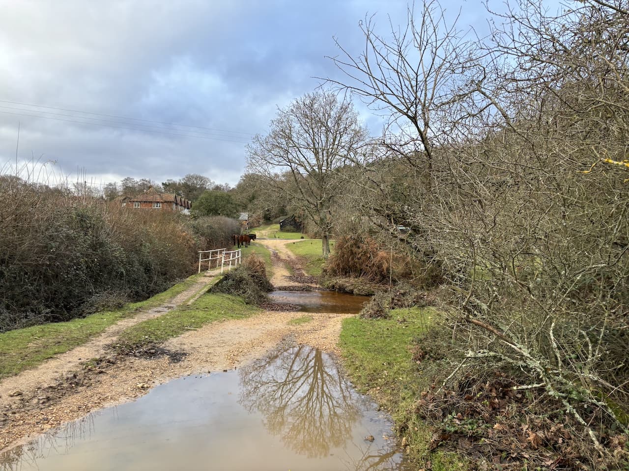
    Continuing along the track we cross a ford in Ashley Bottom and then head uphill to Pitts Wood.

    On our left is a plaque stating that Pitts Wood was enclosed in 1775 and thrown out in 1816 and then re-enclosed in 1906.

    We carry on through the edge of Pitts Wood before traversing across the flooded heathland towards Hampton Ridge.

    Now high up we have wide ranging views across the New Forest.  

    We have joined a cycleway and follow this heading west.  After a couple of hundred yards we take a short detour from our route, following a path on the left running almost parallel to the cycleway. It passes a concrete directional arrow which formed part of the war time bombing range.

    We follow the path to rejoin the Hampton Ridge and then pass the Ordnance Survey Trig Pillar that sits on this ridge.  I have bagged this trig on a few occasions, but it is always worth making a slight diversion to look at a trig!

    Returning to the cycleway we keep on the broad gravel track towards Abbots Well and Frogham.

    The cycle way joins a minor road and we continue towards Frogham, before heading uphill we pass the Abbotts Well.  This inauspicious site is easy to miss but in medieval times it would have been a vital watering hole for travellers through this area of the forest as they headed towards Southampton.  The plaque besides the well states it was first recorded in 1215.

    After a short section on the minor road we turn left and walk through Abbots Well car park and pass a large pond before heading west onto Hyde Common.

    After passing properties the path goes towards the south west, crossing a minor road and continuing to the edge of Gorley Common.  Here we quickly take a track on the left leading towards Dorridge Hill.

    After crossing a footbridge beside a ford we go over a minor road and then continue to ascend  Dorridge Hill.  So far the weather has been kind to us and it has remained dry but the sky ahead suggests we might get wet at some point soon.

    We now follow tracks and paths towards Hasley Inclosure.

    We don’t enter the inclosure but instead take a track to the right that skirts the edge of the woodland.

    At the eastern edge of the inclosure we join a track going towards Sloden Inclosure but after a couple hundred yards at a junction of tracks turn right to head downhill towards Splash Bridge.

    Splash Bridge takes us over Dockens Water and into Broomy Inclosure.  

    In the Inclosure we turn to the left and follow a cycleway to a crossroads of tracks where we go left again.

    On leaving the woods the track goes to the right passing Holly Hatch Cottage and we cross  Dockens Water again.

    The track now heads up to Ragged Boys Hill and passes woodland beside Sloden Inclosure.

    Near a gate to the inclosure we join a track and head northeast across Hiscocks Hill on a track returning us to our starting point.

    Our walk has covered just over thirteen miles and despite the threatening sky we have avoided any serious rain.

    You can view this 13 mile walk on OS Maps and download the GPX File Here

    To follow this walk you will need Ordnance Survey OS Explorer Map 22 – New Forest

    13th December 2023

    © Two Dogs and an Awning (2023)

    All information on this site is provided free of charge and in good faith and no liability is accepted in respect of damage, loss or injury which might result from it.  To the best of my knowledge the routes are entirely on public rights of way or within areas that are open for public access.
    Walking can be hazardous and is done entirely at your own risk.  It is your responsibility to check your route and navigate using a map and compass.
  • Bye Common and Room Hill

    Bye Common and Room Hill

    After yesterday’s abbreviated walk, due to feeling unwell, I had an early night and today feel a lot brighter.  Still not 100% but well enough to venture out for a ten mile walk.  My aim today is to visit one of the Exmoor trigs missing from my list of trigs bagged.  I also hope to do a walk I planned a few years ago with Dexter and Crosby, but had to re-route due to frisky cattle.

    The starting point is the Exmoor National car park in the centre of Exford.  At the moment the parking is free but there is a notice saying parking charges will apply when meters have been installed. I leave the car park via the footpath at the far end of the parking area and head in a south-easterly direction along the edge of a field following the route of the River Exe.

    At a junction of paths I turn left on a path signposted to Higher Combe.

    I am now heading east along a track and keep going in that direction when the path enters a field of pasture.  

    The path leads to a metal gate on the edge of the field.  

    Going through the gate there is a short steep descent to a footbridge over a stream.

    On the far side of the stream I head uphill across a field to join a track close to Higher Combe. I turn left and continue uphill on a concrete driveway.

    At a junction with a minor road, Staddonhill Road, I turn right and walk along this lane, soon reaching a cattle grid with gate beside.

    The map shows this lane as a minor road, in reality it is a dead end lane which leads to Staddon Farm.  It was along this track that I encountered the frisky cattle a couple of years ago.  There is evidence they’ve been here in the recent past but it looks like they have been moved elsewhere.  In any case without the dogs a herd of cattle is easier to deal with.

    Staying with the tarmac driveway I pass a section of hedgerow that has recently been cleared.  This looks drastic, but it is the traditional way of coppicing a hedge in this part of the country and it will soon regenerate.

    At a junction of tracks I continue through a gate on a restricted byway waymarked to Larcombe Foot.

    At a junction of tracks the restricted byway turns right and starts to descend gradually, there is no public access on the path that goes straight.

    Turning left the track keeps going downhill, it is now shown on the map as Kemps Lane.  After going through a gate the path continues to descend towards Kemps Farm.

    It is a cracking day and as I walk down the track there are  fine views of the other side of the valley and the hill I will be heading up before too long.

    After passing through Kemps Farm I reach a minor road.  Instead of joining it I turn right and take a bridge over the River Exe.

    After approximately 100 metres the track forks and I go to the left and head through a gate onto a track heading towards Bye Hill.

    The track leads to another gate after which the path goes diagonally across Bye Common to the top of Bye Hill.

    Heading up there are cracking views back across the valley over the area I walked earlier around Kemps Farm.

    It is a stiff walk up this hill but the views make the effort well worth it.  At the top of the hill the footpath divides and I take a grassy track on the right which starts a steady descent across Bye Common towards the River Exe.

    When the track reaches a junction of paths at a gate I do not go through but instead keep heading west staying close to the fence line.  Soon it becomes a sunken track and keeps going downhill towards the river.

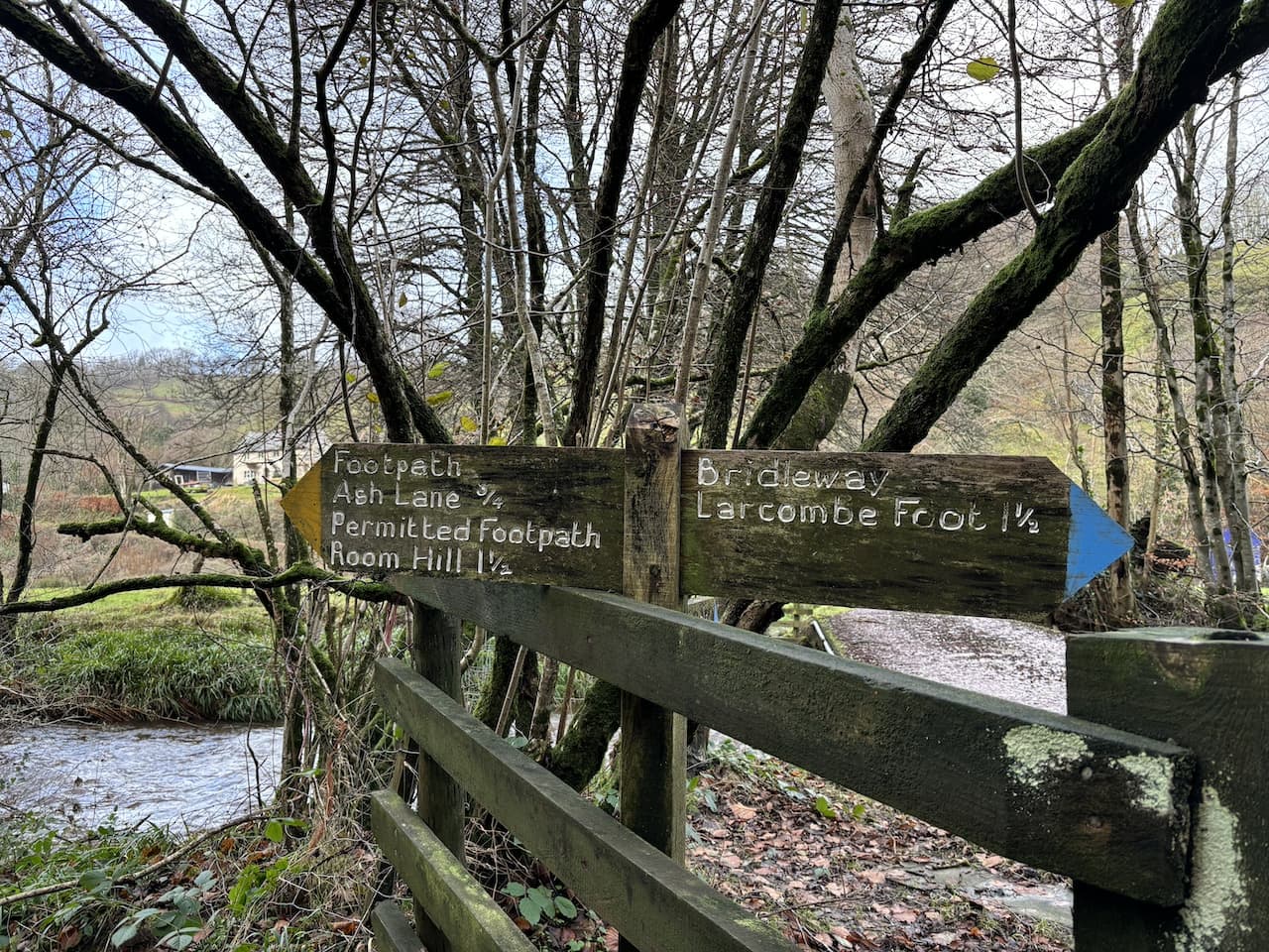
    At a junction of tracks near the river I turn left towards Nethercote and almost immediately reach a bridge over the river.  I don’t cross, but take a path on the left way-marked to Ash Lane and Room Hill.

    Initially the path goes besides the river, but at a fork in the track I go left and head uphill away from the riverbank.

    At first the path goes through trees and then crosses a couple of fields to reach a very boggy area.  The map shows there is a spring here, but today the water running over the bank is like a torrent.

    After going through a gate I turn right along the fence line onto a footpath which joins a grassy track going steadily downhill.

    The path descends through an area of woodland and then across a field to reach the side of the River Exe by a footbridge and ford.

    I turn left on the path as it hugs the river to my right and about one hundred metres after cross a stream and turn to the left to head uphill on a clear path that ascends steadily towards Room Hill.

    At a junction of paths I turn left following the way-markers for Room Hill, this path ascends steeply.  As the path emerges from woodland there are stunning views back into the valley.

    I am now on open access land but follow a well walked path across the summit of Room Hill heading towards Room Hill Road.  At a gate near the road I make a diversion from my route and leave the access land and turn right to walk along the road for a few hundred metres to reach a gateway on the right leading into a field.  Here I pop over a couple of gates and cross the field to reach the Chibbet Cross Ordnance Survey trig pillar.  This is the 421st trig I have bagged. 

    From the trig I retrace my steps back along the road to the access land on Room Hill and head along the edge of the access land with the hedge line on my left.  I am now on route  of the Exe Valley Way, this is a long distance 52-mile path from Exford to Starcross where the River Exe reaches the sea.

    I am heading towards a line of Beech trees and after passing the trees go through a gate and head downhill to reach a gate on the left.  I go through and then cross a field whilst battling with a strong headwind.

    On the far side I enter Court Copse and follow the Exe Valley Way as it goes through the trees and then beside fields.

    The track leads to Court Farm where I have an option of routes, but decide to keep on the Exe Valley Way which goes to the left up a tarmac lane.

    At a road junction at Monk Cross I turn right and then descend along the road into Exford where I turn right to cross the bridge over the River Exe and pass the Exmoor White Horse pub.

    I now follow the road the short distance back to the car park.  It has been a cracking nine mile route with some stunning views.

    You can view this 9 mile walk on OS Maps and download the GPX File Here

    To follow my walk, you will need Ordnance Survey Explorer Map OL9 – Exmoor

    9th December 2023

    © Two Dogs and an Awning (2023)

    All information on this site is provided free of charge and in good faith and no liability is accepted in respect of damage, loss or injury which might result from it.  To the best of my knowledge the routes are entirely on public rights of way or within areas that are open for public access.
    Walking can be hazardous and is done entirely at your own risk.  It is your responsibility to check your route and navigate using a map and compass.
  • Robber’s Bridge and Culbone Hill

    Robber’s Bridge and Culbone Hill

    Yesterday I woke to the sound of heavy rain on the roof of the caravan and the forecast showed it was set in for most of the day so I hunkered down in the van until midafternoon and then went for a wander around Minehead.  The day ended with a fish and chip supper.  I rarely eat fish and chips because it usually leads to a bad bout of indigestion.  But unfortunately, I could not resist the temptation and today I feel decidedly under the weather.  Hopefully some fresh air will improve things.

    For a number of years I have had a trig point on Culbone Hill in my sights, but it involves hopping over a gate into a field which usually houses sheep so it has been off limits when Crosby has been with me, however, today I am walking solo so plan to see if I can bag it as part of my walk.

    I start from the car park on Porlock Common (OS Grid Ref: SS845461).  This is an exposed spot and there is a chill to the strong wind blowing across the moor as I lace up my boots and then head off west beside the A39 towards Pittcombe Head.

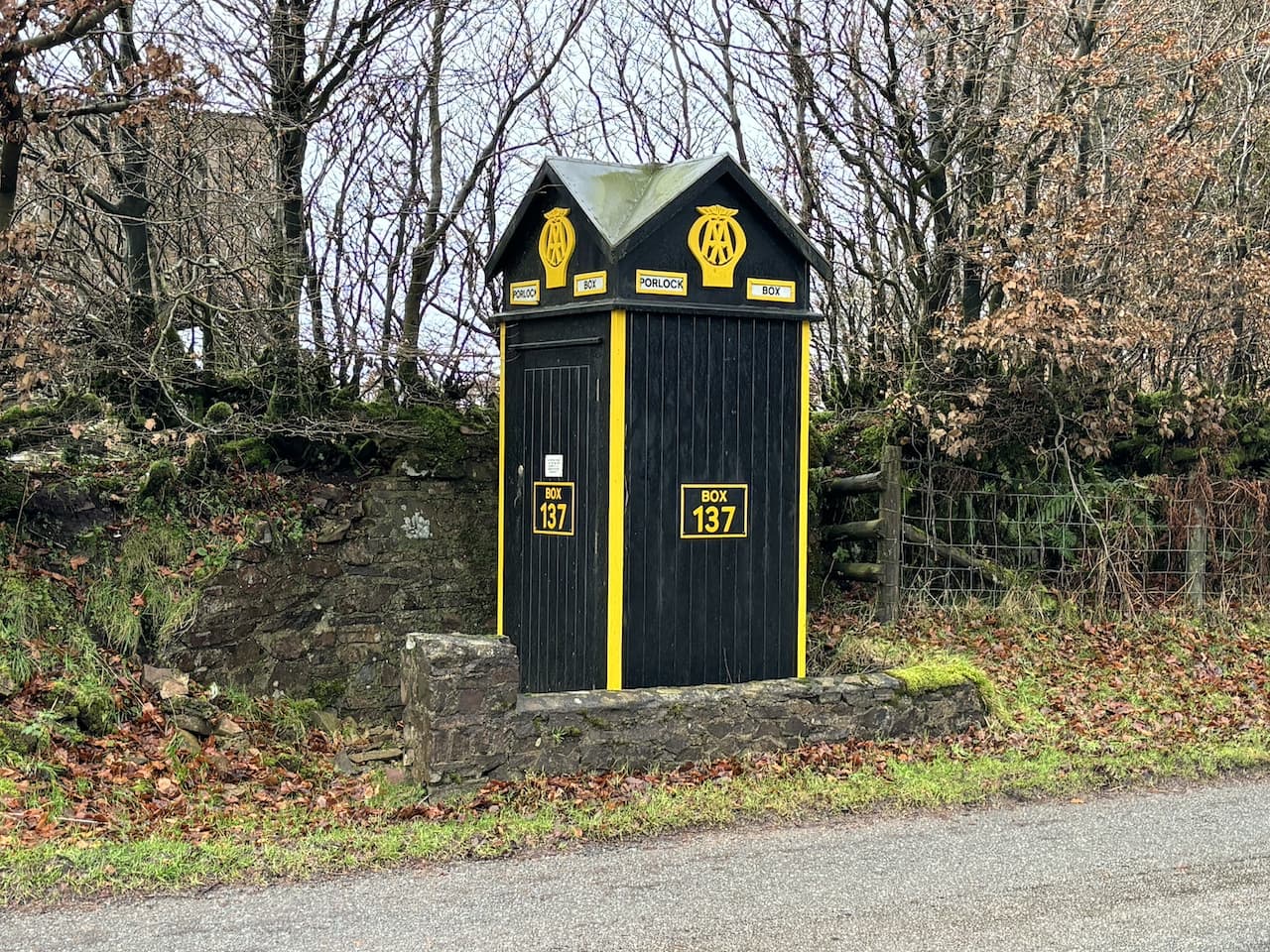
    Close to a junction for the Porlock Hill Toll Road on the opposite side of the road sits an AA sentry box.  These boxes were first installed by the Automobile Association (AA) in 1912 and were installed to be used by patrolmen as places for shelter.  Later they were fitted with telephones and AA members were issued with a key so they could open the box and make a call in the event of a breakdown.  When I started driving in the 1970’s I was an AA member and was issued with a key.  

    There were over 1,000 of these boxes installed around the country, but by 1968 the AA had started phasing them out.  The once familiar roadside landmarks are now extremely rare with only nineteen remaining in their original locations.

    Opposite the sentry box is a junction of bridleways, one heads north, but the one I take is a permitted bridleway heading towards Culbone Hill which runs parallel with the A39.

    Despite being close to the road this bridleway is protected from the traffic by a hedge so it is a pleasant route.

    On reaching a gate in the bridleway I go through and then make a detour from my route by hopping over the gate on my right and heading up onto Culbone Hill to bag the trig pillar.  This is the 420th trig I have bagged.

    From the trig I return to the bridleway and then cross the A39.  I am now at Oare Post and here I take the minor road that heads steadily downhill towards Oareford.  Out to my left there are far reaching views across Exmoor.

    This is a very quiet lane and it is cracking to walk down.  Soon I reach an area where there is a magnificent old beech tree hedge.  

    Then as I keep going down a stunning view opens up in front of me.

    Gradually the road levels out and reaches a parking and picnic area near Robber’s Bridge.  In the height of the summer this would be a popular spot but today there is no one else here.  I pause to look at the old stone bridge dating to before1842, because it was shown on tithe maps of that time.  It gets its name because this area was once known as bandit country and travel along this route would have been fraught with danger.

    Just before reaching Oareford I turn right to follow a bridleway heading towards North Common which goes over the river on a wooden bridge.

    This path heads steeply uphill and I am feeling decidedly under the weather and beginning to fear that I might have more than a bout of bad indigestion. So I am grateful for the excuse to stop and take in the views.

    It is a stiff ascent to reach the more level ground of North Common and once out in the open a strong wind is blowing.  I head north towards a copse on the horizon, I am certainly getting some fresh air but I’m not sure it is doing me any good.  

    On reaching the trees I turn to the right to join the Coleridge Way.  I know that tucked on the western side of the trees is a bench with a cracking view, I sat here in July whilst on a ten day long distance walk.  It is the ideal spot to sit and get my flask of tea out of the rucksack.

    Resuming my walk I follow the Coleridge Way as it goes between the trees and a fence line.

    Leaving the trees behind me I continue along the path still along the fence line before turning left towards the A39.

    At the main road it had been my intention to cross and follow the Coleridge Way before heading back to my starting point via Pitt Combe, however, I am not feeling up to a couple of hours more walking.  So unusually for me I look at options for shortening my route and decide to walk east along the wide grass verge beside the A39 which is the quickest route back to the car.

    The side verge makes it safe enough to walk besides the road and there is not much traffic at this time of year.  I stay with the road to reach the Culbone Stables Inn.  This was once the point where stage coaches stopped on the route between Lynton, Porlock and Minehead.  In 1962 it became a private members club then appears to have been run as pub for a while.  It is now used as a shooting lodge for people visiting the Lillycombe Estate.

    After passing the Stables Inn I cross the road to take a permitted bridleway on the right which runs parallel to the A39.

    I follow this permitted bridleway with the hedge protecting me from the A39.  To my left is woodland.  

    The bridleway leads me to the point where earlier I hopped over the gate to bag Culbone trig pillar.  I now retrace my steps to return to the car.

    My walk has covered just over 5 miles which is much shorter than originally planned. I am looking forward to getting back to the caravan and resting up for the remainder of the day.

    You can view this 5.25 mile walk on OS Maps and download the GPX File Here

    To follow my walk, you will need Ordnance Survey Explorer Map OL9 – Exmoor

    8th December 2023

    © Two Dogs and an Awning (2023)

    All information on this site is provided free of charge and in good faith and no liability is accepted in respect of damage, loss or injury which might result from it.  To the best of my knowledge the routes are entirely on public rights of way or within areas that are open for public access.
    Walking can be hazardous and is done entirely at your own risk.  It is your responsibility to check your route and navigate using a map and compass.

  • Brendon Common from County Gate

    Brendon Common from County Gate

    A couple of years ago I achieved the gold award in the National Navigation Award Scheme.  Learning navigation skills was a thoroughly enjoyable experience and I wish I had done it much earlier.  I am sure if I had I would have avoided a couple of mishaps whilst out walking in remote areas.  I undertook my training with Nigel at New Forest Navigation, since doing the course Nigel (aka Navigation Nigel) has been a regular walking companion.  So alongside the skills I developed on the course I also benefited from gaining a new walking companion.

    I find walking in remote places, whilst relying on a map and compass and using pacing and timing, exhilarating.  It definitely makes me far more aware of my surroundings, constantly looking at contours and features both on the map and on the ground.  Like all skills there is a need to regularly use the knowledge to ensure it is firmly embedded.  So today I have planned a walk which will take me out on Brendon Common where I can test my navigation in some unfamiliar places.

    I start my walk at the County Gate car park beside the A39 between Porlock and Lynton. The car  park is easy to locate and has a number of paths leading from it so is a great spot for walkers.  I leave through a gate and take the path heading south towards Malmsmead.

    Initially the path goes along the top of the hill but soon descends sharply towards Malmsmead.  At a junction of paths I turn right towards Oare Water and cross the river on a footbridge.

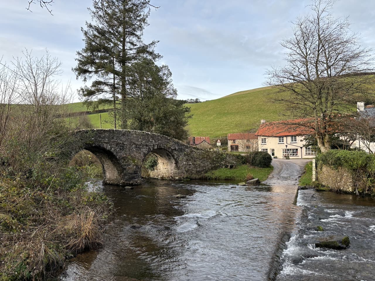
    Over the river I follow the footpath up to a minor road where I turn right and wander down into Malmsmead and the 17th century Malmsmead Bridge that crosses Badgworthy Water.

    After crossing the bridge I pass the shop and cafe and then turn left along the minor road signposted to Fellingscott, Slocombeslade and Tippacott.  

    As the road sweeps to the right I follow a footpath sign through a gate to join a track signposted to Badgworthy Valley.  After crossing a ford the path goes through a series of gates and then becomes a sunken track beside pasture fields.  

    The track leads to a gate which I go through to continue alongside the river.

    Continuing along the path I reach a plaque to Richard Doddridge Blackmore the author of Lorna Doone.  This book, first published in 1869, was one of Lynnie’s mother’s favourite books. The story was set in this valley in the 17th century and tells the tale of the love between John Ridd and Lorna Doone and culminates with the villainous Carver Doone sinking into a bog.

    The path now follows the river through Badgworthy Wood.

    It is a cracking day for walking and apart from two runners I haven’t seen anyone else since I set off.  

    Staying with the path beside the river I cross a footbridge and now the path is high above the river.

    At a junction of paths I go right towards Brendon Common.  As I head up onto the moor the clouds clear and there is cracking blue sky.

    The path goes through the site of a medieval village.  It is here that the Doone’s were said to have lived.  Whilst Blackmore’s story is fiction it is based on historical characters.  An exiled Scottish clan, the Doones, were known to live on this part of Exmoor in the 1600’s.

    My route heads up onto the moor where there are fine views.  This is a clear path that crosses a ford at Badgworthy Lees.

    The path takes me towards a gate on the horizon.

    Once through the gate I follow the clear track across Brendon Common.  Parts of the track are boggy, but nothing too serious and it is relatively easy going.

    The track descends to cross a stream a Lankcombe Ford and then I take a track to the left heading uphill to join a broad track leading across the moor. 

    Proceeding along the track I can see low cloud approaching across the moor.  One of the features of walking on Exmoor is how quickly the weather can change.  It is why I would never head out here without a map and compass.

    At a fork in the track I go to the right and follow a narrower path through the heather to reach Dry Bridge where I take an uphill path in a northerly direction.

    This path leads to Shilstone Hill Ordnance Survey trig pillar.  I have bagged this trig a number of times.

    There are a range of options from the trig point.  I continue north heading towards Shilstone.

    At a crossing of paths I turn to the right going south-easterly, I have not previously walked on this part of the moor so decide to do a bit of map and compass work with some pacing and timing.

    I am soon heading east across Tippacott Ridge, this is remote part of the moor.  The visibility is good and by regularly checking the map I am confident of my location.  

    At a fork in the track I go to the left and head north crossing a ford and heading towards trees.

    Now on a clear track I continue north towards Easter Lane.

    I cross the minor road to go through a gate onto the access land of Southern Ball.

    As I follow the track across the access land there are fine views.

    The path descends to a gate on the edge of Southern Wood.  I go through and follow a path towards Malmsmead.  This path descends through the trees to a minor road.

    At the road I turn right and then almost immediately take a track on the right way-marked to Malmsmead.  This track soon heads up through the trees and then turns to the south to reach another gate.

    Through the gate I follow a track downhill into Malmsmead where I once again cross Badgworthy Water on the packhorse bridge.

    I now retrace my steps to the footbridge over Oare Water.  After crossing the bridge I have the option of going straight up to the car park, instead I turn left and walk beside the river.

    I last walked this path in July whilst on a ten day long distance walk.  Then the water level was low but following the recent rain it is a fast flowing torrent.

    The path leaves the river and steadily ascends through trees,  Emerging from the tree line I continue to a junction of paths near Ashton Farm.  I stop and look back over the route I have just walked.

    I keep the fence line to my left and ignore a path on my right.  This route goes close to the A39, but just before the road I turn right on a bridleway back towards County Gate. The bridleway returns me to my starting point in the County Gate car park, where I enjoy a cup of tea whilst admiring the view.

    It has been a cracking walk covering over eleven miles and I have only seen two other people all the way round.  It always amazes me how quiet it is here outside of the main holiday season.

    You can view this 11.5 mile walk on OS Maps and download the GPX File Here

    To follow my walk, you will need Ordnance Survey Explorer Map OL9 – Exmoor

    6th December 2023

    © Two Dogs and an Awning (2023)

    All information on this site is provided free of charge and in good faith and no liability is accepted in respect of damage, loss or injury which might result from it.  To the best of my knowledge the routes are entirely on public rights of way or within areas that are open for public access.
    Walking can be hazardous and is done entirely at your own risk.  It is your responsibility to check your route and navigate using a map and compass.

  • A Circuit to Long Combe

    A Circuit to Long Combe

    It is the time of year when I always like to get away for a few days walking on Exmoor.  There is something exhilarating about being out in the sort of weather that keeps most people tucked up inside.  So when the opportunity arises to hitch up the caravan and head to Minehead for a week I jump at it.  

    Lynnie is not so keen on winter walking and has opted to stay at home.  Unfortunately Crosby is getting old and the walking I have planned is beyond his old joints so he is staying at home too.

    I am a frequent visitor to Minehead CAMC site so it doesn’t take long to set up and then I am lacing my boots up and heading out for a walk before it gets too dark.  Leaving the site I turn left and walk uphill along the pavement beside the A39, Hopcott Road.  On reaching The Hopcott I turn left to follow the narrow tarmac lane as it heads steadily uphill passing Higher Hopcott and then reaching woodland.

    I ignore footpaths leading off from the road until I reach an information board for Dunster Woods. 

    I take the track to the left of the information board and continue uphill to what is usually a parking area but it is currently closed because of forestry work going on in the woods.

    I keep with this track as it turns left and starts to descend into Long Combe.  When I last walked here the track was surrounded by trees but now there are far reaching views.

    Ignoring a footpath to the right I continue heading downhill on this steep track and I’m soon in an area where the trees have not been cleared.

    At a five way junction of tracks and paths I take the first footpath on the right and head downhill to the bottom of the combe and then turn left and pass a metal gate.

    I now cross the stream running through the combe and follow a track heading towards Alcombe.

    From here the route is very straightforward.  The track soon becomes Manor Road and enters the outskirts of Alcombe.  On reaching the Britannia Inn I turn left into Church Street.

    Church Street leads to the A39 where I turn left and walk the short distance back to the caravan site.   This little circuit has covered just over three and a half miles and has been a good stretch of the legs after my earlier journey.  It is now time to plan my walking for the next couple of days.

    You can view this 3 mile walk on OS Maps and download the GPX File Here

    To follow my walk you will need Ordnance Survey Explorer Map OL9 – Exmoor

    5th December 2023

    © Two Dogs and an Awning (2023)

    All information on this site is provided free of charge and in good faith and no liability is accepted in respect of damage, loss or injury which might result from it.  To the best of my knowledge the routes are entirely on public rights of way or within areas that are open for public access.
    Walking can be hazardous and is done entirely at your own risk.  It is your responsibility to check your route and navigate using a map and compass.

  • Four Trigs on the South Downs

    Four Trigs on the South Downs

    Back in 2018 I spent six days walking the South Downs Way, it was a cracking walk with the bonus of bagging a number of Ordnance Survey trig pillars as I travelled from Winchester to Eastbourne.  Most the trigs were on the route, but occasionally I made a short diversion to bag one.  There were others which I had in mind but the diversion would have added too many miles to my walk.

    Today I plan to revisit two trigs on the South Downs way at Rackham Hill and Kithurst Hill and combine this with bagging two I have not previously visited at Barpham Hill and Blackpatch Hill.  The starting point for my walk is just off the A27 in the car park at the end of Dovers Lane (Grid Ref: TQ060063).

    From the car park I join the tarmac track and head north towards Wepham Wood. It is a bright sunny morning which makes a pleasant change from yesterday’s overcast grey sky.  

    At a junction of paths I keep heading north through the trees and pass a cottage and continue through Lower Oldfield Copse.

    I cross the route of the Monarch’s Way and continue on a path which soon leaves the woods and passes fields as I head towards Upper Barpham.  

    These days Barpham consists of farms at Upper Barpham and Lower Barpham, but in the past there was a medieval village here known as Bargham.  In 1952 an archeological survey discovered the remains of a small Anglo-Saxon church which is thought to have been demolished in the 16th century with the masonry used to build Upper Barpham Farm.  The demise of the village started around the time of the Black Death in 1348-49 and depopulation gradually followed to the extent that the village no longer exists.

    After passing a fine barn at Upper Barpham I continue along the track to a junction of routes.  Here I go through a metal gate to enter a field and head up Barpham Hill.

    Soon on my left I spot the Barpham Hill Ordnance Survey Trig Pillar and wander across the pasture to visit it.  This is the 417th trig I have bagged.

    From the trig I rejoin the footpath which follows a track across the field towards a gate.  

    Through the gate the track continues across another field and then starts to descend with fine views in front.

    After going through a gate I join a track and turn left to reach a junction of paths and soon turn right to head north on a track on Wepham Down.  

    Within a couple of hundred yards I keep straight on where the track divides and join a hedge lined path.

    Soon the path gradually ascends.  Ignoring paths to the left and right I keep going until I reach a track where I turn right and then almost immediately left to take a path which continues uphill to join the route of the South Downs Way.  Here there is a view over Amberley and the flooded fields beyond.

    I now turn right on the South Downs Way and keep going steadily uphill on a track.   Soon I see the Rackham Hill Ordnance Survey trig pillar and pop across to bag it.  I have visited this trig before, there are fine views from here.

    Back on the South Downs Way I keep heading west over Springhead Hill and then bump into a mountain biker who stops for a chat.  These random conversations with total strangers are always interesting.  Often I learn something interesting about the area, but on this occasion it is a chance for us to share stories about how recent bouts of Covid have impacted on our ability to exercise.  

    I head off again along the broad track enjoying the warmth of the sunshine.

    After passing a car park on the left I leave the South Downs Way and fork to the left to follow a path heading up Kithurst Hill.

    As the path levels I reach the Kithurst Hill Ordnance Survey trig pillar, this is another trig which I bagged whilst walking the South Downs Way.

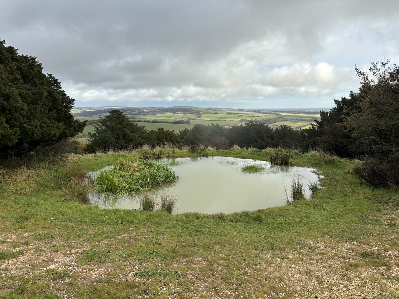
    A few hundred years beyond the trig I reach a junction of paths and turn right to follow a path to return to the South Downs Way.  Turning left I follow the track past a Dew Pond.

    The track continues along to reach a car park where there are a selection of paths I choose one on the right which goes through a metal gate and heads diagonally across a field. At the far side of the field the map shows the path going diagonally across the next field, but it is clear that most people walk around the wide field margin so I turn left and then right around the edge of the field.

    Now heading south I pass a boundary stone with a clear ordnance survey benchmark upon it.

    I keep heading south passing further boundary stones with benchmarks on them and then reach a fork in the path, here I go to the left heading up Blackpatch Hill.  

    The route goes through a gate and continues along the fence line, I take a short diversion to the top of the hill to see the Blackpatch Hill Ordnance Survey trig pillar.  I didn’t bag this when walking the South Downs Way, so it becomes my 418th trig.

    From the trig I turn to the right and follow a fence line downhill to rejoin the footpath and then turn left through a gate and join a track  which heads steadily downhill to pass Longfurlong Farm.  The route continues along the concrete farm driveway towards a minor road.  

    At the end of the concrete driveway and the start of the minor road I turn right to join the Monarch’s Way.  This follows the tarmac driveway to Myrtle Grove Farm.

    After passing the farm buildings, which are occupied by various businesses I stay with the Monarch’s Way and head west along a bridlepath.  Repair work is being carried out but so far it appears to have resulted in a muddy mess.

    I pass an old barn and continue along the track to a tarmac lane.  Here I turn left, still on the route of the Monarch’s Way passing Michelgrove as I continue along the lane.

    At a footpath, with a Monarch’s Way way-marker, I turn right and take a track that soon ascends steadily onto Michelgrove Park.  The tranquility of the afternoon is disturbed by the constant sound of guns as game birds are slaughtered.  

    At a fork on the track I keep to the right and continue a short distance to a four way crossing of paths.  Here the Monarch’s Way goes to the right, but I go straight on following a broad path between the trees.

    At a junction of paths near the edge of the woods I turn left and then very quickly reach a point where the path divides.  Here I go to the right and head through Stonyland Copse.

    This is a pleasant path through an area of mixed woodland.

    At a junction of paths I go straight on and then turn to the right on a track heading west towards my starting point in Hammerpot Copse.

    Back at the car I have walked 13 miles.  It has been a cracking day to be out and there have been some splendid views.  It is days like today that remind me what a great area the South Downs are to walk.

    You can view this 13 mile walk on OS Maps and download the GPX File Here

    To follow this walk you will need Ordnance Survey OS Explorer OL10 – Arundel & Pulborough

    17th November 2023

    © Two Dogs and an Awning (2023)

    All information on this site is provided free of charge and in good faith and no liability is accepted in respect of damage, loss or injury which might result from it.  To the best of my knowledge the routes are entirely on public rights of way or within areas that are open for public access.
    Walking can be hazardous and is done entirely at your own risk.  It is your responsibility to check your route and navigate using a map and compass.

  • Arundel Park to South Stoke

    Arundel Park to South Stoke

    A few days ago the weather forecast for today was persistent rain from dawn to dusk, but yesterday evening it improved to show the rain moving through by early afternoon, so I spend the morning catching up with a few things in the caravan and then head out after an early lunch.

    With a only a few hours of daylight I decide to head to Arundel Park and have a bit of a jamabout.  The starting point for my walk is the roadside car park in Mill Lane near to the Wildlife and Wetland Trust entrance.  From the car park I walk downhill and go through the gate to enter Arundel Park beside Swanbourne Lake.

    This lake is thought to have originated in the 11th century as a mill pond created by damming the steam created from chalk springs.  For centuries it served as the water supply to the mill and more recently has become a recreational area.  

    I follow the path beside the lake passing a few walkers who have braved the morning rain and are looking bedraggled.  I reach a gate and go through.

    I stay in bottom of the valley and at a junction of paths turn to the left and gradually ascend a track.

    Heading uphill I am treated to fine views back over the route I have walked so far.

    I go through a gate and then take some steps on the right onto open ground where I head across to the Hiorne Tower.  This was built in 1797 by Francis Hiorne who at the time was bidding to rebuild Arundel Castle for the Duke of Norfolk.

    In front of the tower is a relic found in a museum at Sevastopol after the siege of Sevastopol in 1855.  This siege was part of the Crimean War and Russian soldiers withdrew into the port which was the home of the Tsar’s Black Sea Fleet.  Here they became besieged by the French, Ottoman and British allied forces.  The battle that ensued lasted from October 1854 to September 1855.

    I now walk across to a tarmac drive and turn right to go through a gate and head north.

    After going through a gate I continue on the tarmac driveway and pass through an area of woodland.  

    I had hoped to leave the park at Duchess Lodge but when I get there the gates are locked so I decide to keep heading north towards Whiteways Lodge.  There are extensive views onto the South Downs and the flooded fields around Amberley.

    Nearing a junction of tracks I meet a fellow walker heading in the opposite direction.  I enquire if I will be able to exit the park at Whiteways Lodge and he thinks it unlikely, but then suggests a route I could follow that would take me back to Arundel via South Stoke.

    Always willing to heed the advice of locals I turn right at the junction of tracks and head beside Lonebeech Plantation.

    After going through a gate I head across a field towards a gate in the distance and midway turn left on a footpath which is the route of the Monarch’s Way and head towards a gate.  This was the path I followed yesterday towards the River Arun.  After going through a kissing gate I follow a track downhill with views towards Houghton and Amberley.

    The way-marked route descends through the edge of South Wood to reach a metal gate in the wall of Arundel Park, I turn right beside the river.  Yesterday my path alongside the river was low lying, today’s path quickly rises a few feet away from the water.

    After going through an area of woodland I pass through a gate to continue along the edge of a field.

    The footpath skirts around cattle barns and then passes a fine old barn apparently built in the late 1800’s and now used as a wedding and events venue.

    After the barn I turn left at a junction and follow a lane passing cottages to reach St Leonard’s church.  This old church was built in the 11th century and serves the small community around South Stoke Farm.

    From the church I continue on a track heading towards the River Arun and just before reaching the river go over a stile on the right to join a footpath by the river.

    The footpath follows the embankment with the river to my left and goes over several stiles heading towards Offham Farm.

    At a track leading to Offham Farm I pass a bridge and continue along the embankment and then go through a copse to emerge into the car park of the Black Rabbit pub.  Apparently the building dates to 1894 and was built by the Duke of Norfolk.  It is an unusual name for a pub and after walking by it yesterday I did an unsuccessful search on the internet to see why it was given this name.

    The pub has a beer garden with a fine views along the river.  It must be very popular in the summer.

    I have two options here I can either walk along the road to the car park or take the route alongside the river.  The light is fading but I should have enough time to take the longer route by the river.  I follow the footpath along the embankment to a junction of footpaths where I turn right back towards Arundel.

    The path goes besides the stream flowing from Swanbourne Lake.  Across the fields I get a good view of Arundel Castle.  This castle was originally built in the 11th century, it was damaged during the English Civil War and then restored in the 18th and 19th century.

    At a footbridge I turn right joining the road to walk back to my starting point.  The route was not what I planned when I set off but nevertheless has been a cracking walk covering 7.5 miles.

    You can view this 7.5 mile walk on OS Maps and download the GPX File Here

    To follow this walk you will need Ordnance Survey OS Explorer OL10 – Arundel & Pulborough

    16th November 2023

    © Two Dogs and an Awning (2023)

    All information on this site is provided free of charge and in good faith and no liability is accepted in respect of damage, loss or injury which might result from it.  To the best of my knowledge the routes are entirely on public rights of way or within areas that are open for public access.
    Walking can be hazardous and is done entirely at your own risk.  It is your responsibility to check your route and navigate using a map and compass.

  • A Trig, Seal and Fleeing King

    A Trig, Seal and Fleeing King

    With the weather looking set fair for the day I have decided to head out for a bit of a jamabout from Arundel.  It is an area I have not previously walked, part of my route will be through Arundel Park where I gather there is permitted walking in some areas whilst others have no access, so I may have to adapt my walk as I go.

    I start from the roadside parking area in Mill Road close to the entrance to Arundel Park and the Wildlife and Wetland Trust nature reserve.  I head north up Mill Road and soon go by the entrance to the nature reserve and then pass the Black Rabbit Pub.  Apparently this building dates to 1894 and was built by the Duke of Norfolk.  It is an unusual name for a pub.  Searching later I can’t find anything about the origins of the name.

    The road passes through a cut in the chalk to reach a junction.  Here I turn left towards South Stoke and continue up to the grand gates to Arundel Park.

    Going through the gates I join a footpath following a track steadily uphill.  It is a cracking day and after yesterday’s inclement weather it is refreshing to see clear blue sky.

    As I head uphill there are fine views out to my right over the River Arun with some flooding in the fields.  It is an ominous sign, I intend to follow a path close to the river later and hope it won’t be submerged.

    Nearing the top of the hill I fork to the left and wander over the open access land to bag the Drylodge Plantation Ordnance Survey trig pillar, my number 416 bagged.

    Near the trig I meet a local couple out for a walk in Arundel Park, they share their ideas for some local walks and also helpfully advise me where I can walk in the Park.  Following their advice I continue across the access land and go through a gate onto more access land with Drylodge Plantation to my left.

    The path goes along the top of the hill with views across the South Downs to flooded fields around Houghton and Amberley.

    After going through another gate I continue on the track towards Lonebeech Plantation and mid-way across the field turn right to join a footpath on the route of the Monarch’s Way.  This leads to a gate.

    The way-marked route goes downhill through the edge of South Wood to a metal gate in the wall of Arundel Park.

    On the path besides the River Arun I turn left and head towards Houghton.

    To my surprise I spot a seal in the river.  Apparently they are a common sight in this river, but it was not what I was expecting.

    Initially the path is dry, but as I near a disused chalk quarry it becomes flooded in parts and it takes careful navigation to avoid getting wet feet.  To make matters worse there are a couple of fallen trees across the path which have not been cleared. 

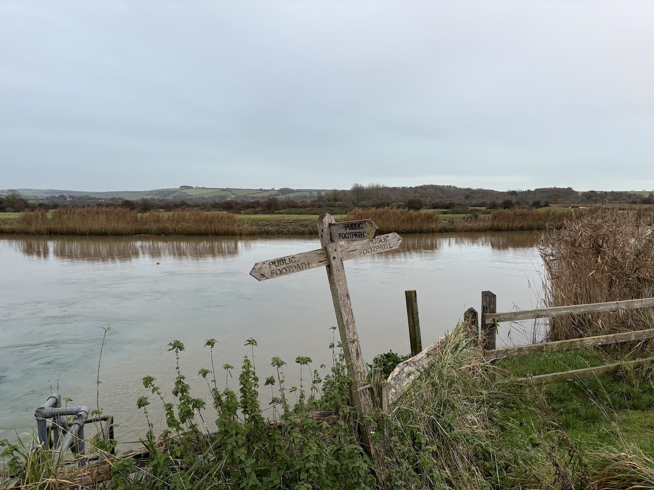
    It is with some relief that I reach the edge of Houghton and go through a gate ascending from the river into Houghton.  At a junction with the B2139 I turn left, still on the route of the Monarch’s Way and walk beside the busy road to pass the George and Dragon pub.

    A notice above the pub door states Charles II stopped for refreshments on Tuesday 14th October 1651 whilst fleeing from his defeat at the Battle of Worcester. 

    Just after the pub the Monarch’s Way follows a bridleway that initially runs parallel to the road and then goes up onto downland with fine views.  During the course of this year I have walked a number of sections of the 625-mile Monarch’s Way which roughly follows the route that Charles II took to get a boat at Shoreham after his defeat by Oliver Cromwell at Worcester.  

    The route goes along the edge of fields and then through a sunken track before heading across another field to reach the A29.  After crossing the road I keep following the Monarch’s Way way-markers into Houghton Forest.

    This is a pleasant area of woodland.  The only  thing disturbing the tranquility is the distant sound of game birds being slaughtered.

    Towards the western edge of the woods I reach a junction of paths and turn left heading south through the trees.

    The path leads to a minor road which I cross and pass through a small parking area to enter another area of woodland.  Staying with the clear path I head towards the A 29.  Approaching the road the path forks, I go left soon emerging beside the main road.  I cross with caution and on the far side ignore a footpath on my left instead taking a path going uphill through the open access woodland heading towards Yewtree Gate.

    On reaching Yewtree Gate I turn left and enter Rewell Wood.

    The track heads in a southeasterly direction passing areas of recently cleared and replanted trees and then goes alongside fields heading towards the A284.

    At a junction of paths just before reaching the main road I turn right and follow a path downhill into woodland.

    At Park Bottom Barn there is a junction of paths.  I follow the one along a track leading to Cricket Hill Farm.  There are no obvious signs of farming as I pass converted barns which are being used as offices and workshops.

    The route is now straightforward, I pass a trout fishery and follow the farm driveway back towards Arundel.  On reaching the A27 I turn left and then cross the A284 and walk into Arundel along Maltravers Street.  At the junction with Parson’s Hill I turn left and walk up towards Arundel Cathedral. 

    At a junction with London Road I turn left and pass the catholic cathedral which was commissioned by the 15th Duke of Norfolk in 1868 and completed in 1873.  

    Walking besides the wall of Arundel Park I reach a driveway into the park on my right and follow it.  

    I keep with the tarmac driveway through the park and then before reaching a gate I take a footpath on the right which leads me to Hiorne Tower.  This was built in 1797 by Francis Hiorne who at the time was bidding to rebuild Arundel Castle for the Duke of Norfolk.

    In front of the tower is a relic found in a museum at Sevastopol after the siege of Sevastopol in 1855.  This siege was part of the Crimean War and Russian soldiers withdrew into the port which was the home of the Tsar’s Black Sea Fleet and were then besieged by the French, Ottoman and British allied forces.  The battle that ensued lasted from October 1854 to September 1855.

    I am now back on the Monarch’s Way and follow this as it goes downhill with fine views across the park.

    At the bottom of the hill I leave the Monarch’s Way at a junction of footpaths and turn right and walk through the valley towards Swanbourne Lake.

    The path goes through a gate and continues on with the lake on my right hand side.  This lake is thought to have originated in the 11th century as a mill pond created by damming the stream created from chalk springs.  For centuries it served as the water supply to the mill and more recently has become a recreational area.   

    My wander about has covered twelve miles and it has been a cracking day.  The forecast does not look great for tomorrow so I will have to hope for a break in the rain to head out for some fresh air.

    You can view this 11 mile walk on OS Maps and download the GPX File Here

    To follow this walk you will need Ordnance Survey OS Explorer OL10 – Arundel & Pulborough

    15th November 2023

    © Two Dogs and an Awning (2023)

    All information on this site is provided free of charge and in good faith and no liability is accepted in respect of damage, loss or injury which might result from it.  To the best of my knowledge the routes are entirely on public rights of way or within areas that are open for public access.
    Walking can be hazardous and is done entirely at your own risk.  It is your responsibility to check your route and navigate using a map and compass.

  • Bow Hill and Devil’s Humps

    Bow Hill and Devil’s Humps

    After yesterday’s blustery walk along the coast and navigating my way around flooded fields I am heading inland to walk on the South Downs.  I am meeting up with my regular walking buddy Nigel from New Forest Navigation who is scoping out routes for his new guided walking venture; Wessex Adventures.

    The starting point for our walk is a roadside parking area just south of Walderton (Grid Ref: SU 787104).  From the car park we turn right to walk on the pavement besides the B2146 towards West Marden and Petersfield.

    We soon reach a junction where we turn left into Woodlands Lane and follow this quiet country lane as it heads steadily uphill.

    The lane levels out and turns to the west.  This road is a dead end for vehicles and it is clear there is very little traffic using it.  After passing Woodlands Cottage the lane becomes a track and reaches a gate which we walk beside to reach a junction of public rights of way.  Here we take the path on the right following a track heading north along the edge of woodland.

    At a junction of tracks we turn right and follow the driveway to Broadreed Farm and then near the farm at a fork in the track go left to walk on a footpath through the farm buildings.

    Leaving the farm we go along a grassy track beside fields.  After passing a copse on our right I spot the Broadreed Ordnance Survey trig pillar in the field on the right.  Fortunately the way the tractor tracks run mean I can walk to the trig without causing any damage to crops.  This is the 414th trig I have bagged.

    Rejoining Nigel on the footpath we continue between fields to reach an area of woodland, Wythy Piece.

    After a couple of hundred yards at a junction of paths we turn right to go along a grassy track between fields.  The rain that has been with us since we set off has become more persistent.  I am not a fan of walking in full waterproofs, but on days like this it is essential.

    The track leads us to Lodge Farm.  We pass the farmhouse with its array of old barns including a granary that has been converted into a chicken coop.

    Continuing in a northerly direction we go through a gate and follow a track towards another gate.  After going through we turn right on Oldhouse Lane and follow this to a junction with the B2146.  

    We cross the B road and head steadily uphill to a copse and find a suitable fallen tree to perch on for our elevenses.  Refreshed we follow the footpath to a minor road where we turn right and then within a hundred yards go left on a track towards Lyecommon.  At a junction of tracks we turn left, soon passing a cottage before entering woodland.

    At a junction of tracks in Grevitts Copse we go right and soon turn right onto a minor road and within a couple of hundred yards just after a cottage we turn left onto a bridleway.  We stay on this track to pass a large cottage and then keep going towards Inholmes Wood.

    At the edge of Inholmes Wood we turn left to follow a path along the edge of a field with the woodland to our right and then in the woods take a track on the right which heads downhill towards a minor road.

    We cross the road and enter Wildhams Wood and immediately turn right on a track in the woods.  On reaching a junction of tracks on the edge of the woodland we turn left and follow a path around  the edge of a field.  We ignore a path in front of us to stay beside the field and then re-enter trees and turn left along a forestry track.

    We soon reach a fork in the track and go left.  The track passes properties and then becomes more of a path and goes alongside a row of fine beech trees.

    The beech trees then give way to an avenue of yew trees.  At a crossing of tracks we turn right and head south on a path leading towards Bow Hill.  When we reach a clearing with a dew pond we stop to take in the extensive views across the South Downs.

    Still heading south up Bow Hill we soon reach the Bow Hill Ordnance Survey trig pillar.  Nigel has been here on a number of occasions, but it is my first visit so I bag my 415th trig pillar.

    From the trig we keep on the track as it sweeps to the right and then go through a gate to carry on besides the Devil’s Humps.  These are four Bronze Age barrows creating an impressive sight on top of the hill.

    Re-entering woodland we head in a south westerly direction along a road path.

    At a junction of tracks by a clearing we turn left and follow a track with the trees to our left for a couple of hundred yards before turning right at the next junction of paths.  This takes us along the edge of woodland.

    Leaving the trees the path starts to descend between fields.  The rain has now cleared and there are fine views as we head downhill.

    At a junction of paths by a derelict barn we turn right, the path leads into woodland where we continue downhill towards Walderton.

    On reaching a road we walk through the village passing the Barley Mow pub and continue on to reach our starting point.

    Despite the wet weather it has been another cracking walk with Nigel.  Hopefully it won’t be too long before we are out together again.

    You can view this 13 mile walk on OS Maps and download the GPX File Here

    To follow this walk you will need Ordnance Survey OS Explorer 120 – Chichester, South Harting & Selsey

    14th November 2023

    © Two Dogs and an Awning (2023)

    All information on this site is provided free of charge and in good faith and no liability is accepted in respect of damage, loss or injury which might result from it.  To the best of my knowledge the routes are entirely on public rights of way or within areas that are open for public access.
    Walking can be hazardous and is done entirely at your own risk.  It is your responsibility to check your route and navigate using a map and compass.

  • A Circuit from Atherington to Flansham

    A Circuit from Atherington to Flansham

    When this blog was first conceived I needed to give it a name.  For a number of days various options were considered and discarded.  At the time we were sorting out the letting of our house in preparation for our travels and I was contacting CL owners to book our stays.  As part of these conversations I described our requirement as “Two adults, a caravan with two dogs and an awning”.  The name for the blog suddenly became obvious.

    I am away for a week staying at the Caravan and Motorhome Club site in Littlehampton.  It is ideally situated for walking on the South Downs.  Crosby is now eleven and whilst still very active he is not up to consecutive days of long walks so he is staying at home with Lynnie.  I was unable to get a pitch with space for an awning.  So for the first time I am one adult, no dogs, no awning!

    In plotting my walks for the week I have identified a few ordnance survey trig pillars that I haven’t bagged in this part of West Sussex.  Some of these trigs are on the downs and others like the ones I am aiming for today are nearer the coast.  My starting point is a parking area near the sea at Atherington.  There is restricted parking here during the summer, but during winter months these do not apply.  

    There is usually more parking here, but a lot of work has been done to create a shingle bank as a sea defence, I am unclear if the reduction in parking is a temporary measure or permanent.  News reports suggest the car park and cafe might be moved further inland.

    As I lace up my boots the spray from waves is crashing over the shingle bank and a local dog walker returning to his car comments on how wild the weather is and unnecessarily warns me to keep away from the waves.  I intend to head west along the coastal path towards Bognor Regis and start by walking up on to the shingle bank that protects the parking and picnic area and local housing.  

    The footpath leaves the far end of the car park along the sea defences, but a combination of erosion and the high tide make this route too dangerous.  A local tells me to take a footpath behind the cafe building that goes through a section of woodland before returning me to the coast path.

    Emerging onto farm land I follow the path with the waves crashing away to my left.

    I last walked along this stretch of coastline in 2017 and the extent of erosion is striking.  Apparently nine acres of farm land have been lost to the sea over the last year and I later see some amazing footage of the changes to the landscape.

    As I near housing at Elmer the sea defences become far more substantial and for the first time I am able to walk on the path I followed six years ago.

    It is a cracking day but I am walking into a strong headwind which makes it challenging to build up any pace.

    The path briefly leaves the sea front and joins a road and then I take the second footpath on the left back to the seafront.

    It is not too long before the path heads inland again because the high tide makes it impossible to stay beside the sea.  I walk through a residential area and then turn left along Elmer Road and soon join the B2132 which goes through Middleton-on-Sea.  After passing shops on the opposite side of the road I turn left into Sea Lane.  On my right is Middleton-on-Sea village pond.

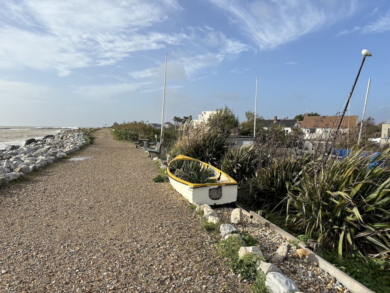
    I continue along Sea Lane, ignoring all roads to left and right, this eventually brings me to the shingle beach where I turn right and I’m soon on a wide grassy area with numerous benches.  To the right I pass a collection of well-maintained wooden beach huts.

    This spot is relatively sheltered from the wind so I decide to avail myself  of one of the benches and stop for elevenses.

    Around the corner I continue along a path and it is not too long before this becomes a tarmac promenade with Bognor Regis in the distance.

    The last time I walked along this seafront was with Lynnie and we went all the way into Bognor Regis and then turned around and retraced our steps back to the car.  Today I am going to do a loop inland so with a view of Butlins in front of me I turn right to leave the promenade and join First Avenue.

    At a junction with Limmer Road I turn left and then very quickly turn right into Summerley Lane.  After passing a Post Office I follow the path into a waterlogged playing field and follow the path around the edge to reach the B2132.

    I cross the B2132 and turn to the right and then immediately at a junction go left into Flansham Lane and follow this to the A259 which I cross and then join Hoe Lane and walk into Flansham.

    In the village at a fork in the road I go to the left and continue along the road which soon becomes a track.  

    The track passes Hoe Farm then the footpath goes beside a gate and continues along to reach a junction of three tracks.  Directly in front of me is Westfield Ordnance Survey Trig Pillar.  This is the 413th trig I have bagged.

    I now turn to the right to follow the track to a junction of tracks, here I go right again.  This path along the field edge is very soggy and flooded in places but fortunately I manage to get through without getting wet feet.  I cross a footbridge into another waterlogged field.

    I dare to hope that I have passed the worst of the flooding and then reach a junction of tracks.  Here it was my intention to turn left and follow paths to Bilsham and on to bag another trig, however, there is no way I can get through this flood without getting wet feet.  There is not much that deters me from bagging a trig, but there is no joy in walking with soaking wet feet.  So I check the map and decide to re-route and turn right to walk back into Flansham.

    Back in the village I retrace my steps along Hoe Lane to the A259.  I cross and take a path that heads east towards Worms Wood.

    I follow the track until it almost reaches the A259 and then go through a gate into Worms Wood.  This is an open access area leased from the local council by the Woodland Trust around 2000 and they have created some cracking woodland.

    I head through the trees with soggy ground beneath my feet.  At the edge of the woodland I go through a gate and after crossing a ditch turn left along the north edge of a recreation area.

    The footpath leaves the recreation area through a kissing gate and then follows a path to reach the B2132.  After crossing the road I follow Ancton Lane to reach Ancton and then continue through a residential area to Elmer where I rejoin the coast path and turn left.  The tide has now gone out and there is a different perspective to the coastline.

    When we walked this bit of coastline six years ago the groynes came all the way up to the shingle bank.  The erosion means they are now separated and presumably no longer serve as a useful defence.  

    With the tide out I am able to walk on the coast path and do not need to go through the woodland to reach the newly created shingle bank and my car.

    You can view this 10.5 mile walk on OS Maps and download the GPX File Here

    To follow this walk you will need Ordnance Survey OS Explorer 121 – Arundel & Pulborough

    13th November 2023

    © Two Dogs and an Awning (2023)

    All information on this site is provided free of charge and in good faith and no liability is accepted in respect of damage, loss or injury which might result from it.  To the best of my knowledge the routes are entirely on public rights of way or within areas that are open for public access.
    Walking can be hazardous and is done entirely at your own risk.  It is your responsibility to check your route and navigate using a map and compass.